spatial data infrastructures
TRANSCRIPT
Management Information System (MIS)
Hans van der Kwast & Marloes MulIHE Delft Institute for Water Education
Spatial Data Infrastructures
08-01-2021
In the second video, we are going to discuss spatial data infrastructures.
1
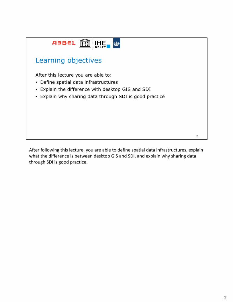
After this lecture you are able to:• Define spatial data infrastructures• Explain the difference with desktop GIS and SDI• Explain why sharing data through SDI is good practice
2
Learning objectives
After following this lecture, you are able to define spatial data infrastructures, explain what the difference is between desktop GIS and SDI, and explain why sharing data through SDI is good practice.
2
3
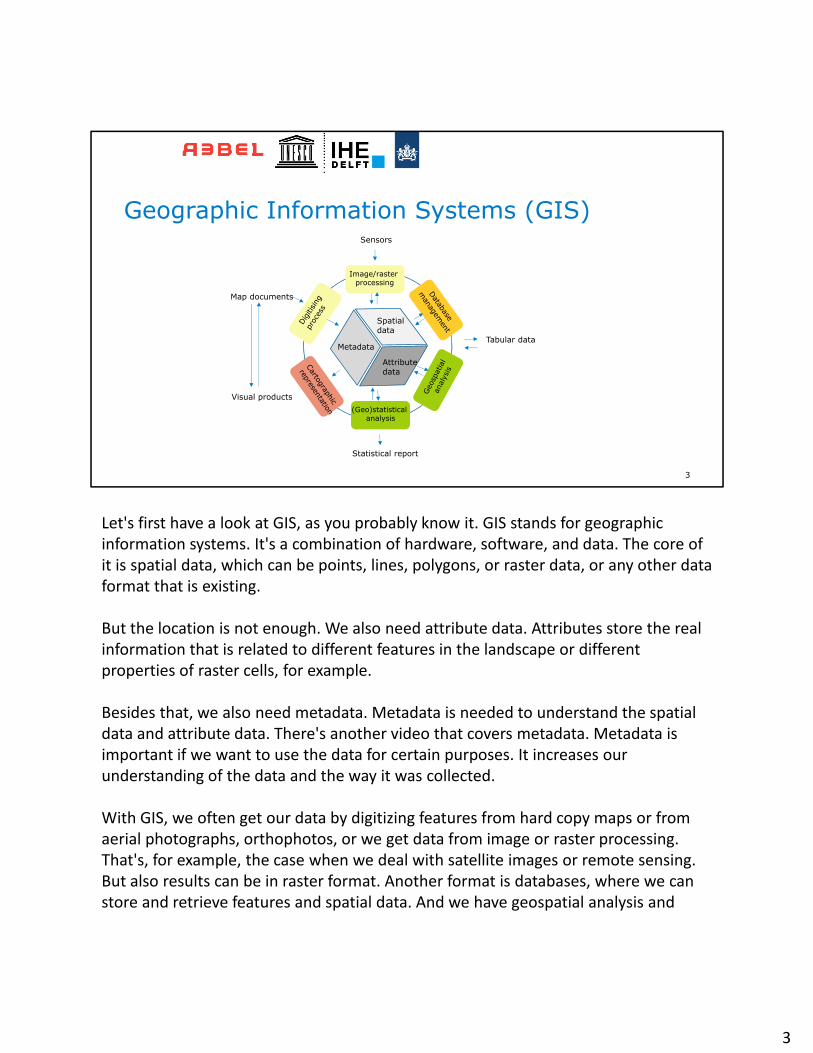
Geographic Information Systems (GIS)
Spatialdata
Attributedata
Metadata
Image/raster processing
(Geo)statisticalanalysis
Tabular data
Map documents
Visual products
Statistical report
Sensors
Let's first have a look at GIS, as you probably know it. GIS stands for geographic information systems. It's a combination of hardware, software, and data. The core of it is spatial data, which can be points, lines, polygons, or raster data, or any other data format that is existing.
But the location is not enough. We also need attribute data. Attributes store the real information that is related to different features in the landscape or different properties of raster cells, for example.
Besides that, we also need metadata. Metadata is needed to understand the spatial data and attribute data. There's another video that covers metadata. Metadata is important if we want to use the data for certain purposes. It increases our understanding of the data and the way it was collected.
With GIS, we often get our data by digitizing features from hard copy maps or from aerial photographs, orthophotos, or we get data from image or raster processing. That's, for example, the case when we deal with satellite images or remote sensing. But also results can be in raster format. Another format is databases, where we can store and retrieve features and spatial data. And we have geospatial analysis and
3
geostatistical analysis resulting in data, that's given here by the green boxes. And in the end, we want to get the data out of the GIS and present it on hard copy maps, but more often these days, on interactive websites or on mobile phone applications.
So basically the output of our analysis in GIS is in tabular format, statistical reports or map documents or official products.
And when you work with GIS, you probably work on your desktop computer where you run some GIS software, such as QGIS. And you process the data and then you store it on a disk. And if you want to share it with your colleagues, the traditional way is that you send it by email or you save it to a USB stick and then you give it to another person. That is not the best way to deal with spatial data if we work in projects or in organizations. It is dangerous because we cannot track changes when we share through USB sticks. Data can be lost or can be manipulated.
3
4
Spatial Data Infrastructures (SDI)
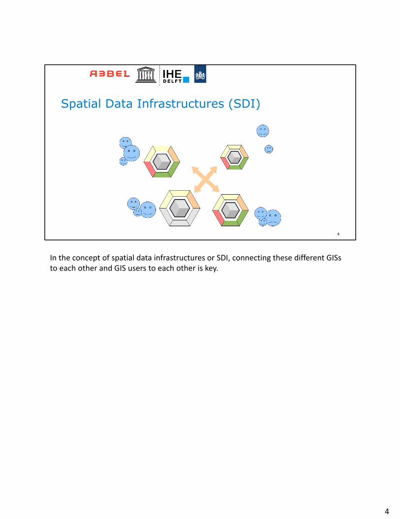
In the concept of spatial data infrastructures or SDI, connecting these different GISs to each other and GIS users to each other is key.
4

5
Agriculture
Health
Drinkingwater
Sanitation
Economy
SDIEntrepreneurs/
Researchers
Developmentof apps and
services
Decision support systems (DSS)
Models
In the previous video, we have discussed integrated water resources management where the different sectors need to exchange data and information. We can exchange data between these sectors using an SDI. And when the data becomes also available for the public, entrepreneurs and researchers are able to develop apps and services based on this data. Scientists can even run models and can develop decision support systems that these different government sectors can also use again. So there's a win‐win situation when more of this data becomes available through a spatial data infrastructure.
5
Enabling environment that supports easy access to and utilization of geospatial data.
• SDIs are more than just data repositories:– Discovery
catalogues, search engine– Visualization
interactive maps, infographics, real time data, etc.
– Evaluationquality, metadata
– Access to geospatial data and information web-based, apps, services, GIS
6
Spatial Data Infrastructure
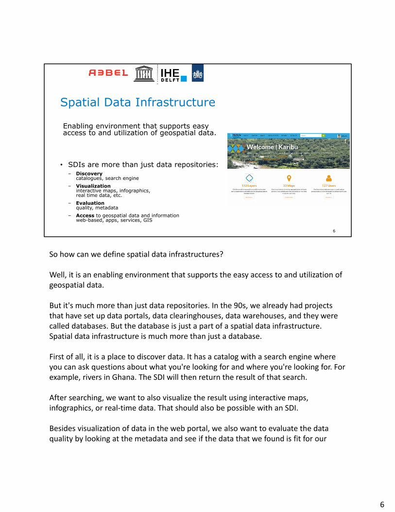
So how can we define spatial data infrastructures?
Well, it is an enabling environment that supports the easy access to and utilization of geospatial data.
But it's much more than just data repositories. In the 90s, we already had projects that have set up data portals, data clearinghouses, data warehouses, and they were called databases. But the database is just a part of a spatial data infrastructure. Spatial data infrastructure is much more than just a database.
First of all, it is a place to discover data. It has a catalog with a search engine where you can ask questions about what you're looking for and where you're looking for. For example, rivers in Ghana. The SDI will then return the result of that search.
After searching, we want to also visualize the result using interactive maps, infographics, or real‐time data. That should also be possible with an SDI.
Besides visualization of data in the web portal, we also want to evaluate the data quality by looking at the metadata and see if the data that we found is fit for our
6
purpose.
Finally, we want to access the data. And not just by downloading the files, but we would also like to connect with our tools to the spatial data infrastructure to have always the latest version of the data. This can be through web‐based maps, web‐based services, apps on the mobile phone, or through our GIS desktop software.
So here on the right side in the animation, you see how we can, on the web, query our spatial data infrastructure, preview maps, create combinations of layers. It also allows us to share documents with information about data which can be linked to the data sets that we found. We can also explore people, so it's like a social network. We can gather people from projects and give them access to specific data. And we can search for different layers that we can query or download or also link with web services or apps or GIS software. So it's very flexible and should facilitate many different types of users to access the data.
6
7
Sharing of:• Spatial data• Metadata• Documents (e.g. Open
Access papers)• Profiles (social media)
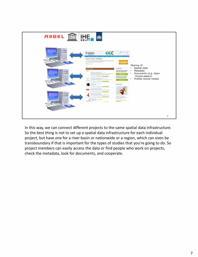
In this way, we can connect different projects to the same spatial data infrastructure. So the best thing is not to set up a spatial data infrastructure for each individual project, but have one for a river basin or nationwide or a region, which can even be transboundary if that is important for the types of studies that you're going to do. So project members can easily access the data or find people who work on projects, check the metadata, look for documents, and cooperate.
7
8
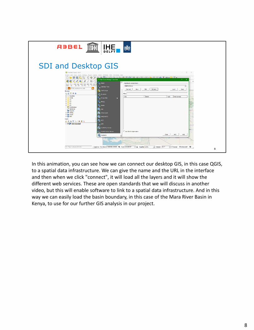
SDI and Desktop GIS
In this animation, you can see how we can connect our desktop GIS, in this case QGIS, to a spatial data infrastructure. We can give the name and the URL in the interface and then when we click "connect", it will load all the layers and it will show the different web services. These are open standards that we will discuss in another video, but this will enable software to link to a spatial data infrastructure. And in this way we can easily load the basin boundary, in this case of the Mara River Basin in Kenya, to use for our further GIS analysis in our project.
8
9
• Top-down
• Public organisations• Mandate• Quality assurance• Government• Fundamental datasets• Metadata standard• Data policy
• Bottom-up
• Civil society• No mandate• Crowd-sourcing• Community based• GSM• Social networking• Big data
Data Portal
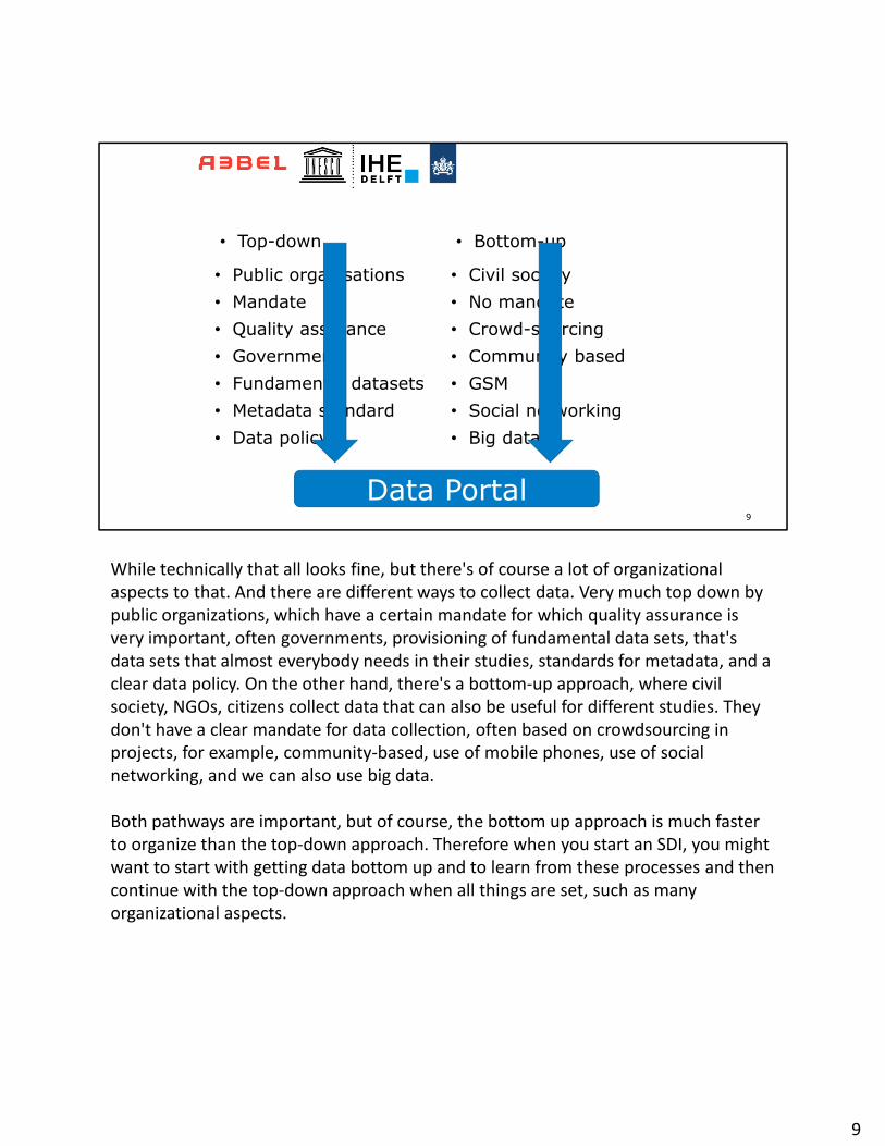
While technically that all looks fine, but there's of course a lot of organizational aspects to that. And there are different ways to collect data. Very much top down by public organizations, which have a certain mandate for which quality assurance is very important, often governments, provisioning of fundamental data sets, that's data sets that almost everybody needs in their studies, standards for metadata, and a clear data policy. On the other hand, there's a bottom‐up approach, where civil society, NGOs, citizens collect data that can also be useful for different studies. They don't have a clear mandate for data collection, often based on crowdsourcing in projects, for example, community‐based, use of mobile phones, use of social networking, and we can also use big data.
Both pathways are important, but of course, the bottom up approach is much faster to organize than the top‐down approach. Therefore when you start an SDI, you might want to start with getting data bottom up and to learn from these processes and then continue with the top‐down approach when all things are set, such as many organizational aspects.
9
10
Strategic Planning
ISNAR (1998)
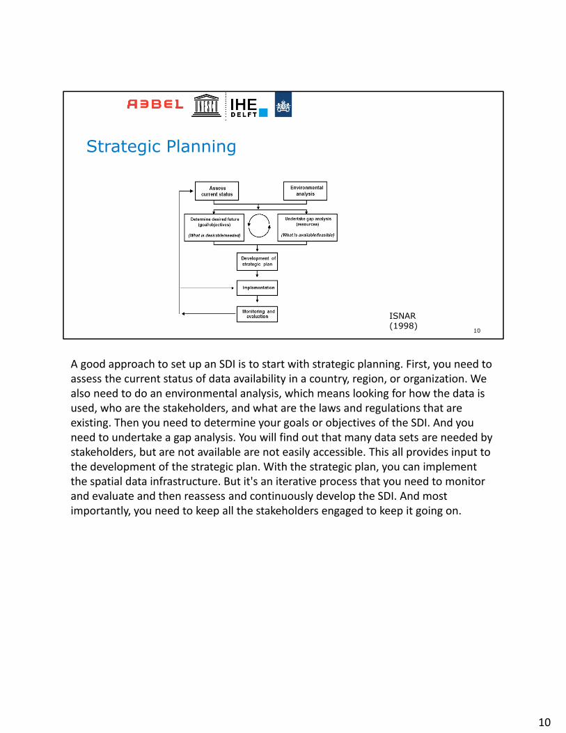
A good approach to set up an SDI is to start with strategic planning. First, you need to assess the current status of data availability in a country, region, or organization. We also need to do an environmental analysis, which means looking for how the data is used, who are the stakeholders, and what are the laws and regulations that are existing. Then you need to determine your goals or objectives of the SDI. And you need to undertake a gap analysis. You will find out that many data sets are needed by stakeholders, but are not available are not easily accessible. This all provides input to the development of the strategic plan. With the strategic plan, you can implement the spatial data infrastructure. But it's an iterative process that you need to monitor and evaluate and then reassess and continuously develop the SDI. And most importantly, you need to keep all the stakeholders engaged to keep it going on.
10
Analogous to a road:• Reliable environment allowing the
movement of data• Maximize the reuse of data: open
standards• All about reuse: data, capabilities,
skills, investments,…• Sharing: data, knowledge, …• Learning from others: collaboration
and co-operation
11
Working smarter not harder!
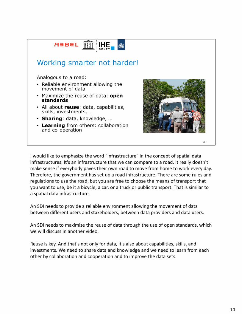
I would like to emphasize the word "infrastructure" in the concept of spatial data infrastructures. It's an infrastructure that we can compare to a road. It really doesn't make sense if everybody paves their own road to move from home to work every day. Therefore, the government has set up a road infrastructure. There are some rules and regulations to use the road, but you are free to choose the means of transport that you want to use, be it a bicycle, a car, or a truck or public transport. That is similar to a spatial data infrastructure.
An SDI needs to provide a reliable environment allowing the movement of data between different users and stakeholders, between data providers and data users.
An SDI needs to maximize the reuse of data through the use of open standards, which we will discuss in another video.
Reuse is key. And that's not only for data, it's also about capabilities, skills, and investments. We need to share data and knowledge and we need to learn from each other by collaboration and cooperation and to improve the data sets.
11
12
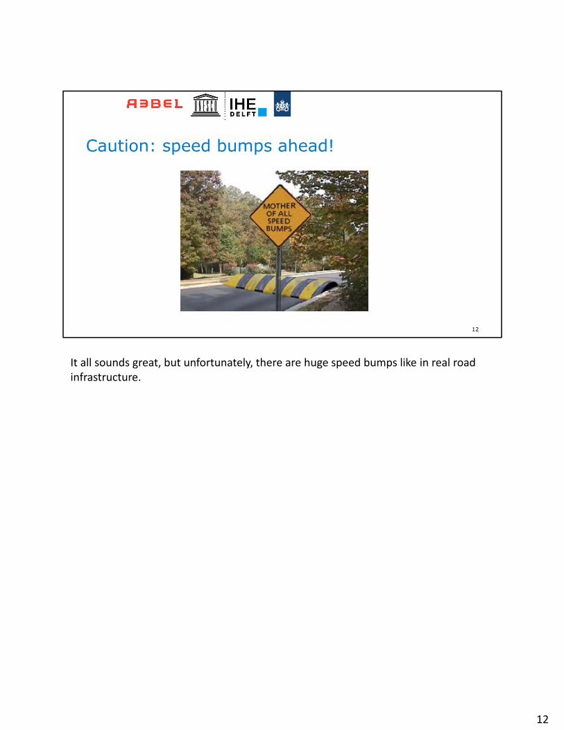
Caution: speed bumps ahead!
It all sounds great, but unfortunately, there are huge speed bumps like in real road infrastructure.
12
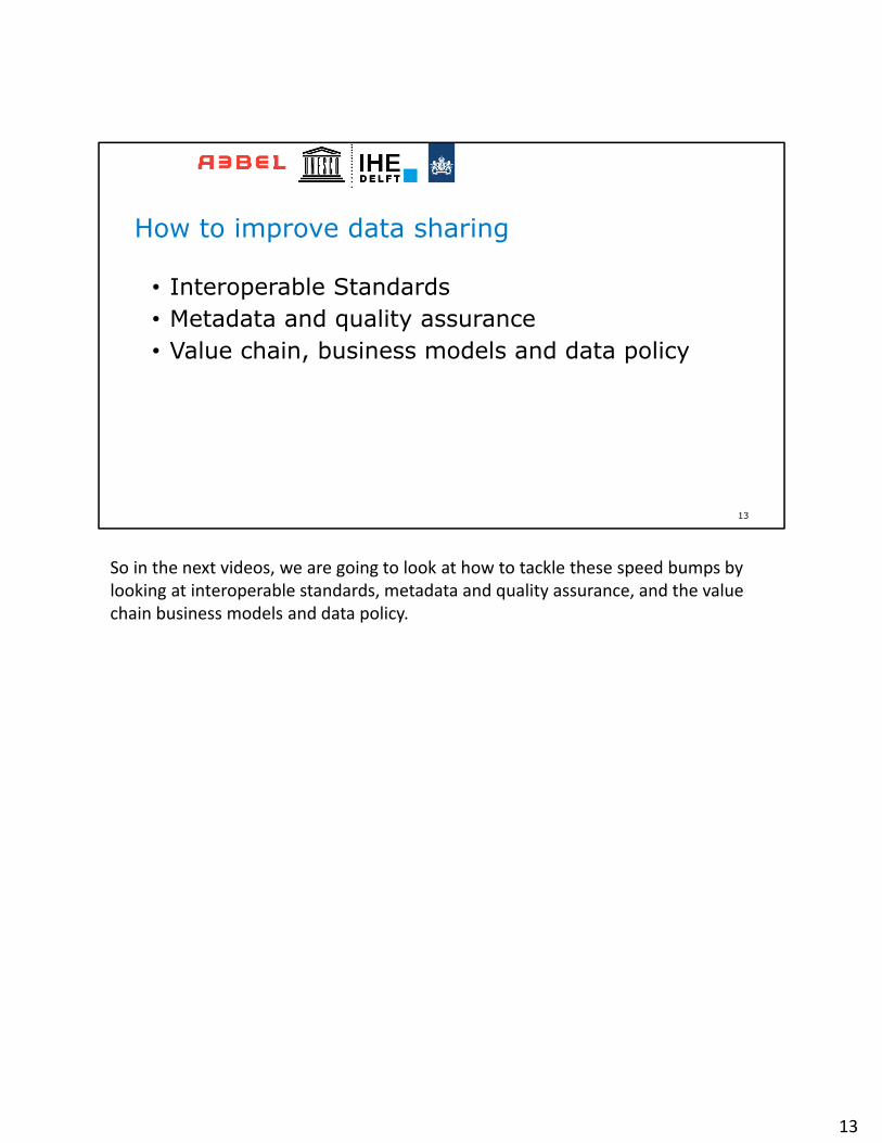
• Interoperable Standards• Metadata and quality assurance• Value chain, business models and data policy
13
How to improve data sharing
So in the next videos, we are going to look at how to tackle these speed bumps by looking at interoperable standards, metadata and quality assurance, and the value chain business models and data policy.
13