spatial perspectives on ceremonial complexes: testing traditional
TRANSCRIPT

Martinsson-Wallin and Wallin: Studies in Global Archaeology no. 20
317
SPATIAL PERSPECTIVES ON CEREMONIAL COMPLEXES: TESTING TRADITIONAL LAND DIVISIONS ON RAPA NUI
Helene Martinsson-Wallin and Paul Wallin
Department of Archaeology and Ancient History, Uppsala University,
Campus Gotland, Sweden
Abstract: The ceremonial sites of Rapa Nui, the ahu, are complex structures that incorporate and display a variety of distinctions and social relationships tied to different land areas that belonged to senior and junior groups. Such distinctions will be analysed via a Correspondence Analysis using selected ahu structures and connected variables. A detailed case study of two ahu in the La Perouse area will focus on the organisation of the variety of prehistoric material expressions connected to these. The aim is to show how habitus works in a local context at the individual organizational level. Through these studies we highlight the complex relationships involved in creating a milieu, in which actors of different groups carry out their practices when creating monuments and organising place.
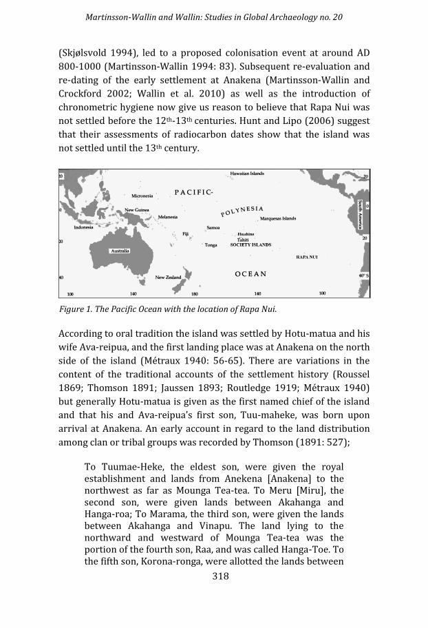
INTRODUCTION Rapa Nui, also known as Easter Island, is geographically the most
isolated island in the world (Figure 1). Yet it was found and populated
by Polynesian seafarers in prehistoric times (Martinsson-Wallin and
Crockford 2002: 256). Prior to archaeological investigations there were
several ideas, generally based on genealogies, about when and by whom
the island was originally settled. Since there are several versions of
genealogical accounts, and their chronological reliability is uncertain,
these traditions are difficult to use when discussing temporal issues
(Martinsson-Wallin 1994: 76). When radiocarbon dating and
stratigraphic methods were introduced by Thor Heyerdahl and
associates in the mid-1950s (Heyerdahl and Ferdon 1961), it was
established that Rapa Nui was settled by humans around AD 400. This
date was subsequently revised after analysing the context of samples
(Martinsson-Wallin 1994: 83). This analysis in conjunction with the
dating of an early settlement excavated by us at Anakena in 1986-1988
Martinsson-Wallin and Wallin: Studies in Global Archaeology no. 20
318
(Skjølsvold 1994), led to a proposed colonisation event at around AD
800-1000 (Martinsson-Wallin 1994: 83). Subsequent re-evaluation and
re-dating of the early settlement at Anakena (Martinsson-Wallin and
Crockford 2002; Wallin et al. 2010) as well as the introduction of
chronometric hygiene now give us reason to believe that Rapa Nui was
not settled before the 12th-13th centuries. Hunt and Lipo (2006) suggest
that their assessments of radiocarbon dates show that the island was
not settled until the 13th century.
According to oral tradition the island was settled by Hotu-matua and his
wife Ava-reipua, and the first landing place was at Anakena on the north
side of the island (Métraux 1940: 56-65). There are variations in the
content of the traditional accounts of the settlement history (Roussel
1869; Thomson 1891; Jaussen 1893; Routledge 1919; Métraux 1940)
but generally Hotu-matua is given as the first named chief of the island
and that his and Ava-reipua’s first son, Tuu-maheke, was born upon
arrival at Anakena. An early account in regard to the land distribution
among clan or tribal groups was recorded by Thomson (1891: 527);
To Tuumae-Heke, the eldest son, were given the royal establishment and lands from Anekena [Anakena] to the northwest as far as Mounga Tea-tea. To Meru [Miru], the second son, were given lands between Akahanga and Hanga-roa; To Marama, the third son, were given the lands between Akahanga and Vinapu. The land lying to the northward and westward of Mounga Tea-tea was the portion of the fourth son, Raa, and was called Hanga-Toe. To the fifth son, Korona-ronga, were allotted the lands between
Figure 1. The Pacific Ocean with the location of Rapa Nui.

Martinsson-Wallin and Wallin: Studies in Global Archaeology no. 20
319
Anekena and the crater Rana-Roraku. To the sixth and the last son were given the lands on the east side of the island. His name was Hotu-iti.
Routledge (1919) recorded during her visit in 1914-1915, that until
recently there were ten paternal descent clan groups on the island but
Métraux added (1940: 120) “I prefer the more general and more
appropriate term tribe (mata).” Routledge’s map of the ‘clan’ areas (see
Figure 2) does not entirely coincide with Métraux’s information of tribes
and land distributions and he suggests some revisions (1940: 122).
Métraux concludes that;
In sum, the tribes (mata) of Easter Island seem to have been separate social groups made up of descendants of a common ancestor.” (1940: 123)… /and that/; …the ten mata or tribes were divided into two main divisions corresponding roughly to the western and eastern parts of the island. The western and northwestern tribes were called Tuu (usually spelled Ko Tu) or mata nui (greater groups), and the eastern tribes were the people of Hoto-iti or mata iti (lesser groups) (1940: 124).
Figure 2. Early map with the main districts indicated. Red, blue and green indicates the lands divisions of the three oldest sons, and black ovals indicate the lands portions given to the three youngest sons of Hotu Matua (After Métraux 1940).

Martinsson-Wallin and Wallin: Studies in Global Archaeology no. 20
320
This shows that the concept of senior and junior branches existed in
Rapa Nui. There is a discrepancy in the account of the land distribution
to the six sons/clans of Hotu-matua since in historic times there seems
to have been ten clan areas. It is also striking that Thompson’s account
that the Miru [Meru] clan was given the land from Akahanga to
Hangaroa does not entirely coincide with Routledge’s map and the
current view that the Miru clan ruled in Anakena and considered the
north coast towards Hangaroa to be their clan area. A subsequent sub-
division of the Marama area on the south coast is very likely with the
Ngatimo, Ngaure and Haumoana clan areas as well as the Tupa-hotu
clan within the Korona-Ronga area (Martinsson-Wallin 1994: 103-104).
Warfare and inconsistencies in the accounts in relation to who were the
informants and their possible agendas are at play here. It is however
clear that assured corporate decent groups were attached to certain
areas as well as to specific ceremonial sites in prehistoric times.
Spatial studies of ceremonial sites (ahu) made by Martinsson-Wallin
(1994: 85-107) show that these sites are distributed all over Rapa Nui
Figure 3. Hypothetical districts based on the dispersal of large main ahu structures (after Stevenson 2002).

Martinsson-Wallin and Wallin: Studies in Global Archaeology no. 20
321
and thus are found in all historically known districts/clan areas. The
study also indicated that there were larger and smaller ceremonial sites
distributed in all districts with some minor reservations for the small
district Ngatimo on the south coast. Martinsson-Wallin’s spatial study of
ahu sites has shown that features such as red lintel stones and hats
(pukao) were also more frequently found on the south coast and that
these features were probably added to the sites over time (1994: 106).
Based on traditional history and archaeological analyses of image
ahu Stevenson (2002) has suggested a hypothetical land division also
including the inland areas (Figure 3). In this paper we test this
hypothesis by evaluating the relationship between ahu and traditional
land divisions by use of multivariate statistics. Our aims are to
investigate general organizational principles seen in the ahu structures
at an island wide level, as well as making a case study at local level using
what has been interpreted as ritual and secular material culture remains
alike.
THE MILIEU - THE BUILT, THE COGNITIVE AND THE NATURAL ENVIRONMENT Studies of the built environment on Rapa Nui show a huge number of
prehistoric material remains, which have been built and re-built over
time (McCoy 1976; Martinsson-Wallin 2000; 2004). Attention has
focused on larger and smaller ritual places scattered around the coastal
areas in the form of raised platforms and ramps constructed of stone
boulders and slabs (ahu), and adjacent statues (moai). The statues are
part of the ceremonial sites but statues are also found in the landscape
on the way to the ritual sites and at all manufacturing stages in the
quarries at Rano Raraku (Van Tilburg 1986). In addition to this there
are structures which are interpreted as chiefly settlement areas with
boat shaped stone foundation houses and adjacent pavements (hare
paenga). There are also various stone buildings such as so called chicken
houses (hare moa), garden stone wall enclosures (mana vai), stone lined
fire places (umu pae), stone cairns as territorial markers (pipihoreko)
and stone towers (tupa) (McCoy 1976). Traces of rectangular shaped
house foundations are also found at inland locations, as well as, a unique
water feature (a dam) recently excavated in a gully on the slopes of
mount Terevaka (Vogt and Moser 2010).
Martinsson-Wallin and Wallin: Studies in Global Archaeology no. 20
322
Pollen records from the crater lakes (Flenley et al 1991) and results
from archaeological excavations (Orliac and Orliac 1998; Martinsson-
Wallin 1998, 2004; Meith and Bork 2010) have shown that the original
natural landscape has been greatly modified due to human impact.
Large scale deforestation of the indigenous giant palm trees (Mieth and
Bork 2010) is evident. The reason for this modification was probably a
combination of intensification of cultivation (horticulture) (ibid 2010),
and utilisation of palm trees in transporting statues and large boulders
to construct the ritual sites as well as utilisation of wood for domestic
activities. A factor that facilitated the intensification of cultivation is
probably the introduction of the sweet potato (Wallin 1999; Wallin et al.
2005; Wallin 2014). Thereby a population increase could be supported
as well as it created a surplus so that the population could focus on
competition in constructing ritual sites and statues and adjacent
structures. This work and the surplus production were under control of
the chiefly segment. Ethnohistoric accounts from the 18-19th centuries
indicate that the whole island was cultivated. Research by Stevenson
and Haoa (1998), Stevenson et al. (2002), Wozniac (1998) and Mieth
and Bork (2010) have confirmed this. Due to deforestation as well as
wind and water erosion, new forms of agriculture were necessary.
These new techniques include rock mulching in which stones were
placed around and on the garden plots to keep humidity and aid soil
fertility. In the contemporary barren landscape many of the rock
gardens are visible in areas with scattered lava stones usually of fist size
up to a couple of decimetres in size. In some places excavations have
shown that new soil and fertilisers were produced from cracking up and
rubbing the rocks to powder (personal communication Sonia Haoa
Cardinali Sept 2013).
The multitude of ceremonial sites and activities in relationship to the
production of these sites is remarkable and shows that the cognitive and
ideological realm have been very important to the people of Rapa Nui. A
phenomenological approach to the landscape and a ‘transported
landscape mindset’ based on the Polynesian ideological realm is
indicated in oral traditions and place names (Kirch and Green 2001).
To further analyse the past Rapa Nui society we will use the concept
of milieu. This word derives from the French words mi (for mid) and lieu
(for place) and is often compared with the word environment. To us
this concept goes beyond how the word environment usually is

Martinsson-Wallin and Wallin: Studies in Global Archaeology no. 20
323
perceived. We define milieu as the centre of a place where people acted
and lived, which also includes its social and cultural surroundings, as
well as the physical location in the landscape. This view includes a
theory of practice where the ‘habitus’ of different actors is built-in to the
ideas of social order, symbolic power and domination (Bourdieu 1977),
and is reflected in the physical remains left behind on the landscape for
us to observe. The concept of ‘habitus’ was used and elaborated by
Bourdieu in investigating relationships of various groups/classes in
French society. He discusses this concept in relation to constructivism,
which, according to him;
is a twofold social genesis on the one hand, the scheme of perception, thought and action which are constructive of what I call habitus, and on the other hand of social structure, and particularly of what I call fields, and of groups, notably those we ordinarily call social classes (Bourdieu 1989: 14).
He writes about cultural capital (e.g. esoteric knowledge, excluding
/including), economic capital (e.g. control of material assets and its
management) and social capital (e.g. kinship). Symbolic capital is a state
of the other capitals and only exists if the values of the other capitals are
recognised by other agents within the same ‘field’ (e.g. the chiefs of the
various clans/tribes).
Previous studies of ahu structures clearly indicated that large ritual
centres are distributed evenly all around the coast of Rapa Nui
(Martinsson-Wallin 1994; Stevenson 2002). What does this mean in
terms of understanding the social organisation and cognitive landscape
of Rapa Nui and the concept of senior and junior relationships in
prehistory? This is something that we will investigate with two studies
in this paper. The first study embraces the ritual sites around the island
based on Martinsson-Wallin’s survey (1994) and their relationship to
the traditional clan/tribal areas as indicated by Routledge (1919) and
Stevenson (2002). A second local case study, will include the large ritual
site of ahu Heki’i and the adjacent ahu Ra’ai, both of which have been
subjected to archaeological excavations (Martinsson-Wallin et al. 1996;
Martinsson-Wallin 1998). These two ahu structures are located on the
northeast coast at Hanga Ho’onu bay where an extensive survey has
been carried out by Christopher Stevenson and Sonia Haoa Cardinali
(2008). The results from these surveys and excavations will be used by

Martinsson-Wallin and Wallin: Studies in Global Archaeology no. 20
324
us to understand the dynamics of ritual place. This will display how
status and power was used and manifested in the material remains.
Since prehistoric Rapa Nui society was founded on people of
Polynesian descent (Mulloy and Figuroa 1978; Martinsson-Wallin 1994;
Martinsson-Wallin and Crockford 2002; Martinsson-Wallin et al. 2013)
it is likely that important structures and concepts found in Polynesian
society, such as the idea of senior and junior branches, have also been
central in Rapa Nui, as indicated above. These concepts are important to
discuss in relation to genealogies and expressions of status seen in the
material remains. This will provide us with a better understanding of
the Rapa Nui past, the meaning of the dispersal of monuments and the
relationship of material remains observed in the milieu of the
monuments. The archaeological remains are grouped around the
ceremonial sites in ways that do not just reflect a single household unit
but signal the existence of a corporate household or residential activity,
a world centred on a strong chief attracting a large part of the
population. The concept of house societies (Levi-Strauss 1987; Fox
1993; Kirch and Green 2001; Kahn and Kirch 2013), is here seen as a
useful analytical frame to understand agglomerated power seen in the
milieu around ahu structures. An analysis in regard to this can show if
different power relations may be observed around various monuments.
RAPA NUI STATUS RELATIONS IN A POLYNESIAN CONTEXT It is clear that genealogy and the concept of senior and junior branches
were present in Rapa Nui society as well as that these branches were
highly competitive in their struggle for power and used status objects in
the expression of power. Genealogies were perhaps the most effective
way to show status and gave rights to chiefs to claim power and
influence in society. Genealogy and the concept of senior and junior
branches in the chiefly sections was the core of social organisation and
have been described in chiefdoms throughout Polynesia (Sahlins 1958;
Goldman 1970). Rapa Nui was described by Goldman as an ‘open
chiefdom’ with a high degree of competition for power, since the
position of high chief was not directly inherited, but bestowed upon the
person best suited for the position within the extended family group
(Goldman 1970:17). On account of the complexity and multitude and
elaboration of archaeological remains it is suggested that Tongan (see
Clark this volume) and Hawai’i (Kirch 2010) societies were highly
Martinsson-Wallin and Wallin: Studies in Global Archaeology no. 20
325
stratified by the 16th century. Kirch (2010) has further suggested that
Hawai’i had the characteristics of an early state at the time of European
contact. Meleisea (1995) and Martinsson-Wallin (see Martinsson-Wallin
this volume) also suggest that Samoa was more stratified in the past
than after European contact. We have suggested elsewhere that Rapa
Nui society shows tendencies of becoming increasingly stratified
subsequent to the societal unrest during the 16th century, just prior to
contact, visible in the birdman ritual/festivity (Wallin and Martinsson-
Wallin 2010). However, the position of paramount chief over the island
was given to one of the leading chiefs as a result of competition and not
directly inherited (Métraux 1940: 333).
Social organisation in Polynesia has generally been defined as
consisting of ramage groups, a descent group composed of individuals
descended from one ancestor through any combination of male and
female links, developed out of segmentation into lineages of related
individuals headed by a senior male individual (Goldman 1970: 542-
549). Several such lineages are also headed by the senior branch that
has the closest relation to the common ancestor and several such units
made up a clan or tribe group. If the population started to grow due to,
for example, favourable economic conditions, this may have led to
higher degrees of stratification. Different heads within this organisation
were the leaders of different sections but one representative might
eventually become the paramount chief. Routledge wrote in a personal
communication to Williamson that on Rapa Nui:
…smaller family units aris[e] within the larger family unit, and again subdivid[e]; and that process can be traced, not only in tradition, but in what appear to be comparatively recent times. ‘The little clans were the children of the big ones.” (Williamson 1924 Vol. II: 56).
Routledge mentions that these larger units consisted of ten mata, which
she indicated to average about 300 to 400 people each (Sahlins 1958:
168). In traditional history it is also stated that the mata group which
descended directly from the first settler supplied the paramount priest-
chief or ariki-mau and this position was inherited from father to the
eldest son within this family (Métraux 1971: 138-139). However,
according to Métraux (1971: 129-130) this paramount priest-chief had
power outside his mata only concerning religious matters and not

Martinsson-Wallin and Wallin: Studies in Global Archaeology no. 20
326
concerning the political power in the different mata. This means that the
idea of a paramount chief existed, but was not the ruler over the entire
island even though the ariki-mau must have had great importance when
it came to the religious sphere and how it should be expressed, since we
can see quite similar ritual expressions all around the island. Métraux
also mentions (1940: 138-139) another important powerful group in
Rapa Nui and that was the mata-toa or the warriors. Métraux further
suggests that the mata-toa had the real power and ruled the mata,
however, as Sahlins suggest, it is quite possible that high chiefs were
also war leaders, which is the case all over Polynesia (Sahlins 1958: 168-
169).
Status objects / monuments and expression of power Power is usually also expressed in material portable objects (things) as
well as in houses and ceremonial structures. This is seen all over
Polynesia in staffs, tapa cloth, wood carvings, red feather girdles, fine
mats etc. Rapa Nui is extraordinary well represented in exhibiting some
of these status objects. There are various kinds of wooden sculptures,
excellent stone tools such as large fish hooks, the obsidian spear heads
of the warriors (mata’a), the rongorongo inscriptions etc. Beside these
small objects there were gigantic statues of different size, large
ceremonial structures, sometimes with extremely nicely cut stone
blocks, as well as chiefly houses called hare paenga, the latter with an
oval shaped cut curb-stone foundation. Also petroglyphs can be included
in “monuments” as places of symbolic meaning.
RAPA NUI STATUS RELATIONS - KO-TU’U AND HOTU ITI DIVISIONS According to Thomson the genealogy of chiefs in Rapa Nui included fifty-
seven names starting with Hotu-matua. Other records by Jaussen and
Métraux include 32 and 29 names respectively, whilst Roussel gave only
23 names. Some names coincide and others are unique to the different
accounts (Martinsson-Wallin 1994: 76). As mentioned above, all
accounts agree on the point that the first name is Hotu-matua and the
second name is Tuu-maheke. However, this suggests the records
probably did not include a straight line of successors but rather
different important chiefs from different lines. It is therefore quite
possible that the first name in the various records was the first chief of

Martinsson-Wallin and Wallin: Studies in Global Archaeology no. 20
327
some importance, maybe established by the order of the birdman ritual
– in other words the line may not be so ancient. According to traditional
history the first high chief Hotu-matua divided the island into different
land areas (Figures 2). Thomson (1891: 527) and Métraux (1940: 121)
relate that the three oldest brothers belonged to the Ko-tu’u clan (mata
nui), and the three youngest brothers belonged to the Hotu-iti clan.
The exact prehistoric land distributions are unclear especially
regarding the statement in Métraux (1940: 121) that Tuu-maheke got
“lands extending northwest from Anakena as far as Maunga Teatea”; the
latter location is situated on the Poike peninsula. It is also stated that
Ra’a got the land between Hangaoteo to Maunga Teatea and thereby it
could be inferred that Tuu-maheke got land from Anakena to Hangaoteo
and not all the way to Maunga Teatea since there otherwise seems to be
an overlap. However, it has to be considered that original land divisions
are likely to have changed over time when the population grew and also
due to competition and warfare and that the six sons for example could
represent six generations with continuous land divisions. This also
pertains to competitions between senior and junior branches both
within and among the Ko-tuu and Hoto-iti areas. These two main groups
Ko-tuu and Hoto-iti are probably representations of senior and junior
clan divisions or branches, since the three oldest brothers were given
Ko-tuu and the three youngest brothers Hotu-iti. It is also well known
that there were major fights between the two divisions (Métraux 1940:
74). Routledge mentions (1919: 280) the story that when Hotu-matua
became old he came to favour his youngest son Hotu-iti, and Hotu-
matua was eventually buried at Akahanga probably situated on the
border of Ko-tuu and Hoto-iti area, which underpins such a tension and
could indicate that the junior branch got more powerful with time,
which can be expressed through the elaborated ahu complex at
Akahanga.
The clans/tribes (mata) of Rapa Nui were separate social groups
made up of descendants from a common ancestor and traditional
history also suggests that among the Ko-tuu and Hoto-iti branches there
are yet other divisions and groupings probably also founded on the
senior/junior (west/east) concept. This division is probably deeply
rooted in the Rapa Nui traditions. If these divisions and competitions
between senior and junior branches actually existed as it is stated in the
traditional history, they would also be possible to detect in the practices

Martinsson-Wallin and Wallin: Studies in Global Archaeology no. 20
328
of how the Rapanui organised their work, and how habitus based
distinctions shaped the material remains on the island.
CORRESPONDENCE ANALYSIS OF IMAGE AHU To explore if the general Polynesian senior/junior competition concept
can be traced in the monumental architecture of Rapa Nui we use earlier
collected archaeological data from all around the island (Martinsson-
Wallin 1994), and analyse it using relational statistics. A selection of 78
image ahu is used in a Correspondence Analysis (CA). The ahu numbers
and the variables and their numbers are based on the ones in
Martinsson-Wallin (1994: 150-160). A selection and re-arrangement of
the original variables has been done. The construction variables used in
this analysis are the ones listed below with variable numbers seen in the
graph (Figure 4), indicated within brackets.
Ahu size (three variables Size 1, Size 2 and Size 3)
Shape of central platform (2.2 and 2.3)
Dressed rear wall (3.2)
Undressed rear wall (3.5)
Rear wall of one layer of blocks (3.8)
Rear wall of two layers of blocks (3.10)
Rear wall of three layers of blocks (3.12)
Dressed front wall (3.15)
Undressed front all (3.18)
Front wall with lintel of red lava stone (3.19)
Location of central platform (4.2 projecting towards the sea, 4.3
parallel with rear wall of the wings, 4.4 pulled back from the
sea).
Construction of ramp (5.5 stepped, 5.6 inclined).
Paved ramp (6.4)
Unpaved ramp (6.6)
Absence of wings (7.2)
One wing (7.4), two wings (7.5)
Dressed rear wall of wings (8.4) and (8.9 paved with poro
stones).
Construction/appearance of plaza (9.4 enclosed or partly
enclosed by wall, 9.7, levelled surface, 9.9 partly paved, 9.10 no
paving).

Martinsson-Wallin and Wallin: Studies in Global Archaeology no. 20
329
Number of statues (10.3 presence, 10.4 one statue, 10.5 2-6
statues, 10.6 7-15 statues)
Presence of Pukao (11.2 absence, 11.3 presence)
Absence (12.2) or presence of crematoria (12.3)
The CA carried out on the 78 ahu, compares each site in relation to each
other, as well as to the variables indicated above. This means that
similarities and differences are detected in the graph if the
sites/variables appear close to each other or not (Figure 4). Different
relations which otherwise would have been quite difficult to detect are
thereby visualised. When interpreting the graph, we colour coded the
two main island divisions (Figure 4). The red field indicates structures
tied to Ko-tuu clan areas dominating the western part of the island and
the green field indicates structures tied to Hoto-iti clan areas on the
eastern side of the island. An additional grey field was also included that
comprises small structures from both areas.
Figure 4. The CA of Rapa Nui ahu structures and their connected variables. Red field indicate the Ko Tu’u senior division, the green field the Hotu Iti junior division and the gray field indicate a mixed field of small low status ahu.

Martinsson-Wallin and Wallin: Studies in Global Archaeology no. 20
330
Interpretation of the graph The CA analysis show that status is expressed differently among the
prestige monuments in the two main clan districts Ko-tu’u and Hotu-Iti.
Variables tied to high status are large size, number of statues, presence
of pukao, red scoria lintel, two wings, poro paved ramp and dressed
stones, which appear more frequently in the Ko-tu’u division. The
analysis also shows trends that Hoto-iti structures can usually be placed
in the middle size group (2) and that status ahu in this area are ahu
Mahatua, Tongariki och Akahanga. Small structures indicate lower
status and are associated with undressed stones, few statues, and one or
no wings. Such monuments are situated in both areas which shows that
low status (junior distinctions) were not important to express in any
distinctive way. Instead their existence was probably of importance as
statements of the existence of competitors, which made the senior
expressions even more impressive. Senior and junior branches are more
visible in the monuments in Ko-tu’u than in the Hoto-iti area, since the
lower part of the red field in the graph (Figure 4) includes exclusively
Ko-tu’u (senior) expressions and the upper part of the red field merges
together with the Hotu-iti (junior) field. Within the green Hotu-iti field
the high status structures (Akahanga and Tongariki) are located in the
left part of the cluster in close relation to some of the high status
monuments of the Ko-tu’u division. Overall, the CA analysis clearly
indicates that there is a distinction between the two traditionally
indicated main divisions on the island, which in a more or less
unconscious way seems to be driven by the ‘habitus’ driven idea of how
things should be done which was deeply rooted in what tradition
ordinated them to do.
THE LA PEROUSE CASE: INTERNAL ORGANIZATION OF CENTRAL PLACES WITHIN A DISTRICT To obtain a detailed understanding of the milieu within a lineage group
that dominated a district and the local group relationships, we will
conduct an in-depth analysis of the ahu-structures Heki’i (Figure 5) and
Ra’ai and the adjacent built and natural environment. Local group
relationships can possibly be compared to the kind of house society
organisation as described by Kahn and Kirch (2013) concerning the
organisation of houses and ceremonial sites in the Opunohu Valley in

Martinsson-Wallin and Wallin: Studies in Global Archaeology no. 20
331
the Society Islands (see Wallin this publication). These structures were
chosen since we have carried out careful survey and excavations at
these two ahu sites and therefore know the area in some detail
(Martinsson-Wallin and Wallin 2000, Martinsson-Wallin et al. 1996,
Wallin and Martinson-Wallin 1997, 2008). Secondly, Stevenson and his
team (that we also collaborated with in 1996-97) have re-surveyed the
surroundings of La Perouse and published the results (Stevenson and
Haoa 2008).
LANDSCAPE AND LOCATION OF AHU HEKI’I AND AHU RA’AI Métraux and Routledge indicate on their maps (Figure 2) that the land
area where ahu Heki’i and Ra’ai are situated belonged to the Hoto-iti
branch, but according to the legend, recounted by Thompson and
Métraux, the land from Anakena and eastward towards Maunga Tea-tea
was given to Tuu-maheke the oldest son of Hotu-matua and he belonged
to the Ko-tu’u branch. This interpretation is also supported by the CA
analysis where ahu Heki’i is clearly placed at one end of the Ko-tu’u field
(Figure 4). This might indicate that ahu Heki’i, which is a dominant
structure on this part of the north coast, could have belonged to a senior
branch of the Tuu-maheke lineage. The senior/junior relationships were
of course visible also within the lineage groups, and in that light it is
likely that ahu Ra’ai is an ahu belonging to a junior branch in relation to
Figure 5. Ahu Heki’i, rear wall.

Martinsson-Wallin and Wallin: Studies in Global Archaeology no. 20
332
ahu Heki’i. In line with this, small ahu located close to these main
structures could belong to other senior/junior relations as well as to
specialists tied to the main structures. However, different sizes and
kinds of ahu structures clearly indicate different distinctions within the
group that together was a unit.
A quantitative study of local relationships at La Perouse (Hanga Hoonu). The survey by Stevenson and Haoa (2008) of the La Perouse area, was
based on previous surveys carried out by University of Chile. Prior
discoveries of archaeological remains were confirmed and new
discoveries added on. Our analysis on the two ahu structures mentioned
above focused on the type of sites that were found within a radius of
250 meters from each of ahu Heki’i and ahu Ra’ai (Figure 6).
A closer description of the remains observed follows below to
understand the complexity of the milieu included in the case study areas.
Figure 6. The two survey areas indicated by circles with a radius of 250 m from the ahu in the center of the circles (Based on survey map by Stevenson and Haoa Cardinali 2008).

Martinsson-Wallin and Wallin: Studies in Global Archaeology no. 20
333
The following features described by Stevenson and Haoa Cardinali
(2008: 15-34) have been identified:
Ahu structures and their size (same sizes used as in the CA
analysis)
Semi-pyramidal ahu late prehistoric shape of ahu.
Alignments, rudimentary alignments of stones, indicating
pathways, agricultural areas or unknown purposes.
Ana kionga, a modified cave with built entrance.
Water hole, a fresh water resource.
Cave, can be of different types with open entrance or a hole into
the ground, and different sizes.
Crematoria, usually located on the seaward side of an ahu
structure and contain burned human bones.
Avanga, is a tomb in connection to ahu structure.
Enclosure, is usually shelters of stacked stones or boulders.
Agricultural feature, of the “rock garden” type or visible as
depressions in the ground.
Hare Moa, or so called “chicken houses” are built of stacked
stones containing a chamber.
Hare Paenga an oval shaped house with a crescent shaped
pavement in front of the entrance. Usually called elite house.
House, stone demarcation square or rounded, may have
postholes.
Mana Vai, are usually rounded stone walled garden enclosures,
singular or grouped.
Cairn, of stacked stones in a conical shape, probably marking
boundaries of areas.
Moai, a stone statue generally carved from the Rano Raraku tuff
Pavement, usually a small set of beach cobbles (poro stones) in
front of an oval shaped house without Paenga stones.
Paenga stone, a stone that originate from an oval shaped house.
Beach-canoe ramp is a stone paved area slanting into the sea.
Petroglyphs, are pecked pictures on flat surfaces showing
different kinds of animals, canoes, geometric designs etc.
Pipi Horeko, are solid circular cairns of stacked stones with flat
top interpreted as boundary markers.

Martinsson-Wallin and Wallin: Studies in Global Archaeology no. 20
334
Platform, made of stacked stones in different shapes from
squared to circular. Working or resting places.
Shrine, simple ahu structure.
Taheta, are artificial depressions in the bedrock or on boulders
for grinding stone adze.
Terrace, interpreted as house foundations located sloping
ground.
Topknot, pukao, the cylindrical shaped “hat” of red scoria placed
on top of the statues.
Tupa, is a tower structure with square to rectangular entrance to
a room, sometimes called ‘turtle-watching towers’.
Umu Pae, an earth oven lined with stone slabs on edge.
By quantifying different types of archaeological remains in the two areas
it is obvious that the area around ahu Heki’i has almost twice the
amount of archaeological remains as around ahu Ra’ai. This fact
indicates a higher degree of competing activities around ahu Heki’i. The
composition of archaeological remains around the two ahu sites is
similar, but the frequency of remains is much higher around ahu Heki’i.
We have interpreted this as ahu Heki’i representing the senior branch
ahu with Ra’ai being a secondary junior centre. The dating of the sites
also point to Heki’i being founded first (Martinsson-Wallin 1998; Wallin
and Martinsson-Wallin 2008).
A few significant differences can be distinguished (Figure 7-9) and
they are:
There is a large elite village (hare paenga houses) in relation to
ahu Heki’i, indicating the seniority and status tied to this
structure. Food production seen in a larger amount of manavai is
also present here, as well as a high amount of umu pae earth
ovens for preparation of food.
The terraces/platforms and topknots are more abundant around
ahu Heki’i, indicating a higher population as well as a of a higher
status complexity.
Indications of markings of borders (pipi horeko) are more
abundant at ahu Ra’ai towards the south which may indicate
that this ahu was in the periphery of the district. It is quite
possible that the combined complex Heki’i/Ra’ai actually was

Martinsson-Wallin and Wallin: Studies in Global Archaeology no. 20
335
located at the border between the Ko-tuu and Hotu-iti areas on
the north coast as probably the Akahanga complex was on the
south coast. Both Ko-tuu and Hotu-iti have connections to
Anakena in that Hotu-matua landed there and his first born son
of was given the northern part from Anakena towards Maunga
teatea but according to the legend Hotu-matua himself was
buried at the other border, at Akahanga.
A basalt workshop is indicated at ahu Ra’ai as well as a higher
frequency of petroglyphs, indicating diversified working and
ritual focuses there, perhaps specialized towards adze
manufacturing. A high amount of taheta may also indicate
grinding of adzes.
Natural good access to the sea is also indicated close to ahu
Heki’i but not at ahu Ra’ai, which suggests a selected favourable
landscape position at Heki’i. To access the sea at Ra’ai
necessitated the building of canoe ramps.
Figure 7. Actual number of features in each area.

Martinsson-Wallin and Wallin: Studies in Global Archaeology no. 20
336
Figure 8. The percent shares of different features within the ahu Heki’i area.
Figure 9. The percent shares of different features within the ahu Ra’ai area.
Martinsson-Wallin and Wallin: Studies in Global Archaeology no. 20
337
DISCUSSION AND CONCLUSION Bourdieu has discussed the functions of kinship and the way that there
are official and practical ways to express these (Bourdieu 1977: 33-34).
Our two analyses can illustrate such relations. In the CA of 78 ahu
structures situated around the whole island, a general trend is shown
that the strict genealogical and ritualised expression of power relations
involved material statements of group unity which ordered the social
world as well as legitimised that order. Such general expressions are
seen in the religious architecture and in the manufacturing of the moai
statues. Here we argue that social groupings based on senior and junior
branches can be detected archaeologically in the status of image ahu
structures and how they were distinguished by the combination of
different construction variables. Official status was expressed differently
in the areas tied to the two traditional main groups called Ko-tu’u, which
controlled the western part, and Hotu-iti that controlled the eastern part
of the island. These were highly visible expressions acted out by the
community directed by the prevailing habitus. It was obvious for the
individual to what group their belongings were tied. All are born into
one or other of the clans, Ko-tu’u or Hotu Iti. This belonging was
expressed into the monuments by practice, which is seen in the
Correspondence Analysis as similarities and differences. However, in
both clans there are senior and junior branches competing in their own
ways. Therefore senior actors in the Hotu-iti clan can be seen as equal to
some of the lower senior actors in the Ko-tu’u clan as well as some of the
junior actors in the senior Ko-tu’u clan. Such relations make it clear to
whom it may be a reason to compete with, since too large gaps in status
distinctions may be meaningless or impossible to challenge.
Our detailed case studies of the milieu around these strict official ahu
expressions are indicative of the practical use of kin relationships
expressed within local groups and are different from the official
expression since what we see in these contexts was tied to the daily life
within such groups. Smaller and less elaborated ahu structures
supported the large official structure, and they were not important for
status differentiations, hence they are not especially elevated
investments. The most striking difference, besides the supporting
smaller and/or less elaborated ahu structures, in the comparison
between the two compared ahu milieus is the presence of 16 hare
paenga houses at Heki’I (Figure 7). In contrast only two such houses are

Martinsson-Wallin and Wallin: Studies in Global Archaeology no. 20
338
close to ahu Ra’ai. The presence of a high status village and the large
sized ahu is a visible status distinction that also demanded higher food
production/consumption at Heki’i, visible in an abundance of manavai
as well as hare moa structures and in a higher frequency of umu pae
ovens (Figure 8-9). Such differences indicate the importance of these
house societies and the fashions their official genealogies embedded in
the habitus they expressed.
The structuration processes founded in senior and junior relations,
which is a common trait in Polynesian societies, can also be seen at all
levels from surrounding local ahu, between adjacent ahu structures, as
well as in the expression of high status ahu on an island wide scale. The
CA analysis shows that the same amount of small ahu existed in both
areas, and these structures do not express status distinctions in
themselves, but instead probably have the function of being junior
expressions or expert structures built to support the main structure in
the area. Local and practice based kinship relations can be detected.
The local practices observed around a senior structure (Heki’i) and a
junior structure (Ra’ai) display that certain actions were undertaken in
relation to them. However, a clear household distinction, of different
domestic features, was seen in a significantly higher density around
Heki’i compared to Ra’ai, and clear differences were also seen in the
amount of status houses (hare paenga) (Figure 7-9), and other status
features. It is also evident that Heki’i had a more favourable landscape
location with access to the sandy beach, as well as water-holes and
caves.
To sum it all up we suggest that the distinctions around large ahu
structures express the tensions within local groups and their belonging
to the larger clan group. It is on the local level that powerful chiefs could
exert their power and express themselves through commanding the
labour of the bulk of the population. The strong houses could, through
strong genealogical connections, attract and feed large groups of people
needed for the work involved in the construction of large structures and
the making of large moai statues. The attraction of being, as well as
belonging to, the realm of a powerful senior high chief dominating large
areas decreases the possibilities for competitors to ‘play the same game’.
A complete domination of a top title holder ruling over whole islands,
was the case in some parts of pre-historic and proto-historic Polynesia
(Society Islands, Hawaii, Tonga, Samoa), and it resulted in hierarchical

Martinsson-Wallin and Wallin: Studies in Global Archaeology no. 20
339
solutions where in some cases power became hereditary and divine.
However, this was probably not the case on Rapa Nui, instead,
competition worked on different levels – from the local family/lineage
level to the general clan/island wide level. Internal control was too high
to let a single title holder reach the top alone, even if the ariki-mau title
holder could be distinguished as an island wide authority in certain
situations related to ritual. It is also likely that the ariki-mau was
challenged by the mata-toa title holders which are indicated by the
violent activities and the deliberate destruction of ceremonial sites and
statues.
ACKNOWLEDGEMENTS We would like to thank our friend and colleague Chris Stevenson for inviting us to the La Perouse Project. Our gratitude also goes to Sonia Haoa Cardinali for good collaboration and friendship on Rapa Nui, from 1987 and onwards. We also thank all collaborators who participated in the project and the Rapanui people in general who have been patient with us! We are also grateful to the Kon-Tiki Museum in Oslo for sponsoring our participation in the project.
REFERENCES Bourdieu, P. 1977. Outline of a theory of practice. Cambridge: Cambridge
University Press. Flenley, J.R., King, A.S.M., Jackson, J., Chew, C., Teller, J.T., and M.E
Prentice 1991. The Late Quartenary vegetational amd climate history of Easter Island. Journal of Quaternary Science 6: 85-115.
Fox, J.J. 1993. Comparative Perspectives on Austronesian Houses. An Introductory Essay. In: J. Fox (ed.), Inside Austronesian Houses. Perspectives on domestic designs for living: 1-29. Canberra: Australian National University ANU ePress.
Goldman, I. 1970. Ancient Polynesian Society. Chicago: University of Chicago Press.
Jaussen, T. 1893. L’Ile de Paques: Historique-Écriture et repertoire des signes des tablettes ou bois d’hibiscus intelligents. Bull. Géogr. Hist. et Descriptive, no. 2: 240-270.
Kahn, J. and P.V. Kirch 2013. Residential Landscapes and House Societies of the Late Prehistoric Society Islands. Journal of Pacific Archaeology. Vol. 4 , No. 1: 50-72.
Kirch, P.V. 2010. How Chiefs became Kings. Divine Kingship and the Rise of Archaic States in Ancient Hawai’i. Berkeley: University of California Press.

Martinsson-Wallin and Wallin: Studies in Global Archaeology no. 20
340
Kirch, P.V. and R.C. Green 2001. Hawaiki, Ancestral Polynesia: Essays in Historical Anthropology. Cambridge: Cambridge University Press.
Levi-Strauss, C. 1987. Anthropology and myth: lectures 1951–1982. Oxford: Basil Blackwell.
Martinsson-Wallin, H. 1994. Ahu - The Ceremonial Stone Structures of Easter Island. AUN 19. Uppsala: Acta Archaeologica Upsaliensis. Uppsala University.
Martinsson-Wallin, H. Excavations at Ahu Heki’i, La Pérouse, Easter Island.
In: Easter Island in Pacific Context, South Seas Synposium. Proceedings
of the fourth International Conference on Easter Island and East
Polynesia:171-177Easter Island Foundation. Martinsson-Wallin, H. 2000. “No Stone Unturned” .... a Reflection on the
Recycling of Worked Stones on Rapa Nui. The Kon-Tiki Museum Occasional Papers. Vol. 5: 44-60.
Martinsson-Wallin, H. 2004. A Historical Perspective on the Restoration and Re-construction of Ceremonial Sites on Rapa Nui (Easter island) – A Discussion of the Recycling of Stones with ‘Mana’. Taipei papers. Indo-pacific Prehistory Association Bulletin 24. vol. 2: 159-167. Canberra: Australian National University.
Martinsson-Wallin, H. and S. Crockford 2002. Early Settlement of Rapa Nui (Easter Island). Asian Perspectives vol 20 No. 2: 244-278
Martinsson-Wallin, H. and P. Wallin 2000. Ahu and Settlement: Archaeological excavations at ‘Anakena and La Pérouse. In: C.M. Stevenson and S. W. Ayres (eds),. Easter Island Archaeology. Research on Early Rapanui Culture: 27-44. Los Osos: Easter Island Foundation.
Martinsson-Wallin, H., Wallin, P. and R. Solsvik 1996. Archaeological excavations at ahu Ra’ai, La Pérouse, Easter Island. Kon-Tiki Museum Field Report Series Vol. 2. Oslo: The Kon-Tiki Museum.
Martinsson-Wallin, H., Wallin, P. Anderson, A and R. Solsvik Chronogeographic variation in initial East Polynesian construction of monumental ceremonial sites. Journal of Islands and Costal Archaeology: 8:405–421.
McCoy, P. 1976. Easter Island Settlement Patterns in the Late Prehistoric and Protohistoirc Periods. New York: Bulletin 5, International Funds for Monuments Inc., Easter Island Committee.
Meleisea, M. 1995. “To whom gods and men crowded”: chieftainship and hierarchy in ancient Samoa. In: J. Huntsman (ed.), Tonga and Samoa: 19-36. Christchurch: Macmillan Brown Centre for Pacific Studies.
Métraux, A. 1940. Ethnology of Easter Island. B.P.B. Museum Bulletin 160. Honolulu: Bishop Museum Press.
Mieth, A. and H. Bork 2010. Humans, climate or introduced rats – which is to blame for the woodland destruction on prehistoric Rapa Nui (Easter Island)? Journal of Archaeological Science. Volume 37, issue 2: 417-426.

Martinsson-Wallin and Wallin: Studies in Global Archaeology no. 20
341
Mulloy, W. and G. Figueroa 1978. The A Kivi-Vai Teka complex and its relationship to Easter Island architectural prehistory. Honolulu: Social Science Research Institute, University of Hawaii at Manoa.
Orliac, M. and C. Orliac 1998 The Disappearance of Easter Island's Forest: Over-exploitation or Climatic Catastrophe? In: C.M. Stevenson, G. Lee and F. 1. Morin, (eds.), Easter Island in Pacific Context, South Seas Symposium. Proceedings of the Fourth International Conference on Easter Island and East Polynesia: 129-134. Los Osos: Easter Island Foundation.
Routledge, K. 1919. The mystery of Easter Island. Adventure Unlimited Press (1998 edition).
Roussel, H. 1869. Ile de Pâques ou Rapanui. Notice par le R. P. Hippolyte Roussel, SS.CC., Apôtre de I’ile de Pâques. Extrait des Annales des Sacré-Caeurs. No. 305: 355-360, 307: 423-430, 308: 462-466, 309: 495-499 (1926). Paris.
Sahlins, M.D. 1958. Social Stratification in Polynesia. University of Washington Press.
Stevenson, C. 2002. Territorial divisions on Easter island in the 16th century: Evidence from the distribution of ceremonial architecture. In T. N. Ladefoged and M. Graves (eds.), Pacific Landscapes: Archaeological Approaches: 211-230. Los Osos: Easter Island Foundation.
Stevenson, C. M., Ladefoged, T. and S. Haoa Cardinali 2002. Productive strategies in an uncertain environment: Prehistoric agriculture on Easter Island. Rapa Nui Journal 16(1): 17-22.
Stevenson, C. and S. Haoa Cardinali 1998. Prehistoric gardening systems and agricultural intensification in the La Perouse area of Easter Island. In: C. Stevenson, G. Lee and F. Morin (eds.). Easter Island in Pacific Context: 205-213. Los Osos: Easter Island Foundation.
Stevenson C. and S. Haoa Cardinali 2008. Prehistoric Rapa Nui. Landscape and Settlement Archaeology at Hanga Ho’onu. Los Osos: Easter Island Foundation.
Thomson, W. J. 1891. Te Pito te Henua, or Easter Island. Report of the U. S. National Museum for the Year ending in June 30 1889: 447-552. Washington D. C.: Smithsonian Institution.
Van Tilburg, J. A. 1986. Power and Symbol: The Stylistic Analysis of Easter Island Monolithic Sculpture. Unpublished PhD dissertation (2 Vols.). Los Angeles: University of California.
Wallin, P. 1999. The sweet potato in Pacific context. –Sweet and soft, but still a “hard fact”. In: P. Wallin (ed.) Archaeology, agriculture and identity. No Barriers Seminar Papers Vol 2:25-28. Oslo: The Kon-Tiki Museum.
Wallin, P. 2014. The Current Debate on the Existence of Prehistoric Sweet Potato in Polynesia: A Deconstruction of a Problem and

Martinsson-Wallin and Wallin: Studies in Global Archaeology no. 20
342
Reshaping of the Question. In: I. Hoëm (ed.), Lost Wakes in the Pacific, Thor Heyerdahl, Kon-Tiki and the Riddle of Polynesia. The Kon-Tiki Museum Occasional Papers. Oslo: The Kon-Tiki Museum & Thor Heyerdahl Institute, Larvik.
Wallin, P., and H. Martinson-Wallin 1997. Archaeological Excavations at the Ahu Heki’i Complex, La Pérouse, Easter Island, October - November 1996. The Kon-Tiki Museum Report Series Vol 1. Oslo: The Kon-Tiki Museum.
Wallin, P., and H. Martinson-Wallin 2008. Excavations at Hanga Ho’onu. In: C.M. Stevenson and S. Haoa Cardinali (eds.), Prehistoric Rapa Nui. Landscape and Settlement Archaeology at Hanga Ho’onu. Chaper 5: 127-185. Los Osos: Easter Island Foundation.
Wallin, P., and H. Martinsson-Wallin 2010. Monumental Structures and the Spirit of Chiefly Actions. Time and Mind. Volume 4, Issue 1: 3-58.
Wallin, P., Stevenson, C., and T. Ladefoged 2005. Sweet Potato production on Rapa Nui. In: C. Ballard, P. Brown, R.M. Bourke and T. Harwood (eds.), The Sweet Potato in Oceania: a reappraisal: 85-88. Sydney: Ethnology Monographs 19, Pittsburgh and Oceania Monograph 56.
Williamson, 1924. The Social and Political Systems of Central Polynesia Vol. II. Cambridge: Cambridge University Press.
Vogt, B. and J. Moser 2010. Ancient Rapanui water management – German archaeological investigations in Ava Ranga Uka A Toroke Hau, 2008-2010. Rapa Nui Journal. Vol. 24(2): 18-26.
Wozniak, J. 1998. Settlement patterns and subsistence on the northwest coast of Rapa Nui. In: C. Stevenson, G. Lee and F. Morin (eds.). Easter Island in Pacific Context: 185-192. Los Osos: Easter Island Foundation.