star rating coding manual
TRANSCRIPT

iRAP Star Rating and Investment Plan
Coding Manual
Drive on the right edition - August 2014
<<Insert image here>>
Document description
Setting the standards for the road coding process
RAP-SR-2.2
PRINT WARNING – printed copies of this document or parts thereof should not be relied upon as a current reference document.
Always refer to the electronic copy for the latest version at:
http://downloads.irap.org/docs/RAP-SR-2-2_Star_Rating_coding_manual.pdf

iRAP Star Rating and Investment Plan Coding Manual | 2
About iRAP
The International Road Assessment Programme (iRAP) is a registered charity dedicated to saving lives
through safer roads.
We provide tools and training to help countries make roads safe. Our activities include:
inspecting high-risk roads and developing Star Ratings and Safer Roads Investment Plans
providing training, technology and support that will build and sustain national, regional and local
capability
tracking road safety performance so that funding agencies can assess the benefits of their
investments.
The programme is the umbrella organisation for EuroRAP, AusRAP, usRAP, KiwiRAP and ChinaRAP. Road
Assessment Programmes (RAP) are now active in more than 70 countries throughout Europe, Asia Pacific,
North, Central and South America and Africa.
iRAP is financially supported by the FIA Foundation for the Automobile and Society and the Road Safety
Fund. Projects receive support from the Global Road Safety Facility, automobile associations, regional
development banks and donors.
National governments, automobile clubs and associations, charities, the motor industry and institutions such
as the European Commission also support RAPs in the developed world and encourage the transfer of
research and technology to iRAP. In addition, many individuals donate their time and expertise to support
iRAP.
For more information
For more information on using this manual refer to the iRAP online training resource RAPcapacity at
http://capacity.irap.org. To find out more about the programme, visit www.irap.org. You can also subscribe to
‘WrapUp’, the iRAP e-newsletter, by sending a message to [email protected].
For improvement suggestions please contact:
James Bradford
iRAP Global Operations Manager
+44 1256 345 598 (GMT+0)
© International Road Assessment Programme (iRAP) 2014
iRAP technology including protocols, processes and brands may not be altered or used in any way without the express written
agreement of iRAP.
iRAP is a charity registered in England & Wales under charity number 1140357.
Registered Office: 60 Trafalgar Square, London, WC2N 5DS.

iRAP Star Rating and Investment Plan Coding Manual | 3
Version history
Date Version Update
Jan 2013
1
RAP-SR document series
Drive on right edition:
http://downloads.irap.org/docs/RAP-SR-2-2_Star_Rating_coding_manual.docx
Drive on left edition:
http://downloads.irap.org/docs/RAP-SR-2-2_Star_Rating_coding_manual-left.docx
May 2013
2 Added new pedestrian crossing categories and School Zone attributes.
June 2014
3 Attribute and category names updated and other minor amendments.
August 2014
4 Added descriptions for intersecting road volumes and minor changes to descriptions for roadside severity – object.

iRAP Star Rating and Investment Plan Coding Manual | 4
Contents
1 Introduction ................................................................................................................................................ 6
1.1 Star Ratings Overview ...................................................................................................................... 6
2 Undivided vs. Divided Carriageways ......................................................................................................... 7
3 Quality Control ........................................................................................................................................... 8
4 Coding Attributes ....................................................................................................................................... 9
4.1 Coder name ...................................................................................................................................... 9
4.2 Coding date ...................................................................................................................................... 9
4.3 Road survey date ............................................................................................................................. 9
4.4 Image reference ............................................................................................................................... 9
4.5 Road name ....................................................................................................................................... 9
4.6 Section.............................................................................................................................................. 9
4.7 Distance.......................................................................................................................................... 10
4.8 Length............................................................................................................................................. 10
4.9 Latitude and longitude .................................................................................................................... 10
4.10 Landmark ....................................................................................................................................... 10
4.11 Comments ...................................................................................................................................... 10
4.12 Carriageway label ........................................................................................................................... 11
4.13 Upgrade cost .................................................................................................................................. 13
4.14 Motorcycle flow observed ............................................................................................................... 15
4.15 Bicycle flow observed ..................................................................................................................... 16
4.16 Pedestrian observed flow across the road ..................................................................................... 17
4.17 Pedestrian observed flow along the road – right ............................................................................ 18
4.18 Pedestrian observed flow along the road – left .............................................................................. 19
4.19 Land use – right .............................................................................................................................. 20
4.20 Land use – left ................................................................................................................................ 23
4.21 Area type ........................................................................................................................................ 24
4.22 Speed limit ...................................................................................................................................... 25
4.23 Motorcycle speed limit .................................................................................................................... 27
4.24 Truck speed limit ............................................................................................................................ 29
4.25 Differential speeds .......................................................................................................................... 31
4.26 Median type .................................................................................................................................... 32
4.27 Centreline rumble strips ................................................................................................................. 38
4.28 Roadside severity – right distance ................................................................................................. 39
4.29 Roadside severity – right object ..................................................................................................... 41
4.30 Roadside severity – left distance & Roadside severity – left object ............................................... 47
4.31 Shoulder rumble strips ................................................................................................................... 48
4.32 Paved shoulder width - right ........................................................................................................... 49
4.33 Paved shoulder width - left ............................................................................................................. 51
4.34 Intersection type ............................................................................................................................. 53
4.35 Intersection channelization ............................................................................................................. 60
4.36 Intersecting road volume ................................................................................................................ 62
4.37 Intersection quality ......................................................................................................................... 65

iRAP Star Rating and Investment Plan Coding Manual | 5
4.38 Property access points ................................................................................................................... 67
4.39 Number of lanes ............................................................................................................................. 69
4.40 Lane width ...................................................................................................................................... 72
4.41 Curvature ........................................................................................................................................ 74
4.42 Quality of curve .............................................................................................................................. 76
4.43 Grade.............................................................................................................................................. 78
4.44 Road condition ............................................................................................................................... 80
4.45 Skid resistance / grip ...................................................................................................................... 82
4.46 Delineation ..................................................................................................................................... 84
4.47 Street lighting ................................................................................................................................. 86
4.48 Pedestrian crossing facilities – inspected road .............................................................................. 87
4.49 Pedestrian crossing quality ............................................................................................................ 92
4.50 Pedestrian crossing facilities – intersecting road ........................................................................... 94
4.51 Pedestrian fencing .......................................................................................................................... 98
4.52 School zone warning ...................................................................................................................... 99
4.53 School zone crossing supervisor ................................................................................................. 101
4.54 Speed management / traffic calming ............................................................................................ 103
4.55 Vehicle parking ............................................................................................................................. 104
4.56 Sidewalk provision – right............................................................................................................. 106
4.57 Sidewalk provision – left ............................................................................................................... 110
4.58 Service road ................................................................................................................................. 111
4.59 Facilities for motorised two-wheelers ........................................................................................... 112
4.60 Facilities for bicycles .................................................................................................................... 115
4.61 Roadworks ................................................................................................................................... 118
4.62 Sight distance ............................................................................................................................... 120
5 Post-coding Attributes ............................................................................................................................ 121
5.1 Vehicle flow (AADT) ..................................................................................................................... 121
5.2 Motorcycle % ................................................................................................................................ 121
5.3 Pedestrian peak hour flow across the road .................................................................................. 122
5.4 Pedestrian peak hour flow along the road - right ......................................................................... 123
5.5 Pedestrian peak hour flow along the road - left ........................................................................... 124
5.6 Bicycle peak hour flow .................................................................................................................. 125
5.7 Operating Speed (85th percentile) ................................................................................................ 126
5.8 Operating Speed (mean) .............................................................................................................. 128
5.9 Road that cars can read ............................................................................................................... 130
5.10 Star Rating policy targets ............................................................................................................. 131
5.11 Appendix - Coding Examples ....................................................................................................... 132

iRAP Star Rating and Investment Plan Coding Manual | 6
1 Introduction
Deaths and injuries from road vehicle crashes are a major and growing public health epidemic. Each year
1.3 million people die and a further 50 million are injured or permanently disabled in road crashes. Road
crashes are now the leading cause of death for children and young people aged between 10 and 24. The
burden of road crashes is comparable with malaria and tuberculosis and costs 1-3% of the world’s GDP.
In low and middle income countries, road crashes represent a major health concern. More than 85% of the
global death toll and serious injuries occur in developing countries. Whereas road deaths are expected to
fall in high-income countries, they are likely to increase by more than 80 per cent in the rest of the world.1
The International Road Assessment Programme (iRAP - www.irap.org) has drawn upon the extensive
knowledge base of the developed world’s Road Assessment Programmes (EuroRAP, AusRAP and usRAP),
with the generous support of the FIA Foundation, to develop a road survey methodology for low and middle
income countries. This Star Rating methodology does not require detailed crash data and works directly from
road surveys.
1.1 Star Ratings Overview
Star Ratings are an objective measure of the likelihood of a road crash occurring and its severity. The focus
is on identifying and recording the road attributes which influence the most common and severe types of
crash, based on scientific evidence-based research. In this way, the level of road user risk on a particular
network can be defined without the need for detailed crash data, which is often the case in low and middle
income countries where data quality is poor. Research shows that a person’s risk of death and serious injury
is highest on a one-star road and lowest on a five-star road.
Star Ratings are also particularly useful in order to objectively quantify the level of risk associated with new
road designs (where crash data is not present) enabling evidence based decisions and also for use in high-
performing countries where the relatively low frequency of crashes limits the ability of crash analysis to
influence performance monitoring and investment prioritisation. Further information on iRAP Star Rating
methodology and access to training courses can be found on RAPcapacity2.
1 World Health Organisation, Global Status Report on Road Safety. Time for Action, 2009 2 RAPcapacity: http://capacity.irap.org

iRAP Star Rating and Investment Plan Coding Manual | 7
2 Undivided vs. Divided Carriageways
For the iRAP V3 protocol divided carriageways and undivided carriageways are coded differently. This is because divided carriageways are surveyed in both directions, but undivided carriageways are recorded in one direction. Divided carriageways are those with a physical separation of the opposing traffic flows – divided either by a barrier or a physical median width.
On an undivided road (see Figure 1):
The median is the road feature that separates the opposing vehicle flows, in this example the median type is centre line road marking.
The right side is used to record the distance to the nearest object to the right, measured from the right edge of the carriageway to the object.
The left side is used to record the distance to the nearest object to the left, measured from the left edge of the carriageway to the object.
Figure 1: Undivided carriageway coding
On a divided carriageway (see Figure 2):
The median is the feature that separates the opposing vehicle flows. On a divided carriageway this will typically be recorded as a physical median strip or median safety barrier.
The right side is used to record the distance to the nearest object to the right, measured from the right edge of the carriageway being inspected to the object.
The left side is used to record the nearest object to the left. The distance to the object is measured from the left edge of the carriageway being inspected to the object. Often the object will be located within the median. If there is no object in the median, then the object is likely to be on the far side of the opposing carriageway. In this case, the distance to the object is likely to be >=10m.
Figure 2: Divided carriageway coding
For more detailed examples please see Appendix.
Roadside left Roadside right Median
Median Roadside right Roadside left

iRAP Star Rating and Investment Plan Coding Manual | 8
3 Quality Control
To help attain a high level of accuracy in the data collected and subsequent coding, the following procedures should be followed:
The name of the coder that coded the attributes should be recorded. This information is included to help trace and correct any inconsistencies in the data.
One coder should be responsible for a length of road. This helps ensure consistency along the length of the road.
Data should be backed up on a regular basis through the road coding process.
Following completion of the road coding process for each length of road the data should be reviewed for accuracy by a separate coder and any errors or inconsistencies can then be corrected and noted. Errors should be reviewed by the coding team to help build consistency in the coding.
A sample of the data should be reviewed by the iRAP, or by an iRAP nominated coding team to help consistency across the programme.
Further guidance can be found in RAP-SR-2.4 Star Rating and Safer Roads Investment Plan Quality Assurance Guide.3
3 RAP-SR-2.4: http://downloads.irap.org/docs/RAP-SR-2-4_QA_Guide.pdf
iRAP Star Rating and Investment Plan Coding Manual | 9
4 Coding Attributes
All of the attributes covered within this section are mandatory for iRAP Star Rating V3 calculations.
Where two coding options are present within a 100m segment the item that appears first in the list of options for the attribute should be recorded.
The coding options for each attribute are presented
in the order in which they should be recorded
4.1 Coder name
The coding team members’ name should be recorded for each 100m length. This will assist in the quality assurance process and enable the data to be traced.
4.2 Coding date
The date the coding was undertaken on should be recorded.
4.3 Road survey date
The date the road survey was undertaken on should be recorded.
4.4 Image reference
An image reference for each 100m length should be recorded. For example this may take the form of a survey reference / file name in combination with a frame number, or a video file name in combination with a time stamp.
4.5 Road name
The road name should be included within the input file to identify which road the data refers to.
In addition to this the road name will be contained within the route file name (if road specific files are generated).
4.6 Section
A section name/number is used in the data to differentiate between sections of road. The section name should be created to distinguish the section of road from other sections of the same road, or a road authority’s own road section system should be used.
For example, section names should describe a ‘from and to’ location (Petersfield to Williamsburg), it should be noted that the sections should be relevant to direction in which the inspection was carried out. Alternatively, if the road authority has divided their network up into management or maintenance sections it may be beneficial to use these for the section numbers.

iRAP Star Rating and Investment Plan Coding Manual | 10
4.7 Distance
The distance will contain the distance in kilometres from the start of road or inspection section. The distance is used in the score calculation stage to order the data. This data should be provided by the inspection system.
The distance should not be less than 0.1km.
4.8 Length
The segment length will contain the length in kilometres that the coding applies to, this should be 0.1km. The segment length is used in the score calculation stage to help with smoothing. This data will be provided by the inspection system.
4.9 Latitude and longitude
The latitude and longitude will contain the respective GPS coordinates in decimal degrees & WGS84 projection at the start of each 100m segment.
4.10 Landmark
For the purpose of iRAP reporting it is beneficial to record key landmarks where they occur. This will allow locations on the road to be referenced relative to the landmarks.
Landmarks can be any of the following or other items of interest:
Town / village name
Major intersection number
Major bridge
Toll booth
Reference point
Notes:
Landmarks can either be entered during the collection of the attribute data or can be added from maps at a later stage.
4.11 Comments
For the purpose of iRAP reporting it is important to record key comments to highlight particular road safety issues or special features encountered during the coding process. Comments may include issues not fully covered by the coding itself or additional location information.
Notes:
Include any supporting information or notes on assumptions made during the coding of the section for example:
High proportion of trucks
Near school so pedestrian demand assumed as high
Poles assumed as frangible
Bus stop present so pedestrian crossing demand is high

iRAP Star Rating and Investment Plan Coding Manual | 11
4.12 Carriageway label
Each section of road requires a carriageway label. This is because undivided carriageways are surveyed in a single direction, divided carriageways are surveyed in both directions and dedicated motorcycle facilities are surveyed separately in both directions, the label is used to distinguish between these carriageways.
Notes:
For single carriageway roads, the carriageway is labelled as U (undivided).
For divided roads and dedicated motorcycle facilities, each carriageway needs to be labelled A for one direction and B for the other direction.
Coding options
Carriageway A of a divided carriageway road
Divided carriageway in one direction.
Carriageway B of a divided carriageway road
Divided carriageway in opposing direction to carriageway A direction.

iRAP Star Rating and Investment Plan Coding Manual | 12
Undivided road
Undivided carriageway (in either direction).
Carriageway A of a motorcycle facility
Motorcycle facility being coded.
Carriageway B of a motorcycle facility
When a second motorcycle facility is being coded, i.e. on the other side of a road, it should be coded as B.

iRAP Star Rating and Investment Plan Coding Manual | 13
4.13 Upgrade cost
Upgrade cost records the influence that the surrounding land-use, environment and topography will have on the cost of major works.
Notes:
Upgrade cost impact should be recorded based on a project that requires additional road space. That is if additional road space is required will the costs be low, medium or high depending on the surrounding environment.
The available space may be high cost for:
Rural roads in mountainous areas/close to rivers etc.
Urban areas where there are permanent structures such as buildings, bridges, tunnels etc. close to the road.
Coding options
High
High cost required to add feature like additional lane.
Examples of high upgrade cost are where:
• major earthworks will be required
• major service relocations expected
• major property or adjacent developments affected.
High – example 2

iRAP Star Rating and Investment Plan Coding Manual | 14
Medium
Moderate cost required to add feature like additional lane.
Examples of medium upgrade cost are where:
• Moderate earthworks required
• Minor adjacent developments will be affected
Low
Low cost required to add feature like an additional lane.
Examples of low upgrade cost are where:
• Minimal earthworks required
• No fringe development

iRAP Star Rating and Investment Plan Coding Manual | 15
4.14 Motorcycle flow observed
Motorcycle flow observed records the number of motorcycles in use within the 100m length.
Notes:
A motorcycle is a motorised two wheel vehicle. This includes mopeds, scooters and light three wheel vehicles.
Motorcycles parked or not in use should not be recorded. Coding options
8+ motorcycles 8 + motorcycles observed per 100m
6 to 7 motorcycles 6 to 7 motorcycles observed per 100m
4 to 5 motorcycles 4 to 5 motorcycles observed per 100m
2 to 3 motorcycles 2 to 3 motorcycles observed per 100m
1 motorcycle 1 motorcycle observed per 100m
None No motorcycles observed within 100m

iRAP Star Rating and Investment Plan Coding Manual | 16
4.15 Bicycle flow observed
Bicycle flow observed records the number of bicyclists observed within the 100m length.
Notes:
It is acknowledged that this is a random sampling of bicycle flow, it is not intended to reflect an exact bicycle volume.
The bicycle flow observed can be used in association with land-use data and local knowledge to estimate the bicyclist peak hour flow during pre-processing.
Coding options
8+ bicycles 8 + bicycles observed per 100m
6 to 7 bicycles 6to 7 bicycles observed per 100m
4 to 5 bicycles 4 to 5 bicycles observed per 100m
2 to 3 bicycles 2 to 3 bicycles observed per 100m
1 bicycle 1 bicycle observed per 100m
None No bicycles observed
iRAP Star Rating and Investment Plan Coding Manual | 17
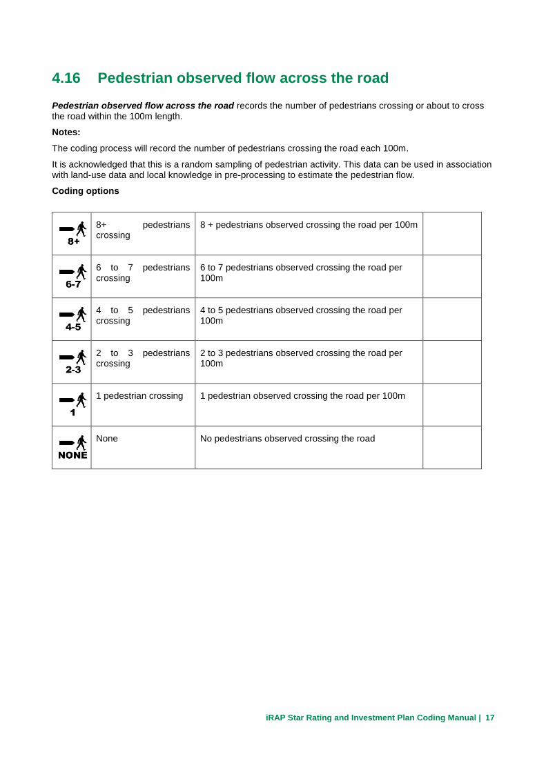
4.16 Pedestrian observed flow across the road
Pedestrian observed flow across the road records the number of pedestrians crossing or about to cross the road within the 100m length.
Notes:
The coding process will record the number of pedestrians crossing the road each 100m.
It is acknowledged that this is a random sampling of pedestrian activity. This data can be used in association with land-use data and local knowledge in pre-processing to estimate the pedestrian flow.
Coding options
8+ pedestrians crossing
8 + pedestrians observed crossing the road per 100m
6 to 7 pedestrians crossing
6 to 7 pedestrians observed crossing the road per 100m
4 to 5 pedestrians crossing
4 to 5 pedestrians observed crossing the road per 100m
2 to 3 pedestrians crossing
2 to 3 pedestrians observed crossing the road per 100m
1 pedestrian crossing 1 pedestrian observed crossing the road per 100m
None No pedestrians observed crossing the road

iRAP Star Rating and Investment Plan Coding Manual | 18
4.17 Pedestrian observed flow along the road – right
Pedestrian observed flow along the road – right records the number of pedestrians walking along the right side of the road within the 100m length.
Notes:
The coding process will record the number of pedestrians walking along the right side of the road each 100m.
It is acknowledged that this is a random sampling of pedestrian activity. This data can be used in association with land-use data and local knowledge in pre-processing to estimate the pedestrian flow.
Coding options
8+ pedestrians along right side
8 + pedestrians observed walking along the right side of the road per 100m
6 to 7 pedestrians along right side
6 to 7 pedestrians observed walking along the right side of the road per 100m
4 to 5 pedestrians along right side
4 to 5 pedestrians observed walking along the right side of the road per 100m
2 to 3 pedestrians along right side
2 to 3 pedestrians observed walking along the right side of the road per 100m
1 pedestrian along right side
1 pedestrian observed walking along the right side of the road per 100m
None No pedestrians observed walking along the right side of the road

iRAP Star Rating and Investment Plan Coding Manual | 19
4.18 Pedestrian observed flow along the road – left
Pedestrian observed flow along the road – left records the number of pedestrians walking along the left side of the road within the 100m length.
Notes:
The coding process will record the number of pedestrians walking along the road each 100m.
It is acknowledged that this is a random sampling of pedestrian activity. This data can be used in association with land-use data and local knowledge in pre-processing to estimate the pedestrian flow.
Coding options
8+ pedestrians along left side
8 + pedestrians observed walking along the left side of the road per 100m
6 to 7 pedestrians along left side
6 to 7 pedestrians observed walking along the left side of the road per 100m
4 to 5 pedestrians along left side
4 to 5 pedestrians observed walking along the left side of the road per 100m
2 to 3 pedestrians along left side
2 to 3 pedestrians observed walking along the left side of the road per 100m
1 pedestrian along left side
1 pedestrian observed walking along the left side of the road per 100m
None No pedestrians observed walking along the left side of the road
iRAP Star Rating and Investment Plan Coding Manual | 20
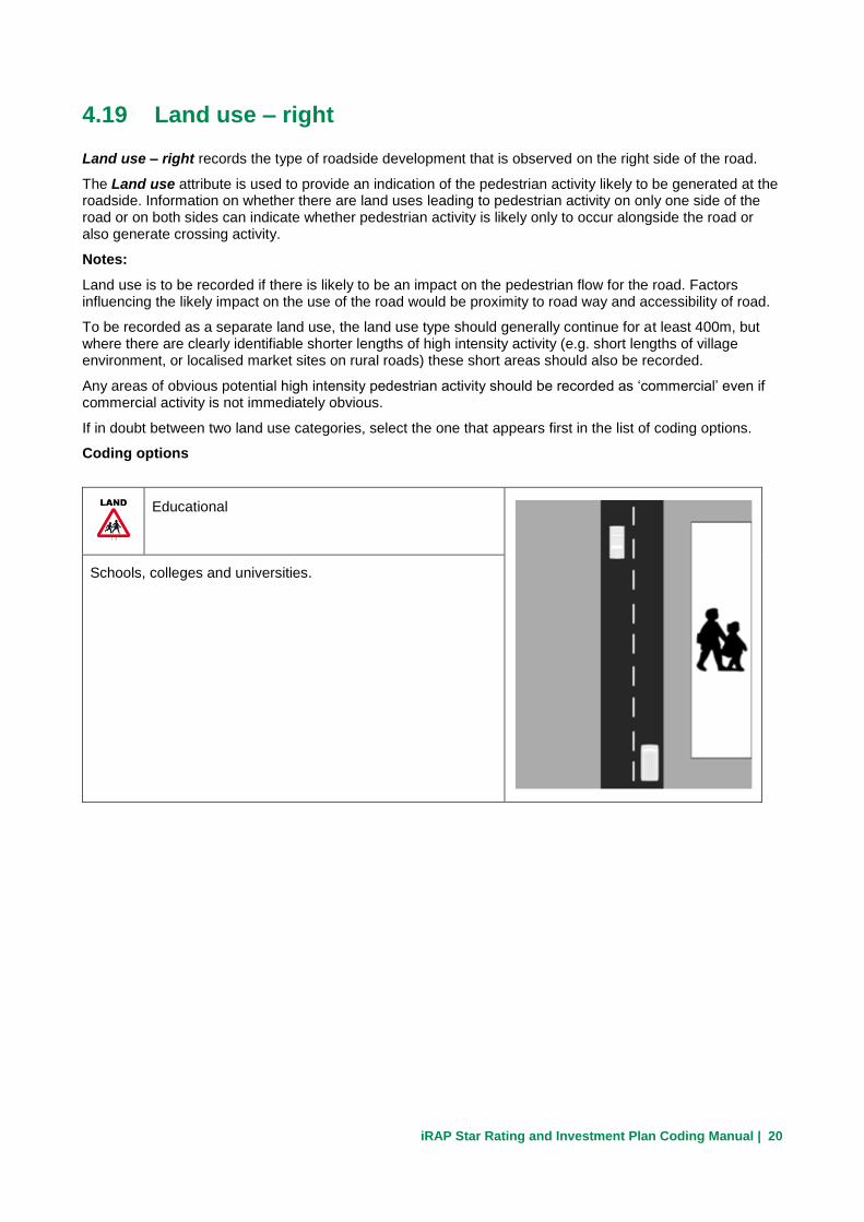
4.19 Land use – right
Land use – right records the type of roadside development that is observed on the right side of the road.
The Land use attribute is used to provide an indication of the pedestrian activity likely to be generated at the roadside. Information on whether there are land uses leading to pedestrian activity on only one side of the road or on both sides can indicate whether pedestrian activity is likely only to occur alongside the road or also generate crossing activity.
Notes:
Land use is to be recorded if there is likely to be an impact on the pedestrian flow for the road. Factors influencing the likely impact on the use of the road would be proximity to road way and accessibility of road.
To be recorded as a separate land use, the land use type should generally continue for at least 400m, but where there are clearly identifiable shorter lengths of high intensity activity (e.g. short lengths of village environment, or localised market sites on rural roads) these short areas should also be recorded.
Any areas of obvious potential high intensity pedestrian activity should be recorded as ‘commercial’ even if commercial activity is not immediately obvious.
If in doubt between two land use categories, select the one that appears first in the list of coding options.
Coding options
Educational
Schools, colleges and universities.

iRAP Star Rating and Investment Plan Coding Manual | 21
Commercial
Shops or other commercial activity, or areas where high
intensity pedestrian activity is evident.
Industrial and manufacturing
Industrial units, factories and manufacturing sites.
Residential
Residential / housing area, includes recreational areas such as
parks and gardens.

iRAP Star Rating and Investment Plan Coding Manual | 22
Farming and agricultural
Land used for farming or agricultural activities.
Undeveloped areas
Open land without shops, housing, industry or agriculture.
iRAP Star Rating and Investment Plan Coding Manual | 23
4.20 Land use – left
Land use - left records the type of roadside development that is observed on the left side of the road.
Coding options
Same as Land use - right.

iRAP Star Rating and Investment Plan Coding Manual | 24
4.21 Area type
Area type records the level of roadside development through which the road is passing.
Notes:
Roadside development should be close to the road and not separated by a large fence or wall.
Isolated small settlements (e.g., extending for 100m to 200m along route) will be recorded as “rural” for area type, but will be identified as local land use changes within this general environment.
Coding options
Urban / rural town or village
Development of congregation of houses over 200 metres.
Rural / open area
Area outside of an urban / rural town or village.
Where roadside development does not impact the road it
should not be considered.

iRAP Star Rating and Investment Plan Coding Manual | 25
4.22 Speed limit
The actual posted numerical speed limit should be recorded.
Notes:
Do not attempt to record the speed of the traffic using the road.
If no speed limit is signed, the default speed limit set by law for that type of road should be used.
The default speed limits for the inspection should be:
Rural roads speed limit
Urban road speed limit
Do not record temporary speed limits at road works.
Do not record advisory speeds.
Coding options
≥150km/h Speed limit is 150km/h or greater
140km/h Speed limit is 140km/h
130km/h Speed limit is 130km/h
120km/h Speed limit is 120km/h
110km/h Speed limit is 110km/h
100km/h Speed limit is 100km/h
90km/h Speed limit is 90km/h

iRAP Star Rating and Investment Plan Coding Manual | 26
80km/h Speed limit is 80km/h
70km/h Speed limit is 70km/h
60km/h Speed limit is 60km/h
50km/h Speed limit is 50km/h
40km/h Speed limit is 40km/h
≤30km/h Speed limit is 30km/h or lower

iRAP Star Rating and Investment Plan Coding Manual | 27
4.23 Motorcycle speed limit
The actual posted numerical speed limit for motorcycles should be recorded.
Notes:
Do not attempt to record the speed of the traffic using the road.
If no speed limit is signed, the default speed limit set by law for that type of road should be used.
Do not record temporary speed limits at road works.
Do not record advisory speeds.
Coding options
≥150km/h Speed limit for motorcycles is 150km/h or greater
140km/h Speed limit for motorcycles is 140km/h
130km/h Speed limit for motorcycles is 130km/h
120km/h Speed limit for motorcycles is 120km/h
110km/h Speed limit for motorcycles is 110km/h
100km/h Speed limit for motorcycles is 100km/h
90km/h Speed limit for motorcycles is 90km/h
80km/h Speed limit for motorcycles is 80km/h
70km/h Speed limit for motorcycles is 70km/h
60km/h Speed limit for motorcycles is 60km/h
50km/h Speed limit for motorcycles is 50km/h

iRAP Star Rating and Investment Plan Coding Manual | 28
40km/h Speed limit for motorcycles is 40km/h
≤30km/h Speed limit for motorcycles is 30km/h or lower

iRAP Star Rating and Investment Plan Coding Manual | 29
4.24 Truck speed limit
The actual posted numerical speed limit for trucks should be recorded.
Notes:
Do not attempt to record the speed of the traffic using the road.
If no speed limit is signed, the default speed limit set by law for that type of road should be used.
The default speed limits for the inspection should be:
Rural roads speed limit
Urban road speed limit
Do not record temporary speed limits at road works.
Do not record advisory speeds.
Coding options
≥150km/h Speed limit for trucks is 150km/h or greater
140km/h Speed limit for trucks is 140km/h
130km/h Speed limit for trucks is 130km/h
120km/h Speed limit for trucks is 120km/h
110km/h Speed limit for trucks is 110km/h
100km/h Speed limit for trucks is 100km/h
90km/h Speed limit for trucks is 90km/h
80km/h Speed limit for trucks is 80km/h
70km/h Speed limit for trucks is 70km/h

iRAP Star Rating and Investment Plan Coding Manual | 30
60km/h Speed limit for trucks is 60km/h
50km/h Speed limit for trucks is 50km/h
40km/h Speed limit for trucks is 40km/h
≤30km/h Speed limit for trucks is 30km/h or lower

iRAP Star Rating and Investment Plan Coding Manual | 31
4.25 Differential speeds
Differential speeds records the difference in either operating speed or speed limit between cars and trucks or cars and motorcycles where it exceeds 20km/h.
Notes:
If the speed limit, motorcycle speed limit and truck speed limit have been fully coded, then the differential speeds can be calculated in pre-processing.
Coding options
Present
Speeds between cars and trucks or cars and motorcycles
exceed 20km/h
Not Present
Speeds between cars and trucks or cars and motorcycles do
not exceed 20km/h

iRAP Star Rating and Investment Plan Coding Manual | 32
4.26 Median type
Median type records the road infrastructure feature that separates the two opposing traffic flows.
The way in which opposing flows are separated affects the likelihood of severe crashes occurring. Physical barriers restrict the movement of errant vehicles across the median and physical medians reduce the potential for head-on impacts by making it less likely that they reach opposing traffic before they recover.
Notes:
Where an obviously defective safety barrier is present in the median such that a vehicle is likely break through the barrier on impact, code the median as if no safety barrier exists. Examples of this are barrier very low, sub-standard materials, broken / un-repaired / poorly maintained railings.
Where a safety barrier is present in the median it should be recorded in median type and in roadside severity – left object. However, if there is an aggressive object in front of the safety barrier, in this case median type would be recorded as safety barrier, and roadside severity – left object would be the aggressive object.
Coding options
Centre line
Single or double central line, or marked central strip <0.3m.
Central line can be either dashed or solid, and of any colour.
If the road is undivided and has no markings it should be
recorded as:
Median type = centre line only
Delineation = poor
Wide centre line (0.3m to 1m)
Single or double central line, or marked central strip 0.3m to
1m.
Central line can be either dashed or solid, and of any colour.

iRAP Star Rating and Investment Plan Coding Manual | 33
Central hatching (>1m)
Marked central strip > 1m wide
Examples of marking are:
• Ladder hatching
• Stripes
• Coloured paving
Continuous central turning lane
Continuous central lane designated as a turning lane
Flexipost
Flexible post or bollard, but no continuous physical divider

iRAP Star Rating and Investment Plan Coding Manual | 34
Physical median width >=0m to <1.0m
Divided road with defined median of different material of width <1m
Physical median width >=1.0m to <5.0m
Divided road with defined median of different material of width 1 to 5m
Physical median width >=5.0m to <10.0m
Divided road with defined median of different material of width 5 to 10m

iRAP Star Rating and Investment Plan Coding Manual | 35
Safety barrier - concrete
Divided road with safety barrier to international standards constructed from concrete.
If the barrier is obviously defective, code as though there is no barrier present.
Safety barrier - metal
Divided road with safety barrier to international standards constructed from metal.
If the barrier is obviously defective, code as though there is no barrier present.
iRAP Star Rating and Investment Plan Coding Manual | 36
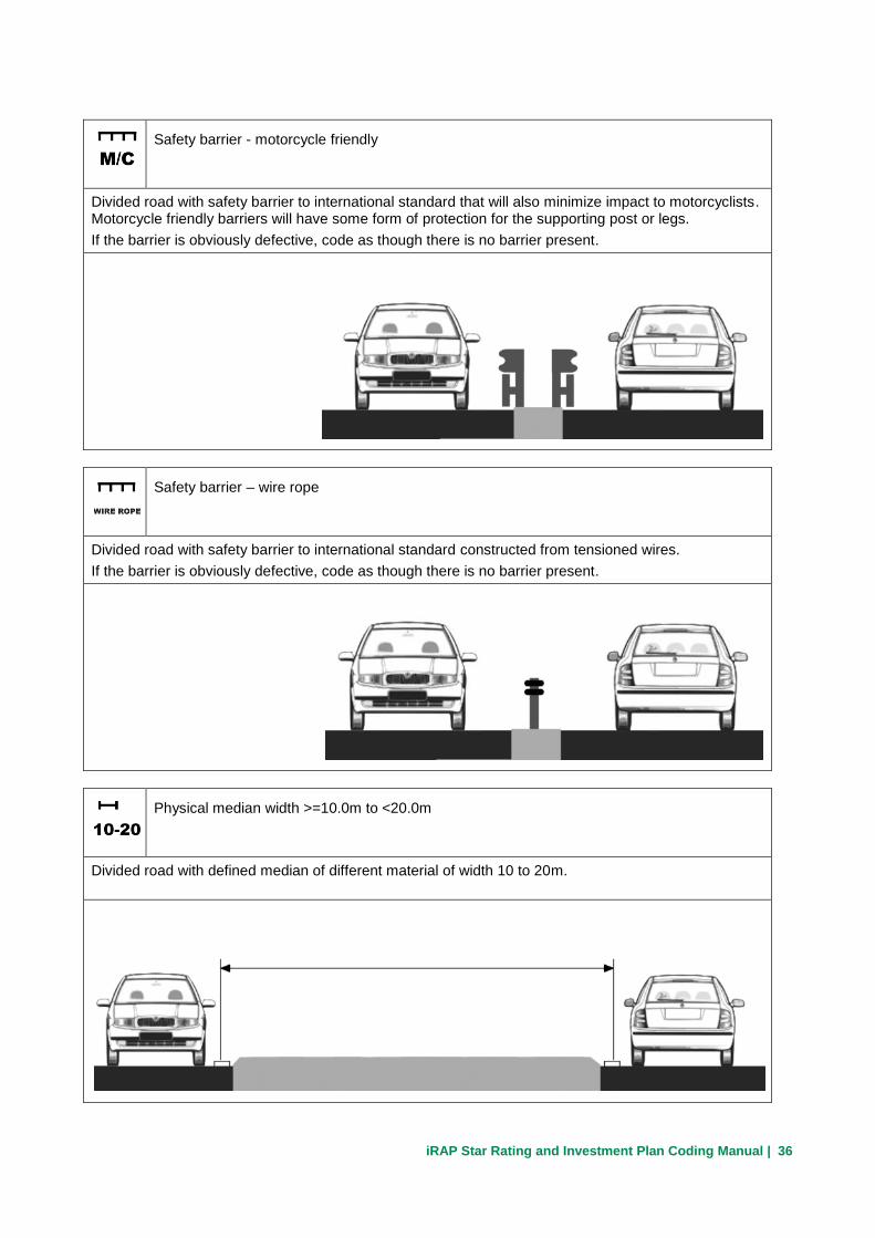
Safety barrier - motorcycle friendly
Divided road with safety barrier to international standard that will also minimize impact to motorcyclists. Motorcycle friendly barriers will have some form of protection for the supporting post or legs.
If the barrier is obviously defective, code as though there is no barrier present.
Safety barrier – wire rope
Divided road with safety barrier to international standard constructed from tensioned wires.
If the barrier is obviously defective, code as though there is no barrier present.
Physical median width >=10.0m to <20.0m
Divided road with defined median of different material of width 10 to 20m.

iRAP Star Rating and Investment Plan Coding Manual | 37
Physical median width >=20.0m
Divided road with defined median of different material of width >20m.
One way
One way streets only. Vehicles travel in a single direction with no opposing flow.

iRAP Star Rating and Investment Plan Coding Manual | 38
4.27 Centreline rumble strips
Centreline rumble strips record any textured markings running along the centre of a road whose function is to warn drivers crossing the median. Also known as raised profile markings, this feature provides an audio-vibratory warning to the driver.
Notes:
Shoulder rumble strips should not be recorded here.
Rumble strips may be constructed by cutting grooves into the pavement surface or by adding raised ribs to the road marking.
Coding options
Not Present
Rumble strip not present in the centre of the road.
Present
Rumble strip present in the centre of the road.

iRAP Star Rating and Investment Plan Coding Manual | 39
4.28 Roadside severity – right distance
Roadside severity – right distance records the distance to the nearest object to the edge line likely to be reached which could result in serious or fatal injury to road users.
Notes:
Each side of the road will be coded separately.
Record from the edge line if present. Where no edge line is present record distance from pavement edge.
Where distance to an object is at or very close to a border between categories, code as closer distance category.
Where a motorcycle facility is present the distance to the nearest object should be measured from edge of the outermost driven lane.
When there is no object present on the roadside record the distance as >=10m.
Coding options
0 to <1m
Objects with effective distance of 0 to 1m
1 to <5m
Object with effective distance of 1 to 5m

iRAP Star Rating and Investment Plan Coding Manual | 40
5 to <10m
Object with effective distance of 5 to 10m
>= 10m
Object with effective distance of >10m

iRAP Star Rating and Investment Plan Coding Manual | 41
4.29 Roadside severity – right object
Roadside severity – right object records the nearest object likely to be reached which could result in serious or fatal injury to road users.
Notes:
The object should be the same as noted in Roadside severity – distance.
Each side of the road section will be rated separately. An aggressive object is any item that could result in serious injury to a road user upon impact.
These include:
• Rocks
• Non-frangible poles/posts and trees greater than 10cm diameter
• Unprotected bridges
Do not record ‘passively safe’ (crash friendly) roadside objects or minor vegetation such as small shrubs, bushes and grass.
Coding options
Cliff
Cliff or equivalent hazard that will result in certain fatality
regardless of speed
Tree >=10cm dia.
Trees greater than 10cm diameter

iRAP Star Rating and Investment Plan Coding Manual | 42
Sign, post or pole >=10cm dia.
Examples are:
Non-frangible lighting columns
Non-frangible sign posts greater than 10cm diameter
Non-frangible traffic signal posts greater than 10cm
diameter
Unprotected safety barrier end
Aggressive ends to safety barriers for example: ramped ends, unprotected ends, sharp ends, fish-tail
terminals. This category should also be used to record damaged sections of safety barrier.
Aggressive vertical face
Irregular rock face

iRAP Star Rating and Investment Plan Coding Manual | 43
Upwards slope – rollover gradient
Cut face of at least 2m height that is likely to cause a vehicle to
roll over (15° to 75°).
Examples are:
Earth bound banks
Grass banks
Irregular rock faces should not be recorded.
Deep drainage ditch
Ditch or culvert of material, depth, or severity of angled face
likely to result in severe injury to vehicle occupants.
Rule of thumb
Only record a ditch if most of the vehicle would drop into the
ditch.
Downwards slope
Downwards slope from the roadway with:
>1:4 slope & drop >1m
Rule of thumb
A slope should be recorded if a vehicle is likely to roll on it.

iRAP Star Rating and Investment Plan Coding Manual | 44
Large boulders >= 20cm high
Large rock or boulder with a height greater than 20cm.
Rigid structure/bridge or building
Solid structures that will cause a rapid deceleration when hit.
Examples are:
Reinforced concrete bridge supports
Culvert headwalls
Semi-rigid structure or building
Solid structures that will likely deform slightly when hit.
Examples include:
Houses and other similar buildings
Street furniture such as bus stops/shelters
Communications cabinets
Stone, masonry or brick boundary walls

iRAP Star Rating and Investment Plan Coding Manual | 45
Safety barrier - concrete
Concrete safety barrier sufficient to restrain most cars and
small vehicles. Should be a continuous 100m length of
unbroken, undamaged safety barrier.
Safety barrier - metal
Metal safety barrier sufficient to restrain most cars and small
vehicles (not wire rope safety barrier). Should be a continuous
100m length of unbroken, undamaged safety barrier.
Safety barrier - wire rope
Wire rope safety barrier sufficient to restrain most cars and
small vehicles. Should be a continuous 100m length of
unbroken, undamaged safety barrier.

iRAP Star Rating and Investment Plan Coding Manual | 46
Safety barrier - motorcycle friendly
Safety barrier designed specifically to restrain motorcycles.
Motorcycle friendly barriers will have some form of protection
for the supporting posts or legs to minimize risk of injury to the
rider. Should be a continuous 100m length of unbroken,
undamaged safety barrier.
Upwards slope – no rollover gradient
Cut face of at least 2m height that a vehicle is likely to slide
along when struck (>= 75°).
Examples are:
Earth bound banks
Grass banks
Irregular rock faces should not be recorded.
No object
No object within 20m of the road.

iRAP Star Rating and Investment Plan Coding Manual | 47
4.30 Roadside severity – left distance & Roadside severity –
left object
Roadside severity – left distance records the same as roadside severity – right distance but for the left side of the roadway.
Roadside severity – left object records the same as roadside severity – right object but for the left side of the roadway.
Notes:
For divided highways, use the left side severity for the assessment of severe objects in the median.
For a divided carriageway if there is an object in the median it should be recorded in roadside severity – left, with the distance being recorded from the left edge of the carriageway in the direction of travel to the object.
For an undivided carriageway the left roadside is recorded.
When a roadside object is in front of a safety barrier the distance to the hazardous object is recorded.
For a divided carriageway if a safety barrier is the closest item it should be recorded.
For a divided carriageway if there is no object in the median:
Roadside severity – left object should be recorded as None
Roadside severity – left distance should be recorded as >10m
Coding options
Same codes as Roadside severity – right distance & Roadside severity – right object.
Roadside left Roadside right

iRAP Star Rating and Investment Plan Coding Manual | 48
4.31 Shoulder rumble strips
Shoulder rumble strips record any textured markings running along a road whose function is to warn drivers leaving the travelled way on the right side of the roadway. Also known as raised profile markings, this feature provides an audio-vibratory warning to the driver.
Notes:
Centreline rumble strips should not be recorded here.
Shoulder rumble strips will only be found on paved shoulders.
Rumble strips may be constructed by cutting grooves into the pavement surface or by adding raised ribs to the road marking.
Coding options
Not Present
No shoulder rumble strip present
Present
Shoulder rumble strip present

iRAP Star Rating and Investment Plan Coding Manual | 49
4.32 Paved shoulder width - right
The paved shoulder width – right refers to the safe and drivable section of road to the side of the edge line on the right hand side of the carriageway. It is measured from the centre of the shoulder marking (the edge line) to the edge of the paving.
Notes:
If paving begins to break up on a shoulder, the paved shoulder width should be measured up to where the edge break occurs.
If a road has no markings for a shoulder (no edge line), then no paved shoulder should be recorded, since a vehicle can be considered to be able to travel to the edge of the sealed surface.
Coding options
None
There is no paved shoulder
Narrow (≥ 0m to < 1.0m)
Paved shoulder is 0 to 1.0m
Rule of thumb – A narrow paved shoulder shall be recorded wherever an edge marking is present
even if the edge line is very close to the pavement edge.

iRAP Star Rating and Investment Plan Coding Manual | 50
Medium (≥ 1.0m to < 2.4m)
Paved shoulder is 1 to 2.4 m
Wide (≥ 2.4m)
Paved shoulder is > 2.4m

iRAP Star Rating and Investment Plan Coding Manual | 51
4.33 Paved shoulder width - left
The paved shoulder width – left refers to the safe and drivable section of road to the side of the edge line on the left hand side of the carriageway. It is measured from the centre of the shoulder marking to the edge of the paving.
Notes:
If paving begins to break up on a shoulder, the paved shoulder width should be measured up to where the edge break occurs.
If a road has no markings for a shoulder, then no paved shoulder should be recorded, since a vehicle can be considered to be able to travel to the edge of the sealed surface.
Coding options
None
There is no paved shoulder
Narrow (≥ 0m to < 1.0m)
Paved shoulder is 0 to 1.0m
Rule of thumb – A narrow paved shoulder shall be recorded wherever an edge marking is present
even if the edge line is very close to the pavement edge.

iRAP Star Rating and Investment Plan Coding Manual | 52
Medium (≥ 1.0m to < 2.4m)
Paved shoulder is 1 to 2.4 m
Wide (≥ 2.4m)
Paved shoulder is > 2.4m
iRAP Star Rating and Investment Plan Coding Manual | 53
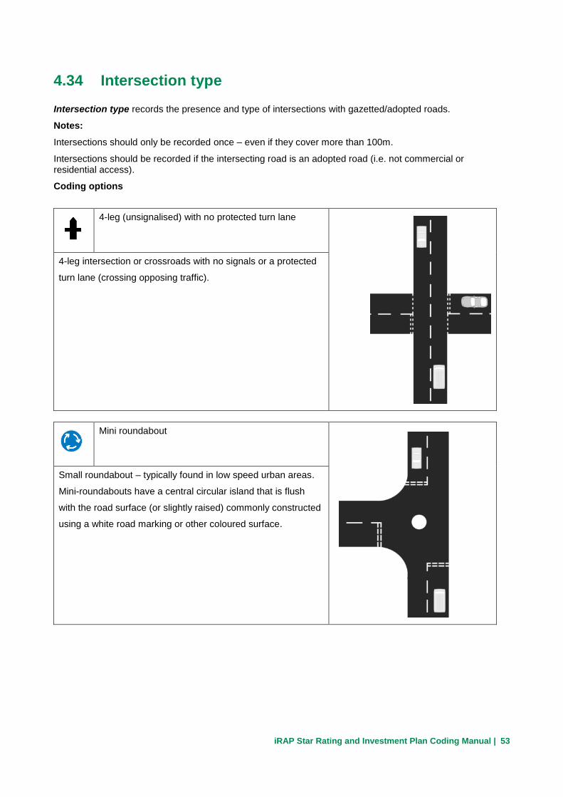
4.34 Intersection type
Intersection type records the presence and type of intersections with gazetted/adopted roads.
Notes:
Intersections should only be recorded once – even if they cover more than 100m.
Intersections should be recorded if the intersecting road is an adopted road (i.e. not commercial or residential access).
Coding options
4-leg (unsignalised) with no protected turn lane
4-leg intersection or crossroads with no signals or a protected
turn lane (crossing opposing traffic).
Mini roundabout
Small roundabout – typically found in low speed urban areas.
Mini-roundabouts have a central circular island that is flush
with the road surface (or slightly raised) commonly constructed
using a white road marking or other coloured surface.

iRAP Star Rating and Investment Plan Coding Manual | 54
4-leg (unsignalised) with protected turn lane
4-leg intersection or crossroads with a protected turn lane
(crossing opposing traffic) but no signals.
4-leg (signalized) with no protected turn lane
4-leg intersection or crossroads with signals but no protected
turn lane (crossing opposing traffic).
Railway Crossing - passive (signs only)
An at-grade railway crossing with give way or stop signage
only (or no signage).

iRAP Star Rating and Investment Plan Coding Manual | 55
3-leg (unsignalised) with no protected turn lane
3-leg intersection or T-junction with no protected turn lane
(crossing opposing traffic) or signals.
4-leg (signalised) with protected turn
lane
4-leg intersection or crossroads with a protected turn lane
(crossing opposing traffic) and signals.
3-leg (signalised) with no protected turn lane
3-leg intersection or T-junction with signals but no protected
turn lane (crossing opposing traffic).
iRAP Star Rating and Investment Plan Coding Manual | 56
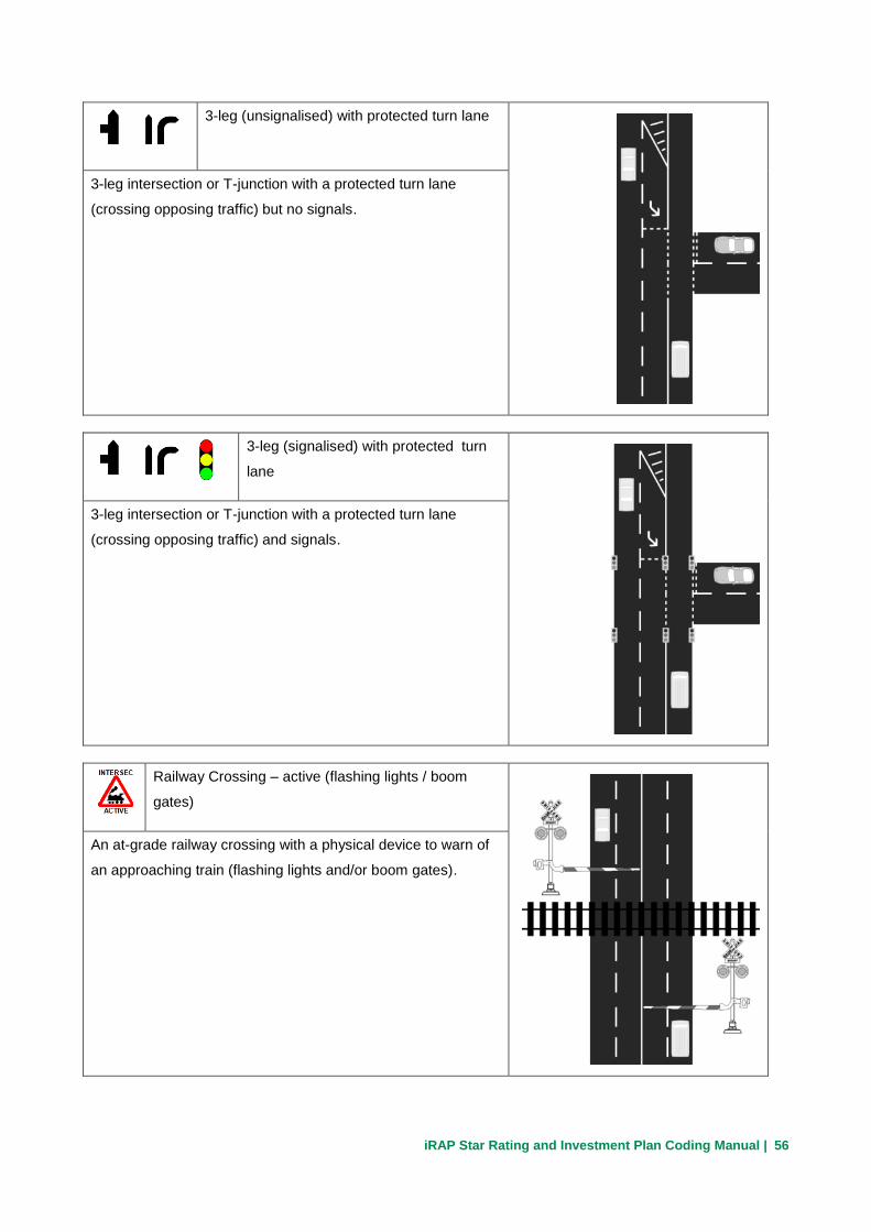
3-leg (unsignalised) with protected turn lane
3-leg intersection or T-junction with a protected turn lane
(crossing opposing traffic) but no signals.
3-leg (signalised) with protected turn
lane
3-leg intersection or T-junction with a protected turn lane
(crossing opposing traffic) and signals.
Railway Crossing – active (flashing lights / boom
gates)
An at-grade railway crossing with a physical device to warn of
an approaching train (flashing lights and/or boom gates).

iRAP Star Rating and Investment Plan Coding Manual | 57
Roundabout
Circular intersection with flow in a single direction about a
central island.
Merge Lane
Side-traffic joins the road being assessed via a merge lane.
This is typically the case at grade separated intersections.
If the merge lane is longer than 100m it should only be
recorded once.
Merge Lane – example 2
Diverge lanes are not coded.

iRAP Star Rating and Investment Plan Coding Manual | 58
Merge Lane – example 3
Filter lanes on 3 or 4 leg intersections are not recorded as
merge lanes.
Median crossing point - informal
Divided roads only. A high demand, but informal, U-turn
location that has no acceleration or deceleration lanes and/or
the pavement surface is in poor condition. These median
crossings have not been formally designed but rather
developed informally overtime through local use.
Median crossing point - formal
Divided roads only. A high demand, formal (designed) U-turn
location. Appropriate acceleration and deceleration lanes may,
or may not be present, use intersection quality to record this
detail plus condition of median pavement surface.
iRAP Star Rating and Investment Plan Coding Manual | 59
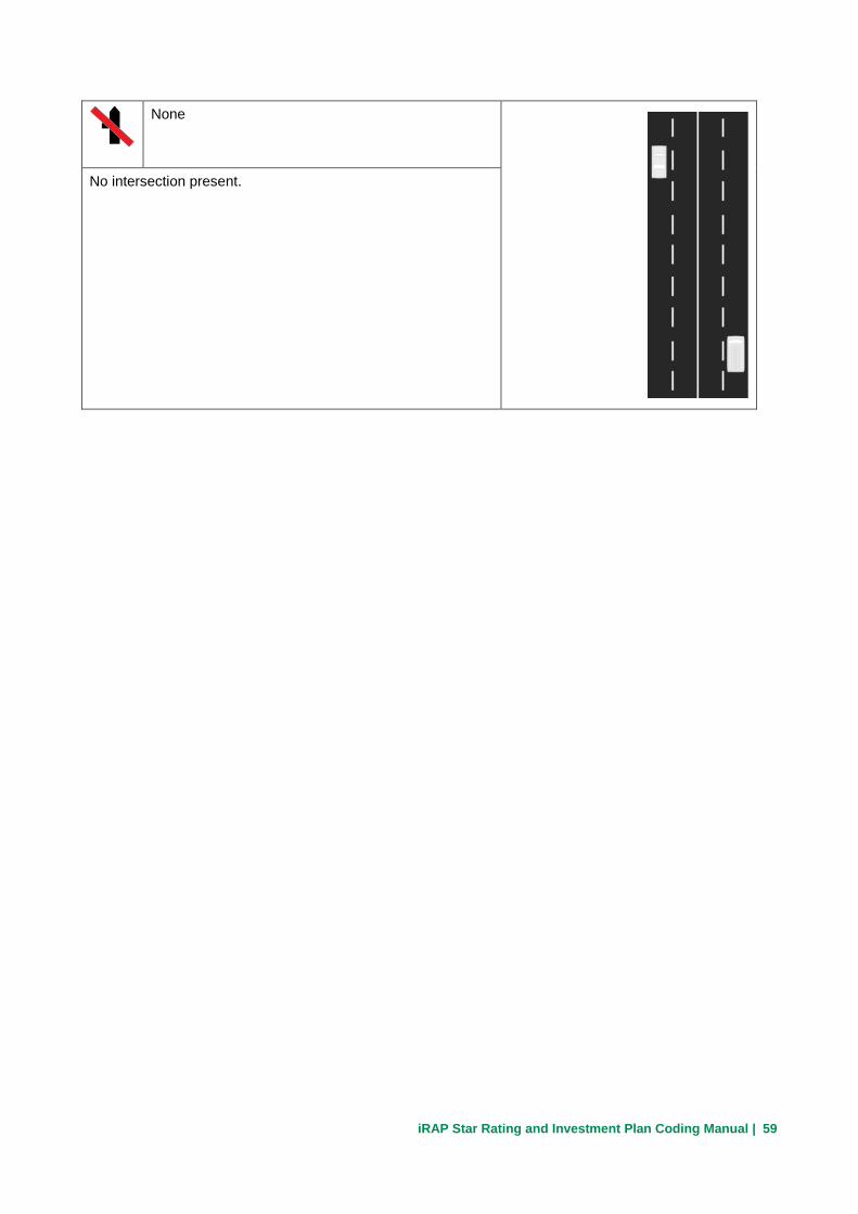
None
No intersection present.
iRAP Star Rating and Investment Plan Coding Manual | 60
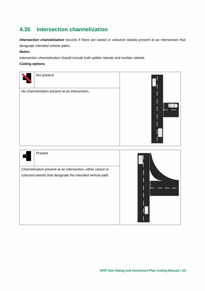
4.35 Intersection channelization
Intersection channelization records if there are raised or coloured islands present at an intersection that
designate intended vehicle paths.
Notes:
Intersection channelization should include both splitter islands and median islands.
Coding options
Not present
No channelization present at an intersection.
Present
Channelization present at an intersection, either raised or
coloured islands that designate the intended vehicle path.

iRAP Star Rating and Investment Plan Coding Manual | 61
Not applicable
No intersection present.

iRAP Star Rating and Investment Plan Coding Manual | 62
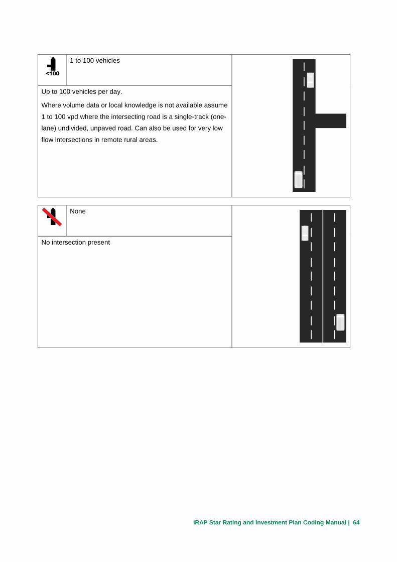
4.36 Intersecting road volume
An estimate of the AADT of the intersecting road is recorded.
Notes:
Where volume data or local knowledge are not available, estimates of the intersecting road volume could be made using aerial photo maps (within the inspection system software or software like Google Earth). The estimate should consider what towns, villages, or cities the intersecting road connects to, and development along the intersecting road.
For railway crossings an estimate of the number of trains running through the crossing per day is required.
Coding options
≥15,000 vehicles
Over 15,000 vehicles per day.
Where volume data or local knowledge is not available assume
over 15,000 vpd where the intersecting road is divided with
three or more lanes provided for side road traffic in each
direction, or multi-lane merge lanes associated with grade
separated intersections.
10,000 to 15,000 vehicles
10,000 to 15,000 vehicles per day.
Where volume data or local knowledge is not available assume
10,000 to 15,000 vpd where the intersecting road is undivided
with three or more lanes provided for side road traffic in each
direction, or single lane merge lanes associated with grade
separated intersections.

iRAP Star Rating and Investment Plan Coding Manual | 63
5,000 to 10,000 vehicles
5,000 to 10,000 vehicles per day.
Where volume data or local knowledge is not available assume
5,000 to 10,000 vpd where the intersecting road is undivided
with two lanes provided for side road traffic in each direction.
1,000 to 5,000 vehicles
1,000 to 5,000 vehicles per day.
Where volume data or local knowledge is not available assume
1,000 to 5,000 vpd where the intersecting road is undivided
with one lane provided for side road traffic in each direction.
100 to 1,000 vehicles
100 to 1,000 vehicles per day.
Where volume data or local knowledge is not available assume
100 to 1,000 vpd where the intersecting road is a single-track
(one-lane) undivided road.
iRAP Star Rating and Investment Plan Coding Manual | 64
1 to 100 vehicles
Up to 100 vehicles per day.
Where volume data or local knowledge is not available assume
1 to 100 vpd where the intersecting road is a single-track (one-
lane) undivided, unpaved road. Can also be used for very low
flow intersections in remote rural areas.
None
No intersection present

iRAP Star Rating and Investment Plan Coding Manual | 65
4.37 Intersection quality
Intersection quality represents the quality of the intersection design, advance warning, signing, and markings.
Notes:
Factors resulting in a ‘poor’ coding may include:
Very short merge lanes
Poor deflection angles at roundabouts (approach means roundabout can be entered at high speeds)
Lack of advance signing and marking on an intersection approach where the intersection is not clearly visible to approaching drivers (i.e., where approach sight distance is limited.)
If there is no intersection present, record the intersection quality as not applicable.
Coding options
Poor
Intersection design is poor or necessary signs and markings
are absent on approaches with limited sight distance, or where
the angle between the intersecting leg is small enough to
reduce the sight distance.
Adequate
Intersection design is adequate and necessary signing and
marking is generally present.

iRAP Star Rating and Investment Plan Coding Manual | 66
Not applicable
No intersection present.

iRAP Star Rating and Investment Plan Coding Manual | 67
4.38 Property access points
Property access points records the number of low-flow points where vehicles can enter or exit the roadway. This includes commercial and residential driveways and minor access lanes.
Notes:
A property access point should be an intersection with a road that has not been “adopted” by the road authority (i.e. is not managed by the road authority).
Coding options
Commercial Access 1+
One or more commercial access points within the100m length.
Includes service stations, shops and roadside cafes and rest
stops. May also include entrances to industrial sites such as
quarries or mining sites.
Residential Access 3+
Three or more residential access points or an access point that
serves three or more residential properties.

iRAP Star Rating and Investment Plan Coding Manual | 68
Residential Access 1 or 2
Less than 3 residential access points or an access point that
serves three or less residential properties. May also include
minor farm accesses and other minor tracks used by motor
vehicles to gain occasional access to the main carriageway.
None
No residential or commercial access points.

iRAP Star Rating and Investment Plan Coding Manual | 69
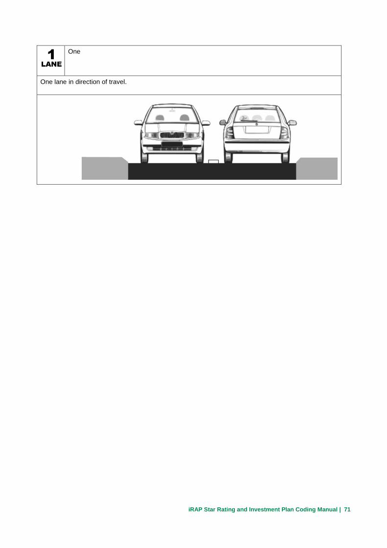
4.39 Number of lanes
Number of lanes records the total number of lanes in the direction of travel.
Notes:
The number of lanes recorded should reflect the predominant character of the road, and changes over short lengths of road (less than 400m) should not be recorded.
Only lanes that serve through traffic should be considered; turning lanes or short auxiliary lanes should not be considered. Dedicated bus lanes, guided bus ways and bus rapid transit systems should not be considered.
Where a divided carriageway has two lanes in one direction and one in the other direction or three and two lanes, only the number of lanes in the direction of travel should be recorded (the number of lanes for the opposing carriageway will be recorded when coding the opposing carriageway).
Coding options
Four or more
Four or more lanes in direction of travel.
Three
Three lanes in direction of travel.

iRAP Star Rating and Investment Plan Coding Manual | 70
Three and two
Undivided carriageway with three lanes in one direction and two in the other direction.
Two
Two lanes in direction of travel.
Two and one
Undivided carriageway with two lanes in one direction and one in the other direction.
iRAP Star Rating and Investment Plan Coding Manual | 71
One
One lane in direction of travel.

iRAP Star Rating and Investment Plan Coding Manual | 72
4.40 Lane width
Lane width is the distance from the centre of the shoulder marking to the centre of the adjacent lane marking or the centreline marking.
Notes:
If the road has no markings for a shoulder, a vehicle can be considered to be able to travel up to the edge of the sealed surface or the closest hazard.
If no lane markings are present, the total road width should be divided by the number of traffic streams.
Coding options
Narrow (≥ 0m to < 2.75m)
Lane width is <2.75m
Rule of thumb - A lorry should struggle to fit in a narrow lane
Medium (≥ 2.75m to < 3.25m)
Lane width is 2.75 to 3.25m

iRAP Star Rating and Investment Plan Coding Manual | 73
Wide (≥ 3.25m)
Lane width is > 3.25m
iRAP Star Rating and Investment Plan Coding Manual | 74
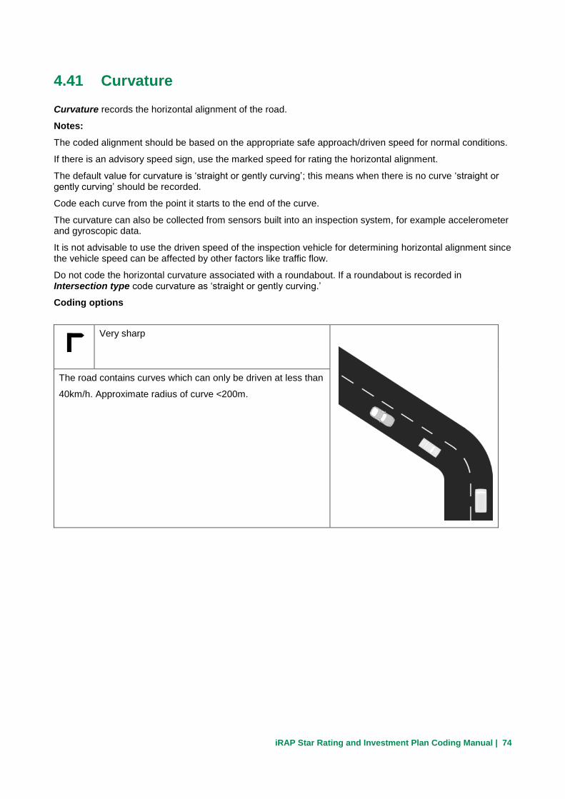
4.41 Curvature
Curvature records the horizontal alignment of the road.
Notes:
The coded alignment should be based on the appropriate safe approach/driven speed for normal conditions.
If there is an advisory speed sign, use the marked speed for rating the horizontal alignment.
The default value for curvature is ‘straight or gently curving’; this means when there is no curve ‘straight or gently curving’ should be recorded.
Code each curve from the point it starts to the end of the curve.
The curvature can also be collected from sensors built into an inspection system, for example accelerometer and gyroscopic data.
It is not advisable to use the driven speed of the inspection vehicle for determining horizontal alignment since the vehicle speed can be affected by other factors like traffic flow.
Do not code the horizontal curvature associated with a roundabout. If a roundabout is recorded in Intersection type code curvature as ‘straight or gently curving.’
Coding options
Very sharp
The road contains curves which can only be driven at less than
40km/h. Approximate radius of curve <200m.

iRAP Star Rating and Investment Plan Coding Manual | 75
Sharp
The road contains sharp curves which can only be driven
between 40 and 70km/h. Approximate radius of curve 200 to
500m.
Moderate
The road has fairly tight curves which can be driven at less
than 100km/h but more than 70km/h. Approximate radius of
curve 500 to 900m.
Straight or gently curving
The road contains only long curves which can be driven at
100km/h or more. Approximate radius of curve >900m.

iRAP Star Rating and Investment Plan Coding Manual | 76
4.42 Quality of curve
Quality of curve records how easy it is to judge how sharp a curve is and if it can be driven safety. The quality of the curve will reflect the extent to which signs and markings help the driver to judge the correct curvature, and the sight distance in advance of, and around, the curve.
Notes:
A practical indication of the quality of the curve might be whether the driver needs to adjust speed suddenly or unexpectedly on the approach to, or within the curve. This may occur even though there has been an attempt through signing to warn the driver of extra risk.
If the code ‘poor’ should be assigned, then it must be selected from the point the curve starts to the end of the curve.
Coding options
Poor
Rapid or unexpected speed adjustments are needed to
negotiate the curve. Lack of advanced signing. Missing or
poorly maintained road markings.
Adequate
Signing, marking and sight distance enable a driver to judge
curvature. Curves of adequate quality may incorporate chevron
alignment markers (CAMs) or other hazard markers.
iRAP Star Rating and Investment Plan Coding Manual | 77
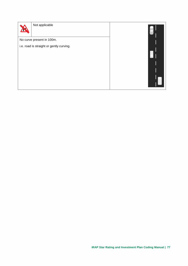
Not applicable
No curve present in 100m.
i.e. road is straight or gently curving.

iRAP Star Rating and Investment Plan Coding Manual | 78
4.43 Grade
Grade records the gradient of the road along its length.
Notes:
Grade refers to both upward and downward grades.
Coding options
≥10%
A rise of more than 10m over a 100m length, or an angle of over 5.75 degrees
≥7.5 to <10%
A rise of 7.5m to 10m over a 100m length, or an angle of 4.3 to 5.75 degrees

iRAP Star Rating and Investment Plan Coding Manual | 79
≥0 to <7.5%
A rise of up to 7.5m over a 100m length, or an angle of up to 4.3 degrees

iRAP Star Rating and Investment Plan Coding Manual | 80
4.44 Road condition
Road condition records the ability of the road to provide a level, even running surface, free from major surface defects that may adversely affect the vehicle path.
Notes:
The features of a poor or medium road condition need only to be present at some point on the 100m length, not over its entire length. Typically a poor quality category will have serious defects for over 10 meters or more.
Defects that should be considered include anything that would cause an impact on vehicle control or path, some examples are:
• Deformation – any forms of rutting or uneven surface that can lead to an uncomfortable or unsafe ride.
• Pot-holes – any holes in the road surface due to loss of material, sufficiently wide or deep enough to cause a severe jolt or loss of control to the vehicle.
• Edge defects – any road shoulder seal problems which encroach on the driven lane.
Coding options
Poor
Road has serious defects which are likely to result in frequent
or unpredictable impact on vehicle control.

iRAP Star Rating and Investment Plan Coding Manual | 81
Medium
Road has a number of minor defects which may result in
occasional impact on vehicle control or path.
Good
Road has very few or no defects. There is no potential impact
on vehicle control or path.

iRAP Star Rating and Investment Plan Coding Manual | 82
4.45 Skid resistance / grip
Skid resistance / grip records the general characteristic of the road surface in terms of its properties
relating to skidding resistance and texture depth.
Notes:
Surface texture deficiencies should be recorded here. This includes surface friction issues such as loose
gravel, flushing or stripping which could reduce traction for vehicles in wet or dry conditions.
The attribute recorded should reflect the general condition of the road over the 100m length.
Coding options
Unsealed - poor
The road surface is unpaved and has a low grip surface.
For example:
Surface is covered in loose gravel or the natural
surface is likely to be slippery in wet conditions (e.g.
silt / clay surfaces).
Unsealed - adequate
The road surface is unpaved with a relatively good surface
grip.
For example:
The surface is compacted aggregate providing a
surface that remains firm in all prevailing weather
conditions.

iRAP Star Rating and Investment Plan Coding Manual | 83
Sealed - poor
The road surface is sealed and has a low grip surface.
For example:
The road surface is paved and looks smooth and shiny
for more than 20% of the preferred vehicle path.
Loose gravel and other material is present for more
than 20%.
Sealed - medium
The road surface is sealed and has a medium grip surface.
For example:
The road surface is paved and looks smooth and shiny
for up to 20% of the preferred vehicle path.
Loose gravel and other material is present for up to
20%.
Sealed - adequate
The road surface is sealed and is expected to have adequate
skid resistance performance. There are no visible smooth and
shiny sections in the preferred vehicle path.

iRAP Star Rating and Investment Plan Coding Manual | 84
4.46 Delineation
Delineation records the road attributes which inform drivers of road conditions to keep them within the driven lane and aware of the road ahead.
Notes:
The delineation is based on a combination of the following factors:
• Centrelines
• Edge lines
• Guideposts / delineators, road studs and hazard markers
• Signage
Warning signs must be present to warn drivers of any sudden change in the road conditions e.g. lane narrowing.
Quality of delineation of curves, intersections and crossings are recorded under other attributes, in this situation delineation should be kept the same as the previous value.
This attribute involves coding the quality of delineation under daylight conditions only.
Coding options
Poor
Signing of hazards, or centre and edge markings are absent or
in poor condition over long lengths.

iRAP Star Rating and Investment Plan Coding Manual | 85
Adequate
Signs warning of severe hazards, and centre and edge
markings are generally present and visible.

iRAP Star Rating and Investment Plan Coding Manual | 86
4.47 Street lighting
Street lighting records the presence of street lighting that is sufficient to illuminate pedestrians and
bicyclists.
Notes:
A street light or street lamp is a raised source of light often mounted on a lamp column or pole either on the
side of the road or within the median, or suspended on a wire above the road to provide illumination.
Coding options
Not Present
Street light is not present that is sufficient to illuminate
pedestrians and bicyclists.
Present
Street light is present that is sufficient to illuminate pedestrians
and bicyclists.

iRAP Star Rating and Investment Plan Coding Manual | 87
4.48 Pedestrian crossing facilities – inspected road
Pedestrian crossing facilities – inspected road records the presence of purpose built pedestrian crossing facilities on the road being inspected.
Notes:
Pedestrian crossing facilities should be recorded regardless of whether they are at an intersection or not.
If located at intersections, the facility needs to be recorded at the same point so that they can be linked.
If two pedestrian crossings on the inspected road are present at an intersection, only one is recorded.
Pedestrian crossings on intersecting roads are not recorded in this attribute.
Where crossing is at a signalized intersection the pedestrian crossing should only be considered signalised if the signals have a pedestrian phase.
Coding options
Refuge only
No crossing is marked but a purpose built central refuge island
is provided for pedestrians.

iRAP Star Rating and Investment Plan Coding Manual | 88
Unsignalised marked crossing without refuge
The crossing is well marked but has no central refuge island.
Unsignalised marked crossing with refuge
The crossing is well marked and split with a purpose built
central refuge island.
Signalised without refuge
Traffic signals control pedestrian and vehicle movements.
Where crossing is at a signalised intersection the pedestrian
crossing should only be considered signalised if the signals
incorporate a pedestrian phase.

iRAP Star Rating and Investment Plan Coding Manual | 89
Signalised with refuge
Traffic signals control pedestrian and vehicle movements; the
crossing is split with a purpose built central refuge.
Where crossing is at a signalised intersection the pedestrian
crossing should only be considered signalised if the signals
incorporate a pedestrian phase.
Grade separated facility
The crossing is physically separated and does not bring
pedestrians into conflict with traffic.
May include pedestrian overbridges or underpasses
(subways).
Unsignalised raised marked crossing with refuge
The crossing incorporates a raised (speed reducing) platform,
is well marked and split with a purpose built central refuge
island.

iRAP Star Rating and Investment Plan Coding Manual | 90
Unsignalised raised marked crossing without refuge
The crossing incorporates a raised (speed reducing) platform,
is well marked but has no central refuge island.
Raised unmarked crossing with refuge
The crossing is unmarked but incorporates a raised (speed
reducing) platform and central refuge island. Pedestrians
typically still give way to cars on this type of treatment.
Raised unmarked crossing without refuge
The crossing is unmarked, incorporates a raised (speed
reducing) platform and no central refuge island. Pedestrians
typically still give way to cars on this type of treatment.

iRAP Star Rating and Investment Plan Coding Manual | 91
No facility
No provision for pedestrians crossing.

iRAP Star Rating and Investment Plan Coding Manual | 92
4.49 Pedestrian crossing quality
Pedestrian crossing quality records how well the crossing can be seen by drivers, or if there are warning signs present.
Notes:
When a pedestrian crossing facility has been recorded the quality of the crossing must also be recorded.
An assessment should be made on whether some drivers may need to brake suddenly when they become aware of the crossing too late, or fail to see it completely.
The three primary factors to be considered in coding quality of crossing are:
• Signing
• Marking or raised crossing
• Good sight distance
Coding options
Poor
Rapid or unexpected speed adjustments might be needed to
avoid risk to pedestrians.
Adequate
Signing, marking & sight distance enable a driver to be aware
in good time of the presence of the crossing.
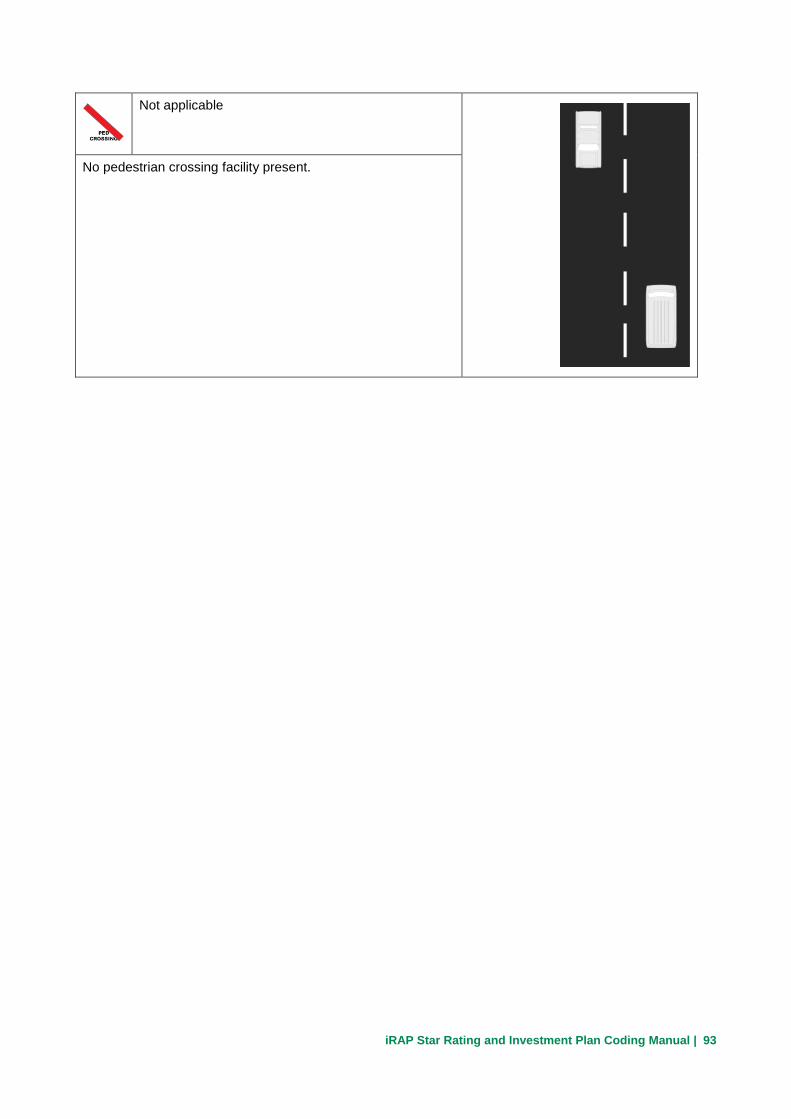
iRAP Star Rating and Investment Plan Coding Manual | 93
Not applicable
No pedestrian crossing facility present.

iRAP Star Rating and Investment Plan Coding Manual | 94
4.50 Pedestrian crossing facilities – intersecting road
Pedestrian crossing facilities – intersecting road records the presence of purpose built pedestrian crossing facilities on an intersecting road.
Notes:
If two pedestrian crossings are present at an intersection, only one is recorded.
Where crossing is at a signalised intersection the pedestrian crossing should only be considered signalised if the signals have a pedestrian phase.
Coding options
Refuge only
No crossing is marked but a purpose built central refuge island
is provided for pedestrians.
Unsignalised marked crossing without refuge
The crossing is well marked but has no central refuge island.

iRAP Star Rating and Investment Plan Coding Manual | 95
Unsignalised marked crossing with refuge
The crossing is well marked and split with a purpose built
central refuge island.
Signalised without refuge
Traffic signals control pedestrian and vehicle movements.
Where crossing is at a signalised intersection the pedestrian
crossing should only be considered signalised if the signals
incorporate a pedestrian phase.
Signalised with refuge
Traffic signals control pedestrian and vehicle movements; the
crossing is split with a purpose built central refuge island.
Where crossing is at a signalised intersection the pedestrian
crossing should only be considered signalised if the signals
incorporate a pedestrian phase.

iRAP Star Rating and Investment Plan Coding Manual | 96
Grade separated facility
The crossing is physically separated and does not bring
pedestrians into conflict with traffic.
May include pedestrian overbridges or underpasses
(subways).
Unsignalised raised marked crossing with refuge
The crossing incorporates a raised (speed reducing) platform,
is well marked and split with a purpose built central refuge
island.
Unsignalised raised marked crossing without refuge
The crossing incorporates a raised (speed reducing) platform,
is well marked but has no central refuge island.

iRAP Star Rating and Investment Plan Coding Manual | 97
Raised unmarked crossing with refuge
The crossing is unmarked but incorporates a raised (speed
reducing) platform and central refuge island. Pedestrians
typically still give way to cars on this type of treatment.
Raised unmarked crossing without refuge
The crossing is unmarked, incorporates a raised (speed
reducing) platform and no central refuge island. Pedestrians
typically still give way to cars on this type of treatment.
No facility
No provision for pedestrians crossing.
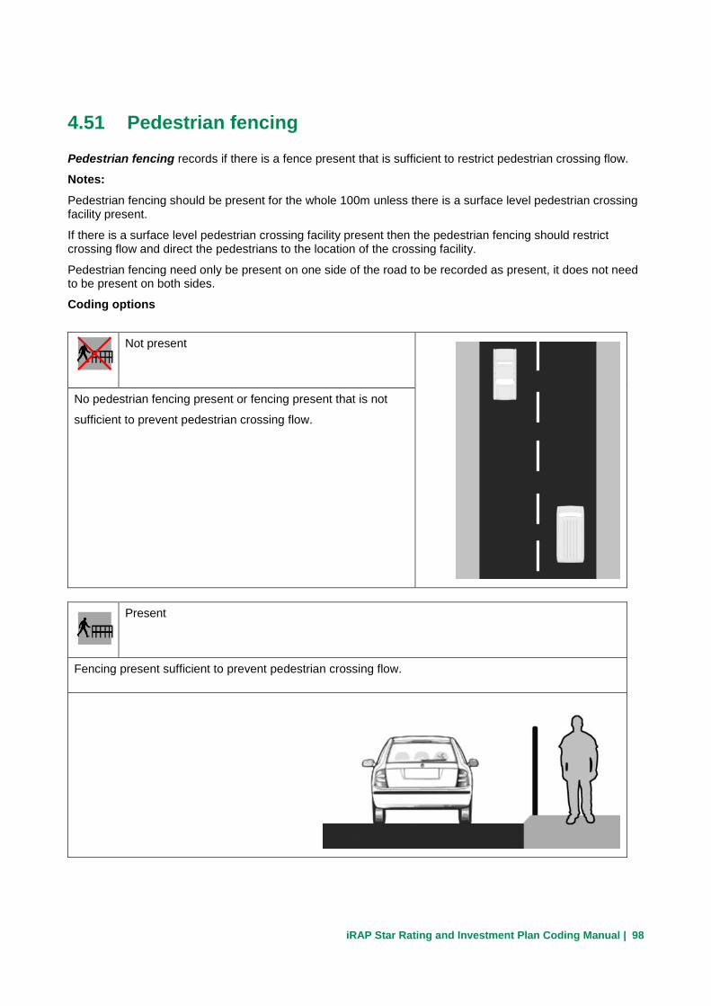
iRAP Star Rating and Investment Plan Coding Manual | 98
4.51 Pedestrian fencing
Pedestrian fencing records if there is a fence present that is sufficient to restrict pedestrian crossing flow.
Notes:
Pedestrian fencing should be present for the whole 100m unless there is a surface level pedestrian crossing facility present.
If there is a surface level pedestrian crossing facility present then the pedestrian fencing should restrict crossing flow and direct the pedestrians to the location of the crossing facility.
Pedestrian fencing need only be present on one side of the road to be recorded as present, it does not need to be present on both sides.
Coding options
Not present
No pedestrian fencing present or fencing present that is not
sufficient to prevent pedestrian crossing flow.
Present
Fencing present sufficient to prevent pedestrian crossing flow.
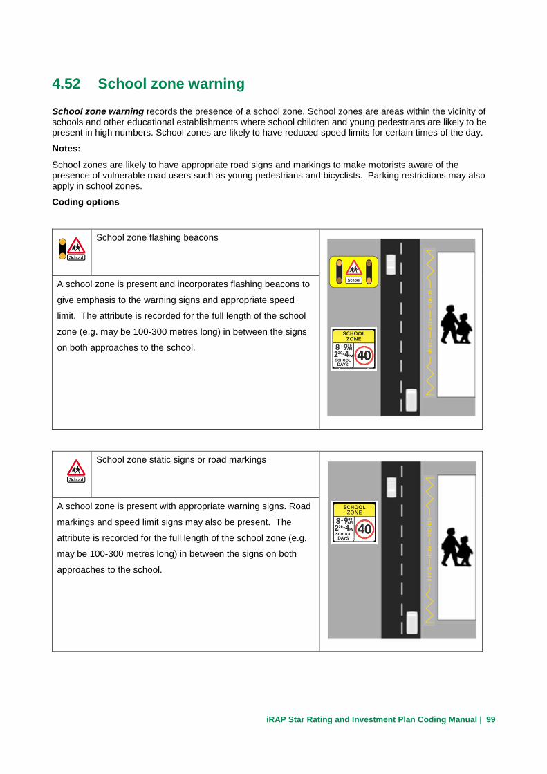
iRAP Star Rating and Investment Plan Coding Manual | 99
4.52 School zone warning
School zone warning records the presence of a school zone. School zones are areas within the vicinity of schools and other educational establishments where school children and young pedestrians are likely to be present in high numbers. School zones are likely to have reduced speed limits for certain times of the day.
Notes:
School zones are likely to have appropriate road signs and markings to make motorists aware of the presence of vulnerable road users such as young pedestrians and bicyclists. Parking restrictions may also apply in school zones.
Coding options
School zone flashing beacons
A school zone is present and incorporates flashing beacons to
give emphasis to the warning signs and appropriate speed
limit. The attribute is recorded for the full length of the school
zone (e.g. may be 100-300 metres long) in between the signs
on both approaches to the school.
School zone static signs or road markings
A school zone is present with appropriate warning signs. Road
markings and speed limit signs may also be present. The
attribute is recorded for the full length of the school zone (e.g.
may be 100-300 metres long) in between the signs on both
approaches to the school.

iRAP Star Rating and Investment Plan Coding Manual | 100
No school zone warning
School is present but no school zone warning signs or
markings are evident.
Not applicable (no school at the location)
No school at the location.
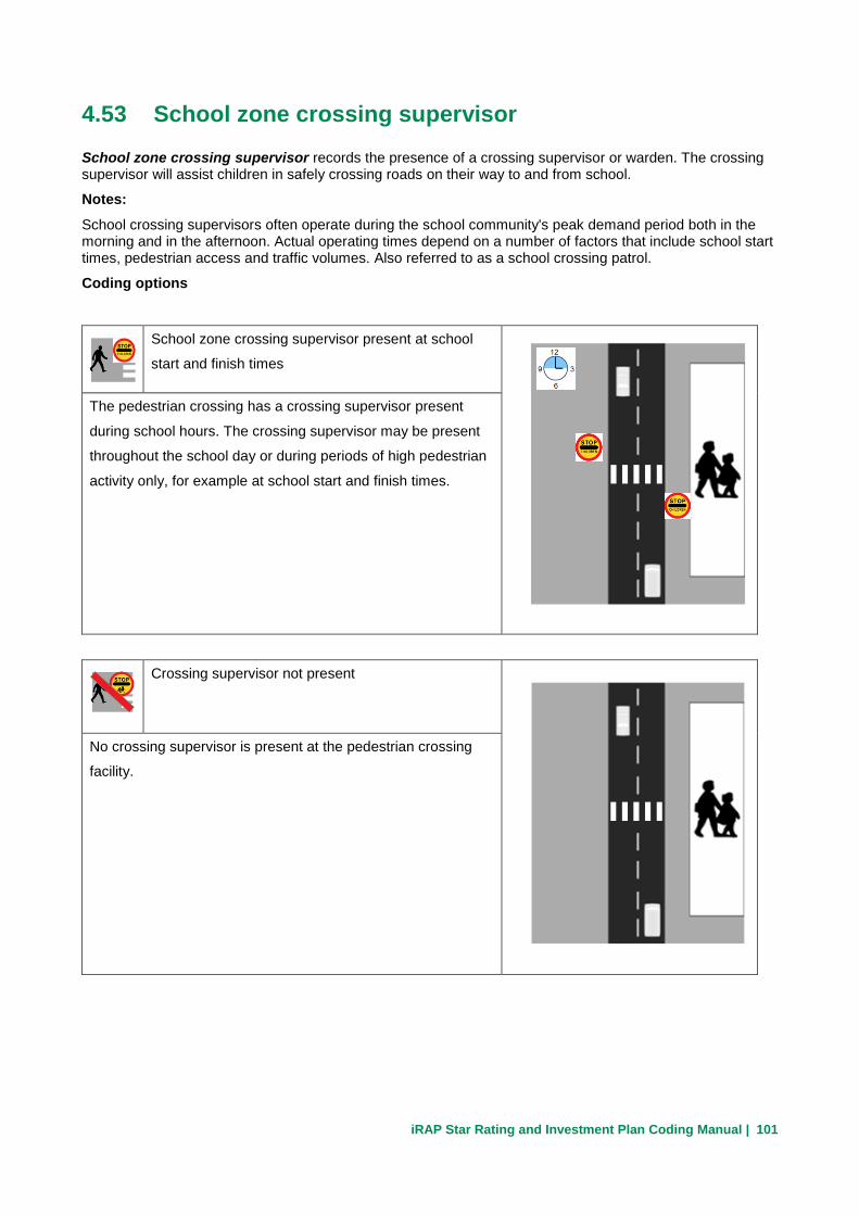
iRAP Star Rating and Investment Plan Coding Manual | 101
4.53 School zone crossing supervisor
School zone crossing supervisor records the presence of a crossing supervisor or warden. The crossing supervisor will assist children in safely crossing roads on their way to and from school.
Notes:
School crossing supervisors often operate during the school community's peak demand period both in the morning and in the afternoon. Actual operating times depend on a number of factors that include school start times, pedestrian access and traffic volumes. Also referred to as a school crossing patrol.
Coding options
School zone crossing supervisor present at school
start and finish times
The pedestrian crossing has a crossing supervisor present
during school hours. The crossing supervisor may be present
throughout the school day or during periods of high pedestrian
activity only, for example at school start and finish times.
Crossing supervisor not present
No crossing supervisor is present at the pedestrian crossing
facility.

iRAP Star Rating and Investment Plan Coding Manual | 102
Not applicable
No pedestrian crossing facility at the location.

iRAP Star Rating and Investment Plan Coding Manual | 103
4.54 Speed management / traffic calming
Speed management / traffic calming records the presence of road infrastructure features that will typically reduce the operating speed by 5 to 10km/h below the speed limit.
Notes:
Speed management / traffic calming is typically found in urban areas.
Traffic calming is often applied to local streets with the aim of lowering traffic speeds and volumes, and sometimes, preventing particular types of vehicle travelling through an area.
Traffic calming features include: roundabouts, kerbed build-outs, speed humps, raised tables, entry treatments, speed cushions, chicanes and modified intersections.
Coding options
Not present
No traffic calming or speed management features are present.
Present
Traffic calming/speed management features are present
sufficient to reduce the operating speed 5-10km/h below the
speed limit.
For example:
Kerb build outs
Speed table
Speed hump

iRAP Star Rating and Investment Plan Coding Manual | 104
4.55 Vehicle parking
Vehicle parking records the extent to which there is vehicle parking along the side of the road.
Notes:
Vehicle parking includes where several buses or taxis stop to service roadside activities.
This attribute should include parked vehicles and on-street parking spaces, bus stops and general encroachment on the highway.
Vehicle parking should be based on activities within 2m of the outside edge of the driveable lane.
Coding options
Two sides
Parking on both sides of the road spill out onto the road.
One side
Parking on one side of the road spill out onto the road.

iRAP Star Rating and Investment Plan Coding Manual | 105
None
No parking on either side of the road.

iRAP Star Rating and Investment Plan Coding Manual | 106
4.56 Sidewalk provision – right
Sidewalk provision – right records the provision of a footpath or the presence of an informal path on the right side of the roadway.
Notes:
A footpath is a purpose built facility for pedestrians that has an all-weather surface (sealed or unsealed) that provides a reliable surface for pedestrians to walk on.
An informal path is a surface that, although not purpose built for pedestrians, provides a location that is commonly used by pedestrians to walk on that is adjacent or away from the driven lane.
Sidewalk provision is based on the sidewalk’s distance from the outer-most driveable lane, and the presence of a vertical barrier between vehicular traffic and pedestrians. This distance can be defined as the distance from the edge-line of the closest trafficable lane to the edge of the pedestrian sidewalk.
Provision for pedestrian crossing movements is not considered as part of this attribute.
A physical barrier can effectively remove the risk of pedestrian and vehicle interaction but to do so, the physical barrier must be sufficient to restrain a vehicle from entering the pedestrian facility at the posted speed limit.
Kerbs, while discouraging traffic from passing over them, can be considered to do little to prevent road traffic from entering the sidewalk, unless specifically designed to do so; thus, kerbs are not a physical barrier.
If the footpath is obstructed e.g. by roadside traders, shop front activities (so that pedestrians have to walk in the roadway), then code as if footpath is not present.
If there is a parking lane present then the distance to the footpath should be measured from the edge of the driven lane.
Non-physical separation many include grass verges.
Coding options
None
No discernible sidewalk is provided

iRAP Star Rating and Investment Plan Coding Manual | 107
Non-physical separation 0m to <1.0m
Sidewalk separated from roadway by no more than 1m, including paved shoulder and no barrier
provided.
Non-physical separation 1.0m to <3.0m
Sidewalk separated from roadway by between 1m and 3m, and no barrier provided.
Non-physical separation >= 3.0m
Sidewalk separated from roadway by at least 3m and no barrier provided.
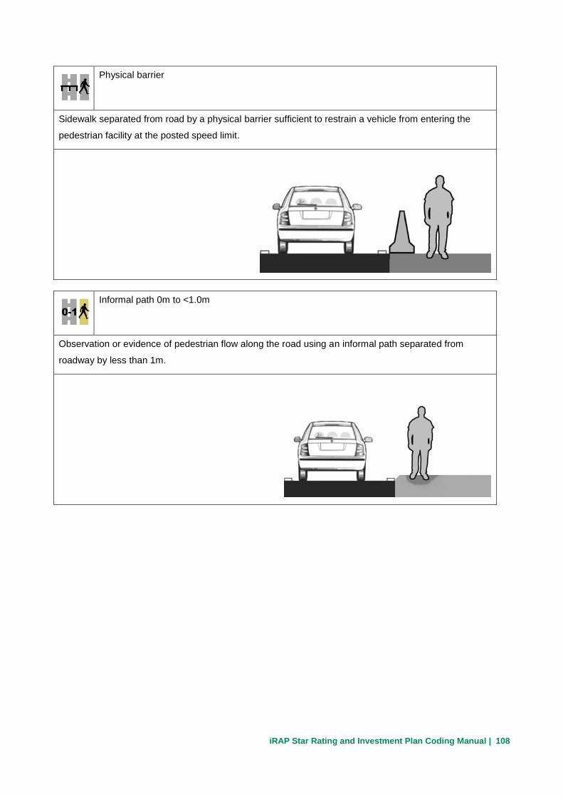
iRAP Star Rating and Investment Plan Coding Manual | 108
Physical barrier
Sidewalk separated from road by a physical barrier sufficient to restrain a vehicle from entering the
pedestrian facility at the posted speed limit.
Informal path 0m to <1.0m
Observation or evidence of pedestrian flow along the road using an informal path separated from
roadway by less than 1m.

iRAP Star Rating and Investment Plan Coding Manual | 109
Informal path >=1.0m
Observation or evidence of pedestrian flow along the road using an informal path separated from
roadway by more than 1m.
iRAP Star Rating and Investment Plan Coding Manual | 110
4.57 Sidewalk provision – left
Sidewalk provision – left records the provision of a footpath or the presence of an informal path on the left side of the roadway.
Notes:
A footpath is a purpose built facility for pedestrians that has an all-weather surface (sealed or unsealed) that provides a reliable surface for pedestrians to walk on.
An informal path is a surface that, although not purpose built for pedestrians, provides a location that is commonly used by pedestrians to walk on that is adjacent or away from the driven lane.
Sidewalk provision is based on the sidewalk’s distance from the outer-most driveable lane, and the presence of a vertical barrier between vehicular traffic and pedestrians. This distance can be defined as the distance from the edge-line of the closest trafficable lane to the edge of the pedestrian sidewalk.
A physical barrier can effectively remove the risk of pedestrian and vehicle interaction but to do so, the physical barrier must be sufficient to restrain a vehicle from entering the pedestrian facility at the posted speed limit.
Kerbs are not a physical barrier.
If the footpath is obstructed e.g. by roadside traders, shop front activities (so that pedestrians have to walk in the roadway), then code as if footpath is not present.
If there is a parking lane present then the distance to the footpath should be measured from the edge of the driven lane.
For divided roads code this attribute as “None”.
Coding options
Same as Sidewalk provision – right.

iRAP Star Rating and Investment Plan Coding Manual | 111
4.58 Service road
Service road records the presence of a service road running parallel with the main carriageway.
Notes:
The purpose of a service road is to link the property accesses and minor intersections together and then join them to the main carriageway at a single point.
Coding options
Not present
No service road present and/or property access points joining
the main carriageway.
Present
Effective service road present.

iRAP Star Rating and Investment Plan Coding Manual | 112
4.59 Facilities for motorised two-wheelers
Facilities for motorised two-wheelers records the presence of purpose built facilities for motorcycles and other motorised two-wheelers.
Notes:
This includes segregated motorcycle paths completely separated by barriers, as well as dedicated lanes within the roadway but to one side of the normal traffic.
For the facility to be coded ‘exclusive motorcycle path with barrier’, there must be a physical barrier sufficient enough to fully restrict vehicles from entering the dedicated path.
Coding options
None
No specific provisions for motorised two wheelers.
Inclusive motorcycle lane on roadway
Dedicated motorcycle lane separated from traffic by lane
marking.

iRAP Star Rating and Investment Plan Coding Manual | 113
Exclusive one-way motorcycle path without barrier
Motorcycle path separated from traffic by least 1m (kerb or
equivalent wide raised surface).
Exclusive one-way motorcycle path with barrier
Segregated motorcycle path separated by a physical barrier or
located at least 10m from the road.
Exclusive two-way motorcycle path without barrier
Two-way motorcycle path separated from traffic by at least 1m
(kerb or equivalent wide raised surface).

iRAP Star Rating and Investment Plan Coding Manual | 114
Exclusive two-way motorcycle path with barrier
Two-way segregated motorcycle path separated by a physical
barrier or located at least 10m from the road.

iRAP Star Rating and Investment Plan Coding Manual | 115
4.60 Facilities for bicycles
Facilities for bicycles records purpose built facilities for bicyclists.
Notes:
A physical barrier must be sufficient to restrain a vehicle from entering the bicycle facility at the posted speed limit.
Some bicycle facilities may be provided alongside pedestrian footpaths.
Use the same codes whether bike facility is on one side or both sides for undivided roads.
Consider only facilities that are specifically for bicycles.
Where a bicycle facility is shared with pedestrians code it as both a sidewalk and a bicycle facility.
Coding options
None
No specific provision for bicycles.
Extra wide outside (>=4.2m)
Lane next to roadside is greater than or equal 4.2m in width.

iRAP Star Rating and Investment Plan Coding Manual | 116
On-road lane
Dedicated bicycle lane separated from traffic only by lane
marking on roadway or by <1m of raised or paved surface.
Shared use path
Bicycle path separated from traffic by >1m raised or paved
surface.
Off-road path
Bicycle path separated from traffic by >1m raised or paved
surface.

iRAP Star Rating and Investment Plan Coding Manual | 117
Off-road path with barrier
Segregated bicycle path separated by a physical barrier or
located at least 10m from the road.
The physical barrier must be sufficient to restrain a vehicle
from entering the bicycle facility at the posted speed limit.
Signed shared roadway
Standard road layout that has been identified by signing as preferred bike route.

iRAP Star Rating and Investment Plan Coding Manual | 118
4.61 Roadworks
Roadworks records where major road construction or road works is in progress.
Notes:
Coding options
Major road works in progress
Major road works are when the road is being significantly
changed and the attribute cannot be coded accurately. Star
ratings will not be generated for these segments.
Minor road works in progress
Minor road works are when all the attributes can be coded
accurately even though there are road works. Road works and
temporary traffic management may affect the speed of passing
traffic.

iRAP Star Rating and Investment Plan Coding Manual | 119
No road works
No construction / road works in progress.

iRAP Star Rating and Investment Plan Coding Manual | 120
4.62 Sight distance
Sight distance records the ability of the driver to see the pedestrians or bicyclists either in the roadway, or about to cross the road ahead, or vehicles at an intersection.4
Notes:
Horizontal / vertical alignment or physical obstructions such as roadside objects and vegetation may reduce
sight distance.
Coding options
Poor
Major sight distance restriction along the road.
Rule of thumb: sight distance along the road is less than 100m.
Adequate
No major sight distance restriction along the road.
4 Sight distance requirements are typically defined in local design standards and relate to the speed at the location and the specific sight distance requirements (e.g. stopping, overtaking and intersection related). For all design applications local standards should be adhered to.

iRAP Star Rating and Investment Plan Coding Manual | 121
5 Post-coding Attributes
5.1 Vehicle flow (AADT)
Vehicle flow for each section of road is recorded. This is used by the fatality estimation component of the model to convert from individual risk to collective risk for cars and motorcycles.
Total vehicle flow recorded in AADT
• This should be the total road AADT (i.e. flow on all carriageways)
• This should include all motorised vehicles
• The numeric value will be entered for each 100m section
5.2 Motorcycle %
Motorcycle percent records the percentage of the total vehicle flow that can be classed as a motorised two wheel vehicle or light three wheel vehicle. This includes mopeds, scooters and auto-rickshaws.
Categories
2 0% 0% of the total vehicle flow is motorcycles
3 1% - 5% 1% - 5% of the total vehicle flow is motorcycles
4 6% - 10% 6% - 10% of the total vehicle flow is motorcycles
5 11% - 20% 11% - 20% of the total vehicle flow is motorcycles
6 21% - 40% 21% - 40% of the total vehicle flow is motorcycles
7 41% - 60% 41% - 60% of the total vehicle flow is motorcycles
8 61% - 80% 61% - 80% of the total vehicle flow is motorcycles
9 81% - 99% 81% - 99% of the total vehicle flow is motorcycles
10 100% 100% of the total vehicle flow is motorcycles

iRAP Star Rating and Investment Plan Coding Manual | 122
5.3 Pedestrian peak hour flow across the road
Pedestrian peak hour flow across the road records the average number of pedestrians crossing the road for each 100m over a typical peak hour.
Categories
1 0 No pedestrians crossing the road within a peak hour
2 1 to 5 1 to 5 pedestrians cross the road on average within a peak hour
3 6 to 25 6 to 25 pedestrians cross the road on average within a peak hour
4 26 to 50 26 to 50 pedestrians cross the road on average within a peak hour
5 51 to 100 51 to 100 pedestrians cross the road on average within a peak hour
6 101 to 200 101 to 200 pedestrians cross the road on average within a peak hour
7 201 to 300 201 to 300 pedestrians cross the road on average within a peak hour
8 301 to 400 301 to 400 pedestrians cross the road on average within a peak hour
9 401 to 500 401 to 500 pedestrians cross the road on average within a peak hour
10 501 to 900 501 to 900 pedestrians cross the road on average within a peak hour
11 900+ 900+ pedestrians cross the road on average within a peak hour

iRAP Star Rating and Investment Plan Coding Manual | 123
5.4 Pedestrian peak hour flow along the road - right
Pedestrian peak hour flow along the road – right records the average number of pedestrians walking along the right side of the road (relative to the direction of inspection) for each 100m over a typical peak hour.
Categories
1 0
No pedestrians walking along the right side of the road on a peak hourly basis
2 1 to 5
1 to 5 pedestrians walking along the right side of the road on a peak hourly basis
3 6 to 25
6 to 25 pedestrians walking along the right side of the road on a peak hourly basis
4 26 to 50
26 to 50 pedestrians walking along the right side of the road on a peak hourly basis
5 51 to 100
51 to 100 pedestrians walking along the right side of the road on a peak hourly basis
6 101 to 200
101 to 200 pedestrians walking along the right side of the road on a peak hourly basis
7 201 to 300
201 to 300 pedestrians walking along the right side of the road on a peak hourly basis
8 301 to 400
301 to 400 pedestrians walking along the right side of the road on a peak hourly basis
9 401 to 500
401 to 500 pedestrians walking along the right side of the road on a peak hourly basis
10 501 to 900
501 to 900 pedestrians walking along the right side of the road on a peak hourly basis
11 900+
900+ pedestrians walking along the right side of the road on a peak hourly basis

iRAP Star Rating and Investment Plan Coding Manual | 124
5.5 Pedestrian peak hour flow along the road - left
Pedestrian peak hour flow along the road – left records the average number of pedestrians walking along the left side of the road (relative to the direction of inspection) for each 100m over a typical peak hour.
Categories
1 0 No pedestrians walking along the left side of the road on a peak hourly basis
2 1 to 5
1 to 5 pedestrians walking along the left side of the road on a peak hourly basis
3 6 to 25
6 to 25 pedestrians walking along the left side of the road on a peak hourly basis
4 26 to 50
26 to 50 pedestrians walking along the left side of the road on a peak hourly basis
5 51 to 100
51 to 100 pedestrians walking along the left side of the road on a peak hourly basis
6 101 to 200
101 to 200 pedestrians walking along the left side of the road on a peak hourly basis
7 201 to 300
201 to 300 pedestrians walking along the left side of the road on a peak hourly basis
8 301 to 400
301 to 400 pedestrians walking along the left side of the road on a peak hourly basis
9 401 to 500
401 to 500 pedestrians walking along the left side of the road on a peak hourly basis
10 501 to 900
501 to 900 pedestrians walking along the left side of the road on a peak hourly basis
11 900+ 900+ pedestrians walking along the left side of the road on a peak hourly basis

iRAP Star Rating and Investment Plan Coding Manual | 125
5.6 Bicycle peak hour flow
Bicycle peak hour flow records the average number of bicycles using the road for each 100m over a typical peak hour.
Categories
1 0 No bicyclists using the road on a peak hourly basis
2 1 to 5 1 to 5 bicyclists using the road on a peak hourly basis
3 6 to 25 6 to 25 bicyclists using the road on a peak hourly basis
4 26 to 50 26 to 50 bicyclists using the road on a peak hourly basis
5 51 to 100 51 to 100 bicyclists using the road on a peak hourly basis
6 101 to 200 101 to 200 bicyclists using the road on a peak hourly basis
7 201 to 300 201 to 300 bicyclists using the road on a peak hourly basis
8 301 to 400 301 to 400 bicyclists using the road on a peak hourly basis
9 401 to 500 401 to 500 bicyclists using the road on a peak hourly basis
10 501 to 900 501 to 900 bicyclists using the road on a peak hourly basis
11 900+ 900+ bicyclists using the road on a peak hourly basis

iRAP Star Rating and Investment Plan Coding Manual | 126
5.7 Operating Speed (85th percentile)
The 85th percentile operating speed is the speed at which 85 percent of the vehicles are travelling at or
below.
Notes:
This attribute is typically collected after the coding phase.
Coding options – km/h
≥150km/h 85th percentile speed is 150km/h or greater
145 to 149 km/h 85th percentile speed is 145 to 149 km/h
140 to 144 km/h 85th percentile speed is 140 to 144 km/h
135 to 139 km/h 85th percentile speed is 135 to 139 km/h
130 to 134 km/h 85th percentile speed is 130 to 134 km/h
125 to 129 km/h 85th percentile speed is 125 to 129 km/h
120 to 124 km/h 85th percentile speed is 120 to 124 km/h
115 to 119 km/h 85th percentile speed is 115 to 119 km/h
110 to 114 km/h 85th percentile speed is 110 to 114 km/h
105 to 109 km/h 85th percentile speed is 105 to 109 km/h
100 to 104 km/h 85th percentile speed is 100 to 104 km/h
95 to 99 km/h 85th percentile speed is 95 to 99 km/h
90 to 94 km/h 85th percentile speed is 90 to 94 km/h
85 to 89 km/h 85th percentile speed is 85 to 89 km/h
80 to 84 km/h 85th percentile speed is 80 to 84 km/h
75 to 79 km/h 85th percentile speed is 75 to 79 km/h
70 to 74 km/h 85th percentile speed is 70 to 74 km/h
65 to 69 km/h 85th percentile speed is 65 to 69 km/h
60 to 64 km/h 85th percentile speed is 60 to 64 km/h
55 to 59 km/h 85th percentile speed is 55 to 59 km/h
50 to 54 km/h 85th percentile speed is 50 to 54 km/h
45 to 49 km/h 85th percentile speed is 45 to 49 km/h
40 to 44 km/h 85th percentile speed is 40 to 44 km/h
35 to 39 km/h 85th percentile speed is 35 to 39 km/h
≤34 km/h 85th percentile speed is ≤34 km/h

iRAP Star Rating and Investment Plan Coding Manual | 127
Coding options – mph
≥90mph 85th percentile speed is 90mph or greater
85 to 89 mph 85th percentile speed is 85 to 89 mph
80 to 84 mph 85th percentile speed is 80 to 84 mph
75 to 79 mph 85th percentile speed is 75 to 79 mph
70 to 74 mph 85th percentile speed is 70 to 74 mph
65 to 69 mph 85th percentile speed is 65 to 69 mph
60 to 64 mph 85th percentile speed is 60 to 64 mph
55 to 59 mph 85th percentile speed is 55 to 59 mph
50 to 54 mph 85th percentile speed is 50 to 54 mph
45 to 49 mph 85th percentile speed is 45 to 49 mph
40 to 44 mph 85th percentile speed is 40 to 44 mph
35 to 39 mph 85th percentile speed is 35 to 39 mph
30 to 34 mph 85th percentile speed is 30 to 34 mph
25 to 29 mph 85th percentile speed is to 29 mph
≤24mph 85th percentile speed is 24mph or less

iRAP Star Rating and Investment Plan Coding Manual | 128
5.8 Operating Speed (mean)
The mean operating speed is the mean average operating speed of the vehicles for the 100m length.
Notes:
This attribute is typically collected after the coding phase.
Coding options - km/h
≥150km/h mean speed is 150km/h or greater
145 to 149 km/h mean speed is 145 to 149 km/h
140 to 144 km/h mean speed is 140 to 144 km/h
135 to 139 km/h mean speed is 135 to 139 km/h
130 to 134 km/h mean speed is 130 to 134 km/h
125 to 129 km/h mean speed is 125 to 129 km/h
120 to 124 km/h mean speed is 120 to 124 km/h
115 to 119 km/h mean speed is 115 to 119 km/h
110 to 114 km/h mean speed is 110 to 114 km/h
105 to 109 km/h mean speed is 105 to 109 km/h
100 to 104 km/h mean speed is 100 to 104 km/h
95 to 99 km/h mean speed is 95 to 99 km/h
90 to 94 km/h mean speed is 90 to 94 km/h
85 to 89 km/h mean speed is 85 to 89 km/h
80 to 84 km/h mean speed is 80 to 84 km/h
75 to 79 km/h mean speed is 75 to 79 km/h
70 to 74 km/h mean speed is 70 to 74 km/h
65 to 69 km/h mean speed is 65 to 69 km/h
60 to 64 km/h mean speed is 60 to 64 km/h
55 to 59 km/h mean speed is 55 to 59 km/h
50 to 54 km/h mean speed is 50 to 54 km/h
45 to 49 km/h mean speed is 45 to 49 km/h
40 to 44 km/h mean speed is 40 to 44 km/h
35 to 39 km/h mean speed is 35 to 39 km/h
≤34 km/h mean speed is ≤34 km/h

iRAP Star Rating and Investment Plan Coding Manual | 129
Coding options – mph
≥90mph mean speed is 90mph or greater
85 to 89 mph mean speed is 85 to 89 mph
80 to 84 mph mean speed is 80 to 84 mph
75 to 79 mph mean speed is 75 to 79 mph
70 to 74 mph mean speed is 70 to 74 mph
65 to 69 mph mean speed is 65 to 69 mph
60 to 64 mph mean speed is 60 to 64 mph
55 to 59 mph mean speed is 55 to 59 mph
50 to 54 mph mean speed is 50 to 54 mph
45 to 49 mph mean speed is 45 to 49 mph
40 to 44 mph mean speed is 40 to 44 mph
35 to 39 mph mean speed is 35 to 39 mph
30 to 34 mph mean speed is 30 to 34 mph
25 to 29 mph mean speed is to 29 mph
≤24mph mean speed is 24mph or less

iRAP Star Rating and Investment Plan Coding Manual | 130
5.9 Road that cars can read
Road that cars can read records if the road fulfils the specification for vehicles to be able recognise the delineation (markings and signs).
Notes:
This attribute is currently not recorded.
All roads should be recorded as not meeting the specification.
Coding options
Does not meet specification
The road does not meet the “roads that cars can read”
specification.
Meets specification
The road meets the “roads that cars can read” specification.

iRAP Star Rating and Investment Plan Coding Manual | 131
5.10 Star Rating policy targets
The Star Rating policy targets record the minimum policy Star Rating targets set for each of the user groups (vehicle occupant, motorcyclists, pedestrians, and bicyclist).
Notes:
Road user targets will be set during pre-processing.
If a policy minimum Star Rating has been set for any for the user groups it should be recorded using this attribute.
Targets should be specified for each user group separately.
Coding options – for each user group
Not applicable No Star Rating policy has been set for specific user group
1 Star Minimum 1 Star policy set for specific user group
2 Star Minimum 2 Star policy set for specific user group
3 Star Minimum 3 Star policy set for specific user group
4 Star Minimum 4 Star policy set for specific user group
5 Star Minimum 5 Star policy set for specific user group

iRAP Star Rating and Investment Plan Coding Manual | 132
5.11 Appendix - Coding Examples
Example 1
Attribute group Attribute Notes
Roadside Right Distance 1 to 5m Distance from edge of lane to tree on the right
Roadside Right Object Tree Tree with diameter >10cm
Median Type 0 to 1m Full width of the median
Roadside Left Distance 0 to 1m Distance from edge lane to lamp column in median
Roadside Left Object Lamp column Sign, post or pole with diameter >10cm
Example 2
Attribute group Attribute Notes
Roadside Right Distance 1 to 5m Distance from edge of lane to tree on the right
Median Type 0 to 1m Full width of the median
Roadside Left Distance 10m+ No object in median so distance recorded as >10m
0.5m
0.5m
2.5m 0.3m
2.5m

iRAP Star Rating and Investment Plan Coding Manual | 133
Example 3
Attribute group Attribute Notes
Roadside Right Distance 1 to 5m Distance from edge of lane to lamp column
Median Type Centre line Opposing traffic next each other
Roadside Left Distance 5 to 10m Distance from edge lane to the tree on the left
Example 4
Attribute group Attribute Notes
Roadside Right Object Upwards slope Upward slope, no rollover gradient
Median Type Centre line Opposing traffic next each other
Roadside Left Object Tree Grass bank is not high enough to be considered a hazard therefore record tree
6m
6m 3m

iRAP Star Rating and Investment Plan Coding Manual | 134
Example 5
Attribute group Attribute Notes
Roadside Right Distance 10m+ Distance from edge of lane to nearest object on right
Median Type Centre line Opposing traffic next each other
Roadside Left Distance 5 to 10m Ditch is not deep enough so distance from edge lane to the tree on the left
Roadside Left Object Tree Tree is hazardous object on the left
Example 6
Attribute group Attribute Notes
Roadside Right Distance 10m+ Distance from edge of lane to nearest object on right
Median Type Centre line Opposing traffic next each other
Roadside Left Object Ditch Deep drainage ditch
8m 15m
15m

iRAP Star Rating and Investment Plan Coding Manual | 135
Example 7
Attribute group Attribute Notes
Roadside Right Distance 1 to 5m Distance from edge of lane to lamp column on left
Median Type Centre line Opposing traffic next each other
Roadside Left Distance 5 to 10m Grass slope not steep enough to count as upward slope with rollover gradient, so distance to tree is recorded.
Example 8
Attribute group Attribute Notes
Roadside Right Distance 1 to 5m Lamp column is in front of barrier, so distance to lamp column is recorded
Median Type Centre line Opposing traffic next each other
Roadside Left Object Safety barrier Barrier would the first object to be hit so is recorded
9m
3m
2m

iRAP Star Rating and Investment Plan Coding Manual | 136
Example 9
Attribute group Attribute Notes
Roadside Right Distance 5 to 10m Slope is less than 1:3, so distance to lamp column is used
Roadside Right Object Lamp column Non-frangible post
Median Type Centre line Opposing traffic next each other
Roadside Left Distance 0 to 1m Downward slope begins adjacent to carriageway edge
Roadside Left Object Downward slope Slope is greater than 1:3 gradient
Example 10
Attribute group Attribute Notes
Number of lanes 1 Number of lanes in direction of travel
Median Type Centre line Opposing traffic next each other
7.5m
Gradient >1:3
6m

iRAP Star Rating and Investment Plan Coding Manual | 137
Example 11
Attribute group Attribute Notes
Number of lanes 2 Number of lanes in direction of travel
Median Type Centre line Opposing traffic next each other
Carriageway type Undivided Because there is no physical separation of the opposing traffic
Example 12
Attribute group Attribute Notes
Number of lanes 2+1 Number of lanes in direction of travel
Median Type Centre line Opposing traffic next each other
Carriageway type Undivided Because there is no physical separation of the opposing traffic

iRAP Star Rating and Investment Plan Coding Manual | 138
Example 13
Attribute Attribute group Attribute
Centre line Median Type Centre line
Good Delineation Poor
1 Number of lanes 1
Notes Both roads are recorded as median type = centre line because this is what is supposed to be on the road, however, because the lines on the road on the right are not present delineation is recorded as poor.
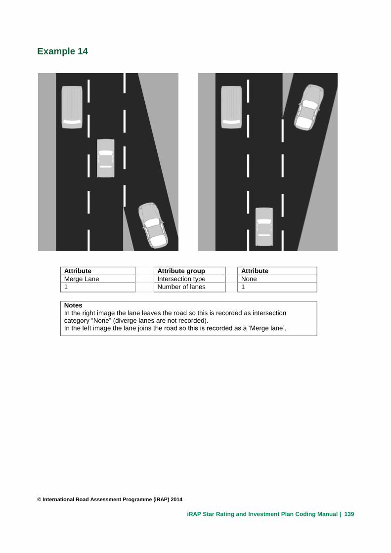
iRAP Star Rating and Investment Plan Coding Manual | 139
Example 14
Attribute Attribute group Attribute
Merge Lane Intersection type None
1 Number of lanes 1
Notes In the right image the lane leaves the road so this is recorded as intersection category “None” (diverge lanes are not recorded). In the left image the lane joins the road so this is recorded as a ‘Merge lane’.
© International Road Assessment Programme (iRAP) 2014