st.helens national land use database annual survey 2011-2012
TRANSCRIPT
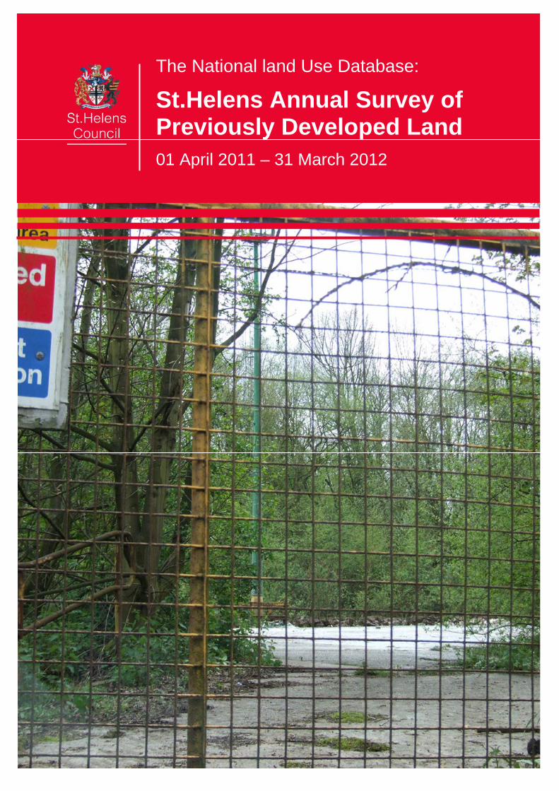
The National land Use Database:
St.Helens Annual Survey of Previously Developed Land
01 April 2011 – 31 March 2012

NLUD - 01 April 2011 to 31 March 2012
St.Helens 1
1. Introduction 2
2. Previously Developed Land 3
3. Data Collection Process 4
4. Results 5
The Quantity of Land 5
Land Developed 6
Land Type 7
Distribution 8
Ownership 9
Planning Status 9
Previous Use and Dereliction 10
Future Use 11
Size 11
Performance Target 11
Appendices
Appendix A: Definitions of Previously Developed Land & Buildings 12
Appendix B: Sites Developed 14
Appendix C: Sites Removed - Outflows 2011 – 2012 15
Appendix D: New Sites - Inflows 2011 – 2012 17
Appendix E: Completed Checked Records (Sorted By Ward) 18

NLUD - 01 April 2011 to 31 March 2012
St.Helens 2
1. Introduction
The Homes & Communities Agency (HCA - http://www.homesandcommunities.co.uk) is, as of 1st December 2008, responsible for the collection and dissemination of data pertaining to Previously Developed Land (PDL) across England. This data was previously collected and managed by the National Land Use Database (NLUD) partnership (comprising Communities and Local Government and the HCA’s forerunner, English Partnerships). The PDL programme provides an inventory of the national stock of brownfield sites, monitors the supply and re-use of previously developed land and buildings from information provided by St.Helens Council’s Planning PDL database and annually submits a data return of Previously Developed Land (PDL) that is vacant or derelict and other previously developed land, which may be available for re-development. This annual period covers from 01 April 2011 to 31 March 2012.
NLUD - 01 April 2011 to 31 March 2012
St.Helens 3
2. Previously Developed Land
The definition of previously developed land provided below is that contained in the appendix of Planning Policy Statement 3: Housing (PPS3) June 2010: Previously-developed land (often referred to as brownfield land) ‘Previously-developed land is that which is or was occupied by a permanent structure, including the curtilage of the developed land and any associated fixed surface infrastructure.’ The definition includes defence buildings, but excludes: - Land that is or has been occupied by agricultural or forestry buildings. - Land that has been developed for minerals extraction or waste disposal by landfill purposes where provision for restoration has been made through development control procedures. - Land in built-up areas such as private residential gardens, parks, recreation grounds and allotments, which, although it may feature paths, pavilions and other buildings, has not been previously developed. - Land that was previously-developed but where the remains of the permanent structure or fixed surface structure have blended into the landscape in the process of time (to the extent that it can reasonably be considered as part of the natural surroundings). There is no presumption that land that is previously-developed is necessarily suitable for housing development nor that the whole of the curtilage should be developed. This definition of previously developed land as quoted in PPS3 was changed in June 2010. The definition in the June 2010 PPS3 was itself revised from earlier versions to exclude private residential gardens. This change in definition has impacted upon the stock of previously developed land in St.Helens, as all these sites have been excluded from the NLUD return since 2010.

NLUD - 01 April 2011 to 31 March 2012
St.Helens 4
3. Data Collection Process
Sites that meet the following criteria (see Appendix A) were identified in the St.Helens NLUD study: a. Previously developed land which is now vacant b. Vacant buildings c. Derelict land and buildings d. Land or buildings currently in use and allocated in the Local Plan and/or having Planning
Permission e. Land or buildings currently in use with redevelopment potential but with no Planning
allocation or permission f. Previously developed land or buildings which has been redeveloped or is under construction To help compile the database of previously developed land sites in St.Helens, a number of existing data sources were used: Housing/Economic Land Supply databases Strategic Housing Land Availability Assessment – SHLAA Planning Permissions granted 2011/12 Site Surveys In this year again, no sites will be collected of less than 0.1 hectares in size in line with the requirements enforced by the HCA. Existing sites under 0.1 hectares have been retained.

NLUD - 01 April 2011 to 31 March 2012
St.Helens 5
4. Results
The Quantity of Land
The stock of previously developed land in St.Helens at 31 March 2012 was 253.27 hectares covering 242 sites. Of these total 54 sites totalling 133.33 hectares were derelict, 52.64% of the total. In 2011 the equivalent figures were 54 sites totalling 156.23 hectares. However the figures are not directly comparable for the following reasons:- i. Each year new sites are added (see Appendix D). While a number of these will have
become vacant or derelict during the year, there can be other reasons for inclusion. ii. Each year some sites are deleted (see Appendix C). A number of these will be the result of
development (see Appendix B). In 2009, HCA enforced a requirement that any new site entered in the data must be at least 0.1 hectares in size – these sites of less than 0.1 hectares already in our data set are to be retained (unless excluded as part of the survey process during future years). Other factors can include corrections to sites being previously recorded in error, merged sites, adjustments to site areas, sites reverting to natural landscape or sites which are deemed to no longer have development potential.
Table 4.1 Total Number and Area of Previously Developed Land Sites Number of NLUD
Sites Total Area (Hectares)
Number of Derelict Sites
Area Derelict
(Hectares) St.Helens 1 Oct 1998 – 31 March 2001 219 385.9 64 263.98 1 April 2001 – 31 March 2002 212 383.8 61 263.09 1 April 2002 – 31 March 2003 203 363.4 58 245.98 1 April 2003 – 31 March 2004 226 391.3 52 228.06 1 April 2004 – 31 March 2005 203 357.6 72 248.11 1 April 2005 – 31 March 2006 296 353.7 66 241.95 1 April 2006 – 31 March 2007 275 346.3 65 229.32 1 April 2007 – 31 March 2008 317 339.9 69 163.18 1 April 2008 – 31 March 2009 272 264.01 52 167.71 1 April 2009 – 31 March 2010 252 261.62 52 167.79 1 April 2010 – 31 March 2011 258 270.52 54 156.23 1 April 2011 – 31 March 2012 242 253.27 58 134.68

NLUD - 01 April 2011 to 31 March 2012
St.Helens 6
Land Developed
Table 4.2 concentrates on sites that were developed during 2011/12. Development is defined when construction commences. A total of 13 sites, totalling 16.69 hectares, were developed. Table 4.2 Land Developed
St.Helens Sites Developed Area Developed
(Hectares) 1 April 2002 – 31 March 2003 23 28.68 1 April 2003 – 31 March 2004 29 25.11 1 April 2004 – 31 March 2005 51 19.92 1 April 2005 – 31 March 2006 55 21.93 1 April 2006 – 31 March 2007 22 18.08 1 April 2007 – 31 March 2008 41 72.46 1 April 2008 – 31 March 2009 21 9.05 1 April 2009 – 31 March 2010 7 1.68 1 April 2010 – 31 March 2011 14 20.33 1 April 2011 – 31 March 2012 13 16.69 Table 4.3 After Use of Development Sites Use Number of Sites Area (Hectares) % Residential 9 15.56 93 Industry & Business 1 0.17 1 Retail 0 0 0 Transport 1 0.17 1 Recreation & Leisure 1 0.29 2 Community Services 1 0.50 3 TOTAL 13 16.69 100 The majority of land developed was for Housing. For more detailed information on these sites see Appendix B, Sites Developed.

NLUD - 01 April 2011 to 31 March 2012
St.Helens 7
Land Type
Table 4.4 Total Number of Previously Developed Sites by Land Type in St.Helens
NLUD Years 98-01
01-02
02-03
03-04
04-05
05-06
06-07
07-08
08-09
09-10
10-11
11-12
a Previously Developed Land which is now Vacant
69 65 58 51 60 145 160 168 176 171 154 141
b Vacant Buildings 60 47 46 41 15 21 20 16 13 12 11 9 c Derelict Land and Buildings
64 61 58 52 72 66 59 69 52 52 54 58
d Land or Buildings currently in Use and Allocated in the Local Plan and/or having Planning Permission
7 16 18 25 3 4 5 6 4 4 5 4
e Land or Buildings currently in Use where it is known there is Potential for Redevelopment with no plan allocation or planning permission
19 23 23 22 2 5 4 10 6 6 8 6
f Previously developed land or buildings which has been redeveloped or is under-construction
- - - 35 51 55 22 41 21 7 14 13
sites being previously recorded in error, merged, excluded (private residential garden), reverting to natural landscape, or no longer have development potential
- - - - - - 5 7 - - 12 11
TOTAL 219 212 203 226 203 296 275 317 272 252 258 242 Table 4.4 shows the number of previously developed sites by Land Type. Around 86% of the sites are in the first 3 categories of vacant or derelict land and buildings.

NLUD - 01 April 2011 to 31 March 2012
St.Helens 8
Distribution
Table 4.5 Distribution of Previously Developed Land
Sites Area Ward Wards
NLUD Sites % Sites
NLUD Sites Area
(hectares) % of Area
Ward Area
(hectares)
Sites as % of Ward
Area Billinge & Seneley Green
6 2.48% 0.31 0.12% 1061 0.03%
Blackbrook 9 3.72% 2.4 0.95% 327.7 0.73% Bold 16 6.61% 26.2 10.35% 1967 1.33% Earlestown 22 9.09% 11.12 4.39% 462 2.41% Eccleston 4 1.65% 20.06 7.92% 970.8 2.07% Haydock 16 6.61% 10.38 4.10% 1407 0.74% Moss Bank 14 5.79% 30.63 12.09% 566.1 5.41% Newton 15 6.20% 58.37 23.05% 702.9 8.30% Parr 27 11.16% 12.02 4.75% 443.4 2.71% Rainford 1 0.41% 0.65 0.26% 3085 0.02% Rainhill 4 1.65% 0.73 0.29% 659.1 0.11% Sutton 18 7.44% 16.34 6.45% 228.3 7.16% Thatto Heath 23 9.50% 9.99 3.94% 581.6 1.72% Town Centre 58 23.97% 48.21 19.04% 583.5 8.26% West Park 2 0.83% 2.54 1.00% 248.1 1.02%
Windle 7 2.89% 3.32 1.31% 293.3 1.13%
TOTAL 242 100.00% 253.27 100.00% 13,587
The 2012 NLUD survey shows 1.86% of the area of land in St.Helens is brownfield with around 20% of this previously developed land concentrated in both the Town Centre and Newton Wards. There are 58 Sites (23.97% of all sites) in the Town Centre Ward with a total area of 48.21 hectares. The highest amount, 58.37 hectares (23.05%) of previously developed land is in Newton, covering 8.30% of the total ward area. This is followed closely by the Town Centre, 48.21 hectares (19.04% of previously developed land, covering 8.26% of the total ward area). This year Rainford Ward has the lowest number of sites with only one recorded previously developed land site, and the smallest amount of PDL at 0.65 ha.

NLUD - 01 April 2011 to 31 March 2012
St.Helens 9
Ownership
Table 4.6 Ownership of Previously Developed Land in St.Helens Ownership Sites % of Sites Area (Hecs) % of Area Local Authority (1) 45 18.60% 34.44 13.60% Private (3) 117 48.35% 179.21 70.76% Other Public (2) 22 9.09% 2.01 0.79% Not Known (4) 55 22.73% 37.35 14.75% Mixed (5) 3 1.24% 0.26 0.10% Total 242 100% 253.27 100%
The majority (48.35%) of sites are identified as in private ownership. Sites in Local Authority ownership account for around only 19% of sites and only 14% of the total area. Figure 4.6 Ownership of Previously Developed Land (% of Sites)
Local Authority 19%
Private 48%
Other Public 9%
Not Known 23%Mixed 1%
Planning Status
Table 4.7 Planning Status of Previously Developed Land in St.Helens Planning Status Sites Area (Hecs) % of Area Allocated in Development Plan 22 61.21 24.17% Detailed Planning Permission 45 26.42 10.43% Outline Planning Permission 10 18.07 7.13% None 165 147.57 58.27% Total 242 253.27 100%
Around 10% are subject to detailed planning proposals, with 24% allocated in the Development Plan. Well over half (58%) of the sites have no Planning Status.

NLUD - 01 April 2011 to 31 March 2012
St.Helens 10
Previous Use and Dereliction
The largest previous uses of previously developed land are 'Manufacturing' and 'Mineral workings and quarries' each accounting for around 30% of total sites identified. Other significant uses include Dwellings with 142 sites and 12%. Previous Use Sites Area (Hecs) % of Area Agricultural 1 0.78 0.31% Amusement and show places 0 0 0.00% Car Parks 1 1.32 0.52% Community Services 1 0.56 0.22% Derelict 1 0.93 0.37% Dwellings 142 30.06 11.87% Education 7 9.67 3.82% Energy production and distribution 1 0.5 0.20% Manufacturing 37 75.97 30.00% Medical and health care services 1 0.14 0.06% Mineral workings and quarries 6 78.28 30.91% Offices 4 1.52 0.60% Places of worship 3 0.73 0.29% Public houses and bars 8 1.54 0.61% Refuse disposal 2 3.16 1.25% Residential institutions 1 0.47 0.19% Shops 5 1.57 0.62% Storage 3 6.69 2.64% Transport tracks and ways 8 18.04 7.12% Vacant Land 6 10.97 4.33% Vehicle storage 2 0.45 0.18% Water storage and treatment 2 9.92 3.92% Total 242 253.27 100%

NLUD - 01 April 2011 to 31 March 2012
St.Helens 11
Future Use
Table 4.9 Proposed Use of Previously Developed Land in St.Helens Proposed Use Sites Area (Hecs) % of Area Housing 42 34.74 13.72% Employment 16 29.62 11.70% Retail 3 4.03 1.59% Mixed with housing component 7 5.21 2.06% Mixed without housing 1 9.8 3.87% Open Space 7 27.04 10.68% Other 4 1 0.39% None 162 141.83 56.00% Total 242 253.27 100%
Employment as the proposed use accounted for around 12% with Housing accounting for nearly 14%. As a separate question, the NLUD survey asks if sites are suitable for housing. In St.Helens, around 80% of previously developed land is considered suitable for Housing – almost 6 times the 14% that is proposed for Housing ie. is subject to an allocation in the local plan or has a detailed/outline planning permission on the site.
Size
The NLUD database shows there are 222 sites (91.74% of all sites) of less than 2.5 hectares in size but forming only 35% of all previously developed land in St.Helens. There are 2 sites (0.83% of all sites) between 10 & 20 hectares in size forming 10.68% of the area of previously developed land in St.Helens. Table 4.10 Size Breakdown of Previously Developed Land in St.Helens
Sites Area Size Band (hectare) No % Sites (hectares) % of Area < 2.5 222 91.74% 88.79 35.06% 2.5 - 5.0 10 4.13% 33.66 13.29% 5.0 - 10.0 7 2.89% 49.76 19.65% 10.0 - 20.0 2 0.83% 27.04 10.68% > 20.0 1 0.41% 54.02 21.33% TOTAL 242 100% 253.27 100%
Performance Target
From April 2010, NI 170 - Previously developed land that has been vacant or derelict for more than 5 years - was removed from the Department of Communities and Local Government's national indicator set. The decision was made following the 2010 budget and was part of the Smarter Government initiative aimed at reducing burdens and increasing flexibility for local areas. However, St.Helens still monitors the restoration of vacant and derelict land and records this via a set of local indicators – URH32 'Area (hectares) of vacant and derelict land restored to productive use'. The results for this can be found in chapter 4 Results - Land Developed.
NLUD - 01 April 2011 to 31 March 2012
St.Helens 12
Appendix A: Definitions of Previously Developed Land & Buildings
The definitions of previously developed land provided below is that given in the National Land Use Database (NLUD) Data Specification v2.2, published on 04 October 2000: Categories A-C is collectively referred to as derelict and vacant land and buildings, whilst categories D & E comprise ‘in-use’ or latent Brownfield land. It should also be noted that the identification and classification of previously-developed sites in NLUD makes no representation on the likely presence of contamination. Sites in Land Types (A – E) may or may not be contaminated.
A) PREVIOUSLY DEVELOPED LAND WHICH IS NOW VACANT
Land that was previously developed and is now vacant which could be developed without treatment. Treatment includes any of the following: demolition, clearing of fixed structures or foundations and levelling. Land previously used for mineral extraction or waste disposal which has been or is being restored for agriculture, forestry, woodland or other open countryside use is excluded.
B) VACANT BUILDINGS
Vacant buildings, unoccupied for one year or more, that are structurally sound and in a reasonable state of repair (i.e. capable of being occupied in their present state). Includes buildings that have been declared redundant or where re-letting for their former use is not expected. Includes single residential dwellings where they could reasonably be developed or converted into 10 or more dwellings.
C) DERELICT LAND AND BUILDINGS
Land so damaged by previous industrial or other development that it is incapable of beneficial use without treatment. Treatment includes any of the following: demolition, clearing of fixed structures or foundations and levelling. Includes abandoned and unoccupied buildings (including former single residential dwellings) in an advanced state of disrepair i.e. with unsound roof(s). Excludes land damaged by development which has been or is being restored for agriculture, forestry, woodland or other open countryside use. Excludes land damaged by a previous development where the remains of any structure or activity have blended into the landscape in the process of time (to the extent that it can reasonably be considered as part of the natural surroundings), and where there is a clear reason that could outweigh the re-use of the site - such as its contribution to nature conservation - or it has subsequently been put to an amenity use and cannot be regarded as requiring redevelopment.
D) LAND OR BUILDINGS CURRENTLY IN USE AND ALLOCATED IN THE LOCAL PLAN AND/OR HAVING PLANNING PERMISSION
Includes all sites, currently in use (with the addition of buildings that have been vacant for less than one year), allocated for development in the adopted plan or with outstanding planning permission where redevelopment has not started. Includes all single residential dwellings having planning permission yielding at least one additional dwelling. NB: Planning permission includes detailed, outline and planning permission subject to further agreement.

NLUD - 01 April 2011 to 31 March 2012
St.Helens 13
E) LAND OR BUILDINGS CURRENTLY IN USE WHERE IT IS KNOWN THERE IS POTENTIAL FOR REDEVELOPMENT (BUT THE SITES DO NOT HAVE ANY PLAN ALLOCATION OR PLANNING PERMISSION)
Includes sites currently in use (with the addition of buildings that have been vacant for less than one year that are likely to be disposed of by their owners for redevelopment or conversion in the next five years. The recognition of potential sites for redevelopment will depend to some degree on local knowledge and judgement. The objective here is to identify major potential redevelopment sites before they reach the planning permission stage. It is not envisaged that extensive surveys will be carried out to develop a comprehensive and site-specific assessment of land and buildings falling in this category.
F) PREVIOUSLY DEVELOPED LAND OR BUILDINGS (ALREADY ENTERED ON TO THE DATABASE) THAT HAVE BEEN REDEVELOPED OR WHERE CONSTRUCTION HAS STARTED
Land or buildings already entered onto the database (e.g. for NLUD Phase 1) but which are now out of scope following redevelopment (including creation of open space and outdoor recreation). Includes sites where planning permission has expired.

NLUD - 01 April 2011 to 31 March 2012
St.Helens 14
Appendix B: Sites Developed
This table shows details of Previously Developed Land or Buildings which have been subject to redevelopment or where construction has commenced in 2011-2012. They are recorded as category ‘f’ in table 4.4 on page 7. There are 13 identified sites where development has taken place during the study period, totalling 16.69 hectares. The table also shows the type of redevelopment which has taken place on each site. Site Ref Address Ward Area
(hecs) Developed in 2011/12
Developed For
431500192 Nlud Site 431500192 Land To North Of Owls Nest Hotel, West End Road, Haydock,
Blackbrook 0.28 0.28 Dwellings
431500284 Nlud Site 431500284 Land Encompassing Cedar Crescent, Laurel Avenue, Newton-le-Willows
Newton 2.15 2.15 Dwellings
431500308 Nlud Site 431500308 Eccleston Methodist Church Site, Burrows Lane, Eccleston,
Eccleston 0.30 0.30 Dwellings
431500328 Nlud Site 431500328 Land Between Park Street And Park Road, Recreation Street, St Helens,
Town Centre
0.17 0.17 Car parks
431500329 Nlud Site 431500329 Triplex Safety Glass Site, Holme Road, Eccleston,
Eccleston 10.08 10.08 Dwellings
431500332 Nlud Site 431500332 Land Between 7 And 17, Dunsop Avenue, Clock Face,
Bold 0.06 0.06 Dwellings
431500347 Nlud Site 431500347 Land Site Of Former 1 To 23, Queensland Place, St Helens,
Thatto Heath
0.17 0.17 Offices
431500354 Nlud Site 431500354 Land Between 83 And 85a, Upland Road, St Helens,
Thatto Heath
0.06 0.06 Dwellings
431500374 Nlud Site 431500374 Land Between 8 And 18, Peckers Hill Road, St Helens,
Sutton 0.03 0.03 Dwellings
431500391 Nlud Site 431500391 Land Between 167 And 181, Crow Lane West, Newton-le-Willows
Earlestown 0.07 0.07 Dwellings
431500467 Nlud Site 431500467 Land To Side And Rear Of St Johns Ambulance Headquarters, Standish Street, St Helens,
Town Centre
0.29 0.29 Outdoor sports places
431500487 Nlud Site 431500487 Land Site Of Former Properties In Weasdale Close And Enford Close, Weasdale Close, St Helens,
Sutton 2.52 2.52 Dwellings
431500594 Nlud Site 431500594 Former Rivington Centre, Rivington Road, St Helens
Windle 0.50 0.50 Education
TOTALS 16.69

NLUD - 01 April 2011 to 31 March 2012
St.Helens 15
Appendix C: Sites Removed - Outflows 2011-2012
This table shows all 24 sites which will be removed from the NLUD study and the reasons why they have been removed. Site Ref. Address Ward Area Reason 431500021 Nlud Site 431500021 Land To Rear Of Princes
Royal Hotel Park Road, Boardmans Lane, St Helens,
Blackbrook 1.56 R
431500022 Nlud Site 431500022 Haresfinch Burgy, Islands Brow, St Helens,
Moss Bank 16.96 R
431500130 Nlud Site 431500130 Land Between 167 To 181, Newton Road, St Helens,
Parr 0.06 N
431500159 Nlud Site 431500159 Land To North West Of 22, Fleet Lane, St Helens,
Parr 0.09 N
431500192 Nlud Site 431500192 Land To North Of Owls Nest Hotel, West End Road, Haydock,
Blackbrook 0.28 F
431500284 Nlud Site 431500284 Land Encompassing Cedar Crescent, Laurel Avenue, Newton-le-Willows
Newton 2.15 F
431500308 Nlud Site 431500308 Eccleston Methodist Church Site, Burrows Lane, Eccleston,
Eccleston 0.30 F
431500328 Nlud Site 431500328 Land Between Park Street And Park Road, Recreation Street, St Helens,
Town Centre 0.17 F
431500329 Nlud Site 431500329 Triplex Safety Glass Site, Holme Road, Eccleston,
Eccleston 10.08 F
431500332 Nlud Site 431500332 Land Between 7 And 17, Dunsop Avenue, Clock Face,
Bold 0.06 F
431500344 Nlud Site 431500344 Land Encompassing Holy Trinity Church Hall, Rectory Road, Ashton In Makerfield,
Billinge & Seneley Green
0.04 N
431500347 Nlud Site 431500347 Land Site Of Former 1 To 23, Queensland Place, St Helens,
Thatto Heath 0.17 F
431500354 Nlud Site 431500354 Land Between 83 And 85a, Upland Road, St Helens,
Thatto Heath 0.06 F
431500374 Nlud Site 431500374 Land Between 8 And 18, Peckers Hill Road, St Helens,
Sutton 0.03 F
431500387 Nlud Site 431500387 Land To South West Of 39, Park Road, St Helens,
Town Centre 0.03 N
431500391 Nlud Site 431500391 Land Between 167 And 181, Crow Lane West, Newton-le-Willows
Earlestown 0.07 F
431500397 Nlud Site 431500397 Land To West Of 115, Crow Lane West, Newton-le-Willows
Earlestown 0.30 N
431500467 Nlud Site 431500467 Land To Side And Rear Of St Johns Ambulance Headquarters, Standish Street, St Helens,
Town Centre 0.29 F
431500487 Nlud Site 431500487 Land Site Of Former Properties In Weasdale Close And Enford Close, Weasdale Close, St Helens,
Sutton 2.52 F
431500499 Nlud Site 431500499 Land Between 2 Bromilow Road And 250, Fleet Lane, St Helens,
Parr 0.03 G
431500500 Nlud Site 431500500 Land Between 15 And 23, Laffak Road, St Helens,
Moss Bank 0.08 G
431500523 Nlud Site 431500523 Land Site Of Former The Plumb Centre 111, Stoney Lane, Rainhill,
Rainhill 0.31 G
431500560 Nlud Site 431500560 Land To South East Of 22, Sandy Lane, St Helens,
Moss Bank 0.02 G
431500594 Nlud Site 431500594 Former Rivington Centre, Rivington Road, St Helens
Windle 0.50 F
NLUD - 01 April 2011 to 31 March 2012
St.Helens 16
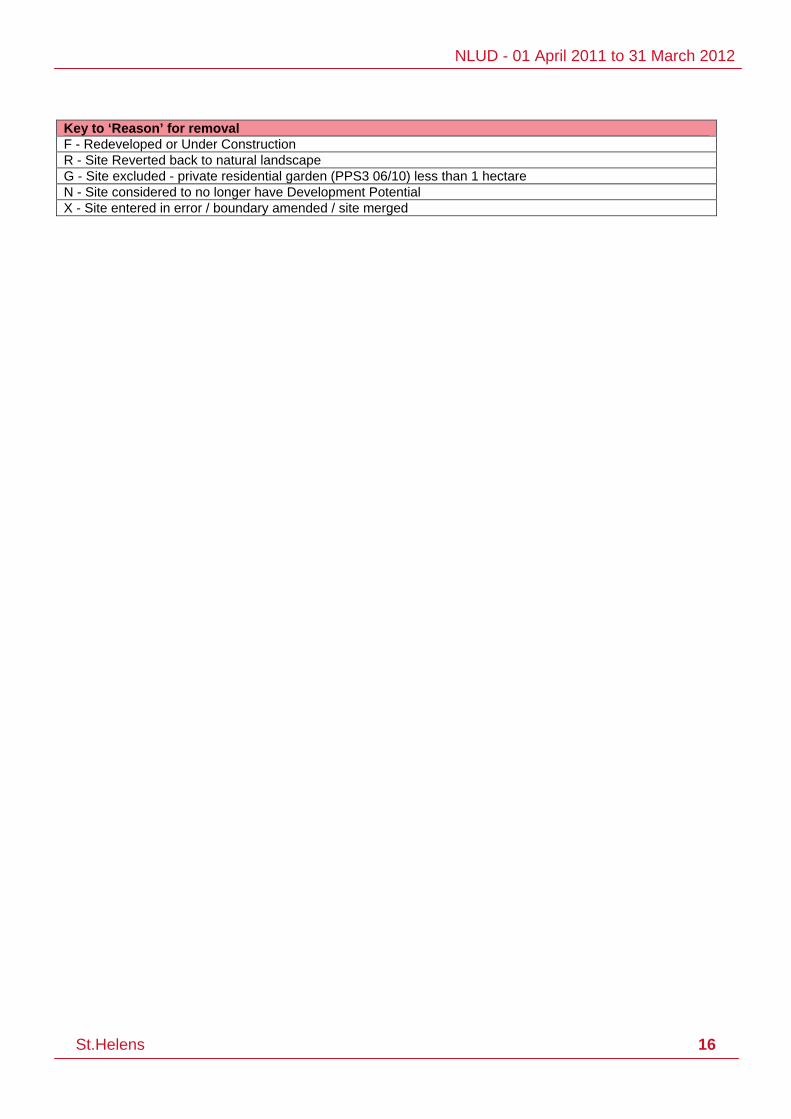
Key to ‘Reason’ for removal F - Redeveloped or Under Construction R - Site Reverted back to natural landscape G - Site excluded - private residential garden (PPS3 06/10) less than 1 hectare N - Site considered to no longer have Development Potential X - Site entered in error / boundary amended / site merged

NLUD - 01 April 2011 to 31 March 2012
St.Helens 17
Appendix D: New Sites - Inflows 2011-2012
This table shows the 9 New Sites as identified from methods outlined in Chapter 3. Data Collection Process (page 4) Site Ref. Address Ward Area Inflow
2011/12
431500601 Land North of St Helens Central Station Town Centre 0.23 VL
431500602 Land Site Of Former St Helens Glass Co Ltd Town Centre 1.29 VL
431500603 Land Site Of Former SHERDLEY REMEC LTD, GORSEY LANE, CLOCK FACE Bold 1.74 VL
431500604 FORMER POULTRY FARM, SOUTH LANE Bold 0.78 VL
431500605 SARACENS HEAD, KENTMERE AVENUE, ST HELENS, WA11 7PG Moss Bank 0.19 VB
431500606 Penlake Industrial Estate, Reginald Road, Bold Bold 3.13 VL
431500607 LAND ADJACENT AND TO REAR OF 25 - 35 ELLABY ROAD RAINHILL ST HELENS Rainhill 0.10 VL
431500608 FORMER RUTLAND HOUSE VETERINARY HOSPITAL, 52-54 COWLEY HILL LANE Rainhill 0.21 VL
431500609 Site East of Polar Ford Site, City Road, St Helens, Windle 0.76 D
Total 8.44 Key to Reason for New Sites D - demolition of existing buildings P - part developed forming new site PP - permission awaiting development VB - vacant building VL - vacant land DP - development potential site

NLUD - 01 April 2011 to 31 March 2012
St.Helens 18
Appendix E: Completed Checked Records (Sorted by Ward)
After completing the site records, the final stage is completing the summary data. Summary data consists of estimates of how much of each land type the latest return has actually captured. The Homes & Communities Agency (HCA) ask for this data as it is understood this is not always possible for each local planning authority to identify and provide information for every site within each NLUD land type within their jurisdiction. It is necessary to provide an estimate of completeness for the returned data. Best judgement based on local knowledge is used to determine this estimate in the absence of quantitative information. This is used for data analysis and calculating general trends in PDL at the regional and national level. Land Type A B C D E Estimate % of total land type area 80 70 90 70 70 Size of threshold used (ha) if applicable (>0.1 since 2010) n/a n/a n/a n/a n/a
This summary information (above) is created each reporting period and returned to the brownfield team at the HCA, together with the site boundary information generated via GIS. These 218 Records (organised by Ward - totalling 217.11 hectares) are the final result of the NLUD process – this excludes all Sites Developed (Appendix B) and Sites Removed/Outflows (Appendix C) but includes all New Sites/Inflows (Appendix D). This list will form the basis / starting point for the 2012 - 2013 NLUD Survey. Site Ref. Address Ward Area 431500346 Nlud Site 431500346 Land Between 12 And 18, Leyland
Green Road, Ashton In Makerfield, Billinge & Seneley Green
0.06
431500369 Nlud Site 431500369 Land Between 97 And 107, Birch Grove, Ashton In Makerfield,
Billinge & Seneley Green
0.06
431500475 Nlud Site 431500475 Land At Junction Of Main Street And Garswood Road, Main Street, Billinge,
Billinge & Seneley Green
0.04
431500538 Nlud Site 431500538 Land To The North East Of 86 Rectory Road, Booths Brow Road, Ashton In Makerfield,
Billinge & Seneley Green
0.07
431500577 Nlud Site 431500577 Land Between 19 And 25, Billinge Road, Ashton In Makerfield,
Billinge & Seneley Green
0.05
Total (5 Sites) 0.27 431500325 Nlud Site 431500325 Land Between 1 And 3, Link Avenue,
St Helens, Blackbrook 0.04
431500326 Nlud Site 431500326 Land Between 9 And 27, Link Avenue, St Helens,
Blackbrook 0.05
431500373 Nlud Site 431500373 Land To Rear Of 322 To 330 Park Street, Clipsley Lane, Haydock,
Blackbrook 0.08
431500489 Nlud Site 431500489 Land Between 135 And 137, Frodsham Drive, St Helens,
Blackbrook 0.07
431500501 Nlud Site 431500501 Land Between 48 And 50, Singleton Avenue, St Helens,
Blackbrook 0.10
431500575 Nlud Site 431500575 Land To Rear Of 2 To 12 Frodsham Drive, Longridge Avenue, St Helens,
Blackbrook 0.08
431500590 Nlud Site 431500590 Land To Rear Of 10 To 22 Longridge Avenue, St Helens
Blackbrook 0.15
Total (7 Sites) 0.56 431500075 Nlud Site 431500075 Land To Rear Of 1 To 3 Penlake
Industrial Estate, Reginald Road, Bold, Bold 1.15

NLUD - 01 April 2011 to 31 March 2012
St.Helens 19
Site Ref. Address Ward Area 431500078 Nlud Site 431500078 Land To East Of Lancs Steel Services
Ltd, Abbotsfield Road, Bold, Bold 0.93
431500118 Nlud Site 431500118 Land To North Of 2, Lionel Street, Bold, Bold 0.04
431500148 Nlud Site 431500148 Land At Emr Metal Reprocessing Yard, Penlake Lane, Bold,
Bold 3.25
431500490 Nlud Site 431500490 Land Between Culburn And Newby, Warrington Road, Bold Heath,
Bold 0.13
431500512 Nlud Site 431500512 Dismantled Railway From The Mews Gartons Lane To Bold Bridge, Warrington Road, Bold Heath,
Bold 4.18
431500515 Nlud Site 431500515 Former Red Quarry Landfill Site, Chester Lane, Clock Face,
Bold 2.65
431500516 Nlud Site 431500516 Land To The North Of Tac Metals, Abbotsfield Road, Bold,
Bold 0.92
431500554 Nlud Site 431500554 Land Site Of Former 2 To 4, Reginald Road, Bold,
Bold 0.02
431500555 Nlud Site 431500555 Land Between 14 And 20, Reginald Road, Bold,
Bold 0.01
431500561 Nlud Site 431500561 Land Encompassing Garage Site To Side Of 16, Field Close, Clock Face,
Bold 0.06
431500586 Nlud Site 431500586 Former Ibstock Brickworks, Chester Lane, Clock Face,
Bold 7.12
431500603 Land Site Of Former SHERDLEY REMEC LTD, GORSEY LANE, CLOCK FACE
Bold 1.74
431500604 FORMER POULTRY FARM, SOUTH LANE Bold 0.78
431500606 Penlake Industrial Estate, Reginald Road, Bold Bold 3.13
Total (15 Sites) 26.13 431500004 Nlud Site 431500004 Former Sankey Sugar Works,
Anglezarke Road, Newton-le-Willows Earlestown 5.07
431500135 Nlud Site 431500135 Land To South East Of 25 And 26 Houghton Close, Houghton Street, Newton-le-Willows
Earlestown 0.41
431500278 Nlud Site 431500278 Land To East Of Unit 9, Deacon Trading Estate, Newton-le-Willows
Earlestown 0.17
431500279 Nlud Site 431500279 Land To West Of 11 And 11a, Deacon Trading Estate, Newton-le-Willows
Earlestown 0.47
431500280 Nlud Site 431500280 Land Between 144 And 150, Common Road, Newton-le-Willows
Earlestown 0.06
431500285 Nlud Site 431500285 Land Between Wind In The Willows Private Day Nursery And Unit 6, Deacon Trading Estate, Newton-le-Willows
Earlestown 0.20
431500292 Nlud Site 431500292 Land Site Of Former Units Opposite 264 To 268 And Kingdom Hall, Earle Street, Newton-le-Willows
Earlestown 0.37
431500299 Nlud Site 431500299 Land To South Of Earlestown Station And East Of Sasib Uk Ltd, Junction Lane, Newton-le-Willows
Earlestown 2.22
431500392 Nlud Site 431500392 Land To Side And Rear Of 389, Common Road, Newton-le-Willows
Earlestown 0.14
431500393 Nlud Site 431500393 Garage Site Land To Rear Of 6 To 24, Tully Avenue, Newton-le-Willows
Earlestown 0.10
431500395 Nlud Site 431500395 Land Opposite 1 To 5, Derby Close, Newton-le-Willows
Earlestown 0.05
431500396 Nlud Site 431500396 Land Between Speakman Avenue Frawley Avenue And Borron Road, Borron Road, Newton-le-Willows
Earlestown 0.35
431500498 Nlud Site 431500498 Land Opposite 97 To 105, Borron Road, Newton-le-Willows
Earlestown 0.08
431500536 Nlud Site 431500536 Land Former Garage Site To Rear Of 3 To 13, Lloyd Crescent, Newton-le-Willows
Earlestown 0.45

NLUD - 01 April 2011 to 31 March 2012
St.Helens 20
Site Ref. Address Ward Area 431500557 Nlud Site 431500557 Land To Rear Of 26 To 46, Hope
Street, Newton-le-Willows Earlestown 0.07
431500559 Nlud Site 431500559 Land Encompassing Nursery, Back Cross Lane, Newton-le-Willows
Earlestown 0.17
431500569 Nlud Site 431500569 Land Between 22 And 28, Dixon Avenue, Newton-le-Willows
Earlestown 0.03
431500579 Nlud Site 431500579 Land To Rear Of 90 To 100, Queens Drive, Newton-le-Willows
Earlestown 0.16
431500580 Nlud Site 431500580 Land To Rear Of 38 To 40 Belvedere Road, Silverdale Road, Newton-le-Willows
Earlestown 0.04
431500588 Nlud Site 431500588 Earlestown Town Hall Site, Market Street, Newton Le Willows
Earlestown 0.14
Total (20 Sites) 10.75 431500029 Nlud Site 431500029 Former Reservoir To Rear Of 1 To 5,
Burrows Lane, Eccleston Park, Eccleston 9.54
431500362 Nlud Site 431500362 Car Park And Land North Of The Seven Stars Inn, Millbrook Lane, Eccleston,
Eccleston 0.14
Total (2 Sites) 9.68 431500016 Nlud Site 431500016 Land To South Of The Book People,
Hall Wood Avenue, Haydock, Haydock 0.89
431500017 Nlud Site 431500017 Land Between Fishwicks And Haydock Cross, Kilbuck Lane, Haydock,
Haydock 3.63
431500189 Nlud Site 431500189 Land To East Of 267, Church Road, Haydock,
Haydock 0.29
431500226 Nlud Site 431500226 Unit 13, Winchester Road, Haydock Haydock 0.09
431500245 Nlud Site 431500245 Land Surrounding Unit 4, Withins Road, Haydock,
Haydock 0.23
431500274 Nlud Site 431500274 Haydock Labour Club Number Two Site, 110, Penny Lane, Haydock,
Haydock 0.10
431500297 Nlud Site 431500297 Land To Rear Of 2, Marlborough Way, Haydock,
Haydock 0.69
431500336 Nlud Site 431500336 Land To Rear Of 1 To 27, Station Road, Haydock,
Haydock 0.14
431500349 Nlud Site 431500349 Land Between 7 And 21, Gray Avenue, Haydock,
Haydock 0.06
431500413 Nlud Site 431500413 Land Site Of Former 61 To 65, Vicarage Road, Haydock,
Haydock 0.04
431500484 Nlud Site 431500484 Land To West Of End Of Wilcock Road, Wilcock Road, Haydock,
Haydock 2.65
431500485 Nlud Site 431500485 Land Former Timber Yard At Central Works, Church Road, Haydock,
Haydock 1.34
431500524 Nlud Site 431500524 Providence Baptist Church, Clipsley Lane, Haydock,
Haydock 0.06
431500564 Nlud Site 431500564 Land To Rear Of 16 To 24, Pimblett Road, Haydock,
Haydock 0.05
431500573 Nlud Site 431500573 Land To East Of 62, Wycliffe Road, Haydock,
Haydock 0.04
431500581 Nlud Site 431500581 Land To Side And Rear Of 33, Willow Road, Haydock,
Haydock 0.07
Total (16 Sites) 10.38 431500121 Nlud Site 431500121 Land To West Of Junction Of Cowley
And Albert Street, Cowley Street, St Helens, Moss Bank 1.32
431500180 Nlud Site 431500180 Land Former Carr Mill Cafe And Car Park And Land To Rear Of 20 To 36, Laffak Road, St Helens,
Moss Bank 3.31
431500196 Nlud Site 431500196 Garage Site To Rear Of 56 To 98, Kentmere Avenue, St Helens,
Moss Bank 0.34

NLUD - 01 April 2011 to 31 March 2012
St.Helens 21
Site Ref. Address Ward Area 431500452 Nlud Site 431500452 Zeetank International Transport Site,
Washway Lane, St Helens, Moss Bank 0.92
431500453 Nlud Site 431500453 Land To South East Of Bowling Greens At Windle City Social Club, City Road, St Helens,
Moss Bank 5.37
431500480 Nlud Site 431500480 Land To Rear Of 2 To 14, Grizedale Avenue, St Helens,
Moss Bank 0.18
431500481 Nlud Site 431500481 Land To Rear Of 20 To 32, Grizedale Avenue, St Helens,
Moss Bank 0.19
431500517 Nlud Site 431500517 Former Carr Mill Infants School, Ullswater Avenue, St Helens,
Moss Bank 1.49
431500570 Nlud Site 431500570 Land Between 12 And 18, Queensway, St Helens,
Moss Bank 0.05
431500572 Nlud Site 431500572 Land Between 9 And 21 Mardale Avenue, Ennerdale Avenue, St Helens,
Moss Bank 0.19
431500605 SARACENS HEAD, KENTMERE AVENUE, ST HELENS, WA11 7PG
Moss Bank 0.19
Total (11 Sites) 13.57 431500005 Nlud Site 431500005 Former Parkside Colliery, Winwick
Road, Newton-le-Willows Newton 54.02
431500129 Nlud Site 431500129 Land To East Of 162, Alder Street, Newton-le-Willows
Newton 0.12
431500136 Nlud Site 431500136 Former Gas Holder Site To West Of 31 To 49, Old Wargrave Road, Newton-le-Willows
Newton 0.56
431500177 Nlud Site 431500177 Land To South Of 1 And 3, Church Drive, Newton-le-Willows
Newton 0.30
431500282 Nlud Site 431500282 Land North West Of 10, Park Avenue North, Newton-le-Willows
Newton 0.11
431500363 Nlud Site 431500363 Land On North Side Of Alfred Street, Mill Lane, Newton-le-Willows
Newton 0.26
431500364 Nlud Site 431500364 Land On South Side Of Alfred Street, Mill Lane, Newton-le-Willows
Newton 0.19
431500398 Nlud Site 431500398 Land Between 378 And 384, Wargrave Road, Newton-le-Willows
Newton 0.04
431500399 Nlud Site 431500399 Land To West Of 44, Acorn Street, Newton-le-Willows
Newton 0.06
431500400 Nlud Site 431500400 Land Between 17 And 19, Acorn Street, Newton-le-Willows
Newton 0.04
431500401 Nlud Site 431500401 Land To Rear Of 352 To 362, Wargrave Road, Newton-le-Willows
Newton 0.09
431500473 Nlud Site 431500473 Garage Court To Rear Of 98 To 108, Alder Street, Newton-le-Willows
Newton 0.10
431500530 Nlud Site 431500530 Land Site Of Former Crouchley House, Bradlegh Road, Newton-le-Willows
Newton 0.13
431500596 Nlud Site 431500596 Land To Rear Of 2 And 4, Kingsway, Newton Le Willows
Newton 0.19
Total (14 Sites) 56.22 431500081 Nlud Site 431500081 Land To Rear Of 1 To 41 Granville
Street And 1 To 7 Bedford Street, Bedford Street, St Helens, Parr 0.71
431500094 Nlud Site 431500094 Former Engineering Works, Hertford Street, St Helens
Parr 0.96
431500131 Nlud Site 431500131 Land To Rear Of 13 To 27 Smithfield Street, Sussex Grove, St Helens,
Parr 1.01
431500139 Nlud Site 431500139 Land Between 8 And 34 Portland Way And 161 And 123 Berrys Lane, Berrys Lane, St Helens,
Parr 0.28
431500140 Nlud Site 431500140 Land Rear Of 14 To 20 Weymouth Avenue, Portland Way, St Helens,
Parr 0.36
431500141 Nlud Site 431500141 Land Between 71 And 109, Berrys Parr 0.51

NLUD - 01 April 2011 to 31 March 2012
St.Helens 22
Site Ref. Address Ward Area Lane, St Helens,
431500142 Nlud Site 431500142 Land To Rear Of 24 To 30 Brookway Lane, Weymouth Avenue, St Helens,
Parr 0.20
431500161 Nlud Site 431500161 Land To Rear Of 187 To 203 And Between 203 And Church, Fleet Lane, St Helens,
Parr 1.14
431500273 Nlud Site 431500273 Land To Side And Rear Of Parr Library, Fleet Lane, St Helens,
Parr 4.03
431500296 Nlud Site 431500296 Land To Rear Of 21 To 29 Archer Grove, Delta Road, St Helens,
Parr 0.22
431500365 Nlud Site 431500365 Land Site Of The Beehive Inn 264 Berrys Lane, Watery Lane, St Helens,
Parr 0.05
431500371 Nlud Site 431500371 Land Site Of Bowling Green Inn 220, Watery Lane, St Helens,
Parr 0.22
431500372 Nlud Site 431500372 Land To Rear Of 49 To 59, Carnegie Crescent, St Helens,
Parr 0.26
431500462 Nlud Site 431500462 Land To South Of 23, Allanson Street, St Helens,
Parr 0.13
431500482 Nlud Site 431500482 Land Site Of Former 2 To 40, Chancery Lane, St Helens,
Parr 0.19
431500491 Nlud Site 431500491 Land Site Of Former 21 To 51, Pennine Close, St Helens,
Parr 0.22
431500531 Nlud Site 431500531 Land Between 438 And 460, Fleet Lane, St Helens,
Parr 0.28
431500546 Nlud Site 431500546 Land Fronting 97 To 103 Cotswold Grove, Provident Street, St Helens,
Parr 0.14
431500565 Nlud Site 431500565 Land To Rear Of 7 To 17, Cherry Tree Drive, St Helens,
Parr 0.09
431500566 Nlud Site 431500566 Land To Rear Of 73 To 83, Cherry Tree Drive, St Helens,
Parr 0.19
431500567 Nlud Site 431500567 Land To South East Of 222, Derbyshire Hill Road, St Helens,
Parr 0.09
431500568 Nlud Site 431500568 Land To Rear Of Horseshoe Garage, Ashtons Green Drive, St Helens,
Parr 0.07
431500571 Nlud Site 431500571 Land Between 17 And 23, Winston Avenue, St Helens,
Parr 0.04
431500585 Nlud Site 431500585 Land Former Willows Green And Ashtons Green Home, Berwyn Grove, St Helens,
Parr 0.47
Total (24 Sites) 11.84
431500024 Nlud Site 431500024 Land To Side And Rear Of 18, Siding Lane, Rainford,
Rainford 0.65
Total (1 Sites) 0.65
431500562 Nlud Site 431500562 Land Former Garage Site To Rear Of 17 To 25 King Edward Road, King Edward Close, Rainhill,
Rainhill 0.11
431500607 LAND ADJACENT AND TO REAR OF 25 - 35 ELLABY ROAD RAINHILL ST HELENS
Rainhill 0.10
431500608 FORMER RUTLAND HOUSE VETERINARY HOSPITAL, 52-54 COWLEY HILL LANE
Rainhill 0.21
Total (3 Sites) 0.42
431500104 Nlud Site 431500104 Land Between Jts Transport And St Helens Junction Rail Station, Station Road, St Helens,
Sutton 0.38
431500111 Nlud Site 431500111 Land Between Garnet Street Oxley Street And Waterdale Crescent, Robins Lane, St Helens,
Sutton 0.40
431500116 Nlud Site 431500116 Land To South East Of Units 1 To 4, Monastery Lane, St Helens,
Sutton 0.77
431500311 Nlud Site 431500311 Site Between 103 And 111, Clock Face Road, Clock Face,
Sutton 0.64

NLUD - 01 April 2011 to 31 March 2012
St.Helens 23
Site Ref. Address Ward Area
431500315 Nlud Site 431500315 Land Between Willow Tree Farm And Willow Tree School, Willow Tree Avenue, Clock Face,
Sutton 0.51
431500316 Nlud Site 431500316 Land To Rear Of 31 To 41, Clock Face Road, Sutton Leach,
Sutton 0.31
431500324 Nlud Site 431500324 Land To Rear Of 24 To 32, Waterdale Crescent, St Helens,
Sutton 0.10
431500375 Nlud Site 431500375 Land To North West Of 31, Powell Street, St Helens,
Sutton 0.06
431500376 Nlud Site 431500376 Land To North West Of 30, Powell Street, St Helens,
Sutton 0.07
431500377 Nlud Site 431500377 Land Adjacent To 142, Mill Lane, Sutton Leach,
Sutton 0.04
431500513 Nlud Site 431500513 Former Rail Line From Dutch Barn Bridge Baxters Lane To Tunstalls Farm, Tunstalls Way, Clock Face,
Sutton 9.79
431500544 Nlud Site 431500544 Land To Rear Of Hoghton Road Business Centre, Hoghton Road, St Helens,
Sutton 0.17
431500550 Nlud Site 431500550 Land To North East Of 67, Peckers Hill Road, St Helens,
Sutton 0.02
431500551 Nlud Site 431500551 Land Site Of Former 2 To 8, Station Road, St Helens,
Sutton 0.04
431500553 Nlud Site 431500553 Land Adjacent To 17, Station Road, St Helens,
Sutton 0.04
431500584 Nlud Site 431500584 Land To Side And Rear Of 243, Leach Lane, Sutton Leach,
Sutton 0.45
Total (16 Sites) 13.78
431500034 Nlud Site 431500034 Land Between Rail Line And Thatto Heath Community Primary School, Elephant Lane, Thatto Heath,
Thatto Heath 4.30
431500154 Nlud Site 431500154 Site To North Of Dma Ltd, Burtonhead Road, St Helens,
Thatto Heath 0.25
431500307 Nlud Site 431500307 Former St Matthews Ce Primary School, Scholes Lane, Thatto Heath,
Thatto Heath 0.22
431500352 Nlud Site 431500352 Land To South Of, Coral Avenue, St Helens,
Thatto Heath 0.15
431500353 Nlud Site 431500353 Land To North Of, Coral Avenue, St Helens,
Thatto Heath 0.16
431500380 Nlud Site 431500380 Land To East Of Council Offices And At Junction Of Fir Street, Sunbury Street, Thatto Heath,
Thatto Heath 0.13
431500381 Nlud Site 431500381 Land To Rear Of 4 To 32 Howard Street, Sunbury Street, Thatto Heath,
Thatto Heath 0.09
431500471 Nlud Site 431500471 Land To South East Of Ravenhead Waste Reception Centre, Burtonhead Road, St Helens,
Thatto Heath 2.05
431500477 Nlud Site 431500477 Land To Rear Of 14 To 40, Adelaide Avenue, St Helens,
Thatto Heath 0.21
431500478 Nlud Site 431500478 Land To Rear Of Royal British Legion Club 98 Scholes Lane, St Matthews Grove, Thatto Heath,
Thatto Heath 0.16
431500479 Nlud Site 431500479 Land Between 4 And 38, Dorothy Street, Thatto Heath,
Thatto Heath 0.19
431500494 Nlud Site 431500494 Land Between 72 And 90 Kimberley Avenue And Between 370 And 388, Sutton Heath Road, St Helens,
Thatto Heath 0.21
431500496 Nlud Site 431500496 Land Site Of Former Grange Park Social Club, Upland Road, St Helens,
Thatto Heath 0.19
431500528 Nlud Site 431500528 Land To South East Of Waterside Village Entrance, Lowfield Lane, St Helens,
Thatto Heath 0.49
431500537 Nlud Site 431500537 Land Encompassing 1, Manley Place, Thatto Heath 0.14

NLUD - 01 April 2011 to 31 March 2012
St.Helens 24
Site Ref. Address Ward Area St Helens,
431500541 Nlud Site 431500541 Land Opposite To 617 To 621, Elton Head Road, St Helens,
Thatto Heath 0.08
431500549 Nlud Site 431500549 Land Site Of Former 51 To 57, Parliament Street, Thatto Heath,
Thatto Heath 0.03
431500576 Nlud Site 431500576 Land To Rear Of 2 And 4, Queensland Avenue, St Helens,
Thatto Heath 0.04
431500578 Nlud Site 431500578 Land Between 190 And 196, Scholes Lane, Thatto Heath,
Thatto Heath 0.05
431500597 Nlud Site 431500597 Railway Hotel, 60, Scholes Lane, Thatto Heath
Thatto Heath 0.26
431500598 Nlud Site 431500598 Sutton Arms, Elephant Lane, St Helens Thatto Heath 0.34
Total (21 Sites) 9.76 431500027 Nlud Site 431500027 Land To Rear Of 17 To 87 Creswell
Street, Eccleston Street, St Helens, Town Centre 0.33
431500044 Nlud Site 431500044 Former Abattoir Site Land Between Railway And 31 Parr Street, Parr Street, St Helens,
Town Centre 1.48
431500059 Nlud Site 431500059 Land Site Of Former St Thomas Square Housing, Liverpool Road, St Helens,
Town Centre 2.05
431500069 Nlud Site 431500069 Land To Rear Of Hays Chemical Distribution Ltd Lancots Lane, Baxters Lane, St Helens,
Town Centre 1.84
431500070 Nlud Site 431500070 Land Between Webb Street And Dismantled Mineral Railway Line, Baxters Lane, St Helens,
Town Centre 1.31
431500076 Nlud Site 431500076 Land Between Hays Chemicals And Railway To West Of, Lancots Lane, St Helens
Town Centre 2.13
431500088 Nlud Site 431500088 Sidac Filter Beds To West Of 18, Ellamsbridge Road, St Helens,
Town Centre 0.52
431500101 Nlud Site 431500101 Land Bounded By Corporation Street Pocket Nook Street And Atlas Street, Atlas Street, St Helens
Town Centre 0.88
431500106 Nlud Site 431500106 Land To North East Of Alexandra Warehouse, Ravenhead Road, St Helens,
Town Centre 7.73
431500107 Nlud Site 431500107 Land Former Gerards Bridge Depot, College Street, St Helens,
Town Centre 2.07
431500110 Nlud Site 431500110 Land North Of Corporation Street Between Railway And Canal, Corporation Street, St Helens,
Town Centre 1.66
431500113 Nlud Site 431500113 Land To Side And Rear Of 351, Sutton Road, St Helens,
Town Centre 0.21
431500114 Nlud Site 431500114 Land Between Oak Street And Little Street, Sutton Road, St Helens,
Town Centre 0.51
431500120 Nlud Site 431500120 Land To Sides And Rear Of 389 And 389a, Sutton Road, St Helens,
Town Centre 0.38
431500157 Nlud Site 431500157 Land On West Side Of, Lawrenson Street, St Helens,
Town Centre 0.15
431500164 Nlud Site 431500164 Land To Rear Of 10 To 52, Sorogold Street, St Helens,
Town Centre 1.07
431500262 Nlud Site 431500262 Land To East Of 107, Tolver Street, St Helens,
Town Centre 0.05
431500269 Nlud Site 431500269 Land Site Of Former Abba Commercials Workshops, Burtonhead Road, St Helens,
Town Centre 0.86
431500270 Nlud Site 431500270 Land To Rear 101 To 119 Liverpool Road, Glover Street, St Helens,
Town Centre 0.39
431500272 Nlud Site 431500272 Site Bordered By Manning Street And Banner Street, Borough Road, St Helens,
Town Centre 0.37
431500288 Nlud Site 431500288 Former Hays Chemical Works, Lancots Lane, St Helens,
Town Centre 1.86
431500290 Nlud Site 431500290 Land Between 6 And 8, Sutton Fold, St Helens,
Town Centre 1.99
NLUD - 01 April 2011 to 31 March 2012
St.Helens 25
Site Ref. Address Ward Area 431500291 Nlud Site 431500291 Land Surrounding Williamson Street,
Recreation Street, St Helens, Town Centre 0.67
431500319 Nlud Site 431500319 Site Of Former 120 To 138, Pocket Nook Street, St Helens,
Town Centre 0.17
431500321 Nlud Site 431500321 Land Opposite 9 To 29, Farnworth Street, St Helens,
Town Centre 0.10
431500322 Nlud Site 431500322 Land Between Edward And Emlyn Street, Gower Street, St Helens,
Town Centre 1.16
431500330 Nlud Site 431500330 Land Between 111 And 213, Park Road, St Helens,
Town Centre 0.91
431500370 Nlud Site 431500370 Land Encompassing Nick Naylor Body Sculpture And Fitness, Lord Street, St Helens,
Town Centre 0.19
431500383 Nlud Site 431500383 Land To Rear Of 2 To 12 Crispin Street, Banner Street, St Helens,
Town Centre 0.03
431500384 Nlud Site 431500384 Land To Rear 68 To 100 Borough Road, Eldon Street, St Helens,
Town Centre 0.17
431500463 Nlud Site 431500463 Land To Rear 40 To 50 Borough Road, Duncan Street, St Helens,
Town Centre 0.15
431500464 Nlud Site 431500464 Land Surrounding 83 To 85, Robins Lane, St Helens,
Town Centre 0.25
431500465 Nlud Site 431500465 Land Between 5 And 15, Okeefe Road, St Helens,
Town Centre 0.10
431500466 Nlud Site 431500466 Land Site Of Former 3 To 9, Parlane Street, St Helens,
Town Centre 0.09
431500502 Nlud Site 431500502 Land Between Sutton Road And Webb Street, Webb Street, St Helens,
Town Centre 0.56
431500503 Nlud Site 431500503 Land To Rear Of 131 To 161 Hardshaw Street, Brynn Street, St Helens,
Town Centre 0.13
431500514 Nlud Site 431500514 Land Between Sutton Road Lancots Lane And Dismantled Railway Line, Lancots Lane, St Helens,
Town Centre 1.02
431500522 Nlud Site 431500522 Land To East Of Couristan Carpets Crown Works, Eccleston Street, St Helens,
Town Centre 0.48
431500529 Nlud Site 431500529 Site Of Former 113 To 115, Hall Street, St Helens,
Town Centre 0.02
431500532 Nlud Site 431500532 Land Encompassing 29, Edward Street, St Helens,
Town Centre 1.21
431500539 Nlud Site 431500539 Land To South West Of M And H Plant Hire Ltd, College Street, St Helens,
Town Centre 0.03
431500540 Nlud Site 431500540 Land Rear Of 18 To 34 Duncan Street 1 To 9 Cheshire Gardens And 1 To 9, The Shires, St Helens,
Town Centre 0.14
431500543 Nlud Site 431500543 Land To Rear Of Colourplan Design And Print, Ardwick Street, St Helens,
Town Centre 0.04
431500545 Nlud Site 431500545 Land To West Of Eccleston Street Garage, Lawrenson Street, St Helens,
Town Centre 0.07
431500552 Nlud Site 431500552 Land Site Of Former 108 To 114, Pocket Nook Street, St Helens,
Town Centre 0.03
431500556 Nlud Site 431500556 Land Site Of Former 2 To 24, Sherdley Road, St Helens,
Town Centre 0.15
431500574 Nlud Site 431500574 Land Between 71 And 77, Pocket Nook Street, St Helens,
Town Centre 0.04
431500582 Nlud Site 431500582 Land To South Of Polar Ford, Scorecross, St Helens,
Town Centre 1.79
431500587 Nlud Site 431500587 Land Surrounding Gas Station, Jackson Street, St Helens,
Town Centre 0.50
431500592 Nlud Site 431500592 Former Revere Graphics Building, Borough Road, St Helens
Town Centre 0.37
431500593 Nlud Site 431500593 Alexandra House, Borough Road, St Town Centre 0.52
NLUD - 01 April 2011 to 31 March 2012
St.Helens 26
Site Ref. Address Ward Area Helens
431500595 Nlud Site 431500595 Land Between Jubilee Barracks And 34, Prescot Road, St Helens
Town Centre 0.12
431500600 Nlud Site 431500600 Former United Glass Site, Peasley Cross Lane, St Helens
Town Centre 5.13
431500601 Land North of St Helens Central Station Town Centre 0.23
431500602 Land Site Of Former St Helens Glass Co Ltd Town Centre 1.29
Total (55 Sites) 47.72 431500589 Nlud Site 431500589 Land Site Of Former Broadway School,
Broadway, Thatto Heath West Park 2.11
431500599 Nlud Site 431500599 Land Site Of Former Caledonia Peugot Garage, Knowsley Road, St Helens
West Park 0.43
Total (2 Sites) 2.54 431500343 Nlud Site 431500343 Polar Ford Site, City Road, St Helens, Windle 1.50
431500404 Nlud Site 431500404 Land Surrounding St Marks Gate Lodge, Rutland Street, St Helens,
Windle 0.05
431500406 Nlud Site 431500406 Land Adjacent To 50, Cooper Street, St Helens,
Windle 0.04
431500407 Nlud Site 431500407 Land To West Of 1, Halefield Street, St Helens,
Windle 0.09
431500591 Nlud Site 431500591 Land To Rear Of 1 To 31, Wyresdale Avenue, St Helens
Windle 0.38
431500609 Site East of Polar Ford Site, City Road, St Helens, Windle 0.76
Total (6 Sites) 2.82

Urban Regeneration, Housing & Culture DepartmentDevelopment PlansTown Hall Victoria SquareSt.Helens WA10 1HPTel: 01744 676190 Minicom: 01744 671671Fax: 01744 676194Email: [email protected]
www.sthelens.gov.uk
Please contact us to request translation of Council information into Braille, audio tape or a foreign language.
2003-2004Rethinking Construction2007-2008Healthy Schools2008-2009Improving Accessibility
2009-2010Homes for the Future2009-2010Raising economicprosperity throughpartnership