structural evolution and petroleum systems of the murchison basin
TRANSCRIPT
Structural Evolution and Petroleum Systems of the Murchison Basin
J. Mac BeggsGeoSphere Ltd, Lower Hutt
Francesca C. GhisettiTerraGeologica, Christchurch
GSNZ Annual Meeting
Wellington, Nov. 23-26, 2008
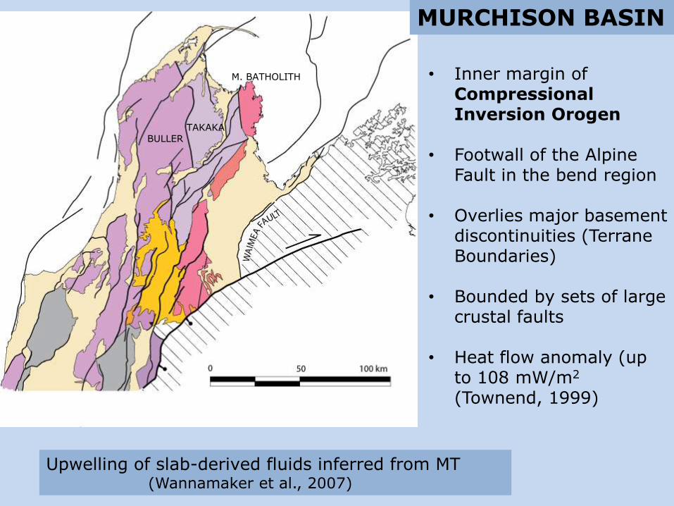
• Inner margin ofCompressionalInversion Orogen
• Footwall of the Alpine Fault in the bend region
• Overlies major basementdiscontinuities (TerraneBoundaries)
• Bounded by sets of largecrustal faults
• Heat flow anomaly (up to 108 mW/m2
(Townend, 1999)
Upwelling of slab-derived fluids inferred from MT (Wannamaker et al., 2007)
BULLERTAKAKA
M. BATHOLITH
MURCHISON BASIN
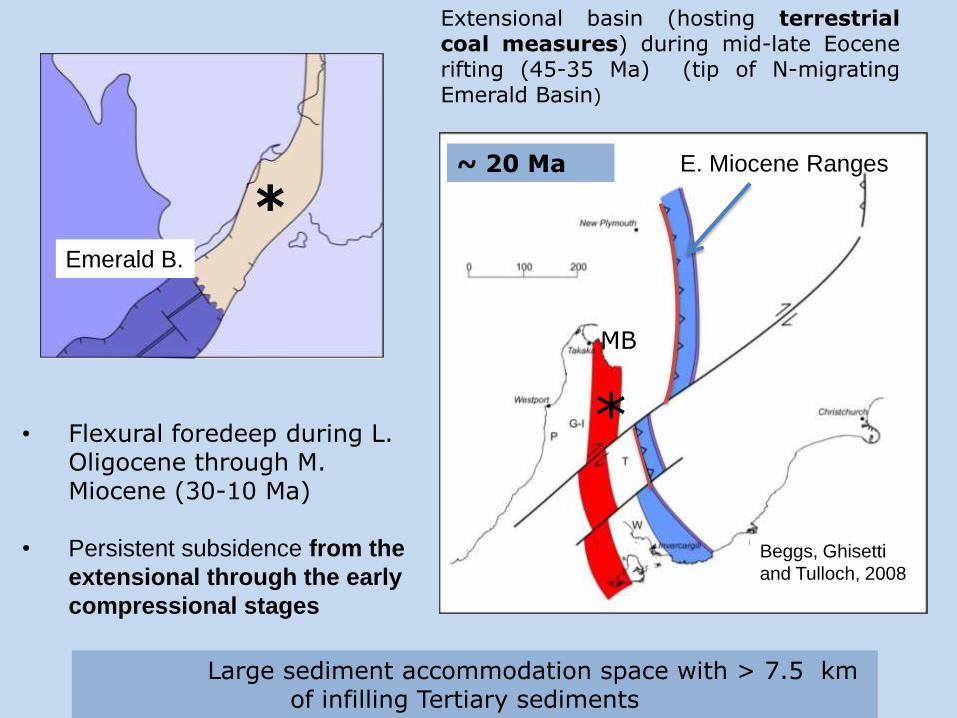
• Flexural foredeep during L. Oligocene through M. Miocene (30-10 Ma)
• Persistent subsidence from the
extensional through the early
compressional stages
Extensional basin (hosting terrestrialcoal measures) during mid-late Eocenerifting (45-35 Ma) (tip of N-migratingEmerald Basin)
*
*
~ 20 Ma
MB
Large sediment accommodation space with > 7.5 km of infilling Tertiary sediments
Beggs, Ghisetti
and Tulloch, 2008
Emerald B.
E. Miocene Ranges

• Strong vertical mobility
• Rapid uplift (post 10 Ma) with removal of > 3.5 km of Eocene and younger section (Gibson et al., 1996)
Ghisetti and Sibson (2006)
BASE TO THE OLIGOCENE SEQUENCE
> 40% post L. Miocene shortening
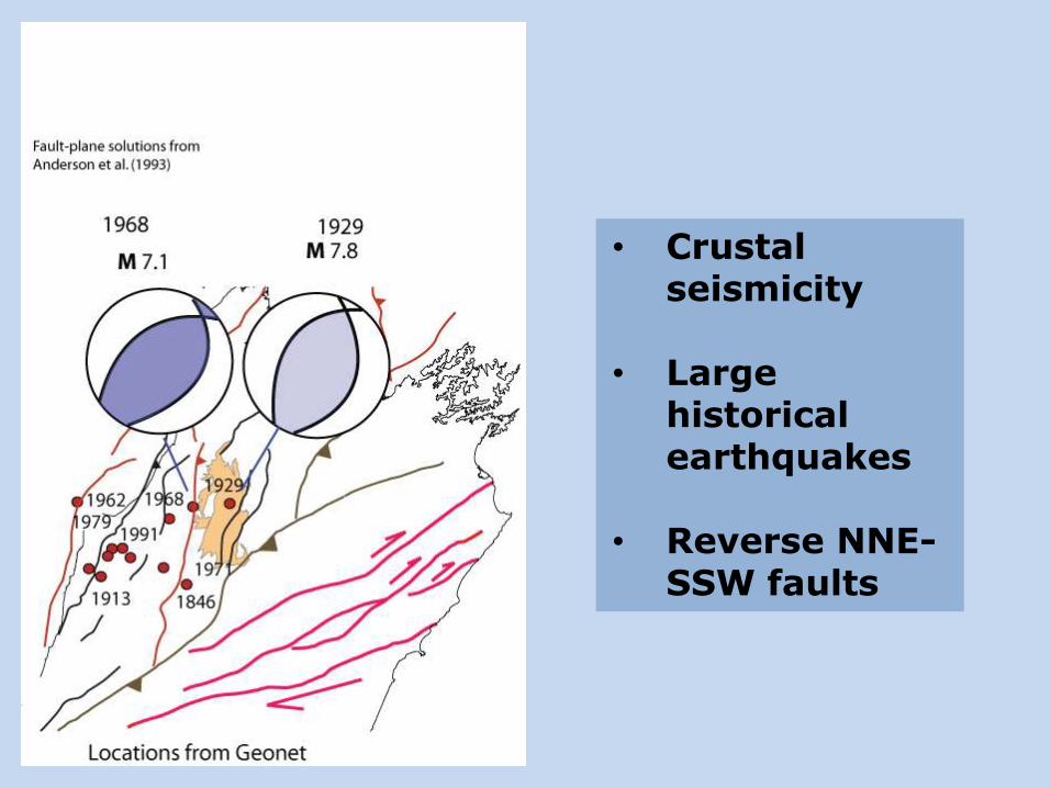
• Crustal seismicity
• Large historical earthquakes
• Reverse NNE-SSW faults
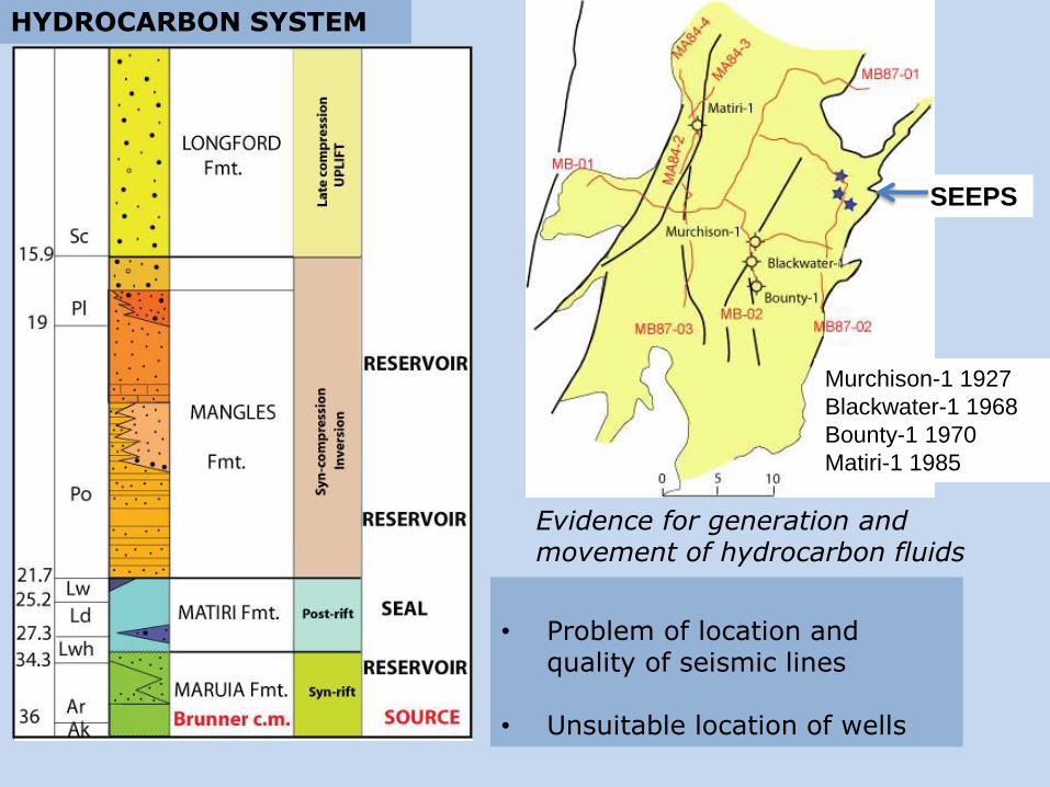
HYDROCARBON SYSTEM
Evidence for generation andmovement of hydrocarbon fluids
• Problem of location and quality of seismic lines
• Unsuitable location of wells
SEEPS
Murchison-1 1927
Blackwater-1 1968
Bounty-1 1970
Matiri-1 1985
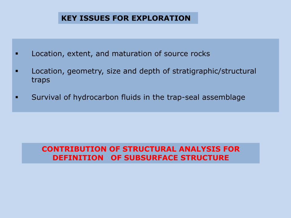
Location, extent, and maturation of source rocks
Location, geometry, size and depth of stratigraphic/structural traps
Survival of hydrocarbon fluids in the trap-seal assemblage
CONTRIBUTION OF STRUCTURAL ANALYSIS FOR DEFINITION OF SUBSURFACE STRUCTURE
KEY ISSUES FOR EXPLORATION
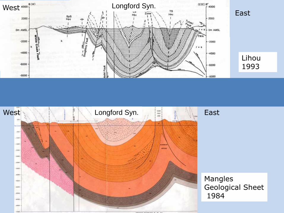
ManglesGeological Sheet1984
Lihou 1993
East
East
West
West Longford Syn.
Longford Syn.
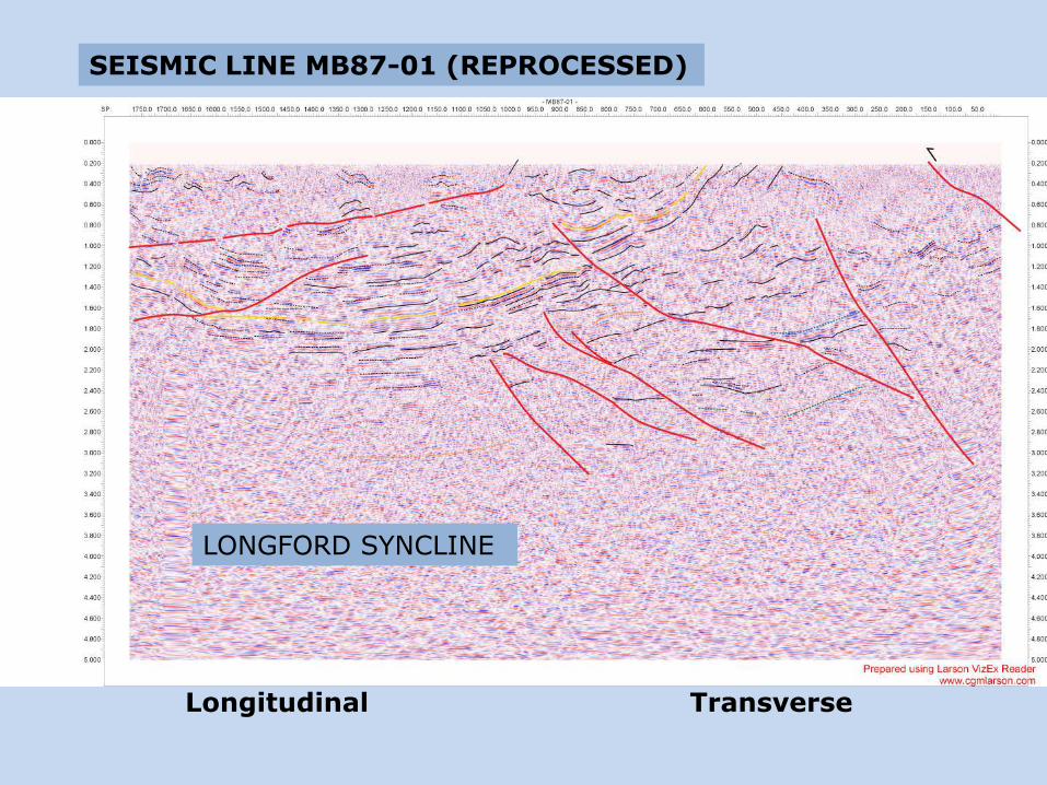
SEISMIC LINE MB87-01 (REPROCESSED)
Longitudinal Transverse
LONGFORD SYNCLINE
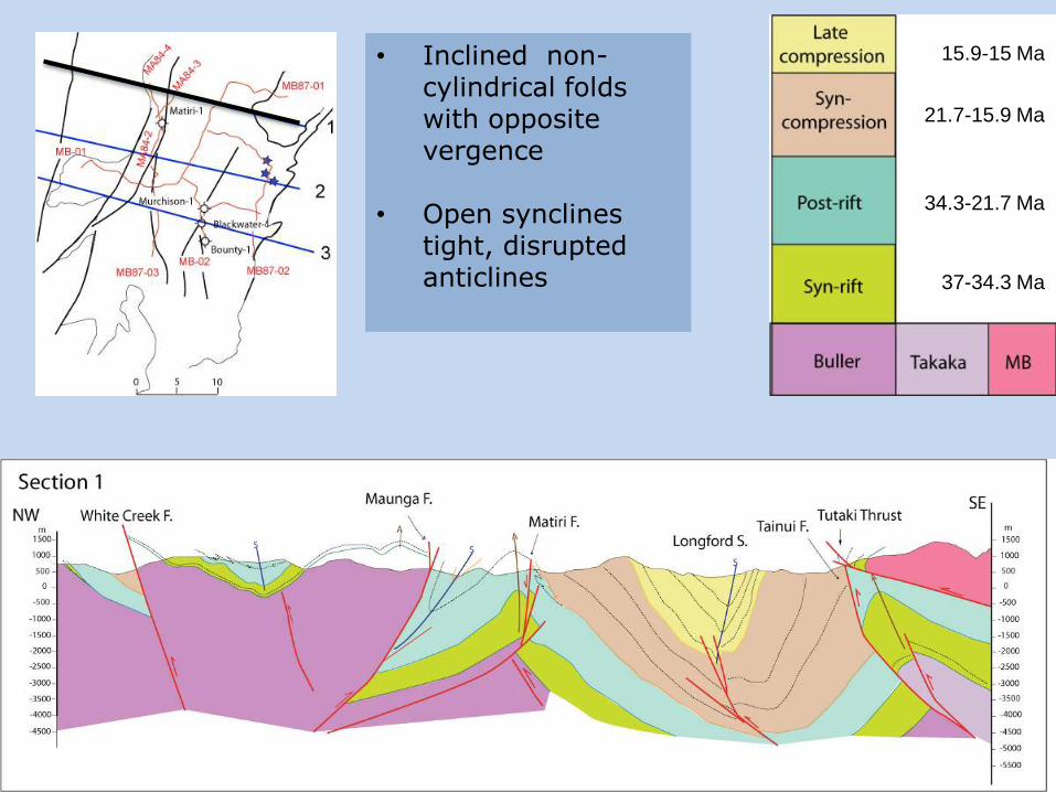
• Inclined non-cylindrical folds with opposite vergence
• Open synclinestight, disrupted anticlines 37-34.3 Ma
34.3-21.7 Ma
21.7-15.9 Ma
15.9-15 Ma
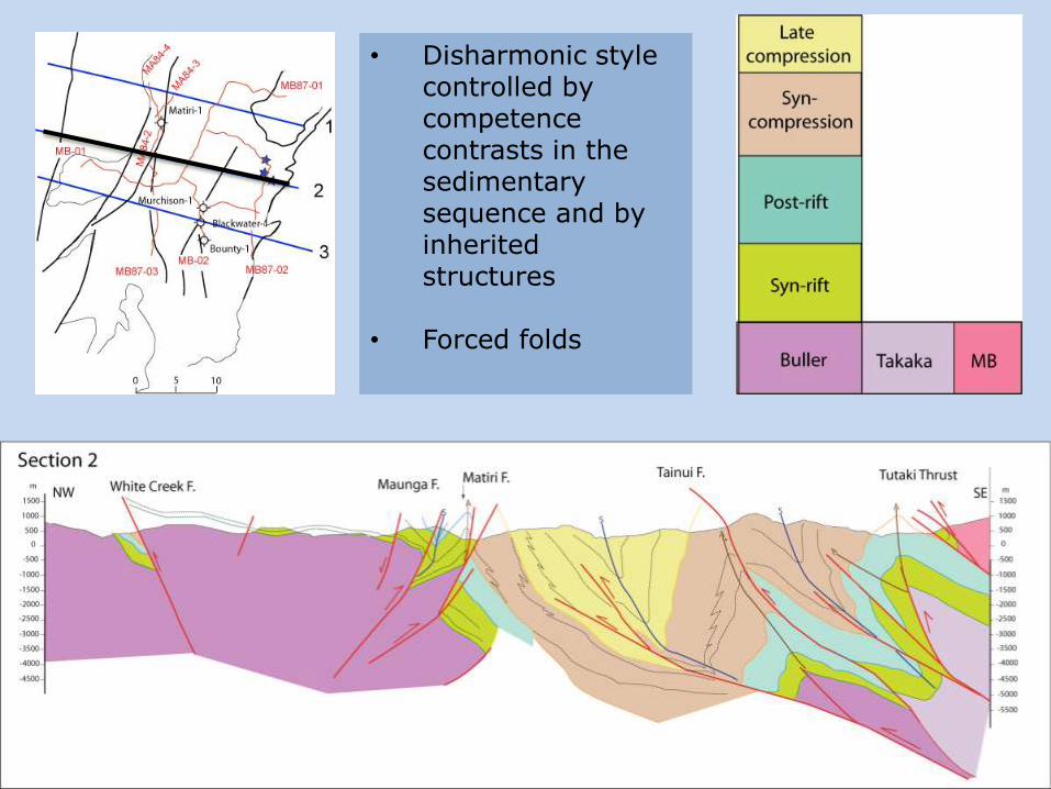
• Disharmonic style controlled by competence contrasts in the sedimentary sequence and byinherited structures
• Forced folds
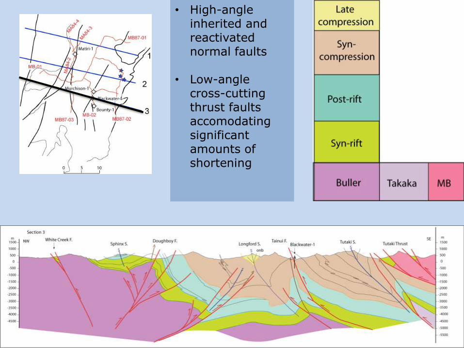
• High-angle inherited and reactivated normal faults
• Low-angle cross-cutting thrust faults accomodatingsignificant amounts of shortening

1. Buckling and detachment (latest Oligocene-Early Miocene)
2. Fold growth and amplification associated with compressionalinversion (Middle Miocene)
3. Crosscutting by low-angle thrusts (footwall shortcuts of AF) since 10 Ma
Modified from Ghisetti and Sibson (2006)

• Difficult downdip projection of surface and near-surface data
• Correct definition of structural style is a key for exploration and well location
• Low-angle crosscutting thrust faults seal stratigraphic traps and early structural traps in the footwall
• 3D migration pathways of fluids are likely to be structurally controlled
IMPLICATIONS FOR HYDROCARBON EXPLORATION