surveying by sandeep jyani sir - wifistudy.com · 2019-06-26 · compass survey (principle, bearing...
TRANSCRIPT
SurveyingBy Sandeep Jyani Sir
26-06-2019

Civil Engineering by Sandeep Jyani 2
SurveyingSyllabusTypes of survey, chain and cross staff survey (principle, ranging, triangulation, chaining, errors, finding area),compass survey (principle, bearing of line, prismatic compass, traversing, local attraction, calculation of bearings, angles and local attraction) leveling (dumpy level, recording in level book, temporary adjustment, methods of reduction of levels, classification of leveling, tilting level, auto level, sources of errors, precautions and difficulties in leveling), contouring (contour interval, characteristics, method of locating, interpolation, establishing grade contours, uses of contour maps), area and volume measurements, plane table survey (principles, setting, method), theodolite survey (components, adjustments, measurements, traversing), Tacheometric survey, curves (types, setting out), advanced survey equipment, aerial survey and remote sensing.
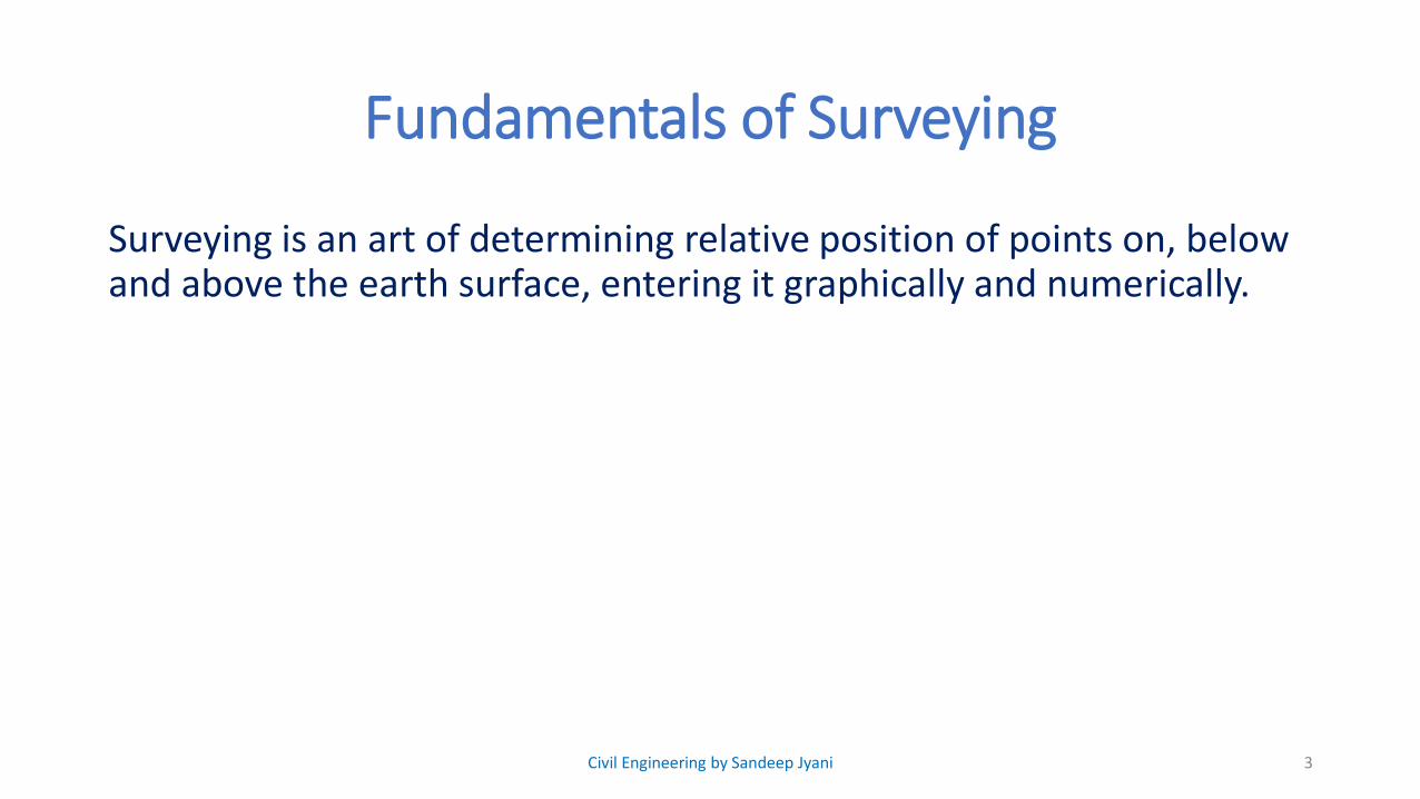
Fundamentals of Surveying
Surveying is an art of determining relative position of points on, below and above the earth surface, entering it graphically and numerically.
3Civil Engineering by Sandeep Jyani

Objectives of Surveying
1. To determine relative position of points
2. To Layout or mark out proposed structure on the ground
3. To measure relative quantities like area & volume
4Civil Engineering by Sandeep Jyani

Methods of Presenting measurements:-
• Numerically : AB = 260 km (examples)
• Graphically :
• Generally Graphical representation is done in the from of
• Plan 𝑜𝑛
Large scale
• Map 𝑜𝑛
Small scale
5
A B260 km
Civil Engineering by Sandeep Jyani

Methods of Presenting measurements:-
• Vertical distances on the plan (on) map can be shown with the help of contours and spot levels.
• Contours are imaginary line joining points of equal elevation on the earth surface.
• Spot levels are reduced level or height of individual points
• Contour gives better visualization of the area.
6Civil Engineering by Sandeep Jyani
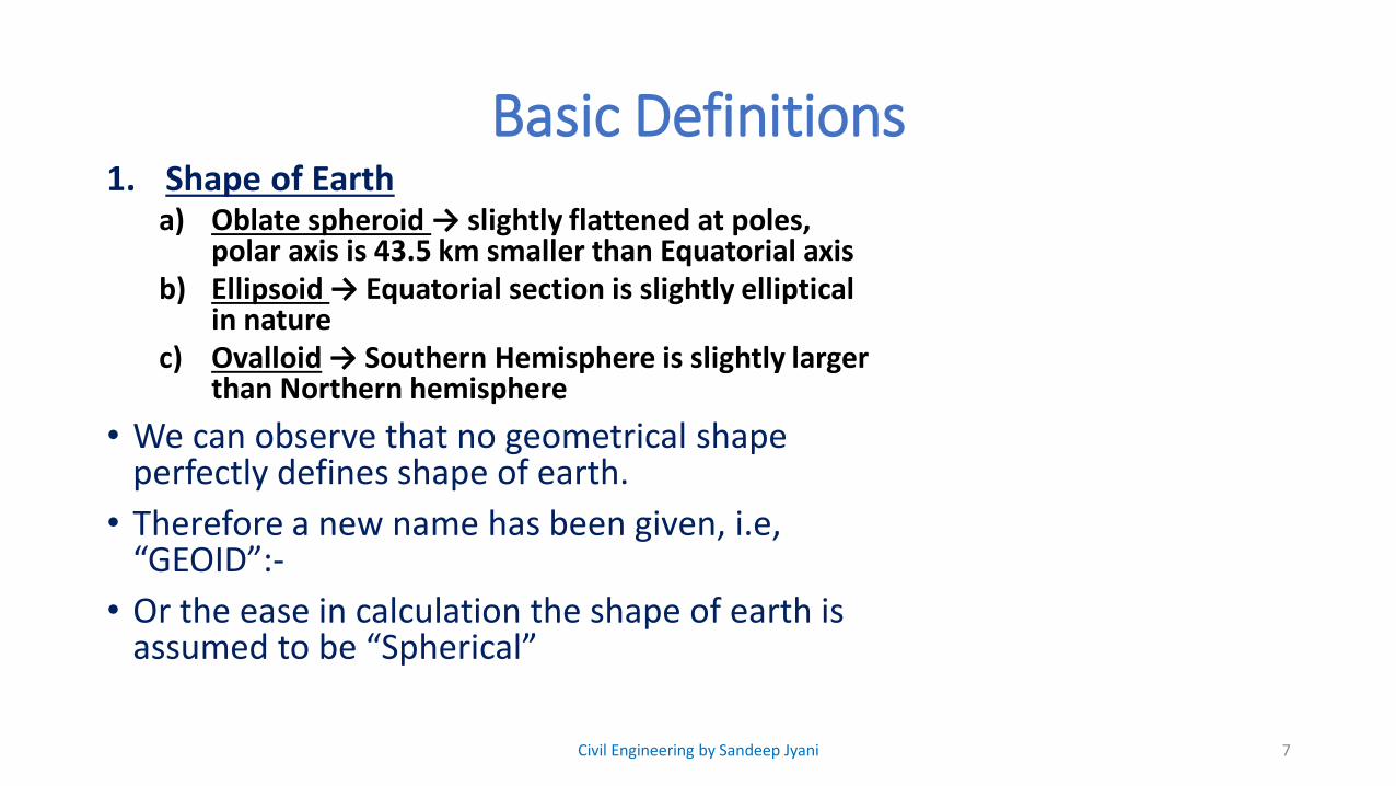
Basic Definitions1. Shape of Earth
a) Oblate spheroid → slightly flattened at poles, polar axis is 43.5 km smaller than Equatorial axis
b) Ellipsoid → Equatorial section is slightly elliptical in nature
c) Ovalloid → Southern Hemisphere is slightly larger than Northern hemisphere
• We can observe that no geometrical shape perfectly defines shape of earth.
• Therefore a new name has been given, i.e, “GEOID”:-
• Or the ease in calculation the shape of earth is assumed to be “Spherical”
7Civil Engineering by Sandeep Jyani

Basic Definitions2. Level Surface
• Level surface is a curved surface parallel to earth surface and every point, it is equidistant from the centre of the Earth, every element on the level surface is perpendicular to plumb line
3. Level line• It is a line in the level surface
4. Horizontal plane:• It is a plane tangential to Earth surface at any
point.
• It is also normal to plumb line
8Civil Engineering by Sandeep Jyani
level surface
level surface
Horizontal surface
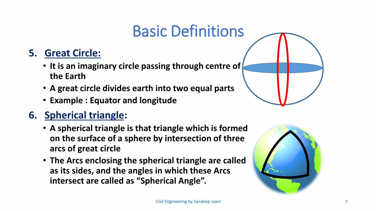
Basic Definitions5. Great Circle:
• It is an imaginary circle passing through centre of the Earth
• A great circle divides earth into two equal parts
• Example : Equator and longitude
6. Spherical triangle:• A spherical triangle is that triangle which is formed
on the surface of a sphere by intersection of three arcs of great circle
• The Arcs enclosing the spherical triangle are called as its sides, and the angles in which these Arcs intersect are called as “Spherical Angle”.
9Civil Engineering by Sandeep Jyani

10

Basic Definitions6. Spherical triangle:
• A spherical triangle is that triangle which is formed on the surface of a sphere by intersection of three arcs of great circle
• The Arcs enclosing the spherical triangle are called as its sides, and the angles in which these Arcs intersect are called as “Spherical Angle”.
• Spherical Angle is defined as the angle between tangents to the great circle drawn at the point of intersection.
• Length of a side of a spherical triangle is defined as angle subtended by that side at the centre of the earth
11Civil Engineering by Sandeep Jyani

Basic Definitions6. Properties of Spherical triangle:
• Length of a side of a spherical triangle should be less than equal to 180°
• Each angle of a spherical triangle should be less than 180°
• Sum of three spherical sides should be in between 0° to 360°
• Sum of spherical angles should be in the range of 180°to 540°
Note:-• Amount by which sum of the angles of a spherical
triangle exceed by 180° is called as “spherical excess”• Surface Area of a spherical triangle should be less than 𝟐𝝅𝒓² where r → radius of the Earth
12Civil Engineering by Sandeep Jyani

Classification of SurveyingSurveying can be classified into many types on the basis of instrument used, place of survey, purpose of survey etc.
But mainly surveying is classified as, Plane Surveying, Geodetic Surveying.
13
Plane Surveying Geodetic Surveying
In the Plane Surveying we neglect the effect of Curvature and plotted Measurements are projected on Horizontal plane
Geodetic survey is done for large Area in which effect of Curvature of the Earth surface is considered
Area < 195.5 km² Area ≥ 195.5 km²
It is done for local surveys It is done by Survey of India to establish control points which serves the purpose of reference point for local surveys
Plane trigonometry Spherical Trigonometry
Civil Engineering by Sandeep Jyani
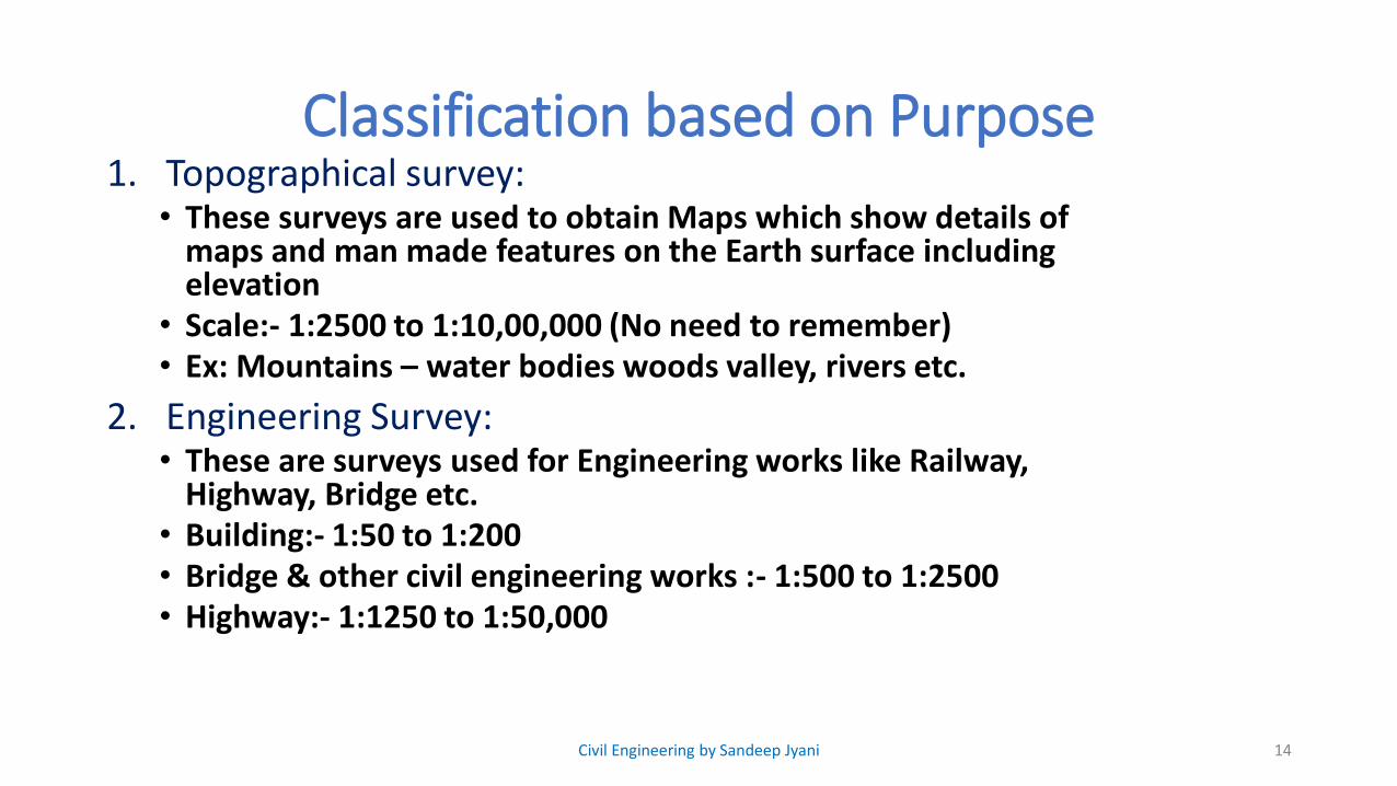
Classification based on Purpose1. Topographical survey:
• These surveys are used to obtain Maps which show details of maps and man made features on the Earth surface including elevation
• Scale:- 1:2500 to 1:10,00,000 (No need to remember)• Ex: Mountains – water bodies woods valley, rivers etc.
2. Engineering Survey:• These are surveys used for Engineering works like Railway,
Highway, Bridge etc.• Building:- 1:50 to 1:200• Bridge & other civil engineering works :- 1:500 to 1:2500• Highway:- 1:1250 to 1:50,000
14Civil Engineering by Sandeep Jyani
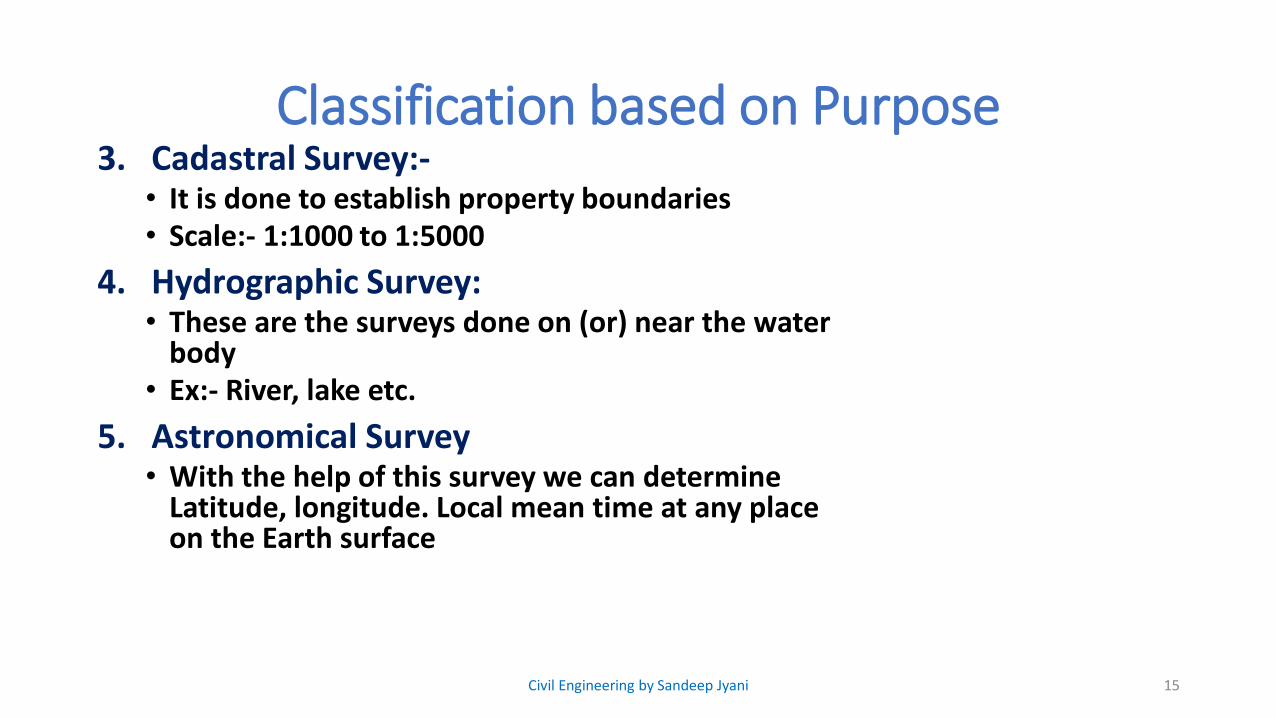
Classification based on Purpose3. Cadastral Survey:-
• It is done to establish property boundaries• Scale:- 1:1000 to 1:5000
4. Hydrographic Survey:• These are the surveys done on (or) near the water
body• Ex:- River, lake etc.
5. Astronomical Survey• With the help of this survey we can determine
Latitude, longitude. Local mean time at any place on the Earth surface
15Civil Engineering by Sandeep Jyani

Classification based on Purpose6. Geological Survey
• It is done to determine information about various strata of earth surface
16Civil Engineering by Sandeep Jyani
Classification based on Instrument
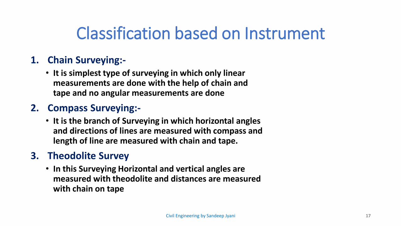
1. Chain Surveying:-• It is simplest type of surveying in which only linear
measurements are done with the help of chain and tape and no angular measurements are done
2. Compass Surveying:-• It is the branch of Surveying in which horizontal angles
and directions of lines are measured with compass and length of line are measured with chain and tape.
3. Theodolite Survey• In this Surveying Horizontal and vertical angles are
measured with theodolite and distances are measured with chain on tape
17Civil Engineering by Sandeep Jyani

Classification based on Instrument
4. Levelling• In this type of Survey, elevations of various points
are measured with the leveling instrument and a vertical staff
5. Plane table Surveying• In plane table Surveying, plan or Map is produced by
determing directions of various points and taking linear measurements with chain on Tape.
6. Tachometric Surveying• In this Surveying horizontal & Vertical distances are
measured with an instrument called “Tachometer”.
18Civil Engineering by Sandeep Jyani
Classification based on Instrument
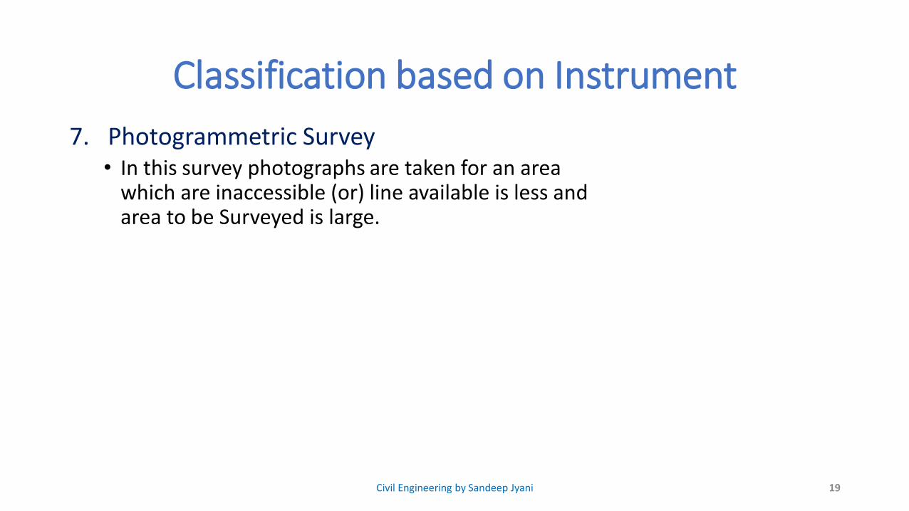
7. Photogrammetric Survey• In this survey photographs are taken for an area
which are inaccessible (or) line available is less and area to be Surveyed is large.
19Civil Engineering by Sandeep Jyani

Principles of Surveying
• Working from whole to Part.• Main objective of working from whole to part is to localize the error where as
if we works from part to whole error gets maximize
• Locating a point at least by 2 measurements.
20Civil Engineering by Sandeep Jyani

SCALE
𝑆𝑐𝑎𝑙𝑒 =𝑙𝑒𝑛𝑔𝑡ℎ 𝑜𝑓 𝑎 𝑙𝑖𝑛𝑒 𝑜𝑛 𝑃𝑙𝑎𝑛 𝑜𝑟 𝑀𝑎𝑝
𝑙𝑒𝑛𝑔𝑡ℎ 𝑜𝑓 𝑠𝑎𝑚𝑒 𝑙𝑖𝑛𝑒 𝑜𝑛 𝑡ℎ𝑒 𝑔𝑟𝑜𝑢𝑛𝑑
1. Numerical Scalea) Representative Factor (RF) 1 cm= 10km (1: 106)
b) Engineer Scale 1 cm= 10km
2. Graphical Scale
21
10km0 km 20km 30km 40km 50km
0 cm 1 cm 2 cm 3 cm 4 cm 5 cm
1 cm= 10km
Civil Engineering by Sandeep Jyani
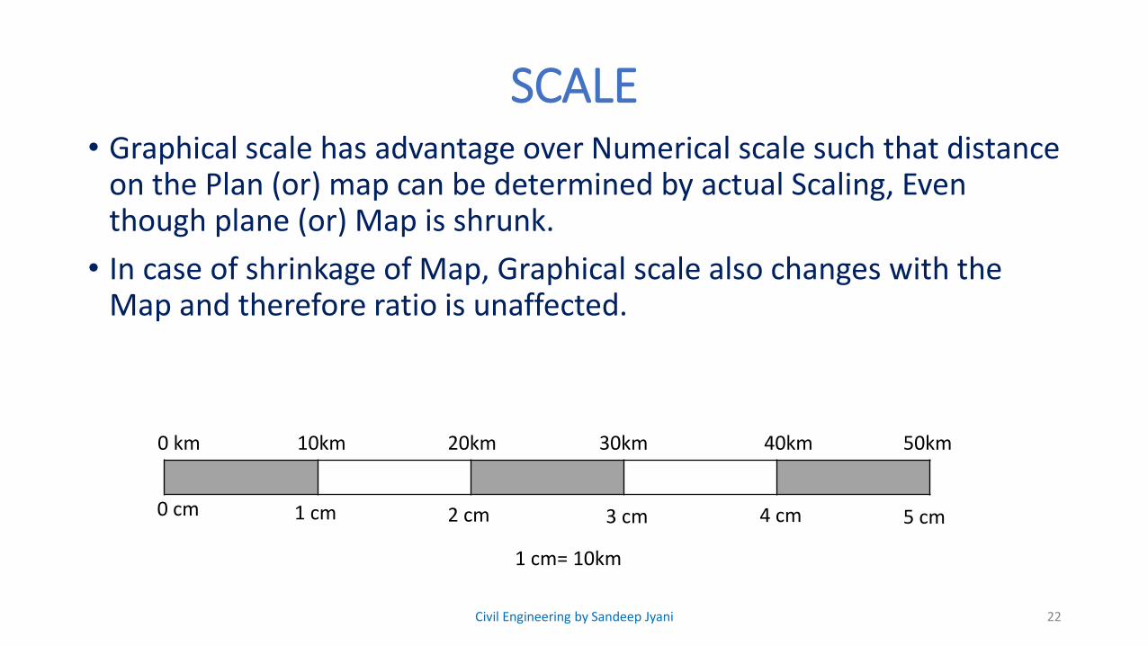
SCALE• Graphical scale has advantage over Numerical scale such that distance
on the Plan (or) map can be determined by actual Scaling, Even though plane (or) Map is shrunk.
• In case of shrinkage of Map, Graphical scale also changes with the Map and therefore ratio is unaffected.
22
10km0 km 20km 30km 40km 50km
0 cm 1 cm 2 cm 3 cm 4 cm 5 cm
1 cm= 10km
Civil Engineering by Sandeep Jyani
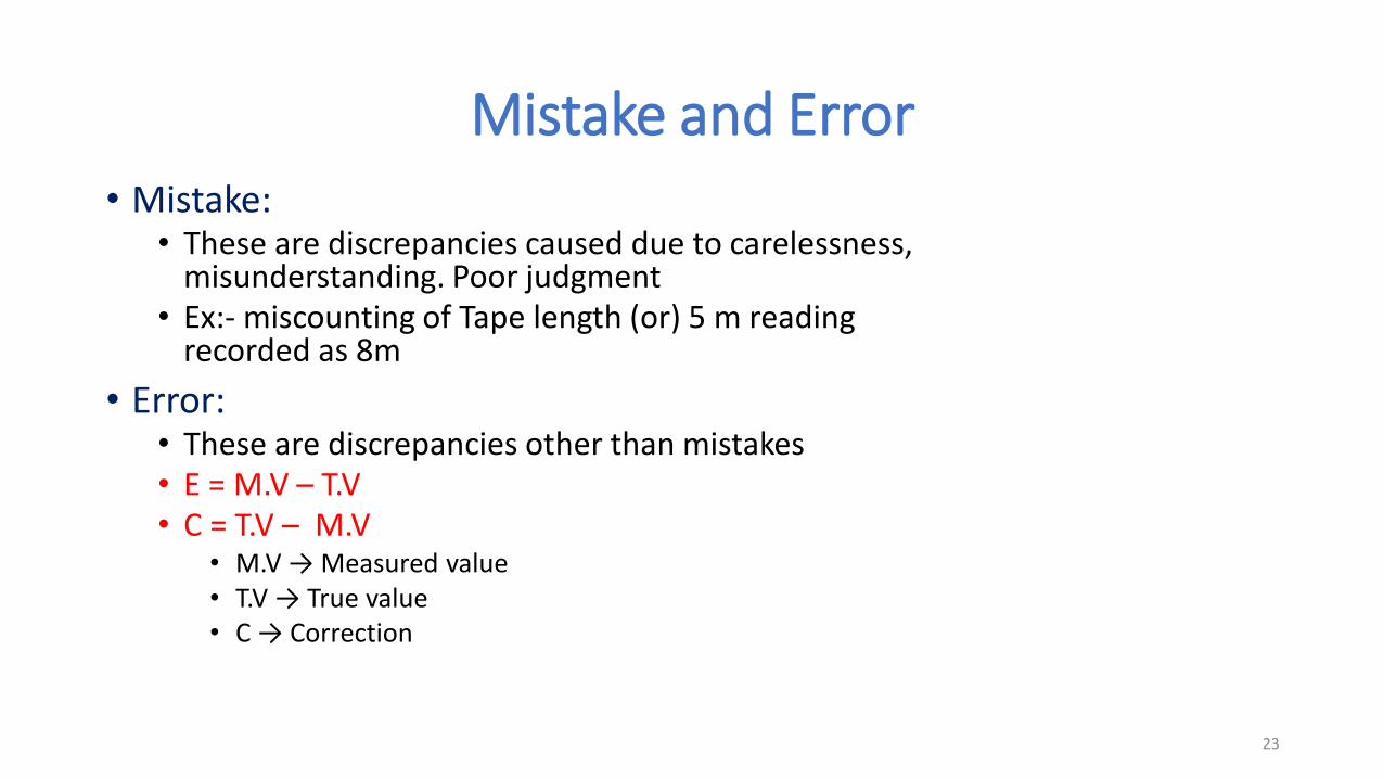
Mistake and Error• Mistake:
• These are discrepancies caused due to carelessness, misunderstanding. Poor judgment
• Ex:- miscounting of Tape length (or) 5 m reading recorded as 8m
• Error:• These are discrepancies other than mistakes• E = M.V – T.V • C = T.V – M.V
• M.V → Measured value• T.V → True value• C → Correction
23

Mistake and Error
Errors are of two types:
1. Systematic error/ Cumulative error• These errors follow a definite mathematical on Physical law
• They are cumulative in nature
2. Random Error/Accidental error• These are errors left out after mistake and systematic error
are eliminated.
24Civil Engineering by Sandeep Jyani

Que. 1 Hydrographic surveys deal with the mapping of
a) large water bodies
b) heavenly bodies
c) mountainous region
d) canal system
25Civil Engineering by Sandeep Jyani

Que. 1 Hydrographic surveys deal with the mapping of
a) large water bodies
b) heavenly bodies
c) mountainous region
d) canal system
26Civil Engineering by Sandeep Jyani

Que 2. In chain surveying field work is limited to
a) linear measurements only
b) angular measurements only
c) both linear and angular measurements
d) all the above
27Civil Engineering by Sandeep Jyani

Que 2. In chain surveying field work is limited to
a) linear measurements only
b) angular measurements only
c) both linear and angular measurements
d) all the above
28Civil Engineering by Sandeep Jyani
Que 3. The main principle of surveying is to work
a) from part to the whole
b) from whole to the part
c) from higher level to the lower level
d) from lower level to higher level.
29Civil Engineering by Sandeep Jyani

Que 3. The main principle of surveying is to work
a) from part to the whole
b) from whole to the part
c) from higher level to the lower level
d) from lower level to higher level.
30Civil Engineering by Sandeep Jyani

Que 4. For the construction of highway (or railway)
a) longitudinal sections are required
b) cross sections are required
c) both longitudinal and cross sections are required
d) none of these
31Civil Engineering by Sandeep Jyani

Que 4. For the construction of highway (or railway)
a) longitudinal sections are required
b) cross sections are required
c) both longitudinal and cross sections are required
d) none of these
32Civil Engineering by Sandeep Jyani

Que 5. The curvature of Earth is taken into account if the extent of survey is more than
a) 100 km2
b) 160 km2
c) 500 km2
d) 260 km2
33Civil Engineering by Sandeep Jyani

Que 5. The curvature of Earth is taken into account if the extent of survey is more than
a) 100 km2
b) 160 km2
c) 500 km2
d) 260 km2
34Civil Engineering by Sandeep Jyani
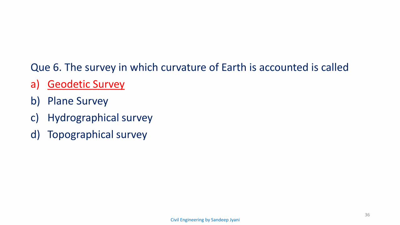
Que 6. The survey in which curvature of Earth is accounted is called
a) Geodetic Survey
b) Plane Survey
c) Hydrographical survey
d) Topographical survey
35Civil Engineering by Sandeep Jyani
Que 6. The survey in which curvature of Earth is accounted is called
a) Geodetic Survey
b) Plane Survey
c) Hydrographical survey
d) Topographical survey
36Civil Engineering by Sandeep Jyani
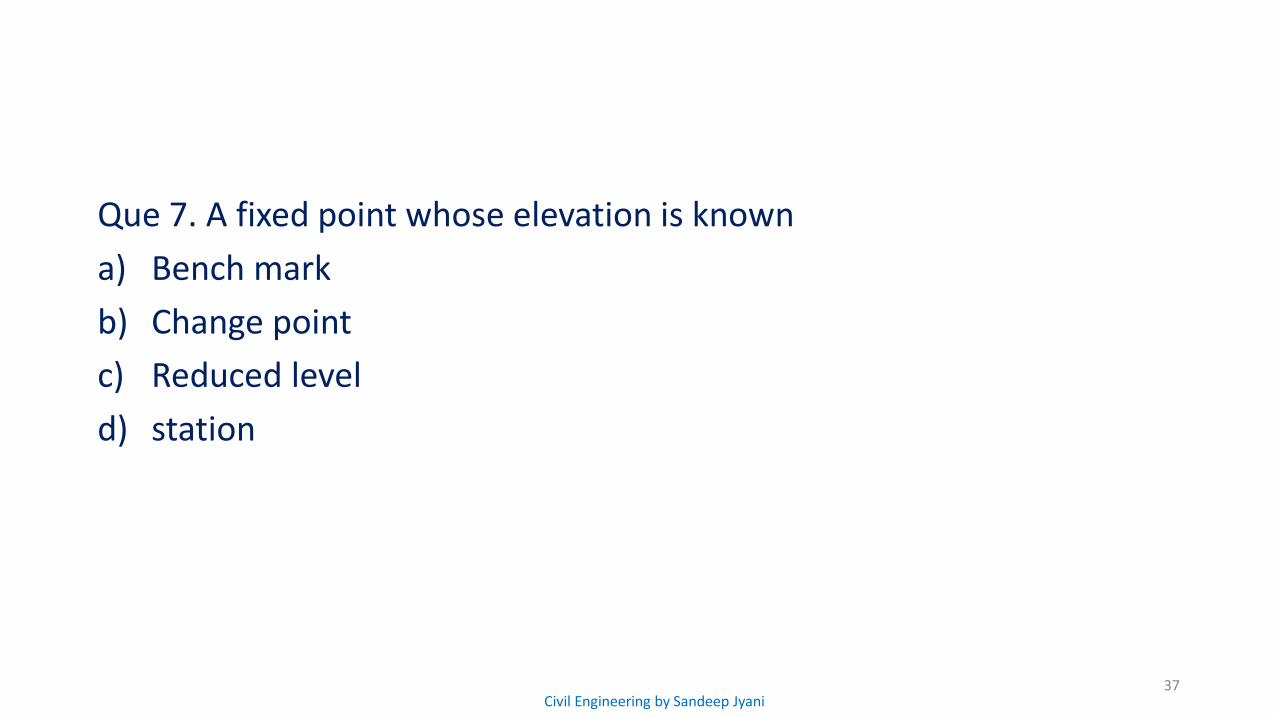
Que 7. A fixed point whose elevation is known
a) Bench mark
b) Change point
c) Reduced level
d) station
37Civil Engineering by Sandeep Jyani

Que 7. A fixed point whose elevation is known
a) Bench mark
b) Change point
c) Reduced level
d) station
38Civil Engineering by Sandeep Jyani
