sustainable drainage systems - west berkshire
TRANSCRIPT
Sustainable Drainage SystemsSupplementary Planning DocumentDecember 2018

West Berkshire SuDS SPD v7.1 (October 2018) i
Revision History
Revision Ref / Date Issued Amendments Issued to
Outline structure / 25 Nov 2015
Discussed in meeting 3/12/2015
Stuart Clark
Draft v1.0 / 30 March 2016 Added content Stuart Clark, Rachael Lancaster
Draft v2.0 /
Amendments following review by Stuart Clark, Rachael Lancaster, Antonia Bartzou and Jon Bowden
Stuart Clark, Rachael Lancaster
Draft v3.1 / 31 March 2017
Amendments following review by Stuart Clark, Rachael Lancaster, Antonia Bartzou and Jon Bowden
Stuart Clark, Antonia Bartzou and Jon Bowden
Draft v4.0 / 23 May 2017 Amendments following review by Stuart Clark and Jon Bowden
Stuart Clark
Draft v5.0 / 30 January 2018
Amendments following review by Stuart Clark, Jon Bowden and Richard Kellagher
Stuart Clark
Draft v6.0 / 08 May 2018
Amendments following review by Stuart Clark, Sinéad O’Donoghue, and Laila Bassett
Stuart Clark
Draft v7.0 / 10 October 2018 Amendments following public consultation
Stuart Clark
Draft v7.1 / 10 October 2018 Additional amendment following consultation
Stuart Clark
Key
Excerpt from the CIRIA SuDS Manual
Signpost to further technical guidance
Link to national and local planning policy
The drainage system shall prevent runoff from leaving the site during interception events (<5mm rainfall).
West Berkshire SuDS SPD Policy/Standard
The SuDS Manual C753 p.19 (CIRIA, 2015)
Supports delivery of: Core Strategy Policy CS16 NPPF Section 10
Contents
West Berkshire SuDS SPD v7.1 (October 2018) ii
1 Our vision ............................................................................................................... 1
2 Overview and context ............................................................................................ 2
2.1 Purpose of this document .................................................................................................. 2 2.2 What are SuDS and why use them? .................................................................................. 2 2.3 How can SuDS support other legislation and policies? ...................................................... 4 2.4 National design guidance ................................................................................................... 6
3 SuDS and West Berkshire ..................................................................................... 7
3.1 Characteristics of West Berkshire ...................................................................................... 7
4 Design and the planning process .......................................................................... 12
4.1 Use the right design team .................................................................................................. 12 4.2 The planning and design process ...................................................................................... 12
5 Principles and standards for integrated SuDS design ........................................... 15
5.1 Principle 1: Replicate natural drainage and manage water quantity................................... 15 5.2 Principle 2: Improve water quality ...................................................................................... 18 5.3 Principle 3: Promote and encourage biodiversity ............................................................... 19 5.4 Principle 4: Enhance the landscape and historic environment ........................................... 21 5.5 Principle 5: Engage and benefit the local community ......................................................... 21 5.6 Principle 6: Ensure that SuDS are adopted and maintained for the lifetime of the
development....................................................................................................................... 23 5.7 Principle 7: Adopt good practice in construction of SuDS .................................................. 26 5.8 Principle 8: Promote SuDS retro-fitting .............................................................................. 26
6 Choosing the right SuDS ....................................................................................... 27
6.1 Introduction ........................................................................................................................ 27 6.2 Flood risk ........................................................................................................................... 27 6.3 Groundwater ...................................................................................................................... 28 6.4 Receiving surface waters ................................................................................................... 29 6.5 Topography ........................................................................................................................ 29 6.6 Contaminated land ............................................................................................................. 30 6.7 Low permeability ................................................................................................................ 30 6.8 High permeability or unstable geology ............................................................................... 31 6.9 Limited space ..................................................................................................................... 31 6.10 Industrial sites / high pollution risk...................................................................................... 31 6.11 Protected habitats .............................................................................................................. 32 6.12 Small/Minor developments ................................................................................................. 32 6.13 Health and safety considerations ....................................................................................... 32 6.14 Affordability ........................................................................................................................ 32
7 Evaluation and approval ........................................................................................ 33
7.1 Responsibilities .................................................................................................................. 33 7.2 How will the SuDS design be evaluated? ........................................................................... 33
References.......................................................................................................................... 35
West Berkshire SuDS SPD v7.1 (October 2018) 1
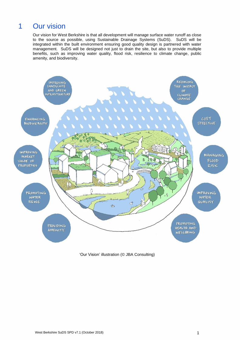
1 Our vision Our vision for West Berkshire is that all development will manage surface water runoff as close to the source as possible, using Sustainable Drainage Systems (SuDS). SuDS will be integrated within the built environment ensuring good quality design is partnered with water management. SuDS will be designed not just to drain the site, but also to provide multiple benefits, such as improving water quality, flood risk, resilience to climate change, public amenity, and biodiversity.
‘Our Vision’ illustration (© JBA Consulting)
West Berkshire SuDS SPD v7.1 (October 2018) 2
2 Overview and context
2.1 Purpose of this document
This Supplementary Planning Document (SPD) is intended to introduce the concept of SuDS, and outline the design principles required to deliver SuDS in West Berkshire. It provides advice on integrating SuDS within any development and delivering the multiple benefit drainage systems expected within West Berkshire.
As a unitary council, West Berkshire Council (WBC) acts as the Highway Authority, Lead Local Flood Authority and Local Planning Authority for the District. In its role as Lead Local Flood Authority (LLFA), WBC is responsible for managing flooding from surface water, groundwater and ordinary watercourses (all watercourses not classified as Main Rivers) (see Section 6.2) and is statutory consultee to the planning system on surface water drainage matters.
The SPD is intended to assist WBC, developers and property owners to deliver SuDS which:
are appropriate to the local area and its hydrology;
deliver social, environmental and financial benefits;
aim to meet a range of sustainability and place-making objectives;
are clearly presented at planning stage, enabling an efficient review and approval process; and
have clear responsibilities for future maintenance and management.
Where appropriate, it defines local technical design standards for West Berkshire where these go beyond national standards. However, this document is not intended as a detailed design guide. The CIRIA SuDS Manual C753 (2015) is recommended for this purpose, and relevant chapters of the manual, and other reference documents are signposted throughout this SPD.
Finally, the document outlines the planning and approval process, and provides checklists and advice to ensure that the planning requirements are clear and accessible (Section 4.2).
2.2 What are SuDS and why use them?
2.2.1 What are SuDS?
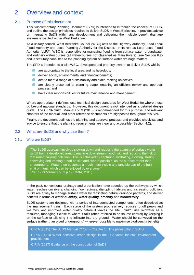
In the past, conventional drainage and urbanisation have speeded up the pathways by which water reaches our rivers, changing flow regimes, disrupting habitats and increasing pollution. SuDS are a way to manage surface water by replicating natural drainage patterns, and deliver benefits in terms of water quantity, water quality, amenity and biodiversity.
SuDS systems are designed with a series of interconnected components, often described as the ‘management train’. Each stage of the system progressively reduces runoff peaks and volumes, and improves water quality before it leaves the site. SuDS use rainwater as a resource, managing it close to where it falls (often referred to as source control) by keeping it on the surface or allowing it to infiltrate into the ground. Water should be conveyed on the surface (rather than piped underground) wherever possible to maximise biodiversity benefits.
“The SuDS approach involves slowing down and reducing the quantity of surface water runoff from a developed area to manage downstream flood risk, and reducing the risk of that runoff causing pollution. This is achieved by capturing, infiltrating, slowing, storing, conveying and treating runoff on site and, where possible, on the surface rather than underground. Water then becomes a much more visible and tangible part of the built environment, which can be enjoyed by everyone.” The SuDS Manual C753 p.19(CIRIA, 2015)
CIRIA (2015) The SuDS Manual (C753) - Chapter 1: The philosophy of SuDS
CIRIA (2013) Water sensitive urban design in the UK: Ideas for built environment practitioners
CIRIA (2017) Guidance on the construction of SuDS

West Berkshire SuDS SPD v7.1 (October 2018) 3
2.2.2 What are the benefits of using SuDS?
The primary benefits of SuDS are in managing water quantity and quality, as well as protecting and improving the environment and biodiversity. This has a positive impact on flood risk downstream, a key issue in West Berkshire.
SuDS also present an opportunity to gain a host of social, environmental and financial benefits for residents and developers (highlighted using symbols throughout this document).
SuDS can be integrated into all new and existing development, by designing source control techniques into the built environment, and keeping water as part of the landscape.
West Berkshire Council want to maximise the multiple benefits offered by SuDS for every development, by encouraging imaginative and innovative design solutions that add value.
2.2.3 Who is the guide for?
This guidance is primarily intended for practical use by designers of surface water drainage systems. However, the guide is also relevant to all those involved in the master-planning, design, approval, construction and maintenance of new development:
Developers
Architects and landscape architects
Consultant engineers and designers
Maintenance companies
Landowners and property owners
Social housing providers
Residents
West Berkshire Council (in its capacity as Local Planning Authority (LPA), Highways Authority and Lead Local Flood Authority (LLFA))
2.2.4 What type of developments?
This guidance demonstrates that SuDS can be incorporated into all types of development, and is intended to encourage SuDS uptake down to permitted development scale:
Residential, commercial, industrial and mixed developments
Greenfield and previously developed sites
Major development (where the LLFA has a statutory consultee role)
Minor developments (including extensions, conservatories and driveways)
Permitted development
Refurbishments of existing developments (SuDS retro-fitting)
Existing public open space and streetscapes (SuDS retro-fitting)
2.2.5 What are the keys to the successful design and implementation of SuDS?
This guidance provides a starting point for the design of a successful SuDS scheme. The key elements of this are:
“Surface water is a valuable resource and this should be reflected in the way it is managed and used in the built environment. It can add to and enhance biodiversity, beauty, tranquillity and the natural aesthetic of buildings, places and landscapes and it can help make them more resilient to the changing climate.” The SuDS Manual C753 p.19 (CIRIA, 2015)
West Berkshire SuDS SPD v7.1 (October 2018) 4
Early consultation with West Berkshire Council
Integrate SuDS into the design from the beginning
Ensure opportunities for multiple benefits are realised
Agree or develop adoption strategy for all forms of SuDS to be used on the site
Consider the operation and maintenance requirements of the whole drainage system
2.3 How can SuDS support other legislation and policies?
The multiple benefits of SuDS will help developments contribute towards the objectives of national planning policy and Local Plan policies. The Local Plan currently comprises of the Core Strategy Development Plan Document (DPD) (adopted 2017), and the West Berkshire District Plan 1991-2006 (Saved Policies 2007). The Local Plan is currently undergoing review, and SuDS will support any existing policies rolled forward into the new Local Plan.
SuDS shall also contribute towards the aims of Neighbourhood Plans, and will be designed to include any local needs specified within the relevant Neighbourhood Development Plan.
SuDS can contribute to meeting the requirements of the following policies and legislation:
Benefit Legislation / policy Implications
Managing flood risk
Flood and Water Management Act (FWMA) (2010)
Established Lead Local Flood Authorities (LLFAs), giving them responsibility for managing the risk of flooding from surface water, groundwater and Ordinary Watercourses (often described as 'local flood risk').
Schedule 3 of the FWMA introduces changes to the legislation relating to SuDS. These changes have not yet been enacted.
Town and Country Planning (Development Management Procedure) (England) Order (2015)
Designates West Berkshire Council, as LLFA, to be a statutory consultee on surface water drainage proposals for all Major developments.
National Planning Policy Framework (NPPF) (DCLG, 2012).
Section 10. Meeting the challenge of climate change, flooding and coastal change
"using opportunities offered by new development to reduce the causes and impacts of flooding"
Planning Practice Guidance: Flood Risk and Coastal Change (DCLG, 2015)
Section 21. “Reducing the causes and impacts of flooding”, recommends the use of SuDS.
WBC Core Strategy Policy CS16: Flooding
“…On all development sites, surface water will be managed in a sustainable manner through the implementation of Sustainable Drainage Methods (SuDS) in accordance with best practice…and to provide attenuation to greenfield run-off rates and volumes, for all new development and re-development…"
WBC local flood risk strategies and plans
Documents such as the Strategic Flood Risk Assessment (SFRA), Local Flood Risk Management Strategy (LFRMS) and Surface Water Management Plans (SWMP) all seek to reduce flooding through the planning process.
Environment Agency River Basin policy documents
River Thames Catchment Flood Management Plan (CFMP) (2009) and Flood Risk Management Plan: River Thames River Basin (2016) seek to reduce flooding through the planning process.
Core Strategy Policy CS16:
"…provide other benefits where possible such as water quality, biodiversity and amenity…”
West Berkshire SuDS SPD v7.1 (October 2018) 5
Benefit Legislation / policy Implications
Improve water quality
Flooding
EU Water Framework Directive (2000)
Improving the water quality of receiving waters such as rivers, streams and groundwater is an obligation under the WFD. Local targets are outlined in the Thames River Basin Management Plan (RBMP) (2009)
Enhance biodiversity and improve green infrastructure
Natural Environment and Rural Communities Act (2006)
WBC has a duty to conserve, restore and enhance biodiversity.
Section 41 identifies Habitats and Species of Principal Importance for Biodiversity in England.
Conservation of Habitats and Species Regulations (2017)
Regulations which identify and conserve European designated sites and protected species.
Careful management of impacts on water quality and biodiversity is a key consideration for SuDS close to European sites.
Wildlife and Countryside Act (1981) (as amended)
Legislation which protects animals, plants and habitats in the UK.
Under the Act, WBC has a duty to consult Natural England on any planning applications which may negatively impact on a SSSI.
National Planning Policy Framework (NPPF) (DCLG, 2012).
Section 11. Conserving and enhancing the natural environment.
“Contribute to conserving and enhancing the natural environment and reducing pollution”
Planning Practice Guidance: Natural Environment
Outlines policies on landscape, biodiversity and ecosystems, green infrastructure and brownfield land, all of which are supported by the implementation of SuDS
The Natural Environment in Berkshire: Biodiversity Strategy 2014-2020
Replaces the Berkshire Biodiversity Action Plan (BAP). Builds upon national and regional targets for biodiversity enhancement. This identifies many opportunities for biodiversity and geological enhancement in all parts of the district.
Aim identified for the creation of 11 ponds within the district. There is the potential for SuDS to contribute towards this aim.
Core Strategy Policy CS14: Design Principles
“…provide, conserve and enhance biodiversity and create linkages between green spaces and wildlife corridors...”
Core Strategy Policy CS16: Flooding
"…provide other benefits where possible such as water quality, biodiversity and amenity…”
Core Strategy Policy CS17: Biodiversity and Geodiversity
"…all new development should maximise opportunities to achieve net gains in biodiversity and geodiversity in accordance with the Berkshire Biodiversity Action Plan and the Berkshire Local Geodiversity Action Plan."
Core Strategy Policy CS18: Green Infrastructure
"…New developments will make provision for high quality and multifunctional open spaces of an appropriate size and will also provide links to the existing green infrastructure network…."
West Berkshire SuDS SPD v7.1 (October 2018) 6
Benefit Legislation / policy Implications
Provide amenity, health and
well-being
Core Strategy Policy CS16: Flooding
"…provide other benefits where possible such as water quality, biodiversity and amenity…”
Quality Design SPD (2006) Part 2: Residential development
SuDS can contribute in terms of enhancing landscape setting (1.4) and outdoor / private amenity space (1.16).
Health and Social Care Act (2012)
Established Council Health and Wellbeing Boards and strategies.
Joint Health and Wellbeing Strategy (2017-2020)
Promotes sustainability, positive mental health and wellbeing, as well as promoting physical activity for children and older people.
“Build a thriving and sustainable environment in which communities can flourish.”
Enable sustainable design
Core Strategy Policy CS15: Sustainable Construction and Energy Efficiency
SuDS can contribute to the aim of building sustainable homes. Efficient water usage helps to meet the National Technical Standards for housing, and WBC BREEAM requirements for new non-residential development.
Quality Design SPD (2006): Part 4 – Sustainable Design Techniques
While this SPD will supersede Section 1.3, which covers SuDS, it will continue to complement other elements of sustainable design, Biodiversity, Landscaping and Planting (1.4) and Greywater Reuse, Water Collection and Storage (1.5).
Improve historic environment and landscape
character
Core Strategy Policy CS14: Design Principles
Requires new development to respect and enhance the character and appearance of the area, contributing positively to local distinctiveness and sense of place
Policy CS19: Historic Environment and Landscape Character
Provides guidelines for adopting a holistic approach to conserving and enhancing the diversity and distinctiveness of the district’s landscape character.
North Wessex Downs AONB Management Plan 2014-2019
Sets out management objectives in terms of landscape, biodiversity, historic environment. Encourages green infrastructure.
2.4 National design guidance
National design guidance for SuDS is available from a number of guidance and code of practice documents, principally the SuDS Manual (CIRIA, 2015) supported by documents produced by the Local Authority SuDS Officer Organisation (LASOO) and British Standards Institution (BSI). The Susdrain website provides a good starting point.
Defra’s Non-Statutory Technical Standards for Sustainable Drainage Systems (Defra, 2015) sets out limited, high level standards for managing flows and volume of runoff, flood risk within the development, structural integrity, maintenance and construction.

West Berkshire SuDS SPD v7.1 (October 2018) 7
From a planning perspective, guidance on managing integrated water issues within local planning has been developed by the Cambridge Institute for Sustainability Leadership (2014).
3 SuDS and West Berkshire
3.1 Characteristics of West Berkshire
West Berkshire is a rural authority in South East England, covering an area of approximately 704km2. Over half of the population is centred in urban areas, with Newbury and Thatcham forming the largest towns, while the remaining 44% of the population is dispersed across the many smaller towns and villages.
3.1.1 Topography
Low lying floodplains of the River Kennet and Thames characterise the east of the district at around 40m above Ordnance Datum (AOD), while the altitude rises towards the North Wessex Downs in the north west of the district, reaching about 55mAOD at Thatcham, 125mAOD at Lambourn and 215mAOD at Farnborough.
3.1.2 Rainfall
The district is reasonably dry by UK standards, with an average annual rainfall of 800-1000mm. A shift in the seasonal pattern of rainfall is expected as a result of climate change, with summers becoming on average drier than at present and winters becoming wetter. The number of days experiencing rainfall in summer and winter will decrease and increase respectively, but the intensities of extreme rainfall in both seasons are expected to increase. Current projections indicate the most likely increase in extreme rainfall intensity in the order of 40% by 2080.
Current Government guidance (Environment Agency, 2016) recommends that an uplift of 20% (Central) to 40% (Upper end) should be applied to peak rainfall estimates, to account for the increase in rainfall intensity expected by the 2080s1. West Berkshire Council require the upper end allowance of 40% to be used within design rainfall calculations.
3.1.3 Soils
Shallow lime-rich soils overlie the chalk in the downland areas to the north, graduating through slightly acidic loamy and clayey soils with lower permeability. Moving south-eastwards through the district, soils become seasonally wet and slightly acidic, with base-rich loamy and clayey soils further south. More freely draining soils occur in some small areas.
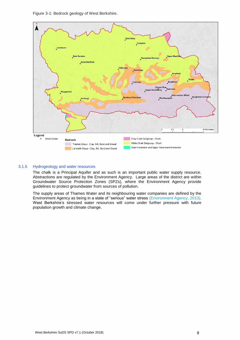
3.1.4 Geology
The geology is predominantly chalk, underlying the north and west of the district. The area surrounding the main river valleys to the south and east is underlain by the Thames Group, a sedimentary bedrock made up of clay, silt, sand and gravel (Figure 3-1).
On the upland slopes, there are surface deposits of clay and flint deposited during the Ice Age, and the river valleys contain clay, silt, sand and gravel associated with floodplain and river terrace deposits.
1 Environment Agency (2016) Flood risk assessments: climate change allowances. Available at: https://www.gov.uk/guidance/flood-risk-assessments-climate-change-allowances.
CIRIA (2015) The SuDS Manual (C753)
Defra (2015) Non-statutory Technical Standards for Sustainable Drainage Systems
Local Authority SuDS Officer Organisation (LASOO) (living document) Non-Statutory Technical Standards for Sustainable Drainage: Best Practice Guidance
HM Government (2010) The Building Regulations Part H: Drainage and Waste Disposal
Susdrain website http://www.susdrain.org/
BSI Standards Publication (2013) Code of Practice for Surface Water Management for Development Sites.
Cambridge Institute for Sustainability Leadership (2014) Planning Advice for Integrated Water Management.
West Berkshire SuDS SPD v7.1 (October 2018) 8
Figure 3-1: Bedrock geology of West Berkshire.
3.1.5 Hydrogeology and water resources
The chalk is a Principal Aquifer and as such is an important public water supply resource. Abstractions are regulated by the Environment Agency. Large areas of the district are within Groundwater Source Protection Zones (SPZs), where the Environment Agency provide guidelines to protect groundwater from sources of pollution.
The supply areas of Thames Water and its neighbouring water companies are defined by the Environment Agency as being in a state of “serious” water stress (Environment Agency, 2013). West Berkshire’s stressed water resources will come under further pressure with future population growth and climate change.

West Berkshire SuDS SPD v7.1 (October 2018) 9
3.1.6 Landscape
West Berkshire has a varied and distinctive landscape character, containing heathland, woodland, wet and dry grasslands and small areas of wetland.
The North Wessex Downs Area of Outstanding Natural Beauty (AONB) covers around 74% of West Berkshire. Designated for the quality of its scenic beauty and chalk landscape, it is a nationally important and legally protected landscape.
3.1.7 Habitat and biodiversity
West Berkshire contains designated sites of local, national and international importance which are central to conserving its biodiversity, ecology and wildlife. These include 51 Sites of Special Scientific Interest (SSSIs), 3 Special Areas of Conservation (SACs) (including the River Lambourn, the Kennet and Lambourn Floodplains and the Kennet Valley Alderwoods), 500 local wildlife sites and 17 Biodiversity Opportunity Areas (BOA).
Around 350km of rivers in the district are also UK Biodiversity Action Plan (BAP) designated chalk river priority habitats.
3.1.8 Flood risk
A significant number of properties in West Berkshire are at risk from flooding from various sources (river, surface water, groundwater) and this is a major concern for residents.
Flood risk arises from the Rivers Kennet, Lambourn, Enborne, Pang and Thames, affecting in particular the settlements of Newbury, Thatcham, Hungerford, Purley-on-Thames and Pangbourne.
There is also significant surface water flood risk in the district, with over 2500 properties affected in July 2007, mostly in Thatcham, Newbury, Pangbourne, Woolhampton and Lambourn. WBC as LLFA has designated several Critical Drainage Areas (CDAs) where surface water flood risk is high, including parts of Newbury, Thatcham, Hungerford, Lambourn, Beedon, Hermitage and Pangbourne. Further details of these CDAs are provided within the West Berkshire SFRA Level 1 Update (2015).
Road closed due to flooding (© JBA Consulting)
The River Lambourn, a designated chalk stream (SAC, BAP, SSSI) (© JBA Consulting)
West Berkshire SuDS SPD v7.1 (October 2018) 10
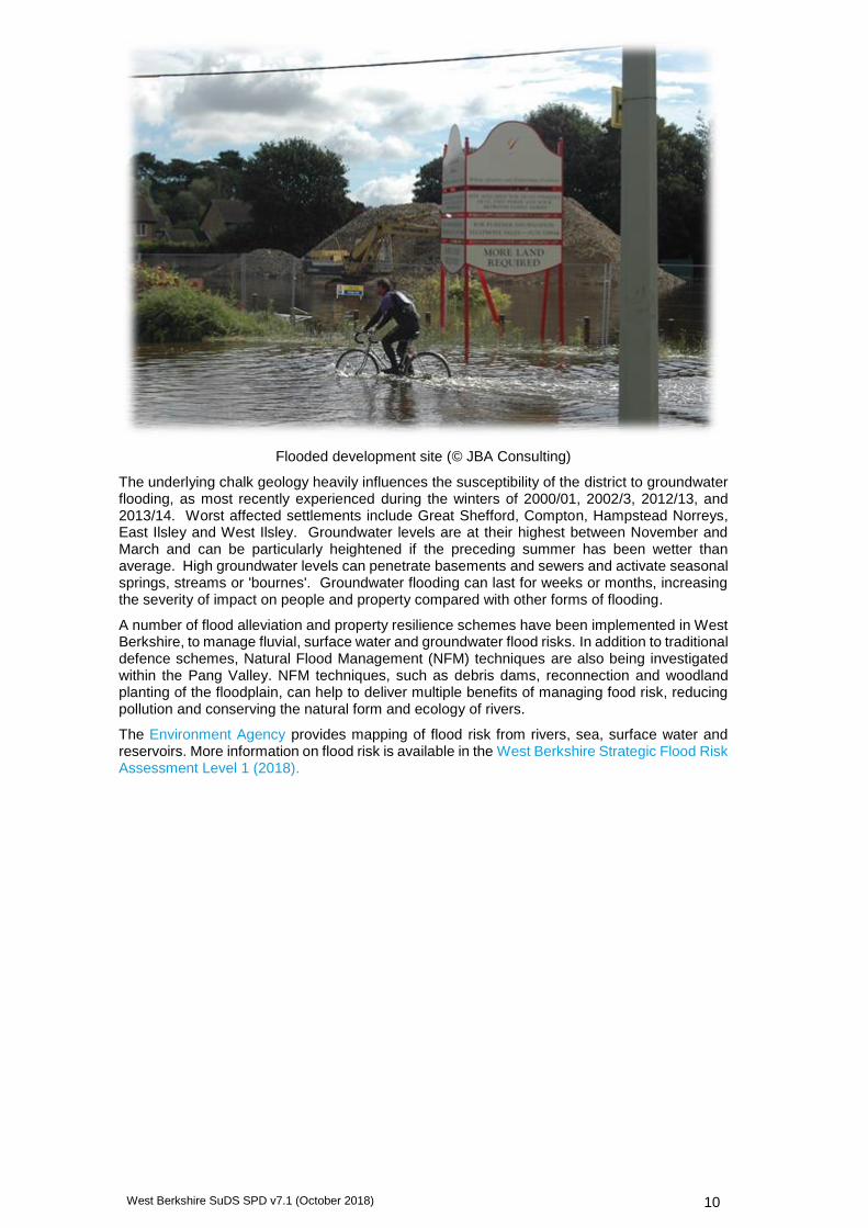
Flooded development site (© JBA Consulting)
The underlying chalk geology heavily influences the susceptibility of the district to groundwater flooding, as most recently experienced during the winters of 2000/01, 2002/3, 2012/13, and 2013/14. Worst affected settlements include Great Shefford, Compton, Hampstead Norreys, East Ilsley and West Ilsley. Groundwater levels are at their highest between November and March and can be particularly heightened if the preceding summer has been wetter than average. High groundwater levels can penetrate basements and sewers and activate seasonal springs, streams or 'bournes'. Groundwater flooding can last for weeks or months, increasing the severity of impact on people and property compared with other forms of flooding.
A number of flood alleviation and property resilience schemes have been implemented in West Berkshire, to manage fluvial, surface water and groundwater flood risks. In addition to traditional defence schemes, Natural Flood Management (NFM) techniques are also being investigated within the Pang Valley. NFM techniques, such as debris dams, reconnection and woodland planting of the floodplain, can help to deliver multiple benefits of managing food risk, reducing pollution and conserving the natural form and ecology of rivers.
The Environment Agency provides mapping of flood risk from rivers, sea, surface water and reservoirs. More information on flood risk is available in the West Berkshire Strategic Flood Risk Assessment Level 1 (2018).

West Berkshire SuDS SPD v7.1 (October 2018) 11
3.1.9 SuDS in West Berkshire
The characteristics of West Berkshire offer a number of particular opportunities and constraints to the implementation of SuDS. Guidance on how to deliver SuDS on sites with constraints can be found in Section 5.
Issue / characteristic
SuDS Opportunities and Benefits Constraint
Flood risk Reduction of surface water and fluvial flood risk through attenuation of runoff.
Improved public perception of new development.
Retro-fitting of SuDS in Critical Drainage Areas and other areas of high surface water flood risk.
SuDS may be ineffective in fluvial Flood Zone areas or groundwater flooding areas.
High groundwater levels may prevent the use of certain infiltration SuDS techniques.
Chalk geology
Highly permeable chalk geology lends itself to infiltration SuDS.
Tendency to simply discharge straight to soakaway rather than providing additional benefits.
Possible structural issues with infiltration SuDS due to solubility of chalk leading to sink holes in the worst case.
In Source Protection Zones, infiltration SuDS must remain sensitive to contamination of aquifers.
Specific design considerations in areas where water table is frequently high.
Water quality Contribute to the achievement of WFD targets for chemical and ecological status.
Sequential stages of treatment are required to manage pollutants close to source, rather than relying on ‘end of pipe’ solutions, such as oil interceptors.
Treatment of runoff may not improve the WFD status of receiving waters, due to external pollution factors. However, pollutants generated by the site should still be managed on the site.
Water resources and supply stress
Improve quality and quantity of direct recharge to aquifers.
Use of rainwater capture and reuse to save water.
In Source Protection Zones, infiltration SuDS must remain sensitive to contamination of aquifers.
Priority habitats
Improve biodiversity of UK BAP, SAC, SSSI designated chalk river priority habitats and other locally designated sites (e.g. Local Wildlife Sites).
Improve biodiversity and habitat connectivity, particularly in Biodiversity Opportunity Areas (BOAs).
Landscape and historic environment
Enhance the characteristics of the AONB landscape.
Integrating historic assets into SuDS green space and re-instating features such as water meadows.
Climate change
'Future-proofing' against predicted climate change impacts in West Berkshire.
West Berkshire SuDS SPD v7.1 (October 2018) 12
Issue / characteristic
SuDS Opportunities and Benefits Constraint
Delivering quality housing
Enhancing landscape and character.
Delivering high quality of design which responds positively to the local context.
Improving marketability and value.
4 Design and the planning process
4.1 Use the right design team
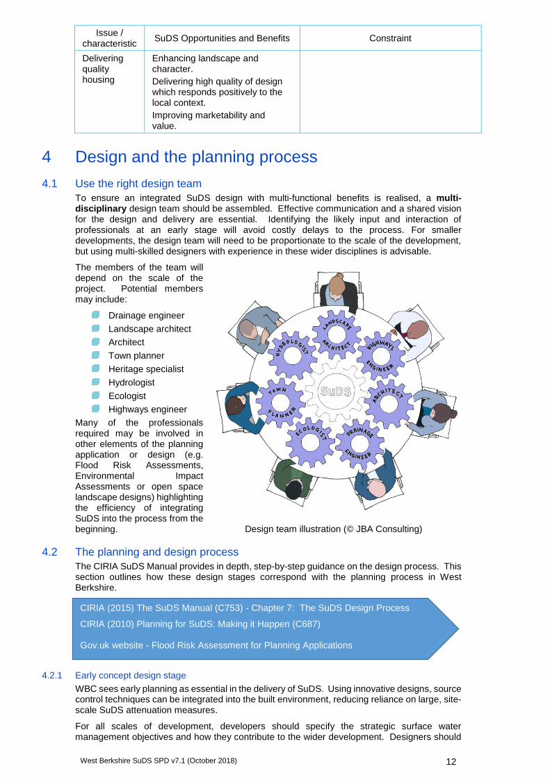
To ensure an integrated SuDS design with multi-functional benefits is realised, a multi-disciplinary design team should be assembled. Effective communication and a shared vision for the design and delivery are essential. Identifying the likely input and interaction of professionals at an early stage will avoid costly delays to the process. For smaller developments, the design team will need to be proportionate to the scale of the development, but using multi-skilled designers with experience in these wider disciplines is advisable.
The members of the team will depend on the scale of the project. Potential members may include:
Drainage engineer
Landscape architect
Architect
Town planner
Heritage specialist
Hydrologist
Ecologist
Highways engineer
Many of the professionals required may be involved in other elements of the planning application or design (e.g. Flood Risk Assessments, Environmental Impact Assessments or open space landscape designs) highlighting the efficiency of integrating SuDS into the process from the beginning.
4.2 The planning and design process
The CIRIA SuDS Manual provides in depth, step-by-step guidance on the design process. This section outlines how these design stages correspond with the planning process in West Berkshire.
4.2.1 Early concept design stage
WBC sees early planning as essential in the delivery of SuDS. Using innovative designs, source control techniques can be integrated into the built environment, reducing reliance on large, site-scale SuDS attenuation measures.
For all scales of development, developers should specify the strategic surface water management objectives and how they contribute to the wider development. Designers should
CIRIA (2015) The SuDS Manual (C753) - Chapter 7: The SuDS Design Process
CIRIA (2010) Planning for SuDS: Making it Happen (C687) Gov.uk website - Flood Risk Assessment for Planning Applications
Design team illustration (© JBA Consulting)

West Berkshire SuDS SPD v7.1 (October 2018) 13
consider how to integrate SuDS and maximise opportunities for multiple benefits at the earliest concept design stage.
Informal discussions with the LPA and LLFA prior to formal pre-application are recommended for all developments, particularly large or complex sites. This will ensure that expectations for surface water management, climate change allowances, adoption and maintenance are clearly understood from the outset.
Early consideration must be given to:
Identification of site characteristics which present opportunities and constraints for SuDS (topography, infiltration, discharge destinations, local habitats, flood risk, adoption arrangements etc.).
Seeking advice and surveys from professionals from relevant disciplines (ecologists, landscape architects, archaeologists, drainage engineers etc.).
4.2.2 Masterplanning
For larger developments, a masterplan will be necessary. At this stage the conceptual design and layout should be determined, designing SuDS around natural flow paths, low points and catchments.
SuDS should be integrated with multifunctional green spaces and the road network, with prevention and source control SuDS integrated into building designs. Land uses should be clustered to manage pollution.
Seeking advice from the LPA, LLFA and Highways Authority (see below) early in the masterplanning process will help to avoid costly issues or redesigns at a later stage. Considering SuDS at this stage also maximises the financial benefits of SuDS, such as cheaper drainage construction costs and a potentially more desirable development.
4.2.3 Pre-application
Applicants are encouraged to seek pre-application advice through the West Berkshire Pre-Application Advice Service to ensure the proposed development is of a high quality.
The more detail provided to the authority about the site location, flood risk constraints, proposed drainage system and discharge points, the better its advice can be.
WBC as LLFA will recommend use of the Sustainable Drainage Strategy Checklists, which have been designed to ensure that proposed drainage systems meet the requirements for approval, adoption and long-term maintenance. This allows any issues to be identified prior to submission.
Sources of data for pre-application concept design:
West Berkshire Council online map
http://ww2.westberks.gov.uk/InternetMapping/Map.aspx
West Berkshire Strategic Flood Risk Assessment Level 1 (2008) Level 1 Update (2018) and Level 2 (2009)
http://info.westberks.gov.uk/sfra
Natural England
http://magic.defra.gov.uk/MagicMap.aspx
Environment Agency flood risk data
https://www.gov.uk/guidance/environmental-data
Soils
http://www.landis.org.uk/soilscapes
Geology
http://mapapps.bgs.ac.uk/geologyofbritain/home.html
BGS Infiltration SuDS map - contact West Berkshire Council (Land Drainage) for an excerpt
Topographical surveys and other relevant site surveys
Existing FRAs for the site
West Berkshire SuDS SPD v7.1 (October 2018) 14
4.2.4 Outline planning application
At this stage, the applicant should include an FRA (if required) and Outline Sustainable Drainage Strategy to demonstrate that SuDS have been appropriately considered. Site specific drainage requirements and constraints should be taken into account and incorporated effectively into the site layout.
The Outline Sustainable Drainage Strategy should include:
1. Site Location Plan (minimum scale of 1:2,500)
2. Details of how the proposed surface water scheme has been determined, following the drainage hierarchy (see Principle 1).
3. Proposed discharge locations.
4. Broad calculations of runoff rates and storage - existing surface water run-off rates, and an indication of post development run-off rates with associated storage requirements.
5. Details of site investigations (e.g. topographic survey, soakage testing)
6. Assessment of flood risk within the development and off-site impacts.
7. Conceptual design/layout of surface water drainage across the site, including outline sizing and optimisation.
8. Details of how the drainage system will operate, taking account of climate change and urban creep.
9. Provision for the safe management of exceedance flows within the site.
10. Justification of chosen components in the management train.
11. Indication of how the design will incorporate multi-functional green spaces and provide multiple benefits (e.g. water quality, biodiversity, amenity, education, landscape, health and well-being).
12. Outline maintenance plan.
13. Correspondence with relevant stakeholders.
14. Consideration of how drainage and flood risk will be managed during construction.
The outline application sections of the Major Applications Sustainable Drainage Strategy checklist should be completed.
For minor developments of three to nine houses, the outline sections of the Minor Applications Sustainable Drainage Strategy Checklist should be completed.
4.2.5 Full planning application or reserved matters application
Many developments move directly from the pre-application stage to a full planning application. At this stage, applicants will be expected to submit a FRA (if required) and a detailed Sustainable Drainage Strategy alongside the planning application.
Where outline planning permission has already been granted, the applicant is expected to provide full details at this stage.
The Detailed Sustainable Drainage Strategy should include everything required for an outline strategy, plus:
1. Details of existing layout, drainage arrangement and surface water flow paths for the site.
2. Results of ground investigations and testing (groundwater monitoring, soil samples, ground stability).
3. Detailed calculations of runoff rates and storage (including existing surface water run-off rates, post development run-off rates with associated storage requirements, and emptying times for the system).
4. Discharge locations and details of required consents from Environment Agency or WBC, and agreements from landowners where drainage crosses third-party land.
5. Detailed explanation of how the design will provide multiple benefits (e.g. water quality, biodiversity, amenity, education, landscape, health and well-being), including links to designs for landscaping, planting schemes etc.
6. Detailed design plans/drawings of surface water drainage across the site (minimum scale 1:500), showing the finalised SuDS scheme and its contributing area. It should demonstrate that opportunities to integrate SuDS have been maximised and fully justify any reasons against their use.
7. Detailed schematisation of components/management train, including long-section and cross-section drawings, pipe diameters, invert levels and gradients.
West Berkshire SuDS SPD v7.1 (October 2018) 15
8. Full maintenance and management plan of the surface water drainage system.
9. Details of a formal agreement, if adoption is proposed, including arrangements of whole life costs for the system (100 years) with organisations that will be responsible for maintenance.
10. Construction programme and method statement, detailing any planned phases, and how on-site and off-site flood risk will be managed during the construction process.
11. Landscape planning strategy.
12. Health and Safety file (particularly where open water SuDS are proposed).
All sections of the Major Applications Sustainable Drainage Strategy checklist should be completed.
For minor developments of three to nine houses, all sections of the Minor Applications Sustainable Drainage Strategy Checklist will need to be completed. A FRA may be required, or the Environment Agency's standing advice may be followed.
5 Principles and standards for integrated SuDS design This section outlines a framework of local principles for developers and their consultants to follow in order to deliver a SuDS scheme which meets the design and added value requirements of West Berkshire Council.
West Berkshire’s SuDS principles aim to:
1. Replicate natural drainage and manage water quantity
2. Improve water quality
3. Promote and enhance biodiversity
4. Enhance the landscape and historic environment
5. Engage and benefit the local community
6. Ensure that SuDS are maintained for the lifetime of the development
7. Adopt good practice in construction of SuDS
8. Encourage SuDS retro-fitting
Details of the design process and how it links with the planning process are given in Section 4.
Links to the relevant chapters of the CIRIA Manual (2015) are provided in each section for more detail.
5.1 Principle 1: Replicate natural drainage and manage water quantity
5.1.1 Overview
Flood risk is a key concern in West Berkshire, with significant existing problems of fluvial, surface water and sewer flooding. Developments that demonstrate active management of flood risk both on and offsite are likely to be more attractive to the public.
In developments with 'traditional drainage' the growth in impermeable area increases the speed and magnitude of the peak runoff and volume compared with the natural drainage regime. For small events, this can negatively impact the morphology and ecology of receiving watercourses. For larger events, it can increase the flood risk downstream. SuDS systems slow down this response by replicating natural drainage, and manage flood risk on site and downstream. Existing features such as wetlands, streams, and areas of high water table should be preserved.
Current minimum technical standards for SuDS in terms of peak flow control, volume control and flood risk are set out in Defra's (2015) Non-statutory Technical Standards for Sustainable Drainage Systems. In West Berkshire, the non-statutory standards have been translated into local standards, and have included consideration of climate change and urban creep.
West Berkshire SuDS SPD v7.1 (October 2018) 16
5.1.2 Policy/standards
5.1.3 Supporting text: Discharge destination
Choice of discharge destination should be prioritised according to the discharge destination hierarchy. The majority of towns and large villages in the district, including Newbury, Thatcham, Purley-on-Thames and Lambourn have separate surface water and foul systems. However, in more isolated villages with foul systems only, infiltration and discharge to surface watercourses are the only options. In West Berkshire, discharge to foul or combined sewers, or existing highway drains will not be permitted within planning applications.
Discharge to infiltration shall not be proposed in areas susceptible to groundwater flooding.
Where discharge to a water body is proposed, it shall be demonstrated that performance of the designed drainage system would not be restricted, and cause flooding, due to high water levels in the receiving water body at the time that the drainage system is discharging, or provision must be made to ensure the drainage system can retain water for periods during which discharge to the river cannot take place.
The relevant authority for the receiving watercourse or drainage system shall be consulted, and the appropriate consents obtained. For Main River, a Flood Risk Activity Environmental Permit from the Environment Agency may be required. For all other watercourses discharge is subject to an Ordinary Watercourse Consent from WBC. A Section 106 agreement with Thames Water
• SuDS designs shall include source control and should convey water on the surface, integrating it into the site design.
• Following water reuse and recycling, the discharge destination shall be prioritised using the following hierarchy:
1. Infiltration
2. Discharge to surface watercourse
3. Discharge to surface water sewer or other drainage system (note that discharge will not be allowed to foul or combined sewers, or existing highway drains).
• Proposals to discharge into a water body, public or private sewer shall be accompanied with correspondence confirming acceptance of the proposal from the network owner, and evidence of capacity in the network to receive the additional flows. Discharge to an Ordinary Watercourse is subject to an Ordinary Watercourse Consent from WBC.
• For all development (both greenfield and previously developed sites):
• SuDS designs shall apply a 40% uplift to peak rainfall estimates, to account for the effect of climate change on rainfall intensity, and an appropriate increase in impermeable area, to account for the effect of urban creep on runoff rates (see Section 5.1.5).
• The peak runoff rate from the development for the 1 in 1-year rainfall event and the 1 in 100-year event shall not exceed the peak greenfield runoff rate for the same event. If not achievable, evidence must be provided, and a suitable rate agreed with the LLFA.
• The runoff volume from the development in the 1 in 100-year, 6-hour rainfall event shall be limited to the greenfield runoff volume for the same event. If not achievable, long-term storage must be provided, and a suitable discharge rate agreed with the LLFA.
• Attenuation storage for peak flow control should be designed to drain down to half-empty within 24 hours.
• The drainage system shall be designed so that, unless an area is designated to hold and/or convey water as part of the design:
• Flooding does not occur on any part of the site for a 1 in 30-year rainfall event.
• Flooding does not occur during a 1 in 100-year plus 40% climate change rainfall event in any part of: a building (including a basement); or in any utility plant susceptible to water (e.g. pumping station or electricity substation) within the development.
• The design of the site shall ensure that flows resulting from rainfall in excess of a 1 in 100-year plus 40% climate change rainfall event are managed via exceedance routes that minimise the risks to people and property within the site and downstream.

West Berkshire SuDS SPD v7.1 (October 2018) 17
is required to connect into a public sewer. Discharge into a canal or navigable river will require a formal agreement with the Canal and River Trust. See Sections 5.6.3, 5.6.4 and 6.4 for more detail.
5.1.4 Supporting text: Peak runoff rate and volume
Peak runoff rates and total volumes of runoff should be controlled by means of using both attenuation systems and volume reduction mechanisms, for example by capturing runoff at source, using it as a resource (e.g. rainwater capture and reuse), slowing flow rates across the site, storing runoff, and maximising infiltration and evaporation. This applies to both extreme rainfall conditions as well as minor events to achieve interception.
Applications must include details of flows which discharge into the site, and how these flows will be routed through the development and prevent flood damage on site or downstream of the site. An ‘integrated’ management train must be proposed, with flow attenuated and controlled at all locations within the development, considering property level SuDS, street level SuDS as well as site controls.
End-of-pipe ‘attenuation-only’ approaches (for example a pond or underground storage tank with a controlled outlet) do not offer multiple benefits and will only be accepted if no other solutions are feasible. The method of control at the outlet (e.g. vortex control products, orifice, pipes) should be suitable for the rate of discharge to achieve desired flow control rates as well as minimising blockage risk and maximising ease of operation and maintenance.
There are various methods, tools and websites available for estimating pre- and post-development runoff and volumes. In line with the CIRIA SuDS Manual and interim Environment Agency guidance, use of Flood Estimation Handbook (FEH) methods is recommended for greenfield runoff estimation in West Berkshire (Table 24.1, The SuDS Manual C753; Environment Agency, 2012). The choice of method must be properly justified based on the latest guidance at the time of application and the catchment characteristics, for example some methods are not suitable for the highly permeable catchments found in parts of West Berkshire.
The effort and expense spent on runoff calculations should be proportional to the scale and potential impact of the development. Some large developments may require short-term gauging to verify flows as well as longer term monitoring of groundwater levels.
If infiltration SuDS are proposed, a desktop study and ground investigations (infiltration tests, groundwater level monitoring) must be carried out to confirm that conditions are suitable for the system to work effectively. The base of the infiltration unit must be more than 1m above the maximum estimated high groundwater level.
The characteristics of West Berkshire mean that SuDS are suitable for almost all developments. Where SuDS are not proposed, or they are used but do not meet the required peak runoff rates and volumes, West Berkshire Council will require the developer to provide detailed evidence to demonstrate why these standards cannot be met.
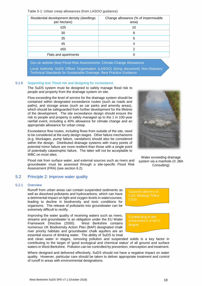
5.1.5 Supporting text: Climate change and urban creep allowances
West Berkshire Council expects SuDS designs to allow for a 40% uplift for climate change. This is based on the Government’s ‘upper end’ estimate of rainfall intensity for the 2080s. Where developments have a short to medium-term design horizon, the allowance may be lowered to the 2050s estimate (20%), however this will be decided by WBC on a case-by-case basis.
‘Urban creep’ is the increase in runoff rate that may occur due to an increase in impermeable area draining to the SuDS system over time without planning permission being required (e.g. permitted development such as construction of patios, conservatories, small extensions etc). The potential for urban creep will vary with the density of the original development, and this should be allowed for in design calculations using Table 5-1.
CIRIA (2015) The SuDS Manual (C753) - Chapter 3: Designing for water quantity
Defra (2015) Non-statutory Technical Standards for Sustainable Drainage Systems
CIRIA (2015) The SuDS Manual (C753) - Chapter 24: Hydrology and hydraulics: design methods and calculations. Table 24.1 for a summary of methods.
Environment Agency (2012) Estimating flood peaks and hydrographs for small catchments: Phase 1 (SC090031/S)
CIRIA Susdrain website
UK Sustainable Drainage Guidance and Tools website
West Berkshire SuDS SPD v7.1 (October 2018) 18
Table 5-1: Urban creep allowances (from LASOO guidance)
Residential development density (dwellings per hectare)
Change allowance (% of impermeable area)
≤25 10
30 8
35 6
45 4
≥50 2
Flats and apartments 0
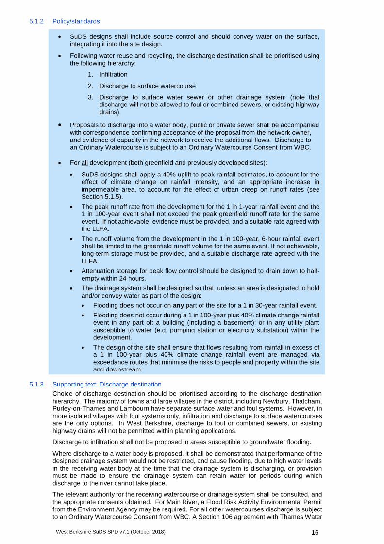
5.1.6 Supporting text: Flood risk and designing for exceedance
The SuDS system must be designed to safely manage flood risk to people and property from the drainage system on site.
Flow exceeding the level of service for the drainage system should be contained within designated exceedance routes (such as roads and paths), and storage areas (such as car parks and amenity areas), which should be safeguarded from further development for the lifetime of the development. The site exceedance design should ensure the risk to people and property is safely managed up to the 1 in 100-year rainfall event, including a 40% allowance for climate change and an appropriate allowance for urban creep.
Exceedance flow routes, including flows from outside of the site, need to be considered at the early design stages. Other failure mechanisms (e.g. blockages, pump failure, vandalism) should also be considered within the design. Distributed drainage systems with many points of potential minor failure are more resilient than those with a single point of potentially catastrophic failure. The latter will not be acceptable to WBC on most sites.
Flood risk from surface water, and external sources such as rivers and groundwater must be assessed through a site-specific Flood Risk Assessment (FRA) (see section 6.2).
5.2 Principle 2: Improve water quality
5.2.1 Overview
Runoff from urban areas can contain suspended sediments as well as dissolved pollutants and hydrocarbons, which can have a detrimental impact on light and oxygen levels in watercourses, leading to decline in biodiversity and toxic conditions for organisms. The release of pollutants into groundwater can be extremely difficult to rectify.
Improving the water quality of receiving waters such as rivers, streams and groundwater is an obligation under the EU Water Framework Directive (2000). West Berkshire contains numerous UK Biodiversity Action Plan (BAP) designated chalk river priority habitats and groundwater chalk aquifers are an essential source of drinking water. The ability of SuDS to treat and clean water in stages, removing pollution and suspended solids is a key factor in contributing to the target of 'good ecological and chemical status' of all ground and surface waters in West Berkshire. Pollution can be controlled by prevention, interception and treatment.
Where designed and delivered effectively, SuDS should not have a negative impact on water quality. However, particular care should be taken to deliver appropriate treatment and control of runoff in areas with environmental designations.
Supports delivery of: Core Strategy Policy CS16
Contributing to the achievement of WFD targets
Water exceeding drainage system via a manhole (© JBA
Consulting)
Gov.uk website (live) Flood Risk Assessments: Climate Change Allowances
Local Authority SuDS Officer Organisation (LASOO) (living document) Non-Statutory Technical Standards for Sustainable Drainage: Best Practice Guidance
West Berkshire SuDS SPD v7.1 (October 2018) 19
5.2.2 Policy/standards
5.2.3 Supporting text: Interception
Runoff from small frequent events (those of less than 5mm total rainfall) constitutes the majority of annual runoff events and therefore convey the majority of the annual pollutant load to the receiving water course. Key to reducing pollution in rivers is therefore preventing any runoff from sites from the first 5mm for the majority of rainfall events, for example by using interception type SuDS such as rainwater capture and reuse, bioretention areas, green roofs, infiltration SuDS and pervious surfaces.
5.2.4 Supporting text: Water quality treatment
Interception is the primary defence against chronic polluting effects of developments, but designing SuDS to treat runoff is also important. Management of runoff water quality can be achieved through using SuDS components in series (this is termed a ‘management train’) promoting processes such as sedimentation, filtration, and biodegradation. Slow velocities and long retention times can increase the effectiveness of these processes.
The treatment train concept is a robust approach which allows chronic or diffuse urban pollution to be treated at each stage, gradually improving water quality as it travels through the system. The SuDS Manual offers an index method for designing the treatment train. Unlike a conventional system, SuDS design should ensure that if one part of the system is not functioning fully, the other components still provide attenuation and water treatment, making the system more resilient. Each stage provides a buffer for pollution incidents such as accidental spills/leaks. Additional controls such as oil separators may be needed in certain situations (e.g. garage forecourts, coach and lorry parks/turning areas), but are discouraged as a standard SuDS measure.
Particular attention will need to be given to water quality where receiving surface waters or groundwater are environmentally sensitive (see Section 6.3.2). West Berkshire will seek to work with Natural England to ensure that water quality and biodiversity in areas with environmental designations is protected.
5.3 Principle 3: Promote and encourage biodiversity
5.3.1 Overview
Biodiversity is an essential part of sustainable development. It describes the diversity of species, the genetic variability of each species, and the different habitats that they form. Under national and local legislation and policy, LPAs have a responsibility to protect and enhance biodiversity. Many SuDS features can provide biodiversity benefits, either on their own or as part of wider green infrastructure. This contributes to rural/urban habitat connectivity, ecosystem resilience and achieving the aims of the Berkshire Biodiversity Strategy.
CIRIA (2015) The SuDS Manual (C753) - Chapter 26: Water quality management: Design methods
CIRIA (2015) The SuDS Manual (C753) - Chapter 4: Designing for water quality
Supports Conservation of Habitats and Species Regulations (2017) and Wildlife and Countryside Act (1981) (as amended)
• The drainage system shall prevent runoff from leaving the site during interception events (<5mm rainfall).
• A SuDS treatment train approach shall be followed to ensure that runoff is treated to an acceptable standard before entering the receiving water body. Designs must demonstrate that they are:
• Managing runoff close to the source
• Treating runoff on the surface
• Treating runoff to remove a range of contaminants
• Minimising risk of sediment re-mobilisation
• Minimising impact of accidental spills.
Supports delivery of: Core Strategy Policy CS14, 16, 17 and 18 NPPF Section 11
West Berkshire SuDS SPD v7.1 (October 2018) 20
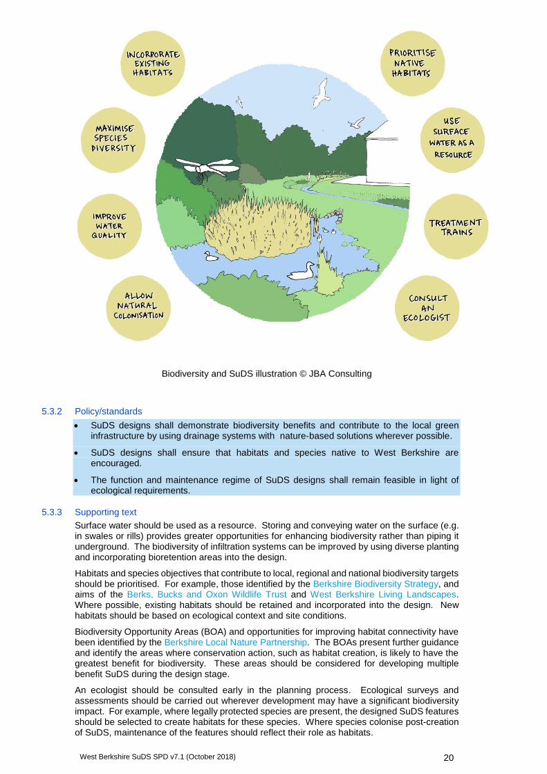
Biodiversity and SuDS illustration © JBA Consulting
5.3.2 Policy/standards
• SuDS designs shall demonstrate biodiversity benefits and contribute to the local green infrastructure by using drainage systems with nature-based solutions wherever possible.
• SuDS designs shall ensure that habitats and species native to West Berkshire are encouraged.
• The function and maintenance regime of SuDS designs shall remain feasible in light of ecological requirements.
5.3.3 Supporting text
Surface water should be used as a resource. Storing and conveying water on the surface (e.g. in swales or rills) provides greater opportunities for enhancing biodiversity rather than piping it underground. The biodiversity of infiltration systems can be improved by using diverse planting and incorporating bioretention areas into the design.
Habitats and species objectives that contribute to local, regional and national biodiversity targets should be prioritised. For example, those identified by the Berkshire Biodiversity Strategy, and aims of the Berks, Bucks and Oxon Wildlife Trust and West Berkshire Living Landscapes. Where possible, existing habitats should be retained and incorporated into the design. New habitats should be based on ecological context and site conditions.
Biodiversity Opportunity Areas (BOA) and opportunities for improving habitat connectivity have been identified by the Berkshire Local Nature Partnership. The BOAs present further guidance and identify the areas where conservation action, such as habitat creation, is likely to have the greatest benefit for biodiversity. These areas should be considered for developing multiple benefit SuDS during the design stage.
An ecologist should be consulted early in the planning process. Ecological surveys and assessments should be carried out wherever development may have a significant biodiversity impact. For example, where legally protected species are present, the designed SuDS features should be selected to create habitats for these species. Where species colonise post-creation of SuDS, maintenance of the features should reflect their role as habitats.

West Berkshire SuDS SPD v7.1 (October 2018) 21
5.4 Principle 4: Enhance the landscape and historic environment
5.4.1 Overview
Integrating SuDS into the landscape enhances the attractiveness and amenity value of a development scheme and the visual quality of an area. They improve access to open green space and ensure consideration of site layout, user interaction, and selection of appropriate planting and soft landscaping.
SuDS can also help to conserve existing cultural, historical and landscape features, for example through reinstating historic water meadows, or integrating a historic monument sympathetically into the open space.
5.4.2 Policy/standards
5.4.3 Supporting text
A site assessment should be carried out to identify key environmental features on site and in the local area, including landscape character and heritage assets, and integrate them into the development.
A landscape architect (and where heritage assets on or near the site may be affected, a heritage specialist) should be consulted early in the planning process in order to have a fully integrated SuDS scheme that combines landform, hard and soft detailing and provides landscape, amenity and, where possible, heritage benefits.
Site constraints and opportunities should be identified including scale, topography within and outside the site, soils, aspect, landscape features, existing vegetation and how ground levels relate to the proposed development. The design should consider the intended use of the site, including access and circulation, and how hard and soft solutions can be appropriately integrated.
5.5 Principle 5: Engage and benefit the local community
5.5.1 Overview
SuDS help create places that support local communities and are sustainable, attractive and useful for people to live in. They can improve community cohesion, crime reduction, education, investment, recreation, health and well-being. This overlaps with many biodiversity, landscape and amenity benefits.
Supports delivery of: Core Strategy Policy CS14, 18 and 19 Quality Design SPD (2006) Part 2: Residential development
CIRIA (2015) The SuDS Manual (C753) - Chapter 5: Designing for amenity
Delivery of Core Strategy Policy CS14 Quality Design SPD (2006) Part 2: Residential development Supports Health and Wellbeing Strategy 2015-2018
CIRIA (2015) The SuDS Manual (C753) - Chapter 5: Designing for Amenity
CIRIA (2015) The SuDS Manual (C753) - Chapter 29: Landscape
CIRIA (2015) The SuDS Manual (C753) - Chapter 6: Designing for Biodiversity
CIRIA (2015) The SuDS Manual (C753) - Chapter 29: Landscape
RSPB/WWT (2012) Sustainable Drainage Systems: Maximising the potential for people and wildlife. A guide for local authorities and developers
Freshwater Habitats Trust (live) Pond Creation Toolkit website
CIRIA (2011) Delivering biodiversity benefits through green infrastructure (C711)
• SuDS shall be designed to enhance the local landscape and historic environment, by integrating water and heritage features into the site landscape design.

West Berkshire SuDS SPD v7.1 (October 2018) 22
5.5.2 Policy/standards
• Developers shall have suitable engagement with new and existing communities to explain the benefits and responsibilities of SuDS, appropriate to the scale of the development.
• Opportunities shall be taken to promote education, recreation, health and well-being through SuDS.
• All water features shall demonstrate that the risk of drowning has been assessed, and all reasonable measures have been taken to minimise the risk.
5.5.3 Supporting text: Community engagement
It is important to engage the community from the outset. Community buy-in and ownership of a SuDS scheme will encourage understanding of the benefits to householders, and help to identify and manage any concerns or objections to the scheme. Involvement of the community in the design process and maintenance of SuDS will help to create a shared responsibility and pride for the scheme in the longer term.
SuDS can bring a number of economic benefits to a community, as a by-product of improvements in visual attractiveness and provision of amenity, including: increasing property and land values; improving economic investment within the local area; and increasing employment productivity due to the high-quality working environment.
Once a scheme is in place, well-placed signage can help to explain the function of the feature and ensure continued community understanding. For major developments, information about SuDS, their benefits and any resident responsibilities should be included in a new resident’s pack.
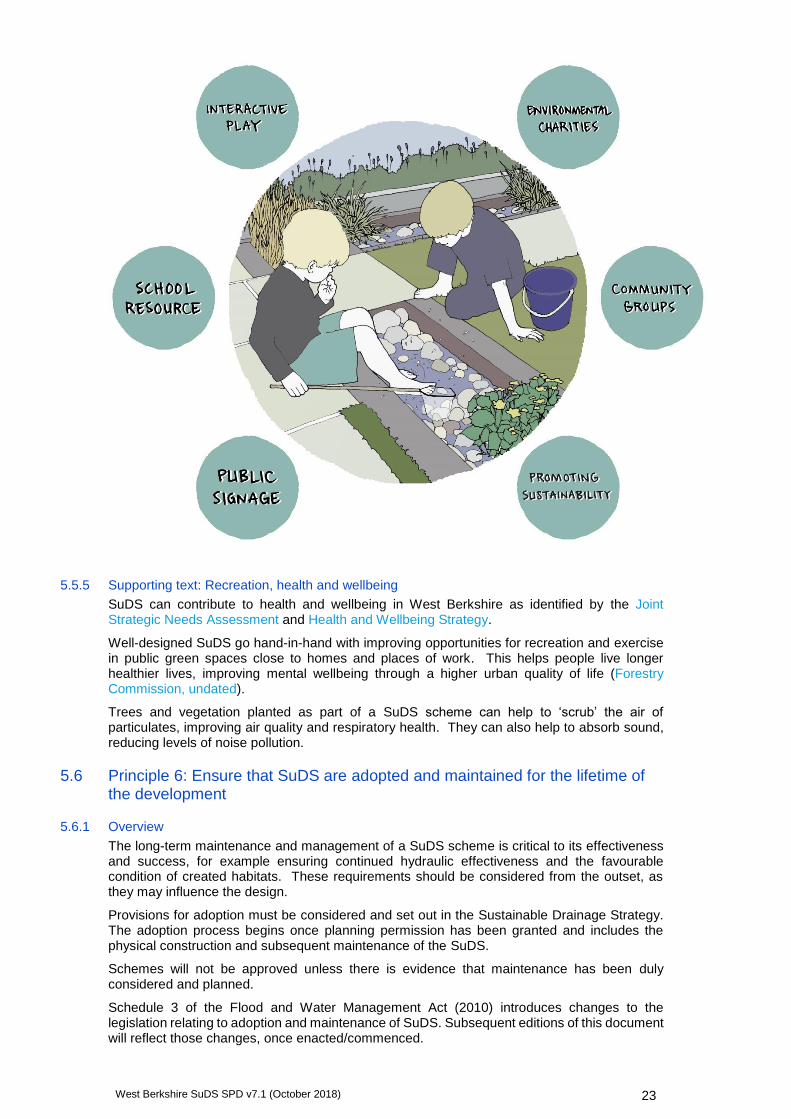
5.5.4 Supporting text: Education and play
Opportunities should be taken to promote the use of SuDS for environmental learning, either formally as a school resource, or more informally through the work of community or environmental organisations/charities.
SuDS in public spaces or schools can be purposefully designed to serve as an educational resource, e.g. for pond dipping, and provide opportunities to interact with water in playgrounds.
CIRIA (2013) The SuDS Manual Update (RP992): Health and safety principles for SuDS: framework and checklists.
CIRIA (2015) The SuDS Manual (C753) - Chapter 34: Community engagement
CIRIA (2015) Communication and engagement in local flood risk management (C751) and companion guide (C752)
CIRIA (2015) The SuDS Manual (C753) - Chapter 36: Health and Safety
London Play (2010) Play with rainwater and SuDS
West Berkshire SuDS SPD v7.1 (October 2018) 23
5.5.5 Supporting text: Recreation, health and wellbeing
SuDS can contribute to health and wellbeing in West Berkshire as identified by the Joint Strategic Needs Assessment and Health and Wellbeing Strategy.
Well-designed SuDS go hand-in-hand with improving opportunities for recreation and exercise in public green spaces close to homes and places of work. This helps people live longer healthier lives, improving mental wellbeing through a higher urban quality of life (Forestry Commission, undated).
Trees and vegetation planted as part of a SuDS scheme can help to ‘scrub’ the air of particulates, improving air quality and respiratory health. They can also help to absorb sound, reducing levels of noise pollution.
5.6 Principle 6: Ensure that SuDS are adopted and maintained for the lifetime of the development
5.6.1 Overview
The long-term maintenance and management of a SuDS scheme is critical to its effectiveness and success, for example ensuring continued hydraulic effectiveness and the favourable condition of created habitats. These requirements should be considered from the outset, as they may influence the design.
Provisions for adoption must be considered and set out in the Sustainable Drainage Strategy. The adoption process begins once planning permission has been granted and includes the physical construction and subsequent maintenance of the SuDS.
Schemes will not be approved unless there is evidence that maintenance has been duly considered and planned.
Schedule 3 of the Flood and Water Management Act (2010) introduces changes to the legislation relating to adoption and maintenance of SuDS. Subsequent editions of this document will reflect those changes, once enacted/commenced.
Children playing in SuDS illustration (© JBA Consulting)
West Berkshire SuDS SPD v7.1 (October 2018) 24
5.6.2 Policy/standards
• SuDS designs shall be low-maintenance. Pumping should not be used unless draining water by gravity is not reasonably practicable.
• SuDS designs shall be robust and resilient, with a range of management train components used to ensure no single point of failure.
• Plans for adoption and a Maintenance Plan detailing the operation, monitoring and maintenance of the drainage systems for the life of the development shall be provided with all SuDS designs.
5.6.3 Supporting text: Adoption
The developer may arrange for adoption and maintenance to be undertaken by one of the following parties, where appropriate:
West Berkshire Council - only adopt appropriate SuDS serving public highways, and those located on public open spaces to be maintained by the Council.
Thames Water - may adopt private surface water drainage and drainage within the Adoptable Highway.
Service management companies.
Private ownership - SuDS on private property will remain the responsibility of the owner or tenant.
Where the SuDS are adopted by residents, provision should be made to ensure that they and future residents are aware of this responsibility, and that SuDS designs do not place an unreasonable burden on residents, where possible.
5.6.4 Supporting text: Adopted highways
Designing highway drainage for adoption requires early consultation with WBC, as the Highway Authority. Following consultation, WBC may adopt SuDS which directly drain the road network under a Section 38 Agreement (Highways Act, 1980) with the following considerations:
SuDS proposed for adoption must be designed and built to current CIRIA SuDS Manual design standards.
The preferred SuDS components for highways are roadside swales.
Permeable paving can be adopted if demonstrated that the carriageway can be practically reconstructed whilst maintaining access for residents and emergency vehicles. This will be considered on a case-by-case basis.
No private drainage will be allowed to discharge into adopted highway drains.
Soakage crates will not be accepted under roads or footways.
No discharge will be allowed into foul or combined sewers and existing highway drains.
Thames Water may adopt surface water sewer attenuation components (e.g. oversized pipes) within the Adoptable Highway, under Section 104 of the Water Industry Act (1991), a separate process to highways drainage adoption. However, they do not currently adopt ‘soft’ SuDS (e.g. swales) or engineered SuDS components (e.g. crate storage) in West Berkshire.
5.6.5 Supporting text: Maintenance
It is the responsibility of the developer to establish a maintenance agreement that ensures the drainage system functions as designed for the lifetime of the development. It is likely to be, but not necessarily, the same organisation which adopts the SuDS. This maintenance may be undertaken by any of the following bodies:
Service management companies
Individuals (site owners or residents)
West Berkshire Council - will only maintain SuDS which they have adopted
Water and sewerage companies - can maintain SuDS they have adopted.
CIRIA (2015) The SuDS Manual (C753) - Chapter 9: Designing SuDS for Roads and Highways
SuDS Working Party (2009) SuDS for Roads

West Berkshire SuDS SPD v7.1 (October 2018) 25
What does maintenance of SuDS involve?
The condition and performance of SuDS features can alter over time, and adaptive
maintenance regimes may be required to ensure the drainage system continues to function as
designed.
Maintenance records, including repairs and replacement should be retained for the entire life
of the development, and made available at the request of the Lead Local Flood Authority.
Waste management
Disposal of waste such as litter, sediment, contaminants and vegetation from SuDS maintenance must be in accordance with the latest regulations and legislation.
SuDS Maintenance Plan
Different levels of detail will be required at Outline and Full application stage (see Sustainable Drainage Strategy validation checklists), but the maintenance plan should address the following questions:
How will the SuDS system and components work?
Which parts of the system are critical to the operation of the SuDS management train?
Who will undertake the maintenance?
What tasks will be required and how often?
How will SuDS be monitored and maintained for the lifetime of the development?
What are the access provisions for maintenance personnel and machinery?
What are the potential failure mechanisms and how are these to be managed and minimised?
What are the long-term costs and sustainability of the maintenance regime?
How will waste disposal (litter, vegetation, sediment) be managed in accordance with legislation?
Are there opportunities to involve the local community in maintenance?
How will created habitats be maintained in favourable condition (e.g. cutting grassland swards for maximum diversity and timing of silt removal and vegetation cutting) without damaging the habitat or ecological balance?
Should the maintenance regime change over time as habitats mature?
Regular maintenance
(Daily or monthly activities)
• Inspections and reporting
•Litter and debris removal
•Grass cutting, weed and invasive plant control, shrub management
•Sweeping pervious surfaces
•Oil removal/cleaning and replacing filters in proprietary systems
Occasional maintenance
(Frequency determined for each site)
•Sediment removal
•Vegetation and plant replacement
Remedial maintenance
•Structure rehabilitation and repair
•Pervious surface rehabilitation and repair
•Scarifying, spiking or air pressure treatment to increase infiltration capacity
CIRIA (2015) The SuDS Manual (C753) - Chapter 32: Operation and Maintenance
CIRIA (2015) The SuDS Manual (C753) - Chapter 33: Waste management
Gov.uk website (live) Waste legislation and guidance
West Berkshire SuDS SPD v7.1 (October 2018) 26
5.7 Principle 7: Adopt good practice in construction of SuDS
5.7.1 Overview
Good practice in the construction of SuDS is well-documented by existing guidance and should be followed in West Berkshire.
5.7.2 Policy/standards
The current technical standards for SuDS construction set out in Defra's Non-Statutory Technical Standards for Sustainable Drainage Systems (2015) are minimum standards for West Berkshire.
• All materials specified within the SuDS design shall be of a suitable nature and quality for their intended use.
• SuDS components shall be designed to ensure structural integrity of the drainage system and adjacent structures over the design life of the development.
• The construction of any drainage connection shall not adversely affect the structural integrity and functionality of the existing sewer or drainage system. Any damages caused shall be rectified before the drainage system is completed.
• Temporary measures shall be agreed prior to the construction phase to ensure that flooding to the site and surrounding area does not occur prior to completion of the drainage system, and downstream pollution is avoided.
5.7.3 Supporting text
Prior to commencing construction, the CIRIA Guidance on the construction of SuDS should be consulted, to determine the general and SuDS component-specific requirements to be considered during construction.
Several construction factors influence the phasing of SuDS within larger development sites. As best practice, the drainage system should be completed and in good condition while the rest of the site works are underway. However, damage and erosion of SuDS components are key considerations, and in some cases, temporary drainage solutions are required during the site construction phases.
Particular issues relating to construction of SuDS include:
Programming may be different from conventional drainage systems
Access and storage areas – permeable pavements should be constructed at the end of the project to avoid degradation by construction activities
Erosion and sediment control – in particular stabilising SuDS vegetation and protecting components from silt-laden construction runoff
Maintaining good soil quality and structure
Education of construction workers about the function of SuDS
Protection of infiltration areas from compaction by site traffic
Landscaping – consideration of soils and planting schemes
A construction method statement should be submitted with a full planning application.
5.8 Principle 8: Promote SuDS retro-fitting
5.8.1 Overview
Redevelopment and renovation of existing buildings can present many opportunities to retro-fit SuDS. The benefits of retro-fit SuDS can be similar to those in new developments, but may also include opportunities to improve existing drainage, reduce surface water flood risk in towns and villages and address existing water quality issues.
Delivery of Core Strategy Policy CS15
CIRIA (2017) Guidance on the construction of SuDS (C768)
CIRIA (2015) The SuDS Manual (C753) - Chapter 31: Construction
CIRIA (2007) Site Handbook for the Construction of SuDS (C698)

West Berkshire SuDS SPD v7.1 (October 2018) 27
5.8.2 Policy/standard
Opportunities shall be taken to retro-fit SuDS into the redevelopment and renovation of existing buildings or sites.
5.8.3 Supporting text
Opportunities to retro-fit SuDS are most likely to be realised when they are considered early in any redevelopment or renovation plans. This may require close co-operation between developers, planners and risk management authorities, and could involve joint-funding. For example, retro-fitting a public area upstream of a development site could help to manage surface water runoff entering the site and enhance the existing neighbouring street-scene.
Redevelopments and refurbishments
When planning redevelopment or refurbishment which will not significantly change a site layout, consider opportunities to:
Remove existing surface water connections from foul or combined sewers. This can also enable capacity within the foul or combined sewers to allow additional foul flows;
Replace old, impermeably paved surfaces with permeable paving surfaces or connect them to new filter drains or bio-retention areas as part of re-landscaping;
Where front gardens are being converted for parking, use features such as pervious paving and raingardens to provide parking space without causing additional runoff onto the road.
6 Choosing the right SuDS
6.1 Introduction
SuDS can be implemented on any development site. Certain site conditions may require adjustments to design or the type of components used, but even the most challenging sites must integrate SuDS in some form. Development proposals will be regarded favourably for maximising benefits and including multi-use features, not just focussing on water quantity.
The following sections provide guidance on the most commonly raised site constraints and demonstrate how they can be overcome with good planning and design.
6.2 Flood risk
Flood risk can come from various sources: fluvial (river) flooding, pluvial (surface water) flooding, sewer systems and high groundwater levels. Despite the challenges which flooding can cause for development, it can also provide opportunities. Understanding the causes and impacts of flooding on a site can allow natural flow paths and flood extents to be harnessed and incorporated into the design.
Details of the relative flood risk across the district can be found within the West Berkshire Level 1 Strategic Flood Risk Assessment (2018).
6.2.1 Fluvial flood risk
Advice should be sought from the Environment Agency regarding fluvial flood risk on Main Rivers, and from the LLFA for fluvial risk from Ordinary Watercourses. A Flood Risk Assessment should be completed where necessary to ensure that the site is safe and does not increase flood risk elsewhere (e.g. compensation for loss of floodplain storage).
The National Planning Policy Framework (NPPF) and West Berkshire Level 1 Strategic Flood Risk Assessment (SFRA) provide full details of managing flood risk within development. The West Berkshire Level 1 SFRA also outlines the criteria for sites requiring a site-specific Flood Risk Assessment (FRA).
SuDS design considerations:
CIRIA (2012) Retro-fitting to manage surface water (C713)
A retro-fit opportunity for raingardens on a residential
street (© JBA Consulting)

West Berkshire SuDS SPD v7.1 (October 2018) 28
Storage for runoff from the development in extreme events should be located out of the floodplain.
Floodplain areas can provide treatment for more frequent events, as long as floodplain capacity is not reduced. The effects of modelled fluvial water levels, frequency, duration and velocities on performance of SuDS components, and the risk of damage by erosion should be considered.
Design for a high groundwater table.
Consider maintenance implications of silt deposition from a flood event.
Design attenuation SuDS with a sufficient drain-down time (to half-empty within 24 hours) following a storm event to allow for it to receive runoff from subsequent events.
6.2.2 Surface water and ordinary watercourse flood risk
Advice should be sought from WBC regarding flood risk from surface water and Ordinary Watercourses. Surface water flood risk may be identified using the Environment Agency Risk of Flooding from Surface Water map and the Critical Drainage Areas (CDAs) designated by WBC within the SFRA. Flood risk from ordinary watercourses not shown in the Environment Agency Flood Zones map may also be indicated by this surface water mapping.
The identification of local surface water flood risk should not be a constraint, as well-designed SuDS can improve flood risk both on and off the site.
SuDS design considerations:
Assess and design for additional surface water flows and volumes entering the site.
Design for natural drainage pathways - existing surface water flow routes should be identified and integrated into the exceedance design for the site.
Communication and collaboration with neighbouring land owners and stakeholders.
6.3 Groundwater
6.3.1 High groundwater levels
Site investigations, informed by local flooding incidents and WBC flood reports, should be undertaken to identify if the site is prone to high groundwater levels. Infiltration testing and groundwater monitoring should be undertaken throughout the winter months, and should take account of the wetness of that winter and also historic groundwater levels. High groundwater levels during extreme wet periods may render infiltration SuDS ineffective and pose a direct pollution risk to groundwater. If levels are very high, groundwater may enter the SuDS feature and reduce the storage capacity and structural integrity of the design.
SuDS design considerations:
The base of an infiltration system should be located at least 1m above the likely maximum water table. Groundwater quality protection must be considered for infiltration SuDS where the seasonal water table is high.
Avoid locating below-ground features such as tanks below the maximum groundwater level, as pressure loads are likely to be high.
Shallow surface features such as swales, ponds and permeable pavements can be lined with an impermeable layer to isolate SuDS from groundwater.
A groundwater flood risk map is available in Appendix D of the West Berkshire Level 1 SFRA (2018), advice should be sought from the LLFA regarding areas at risk. On-site ground investigations are required prior to the design and construction of infiltration SuDS or deep storage features.
Gov.uk (website) Flood Risk for Planning Applications
CIRIA (2015) The SuDS Manual (C753) - Chapter 8: Designing for specific site conditions
CIRIA (2015) The SuDS Manual (C753) - Chapter 8: Designing for specific site conditions
CIRIA (2015) The SuDS Manual (C753) - Chapter 8: Designing for specific site conditions
Environment Agency (2017) The Environment Agency’s approach to groundwater protection - Position Statements G10, G13 and N10.
West Berkshire SuDS SPD v7.1 (October 2018) 29
6.3.2 Discharges to groundwater and Source Protection Zones (SPZ)
The quality of discharges to groundwater are regulated by the Environment Agency. The document ‘The Environment Agency’s approach to groundwater protection’ gives details of their position statements, and supports the use of a SuDS management train approach.
SPZs are designated to protect drinking water supply aquifers from pollution. For development in an SPZ1 which proposes infiltration SuDS for anything other than clean roof drainage, the Environment Agency will require a risk assessment to demonstrate that pollution of groundwater will not occur. There are 16 SPZ1s in West Berkshire.
The Source Protection Zone map can be found at http://www.natureonthemap.naturalengland.org.uk/MagicMap.aspx.
SuDS design considerations:
Shallow surface features such as basins, swales, ponds and permeable paving can be lined with an impermeable layer to prevent infiltration.
Provision of additional treatment stages or proprietary treatment systems to improve water quality before infiltration.
6.4 Receiving surface waters
When planning a new outfall to a watercourse, or works to the bed or banks of a channel, a consent will be required.
Works within 8m of a designated Main River will require a Flood Risk Activity Permit from the Environment Agency https://www.gov.uk/guidance/flood-risk-activities-environmental-permits.
For all other watercourses, an Ordinary Watercourse Consent may be required from WBC as the Land Drainage Authority. Approval will be dependent on the impacts on adjacent land owners and future maintenance of the watercourse.
For inland canals and navigable watercourses, the Canal and River Trust will consider discharge of uncontaminated surface water at suitable locations, although in the majority of situations, there is no obligation to accept discharges. The Trust undertakes a staged process to review the impact of all new or modified discharges to its network, in addition to any considerations that are made by the Environment Agency and/or the Local Planning Authority via the normal planning process. https://canalrivertrust.org.uk/media/library/4505.pdf
An Environmental Permit is not currently required to discharge uncontaminated runoff from public roads and small parking areas to surface water bodies, if it has been treated by a SuDS system.
SuDS design considerations:
Provision of additional treatment stages or proprietary treatment systems to improve water quality.
6.5 Topography
6.5.1 Flat site
SuDS generally rely on gravity to transfer water around the site and meet outlet levels without being affected by downstream water levels, meaning flat sites can be problematic.
SuDS design considerations:
Green roofs, rainwater capture and reuse and permeable paving can be used as normal on flat sites
Keep water on the surface and use conveyance methods of kerbs, shallow rills and swales.
Design should be based on small sub-catchments with storage and conveyance managed close to source. Hydraulic head will build up locally and push water out of the system.
Pumped systems should only be used as a last resort where maintenance can be guaranteed.
Environment Agency (2017) The Environment Agency’s approach to groundwater protection.

West Berkshire SuDS SPD v7.1 (October 2018) 30
6.5.2 Steep site
Steep slopes (>5%) can generate high flow velocities and pose problems of water by-passing drainage features, scour, erosion and in severe cases health and safety issues. Permeable paving becomes ineffective on steep gradients, and infiltrated water can re-emerge further downslope, causing slope instability.
SuDS design considerations:
Green roofs, rainwater capture and reuse can be used as normal on steep sites.
Features such as permeable paving, bioretention areas, swales and wetland can be terraced or designed to follow contours.
Design should be based on small sub-catchments with storage and conveyance managed close to source.
Erosion protection can be provided for steep conveyance features such as waterfalls, stones set into the bed of channels etc.
Check dams can be placed in swales to slow velocities.
Geotechnical investigations should be undertaken to make sure that infiltration will not cause instability.
6.6 Contaminated land
There are over 1300 potential contaminated sites in West Berkshire which have been prioritised by WBC in terms of the risk posed to humans and the wider environment (West Berkshire Council, 2014).
Water infiltrating through affected soils can mobilise contaminants and pose a pollution risk to groundwater. Excavation and disposal of contaminated soils is expensive, and SuDS may compromise remediation measures in place to protect residents from contamination. However contaminated land will not be accepted as a reason to exclude SuDS.
SuDS design considerations:
Green roofs and rainwater capture and reuse can be used as normal on contaminated sites
Seek early advice from a geo-environmental professional so that drainage design and remediation strategies for contamination can be integrated (e.g. capping layer can be extended beneath SuDS).
Suitability of infiltration systems will depend on testing the leaching potential of contaminants. Infiltration may be possible at depth, below the contaminated layer. Alternatively, contaminated soil around soakaways can be removed and replaced.
If infiltration is not possible, shallow surface features such as basins, swales, ponds and permeable pavements can be lined with an impermeable layer to prevent infiltration.
Materials should be assessed for durability when exposed to contaminants (as for any other construction material in this situation).
Use of shallow surface features can reduce the need to excavate contaminated ground.
6.7 Low permeability
Soils/geology with low permeability are often cited as a reason not to include SuDS, but in reality, almost all SuDS components can still be used, with some modifications.
SuDS design considerations:
All SuDS except infiltration systems can be used on low permeability sites. Above ground components should be used to provide the required attenuation and treatment.
Greenfield runoff rates tend to be high on low permeability geologies, so attenuation requirements should be more manageable.
Permeable paving may require an underdrain.
Infiltration may be possible at greater depth below a low permeability soil layer. The Environment Agency should be consulted on deep infiltration systems to ensure they will not have an adverse effect on groundwater.
CIRIA (2015) The SuDS Manual (C753) - Chapter 8: Designing for specific site conditions
CIRIA (2015) The SuDS Manual (C753) - Chapter 8: Designing for specific site conditions
CIRIA (2015) The SuDS Manual (C753) - Chapter 8: Designing for specific site conditions

West Berkshire SuDS SPD v7.1 (October 2018) 31
6.8 High permeability or unstable geology
Large areas of West Berkshire are underlain by chalk geology. There is a potential for infiltration systems to cause solution of chalk over time, leading to sink holes or settlement of foundations at infilled solution features.
SuDS design considerations:
Seek early advice from a geo-technical professional
Place infiltration features at sufficient distance from foundations.
6.9 Limited space
Brownfield developments may be restricted in terms of space or existing infrastructure. It may be perceived that site profitability will be reduced by the land-take associated with larger surface SuDS such as swales and ponds/wetlands.
There are a range of space-efficient SuDS techniques. Source control is a key concept, and opportunities can be maximised where strategic SuDS design is considered at an early stage and all available public and private space is utilised (e.g. verges, small pockets of grass or paving). Incorporating SuDS into landscaping can significantly enhance the amenity value of brownfield sites for residents. High density housing will not be accepted as a reason to exclude SuDS.
Design considerations:
Green roofs, rainwater capture and reuse, infiltration systems, permeable paving, bioretention areas, tree pits and micro-wetlands are all possible on space-restricted sites.
Non-trafficked paved areas can be made permeable (pavements/footpaths, parking).
Rills, channels and depressions can be built into the hardscape and planted to provide water features.
Swales, filter strips, ponds and large wetlands are less suitable.
Access to existing underground infrastructure, such as utilities, will need to be considered in the design.
6.10 Industrial sites / high pollution risk
Care must be taken when designing SuDS for some commercial and industrial sites, particularly where storage, handling or use of hazardous substances occurs (such as for example, garage forecourts, coach and lorry parks/turning areas and metal recycling/vehicle dismantling facilities).
Design considerations:
Runoff from ‘safe’ areas (e.g. roofs or car parks) should be separated and drained through SuDS.
SuDS such as swales, permeable paving and bioretention areas can be lined if there is a risk of contamination.
Runoff from areas with a high risk of contamination from hazardous substances should be separated, contained and dealt with as industrial waste.
Discharges of surface water run-off to ground at pollutant storage sites are likely to require an environmental permit from the Environment Agency. The site will be subject to risk assessment and provision of acceptable effluent treatment.
CIRIA (2015) The SuDS Manual (C753) - Chapter 8: Designing for specific site conditions
CIRIA (2002) Engineering in Chalk (C574)
“Opportunities for the creation of SuDS can be found in even the smallest of spaces, and a perceived lack of space is not a justifiable reason for not using SuDS” CIRIA SuDS Manual (2015) p.159
CIRIA (2015) The SuDS Manual (C753) - Chapter 10: Designing for the urban environment
Environment Agency (2017) The Environment Agency’s approach to groundwater protection.
West Berkshire SuDS SPD v7.1 (October 2018) 32
6.11 Protected habitats
There are large numbers of designated sites and watercourses in West Berkshire, and SuDS designers should be aware of their species and habitat needs.
Developments within an SSSI Impact Risk Zone should liaise with Natural England, as receiving waters are likely have environmental designations (SSSI, SAC etc.). SSSI Impact Risk Zones and all other environmental designation areas can be viewed on the Natural England website. The Local Planning Authority is required to consult Natural England within these areas.
6.12 Small/Minor developments
SuDS can and should be incorporated in all developments, including smaller developments and extensions/renovations.
Advice and information for smaller developments is available in this document and from WBC (see Minor Applications Sustainable Drainage Strategy validation checklist).
Much of the advice relating to space-restricted developments (see Section 6.9) can also be applied to minor development and renovations. There are opportunities to install source control SuDS in any small project:
Green roofs and trees can add biodiversity value on small areas (and can be used by the resident, for example for garden storage, if roof design allows).
Roof runoff can be routed through small SuDS features such as bioretention areas (also known as rain gardens), rills and micro-wetlands in the garden to slow runoff and provide biodiversity and amenity value before discharging to soakaway or surface water sewer.
Areas of hardstanding such as parking areas can be fitted with permeable paving or gravel to slow runoff and improve water quality.
6.13 Health and safety considerations
Designers have responsibilities under the Construction (Design and Maintenance) Regulations 2015 (CDM) to eliminate, reduce or control foreseeable risks during construction, maintenance and use of a structure.
As SuDS are no more hazardous than natural waterbodies, health and safety concerns are not accepted as a reason for their exclusion in development. Potential health and safety risks can be overcome through good SuDS design, and should be balanced against the benefits for health and well-being. Public perception of risk can be addressed through community engagement and education.
6.14 Affordability
The costs of SuDS are generally lower than conventional piped and tanked drainage (Defra, 2011). Where SuDS are integrated into the design at an early stage, they become part of the above-ground landscaping and building design, and there is less need for expensive hard-engineered solutions, such as over-sized pipes and underground storage.
Full lifetime costs should be taken into account. SuDS generally have low maintenance costs over their lifetime, with surface features like swales able to be maintained within landscape maintenance contracts. However, the costs of replacing/refurbishing permeable paving can be high.
The multiple benefits of SuDS should not be underestimated when assessing costs and benefits, as they can make SuDS schemes attractive to other organisations, who may be able to offer partnership funding opportunities and engage local communities.
SuDS design considerations:
Consider SuDS design at an early stage and consult with all stakeholders to identify funding opportunities.
Prioritise source control and surface systems to avoid hard-engineered and deep excavated solutions.
Choose low maintenance designs, which can be maintained under standard landscaping contracts.
CIRIA (2015) The SuDS Manual (C753) - Chapter 36: Health and Safety
CIRIA (2013) The SuDS Manual Update (RP992): Health and safety principles for SuDS: framework and checklists.
West Berkshire SuDS SPD v7.1 (October 2018) 33
Deal with waste on-site.
Involve the community in maintenance.
Fully assess the wider benefits when evaluating a SuDS scheme (e.g. CIRIA SuDS Manual Table 35.1, CIRIA B£ST Evaluation Tool)
7 Evaluation and approval SuDS designs are submitted, evaluated and approved through the planning system. The decision-making process and the roles of those involved are detailed below.
7.1 Responsibilities
Developer
Provides a brief to the designer
Arranges the future adoption and maintenance of SuDS
Designer
Undertakes master-planning, pre-application and application submission, including drainage designs.
Satisfies the needs of the developer but also meets the requirements of Council planning policy and the NPPF, following good practice.
Planners / SuDS Approving Officer
Receives and validates application using checklist
Passes application to consultees
Approves application
Approves future maintenance arrangements.
Statutory and non-statutory consultees
Consultation and advice on the planning application
7.2 How will the SuDS design be evaluated?
7.2.1 Evaluation
The checklists provided are designed to help applicants provide the required documents and evidence first time, ensuring a smooth progression through the planning process. Engaging in pre-application discussions, following the advice given and using the checklists will facilitate our evaluation at outline or full application stage.
The SuDS scheme will be evaluated against all relevant Council policies, SPDs and guidance using the appropriate checklist. Where the scheme does not meet any one of these requirements, an explanation will be required.
The evaluation will cover:
The provision of multiple benefits and meeting of other Council policy objectives.
The appropriateness of the scheme design and choice of management train components.
Performance against West Berkshire’s technical standards as outlined in this document.
Meeting requirements for adoption by WBC (if appropriate, e.g. highways and public spaces).
Provision of plans for future adoption and maintenance by other parties.
7.2.2 Consultation
Statutory consultees must be consulted where appropriate conditions apply, for example:
West Berkshire LLFA - Consult on SuDS design and flood risk from Ordinary Watercourses, surface water, groundwater. West Berkshire LLFA is a statutory consultee on surface water drainage proposals for all Major developments, including
CIRIA (2015) The SuDS Manual (C753) - Chapter 35: Costs and benefits
UK SuDS website costing tool www.uksuds.com/
CIRIA B£ST Evaluation Tool
West Berkshire SuDS SPD v7.1 (October 2018) 34
both greenfield and brownfield development (Department for Communities and Local Government (DCLG), 2014).
Environment Agency - Consult on flood risk within Flood Zones 2 and 3, discharge of surface water to Main Rivers, Critical Drainage Areas and infiltration in Source Protection Zones.
Highway Authority - Consult if SuDS will impact on adopted public highways or if discharge of surface water to highway drainage is proposed.
Natural England – Consult if the development is likely to impact on an environmentally designated site.
Canal and River Trust - Consult for direct advice during the preliminary design stages to determine whether the development is likely to impact on an inland waterway or Canal and River Trust assets.
Sewerage undertaker (Thames Water) – Consult if there is a proposal to discharge surface water into the public sewer network.
Whilst not compulsory, consultation with other organisations and groups is beneficial, to gain further understanding of the implications and considerations in planning for SuDS. Recommended non-statutory consultees include:
Berks, Bucks and Oxon Wildlife Trust (BBOWT)
River Kennet and Pang Catchment Partnership Groups
RSPB
Fisheries Trust
Local communities - Parish Councils, community flood groups etc.
7.2.3 Decision making
WBC as LLFA will assess the suitability of the proposed SuDS scheme. The decision will take into consideration the extent to which the Sustainable Drainage Strategy has complied with the requirements outlined in this SPD, along with current best practice and standards.
As LLFA, West Berkshire Council has a duty to ensure that development does not increase flood risk. It is therefore very unlikely that approval will be given to any applications that do not include SuDS, especially in areas susceptible to surface water and groundwater flooding.
Following the SuDS Checklist from an early stage should ensure that the proposal complies with our requirements.
7.2.4 Recording and registering SuDS
WBC will record all SuDS schemes on its asset register and may designate them as flood risk assets under the FWMA (2010). The importance of maintaining them must then be recorded on property deeds and maintenance plans. Once approved, the developer must provide the LLFA with the following for the purposes of registering the scheme:
As-built drawings of the SuDS scheme.
List and GIS shapefiles of adoptable SuDS
GIS layer showing the site boundary, geo-referenced to the Ordnance Survey British National Grid.
West Berkshire SuDS SPD v7.1 (October 2018) 35
References
Master Planning and Concept Design Cambridge Institute for Sustainability Leadership (2014) Planning Advice for Integrated Water Management.
https://www.cisl.cam.ac.uk/resources/publication-pdfs/natural-capital-leaders-platform-water-planning-ad.pdf
CIRIA (2010) Guidance on water cycle management for new developments (WaND) (C690)
http://www.ciria.org/ItemDetail?iProductCode=C690&Category=BOOK
CIRIA (2010) Planning for SuDS: Making it Happen (C687)
http://www.ciria.org/Resources/Free_publications/Planning_for_SuDS_ma.aspx
CIRIA (2013) Creating water sensitive places: scoping the potential for Water Sensitive Design in the UK (C724)
http://www.ciria.org/Resources/Free_publications/Creating_water_sens1.aspx
CIRIA (2013) Water sensitive urban design in the UK: Ideas for built environment practitioners.
http://www.ciria.org/Resources/Free_publications/Water_Sensitive_Urba.aspx
CIRIA (2015) BeST (Benefits of SuDS Tool) (W045)
https://www.ciria.org/Resources/Free_publications/New-tool-assesses-the-benefits-of-SuDS.aspx
Outline Design BSI Standards Publication (2013) Code of Practice for Surface Water Management for Development Sites (Section 5)
http://shop.bsigroup.com/en/ProductDetail/?pid=000000000030253266
CIRIA (1996) Infiltration drainage - manual of good practice (R156)
http://www.ciria.org/ItemDetail?iProductCode=R156&Category=BOOK
CIRIA (2001) Rainwater and greywater use in buildings: Best practice guidance (C539)
http://www.ciria.org/ItemDetail?iProductCode=C539&Category=BOOK&WebsiteKey=3f18c87a-d62b-4eca-8ef4-9b09309c1c91
CIRIA (2004) Sustainable Drainage Systems. Hydraulic, structural and water quality advice (C609B)
http://www.ciria.org/ItemDetail?iProductCode=C609D&Category=DOWNLOAD
CIRIA (2006) Designing for Exceedance in Urban Drainage: Good Practice (C635)
http://www.ciria.org/Resources/Free_publications/Designing_exceedance_drainage.aspx
CIRIA (2013) The SuDS Manual Update (RP992): Health and safety principles for SuDS: framework and checklists.
https://www.susdrain.org/files/resources/SuDS_manual_output/paper_rp992_17_health_and_safety_principles.pdf
CIRIA (2015) The SuDS Manual (C753) (Chapters 3, 4, 5, 6 and 25)
http://www.ciria.org/Memberships/The_SuDS_Manual_C753_Chapters.aspx
Defra (2015) Non-statutory Technical Standards for Sustainable Drainage Systems
https://www.gov.uk/government/uploads/system/uploads/attachment_data/file/415773/sustainable-drainage-technical-standards.pdf
Environment Agency (undated) Sustainable Drainage Systems: A Guide for Developers
http://www.rtpi.org.uk/media/12399/SuDS_a5_booklet_final_080408.pdf
Environment Agency (2012) Estimating flood peaks and hydrographs for small catchments: Phase 1. Project SC090031
http://nora.nerc.ac.uk/19604/4/SC090031_report.sflb.pdf
West Berkshire SuDS SPD v7.1 (October 2018) 36
HR Wallingford (2004) The Operation and Maintenance of Sustainable Drainage Systems (and Associated Costs) (SR 626)
http://eprints.hrwallingford.co.uk/982/1/SR626-Operation-maintenance-sustainable-drainage-systems.pdf
HR Wallingford (2004) Whole Life Costing for Sustainable Drainage (SR 627)
http://eprints.hrwallingford.co.uk/983/1/SR627-Whole-life-costing-sustainable-drainage.pdf
Hydro International (2011) A guide to SuDS in the urban landscape
http://www.hydro-int.com/UserFiles/Hydro_e-guide.pdf
Local Authority SuDS Officer Organisation (living document) Non-Statutory Technical Standards for Sustainable Drainage: Best Practice Guidance
http://www.lasoo.org.uk/?publications=non-statutory-technical-standards-for-sustainable-drainage
National SuDS Working Group (2004) Interim Code of Practice for Sustainable Drainage Systems.
http://www.susdrain.org/files/resources/other-guidance/nswg_icop_for_SuDS_0704.pdf
Susdrain website
http://www.susdrain.org/
Thames Water Utilities Limited (2012) Addendum to Sewers for Adoption 7th Edition Nov 2012.
http://www.thameswater.co.uk/tw/common/downloads/your-business-developer-services/tw-addendum-to-sewers-for-adoption-7th-edition.pdf
Detailed Design
Bray, B., Gedge, D. Grant, G, Leuthvilay, L. (2012) Rain Garden Guide
http://raingardens.info/wp-content/uploads/2012/07/UKRainGarden-Guide.pdf
CIRIA (2002) Source control using constructed pervious surfaces. Hydraulic, structural and water quality performance issues (C582)
http://www.ciria.org/ItemDetail?iProductCode=C582&Category=BOOK
CIRIA (2007) Building Greener: Guidance on the use of green roofs, green walls and complementary features on buildings (C644D)
http://www.ciria.org/ItemDetail?iProductCode=C644D&Category=DOWNLOAD
CIRIA website (live) Building Greener
http://www.ciria.com/buildinggreener/gr_introduction.htm
CIRIA (2008) Structural designs of modular geocellular drainage tanks (C680)
http://www.ciria.org/ItemDetail?iProductCode=C680&Category=BOOK
Department for Communities and Local Government (2009) Permeable surfacing of front gardens: guidance.
https://www.gov.uk/government/publications/permeable-surfacing-of-front-gardens-guidance
Interpave (2010) Permeable paving for adoption
http://www.paving.org.uk/commercial/permeable_paving_for_adoption.php
Interpave (2012) Planning with paving
http://www.paving.org.uk/commercial/planning_with_paving.php
Interpave (2012) Understanding permeable paving: Guidance for designers, developers, planners and local authorities. Edition 4
http://www.paving.org.uk/commercial/understanding_permeable_paving.php
Green Roof Organisation (2014) The GRO Green Roof Code: Green Roof Code of Best Practice for the UK 2014.
https://livingroofs.org/wp-content/uploads/2016/03/grocode2014.pdf
SEPA (2000) Ponds, pools and lochans: guidance on good practice in the management and creation of small waterbodies in Scotland
http://www.sepa.org.uk/media/151336/ponds_pools_lochans.pdf
West Berkshire SuDS SPD v7.1 (October 2018) 37
SuDS Working Party (2009) SuDS for Roads.
http://www.scotsnet.org.uk/assets/sudsforroads.pdf
SuDS Working Party (2012) SuDS for Roads Whole Life Costs Tool.
http://www.scotsnet.org.uk/documents/sudsforroads-wlc-and-wlcarbon-toolv117.xls
Construction CIRIA (2001) Control of water pollution from construction sites. Guidance for consultants and contractors(C532)
http://www.ciria.org/ItemDetail?iProductCode=C532
CIRIA (2002) Control of water pollution from construction sites – guide to good practice (SP156).
http://www.ciria.org/ItemDetail?iProductCode=SP156&Category=TP&WebsiteKey=3f18c87a-d62b-4eca-8ef4-9b09309c1c91
CIRIA (2006) Control of water pollution from linear construction projects. Site Guide (C649)
http://www.ciria.org/ItemDetail?iProductCode=C649&Category=BOOK&WebsiteKey=3f18c87a-d62b-4eca-8ef4-9b09309c1c91
CIRIA (2006) Control of water pollution from linear construction projects. Technical Guidance (C648)
http://www.ciria.org/ItemDetail?iProductCode=C648&Category=BOOK&WebsiteKey=3f18c87a-d62b-4eca-8ef4-9b09309c1c91
CIRIA (2007) Site handbook for the construction of SuDS (C698)
http://www.ciria.org/Resources/Free_publications/site_handbook_SuDS.aspx
CIRIA (2015) The SuDS Manual (C753): Chapter 21.
http://www.ciria.org/Memberships/The_SuDS_Manual_C753_Chapters.aspx
CIRIA (2015) The SuDS Manual C753 Update - Appendix B: Construction assessment checklist.
http://www.susdrain.org/resources/SuDS_Manual.html
CIRIA (2017) Guidance on the construction of SuDS (C768).
https://www.ciria.org/Resources/Free_publications/Guidance_on_the_construction_of_SuDS_-_C768.aspx
CIRIA RP992 The SuDS Manual Update: Paper RP992/22 Guidance of Construction Method Statements. http://www.susdrain.org/files/resources/SuDS_manual_output/paper_rp992_22_construction_method_statements_assessment_checklists.pdf
Environment Agency (2014) Interim Pollution Prevention Guidance for works at or near a watercourse.
https://www.gov.uk/government/collections/pollution-prevention-guidance-ppg
Adoption CIRIA (2015) The SuDS Manual C753 Update: Appendix B: SuDS adoption handover checklist.
http://www.susdrain.org/resources/SuDS_Manual.html
Operation and Maintenance CIRIA (2004) Model agreements for sustainable water management systems, model agreements for SuDS (C625)
http://www.ciria.org/ItemDetail?iProductCode=C625&Category=PHOTOCOPYCIRIA (2015)
The SuDS Manual (C753): Chapter 22 (and maintenance section of each SuDS component chapter).
http://www.ciria.org/Memberships/The_SuDS_Manual_C753_Chapters.aspx
CIRIA RP992 The SuDS Manual Update: Paper RP992/23 - Example of a SuDS Maintenance Plan http://www.susdrain.org/files/resources/SuDS_manual_output/paper_rp992_23_example_suds_maintenance_plan.pdf
West Berkshire SuDS SPD v7.1 (October 2018) 38
CIRIA RP992 The SuDS Manual Update: Paper RP992/23 - Guidance on the Maintenance Plan. http://www.susdrain.org/files/resources/SuDS_manual_output/paper_rp992_21_maintenance_plan_checklist.pdf
Water quality Environment Agency (2012) Kennet and Vale of White Horse Catchment Abstraction Licensing Strategy
https://www.gov.uk/government/publications/kennet-and-vale-of-white-horse-catchment-abstraction-licensing-strategy
Environment Agency (2013) Water Stressed Areas - Final Classification
https://www.gov.uk/government/uploads/system/uploads/attachment_data/file/244333/water-stressed-classification-2013.pdf
Environment Agency (2017) The Environment Agency’s approach to groundwater protection.
https://www.gov.uk/government/uploads/system/uploads/attachment_data/file/598778/LIT_7660.pdf
Biodiversity and landscape Berkshire Local Nature Partnership (2014) The Natural Environment in Berkshire: Biodiversity Strategy 2014-2020
http://berkshirelnp.org/images/Biodiversity%20Strategy%20Small.pdf
Berkshire Local Nature Partnership (live website) Biodiversity Opportunity Areas
http://www.berkshirelnp.org/index.php/what-we-do/strategy/biodiversity-opportunity-areas
Berkshire Local Nature Partnership (live website) Habitat Connectivity in Berkshire
http://berkshirelnp.org/index.php/what-we-do/advice-and-expertise/habitat-connectivity-in-berkshire
Berks, Bucks & Oxon Wildlife Trust (live website) West Berkshire Living Landscape
http://www.bbowt.org.uk/what-we-do/living-landscapes/west-berkshire-living-landscape
CIRIA (2011) Delivering biodiversity benefits through green infrastructure (C711)
http://www.ciria.org/ItemDetail?iProductCode=C711&Category=BOOK
Forestry Commission (2013) Air temperature regulation by trees and green infrastructure.
http://www.forestry.gov.uk/PDF/FCRN012.pdf/$FILE/FCRN012.pdf
Freshwater Habitats Trust (live) Pond Creation Toolkit website
http://freshwaterhabitats.org.uk/projects/million-ponds/pond-creation-toolkit/
Royal Horticultural Society (2017) Gardening in a Changing Climate.
https://www.rhs.org.uk/science/gardening-in-a-changing-world/climate-change
Amenity and public engagement CIRIA (2015) Communication and engagement in local flood risk management (C751) and companion guide (C752)
http://www.ciria.org/Resources/Free_publications/c751.aspx
Forestry Commission (undated) The Urban Forest: How trees and woodlands can improve our lives in towns and cities.
http://www.forestry.gov.uk/pdf/FCURBANFORESTA44PP.PDF/$FILE/FCURBANFORESTA44PP.PDF
London Play (2010) Play with rainwater and SuDS
http://www.londonplay.org.uk/resources/0000/1701/Sustainable_drainage_and_play_with_rainwater_low_res.pdf
RSPB/WWT (2012) Sustainable Drainage Systems: Maximising the potential for people and wildlife. A guide for local authorities and developers.
http://www.rspb.org.uk/Images/SuDS_report_final_tcm9-338064.pdf
Retro-fitting SuDS
West Berkshire SuDS SPD v7.1 (October 2018) 39
CIRIA (2012) Retro-fitting to manage surface water (C713)
http://www.ciria.org/Resources/Free_publications/Retro-fitting_manage_surface_water.aspx
Policy and Legislation Department for Communities and Local Government (2012) National Planning Policy Framework
https://www.gov.uk/government/uploads/system/uploads/attachment_data/file/6077/2116950.pdf
Department for Communities and Local Government (2014) Written Statement to Parliament: Sustainable Drainage Systems. Delivered on 18th December 2014.
https://www.gov.uk/government/speeches/sustainable-drainage-systems
Department for Communities and Local Government (2015) Planning Practice Guidance: Flood Risk and Coastal Change
http://planningguidance.planningportal.gov.uk/blog/guidance/flood-risk-and-coastal-change/
Department for Communities and Local Government (2015) Planning Practice Guidance: Natural Environment
http://planningguidance.communities.gov.uk/blog/guidance/natural-environment/
Department for Communities and Local Government (2016) Planning Practice Guidance: Housing - Optional Technical Standards.
http://planningguidance.communities.gov.uk/blog/guidance/housing-optional-technical-standards/
Defra (2009) Thames River Basin District River Basin Management Plan
https://www.gov.uk/government/publications/thames-river-basin-management-plan
Environment Agency (2009) River Thames Catchment Flood Management Plan: Summary document
https://www.gov.uk/government/publications/thames-catchment-flood-management-plan
Environment Agency (2016) Flood Risk Management Plan: Thames River Basin District Summary
https://www.gov.uk/government/uploads/system/uploads/attachment_data/file/507137/LIT_10228_THAMES_FRMP_SUMMARY_DOCUMENT.pdf
European Union (2000) Water Framework Directive (Directive 2000/60/EC of the European Parliament and of the Council of 23 October 2000 establishing a framework for Community action in the field of water policy)
http://ec.europa.eu/environment/water/water-framework/index_en.html
Gov.uk website (live) Flood Risk Assessment for Planning Applications
https://www.gov.uk/guidance/flood-risk-assessment-for-planning-applications
Gov.uk website (live) Flood Risk Assessments: Climate Change Allowances
https://www.gov.uk/guidance/flood-risk-assessments-climate-change-allowances
Gov.uk website (live) Waste legislation and guidance
https://www.gov.uk/guidance/waste-legislation-and-regulations
Health and Safety Executive (2015) Construction (Design and Maintenance) Regulations
http://www.hse.gov.uk/construction/cdm/2015/index.htm
HM Government (1981) Wildlife and Countryside Act
https://www.legislation.gov.uk/ukpga/1981/69
HM Government (2006) Natural Environment and Rural Communities Act
http://www.legislation.gov.uk/ukpga/2006/16/contents
HM Government (2010) The Building Regulations Part H: Drainage and Waste Disposal
http://www.planningportal.gov.uk/buildingregulations/approveddocuments/parth/approved#Download
HM Government (2010) Flood and Water Management Act
http://www.legislation.gov.uk/ukpga/2010/29/pdfs/ukpga_20100029_en.pdf
HM Government (2012) Health and Social Care Act
http://www.legislation.gov.uk/ukpga/2012/7/contents/enacted
West Berkshire SuDS SPD v7.1 (October 2018) 40
HM Government (2017) The Conservation of Habitats and Species Regulations
https://www.legislation.gov.uk/uksi/2017/1012/contents/made
Thames Water Utilities Limited (2014) Final Water Resource Management Plan 2015 to 2040
https://corporate.thameswater.co.uk/about-us/our-strategies-and-plans/water-resources/our-current-plan-wrmp14
UK Climate Projections (2009)
http://ukclimateprojections.metoffice.gov.uk/
UK Sustainable Drainage Guidance and Tools website
http://www.uksuds.com/
West Berkshire Council (2006) Quality Design – West Berkshire: Supplementary Planning Document Series (Parts 1 to 4).
http://info.westberks.gov.uk/index.aspx?articleid=28786
West Berkshire Council (2010) Preliminary Flood Risk Assessment
West Berkshire Council (2012) West Berkshire Core Strategy (2006-2026) Development Plan Document. Adopted July 2012.
http://info.westberks.gov.uk/index.aspx?articleid=28782
West Berkshire Council (2013) Local Flood Risk Management Strategy (2013-2017)
http://www.westberks.gov.uk/CHttpHandler.ashx?id=35213&p=0
West Berkshire Council (undated) Joint Strategic Needs Assessment
http://info.westberks.gov.uk/index.aspx?articleid=30214
West Berkshire Council (undated) Health and Wellbeing Strategy 2015-2018
http://info.westberks.gov.uk/CHttpHandler.ashx?id=33954&p=0
West Berkshire Council (2014) Contaminated Land Strategy (3rd Revision).
http://info.westberks.gov.uk/CHttpHandler.ashx?id=36586&p=0
West Berkshire Council (2008, 2009, 2015) Strategic Flood Risk Assessment Level 1, Level 2 and Level 1 Update.
http://info.westberks.gov.uk/index.aspx?articleid=29343

Minor Applications Sustainable Drainage Strategy validation checklist
1 Site details Site name Site location and coordinates Site description Total site area Greenfield/previously developed?
Existing impermeable area Proposed impermeable area Type of development
The checklists should be completed by the applicant for developments of 3 to 9 dwellings and submitted as an appendix to the sustainable drainage strategy for the relevant planning application.
Completion notes:
This checklist covers both Outline and Full application requirements. Requirements have been colour coded as to whether they are needed at both Outline and Full stage, or at Full stage only. For those required at both, the level of detail expected will be higher for the Full application than the Outline.
Level of assessment
Detail required
Outline and Full Requirement applies at both Outline and Full application stage to an appropriate level of detail.
Full only Requirement applies at full application stage only
2 Plans and drawings Plans and drawings will be required appropriate to the level of application (Outline/Full) and the size of the development.
Evidence required
Format Submitted?
����� Site location (minimum 1:2,500 scale) Plan
Existing drainage layout Plan, drawing
Proposed sustainable drainage layout Plan, drawing
Topographical survey of the site Plan, drawing
Detailed drainage layout (minimum scale 1:500) Drawing
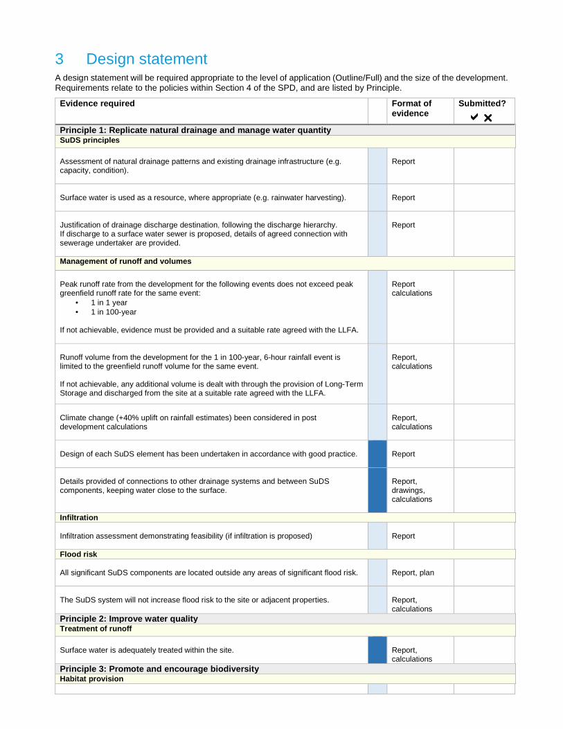
3 Design statement A design statement will be required appropriate to the level of application (Outline/Full) and the size of the development. Requirements relate to the policies within Section 4 of the SPD, and are listed by Principle.
Evidence required Format of evidence
Submitted?
����� Principle 1: Replicate natural drainage and manage water quantity SuDS principles Assessment of natural drainage patterns and existing drainage infrastructure (e.g. capacity, condition).
Report
Surface water is used as a resource, where appropriate (e.g. rainwater harvesting).
Report
Justification of drainage discharge destination, following the discharge hierarchy. If discharge to a surface water sewer is proposed, details of agreed connection with sewerage undertaker are provided.
Report
Management of runoff and volumes
Peak runoff rate from the development for the following events does not exceed peak greenfield runoff rate for the same event:
• 1 in 1 year • 1 in 100-year
If not achievable, evidence must be provided and a suitable rate agreed with the LLFA.
Report calculations
Runoff volume from the development for the 1 in 100-year, 6-hour rainfall event is limited to the greenfield runoff volume for the same event. If not achievable, any additional volume is dealt with through the provision of Long-Term Storage and discharged from the site at a suitable rate agreed with the LLFA.
Report, calculations
Climate change (+40% uplift on rainfall estimates) been considered in post development calculations
Report, calculations
Design of each SuDS element has been undertaken in accordance with good practice.
Report
Details provided of connections to other drainage systems and between SuDS components, keeping water close to the surface.
Report, drawings, calculations
Infiltration Infiltration assessment demonstrating feasibility (if infiltration is proposed)
Report
Flood risk All significant SuDS components are located outside any areas of significant flood risk.
Report, plan
The SuDS system will not increase flood risk to the site or adjacent properties.
Report, calculations
Principle 2: Improve water quality Treatment of runoff
Surface water is adequately treated within the site.
Report, calculations
Principle 3: Promote and encourage biodiversity Habitat provision

The system is on the surface and contains vegetated components.
Report, plans
The drainage system will support, protect and enhance natural local habitats and species.
Report
Principle 4: Enhance the landscape Visual impact The drainage scheme enhances the visual character of the development.
Report, plans, photographs
Principle 5: Make development future-proof Climate change Use of SuDS in moderating of temperatures through evaporative cooling, reflectance and shading has been exploited
Report
Principle 6: Engage and benefit the local community Opportunities to enhance provision for recreation, health and wellbeing, education and play Where the drainage system serves more than one property, communal space is used in a beneficial way for the community.
Report
The proposed components are safe for any proposed amenity use.
Report
4 Maintenance and construction Maintenance plans and construction method statements will be required appropriate to the level of application (Outline/Full) and the size of the development. Requirements relate to the policies within Section 4 of the SPD, and are listed by Principle.
Evidence Required
Format of evidence
Submitted?
����� Principle 7: Ensure that SuDS are maintained for the lifetime of the development Operation and Maintenance Maintenance Plan for the proposed drainage system over its lifetime (100 years for residential, 60 years for commercial)
Report
Whole life maintenance and monitoring costs for the proposed drainage system (100 years for residential, 60 years for commercial)
Report
Evidence that the proposed components safe to construct, maintain and operate.
Report
Principle 8: Adopting good practice in construction of SuDS Consents Record of all necessary consents obtained for on or off-site works
Certificate or letter/email correspondence

5 Adoption arrangements
Evidence Required
Format of evidence
Submitted?
����� Adoption Demonstrate that provision has been made for a suitable organisation or individual to adopt the scheme, including relevant evidence of commitments.
Report, letter/email correspondence
Records As-constructed drawings of drainage system
Detailed drawings
Record of easement agreements
Report, letter/email correspondence
Record of commuted sums Report, letter/email correspondence
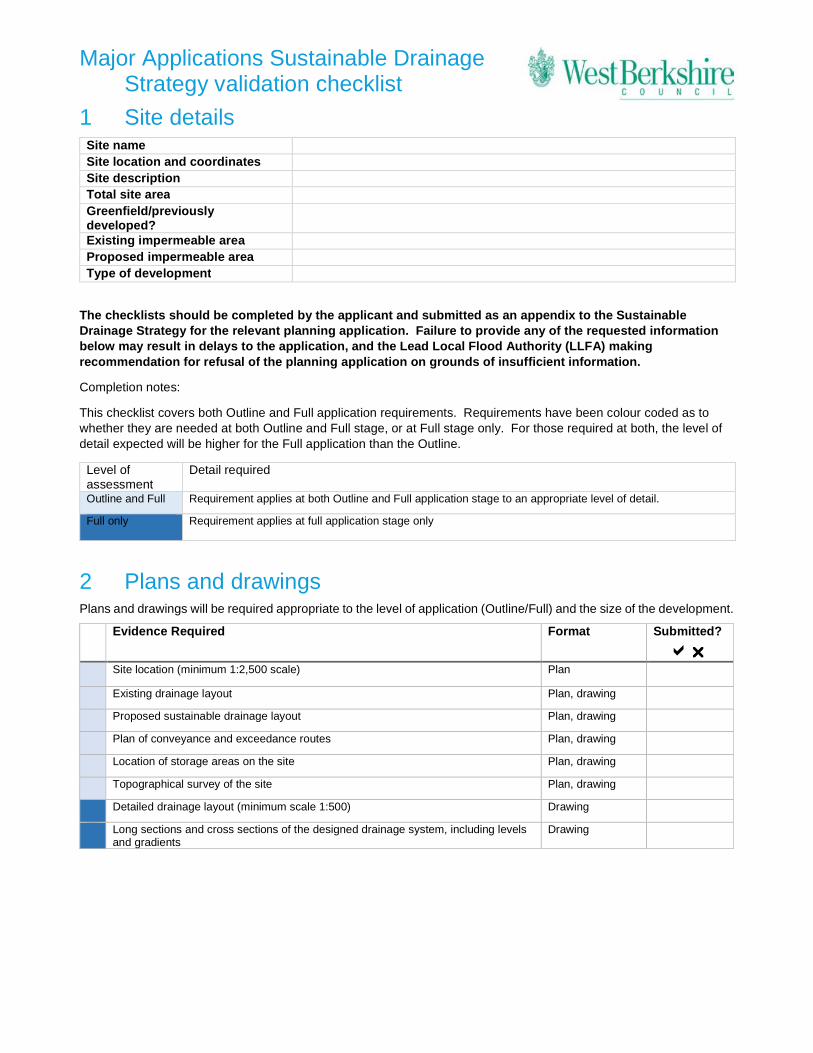
Major Applications Sustainable Drainage Strategy validation checklist
1 Site details Site name Site location and coordinates Site description Total site area Greenfield/previously developed?
Existing impermeable area Proposed impermeable area Type of development
The checklists should be completed by the applicant and submitted as an appendix to the Sustainable Drainage Strategy for the relevant planning application. Failure to provide any of the requested information below may result in delays to the application, and the Lead Local Flood Authority (LLFA) making recommendation for refusal of the planning application on grounds of insufficient information.
Completion notes:
This checklist covers both Outline and Full application requirements. Requirements have been colour coded as to whether they are needed at both Outline and Full stage, or at Full stage only. For those required at both, the level of detail expected will be higher for the Full application than the Outline.
Level of assessment
Detail required
Outline and Full Requirement applies at both Outline and Full application stage to an appropriate level of detail.
Full only Requirement applies at full application stage only
2 Plans and drawings Plans and drawings will be required appropriate to the level of application (Outline/Full) and the size of the development.
Evidence Required Format Submitted?
����� Site location (minimum 1:2,500 scale) Plan
Existing drainage layout Plan, drawing
Proposed sustainable drainage layout Plan, drawing
Plan of conveyance and exceedance routes Plan, drawing
Location of storage areas on the site Plan, drawing
Topographical survey of the site Plan, drawing
Detailed drainage layout (minimum scale 1:500) Drawing
Long sections and cross sections of the designed drainage system, including levels and gradients
Drawing
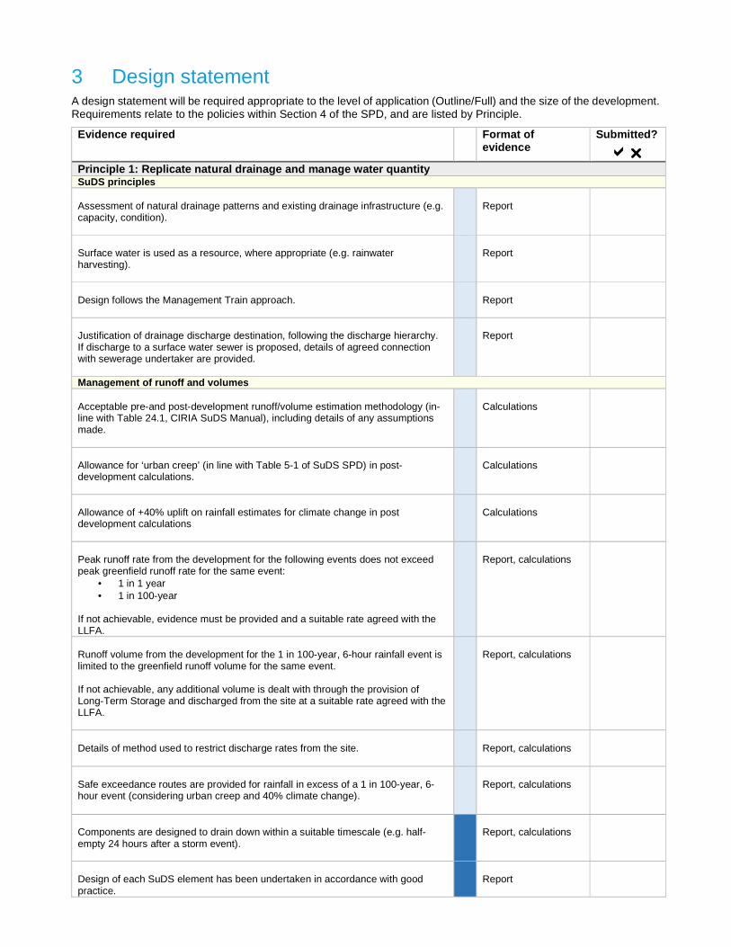
3 Design statement A design statement will be required appropriate to the level of application (Outline/Full) and the size of the development. Requirements relate to the policies within Section 4 of the SPD, and are listed by Principle.
Evidence required
Format of evidence
Submitted?
����� Principle 1: Replicate natural drainage and manage water quantity SuDS principles Assessment of natural drainage patterns and existing drainage infrastructure (e.g. capacity, condition).
Report
Surface water is used as a resource, where appropriate (e.g. rainwater harvesting).
Report
Design follows the Management Train approach.
Report
Justification of drainage discharge destination, following the discharge hierarchy. If discharge to a surface water sewer is proposed, details of agreed connection with sewerage undertaker are provided.
Report
Management of runoff and volumes
Acceptable pre-and post-development runoff/volume estimation methodology (in-line with Table 24.1, CIRIA SuDS Manual), including details of any assumptions made.
Calculations
Allowance for ‘urban creep’ (in line with Table 5-1 of SuDS SPD) in post-development calculations.
Calculations
Allowance of +40% uplift on rainfall estimates for climate change in post development calculations
Calculations
Peak runoff rate from the development for the following events does not exceed peak greenfield runoff rate for the same event:
• 1 in 1 year • 1 in 100-year
If not achievable, evidence must be provided and a suitable rate agreed with the LLFA.
Report, calculations
Runoff volume from the development for the 1 in 100-year, 6-hour rainfall event is limited to the greenfield runoff volume for the same event. If not achievable, any additional volume is dealt with through the provision of Long-Term Storage and discharged from the site at a suitable rate agreed with the LLFA.
Report, calculations
Details of method used to restrict discharge rates from the site.
Report, calculations
Safe exceedance routes are provided for rainfall in excess of a 1 in 100-year, 6-hour event (considering urban creep and 40% climate change).
Report, calculations
Components are designed to drain down within a suitable timescale (e.g. half-empty 24 hours after a storm event).
Report, calculations
Design of each SuDS element has been undertaken in accordance with good practice.
Report

Evidence required
Format of evidence
Submitted?
����� Details provided of connections to other drainage systems and between SuDS components, keeping water close to the surface.
Report, drawings, calculations
Infiltration Infiltration assessment, groundwater monitoring and ground stability reports (if infiltration is proposed).
Report
Flood risk All significant SuDS components are located outside any areas of significant flood risk.
Report, plan
SuDS system does not:
• flood on any part of the site for a 1 in 30-year rainfall event • flood any building or utility plant within the development during the 1 in
100-year plus climate change rainfall event • increase flood risk to adjacent properties.
Report, calculations
Principle 2: Improve water quality Treatment of runoff An appropriate treatment strategy has been provided for the pollution hazard level of the development.
Report
Runoff does not occur on-site for the majority of small rainfall events (first 5mm rainfall depth).
Report, calculations
Runoff is treated to an acceptable standard within the site, in accordance with the SuDS management train approach.
Report, calculations
Principle 3: Promote and encourage biodiversity Habitat provision The system is on the surface, contains visible vegetated components, and will form part of the local green infrastructure.
Report, plans
The drainage system will support, protect and enhance natural local habitats and species.
Report
Principle 4: Enhance the landscape Visual impact The drainage scheme integrates water into the landscape design, and enhances the visual character of the development.
Report, plans, photographs
Conservation of landscape and heritage The proposed scheme conserves any existing cultural, historical and landscape features.
Report, plans, photographs
Principle 5: Make development future-proof Climate change Use of SuDS in moderating of temperatures through evaporative cooling, reflectance and shading has been exploited
Report
Principle 6: Engage and benefit the local community Amenity

Evidence required
Format of evidence
Submitted?
����� Opportunities have been taken to provide recreation and promote education, health and wellbeing.
Report
The proposed drainage components are safe for any proposed amenity use. Report
Community engagement Engagement with existing and new communities and awareness raising within design proposals.
Report
4 Maintenance and construction Maintenance plans and construction method statements will be required appropriate to the level of application (Outline/Full) and the size of the development. Requirements relate to the policies within Section 4 of the SPD, and are listed by Principle.
Evidence Required
Format of evidence
Submitted?
����� Principle 7: Ensure that SuDS are maintained for the lifetime of the development Operation and Maintenance Maintenance Plan covers the proposed drainage system over its lifetime (100 years for residential, 60 years for commercial)
Report
The SuDS design is low maintenance. If pumping is required for operation of the system, evidence that all other possible alternatives have been considered.
Report
Whole life maintenance and monitoring costs provided for the proposed drainage system (100 years for residential, 60 years for commercial).
Report
Acceptable operation and maintenance costs for the adopting body (including any pumping requirements)
Report, letter/email correspondence
Designed drainage system components are robust and resilient.
Report
Principle 8: Adopt good practice in construction of SuDS Construction Suitable construction method statement.
Report
Record of all necessary consents obtained for on or off-site works.
Certificate or letter/email correspondence
Proposed materials are of a suitable nature and quality for their intended use.
Report
The proposed components are safe to construct, maintain and operate.
Report
Agreed temporary measures are in place to prevent flooding to the site and surrounding area prior to completion of the drainage system.
Report
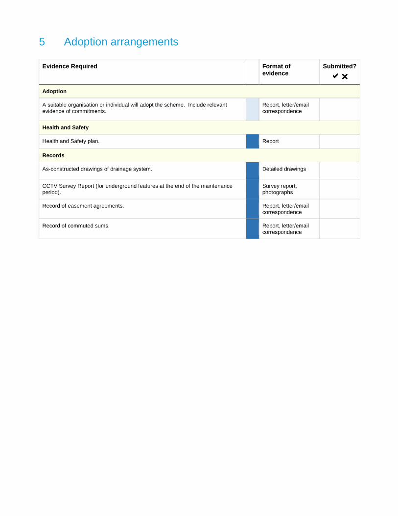
5 Adoption arrangements
Evidence Required
Format of evidence
Submitted?
�����
Adoption
A suitable organisation or individual will adopt the scheme. Include relevant evidence of commitments.
Report, letter/email correspondence
Health and Safety
Health and Safety plan. Report
Records
As-constructed drawings of drainage system. Detailed drawings
CCTV Survey Report (for underground features at the end of the maintenance period).
Survey report, photographs
Record of easement agreements. Report, letter/email correspondence
Record of commuted sums. Report, letter/email correspondence
If you require this information in an alternative format or translation,please contact Planning & Countryside on Telephone 01635 551111.
West Berkshire Council Planning and Countryside Market Street Newbury Berkshire RG14 5LD
t: 01635 519111 f: 01635 519408 e: [email protected] www.westberks.gov.uk
WBC/P&T/LB/1018
Cover photos: Courtesy of © Susdrain / SuDS at Greener Grangetown in Cardiff Summer 2018 (Courtesy susdrain/CIRIA)www.susdrain.org/resources/images.html