table of contents - · pdf filetable of contents about the ... park and ride ... system...
TRANSCRIPT


TABLE OF CONTENTS About the Transportation Concept Report ................................................................................................................... i
Stakeholder Participation.............................................................................................................................................. i
EXECUTIVE SUMMARY .................................................................................................................................................2
CORRIDOR OVERVIEW .................................................................................................................................................5
Route Segmentation ................................................................................................................................................5
Route Description ....................................................................................................................................................5
Community Characteristics ................................................................................................................................... 10
Land Use and Transportation ................................................................................................................................ 10
Land Use Characteristics ................................................................................................................................... 10
Development Review ........................................................................................................................................ 10
System Characteristics .......................................................................................................................................... 11
California-Baja California International Border .................................................................................................... 13
Freight ................................................................................................................................................................... 16
Airport Facilities .................................................................................................................................................... 20
MULTIMODAL TRANSPORTATION AND SYSTEM MANAGEMENT ............................................................................. 21
Complete Streets .................................................................................................................................................. 21
Bicycle Facilities..................................................................................................................................................... 21
Pedestrian Facilities .............................................................................................................................................. 23
Transit Facilities..................................................................................................................................................... 24
Transportation Centers ......................................................................................................................................... 24
Transit Expansion .................................................................................................................................................. 26
Park and Ride ........................................................................................................................................................ 27
Transportation Demand Management ................................................................................................................. 28
Car and Ride Sharing ............................................................................................................................................. 29
Intelligent Transportation Systems ....................................................................................................................... 29
Transportation System Management and Operations ......................................................................................... 30
ENVIRONMENTAL CONSIDERATIONS ........................................................................................................................ 31
CORRIDOR PERFORMANCE ....................................................................................................................................... 31
KEY CORRIDOR ISSUES .............................................................................................................................................. 40
CORRIDOR CONCEPTS ............................................................................................................................................... 41
APPENDIX .................................................................................................................................................................. 47
Appendix A - Environmental Considerations ........................................................................................................ 47

Appendix B – Build NCC Fact Sheet ....................................................................................................................... 53
Appendix C – NCC Active Transportation Improvements .................................................................................... 55
Appendix D – Genesee Ave. Interchange Improvements ..................................................................................... 56
Appendix E – Encinitas Boulevard Enhancements ................................................................................................ 57
Appendix F – Central I-5 Corridor Study Recommended Plan .............................................................................. 58
Appendix G – San Ysidro/Puerta México-El Chaparral .......................................................................................... 59
Appendix H – Glossary of Terms and Acronyms ................................................................................................... 63

i
ABOUT THE TRANSPORTATION CONCEPT REPORT System Planning is the long-range transportation planning process for the California Department of Transportation (Caltrans). The System Planning process fulfills the statutory responsibility of Caltrans as owner/operator of the State Highway System (SHS) by evaluating conditions and proposing enhancements to the SHS (Gov. Code §65086). Through System Planning, Caltrans focuses on developing an integrated multimodal transportation system that meets the Caltrans goals of safety and health, stewardship and efficiency, sustainability, livability and economy, system performance, and organizational excellence. The System Planning process is primarily composed of four parts: the District System Management Plan (DSMP), the Transportation Concept Report (TCR), the Corridor System Management Plan (CSMP), and the DSMP Project List. The district-wide DSMP is a strategic policy and planning document that focuses on maintaining, operating, managing, and developing the transportation system. The TCR is a planning document that identifies the existing and future route conditions as well as future needs for each route on the SHS. The CSMP is a complex, multi-jurisdictional planning document that identifies future needs within corridors experiencing or expected to experience high levels of congestion. The CSMP serves as a TCR for segments covered by the CSMP. The DSMP Project List is a list of planned and partially programmed transportation projects used to recommend projects for funding. These System Planning products are also intended as resources for stakeholders, involving the public as well as regional and local agencies.
STAKEHOLDER PARTICIPATION As part of the development of this TCR, Caltrans District 11 has coordinated with the jurisdictions located along the Interstate(I) 5 corridor. The local stakeholders include the San Diego Association of Governments (SANDAG), the County of San Diego, the Cities of San Diego, Chula Vista, National City, Del Mar, Solana Beach, Encinitas, Carlsbad and Oceanside obtaining internal and external input during the TCR development and reviewing the draft report are essential to validate data and the overall characterization of the route and obtain consensus on future needs and opportunities. Much of the TCR information came from internal Caltrans files and databases managed by the Divisions of Program and Project Management, Traffic Operations, Environmental Planning, and Transportation Planning (Travel Modeling and Forecasting Branch), in addition to our System Planning counterparts in Caltrans Headquarters and adjacent Caltrans Districts. Caltrans staff reviewed and considered partner agency documents such as City and County General Plans, Regional Transportation Plans, Bicycle Transportation Plans, Public Transit Plans, traffic studies, TCRs of adjoining Caltrans Districts, statewide planning tools, and other related documents.
Disclaimer: The information and data contained in this document are for planning purposes only and should not be relied upon for final design of any project. Any information in this Transportation Concept Report (TCR) is subject to modification as conditions change and new information is obtained. Although planning information is dynamic and continually changing, the District 11 System Planning Division makes every effort to ensure the accuracy and timeliness of the information contained in the TCR. The information in the TCR does not constitute a standard, specification, or regulation, nor is it intended to address design policies and procedures.

1
Mission Provide a safe, sustainable, integrated and efficient transportation system to enhance California’s economy
and livability
Vision A performance-driven, transparent and accountable organization that values its people, resources and
partners, and meets new challenges through leadership, innovation and teamwork
Goals Safety and Health
Provide a safe transportation system for workers and users, and promote health through active transportation and reduced pollution in communities.
Stewardship and Efficiency
Money counts. Responsibly manage California’s transportation-related assets.
Sustainability, Livability and Economy
Make long-lasting, smart mobility decisions that improve the environment, support a vibrant economy, and build communities, not sprawl.
System Performance
Utilize leadership, collaboration and strategic partnerships to develop an integrated transportation system that provides reliable and accessible mobility for travelers.
Organizational Excellence
Be a national leader in delivering quality service through excellent employee performance, public communication, and accountability.
Values Integrity • Commitment • Teamwork • Innovation

2
EXECUTIVE SUMMARY Interstate 5 (I-5) extends from the California-Mexico border to Canada for a total length of more than 1,350 miles. In San Diego County, I-5 extends 72.4 miles from the U.S./Mexico International Border to the Orange County line. I-5 serves interregional travel by linking the San Diego metropolitan area with Mexico to the south and Orange County and the Los Angeles metropolitan area to the north. I-5 is a heavily utilized commuter route providing direct access to the San Diego Central Business District (CBD) as well as numerous other employment centers located within the corridor. The Interstate also offers a direct connection to the San Ysidro Port of Entry, the busiest land border crossing in the western hemisphere. I-5 also provides truck access to San Diego's marine terminals, rail yards, and air freight terminals for the purpose of goods movement. I-5 parallels the coast offering access to coastal recreation, weekend and summer special events, and tourism. Caltrans has prepared this TCR for I-5 to gain a long term consensus-based vision intended to assist Caltrans, San Diego Association of Governments (SANDAG), the County of San Diego, the cities of San Diego, Chula Vista, National City, Del Mar, Solana Beach, Encinitas, Carlsbad and Oceanside, and other public agencies serving San Diego County, to manage the route. The TCR will discuss the portion of I-5 in San Diego County from the U.S./Mexico border to the San Diego/Orange County limit. The report includes an assessment of current and future operating conditions and improvements that will be needed to meet operational and multimodal goals for the facility. In order to meet future demand, the concept for the I-5 corridor is to optimize system efficiency through freeway capacity enhancements, connector and interchange improvements, expanded intercity rail, new transit services, operational improvements, system management, and other multimodal and active transportation strategies that will optimize corridor efficiency, sustainability and mobility. SANDAG, the Metropolitan Planning Organization (MPO) for San Diego County, partners with Caltrans to plan and build transportation improvements in the region. Future projects referenced are based on the San Diego Forward: The Regional Plan (SD Forward) that was adopted on October 9, 2015. Priorities identified in the adopted SD Forward can be referenced at www.sdforward.com. The SANDAG Regional Plan identifies freeway improvements in the “Constrained Highway Network” to include new “Managed Lanes” for most of the corridor, new general purpose lanes between State Route 54 (SR-54) and State Route 15 (SR-15), freeway “access” improvements between SR-15 and Interstate 8 (I-8), HOV and Freeway Connectors along the corridor, and new toll freeway lanes north of State Route 76 (SR-76) to Orange County. The “Managed Lane” concept is typically a “freeway-within-a-freeway,” where a set of lanes within the freeway cross section are separated from the general-purpose lanes to maximize efficiency of the corridor and provide travel ways for high occupancy vehicles (HOVs) and express bus transit services. Caltrans, in partnership with SANDAG, has developed the I-5 North Coast Corridor (NCC) Public Works Plan/Transportation and Resource Enhancement Program (PWP/TREP). The PWP/TREP includes a package of highway, rail, transit, bike/pedestrian, environmental and coastal access improvements along San Diego’s North Coast Corridor, a 27-mile stretch from La Jolla to Oceanside, to be delivered over the next 30 years. The document serves as the master permit and implementation blueprint for the NCC Program. Under the I-5 NCC project, ultimate freeway improvements to north I-5 will be the construction

3
of two managed lanes in each direction from La Jolla Village Drive to Vandegrift Boulevard. The managed lanes will be branded as “Express Lanes” and will be free for carpools, vanpools and buses while allowing single-occupant vehicles to use the facility for a fee. These Express lanes will allow for transit expansion along the corridor while promoting Transportation Demand Management (TDM) strategies. Operational improvements, such as auxiliary lanes and local freeway interchange modifications, will be added incrementally in key locations to improve traffic flow. The next project going into construction in 2017 is adding two HOV lanes from Lomas Santa Fe Drive to SR-78. Also identified in SD Forward is the widening of El Camino Real, a parallel arterial to I-5 through the NCC Corridor. Several interchange improvements are also planned along the corridor that are primarily funded through local funding sources. Chula Vista has an established Development Impact Fee program for western Chula Vista associated with large scale land development projects to provide improvements to interchanges along the corridor. The City of San Diego has an established Facilities Benefit Assessment (FBA) for several interchanges along I-5. Rail service operates parallel to and the full length of the I-5 Corridor in San Diego County. San Diego Metropolitan Transit System (MTS) operates light rail trolley service from San Ysidro to Old Town San Diego. Construction is under way for the Mid-Coast Trolley Project that will extend the Blue Line from the Santa Fe Depot in Downtown San Diego to the University City community. Construction began in fall 2016 and service is anticipated to begin in 2021. The Los Angeles-San Diego-San Luis Obispo (LOSSAN) is the second busiest intercity rail corridor in the nation supporting commuter, intercity, and freight rail services. Train operations on the line include Amtrak’s Pacific Surfliner; the Southern California Regional Rail Authority’s Metrolink and the North County Transit District’s COASTER and SPRINTER passenger rail services; and Union Pacific and BNSF Railway freight rail services. The 60-mile San Diego segment of the LOSSAN corridor extends from the Orange County line to the Santa Fe Depot in Downtown San Diego. Over the next 20 years, SANDAG plans to construct nearly $1 billion in improvements in the San Diego segment, including a double tracking the corridor from Orange County to Downtown San Diego. To date, two-thirds of the San Diego segment has been double tracked. Other infrastructure improvements include bridge and track replacements, new platforms, pedestrian undercrossings, and other safety and operational enhancements. Additionally, bus rapid transit (BRT), branded as Rapid, is planned to run service in South Bay, with future service operating on the I-5 NCC, once the managed lanes are completed. With its coastal environment and temperate weather, the I-5 corridor is considered perfect to serve Active Transportation users the entire length of the route. Planned improvements will provide enhanced bicyclist and pedestrian access both parallel to and across the corridor. The Border to Bayshore Bikeway will provide safe bicycling connections between the San Ysidro Port of Entry and the City of Imperial Beach where it will link to the Bayshore Bikeway, providing an option for people to travel by bicycle between Tijuana and San Diego. The Bayshore Bikeway will eventually extend the entire 24 miles around San Diego Bay and provide a vital and scenic connection between Bayfront cities and some of the region’s most visited destinations. Most segments of the Bayshore Bikeway are either already complete or in construction while SANDAG continues the work to fill in the gaps that currently exist. The Bayshore Bikeway will link to the Coastal Rail Trail, which is an existing and planned continuous bike route that runs approximately 44 miles between Oceanside and Santa Fe Depot in Downtown San Diego. The Rose Creek and Encinitas segments of the Coastal Rail Trail, which are currently in the final design phases will provide a comfortable environment for people of all ages and abilities to ride their bikes. These segments are among the high priority Coastal Rail Trail projects identified in the SANDAG Early Action Plan to be

4
funded for implementation. The I-5 North Coast Bike Trail will complement the Coastal Rail Trail and provide additional options for travel through and across the I-5 corridor with enhanced community connections and environmental enhancements in the coastal lagoons. The I-5 North Coast Bike Trail is a component of and will parallel the entire length of the 27-mile long I-5 North Coast Corridor which extends from Voigt Drive in the City of San Diego to Harbor Drive in the City of Oceanside. State legislation requires Caltrans to develop a Ten-Year State Highway Operation and Protection Plan (SHOPP). The Plan identifies rehabilitation needs, schedules for meeting those needs, strategies for cost control, and program efficiencies. SHOPP projects are limited to capital improvements related to maintenance, safety, and rehabilitation of State highway and bridges. The SHOPP program reflects the first four years of the Ten-Year State Highway Operation and Protection Plan. District 11 developed the latest SHOPP needs plan in 2017 that includes operational and rehabilitation improvements for I-5. To achieve the concept stated above for I-5, in addition to planned capacity increasing projects, system operations and management concepts need to be further developed for the corridor. Among the projects and strategies that need to be included are TDM strategies, Intelligent Transportation Systems (ITS), and Transportation Systems Management and Operations (TSMO).

5
CORRIDOR OVERVIEW
ROUTE SEGMENTATION For the purpose of analysis, I-5 was divided into fourteen segments as identified in Table 1 below. Table 1: I-5 Route Segmentation
ROUTE DESCRIPTION Route Location I-5 begins in the City of San Diego near the international border of Mexico and the U.S. It heads north through the cities of Chula Vista and National City. The route then continues into the City of San Diego urban center. It continues into the cities of Del Mar, Solana Beach, Encinitas, Carlsbad, and Oceanside. The route continues through San Diego County passing Camp Pendleton and into Orange County.
Segment Location Description Local Jurisdiction
Beginning Post Mile End Post Mile Segment
Length
1 International Border to I-805 San Diego R0.000 R0.900 0.900
2 I-805 to SR-905 San Diego R0.900 3.100 2.200
3 SR-905 to SR-54 San Diego
Chula Vista National City
3.100 9.400 6.300
4 SR-54 to I-15 National City San Diego 9.400 R12.400 3.000
5 I-15 to SR-94 San Diego R12.400 R15.000 2.060
6 SR-94 to SR-163 San Diego R15.000 R16.100 1.100
7 SR-163 to I-8 San Diego R16.100 R20.100 4.000
8 I-8 to SR-52 San Diego R20.100 R25.900 5.800
9 SR-52 to I-805 San Diego R25.900 R30.800 4.900
10 I-805 to SR-56 San Diego R30.800 R32.800 2.000
11 SR-56 to Manchester Avenue
San Diego Solana Beach
Encinitas R32.800 R38.500 5.700
12 Manchester Avenue to SR-78
Encinitas Carlsbad
Oceanside R38.500 R51.200 12.700
13 SR-78 to Urban Rural Limit
Oceanside San Diego
County R51.200 R56.400 5.200
14 Urban Rural Limit to Orange County Line
San Diego County R56.400 R72.367 15.967

6
Route Purpose I-5 serves interregional travel by linking the San Diego metropolitan area with Mexico to the south and Orange County and the Los Angeles metropolitan area to the north. I-5 is a heavily utilized commuter route providing direct access to the San Diego downtown as well as numerous other employment centers located within the corridor. I-5 provides truck access to San Diego's marine terminals, rail yards, and air freight terminals for the purpose of goods movement. Since l-5 parallels the coast, it provides access to a multitude of coastal recreational opportunities, as well as being a recreational gateway into Mexico. Major Route Features The Federal functional classification for I-5 is Interstate under the “Eisenhower Interstate System”. The entire route is in the National Highway System, a network of roadways important to the country's economy, defense, and mobility. I-5 is designated as part of the Surface Transportation Assistance Act (STAA) for trucks. Segments 0 – 3 (PM 0.00 – 4.600) and 14 (R14.000 – R 72.367) of I-5 are on the California list of Eligible Routes for the State Scenic Highways.

7
Map 1: I-5 Route Segmentation

8
Map 2: I-5 Route Segmentation

9
Table 2: Route Designations and Characteristics
Segment Number 1 2 3 4 5 6 7 8 9 10 11 12 13 14
Freeway & Expressway Yes Yes Yes Yes Yes Yes Yes Yes Yes Yes Yes Yes Yes Yes
National Highway System Yes Yes Yes Yes Yes Yes Yes Yes Yes Yes Yes Yes Yes Yes
Strategic Highway Network1 Yes Yes Yes Yes Yes Yes Yes Yes Yes Yes Yes Yes Yes Yes
Scenic Highway Eligible Eligible Eligible
(PM 3.1 - 4.6)
No No No No No No No No No No No
Interregional Road System2 Yes Yes Yes Yes Yes Yes Yes Yes Yes Yes Yes Yes Yes Yes
High Emphasis3 Yes Yes Yes Yes Yes Yes Yes Yes Yes Yes Yes Yes Yes Yes
Focus Route4 No No No No No No No No No No No No No No
Goods Movement Route Yes Yes Yes Yes Yes Yes Yes Yes Yes Yes Yes Yes Yes Yes
Truck Designation NN5 NN5 NN5 NN5 NN5 NN5 NN5 NN5 NN5 NN5 NN5 NN5 NN5 NN5
STAA6 STAA6 STAA6 STAA6 STAA6 STAA6 STAA6 STAA6 STAA6 STAA6 STAA6 STAA6 STAA6 STAA6
Rural/Urban/ Urbanized Urban Urban Urban Urban Urban Urban Urban Urban Urban Urban Urban Urban Urban Urban
Metropolitan Planning Organization SANDAG SANDAG SANDAG SANDAG SANDAG SANDAG SANDAG SANDAG SANDAG SANDAG SANDAG SANDAG SANDAG SANDAG
Regional Transportation Planning Agency SANDAG SANDAG SANDAG SANDAG SANDAG SANDAG SANDAG SANDAG SANDAG SANDAG SANDAG SANDAG SANDAG SANDAG
County Transportation Commission SANDAG SANDAG SANDAG SANDAG SANDAG SANDAG SANDAG SANDAG SANDAG SANDAG SANDAG SANDAG SANDAG SANDAG
Local Agency San Diego San Diego
San Diego Chula Vista
National City
National City
San Diego San Diego San Diego San Diego San Diego San Diego San Diego
San Diego Solana Beach
Encinitas
Encinitas Carlsbad
Oceanside
Oceanside San Diego
County
San Diego County
Tribes None None None None None None None None None None None None None None
Terrain7 Flat Flat Flat Flat Flat Flat Flat Flat/ Rolling Rolling Rolling Rolling Rolling/
Flat Flat Flat
[1]The Strategic Highway Network is a designation given to roads that provide defense access, continuity, and emergency capabilities for movements of personnel and equipment in both peace and war. [2] Interregional Road System is a subset of the State Highway System routes that provides connectivity between California’s major regions. [3] Highways classified as High Emphasis Routes are a subset of the Interregional Road System that receive a priority for programming. [5] National Network [4] Focus Routes are a subset to High Emphasis Routes that are corridors that should be of the highest priority for completion to minimum facility standards in the 20-year period. [6] Surface Transportation Assistance Act http://www.dot.ca.gov/trafficops/trucks/docs/truck-legend.pdf [7] D11 Traffic Operations Traffic Accident Surveillance and Analysis System (TASAS) website.

10
COMMUNITY CHARACTERISTICS The southern most segment of I-5 starts at the international border near Mexico. It is the San Ysidro Port of Entry. The community in the south near the border includes the cities of Chula Vista, National City and San Diego. The I-5 corridor continues through the urban center, which includes the community of downtown San Diego and the Naval Base San Diego. As the corridor continues north is adjacent to the beach communities of Point Loma, Ocean Beach, Mission Beach, Pacific Beach, La Jolla, Del Mar, Solana Beach, Encinitas, Carlsbad and Oceanside. The community of La Jolla is home to the University of California, San Diego, which is adjacent to the east and west of I-5 near Genesee Avenue. This is also the community with several large hospitals and medical centers. Just north of La Jolla is the Del Mar Fairgrounds. The San Diego county limit of I-5 is adjacent to Camp Pendleton, which is the region’s largest military base. Figure 1: I-5 Southbound with UC San Diego Health La Jolla in the background.
According to the SANDAG Regional Growth Forecast 2050, the region’s population will grow by nearly one million people by 2050. The growth in population will drive job growth and housing demand within the region – adding nearly 500,000 jobs and more than 330,000 housing units by 20501. LAND USE AND TRANSPORTATION There is a direct nexus between land use and transportation. A better understanding of future development growth and transportation trends will help determine how to best plan for a transportation system that can accommodate future growth. The intent of routes that are part of the National Highway System, including I-5, is to maintain mobility for regional and interregional travel. Land Use Characteristics There are a variety of land use types along I-5. It is one of the few routes in San Diego County that connects both county and international boundaries in the region. It connects to the borders of Mexico in the south and Orange County in the north. The land-use around I-5 in Chula Vista is primarily residential, industrial, and park preserve. In the City of Chula Vista there is a nature preserve near I-5. The City of
1 http://www.sandag.org/index.asp?classid=12&subclassid=84&projectid=503&fuseaction=projects.detail

10
National City has land-use around I-5 that is primarily industrial and residential. Adjacent to I-5 is also Naval Base San Diego. North of National City, I-5 goes through the City of San Diego. I-5 is near the port district in San Diego. The Port of San Diego is currently revising the Port Master Plan. Significant growth is expected in the downtown area of San Diego. This is the most dense area in the county of San Diego. It is urbanized and predominately residential commercial mixed use retail, including a convention center, and some recreational uses such as the Major League Baseball field (Petco Park) and access for recreational boaters. The Harbor of San Diego, which in some areas is parallel to I-5, includes commercial freight ships and passenger cruise ships. In downtown is the San Diego International Airport. It is near I-5, which is the main freeway access to the airport. The City of San Diego communities of Point Loma, Ocean Beach, Pacific Beach and Mission Beach have residential and commercial land use. In Point Loma is Point Loma Nazarene University. In the communities of Morena and Linda Vista, along I-5, the majority of land use is industrial. In this community the City of San Diego has proposed a specific plan amendment to change the zoning from industrial to residential to promote transit oriented development (TOD). I-5 continues north through the community of La Jolla, which is within the jurisdiction of the City of San Diego. La Jolla is next to the Pacific Ocean and it brings a large number of tourists each year. The majority of land use is residential, commercial and retail. La Jolla also is where one of the largest universities in San Diego is located: University of California, San Diego (UC San Diego). This community also has three of the largest hospitals in San Diego County. These are VA San Diego Healthcare, Scripps Health hospital and UC San Diego Health. To the north of La Jolla is the community of Sorrento Valley. Sorrento Valley land uses are primarily commercial businesses. This is a large employment area within San Diego County. North of Sorrento Valley is the City of Del Mar. The city limits of Del Mar are not adjacent to I-5, however, they are close in proximity to the corridor. The Del Mar Fairgrounds are used year round for various events and adjacent to the I-5. The two largest events are the San Diego County Fair and the Del Mar races. Land-use in Del Mar is primarily residential commercial restaurants and retail. The City of Solana Beach is another beach community, and has a population of 4,278. The land use around I-5 is retail and residential. The next community north of Solana Beach is the City of Encinitas. Encinitas also borders the Pacific Ocean. The primary land uses along I-5 are auto, commercial, retail, residential, and restaurant. Their population is 61,588. North of Encinitas is the City of Carlsbad, which has a population of 110,972. The primary land uses around I-5 are auto, commercial, residential, retail, and restaurant. North of Carlsbad is the City of Oceanside which has a population of 172,794. It borders along Camp Pendleton, which belongs to the United States Marine Corps. Oceanside has land uses of school, lodging, restaurant, retail, and residential along I-5. Development Review As local development projects are approved locally, potential impacts to I-5 will be identified through the development review process. Anticipating future impacts to I-5 provides an opportunity for Caltrans and its local partners to collaborate to develop solutions for the transportation system. The City of San Diego has contributed funds toward the I-5/Genesee Avenue Interchange Project through the Facilities Benefit

11
Assessment (FBA). Through the local environmental process potential impacts associated with land use decisions are analyzed to determine the appropriate offsetting mitigation measures and strategies. Identifying these impacts can also aid MPOs, RTPAs, counties, and cities in developing and implementing transportation impact fee programs and/or other funding strategies for infrastructure improvements. The City of Chula Vista has prepared a Development Impact Fee (TDIF) for western Chula Vista to secure funding for infrastructure improvements.2 The Chula Vista Bayfront Master Plan3 is a planning document which includes plans for bike trails, retail uses, a Bayfront Resort and Convention Center, RV camping, and open space. This is expected to be a new traffic generator. UC San Diego (near La Jolla) and the University of San Diego (near Morena and Linda Vista) both are in the process of updating their campus long term plans. Both universities anticipate a growth in faculty and student population. SYSTEM CHARACTERISTICS Segments 1 – 9 have eight general purpose lanes. Segment 10 has eight to fourteen general purpose lanes near postmile R31.6, south of Carmel Mountain Road Under Crossing (UC), I-5 and I-805 merge. Segments 11 – 14 have eight general purpose lanes. The following Table 3 has data that includes the lane miles, general purpose and High Occupancy Vehicle (HOV) lanes for existing and concept facilities.
2 http://www.codepublishing.com/CA/ChulaVista/html/ChulaVista03/ChulaVista0356.html 3 https://www.portofsandiego.org/commercial-fisheries/documents/real-estate-projects/chula-vista-bayfront-master-plan/3910-chula-vista-bayfront-master-plan-fact-sheet/file.html

12
Table 3: I-5 System Characteristics
Segment # 1 2 3 4 5 6 7 8 9 10 11 12 13 14
Existing Facility
Facility Type Freeway Freeway Freeway Freeway Freeway Freeway Freeway Freeway Freeway Freeway Freeway Freeway Freeway Freeway
General Purpose
Lanes 8 8 8 8 8 8 8 8 8 8/14 8 8 8 8
Lane Miles 7.200 17.600 50.400 24.000 16.480 8.800 32.000 46.400 39.200 20.000/16.000 45.600 101.600 41.600 127.736
HOV Lanes 0 0 0 0 0 0 0 0 0 2 2 0 0 0
Auxiliary Lanes No Yes Yes Yes Yes Yes Yes Yes Yes Yes Yes Yes Yes Yes
Concept Facility
Facility Type Freeway Freeway Freeway Freeway Freeway Freeway Freeway Freeway Freeway Freeway Freeway Freeway Freeway Freeway
General Purpose
Lanes 8 8 10 10 8 8 8 8 8 8/14 8 8 8 8
Lane Miles 7.200 17.600 63.000 24.000 16.480 8.800 32.000 46.400 39.200 16.000 45.600 101.600 41.600 127.736
Managed Lanes
(Replaces HOV)
0 2 2 2 0 0 0 2 2 4 4 4 4 4
Auxiliary Lanes No Yes Yes Yes Yes Yes Yes Yes Yes Yes Yes Yes Yes Yes

13
CALIFORNIA-BAJA CALIFORNIA INTERNATIONAL BORDER With a population of over 4.7 million people, the San Diego/Tijuana area is often described as a “binational mega region”.4 Although separated by the United States/Mexico International Border, the neighboring cities are connected economically, socially, and culturally. As a result, the San Ysidro Port of Entry (POE) is the busiest land border crossing in the Western Hemisphere,5 and the Otay Mesa POE is the main commercial gateway for international trade between California and Mexico.6 I-5 provides north-south movement for goods coming through the ports of entry along the western California-Baja California International Border and provides links to I-8, SR-15 and I-805. I-5 begins at the International Border at San Ysidro, California and Tijuana, Baja California. Figure 2: Aerial view of I-5 and I-805 facing south at International Border at San Ysidro, CA and Tijuana, Baja California.
In 2015, over 33 million people crossed from Mexico to the United States through the San Ysidro POE as bus and private vehicle passengers or as pedestrians. International trade between the United States and Mexico is a key contributor to local, state, and national economic growth for both countries. Mexico ranks second among the U.S. export markets and third in total U.S. trade (imports plus exports).7 Mexico is California’s number one export market. In 2015, 4 The San Diego Tijuana Region, http://www.smartbordercoalition.com/about/ 5 San Ysidro LOPE Project Facts, http://www.gsa.gov/portal/category/105703 6 “2013 San Diego-Baja California Border Crossings and Trade Statistics”, http://www.sandag.org/uploads/publicationid/publicationid_1424_17572.pdf 7 U.S.-Mexico Economic Relations: Trends, Issues, and Implication, Congressional Research Service, https://www.fas.org/sgp/crs/row/RL32934.pdf

14
California exports to Mexico totaled $26.8 billion. Computers and electronic products remain California’s largest export with transportation equipment and machinery the next largest export.8 In California, nearly 700,000 jobs are supported by trade with Mexico.9 The 1994 North American Free Trade Agreement (NAFTA) boosted cross border trade, economic growth, and jobs. According to the Chamber of Commerce of the United States of America, in the two decades since NAFTA was enacted, U.S. trade in goods and services with Mexico increased more than 5 times, from $99.3 billion in 1993 to $531.1 billion in 2015. Cross border traffic delays continue to impact commerce between Mexico and the United States. These impacts affect California more than any other state in the United States. The SANDAG report entitled “Economic Impacts of Wait Times at the San Diego-Baja California Border”, updated for 2008, measured the economic impacts of delays at the California Ports of Entry for both commercial traffic and personal trips.10 In California alone, it is estimated that almost 25,000 jobs were lost to delays at the border in 2008, along with total output losses of $3.2 billion. San Ysidro Port of Entry The San Ysidro POE currently processes an average of 70,000 northbound vehicles and 20,000 northbound pedestrians per day.11 These numbers are expected to increase significantly in the next 15 years. In 2010 the U.S. General Services Administration began a three phase, complete reconfiguration and expansion of the POE. This project, which is now fully funded, is scheduled for completion in fall 2019. After all three phases are completed the POE will boast 62 northbound primary inspection booths, an improved secondary inspection area, new pedestrian bridges, and expanded pedestrian facilities.12 Improvements at the POE also include a pedestrian crossing on the east and west sides of the San Ysidro POE. The Western Pedestrian Crossing (PedWest) opened in July 2016. In conjunction with PedWest, the Virginia Avenue Transit Center, a new intermodal transit center was built to accommodate taxis, buses, pedicabs, trolley line connections, and privately owned vehicles dropping off and picking up passengers. The $8 million Transit Center project was jointly funded by U.S. General Services Administration (GSA) and the Caltrans District 11 using Coordinated Border Infrastructure program funds administered by Federal Highway Administration. 13
8 Give Credit where Credit is Due: Tracing Value Added in Global Production Chains, Hong Kong Institute for Monetary Research, http://www.hkimr.org/uploads/publication/49/ub_full_0_2_297_wp-no-31_2011-final-.pdf 9 California Chamber of Commerce, International, Trading Partner Portal, Mexico http://advocacy.calchamber.com/international/portals/mexico/ 10 San Diego Association of Governments/Caltrans District 11, Economic Impacts of Border Wait Times at the California-Mexico Border, 2009 Update, http://www.dot.ca.gov/dist11/departments/planning/pdfs/border/2010_Impacts_Border_Delay_January.pdf 11 “San Ysidro Port of Entry’s New PedWest Facility, Transit Center Opens”, http://www.gsa.gov/portal/content/139410 12 “San Ysidro LPOE Project Facts”, http://www.gsa.gov/portal/category/105703 13 “Virginia Avenue Transit Center Fact Sheet”, http://www.gsa.gov/portal/mediaId/231975/fileName/Virginia_Avenue_Fact_Sheet_(1).action

15
Figure 3: Artist’s rendering of the future San Ysidro Land Port of Entry.
Cross Border Xpress Both the United States and Mexico are taking steps to reduce delays in cross border traffic for both commercial and private vehicles. Perhaps, one of the most innovative is the privately owned international port of entry connecting San Diego with Tijuana’s A. L. Rodriguez International Airport. The Cross Border Xpress (CBX), which opened in December 2015, enables ticketed passengers to cross the border to or from the airport for a fee. The CBX allows travelers to avoid long wait times at the San Ysidro and Otay Mesa POEs when heading northbound. Travelers also avoid the additional five mile drive through Tijuana to and from the San Ysidro POE or the three mile drive through Mesa de Otay to and from the Otay Mesa POE. The CBX includes a U.S. Customs and Border Protection inspection area, airline ticket counters, long-term parking, car rental booths, and areas to connect with buses and taxis.14 14 “New Tijuana Airport Bridge Opens”, The San Diego Union-Tribune, December 9, 2015

16
Figure 4: Rendering of the Cross Border Xpress.
FREIGHT I-5 is part of the Strategic Highway Network (STRAHNET) network and is designated in the Surface Transportation Assistance Act (STAA) Truck Network as a National Network route capable of accommodating “40 foot Kingpin to Rear Axle California Legal” trucks. The Port of San Diego is parallel to I-5 and brings in nearly 1.4 million metric tons of cargo per year. The I-5 corridor is also part of the Fixing America’s Surface Transportation Act (FAST Act – December 2015) National Highway Freight Network (NHFN), as well as as key freight corridor within the California Freight Mobility Plan. In San Diego County, along the I-5 corridor, Burlington Northern Santa Fe (BNSF) operates via a freight easement on 62 miles of coastal line owned by the North County Transit District (NCTD) and the Metropolitan Transit System (MTS). This line connects to the Tenth Avenue Marine Terminal (TAMT) and the National City Marine Terminal (NCMT) on a segment owned by BNSF (2016 Freight Gateway Study Update)15. BNSF carries imported automobiles (off-loaded at the Port of San Diego), lumber, and soda ash for export. It also transports other industrial, agriculture and consumer products16. The rail corridor connects to freight, which transports goods to various locations in the county and beyond. Table 4 summarizes the various types of freight systems within the county of San Diego near I-5.
15 http://www.sandag.org/index.asp?projectid=437&fuseaction=projects.detail 16 http://www.bnsf.com/about-bnsf/bnsf-review/2015/#bnsf-annual-report-2015/slide8

17
Figure 5: Trucks Visible on I-5 Southbound.

18
Table 4: I-5 Freight System
17 http://www.bnsf.com/about-bnsf/our-railroad/
Facility Type/Freight
Generator Location Mode Name
Major Commodity/
Industry
Port Port of
San Diego
Ship, Rail, Truck Port of San Diego
Vehicles, fruits/nuts, Iron/Steel, Base Metals, Plastic/Rubber, Windmills, Machinery. Autos / Parts
Instruments, Pulp/Paper Textiles, Chemicals, Crude Oil, Food Products
Rail Line San
Diego County
Rail Pacific Sun Railroad, a
subsidiary of Watco Companies, LLC (I-5 LOSSAN Corrdior)
Agricultural Products, Corn Syrup, Lumber, Malt, Propane, Petroleum Products, Pulp
Rail Line San
Diego County
Rail Burlington Northern Santa Fe (BNSF)17
Vehicles, Chemicals, Construction, Consumer Goods, Energy Products and Fuels, Food, Grains, Intermodal, Machinery, Metals and Solid Waste.
Air Cargo Airport
Lindberg Field Airplane San Diego International Airport Various Goods
Freeway San
Diego County
Truck I-5 (National Network) Vehicles, fruits/nuts, Iron/Steel, Base Metals, Plastic/Rubber, Windmills, Machinery. Autos / Parts
Land POE San Ysidro Train San Ysidro Port of Entry Energy products and fuels, cereals, food, grains and plastics.
Land POE Otay Mesa Truck Otay Mesa Port of Entry Electric Machinery, Medical & Precision Machinery, Vehicles, Heavy Machinery & Mechanical Appliances,
Vegetables & Fruit

19
Map 2: I-5 Route Truck Network

20
AIRPORT FACILITIES San Diego International Airport at Lindberg Field San Diego International Airport at Lindberg Field is a major passenger and freight intermodal facility. An expansion project recently occurred at the San Diego International Airport. The expansion included a centralized receiving and distribution center, ten new gates and dual-level roadway. Currently an Airport Development Plan is being developed. The Airport Development Plan (ADP) is the master plan for the future improvements through 2035. Intermodal transportation facilities are being considered as part of the ADP18. As of December 12, 2016 total passenger operations for 2016 was 20,725,80119. Total cargo tons for 2016 was 168,276.88. McClellan-Palomar Airport McClellan-Palomar airport is a general aviation airport located near I-5 and State Route 78 (SR-78) in the City of Carlsbad. It is owned by the County of San Diego and is one of the busiest single runway airports in the USA. The total passenger operations counts for 2015 were 134,95620. Bob Maxwell Memorial Field at Oceanside Municipal Airport Bob Maxwell Memorial Field at Oceanside Municipal Airport is a general aviation airport located near I-5 and State Route 76 (SR-76) in the City of Oceanside. It features one runway with fuel services. Its functional class is regional. The airport serves a vibrant coastal community with numerous tourist attractions such as coastal sports, parachuting on the north end of the field, the Mission San Luis Rey, several museums, and other tourist attractions. Airport services include: aircraft fuel sales, search and rescue, disaster/emergency services, aero medical emergency, sport flying, parachuting, and car rental. There were 61 based aircraft, and 11,848 annual operations for the period ending December 31, 2013. The airport is 2 miles from the City of Oceanside, but is not served by transit. The airport is owned by the City of Oceanside and operated and managed by Airport Property Ventures, LLC pursuant to lease and operating agreements. Military Airports The three military airports that are within five miles of the I-5 corridor are Camp Pendleton MCAS (Munn Field) Airport, Marine Corps Air Station Miramar and Naval Outlying Landing Field Imperial Beach.
18 http://san.org/Airport-Projects/Airport-Development-Plan#115530-faq 19 http://www.san.org/DesktopModules/Bring2mind/DMX/Download.aspx?EntryId=10187&Command=Core_Download&language=en-US&PortalId=0&TabId=403 20 http://www.sandiegocounty.gov/content/sdc/dpw/airports/airportsmain/operations.html

21
MULTIMODAL TRANSPORTATION AND SYSTEM MANAGEMENT COMPLETE STREETS A Complete Street is defined as a transportation facility that is planned, designed, operated, and maintained to provide safe mobility for all users, including bicyclists, pedestrians, transit riders, and motorists appropriate to the function and context of the facility. Caltrans Complete Streets Policy (Deputy Directive 64-R2) guides Caltrans to provide for travelers of all ages and abilities in all planning, programming, design, construction, operations, and maintenance activities and products on the State Transportation System. Caltrans views all transportation improvements (new and retrofit) as opportunities to improve safety, access, and mobility for all travelers and recognizes bicycle, pedestrian, and transit modes as integral elements of the transportation system. Caltrans seeks to integrate multimodal projects in balance with community goals, plans, and values. Implementing Complete Streets begins with early planning to identify opportunities to increase modal options and multi-modal connectivity and advancing these improvements through all phases of a project’s development. Implementing Complete Streets supports local agencies’ efforts required by the California Complete Streets Act of 2008 (Assembly Bill 1358). Complete Streets policies support the goal of reducing greenhouse gas emissions, set out in the California Global Warming Solutions Act of 2006 (Assembly Bill 32) and Senate Bill 375, which requires the development of Sustainable Communities Strategies (SCS). It also demonstrates how the future land use development pattern and the transportation network, policies, and programs in the region can work together to achieve the greenhouse gas (GHG) emission reduction targets for cars and light trucks established by the California Air Resources Board (ARB). The SCS integrates land use, housing, and transportation planning to provide a regional policy foundation that local governments may build upon to create a more sustainable communities in California. Along I-5 in North County, the cities of Encinitas and Oceanside are proposing multi-modal projects on North Coast Highway 101. The City of Encinitas and the City of Oceanside are each preparing a corridor study for future changes to Highway 101. Both projects integrate bike paths, pedestrian friendly streets and reducing the number of vehicle lanes. BICYCLE FACILITIES The legal authority to prohibit bicycle and pedestrian use from freeways and expressways is specified in the California Vehicle Code section 21960. However, bicycle riders and pedestrians have the legal right to access most public roads in California. While pedestrians are prohibited from virtually all freeways, bicycles are permitted on the outside shoulders of nearly 25 percent of all freeways located within the state. Bicycles access on freeway shoulders has been permitted on I-5 from Genesee Avenue to Sorrento Valley Road (PM 29.40 – 30.10) and from Vandegrift Avenue to Las Pulgas Road (PM 54.50 – 61.90). Currently south bound bikes are prohibited. Future bike facilities are proposed along I-5. Future secure bike storage would be recommended to include in future transit stations and park and ride lots near the corridor.
22
Three bikeways are proposed for the San Diego coastal region are Border to Bay Shore, Bayshore and Coastal Rail Trail. The planning phase for the Border to Bayshore Bikeway is to begin sometime in 201721. SANDAG is working with the cities of San Diego and Imperial Beach as well as community stakeholders for project input. The bikeway will provide a connection from the San Ysidro Port of Entry to Imperial Beach. The Pedestrian and Bicycle Transportation Access Study for the California/Baja California Land Ports of Entry was prepared by the Imperial County Transportation Commission in 201522. The study analyzes pedestrian and bicycle activity across several port of entries between California and Baja California. See Appendix G future project recommendations. Another bike connection, the Bayshore Bikeway path will surround the San Diego Bay. Future bikeways are proposed to provide 24 miles of bikeway along the bayfront23. Currently 15 miles of bikeway are existing25. The Coastal Rail Trail is a proposed route of approximately 44 miles from Santa Fe Depot in Downtown San Diego to Oceanside24. The Rose Creek bikeway and Encinitas bikeway are currently in the planning phases. The Rose Creek bike path would cross under I-5 near the proposed MTS Blue Line trolley station at Balboa Avenue connecting Mission Bay (west of I-5) with the Balboa station (east of I-5). Additional bike path projects are the Encinitas Boulevard enhancements and the I-5 Undercrossing - Bikeway Pedestrian Connector. The Encinitas Boulevard Enhancement project includes a bike lane under I-5 connecting east to west. The I-5 Undercrossing Bikeway Pedestrian Connector connects the bike path along SR-56 to the Sorrento Valley Road multi-use bike/pedestrian path. The Genesee Avenue Interchange Improvement project, which is currently under construction, includes a separate bike facility that crosses Genesee Avenue connecting UC San Diego to the Sorrento Valley Coaster Station. For a photo rendering see Appendix D.
SANDAG and Caltrans have collaborated with the California Coastal Commission, local cities, resource agencies, and the public to develop the I-5 North Coast Corridor (NCC) Public Works Plan/Transportation and Resource Enhancement Program (PWP/TREP)25. The program has a plan of rail, highway, transit, bicycle, pedestrian, and coastal resource improvements that spans 27 miles of the northern San Diego County coastline from La Jolla to Oceanside.
The I-5 NCC includes Active Transportation improvements such as a new 27-mile North Coast Bike Trail, which complements the existing Costal Rail Trail. The new bike trail would connect the region’s major bicycle corridors. The trail will run the entire length of the corridor roughly parallel to the highway that would complement the existing Coast Highway, Coastal Rail Trail, and the Coastal Trail. The trail would consist of separated and shared bicycle facilities, partially in the Caltrans right-of-way and partially on adjacent city right-of-way. 21 http://www.keepsandiegomoving.com/RegionalBikeProjects/border_to_bayshore.aspx 22 http://www.imperialctc.org/media/managed/borderstudy/Bicycle%20and%20Pedestrian%20Border%20Study%20-%20FINAL%20Feb%202015.pdf 23 http://www.sandag.org/index.asp?projectid=63&fuseaction=projects.detail 24 http://www.keepsandiegomoving.com/RegionalBikeProjects/coastal_rail_trail.aspx 25 http://www.dot.ca.gov/dist11/Env_docs/I-5PWP/5PWPFinal.html
23
Table 5: I-5 Bicycle Facilities
State Bicycle Facility Parallel Bicycle Facility
Segment Bicycle Access Prohibited
Parallel Facility Present
Name Facility
Description
1 Yes Yes Camino De La Plaza Arterial Road Class II
2 Yes Yes Beyer Blvd Arterial Road Class II
3 Yes Yes Bay Blvd Class II
4 Yes Yes Harbor Dr, Bayshore Bikeway Class II and Class II facilities
5 Yes Yes Harbor Dr, Bayshore Bikeway Class II and Class II facilities
6 Yes Yes Harbor Dr, Bayshore Bikeway Class II and Class II facilities
7 Yes Yes Pacific Highway Class II Facilities
8 Yes Yes Pacific Highway, Mission Blvd, Moreno Blvd Class I,II,III facilities
9 Yes Yes Genesee Ave Class II
10 Yes Yes Torrey Pines Rd Class II
11 Yes Yes Coast Highway Class II and III Facilities 12 Yes Yes N Coast Highway Class I, II, III Facilities
13 Yes Yes Pacific St/Harbor Dr Class II, III Facilities
14 No, from the Las Pulgas Road ramp to the Harbor Drive ramp Yes Stuart Mesa Rd Class III, Freeway Shoulder Access
PEDESTRIAN FACILITIES There are not any designated pedestrian facilities on I-5, however, pedestrians often encounter difficulties when crossing freeway on and off-ramps, underpasses, and overpasses. Many freeway intersections along the I-5 corridor present challenges for pedestrian movement. Freeways can act as a barrier to walking where housing, employment, and shopping destinations may be located. High motor vehicle speeds and the potential absence of sidewalks and crosswalks are not pedestrian friendly. In order to connect destinations and neighborhoods in the corridor while improving pedestrian walkability, Caltrans has been assessing the ability to effectively accommodate vehicle traffic, non-motorized vehicle users, and pedestrians. The intent is to provide pedestrians and non-motorized vehicle users with an efficient method, in accordance with ADA, as funding becomes available. These improvements include upgrades to sidewalks including truncated domes, audible pedestrian signals, and curb cuts at intersections to enhance pedestrian walkability. Caltrans is committed to improving accessibility for all modes of transportation and improving mobility for bicyclists and pedestrians. These combined efforts will help support the statewide goal of tripling bicycle use, doubling pedestrian use, and doubling transit by 2020, as outlined in the Caltrans Strategic Management Plan 2015 - 2020. A pedestrian crossing was recently opened at the San Ysidro POE. Additional information is discussed in the CA-Baja International Border Section. Future pedestrian components are included in the I-5 NCC, LOSSAN, and the I-5 Genesee Ave. Interchange Improvement projects. Additional pedestrian improvements are planned near the I-5 corridor on local

24
roads for the North Coast Highway 101 Streetscape Improvement project, the North Coast Highway Corridor Study and the Morena Corridor Specific Plan. TRANSIT FACILITIES In San Diego County, the Metropolitan Transit System (MTS)26 provides fixed route services throughout most of the county. SANDAG shares public transit planning and decision-making responsibilities with Caltrans, North County Transit District (NCTD), MTS, and other transit operators. In addition to its role as Metropolitan Planning Organization (MPO), SANDAG, provides long range planning, funding administration, programming, project development, and construction for public transit in the San Diego region. MTS provides bus and rail service directly or through contract for the majority of San Diego County and coordinates and monitors these services. NCTD provides rail and bus services in North County. The Coaster is a commuter train and parallels along I-527. The Sprinter is light rail and connects to the end of the Coaster in Oceanside and proceeds east28 to Escondido. UC San Diego currently has a shuttle available for faculty, students, staff and patients that drives on I-5 to connect the Old Town Transit Center, UC San Diego Medical Center Hillcrest, UC San Diego Health La Jolla and UC San Diego. Intercity Rail service in the I-5 corridor includes the provision of AMTRAK service by the Los Angeles-San Diego Rail Corridor Agency (LOSSAN RCA). Commuter Rail service includes the Coast Express Rail, or Coaster service, which operates between Downtown San Diego and Oceanside. Intercounty commuter rail service is provided by Metrolink between Oceanside and Los Angeles. These services connect to the trolley service that originates at the U.S./Mexico border, providing active transportation options for international travel. Private bus companies and shuttles also provides intercity bus service in the I-5 corridor between the International Border and Los Angeles. TRANSPORTATION CENTERS Transportation Centers, or Transport Hubs, play an integral part in San Diego County’s multimodal network as they provide single location options for users to utilize various travel modes to reach destinations within and outside of the County. There are three Transportation Centers available along the I-5:
• Old Town Transit Center is located near I-5 near Pacific Highway and offers 124 parking spaces, ten MTS bus routes, two light rail routes, a commuter train route and a passenger train route.
• Santa Fe Depot connects the passenger train to the light rail system and a bus route to the airport. • Oceanside Transit Center connects the light rail to train and several local bus routes.
26 http://www.sdmts.com/ 27 http://www.gonctd.com/coaster/ 28 http://www.gonctd.com/sprinter/

25
TABLE 6: TRANSIT FACILITIES
29 Annually 30 Minutes 31 https://www.sdmts.com/sites/default/files/attachments/commreport-web1.pdf
Segment Mode &
Collateral Facility
Name Route End Points Ridership29 Headway30 Station Location
1-14 Rail
Amtrak: Pacific Surfliner
San Diego to San Luis Obispo 2,705,823 60 Santa Fe Depot
Coaster San Diego to Oceanside 1,700,000 45 Santa Fe Depot
Light Rail Regional Transit: Blue Line
San Ysidro to San Diego 16,532,20931 9 E. San Ysidro Transit Center
1 Express Bus/BRT
MTS Express Rapid Route 906/907
San Ysidro to San Diego 1,583,52731 15
Various MTS Route 20 Mira Mesa to
San Diego 1,233,204 30/60
7 Express Bus/BRT
MTS Express Rapid Route 50
Downtown to UTC 2,644,461 30 Various
8 Express Bus/BRT
MTS Express Route 150
Downtown to UC San Diego 688,963
15/30 Various
MTS Express Route 30
Downtown to UTC/VA Med
Ctr 2,097,354
15 Various
UC San Diego Shuttle Hillcrest
UC San Diego La Jolla to UC
San Diego Medical Center
Hillcrest
188,701
30 Various MTS Express Route
105 Old Town to
UTC 391,737 30 Various
9 Express Bus/BRT
MTS Express Route 150
Downtown to UC San Diego 688,963
15/30 Various
UC San Diego Shuttle Hillcrest
UC San Diego La Jolla to UC
San Diego Medical Center
Hillcrest
188,701
30 Various MTS Limited
Service Routes 979/978
SVCC Torrey Pines/
University City 118,802
30 Various
13 Express Bus/BRT
NCTD Route 392 Oceanside to Naval Hospital 202,861
30 Various
NCTD Route 395 Oceanside to San Clemente 202,861
30 Various

26
TRANSIT EXPANSION To meet future demand as effectively and efficiently as possible, Caltrans, SANDAG, MTS and NCTD have been comprehensively examining transit services and needs to expand the multi-modal transportation system that provides a menu of travel options to the single occupant vehicle. By analyzing both the existing and future conditions, MTS has planned for future improvements and expansion to bus services by identifying where new or expanded service is needed. A key strategy in the future will be the development of a BRT system that will combine the quality of rail transit with the flexibility of buses. BRT lines can operate on exclusive transitways, HOV lanes, expressways, or local streets and combines ITS technology, lower emissions, quieter vehicles, and rapid fare collection to enhance transit service when compared to the traditional fixed-route bus. MTS currently operates five Express Bus routes branded as “Rapid” for commuters between San Diego County and neighboring counties. These are relatively long-distance fixed-route buses that utilize HOV lanes on freeways and usually begin at Park and Ride facilities where commuters can park their cars and travel to popular business centers in Los Angeles and Orange Counties. As demand and ridership continue to grow, MTS is committed to expand the Express Bus network for corridors which serve major destination areas and improve regional connectivity. On I-5, MTS has proposed the following expansions:
• The Mid-Coast Trolley, which is a new light rail running parallel to I-5 from the Old Town Transit Center to several new stations, including the VA Healthcare System, UC San Diego and University Town Center (UTC).
The Mid-Coast Trolley is a light rail project that will connect the light rail from the Old Town Transit Center along I-5 to Voight Drive and University Town Center32. The project is currently under construction. Proposed trolley stations are planned at Tecolote Road, Clairemont Drive, Novel Drive, VA Medical Center (La Jolla), Pepper Canyon (at UCSD West), Voigt Drive (at UCSD East), Executive Drive and Terminus (at Westfield UTC)33. After several years of planning and collaboration with South County communities, construction is underway on the South Bay Rapid Project, a $128 million effort to provide travelers with a frequent and reliable transit choice. It will be an option for commuters to use instead of the I-5. When completed, South Bay Rapid will include 12 stations along a 26-mile route from the Otay Mesa Port of Entry to Downtown San Diego via eastern Chula Vista, connecting to employment and activity centers in Downtown San Diego and South County. At the heart of the project is the dedicated transit guideway – a nearly six-mile-long transit-only lane being constructed in the median of East Palomar Street and along Eastlake Parkway in Chula Vista34. NCTD is proposing a Rapid bus route proposed along Highway 10135, which is parallel to I-5 North Coast. Future BRT could be proposed on the I-5 NCC Express Lanes36. 32 http://www.keepsandiegomoving.com/Midcoast/midcoast-intro.aspx 33 http://www.sandag.org/uploads/projectid/projectid_250_16887.jpg 34 http://www.keepsandiegomoving.com/Rapid/SouthBayRapid_introduction.aspx 35 http://www.keepsandiegomoving.com/I-5-Corridor/Hwy-Impr-FAQ.aspx 36 http://www.keepsandiegomoving.com/I-5-Corridor/what-is-an-EL.aspx
27
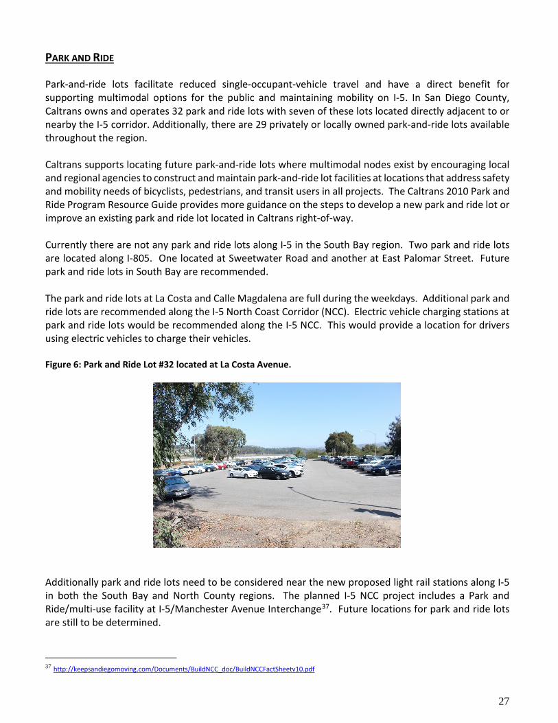
PARK AND RIDE Park-and-ride lots facilitate reduced single-occupant-vehicle travel and have a direct benefit for supporting multimodal options for the public and maintaining mobility on I-5. In San Diego County, Caltrans owns and operates 32 park and ride lots with seven of these lots located directly adjacent to or nearby the I-5 corridor. Additionally, there are 29 privately or locally owned park-and-ride lots available throughout the region. Caltrans supports locating future park-and-ride lots where multimodal nodes exist by encouraging local and regional agencies to construct and maintain park-and-ride lot facilities at locations that address safety and mobility needs of bicyclists, pedestrians, and transit users in all projects. The Caltrans 2010 Park and Ride Program Resource Guide provides more guidance on the steps to develop a new park and ride lot or improve an existing park and ride lot located in Caltrans right-of-way. Currently there are not any park and ride lots along I-5 in the South Bay region. Two park and ride lots are located along I-805. One located at Sweetwater Road and another at East Palomar Street. Future park and ride lots in South Bay are recommended. The park and ride lots at La Costa and Calle Magdalena are full during the weekdays. Additional park and ride lots are recommended along the I-5 North Coast Corridor (NCC). Electric vehicle charging stations at park and ride lots would be recommended along the I-5 NCC. This would provide a location for drivers using electric vehicles to charge their vehicles. Figure 6: Park and Ride Lot #32 located at La Costa Avenue.
Additionally park and ride lots need to be considered near the new proposed light rail stations along I-5 in both the South Bay and North County regions. The planned I-5 NCC project includes a Park and Ride/multi-use facility at I-5/Manchester Avenue Interchange37. Future locations for park and ride lots are still to be determined.
37 http://keepsandiegomoving.com/Documents/BuildNCC_doc/BuildNCCFactSheetv10.pdf

28
Table 7: Park and Ride Facilities Near I-5
Name/Lot Number Location Spaces Usage
Park and Ride Lot #17 4300 Taylor Street, San Diego, CA 25 High
Park and Ride #43 8002 Gilman Drive, San Diego, CA 26 Medium
Park and Ride #7 12791 Sorrento Valley Road, San Diego, CA 50 High
Park and Ride #47 1665 Villa Cardiff Drive, Cardiff, CA 56 Medium
Park and Ride # 62 170 Calle Magdalena, Encinitas, CA 27 Low
Park and Ride # 32 710 La Costa Avenue, Encinitas, CA 115 High
Park and Ride #44 1928 S Moreno Street, Oceanside, CA 130 High
Park and Ride #5 1667 Maxson Street, Oceanside, CA 43 Medium
TRANSPORTATION DEMAND MANAGEMENT Transportation Demand Management (TDM) programs are designed to reduce or shift demand for transportation by commuters through various means, such as the use of public transportation, carpooling, vanpooling, bicycling, walking, flexible work schedules, telework centers near residential areas, and telecommutting. Additionally, TDM strategies can be used to manage congestion particularly during peak periods. Employers can also provide subsidies or programs to encourage employees to choose alternate transportation choices for commuting. In San Diego County, SANDAG has established the iCommute38 program to provide resources for those interested in TDM options. The program’s goal is to manage and reduce traffic congestion, as well as reduce greenhouse gas emissions and other environmental pollutants that result from commuters driving alone each day. Some of the services provided are online trip planning and ridematching for commuters to find and organize carpools and vanpools, a subsidized vanpool program, a guaranteed ride home service, the regional bike map and bike locker program, and the GO by BIKE and Walk, Ride and Roll to school mini-grant programs. iCommute staff also assists employers with establishing custom TDM programs that fit employee and business needs. A TDM Plan was developed for the I-5 North Coast Corridor39. This report lead to the “Shift San Diego” program which provides commuters in the Golden Triangle area near I-5 and Genesee Avenue real time information for transportation. In the Golden Triangle region, SANDAG is engaged with over 60 employers and operates 130 vanpools. Currently there are 130 employers representing over 250,000 employees engaged in the SANDAG TDM program. Nearly 150 SANDAG vanpools travel the I-5 each work day. The Regional Mobility Hub Implementation Strategy by SANDAG, includes Mobility Hubs along the I-5 corridor for the communities of National City, Barrio Logan, Sorrento Valley and Oceanside. The definition 38 http://www.icommutesd.com 39 http://www.sandag.org/uploads/projectid/projectid_19_16644.pdf

29
used by SANDAG of a mobility hub is “Mobility hubs are transportation centers located in smart growth opportunity areas (areas that will support mixed-use, transit-oriented development) that are served by high-frequency transit. They provide an array of transportation services, amenities, and urban design enhancements that bridge the distance between transit and where people live, work, and play.40” These mobility hubs could be integrated at different transit and community contexts. For the Mid-Coast Trolley stations a separate Mobility Hub Implementation Strategy is being developed.41 The San Ysidro Transit Center is one of the major transportation centers and transport hubs given the high trolley ridership, facilitation of crossborder connections and availability of other connecting mobility options. CAR AND RIDE SHARING In addition to local taxicabs, which are operated by multiple companies and regulated by MTS, Car and Ride Sharing are emerging industries in San Diego County that cover most of the urban area along I-5. Emerging dynamic ride-sharing services known as Transportation Network Companies (TNCs) are currently operating in San Diego, including the I-5 corridor. TNCs feature private drivers and smartphone-based booking and payment systems. Using smartphone apps Uber and Lyft are two TNCs that are growing rapidly in popularity in the San Diego region allowing riders to find drivers, make payments electronically, and track service. This service is meant to be a high-tech, low-cost alternative to taxicab services. INTELLIGENT TRANSPORTATION SYSTEMS Intelligent Transportation Systems (ITS) use technology to manage various transportation modes enabling users to be well informed and make better travel decisions. Investments in ITS lead to cost-effective solutions compared to capacity-increasing roadway improvements since ITS enable using the existing facilities more efficiently ITS. Solutions include changeable message signs, Close Circuit Television, and advanced traffic management systems. The benefits of ITS include improvements in mobility, safety, fuel consumption reduction, air quality, and operational and economic savings. Mobility detection and surveillance technologies allow faster identification of response to and clearance of incidents, leading to reduced traffic delays. Other ITS methods for addressing accidents include providing advanced warnings to motorists of slow traffic ahead to alert drivers to roadway hazards (e.g., roadway sections with reduced visibility or traction). ITS infrastructure can reduce operating costs and enhance system performance including faster incident response times, congestion avoidance, and improve transit on-time performance. Remote monitoring of facilities also reduces staffing burden, and data archives allow for improved performance monitoring, more informed decision making, and data-driven long term planning. In 2011 a new District 11 ITS Master Plan was developed. The plan analyzes and provides an assessment of the existing ITS architecture and provides a cost assessment for maintaining and operating the existing/future ITS architecture. The plan also provides a vision for the expansion and improvements to the existing District 11 ITS infrastructure including field elements and their corresponding communication and back-office systems. ITS projects proposed for the I-5 corridor include Vehicle Detection Stations and Ramp Meters. 40 http://www.sdforward.com/mobility-planning/mobilityHubs 41 http://www.sdforward.com/mobility-planning/mobilityHubs

30
TRANSPORTATION SYSTEM MANAGEMENT AND OPERATIONS Transportation System Management and Operations (TSMO) is a performance based approach to optimize multimodal transportation through better planning, design, construction, maintenance, operation, and management of the transportation system. TSMO identifies potential cost-effective strategies that combine ITS infrastructure and operational strategies to improve the efficiency and reliability of the transportation network. Examples of TSMO strategies and concepts include, but are not limited to:
• Ramp metering systems • ITS • Real-time traveler information • Integrated Corridor Management (ICM) • Planning for Operations • Traffic incident and special event
management
• Traffic Management Plans (TMP’s) • Traffic signal synchronization • Managed lanes • Dynamic lane management • Variable Speed Limit
SANDAG has been working very closely with Caltrans District 11 and local agencies to promote the implementation of several innovative transportation demand and system management strategies or programs as the means to improve how our transportation system is being managed based on performance and as a unified system. Such efforts have included the promotion and support of TSMO strategies through the completion of the I-15 Integrated Corridor Management and the I-805 Active Traffic and Demand Management (ATDM) Concept of Operations Plan. The ICM concept enables multiple systems to “talk” to each other to coordinate operations and maximize efficiency regardless of who owns or operates the individual system. The I-805 ATDM Concept of Operations Plan focused on the identification and assessment of Transportation Demand (TDM) and System Management (TSM) strategies suitable to meet the mobility needs of the I-805 South Corridor. The ATDM Concept of Operations Plan set the vision and goals and is considered as an initial document that provides a programmatic overview of ATDM strategies to be considered for further analysis. The I-15 ICM project and completion of the I-805 ATDM Concept of Operations Plan served as foundational activities that help the establishment of the I-15 Corridor Management Team (CMT). The referenced Corridor Concept should expand on and promote the establishment of a TSMO plan as an opportunity for making more efficient use of the existing and planned transportation system along the I-5 corridor. The San Diego Forward: Regional Plan, Transportation System and Demand Management Programs, and Emerging Technologies identifies a number of TSM and TDM program focus areas that can serve as the foundation for identifying key TSMO strategies for the I-5 corridor. Further expanding and Incorporating TSMO into the TCR long-range system planning process can help articulates the State’s vision for an integrated multimodal transportation system that support strategies that go beyond capacity expansion. Consideration of TSMO strategies are consistent with advancing Caltrans Strategic Planning efforts and specifically supporting System Performance which is one of the Caltrans Strategic Plan Goals.

31
ENVIRONMENTAL CONSIDERATIONS
Caltrans strives to maintain, operate, and improve the transportation system in a manner sensitive to the environmental setting. Environmental issues are addressed in the system planning process and the project development process as early as feasible. Known environmental issues and concerns are included in a TCR so that planners, engineers, and other project development staff can incorporate environmental factors into project design from the outset. Some of the key environmental issues along I-5 are: Cultural resources, special status species, habitat connectivity, and air quality. For more detailed information please see Appendix A.
CORRIDOR PERFORMANCE The Corridor Performance of I-5 was developed using data from Caltrans Traffic information, SANDAG Model resources, and planning staff knowledge. The information in the table addresses the north and south volumes separately. AM and PM Peak Hour Volumes are addressed. Total Average Annual Daily Traffic (AADT) and Total Average Annual Daily Truck Traffic (AADTT) are also addressed in the table. The Base Year (BY) is 2014. The Horizon Year (HY) is 2050. The Level of Service (LOS) is shown by segment for BY 2014 and HY 2050. The LOS method used is from the Highway Capacity Manual (HCM). Vehicle Miles Traveled (VMT) is shown by segment for BY 2014 and HY 2050. The Volume Versus Capacity (V/C) is shown for peak hour for BY 2014 and HY 2050 by segment. The majority of the congestion along the route is found on segments 3, 4, 7, 8, 9, 10, 11, and 12. Segments 3 and 4 are where I-5 intersects with SR-54. Segments 7-10 are where I-5 intersects with SR-163, I-8, SR-52 and the merge with I-805. All of these locations are routes near the largest employment areas in the San Diego region. Segment 10 is at I-805 and SR-56. Segments 11-12 are between SR-56 and SR-78, which are both routes connecting east to west. Many commuters use these routes to travel to and from Riverside County. Camp Pendleton also has a large number of employees commuting to the base.

32
Table 8: I-5 Corridor Performance
Segment # 1 2 3 4 N S N S N S N S
International Border to I-805 I-805 to SR-905 SR-905 to SR-54 SR-54 to I-15
Basic System Operations
AADT (BY) 2014
44,219 41,414 26,985 23,407 74,436 67,853 97,066 94,314
AADT (HY) 2050
47,517 44,503 28,997 25,153 77,655 75,167 118,582 122,828
AADT: Growth Rate/Year
0.21% 0.21% 0.21% 0.21% 0.12% 0.30% 0.62% 0.84%
Peak Hour Volumes (BY)
AM 3,222 PM 4,662
AM 1,565 PM 6,359
AM 1,978 PM 2,901
AM 1,180 PM 5,161
AM 5,315 PM 4,189
AM 2,695 PM 7,072
AM 7,788 PM 4,760
AM 3,726 PM 8,394
Peak Hour Volumes (HY)
AM 2,776 PM 4,084
AM 1,354 PM 4,974
AM 2,286 PM 3,281
AM 1,099 PM 3,844
AM 5,326 PM 4,251
AM 3,415 PM 7,358
AM 8,672 PM 6,103
AM 5,801 PM 10,096
LOS Method HCM HCM HCM HCM HCM HCM HCM HCM
Segment LOS (BY)
AM B PM B
AM A PM C
AM A PM B
AM A PM D
AM C PM C
AM B PM D
AM E PM C
AM C PM E
Segment LOS (HY)
AM A PM B
AM A PM B
AM B PM B
AM A PM C
AM C PM C
AM C PM D
AM D PM C
AM C PM D
VMT (BY) 25,400 28,455 87,315 83,493 442,374 407,794 340,810 263,506
VMT (HY) 21,650 23,473 80,593 64,233 469,835 461,891 408,277 354,241
Peak Hour Traffic Data
Peak Period Length
AM 3.0 Hours PM 3.5 Hours
AM 3.0 Hours PM 3.5 Hours
AM 3.0 Hours PM 3.5 Hours
AM 3.0 Hours PM 3.5 Hours
AM 3.0 Hours PM 3.5 Hours
AM 3.0 Hours PM 3.5 Hours
AM 3.0 Hours PM 3.5 Hours
AM 3.0 Hours PM 3.5 Hours
Peak Hour Time of Day
AM 6:00 ~ 9:00 PM 3:30 ~ 7:00
AM 6:00 ~ 9:00 PM 3:30 ~ 7:00
AM 6:00 ~ 9:00 PM 3:30 ~ 7:00
AM 6:00 ~ 9:00 PM 3:30 ~ 7:00
AM 6:00 ~ 9:00 PM 3:30 ~ 7:00
AM 6:00 ~ 9:00 PM 3:30 ~ 7:00
AM 6:00 ~ 9:00 PM 3:30 ~ 7:00
AM 6:00 ~ 9:00 PM 3:30 ~ 7:00
Peak Hour VMT (BY)
AM 1,462 PM 2,116
AM 792 PM 3,220
AM 5,385 PM 7,895
AM 3,126 PM 13,681
AM 31,672 PM 24,960
AM 16,627 PM 43,630
AM 28,238 PM 17,260
AM 10,633 PM 23,952
Peak Hour VMT (HY)
AM 1,260 PM 1,854
AM 686 PM 2,519
AM 6,221 PM 8,930
AM 2,915 PM 10,190
AM 31,814 PM 25,391
AM 21,162 PM 45,648
AM 30,960 PM 22,040
AM 16,785 PM 29,366
Peak Hour V/C (BY)
AM 0.2968 PM 0.4174
AM 0.1893 PM 0.6025
AM 0.2633 PM 0.3807
AM 0.2167 PM 0.7345
AM 0.6680 PM 0.5094
AM 0.3906 PM 0.8700
AM 0.9572 PM 0.5869
AM 0.4959 PM 0.9878
Peak Hour V/C (HY)
AM 0.2574 PM 0.3676
AM 0.1640 PM 0.4712
AM 0.3097 PM 0.4400
AM 0.2131 PM 0.5527
AM 0.6572 PM 0.5097
AM 0.4804 PM 0.8330
AM 0.8092 PM 0.6252
AM 0.5913 PM 0.8429

33
Segment # 5 6 7 8 N S N S N S N S I-15 to SR-94 SR-94 to SR-163 SR-163 to I-8 I-8 to SR-52
Basic System Operations
AADT (BY) 2014
85,008 84,225 122,591 92,463 88,757 92,180 97,823 94,564
AADT (HY) 2050
96,001 92,632 131,734 99,359 102,242 99,697 110,354 105,804
AADT: Growth Rate/Year
0.36% 0.28% 0.21% 0.21% 0.42% 0.23% 0.36% 0.33%
Peak Hour Volumes (BY)
AM 7,385 PM 4,635
AM 3,695 PM 6,456
AM 11,050 PM 7,493
AM 4,670 PM 6,888
AM 6,264 PM 5,346
AM 5,260 PM 6,609
AM 7,123 PM 6,112
AM 5,098 PM 7,542
Peak Hour Volumes (HY)
AM 7,504 PM 5,427
AM 4,359 PM 6,385
AM 9,729 PM 7,333
AM 4,710 PM 6,430
AM 7,220 PM 7,112
AM 6,197 PM 6,883
AM 8,490 PM 7,650
AM 6,193 PM 8,429
LOS Method HCM HCM HCM HCM HCM HCM HCM HCM
Segment LOS (BY)
AM F PM C
AM C PM D
AM F PM D
AM C PM D
AM D PM C
AM D PM D
AM E PM D
AM C PM E
Segment LOS (HY)
AM F PM D
AM C PM D
AM F PM D
AM C PM D
AM F PM E
AM D PM D
AM E PM D
AM D PM E
VMT (BY) 202,754 261,139 121,748 84,730 307,901 316,050 587,984 551,548
VMT (HY) 210,126 264,181 140,764 114,373 348,243 347,689 667,836 610,664
Peak Hour Traffic Data
Peak Period Length
AM 3.0 Hours PM 3.5 Hours
AM 3.0 Hours PM 3.5 Hours
AM 3.0 Hours PM 3.5 Hours
AM 3.0 Hours PM 3.5 Hours
AM 3.0 Hours PM 3.5 Hours
AM 3.0 Hours PM 3.5 Hours
AM 3.0 Hours PM 3.5 Hours
AM 3.0 Hours PM 3.5 Hours
Peak Hour Time of Day
AM 6:00 ~ 9:00 PM 3:30 ~ 7:00
AM 6:00 ~ 9:00 PM 3:30 ~ 7:00
AM 6:00 ~ 9:00 PM 3:30 ~ 7:00
AM 6:00 ~ 9:00 PM 3:30 ~ 7:00
AM 6:00 ~ 9:00 PM 3:30 ~ 7:00
AM 6:00 ~ 9:00 PM 3:30 ~ 7:00
AM 6:00 ~ 9:00 PM 3:30 ~ 7:00
AM 6:00 ~ 9:00 PM 3:30 ~ 7:00
Peak Hour VMT (BY)
AM 17,979 PM 11,284
AM 11,861 PM 20,727
AM 11,743 PM 7,963
AM 4,406 PM 6,499
AM 22,538 PM 19,237
AM 18,623 PM 23,401
AM 43,933 PM 37,701
AM 29,935 PM 44,282
Peak Hour VMT (HY)
AM 16,665 PM 12,052
AM 12,785 PM 18,731
AM 12,419 PM 9,363
AM 5,748 PM 7,847
AM 25,979 PM 25,588
AM 21,940 PM 24,368
AM 52,045 PM 47,072
AM 36,243 PM 48,920
Peak Hour V/C (BY)
AM 1.0142 PM 0.6308
AM 0.5180 PM 0.8311
AM 1.3604 PM 0.8292
AM 0.5824 PM 0.7753
AM 0.8858 PM 0.6750
AM 0.7205 PM 0.7904
AM 0.9714 PM 0.7451
AM 0.6664 PM 0.8947
Peak Hour V/C (HY)
AM 1.0136 PM 0.7272
AM 0.6182 PM 0.8143
AM 1.2446 PM 0.8534
AM 0.6380 PM 0.7716
AM 1.0164 PM 0.8920
AM 0.8636 PM 0.8251
AM 0.9877 PM 0.8618
AM 0.8101 PM 0.8982

34
Segment # 9 10 11 12
N S N S N S N S SR-52 to I -805 I-805 to SR-56 SR-56 to Manchester Avenue Manchester Avenue to SR-78
Basic System Operations AADT (BY)
2014 84,718 81,956 161,149 151,959 130,390 131,145 100,096 99,366
AADT (HY) 2050
97,310 84,837 172,125 168,166 142,317 142,887 121,602 121,228
AADT: Growth
Rate/Year 0.41% 0.10% 0.19% 0.30% 0.25% 0.25% 0.60% 0.61%
Peak Hour Volumes
(BY)
AM 6,779 PM 7,115
AM 4,873 PM 5,826
AM 7,473 PM 12,447
AM 11,078 PM 8,529
AM 7,112 PM 10,858
AM 9,457 PM 7,205
AM 5,306 PM 7,545
AM 6,633 PM 5,532
Peak Hour Volumes
(HY)
AM 7,741 PM 6,896
AM 4,519 PM 6,284
AM 9,328 PM 11,639
AM 13,488 PM 10,183
AM 17,325 PM 23,062
AM 11,001 PM 8,990
AM 6,589 PM 9,306
AM 8,371 PM 7,281
LOS Method HCM HCM HCM HCM HCM HCM HCM HCM
Segment LOS (BY)
AM E PM E
AM D PM D
AM D PM D
AM E PM D
AM E PM F
AM F PM D
AM D PM F
AM E PM D
Segment LOS (HY)
AM D PM D
AM C PM D
AM D PM D
AM F PM D
AM F PM F
AM F PM E
AM D PM F
AM E PM D
VMT (BY) 415,709 429,013 356,727 366,650 707,080 702,292 1,253,473 1,266,779
VMT (HY) 568,234 504,770 336,927 364,623 880,790 834,926 1,540,888 1,526,111
Peak Hour Traffic Data Peak Period
Length AM 3.0Hours PM 3.5Hours
AM 3.0Hours PM 3.5Hours
AM 3.0Hours PM 3.5Hours
AM 3.0Hours PM 3.5Hours
AM 3.0Hours PM 3.5Hours
AM 3.0Hours PM 3.5Hours
AM 3.0Hours PM 3.5Hours
AM 3.0Hours PM 3.5Hours
Peak Hour Time of Day
AM 6:00 ~ 9:00 PM 3:30 ~ 7:00
AM 6:00 ~ 9:00 PM 3:30 ~ 7:00
AM 6:00 ~ 9:00 PM 3:30 ~ 7:00
AM 6:00 ~ 9:00 PM 3:30 ~ 7:00
AM 6:00 ~ 9:00 PM 3:30 ~ 7:00
AM 6:00 ~ 9:00 PM 3:30 ~ 7:00
AM 6:00 ~ 9:00 PM 3:30 ~ 7:00
AM 6:00 ~ 9:00 PM 3:30 ~ 7:00
Peak Hour VMT (BY)
AM 33,940 PM 35,623
AM 25,385 PM 30,347
AM 15,876 PM 26,622
AM 25,591 PM 19,539
AM 38,416 PM 57,941
AM 49,759 PM 38,231
AM 66,061 PM 93,947
AM 84,137 PM 70,176
Peak Hour VMT (HY)
AM 39,340 PM 34,941
AM 23,543 PM 32,739
AM 16,983 PM 21,572
AM 27,765 PM 20,758
AM 98,221 PM 130,454
AM 58,829 PM 48,036
AM 82,473 PM 116,527
AM 106,343 PM 92,452
Peak Hour V/C (BY)
AM 0.9818 PM 0.9272
AM 0.7179 PM 0.7834
AM 0.7322 PM 0.8606
AM 0.9206 PM 0.7880
AM 0.8879 PM 1.1562
AM 1.0302 PM 0.7841
AM 0.7921 PM 1.0170
AM 0.9757 PM 0.7783
Peak Hour V/C (HY)
AM 0.8757 PM 0.7413
AM 0.6199 PM 0.7185
AM 0.7531 PM 0.7460
AM 1.0064 PM 0.8005
AM 2.1422 PM 2.4369
AM 1.1262 PM 0.9467
AM 0.8440 PM 1.0288
AM 0.9931 PM 0.8788

35
Segment # 13 14
N S N S
SR-78 to U/R Limit U/R Limit to Orange County
Line Basic System Operations
AADT (BY) 2014
96,699 101,260 70,974 73,421
AADT (HY) 2050
120,719 118,714 95,614 94,563
AADT: Growth Rate/Year
0.69% 0.48% 0.96% 0.80%
Peak Hour Volumes (BY)
AM 5,111 PM 6,351
AM 6,029 PM 5,845
AM 3,367 PM 5,079
AM 4,231 PM 3,380
Peak Hour Volumes (HY)
AM 6,114 PM 7,925
AM 6,973 PM 6,743
AM 4,378 PM 6,837
AM 5,571 PM 4,218
LOS Method HCM HCM HCM HCM
Segment LOS (BY)
AM D PM D
AM D PM D
AM C PM D
AM C PM C
Segment LOS (HY)
AM D PM E
AM D PM D
AM C PM E
AM D PM C
VMT (BY) 343,972 355,540 1,379,622 1,405,151
VMT (HY) 420,564 415,844 1,770,464 1,760,953
Peak Hour Traffic Data Peak Period Length
AM 3.0Hours PM 3.5Hours
AM 3.0Hours PM 3.5Hours
AM 3.0Hours PM 3.5Hours
AM 3.0Hours PM 3.5Hours
Peak Hour Time of Day
AM 6:00 ~ 9:00 PM 3:30 ~ 7:00
AM 6:00 ~ 9:00 PM 3:30 ~ 7:00
AM 6:00 ~ 9:00 PM 3:30 ~ 7:00
AM 6:00 ~ 9:00 PM 3:30 ~ 7:00
Peak Hour VMT (BY)
AM 17,824 PM 22,171
AM 21,036 PM 20,395
AM 60,037 PM 90,551
AM 75,027 PM 59,944
Peak Hour VMT (HY)
AM 21,102 PM 27,386
AM 24,165 PM 23,371
AM 77,705 PM 121,513
AM 99,025 PM 74,975
Peak Hour V/C (BY)
AM 0.7218 PM 0.8638
AM 0.8401 PM 0.7700
AM 0.4964 PM 0.7315
AM 0.6125 PM 0.5046
Peak Hour V/C (HY)
AM 0.7394 PM 0.9106
AM 0.8420 PM 0.7793
AM 0.6265 PM 0.9343
AM 0.7828 PM 0.6330

36
Segment # 1 2 3 4 N S N S N S N S International Border to I-805 I-805 to SR-905 SR-905 to SR-54 SR-54 to I-15
Truck Traffic
Total Average Annual Daily Truck Traffic (AADTT) (BY)
1,327 1,242 1,079 936 3,350 3,053 4,853 4,716
Total Average Annual Daily Truck Traffic (AADTT) (HY)
1,426 1,335 1,160 1,006 3,494 3,383 5,929 6,141
Total Trucks (% of AADT) (BY) 3.00% 4.00% 4.50% 5.00%
Total Trucks (% of AADT)(HY) 3.00% 4.00% 4.50% 5.00%
5+ Axle Average Annual Daily Truck Traffic (AADTT)(BY)
446 417 237 206 938 855 1,199 1,165
5+ Axle Average Annual Daily Truck Traffic (AADTT)(HY)
479 449 255 221 978 947 1,464 1,517
5+ Axle Trucks (as % of AADT)(BY) 1.01% 0.88% 1.26% 1.24%
5+ Axle Trucks (as % of AADT)(HY) 1.01% 0.88% 1.26% 1.24%

37
Segment # 5 6 7 8
N S N S N S N S
International Border to I-
805 I-805 to SR-905 SR-905 to SR-54 SR-54 to I-15
Truck Traffic Total Average Annual Daily Truck Traffic (AADTT) (BY)
3,400 3,369 4,904 3,699 3,639 3,779 4,402 4,255
Total Average Annual Daily Truck Traffic (AADTT) (HY)
3,840 3,705 5,269 3,974 4,192 4,088 4,966 4,761
Total Trucks (% of AADT) (BY) 4.00% 4.00% 4.10% 4.50%
Total Trucks (% of AADT)(HY) 6.00% 4.00% 4.10% 4.50%
5+ Axle Average Annual Daily Truck Traffic (AADTT)(BY)
782 775 981 740 910 945 1,189 1,149
5+ Axle Average Annual Daily Truck Traffic (AADTT)(HY)
883 852 1,054 795 1,048 1,022 1,341 1,286
5+ Axle Trucks (as % of AADT)(BY) 0.92% 0.80% 1.03% 1.22%
5+ Axle Trucks (as % of AADT)(HY) 0.92% 0.80% 1.03% 1.22%

38
Segment # 9 10 11 12
N S N S N S N S
SR-52 to I -805 I-805 to SR-56 SR-56 to Manchester
Avenue Manchester Avenue to SR-
78 Truck Traffic
Total Average Annual Daily Truck Traffic (AADTT) (BY)
3,473 3,360 6,607 6,230 9,010 9,062 4,805 4,770
Total Average Annual Daily Truck Traffic (AADTT) (HY)
3,383 3,478 7,057 6,895 9,834 9,874 5,837 5,819
Total Trucks (% of AADT) (BY) 4.10% 4.10% 6.91% 5.98%
Total Trucks (% of AADT)(HY) 4.10% 4.10% 6.91% 5.98%
5+ Axle Average Annual Daily Truck Traffic (AADTT)(BY)
1,459 1,411 2,775 2,617 4,424 4,450 2,359 2,342
5+ Axle Average Annual Daily Truck Traffic (AADTT)(HY)
1,676 1,461 2,964 2,896 4,829 4,848 2,866 2,857
5+ Axle Trucks (as % of AADT)(BY) 1.72% 1.72% 2.36% 2.36%
5+ Axle Trucks (as % of AADT)(HY) 1.72% 1.72% 2.36% 2.36%

39
Segment # 13 14
N S N S
SR-78 to U/R Limit U/R Limit to Orange
County Line Truck Traffic
Total Average Annual Daily Truck Traffic (AADTT) (BY)
5,783 6,055 4,244 4,391
Total Average Annual Daily Truck Traffic (AADTT) (HY)
7,219 7,099 5,718 5,655
Total Trucks (% of AADT) (BY) 5.98% 5.98%
Total Trucks (% of AADT)(HY) 5.98% 5.98%
5+ Axle Average Annual Daily Truck Traffic (AADTT)(BY)
2,839 2,973 2,084 2,156
5+ Axle Average Annual Daily Truck Traffic (AADTT)(HY)
3,545 3,486 2,807 2,777
5+ Axle Trucks (as % of AADT)(BY)
2.94% 2.94%
5+ Axle Trucks (as % of AADT)(HY)
2.94% 2.94%

40
KEY CORRIDOR ISSUES Bottlenecks Major bottlenecks and the number of vehicles using I-5 are the primary cause of congestion and lost productivity. A bottleneck is a location where traffic demand exceeds the effective carrying capacity of the roadway. In most cases, the cause of a bottleneck relates to a sudden reduction in capacity, such as a lane drop, merging and weaving, driver distractions, a surge in demand, or a combination of factors. There are eight major bottleneck locations in the northbound direction and eight in the southbound direction of I-5. These major bottlenecks were identified and verified based on a variety of data sources, including Caltrans detector data, recently conducted probe vehicle runs using GPS technology, State Highway Congestion Monitoring Program (HICOMP) data, field observations and video-taping. Bottlenecks were also identified and verified for both directions of the HOV lane, using primarily Caltrans detector data, field observations, and video-taping. Caltrans Performance Measurement System (PeMS) speed contour plots show speeds for every detector location along the corridor for every five-minute period throughout the day. Delay Delay is defined as the observed travel time minus the travel time during free flow conditions (assumed 60 miles per hour) and can be grouped into two components: severe delay and other delay. Severe delay occurs when speeds are below 35 mph and other delay occurs when speeds are between 35 and 60 mph. Severe delay represents breakdown conditions, while other delay represents conditions approaching or leaving the breakdown congestion, or areas that experience temporary slowdowns. Significant traffic generators along the I-5 corridor include:
• Camp Pendleton • Carlsbad Premium Outlets • Carlsbad State Beach • Del Mar Race Track • Downtown San Diego • La Jolla • LEGOLAND • Mission Beach • Naval Base San Diego • Oceanside Pier • Pacific Beach
• Qualcomm Inc. (Headquarters) • San Diego Harbor • San Diego International Airport • San Diego Zoo • San Ysidro Border Crossing • SCRIPPS Health Hospital • Sea World • University of California, San Diego (UC
San Diego) • UC San Diego Health • VA San Diego Healthcare • Westfield University Town Center (UTC)
According to Caltrans counting station information, segments 1-3 experience peak traffic in the northbound lanes during 6 - 7 am, 12 – 1 pm and 4 - 5 pm. Southbound lanes experience peak traffic between 11 am – 12 pm and 3 – 6 pm. Segment 5 experiences peak traffic in the northbound lanes from 6 – 8 am and 2 – 4 pm. Peak traffic for the southbound lanes is 7 – 8 am, 11 am – 12 pm, and 3 – 5 pm. In segments 7 – 10, the northbound lanes experience peak traffic from 7 – 8 am and 3 – 6 pm. The southbound lanes experience peak traffic during 8 – 9, 11 am – 12 pm, and 3 – 5 pm. In segment 11, peak traffic in the northbound lanes are from 11 – 12 pm, and 3 – 4 pm. In the southbound lanes, peak

41
traffic is from 7 – 8 am and 3 – 4 pm. In segment 12, the northbound lanes experience peak traffic from 8 – 10 am, 11 am – 12 pm, and 3 – 5 pm. The southbound lanes experience peak traffic from 6 – 8 am and 2 – 4 pm. In Segment 13, the northbound lanes experience peak traffic from 6 – 7 am, 11 – 12 pm, 2 – 3 pm, and 5 – 6 pm. Southbound lanes experience traffic from 7 – 8 am, 11 am – 12 pm, and 2 – 5 pm. The Pacific Fleet, Naval Base San Diego (NBSD) includes four major facilities near I-5. NBSD (32nd Street), the Broadway Complex (downtown), Naval Facilities Engineering Command Soutwest (Pacific Highway), and the Naval Medical Center San Diego (Balboa Park). NBSD at 32nd Street processes approximately 40,000 vehicles through its gates per day; the Naval Medical Center processes approximately 10,000 vehicles per day (staff, patients, and visitors) through its gates.42 The U.S. Navy’s Pacific Rebalance of assets will generate a 40% increase in both active-duty military and dependents from Fiscal Year 2015 to Fiscal Year 2024 in the San Diego region40. The Corridor Performance analyzed weekday travel patterns. I-5, however, has an increase in vehicle volume due to weekend, seasonal and special events along the corridor. The Del Mar Fairgrounds is the venue for the San Diego County Fair which occurs from June to early July. The 26 day event in 2016 brought a total attendance of 1,609,48143. The Fairgrounds is also the site of live horse races from July – September and November44. Both events increase traffic along the I-5 near the Via De La Valle on and off ramps. Interregional Travel Since the I-5 is the main way to travel to Orange County and Los Angeles, many residents of San Diego County and those traveling from Mexico use I-5 to access job centers within Orange and Los Angeles Counties. As Orange County continues to experience rapid population growth demand on I-5 interregional travel will continue to increase. Intensification of Land Use While most of the area adjacent to I-5 within San Diego County is developed, there is an anticipated intensification of land use primarily in the area adjacent to the I-5.
CORRIDOR CONCEPTS The concept for I-5 in San Diego County is to optimize system efficiency through enhancing freeway capacity where feasible and through improvements that increase opportunities for multi-modal options. These projects include planned managed lanes that will allow for bus rapid transit (BRT) service, integrated light rail expansion, and robust active transportation improvements that complete the system. Key connectors and interchanges will be improved to achieve these goals. SANDAG, the MPO for San Diego County, partners with Caltrans to plan and build transportation improvements in the region. Future projects referenced are based on the San Diego Forward: The Regional Plan (SD Forward) adopted in October 9, 2015. Priorities identified in the newly adopted SD Forward can be referenced at www.sdforward.com. 42 Department of Navy 43 http://www.delmarfairgrounds.com/index.php?fuseaction=about.press_details&newsid=1209 44 http://www.delmarfairgrounds.com/index.php?fuseaction=about.home

42
SANDAG and Caltrans have collaborated with the California Coastal Commission, local cities, resource agencies, and the public to develop the I-5 North Coast Corridor (NCC) Public Works Plan/Transportation and Resource Enhancement Program (PWP/TREP) 45, which lays out a blueprint for implementing a $6-billion 40-year program of rail, highway, transit, bicycle, pedestrian, and coastal resource improvements that span 27 miles of the Northern San Diego County coastline from La Jolla to Oceanside. This project represents the SD Forward investment on the corridor. The ultimate freeway improvement to I-5 within the North Coast Corridor will be the construction of two managed lanes in each direction from La Jolla Village Drive to Vandegrift Boulevard. The managed lanes will be branded as “Express Lanes” and will be free for carpools, vanpools and buses. Additional lane capacity will allow single-occupant vehicles to use the Express Lanes for a fee. These Express Lanes will allow for transit expansion along the corridor, while promoting TDM strategies. Operational improvements, such as auxiliary lanes and local freeway interchange modifications, will be added incrementally in key locations to improve traffic flow. Phasing of the projects from the SD Forward is shown in Table 9. The next phasing of the project going into construction is adding two HOV lanes from Lomas Santa Fe Drive to SR-78.
Table 9: Planned Projects from SANDAG SD Forward Revenue Constrained Projects
Seg. Description Planned or
Programmed Location Purpose Implementation Phase
12 Add 2 ML46 Programmed Manchester Avenue to SR-78
System Expansion 2020
3 Add 2 ML Planned SR-905 to SR-54 System Expansion 2035
4 Add 2 F and 2 ML Planned SR-54 to SR-15 System Expansion 2035
9 Add 2 ML Planned La Jolla Village Drive to I-5/805 Merge
System Expansion 2035
10 Add 2 ML Planned I-5/805 Merge to SR-56 System Expansion 2035
11 Add Additional 2 ML Planned SR-56 to Manchester Avenue
System Expansion 2035
12 Add Additional 2 ML Planned Manchester Avenue to SR-78
System Expansion 2035
13 Add 2 ML Planned SR-78 to Vandergrift Boulevard
System Expansion 2035
8, 9 Add 2 ML Planned I-8 to La Jolla Village Drive
System Expansion 2050
13 Add Additional 2 ML Planned SR-78 to Vandergrift Boulevard
System Expansion 2050
14 Add 4 T47 Planned Vandergrift Boulevard to Orange County Line
System Expansion 2050
5, 6, 7 Operational Improvements Planned SR-15 to I-8 System
Preservation 2050
45 http://www.dot.ca.gov/dist11/Env_docs/I-5PWP/5PWPFinal.html 46 Managed Lane 47 Toll Lane

43
12, 13
ML Connectors South to East, West to North, North to East, and
West to South Planned SR-78 System
Expansion 2035
9, 10 ML Connectors North to North
and South to South Planned SR-805 System Expansion 2035
10, 11
Freeway Connectors West to North and South to East Planned SR-56 System
Expansion 2035
12, 13
Freeway Connectors South to East and west to South Planned SR-78 System
Expansion 2035
Currently in construction is the I-5/Genesee Ave Interchange Improvement Project that includes the replacement of the existing overcrossing, widening of freeway access ramps, and the addition of an auxiliary lane in the northbound direction on I-5 between Genesee Avenue and Roselle Street. Typically, freeway-to-freeway interchanges have grade-separated direct connectors for all of the directional movements. However, in the case of the I-5/SR-56 interchange, only two of these connections (northbound I-5 to eastbound SR-56 and westbound SR-56 to southbound I-5) are currently served by direct connectors. Travelers that needs to go from SR-56 west to I-5 north or I-5 south to SR-56 east must exit the freeway at Carmel Valley Road/El Camino Real and travel through two or three signalized intersections. This causes congestion at the ramp intersections serving these freeway-to-freeway movements along El Camino Real and Carmel Valley Road. This condition not only causes delays for regional travelers on the freeway system, but the additional regional traffic on the local streets reduces the capacity of the intersections to accommodate local traffic. Caltrans is finalizing an environmental document for two new I-5/SR-56 connectors. The project proposes westbound SR-56 to northbound I-5 connector and a southbound I-5 to eastbound SR-56 connector. The project will improve the traffic operations on I-5 between Del Mar Heights Road and Carmel Valley Road, and on SR 56 between I-5 and Carmel Country Road. Caltrans is currently studying the project alternatives and expects to release the Final EIR/EIS in 2017. Project Study Report-Project Development Support Caltrans is currently preparing two Project Study Report-Project Development Support (PSR-PDS) document to highlight transportation improvement projects that will improve the overall movement of people and goods along SR-78 and I-5/SR-78 connector by implementing the most cost effective strategies while minimizing impacts to the surrounding communities.
• I-5/SR-78 PSR-PDS • SR-78 Managed Lanes
The I-5/SR-78 PSR-PDS as well as the SR-78 Managed Lanes project address congestion, weaving and bottlenecks on SR-78. Two common approaches to lane management are restricted use based on vehicle eligibility and control of access through limited ingress/egress. Vehicle eligibility is based on occupancy or vehicle type. California’s Managed Lanes are comprised of HOV lanes, Express Lanes and Park and Ride facilities. The HOV lane, also known as the carpool or diamond lane, is a traffic management strategy to encourage ridesharing, which alleviates congestion and maximizes the people-carrying capacity of California highways. The goals of the HOV lanes are to provide an express service incentive for motorists to carpool, thereby, reducing congestion. Express Lanes provide a managed approach to improving system performance and reliability, optimizing use of capacity, and creating new sources of revenue to further improve transportation in the corridor, including transit. Also known as High Occupancy Toll

44
(HOT) lanes, express lanes provide preferential access for eligible vehicles, such as high occupancy vehicles and certain low emission vehicles, and for FasTrak users choosing to pay a fee to access the Express Lanes. The SR-78 Managed Lane project would utilize the Managed Lane operational concept through implementation of one of the two lane management strategies, HOV lane or express lane, to reduce the demand on the existing general purpose lanes from I-5 to SR-78 by providing dedicated lanes for managed lane traffic and to provide system connectivity with the proposed I-5 Managed Lanes. The use of lane management strategies and congestion pricing would reduce congestion in the general purpose lanes by allowing some general purpose vehicles with FasTrak transponders to use excess capacity in the managed lanes. Central Interstate 5 Corridor Study In 2003, SANDAG completed the Central Interstate 5 Corridor Study48. This study examined I-5 between Sea World Drive and SR-54. Based on the study, projects have been developed to address deficiencies including direct access ramps to the San Diego International Airport and access improvements to the Port of San Diego Marine Terminals. The Recommended Plan map is attached as Appendix F. A PSR-PDS was written for the proposal of connector ramps between I-5, the San Diego International Airport and the proposed Intermodal Transportation Center (ITC) on Pacific Highway. Mid-Coast Trolley Project Running parallel to I-5, the Mid-Coast Trolley Project will extend Blue Line Trolley service from Santa Fe Depot in Downtown San Diego to the University City community, serving major activity centers such as Old Town, UC San Diego, and Westfield UTC. The new trolley track will follow the existing rail right of way for the majority of the new route. Construction began in fall 2016 and service is anticipated to begin in 2021. The project will connect corridor residents with other Trolley lines serving Mission Valley, East County, and South County. Caltrans is working with the City of San Diego and MTS to develop transit stations adjacent to I-5 that provide accessibility and convenient connections49. LOSSAN Rail Corridor The Los Angeles – San Diego – San Luis Obispo Rail Corridor (LOSSAN Corridor) is 351-miles of intercity passenger rail50. Forty-six percent of the LOSSAN Corridor in San Diego County is single-tracked, which creates choke points when trains traveling in opposite directions meet. These conflicts create most of the delay in the corridor, and therefore corridor wide double-tracking is necessary to sufficiently increase capacity and service. The LOSSAN Corridor in the NCC includes several double-tracking projects, consisting of 14 miles of new track. More than any other rail improvement, this would do the most to increase capacity, increase reliability, and reduce travel time for freight and intercity passenger rail. This improvement would benefit all four current rail operators (COASTER, Amtrak, Metrolink and BNSF) in the corridor by decreasing conflicts, which would result in better reliability and shortened travel times. The program features enhanced pedestrian crossings, vehicle crossing improvements, and rail bridge replacements to improve safety and accessibility.
48 http://www.sandag.org/uploads/publicationid/publicationid_878_4471.pdf 49 http://www.sandag.org/index.asp?projectid=250&fuseaction=projects.detail 50 http://www.octa.net/LOSSAN-Rail-Corridor-Agency/Overview/

45
The program will also construct a new facility, the I-5 North Coast Bike Trail. The Trail will run the entire length of the corridor roughly parallel to the highway that would complement the existing Coast Highway, Coastal Rail Trail, and the Coastal Trail. The trail would consist of separated and shared bicycle facilities, partially in the Caltrans right-of-way and partially on adjacent city right-of-way. This would link communities and provide continuous active transportation options from the Orange County Line to urbanized area of San Diego. Included in the improvements is lengthening the rail and highway bridges for improved water circulation and facilitating large-scale restoration plans in the San Elijo, Batiquitos and Buena Vista Lagoons. The program provides for a more comprehensive and sustainable approach to improving the quality of storm water runoff from the transportation facilities. I-5 Genesee Ave Interchange Improvement Project The I-5 Genesee Ave Interchange Improvement project will add a new, separated bicycle/pedestrian path, providing links to transportation, employment centers, hospitals and University of California, San Diego. Figure 7: I-5 Genesee Ave Interchange Improvement project construction.
Ten-Year State Highway Operation and Protection Plan State legislation requires Caltrans to develop a Ten-Year State Highway Operation and Protection Plan (SHOPP). The Plan identifies rehabilitation needs, schedules for meeting those needs, strategies for cost control, and program efficiencies. Additionally, State legislation requires the development of a four-year State Highway Operation and Protection Program (SHOPP.) SHOPP projects are limited to capital improvements related to maintenance, safety, operation, mobility and rehabilitation of State highway and bridges. The SHOPP program reflects the first four years of the Ten-Year State Highway Operation and Protection Plan. District 11 developed the latest SHOPP needs plan in 2017. Projects along I-5 include, sign replacement, fiber optic systems installation, and pavement maintenance projects.

46
Future Local Projects Future local arterial projects that parallel along I-5 include the North Coast Highway 101 improvement projects for the cities of Oceanside and Encinitas. These plans include bike/pedestrian improvements. The City of San Diego has future plans to enhance Morena Boulevard. with pedestrian and bike connections to transit. To achieve the concept stated above for I-5, in addition to planned capital capacity increasing projects, system operations and management concepts need to be further developed for the corridor. Among the projects and strategies that need to be included are TDM strategies, ITS, and TSMO.

47
APPENDIX APPENDIX A - ENVIRONMENTAL CONSIDERATIONS Environmental Considerations51 The purpose of this environmental section is to conduct a high level identification of environmental factors that may need future analysis in the project development process and project planning efforts. This information does not represent all possible environmental considerations that may exist within the area surrounding Interstate 5 (I-5). As seen in Appendix A page 51 Table 11, the environmental factors have been categorized based on a scale of high-medium-low probability of environmental resource issues established by district staff. Resources with a greater than “low” environmental sensitivity are explained below: Potential Section 4(f) Land: I-5 serves several communities within San Diego County. Project planning efforts should include all measures to first avoid and then develop prudent and feasible alternatives that avoid publically-owned parks, recreation lands, wildlife and waterfowl refuges, historic resources, and archeological sites as defined by the Department of Transportation Act. Environmental Justice: Both low-income and minority populations exist among the communities along I-5. Project planning efforts include considerations to avoid any disproportionately high and adverse impacts on these populations and ensure that all populations, regardless of race and income level are included in the project development process. Farmland: Agriculture is in current production along I-5. The planning process should develop alternatives that minimize any conversion of prime or unique farmland to non-agricultural land uses. These designations have additional requirements through the Coastal Commission requirements. Cultural Resources: Cultural resources encompass both the built and archeological environments, which includes both prehistoric and historic archeological sites. Potential for cultural resources is high all along the I-5 Corridor. Record searches and often pedestrian surveys are required to assess the potential for these resources. Paleontological Resources: These types of resources are considered fossilized remains of both plants and animals as well as the sedimentary rock in which they occur. Fossils have the potential to occur in environments where material eroded from the mountains has been transported downhill and deposited. Research to identify the potential of fossil remains are be required during the project development process. Visual/Aesthetics: Although I-5 is not designated as a State Scenic Highway, the Corridor contains a variety of visual resources that include lagoons, natural vistas of the ocean, and green visual landscape of the freeway. The southern portion of the I-5 Corridor is more urban with cityscapes. Project planning efforts should remain consistent with the landscape goals and policies set forth by the County and the I-5 Design Guidelines.
51 District 11 Environmental Coordinator

48
Hazardous Materials and Naturally Occurring Asbestos: I-5 Corridor connects several communities with a mixture of commercial, industrial, and residential land uses, which have the potential to generate hazardous materials. Additionally, the potential for aerially deposited lead exists throughout the Corridor. As such, an Initial Site Assessment may be required to identify potential sources of hazardous materials. Proper disposal of hazardous material is vital if it is disturbed during project construction. Water Quality: There are several watershed within the I-5 Corridor. Section 401 of the Clean Water Act requires water quality certification from the State Water Resources Control Board or from a Regional Water Quality Control Board when the project requires a Clean Water Act Section 404 permit to dredge or fill within a water of the United States. Along with Section 401 of the Clean Water Act, Section 402 of the Act establishes the National Pollutant Discharge Elimination System permit for the discharge of any pollutant into waters of the United States. The federal Environmental Protection Agency has delegated administration of the National Pollutant Discharge Elimination System program to the State Water Resources Control Board and Regional Water Quality Control Board. The State Water Resources Control Board has developed and issued a statewide National Pollutant Elimination System permit to regulate storm water discharges from all Department activities on its highways and facilities. All construction projects require a Storm Water Pollution Prevention Plan to be prepared and implemented during construction. Seismic/Geology/Soils: Earthquakes are the principal geologic activity occurring within the I-5 Corridor. As such, geotechnical considerations should be an important part of the project development process. Air Quality: Most of California’s transportation air quality requirements come from the Federal Clean Air Act (FCAA) and the California Clean Air Act (CCAA). The FCAA sets nationwide standards called National Ambient Air Quality Standards (NAAQS) managed by the U.S. Environmental Protection Agency (EPA). As such, the U.S. EPA has set both primary (health) and secondary (welfare) standards for the six "criteria pollutants"– carbon monoxide, lead, nitrogen dioxide, ozone, sulfur dioxide, and particulates (PM10 and PM2.5). The California Clean Air Act, managed by the California Environmental Protection Agency (Cal EPA), sets California's vehicle emission control and fuel standards at more stringent levels than Federal standards. This often results in differing air quality designations for the same region within California. Ozone is the only remaining criteria pollutant to have non-attainment federal and state designations. For PM 10 and PM 2.5 only the state designation is nonattainment. Floodplain: I-5 Corridor is mainly within the coastal zone and contains several lagoons, rivers, and creeks. These water bodies are considered to be within the 100-year floodplain. Project planning should minimize encroachment into the floodplain as well as avoid any type of longitudinal encroachment. Noise: I-5 Corridor is mainly alongside residential land use. Project planning efforts should identify sensitive receptors along the route and determine reasonable and feasible measures to reduce noise levels exceeding federal and state thresholds. Climate Change: Within California, transportation sources including passenger cars, light duty trucks, other trucks, buses, and motorcycles make up the largest source (second to electrical generation) of

49
Greenhouse Gas emitting sources. Project planning efforts should include all possible measures that support efforts to reduce vehicle miles traveled by working with local jurisdictions on planning activities; however, Caltrans does not have local land use planning authority. Waters and Wetlands: I-5 Corridor contains many waters and wetlands. Project planning efforts should identify these resources and avoid impacts. In addition, the identification and permitting of potential project filling and/or dredging within a jurisdictional water body would need to be coordinated with the appropriate regulatory agency. Special Status Species: I-5 Corridor contains several Special Status Species. These include and are not limited to: Belding’s savannah sparrow; Western snowy plover (Critical Habitat); Light-footed clapper rail; California gnatcatcher; Tidewater goby, Wandering skipper, etc. Project planning efforts should coordinate with biological specialists to identify the Special Status Species and critical habitat to minimize impacts. Habitat Connectivity: : I-5 Corridor contains wildlife corridors and other elements to provide a function network of connected lands that are essential to the continued support of diverse natural communities that exist within the I-5 Corridor. Every natural crossing serves as a wildlife corridor.
Sea Level Rise
Sea level rise (SLR) is perhaps the best documented and most accepted impact of climate change. Observations of sea levels along the California coast, and global climate models indicate that California’s coast will experience rising sea levels over the next century and beyond (unless emissions of greenhouse gases are dramatically reduced from current levels).
The effects of SLR will have impacts on all modes of transportation located near the coast. Rising sea levels will significantly increase the challenge to transportation managers in ensuring reliable transportation routes are available. SLR will likely lead to multiple changes to the physical environment beyond a simple increase in sea surface elevation. Higher water levels may increase coastal bluff erosion rates, change environmental characteristics that affect material durability, lead to increased groundwater levels and change sediment movement both along the shore and at estuaries and river mouths. All of these factors will have to be addressed at the planning and project level.
In an effort to better understand potential amounts of rise and the associated impacts, then Governor Arnold Schwarzenegger signed Executive Order (EO) S-13-08 in November 2008. The EO directs State agencies planning construction projects in areas vulnerable to SLR to begin planning for potential impacts by considering a range of SLR scenarios for the years 2050 and 2100. Although EO S-13-08 allows for some exemptions for routine maintenance projects the intent is to plan ahead to assess project vulnerability and reduce anticipated risks associated with SLR.
If the impact analysis and related adaptation measures are not planned for in advance, there is risk of not being able to obtain necessary approvals and permits, which could potentially delay project delivery in the ready to list phase of a project.
Planning for potential impacts to California’s infrastructure due to SLR also requires addressing cost, scope and schedule in our project planning documents. Items that need to be considered, in addition to enhancing the design of structures, will be the potential increased costs of permit fees and mitigation to

50
implement the enhanced design. To reduce the risk of impact on project delivery in the future, it is important to include these considerations into the project planning now.
Interstate 5
Interstate 5 is a 71.827 mile route that lies within the coastal boundaries and within the cities of San Diego, Chula Vista, National City, Del Mar, Solana Beach, Encinitas, Carlsbad and Oceanside. It is a route that begins near the international border at San Ysidro in South San Diego heading north towards the cities of Chula Vista, National City, San Diego, Del Mar, Solana Beach, Encinitas, Carlsbad and Oceanside. The most vulnerable of areas are within the western limits of Camp Pendleton. The route passes through United State Marine Corps Camp Pendleton for a few miles before entering Orange County.
Making a determination of whether to incorporate SLR adaptation measures into the programming and design of a project is a two-part analysis followed by documentation of the effort to be included into the early planning stages of a Project Initiation Document (PID).
• The first step will be to determine whether there is the potential for the project to be impacted by an increase in SLR.
• The second step is to balance the potential SLR impacts with the level of risk and the potential consequences to the transportation system to determine whether the potential impacts warrant programming resources to include adaptation measures into the project.
To assess whether an individual project will potentially be impacted by SLR, a three-part screening criteria has been developed. In brief, the screening involves examination for the following three questions:
1. Is the project located on the coast or in an area vulnerable to SLR? 2. Will the project be impacted by the stated SLR? 3. Is the design life of the project beyond year 2030?
In general, the State Highway System (SHS) is limited in its adaptive capacity because of the numerous services it facilitates (travel routes for the public, emergency evacuation etc.), its permanent location, longitudinal nature, long lifespan, and uncertain resources. However, new methods to increase the resiliency and adaptive capacity of the SHS must be developed in order to cope with the potential impacts of SLR.

51
Appendix A Table 11: I-5 Environmental Resources
S e g
Poten
tial S
ectio
n 4 (f)
Land
Coas
tal Z
one
Farm
land
/ Ti
mbe
rland
Env.
Just
ice
Cultu
ral R
esou
rces
Visu
al A
esth
etic
s
Geol
ogy/
Soils
/ Se
ismic
Floo
dpla
in
Climate
Chan
ge an
d Sea
Le
vel R
ise V
ulnera
bility
Haza
rdou
s M
ater
ials
Natur
ally O
ccurrin
g As
besto
s
Air Quality
Noi
se
Wat
ers a
nd
Wet
land
s
Wild
and S
cenic
Rive
rs
Spec
ial S
tatu
s Sp
ecie
s
Fish
Pas
sage
Habi
tat
Conn
ectiv
ity
Ozone
PM
CO 2.5 10
1 Inte
rnat
iona
l Bo
rder
to I-
805
High
High
Med
ium
High
High
Low
High
High
High
Med
ium
Low
Non
-Att
ainm
ent
Non
-Att
ainm
ent
Non
-Att
ainm
ent
Atta
inm
ent/
M
aint
enan
ce
High
High
Low
High
Low
High
2 I-805
to S
R-90
5
High
High
Med
ium
High
High
Low
High
High
High
Med
ium
Low
Non
-Att
ainm
ent
Non
-Att
ainm
ent
Non
-Att
ainm
ent
Atta
inm
ent/
M
aint
enan
ce
High
High
Low
High
Low
High
3 SR-9
05 to
SR
-54 Hi
gh
High
Low
High
High
Low
High
High
High
Med
ium
Low
Non
-Att
ainm
ent
Non
-Att
ainm
ent
Non
-Att
ainm
ent
Atta
inm
ent/
M
aint
enan
ce
High
High
Low
High
Low
High
4 SR-5
4 to
I-15
High
High
Low
High
High
Low
High
High
High
Med
ium
Low
Non
-Att
ainm
ent
Non
-Att
ainm
ent
Non
-Att
ainm
ent
Atta
inm
ent/
M
aint
enan
ce
High
Low
Low
High
Low
High
5 I-15
to S
R-94
High
High
Low
High
High
Low
High
High
High
Med
ium
Low
Non
-Att
ainm
ent
Non
-Att
ainm
ent
Non
-Att
ainm
ent
Atta
inm
ent/
M
aint
enan
ce
High
Med
ium
Low
High
Low
High
6 SR-9
4 to
SR-
163
High
High
N/A
High
High
High
High
High
High
Med
ium
Low
Non
-Att
ainm
ent
Non
-Att
ainm
ent
Non
-Att
ainm
ent
Atta
inm
ent/
M
aint
enan
ce
High
Low
Low
High
Low
High
7 SR-1
63 to
I-8
High
High
N/a
High
High
High
High
High
High
Med
ium
Low
Non
-Att
ainm
ent
Non
-Att
ainm
ent
Non
-Att
ainm
ent
Atta
inm
ent/
M
aint
enan
ce
High
Med
ium
Low
High
Low
High
8 I-8 to
SR-
52
High
High
Low
Low
High
High
High
High
High
Med
ium
Low
Non
-Att
ainm
ent
Non
-Att
ainm
ent
Non
-Att
ainm
ent
Atta
inm
ent/
M
aint
enan
ce
High
High
Low
High
Low
High

52
S e g
Poten
tial S
ectio
n 4 (f)
Land
Coas
tal Z
one
Farm
land
/ Ti
mbe
rland
Env.
Just
ice
Cultu
ral R
esou
rces
Visu
al A
esth
etic
s
Geol
ogy/
Soils
/ Se
ismic
Floo
dpla
in
Climate
Chan
ge an
d Sea
Le
vel R
ise V
ulnera
bility
Haza
rdou
s M
ater
ials
Natur
ally O
ccurrin
g As
besto
s
Air Quality
Noi
se
Wat
ers a
nd
Wet
land
s
Wild
and S
cenic
Rive
rs
Spec
ial S
tatu
s Sp
ecie
s
Fish
Pas
sage
Habi
tat
Conn
ectiv
ity
Ozone
PM
CO 2.5 10
9 SR-5
2 to
I-80
5
High
High
High
High
High
High
High
High
High
Med
ium
Low
Non
-Att
ainm
ent
Non
-Att
ainm
ent
Non
-Att
ainm
ent
Atta
inm
ent/
M
aint
enan
ce
High
High
Low
High
Low
High
10 I-8
05 to
SR-
56
High
High
High
High
High
High
High
High
High
Med
ium
Low
Non
-Att
ainm
ent
Non
-Att
ainm
ent
Non
-Att
ainm
ent
Atta
inm
ent/
M
aint
enan
ce
High
High
Low
High
Low
High
11 SR
-56
to
Man
ches
ter
Hi
gh
High
High
Low
High
High
High
High
High
Med
ium
Low
Non
-Att
ainm
ent
Non
-Att
ainm
ent
Non
-Att
ainm
ent
Atta
inm
ent/
M
aint
enan
ce
High
High
Low
High
Low
High
12 M
anch
este
r Av
enue
to S
R-
High
High
High
Med
ium
High
High
High
High
High
Med
ium
Low
Non
-Att
ainm
ent
Non
-Att
ainm
ent
Non
-Att
ainm
ent
Atta
inm
ent/
M
aint
enan
ce
High
High
Low
High
High
High
13 SR
-78
to U
/R
Lim
it
High
High
Med
ium
Med
ium
High
High
High
High
High
Med
ium
Low
Non
-Att
ainm
ent
Non
-Att
ainm
ent
Non
-Att
ainm
ent
Atta
inm
ent/
M
aint
enan
ce
High
High
Low
High
High
High
14 U
/R L
imit
to
Ora
nge
Coun
ty
Med
ium
High
Low
Low
High
High
High
High
High
Med
ium
Low
Non
-Att
ainm
ent
Non
-Att
ainm
ent
Non
-Att
ainm
ent
Atta
inm
ent/
M
aint
enan
ce
High
High
Low
High
Low
High

53
APPENDIX B – BUILD NCC FACT SHEET52
52 http://keepsandiegomoving.com/Documents/BuildNCC_doc/BuildNCCFactSheetv10.pdf

54
8http://keepsandiegomoving.com/Documents/BuildNCC_doc/BuildNCCFactSheetv10.pdf

55
APPENDIX C – NCC ACTIVE TRANSPORTATION IMPROVEMENTS

56
APPENDIX D – GENESEE AVE. INTERCHANGE IMPROVEMENTS

57
APPENDIX E – ENCINITAS BOULEVARD ENHANCEMENTS

58
APPENDIX F – CENTRAL I-5 CORRIDOR STUDY RECOMMENDED PLAN

59
APPENDIX G – SAN YSIDRO/PUERTA MÉXICO-EL CHAPARRAL53
53 http://www.imperialctc.org/media/managed/borderstudy/BicycleandPedestrianBorderStudyFINALFeb202015.pdf

60
9http://www.imperialctc.org/media/managed/borderstudy/BicycleandPedestrianBorderStudyFINALFeb202015.pdf

61
9http://www.imperialctc.org/media/managed/borderstudy/BicycleandPedestrianBorderStudyFINALFeb202015.pdf

62
9http://www.imperialctc.org/media/managed/borderstudy/BicycleandPedestrianBorderStudyFINALFeb202015.pdf

63
APPENDIX H – GLOSSARY OF TERMS AND ACRONYMS AADT Annual Average Daily Traffic AB Assembly Bill ADA Americans with Disabilities Act of 1990 ADT Average Daily Traffic BLM Bureau of Land Management BRT Bus Rapid Transit BY Base Year (2010) CALTRANS California Department of Transportation CEQA California Environmental Quality Act CMA Congestion Management Agencies CO Carbon Monoxide CO2 Carbon Dioxide CTC California Transportation Commission FHWA Federal Highway Administration GHG Green House Gases GIS Geographic Information System GSA HCM
United States General Service Administration Highway Capacity Manual
HOT High occupancy toll lane HOV High Occupancy Vehicle HY Horizon Year (2050) IC Interchange ICTC Imperial County Transportation Commission IGR Inter-governmental Review IRRS Interregional Route System IS Intersection ITC Intermodal Transit Center ITS Intelligent Transportation System LOS Level of Service MPO Metropolitan Planning Organization NOA Naturally Occurring Asbestos NAAQS National Ambient Air Quality Standard NEPA National Environmental Policy Act NHS National Highway System NO2 Nitrogen Dioxide PID Project Initiation Document PM Post Mile PM Particulate Matter PSR Project Study Report ROW Right-of-Way RTP Regional Transportation Plan RTIP Regional Transportation Improvement Program

64
RTPA Regional Transportation Planning Agency SANDAG San Diego Association of Governments SCS Sustainable Community Strategy SHOPP State Highway Operation and Protection Program SHS State Highway System SIP State Implementation Plan STIP State Transportation Improvement Program STTA Surface Transportation Assistance Act TCIF Trade Corridors Improvement Fund TCR Transportation Concept Report TDM Transportation Demand Management TMS Transportation Management System USEPA United States Environmental Protection Agency V/C VMT
Volume Versus Capacity Vehicle Miles Travels

65
DEFINITIONS AADT – Annual Average Daily Traffic - The total traffic volume for the year divided by 365 days. The traffic count year runs from October 1st through September 30th. Traffic counting is generally performed by electronic counting instruments moved to locations throughout the state in a program of continuous traffic count sampling. The resulting counts are adjusted to an estimate of the annual average daily traffic by compensating for seasonal influence, weekly variation and other variables which may be present. Annual ADT is necessary for presenting a statewide picture of traffic flow, evaluating traffic trends, computing accident rates, planning and designing highways and other purposes. Base year – The year of the most current data available to Caltrans District Offices. Bikeway Class I (Bike Path) – Provides a completely separated right of way for the exclusive use of bicycles and pedestrians with cross flow by motorists minimized. Bikeway Class II (Bike Lane) – Provides a striped lane for one-way bike travel on a street or highway. Bikeway Class III (Bike Route) – Provides for shared use with pedestrian or motor vehicle traffic. Bottlenecks – A location where traffic demand exceeds the effective carrying capacity of the roadway. In most cases, the cause of a bottleneck relates to a sudden reduction in capacity, such as a lane drop, merging and weaving, driver distractions, a surge in demand, or a combination of factors. Capacity – The maximum sustainable hourly flow rate at which persons or vehicles reasonably can be expected to traverse a point or a uniform section of a lane or roadway during a given time period under prevailing roadway, environmental, traffic, and control conditions. Capital Facility Concept – The 20-25 year vision of future capital facility investments on the route. The capital investment can include capacity increases, bicycle, pedestrian, and transit facilities, grade separations and managed lanes. Complete Streets - A transportation facility that is planned, designed, operated, and maintained, appropriate to the function and context of the facility, to provide safe mobility for all users, including bicyclists, pedestrians, transit riders, and motorists. (See Caltrans Deputy Directive number DD-64-R1). Concept LOS – The minimum acceptable Level of Service over the next 20-25 years. Conceptual Project– An improvement or action needed to maintain mobility or to serve multimodal users that is not currently included in a fiscally constrained plan and is not currently programmed. It could be included in a General Plan or in the unconstrained section of a long-term plan. Corridor – A broad geographical band that follows a general directional flow connecting major sources of trips that may contain a number of streets, highways, bicycle, pedestrian, and transit route alignments. Off system facilities are included for informational purposes and are not analyzed in the TCR.

66
Environmental Justice – The fair treatment and meaningful involvement of all people regardless of race, color, national origin, or income with respect to the development, implementation, and enforcement of environmental laws, regulations, and policies. http://www.epa.gov/environmentaljustice/. Goods Movement Corridor – Port-to-border transportation corridors that constitute the State’s goods movement backbone. The four corridors identified in California’s Goods Movement Action Plan are: Los Angeles-Long Beach-Inland Empire, Bay Area, San Diego/Border, and Central Valley. Facility Concept – Description of a Facility and strategies that may be needed within 20-25 years. The concept can include capacity increasing, State Highway, bicycle facility, pedestrian facility, transit facility, non-capacity increasing operational improvements, new managed lanes, conversion of existing managed lanes to another managed lane type or characteristic, TMS field elements, Transportation Demand Management, and Incident Management. Facility Type – Describes the State Highway. The facility could be freeway, expressway, conventional, or one-way city street. Federal Functional Classification - The Federal-Aid Highway Act of 1973 required the use of functional highway classification to update and modify the Federal-aid highway systems by July 1, 1976. This legislative requirement is still effective today. http://www.fhwa.dot.gov/planning/processes/statewide/related/functional_classification/fc01.cfm Focus Route – A phrase specific to the Interregional Transportation Specific Plan. Focus Routes are a subset of the 34 High Emphasis Routes. The routes represent 10 Interregional Road System (IRRS) corridors that should be of the highest priority for completion to minimum facility standards in the 20-year period. Completion of the Focus Routes to minimum facility standards (for most routes freeway or expressway) will assure a statewide trunk system is in place and complete for higher volume interregional trip movements. Freight Generator – Any facility, business, manufacturing plant, distribution center, industrial development, or other location (convergence of commodity and transportation system) that produces significant commodity flow, measured in tonnage, weight, carload, or truck volume. Headway – The time between two successive vehicles as they pass a point on the roadway, measured from the same common feature of both vehicles. High Emphasis Route - Due to the large number of routes and capacity improvements needed on the Interregional Road System, the 1990 IRRS Plan identified 13 of the 87 routes as being the most critical IRRS routes and identified them by the term “High Emphasis Routes”. Horizon Year – The year that the future (20-25 years) data is based on. Intermodal Freight Facility – A freight facility where different transportation modes and networks connect. The freight is transferred (or “transloaded”) from one mode, such as rail, to another, such as a truck. IRRS - Interregional Road System - Consists of State Routes located outside the boundaries of urbanized areas exceeding a population of over 50,000. In some cases, routes have been continued through urban areas to provide connections for continuations of the IRRS routes. Routes in urbanized areas are not eligible for IRRS funding.

67
ITS – Intelligent Transportation System - Improves transportation safety and mobility and enhances productivity through the integration of advanced communication technologies with the transportation infrastructure and vehicles. Intelligent transportation systems encompass a broad range of wireless and wired communication-based information and electronics technologies to collect information, process it, and take appropriate actions. LOS – Level of Service - A qualitative measurement of the perceptions of motorists to operational conditions within a traffic stream. A LOS generally describes the conditions in terms of speed, travel time, freedom to maneuver, traffic interruption, comfort, and convenience. The six levels of service can generally be categorized as follows:
LOS A describes free flowing conditions. The operation of vehicles is virtually unaffected by the presence of other vehicles, and operations are constrained only by the geometric features of the highway.
LOS B is also indicative of free-flow conditions. Average travel speeds are the same as in LOS A, but drivers have slightly less freedom to maneuver.
LOS C represents a range in which the influence of traffic density on operations becomes marked. The ability to maneuver with the traffic stream is now clearly affected by the presence of other vehicles.
LOS D demonstrates a range in which the ability to maneuver is severely restricted because of the traffic congestion. Travel speed begins to be reduced as traffic volume increases.
LOS E reflects operations at or near capacity and is quite unstable. Because the limits of the level of service are approached, service disruptions cannot be damped or readily dissipated.
LOS F a stop and go, low speed conditions with little or poor maneuverability. Speed and traffic flow may drop to zero and considerable delays occur. For intersections, LOS F describes operations with delay in excess of 60 seconds per vehicle. This level, considered by most drivers unacceptable often occurs with oversaturation, that is, when arrival flow rates exceed the capacity of the intersection.
Multi-modal – The availability of transportation options using different modes within a system or corridor, such as automobile, subway, bus, rail, or air.

68
Peak Hour – The hour of the day in which the maximum volume occurs across a point on the highway. Peak Hour Volume – Amount of traffic counted during the hour of the day in which the maximum volume occurs across a point on the highway. It is generally between 6 percent and 10 percent of the ADT. The lower values are generally found on roadways with low volumes. Peak Period – The part of the day during which traffic congestion on the road is at its highest. Normally, this happens twice a day, once in the morning and once in the evening; the time periods when the most people commute. Peak Period is defined for individual routes, not a District or statewide standard. Planned Project – An improvement or action in a fiscally constrained section of a long-term plan, such as an approved Regional or Metropolitan Transportation Plan (RTP or MTP), Capital Improvement Plan, or measure. Post-25 Year Concept – This dataset may be defined and re-titled at the District’s discretion. In general, the Post-25 Year concept could provide the maximum reasonable and foreseeable roadway needed beyond a 20-25 year horizon. The post-25 year concept can be used to identify potential widening, realignments, future facilities, and rights-of-way required to complete the development of each corridor. Post Mile – A post mile is an identified point on the State Highway System. The milepost values increase from the beginning of a route to the next county line. The milepost values start over again at each county line. Milepost values usually increase from south to north or west to east depending upon the general direction the route follows within the state. The milepost at a given location will remain the same year after year. When a section of road is relocated, new mileposts (usually noted by an alphabetical prefix such as "R" or "M") are established for it. If relocation results in a change in length, "milepost equations" are introduced at the end of each relocated portion so that mileposts on the reminder of the route within the county will remain unchanged. Programmed Project – An improvement or action in a near-term programming document identifying funding amounts by year, such as the State Transportation Improvement Program or the State Highway Operations and Protection Program. Railroad Class I – The Surface Transportation Board (STB) defines a Class I railroad in the U.S. as a carrier having annual operating revenues of $250 million or more. This class includes the nation’s major railroads. In California, Class I railroads include Union Pacific Railroad (UP) and Burlington Northern Santa Fe Railway (BNSF). Railroad Class II – STB defines a Class II railroad in the U.S. as having annual carrier operating revenues of less than $250 million but more than $20 million. Class II railroads are considered mid-sized, freight-hauling railroad in terms of operating revenues. They are considered “regional railroads” by the Association of American Railroads. Railroad Class III – Railroads with annual carrier operating revenues of $20 million or less. The typical Class III is a short line railroad, which feeds traffic to or delivers traffic from a Class I or Class II railroad. Route Designation – Adopted through legislation to identify what system the route is associated with on the State Highway System. A designation denotes what design standards should apply during project development and design. Typical designations include but not limited to National Highway System (NHS), Interregional Route System (IRRS), Scenic Highway System, Rural – Fewer than 5,000 in population designates a rural area. Limits are based upon population density as determined by the U.S. Census Bureau.

69
Scenic Highway - When a city or county nominates an eligible scenic highway for official designation, it must identify and define the scenic corridor of the highway. These local agencies must also adopt ordinances to preserve the scenic quality of the corridor or document such regulations that already exist in various portions of local codes. These ordinances make up the scenic corridor protection program. Landscape Architecture advises the local jurisdictions of the processes and procedures involved in preparing and presenting the applications for scenic highway designations to the California Department of Transportation for approval.
Section 4(f) – Department of Transportation Act “Section 4(f)” [49 USC § 303] – defines protected resources as publicly-owned public parks, recreational areas of national, state or local significance, wildlife or waterfowl refuges; or lands from a historic site of national, state or local significance. Recreational areas include formal and informal facilities, including after-school public use of school playgrounds and recreational facilities.
Segment – A portion of a facility between two points. Special Route (Truck) Restrictions – A Caltrans list of restrictions on routes pertaining to truck weight, number of axles, or carrying of hazardous materials, etc. Special Status Consideration - Species of Special Concern Includes fish, amphibians, reptiles, birds, and mammals that the Department of Fish and Game (DFG) has determined are potentially at risk to become threatened or endangered. Strategic Highway Network (STRAHNET) - Routes that provide defense access, continuity, and emergency capabilities for movement of personnel and equipment in both peace and war. In addition, STRAHNET connectors link important military installations and ports to STRAHNET. System Operations and Management Concept – Descriptions of system operations and management elements that may be needed within 20-25 years. This can include non-capacity increasing operational improvements (Aux. lanes, channelization’s, turnouts, etc.), conversion of existing managed lanes to another managed lane type or characteristic (e.g. HOV land to HOT lane), TMS Field Elements, Transportation Demand Management, and Incident Management. TASAS - Traffic Accident Surveillance and Analysis System (TASAS) is a source for highway data and collision data. The highway data is updated via construction plan reviews and District TASAS Coordinators. The accident data is provided by the California Highway Patrol (CHP) from their SWITRS database. Caltrans is responsible for coding the accident location and CHP is responsible for coding all other accident information. TDM – Transportation Demand Management - Programs designed to reduce or shift demand for transportation through various means, such as the use of public transportation, carpooling, telework, and alternative work hours. Transportation Demand Management strategies can be used to manage congestion during peak periods and mitigate environmental impacts. Terrain – Caltrans documents two types of terrain; the topography of the route corridor and the profile of the roadway. The terrain data in the TCR describes the topography of each route segment and is obtained from TASAS and is characterized subjectively as “Flat,” “Rolling,” or “Mountainous.” The Highway Design Manual defines maximum grades for types of highways and terrain conditions. The types of terrain are categorized as “Level,” “Rolling,” and “Mountainous.” The grade percentage chart can be found in Chapter 200, Table 204.3. TMS – Transportation Management System - The business processes and associated tools, field elements and communications systems that help maximize the productivity of the transportation system. TMS includes, but is not limited to, advanced operational hardware, software, communications systems and infrastructure, for

70
integrated Advanced Transportation Management Systems and Information Systems, and for Electronic Toll Collection System. Truck Designation - The California "Truck Network" Route List provides the state route segments and their truck access designations (such as National Network, Terminal Access, California Legal, Advisory, or Restricted) with each segment's beginning and ending post miles, and beginning and ending cross streets. Urban – 5,000 to 49,999 in population designates an urban area. Limits are based upon population density as determined by the U.S. Census Bureau. Urbanized – Over 50,000 in population designates an urbanized area. Limits are based upon population density as determined by the U.S. Census Bureau. VMT – Vehicle Miles of Travel - The total number of miles traveled by motor vehicles on a road or highway segment.