the foundational process of cities in spanish america: the
TRANSCRIPT

Roberto Rodriguez The Foundational Process of PhD, Visiting Professor City and Regional Planning Department Cities in Spanish America: Cal Poly San Luis Obispo The Law of Indies as a planning tool forProfessor, Universidad Simon Bolivar, urbanization in early colonial towns in Venezuela.1 Caracas, Venezuela.
This essay analyzes the criteria used by the Law of Indies in the settlement of towns in Spanish Latin America using the city of Barcelona, Venezuela, as a case study. This is the first scholarly analysis of the historical evolution of city´s physical structure, and it will help advance the research methods in planning history education.
This study deals with the analysis of the establishment and functional structure of the population centers which were the first in the region during the colonization process of the new provinces in Latin America, and in particular, in Venezuela. This is a valuable attempt at recollecting and understanding information on this phenomenon which marks the beginning of the settlement of these cities (Gasparini, 1991).
At first the colonization of the new territories may not have counted on a pre-established plan, the magnitude of their dimensions and their importance to Spain as source of wealth, required the design of a strategy which would permit them to become coherent places and ensure their continuity.
As a result, the Spanish Crown enacted a series of codes to guide the process of the founding of future populations in the discovered territories. This established the first attempt at territorial codes carried out in these lands at that time. These early territorial codes could be considered as the first record of planning in the Americas that led to the appearance of settlements, which followed a set pattern. They reproduce to a certain extent the characteristics of the peninsular cities, although they followed the organizational pattern of the military structure of Roman cities (Roman Castrum).
On the other hand, although there were certain elements that allowed the homogeneous structure of the population centers. This model had to adapt itself to the geographical characteristics of the newly conquered territories which posed a number of restrictions in the application of the royal ordinances for the settlement of the New World.
1. Version of “El proceso fundacional de Ocupación del Territorio y la Estructura Urbana de Poblados Cabecera en el Oriente Venezolano” published in Quivera, International Journal of Regional and Urban Studies, Mexico Fall 2004.
THE TERRITORIAL CODE IN THE LAW OF THE INDIES ENACTED IN 1573 (ORDINANCES FOR THE DISCOVERY, NEW SETTLEMENT AND PACIFICATION).
The process of the founding, building, and later development of the urban areas in America started by the Spanish crown that went on for approximately three hundred years was the greatest effort at the creation of cities and urban planning in an extension of continental magnitude without comparable precedent except for the present day.
The conquerors of the New World considered the city to be an important element in the colonization of America, since they saw it as the site for which political, military and religious power would be established, in addition to being the basic infrastructure for commerce with Spain through a network of population centers. These population centers would control the resources and provide administration to the provinces.
The urban centers, which the Spanish discovered on their arrival to America, were the first centers for settlement. These acted as support nodes for territorial expansion and lead to new urban settlements that became advanced religious and military population centres that were crucial for new conquests and greater penetration of territories that would later on be added into the empire. The characteristics of the land, unknown to them, and its enormous distances led to a dispersed occupation in diverse geographic locations. In spite of this, relative uniformity in the founding of the new settlements was achieved (Vegas et al, 1984).
The conquest and colonization began in Santo Domingo and then progressively extended to the rest of the Greater Antilles and later on into modern day Mexico and Panama, from where expeditions for the occupation of South America would depart. By 1580, Spain had practically concluded its colonial conquest and occupation, initiating the consolidation of its

48 FOCUS volume 2, April 2005
urban network (Mendoza, 1887). At that time, the colonizers had made a valid attempt at urban planning through the development of a model applicable to the new settlements considering that the establishment and later expansion of the centers would be determined by the rigorous application of a previously elaborated plan.
The growth of the planned cities were based on a layout in which the exact form of the settlement, the alignment of the roads, the arrangement of the blocks, and the pattern for the division of the parcels among the founding members were defined. Theses cities were subject to modifications in their form, both at later stages in their development as well as at the start, due to topographical adaptations or the territorial interests of its inhabitants.
The model of the semi-lattice city or square plan used by the Spanish had great operational advantages favouring the division of land lots among the inhabitants as well as allowing an easy pattern and division into streets and blocks due to its geometric properties. Such ease, no doubt stimulated the rapid expansion of the urban Spanish network in America and the division of land among the inhabitants ensured in some fashion, the sense of belonging and ownership of the new land.
The morphological background of the reticular model in the Law of the Indies is the product of the tradition of the founding of the Greek colony in the Old World (Priene) which were later adopted by the Romans in the conquered territories, and known as the military camp or Roman Castrum with its two main streets (cardus and decumanus). On the other hand, the layout of the Pre-Colombian American cities (Tenochtitlan and Cuzco) that were designed with a semi-reticular pattern must also be taken into account, as they had an important influence on the colonization process in the New World, at least in the regions where the native cultures were more developed. Undoubtedly, the reticular pattern is the constant element in the founding of Hispano-American cities where even with topographical differences and distinct environments, a vision of a uniformed colonial city of the Spanish crown was achieved.
In comparison to the geometric rigidity which the reticular could entail, the application of this model has shown a great structural flexibility and a multiplicity of morphological
variations when put into practice. The reticular pattern of the checker box offered possibilities for controlled expansion, in spite of being inadequate for use in irregular terrain, which allowed it easily to become part of the city.
The variations of the reticular pattern could be produced by the alignment of the roads or through the disparity of the arrangement and the dimensions of the blocks, with which the orthogonal pattern whose regularity in the urban structure is not precise would be called semi-reticular (semi lattice). Generally, these modifications were the products of geographical accidents; but in certain cases, they were the result of the interests of the owners who wielded power over the use and occupation of the urban space.
The process which stems immediately from the founding of the settlement is the continuity of the reticular plan whose natural expansion is through the main streets. However, this only occurs after the termination of the process of the saturation of the initial perimeter, the blocks adjacent to the Town Square which is the geographic and functional origin of the city.
The eventful experiences of the first settlements established the need for the regulating of the process of the creation of new cities in America (except for special cases such as Tenochtitlan, whose reticular layout of its channels were used as a base for the establishment of the city of Mexico). As a result, a number of arrangements to this end were established by the Spanish Crown during the reign of Charles I (1517-1556) who enacted the “General Cedula for the Founding of Cities in the Indies” (1521), the “Instructions to Cortez” (1523), the “Imperial Provision” (1526), and the “Instructions and Rules for Populating” (1529). These documents permitted the elaboration of the “New Laws” (1542) during this period.2
During the reign of Philip II (1556-1598) a number of regulations with more specificity were drawn up for the new settlements. These were the instruments for
2. From various documents in possession of the Instituto de Cultura Hispánica, Ministerio de la Vivienda de España; Archivo General de Indias, Sevilla. Sección de Indiferencia General, Legajo 427, Libro XXIX: a) Carlos I - Cédula General para la fundación de ciudades en Indias, 1521; Instrucciones y Reglas para Poblar, 1529; Las Leyes Nuevas, 1542; b) Felipe II - Ordenanzas de Descubrimiento, Nueva Población y Pacificación, 1573.

FOCUS volume 2, April 2005 49
the building codes for the human settlements during the colonial period in Ibero-America. These regulations were called “Ordinances of Discovery, New Settlements and Pacification” and were decreed by Philip II in the Segovia Woods on July 13th, 1573.
At the time in which the Ordinances were decreed, the main urban centers had already been founded and in general a large number of smaller cities, among which of greater importance were Santo Domingo, Bogotá, Quito, Mexico, La Asunción, Cartagena, Veracruz, Panama, Potosi, Lima, and La Havana. The majority of these cities would not lose their importance as political and commercial centers and many would even become the capitals of the future Latin American nations from the XIX century onward.
The Ordinances can be found in the General Archives of the Indies in Seville, in the General Indifference Section, dossier 427, book XXIX. The ordinances were included in the fourth volume of the Cedulario by Diego de Encinas, under titles I to VII in his Colección de Incuables Americanos. Torres de Mendoza also published them in 1887 in the unedited collection of documents on the Indies related to “Discovery, Conquest and Organisation of the Old Spanish Possessions in America and Oceania”.
The Ordinances comprise a number of normative principles and procedures for action which are described in the 148 chapters or articles subdivided, in turn, in three large groups in the following manner: a) The Discovery (32), b) The New Settlements (105) and c) The Pacification (11).
THE HISTORICAL DEVELOPMENT OF THE SPANISH CONQUEST AND SETTLEMENT IN EASTERN VENEZUELA.
Twostagescanbeidentifiedintheprocessof theestablishment and consolidating of the Spanish settlements in the coastal sub-region in Eastern Venezuela. The first occurs from the first insular settlement until the final establishment of the city of Cumaná in 1569, the capitol city of the province of Nueva Andalucía (Martinez, 1980). From this moment, the second stage of the conquest began which covers the entire functional development of the lands in Cumanagotos, and culminated with the establishment of Barcelona one century later in 1671.
The territorial occupation during the first stage began in 1510 with the founding of Cubagua, which was uninhabited at that time. The first settlement was due to the presence of large pearl resources on the island.
The exploitation of the pearls led to the spontaneous appearance of a newly founded centre, without a pre established urban plan, from 1517 on, which was called Nueva Cadiz and which from its start was dependent on water, food and labor from the less rugged territory. The survival of Nueva Cadiz forced its inhabitants to obtain basic supplies from the continental coast or from the neighbouring island of Margarita. At this time, the first incursions (raids) were being made on the mouth of the Cumaná River with the aim of establishing a permanent supply of potable water to fill the needs of the new city (Menendez, 1989).
In 1528, the settlement of 1,000 people was firmly established and granted the title of City by Carlos V. However, in 1539 it began decline as a center for territorial occupation and commerce because of the emigration of the majority of its inhabitants to newer sources of wealth due to the premature exhaustion of the oysters. By 1543 Nueva Cadiz was completely abandoned, and its inhabitants transferred to the neighboring island of Margarita.
The territorial occupation of Margarita was dispersed and barely consolidated when the island was handed over to the Villalobos family in 1528, and therefore not subject to royal decree. As a result, the majority of its inhabitants settled the area in a dispersed manner, rural in nature, with houses not organised in villas or cities, but distributed individually throughout the territory. Nevertheless, the island is the only stable territorial reference during the first years of the conquest and was a point of departure and operations base for the new expeditions to the nearby continent and the following territorial occupation of Eastern Venezuela, which would culminate as previously said, with the founding of the city of Cumaná in 1569 (Martínez, 1965) and Barcelona in 1671.
THE FUNCTIONAL AND MORPHOLOGICAL STRUCTURE OF BARCELONA, VENEZUELA
The historical development of the functional structure Barcelona, Venezuela is based on three basic premises. In

50 FOCUS volume 2, April 2005
the first place, the city was formed as a new urban center the result of the merging of two previous settlements; San Cristóbal de Los Cumanagotos (St. Christopher of Los Cumanagotos) and Santa Eulalia or New Barcelona. This created a differentiation and spatial segregation of its inhabitants, which was evident from the moment the city was founded. The former inhabitants of Santa Eulalia, who were greater in number, inhabited the central plots and were located near the buildings and spaces, which represented the public and religious powers (Zawisza, 1989). On the other hand, the former inhabitants of Cumanagotos were located in the peripheral area on the Western border of the Neverí River due to their lesser political weight.
The spatial separation caused the informal co-existence of two ecclesial parishes, although the parts would not be definitely installed until the end of the XIX century. Paradoxically, both newly founded parishes were given the name of the patron saint, which corresponded to the settlement. Therefore, the parish of the present cathedral was consecrated to Saint Christopher although its inhabitants were from New Barcelona and the peripheral parish, presently devoted to Our Lady of Carmen, was consecrated to Santa Eulalia, although the majority of its patrons came from the old settlement of Cumanagotos.
The importance of this segregation is reflected in outstanding spatial and functional elements, since the difference in nature of the two groups of inhabitants generated a relatively distinct urban dynamic from the start. Two types of tendencies in the process of the expansion of the city can be identified: one is the density and solidifying of the original central area, and the other is the expansion toward the river. The latter tendency was an attempt to stimulate port activities and was pushed by the inhabitants of Cumanagotos, whose settlement was older than that of Santa Eulalia, with an important commercial and maritime calling.
At this point, it may be relevant to begin the discussion of the second premise of this analysis, the implementation of the Ordinances of Phillip II. As a matter of fact, the initial forming and future expansion of the city was carried out formally by the construction of a perfectly grid and orthogonal plan with an un-built block at the center as the main open space or squared in form, and looking toward the West, in accordance with the urban concept found in the Law of the Indies (Instituto del Patromonio Cultural, 2000). This main square
become the city core that unifies the government, religious, and trading activities.
The morphology of the main square from where all the streets spread out at a right angle, in an East-West direction showing the inclination of the river to the city bears the names of the religious patron saints, and showed the typical arrangement of the Spanish square, even more so when the dimensions of the square are seen to be the equivalent of two blocks that are divided into four square plots of similar dimensions.
The reticular urban pattern of Barcelona is found in the expansion which the city underwent form 1671 to 1884 at which time the urban structure suffered considerable modifications. However, this process cannot be understood unless the third premise, which deals with the geographical space over which the settlement would be founded is analyzed.
The city of Barcelona was initially located on the West border of the Neverí River, a natural border, which was relatively isolated until 1793, the year in which the construction of the first bridge was completed. Similarly, to the South of the city the Arroyo River which today has been channeled, but at the time the city was founded it was an important barrier to spatial growth, particularly due to the presence of large marshy areas. However, even though the Arroyo River was a barrier for urban growth, the Neverí on the contrary, represented an attraction due to its potential for commercial communication.
Based on these three previously explained premises, and the elements that modified the city in time and space, it has been considered that the functional analysis of the city can be divided into four chronological periods. The first period began in 1671 when Barcelona was founded, and extends toward the beginning of the XVII century. The second period covers the first half of the eighteenth century while the third continues to the year 1800. Finally, the fourth historic period covers the XIX century. It should be pointed out that from this moment, the physical expansion of the historic center of the city had been completed and the changes that were observed were mainly with regard to the use of the land and not its urban function. Nevertheless, at the end of this section a brief description of the more important morphological modifications shall be made.
FOCUS volume 2, April 2005 51
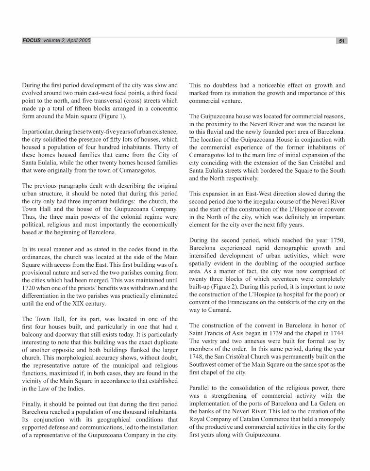
During the first period development of the city was slow and evolved around two main east-west focal points, a third focal point to the north, and five transversal (cross) streets which made up a total of fifteen blocks arranged in a concentric form around the Main square (Figure 1).
In particular, during these twenty-five years of urban existence, the city solidified the presence of fifty lots of houses, which housed a population of four hundred inhabitants. Thirty of these homes housed families that came from the City of Santa Eulalia, while the other twenty homes housed families that were originally from the town of Cumanagotos.
The previous paragraphs dealt with describing the original urban structure, it should be noted that during this period the city only had three important buildings: the church, the Town Hall and the house of the Guipuzcoana Company. Thus, the three main powers of the colonial regime were political, religious and most importantly the economically based at the beginning of Barcelona.
In its usual manner and as stated in the codes found in the ordinances, the church was located at the side of the Main Square with access from the East. This first building was of a provisional nature and served the two parishes coming from the cities which had been merged. This was maintained until 1720 when one of the priests’benefits was withdrawn and the differentiation in the two parishes was practically eliminated until the end of the XIX century.
The Town Hall, for its part, was located in one of the first four houses built, and particularly in one that had a balcony and doorway that still exists today. It is particularly interesting to note that this building was the exact duplicate of another opposite and both buildings flanked the larger church. This morphological accuracy shows, without doubt, the representative nature of the municipal and religious functions, maximized if, in both cases, they are found in the vicinity of the Main Square in accordance to that established in the Law of the Indies.
Finally, it should be pointed out that during the first period Barcelona reached a population of one thousand inhabitants. Its conjunction with its geographical conditions that supported defense and communications, led to the installation of a representative of the Guipuzcoana Company in the city.
This no doubtless had a noticeable effect on growth and marked from its initiation the growth and importance of this commercial venture.
The Guipuzcoana house was located for commercial reasons, in the proximity to the Neverí River and was the nearest lot to this fluvial and the newly founded port area of Barcelona. The location of the Guipuzcoana House in conjunction with the commercial experience of the former inhabitants of Cumanagotos led to the main line of initial expansion of the city coinciding with the extension of the San Cristóbal and Santa Eulalia streets which bordered the Square to the South and the North respectively.
This expansion in an East-West direction slowed during the second period due to the irregular course of the Neverí River and the start of the construction of the L’Hospice or convent in the North of the city, which was definitely an important element for the city over the next fifty years.
During the second period, which reached the year 1750, Barcelona experienced rapid demographic growth and intensified development of urban activities, which were spatially evident in the doubling of the occupied surface area. As a matter of fact, the city was now comprised of twenty three blocks of which seventeen were completely built-up (Figure 2). During this period, it is important to note the construction of the L’Hospice (a hospital for the poor) or convent of the Franciscans on the outskirts of the city on the way to Cumaná.
The construction of the convent in Barcelona in honor of Saint Francis of Asis began in 1739 and the chapel in 1744. The vestry and two annexes were built for formal use by members of the order. In this same period, during the year 1748, the San Cristóbal Church was permanently built on the Southwest corner of the Main Square on the same spot as the first chapel of the city.
Parallel to the consolidation of the religious power, there was a strengthening of commercial activity with the implementation of the ports of Barcelona and La Galera on the banks of the Neverí River. This led to the creation of the Royal Company of Catalan Commerce that held a monopoly of the productive and commercial activities in the city for the first years along with Guipuzcoana.

52 FOCUS volume 2, April 2005
Figure 1. Barcelona, Venezuela. 1671-1700. Key to main buildings in the map:
1) City council, 2) Church, 3) Guipuzcoana Trading Co. Population: 400.
These changes produced significant modifications in the urban pattern and dynamics of activities in Barcelona. The axis of the Real Street (High Street) formerly known as Salle San Cristóbal, the road to Cumaná, and the areas near to the fluvial ports and mainly along La Galera street all had increased commercial significance. Therefore, the occupation and urban expansion trends and the productive activities toward the North and toward the river continued, thereby increasing the demand for new residential areas.
During the second period, the city did not extend toward the El Arroyo sector. This was due to the marshy ground and other previously mentioned factors which together led to the city’s growth in other areas.
By 1761, the city reached a population of three thousand inhabitants, a population six times larger than its original
ninety years earlier when it was founded. By the beginning of the 19th century approximately forty years later, the city had quintupled its population, surpassing fifteen thousand inhabitants in its independence period.
During the third period from 1750 to 1800, the city underwent accelerated growth. At this time the occupation of the present historical center was practically completed (Figure 3).
By 1777, the fourth cloister of the Franciscan hospice had been inaugurated. In 1783, construction of the upper floors was completed with the termination of the missionary work. Around the same time in 1774 the construction of the San Cristóbal Church, which had been temporarily halted between 1766 and 1768 as a result of a strong earthquake that destroyed its sidewalls, was completed. During this period, commerce in Barcelona continued to maintain a certain amount of importance, both on a local

Resbaladero quarter began.
FOCUS volume 2, April 2005 53
and regional level. This was evident by the construction of huge mansions by the Creole oligarchy that would later play an important role in the historic events of the independence period. Among these buildings, were the residences of the Cajigal, Freites, Urbaneja, Anzoategui, Arquidegui, Dominici, and Salavarría families.
With regard to the functional structure of the city, the construction of the Portugal Bridge over the Neverí in 1795, stands out. The bridge generated intense urban growth on the right bank of the river over the port quarter of Barceloneta or Portugal. In this sector, the public city jail (which was partially destroyed by the construction of the bridge) was sited. It served as a government house for a brief period.
Due to the construction of this bridge, the commercial
activities on Santa Eulalia Street developed in a parallel fashion to the dynamics of High street. Both streets, along with La Paz Street (the old route to Cumaná) represented the main corridors of urban activity during this period, maintaining its importance in the structure of the city to even the present day.
In the same vein, the expansion of residential activity led to the creation of the El Resbaladero quarter in the North of the city in the vicinity of the Franciscan hospice. Parallel to this, the bank of the Neverí was occupied while the El Arroyo River continued being the Southern limit of the city. At that time Barcelona was made up of forty-four squares or blocks divided following the colonial reticular pattern. It should be pointed out that the size of the Main Square continued being reduced in favor of religious and commercial activities at the same time as a slight distortion in the square pattern in the El
Figure 2. Barcelona, Venezuela. 1700-1750. Key to main buildings in the map: 1) City council, 2) Church, 3) Guipuzcoana Trading Co., 4) Catalunya Trading Co., 5) Covent.

54 FOCUS volume 2, April 2005
In the fourth and final period identified, that reaching 1900, the expansion of the city spans the era of the War of Independence and the first half of the Republican Regime (Figure 4). In the first twenty years of this period, war wrought huge destruction on the structure and morphology of the city. In the Battle of Barcelona, patriots used the Franciscan convent as a fort for defense, as a result this building now lays in ruins, but would later be christened Casa Fuerte in 1817.
Other important elements in the urban landscape of the time are the enlarged San Cristóbal Church and the Municipality Building over the old Main Mayor, called Plaza Principal in the first Republican Period, this space was substantially reduced and ended up in the form of a square. The other square which remained in the city is known as Libertad (Freedom). It is the former Hospice Square considering that the present Rolando Square was not built until the demolition of the block, which it presently occupies at the beginning of the present century.
Figure 3. Barcelona, Venezuela. 1750-1850. Key to main buildings in the map: 1) City council, 2) Church, 3) Guipuzcoana Trading Co., 4) Catalunya Trading Co., 5) Covent - Hospice, 6) Jail, 7) Urbaneja House, 8) Urquindequi House, 9) Salavarria House, 10) Dominici House, 11) Cajical House.
On the edge of Rolando Square the National Theater, today known as Cajigal, and the Church of El Carmen were built in 1895 and toward the end of the nineteenth century respectively. It should be mentioned that the church of Ermita del Carmen serve as the new parish in Barcelona (an ambition which as we have seen stems from the first years of the founding of the city).
During the fourth period, the final solidification of the historic center was completed as well as that of the first peripheral quarters such as El Resbaladero in the North, Cayaurima, Dos Caminos and San Pedrito or Buenos Aires in the West, La Aduana and El Arroyo in the South, and Guamachito, Portugal and la Barceloneta on the right side of the river. The emergence and consolidation of the quarters on the other bank of the Neverí prompted the building of the San Felipe Church in the vicinity of the public jail.
In the same fashion, the access roads to the city at the end

FOCUS volume 2, April 2005 55
of the century were improved by the construction of the Guzman Blanco Road connecting Cumaná, the Anzoategui Bridge on the road to Píritu, and the Pozuelos Road on what is today Cajigal Avenue. These improvements in the access routes were accompanied by maintenance work on the infrastructure of the fluvial ports of El Pasaje and La Galera, and by the remodelling of the bridge over the Neverí, which was rechristened Bolivar after the War of Independence.
The economic surge of the city in the second half of the nineteenth century, in conjunction with its standing in government in the new republic as well as with the improvements in the city’s communication infrastructure substantially changed the structure and dynamics of its
Figure 4. Barcelona, Venezuela. 1850-1900. Key to main buildings in the map: 1) City Council, 2) Church, 3) Figetas House, 4) Office of the Governor, 5) Fort, 6) Jail, 7) San Felife Church, 8) Casino, 9) Rolando House, 10) El Carmen Church, 11) Cajigal Theatre, 12) Monagas House, 13) Cementery, 14) Cornonado House.

56 FOCUS volume 2, April 2005
urban activities. This can be seen by the erection of a casino in the city, the inauguration of the cemetery in 1892, the running of a university college between 1885 and 1893, and the construction of public buildings such as the Municipality and the government building.
ANALYSIS
The analysis of the urban structure of the City of Barcelona should be undertaken both from the perspective of its physical and spatial structure, and from the typology pattern of the buildings and the layout of the roads. These are compatible with the conditions established in the Ordinances for the New Settlements. This means that the location of Barcelona in an extensive fluvial plain where the only immediate border is the eastern bank of the Neverí River rendered the possibilities for the continuing of the semi-lattice pattern.
These geographical characteristics permitted the formal implementation of the stipulations contained in the Ordinances of Philip II without any notable resistance posed by the physical terrain. This statement can be asserted by the fact that this reticular pattern remained unaltered in Barcelona until the end of the XIX century (when a bigger expansion came in). In this case it can be observed that the norms established in the Law of the Indies could be fully implemented due to the geographical factors that determined the possible physical expansion in the initial years and to a slow growth dynamics of the time (one of the few examples of a perfect grid founded by the Spaniards at that time on a hill is in San Francisco, California).
It is important to mention that toward the end of the Eighteenth Century the population of Barcelona managed to overcome the physical obstacle of the Neverí River by constructing its first bridge. This permitted permanent and vital communication with the other side of the river and constituted the first important structural modification of Barcelona. This new communication link was the first step in spurring on the development of other peripheral areas and led to stabilizing diverse activities for the storage, exchange and distribution of products coming to the interior of the country via the port area.
Thus a trend of urban growth was revealed, first in the traditional city center of Barcelona and from there towards the outskirts. The peripheral quarters on the outskirts of
Barcelona were comprised, until the beginning of the Twentieth Century, an extension of the central area. The morphological traits of the outskirts are very similar to those which are present today in the central area.
Geographical location is not the only element which determines spatial growth. Cultural patterns unique to the region and patterns that impart special characteristics to the city should also be kept in mind. From the beginning, Barcelona was an important point in linking the East of Venezuela with the Captaincy General of Caracas. This role was reinforced by Barcelona’s proximity to the port of Cruz (today known as Puerto La Cruz) which, like other ports in America such as la Verdadera Cruz (today Veracruz in Mexico) comprised access and exit ports for indigenous products. This strategic position acted as a link between the governments of New Andalucía and Venezuela and turned Barcelona into the main commercial center in the East of Venezuela.
Cumaná arose similarly, since it was the first populated settlement for advance military and religious entities on the continent. Its position as the first city and its early consolidation quickly made it the leading military and political center of that provincial area. This led to the construction of permanent forts and castles, which gave it an important cultural legacy. However, the distance from the Captaincy General and the discovery of a nearer, alternative port gave Barcelona the edge as an important location in the region.
It is useful to note that the dynamics of the activities in Barcelona took a concentric form around the Main Square. The churches, along with the squares, determined the organizational structure of the city, giving a sense of permanence to the activities that brought the urban morphology of the present city.
CONCLUSIONS
Barcelona retains the conditions set out in the Ordinances of the Law of the Indies for New Settlements which constituted a model for developments adaptable to local topographical conditions. Barcelona’s geographical location on a regional level was also key, facilitating the political function which it carried out within the sphere of the strategies for territorial occupation and colonization of the East of Venezuela.

FOCUS volume 2, April 2005 57
In addition, Barcelona’s proximity to the Captaincy General of Caracas made it complementary with regard to the latter. On the other hand, Cumaná played a role as a link with respect to the East of the country. For this reason the development of Barcelona would flourish within the parameters of commerce and a unique geopolitical position.
Therefore, it is important to highlight the validity of the 1573 Ordinances of Philip II, its influence is found in the present urban structure of Iberian American cities. Barcelona constitutes as one of the clearest examples of the implementation, and the worth of the regulations emitted from the Spanish Crown for the control of the process of establishing new cities in the newly discovered territories.
These regulations for the new settlements were based on a number of urban planning morphological and sanitary principles. These principles in turn fostered order and organization over the arc of the urban settlement process in Spanish Latin America, and left their mark on the cultural symbiosis between the traditions in the Old World and the new population centers.
These principles, conceived more than 400 years ago, are still prevalent as ordering concepts in modern urban planning. The most famous is the centrality principle, which permits flexibility in the reticular plan and is the embryo of the segregation of uses. All in all, the Ordinances of Phillip II most definitely marks as the planning process of the twentieth Century.
REFERENCES
Fajardo, A. (1992). Cinco Siglos de Cartografía en Venezuela. Caracas: Servicio Autónomo de Geografía y Cartografía Nacional.
Gasparini, G. (1991). Formación Urbana de Venezuela, Siglo XVI. Caracas: Armitano Editores.
Instituto del Patrimonio Cultural (2000). Cuadernos del Patrimonio Cultural, Serie Inventarios. Caracas: Instituto del Patrimonio Cultural.
Martínez, J. Ramos (1980). Memorias para la Historia de Cumana y Nueva Andalucía. Vol. II. Cumaná: Editorial Universitaria de Oriente.
Mendoza, J. Martínez (1965). La Fecha de la Fundación de Cumaná. Caracas: Separata del Boletín de la Academia Nacional de la Historia.
Mendoza, T. de (1887). Colección de documentos inéditos de Indias relativos al Descubrimiento, Conquista y Organización de las Antiguas Posesiones Españolas de América y Oceaní.
Menéndez J. M. (1989). Pueblos de esta Tierra: Cumaná. Caracas: Fondo Editorial CONICIT-Universidad Central de Venezuela.
Vegas, F.; López, W. & Neri-Plazola, N. (1984). El Continente de Papel: Venezuela en el Archivo de Indias. Caracas: Ediciones Fundación Neumann.
Zawisza, L. (1989). Arquitectura y Obras Públicas en Venezuela, Siglo XIX. Caracas: Ediciones de la Presidencia de la República.

58 FOCUS volume 2, April 2005