the hoang sa (paracel) and truong sa (spratly ... · it was recorded in toan tap thien nam tu chi...
TRANSCRIPT
THE HOANG SA (PARACEL) AND TRUONG SA (SPRATLY)
ARCHIPELAGOES AND INTERNATIONAL LAW
MINISTRY OF FOREIGN AFFAIRS SOCIALIST REPUBLIC OF VIETNAM
HANOI — APRIL 1988

I
VIETNAM'S CASE VERSUS CHINA'S CASE REGARDING THE HOANG SA (PARACEL)
AND TKUONG SA (SPRATLY) ARCHIPELAGOES
In the course of the settlement of disputes between various countries in the world on the sovereignty over ownerless terri-tories (res nullius), a principle of international law on the assertion of territorial sovereignty has been formulated : the principle of effectivity. This principle lies at present at the core of customary international law. In Asia, Africa, Europe, America and the Pacific region, numerous disputes over terri-torial sovereignty have been settled on the basis of the prin-ciple of effectivity. The best-known instance was the sentence pronounced by arbitrator Max Huber 60 years ago in the case involving the United States and the Netherlands on the status of Palmas Island. The conclusions of this settlement and others including the Minquiers and Ecrehous case between Britain and France, the Clipperton Island case between Mexico and France, the East Greenland case between Norway and Den-mark, etc., have become criteria to assert sovereignty over ownerless (res nullius) and abandoned (res derelicta) terri-tories. Effective occupation and effective, continuous and peaceful exercise of State authority entitle to sovereignty.
Meanwhile, outdated or inappropriate views have been dis-carded, for example :
3

— The right of discovery and the right of first occupancy; the principle of fictive occupation. (A discovery will result only in an imperfect title, i.e., an "embryonic" title. To be effective, such a title needs to be perfected over a reasonable period of time through effective occupation and effective admi nistration of the discovered territory.)
— Occupation by private individuals will not entitle their country to territorial sovereignty. Only the State can be the title-holder of the occupation.
— An occupation through conquest (de bellatio) will not entitle to territorial sovereignty over the conquered territory.
To reach an objective and impartial conclusion on the sov-ereignty over the Hoang Sa and Truong Sa archipelagoes, it is necessary to set the Vietnamese and Chinese respective cases against the norms of the principle of effectivity: effective occupation ; effective, continuous and peaceful exercise of State authority.
1. Vietnam's case: Vietnam's case is that it has maintained effective occupation
of the two archipelagoes at least since the 17th century when they were not under the sovereignty of any country and the Vietnamese State has exercised effectively, continuously and peacefully its sovereignty over the two archipelagoes until the time when they were invaded by the Chinese armed forces.
It was recorded in Toan Tap Thien Nam Tu Chi Lo Do Thu (Route Maps from the Capital to the Four Directions) by Do Ba Cong Dao in the 17th century that at least by that century the map of Vietnam had designated the two archipelagoes by a single name Bai Cat Vang and placed them within the administrative confines of Binh Son district, Quang Nghia prefecture. Bai Cat Vang was then otherwise known as Hoang Sa, Con Vang, Truong Sa, Dai Hoang Sa, Dai Truong Sa, Van Ly Truong Sa, etc. , and now as Hoang Sa and Truong Sa.
4
Vietnam consol idated i t s occupat ion and es tabl ished its sovereignty by organizing Hoang Sa brigades for the purposes of exploitation in a State capacity. Each brigade comprised 70 members whose annual task was to collect in Hoang Sa over a period of 6 months such sea products as holothurians, turtles, precious conches, etc., and retrieve from wrecked ships in the vicinity of these archipelagoes such commodities as gold and silver, coins, guns and ammuni-tion, tin, porcelain and glass wares, etc. Do Ba Cong Dao's book and dozens of others like Phu Bien Tap Luc (1776) (Miscel-laneous Records on the Pacification of the Frontiers), Dai Nam Thuc Luc Tien Bien va Chinh Bien (1844 — 48) (Truthful Accounts about Dai Nam Former and Present Dy-nasties), Dai Nam Nhat Thong Chi (1882) (Geography of Unified Dai Nam) and official annals of the National Institute of History under the Imperial Court of Hue, Lich Trieu Hien Chuong Loai Chi (1821) (Collection of Regulations under Successive Dynasties), Hoang Viet Dia Du Chi (1833) (Geo-graphical Treatise of Imperial Vietnam), etc., all wrote about Hoang Sa and its exploitation by Hoang Sa brigades. Regula-tions on recruitment, tribute, reward and remuneration of Hoang Sa brigades were all clearly defined by the State.
The Hoang Sa brigades were later reinforced by the Bac Hai brigades and they operated continuously during the reigns of the Nguyen Lords (1558 —1783) and until the Tay Son (1786 — 1802) and Nguyen Dynasties (1802 — 1945).
Emperor Gia Long, the founder of the Nguyen dynasty, and his successors like Minh Mang, Thieu Tri and Tu Duc took particular care to consolidate national sovereignty over the two archipelagoes.
Hereunder are some relevant events: — In 1815, Emperor Gia Long appointed Pham Quang Anh
to lead a Hoang Sa brigade to explore the archipelago and survey sea routes. The survey was continued in the follow-ing year.
5

— Upon completion in 1833 of preparatory jobs on his per-sonal order, including the provision of boats and materials, in 1834 and also in the years 1835 and 1836, Emperor Minh Mang successively appointed generals Truong Phuc Si, Pham Van Nguyen and Pham Huu Nhat to carry out a cartogra-phical survey of each of the islands and an overall survey of the sea in the vicinity, to draw maps, to build temples and place sovereignty markers in Hoang Sa. Emperor Thieu Tri personally examined and approved annual plans of opera-tions of Hoang Sa brigades presented to him by the Ministry of Public Works (See Annex II). Emperor Tu Duc conferred upon martyrs of the Hoang Sa brigades the t i t le "Truong Sa Hero" (See Annex III).
After the establishment of her protectorate over Vietnam by virtue of the June 6, 1884 Treaty, France administered the two archipelagoes of Hoang Sa and Truong Sa in the name of Vietnam.
At the beginning, the French authorities had a project for a lighthouse on the Hoang Sa archipelago, carried out naval patrols in the waters of the two archipelagoes to ensure security and committed customs ships to combatting smuggling, They allowed the Japanese to collect guano on the Hoang Sa Islands. Between 1925 and 1927 the Oceanographical Insti-tute at Nha Trang commissioned SS De Lanessan to carry out oceanographical, geological and biological studies in the two archipelagoes successively.
Between 1930 and 1932 the Inconstant, Alerte and La Malicieuse warships and also SS De Lanessan made several voyages to Hoang Sa.
From 1930 to 1933, French naval units were stationed on the main islands of the Truong Sa archipelago : Truong Sa, An Bang, Ba Binh (Itu Aba), the Song Tu cluster, Loai Ta and Thi Tu. That activity was published in the Official Journal of the French Republic on July 26, 1933. Also in 1933, the Truong Sa archipelago was placed under the admi-
6

lustration of Ba Ria province by a decree of the then Cochin-china governor, J. Krautheimer (See Annex IV).
In the wake of the Japanese occupation of Manchuria (1931) and the Lu Qiu bridge incident (1937), initial moves in the war of aggression against China, the danger of Japanese expansionism loomed large in Southeast Asia. The French authorities, therefore, embarked upon a plan for the defence of Indochina including the safeguarding of the two archipelagoes of Hoang Sa and Truong Sa. As a result, the Hoang Sa archi-pelago, then belonging to Nam Nghia province, was made a separate administrative unit in Thua Thien province (later on the archipelago was split into two administrative units). In 1937, the Lamotte Piquet cruiser commanded by Vice-Admiral Esteva called at Hoang Sa, The Indochinese authori-ties stationed an army unit on the Hoang Sa archipelago, where they set up a meteorological station, a wireless station and installed more sovereignty markers and lighthouses.
When in a statement in early 1939, Japan placed a number of islands in the Truong Sa archipelago under its jurisdiction, France lodged an official protest. Nevertheless, from 1939 till the end of the Second World War, the Japanese army occupied both archipelagoes.
On her return to Indochina after the Second World War, France demanded in early 1947 that the armed forces of the Republic of China be withdrawn from the archipelagoes of Hoang Sa and Trupng Sa which they had illegally occupied in late 1946, and brought in French forces to replace the Chinese troops. France also had the meteorological station and the wireless station rebuilt.
At the 1951 San Francisco Conference — attended by 51 countries — on the Peace Treaty with Japan, the Head of the Delegation of the State of Vietnam under French patronage in a statement reaffirmed Vietnamese sovereignty over the two archipelagoes. No objections were raised nor any reser-vations made against his statement at the Conference.
7

The 1954 Geneva Agreements on Indochina recognized the independence, unity, sovereignty and territorial integrity of Vietnam. However, Vietnam was temporarily partitioned in two; the Southern territory lying below the 17th parallel (including the Hoang Sa and Truong Sa archipelagoes) was placed under the administration of the South Vietnam autho-rities. Upon their withdrawal from Indochina in 1956, the French authorities transferred the territory of South Viet-nam to the Saigon administration which subsequently sent trcops to take over the Hoang Sa and Truong Sa archipelagoes and reorganized them administratively, setting up a village in each of them and annexing it to a district on the mainland (See Annex V). They installed sovereignty markers on the major islands, maintained the meteorological stations [listed in the network of the World Meteorological Organization (WMO)], allowed businessmen to exploit guano in Hoang Sa and sent scientific survey teams to these two archipelagoes.
Taking advantage of the French withdrawal from Indo-china, in 1956 the Beijing authorities occupied the Eastern cluster of islands of the Hoang Sa archipelago. Their occu-pation met with a strong protest from the Saigon administra-tion. In 1959, a landing attempt on the Western part of the archipelago made by Chinese soldiers disguised as fishermen was smashed by the Saigon forces. Eighty-two Chinese "fisher-men" were captured.
In 1974, taking advantage of the situation at the time, when the army of the Saigon administration was busy coping with the attacks launched by the armed forces of the Provi-sional Revolutionary Government of the Republic of South Vietnam (PRGRSV), China used its air force and navy to occupy the remaining Western part of the Hoang Sa archipe-lago. The Saigon administration strongly pronounced itself end informed other countries and the UN Security Council of this incident. Concerning this same incident, the PRGRSV made public a three-point position including a proposal to
8
hold talks between the parties concerned to settle the dispute. At a Conference of the World Meteorological Organization (WMO) held in 1975 in Colombo, the PRG resolutely defended Vietnamese sovereignty over the Hoang Sa archipelago and was determined to maintain a national meteorological station there.
All other cases of violation of Vietnam's sovereignty over the two archipelagoes met with similar strong protests from the various South Vietnam administrations.
Following the reunification of Vietnam, the Socialist Re-public of Vietnam time and again reaffirmed its sovereignty over these two archipelagoes in conducting its relations with China and other countries concerned, in international organi-zations and at international conferences, as well as at the talks between the Deputy Ministers for Foreign Affairs of the two countries started in Beijing in October 1977, and on other occasions. In 1982, the S.R.V. established the Hoang Sa and Truong Sa districts attached to the Quang Nam-Da Nang and Phu Khanh provinces respectively (See Annex VI).
On the strength of the above facts, it can be definitely asserted that the State of Vietnam has effectively occupied the Hoang Sa and Truong Sa archipelagoes and has exercised effectively, continuously and peacefully its State functions there for some 300 years since the 17th century till Beijing invaded the two archipelagoes,
2. China's case: So far, China has mainly bassd herself on historical occurren-
ces to present her case, arguing that : The Chinese people were the first to discover, exploit and
govern Jiuruluozhou, Shitang, Tianli Shitang, Wanli Shitang, Wenli Changsha... which purportedly correspond to Xisha and Nansha today, and fcr thousands of years successive Chinese dynasties and administrations have been continuously exercis-ing their rule over these two archipelagoes.
9
First, a question which needs to be considered is whether the above-mentioned really are names of islands belonging to the Hoang Sa and Truong Sa archipelagoes. This is one of the first questions that Max Huber had to deal with in the Palmas island dispute. One can see that the above-men-tioned evidence produced by China is fuzzy to say the least. Not until 1787-88 when a survey was undertaken by the Kergariou-Locmaria expedition did the Western navigators realize that there existed two separate archipelagoes, later called Hoang Sa (Paracel) and Truong Sa {Spratly).
Even if the identification were in China's favour, that would not be the fundamental issue. The fundamental issue is to examine its argumentation under the light of the prin-ciple of effectivity.
On the discovery and exploitation by the Chinese people : In former times it was not only the Chinese, but also the
Vietnamese, the Malays, the Persians, the Arabs... who made voyages to and from the waters of the Hoang Sa and Truong Sa archipelagoes. There js no proof that no other people had discovered these two archipelagoes before the Chinese did.
Discovery and exploitation by " the people " will not, under international law, result in the acquisition of national sov-ereignty. Even the discovery by States confers but an em-bryonic, imperfect title, which becomes complete only if subsequent activities are undertaken by these States to de-monstrate their will to exercise their jurisdiction.
On the jurisdiction exercised for thousands of years by Chinese feudal dynasties :
Up to now, Beijing has cited a number of occurrences to prove that the various Chinese dynasties had exercised their jurisdiction over these two archipelagoes :
— Beijing has cited the following excerpt from the Preface to Wujing Zongyao (General Programme of Military Affairs) written by Emperor Renzong (1023 — 63) of the Northern Sung: The court of the Northern Sung "orders that imperial
10

troops be dispatched to build and defend the bases of naval patrol" in Guangnan (i.e. present-day Guangtung), "that daoyu warships be built", "If from Tunmenshan, one avails oneself of the east wind and takes the Southwest route, one will reach Jiuruluozhou (viewed by Beijing as today's Xisha archipelago) in seven days." This is supposed to prove that the Xisha archipelago had come under the administration of the court of the Northern Sung.
In fact, there are in the following paragraph of the Preface three separate ideas (hereunder underlined by the authors) which have been rearranged into one sentence :
"Orders that imperial troops be dispatched to build and defend bases of naval patrol in the Eastern and Western sea harbours, which are 280 truong (an ancient unit of measure equal to 3.51 metres) wide, and about 200 li from Tunmenshan, and that daoyu warships be built. If from Tunmenshan one avails oneself of the east wind and takes the Southwest route, one will reach Jiuruluozhou in seven days; proceeding further, one will reach Bulaoshan in the Kingdom of Huanzhou1 within three days ; and about 300 li further southwards from that point is Lingshandong. To the Southwest of Lingshandong are the Kingdoms of Dashifu, Sizi and Tianzhu where no one had any idea of how long a voyage to these kingdoms would take."2
Clearly, the above excerpt mentioned, on the one hand, the Court's order on the establishment of bases for naval patrol, and on the other hand, described the sea-routos to various
1. Bulaoshan : Cu Lao Cham in Vietnam. Huanzhou : Champa.
2. Dashifu (mentioned in many Chinese ancient books as Dashi): a medieval feudal state in the present-day Persian Gulf; Sizi : Sri Lanka; Tianzhu: India (according to the Chinese books Tangshu, Songshi and Gujin tushu jicheng).
11
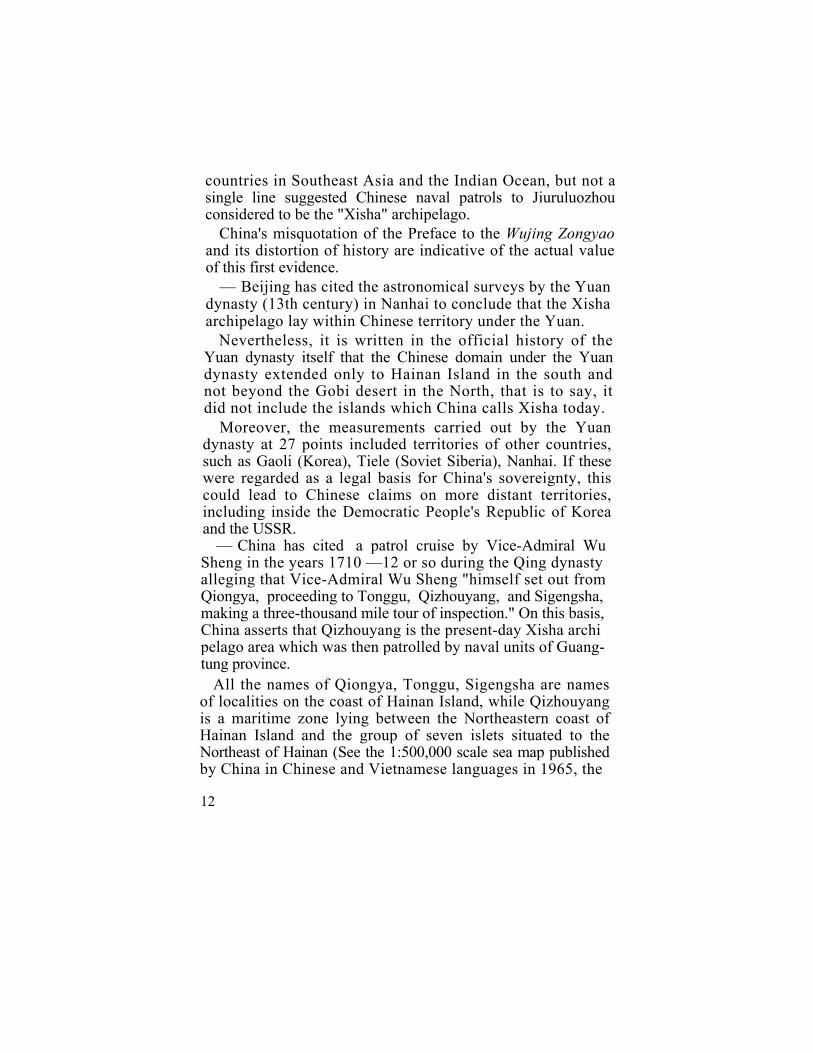
countries in Southeast Asia and the Indian Ocean, but not a single line suggested Chinese naval patrols to Jiuruluozhou considered to be the "Xisha" archipelago.
China's misquotation of the Preface to the Wujing Zongyao and its distortion of history are indicative of the actual value of this first evidence.
— Beijing has cited the astronomical surveys by the Yuan dynasty (13th century) in Nanhai to conclude that the Xisha archipelago lay within Chinese territory under the Yuan.
Nevertheless, it is written in the official history of the Yuan dynasty itself that the Chinese domain under the Yuan dynasty extended only to Hainan Island in the south and not beyond the Gobi desert in the North, that is to say, it did not include the islands which China calls Xisha today.
Moreover, the measurements carried out by the Yuan dynasty at 27 points included territories of other countries, such as Gaoli (Korea), Tiele (Soviet Siberia), Nanhai. If these were regarded as a legal basis for China's sovereignty, this could lead to Chinese claims on more distant territories, including inside the Democratic People's Republic of Korea and the USSR.
— China has cited a patrol cruise by Vice-Admiral Wu Sheng in the years 1710 —12 or so during the Qing dynasty alleging that Vice-Admiral Wu Sheng "himself set out from Qiongya, proceeding to Tonggu, Qizhouyang, and Sigengsha, making a three-thousand mile tour of inspection." On this basis, China asserts that Qizhouyang is the present-day Xisha archi pelago area which was then patrolled by naval units of Guang- tung province.
All the names of Qiongya, Tonggu, Sigengsha are names of localities on the coast of Hainan Island, while Qizhouyang is a maritime zone lying between the Northeastern coast of Hainan Island and the group of seven islets situated to the Northeast of Hainan (See the 1:500,000 scale sea map published by China in Chinese and Vietnamese languages in 1965, the
12
Map of Leizhou Peninsula and Hainan Island and A Topo-graphical Map of Nanhai printed by the Chinese Cartological Publishing House in May 1984) (See Annex VII).
So, that was just an inspection tour around Hainan island, Beijing's conclusions are obviously contrary to historical and geographical facts.
— About the "tour of inspection" around the Xisha archi-pelago by Admiral Li Zhun in 1909 referred to by Beijing:
The blitz landing and pulling out of Chinese troops on some islands of the Hoang Sa archipelago ordered by Admiral Li Zhun was a violation of Vietnamese sovereignty and absolutely cannot be regarded as an exercise of Chinese "sovereignty".
That "tour of inspection" and all the subsequent activities of the Government of the Republic of China or the Govern-ment of the People's Republic of China, supposedly aimed at asserting Chinese "rule" over the Hoang Sa or Truong Sa archipelago, took place at a time when these two archipelagoes already belonged to Vietnam. All the three occurrences as cited by China were, on the one hand, distortions of historical and geographical facts and, on the other, had no connections with the Hoang Sa and Truong Sa archipelagoes of Vietnam.
If maritime patrol and inspection tours are presented as an argument proving Chinese sovereignty over the two archi-pelagoes, one may wonder whether China is going to claim sovereignty over such territories in relation to which Zheng-He under the Ming dynasty seven times (between 1405 and 1430) dispatched a large fleet with more than 60 naval vessels and 28,000 seamen to impose Chinese hegemony on territories within the Indian Ocean zone and undertake territorial explor-ation in the Red Sea zone and along the coast of Eastern Africa ?
Moreover, for an extended period of 700 years, from the Renzong reign of the Northern Sung (1023 — 63) to the Kangxi reign of the Qing dynasty (1654 —1722) China was able to cite only three scattered occurrences that provide
13

unconvincing evidence. It is therefore impossible for China to make any claim about an "effective and continuous exercise of sovereignty".
Comparing the respective cases of Vietnam and China, one can see that: China has never administered the Hoang Sa and Truong Sa archipelagoes and it is all the more impos-sible to say that China has exercised effectively, continuously and peacefully her "sovereignty" over these islands. The claim of Chinese sovereignty is one that China has not up to now been able to prove.
The State of Vietnam has effectively occupied the two archipelagoes of Hoang Sa and Truong Sa since at least the 17th century and has effectively, continuously and peacefully exercised its sovereignty ever since.
From the 17th to the 19th century, Chinese dynasties had never protested but implicitly recognized Vietnamese juris-diction over the archipelagoes. There was even a case when soldiers of the Hoang Sa brigade were helped by the Chinese to get back to Thuan Hoa from Qinglan port (Hainan Island) into which their boat had been swept by a typhoon 1. With the 1884 Franco-Chinese Treaty signed in Tientsin, China recognized French rule in Vietnam. During the nearly century-long French rule over Vietnam, only on a few occasions did China make a claim of sovereignty over the Hoang Sa archipelago, but when France twice (in 1937 and 1947) proposed a legal solution, the Republic of China turned down the French
1. On pages 82b-85a of Phu Bien Tap Luc, Le Quy Don wrote: "In the seventh month of the 18th year of Kianlong's reign, from An Vinh-village, Cat Liem brigade, Chuong Nghia sub-district, Quang Ngai district of Annam, there were 10 servicemen who went to Wanli Changsha to collect things. Among them, 8 men landed on the islands to collect things while the rest remained on board to look after the boat. As their boat rope was cut off by winds, they were driven off to Qinglan. port where after verification the officials there sent them back home, Nguyen Phuc Chu then ordered Thuc Luong who was governor of Thuan Hoa province to write them a letter of acknowledgement..."
14

proposals. In all Chinese maps Hainan Island is drawn as the southernmost point of China. A Chinese geographical book published in 1906 even put the southernmost point of China at 18°13' North parallel 1. In connection with the sinking of SS Bellona and Imeji Maru in the waters of the Hoang Sa archipelago (in 1895 — 96), the Chinese authorities in Liang CJuang province in an answer to the British Consul even said that Xisha did not belong to China.
1. In Hoangchao Yitong Yudi Zongtu (General Map of the Unified Empire) published in the 20th year of Guangxu's reign (1894), Chinese territory extended only as far as Hainan island. Its annotation clearly wrote that the southernmost point of the Qing country is "Zhouya, Giongzhou Fu, Guangtung, 18°13' North". In Zhongguo Dilixue Jia Keshu written by Wu Jin Tu in the 31st year of Guangxu's reign (1905) and published in 1906, it was clearly written in Book I that: "The southern-most point is the Yashou coast of Qiongzhou Island, 18°13' North parallel" (page 24b).
15
II
STANDS TAKEN BY OTHER COUNTRIES ON "CHINA'S SOVEREIGNTY OVER THE TWO
ARCHIPELAGOES"
Beijing has insisted "...many countries and world public-opinion have recognized the Xisha and Nansha archipelagoes as China's territories".
The evidences as presented by Beijing can be classified into the following three categories :
— Recognition by Governments, — Recognition by international or regional organizations, — Recognition derived from some encyclopedias and maps.
1. Recognition by Governments : The primary evidence produced by Beijing is the July 4,
1938 statement of the spokesman of the Ministry of Foreign Affairs of Japan, which said the Xisha archipelago was "China's territory". At that time, the Japanese military forces were expanding their war of aggression against China. Japanese warships and aircraft had just strafed Heikeou city on Hainan Island (January, 1938) and Japanese warships had entered Yulin port on the island's Southern coast in an attempt to intimidate China (January, 1938). The above-mentioned Ja-panese statement should be replaced in the context of Japan's strategy of aggression against China and of the Japanese design to use China's territory to seize the territories under
16
French, British, American and Dutch occupation in Southeast Asia. It cannot be construed as a recognition of the "sover-eignty " of China over the Xisha archipelago. Indeed, soon afterwards, the Japanese military forces seized both Hainan Island and the Vietnamese archipelago of Hoang Sa which was then under French occupation.
Beijing has invoked the provision of the September 1951 San Francisco Peace Treaty with Japan under which, in China's view, "Japan renounced its title to the Xisha and Nansha archipelagoes", and the Soviet Union's support of the Chinese claim. But China has deliberately ignored the November 26, 1943 Cairo Declaration, the July 26, 1945 Potsdam Declaration and the decision adopted by the San Francisco Conference concerning the Peace Treaty with Japan despite the fact that they are highly important international documents relating to the question of Japanese-occupied territories.
The fact was that in November 1943, American President Franklin D. Roosevelt, British Prime Minister Winston Chur-chill and the President of the Republic of China, Tchiang Kaishek, held a secret meeting in Cairo to discuss the con-clusion of the war with Japan and the settlement of post-war issues, including those connected with other countries' terri-tories occupied by Japan. Neither France nor Vietnam was present at the meeting. After four days of discussion, the leaders of the three countries agreed :
"It is our purpose that Japan shall be tripped of all the islands in the Pacific which she has seized or occupied since the beginning of the First World War in 1914, and that all the territories Japan has stolen from the Chinese, such as Man-churia, Formosa, and the Pescadores shall be restored to the Republic of China". (Cairo Declaration)
This agreement made no mention of the Hoang Sa and Truong Sa archipelagoes though both France and Vietnam
17

were not present at the meeting while China was among the three parties participating in the decision on the issue ct territories.
In the Potsdam Declaration of July 26, 1945, the leaders of the United States, the United Kingdom and the Republic of China reaffirmed : "The terms of the Cairo Declaration shall be implemented." After it declared war with Japan in the Far East, the Soviet Union endorsed this proclamation.
At the 1951 San Francisco Conference, an amendment was made to the draft Peace Treaty calling for the returning to China of the Xisha and Nansha archipelagoes. But the Con-ference voted for the rejection of the amendment with 46 votes in favour, 3 against and one abstention.
The Peace Treaty was signed by all the participants in the Conference on September 8, 1951. According to Art. 2, Chapter 2 of the Treaty concerning the settlement of territories occupied by Japan: Japan renounces all right, title and claim to Korea (Par. a), to Formosa and the Pescadores of China (Par. b), to the Kurile Islands, to part of Sakhalin and the islands adjacent to it of the Soviet Union (Par. c), to the Pa-cific Islands formerly under the trusteeship mandate of Japan (Par. d), to any part of the Antarctic area derived from any Japanese activities (Par. e) and to the Spratly and Paracel Islands (Par. f).
The Cairo Declaration did not say the Paracel and Spratly archipelagoes were under Chinese sovereignty. The Potsdam Declaration confirmed the Cairo Declaration. Also at the San Francisco Conference, the proposal to return the Paracel and Spratly archipelagoes to China was rejected. These are clearcut and unmistakable facts.
In addition, at the San Francisco Conference, the Head of the delegation of the State of Vietnam, in a statement, asserted the long-standing, national sovereignty of Vietnam over the Hoang Sa and Truong Sa archipelagoes. This statement aroused no objections nor reservations from any country.
18

On the strength of the above-mentioned historical facts and legal grounds the correct conclusions are:
— China's claim of sovereignty over the Paracel {Hoang Sa) and Spratly (Truong Sa) has been rejected at international conferences in which the question of Chinese territories has been raised.
— The Paracel and Spratly archipelagoes remaining under French administration, France returned these islands to Viet-nam upon its withdrawal from that country under the pro-visions of the 1954 Geneva Agreements on Vietnam.
2. Recognition by international specialized agencies and or ganizations :
Beijing has also cited a few decisions of the Far Eastern Meteorological Organization and the International Civil Avia-tion Organization. This type of evidence is not worth con-sidering for it has been stipulated in the statutes of all inter-national and regional specialized agencies that none of their decisions implies the recognition of a State's sovereignty over any territory.
On the other hand, China, under the pretext of "conducting scientific surveys", has used warships to occupy a number of reefs in the Spratly archipelago.
3. Recognition derived from encyclopedias and maps of some other countries:
Beijing has quoted a number of encyclopedias and maps published between 1954 and the 1970's by some countries as indicating that the Xisha and Nansha Islands are part of Chinese territory. Nevertheless, Vietnam has ancient mapa from the 17th, 18th and 19th centuries which show the two archipelagoes as belonging to Vietnam. Moreover, there are books and maps of other countries which either determine that these archipelagoes belong to Vietnam or just leave their
19

sovereignty undetermined. As a matter of fact, this carries little importance as according to international customs and practices geographical maps can only provide supporting evi-dence of minimal value 1.
All that China has brought forward as recounted above to back up her claim is not convincing enough to prove that "China's sovereignty over the Xisha and Nansha Islands has been universally recognized".
* * *
Beijing stresses that Vietnam itself has "recognized" the Xisha and Nansha Islands as Chinese territories. It cites as evidence a view expressed in 1956 by Deputy Minister for Foreign Affairs of the Democratic Republic of Vietnam Ung Van Khiem, a note in 1958 of Prime Minister Pham Van Dong approving the statement by the People's Republic of China on her 12-nautical-mile wide territorial waters and the statement in 1965 of the Government of the Democratic Republic of Vietnam protesting the United States' delimitation of the fighting zone of the U.S. armed forces in Indochina and which said the zone impinged on "the Xisha maritime area of China".
It is true that the above-mentioned facts have occurred. But it is necessary to replace them exactly in their historical
1. In his decision regarding the dispute between the United States and the Netherlands over Palmas Island, arbitrator Max Huber com-mented : "...it is only with utmost caution that one can consider relying on maps for settling a matter of territorial sovereignty..." and "When the arbitrator knows with certainty of the existence of decisive legal data that contradict the assertions of cartographers whose sources of information are unknown, he may altogether disregard the value of these maps no matter how numerous and highly valued". (General Journal of International Public Law, 3rd series. Volume IX. TOME XLII-1935, A. Pédone Publishing House, Paris, pp. 179-180.)
20

context. These facts happened between 1956 and 1965 when Vietnam had to fight against U.S. intervention and aggression.
As stated earlier, half of Vietnam south of the 17th parallel was placed under provisional control of the South Administra-tion pending national reunification in accordance with the provisions of the 1954 Geneva Agreements on Indochina. The Saigon Administration (in the South) took over the Hoang Sa and Truong Sa archipelagoes from the French in 1956 upon their withdrawal from Indochina. From then up to early 1975 they made administrative units out of these islands, undertook economic surveys and exploitation. They put up a resolute fight against plans and actual attempts by Beijing or by other countries to seize the two archipelagoes. The Provisional Revolutionary Government of the Republic of South Vietnam, a signatory to the 1973 Paris Act alongside of the United States and other countries, also proclaimed Vietnam's sov-ereignty over these two archipelagoes.
Right after the conclusion of the 1954 Geneva Agreements on Indochina, the Vietnamese people had to fight against U.S. intervention and aggression in South Vietnam. Since 1965 the U.S. had been waging a local war in the South and at the same time conducting an aerial war of destruction in the North with the whole of its enormous military power. The Vietnamese people therefore had to do whatever they could to defeat the war of aggression and were determined not to forfeit their country once again. To the entire nation of Viet-nam this was a matter of life and death.
During this period, China considered U.S. imperialism her chief enemy, resolutely backed Vietnam in its struggle against the U.S. and proclaimed herself "the rear of the Vietnamese people". China was among the countries which provided Viet-nam with the greatest volume of aid. Vietnam and China became true allies in their common struggle against the U.S. Their relations were "as close as lips to teeth".
21

In such a life and death struggle against an aggressor whose military strength far surpassed its own, the more Vietnam; could rely on China's attachment to Vietnam's struggle to prevent the U.S. from using these two archipelagoes as well as the Bien Dong Sea against it, the better. In that spirit and against that background should the above-mentioned state-ment be understood.
Vietnam, trusted China in all sincerity and believed that after the war all territorial problems would be suitably re-solved between those who were "at the same time comrades and brothers".
During the war of resistance against the French, in 1949 the Vietnamese armed forces drove the Kuomintang troops out of Chusan (Chinese territory), liberated this region and handed it over to the Chinese People's Liberation Army afterwards. In the same spirit, entitled to take over Northern Vietnam under the 1954 Geneva Agreements on Indochina, the Vietnamese Government asked China to administer on Vietnam's behalf Bach Long Vi Island in the Bac Bo (Tonkin) Gulf and then regained its administration over the island in 1957. Vietnam put so much confidence in China that when the latter helped Vietnam to reconstruct the railway between Hanoi and Dong Dang, the Vietnam Railway Board even accepted a document saying that the point of junction of the two countries' railways would go "beyond the national border line" as far as 316 meters into Vietnamese territory in comparison with the official border line between the two countries as was defined in the May 25, 1955 Sino-Viet-namese railway agreement.
We adopted the same attitude towards our Lao brothers. During the initial stage of its war of resistance against the U.S., Vietnam spared parts of its territory such as Na Meo (Thanh Hoa province) and Keng Du (Nghe An province) to Lao patriotic forces for use as bases. The Lao patriotic forces similarly agreed to let Vietnam build the Ho Chi Minh
23

trail on part of Lao territory adjacent to Vietnam. After the war against the U.S., the Socialist Republic of Vietnam and the Lao People's Democratic Republic satisfactorily resolved together all related questions. Vietnam handed back to Laos all territories it had borrowed from Laos and vice-versa. On July 18, 1977, the two countries signed an agreement on national border delimitation, on the basis of respect for the border line existing in 1945 when the two countries declared independence.
However, the relations between Vietnam and China have not developed as well as the Vietnamese people hoped. The People's Republic of China in 1971 received Security Adviser to the U.S. President, Henry Kissinger, and in 1972 signed the Shanghai Joint Communique with President Richard Nixon: these events resulted in China turning friend into foe and vice-versa and in China's collusion with the U.S. in its strategy against the Vietnamese people aimed at preventing the Viet-namese people from completely liberating South Vietnam and achieving national reunification. Along with the escalation of provocative acts and land-grabbing operations along the land border, in January 1974, Beijing used a military force to attack and occupy the remaining Western group of islands of the Hoang Sa archipelago. With the war by proxy of the genocidal Pol Pot clique in Southwestern Vietnam and the war involving 600,000 Chinese troops in the Northern border regions of Vietnam, Beijing has brought the Sino-Vietnamese relations to their worst. The realities of the last ten years and more have clearly shown that China has turned things round, switching friends and foes and brazenly carrying out an anti-Vietnam policy.
In short, Beijing's claims over the Hoang Sa and Truong Sa archipelagoes are without historical and legal grounds. Chinese actions in the Hoang Sa archipelago previously and in the Truong Sa archipelago at present, are in fact part of China's expansionist and hegemonist policy towards Viet-nam and Southeast Asia.
23

Throughout the past thousands of years, China had never exercised sovereignty over these two archipelagoes. What China did though was by the gradual use of military force between 1956 and 1974 to occupy the Hoang Sa archipelago. And what she has been doing since January 1988 is to begin occupying a number of reefs in Vietnam's Truong Sa, again by use of military force.
Thus, China is translating into action the July 30, 1977 declaration made by former Chinese Foreign Minister Huang Hua: "The Chinese territory spreads down to the James Shoals near Sarawak (Malaysia)... You can carry out explora-tions as you wish. When the time comes, however, we will retrieve those islands. There will be no need then to negotiate at all, these islands having since long ago belonged to China..."
24
III
PEACEFUL NEGOTIATIONS: THE MOST APPROPRIATE WAY OF SETTLING DISPUTES
OVER THE TWO ARCHIPELAGOES
After World War I, the right to use war as provided for by traditional international law was repudiated by modern inter-national law. The United Nations Charter prohibits the threat to use force or the use of force in relations between States (Article 2, Paragraph 4). It is also stipulated in the United Nations Charter that the member States shall settle disputes in their mutual relations by peaceful means (Article 2, Paragraph 3). The Charter devotes a whole chapter to the peaceful settlement of disputes (Articles 33 to 38).
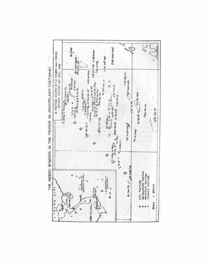
As regards the Vietnamese archipelagoes of Hoang Sa and Truong Sa, during the last thirty-two years, China has on three occasions resorted to the use of force in order to invade them: in 1956 the Eastern sector of Hoang Sa; in 1974 the Western sector of that archipelago; and in 1988 a number of reefs in the Truong Sa archipelago. It even went as far as impudently demanding that Vietnam withdraw from the islands of Vietnam's Truong Sa archipelago.
China's gunboat policy violates international law and goes counter to the trend towards the peaceful settlement of all disputes in State-to-State relations now prevailing in the world and in the region:
25

In the face of China's policy of reliance on the use of force, the Socialist Republic of Vietnam is determined to defend its sovereignty and territorial integrity, and at the same time, respects the principle of refraining from the threat to use force or the use of force to settle disputes, consistently advocat-ing the settlement of all disputes between the two countries, including the one concerning the two archipelagoes, through peaceful negotiations. In line with this principled position, back in 1978 the Socialist Republic of Vietnam reached agreements with ASEAN countries, namely with Malaysia and the Philip-pines, to settle all differences, including territorial questions, through negotiations in a spirit of conciliation and friendship.
With China, from the outset, Vietnam has put forth proposals for the settlement of disputes through negotiations in a spirit of equality, mutual respect, friendship and good neighbourliness (Point 3, three-point position of January 26, 1974, reaffirmed in 1975 and 1976 and at Vietnam-China talks at Deputy-Foreign Ministerial level during 1977 and 1978). Regrettably, the Chinese side neither responded to these proposals nor put into effect the statement by Chinese leader Deng Xiaoping (then Deputy Prime Minister):
"Between the two countries there exists a dispute over the two archipelagoes which can be an object of discussion between the two sides." (Talks between the late General Secre-tary of the Communist Party of Vietnam Le Duan and Deputy Premier Deng Xiaoping, September 24, 1975).
In the face of the extremely serious situation in the Truong Sa archipelago area, since March, 1988, Vietnam has three times proposed to the Chinese side to open talks for the settle-ment of differences concerning the Truong Sa archipelago and other disputes over the common border and the Hoang Sa archipelago (Notes dated March 17 and March 23, 1988 respec-tively); at the same time it proposed that pending the settle-ment of disputes by means of negotiations, "the two sides
26
should refrain from the use of force to settle disputes and avoid any clashes that may aggravate the situation." (Note dated March 26, 1988).
The above-mentioned proposals successively put forth by Vietnam reflect the Vietnamese people and Government's self-restraint, constructive position and attitude of goodwill for the sake of peace. The Chinese authorities slanderously label the Vietnamese proposals "hypocritical" in order to reject negotiations with Vietnam and have not responded to Viet-nam's proposal that the two sides undertake not to use force to settle disputes. All this shows that China continues implement-ing a policy of hostility against Vietnam, and continues its acts of usurpation in the Truong Sa archipelago. In the meantime, China has declared that she is prepared to settle early border questions with other countries. This pertains to China's traditional "divide-and-rule" policy.
The developments of the situation since the March 14, 1988 incident up to the present day point to all the dangers inherent in China's policy of reliance on the use of force,
A peaceful settlement of the dispute over the archipelagoes of Truong Sa and Hoang Sa would respond to the desire for peace of the peoples of Vietnam and China, in confor-mity with the principles of international law and the United Nations Charter, with the interest of peace, stability and co-operation in Southeast Asia, the Asian-Pacific region and the whole world. This is the most correct way. Public opinion in Southeast Asia and in the whole world is looking forward to China's positive response. Being one of the five permanent members of the United Nations Security Council, China has a major obligation to abide by the United Nations Charter.
April 1988
27

MAPS AND ANNEXES

ANNEX I
SOME GEOGRAPHICAL FEATURES OF THE HOANG SA AND TRUONG SA ARCHIPELAGOES
For a long time Vietnamese and Westerners have thought that in the Bien Dong Sea (also called South China Sea or China Sea) there is a long archipelago that the Vietnamese then called Bai Cat Vang, Con Vang, Hoang Sa, Truong Sa, Dai Truong Sa, Van Ly Truong Sa while Western navigators and cartographers named them Paracel, Parcel or Pracel.
Only in 1787-88 two hundreds years ago, could the-Kergariou-Locmaria research expedition clearly and exactly determine the position of the Hoang Sa (Paracel) archipelago, which thus was hence differentiated from the Truong Sa archipelago further South.
These two archipelagoes lie 500 kilometres from each other. They consist of a large number of islands, shoals and coral reefs. The total emerging area of each archipelago is about 10 square kilometres.
The value of both archipelagoes lies in their strategic position in the Bien Dong Sea and their great potentials in oil and natural gas.
The Hoang Sa archipelago:
(Known as Paracel by Westerners and Xisha by China). In this archipelago, there is an island called Hoang Sa (Pattle Island).
31

The Hoang Sa archipelago consists of about 30 islands, reefs
and shoals, all of which are scattered over an area of about 15,000 square kilometres and are divided into two clusters: the Eastern cluster of An Vinh (Amphitrite cluster) and the Western cluster of Luoi Liem (Crescent cluster).
The nearest point of this archipelago is about 170 nautical miles (one nautical mile = 1,853 km) off Da Nang (of Viet-nam) and about 156 nautical miles from Hainan Island (of China). The distance from East to West and from North to South of the archipelago is about 95 and 90 nautical miles respectively.
The Truong Sa archipelago: (Known as Spratly by Westerners and Nansha by China). In this archipelago, there is one island called Truong Sa
(Spratly Island). The Truong Sa archipelago consists of about 100 islands,
reefs and shoals lying over an area of about 160,000 —180,000 square kilometres.
The Truong Sa archipelago is situated Southeast of the Hoang Sa archipelago. The nearest point of the Truong Sa archipelago is about 250 nautical miles from Cam Ranh (of Vietnam) and about 522 nautical miles from Yulin (Hainan Island, China). The distance from East to West and from North to South is about 325 and 274 nautical miles respectively.
32

ANNEX II
In the report of the Ministry of Public Works submitted to Emperor Thieu Tri in 1847, it was said : "Hoang Sa belongs to our country's territorial waters. According to custom, gunboats are sent there every year to better ascertain navi-gation routes to these islands. As there are too many engage-ments this year, we submit that the voyage be postponed till next year."
Emperor Thieu Tri annotated : "Postpone." (See attached copy)
34

ANNEX III
In the year of Dinh Mao, the 20th year of Tu Duc's reign (1867), sailors fallen in Truong Sa were conferred the title "Hero" by the Emperor: "Truong Sa Heroes on sea patrol", "Truong Sa Heroes fishing", "Truong Sa Heroes holding fishing nets", "Truong Sa Heroes guarding stores", "Truong Sa Heroes guarding encampments", "Truong Sa Heroes preparing meals", etc.
(See attached copy)
36


ANNEX IV
1. Decree N° 4762-CP of December 21, 1933 issued by the Governor of Cochinchina on the incorporation of the Truong Sa archipelago into the province of Ba Ria.
(See attached copy)
38


2. Ordinance No 10 of the 29th day of the second lunar
month, the 13th year of Bao Dai's reign, (March 30, 1938) on the incorporation of the Hoang Sa archipelago into the prov-ince of Thua Thien. (Published in Nam Trieu quoc ngu Cong bao (the Official Quoc Ngu Journal of the Vietnamese Court), 8th issue of 1938, page 233).
(See attached copy)


3. Decree No 3282 of May 5, 1939 issued by the Governor
General of Indochina. J. Brévié on amending Decree 156-SC of June 15, 1938 (misprinted as 1932) and establishing in the Hoang Sa archipelago two administrative agencies deno-minated "Crescent and Dependencies" and "Amphitrite and Dependencies."
(Bulletin Administratif de l'Annam, 9th issue of 1939)
42


ANNEX V
1. Decree No 174-NV of July 13, 1961 issued by President Ngo Dinh Diem of the Republic of Vietnam on the allocation of the Hoang Sa archipelago to the province of Quang Nam and the establishment in this archipelago of a commune named Dinh Hai, as part of Hoa Vang district.
(See attached copy)
44


2. Decision N° 420-BNV/HCĐP/26 of September 6, 1973 by
the Ministry of the Interior of the Republic of Vietnam on the incorporation of the Truong Sa, archipelago into the commune of Phuoc Hai, Dat Do district, Phuoc Tuy province.
(See attached copy)
46


ANNEX VI
1. Decision No 193-HĐBT of December 9, 1982 by the Council of Ministers of the Socialist Republic of Vietnam on the setting up of the Truong Sa district as part of Dong Nai province.
(See attached copy)
48


2. Decision N° 194-HĐBT of December 9, 1982 by the
Council of Ministers of the Socialist Republic of Vietnam on the establishment of the Hoang Sa district, as part of Quang Nam — Da Nang province.
(See attached copy)
50


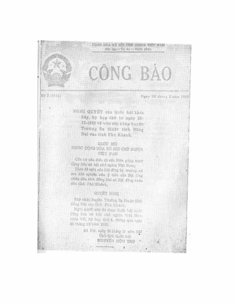
3. Resolution adopted by the National Assembly (7th
legislature) of the Socialist Republic of Vietnam on December 28, 1982 at its 4th session on detaching the district of Truong Sa from Dong Nai province and incorporating it into Phu Khanh province.
(See attached copy)
52

ANNEX VII
2. A "Map of Leizhou peninsula and Hainan Island", a maritime map of "China — Vietnam — Nanhai", scale 1:500,000 published by China in 1965 in the Chinese and Vietnamese languages.
(See attached copy)
54
