the spratly islands dispute
TRANSCRIPT
International Boundaries Research Unit
MARITIME BRIEFING
Volume 2 Number 1
The Spratly Islands Dispute: Who's On First?
Daniel J. Dzurek

i
Maritime Briefing
Volume 2 Number 1 ISBN 1-897643-23-3
1996
The Spratly Islands Dispute: Who's On First?
by
Daniel J. Dzurek
Edited by
Clive Schofield
International Boundaries Research Unit Suite 3P, Mountjoy Research Centre
University of Durham Durham DH1 3UR
UK
Tel: UK + 44 (0) 191 374 7701 Fax: UK +44 (0) 191 374 7702
ii
The Author
Daniel J Dzurek works as an international boundary consultant for oil companies, map makers, and law firms. Formerly, he was a research associate at the East-West Center in Honolulu and served in the US Department of State as Chief of the Spatial, Environmental, and Boundary Analysis Division in the Office of the Geographer. While at State, he authored five issues of
Limits in the Seas, participated in three negotiating sessions on the Russia-US maritime boundary treaty, and assisted in the US submission to the ICJ in the Gulf of Maine Case. He
has published extensively on maritime boundary issues.
The opinions contained herein are those of the author and are not to be construed as those of IBRU.
iii
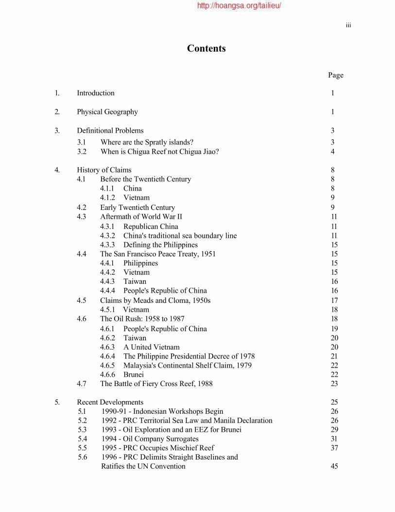
Contents
Page
1. Introduction 1
2. Physical Geography 1
3. Definitional Problems 3
3.1 Where are the Spratly islands? 3 3.2 When is Chigua Reef not Chigua Jiao? 4
4. History of Claims 8 4.1 Before the Twentieth Century 8
4.1.1 China 8 4.1.2 Vietnam 9
4.2 Early Twentieth Century 9 4.3 Aftermath of World War II 11
4.3.1 Republican China 11 4.3.2 China's traditional sea boundary line 11 4.3.3 Defining the Philippines 15
4.4 The San Francisco Peace Treaty, 1951 15 4.4.1 Philippines 15 4.4.2 Vietnam 15 4.4.3 Taiwan 16 4.4.4 People's Republic of China 16
4.5 Claims by Meads and Cloma, 1950s 17 4.5.1 Vietnam 18
4.6 The Oil Rush: 1958 to 1987 18
4.6.1 People's Republic of China 19 4.6.2 Taiwan 20 4.6.3 A United Vietnam 20 4.6.4 The Philippine Presidential Decree of 1978 21 4.6.5 Malaysia's Continental Shelf Claim, 1979 22 4.6.6 Brunei 22
4.7 The Battle of Fiery Cross Reef, 1988 23
5. Recent Developments 25 5.1 1990-91 - Indonesian Workshops Begin 26 5.2 1992 - PRC Territorial Sea Law and Manila Declaration 26 5.3 1993 - Oil Exploration and an EEZ for Brunei 29 5.4 1994 - Oil Company Surrogates 31 5.5 1995 - PRC Occupies Mischief Reef 37 5.6 1996 - PRC Delimits Straight Baselines and
Ratifies the UN Convention 45

Page
6. Summary of National Claims 6.1 Brunei 6.2 China
6.2.1 People's Republic of China 6.2.2 Republic of China on Taiwan
6.3 Malaysia 6.4 Philippines 6.5 Vietnam
7. Relevant International Legal Principles 7.1 Establishing Sovereignty over Islands
7.1.1 Modes of territorial acquisition 7.1.2 Other legal considerations 7.1.3 Fallacious legal arguments
7.2 Island or Rock?
8. Conclusions
Proclamations and Legislation
Selected Bibliography
47 48 48 49 49 49 49 50
50 51 52 52 53 53
54 59 62
Tables and Figures
Figure 1: South China Sea: Selected Claims/Oil and Gas Resources 2
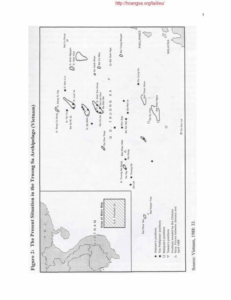
Figure 2: The Present Situation in the Truong Sa Archipelago (Vietnam) 5
Figure 3: Chinese Installation on Kennan Reef 7
Figure 4: Chinese Installation on Gaven Reef 24
Figure 5: South China Sea: Claims and Outposts in the Spratly Island Region 38
Table 1: Geographic Coordinates of Fiery Cross Reef 6
Table 2: Selected Spratly Island Place Names 56
Table 3: Distances Between Occupied Spratly Features 58

The Spratly Islands Dispute: Who's On First?
Daniel J. Dzurek
1. Introduction
The area of the Spratly islands 1 in the South China Sea is the most contested place on the planet. It includes both sovereignty and jurisdictional (boundary) disputes. The reference of this monograph's title to the Laurel and Hardy comic routine hints at the chronic miscommunication among the claimants. It also alludes to the allegation of 'discovery' that underlies several sovereignty assertions and to the sequential occupation of military outposts by the claimants. Brunei, China, Malaysia, the Philippines, Taiwan,2 and Vietnam claim part or all of the area. All of the countries except Brunei claim some of the islands and reefs.3
Matters are complicated because there is no agreed definition of the 'Spratly islands', and international law is ambiguous about the definition of islands and the resolution of conflicting sovereignty and jurisdictional claims. The Spratly islands dispute is aggravated by historical animosity, other land and maritime boundary disputes among the claimants, and the possibility of oil and gas deposits near the islands.
2. Physical Geography
The southern portion of the South China Sea is studded with low islands, cays, and reefs extending in a rough oval southwest to northeast for approximately 900 kilometres (km). The average east-west extension is roughly 360km. The 240,000 sq. km area is roughly the size of the United Kingdom (see Figure 1). However, estimates of the jurisdictional area under dispute vary dramatically.4
There are more than 170 features with English names in the Spratly islands.5 Most are submerged banks and shoals; approximately 36 tiny islands rise above the water. Within the Spratly islands, features tend to cluster on submerged structures, variously termed table mounts, atolls, reefs, or banks, of relatively shallow depths (less than 200 metres). Some
1
2
3 4
5
To refer to the entire Spratly group, the term Spratly islands, with a lowercase generic, will be used to remind the reader that the group is ill-defined and to distinguish from Spratly Island. Because troops from both Chinese authorities are present in the Spratly islands, they must be distinguished for purposes of this study. The Nationalist authorities in Taipei, Taiwan will be identified as Taiwan where a distinction is necessary, and the authorities in Beijing will be denoted as China or People's Republic of China (PRC). However, both authorities view Taiwan as a province of China and maintain similar claims to the Spratly islands. Brunei claims the seas surrounding Louisa Reef. Prescott (1993) calculates an area nearly twice as large, 154,000 square nautical miles (nm) (528,000 sq. km). Vietnamese sources give an area of 160,000-180,000 sq. km. Chinese authorities estimate an area of 800,000 sq. km. Dzurek, 1994:167. The Spratly Islands: Placenames Guide (Australia, 1988) lists 98 Chinese place names and 62 Vietnamese place names in the Spratly islands.

2
Figure 1: South China Sea: Selected Claims/Oil and Gas Resources
Source: US Department of State, Office of the Geographer and Global Issues.
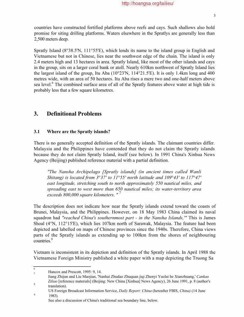
3 countries have constructed fortified platforms above reefs and cays. Such shallows also hold promise for siting drilling platforms. Waters elsewhere in the Spratlys are generally less than 2,500 meters deep.
Spratly Island (8°38.5'N, 111°55'E), which lends its name to the island group in English and Vietnamese but not in Chinese, lies near the southwest edge of the chain. The island is only 2.4 meters high and 13 hectares in area. Spratly Island, like most of the other islands and cays in the group, sits on a larger coral bank or atoll. Nearly 610km northwest of Spratly Island lies the largest island of the group, Itu Aba (10°23'N, 114°21.5'E). It is only 1.4km long and 400 metres wide, with an area of 50 hectares. Itu Aba rises a mere two and one-half meters above sea level.6 The combined surface area of all of the Spratly features above water at high tide is probably less that a few square kilometres.
3. Definitional Problems
3.1 Where are the Spratly islands?
There is no generally accepted definition of the Spratly islands. The claimant countries differ. Malaysia and the Philippines have contended that they do not claim the Spratly islands because they do not claim Spratly Island, itself (see below). In 1991 China's Xinhua News Agency (Beijing) published reference material with a partial definition.
"The Nansha Archipelago [Spratly islands] (in ancient times called Wanli Shitang) is located from 3°37' to 11°55' north latitude and 109°43' to 117°47' east longitude, stretching south to north approximately 550 nautical miles, and spreading east to west more than 650 nautical miles; its water-territory area exceeds 800,000 square kilometers. " 7
The description does not indicate how near the Spratly islands extend toward the coasts of Brunei, Malaysia, and the Philippines. However, on 18 May 1983 China claimed its naval squadron had "reached China's southernmost part - in the Nansha Islands,'" This is James Shoal (4°N, 112°15'E), which lies 107km north of Sarawak, Malaysia. The feature had been depicted and labelled on maps of Chinese provinces since the 1940s. Therefore, China views parts of the Spratly islands as extending up to 100km from the shores of neighbouring countries.9
Vietnam is inconsistent in its depiction and definition of the Spratly islands. In April 1988 the Vietnamese Foreign Ministry published a white paper with a map depicting the Truong Sa
6
7
8
9
Hancox and Prescott, 1995: 9, 14. Jiang Zhijun and Liu Maojian, 'Nanhai Zhudao Zhuquan jiqi Zhenyi Yuolai he Xtanzhuang,' Cankao Ziliao [reference materials] (Beijing: New China [Xinhua] News Agency), 26 June 1991, p. 8 (author's translation). US Foreign Broadcast Information Service, Daily Report: China (hereafter FBIS, China) (14 June 1983). See also a discussion of China's traditional sea boundary line, below.

4 [Spratly] Archipelago (see Figure 2). The labelled features stretch as far west as Bai Phuc Tan (Prince of Wales Bank at 8°07'N, 110°32'E) and as far south as Da Sac Lot (Royal Charlotte Reef at 6°57'N, I13°35'E). On 19 May 1992 in response to China's contract with Crestone Energy (US) for the area around Vanguard Bank (7°32'N, 109°44'E) and Prince of Wales Bank, Vietnam claimed that the contract area was on its continental shelf and outside the Spratly islands (see below).10 An unofficial Vietnamese definition was reportedly published in October 1992, which described the Truong Sa [Spratly] archipelago as situated from 6°50'N to 12°N and lll°30'E to117o20'E.11 However a 1992 Vietnamese map of Indochina continues to suggest that Vietnam regards the Spratly islands as encompassing Vanguard and Prince of Wales banks. The map includes a first-order administrative district label for the Truong Sa archipelago that stretches south of Vanguard Bank, which is among the features labelled on the map.12
Various authors have proposed definitions for the Spratly islands. Prescott has written that "There is no single authoritative definition of the extent of the Spratly Islands, but they are found in the southeastern part of the South China Sea. " 13 Hancox and Prescott (1995) examined the spatial extent of the Spratly islands in an earlier Maritime Briefing. Heinzig's definition includes the area between 4°N and 11°30'N and from 109°30'Eto 117°50'E.14
For purposes of this study, a definition encompassing the largest delimitation of the Spratly islands is desirable. Therefore the Chinese limits, up to 185 kilometres (100 nm) from the Malaysian and Philippine main islands, are used. This excludes the Paracel Islands, Macclesfield Bank, and Scarborough Reef, which, though disputed, are not part of the Spratly islands under most countries' definitions.
3.2 When is Chigua Reef not Chigua Jiao?
Even the identification of particular features can be problematic in the Spratly islands. One is confronted with place names in Chinese, English, French, Malay, Filipino, and Vietnamese. There are variants within each language for some features. For example, Fiery Cross Reef (9°33'N, 112°53'E), which was the scene of a battle between the People's Republic of China (PRC) and Vietnam in 1988, also bears the English names: Fierry Cross and Investigator Northwest Reef. The same feature is identified by one set of characters in Chinese, but they are variously rendered in roman characters as Yongshu Jiao, Yungshu Jiao, and Yung-shu Chiao.15 It is named Chu Thap in Vietnamese and Kalingan in Filipino. The feature's French name is RecifCroix de Feu.16
10
11
12
13
14
15
16
'Statement of the Ministry of Foreign Affairs of the Socialist Republic of Vietnam on the Agreement between Chinese and US Oil Companies for the Exploration and Exploitation of Oil and Gas on the Continental Shelf of Vietnam', Press Release No. 08/BC, Vietnamese Mission to the United Nations, New York, 19 May 1992. Luu Van Loi, 'Bien Dong', Vietnam Courier No. 36, October 1992, as cited in Ning Lu, 1993: 59. The label 'HUYEN TRUONG SA (TINH KHANH HOA)' curves southward beneath the island group on an inset of the map (Vietnam, 1992). Prescott, 1985:218. Heinzig, 1976: 17. The Chinese characters correspond to Chinese telegraphic codes 3057, 2540, 4339 and can be translated as "eternal summer shoal." Gazetteer on reverse of 'The Spratly Islands and Paracel Islands' (map) (United States, 1992).
5

6
The location of Fiery Cross Reef also differs among sources (see Table 1). The average difference in location among the five published sources is 10km. Many features in the Spratly islands, especially reefs, extend for several kilometres, therefore precise locations can be uncertain. Also, some variation is due to differing map projections and diverse national geodetic systems. However, the largest nominal divergence among these various locations in Table 1 is some 18km.
On occasion, uncertainty is compounded because a place name in one language does not appear to correspond with that in another language. Such is the case with Dongmen Jiao, which was occupied by the PRC in 1988 (see Figure 3).17 A recent US government map with gazetteer identifies this Chinese name with Chigua Reef, also called Kennan Reef, located at 9°55'N, 114°29'E.18 However, both Chigua Jiao19 [reef] and Dongmen Jiao appear in Chinese documents, showing that they are separate entities. One Chinese gazetteer locates Dongmen Jiao at 9°54'N, 114°30'E and Chigua Jiao at 9°42'N, 114°18'E. This source explicitly identifies Chigua Jiao as 'Johnson Reef.'20 The listed geographic coordinates suggest that Chigua Jiao in the Chinese context is Johnson Reef South, and Dongmen Jiao is what the United States identifies as Chigua Reef or Kennan Reef. Both 'islands' are outcroppings on the Union Reefs platform, which includes four other occupied features. Such confusing place names reflect even more bewildering historical claims.
Table 1: Geographic Coordinates of Fiery Cross Reef
Sources:
A United States, National Technical Information Service (1992) 'The Spratly Islands and Paracel Islands [map]', US Department of Commerce, National Technical Information Service (Purchase No. PB92- 928343);
B United States Board on Geographic Names (1987) Gazetteer of the Paracel Islands and Spratfy Islands, Washington, DC: Defense Mapping Agency: 11;
C Pan Shiying (1993) 'The Nansha Islands: A Chinese Point of View', Window (Hong Kong), 3 September: 29;
D Zhongguo Diminglu: Zhongkva Renmin Gongkeguo Dituji Diming Suoyin [Gazetteer of China: Index to the Atlas of the People's Republic of China] (1983) Beijing: Ditu Chubanshe: 273;
E Australia, Department of Defence (1988) Spratly Islands: Placenames Guide, Joint Intelligence Organization Working Paper, No. 8/88 (October), Canberra: 8.
17 18 19 20
Chinese telegraphic codes 2639, 7024,4339 meaning "eastern gate shoal." "The Spratly Islands and Paracel Islands" (map) (United States, 1992). Chinese telegraphic codes 6375, 3900,4339 meaning "red gourd shoal." Shijie Diminglu [world gazetteer], 1994: 2,745 and 2,750.
Table 1: Geographic Coordinates of Fiery Cross Reef
Source Latitude (N) Longitude (£) A B C D E
9° 33' 00" 9° 38' 9° 32' 30" 9° 42' 9° 33' 02"
112° 53'00" 112°57' 112° 54'00" 112°54' 112° 53'34"

7

8 4. History of the Claims
Some claimants use centuries-old evidence of discovery as their basis for title to the Spratly islands, claiming that they were on first. However, sovereignty over the Spratlys has been hotly contested only since the end of the Second World War, with the withdrawal of Japanese and French forces that had occupied some islands. Besides the varying temporal aspect, the claims differ spatially. Only China, including Taiwan, and Vietnam claim all of the Spratly islands. The interplay of the claimants in time and space resembles a complex tapestry, the threads of which stretch into antiquity.
4.1 Before the Twentieth Century
4.1.1 China
Although the authorities in Taipei (Taiwan) and Beijing dispute which is the rightful government of China, both put forward essentially the same basis for their Spratly claim, which is similar to that for the Paracel Islands. They claim discovery of the Spratly islands and intermittent presence from the Han dynasty (2nd century BC). All Chinese authorities cite ancient texts and maps relating to Chinese naval and fishing activity throughout the South China Sea. Given extensive naval activity by China in the South China Sea, especially during the Ming Dynasty, Chinese navigators undoubtedly were among the first to reach the islands.21 The Chinese activity in the Paracel Islands is better documented than that in the more distant Spratly islands.22 Moreover, place name usage and ancient maps may relate to other features in the South China Sea.23 Modem authors' assertions of subsequent discovery of Chinese artefacts and graves are not persuasive proof of Chinese title to the islands. Chinese goods would have been available to other peoples through trade. Graves may prove the presence of Chinese on or near the islands, but do not demonstrate continuing presence or administration.
Samuels suggests that the first distinct Chinese reference to the Spratly islands is found in a 1730 text by Ch'en Lun-chiung.25 Independent witness of Chinese activity in the Spratly islands dates to 1867, when a British survey ship allegedly encountered Chinese fishermen on Itu Aba.26 In 1883, according to Chinese sources, the German government suspended survey work in the Spratly islands due to a protest from the Chinese government. Haller-Trost suggests that the survey only covered the Paracel Islands.27
21
22
23
24
25
26
27
Heinzig, 1976: 22-24; Chang, 1991: 404-406. Samuels, 1982: 9-25. Heinzig, 1976: 21-23; with Chang, 1991: 403-405. Pan, 1993: 24; Chang, 1991: 404. Hai-kuo wen-chien lu (sights and sounds of the maritime countries), see Samuels, 1982: 36. Heinzig, 1976: 23; Pan, 1993: 24. Heinzig, 1976: 25-26; Document issued by the Ministry of Foreign Affairs of the People's Republic of China: China's indisputable sovereignty over the Xisha and Nansha Islands, 30 January 1980 (China: 1982: 455); S.K.T. Yu, 1990: 10-11; Haller-Trost, 1994b.

9
4.1.2 Vietnam
Vietnam asserts that:
"it has maintained effective occupation of the two archipelagoes [Paracel and Spratly islands] at least since the 17th century when they were not under the sovereignty of any country and the Vietnamese State has exercised effectively, continuously and peacefully its sovereignty over the two archipelagoes until the time when they were invaded by the Chinese armed forces. " 28
However, most of Vietnam's 18th and 19th century historical evidence relates to the Bai Cat Vang islands, which Vietnam maintains included both the Hoang Sa [Paracel] islands and the Truong Sa [Spratly] islands.29 Heinzig states that "Vietnamese argumentation, covering the period until the end of the 19th century, refers exclusively to the Paracels. " 30 Given the 400km distance between them, it would be unusual to treat both island groups as a single entity or use one place name for both.
Vietnam claims that it conducted surveys and mapping expeditions to both island groups.31
However, its activities clearly focused on the Paracel Islands.32 Use of the term Truong Sa appears to date to a 1867 decree of Emperor Tu Due of Annam.33
Vietnam claims that France administered the islands as part of its protectorate, established under a 1884 treaty. After France consolidated its hold on Vietnam in a war with China, the two parties concluded a peace treaty delimiting the boundary of French Indochina on 27 June 1887, which allocated islands east of the 105°43' meridian from Paris (108°03'E of Greenwich) to China. The 1887 treaty has been cited as evidence against French and Vietnamese claims to the Paracel and Spratly islands.34 It is unlikely that this allocation can reasonably be interpreted to reach into the South China Sea, proper, because when extended beyond the Gulf of Tonkin the line intersects the mainland of Vietnam. This would also place islands immediately off the Vietnamese coast, such as Con Co, Cu Lao Re, and Cu Lao Con, under Chinese sovereignty, but China has never claimed these coastal islands. There is little evidence of French activity in the Spratly islands until 1930.35
4.2 Early Twentieth Century
The early twentieth century was a period of turbulence and warfare throughout much of East and Southeast Asia, which also suffered during World War II. In 1902 the Chinese imperial government sent a naval task force to inspect islands in the South China Sea. The troops reportedly erected sovereignty markers and hoisted Chinese flags on some islands, but it is not
28
29
30
31
32
33
34
35
Vietnam, 1988:4. Vietnam, 1988: 4. Heinzig, 1976:24. Heinzig, 1976: 25; Vietnam, 1988: 4-6. Samuels, 1982: 43-44. Vietnam, 1988: 6, 36. Park, 1978: 33-34; Thomas, 1990: 415; Dzurek, 1994. Samuels, 1982:63-64.

10 clear that the task force penetrated beyond the Paracel Islands to the Spratly islands. The Chinese Republic placed the Paracel Islands under the administration of a county on Hainan Island in 1911,36 but apparently did not include the Spratly islands.
A Japanese exploration team visited the Spratly islands in 1918 and met with Chinese fishermen who lived on Southwest Cay.37 During the late 1920s and early 1930s Japanese phosphate companies were active in the Spratly islands. France was also active there, sending reconnaissance vessels and, apparently, occupying one island.38 In 1927 France and Japan held inconclusive discussions about their activities in the South China Sea.39
The Chinese claim to the Spratly islands is weakened by a 1928 Chinese government commission report that said the Paracel Islands were the southernmost territory of China. As Samuels has observed, this suggests that the Spratly islands were not viewed as Chinese territory at that time.40
On 13 April 1930 France claimed to have taken possession of Spratly Island. It proceeded to claim all the islands between 7° and 12° North latitude and between 111° and 117° East longitude, but formal notice was not published until 1933. Marston ably recounts the resulting diplomatic exchanges between Britain and France because of an inchoate claim that Britain had to Spratly Island and Amboyna Cay.41
Although the strategic position of the islands and concerns about Japanese intentions influenced the British, they appeared to have viewed the Spratly islands as terra nullius. Chinese claims were not considered by the British, although the French described the islands as settled by Chinese.42 On 26 July 1933 the Chinese foreign ministry publicly affirmed Chinese sovereignty of the islands:
"The coral islands between the Philippines and Annam are inhabited only by Chinese fishermen, and are internationally recognized as Chinese territories." 43
On 29 September 1933 the Chinese government protested French activities in the islands by referring to the 1887 Sino-French treaty.44 Additional protests to the French government followed.45 Upheavals and warfare in mainland China probably precluded anything stronger than Chinese diplomatic protests. On 21 December 1933 the French governor of Cochin-China incorporated the Spratly islands into Ba Ria province.46
36
37
38
39
40
41
42
43 44
45
46
Chang, 1991:405-06. Ogura Unosuke (1940) Boju No Shima (Storm island), 5th ed. (Tokyo: 1940), cited in Lu, 1993:28-29. Heinzig, 1976:28. Samuels, 1982:63-64. Samuels, 1982: 68. Marston, 1986:344-56. J. Vivielle, 'Les Ilots des mers de Chine', Le Monde Coloniale Illurts Vinielle, No. 121 (September 1933), as cited in Lu, 1993: 31, and in Chang, 1991: 406. Shen Shungen (1992)Keai de Nasha, Shanghai: Yuandong: 106 as translated in Lu, 1993: 32. France (1933) Journal Officiel de la Republique francaise, Vol. 65, No. 1752 (25 January 1933): 7,794, as cited in Chang, 1991: 411;see also Heinzig, 1976:28. Van Dyke and Bennett, 1993: 63-64; Chang, 1991:406; China, 1982:456. Decree No. 4762-CP, reproduced in Vietnam, 1988: 38-39.
11 Following conquest of Hainan Island, just off the Chinese mainland, Japanese forces occupied the Spratly islands by the end of March 1939. Some authors have argued that the Japanese did not attack Vietnam until late 1941; therefore their earlier occupation of the Spratly and Paracel islands must be viewed as movements against what they recognised as Chinese territory.47
There was no report of fighting between Japanese forces and French personnel, who would be assumed to have been in the Paracel and Spratly islands.48 Japan stationed troops on Spratly Island and put a submarine base on Itu Aba.49 The islands were then used as a staging post for the invasion of the Philippines.
4.3 Aftermath of World War II
4.3.1 Republican China
Chinese forces accepted the surrender of Japanese troops in northern Vietnam and were instructed to do so in the South China Sea islands. It is not clear that any Japanese surrendered to them in the islands.50
Two Chinese naval patrols were ordered to the Spratly islands in 1945-46. The French naval battleship, Chevreud, landed crews on Spratly Island and Itu Aba, where they placed a stone marker in October 1946.51 China protested the French action, and the two countries conducted inconclusive talks on the dispute. Another Chinese naval patrol sailed to the islands and arrived at Itu Aba on 12 December 1947. It reportedly erected markers on Itu Aba, Spratly Island, and West York Island. A garrison was established on Itu Aba, the largest of the islands. In 1946-47 China published official names for the islands and incorporated them into Guangdong province.52 Nationalist forces apparently occupied Itu Aba until 1950, when they withdrew to Taiwan in the aftermath of the Chinese civil war. They were not to return until 1956. 53
4.3.2 China's traditional sea boundary line
At this time, Chinese maps began to depict a tongue-shaped, interrupted boundary line that suggests Chinese jurisdiction over most of the South China Sea. A survey of Chinese maps and atlases in the Library of Congress, spanning the years 1933-50, yielded two 1947 atlases as the earliest depictions of this line.54 Heinzig reported that he was in possession of a 1949 chart depicting the historic claim line.55 One 1948 atlas, in the Library of Congress, depicts a continuous line, but the symbol of that line differed from that used for international
47
48
49
50
51
52
53
54
55
Chang, 1991:412. Samuels, 1982: 65. Heinzig, 1976:29. Lu, 1993: 34; Heinzig, 1976: 31-32; Samuels, 1982: 75. Samuels, 1982: 75. Chang, 1991: 406-407; Bennett, 1992:437-38; Chao, 1990: 25-26; Lu, 1993: 34-35. Samuels, 1982: 77. 'Chung-kuo shih ti t'u piao pien tsuan she', 1947, plate 27 (Library of Congress (LC) Call Number: G2305 .C95); Chin Ch'ing-yu, 1947, plate 11 (LC Call Number: G2305 .C53). Heinzig, 1976: n. 119.

12 boundaries.56 Song cites a depiction of the tongue-shaped line on a map published by the Republic of China Ministry of Interior in January 1948. 57 The interrupted line is found in a 1950 PRC provincial atlas and continues to appear on most maps of Chinese origin. Although often characterised in English as China's "historic claim line", as several Chinese speakers have observed the Chinese term might best be translated as "traditional sea boundary line."' Chinese references to the line vary,60 but most do not include the Chinese character for "historic" that is found in Chinese international legal terms, such as those for historic waters or historic bay that have special usage in the law of the sea.
In the 1979 national atlas of China the line is depicted with the same symbols as an international boundary, but it is not continuous. The atlas uses the identical interrupted symbol to distinguish the sovereignty of island groups belonging to other countries. For instance, it uses such line segments to differentiate the Natuna Islands of Indonesia from nearby Malaysia and to separate the southern Philippine islands from Malaysia.61 It is notable that the segments between the Natuna Islands and Malaysia do not follow the agreed Indonesia-Malaysia continental shelf boundary. Therefore, China's cartographic usage suggests that this traditional sea boundary line distinguishes the sovereignty of islands, not the limits of maritime jurisdiction.
China has never precisely delimited the course of this irregular boundary. The dashed lines generally follow the 200 meter isobath. The endpoints of the interrupted segments differed by 1 to 5 nautical miles in relative position among recent PRC maps.62 In 1979 Hasjim Djalal, then Director of Legal and Treaty Affairs of the Indonesian Department of Foreign Affairs, wrote:
"The nature of the claim of the PRC to the South China Sea is enigmatic...It is not clear whether the lines indicated in the Chinese maps are intended as the limits of the Chinese territorial claim towards the whole area, thus including the islands, the sea, the airspace, the seabed and all the resources contained therein; or whether the lines simply indicate that only the islands contained within the lines which are claimed by the PRC. Careful reading of the Chinese statements on this matter, especially those at the ICAO meetings [1979], indicates that the Chinese territorial claims are limited towards the islands and all rights related thereto, and not territorial claims over the South China Sea as a whole." 63
56 Ting Wen-chiang, 1948: 28 (LC Call Number: G2305 .T502 1948a). 57 Song, 1994:8.
58 Chung hua jen min kung ho kuo fen sheng ching t'u, 1950: plate 1 (LC Call Number: G2305 .Y3 1950). 59 The term used is chuantong haijiang xian (traditional sea frontier line) in Jiang Zhijun and Ltu
Maojian, 'NanhaiZhudaoZhuquanjiqi Zhenyi Yuolai he Zianzhuang', Cankao Ziliao: 9 (Ning Lu to the author, personal correspondence, 15 July 1993). Sea also Gao, 1994: 346.
60 Song, 1994: 11. 61 'Zhonghua Renmin Gongheguo Dituji' [Atlas of the People's Republic of China], 1979: plates 2, 56. 62 'Nanhai zhu dao' 1:2,000,000 (Beijing: Ditu Chubanshe, 1983);'Nanhai dixingtu' 1:3,000,000
(Beijing: Ditu Chubanshe, 1984); and 'Nanhai jilinjin dayang dishtta', (Zhongguo Kexueyuan, 1990), sheets 2 and 5.
63 Djalal, 1979: 41-42. Djalal is also quoted in David Jenkins, 'Trouble over Oil and Waters', Far Eastern Economic Review, 7 August 1981: 26.

13 Chinese scholars disagree about the legal status of the waters enclosed by the tongue-shaped line. Some claim historic waters status,64 while others agree with Djalal.65 Official statements distinguish the PRC from Taiwan. In discussing jurisdictional claims in the South China Sea, PRC government documents generally refer to more orthodox sovereignty claims to specific island groups, based on discovery and administration, and to maritime jurisdiction derived from that sovereignty:
"The PRC has not formalized its historical claim with precise coordinates, and has kept silent on the nature of this tongue-shaped line and the legal status of the waters enclosed by the line. " 66
Thus, it would appear that for the PRC the Chinese traditional sea boundary line relates to the sovereignty of the enclosed islands. 67 If it were to include continental shelf jurisdiction, it would have little standing in modern international law.
Continental shelf jurisdiction is predicated upon natural prolongation of the geologic shelf or proximity to a landmass, if there is no natural shelf. In the South China Sea, the traditional sea boundary line does not depict the limit of a geologic shelf extending from the Chinese mainland. Nor does it follow a median line equidistant from the islands claimed by China and the territories of other coastal states. In point of fact, the tongue-shaped line seems to follow the 200-meter isobath. If the line were a continental shelf claim, China would be claiming everything beyond the minimum available to the other coastal states under a narrow interpretation of continental shelf jurisdiction current in the 1940s. However, the 1945 Truman Proclamation and the 1958 Geneva Convention on the Continental Shelf recognised coastal state jurisdiction to a depth of 200 meters (approximately 100 fathoms) or to the limit of exploitability. Even at the time the line first appeared on Chinese maps, the 200 meter depth limit was not an absolute. The 1982 UN Convention abandoned the 200-meter isobath criterion completely. Therefore, the Chinese traditional sea boundary line has no foundation for continental shelf jurisdiction in the law of the sea.
In response to the PRC occupation of Mischief Reef (see Section 5.5), Indonesia raised the function of the tongue-shaped line with Beijing. Jakarta apparently feared that the line represented a claim to the natural gas fields off the Natuna Islands. On 26 June 1995 Foreign Minister Ali Alatas implied that the traditional sea boundary line had recently appeared on Chinese maps.68 Such an implication is inconsistent with work previously published by his Ambassador-at-large for the Law of the Sea, Hasjim Djalal. Following bilateral meetings in Beijing on 21 July the Indonesian Foreign Minister said that the PRC had never claimed the Natuna Islands, but implied that the maritime boundary between the Spratly and Natuna islands remained to be settled. The PRC Foreign Ministry confirmed the distinction.69
64
65
66
67
68
69
Pan, 1994. For example, Gao, 1994: 346; S.K.T. Yu, 1990; and Hungdah Chiu, summarised in Song, 1994: 34-35. Song, 1994:6. Gao, 1994: 346. 'Alatas: No Boundary Dispute with PRC, Radio Republik Indonesia (Jakarta) broadcast in Indonesian, 0600 GMT, 26 June 1995, translated in FBIS, East Asia (27 June 1995): 55; 'Indonesia Delays Spratlys Talks until October', Reuter (Jakarta), 20 June 1995. 'Indonesia Satisfied by China's Natuna Explanation', Reuter (Jakarta), 21 July 1995; 'On Natuna Archipelago Ownership', Xinhua (Beijing) broadcast in English, 22 June 1995, transcribed in FBIS, Daily Report: China (22 June 1995).
14 Obviously, Indonesia could not negotiate a boundary between the Natuna Islands and the Spratlys without first deciding who was sovereign of the Spratlys. As a neutral party to the dispute, such a determination is unlikely. Indonesian satisfaction with the PRC position suggests that China does not interpret the tongue-shaped line as a maritime boundary. Were it to do so, the Natuna gas field would be in dispute with the PRC.
In distinction to the apparent PRC position, officials of the Republic of China (Taiwan) have recently claimed that the waters enclosed by the traditional claim line are historic waters of China. In June 1994 Chang King-yu, Minister without Portfolio of the Executive Yuan, said that "the waters enclosed by the 'U'-shaped line in the South China Sea are our historic waters and the ROC is entitled to all the rights therein. " 70 On 18 July 1991 at the Second Workshop on Managing Potential Conflicts in the South China Sea (Bandung, Indonesia), Tzen Wen-hua, Representative of the Taipei Economic and Trade Office in Jakarta, stated:
"The South China Sea is a body of water under the jurisdiction of the Republic of China. The Republic of China has rights and privileges in the South China Sea. Any activities in the South China Sea must acquire the approval of the Government of the Republic of China." 71
Neither Beijing nor Taipei have exercised the kind of control within the traditional claim line that would characterise historic waters jurisdiction. Under international law, historic waters should have the status of internal waters or territorial sea. However, the vessels of other countries have exercised freedom of navigation through most of the area bounded by the tongue-shaped line. Foreign aircraft, which are prohibited from the airspace above internal waters and territorial seas without the explicit permission of the coastal state, have overflown the South China Sea for decades. Neither the PRC nor ROC have prevented or protested these activities by foreign vessels. In addition, a claim of historic waters requires recognition by the international community. No such recognition has been given to the Nationalist claim.72
Both Beijing and Taipei have decrees or legislation relating to the territorial sea that specifies its measurement from straight baselines around islands in the South China Sea (see Appendix ?). Such decrees would be superfluous if the tongue-shaped line delimited historic waters. In particular, Article 1 of the 1958 PRC Declaration on China's Territorial Sea states that:
"The breadth of the territorial sea of the People's Republic of China shall be twelve nautical miles. This provision applies to all territories of the People's Republic of china, including the Chinese mainland and its coastal islands, as well as Taiwan and its surrounding islands, the Penghu Islands and all other islands belonging to China which are separated from the mainland and its coastal islands by the high seas" [emphasis added].73
70 Statement at a conference sponsored by the Chinese Society of International Law (Taipei), as reported in United Daily News (29 June 1994: 4), and quoted in Song, 1994:7.
71 Excerpt of Tzen's statement distributed by the Coordination Council for North American Affairs at the South China Sea Conference, 7-9 September 1994, American Enterprise Institute, Washington, DC.
72 Song, 1994: 28-36. 73 People's Republic of China, Declaration on China's Territorial Sea, 9 September 1958, reprinted in US
Department ofState, Office of the Geographer, 1972: 1.

15 Article 2 lists the islands inside the Chinese baseline, whereas Article 4 lists Taiwan, the Spratly islands, and others. The PRC 1958 Declaration clearly groups the Spratly islands among those which are separated from the mainland by the high seas. Therefore proclamations and laws by the Chinese authorities relating to the Spratly islands, especially the PRC 1958 Declaration, are inconsistent with a historic waters claim delimited by the tongue-shaped line.
4.3.3 Defining the Philippines
A series of treaties between Spain and the United States (1898 and 1900) and the United Kingdom and the United States (1930) established the national area of the Philippines by lines of allocation, connecting points of specified geographic latitude and longitude. All the islands within these so-called treaty limits were administered by the US and, in 1946, became the Republic of the Philippines. Although the geographic polygon was only intended to designate the sovereignty of islands, the Philippines subsequently claimed that the treaty limits established territorial sea jurisdiction.74 It also used that same methodology in its later claim to part of the Spratly islands (see Section 4.6.4).
4.4 The San Francisco Peace Treaty, 1951
4.4.1 Philippines
In 1947, a year after gaining independence, the Philippine Secretary of Foreign Affairs called for the territory occupied by Japan during the Second World War to be awarded to the Philippines.75 Chinese communist success in China's civil war heightened Philippine security concerns. On 7 April 1949 the Chinese Republican Legation in Manila informed the Philippines government that the Chinese were garrisoning Itu Aba in an effort to block the traffic of arms through Hainan to Communist forces. However the Philippine government continued to express concern and discussed inducing Filipinos to settle in the Spratly islands. On 17 May 1950 Philippine President Quirino told a press conference that the Spratly islands belonged to the Philippines, but the statement was disavowed by a government spokesman.76
The Philippines did not make a claim to the islands during the 1951 San Francisco peace conference. However the Philippines has interpreted the Japanese renunciation of the Spratly islands in the resulting treaty as making the area res nullius and open to acquisition.77
4.4.2 Vietnam
Under French sponsorship, a Vietnamese delegation participated in the 1951 San Francisco peace conference, where the delegation head issued a statement reaffirming Vietnamese
74 Prescott, J.R.V. and Morgan, J.R. (1983) 'Marine Jurisdictions and Boundaries', in Morgan and Valencia: 50.
75 Coquia, 1990: 119. 76 Chao, 1990:28-29. 77 Drigot, 1982:44.

16 sovereignty over the Paracel and Spratly islands.78 Vietnam points out that no delegation objected to the statement, but fails to mention that China was not represented at the conference. The resulting treaty included a Japanese renunciation of the Spratly and Paracel islands, without designating which country was sovereign.
"Japan renounces all right, title and claim to the Spratly Islands and to the Paracel Islands. " 79
However, this failure to designate a successor was not unique to the South China Sea islands. Japan did not formally designate a successor for any of the other territories mentioned in the same treaty article, such as Formosa (Taiwan), the Kuril Islands, and part of Sakhalin.80
4.4.3 Taiwan
Because the Allies, in particular the United Kingdom and the United States, could not agree on which government represented China, no Chinese delegation participated in the 1951 San Francisco Peace Conference. Therefore, the Republic of China (Taiwan) negotiated a separate peace treaty with Japan, signed on 28 April 1952. Article 2 of the text included a reference to the San Francisco treaty:
"It is recognized that under Article 2 of the Treaty of Peace with Japan signed at the city of San Francisco in the United States of America on September 8, 1951, Japan has renounced all right, title and claim to Taiwan (Formosa) and Penghu (the Pescadores) as well as the Spratly Islands and the Paracel Islands." 81
Taiwan has argued that the explicit reference to the Spratly and Paracel islands in the text of this bilateral treaty implies Japanese recognition of Chinese sovereignty.82 Samuels and Lu have observed that, unlike the 1951 treaty, the Sino-Japanese text mentions the Spratly and Paracel islands in the same sentence with Taiwan and the Pescadores islands. The latter are generally recognised as Chinese territories. Moreover, according to the negotiating record Japan insisted that the renunciation article deal only with Chinese territory. This shows that the ROC and Japan viewed the islands of Taiwan, the Pescadores, the Spratlys, and the Paracels as having similar status - that is, belonging to China.
4.4.4 People's Republic of China
The People's Republic of China was proclaimed on 1 October 1949. On 6 June 1950 with the success of Communist forces in the Chinese civil war, the Nationalist garrison in the Spratly
78 Vietnam, 1988:7. 79 Treaty of Peace with Japan, 1952: 3,172. 80 Samuels, 1982: 77.
81 Treaty of Peace Between the Republic of China and Japan: 38. 82 Republic of China, Foreign Ministry statement, 10 June 1956, as cited in Chao, 1990: 31. 83 Samuels, 1982: 79-80; Lu, 1993: 38; Chao, 1990: 30, n. 74.
17
islands temporarily withdrew to Taiwan.84 The People's Republic of China (PRC) did not station its own troops in the islands until 1988. However, on 26 May 1950 the People's Daily (Beijing), reacting to the statement by Philippine President Quirino, reiterated China's claim to the Spratly islands.85
In August 1951 PRC Foreign Minister Zhou Enlai responded to a draft of the San Francisco peace treaty by stating that the islands had always been Chinese territory.86 Andre Gromyko, the Soviet delegate, proposed an amendment to the treaty that would have recognised the People's Republic of China as sovereign, but the amendment was ruled out of order.87
4.5 Claims by Meads and Cloma, 1950s
Following the withdrawal of Japan and the unsettled situation throughout Asia after the war, two individuals claimed the area of the Spratlys where the Philippines subsequently asserted rights. In the mid-1950s Morton F. Meads made a claim to islands in the vicinity of Itu Aba, based on their 'discovery' by James G. Meads in the 1870s and subsequent establishment there of the 'Kingdom of Humanity' in 1914.88
In 1956 Thomas Cloma, a Filipino, asserted ownership of thirty-three islands and reefs and
fishing grounds within a geographic polygon covering 65,000 sq. nm.89 Cloma coined the term Kalayaan (Freedomland) for the area and sent a letter to the Philippine Vice-President, requesting official endorsement. After several months, the Philippine government gave qualified support to Cloma. The Philippine government observed that the Kalayaan Islands were res nullius and open to exploitation by Filipinos since no country had established sovereignty. Manila further distinguished the Kalayaan Islands from the "seven" Spratly islands, which the Philippines claimed were a de facto trusteeship of the Allies and therefore also open to economic use and settlement by Philippine nationals.90 Beijing, Taipei, and Saigon lodged protests with Manila.
At this time Taiwanese troops reportedly reestablished their presence on Itu Aba, but Heinzig presents contradictory reports. His evidence suggests continuing Taiwanese occupation of Itu Aba only since 1971, when Taiwan's forces repulsed an attempted Philippine landing. Lu, citing Taiwanese sources, describes a series of Taiwanese patrols, beginning in March 1956, which covered the area from 9°30'N to 12°N and from 113°30'E to 114°50'E. The first patrol reportedly apprehended Felmon Cloma, the brother of Thomas, who provided a note
84 Lu, 1993: 35;Chao, 1990:29. 85 Lu, 1993:36. 86 Heinzig, 1976: 39; Buchholz, 1984: 66; Lu, 1993: 36. 87 Heinzig, 1976:40; Whiteman, 1965: 545, 552-53. 88 Samuels, 1982: 168-72; Pinther, M. (1988) 'Islands In the News', The Carto-Philatelist 33 (June): 52;
Dzurek, 1985:273, 89 Coquia, 1990: 119; Heinzig, 1976: 36; Drigot, 1982:44. 90 Lu, 1993: 63-65; Samuels, 1982: 81-86. 91 Chao, 1990: 34-3 8; Coquia, 1990: 119; Heinzig, 1976: 35-36,42.
18 acknowledging Chinese sovereignty. 92 Other authors hold that Taiwan reestablished a presence in the late 1950s.93
4.5.1 Vietnam
Vietnam maintains that the Paracel and Spratly islands, which lie south of the 17th parallel that formerly separated North and South Vietnam, were transferred by the French to South Vietnamese administration in 1956.94 Evidently France ceded control of the Paracel Islands to Vietnam on 15 October 1950, but there is no record of a similar devolution of French rights in the Spratly islands when they withdrew from Indochina in 1956. Indeed, in that year the French reportedly notified the Philippine government that they regarded the Spratly islands as French territory and had not ceded them to Vietnam.95 On 1 June 1956 the government of South Vietnam issued a communique reaffirming its sovereignty over the Paracel and Spratly islands.96 During August 1956 the government of South Vietnam sent a naval patrol to Spratly Island, but it did not at that time establish a base there.97
4.6 The Oil Rush: 1958 to 1987
Southeast Asia's first offshore well was drilled in 1957,98 but active offshore hydrocarbon exploration in the South China Sea, indeed in most of East and Southeast Asia, can probably be traced to a 1969 publication by the ECAFE99 Committee for the Coordination of Joint Prospecting for Mineral Resources in Asian Offshore Areas (CCOP), which suggested that there were petroleum resources under the Yellow and East China seas.100 In the same year, the World Court enunciated the natural prolongation principle in deciding the North Sea Continental Shelf cases. In 1972 Kenya proposed a 200-nm EEZ. This was followed by a steep rise in oil prices beginning in 1973.101 A 1974 agreement between Japan and South Korea jointly to develop an area in the East China Sea prompted a protest from the PRC and sensitised coastal states in the region to potential marine resources.
Throughout Asia, the rush was on. It was during the late 1960s and early 1970s when most South China Sea littoral countries claimed continental shelves and the sovereignty disputes over the Spratly and Paracel islands grew in prominence.
92 'Haijun Xunyi Nansha Haijiang Jingguo' (Account of a naval patrol in the Spratly sea frontiers), in Zhongguo Nanhai Zhu Qundao Wenxian Huibian (Collected works on the archipelagos in the South China Sea] (Taipei: Taiwan Xuesheng Shuju) (1975), as cited in Lu, 1993: 39-41.
93 Hamzah, 1990: 5; Samuels, 1982: 84-85. 94 Vietnam, 1988: 8. 95 Philippines Ministry of Defense, The Kalayaan Islands, Series One Monograph No. 4 (Makati:
Development Academy of the Philippines Press, 1982), as cited in Gunn, 1990. See also, Samuels, 1982: 77 and 84; Yu, S.K.T., 1990.
96 Hamzah, 1990: 5. 97 Samuels, 1982: 85-86. 98 Valencia, 1985: 158; Samuels, 1982: 154. 99 Economic Commission for Asia and the Far East (ECAFE), an organ of the United Nations Economic
and Social Council. 100 Emery, 1969. 101 Dzurek, 1985:261.

19 The early 1970s saw a shift in the Southeast Asian regional political balance, especially as the United States began disengaging from Vietnam. In 1971 Taiwan was expelled from the United Nations and the PRC took its seat. US President Nixon visited China in 1972, and the following year the US signed the Paris agreements ending the Vietnam War. The United States recognised the People's Republic of China in 1978. The US withdrawal uncorked regional tensions that had been bottled-up during the Vietnam War. Taiwan became marginalised, and Vietnam resurgent. There was a resultant shift among the South China Sea powers, and, in an ironic consequence, a falling-out between a reunited Vietnam and its former ally, China.
4.6.1 People's Republic of China
On 4 September 1958 during the rising tensions in the Taiwan Straits, the government of the People's Republic of China issued a declaration on China's territorial sea, which extended the territorial sea to 12nm. claimed straight baselines along parts of its coast, and listed several island groups belonging to China, including the Spratly and Paracel islands.102 Ten days later, Pham Van Dong, the premier of North Vietnam, sent a diplomatic note to the PRC recognising and supporting the territorial sea declaration (see Section 4.6.3).103 South Vietnam did not protest the Chinese declaration at the time, but in February 1959 South Vietnamese forces harassed PRC fishermen in the Paracel Islands.
During the 1960s China fought along its land frontiers and suffered the Cultural Revolution. In 1962 it battled India. The USSR and China clashed in 1968. The PRC was also supporting North Vietnam against the US. At sea, China focused on building defences on the Paracel Islands and repeatedly denounced American violations of claimed territorial seas and airspace of the islands.104
In January 1974 the PRC condemned South Vietnam's actions in the Spratly islands and seized control of the remaining Paracel Islands after an air and sea battle with South Vietnamese forces. During the 1970s, China began offshore oil exploration. By 1977 a Chinese oil rig was reported operating in the Paracel Islands.105
Beijing did not occupy any of the Spratly islands until 1988, but it frequently protested actions by other Spratly claimants.106 On 21 July 1980 the PRC Ministry of Foreign Affairs protested an agreement between the Soviet Union and Vietnam to conduct hydrocarbon exploration
102 New China News Agency (Beijing) broadcast in Chinese, 4 September 1958, reproduced in US Department of State, Office of The Geographer (1972) 'Straight Baselines: People's Republic of China', Limits in the Seas No. 43 (Washington, DC: US Department of State, 1 July); Hamzah, 1990: 6; Samuels, 1982: 86-87.
103 Note from Pham Van Dong to Zhou Enlai, 14 September 1958, Nhan Dan (Hanoi), 22 September 1958. Facsimiles of the official diplomatic note in Vietnamese, translations into English and French, and copies of the Nhan Dan page can be found in 'Some Documentary Evidence Showing That the Vietnamese Government Recognized the Xisha and Nansha Islands as Chinese Territory', available from the PRC Ministry of Foreign Affairs. There is also some evidence that North Vietnam recognised PRC sovereignty over the Spratly islands in June 1956 (see Haller-Trost, 1994b: 22).
104 Samuels, 1982: 87-88. 105 Samuels, 1982: 161. 106 Chang 1990: 22; Samuels, 1982; 98-113.

20 activities off southern Vietnam. Foreshadowing the 1992 exchange over the Crestone contract (see Section 5.2), the PRC claimed that the area was under Chinese jurisdiction because China was sovereign over the Spratly islands.107
In the mid-1980s China sent several naval patrols into the Spratly islands and conducted scientific surveys there. In July 1987 the Spratly islands were included as part of the new province of Hainan. During November of that year, the PRC navy conducted manoeuvres as far south as James Shoal.108
4.6.2 Taiwan
Throughout this period, Taiwan continued to support and enhance its base on Itu Aba (T'ai P'ing) Island. In 1963 it sent a large task force to the island. Taiwan also sent reconnaissance patrols into the Spratly islands and erected boundary markers on Thitu, Namyit, and other islands. On 10 July 1971 the Philippines alleged that Taiwanese vessels fired on a Philippine vessel attempting to land on Itu Aba, but Taiwan denied the allegation.109 In response to the PRC's 1974 attack in the Paracels, Taiwan reinforced Itu Aba and began routine air and sea convoys there.110 On several occasions Taiwan issued statements and lodged protests reaffirming sovereignty over the Paracel and Spratly islands.111
4.6.3 A United Vietnam
As the Vietnam War neared an end, especially after the 1973 Paris agreements and subsequent withdrawal of the United States, claims in the South China Sea were reinvigorated. In 1971 North Vietnam began exploring for oil in the Gulf of Tonkin, where it came into conflict with China over their maritime frontier.112 Hanoi apparently had second thoughts about its acquiescence to China's Spratly islands claim and, in 1971 and 1973, proclaimed the Spratly islands to be Vietnamese territory. On 20 July 1973 the government in Saigon awarded eight offshore tracts, including several near the western edge of the Spratly islands. South Vietnam incorporated ten Spratly islands into Phuc Tuy province on 6 September 1973, and sent troops to Spratly Island and Namyit Island. Eventually, Saigon forces occupied five or six islands.113
In April 1975 troops from Hanoi seized six of the Spratly islands that South Vietnamese troops had occupied earlier that year.114 The next year Hanoi published a map of the new united
107 PRC Ministry of Foreign Affairs (1982) 'Zhonghua Renmin Gongheguo waijiaobu fayanren jiu Sulian he Yiienan qianding suowei zai 'Yiienan nanfang dalujia' hezuo kantan, kaifa shiyou he tianranqi de xieding shifabiao de shengming', in Chinese Yearbook of International Law, 1982 (Beijing: Zhongguo Duiqaifanyi Chubangongsi Chuban): 463-64. 108 Chang, 1990: 24.
109 Samuels, 1982: 89; Chang, 1991: 407; Hindley, M. and Bridge, J. (1994) 'South China Sea Disputed Islands', Free China Review (August): 45.
110 Samuels, 1982: 102-103. 111 Reportedly, on 25 January, 9 August, 27 August, and 26 December 1973, and on 18 January 1984, as
cited in Chang, 1991:407. 112 Samuels, 1982: 158-60; Dzurek, 1994: 164-66. 113 Samuels, 1982: 99, 106-107. 114 Chang, 1990:22.
21 Vietnam that included both the Paracel and Spratly island.115 Relations between the former allies deteriorated and, in 1979, China and Vietnam fought a brief land border war.
4.6.4 The Philippine Presidential Decree of 1978
In the 1960s the Philippines' strategic concerns ebbed, but offshore oil beckoned when a 1969 United Nations-sponsored study suggested offshore petroleum in the Yellow and East China seas.116 During 1970-71 when exploration began off Palawan island, Philippine forces reportedly occupied three Spratly islands in the Kalayaan area that Manila subsequently claimed. In 1971 the Philippines alleged that one of its vessels attempted to land on Itu Aba, but was repulsed by Chinese troops from Taiwan.117 Philippine concerns heightened following Chinese actions in the Paracel Islands. During February 1974 Manila reinforced its deployment in Kalayaan and listed the islands that it occupied. It also protested South Vietnamese and Taiwanese activities in the Spratly islands, but suggested a negotiated settlement. The Philippines reportedly occupied two more islands in 1975.118 In June 1976 oil was discovered in the Nido Complex off Palawan.119 In July the Philippine national oil company proposed that the Paracel Islands be divided between China and Vietnam, while the Philippines gain undisputed possession of the Spratly islands.120 About the same time, the Philippines signed an exploration contract for the Reed Bank in the eastern Kalayaan area.121
On 11 June 1978 when he also signed the Philippine EEZ decree, President Marcos formally decreed sovereignty over a geographic polygon122 roughly corresponding to Cloma's limits. This presidential decree was not published until February 1979.123 The Philippines holds that Kalayaan is distinct from the Spratly islands, to which it has no claim.124 The Philippine claim to Kalayaan is based on geographic proximity, effective occupation and control, vital interest, and the interpretation that the islands became res nullius when Japan renounced sovereignty in the 1951 San Francisco Peace Treaty.125 Use of a geometric polygon to claim the area is probably patterned after the Philippines' archipelagic definition.
115 Samuels, 1982: 108. 116 Dzurek, 1985:261. 117 Hamzah, 1990: 6; Heinzig, 1976: 36.
Kota, Lawak, Likas, Pagasa, and Parola islands (in Filipino; Loaita, Nanshan, West York, Thitu, and Northeast Cay, in English). See, Samuels, 1982: 103-105.
119 Samuels, 1982: 157. 120 Park, 1978: 49. 121 Samuels, 1982: 92, 157; Drigot, 1982: 54-55, n. 11 and 12. 122 The Philippine claim abuts its treaty limits and links the following coordinates: (12°N, 118°E),
(12°N, 114°30'E),(8°N, 112°10'E),(7°40'N, 112o10'E),(7°40'N, 116°E), and(10°N, 118°E). Presidential Decree No. 1596, 1979: 1,556-57; see also Coquia, 1990: 119. Philippines Ministry of Defense (1982) The Kalayaan Islands (Makati: Development Academy of the Philippines Press): 13, as given in Villacorta, 1990.
125 Drigot, 1992: 40-52.

22 4.6.5 Malaysia's Continental Shelf Claim, 1979
In 1978 Malaysian troops visited the southern Spratly islands.126 They landed on Amboyna Cay and reportedly erected a monument, which was subsequently removed by Vietnamese forces, who remained on the cay.127 The following year, Malaysia published a map delimiting its continental shelf claim,128 which enclosed several Spratly features including some occupied by the Philippines and Vietnam.
Malaysia uses an aberrant interpretation of the law of the sea. It claims islands by reason of its title to the surrounding continental shelf, instead of acknowledging that island sovereignty confers jurisdiction in the surrounding seas.129
During April 1980 Malaysia proclaimed an EEZ, but has not delimited it. The continental shelf map and EEZ proclamation led to protests by other Spratly claimants. In May 1983 troops from Malaysia landed on Swallow Reef, where they have maintained a base since. In November 1986 two more atolls were occupied.130 Malaysia has dredged materials to expand Swallow Reef into a cay of 6 hectares, including a 500 metre air strip.131
4.6.6 Brunei
At Brunei's independence in 1984, it inherited a continental shelf partially delimited by the United Kingdom.132 That shelf area lay between parallel lines drawn to the 100 fathom isobath. On behalf of Brunei, the United Kingdom also protested Malaysia's claim to Louisa Reef on its 1979 map.133 If extended farther, the lines would enclose Louisa Reef. Brunei is reported to claim the marine area around the reef, but does not appear to view the reef as an island subject to a claim of sovereignty.134
Bruneian authorities claim to have declared fisheries limits in 1983.135 In 1987-88 the Surveyor General of Brunei reportedly printed maps depicting fishery and continental shelf claims extending the lateral boundaries to an area beyond Rifleman Bank.136 This bank lies beyond the Malaysian continental shelf claim. It is 242nm from the nearest coastal point of Brunei, but only 201nm from the turning point of Vietnam's straight baseline at Hon Hai islet. Rifleman Bank is 278nm from Mui Ke Ga, a cape on the Vietnamese mainland.137 Therefore, Brunei's continental shelf claim discounts the Vietnamese baseline and the effect of offshore
126 Bahrin and Khadijah, 1990: 2. 127 Hamzah, 1990: 3. 128 Malaysia, 1979. 129 Hamzah, 1990: 7; Cordner, 1994: 67; Haller-Trost, 1990: 9-10. 130 Chang, 1990: 23, 25; Hamzah, 1990: 3,7. 131 Mellor, W. (1993) 'Tug of War', Asia, Inc. (September): 54. 132 Haller-Trost, 1990: 3;Prescott, 1987: 227-28. 133 Hamzah, 1990: 7; Cordner, 1994:68. 134 Statement of the Foreign Minister of Brunei, January 1993, as reported in Thomas, 1993: 4. 135 Brunei, 'Brunei Declares EEZ', government press release, published in Borneo Bulletin, 26 July 1993. 136 Hamzah, 1990,26, n. 24; Haller-Trost, 1994a: 2-5,43-44, and map 3 (p. 55).
137 Great circle distances calculated from published coordinates and US Defense Mapping Agency chart 71028 (scale 1:1,091,700, 7th ed., 21 May 1983) and chart 93030 (scale 1:1,071,000, 4th ed, 15 March 1980).
23 islands. Cordner contends that "the East Palawan Trough terminates the natural prolongation of the continental shelf 60 to 100 miles off Brunei. " 138 Under this interpretation, Brunei could not claim the Rifleman Bank area. However, ICJ rulings in the Libya-Malta, Libya-Tunisia and Canada-US cases have diminished natural prolongation as an argument in continental shelf boundary disputes between states with opposite coastlines.
4.7 The Battle for Fiery Cross Reef, 1988
Apparently by February 1988, the Chinese navy was searching for bases in the Spratly Islands. The PRC also claims to have been preparing sites for scientific observation stations under a UNESCO plan. Vietnam complained about Chinese naval vessels; the PRC responded that the Spratly islands were part of China. Construction of a Chinese base at Fiery Cross Reef had begun by 14 March 1988, when Vietnamese forces may have sought to disrupt construction work. On that date there was an armed battle in which about 75 Vietnamese personnel were killed or reported missing and three Vietnamese ships were set ablaze. Chinese casualties were apparently minor. The battle lasted for about 28 minutes.
The Chinese version of the events was that a Chinese survey team landed on Fiery Cross Reef to set-up an observation post. Three Vietnamese ships arrived and landed troops on the reef. When the Chinese asked them to leave, the Vietnamese opened fire. Chinese ships returned fire. According to Vietnam, three Chinese warships landed troops on Fiery Cross Reef, removed Vietnam's flag, and planted China's flag. When the Vietnamese asked the Chinese to leave, the Chinese troops and ships opened fire.139
On 23 March 1988 Vietnam offered to open talks on the Spratly dispute. The following day China rejected the offer. Vietnam repeated the offer to negotiate and was again rejected.140
However, the PRC took a softer line toward Malaysia and the Philippines. By 12 May 1988 perhaps in response to a public relations disaster, the PRC proposed negotiations with Vietnam while repeating a demand for the withdrawal of Vietnamese forces.141
Following the clash, the PRC sent more ships to the islands, and warned of another battle. China occupied additional reefs, bringing the total to seven by early May 1989. As of July the Chinese base at Fiery Cross Reef was complete.142 The PRC continued to fortify some islands (see Figure 4).
Vietnam increased its occupation to 21 islets and reefs. Shortly after the armed clash with China, the Vietnamese Minister of Defence reportedly visited the Spratly islands. In November 1988 Vietnam reported that a PRC destroyer had fired on one of its ships, but China denied the incident.143 In August 1989 Vietnam built facilities on Bombay Castle (on
138 Cordner, 1994: 68. 139 Chang, 1990: 25-26; Chang, 1991: 408; Davidson, 1988: 345-47. 140 Davidson, 1988: 346. 141 Thomas, 1990: 422. 142 Chang, 1990: 27; Thomas, 1990: 419. 143 Chang, 1990: 27; Thomas, 1990: 419.

24
25 Rifleman Bank), Vanguard Bank, and Prince of Wales Bank, bringing to 24 the number of islets and reefs under its control.144
Though not directly involved in the clash near Fiery Cross Reef, the other claimants reacted vigorously. In February, Malaysia's Deputy Foreign Minister stated:
"The islands and atolls are under Malaysian sovereignty, and Malaysia has in the past reaffirmed its jurisdiction....They are within Malaysia's continental shelf area and Malaysia's sovereignty over them has been officially declared through the new Map of Malaysia, published on December 21st, 1979....The claim is in line with the Geneva Convention of 1958 pertaining to territorial waters and continental shelf boundaries, and the UN Convention on the Law of the Sea, as well as other international practices. " 145
Taiwan reacted, in March, by reasserting its sovereignty and resupplying its garrison on Itu Aba.146 On 20 August 1988 Malaysia apprehended four Taiwanese fishing vessels within the Spratly area overlapped by the Malaysian EEZ claim. Taiwanese authorities did little to protest the Malaysian actions, and the Malaysian court fined the four ship masters.147 On 17 March 1988 the Philippines reacted to the recent China-Vietnam clash by warning both not to interfere in Kalayaan. Manila also urged peaceful settlement of the issue. In April a Philippine delegation visited Hanoi and reached an agreement not to use force in settling disputes. Philippine President Aquino visited China in the same month and agreed with China to shelve the dispute. Also in April Philippine fishermen were detained by the Malaysian navy near Commodore Reef. Manila protested, and the fishermen were eventually released by Malaysia as a good will gesture without prejudice to Kuala Lumpur's claim. Both Malaysia and the Philippines increased defence preparations and tensions rose. A Philippine scientific survey was mounted in May. In August the Philippine navy apprehended four Taiwanese fishing vessels for intruding in Kalayaan.148
5. Recent Developments
The 1990s have seen different tactics used by the claimants to the Spratly islands. Before 1988 the PRC was on the margins of the Spratly dispute. With its occupation of some Spratly islands the PRC has become the principal player in the game. Gao observes that the PRC was concerned with security in the South China Sea before the 1980s, but the Fiery Cross Reef incident was a turning point in PRC policy, which shifted toward economic interests.149
When the Cambodian problem was resolved in 1991, the disputes in the South China Sea, especially that over the Spratly islands, became the principal source of tension in Southeast
144 Thomas, 1990:419-20. NewStraits Times, 25 February 1988, as quoted in Haller-Trost,1990: 9-10.
146 Thomas, 1990: 416; Chang, 1990: 29. 147 Yu,P.K.H., 1990:78-81. 148 Chang, 1990: 28-30; Yu, P.K.H., 1990: 79-80; Thomas, 1990: 422-23. 149 Gao, 1994: 352-53.

26 Asia.150 Most of the other claimants found themselves reacting to Chinese tactics. During the first half of the decade, the contending countries made contracts with foreign oil companies and undertook offshore exploration activities in the disputed areas. The disputants also used fishing activities to press claims. This has also been the period of non-governmental conferences sponsored by Indonesia and Canada, ASEAN involvement, and formal bilateral talks.
5.1 1990-91 - Indonesian Workshops Begin
The first of the Indonesia-sponsored, non-governmental workshops on the South China Sea was held in Bali during January 1990. The initial meeting was generally limited to academics or officials from ASEAN countries and Canada, which provided some funding.151 On 29 December 1990 the ROC Foreign Minister reaffirmed its claim to the Spratly islands.152
During 1991 Malaysia announced its decision to construct a resort and airstrip on Swallow Reef. In July Taiwan restated its sovereignty claim to the Spratly islands.153 During that month the second Indonesian workshop met in Bandung and was expanded to include non-ASEAN participants. Subsequent workshops included participants from the PRC, Taiwan, Vietnam, and other Southeast Asian countries.154
5.2 1992 - PRC Territorial Sea Law and Manila Declaration
1992 saw new laws, workshops, and declarations about the Spratly islands. The PRC passed a law defining its territorial sea that reiterated previously claimed island groups, including the Spratlys, and Vietnam modified the definition of its continental shelf. Both the PRC and Vietnam used oil exploration licensing to reinforce their overlapping claims. At its meeting in Manila, ASEAN approved a declaration to resolve the South China Sea disputes peacefully and explore cooperation in various fields, such as navigation, protection of the marine environment, and combating piracy. Indonesia hosted a third non-governmental workshop.
During February 1992 the PRC passed its Law on the Territorial Sea, which reiterated its claim to various island groups in the South China Sea. The new law essentially codified and elaborated the 1958 Declaration on the Territorial Sea. The law listed the same groups of islands (including the Spratly islands) claimed in the earlier declaration, but added the Diaoyu Islands that China disputes with Japan in the East China Sea. Although there were no new
150 Gao, 1994: 350. 151 McDorman, 1993:274. 152 Chang, 1991:399. 153 McDorman, 1993: 276. 154 Vatikiotis, M. (1991) 'Eye on the Islands', Far Eastern Economic Review, 4 July: 19; McDorman,
1993:274, 283. 155 'Law on Territorial Waters, Adjacent Areas', Xinhua (Beijing) in Chinese, 25 February 1992,
translated in FBIS, China (28 February 1992): 2; People's Republic of China, National People's Congress, Legislative Affairs Commission, 'Law of the People's Republic of China on the Territorial Sea and the Contiguous Zone', adopted 25 February 1992 (booklet in English); Law of the People's Republic of China concerning Territorial Waters and Adjacent Regions (1992) Gazette of the State Council of the People's Republic of China (13 March 1992) no. 3, serial no. 688:69-71 (in Chinese).
27 claims in the law via-a-vis the South China Sea, various Southeast Asian countries reacted strongly.
In its 1992 Law the PRC also claimed a contiguous zone, as permitted in international law. The new law provides the right of innocent passage for foreign non-military ships, but requires PRC approval before foreign military vessels can enter China's territorial sea, as had the 1958 Declaration. The requirement for prior approval of military ship passage is inconsistent with the 1982 UN Convention.156 However, twenty-eight countries, including Burma, Cambodia, the Philippines, Vietnam, and even Denmark, require prior permission for the transit of foreign warships through their territorial seas.157 The restriction on innocent passage may be inconsistent with international law, but its is not unusual.
In March the Philippines arrested Chinese fishermen in the disputed area. The fishermen were later released.158 A major development occurred in May, when Crestone Energy Corporation (Denver) and the PRC's China National Offshore Oil Corporation (CNOOC) signed an oil exploration contract for a large area encompassing Vanguard, Prince Consort, Prince of Wales, Alexandra, and Grainger banks, which the Chinese termed Wan-an Bei 21 (WAB-21). Vietnam promptly protested and the PRC rejected the protest.159 There was a strong response throughout Southeast Asia, where commentators viewed the Crestone contract and the new PRC Law on the Territorial Sea as evidence of "China's new hegemonic interest in the region." 160
The third Indonesian workshop met in Yogjakarta from 29 June through 2 July 1992. The participants agreed to set up two expert working groups: on resource assessment and ways of development and on marine scientific research. On the last day of the conference, the PRC Foreign Ministry spokesperson reaffirmed Chinese sovereignty over the Spratly islands.161
During the July ASEAN ministerial meeting in Manila, the ministers issued the "ASEAN Declaration on the South China Sea ", patterned after the principles enunciated at the Bandung workshop. In the Declaration the ASEAN Foreign Ministers:
"Emphasize the necessity to resolve all sovereignty and jurisdictional issues pertaining to the South China Sea by peaceful means, without resort to force;
Urge all parties concerned to exercise restraint with the view to creating a positive climate for the eventual resolution of all disputes;
156 Wang and Pearse, 1994: 438-39. 157 Roach and Smith, 1994: 158-59. 158 McDorman, 1993:276. 159 'China's Decision on Spratlys Causes Ripples in Vietnam,' New Straits Times, 27 June 1992: 20; Kristof, N.D. (1992) 'China Signs U.S. Oil Deal for Disputed Waters,' New York Times, 18 June 1992; 'China Rejects Vietnam Claims on Crestone Deal,' Platt's Oilgram News, 29 June 1992. 160 Hamzah, B.A. (1992) 'China's Strategy', Far Eastern Economic Review, 13 August 1992: 22. 161 'Cooling offa Flashpoint,' Asiaweek ( \7 My 1992): 21-23; Michael Richardson, 'Oil Hunt in South China Sea: Some See Flash Point,' International Herald Tribune (30 June 1992); McDorman, 1993: 283-84; PRC Ministry of Foreign Affairs spokesman, 'China Has Indisputable Sovereignty over the Spratly Islands,' Peoples Daily (3 July 1992).
28 Resolve, without prejudicing the sovereignty and jurisdiction of countries
having direct interests in the area, to explore the possibility of cooperation in the South China Sea relating to the safety of maritime navigation and commu-nication, protection against pollution of the marine environment, coordination of search and rescue operations, efforts towards combating piracy and armed robbery as well as collaboration in the campaign against illicit trafficking in drugs;
Commend all parties concerned to apply the principles contained in the Treaty of Amity and Cooperation in Southeast Asia as the basis for establishing a code of international conduct over the South China Sea;
Invite all parties concerned to subscribe to this Declaration of principles. " 162
PRC Foreign Minister Qian assured the ASEAN foreign ministers that China would not use force in the Spratly dispute and said that the PRC favours shelving the territorial issues.163
During August 1992, probably in response to the Crestone contract, Vietnam modified its definition of the continental shelf to extend to the 1,500 meter isobath, thereby encompassing Vanguard Bank but excluding Rifleman Bank and Spratly Island. Vietnam sought to make its claim to the contract area distinct from its sovereignty claim to the Spratly islands.164
During September the link between the Chinese-Vietnamese dispute in the Spratlys and their other boundary and maritime disputes became more apparent. On 4 September Vietnam demanded the withdrawal of Chinese drilling ships from the Gulf of Tonkin. The PRC foreign minister rejected Vietnam's complaint.165 During his visit to Hanoi, PRC Deputy Foreign Minister Xu said that China was willing to discuss the land boundary dispute and the Gulf of Tonkin maritime boundary when their experts were to meet, but not the Spratly dispute.166
The end of 1992 found other claimants entering the fray and the Vietnamese using the foreign oil company gambit. In November Taiwanese officials said that Taiwan would set up a task force to deal with the Spratly dispute.167 On 2 December Philippine Foreign Secretary Romulo said that Washington should clarify the application of the Mutual Defense Treaty to the Spratly Islands.168 PRC Prime Minister Li Peng visited Vietnam (30 November-
162 McDorman, 1993: 285. 163 Thomas, 1993: 2; McDorman, 1993: 281; William Branigin, 'China Assures Asian Bloc on Islands,'
Washington Post (22 July 1992): A23. 164 Huynh Minh Chinh, 'Thu Chinh Bank Is on Vietnam's Continental Shelf,' Vietnam Courier, No. 34,
August 1992. 165 Kathleen Callo, 'China Puts Oil Platform in Vietnam Waters,' Reuter (Hanoi), 5 September 1992; 'Note dated 8 September 1992 from the Ministry of Foreign Affairs of China to the Ministry of Foreign Affairs of Viet Nam,' in United Nations General Assembly, 47th sess. (25 September 1992), doc. A/47/472, annex; Miury Hiebert, 'Ruffled Waters,' Far Eastern Economic Review (24 September
1992). 166 'Vietnam: Border dispute Overtures,' Far Eastern Economic Review (1 October 1992); 'PRC Border
Talks to Resume 14 Feb,' AFP (Hong Kong) in English, 4 February 1993, transcribed in FBIS, East Asia (4 February 1993): 51.
167 'Taiwan to Set up Taxk Force on Spratly Islands,' Straits Times (30 November 1992):5. 168 'US Urged to Back Talks on Disputed Spratlys,' Straits Times (3 December 1992): 17.

29 4 December) and discussed the various disputes between China and Vietnam. The PRC and Vietnam agreed to use 1887 and 1895 French maps to resolve their land boundary dispute, but China refused to compromise on the Wan-an Bei area. At the farewell to Li Peng, Vietnam Foreign Minister Cam said that Hanoi had unnegotiable sovereignty of the Vanguard area and all claimants of the nearby Spratly islands should hold talks.169 About this time, British Petroleum (BP) spudded Lan Do 1 well in Vietnam Block 06, near by the Crestone concession at WAB-21.170
5.3 1993 - Oil Exploration and an EEZ for Brunei
In 1993 the PRC and Vietnam made some progress on their other disputes, but tensions heightened in the Spratly islands. Each claimant used survey ships to pressure the other. Later in the year, Vietnam offered exploration tracts overlaying the area that the PRC contracted to Crestone. Malaysia and Vietnam reached agreement for joint development of their overlapping claims west of the Spratlys. Brunei claimed an EEZ, which included the area around Louisa Reef.
During the January ASEAN summit Brunei's Foreign Minister reportedly stated at a press conference that Brunei claims only seas surrounding Louisa Reef.171 On 6 January Vietnam's UN representative reaffirmed sovereignty over Vanguard Bank and the Spratly and Paracel islands. He called for negotiations and restraint in the Spratly dispute. BP spudded a second well, Lan Tay 1, in Vietnam's block 06.172
During 14-17 February in Hanoi, the PRC and Vietnam held their second round of expert-level talks. The parties discussed the principles for resolving the land and maritime disputes.173 In April an additional bilateral irritant was revealed. Vietnam reported that during the preceding two months the PRC had seized 18 Vietnamese ships allegedly engaged in smuggling between Hong Kong and China. Vietnam said that 20 vessels had been apprehended in the third quarter of l992.174
During April and May the PRC and Vietnam conducted survey activities to reinforce their overlapping claims. From 19 April to 18 May 1993 the Vietnam Centre for National Sciences and Technology conducted a general survey in the Spratly islands. About the same time, the PRC seismic vessel Fendou-4 surveyed Vietnamese blocks, disturbing seismic surveys being
169 'Comrades Apart,' Far Eastern Economic Review (17 December 1992): 23; Mary Kay Magistad, 'Vietnamese and Chinese Open Talks,' Washington Post (1 December 1992): A31; 'Visit to Vietnam a Success, Says Li Peng,' Straits Times (4 December 1992): 4.
170 Dev George, 'Vietnamese Waters Chum As Major Operators Vie for Best Prospects,' Offshore (April 1993): 30.
171 Thomas, 1993: 4, n. 3 172 United Nations General Assembly, Provisional Verbatim Record, 83rd Meeting (10 December 1992),
doc. A/47/PV.83 (6 January 1993), part 5; George, 1993: 30. 173. 'PRC Border Talks to Resume 14 Feb;' 'Hanoi Radio Reports Border Talks with PRC,' Voice of
Vietnam (Hanoi) in Vietnamese 19 February 1993, translated in FBIS, East Asia (22 February 1993): 59.
174 'Spokesman: China Holding 13 SRV Cargo Ships,' AFP (Hong Kong) in English, 22 April 1993, transcribed in FBIS, East Asia (23 April 1993): 54.

30 conducted by the BP consortium in the area. Vietnam protested. The PRC vessel left on 11 May.175
During May and June Malaysia came to bat. On 12 May 1993 the Malaysian Prime Minister told Vietnam's First Deputy Prime Minister that the parties should stick to principles and not introduce historical arguments or other conditions to disputes in the South China Sea.176 From 30 May to 3 June the working group on marine science research formed at the Yogjakarta workshop held its first meeting, in Manila.177 On 4 June Malaysia and Vietnam exchanged diplomatic notes establishing a joint development zone (1,358 sq. km) in their overlapping claims at the entrance to the Gulf of Thailand.178 On 10 June the PRC protested the visit of Vietnam Deputy Prime Minister Tran Duc Luong to the Spratly islands.179
During July 1993 Brunei became the most recent of South China Sea littoral countries to claim an EEZ, leaving only the PRC as odd man out. The claim extends the lines decreed by Britain in 1958 to the median line between Borneo and the Asian mainland or to 200 nautical miles. An extension to 200 nm would fall short of reaching the seaward limit of Malaysia's continental shelf claim, but it would enclose Louisa Reef (6°20'N, 113°14'E). However, Brunei's continental shelf claim extends beyond that of Malaysia.180 Also in July the Working Group on Resources Assessment and Ways of Development, set up in the Indonesian
workshop talks, held its second meeting in Jakarta.181
On 7 August Vietnam provided an export tax exemption for fishing in the Spratly islands.182
At the end of that month, PRC and Vietnam held talks in Beijing on principles to solve border issues and the Gulf of Tonkin. The parties agreed to continue discussions and pledged that neither side would carry out activities to complicate the conflict, use force or threaten to use force.183
The autumn of 1993 saw move and counter-move by the PRC and Vietnam on the oil exploration and leasing front. On 16 September a Vietnam foreign ministry source said that
175 'Researchers Carry Out'General Survey' of Spratlys,' VNA (Hanoi) in English, transcribed in FBIS, East Asia (9 June 1993): 56; 'Ministry Accuses PRC Ship of Violating Territory,' AFP (Hong Kong) in English, 11 May 1993, and 'VNA Reports Violation,' VNA (Hanoi) In English, 11 May 1993, transcribed in FBIS, East Asia (12 May 1993): 50-51; 'Chinese Shooting Seismic in Vietnam Block 06,' Offshore (July 1993): 17; Gao, 1994: 350.
176 'Mahathir, SRV Minister on Resolving Disputes,' BERNAMA (Kuala Lumpur) in English, 12 May 1993, transcribed in FBIS, East Asia (12 May 1993): 34.
177 Far Eastern Economic Review (27 May 1993): 30; Statement of Working Group Meeting on Marine Scientific Research in the South China Sea, Manila, 2 June 1993 (mimeograph).
178 'Oil Exploration Agreement Signed with SRV,' BERNAMA (Kuala Lumpur) in English, 4 June 1993, transcribed in FBIS, East Asia (8 June 1993): 31; 'Hanoi, KL Seal 40-year Oil, Gas-exploration Pact,' Straits Times (5 June 1993).
179 'Knotty Reefs,' Far Eastern Economic Review (10 June 1993): 9. 180 Brunei, 'Brunei Declares EEZ'; Haller-Trost,1994a: 4-5,43^4, and map 3 (p. 55). 181 Statement of the Working Group Meeting on Resources Assessment and Ways of Development in the
South China Sea, Jakarta, 6 July 1993 (memeograph). 182 'Incentives Granted to Promote Spratlys Fishing,' VNA (Hanoi) in English, 30 August 1993,
transcribed in FBIS, East Asia (1 September 1993): 38. 183 'Deputy Foreign Minister Heads PRC Border Talks,' Voice of Vietnam (Hanoi) in English, 30 August
1993, and 'More on Border Talks with PRC,' Voice of Vietnam (Hanoi) in Vietnamese, 30 August 1993, in FBIS, East Asia (2 September 1993): 39; 'Diplomacy: Border Talks,' Far Eastern Economic Review (9 September 1993): 14.

31 the PRC had resumed oil exploration in the Gulf of Tonkin. A month later Vietnam invited oil companies to bid on nine offshore blocks, including contract areas around Vanguard Bank and Prince of Wales Bank in the PRC's Crestone area. PetroVietnam Chairman Ho Si Thoang said that this was not in a disputed area and that the Spratly islands were not entitled to an EEZ.184
On 19 October the PRC and Vietnam signed an agreement on principles to resolve territorial and border issues.185 In November PetroViemam opened bidding on Blue Dragon (Block 5-1), west of the Crestone area.186 On 8 November Vietnam announced that it had built a lighthouse on Song Tu Tay (Southwest Cay, 11°25'45"N, 114°19'40"E).187 The presidents of Vietnam and the PRC ended their summit in Beijing on 15 November without any further agreement on territorial disputes.188 On 20 December Mobil Corporation announced that it was part of a consortium awarded drilling rights by Vietnam to Blue Dragon.189
5.4 1994 - Oil Company Surrogates
During 1994 the PRC and Vietnam continued to use foreign oil companies as designated hitters in the Spratlys and the Gulf of Tonkin. The Philippines also tried that play by contracting with another American company in the Kalayaan area. Vietnam ratified the 1982 UN Convention on the Law of the Sea. Indonesia's proposals to formalise its workshops as governmental fora and allocate the South China Sea into zones of control were rejected. The PRC and Vietnam discussed their island disputes in the South China Sea for the first time at the ministerial level and agreed to form an expert group on the matter.
On 22 January 1994 a Vietnam Foreign Ministry spokesman responded to a 14 January PRC statement by reasserting Vietnamese sovereignty over the Spratly and Paracel islands. A few days later, Defence Secretary De Villa said that the Philippines may invoke the US defence treaty if its forces were attacked by other claimants in the Spratly islands.190
On 3 February a Vietnam Foreign Ministry spokeswoman accused Taiwan of violating Vietnamese sovereignty by considering building an airport, port, and lighthouse on Itu Aba. During that month PRC authorities reportedly warned Conoco to stop negotiating with
184 'PRC Resumes Oil Exploration,' KYODO (Hanoi) in English, 16 September 1993, transcribed in FBIS East Asia (16 September 1993): 52; 'Vietnam Protests against Chinese Oil Rig in Tonkin Gulf,' Straits Times (13 September 1993): 9; 'PetroVietnam Official on Spratlys Exploration,' Bangkok Post (Inside Indochina supplement) (2 November 1993): 2; reprinted in FBIS, East Asia (3 November 1993): 54-44.
185 'China, Vietnam Agree Not to Use Force in Border Disputes,' Straits Times (20 October 1993); 'Hanoi Reviews Relations with China in 1993,' Voice of Vietnam (Hanoi) in English, 3 January 1994, transcribed in FBIS, East Asia (5 January 1994): 39.
186 'Bidding Begins on Big Blue Dragon,' Offshore (November 1993): 14, 187 'Lighthouse Built on Island in Spratlys’, VNA (Hanoi) in English, 8 November 1993, transcribed in
FBIS, East Asia (10 November 1993): 73. 188 'Foreign Minister Briefs Press on PRC Visit,' Voice of Vietnam (Hanoi) broadcast in Vietnamese, 16
November 1993, translated in FBIS, East Asia (17 November 1993): 66; 'Government, PRC Said to Disagree over Spratlys,' KYODO (Tokyo) in English, 19 November 1993, transcribed in FBIS, East Asia (22 November 1993): 53.
189 'Mobil Group Wins Vietnam Oil Rights,' Washington Post (21 December 1993): D3. 190 'Ministry Reasserts Sovereignty over Spratlys,' Voce of Vietnam (Hanoi) in English, 22 January
1994, transcribed in FBIS, East Asia (24 January 1994): 65; 'US Pact May Be Invoked If Attack in Spratlys,' AFP (Hong Kong) in English, 25 January 1994, transcribed in FBIS, East Asia (25 January 1994): 63-64.