the lake simcoe environmental management strategy...
TRANSCRIPT

The Lake Simcoe Environmental Management Strategy (LSEMS)Implementation Program is a cooperative effort between the followingagencies:
Lake Simcoe Region Conservation Authority; Ministry of Natural Resources; Ministry of Environment and Energy; and Ministry of Agriculture, Food and Rural Affairs

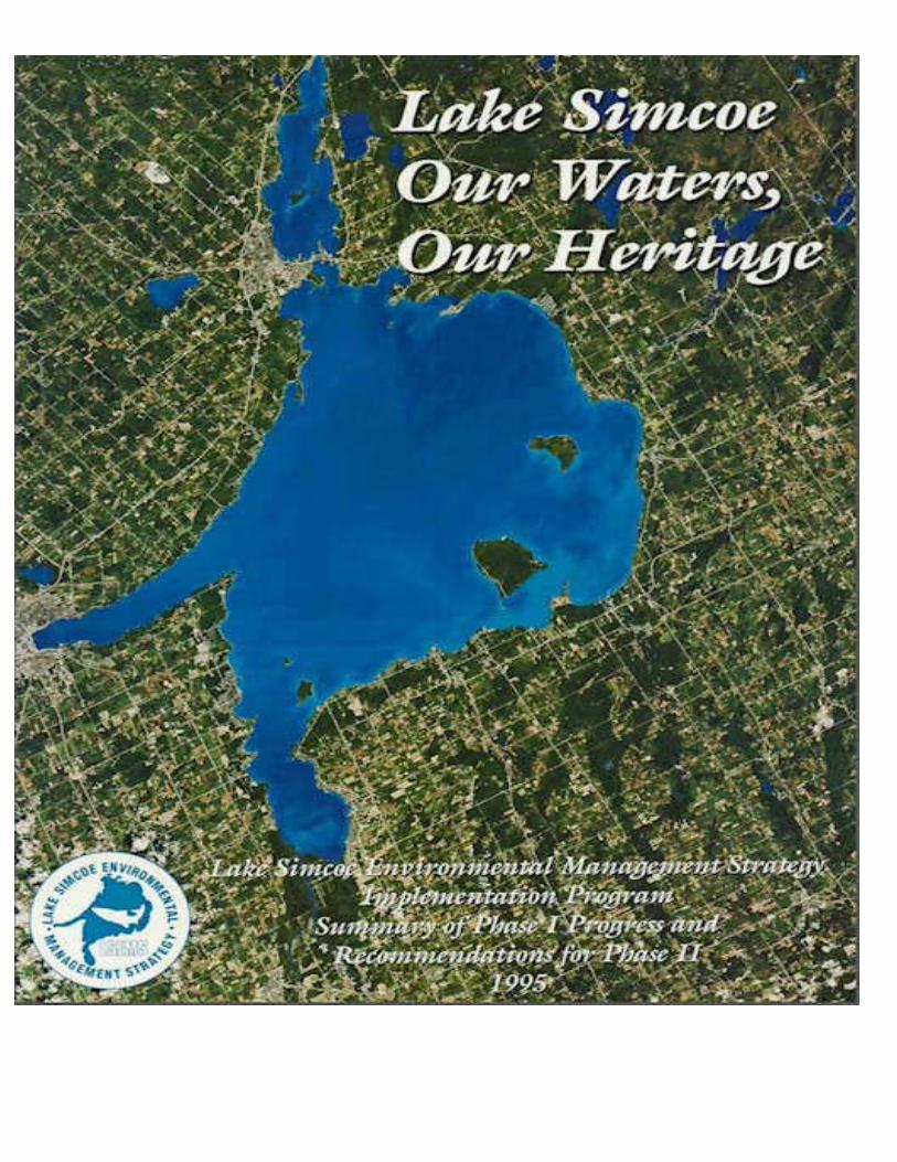
Lake Simcoe
Our Waters, Our Heritage
Lake Simcoe Environmental Management Strategy Implementation Program
Summary of Phase I Progress and Recommendations for Phase II
November 1995

Acknowledgements
Photographs on pages 10, 22, 23, 33, 34, 88, and 92 are used with the permission of SimcoeCounty Archives.
Photograph on page 34, is used with the permission of the Ministry of Natural Resources PhotoLibrary
All other photographs are used with the permission of the Lake Simcoe Region ConservationAuthority
Edited by Isobel Heathcote,Design and Layout by Wyndham Research Inc.
Final Edit and Cover Design by Brian R. Kemp - Lake Simcoe Region Conservation Authority
Image on Cover: © WorldSat International Inc., 1988.Burlington, Ontario, Canada. All Rights Reserved
Table of Contents
1 Introduction 112 The Lake Simcoe Ecosystem 273 Monitoring the Health of Lake Simcoe 354 Sources and Processes 515 Progress to Date 596 Goals, Issues and Proposed Actions 71
Glossary 97References 101Appendix: Related Publications 103

This report is dedicated to the memory of
Basil Noels
In recognition of his hard work and dedication to this initiative and the protection of natural resources within the Lake Simcoe watershed.
Chief Administrative Officer of the Lake Simcoe Region Conservation Authorityfor 15 years (1979-1995) and Chairman of the Lake Simcoe Environmental
Management Strategy (LSEMS) implementation Program for 5 Years (1990-1995)
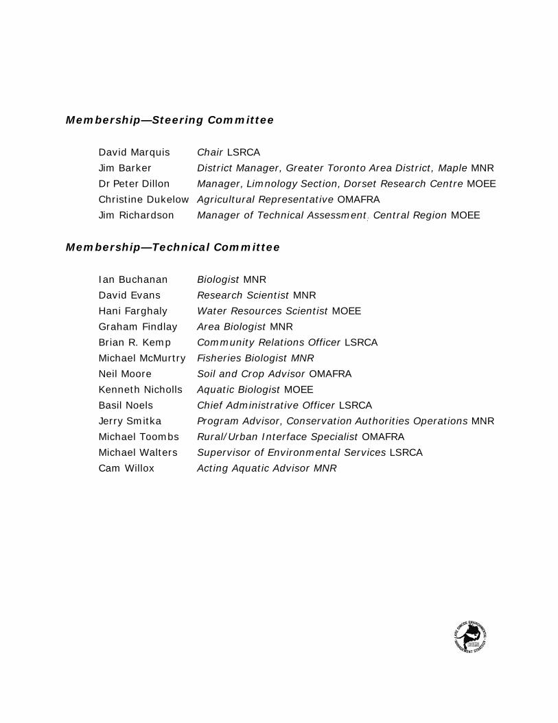
Membership—Steering Committee
David Marquis Chair LSRCAJim Barker District Manager, Greater Toronto Area District, Maple MNRDr Peter Dillon Manager, Limnology Section, Dorset Research Centre MOEEChristine Dukelow Agricultural Representative OMAFRAJim Richardson Manager of Technical Assessment: Central Region MOEE
Membership—Technical Committee
Ian Buchanan Biologist MNRDavid Evans Research Scientist MNRHani Farghaly Water Resources Scientist MOEEGraham Findlay Area Biologist MNRBrian R. Kemp Community Relations Officer LSRCAMichael McMurtry Fisheries Biologist MNRNeil Moore Soil and Crop Advisor OMAFRAKenneth Nicholls Aquatic Biologist MOEEBasil Noels Chief Administrative Officer LSRCAJerry Smitka Program Advisor, Conservation Authorities Operations MNRMichael Toombs Rural/Urban Interface Specialist OMAFRAMichael Walters Supervisor of Environmental Services LSRCACam Willox Acting Aquatic Advisor MNR

Recreational activities area historical pastime on Lake Simcoe

1. Introduction
For centuries Lake Simcoe has served as a valuable natural and recreational resource.In the early 1970's concern from local municipalities, the Ontario government and thegeneral public over changes occurring to Lake Simcoe's water quality and coldwater fisheryprompted the Ministry of the Environment to investigate. Results released in the 1979 LakeSimcoe — Couchiching Environmental Strategy indicated that the concern was justified.Water quality in Lake Simcoe was identified as one of the possible causes of the recentdecline in the coldwater fish populations. Investigations revealed that excessive inputs ofphosphorus were primarily responsible and that the phosphorus was originating from humanactivities within the watershed.
In 1981 the Ministry of the Environment initiated new studies to identify and measuresources of phosphorus entering Lake Simcoe, and to recommend remedial measures toreduce these inputs. Entitled the Lake Simcoe Environmental Management Strategy(LSEMS). these studies concluded in 1985 with the production of the Final Report andRecommendations of the Steering Committee, a watershed plan comprised of eighteenrecommendations intended to reduce phosphorus inputs to Lake Simcoe.
In 1986, a proposal jointly prepared by the Ontario Ministries of the Environment,Natural Resources, and Agriculture and Food, and the Lake Simcoe Region ConservationAuthority, was submitted to the Provincial Cabinet for funding. On July 27, 1990, theimplementation of LSEMS (Phase 1) was announced on the shores of Lake Simcoe.
11
The goal of the LSEMS program is
to restore a self-sustaining coldwater fishery in Lake Simcoe
and, like the original studies, the implementation program is a partnership between thethree provincial ministries and the Conservation Authority. An agreement, referred to as theMemorandum of Understanding, outlines the roles and responsibilities of each partnerinvolved in implementing the environmental management strategy. Objectives includereducing phosphorus inputs associated with urban development and those originating fromrural agricultural activities.
This report represents a summary of the activities initiated and completed duringphase I of the LSEMS program. It is the work of many people, representing a variety ofinterests and agencies. It also contains a series of recommendations which provide theframework for the next phase of the LSEMS Implementation Program.
Geographic Setting
Located 50 km north of Toronto, Lake Simcoe is a little more than an hour's drivefrom half the population in Ontario (Map 1.1). The watershed has a total land and watersurface area of 3572 km2, of which the lake occupies about 20 percent or 725 km2. LakeSimcoe is part of the Trent-Severn Waterway connecting Lake Ontario to Georgian Bay andis southern Ontario's largest body of water (excluding the Great Lakes).
The land portion of the watershed is approximately 2,825 km2 and is drained by 35tributary rivers, with five major tributaries accounting for over 60 percent of the total area(Map 1.2). Most of these rivers originate along the southern boundary of the watershed inthe prominent physiographic feature known as the Oak Ridges Moraine. These rivers thendrain in a northerly direction through the four remaining major physiographic features -- theSimcoe Uplands, Schomberg Clay Plain, Peterborough Drumlin Field, and SimcoeLowlands—before discharging to Lake Simcoe.
12

Map 1.1 Location of the Lake Simcoe Watershed.
Socio-Economic Activities Withinthe Lake Simcoe Watershed
Much of Ontario is still recovering from the effects of the economic recession thatbegan in the early 1990's. A combination of societal change, low levels of public confidenceand down-sizing has contributed to this slow recovery. Despite this weak economiccondition, the population and urban centres within the Lake Simcoe watershed continue togrow faster than originally anticipated. This is illustrated by comparing past populationpredictions made during the LSEMS studies in 1985 to present day population estimates. Inalmost every instance the current population for the watershed's major urban centresexceeds the projected population for the year 2001.
Available evidence suggests that this rapid growth in the population is the result ofchanging development pressures from Metropolitan Toronto. Approximately half of the Lake
13
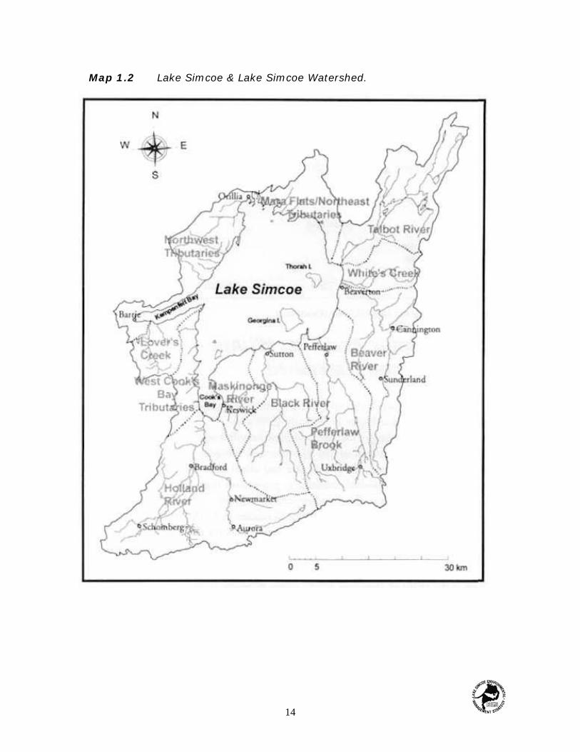
Map 1.2 Lake Simcoe & Lake Simcoe Watershed.
14

Simcoe watershed is in the newly designated 'Greater Toronto Area' (GTA) with theremaining area considered to be part of the GTA's `hinterland'.
Land use and agricultural and urban activities within the watershed have a significantand measurable impact on the water quality of Lake Simcoe. Future intensification has thepotential to impose new and more difficult demands upon an ecosystem already understress. Efforts to mitigate the effects associated with increased development are essentialto protect the future of Lake Simcoe as a natural and recreational resource.
Recent Trends in Population,Employment and Housing
Over the last thirty years, the permanent population within the Lake Simcoewatershed has more than tripled, from an estimated 85,289 people in 1961 to 271,410 in1991. Most of this growth has occurred within the urban centres of Aurora, Barrie, Bradford.Newmarket and Uxbridge, all of which recorded annual population growth rates greater thanthe watershed average. The population within these major urban centres, together withOrillia, now totals approximately 195,774 persons or 72% of the entire population within theLake Simcoe basin.
To accommodate the recent increase in population, employment opportunities andassociated infrastructure have also grown. During the five year period from 1986 to 1991,the labour force within these urban areas rose by over 30,000 people. A comparison of thepercentage of the total population in the labour force between 1986 to 1991 found that therehas been no change. Approximately 44% of the total population within these urban centreswere part of the work force with the rate of unemployment registering a slight increase from6.2% in 1986 to 7.1% in 1991.
A 25% increase in the number of homes or dwellings was observed over the sameperiod. Estimates for the average number of people per dwelling over the period 1986 to1991 show no significant change, increasing slightly from 3.5 to 3.7 people per unit.Information on the number of houses built from 1984 to 1992 within the same six urbanareas is shown in Figure 1.1. Housing starts increased dramatically from 1984 peaking in1989 with an estimated 4641 units being built.
15

Housing starts keep up with the increasingurban population of the watershed.
Figure 1.1 Housing Starts in the Lake Simcoe Watershed, 1984-1992 (showncumulatively).
Most of this activity was centred in the City of Barrie. After 1989, a significant declinein the number of housing starts occurred in Barrie, but housing construction in theFive remaining urban areas showed little change or, in some instances, displayed aslight increase. The results indicate that employment opportunities and availablehousing have kept pace with the growing population.
Future population and employmentpredictions suggest that areas within thewatershed will continue to experience highlevels of growth despite economicrestructuring. We can speculate that, aswith past growth, most of the futurepopulation expansion will occur in thewatershed's urban areas. Figure 1.2 showspredicted future population growth withinAurora, Barrie, Bradford, Newmarket, Orilliaand Uxbridge.
16

Figure 1.2 Future population growth in the major urban centres of the Lake Simcoe Watershed (shown cumulatively).
Land Uses
Land use information for the Lake Simcoe watershed has been obtained from aLANDSAT image taken on August 25, 1993 and interpreted using computer analysis. Landuse was divided into seven classes: forest, wetland, scrubland, water, cultivated fields,pasture lands and urban areas. The total watershed land and water surface area wasestimated to be 3,572 km2 which is slightly larger than previous estimates made during theoriginal LSEMS studies. The area estimate for surface water includes not only Lake Simcoebut also smaller lakes and reservoirs within the watershed.
17

Table 1.1 Vegetable Production in the HollandMarsh Polders as a percentage oftotal production.
Vegetable Ontario Canada
Lettuce 72 12
Carrots 70 32
Onions 67 45
Celery 64 47
Pers. Comm. McDonald, M.R., 1884. OMAFRA MuckResearch Station
Based on the LANDSAT image the total land area of the watershed is 2,825 km2 ofwhich about 45% (1,263 km2) is devoted to agricultural activities. This represents a sharpdecline from the 61% agricultural usage mapped in 1985. Urban areas have increased from65 km2 to 87 km2 and now account for 3% of the total area. Forest, wetland and scrublandmake up the remaining 52% (1.475 km2) of the watershed.
Agriculture
Based on 1991 Ontario census data, the Lake Simcoe basin supports a conventionalfarm economy with 2,157 farms involved in cash crop, livestock and mixed operations. Morethan 611 farms have ceased their operations since 1981 which helps to account for the 20%drop its agricultural land use. A total of 523 km2 of land was cultivated in 1993 and 739 km2
were used for pasture or left fallow. Most of the cropland in the watershed is planted tograin, corn, and hay; a recent increase has also been observed in the acreage of soya beanproduction. Livestock production within the watershed has declined since 1985, with a 22%drop in the total number of beef cattle.
The Holland River systemsupports the largest cultivatedmarsh or 'polder' area in Ontario,The polders occupy roughly 33km2 (Map 1.3). The Holland Marshpolder is the largest of the fourmarsh areas at 24 km2. Waterlevels within the polders aremaintained through a series ofpumping stations and canals.Table 1.1 lists the four mostcommon vegetables grown in thepolders and their relative marketshare in the province and Canada.
18

Map 1.3 Holland River System.
Urbanization
Urban land use comprises only 3% of the total area within the Lake Simcoewatershed, but this use has been growing quickly in recent years. Available informationsuggests that further population growth will continue to increase development pressures andresult in more urban land use intensification. A comparison of the relative changes in landuse distribution for Aurora, Barrie, Bradford, Newmarket, Orillia and Uxbridge (Map 1.4)shows consistent increases in the areas of both residential and commercial and industrialland uses.
In these six centres, residential land use has increased dramatically with an overallincrease of 89% during the ten year period from 1981 to 1991. The City of Barrie reportedthe greatest increase in residential area of 846 hectares for a total of 1821 ha, It wasfollowed by the Town of Aurora with a 624 ha increase, which more than doubled itsresidential area from 450 to 1074 ha. However, the urban centre most affected by growthis the Town of Bradford which has quadrupled its residential area from 150 ha in 1981 to665 ha in 1991. The initial residential areas and the increases to 1991 for the six majorurban centres in the watershed are shown in Figure 1.3.
19
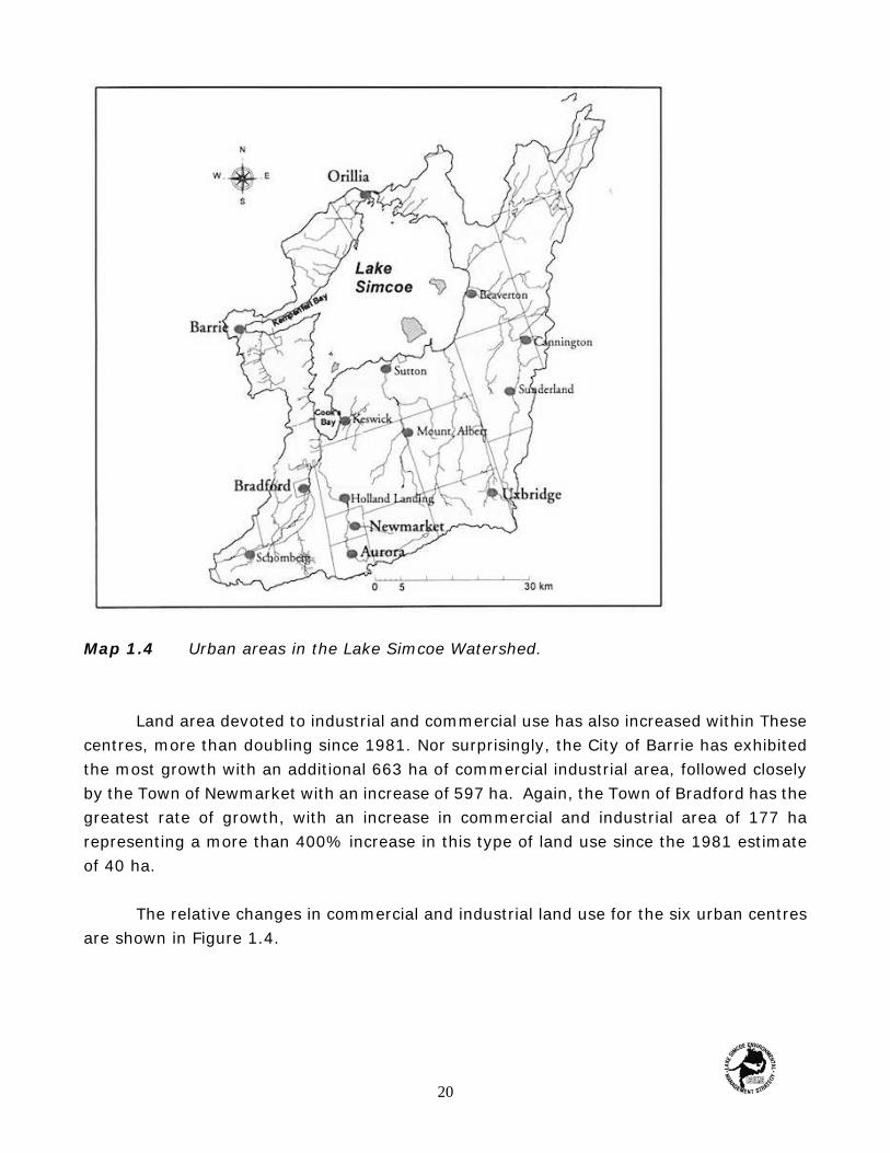
Map 1.4 Urban areas in the Lake Simcoe Watershed.
Land area devoted to industrial and commercial use has also increased within Thesecentres, more than doubling since 1981. Nor surprisingly, the City of Barrie has exhibitedthe most growth with an additional 663 ha of commercial industrial area, followed closelyby the Town of Newmarket with an increase of 597 ha. Again, the Town of Bradford has thegreatest rate of growth, with an increase in commercial and industrial area of 177 harepresenting a more than 400% increase in this type of land use since the 1981 estimateof 40 ha.
The relative changes in commercial and industrial land use for the six urban centresare shown in Figure 1.4.
20

Figure 1.3 Changes in Urban Land Use, 1981-1991- Residential Areas.
Figure 1.4 Changes in Urban Land Use, 1981 -1991- Industrial and Commercial Areas.
21

Water Uses
The waters of Lake Simcoe are extremely important to the surrounding community,and support a wide variety of uses, ranging from a source of drinking water to wasteassimilation and summer and winter recreation. Tourism is the most important industry
Cutting ice on Lake Simcoe was once a thriving industry. In the 1880's, ice was supplied to most of the eastern United States.
associated with the lake: approximately $500 million is spent annually on tourism andrecreational activities in the Lake Simcoe watershed. It is harder to put a price on the valueof the lake as a natural resource that provides fish and wildlife habitat as well as possessingsimple aesthetic beauty, but these uses are equally important.
Drinking Water
Lake Simcoe provides a source of drinking water for the communities of Beaverton,Brechin, Sutton and Keswick with an average of 9,500 m3 being used each day. Keswickaccounts for almost half this amount, using an estimated 4,500 m3/day, followed by Suttonwith 2,000 m3/day, Beaverton at 1,500 m3/day and finally Brechin at 1,000 m3/day.
22

Waste Assimilation
Seven communities use Lake Simcoe to assimilate treated waste water from theirsewage treatment plants, The communities of Barrie, Orillia, Innisfil Keswick, Beaverton,Lagoon City and Sutton discharge their treated waste water directly to the lake, Anotherseven communities discharge to streams which eventually drain to Lake Simcoe.
Recreational Boating
The size and location of Lake Simcoe and its link to the Trent-Severn Waterway havemade recreational boating activities very popular in the lake. Contributing to this popularityare several public boat-launching and docking sites. Many cottages and homes along theshore also have docking facilities, and inland residents also use launch sites around the lake.
Lake Simcoe has provided recreational opportunities since the turn of the century. Boating is one of the most popular pastimes.
23

Estimates of boat ownership or usage on the lake are difficult to make; however,there are 29 marinas on Lake Simcoe providing a total of 4,246 boat slips. In 1990 the waterof Lake Simcoe attracted approximately 11,500 transient boaters who passed through theTrent-Severn Waterway.
Fishing - Summer and Winter
Lake Simcoe receives the greatest angling effort of any Ontario inland lake. In 1990an estimated 144.000 anglers visited Lake Simcoe, spending approximately 746,000 hoursfishing. Ice fishing is extremely popular with anglers and accounts for most of the anglingeffort, with an estimated 2,000 to 4,000 ice huts on Lake Simcoe each winter.
An estimated 2000- 4000 ice huts appear on Lake Simcoe each winter.
During the ice fishing season the two most sought-after species are lake trout arid lakewhitefish, both coldwater species that are threatened.
This extremely large and valuable recreational opportunity is not offered by any otherinland lake in Ontario.
Related Tourism Events
Water-related recreation is a strong social and economic Factor around Lake Simcoe. Forthree weeks in April, the Orillia Annual Perch Festival takes place, and the Georgina AnnualIce Fishing Festival occurs during the winter. The Town of Georgina. the self-named 'IceFishing Capital of the World'. hosts an annual ice fishing festival with a budget of $60,000
24

and attracts approximately 3,000 participants. In 1993 Lake Simcoe was the venue for aninternational ice-fishing tournament attended by anglers and tourists from around the world.During the long weekend in August approximately 150,000 people visit the Kempenfelt Artsand Crafts Festival held on the shores of Kempenfelt Bay in Barrie.
A number of services and facilities that are entirely or partially dependent on tourismare established in the Lake Simcoe region. These include:
< 10 private campgrounds< public parks/conservation areas and boat launches < resorts, cottages, bed and breakfasts, farm vacations< 3 provincial parks the largest, Sibbald Point Provincial Park has an annual
visitation rate of over 300,000 people)
Private campgrounds are used by both residents and non-residents. Family and groupcamping are popular and campgrounds are one of the primary choices of rentalaccommodation for summer anglers.
Public parks and conservation authority areas are also used by both local residentsand visitors to the area. A few of the parks provide camping facilities, but the majority aredesignated for day use only.
Resorts, cottages, bed and breakfasts, and farm vacation operations are patronizedpredominantly by non-residents for family vacations, although cottages are also a commonaccommodation choice for anglers. There are approximately 12,000 cottages around thelake, adding approximately 40,000 - 50,000 people to the region throughout the summerseason.
Together, these water-related activities bring approximately $160 million each yearinto the regional economy, proving that a healthy Lake Simcoe is indeed a valuablecommunity resource (Figure 1.5).
25
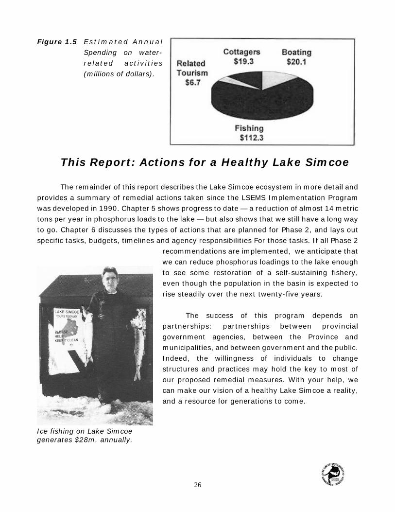
Ice fishing on Lake Simcoegenerates $28m. annually.
Figure 1.5 Es t imated Annua lSpending on water-related activit ies(millions of dollars).
This Report: Actions for a Healthy Lake Simcoe
The remainder of this report describes the Lake Simcoe ecosystem in more detail andprovides a summary of remedial actions taken since the LSEMS Implementation Programwas developed in 1990. Chapter 5 shows progress to date — a reduction of almost 14 metrictons per year in phosphorus loads to the lake — but also shows that we still have a long wayto go. Chapter 6 discusses the types of actions that are planned for Phase 2, and lays outspecific tasks, budgets, timelines and agency responsibilities For those tasks. If all Phase 2
recommendations are implemented, we anticipate thatwe can reduce phosphorus loadings to the lake enoughto see some restoration of a self-sustaining fishery,even though the population in the basin is expected torise steadily over the next twenty-five years.
The success of this program depends onpartnerships: partnerships between provincialgovernment agencies, between the Province andmunicipalities, and between government and the public.Indeed, the willingness of individuals to changestructures and practices may hold the key to most ofour proposed remedial measures. With your help, wecan make our vision of a healthy Lake Simcoe a reality,and a resource for generations to come.
26

2 The Lake Simcoe Ecosystem
The Watershed Setting
Like most inland lakes in temperate North America, Lake Simcoe lies in a watershedlandscape carved by receding glacial ice more than 12,000 years ago. The lake and itswatershed now form a definable ecosystem, through which water, nutrients and energymove in predictable ways. Figure 2.1 illustrates how water moves in the ecosystem.
The earliest studies of the Lake Simcoe ecosystem began in the late 1920's, with thework of D.S. Rawson, Over the past thirty years, these studies have intensified considerably,with fisheries assessment by the Ontario Ministry of Natural Resources beginning in the early1960's and water quality studies by the Ontario Ministry of the Environment from 1970.
The following sections summarize our current understanding of the structure andfunction of that ecosystem.
The Lake Simcoe Uplands
As the great glaciers of the last ice age advanced, they pushed before them mixtures of soiland rock, rather like the action of a giant bulldozer. In places, the resultant landscaperesembles tilled fields and referred to as glacial till.
27

Figure 2.1 The hydrological cycle.
In others, often at the edge of an advancing glacier, mounds of soil and rock were pushedtip, creating hilts, or moraines that remained when the glaciers retreated. Under the glacieritself, soils were sculpted by the ice surface, and by water and sediment draining from theice, into mounds (drumlins) and ridges (eskers). Most of Southern Ontario is characterizedby glacial till and glacial features like these. The upland areas in the Lake. Simcoe watershedcontain numerous glacial features, inducting ancient shorelines and bluffs from glacial LakeAlgonquin on the west side of Lake Simcoe from Orillia to Bradford, and drumlins east ofOrillia. The presence of sand and gravel pits often gives a hint as to the route taken byglacial meltwaters.
At the highest points of land in the Lake Simcoe watershed, a series of broad ridgesand upland plains supports mixed fanning activity and some woodlots. The origin of theseridges is not always dear, but it is likely that they are moraines created by an earlier glacialadvance, arid then "planed" by the retreating Wisconsin glacier at the end of the last iceage. Between Barrie and Alliston, the upland areas we see today are till plains shaped by thevast ice sheet.
28
Originally, these regions, which stand 75 m above the plain, were covered with mixedhardwood forest dominated by sugar maple, beech and white pine. Extensive logging in thelast quarter of the nineteenth century virtually stripped the landscape of trees and openedit to agriculture. Over the last hundred years, the area's climate and favourable soilconditions have supported many crops. including hay, oats, corn, wheat, and potatoes. Beef,hogs and poultry are also raised in the area. In the Lake Simcoe ecosystem. the Oak RidgesMoraine and upland areas are important because water is naturally stored in their poroussoils, and the many springs on their slopes feed the streams Char flow in lower lying areas.
The Lake Simcoe Lowlands
In the Lake Simcoe lowlands, many natural features, such as beaches and boulderterraces, attest to the history of the area as a portion of glacial Lake Algonquin. As theWisconsin glacier retreated, meltwater poured off its surface and drained away to thesouthwest through what is now Cook's Bay and Kempenfelt Bay. The low-lying marshlandsand sandy features of these areas are all that remain of glacial drainage features that lastedtens of thousands of years.
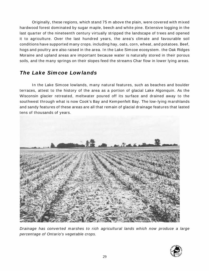
Drainage has converted marshes to rich agricultural lands which now produce a largepercentage of Ontario's vegetable crops.
29
The Upper Holland River basin and the broad marshy valley south of the lake areunderlain by two to five metres of peat, showing that the area has been marshland sinceglacial times. The role of this marsh in the ecosystem is again one of water storage and flowcontrol, as well as providing a diverse habitat for wetland birds and mammals, young fish,and a wide variety of plants.
In recent years, extensive drainage works, first begun in 1925, have converted thevast marsh to rich agricultural lands on which are grown a wide variety of vegetable crops,including carrots, onions, lettuce and potatoes. With burgeoning agricultural developmenthas come increasing urban growth and the rapid expansion of market centres such asBradford. In the modern watershed, there is steadily increasing demand for urbandevelopment and improved highway access to centres such as Toronto.
The streams that flow through these lowland areas carry natural spring water andgroundwater, storm runoff from agricultural lands and urban pavements—and the pollutantsassociated with those uses—down to the lake.
The Lake itself
At the lake shore, there are many more relics of glacial drainage, particularly in theform of sandy beaches. These beaches have long attracted cottagers to the area and are anattractive feature of the area for recreational users. The lake waters are relatively shallowin Cooks Bay (to the south) and in the area cast of Georgina and Thorah Islands (Figure2.2). The main basin of Lake Simcoe is deep, as is Kempenfelt Bay which contains thedeepest point of Lake Simcoe (approximately 42 metres).
In the summer, the waters of the lake are stratified, or layered, with wind-mixed,sun-warmed waters on the surface, and cooler, quieter waters at depth (Figure 2.3). In thewinter the temperature of the water is fairly uniform. Spring and fall are periods of turnover,during which times a gradual mixing of the surface layers occurs. This mixing gets deeperand deeper until bottom waters are fully mixed. This stratification — turnover cycle isimportant to the chemistry and biology of lake waters. During periods of stratification, thetransition lone between surface and deep waters, called the thermocline, acts as a barrierto the transfer of nutrients (for example, phosphorus) and oxygen from well-mixed,sunlight-tilled surface waters to the colder, deeper waters of the lake.
30

Figure 2.2 Bathymetric Map of Lake Simcoe.
Figure 2.3 Thermal Stratification of Lake Simcoe in Summer.
31
What is Eutrophication?
Eutrophication is a term which refers tothe physical, chemical and biologicalchanges that occur when a lake or riverreceives excessive loads of phosphorusand nitrogen. usually as a result of humanactivities.
Although some amounts of thesesubstances are necessary for normal plantgrowth, high nutrient levels encourageover-abundant plant growth and algaeblooms.
Highly eutrophic lakes and streams areunpleasant to look at, can emit strongodours. and support less desirablecommunities of plants and animals.
The spring and fall turnovers mix nutrients from bottom sediments into overlying waters,and bring oxygenated water from the lake surface to the bottom.
The physical and chemical dynamics of the lake are also important for the health offish and other aquatic biota. In an undisturbed lake system, some aquatic plants will grow
in shallow, clear waters. The natural cycling ofnutrients within the lake—nutrients necessaryfor the support of invertebrate species andthus of fish and other vertebrates—depends onthe decay of dead plant material in lakesediments, and the twice yearly mixing ofthose nutrients into the water column. Ashuman activity in the area increases, however,increased levels of phosphorus—from humansewage, and urban and agricultural runoff—canenrich lake waters beyond natural levels. Thisenrichment, termed eutrophication,encourages the growth of excessive levels ofalgae and rooted aquatic plants. The limneticzone, which now receives high levels ofnutrients from surface runoff and from bottomsediments, supports a dense plankton
population and many fish. Shoreline and submerged vegetation has also become abundantand the width of the littoral zone has increased.
The Watershed as an Evolving Ecosystem
The past two hundred years of European settlement have brought extensive changesto the Lake Simcoe ecosystem. But it would be a mistake to think of this as the first changesthe system has experienced in its life. The Lake Simcoe ecosystem, like all others, is an everchanging ecosystem. Beginning with its role as an important drainage route for glacialmelt-waters, it has seen many stages in its development, and its plant and animalpopulations have changed as the landscape has changed.
32

Even after the establishment of what we would consider a mature landscape, perhapsa thousand years ago, many natural forces disturbed the ecosystem. Fire, usually startedby lightning, was always present. in the Simcoe uplands, clearing patches in the forest charwould later be colonized by light-loving species like raspberries and birch. Strong windscaused older or shallow-rooted trees to topple over, tearing up the forest floor anddisturbing other plants and animals. To a certain extent, the advent of European settlementhas itself disturbed natural cycles of burn and windfall, and replaced them with humanactivities like Logging and agriculture. And although these human activities appear to us tohave major consequences in ecosystem function, so might natural disasters like tornadoesand forest fires. But many human activities, such as paving, are irreversible; with naturaldisasters, the ecosystem balance is restored over time.
Forest ecosystems respond to disturbance with an increase in the lass of water andnutrients from disturbed soils, but these released materials are themselves necessary toencourage new growth and restore ecosystem equilibrium. in the present-day Lake Simcoewatershed, we have allowed the 'disturbed' condition to persist—indeed, we have prevented
Removing stumps to create croplands, Innisfil Township, c. 1880.
33

the re-establishment of natural forest and marsh vegetation throughout the watershed—andso the watershed is now in a perpetual condition of nutrient, soli and water loss. If we areto manage this ecosystem sustainably, so that human development and natural processescan co-exist, we must seek to stabilize the system's nutrient and soil loss, and reestablishas much as possible natural pathways of water movement.
The following chapters discuss these processes, and possible managementapproaches, in more detail.
Stumps indicate the extent of soft loss after the removal of forest cover.
34

3 Monitoring the Health of Lake Simcoe
We know from studies of relatively undisturbed Ontario lakes that Lake Simcoe waterquality shows evidence of human activities. In recent years, the most obvious of theseimpacts have been nuisance aquatic plant growth and declining coldwater fisheries. Butthese are just symptoms of more complex problems. In Chapter 2 we saw that increasinglevels of nutrients such as phosphorus can encourage rooted plants and algae to grow tolevels much beyond those in an undisturbed system. These plants produce abundant oxygenduring the day, bur also use considerable oxygen at night. More oxygen is used as this richgrowth of plant material dies and decays on the lake bottom. Decreased oxygen levelscreate conditions that are difficult for coldwater fish species to tolerate, so those specieseither die out or move, if they can, to a more hospitable location.
Although many other chemical parameters, and plant and animal species, may beaffected by human activities, these three — phosphorus, oxygen and the state or the fishcommunity — are probably the best indicators of overall ecosystem health. They provideuseful benchmarks for ecosystem health and they can also can be used to set targets forfuture ecosystem management.
35

This chapter discusses the current health of the Lake Simcoe ecosystem, as weunderstand it from studies over the past twenty-five years, and sets goals for these keyindicators over the longer term.
Some History
The first comprehensive studies of Lake Simcoe water quality were conductedbetween 1971 and 1974 by the Ontario Ministry of the Environment (formerly the OntarioWater Resources Commission). More studies were done between 1976 and 1979 and againbetween 1980 and 1984. Since 1985, the Ministries of Environment and Energy, and NaturalResources, and the Lake Simcoe Region Conservation Authority, have continued to monitorwater quality in the lake. The Ministry of Natural Resources began fisheries assessments inthe 1960's and these continue to the present. These long term studies have great value indeveloping assessments of trends over time; without them, we would have merely'snapshots' that may or may not be typical of general conditions.
The following paragraphs describe past, current and ideal conditions for each indicatorparameter.
Phosphorus
In Lake Simcoe (as in most other freshwater lakes), phosphorus is the nutrient inlowest supply. For that reason, its concentration is often believed to limit the growth ofrooted plants and algae. When phosphorus concentrations are low, plant growth—includingthat of microscopic floating algae—is usually also low. When phosphorus is present in highconcentrations, plant growth is usually abundant. Studies from many systems have shownthat phosphorus concentrations in lakes are directly related to the amounts of phosphorusdischarged to the lakes. While this may seem obvious, it provides reassurance that if we canreduce phosphorus loadings to Lake Simcoe, lake water concentrations of phosphorus willquickly diminish.
Radioisotope dating techniques have been used by Ministry of Environment andEnergy and Department of Fisheries and Oceans Canada staff to date Lake Simcoesediments (Figure 3.1). The results of these studies show that the accumulation ofsediments has increased tremendously over the past hundred years, with peak accumulationrates occurring between 1910 and 1940 in most of the lake (Cook’s Bay peaks occurred
36

between 1940 and1950). Patterns in phosphorus loadings are similar, with contributionsrising rapidly Following European settlement. One interesting point about these loadings isthat from the late eighteenth century to the 1950's, by far the majority of phosphorus camefrom accelerated erosion, probably as a result of increasing land clearance in the second halfof the century, a steadily increasing component of the phosphorus load has come fromso-called point sources, primarily sewage treatment plant discharges.
Figure 3.1 Estimated Historical Loadings of Phosphorus to take Simcoe (inferred fromanalysis of lake sediments).
The lake sediment chemical analyses also show that the Holland River marshes andCook's Bay were effective phosphorus filters, removing more than 88% of the potentialphosphorus input from the Holland River in the years before European settlement. Today,about 50% of the loading to Cooks Bay, and 75% of the loading to Kempenfelt Bay, aretransported into the lake, nor filtered out by marshland.
37
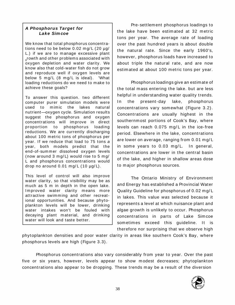
A Phosphorus Target for Lake Simcoe
We know that total phosphorus concentra-tions need to be below 0.02 mg/L (20 µg/L.) if we are to manage excessive plantgrowth and other problems associated withoxygen depletion and water clarity. Weknow also that cold-water fish do not growand reproduce well if oxygen levels arebelow 5 mg/L (8 mg/L is ideal). 'Whatloading reductions do we need to make toachieve these goals?
To answer this question. two differentcomputer purer simulation models wereused to mimic the lakes naturalnutrient—oxygen cycle. Simulation resultssuggest the phosphorus and oxygenconcentrations will improve in directproportion to phosphorus loadingreductions. We are currently dischargingabout 100 metric tons of phosphorus peryear. If we reduce that load to 75 tons ayear, both models predict that theend-of-summer dissolved oxygen levels(now around 3 mg/L) would rise to 5 mg/L and phosphorus concentrations woulddrop no around 0.01 mg/L (10 µg/L).
This level of control will also improvewater clarity, so that visibility may be asmuch as 5 m in depth in the open lake.Improved water clarity means moreattractive swimming and other recreat-ional opportunities. And because phyto-plankton levels will be lower, drinkingwater intakes won't be fouled withdecaying plant material, and drinkingwater will look and taste better.
Pre-settlement phosphorus loadings tothe lake have been estimated at 32 metrictons per year. The average rate of loadingover the past hundred years is about doublethe natural rate. Since the early 1960's,however, phosphorus loads have increased toabout triple the natural rate, and are nowestimated at about 100 metric tons per year.
Phosphorus loadings give an estimate ofthe total mass entering the lake. but are lesshelpful in understanding water quality trends.In the present-day lake, phosphorusconcentrations vary somewhat (Figure 3.2).Concentrations are usually highest in thesouthernmost portions of Cook's Bay, wherelevels can reach 0.075 mg/L in the ice-freeperiod. Elsewhere in the lake, concentrationsare lower on average, ranging from 0.01 mg/Lin some years to 0.03 mg/L. In general,concentrations are lower in the central basinof the lake, and higher in shallow areas doseto major phosphorus sources.
The Ontario Ministry of Environmentand Energy has established a Provincial WaterQuality Guideline for phosphorus of 0.02 mg/Lin lakes. This value was selected because itrepresents a level at which nuisance plant andalgae growth is unlikely to occur. Phosphorusconcentrations in parts of Lake Simcoesometimes exceed this guideline. It istherefore nor surprising that we observe high
phytoplankton densities and poor water clarity in areas like southern Cook’s Bay, wherephosphorus levels are high (Figure 3.3).
Phosphorus concentrations also vary considerably from year to year. Over the pastfive or six years, however, levels appear to show modest decreases; phytoplanktonconcentrations also appear to be dropping. These trends may be a result of the diversion
38

Figure 3.2 Comparison of phosphorus concentrations between the periods 1980-86 and1987-92. Data were obtained from 11 stations on Lake Simcoe.
Figure 3.3 Comparison of phytoplankton densities between the periods 1980-86 and1987-92. Data were obtained from 11 stations on Lake Simcoe.
39

An Oxygen Target for Lake Simcoe
In Lake Simcoe end-of-summer deep wateroxygen concentrations are typicallybetween about 2.5 and 4 mg/L. How do weknow how these low levels affect LakeSimcoe lake trout? Two methods wereused. In the first, we employed laboratorydata on the physiological response of laketrout to different levels of oxygen. In thesecond, we looked at the oxygenconcentrations in other Ontario lakescurrently supporting healthy lake troutpopulations.
Laboratory studies show us that take troutneed at least 7 mg/L of oxygen to haveenough energy for demanding activity suchas pursuing prey. Below that level, trout may be limited in how actively they canswim, spawn, and feed. A Full 'scope foractivity' (optimal habitat) is only possibleat oxygen concentrations above 8 mg/LHistoric pre-settlement end-of-summeroxygen levels are estimated to have beenabout 8.0 mg/L.
Most Ontario lakes that now support aself-sustaining lake trout population haveend-of-summer dissolved oxygenconcentrations grater than 7 mg/L in theirdeepest waters. Some, however, havehealthy lake trout stocks with deep wateroxygen concentrations of less than 6.0mg/L, and a few show levels as low as 3.0mg/L and 4.0 mg/L.
We propose an interim target oxygen levelof 5 mg/L for Lake Simcoe. Although thislevel is well below the ideal, it is within therange observed for lakes with self-sustaining stocks and can therefore beexpected to provide at least a minimallevel of protection for Lake Simcoe laketrout. It would also represent aconsiderable improvement in the habitatfor cold-water fishes in the lake, andappears to be achievable in terms ofnecessary phosphorus reductions.
of sewage effluent from Aurora and Newmarketour of the Lake Simcoe basin in 1984 andreduced phosphorus loadings from othersources.
Oxygen
Dissolved oxygen is one of the mostimportant water quality parameters in LakeSimcoe because it directly affects the health andhabits of fish populations. Lake trout areparticularly susceptible to changes in oxygenlevels. Over the past ten years. we have seenthat oxygen concentrations in the deepestwaters of Kempenfelt Bay and the main lakehave decreased through the summer months,reaching an average of about 3 mg/L inSeptember of most years. Oxygen levels areclosely tied to the abundance of plant growth inthe lake. Lake trout are most comfortable atoxygen levels of 8 mg/L, or more but cansurvive (and reproduce in some lakes) atend-of-summer concentrations of 5 mg/L. Therehave riot yet been improvements in end-ofsummer oxygen levels in Lake Simcoe to matchthe observed decreases in phosphorus levels.
Dissolved Salts
Lake Simcoe is a hard water lakes a resultof its location in limestone bedrocks and alkalinesoils. The term hard water is generally taken tomean high concentrations of dissolved calciumcarbonate, and can also mean high naturallevels of dissolved salts like chloride, sulphateand carbonate. One way to measure theconcentration of dissolved salts in water is tomeasure the water's electrical conductance, orconductivity; water with higher salt
concentrations conducts electricity more readily.
40

Over the past ten years, the specific conductance of Lake Simcoe water has increasedsteadily, with the highest levels observed in February and March of each year. This increaseappears to be tied to rising levels of chloride in the lake (Figure 3.4), probably as a resultof increasing road salt use as the watershed's urban areas expand. Although we do not haverecords of earlier conductivity measurements from Lake Simcoe, very similar trends wereobserved in Lake Erie and Lake Ontario over the first half of this century. These levels haveminimal impact on the lake ecosystem but give a clear indication of the effects ofurbanization and increasing human activity in the watershed.
Figure 3.4 Chloride Concentrations
The Fish Community
The earliest written records of the Lake Simcoe fishery come from the Frenchexplorers and missionaries visiting the Huron in the early seventeenth century. ‘Great fish'were caught by the natives, according to one author, ‘fish as big as the largest cod, butmuch better.' Fish played an important part in the diet of the Hurons, and also in theirspiritual life. Although records of this time are scarce, it is known that certain Huronceremonies centred on the timing of the fishing season. Champlain visited the Narrowsbetween Lake Simcoe and Lake Couchiching in August of 1615, and described the 'greatcatch of fish' made by the natives using a weir constructed of sticks and nets. (This fishingmethod apparently gave rise to an early French name for the lake: Lac aux Claies, or Lakeof the Stakes.)
Between 1649 and 1650, the Hurons were overcome by the Iroquois, and Jesuitmissions in the area came to an end. The Ojibway subsequently colonized the lakeshore andwere widely regarded for their fishing skill.
41

'We hear of maskalonge (a Superior kind of
pike)...in abundance in Lake Simcoe...'
Gov. George Graves Simcoe, 1792
Lake Simcoe Fisheries Facts
Like Simcoe supports the greatest anglingeffort of any inland lake in Ontario.
Fishing in Lake Simcoe accounts for 15%of the angling effort in Ontario.
An estimated 172,000 anglers visited thelake in 1990.
Approximately $112 million in income isgenerated by the fishery each year.
Although anglers use the lake in allseasons, the majority of fishing takesplace in winter (in 1993, it was more thanthree times the summer effort).
Lake Simcoe supports 2,000-4,000 icehuts each winter.
The most sought-after species are lakewhitefish, lake trout and yellow perch.
Early records speak of the natives trading their catchfor guns, ammunition, knives and other articles —perhaps the beginning of the lake's commercial fishery.
In 1792, Governor George Graves Simcoe wrotethat, 'we hear of maskalonge (a Superior kind ofpike)... in abundance in Lake Simcoe’, and he visitedthe lake on his journey from Humber Bay toPenetanguishene in 1793. The diary of George Bondrecorded a description of native ice fishing practices in
1815, and also the native custom of night spearing using canoe, spear, and pole-mountedtorch to light the way. Smith's Canadian Gazetter of 1846 mentioned the abundance ofmaskinonge and whitefish in the lake, while the Canadian Handbook and Tourists' Guideof 1866 spoke of 'the natives love of fishing'.
Lake Simcoe's commercial fishery grewsteadily through the nineteenth century, withfishing activities throughout the year. Fishingregulations enacted in 1885 placed limits onfishing methods, season length, and the sizeand number of fish that could be taken.Commercial fishing reports (required since1868) show 11 named species (herring,whitefish, lake trout, pickerel, bass, pike,maskinonge, sturgeon, perch, catfish and carp)and a category called 'coarse fish' that includeswhite sucker, sunfish, rock bass and other lessmarketable species.
In 1903, the sale of all game fish wasprohibited by law; all game species werehenceforth reserved for sport fishing, and haveremained so with minor exceptions until thepresent day. Carp had been introducedaccidentally at the end of the 1800's, and theirpopulation increased dramatically through thefirst decade of the twentieth-century. By 1911,
carp accounted for 81% of the commercial fishery in the lake, and indeed this speciesaccounted for almost 70% of the commercial fishery until the1930's. The carp catch declinedin the 1930's and 40's. The fifties saw low commercial catches of carp and mixed coarse fish,
42
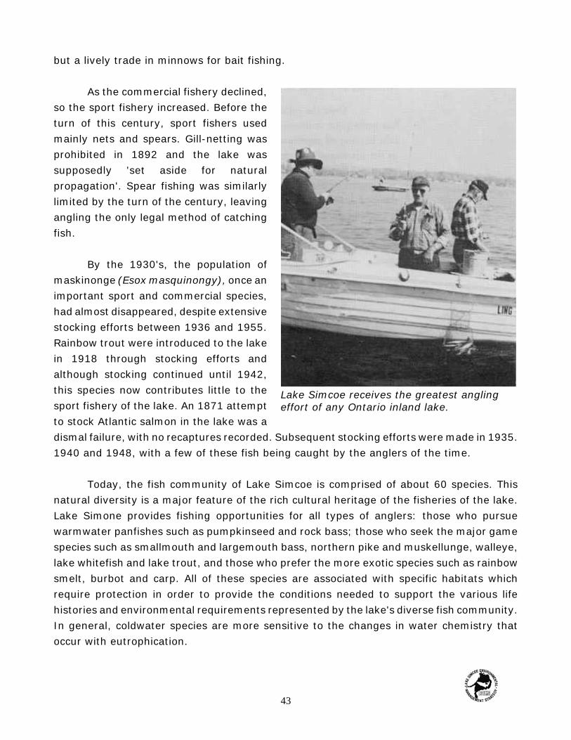
Lake Simcoe receives the greatest anglingeffort of any Ontario inland lake.
but a lively trade in minnows for bait fishing.
As the commercial fishery declined,so the sport fishery increased. Before theturn of this century, sport fishers usedmainly nets and spears. Gill-netting wasprohibited in 1892 and the lake was supposedly 'set aside for naturalpropagation'. Spear fishing was similarlylimited by the turn of the century, leavingangling the only legal method of catchingfish.
By the 1930's, the population ofmaskinonge (Esox masquinongy), once animportant sport and commercial species,had almost disappeared, despite extensivestocking efforts between 1936 and 1955.Rainbow trout were introduced to the lakein 1918 through stocking efforts andalthough stocking continued until 1942,this species now contributes little to thesport fishery of the lake. An 1871 attemptto stock Atlantic salmon in the lake was adismal failure, with no recaptures recorded. Subsequent stocking efforts were made in 1935.1940 and 1948, with a few of these fish being caught by the anglers of the time.
Today, the fish community of Lake Simcoe is comprised of about 60 species. Thisnatural diversity is a major feature of the rich cultural heritage of the fisheries of the lake.Lake Simone provides fishing opportunities for all types of anglers: those who pursuewarmwater panfishes such as pumpkinseed and rock bass; those who seek the major gamespecies such as smallmouth and largemouth bass, northern pike and muskellunge, walleye,lake whitefish and lake trout, and those who prefer the more exotic species such as rainbowsmelt, burbot and carp. All of these species are associated with specific habitats whichrequire protection in order to provide the conditions needed to support the various lifehistories and environmental requirements represented by the lake's diverse fish community.In general, coldwater species are more sensitive to the changes in water chemistry thatoccur with eutrophication.
43
Over the past hundred years, the Lake Simcoe fishery has undergone dramaticchanges. Lake whitefish, lake trout and lake herring all Experienced major fishing pressuresin the last half of the nineteenth century and the first half of the twentieth century. "Exotic'species such as carp and rainbow smelt were introduced by humans, with far-reachingconsequences for species composition and habitat. Whitefish and lake trout have beenstocked in the lake since the 1880's, with spawning stock drawn from various sourcesincluding Lake Manitou and Lake Superior. Since the late 1970's only Lake Simcoe stock hasbeen used.
The modern fishery, with its complex inter-species relationships, is therefore stillevolving. The following paragraphs describe the status of major species over the past thirtyyears. a period when change in the watershed, the lake, and the fishery has been rapid.
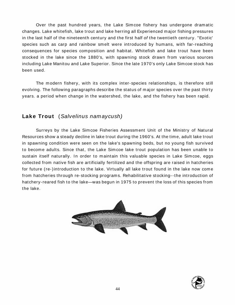
Lake Trout (Salvelinus namaycush)
Surreys by the Lake Simcoe Fisheries Assessment Unit of the Ministry of NaturalResources show a steady decline in lake trout during the 1960's. At the time, adult lake troutin spawning condition were seen on the lake's spawning beds, but no young fish survivedto become adults. Since that, the Lake Simcoe lake trout population has been unable tosustain itself naturally. In order to maintain this valuable species in Lake Simcoe, eggscollected from native fish are artificially fertilized and the offspring are raised in hatcheriesfor future (re-)introduction to the lake. Virtually all lake trout found in the lake now comefrom hatcheries through re-stocking programs. Rehabilitative stocking--the introduction ofhatchery-reared fish to the lake—was begun in 1975 to prevent the loss of this species fromthe lake.
44

This measure has been successful: more than 4,000 trout have been caught in the lake eachyear since 1977 (Figure 3.6).
In 1977, fishing regulations were changed to protect lake trout and lake whitefish.The winter fishing season was shortened by two weeks and the possession limit for lakewhitefish was reduced to two fish per angler, to match the limit for lake trout.
Figure 3.6 Trends in the winter take trout catch, Lake Simcoe, 1961-93.
The reasons for the failure of natural lake trout spawning are probably complex. Weknow that excess growth of filamentous algae like Cladophora on spawning beds can preventfish eggs from falling into protective crevices among the rocks on the spawning site, thusmaking them available to predators. Excessive plant growth and the resultant increase inthe deposition of organic matter also lowers oxygen levels, and this too may affect thesurvival of eggs or young fish. Finally, increased sediment accumulation—from erosion onshore or re-suspension of sediments within the lake—may blanket spawning beds.
Lake Whitefish (Coregonus clupeaformis)
The lake whitefish population declined about a decade after that of the lake trout.Present-day catches of lake whitefish are only about a tenth of the annual catches in themid-60's (Figure 3.7). The catches of the mid-60's, which were exceptionally high, shouldnot be regarded as normal; they may not be sustainable even by a healthy naturallyreproducing population. The average size of Lake Simcoe whitefish has increased over thepast thirty years -- clear evidence of faster growth or a shift in age structure towards larger
45

fish. In 1967, the most abundant age classes for this species were the 5, 6 and 7 year oldfish; in 1977, the same age classes were almost completely absent. Throughout the 1980's,the prominent age classes were 9, 10, 11 and 12 year old fish. Overall, these observationssuggest that there are very few young fish in the lake, and therefore little naturalrecruitment.
Figure 3.7 Trends in the winter lake whitefish catch, Lake Simcoe, 1961-93.
Rehabilitative stocking of whitefish began in Lake Simcoe in 1982, in response to theapparent collapse of the population in the late 1970's. An average 140,000 fingerlingwhitefish are now released into the lake each year, and stocked lake whitefish now make upabout 40% of the winter catch.
Lake Herring (Coregonus artedii)
Symptoms of distress in the lake herring population have followed those observed inlake whitefish. Many fish were caught in the late 19701s, but the numbers of lake herringhave since declined rapidly. Also like the whitefish population, the average size of lakeherring has been increasing since the 1970's, but the average age of the population has notchanged significantly. For this reason, it appears that the increase in lake herring size isprobably a result of increased growth rather than an aging population. The decline inabundance and increase in average fish size are nevertheless warning signs that this speciestoo is in decline (Figure 3.8).
46
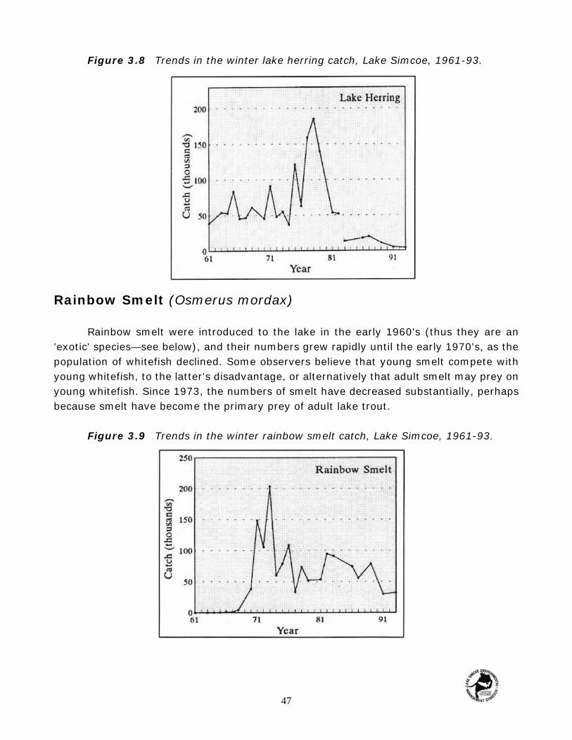
Figure 3.8 Trends in the winter lake herring catch, Lake Simcoe, 1961-93.
Rainbow Smelt (Osmerus mordax)
Rainbow smelt were introduced to the lake in the early 1960's (thus they are an'exotic' species—see below), and their numbers grew rapidly until the early 1970's, as thepopulation of whitefish declined. Some observers believe that young smelt compete withyoung whitefish, to the latter's disadvantage, or alternatively that adult smelt may prey onyoung whitefish. Since 1973, the numbers of smelt have decreased substantially, perhapsbecause smelt have become the primary prey of adult lake trout.
Figure 3.9 Trends in the winter rainbow smelt catch, Lake Simcoe, 1961-93.
47
Warm- and Coolwater Fish Species
While lake trout, lake whitefish, lake herring and rainbow smelt prefer cold, well-oxygenated waters, other species such as yellow perch (Perca flavescens), northern pike(Esox lucius), largemouth and smallmouth bass (Micropterus salmoides and Micropterusdolomieu) and pumpkinseed (Lepomis gibbosus) prefer warmer water temperatures. Thesespecies have not shown the same declining trends as have Lake Simcoe's coldwater species.Yellow perch and northern pike populations have fluctuated widely with no decreasing trend.Bass and pumpkinseed appear to be on the increase. These trends could arise from theincreasing availability of food with eutrophication, or they could simply be a response toclimatic trends that encourage the survival and growth of young warmwater fish.
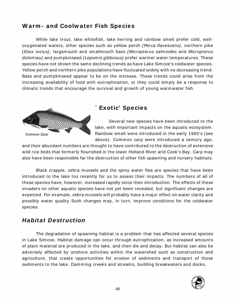
`Exotic' Species
Several new species have been introduced to thelake, with important impacts on the aquatic ecosystem.Rainbow smelt were introduced in the early 1960's (seeabove). Common carp were introduced a century ago,
and their abundant numbers are thought to have contributed to the destruction of extensivewild rice beds that formerly flourished in the lower Holland River arid Cook's Bay. Carp mayalso have been responsible far the destruction of other fish spawning and nursery habitats.
Black crappie, zebra mussels and the spiny water flea are species that have beenintroduced to the lake too recently for us to assess their impacts. The numbers of all ofthese species have, however, increased rapidly since their introduction. The effects of theseinvaders on other aquatic species have not yet been revealed, but significant changes areexpected. For example, zebra mussels will probably have a major effect on water clarity andpossibly water quality Such changes may, in turn, improve conditions for the coldwaterspecies.
Habitat Destruction
The degradation of spawning habitat is a problem that has affected several speciesin Lake Simcoe. Habitat damage can occur through eutrophication, as increased amountsof plant material are produced in the lake, and then die and decay. But habitat can also beadversely affected by onshore activities within the watershed such as construction andagriculture, that create opportunities for erosion of sediments and transport of thosesediments to the lake. Damming creeks and streams, building breakwaters and docks,
48
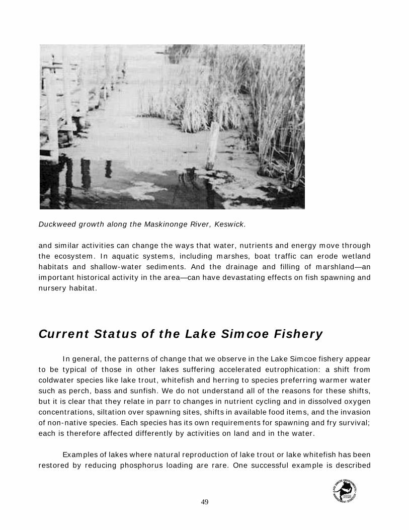
Duckweed growth along the Maskinonge River, Keswick.
and similar activities can change the ways that water, nutrients and energy move throughthe ecosystem. In aquatic systems, including marshes, boat traffic can erode wetlandhabitats and shallow-water sediments. And the drainage and filling of marshland—animportant historical activity in the area—can have devastating effects on fish spawning andnursery habitat.
Current Status of the Lake Simcoe Fishery
In general, the patterns of change that we observe in the Lake Simcoe fishery appearto be typical of those in other lakes suffering accelerated eutrophication: a shift fromcoldwater species like lake trout, whitefish and herring to species preferring warmer watersuch as perch, bass and sunfish. We do not understand all of the reasons for these shifts,but it is clear that they relate in parr to changes in nutrient cycling and in dissolved oxygenconcentrations, siltation over spawning sites, shifts in available food items, and the invasionof non-native species. Each species has its own requirements for spawning and fry survival;each is therefore affected differently by activities on land and in the water.
Examples of lakes where natural reproduction of lake trout or lake whitefish has beenrestored by reducing phosphorus loading are rare. One successful example is described
49
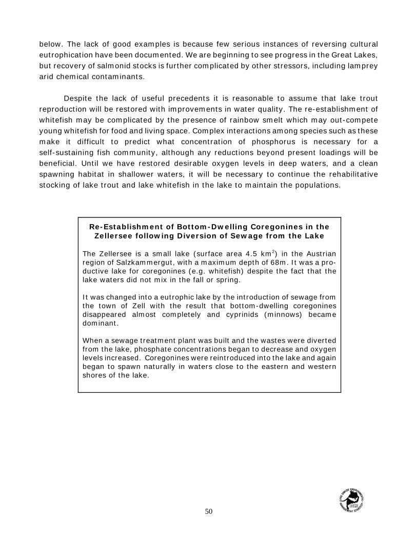
Re-Establishment of Bottom-Dwelling Coregonines in theZellersee following Diversion of Sewage from the Lake
The Zellersee is a small lake (surface area 4.5 km2) in the Austrianregion of Salzkammergut, with a maximum depth of 68m. It was a pro-ductive lake for coregonines (e.g. whitefish) despite the fact that thelake waters did not mix in the fall or spring.
It was changed into a eutrophic lake by the introduction of sewage fromthe town of Zell with the result that bottom-dwelling coregoninesdisappeared almost completely and cyprinids (minnows) becamedominant.
When a sewage treatment plant was built and the wastes were divertedfrom the lake, phosphate concentrations began to decrease and oxygenlevels increased. Coregonines were reintroduced into the lake and againbegan to spawn naturally in waters close to the eastern and westernshores of the lake.
below. The lack of good examples is because few serious instances of reversing culturaleutrophication have been documented. We are beginning to see progress in the Great Lakes,but recovery of salmonid stocks is further complicated by other stressors, including lampreyarid chemical contaminants.
Despite the lack of useful precedents it is reasonable to assume that lake troutreproduction will be restored with improvements in water quality. The re-establishment ofwhitefish may be complicated by the presence of rainbow smelt which may out-competeyoung whitefish for food and living space. Complex interactions among species such as thesemake it difficult to predict what concentration of phosphorus is necessary for aself-sustaining fish community, although any reductions beyond present loadings will bebeneficial. Until we have restored desirable oxygen levels in deep waters, and a cleanspawning habitat in shallower waters, it will be necessary to continue the rehabilitativestocking of lake trout and lake whitefish in the lake to maintain the populations.
50

4 Sources and Processes
Sources of Phosphorus to Lake Simcoe
Chapters 2 and 3 describe why we believe the health of the Lake Simcoe ecosystemto be fundamentally linked to phosphorus concentrations, which in turn affect oxygen levels,habitat and fish populations. What measures are appropriate to reduce current phosphorusloads to the lake?
To answer this question, we must consider the Lake Simcoe ecosystem as a whole,Phosphorus is a natural and important part of the Lake Simcoe ecosystem; our difficulty isthat current levels are nearly three times those that existed before European settlement.Phosphorus cycles through the natural system in predictable ways (Figure 4.1). This cyclewill be altered either by adding (or removing) extra phosphorus at one or more points in thecycle, or by changing the rate at which phosphorus moves through the ecosystem. Bothprocesses are at work in the Lake Simcoe ecosystem. Both must be addressed if we are toreduce phosphorus loads efficiently and effectively.
51

Table 4.1 Estimated Phosphorusloadings 1994 by source(rounded).
Phosphorus Source Estimated Load(Metric Tons)
Septic Systems 2.2Sewage Treatment Plants 5.6Urban Dry Weather 6.2Urban Stormwater 10.5Livestock 14.5Erosion
Cultivated Land (erosion) 24.0Pasture/Fallow 6.5Forest 8.0Wetland 4.5Idle Scrubland 3.0Atmospheric Deposition 11.0Total 104.0
Figure 4.1 The Phosphorus Cycle.
Introduced Sources of Phosphorus
Table 4.1 shows the estimated phosphorus loadings in the Lake Simcoe Watershedfor the year 1990. The loadings from each source are discussed below.
Intensive human settlement brings withit several new sources of phosphorus and canincrease the amount of phosphorus fromexisting sources. Human sewage, containingphosphorus from soaps, detergents, andhuman waste is one such source. Whereautomatic dishwashers are in use, phosphoruscontributions can be much higher, because ofthe higher phosphorus levels found in mostcommercial dishwashing detergents.
As urbanization increases, sewagesources of phosphorus can become veryimportant. Most human sewage is currentlytreated either in centralized sewage treatmentplants, each of which has one or a few majorpoints of discharge to the ecosystem. Loadings
52

Loading
a term used to indicate thetotal amount of a pollutantleaving or entering asystem. Loadings arecalculated by multiplyingconcentration times thevolume of and are usuallyexpressed in units of massper unit time.
of phosphorus from sewage treatment plants in the LakeSimcoe area have in fact declined since 1984, when theNewmarket and Aurora Sewage Treatment Plants wereclosed, and some of the other plants improved theirphosphorus removal methods. Further reductions can only beachieved by increasing the level of treatment at existingplants, so that more phosphorus is removed from the wastestream before it is discharged to receiving waters. In 1990the estimated total phosphorus load from sewage treatmentplants was 5.6 metric tons.
In rural areas, a high proportion of sewage may be treated in private septic systems.in this case, each property owner in a sense is a potential discharger of phosphorus andother pollutants to the environment. Well-maintained and operated septic systems are highlyeffective at reducing phosphorus concentrations, but problems can arise when the systemis overloaded, cracked or leaking, or otherwise below acceptable standards of operation.Searching out defective septic systems is a time-consuming task and one that requiresconsiderable cooperation from landowners, yet repair or replacement of these systems isoften the only way to reduce pollutant loadings from them.
In 1990 the estimated total phosphorus load from septic systems was 2.2 metric tons.
Another introduced source of phosphorus is chemical fertilizers, which are usedextensively in agricultural portions of the basin, particularly the drained marshlands, orpolders of the Holland Marsh. Over the years, high concentrations of phosphorus haveaccumulated in the muck soils of the polders. When water drains from the soil intosubsurface drainage systems, it carries with it elevated levels of dissolved phosphorus. Thissoluble phosphorus is of particular concern because it is the fraction most easily taken upby aquatic plants and algae. With soil testing, farmers can tailor fertilizer application ratesto the requirements of specific crops.
In 1990 the estimated total phosphorus load from cultivated lands was 24.0 metrictons.
Livestock operations have been prominent in the Lake Simcoe basin for at least ahundred years. Rainwater runoff from feedlots and improperly stored manure cancontribute another 'new' source of phosphorus to the ecosystem. Improved manure storage,diversion of runoff around feedlots, and the creation of vegetative buffer strips cansignificantly reduce pollutant loadings from these sources.
53

Uncontrolled livestock access to a Watercourse results in an excessive loading ofphosphorus and other pollutants to the Watercourse.
Careful timing of manure application and the incorporation of manure after spreading alsolower the potential for loss of phosphorus and other pollutants.
Where livestock have direct access to a watercourse for their water supply, animalfeces with associated phosphorus and other pollutants can enter streams directly. Livestockcan also cause accelerated streambank erosion by trampling vegetation, thus introducingmore phosphorus and sediment to the stream. Livestock access problems can be controlledby installing fences and stream crossings and by providing alternative sources of water forlivestock.
In dairy operations, milkhouse washwater may be rich in phosphorus as well. Itis often discharged to a watercourse through surface drains. It can be controlled byincorporating the washwater into a manure storage facility or by installing a treatmentsystem.
These agricultural sources have also diminished in recent years as farmers havebecome more aware of the need for careful conservation practices. In 1990 the estimatedtotal phosphorus load from livestock operations was 14.5 metric tons.
54
Altered Phosphorus Transport Mechanisms
Many of the "sources' we think of when we consider phosphorus enrichment are infact natural mechanisms whose rates of transport have been altered by human activities.
Atmospheric deposition is an important part of the phosphorus cycle. It occurs bothas wet deposition — that precipitation—and dry deposition— primarily dust particles. About70% of all atmospheric loads of phosphorus are thought to come from precipitation (rain,hail, snow), with the remaining 30% contributed by dustfall. Humans alter the rate ofatmospheric deposition by clearing land and leaving it open to wind erosion. Phosphorusmay also arise from industrial sources. Because air masses can be transported longdistances, the phosphorus contained in wet and dry deposition may in fact be generatedhundreds or thousands of kilometers away from Lake Simcoe. Yet these atmospheric sourcesare nevertheless significant in the Lake Simcoe ecosystem, contributing in total 11.0 metrictons in 1990.
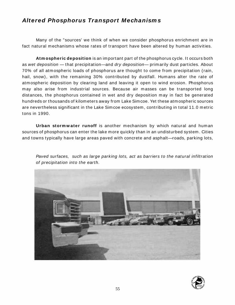
Urban stormwater runoff is another mechanism by which natural and humansources of phosphorus can enter the lake more quickly than in an undisturbed system. Citiesand towns typically have large areas paved with concrete and asphalt—roads, parking lots,
Paved surfaces, such as large parking lots, act as barriers to the natural infiltrationof precipitation into the earth.
55

sidewalks, and so on. They also have many buildings located close together, each with animpermeable roof surface. The se paved surfaces and roof areas act as barriers to thenatural infiltration of rainwater into the earth. As early as the middle of the last century,urban residents recognized that if they allowed rainwater to drain off roofs and roadways,it could pose serious flooding problems and create obstacles to traffic. Some of the earliestsewers built in Toronto, for instance, were built not for sanitary purposes but to improve thedrainage of street surfaces so that traffic could pass more quickly.
Stormwater management ponds ate control mechanisms that are put in place to maintainthe quality of stormwater runoff from urban developments
The rainwater drained away from streets and roofs, turned stormwater runoff, hastraditionally been diverted directly to local lakes or streams without treatment. After all, whywould treatment be necessary: it's simply rainwater, isn't it? But in the modern ecosystem,with common use of lawn fertilizers, numerous domestic pets, and a variety of pollutantsemitted from cars and other vehicles, stormwater can no longer be considered 'clean'.Whereas rainwater in an undisturbed ecosystem will flow slowly, almost imperceptibly,through the soil and into groundwater and surface waters, rainwater in a city flushes quicklyoff surfaces and just as quickly into receiving waters, carrying with it all manner ofassociated pollutants, including phosphorus. Newer urban development often provides forstormwater control through settling and infiltration ponds and other devices, but these areasare small relative to the overall Lake Simcoe watershed. The lack of stormwater treatmentin most of the watershed, and the rapid growth of phosphorus loadings from urban
56

stormwater runoff (18.5 metric tons in 1990, but only 2.5 metric tons in 1985), make thissource of phosphorus one of the most important in the area.
Stormwater runoff can be controlled through a variety of so-called best managementpractices such as detention ponds, infiltration trenches and artificial wetlands. Although suchmeasures are more easily installed in new development, they can also be retrofitted in olderareas.
Soil erosion is another natural phenomenon that is accelerated in many disturbedecosystems. LSEMS studies completed in 1985 found that soil erosion was the single largestcontributor of phosphorus to Lake Simcoe. Erosion occurs in many ways, most commonlywhen vegetation is removed and the soil laid bare, either For agriculture or construction.Many contaminants, including phosphorus and some pesticides, attach themselves tosediments, so that when sails are eroded the contaminants are transported through theecosystem with the soil particles.
Erosion is a natural process, even in a mature forest, but generally this would be analmost negligible contribution of sediments and nutrients. After European settlement,however, clearance was widespread and rapid in the Lake Simcoe watershed, especially inthe last half of the nineteenth century when almost all the area's forests were cleared. Inthe modern watershed, erosion occurs more easily on steep slopes and where water ismoving over the open land surface. Agricultural lands (whether pastureland or cultivatedfields), construction sites and stream banks are the areas where most erosion now occurs.Eroded soils, with their attached phosphorus and other pollutants, can enter the lake directlyor can be transported through storm sewers car overland to streams, and then through thestreams to the lake.
Phosphorus loadings from soil erosion have diminished over the past several decades.This is because the amount of farmland under cultivation has decreased and because manyfarmers are now using soil conservation techniques to reduce erosion and conserve valuabletopsoil, However, the total phosphorus load from all forms of soil erosion was 46.0 metrictons in 1990.
Measures can be taken both in agricultural areas and in urban areas to reduce soilerosion. Generally, these measures involve limiting the exposure of bare soils to wind andwater, channelling runoff in a controlled manner, and the retirement of particularlysusceptible lands from cultivation.
57

Related Activities
Reducing phosphorus loads to Lake Simcoe is a central component of an ecosystemrestoration strategy. But phosphorus reductions are not enough: we must also understandthe dynamics of the ecosystem itself, and the social, economic and institutional frameworkin which restoration actions can be undertaken.
Ongoing routine monitoring of water quality and the fish communities provides regularcheck-ups on the health of the Lake Simcoe ecosystem. More specialized studies yieldinformation that is helpful in understanding how nutrients and energy flow through thesystem, and which actions will be most likely to achieve the desired results.
Finally, the success of any restoration program will depend on public involvement andcommunity action. To ensure that proposed controls are widely implemented, informationmust be made available to the community in a variety of forms. Important partners in thisoutreach are local environmental public interest groups, other community groups, youth andschool groups, and the media.
School children take part in an annual cleanup of Vivian Creek, Mount Albert.
58

Table 5.1. Reductions in PhosphorusLoadings (rounded).
Phosphorus Source EstimatedReduction
(metric tons)Sewage Treatment Plants & Septic Systems 5.0
Urban Soil Erosion 0.5Urban Stormwater Best Management Practices 1.0
Agricultural Land (erosion) 5.0Fencing, Milkhouse waste- water, Manure Storage Improvements
1.5
Total 14.0
5 Progress to Date
Phosphorus Controls
The most important single objective of the Lake Simcoe Environmental ManagementStrategy Implementation Program is to reduce phosphorus loadings entering the lake. TheLSEMS studies, released in 1985, identified specific actions that were expected to reducephosphorus loads to Lake Simcoe. The 1985 report provided a framework for remedial actionand guidance on where appropriate measures should be implemented.
In its first five years, or Phase I, theobjectives of the Implementation Strategyhave been achieved by a combination ofguidelines (for example on stormwater controlin new subdivisions), remedial projects aimedat correcting past problems, and a communityaction program (Table 5.1). These actionshave targeted most of the major phosphorussources and pathways identified earlier in thissection. The following sections give anoverview of actions to date and how theyrelate to the1985 LSEMS Steering CommitteeRecommendations.
Human Sewage
Tackling sources of phosphorus from human sewage means improving the effluentfrom both sewage treatment plant sources and private septic systems. Phosphorus loadingcontrols on discharges from sewage treatment plants in the Lake Simcoe basin werespecified by the Ontario Ministry of the Environment in 1989 in accordance withrecommendation C6 of the 1985 LSEMS final report.
59
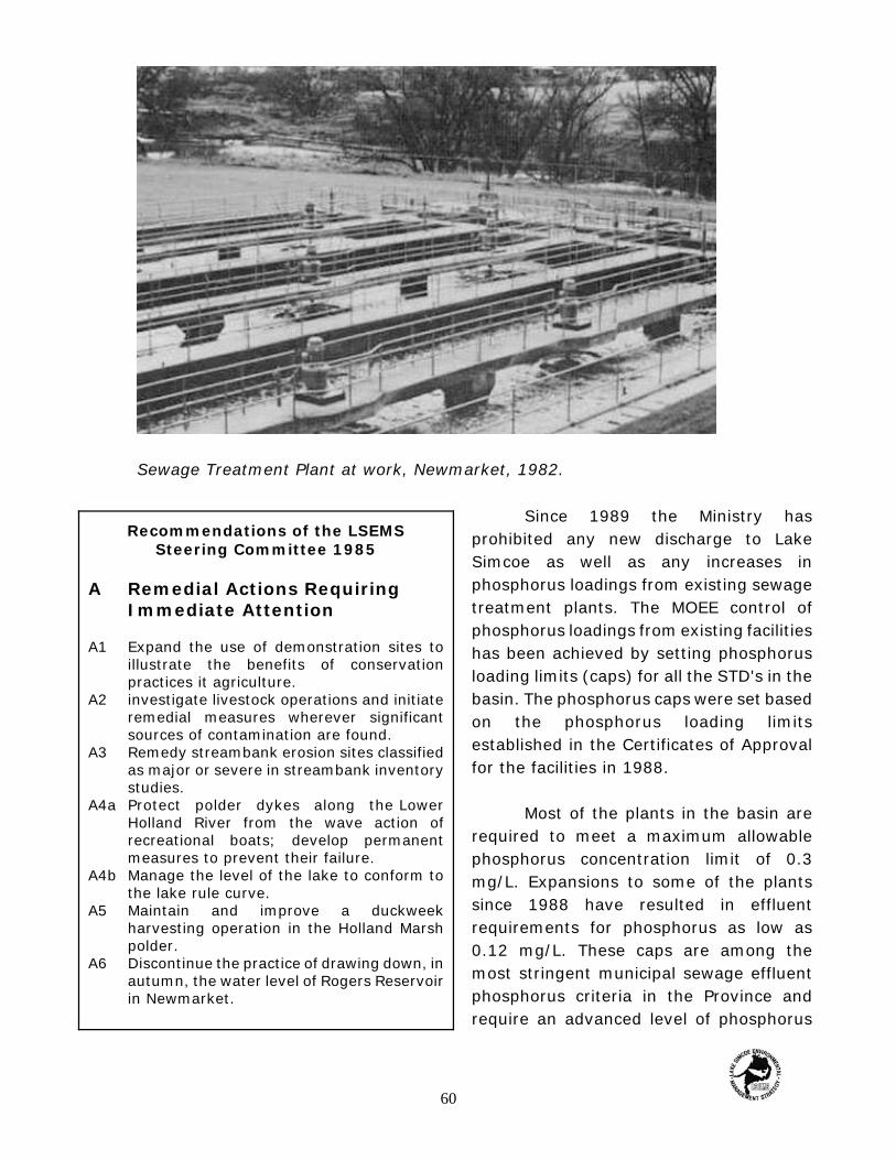
Recommendations of the LSEMSSteering Committee 1985
A Remedial Actions RequiringImmediate Attention
A1 Expand the use of demonstration sites toillustrate the benefits of conservationpractices it agriculture.
A2 investigate livestock operations and initiateremedial measures wherever significantsources of contamination are found.
A3 Remedy streambank erosion sites classifiedas major or severe in streambank inventorystudies.
A4a Protect polder dykes along the LowerHolland River from the wave action ofrecreational boats; develop permanentmeasures to prevent their failure.
A4b Manage the level of the lake to conform tothe lake rule curve.
A5 Maintain and improve a duckweekharvesting operation in the Holland Marshpolder.
A6 Discontinue the practice of drawing down, inautumn, the water level of Rogers Reservoirin Newmarket.
Sewage Treatment Plant at work, Newmarket, 1982.
Since 1989 the Ministry hasprohibited any new discharge to LakeSimcoe as well as any increases inphosphorus loadings from existing sewagetreatment plants. The MOEE control ofphosphorus loadings from existing facilitieshas been achieved by setting phosphorusloading limits (caps) for all the STD's in thebasin. The phosphorus caps were set basedon the phosphorus loading limitsestablished in the Certificates of Approvalfor the facilities in 1988.
Most of the plants in the basin arerequired to meet a maximum allowablephosphorus concentration limit of 0.3mg/L. Expansions to some of the plantssince 1988 have resulted in effluentrequirements for phosphorus as low as0.12 mg/L. These caps are among themost stringent municipal sewage effluentphosphorus criteria in the Province andrequire an advanced level of phosphorus
60

Recommendations of the LSEMS Steering Committee 1985
B Monitoring or Water Quality Conditions
B1 Continue monitoring water quality at water intakesopen lake water quality, and water quality in theHolland River.
B2 Arrange with the Holland Marsh Drainage Commissionto implement an ongoing water quality and quantitymonitoring program for the Holland Marsh polderpump-off water.
Installing a proper septic system along the PefferlawBrook.
control.
Since 1988, the LakeSimcoe watershed sewagetreatment plants have jointlyachieved annual loadingreductions of more than 5 metricroes by adhering to thesephosphorus concentration limitsdespite the significant increasein population within thewatershed.
Septic system problems, because they are invisible, are perhaps the most difficultof phosphorus sour to identify in the watershed. The Clean Up Rural Beaches (CURB)program sponsored by the OntarioGovernment offers of financialassistance to private landowners whowant to correct faulty or inadequateseptic systems. Until 1993, theLandowner Environmental AssistanceProgram (LEAP) also providedfunding for septic system upgrades.To date, ten septic systems havebeen repaired or rebuilt under theseprograms at a total cost of about$68,000, $20,000 of which wasprovided by CURB or LEAP and theremaining $48,000 by thelandowners.
Although the ten systems described here represent only a small proportion of the totalseptic systems in the watershed, the fact that they had failed indicated that as much as 90%of the phosphorus entering them was discharged into receiving waters. This percentage isestimated to have dropped to 5% or less after the systems were repaired or replaced, fora total phosphorus loading reduction of about 0.03 metric tons per year.
Fertilizers
Through the LSEMS, the Ministry of Agriculture, Food and Rural Affairs and theAuthority have actively promoted the testing of soils and manures so that farmers tailorapplication rates to the needs of particular crops. Important adjuncts of this work are the
61

Recommendations of the LSEMSSteering Committee, 1985
C Agency Programs and Policiesto Reduce Phosphorus Loadings
C1 Track the implementation and evaluatethe effectiveness or recommendedremedial actions It order that agencyprograms can be modified to respondto evolving problems.
C2 Expand the current soil erosionreduction programs utilizing loll timeconservation specialists.
C3 Target soil erosion reduction programsto high priority management areas.
C4 Recommend to farmers the use ofoptimal fertilizer phosphorus applicationrates.
C5 Promote the adoption of remedialefforts throughout the watershedpopulation using resources of thecommunity relations program of theSouth Lake Simcoe ConservationAuthority as well as other agencyprograms.
C6 Prohibit any increase in total pointsource loading from municipal orindustrial water pollution controlfacilities until the lake's response to anincrease in phosphorus loading can bereliably predicted.
C7a Apply the Revised Design andConstruction Guidelines for Work UnderThe Drainage Act to all municipaldrainage work in the basin.
C7b Apply guidelines from the UrbanDrainage Management Program to allfuture urban development in the basin.
demonstration of soil conservation practicesand the development of a nutrientmanagement plan.
Livestock Operations
The Ontario Ministry of Agriculture,Food and Rural Affairs and the Lake SimcoeRegion Conservation Authority, in partnershipwith the Ministry of Natural Resources and theMinistry of Environment and Energy, havedeveloped remedial action and informationprograms for livestock operations in thewatershed. A variety of technical and financialassistance programs, such as the Ontario SoilConservation and Environmental ProtectionAssistance Program (OSCEPAP), the LandStewardship Program the LandownerEnvironmental Assistance Program (LEAP) andthe Clean Up Rural Beaches Program (CURB)have all provided important incentives foroperators to change over to more protectivepractices.
146 projects have been completedunder these programs, at a total cost ofalmost $2 million. The most popular projecttype, as judged by grant applications, wasmanure storage improvements, whichaccounted for 47% of the total number ofprojects and 74% of the total funds spent.Fencing watercourses to restrict livestock
access was another popular project, accounting for 43% of projects and 24% of total funds.installation of milkhouse washwater systems was less popular, and only yielded 10% ofprojects, using 2% of total Funds. The high cost of manure storage improvements makesthis area an attractive one for farmers, bur in fact fencing and milkhouse washwater systemsare more cost-effective at reducing phosphorus loads per dollar spent. Under the LEAP andCURB programs, fencing and milkhouse washwater systems have been especiallytargeted—an important measure to ensure that the maximum reduction in phosphorus isachieved with the limited funds available.
62

Recommendations or the LSEMSSteering Committee, 1985
D The Need for Future Research
D1 Develop a predictive phosphorus /algae/oxygen model for Lake Simcoe.
D2 Continue studies to examinephosphorus movement in the LowerHolland River.
D3 Establish sites and subwatersheds inthe Lake Simcoe watershed toinvestigate the effectiveness of ruralconservation practices.
Before and after: fencing and erosion control along Whites Creek near Beaverton.
Recent estimates using the watershed model suggest that these measures havetogether reduced phosphorus loads to Lake Simcoe by about 1.55 metric tons per year.
Atmospheric Sources
As described above, atmospheric sources of phosphorus usually arise outside thebasin, and can even come from other countries. Control of these sources therefore requirescooperation between Canadian federal and provincial governments, and between thegovernments of Canada and the UnitedStates. Various programs are underway at alllevels of government and in all jurisdictions tocontrol these air sources. But apart fromcontrols on wind erosion (see Soil Erosion,below), they are considered to fall outside thescope of the Lake Simcoe EnvironmentalManagement Strategy and will not bediscussed further in this report. We mentionatmospheric sources in this section becausewe must account for them in estimating totalphosphorus loads to the basin, and inpredicting the impacts of actions we can takewithin the watershed.
63

Recommendations of the LSEMSSteering Committee 1985
E An Administrative Mechanism
E1 Establish an administrative structure toensure that water quality protection andenhancement programs within the LakeSimcoe Basin are carried out in anintegrated and comprehensive manner.
Accomplishments of RuralRemediation Projects
< Prevented an estimated 6 T/yr ofphosphorus from entering Lake Simcoe.
< Completed more than 300 remedialprojects.
< Fenced more than 13 km of stream torestrict livestock access.
< Improved fish habitat along more than 5km of stream through small scalestream rehabilitation projects.
< Converted more than 16 km of bufferstrips.
< Established 11 Demonstration Sitesthroughout the watershed includingexperimental and research projects.
< Converted over 66,000 acres to someform of conservation tillage.
< Investigated livestock operationsthroughout the watershed.
< Mapped high priority management areasfor the purpose of targeting soil erosionworks.
Urban Stormwater Runoff
In the late 1980's, the Ministries of theEnvironment and Natural Resources officiallyrecognized the importance of controllingstormwater runoff from existing development.In 1990 they released a set of interimguidelines for stormwater quality control.These guidelines required that stormwaterrunoff from new development be controlledthrough 'Pest management practices' such asdetention ponds, infiltration trenches andartificial wetlands. In 1994 the Ministry of Environment and Energy published theStormwater Management Practices, Planning and Design Manual which provides a marecomprehensive approach to stormwater management. It was estimated that through theadoption of the best management practices described in this manual, a reduction inphosphorus loadings of approximately 40% can be achieved from urban stormwater. Thistranslates into a loading reduction to the lake of about 0.77 metric tons per year.
Soil Erosion
In 1985, a series of constructionguidelines for the Lake Simcoe—LakeCouchiching area were produced by theMinistry of the Environment and adopted bythe Ministry of Natural Resources and the LakeSimcoe Region Conservation Authority. Theseguidelines are specific to the watershed andrecognize its special characteristics. Under theguidelines, sediment and erosion controlfacilities must be installed on lands underconstruction to reduce erosion and retaineroded soil particles. These guidelines areestimated to have reduced phosphoruscontributions from construction activities byabout 0.4 metric tons per year.
64
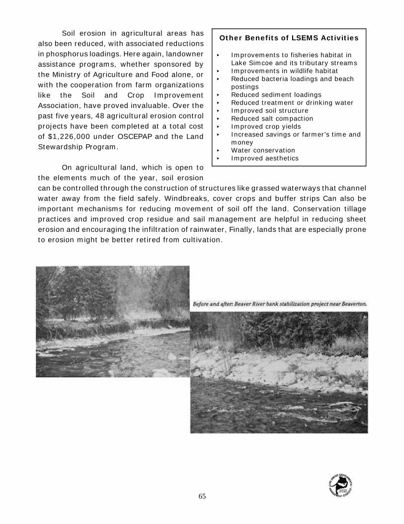
Other Benefits of LSEMS Activities
< Improvements to fisheries habitat inLake Simcoe and its tributary streams
< Improvements in wildlife habitat< Reduced bacteria loadings and beach
postings< Reduced sediment loadings< Reduced treatment or drinking water< Improved soil structure< Reduced salt compaction< Improved crop yields< Increased savings or farmer’s time and
money< Water conservation< Improved aesthetics
Soil erosion in agricultural areas hasalso been reduced, with associated reductionsin phosphorus loadings. Here again, landownerassistance programs, whether sponsored bythe Ministry of Agriculture and Food alone, orwith the cooperation from farm organizationslike the Soil and Crop ImprovementAssociation, have proved invaluable. Over thepast five years, 48 agricultural erosion controlprojects have been completed at a total costof $1,226,000 under OSCEPAP and the LandStewardship Program.
On agricultural land, which is open tothe elements much of the year, soil erosioncan be controlled through the construction of structures like grassed waterways that channelwater away from the field safely. Windbreaks, cover crops and buffer strips Can also beimportant mechanisms for reducing movement of soil off the land. Conservation tillagepractices and improved crop residue and sail management are helpful in reducing sheeterosion and encouraging the infiltration of rainwater, Finally, lands that are especially proneto erosion might be better retired from cultivation.
65
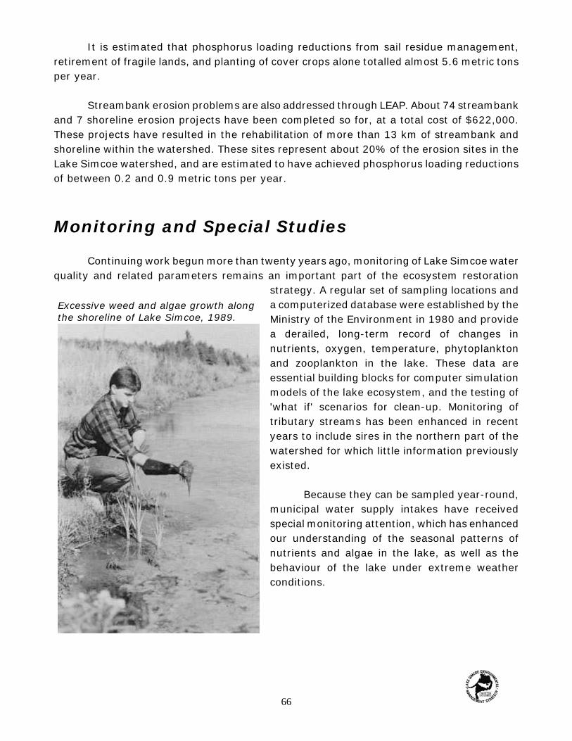
Excessive weed and algae growth alongthe shoreline of Lake Simcoe, 1989.
It is estimated that phosphorus loading reductions from sail residue management,retirement of fragile lands, and planting of cover crops alone totalled almost 5.6 metric tonsper year.
Streambank erosion problems are also addressed through LEAP. About 74 streambankand 7 shoreline erosion projects have been completed so for, at a total cost of $622,000.These projects have resulted in the rehabilitation of more than 13 km of streambank andshoreline within the watershed. These sites represent about 20% of the erosion sites in theLake Simcoe watershed, and are estimated to have achieved phosphorus loading reductionsof between 0.2 and 0.9 metric tons per year.
Monitoring and Special Studies
Continuing work begun more than twenty years ago, monitoring of Lake Simcoe waterquality and related parameters remains an important part of the ecosystem restoration
strategy. A regular set of sampling locations anda computerized database were established by theMinistry of the Environment in 1980 and providea derailed, long-term record of changes innutrients, oxygen, temperature, phytoplanktonand zooplankton in the lake. These data areessential building blocks for computer simulationmodels of the lake ecosystem, and the testing of'what if' scenarios for clean-up. Monitoring oftributary streams has been enhanced in recentyears to include sires in the northern part of thewatershed for which little information previouslyexisted.
Because they can be sampled year-round,municipal water supply intakes have receivedspecial monitoring attention, which has enhancedour understanding of the seasonal patterns ofnutrients and algae in the lake, as well as thebehaviour of the lake under extreme weatherconditions.
66

LSFAU staff member removes spawn froma lake trout.
Special studies have also been conducted on the distribution and species mix ofaquatic plants in Cook's Bay and of a benthic (bottom-dwelling) algal species across thewhole lake. These studies are important in evaluating changes in fish habitat and possibleresponses to phosphorus loading controls.
Computer simulation models have now been developed to predict the effects ofremedial strategies. One model predicts the effects of changes in phosphorus loading rateson deep water dissolved oxygen concentrations; another predicts the movement of watermasses within the lake during the mixing periods of spring and fall.
Fisheries Assessment and Research
Just as long-term water qualitymonitoring provides an important basis fortracking change in the lake, so does long-termmonitoring of the number, age and species offish. The LSEMS goal of restoring the coldwaterfish community provides the context for thiswork. The Lake Simcoe Fisheries AssessmentUnit of the Ministry of Natural Resourcescontinues its longstanding tracking of the LakeSimcoe fish community, including creelsurveys, index netting programs, anddocumentation of invasion by exotic species.The Unit is also responsible for the stocking oflake trout and lake whitefish, and regularlysurveys nearshore fish habitat and alterationsto the shoreline. The understanding of thebiology of Lake Simcoe fish species, their waterquality and habitat requirements, and thecomplex interrelationships between species inthe Lake Simcoe food web, are essential to thedevelopment of a successful ecosystemrestoration plan.
67

Community Relations Activities
On July 29, 1990, the Government of Ontario officially announced the initiation of theLSEMS Implementation Program. Since that time, the Lake Simcoe Region ConservationAuthority has been active in promoting LSEMS activities throughout the basin. To date,achievements have included the production of technical reports, brochures, news releasesand a series of fact sheets on LSEMS goals and activities. The Authority has also hosted anumber of special events, including public meetings, workshops, watershed tours, anEnviroFair, and an environmental management conference.
The Authority has also worked closely with the media in promoting the LSEMSImplementation Plan. Activities in this area include television commercials, a full-lengthfeature for television, various other short television reports, numerous interviews of radiotalk shows and news programs across Southern Ontario, and local, regional, provincial andnational newspaper coverage. A recent addition has been Down to Earth, a thirteen-weekenvironmental series on Trillium Community television (Channel 10, Barrie), a thirty-minuteshow dealing with environmental issues in and around the Lake Simcoe watershed.
Educational activities have formed a large parr of the Authority's outreach program.Five different educational displays have been produced and shown throughout the LakeSimcoe watershed at agricultural fairs, environmental festivals, community events andconferences, and audio-visual presentations and workshops are always available on requestto community, youth and school groups.
In 1992 the Authority launched the Save Our Simcoe (S.O.S.) Public AwarenessProgram in November, 1992. The Program features a hot line and many different communityawareness events. One of the most important aspects of the S.O.S. Program is its"hands-on' approach, encouraging local residents and school children to get involved inS.O.S. activities such as storm drain marking, river clean-ups, garbage bag distribution toice hut operators, tree planting, and similar activities. To date mare than 2,500 people haveparticipated in these projects, with mare than 50,000 households contacted through fliers,calendars. and other spin-offs.
68

Save Our Simcoe Campaign Achievements
< More than 500 people have called the toll-free hotline.< More than 500 participants have taken part In 45 speaking engagements throughout the Lake
Simcoe watershed.< Over 7,500 people have taken the opportunity to view the S.O.S. campaign displays.< There were over 200 participants in the 1993 S.O.S. Environmental Management Conference.< Over 400 people attended EnviroFair ‘93, and over 600 attended Elmira Fair '94.< Community groups and students have participated in the S.O.S. Storm Drain Marking program
in communities in the Lake Simcoe Watershed; these volunteers have painted the S.O.S. fishlogo next to 1800 Storm drains and have distributed 7800 fliers outlining 6o/talons to LakeSimcoe's phosphorus pollution problem.
< More than 500 Barrie area school children took part in a calendar contest organized by theLake Simcoe Region Conservation Authority and the Barrie Environmental Action Centre. Thestudents were Asked to illustrate a comparison between a clean Lake Simcoe and a pollutedLake Simcoe. The twelve winning entries appeared on the 1994 Save Our Simcoe Calendar.26,000 calendars were distributed throughout the watershed.
< The S.O.S. campaign has been endorsed by by 17 municipalities, one region and one countywithin the watershed; all 8 MPPs with ridings in the Lake Simcoe watershed have also endorsedthe campaign.
< Bell Ontario presented the S.O.S. Campaign with a computer database worth $17,500 for theLSEMS Implementation Program.
< Canada Trust (Aurora), through its Friends of the Environment Foundation, supported a FallClean-up and Tree-planting Day in the Town of Aurora along Tannery Creek (a tributary of theHolland River) by providing a grant of $5,000 tor the purchase al trees and shrubs.
< CKVR Television in Barrie produced a 30-minute educational video, This was our Lake, whichaired on CKVR and is available to schools and libraries in the watershed. The video was madepossible through donations from the Canada Trust-Friends of the Environment Foundation, theNewmarket Rotary Club, and CKVR Television.
< The Save Our Simcoe Alliance — a Lake Simcoe Community coalition to battle the lake'sphosphorus was formed in January 1994.
Bradford District High School students do their part by getting involved in theS.O.S Storm Drain Marking Program.
69

Trees for Canada Day is a great success everyyear thanks to the many ambitious tree planters.
Wildlife shrubs were planted alongTannery Creek in Aurora as part ofa park naturalization project.
Urban watercourses throughout the LakeSimcoe watershed are cleaned annually byschool students.
70

6 Goals, Issues andProposed Actions
What remains to be done?
Estimates of the impact of Phase I activities indicate that remedial actions to datehave reduced the annual phosphorus loading to Lake Simcoe by about 14 metric tons. Alittle more than half of this comes from remedial projects to control soil erosion, loadingfrom livestock operations, and failed septic systems. The remaining reduction is attributedto controls on construction activities, stormwater runoff and sewage treatment plants. Whilethese reductions represent an important first step in restoring the health of the Lake Simcoeecosystem, they were largely offset by increased loading from urban stormwater runoffduring the same period.
There is much more work that needs to be completed throughout the watershed.Many more remedial projects need to be completed, guidelines regulating the developmentindustry must be enforced, monitoring of the lake must continue and the community as awhole needs to become more involved. By continuing to foster partnerships betweengovernment agencies, special interest groups and the general public we can succeed. Withthis in mind we are ready to embark on the second phase oft long-term plan to complete thetask that has been started. Phase 2 must build on the successes of Phase 1 and we must useour understanding of the ecosystems behaviour together with our available resources toachieve the greatest possible phosphorus loading reductions.
71

Projections
How far do we need to go in Phase 2 to be confident that we are not only achievingour ecosystem goals. bur also maintaining those efforts in the face of ever-expanding urbandevelopment? The answers to this question are not clear because we cannot know the futurewith certainty. However, we can make predictions about the impact of proposed remedialactions based on current trends and land use practices. An excellent method of assessingthe impact of proposed remedial actions is by using the computer simulation of the LakeSimcoe Watershed developed by Beak Consultants Limited.
A number of future phosphorus loading scenarios were evaluated during Phase 1 usingthe Watershed Water Quality model. These predictions use 1991 sewage treatment plantloads and 1990 meteorological conditions, since that year is considered no best reflectaverage conditions that prevailed between 1986 and 1992. Both 'do nothing' and 'remedialaction' scenarios were modelled, and include pollutant loadings associated with futurepopulation growth and urbanization projections.
The results of this modelling show that if all possible remedial measures wereimplemented, the phosphorus loading to Lake Simcoe could be reduced by as much as anestimated 35 metric cons annually (Figure 6.1). This drop in the present day loading iswithin the proposed phosphorus targets outlined in Chapter 3.
`Do Nothing' versus the implementation of Phosphorus Controls - 2001
Scenario 1 is the 'do nothing' alternative considered from present day conditions tothe year 2001. Without remedial measures, the total phosphorus load is estimated to climbto about 107 T annually. The increased loading comes from additional urban growth andassociated increases in stormwater runoff (estimated at 5 T) and wastewater discharge fromSTP's (about 2 T). Additional inputs from agricultural activities are not expected andtherefore not predicted. (In fact, the increase in urban area may reduce agricultural loadsby taking existing farmland out of production.)
72

Scenario 2 shows the same planning projections, but this time including theimplementation of remedial measures, Existing uncontrolled urban areas are to beretro-fitted with urban hest management practices to reduce loads from stormwater runoff.Agricultural programs to initiate agricultural best management practices continue. Underthese controls, the total phosphorus load to the lake would be approximately 70 T annually,about one third less than under the 'do-nothing' option.
`Do Nothing' versus the Implementation of Phosphorus Controls - 2011
Scenario 3 takes the 'do nothing' option ten years further into the future. During thatten years phosphorus loads are predicted to increase by another 7 T so that by the year2011 the total phosphorus load entering Lake Simcoe would be about 114 T annually if noremedial work is initiated. Again, increased urban development is responsible for the loadingincreases: stormwater runoff accounts for an additional 4.5 T while increased dischargesfrom sewage treatment plants contribute the remaining 2.5 T.
Scenario 4 shows the projected 2011 conditions under the same active phosphoruscontrol measures as scenario 2. If such measures were implemented, the projectedphosphorus load to the lake can be held at about 75 T annually.
Figure 6.1 Projected effects of implementing phosphorus controls vs doing nothing.
73

Consequences
What are the implications of 'doing nothing'? Clearly, phosphorus loads will rise abovepresent levels, but what implications might exist for fish and other indicators of ecosystemhealth?
The results of the water quality modelling suggest that the implications of doingnothing relative to the coldwater fish community in Lake Simcoe would be disastrous. Basedon work conducted by the Ministry of Environment and Energy, the predicted loadingincreases would reduce the end-of-summer hypolimnetic dissolved oxygen concentrationsto 3.0 mg/L in 2001, and to 2.6 mg/L in 2011.
We know that cold water fish species in the lake are already living in marginalconditions, with their reproductive potential gravely reduced. The increased stress of furtheroxygen reductions is likely to make the lake wholly inhospitable to coldwater species. Underthese conditions, the re-establishment of a self-sustaining fishery would be impossible.
To make matters worse, the results of deep water chemistry studies suggest that ifconditions deteriorate further, the increased phosphorus loadings may not be the onlyproblem we have to deal with. Bottom sediments in the lake contain large deposits ofphosphorus which remain relatively inert under well oxygenated conditions. As oxygen levelscontinue to decline on the lake bottom, conditions can be created whereby the phosphoruscontained in the sediments can be released. If this happened in Lake Simcoe, an importantsource of additional phosphorus loading would be created, further contributing to ecosystemdeterioration.
The following recommendations summarize the actions that we believe should havea high priority in the Phase 2 Implementation Plan. Some represent continuations ofactivities begun in Phase 1; others are new activities designed to fill gaps or supplementother ongoing projects. For convenience, they are grouped by type of activity: agricultural,urban, or recreational.
74

Objective: To reduce water quality degradation through improvements infarming practices by developing individual farm plans which address soil, crop,livestock and water management issues, and provide farmers the technical andfinancial assistance to implement individual farm management plans.
Activity A: AGRICULTURE
Issue 1 Livestock Access to Watercourses
Livestock which have access to a watercourse will pollute surface waters bycontributing nutrients (phosphorus) and bacteria contained in feces, and eroded sedimentfrom the trampling of streambanks. Through various assistance programs over fifty projectshave been completed within the watershed to restrict livestock access; however more thantwice this number still need to be addressed.
ACTION: Limit livestock access by installing restrictive fencing, alternative wateringfacilities and crossings where required. Target high priority farms and complete 10 projectsper year. Continue to promote financial assistance programs (LEAP, CURB), providelandowners with technical support and project design information.
PARTNERS: LSRCA, OMAFRA, MOEE MNR, Landowners
Livestock access to a watercourse along the Black River.
75
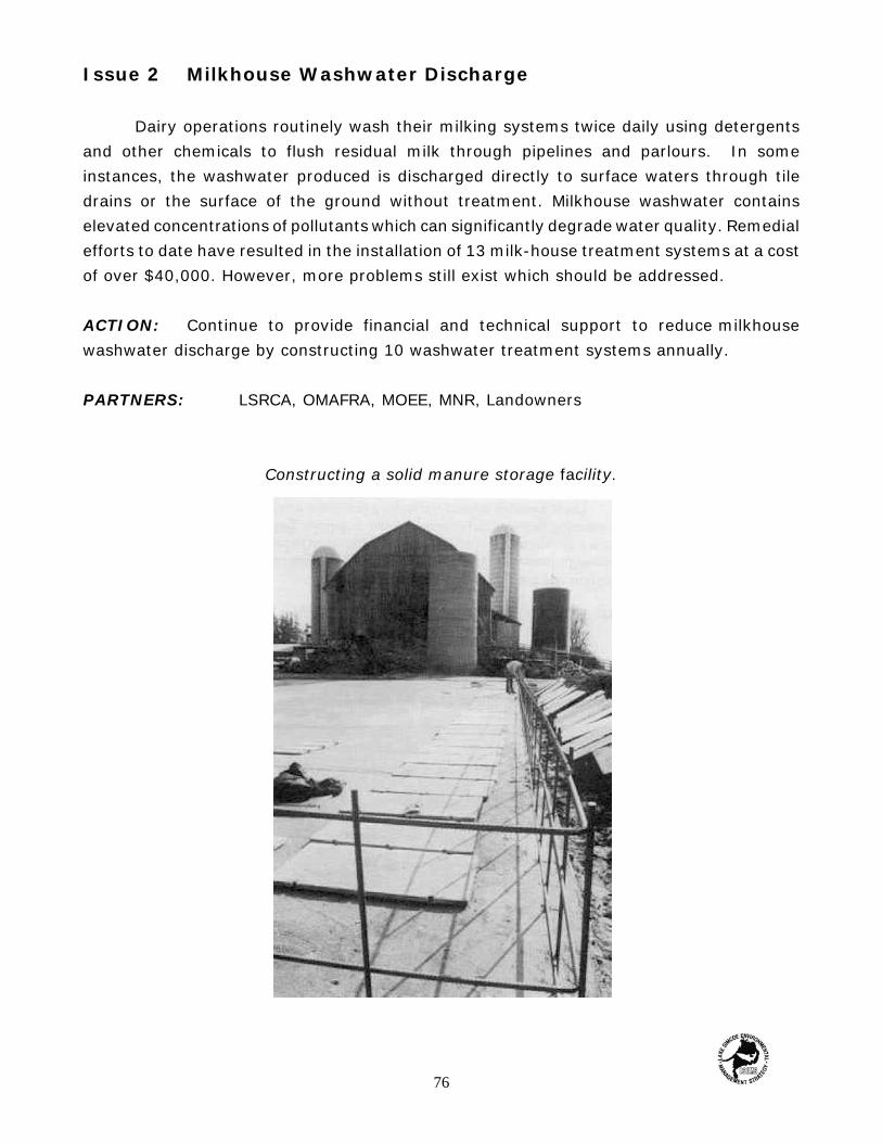
Issue 2 Milkhouse Washwater Discharge
Dairy operations routinely wash their milking systems twice daily using detergentsand other chemicals to flush residual milk through pipelines and parlours. In someinstances, the washwater produced is discharged directly to surface waters through tiledrains or the surface of the ground without treatment. Milkhouse washwater containselevated concentrations of pollutants which can significantly degrade water quality. Remedialefforts to date have resulted in the installation of 13 milk-house treatment systems at a costof over $40,000. However, more problems still exist which should be addressed.
ACTION: Continue to provide financial and technical support to reduce milkhousewashwater discharge by constructing 10 washwater treatment systems annually.
PARTNERS: LSRCA, OMAFRA, MOEE, MNR, Landowners
Constructing a solid manure storage facility.
76

Issue 3. Runoff from Manure Storage, Feedlots and Manure-Spread Fields
Stormwater runoff from inadequate manure storage, feedlots, and manure spreadfields can carry nutrients, bacteria, and sediment into surface waters draining to the lake.Approximately 68 manure storage systems have been constructed to reduce manure runoffat an estimated cost of $1,345,000. It is believed that runoff from approximately 100 morefarm operations needs to be controlled.
ACTION: Construct proper manure storage to eliminate runoff, create clean waterdiversions around feedlots and/or install eavestroughs to reduce the volume of contaminatedrunoff. Create grass and buffer strips wherever possible to help control and filterrunoff-before it enters a watercourse or drainage ditch. In addition, promote the adoptionof sound manure management practices to incorporate manure after spreading, discontinuewinter application, calculate manure application rates based on soil and crop nutrientrequirements.
PARTNERS: LSRCA, OMAFRA, MOEE, MNR, Landowners
Issue 4 Runoff and Erosion from Cropland
Stormwater runoff from cultivated fields can cause erosion and wash soil particles,nutrients, and pesticides into surface waters. It is estimated that 20 tonnes of phosphorusare transported into the lake every year from cultivated lands.
ACTION: Provide technical and financial assistance to construct erosion control structuressuch as grass waterways, terraces, wind breaks, and water and sediment control basinswhere required. Provide incentives to purchase conservation tillage equipment such as chiselplows and drill seeders. Promote the retirement of erodible lands which are too fragile forproduction.
PARTNERS: Soil and Crop Improvement Agency, OMAFRA, LSRCA, Landowners
77

Issue 5 Application Rate of Fertilizers on Agricultural Lands
Over-application of chemical and natural fertilizers on agricultural lands concentratesnutrients increasing the potential for surface water degradation. This practice is prevalentwithin vegetable polders since the cost associated with purchasing the fertilizer is small incomparison to the value of the crop.
ACTION: Promote soil and manure testing so that fertilizer application rates arecalculated based on the individual crop requirements. Set up demonstration plots in eachof the vegetable polders in cooperation with marsh farmers.
PARTNERS: OMAFRA, Muck Growers Association, Soil and Crop Improvement Association
78

Issue 6 Pump-off Water from the Holland Marsh Polder
Drainage within the Holland Marsh Polder is regulated by two pumping stations whichdischarge into the Holland River. Pump-off water from the polder is extremely high innutrients due to the intensive use of the muck soils For vegetable production. It is estimatedthat an average of 5.1 tonnes of phosphorus enters the Holland River from the pokierannually.
ACTION: Investigate the feasibility of constructing a treatment Facility to chemicallyremove phosphorus from the pump-off water at the Bradford Pumping Station.
PARTNERS: MOEE, LSRCA
Issue 7 Application of Industrial and Sewage Sludge on AgriculturalLands
The spreading of industrial and sewage sludge on agricultural lands can increase soil fertilityand improve soil structure if applied and managed properly, Guidelines exist which regulatethese activities to ensure that improper application does not occur; however, theseguidelines still allow for winter spreading on frozen ground. Winter application is recognizedas a poor practice because the frozen ground promotes runoff during spring conditions.
ACTION: Evaluate the guidelines which regulate the application of industrial and sewagesludge, Discontinue winter application of sludge on agricultural lands and evaluate theconstruction of sludge storage sites if required.
PARTNERS: MOEE, OMAFRA
79

Objective: To reduce water quality degradation from industrial, commercialand residential land use through the initiation of best management practices,a sound planning approach, and community action.
Activity B. URBAN
Issue 8 Soil Erosion and Sedimentation from Construction Activities
Construction activities routinely involve the removal of vegetation and topsoil frombuilding sites exposing the surface to wind and water erosion. Provisions exist in thePlanning Act to control erosion from construction activities. However, these guidelines havenot been adopted by all municipalities within the watershed.
ACTION: Promote the adoption of Soil Conservation and Tree Cutting By-Laws by all themunicipalities within the watershed. Continue to comment on subdivision plans and ensurecompliance with conditions through enforcement of the regulations. Use a combination ofmanagement practices and proper planning to ensure success.
PARTNERS: LSRCA, MNR, MOEE, OMAFRA
80

Besides controlling stormwater, these pondsprovide beneficial habitats for a variety of wildlife.
Issue 9 Stormwater Management Practices to Control Urban Runoff
Stormwater runoff from urban areas contains sediment, nutrients, bacteria andmetals, and is routinely discharged through storm sewers directly into surface waters. Asa result, urban stormwater runoff is a significant contributor of pollution entering LakeSimcoe.
ACTION: Promote the adoption of state-of-the-art stormwater management practices asoutlined in the 1994 MOEE / MNRpublication Stormwater ManagementPractices Planning and DesignManual. Water quality storagerequirements should meet or exceedthose defined for Level I Protection.Work with municipalities to ensurethat stormwater managementfacilities are maintained.
PARTNERS: LSRCA, MNR, MOEE
Issue 10 Existing Uncontrolled Urban Stormwater Runoff
Urban development within the Lake Simcoe watershed approved prior to 1991 did notrequire the implementation of best management practices to control stormwater runoff. Asa result, the majority of urban area within the watershed is uncontrolled and contributes anestimated 20 to 30 tonnes of phosphorus to Lake Simcoe annually.
ACTION: Develop and initiate a plan to retro-fit existing uncontrolled urban developmentwith stormwater best management practices to reduce surface water pollution. Work withmunicipalities to ensure that facilities are maintained and operating properly.
PARTNERS: LSRCA, MNR, MOEE, Municipalities
81

Installing a private sewage disposalsystem along the shore of LakeSimcoe.
Issue 11 Municipal Sewer Cross Connections
Improper cross connections from residential, commercial and industrial areasdischarge untreated waste directly into surface waters, contributing high concentrations ofbacteria, nutrients and other pollutants. Recent studies conducted by municipalities haveconcluded that these connections exist and can significantly degrade water quality.
ACTION: Under the Municipal Industrial Strategy for Abatement program conduct anend-of-pipe audit to trace arid eliminate all illegal cross connections. Furthermore,inspections should be a requirement as a condition of sale for all industrial, commercial andresidential properties.
PARTNERS: MOEE, Regional Municipalities
Issue 12 Inadequate/Faulty Private Sewage Disposal Systems
Many cottages and permanent residencesalong the shore of Lake Simcoe have inadequateprivate sewage disposal systems which contributenutrients and bacteria to both surface andgroundwater.
ACTION: Trace and correct problems associatedwith inadequate private sewage disposal systemsand promote the proper maintenance of existingsystems. Evaluate the feasibility of providingsanitary services using existing STP capacity tonear-shore areas using private sewage disposalsystems where problems have been identified.
PARTNERS: MOEE, Regional Health Departments,LSRCA, Landowners
82

Issue 13 Alternative Private Sewage Disposal Systems
Many alternative private waste management systems are being developed and whilesome definite advantages are apparent from laboratory trials, little actual information isknown regarding their effectiveness. Other systems such as composting toilets have beenproven effective but have nor been widely accepted. Communal sewage systems could alsobe advantageous given that they could be better operated and maintained.
ACTION: Promote alternative private waste management systems that have beenproven effective.
PARTNERS: LSRCA, MOEE, Regional Municipalities, Landowners
Issue 14 Sewage Treatment Plant Effluent
Sewage Treatment Plants {STP's) discharge effluent containing phosphorus intosurface waters and directly into the lake. Continued development pressure will increase thecontribution of phosphorus entering the lake from STP's. Guidelines regulating the dischargeof phosphorus from STP's are in place and enforced by the MOEE. However as thewatersheds population grows further reductions in the phosphorus limit maybe required.
ACTION: Review the existing guidelines relative to phosphorus limits every five years todetermine whether phosphorus limits should be lowered. Encourage municipalities tocontinue to upgrade the phosphorus removal capability of the STP's as new technologybecomes available.
PARTNERS: MOEE, Municipalities
Issue 15 Phosphorus Loadings from Future Development
Future development within the Lake Simcoe watershed is inevitable. As the populationwithin the basin continues to grow so will the urban centres, associated infrastructure, andthe phosphorus load entering the lake. To ensure the continued sustainability of the LakeSimcoe ecosystem, Future planning efforts must be conducted on a watershed basis andinclude criteria For phosphorus export.
83
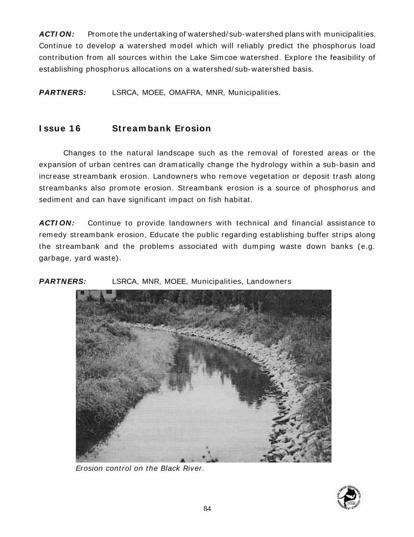
Erosion control on the Black River.
ACTION: Promote the undertaking of-watershed/sub-watershed plans with municipalities.Continue to develop a watershed model which will reliably predict the phosphorus loadcontribution from all sources within the Lake Simcoe watershed. Explore the feasibility ofestablishing phosphorus allocations on a watershed/sub-watershed basis.
PARTNERS: LSRCA, MOEE, OMAFRA, MNR, Municipalities.
Issue 16 Streambank Erosion
Changes to the natural landscape such as the removal of forested areas or theexpansion of urban centres can dramatically change the hydrology within a sub-basin andincrease streambank erosion. Landowners who remove vegetation or deposit trash alongstreambanks also promote erosion. Streambank erosion is a source of phosphorus andsediment and can have significant impact on fish habitat.
ACTION: Continue to provide landowners with technical and financial assistance toremedy streambank erosion, Educate the public regarding establishing buffer strips alongthe streambank and the problems associated with dumping waste down banks (e.g.garbage, yard waste).
PARTNERS: LSRCA, MNR, MOEE, Municipalities, Landowners
84
Objective: To reduce the potential impacts to Lake Simcoe that are associated withrecreational uses of the lake. To guide management of the recreational fishery so thatthis use is sustainable in the future. To maintain the amount of shoreline now in anatural state and restore areas that have been degraded. To ensure continued publicaccess to the lake and its shoreline.
Activity C: RECREATION
Issue 17 Introduction of Exotic Species
Exotic (e.g. zebra mussel, black crappie, spiny waiter flea) and other non-nativespecies can be introduced to Lake Simcoe by several routes, such as boaters, and thetransfer of bait from other waterbodies by anglers and baitfish dealers. Such species mayhave serious negative impacts on the ecosystem. There is already an extensivecommunication program on zebra mussels for boaters and anglers. However, regulations stillpermit baitfish dealers to transfer large quantities of bait from one lake to another (forexample, from any of the Great Lakes to Lake Simcoe).
ACTION: Evaluate regulations on the transport and distribution of baitfish with thepurpose of eliminating transfer of exotic and non-native species. Continue to educate thepublic on ways to minimize the risk of spread of exotic and non-native species.
PARTNERS: MNR, Baitfish Dealers
Issue 18 Contamination and Phosphorus Loading From Boating
Grey water is released into the lake by boaters and contributes to phosphorus loadingin the lake. The extent and ecological consequences of this is not known, but due to thelarge numbers of boaters using Lake Simcoe the potential for a serious problem is relativelygreat. Furthermore, gas and oil are released directly into the waters of Lake Simcoe by
85
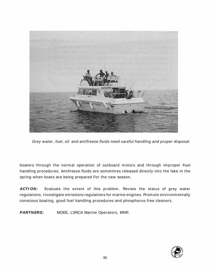
Grey water, fuel, oil and antifreeze fluids need careful handling and proper disposal.
boaters through the normal operation of outboard motors and through improper Fuelhandling procedures. Antifreeze fluids are sometimes released directly into the lake in thespring when boats are being prepared For the new season.
ACTION: Evaluate the extent of this problem. Review the status of grey waterregulations. Investigate emissions regulations for marine engines. Promote environmentallyconscious boating, good fuel handling procedures and phosphorus-free cleaners.
PARTNERS: MOEE, LSRCA Marine Operators, MNR
86

Issue 19 Erosion Along the Holland River
Serious erosion of the Holland River channel and wetlands is occurring due in part tofluctuations in the lake's water level and heavy boat traffic. Consequently, fish and wildlifehabitats are being destroyed, phosphorus from the eroded material is entering Lake Simcoe,and polder dykes of neighbouring marsh farms are being exposed.
ACTION: Develop a restoration strategy for the lower Holland River. Evaluate and costoptions including limits to boat traffic capacity or speed, restrictions on further marinadevelopment in the Holland River, structures to mitigate wave action and restrict thechannel for boats, and restoration work on the wetlands and riverbanks.
PARTNERS: LSRCA, MNR, OMAFRA, Trent-Severn Waterway Commission
Issue 20 Shoreline Development
The lack of specific development policies for shoreline properties coupled with thenumber of agencies involved in the review process often cause delays in approval and canlead to inconsistencies in the level of protection for shoreline features. This fragmentedapproach to managing shoreline development has led many agencies to develop shorelinemanagement guidelines. These guidelines have been documented to better protect andre-store natural shorelines and at the same rime speed up the approval process by providinga clear explication of the development requirements to consultants.
ACTION: Develop an integrated shoreline management plan for Lake Simcoe to ensurethe protection of natural heritage Features while allowing for future development. Theshoreline management plan should include recommendations for the near-shore, shorelineand littoral zone areas. A littoral zone study recommended under Monitoring and ScientificStudies (Issue 26) would be beneficial. The plan should be developed For use on ageographic information system (GIS).
PARTNERS: LSRCA, Municipalities
87

Enjoying the afternoon on the shore of Lake Simcoe.
88

Objective: To detect seasonal and long-term trends in chemical and biologicalindicators used to assess the health of the Lake Simcoe ecosystem; to undertake specialstudies to understand and model the lake's responses to stressors including humanactivities in the watershed and invading species; and to be able to baserecommendations management on sound scientific knowledge and data.
Activity D: MONITORING AND SCIENTIFIC STUDIES
Issue 21 Effects of Phosphorus Loading
Remediation work during LSEMS implementation Phase 2 will significantly reducephosphorus loading. It is essential to measure the response of this loading reduction in theLake so that any further remedial activities can be identified and implemented and so thatchanges in water quality / trophic state can be quantified. The question, "Is the lakeimproving?', will be one of the most critical posed by lake users, scientists and lakemanagers during LSEMS Implementation Phase 2.
ACTION: Continue regular sampling at 12 main lake stations and four lower Holland Riverand South Cook's Bay stations dining the May—November periods of 1995-1999 forplankton, nutrients, temperature and dissolved oxygen; continue sampling at four municipalwater intakes for nutrients and phytoplankton; apply appropriate statistical analyses todetect trends and interpret changes.
PARTNERS: MOEE, LSRCA, MNR
89
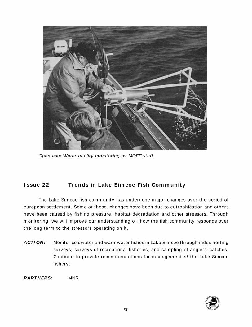
Open lake Water quality monitoring by MOEE staff.
Issue 22 Trends in Lake Simcoe Fish Community
The Lake Simcoe fish community has undergone major changes over the period ofeuropean settlement. Some or these. changes have been due to eutrophication and othershave been caused by fishing pressure, habitat degradation and other stressors. Throughmonitoring, we will improve our understanding o I how the fish community responds overthe long term to the stressors operating on it.
ACTION: Monitor coldwater and warmwater fishes in Lake Simcoe through index nettingsurveys, surveys of recreational fisheries, and sampling of anglers' catches.Continue to provide recommendations for management of the Lake Simcoefishery:
PARTNERS: MNR
90

Issue 23 Exotic Species Invasions
The black crappie, spiny water flea and the zebra mussel are three 'exotic' speciesthat have recently invaded the Great Lakes and several inland lakes in North America,including Lake Simcoe. The impacts of these organisms on food web function and on nutrientcycling and trophic state variables are potentially very great in Lake Simcoe, but are poorlyunderstood. Rased on evidence from Lake Erie and Lake St. Clair, these organisms have thepotential to greatly influence the long term trends in water clarity, plankton densities,nutrient concentrations and fish habitat and thereby complicate the interpretation of directeffects of phosphorus loading changes.
ACTION: Quantify the invasion rate and population dynamics of the black crappie, spinywater flea and the zebra rnussel in Lake Simcoe; analyze plankton samples from all stationswith special attention to possible predation effects of the spiny water flea and filtrationeffects of the zebra mussel; collaborate with investigators on Lake Erie, Lake St. Clair andthe Bay of Quinte to separate the effects of invading species from the effects of nutrientloading changes; monitor effects of invading species on benthic invertebrates and fishcommunities
PARTNERS: MNR, MOEE
Issue 24 Quantification of Mass Balance
Several gaps exist in the information base on the sources, fate and transport ofnutrients for the lake, For example, flows and concentration data have only recently (1993)been collected regularly from tributaries in the northern parr of the watershed. Little isknown of the circulation patterns in the lake under thermally stratified conditions relativeto the dispersion of inputs from point sources and movement into the main basin of theLake.
ACTION: Establish continuous flow monitoring equipment on important streams(presently ungauged); establish stare-of-the art (ultra sensitive) flow metering equipmenton the lower Holland River; measure nutrient concentrations and loading to the Lake fromall important streams and rivers; calculate a phosphorus mass balance for the lake overseveral years which accounts for weather and other effects contributing to year-to-yearvariability.
PARTNERS: MOEE, LSRCA
91

Issue 25 Factors Limiting Recruitment in Coldwater Fishes inLake Simcoe
The factors limiting recruitment of coldwater fishes (lake trout, lake whitefish, lakeherring) in Lake Simcoe are not well understood at present. Recruitment of lake trout andJake whitefish is negligible and these populations are being supported by rehabilitiativerestocking. Information is needed on the relative importance of environmental conditionsat the spawning sites, predation by other fish and crayfish, competition with rainbow smelt,and the quality of late summer deep-water habitat. Specific management actions torehabilitate these cold-water fishes may vary depending on the factors limiting recruitment.
ACTION: Conduct field and laboratory experiments to identify the factors limitingrecruitment.
PARTNERS: MNR, MOEE.
Altered shorelines such as this provide little in the way of fish habitat.
92

Issue 26 Alteration and Destruction of Littoral Zone Fish Habitatin Lake Simcoe
Most of the Lake Simcoe shoreline has been developed to some extent, whether forcottage use, marinas, beaches or urban areas. There is steady pressure for this developmentto continue. It is not known to what extent human alterations have affected the habitat offish that occupy the near-shore, or littoral zone. These fish include many minnow species,larger warmwater species, and the early life stages of many sportfish. By mapping thishabitat in derail and describing the fish species that are associated with it, we will be ableto predict what the effects of further development would be. We also would be able tomonitor any changes in composition and distribution of aquatic plants with changes in thenutrient status and water clarity of the lake. A computerized mapping system incorporatingGeographic Information System (GIS) technology would allow easy access to the largevolume of information that is accumulating on the near-shore zone of Lake Simcoe.
ACTION: Mapping of littoral zone features and habitat. Most of the shoreline of LakeSimcoe has already been mapped in the LSPAU Littoral Zone Program. We need to completethe shoreline using the same methods and integrate the data into a Geographic InformationSystem (GIS). A pilot GIS project has been completed for a segment of shoreline. Themethods need to be further refined and applied to the rest of the shoreline. Mapping offeatures to be repeated at 10 year intervals.
PARTNERS: MNR, LSRCA
93

Objective: Encourage public commitment and involvement to the protection andrestoration of the Lake Simcoe ecosystem through public awareness, education, andcommunity action.
Activity E: PUBLIC AWARENESS, EDUCATIONCOMMUNITY ACTION
Public awareness of the problem must be followed by public involvement to solve it.
Issue 27 Public Awareness, Education and Community Action
Efforts to inform and educate the public regarding Lake Simcoe's environmentalproblems and the proposed solution.% of the LSEMS Implementation Program have beenunder way since 1990. They include media releases, public presentations, displays,television commercials, workshops and publications. A heightened public awarenesscampaign entitled Save Our Simcoe (S.O.S.) was launched in the fall of 1992. This campaignwas designed to provide further awareness of Lake Simcoe's condition, as well as toencourage public support and initiate community action.
ACTION: Maintain the public awareness and education program and enhance thecommunity action strategy by developing educational material for watershed schools,supporting the efforts of and working co-operatively with the Save Our Simcoe Alliance,promoting community action and providing further education on water conservation,fertilizer and pesticide use, and household hazardous waste disposal.
PARTNERS: LSRCA, OMAFRA., MNR, MOEE, local school boards, watershedmunicipalities and Save Our Simcoe Alliance.
94

Objective: To protect the quality and integrity of ecosystems, including air, water,land and biota; and where quality and integrity have been diminished, to encouragerestoration.
Activity F: NATURAL HERITAGE FEATURES
Issue 28 Ecological integrity of the Landscape is Being Threatened
Natural heritage comprises the native flora and fauna and related landform featureswhich contribute to the health and diversity the natural environment and provide a widerange of important environmental, social and economic benefits. Natural heritage featuresmay be grouped into the following core conservation lands and waters groups: wetlands,woodlots, corridors, species au risk, public conservation lands, Areas of Natural andScientific Interest (ANSls), Environmentally Sensitive Areas (ESA's), water bodies,watercourse and valley lands, and critical fish and wildlife habitat, Changes in land use andincreased urbanization throughout the Lake Simcoe watershed are threatening the ecologicalintegrity of the landscape. There is a dear connection between natural heritage features andwater quality. These linkages must be protected and restored.
ACTION: To encourage sustainable development and ensure that changes in land use inthe Lake Simcoe watershed protect or enhance the natural heritage features. Assistmunicipalities to implement the Natural Heritage Policy as part of the planning reforms inthe Province and support current resource mapping inventory and assessment to provideup-to-date information. Encourage sustainable development on a sub-watershed/watershed basis.
PARTNERS: MNR, LSRCA, MORE, OMAFRA, local and regional municipalities
95
Glossary
best management practices A term used to describe preferred methods ofmanaging stormwater in an ecosystem. Typical best management practices, or BMP's asthey are sometimes are detention ponds, infiltration trenches, and artificial wetlands.
biogeochemical cycles The pathways by which naturally occurring substancesmove through the ecosystem. Examples of biogeochemical cycles are the hydrologic (water)cycle, the phosphorus cycle, the nitrogen cycle, and the carbon cycle.
coldwater fish Fish species such as lake trout, lake herring and lake whitefish thatrequire cold water temperatures to reproduce, grow and mature properly.
CURB The Clean Up Rural Beaches Program, sponsored by the Ontario Government.CURB offers financial assistance to private landowners who want to correct faulty orinadequate septic systems.
diversity An indication of the numbers of species, and the numbers of individualsof each species, in a given ecosystem. Generally speaking, diverse ecosystem will have alarge number of specks each with a moderate number of individuals, and no dominantspecies. Diverse ecosystems are thought to be better able to withstand disturbance than lessdiverse ecosystems.
drumlin A mound of earth accumulated under a glacier by the drainage of waterand sediments from melting ice. Usually occurring in clusters or fields, and often said to be'whale-shaped' because one end is rounded while the other tapers away.
dry deposition The dry materials that 'rain' out of the atmosphere into artecosystem; primarily dust particles.
ecosystem A recognizable ecological unit; a group of plant and animal species(including humans and their built environment) living together in a particular abiotic(non-living)environment, for instance in a particular climate, with a particular type of soiland water chemistry. The Lake Simcoe Basin can be considered a separate and recognizableecosystem.
epilimnion The warm, well-mixed, well-oxygenated surface waters of a stratifiedlake in summer (see stratification—turnover cycle).
96

esker A long, sinuous ridge of earth formed under a glacier by a stream of drainagewater; often said to be `snake-shaped'.
euphotic zone The zone of water through which sunlight can penetrate, and thusthe area of greatest plant and algae growth.
eutrophication The physical, chemical and biological changes that occur when alake or river receives excessive inputs of phosphorus and nitrogen, usually as a result ofhuman activities.
exotic species A term used for any non-native species accidentally or intentionallyintroduced into natural ecosystems. Examples of exotic species in Ontario lakes are thecommon carp, the black crappie, the spiny water flea and the zebra mussel.
glacial ice sheet A glacier, one of several ice sheets that has covered much of theNorthern Hemisphere, including Ontario, at various times in the past. The most recent icesheet is thought to have retreated from Ontario about 12,000 years ago. Glacial ice can beover a kilometer thick, and thus has considerable power to compress, plough and shapeunderlying soils and rock.
hard water Water containing high concentrations of dissolved calcium carbonate,and often with high natural levels of dissolved salts like chloride and sulphate. Hard waterusually conducts electricity well, so a high specific conductance or conductivity can indicatehard water conditions.
hypolimnion The deepest, coolest waters of a stratified lake (see stratification—turnover cycle); often oxygen-poor in the summer.
Land Stewardship Program A program sponsored by the Ontario Ministry ofAgriculture, Food and Rural Affairs; a source of financial assistance for landowners interestedin soil erosion control projects.
LEAP The Landowner Environmental Assistance Program, an Ontario governmentprogram that until 1993 provided funding For septic system upgrades.
loading A term used to indicate the total amount of pollutant leaving or enteringa system. Loadings are calculated by multiplying pollutant concentration (for instance, inmilligrams of pollutant per liter of water, or mg/L) times the volume of water flow (forinstance, in cubic meters per second, or m3/s) and are usually expressed in units of massper unit time, such as mg/s, kg/yr or tonnes/yr.
97

metalimnion The zone of rapid temperature transition between the warm surfacewaters and the cool deep waters of a stratified lake. Water temperature in the metalimnioncan change as much as 20°C over a few meters of water depth.
milkhouse washwater The water used to wash equipment and surfaces in dairyoperations; often a rich source of phosphorus and other pollutants.
moraine A mound of earth and rock pushed up in front of an advancing glacier; theOak Ridges Moraine southwest of Barrie is one of Ontario's most well-known examples ofa moraine.
OSCEPAP The Ontario Soil and Crop Environmental Protection and AssistanceProgram, sponsored by the Ontario Ministry of Agriculture, Food and Rural Affairs.
phosphorus A naturally occurring chemical nutrient important for the growth ofplants. When phosphorus is present in excessive quantities, it can encourage excessiveplant growth, including nuisance algae blooms; see eutrophication.
polder A plot of agricultural land created from marshes drained by a system ofcanals; an important type of cropland in the farming areas of Holland Marsh, south of LakeSimcoe.
rainwater runoff Rainwater that flows off impervious surfaces such as roofs, roadsand parking lots, and off pervious surfaces such as farmland and lawns; rainwater runoff isan important mechanism for picking up pollutants on the surface and transporting them tolocal lakes and streams. Also known as stormwater runoff.
rehabilitative stocking The process of introducing hatchery-reared young ash intolakes and streams in an attempt to restore or supplement natural populations.
soft water Water containing low concentrations of dissolved calcium carbonate, andoften with low natural levels of dissolved salts like chloride and sulphate. Soft water usuallyconducts electricity poorly, so a low specific conductance or conductivity can indicate softwater conditions.
spawning Fish reproduction, involving the laying of eggs, often on sand or gravelin shallow water, and the fertilization and hatching of those eggs into young fish.
98

specific conductance A laboratory test that gives an indication of a water sample'sability to conduct electricity; a measure of the amount of dissolved salts in the water.
stocking See rehabilitative stocking.
stormwater runoff See rainfall runoff.
stratification—turnover cycle The process by which lake surface waters aregradually warmed by summertime solar radiation and mixed by wind action, whileunderlying waters remain cool and poorly oxygenated (stratification); followed by increasedwind mixing in the autumn, with gradual breakdown of stratification (turnover). This processis repeated at least once each year in most lakes in temperate climates, (Some lakesexperience a reverse stratification in winter, with ice ors the lake surface and deeper watersa few degrees warmer; this stratification is then followed by turnover in spring, as airtemperatures rise And winds blow across the lake surface.) The stratification—turnover cycleis important in bringing oxygen to deeper waters and nutrients to the surface of the lake.
warmwater fish Fish species that prefer warm water conditions, or which requirewarm water conditions to spawn and rear young effectively. Examples of warmwater Fishare pumpkinseed arid rock bass.
watershed The geographical area within which all flowing water drains to a singleriver system, lake or sea.
wet deposition Rainfall-carried deposition of materials into an ecosystem, includingdissolved pollutants such as phosphorus carried in raindrops.
99

References
BEAK Consultants Limited, 1994. Development and implementation of a phosphorus loadingwatershed management model for Lake Simcoe. Draft Report to the Lake SimcoeRegion Conservation Authority, June 1994
Colby, P.J., G.R. Spangler, D.A. Hurley and A.M. McCombie. 1972 . Effects of Eutrophicationon Salmonid Communities in Oligotrophic Lakes J. Fish. Res. Bd Canada 29:975-983.
Dobson, J.E., R. Shaw, K.H. Nicholls and M.B. Jackson. 1982. water Quality Characteristicsof Lake Simcoe, 1980. Don Mills, Ontario Ministry of the Environment, CentralRegion, 97pp.
Evans, D.O., J. M. Casselman and C. C. Willox. 1991. Effects of Exploitation, Loss ofNursery Habitat. and Stocking on the Dynamics and Productivity of Lake TroutPopulations in Ontario Lakes Toronto, Ontario Ministry of Natural Resources. LakeTrout Synthesis, Response to Suess Working Group 193 pp.
Evans, D.O., J.J. Houston and G.N. Meredith. 1988. Status of the Lake Simcoe WhitefishCoregonus clupeaformis in Canada. Canadian Field Naturalist 102:103-113.
Evans, D.O., and P. Waring, 1987. Changes in the Multispecies Winter Angling Fishery ofLake Simcoe. Ontario, 1961-83; Invasion by Rainbow Smelt Osmerus mordax and theRoles of Infra-and Inter-specific Interactions. Can J. Fish. Aquat. Sci. 44(suppl.2):182-197.
Grimaldi, E. and W. Numann.1972. The Future of Salmonid Communities in the EuropeanSubalpine Lakes. J. Fish. Res. Bd Canada 29: 1931-936.
Heiskary, S.A. and W.W. Walker Jr. 1988. Developing Phosphorus Criteria for MinnesotaLakes Lake Reserv. Manage. 4:1-19.
Hunter, A.E. 1979. Lake Simcoe and its Environs Toronto, Coles Publishing CompanyLimited Johnson, M. G. and K. H. Nicholls. 1989 Temporal and Spatial Variability inSediment and Phosphorus Loads to Lake Simcoe Ontario J. Great Lakes Res.15:265-282.
McCrimmon, H.R. 1956. Fishing in Lake Simcoe Toronto, Ontario Department of Lands aridForests.
100
McCrimmon, H.R. and E. Skobe. 1970. The Fisheries of Lake Simcoe Toronto, OntarioDepartment of Lands and Forests 140pp.
McIntyre, D.B. 1989. Creek Survey of the Lake Simcoe Winter Sport Fishery, 1989 Toronto.Ontario Ministry of Natural Resources, Lake Simcoe Fisheries Assessment Unit Report1985-4 92pp.
McMurtry, M.J. 1989. Fall Trapnetting on the Spawning Grounds of Lake Trout and LakeWhitefish in Lake Simcoe, 1985.-1989 Toronto, Ontario Ministry of Natural Resources,Lake Simcoe Fisheries Assessment Report, 1989-3 58pp.
Nicholls, K.H., E.M. Forbes, R. Shaw, J. Dobson and L. Nakamoto, 1985. Phytoplankton ofSimcoe During the Ice-Free Periods of 1980-82 and Potential Response to ReducedPhosphorus Loading J. Great Lakes Res. 11: 3-12.
Ralston, J.G., S. M. Irwin and D.M. Veal. 1975. Lake Simcoe Basin a Water Quality and UseStudy Toronto. Ontario Ministry of the Environment, 143pp.
Veal, D.M. and A.R. Clark. 1970. A Preliminary Report on Water Quality Characteristics ofKempenfelt Bay and Adjacent Lake Simcoe Toronto, Ontario Ministry of theEnvironment.
Wilson, J.P. 1986. The Use of Statistical Models to Document Environmental Change in theLake Simcoe Basin Toronto, Ph. D. Thesis, Dept of Geography, University of Toronto,345pp.
See also the Appendix for a list of Lake Simcoe Environmental Management Strategypublications.
101

Appendix
RelatedPublications
102
Lake Simcoe Environmental Management Strategy Reports
A Land Subgroup. 1985. Overview Phosphorus Sources, Loads and RemedialMeasures Studies
A1* Frank, D., D. Henry, J. Antoszek and E Engler. 1985. Lake Simcoe TributaryWater Quantity and Quality Data Report
A2 Frank, D., D. Henry; T. Chang and B. Yip. 1985. Newmarket Urban TestCatchment Data Report
A3 Antoszek, J., T. Stam and D. Pritchard. 1985. Streambank Erosion Inventory (2volumes)
A4* Rupke and Associates. 1985. Calibration Summary of Holland Marsh PolderDrainage Pumps
A5* Limnos Limited. 1985. Phosphorus Control by Duckweed Harvest—Holland MarshPolder Drainage System
A6 Land Subgroup. 1985. Phosphorus Modelling and Control Options
B Lake Subgroup. 1985. Overview of Lake Simcoe. Water Quality and FisheriesStudies
B1 Humber, J. E. and M. G. Foy. 1985. Water Quality Characteristics of Lake Simcoe1980-1984
B2 Neil, J. H. and G. W. Robinson, 1985. Dichotomosiphon tuberosus, a Benthic AlgalSpecies Widespread in Lake Simcoe
B3 Angelow, R. and G. Robinson. 1985. Summer Nutrient Conditions in the LowerHolland River Prior to Diversion of Municipal Inputs.
B4 Neil, J. H., G. A. Kormaitas and G.W. Robinson. 1985. Aquatic Plant Assessmentin Cook's Bay, Lake Simcoe
B5 Gault, H. D. 1985. Community Relations Report.
103
Implementation Reports
Imp A1 Harrington and Hoyle Limited. 1992. Lower Holland River Erosion ControlStudy
Imp A2 Peat, G. and M. Walters. 1994. Lake Simcoe Tributary Monitoring Data Report:1982-1992
Imp B1 Limnos Limited. 1987. The Benthic Alga Dichotomosiphon tuberosus in LakeSimcoe- 1986.
Imp B2 Beak Consultants Limited. 1987. The Predictability of Hypolimnetic DissolvedOxygen Depletion in Lake Simcoe (Part 1)
Imp B3 Cumming-Cockburn and Associates Limited. 1987. Estimated Outflow fromLake Simcoe at Atherley. 1982-86
Imp B4 Limnos Limited. 1988. Aquatic Plants of Cook's Bay, Lake Simcoe, 1987.
Imp B5 Limnos Limited. 1988. Duckweed Harvest from Holland River.
Imp B6 Limnos Limited. 1988. Assessment and Control of Duckweed in the MaskinongeRiver, Keswick, Ontario.
Imp B7 Johnson and Nicholls. 1989. The History of Phosphorus, Sediment and MetalsLoading to Lake Simcoe from Lake Sediment Records.
Imp B8 Beak Consultants Limited. 1987 The Hypolimnetic Oxygen Dynamics in LakeSimcoe: Part 2—Evaluation Using Time Trend and Model SimulationTechniques.
Imp B9 Limnos Limited. 1990. Lake Simcoe Hypolimnion Aeration - an Assessment ofthe Potential for Direct Treatment.
Imp B10 Hopkins, G. J. and L. Webb. 1990 Lake Simcoe Nearshore Water QualityMonitoring at Water Supply intakes, 1982-1989 Data Report.
Imp B11 Limnos limited. 1991. Status in 1990 of the Dominant Benthic AlgaDichotomosiphon tuberosus in Lake Simcoe
104

Imp B12 Cumming-Cockburn and Associates Limited. 1991. Estimated Monthly Flowsand Exports of Total Nitrogen and Phosphorus from Lake Simcoe at Atherley.
Imp B13 Nicholls, K.H. 1991. Water Quality Trends in Lake Simcoe 1972-1990 and theImplications for Basin Planning and Limnological Research Needs.
Imp B14 Hydroflux Engineering. 1992. Hydrodynamic Computer Model of Major WaterPatterns in Lake Simcoe.
Imp B15 Beak Consultants Limited. 1993. Hypolimnetic Oxygen Dynamics in LakeSimcoe: Part 3 - Estimation of Phosphorus Loadings and Evaluation ofEmpirical Oxygen Models for Lake Simcoe.
Imp B16 Beak Consultants Limited. 1993. Hypolimnetic Oxygen Dynamics in LakeSimcoe: Part 3 - Model Confirmation and Prediction of the Effects ofManagement.
Imp B17 Nicholls, K.H. 1995. A Limnological Basis for a Lake Simcoe PhosphorusLoading Objective.
105
Related Reports by the Lake Simcoe Fisheries Assessment Unit,Ontario Ministry of Natural Resources
1985-1 Wilson, N. and J. Burns. 1985. A Study of the Summer Diet of Yellow Perch andSmallmouth Bass in Lake Simcoe-1 982.
1985-2 MacMillan, A. 1985. A Study of the Late Summer Limnetic ZooplanktonCommunity of Lake Simcoe-1983.
1985-3 Burns, A.J. 1985. The Late Summer Feeding Habits of Six Fish Species Foundin the Central Basin of Lake Simcoe-1983.
1985-4 Willox, C.C. L985. An Assessment of the Lake Simcoe Winter Sport Fishery1981 to 1983.
1985-5 Allen, R.J. 1985. Analysis of Scale Age and Growth fir Lake Whitefish from LakeSimcoe.
1986-1 Stanford, M. and K Foster. 1986. Lake Simcoe Littoral Zone Study-1985
1986-2 Waring, P. 1986. Dissolved Oxygen and Temperature Profiles at Two LakeSimcoe Limnological Stations-1981 to 1983.
1986-3 Willox, C.C.1986. A Summary of Fall Netting an Lake Trout and Lake WhitefishSpawning Shoals in Lake Simcoe-1980 to 1984.
1986-4 Foster, K. and C. MacDonald. 1986. Lake Simcoe Littoral Zone Study-1986.
1987-1 Willox, C.C. 1987. A Summary of the 1986 Lake Simcoe Winter Creel Survey.
1987-2 Willox, C.C. 1987. Data Summary of the 1986 Lake Simcoe Winter CreelSurvey.
1987-3 Foster, K., D. Crowd and C. MacDonald. 1987. Lake Simcoe Littoral ZoneStudy-19 87.
1987-4 Butterwick, D. 1987. Dissolved Oxygen and Temperature Regimes for LakeSimcoe-1984 to 1986.
106

1989-1 Arndt, S.K. 1989. An Assessment of Yellow Perch Angling in Atherley Narrows, Lake Simcoe, in the Spring of 1983.
1989-2 Arndt, S.K. 1989. Creel Survey of the Lake Simcoe Summer Fishery -1988.
1989-3 McMurtry, M. J. 1989. Fall Trapnetting on the Spawning Grounds of Lake Troutcruel Lake Whitefish in Lake Simcoe-1985 to 1988.
1989-4 Ross, D.J. and S.J. Dean. 1989. Lake Simcoe Littoral Zone Study-1989.
1989-5 Allen, R.J. 1989. An Assessment of Yellow Perch Angling in Atherley Narrows,Lake Simcoe, in the Spring of 1989.
1989-6 Willox, C.C. 1989. Creel Surveys of Lake Simcoe Summer Fishery 1981 to1983.
1989-7 McIntyre, D.B. 1989. Creel Survey of the Lake Simcoe Winter Fishery-1989.
1989-8 Fulford, P.J. 1989. Summer Index Trapnetting Program on Lake Simcoe -1980and 1981.
1989-9 Allen, R.J. 1989. The Lake Simcoe Angler Diary Program.
1991-1 McMurtry, M.J. 1991. Lake Simcoe Summer Index Netting Program 1982.
1992-1 Dean, S.K. and O.J. Ross. 1992. Lake &meat- Littoral Zone Study-1991.
1992-2 Fulford, P.J. and M.J. McMurtry. 1992. Monitoring the Nearshore FishCommunity of Lake Simcoe —1965 to 1981: A Case Study.
107
For More Information Contact:
Lake Simcoe Region Conservation Authority120 Bayview Parkway, P.O. Box 282,Newmarket, Ontario. L3Y 4X1(905) 895-1281 or (905) 773-6482
108