the role of the geological survey in the planning process ...igi.ie/assets/files/land use and...
TRANSCRIPT
11
1
The Role of the Geological
Survey in the
Planning Process in Northern
Ireland
Terence P Johnston BSc C Geol.
(Geological Survey of Northern Ireland)
© Geological Survey of Northern Ireland
2
Summary
•The Geological Survey of Northern Ireland (GSNI)
•GSNI Datasets
•GSNI’s Role in the Planning Process
•Geological Considerations in Land Use Planning
•Communicating Geoscience Information
•Conclusions

22
3
Geological Survey
of
Northern Ireland
•“National” geological survey for Northern Ireland
•Established in 1947
•Based in Belfast
•Currently employing 8 geologists plus 8 support staff
•Funded by the Dept of Enterprise, Trade & Investment
(DETI)
•Managed by BGS on behalf of the DETI
4
"To provide the essential geoscience information
necessary to promote economic growth, especially in
relation to minerals, energy, groundwater, land use and
natural hazards”
GSNI Mission & Aims
Aims
•Provide impartial geoscience information and advice to DETI, Government Departments & the private sector
•Maintain a continuity of locally based geological expertise
•Develop and manage geoscience data sets for the public good
•Provide up to date quality assured geological map coverage for Northern Ireland
•Help ensure sustainable development of resources
33
5
Department of Enterprise
Trade & Investment
•One of 11 government departments of the NI Executive
established under the Northern Ireland Act (1998)
•Responsibilities ranging from economic policy and development,
tourism, health and safety and consumer protection
•Invest Northern Ireland is one of 4 agencies within DETI
•GSNI advises DETI on mineral and petroleum
exploration and abandoned mines
Demand for
Geoscience Information
•Demand for information has grown steadily during the
past 10 years
•GSNI answered 600 geological enquiries in 2002
•Planning Service consultations and enquiries relating to
environmental impact assessment is the main growth
sector.
•Demand driven by EC Directives and economic growth

44
Geoscience Maps: bedrock
drift
applied geology
geochemistry
geophysics
Databases: boreholes
mine shafts & adits
quarries
exploration data
GSNI DatasetsGSNI Datasets
Geological Maps
Scale 1:50,000Scale 1:250,000
© Crown Copyright
© Crown Copyright
1:10k
1:250k1:50k

55
9
Geological Maps: Applied
Special Engineering Geology Map of Belfast
© Crown Copyright 1984
Hydrogeological Map of N Ireland
© NERC 1994
© Crown Copyright
© Crown Copyright
• 45000 archived borehole records
• advice to construction industry
Databases: Borehole
© Crown Copyright
66
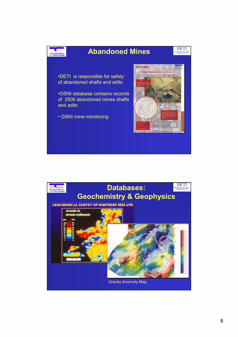
•DETI is responsible for safety
of abandoned shafts and adits
•GSNI database contains records
of 2500 abandoned mines shafts
and adits
• GSNI mine monitoring
Abandoned Mines
Databases:
Geochemistry & Geophysics
Gravity Anomoly Map

77
13
Geological information can help prevent poor planning decisions
Photograph © Rivers Agency & Esler Crawford
GSNI’s Role in the Planning
Process
14
•The Planning Service is an Executive Agency of the
Department of the Environment (NI)
•The Department of the Environment’s aims to:
“ …….improve the quality of life for people in
Northern Ireland through the promotion of
sustainable development activities in all the activities
of government and wider society”(Planning Service Corporate Plan 2003/04)
The Planning Service
88
15
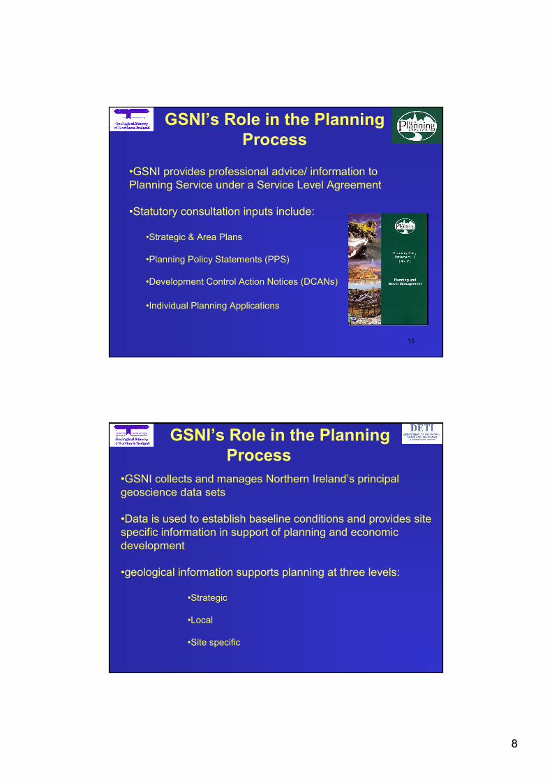
GSNI’s Role in the Planning
Process
•GSNI provides professional advice/ information to
Planning Service under a Service Level Agreement
•Statutory consultation inputs include:
•Strategic & Area Plans
•Planning Policy Statements (PPS)
•Development Control Action Notices (DCANs)
•Individual Planning Applications
•GSNI collects and manages Northern Ireland’s principal
geoscience data sets
•Data is used to establish baseline conditions and provides site
specific information in support of planning and economic
development
•geological information supports planning at three levels:
•Strategic
•Local
•Site specific
GSNI’s Role in the Planning
Process

99
Planning Support: Strategic
• developing & implementing
policy:•minerals
•waste management
•water protection
•planning national infrastructure
Photogr aph S. Booth, BGS ©NERC
•local land use zoning
•protection of specific resources
•site selection for developers
Planning Support: Local
© Crown Copyright
1010
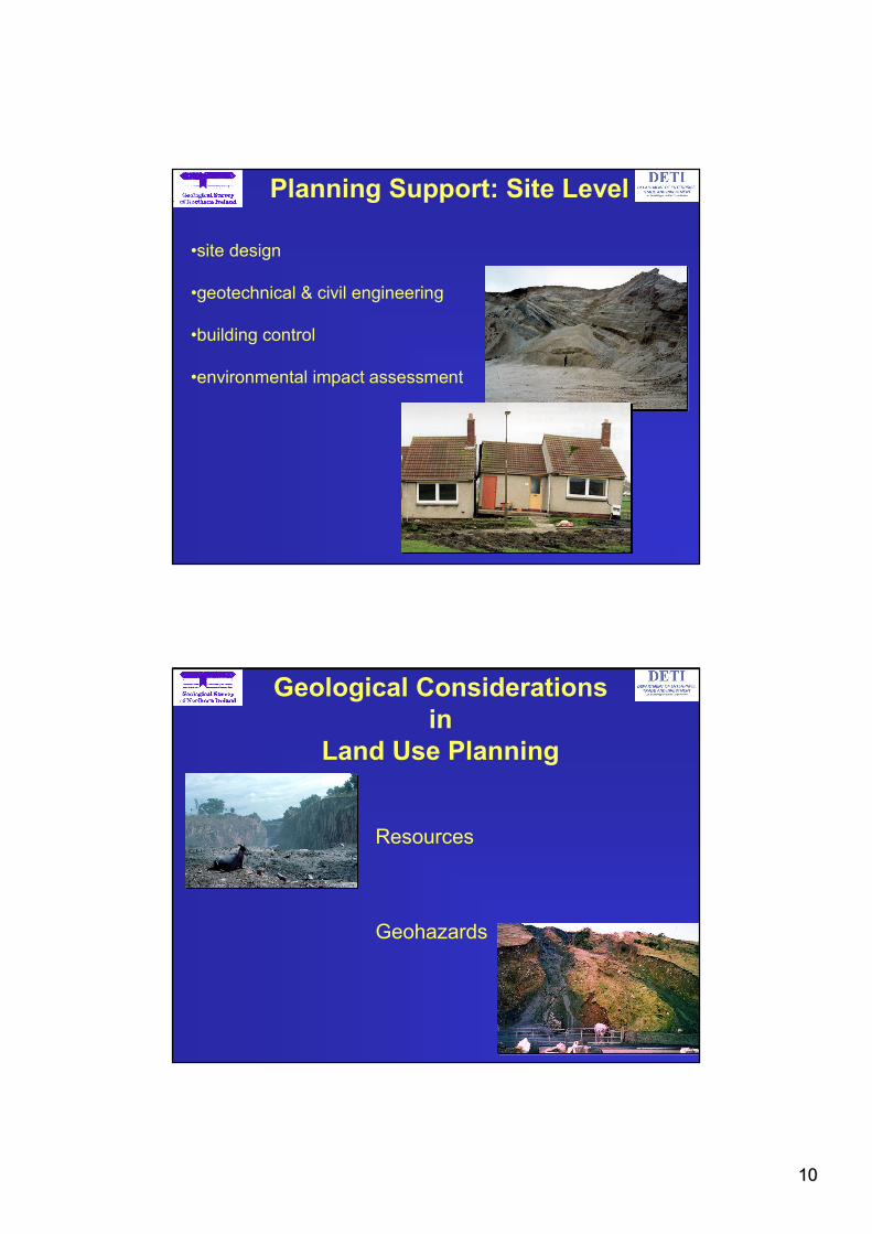
•site design
•geotechnical & civil engineering
•building control
•environmental impact assessment
Planning Support: Site Level
Photograph F. MacTaggart BGS © NERC
20
Geological Considerations
in
Land Use Planning
Resources
Geohazards

1111
21
Resources
• Planning Service, GSNI & DETI all have responsibility
for ensuring sustainable development
•Resources generally finite and important/essential to
the economic well-being of the country.
•Northern Ireland resources include:
minerals: aggregates, sand &
gravel, brick clays
MDA minerals; salt & gold?
•energy: lignite & petroleum?
•groundwater
•landscape
22
Resources:Sand & Gravel
•Resource information studies for
the Planning Service
(Special Studies Unit)
•In conjunction with Area Plans
•to identify resources and aid
planning of future development
of sand & gravel resources
© Crown Copyright
Sand & Gravel Resource Map, Limavady

1212
Lignite Policy Area:
Ballymena & Larne Area Plan 2016
Resources: Lignite
Lignite Trial Pit, Crumlin
Protecting lignite deposits at Ballymoney & Crumlin, Co Antrim
© Crown Copyright
Resources: Landscape
•Promoting landscape for
Geotourism and recreation
•Joint GSNI - GSI Projects with
local Councils
•Funding from EU,IFI, local
Councils
•Developing the “Landscapes
from Stone” brand
•Marble Arch-Cuilcagh
(European Geopark)
•Breifne Mountain Park
1313
25
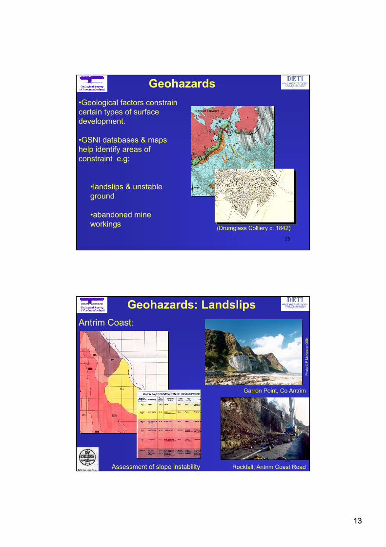
Geohazards
•Geological factors constrain
certain types of surface
development.
•GSNI databases & maps
help identify areas of
constraint e.g:
•landslips & unstable
ground
•abandoned mine
workings(Drumglass Colliery c. 1842)
© Crown Copyright
26
Geohazards: Landslips
Garron Point, Co Antrim
Photo ©P McKeever GSNI
Rockfall, Antrim Coast Road
Photo ©M Cooper GSNI
Antrim Coast:
Assessment of slope instability

1414
27
Geohazards: Legacy Mining
Salt Miners c.1920
•Northern Ireland’s mining legacy
extends back to the 17th Century
•coal, lead, salt, iron ore, bauxite
• over 2500 abandoned mines shafts
and adits recorded in database
•GSNI advise local developers and
planners & building control officers
Drumglass Colliery, Dungannon
28Maidenmount Mine 2001
Geohazards: Mine Collapses
Photo ©Phoenix Gas
Collapse of salt mine at Carrickfergus, Co Antrim
August 2001
July 2002

1515
29
Geohazards: Radon
Radon is related to bedrock and superficial geology
© Crown Copyright
© Crown Copyright
The Geology of Londonderry with parts
of Tyrone and Fermanagh
Maj.-Gen. J.E. Portlock
(1843)
Part of the Geological Map of Northern
© Crown Copyright 1997
Communicating Geoscience
Information
Maps remain principal medium for communicating geological data
Sir Richard Griffith (1784 -
1878)
© Crown Copyright

1616
GIS & DiGMapNI
•Geographic Information Systems (GIS) are used to manage data
•GIS will help meet increasing demand for site reports etc
•GIS requires maps and data to be in digital form
•GSNI currently working on the digital geological map of Northern Ireland
Phase 1 (completed)1:250k scale cover for Northern Ireland :
Solid Geology, Quaternary Geology, Hydrogeology, Groundwater Vulnerability
Phase 2 (completion Dec 2003)1:50k scale digital versions of the published geological maps
Phase 3 (2004 - )Seamless 1:50k scale geological coverage for Northern Ireland
•Future 3 & 4-d modelling and visualisation of geoscience and related datasets
GeoHazarD Project
•BGS Project to produce a national data set
covering geological hazards at 1:50k scale
•To help identify potential geologically related
hazards
•Data sets include:
•radon prone areas
•shrinking clay deposits
•landslides
•mining hazards
•borehole logs
•historical Ordnance Survey maps
•GeoHazarD will form the basis for a
comprehensive and efficient
internet based enquiry service.
1717
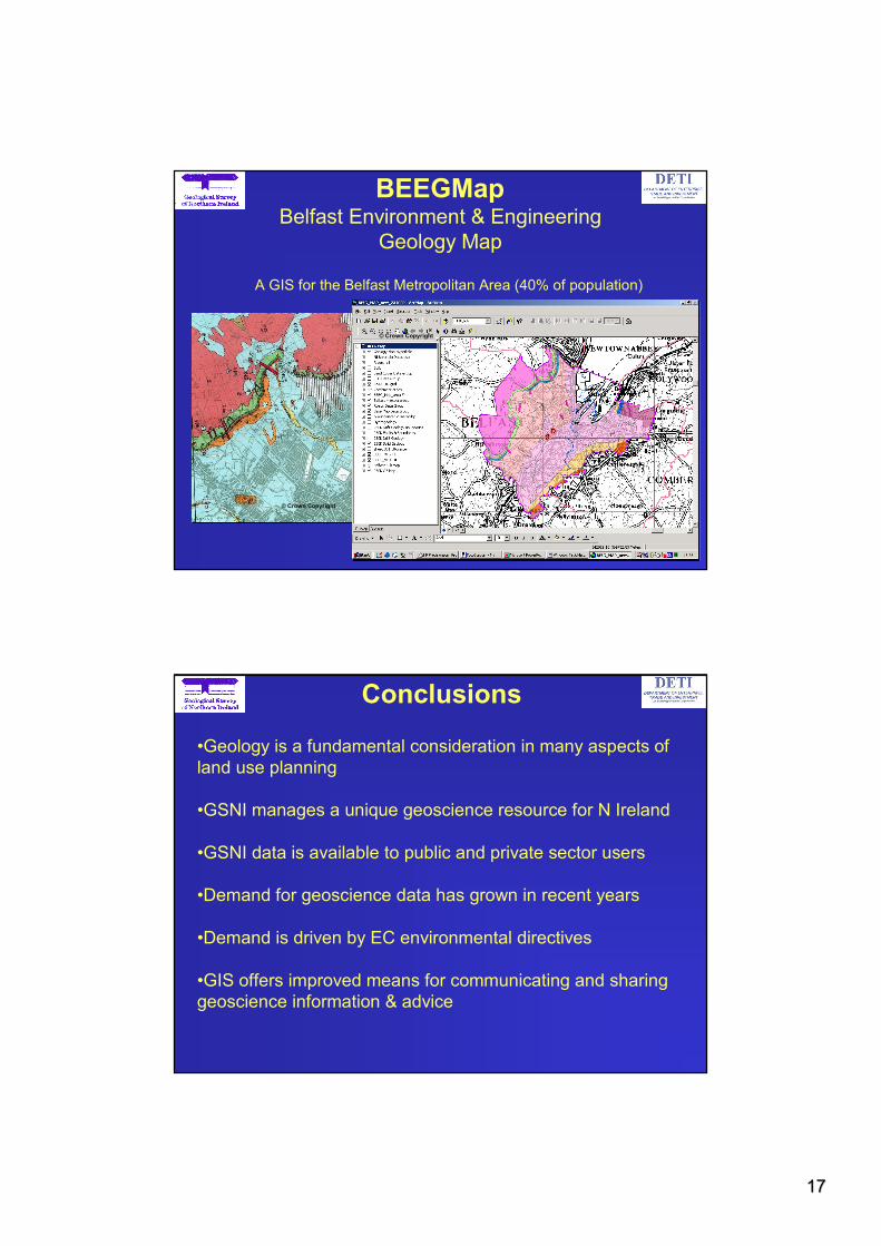
BEEGMapBelfast Environment & Engineering
Geology Map
A GIS for the Belfast Metropolitan Area (40% of population)
© Crown Copyright
© Crown Copyright
© Crown Copyright
Conclusions
•Geology is a fundamental consideration in many aspects of
land use planning
•GSNI manages a unique geoscience resource for N Ireland
•GSNI data is available to public and private sector users
•Demand for geoscience data has grown in recent years
•Demand is driven by EC environmental directives
•GIS offers improved means for communicating and sharing
geoscience information & advice

1818
20 College Gardens
BELFAST
BT9 6BS
N Ireland
Tel: 028 9066-6595
Fax 028 9066-2835
e-mail: [email protected]
Web: www.bgs.ac.uk/gsni
Where to find us