theodore roosevelt lake 2013 sedimentation survey. department of the interior bureau of reclamation...
TRANSCRIPT

U.S. Department of the Interior Bureau of Reclamation Technical Service Center Denver, Colorado January 2014
Technical Report No. SRH-2014-08
Theodore Roosevelt Lake 2013 Sedimentation Survey

U.S. Department of the Interior Bureau of Reclamation Technical Service Center Water and Environmental Resources Division Sedimentation and River Hydraulics Group Denver, Colorado January 2014
Technical Report No. SRH-2014-08 Theodore Roosevelt Lake 2013 Sedimentation Survey
prepared by
Ronald L. Ferrari

ACKNOWLEDGMENTS
The Bureau of Reclamation's (Reclamation) Sedimentation and River Hydraulics
(Sedimentation) Group of the Technical Service Center (TSC) prepared and published
this report for the Salt River Project (SRP). Kent Collins and Ron Ferrari of the
Sedimentation Group conducted the bathymetric survey in May 2013. Ron Ferrari
completed the data processing to generate the 2013 topography and area-capacity values
presented in this report. Kent Collins of the Sedimentation Group performed the
technical peer review of this document.
Mission Statements
The U. S. Department of the Interior protects America’s natural
resources and heritage, honors our cultures and tribal communities,
and supplies the energy to power our future.
The mission of the Bureau of Reclamation is to manage, develop,
and protect water and related resources in an environmentally and
economically sound manner in the interest of the American public.
Reclamation Report
This report was produced by the Bureau of Reclamation’s Sedimentation and
River Hydraulics Group (Mail Code 86-68240), PO Box 25007, Denver,
Colorado 80225-0007, www.usbr.gov/pmts/sediment/.
Disclaimer No warranty is expressed or implied regarding the usefulness or completeness of
the information contained in this report. References to commercial products do
not imply endorsement by the Bureau of Reclamation and may not be used for
advertising or promotional purposes.

REPORT DOCUMENTATION PAGE Form Approved OMB No. 0704-0188
The public reporting burden for this collection of information is estimated to average 1 hour per response, including the time for reviewing instructions, searching existing data sources,
gathering and maintaining the data needed, and completing and reviewing the collection of information. Send comments regarding this burden estimate or any other aspect of this
collection of information, including suggestions for reducing the burden, to Department of Defense, Washington Headquarters Services, Directorate for Information Operations and
Reports (0704-0188), 1215 Jefferson Davis Highway, Suite 1204, Arlington, VA 22202-4302. Respondents should be aware that notwithstanding any other provision of law, no
person shall be subject to any penalty for failing to comply with a collection of information if it does not display a currently valid OMB control number.
PLEASE DO NOT RETURN YOUR FORM TO THE ABOVE ADDRESS. 1. REPORT DATE (DD-MM-YYYY)
January 2014 2. REPORT TYPE
3. DATES COVERED (From – To)
4. TITLE AND SUBTITLE
Theodore Roosevelt Lake
2013 Sedimentation Survey
5a. CONTRACT NUMBER
5b. GRANT NUMBER
5c. PROGRAM ELEMENT NUMBER
6. AUTHOR(S)
Ronald L. Ferrari
5d. PROJECT NUMBER
5e. TASK NUMBER
5f. WORK UNIT NUMBER
7. PERFORMING ORGANIZATION NAME(S) AND ADDRESS(ES)
Bureau of Reclamation, Technical Service Center, Denver, CO 80225
8. PERFORMING ORGANIZATION REPORT NUMBER
9. SPONSORING/MONITORING AGENCY NAME(S) AND ADDRESS(ES) Bureau of Reclamation, Denver Federal Center, PO Box 25007
Denver, CO 80225-0007
10. SPONSOR/MONITOR'S ACRONYM(S)
11. SPONSOR/MONITOR'S REPORT NUMBER(S)
12. DISTRIBUTION/AVAILABILITY STATEMENT
13. SUPPLEMENTARY NOTES 14. ABSTRACT
Reclamation surveyed Theodore Roosevelt Lake in May of 2013 to develop updated reservoir topography and compute present
storage-elevation relationships (area-capacity tables). The bathymetric survey was conducted near water surface elevation
2,109.7 feet tied to the National Geodetic Vertical Datum of 1929 (NGVD29) that is about 2.0 feet lower than the North
American Vertical Datum of 1988 (NAVD88). The survey used sonic depth recording equipment interfaced with a real-time
kinematic (RTK) global positioning system (GPS) that provided sounding positions throughout the underwater portion of the
reservoir covered by the survey vessel. The above-water topography was developed from 5-foot aerial photography collected for
the 1995 survey and January 2012 LiDAR that covered the upper reservoir areas in Tonto Creek and Salt River. The developed
reservoir topography was tied to NAVD88. The resulting elevations versus area and capacity values were shifted down 2.0 feet
to NGVD29 to match the reservoir’s operation vertical datum.
As of May 2013, at active conservation use elevation 2,151.0, the reservoir surface area was 21,383 acres with a capacity of
1,636,254 acre-feet. Since April 1995, a total capacity change of 16,789 acre-feet below elevation 2,251.0 was measured
resulting in 1.0 percent loss in reservoir capacity and an annual loss of 927.6 acre-feet since 1995. The capacity change is due to
sediment deposition and methodology differences between the surveys. The 1995 and 2013 surveys were the first detailed
surveys since the major dam modifications began in 1989 and were completed in 1996. A previous survey result, such as the
1981 survey before dam modification, may provide a better annual estimate of loss due to sediment. The 1981 survey measured
an average annual capacity loss of 2,676 acre-feet since May 1909 dam closure. 15. SUBJECT TERMS reservoir area and capacity/ sedimentation/ reservoir surveys/ global positioning system/ sounders/ contour
area/ RTK GPS/ multibeam sounders 16. SECURITY CLASSIFICATION OF: 17. LIMITATION
OF ABSTRACT 18. NUMBER OF PAGES
19a. NAME OF RESPONSIBLE PERSON
a. REPORT
b. ABSTRACT a. THIS PAGE 19b. TELEPHONE NUMBER (Include area code)
Standard Form 298 (Rev. 8/98) Prescribed by ANSI Std. Z39.18

BUREAU OF RECLAMATION
Technical Service Center, Denver, Colorado Sedimentation and River Hydraulics Group, 86-68240
Technical Report No. SRH-2014-08
Theodore Roosevelt Lake 2013 Sedimentation Survey
Theodore Roosevelt Dam
Arizona
‘71c )
Date
Prepared: Ronald L. Ferrari Hydraulic Engineer, Sedimentation and River Hydraulics Group 86-68240
Pe -r Reviev: Kent Collins, RE Date Hydraulic Engineer, Sedimentation and River Hydraulics Group 86-68240

Table of Contents Page
Introduction ...................................................................................................................................... 1
Previous Surveys .............................................................................................................................. 3
Original ..................................................................................................................................... 3
1981 Survey .............................................................................................................................. 3
1995 Survey .............................................................................................................................. 3
Control Survey Data Information ..................................................................................................... 4
Reservoir Operations ........................................................................................................................ 7
Hydrographic Survey, Equipment, and Method of Collection ......................................................... 8
Bathymetric Survey Equipment ................................................................................................ 8
1995 Aerial Contours .............................................................................................................. 11
2012 LiDAR ............................................................................................................................ 12
Reservoir Area and Capacity .......................................................................................................... 33
Topography Development ....................................................................................................... 33
2013 Roosevelt Lake Surface Area Methods .......................................................................... 56
2013 Roosevelt Lake Storage Capacity Methods .................................................................... 56
Roosevelt Lake Surface Area and Capacity Results ............................................................... 57
Longitudinal Distribution ............................................................................................................... 57
2013 Roosevelt Lake Analyze ........................................................................................................ 65
Summary and Conclusions ............................................................................................................. 67
References ...................................................................................................................................... 69
Index of Figures Figure 1 - SRP reservoirs located downstream of Roosevelt Lake. ................................................. 1
Figure 2 - Downstream view of Roosevelt Dam and right abutment spillway. ................................ 2
Figure 3 – “Rose 1” control point used as base for the 2013 hydrographic survey. ......................... 5
Figure 4 - Temporary monument labeled "Rose 1," looking east. .................................................... 5
Figure 5 - Theodore Roosevelt Lake 2013 control points. ............................................................... 6
Figure 6 - Large survey vessel with mounted instrumentation for mapping upstream of Grand
Coulee Dam on Franklin D. Roosevelt Reservoir, Washington. ............................................ 8
Figure 7 - 1995 and 2013 data points, Roosevelt Lake. ................................................................. 10
Figure 8 - 1995 and 2013 Roosevelt Lake 5-foot contours. ........................................................... 10
Figure 9 - Reservoir areas covered by the January 2012 LiDAR. .................................................. 13
Figure 10 - Theodore Roosevelt Lake data sets, 1 of 19, NAVD88. .............................................. 14
Figure 11 - Theodore Roosevelt Lake data sets, 2 of 19, NAVD88. .............................................. 15
Figure 12 - Theodore Roosevelt Lake data sets, 3 of 19, NAVD88. .............................................. 16
Figure 13 - Theodore Roosevelt Lake data sets, 4 of 19, NAVD88. .............................................. 17
Figure 14 - Theodore Roosevelt Lake data sets, 5 of 19, NAVD88. .............................................. 18
Figure 15 - Theodore Roosevelt Lake data sets, 6 of 19, NAVD88. .............................................. 19
Figure 16 - Theodore Roosevelt Lake data sets, 7 of 19, NAVD88. .............................................. 20
Figure 17 - Theodore Roosevelt Lake data sets, 8 of 19, NAVD88. .............................................. 21
Figure 18 - Theodore Roosevelt Lake data sets, 9 of 19, NAVD88. .............................................. 22
Figure 19 - Theodore Roosevelt Lake data sets, 10 of 19, NAVD88. ............................................ 23
Figure 20 - Theodore Roosevelt Lake data sets, 11 of 19, NAVD88. ............................................ 24
Figure 21 - Theodore Roosevelt Lake data sets, 12 of 19, NAVD88. ............................................ 25
Figure 22 - Theodore Roosevelt Lake data sets, 13 of 19, NAVD88. ............................................ 26
Figure 23 - Theodore Roosevelt Lake data sets, 14 of 19, NAVD88. ............................................ 27
Figure 24 - Theodore Roosevelt Lake data sets, 15 of 19, NAVD88. ............................................ 28
Figure 25 - Theodore Roosevelt Lake data sets, 16 of 19, NAVD88. ............................................ 29
Figure 26 - Theodore Roosevelt Lake data sets, 17 of 19, NAVD88. ............................................ 30
Figure 27 - Theodore Roosevelt Lake data sets, 18 of 19, NAVD88. ............................................ 31

7
Figure 28 - Theodore Roosevelt Lake data sets, 19 of 19, NAVD88. ............................................ 32
Figure 29 - Theodore Roosevelt Dam and reservoir developed TIN, 1 of 3, (NAVD88). ............. 34
Figure 30 - Theodore Roosevelt Lake developed TIN, 2 of 3, (NAVD88). ................................... 35
Figure 31 - Theodore Roosevelt Lake developed TIN, 3 of 3, (NAVD88). ................................... 36
Figure 32 - 2013 Theodore Roosevelt Lake 5-foot contours, 1 of 19 (NAVD88).......................... 37
Figure 33 - 2013 Theodore Roosevelt Lake 5-foot contours, 2 of 19 (NAVD88).......................... 38
Figure 34 - 2013 Theodore Roosevelt Lake 5-foot contours, 3 of 19 (NAVD88).......................... 39
Figure 35 - 2013 Theodore Roosevelt Lake 5-foot contours, 4 of 19 (NAVD88).......................... 40
Figure 36 - 2013 Theodore Roosevelt Lake 5-foot contours, 5 of 19 (NAVD88).......................... 41
Figure 37 - 2013 Theodore Roosevelt Lake 5-foot contours, 6 of 19 (NAVD88).......................... 42
Figure 38 - 2013 Theodore Roosevelt Lake 5-foot contours, 7 of 19 (NAVD88).......................... 43
Figure 39 - 2013 Theodore Roosevelt Lake 5-foot contours, 8 of 19 (NAVD88).......................... 44
Figure 40 - 2013 Theodore Roosevelt Lake 5-foot contours, 9 of 19 (NAVD88).......................... 45
Figure 41 - 2013 Theodore Roosevelt Lake 5-foot contours, 10 of 19 (NAVD88)........................ 46
Figure 42 - 2013 Theodore Roosevelt Lake 5-foot contours, 11 of 19 (NAVD88)........................ 47
Figure 43 - 2013 Theodore Roosevelt Lake 5-foot contours, 12 of 19 (NAVD88)........................ 48
Figure 44 - 2013 Theodore Roosevelt Lake 5-foot contours, 13 of 19 (NAVD88)........................ 49
Figure 45 - 2013 Theodore Roosevelt Lake 5-foot contours, 14 of 19 (NAVD88)........................ 50
Figure 46 - 2013 Theodore Roosevelt Lake 5-foot contours, 15 of 19 (NAVD88)........................ 51
Figure 47 - 2013 Theodore Roosevelt Lake 5-foot contours, 16 of 19 (NAVD88)........................ 52
Figure 48 - 2013 Theodore Roosevelt Lake 5-foot contours, 17 of 19 (NAVD88)........................ 53
Figure 49 - 2013 Theodore Roosevelt Lake 5-foot contours, 18 of 19 (NAVD88)........................ 54
Figure 50 - 2013 Theodore Roosevelt Lake 5-foot contours, 19 of 19 (NAVD88)........................ 55
Figure 51 - Theodore Roosevelt Lake area and capacity plots. ...................................................... 62
Figure 52 - Longitudinal profile of the Tonto Creek from the dam upstream. ............................... 63
Figure 53 - Longitudinal profile of the Salt River from the dam upstream. ................................... 64
Index of Tables
Table 1 - Reservoir sediment data summary (page 1 of 2). ............................................................ 59 Table 2 - Theodore Roosevelt Lake 2013 survey summary. .......................................................... 61


1
Introduction
The original Theodore Roosevelt (Roosevelt) Lake and Dam, the first major
features developed by the Bureau of Reclamation (Reclamation), were
constructed between 1903 and 1911. The dam and reservoir, operated as part of
the Salt River Project (SRP), are located about 76 miles northeast of Phoenix and
30 miles northwest of Globe, Arizona (Figure 1). The original dam formed the
reservoir downstream of the Salt River and Tonto Creek confluence. The dam
was one of the last and highest thick-arch structures, measuring 280 feet high with
a crest length of 723 feet. Between 1989 and 1996 the dam was raised 77 feet
creating a concrete-gravity arch that increased the conservation storage capacity
20 percent, and for dam safety, added reservoir flood control space. In addition,
two new spillways and outlet works were constructed, the powerplant was
modified, and recreation facilities at Roosevelt Lake were improved. The dam
and reservoir, part of the SRP multipurpose project, controls floods, generates
power, and stores water. Additional project reservoirs located downstream
include Apache Lake behind Horse Mesa Dam, Canyon Lake behind Mormon
Flat Dam, and Saquaro Lake behind Stewart Mountain Dam (Figure 1).
Figure 1 - SRP reservoirs located downstream of Roosevelt Lake.

2
The dam and feature elevations are tied to NGVD29 that was confirmed by this
survey to be around 2.0 feet lower than NAVD88. This shift was determined by
comparing published elevations with measured reservoir water surface and top of
the dam elevations. Unless noted, all elevations in this report are tied to
NGVD29. The 2013 developed topography was tied to NAVD88 and elevations
of the surface area computations were shifted down 2.0 feet to match NGVD29,
the operation vertical datum. The concrete gravity arch dam, Figure 2, has the
following dimensions in feet (NGVD29):
Structural height1 316 Crest length 1,210
Crest elevation2 2,218.0 Top width 21.6
Figure 2 - Downstream view of Roosevelt Dam and right abutment spillway.
The spillways, located on each abutment of the dam, have four top-seal radial
gates with sill elevations 2,100.0 and a total maximum capacity of 150,000 cubic
feet per second (cfs). Modification of the outlet works increased their capacity, at
eighty percent open, to 10,840 cfs at water surface elevation 2,151.0.
1 Values for concrete dam section. The definition of such terms as “top width, “structural height,” etc. may
be found in manuals such as Reclamation’s Design of Small Dams and Guide for Preparation of Standing
Operating Procedures for Dams and Reservoirs, or ASCE’s Nomenclature for Hydraulics.
2 Elevations in feet. Unless noted, all elevations based on the project’s operation vertical datum (NGVD29)
that is 2.0 feet lower than NAVD88. The 2013 reservoir topography was tied to NAVD88. The elevation
versus surface area and capacity values were shifted down 2.0 feet to NGVD29 for operational purposes.

3
Previous Surveys
Original
The original topography of Theodore Roosevelt Lake was available as a hard
copy map, Drawing 25-P-48, dated 1915. It is assumed the topography was
developed using a plane table survey prior to dam closure. The developed 10-foot
contours were the measured original surface areas used to compute the reservoir
capacity (Bureau of Reclamation, 1996).
1981 Survey
Between 1914 and 1981 six surveys of varying degrees of accuracy were
conducted using the range line method for collection and analysis. The 1981
survey included collection of bottom data along 39 range lines that were laid out
to represent the entire reservoir prior to the raise of the original dam completed in
1909. The 1981 reservoir surface areas were computed by applying adjustment
factors to the original contour areas. The input data included the original and
1981 range line data along with the surface areas for the affected contour
elevations. Additional information on collection and analysis procedures are
outlined in Chapter 9 of the Erosion and Sedimentation Manual (Ferrari and
Collins, 2006). The 1981 survey and analysis estimated 193,765 acre-feet of total
sediment had accumulated in the reservoir, over the first 72.4 years of operation,
resulting in 12.7 percent of original loss of reservoir storage and an average
annual loss of 2,676 acre-feet (Bureau of Reclamation, 1982).
1995 Survey
The April 1995 bathymetric survey, conducted near water surface elevation 2,126,
was the first study that resulted in detailed contours of Roosevelt Lake since dam
closure in 1909 and since the raising of the dam 77 feet that began in 1989 and
was completed in 1996. Above water 5-foot contours were developed from aerial
photography obtained on October 28, 1994 near reservoir elevation 2,087.
Reclamation’s Phoenix Area Office conducted the photography interpretation that
provided 5-foot contour intervals from elevation 2,090.0 through 2,225.0. The
bathymetric survey was conducted using a single beam depth sounder interfaced
with GPS navigating along grid lines perpendicular to the original river
alignment, spaced 400 feet apart, covering the underwater portion of the reservoir.
Additional data was collected along the shore as the boat traversed between
transects resulting in 70,500 underwater coordinate points. The resulting 1995
topography and surface areas consisted of 5-foot contours from elevation 1,965
through 2,225.0.

4
The measured surface area was 31,853 acres with a total capacity of 3,432,408
acre-feet at top-of-dam elevation 2,218.0. Since initial filling in 1909 about
182,185 acre-feet capacity had been lost by 1995 below elevation 2,136.0, the
original active conservation capacity elevation prior to dam modification. The
1995 measured capacity loss was equivalent to an 11.9 percent lost and an annual
loss of 2,121 acre-feet per year. The 1995 survey developed detailed topography
with resulting reservoir area and capacity values, compared to the original less
detailed developed topography affecting the sediment computation accuracy. The
report summarizing the 1995 survey and the developed 5-foot developed contours
are available on the Sedimentation Groups web site (Bureau of Reclamation,
1996).
Control Survey Data Information
The 2013 survey established a temporary control point in an open area
overlooking the reservoir located within the fenced portion of the USDA Forest
Service visitor center, Figures 3 through 5. The point is an aluminum cap
stamped “ROSE 1” mounted on rebar driven into the ground, considered
temporary since located in an area that can be disturbed, and used as the base
during this survey. The National Geodetic Survey (NGS) survey marker
“Roosevelt 1946” was located, but was near a building that could cause a GPS
issue known as multipath, so was not used as the base.
The on-line positioning user service (OPUS) was used to establish horizontal and
vertical control on point “Rose 1”. OPUS is operated by the National Geodetic
Survey (NGS) and allows users to submit GPS data files that are processed with
known point data to determine positions relative to the national control network.
The horizontal control was established in Arizona state plane east coordinates tied
to the North American Datum of 1983 (NAD83) in International Feet. The
elevation was tied to NAVD88 (GEOID12A) in US Survey Feet (feet). The 2013
OPUS generated coordinates were used to measure position and the vertical
difference between NAVD88 (GEOID12A), the recorded water surface elevations
during the 2013 survey, and RTK GPS topo measurements on the dam. The water
surface measurements were collected during calm conditions between recorded
gage readings 2,109.84 and 2,109.91 (NGVD29). RTK GPS measurements on
“Roosevelt 1946” were compared to the NGS published coordinates, helping
confirm the computed coordinates for “ROSE 1”.

5
Figure 3 – “Rose 1” control point used as base for the 2013 hydrographic survey.
Figure 4 - Temporary monument labeled "Rose 1," looking east.

6
Figure 5 - Theodore Roosevelt Lake 2013 control points.
The 2013 survey confirmed the project features and water surface gage
measurements are tied to NGVD29. The 2013 survey obtained measurements on
top of dam and the water surface during calm conditions. The RTK GPS topo
measurements, tied to NAVD88 (GEOID12A), were found to be from 1.95 to
2.03 feet higher than the recorded water surface measurements and from 1.87 to
2.07 feet higher than the design drawing elevation of the modified dam. On
average, the RTK GPS elevation measurements (NAVD88) were around 2.0 feet
higher. For this area the NGS published difference between NAVD88 and
NGVD29 was around 2.0 feet. Following are the coordinates for the monuments
used during the May 2013 survey. The horizontal control was established in
Arizona state plane east coordinates, NAD83, International Feet, and elevations
tied to NAVD88 (GEOID12A) in US Survey Feet.
Rose 1 Roosevelt 1946 Roosevelt 1946
(OPUS Developed) (RTK GPS Measured) (NGS Published)
East 406,094.07 406,035.92 406,035.84
North 972,557.01 972,489.02 972,488.92
Elevation 2,222.73 2,333.09 2,232.99
7
Reservoir Operations
The reservoir is a multiuse facility for the SRP providing irrigation and municipal
water, flood control storage space, and wildlife and recreation benefits. The 2013
reservoir topography was developed with elevations tied to NAVD88. The
computed results were shifted downward 2.0 feet to match the operation vertical
datum of NGVD29. The 2013 total capacity at maximum design operation
elevation 2,218.0 was 3,410,897 acre-feet. The following values are from the
May 2013 capacity table:
1,219,903 acre-feet of surcharge between elevation 2,175.0 and 2,218.0
554,740 acre-feet of flood control between elevation 2,151.0 and 2,175.0.
1,619,228 acre-feet of active conservation between elevation 1,989.0 and 2,151.0
17,026 acre-feet of dead storage below elevation 1,989.0.
Roosevelt Lake receives the majority of its inflow from the Salt River and Tonto
Creek watersheds. The inflow and end-of-month stage records in Table 2 show
the annual fluctuation for water years 1996 through May 2013. The annual values
for the 1910 through 1995 operation period are available in the 1995 survey report
(Bureau of Reclamation, 1996). The average reservoir water inflow for operation
period 1996 through 2013 was 484,501 acre-feet. The average inflow for
operation period 1910 through 1995 was 752,279 acre-feet. The average annual
inflow since 1996 indicated a very dry period, but 2005, 2008, and 2010 showed
very high above average inflows resulting in the highest levels of the reservoir.
The table’s water levels show wild fluctuations of the reservoir since 1996 from a
maximum elevation of 2,152.1 in 2010 to a minimum elevation of 2,033.0 in
2002.

8
Hydrographic Survey, Equipment, and Method of Collection
Bathymetric Survey Equipment
The bathymetric survey equipment was mounted in the cabin of a 24-foot trihull
aluminum vessel equipped with twin in-board motors, Figure 6. The
hydrographic system included a GPS receiver with built-in radio, multibeam
depth sounder, helmsman display for navigation, computer, and hydrographic
system software for collecting the underwater data. An on-board generator and
batteries supplied power to all the boat equipment. The shore equipment included
a second GPS receiver with an external radio. The GPS receiver and antenna
were mounted on a survey tripod over a known datum point with a 12-volt battery
providing power for the shore unit.
Figure 6 - Large survey vessel with mounted instrumentation for mapping upstream of
Grand Coulee Dam on Franklin D. Roosevelt Reservoir, Washington.
The Sedimentation Group uses RTK GPS with the major benefit being precise
heights measured in real time to monitor water surface elevation changes and to
determine the vertical datum of the projects. The RTK GPS system employs two
9
receivers that track the same satellites simultaneously just like with differential
GPS. The basic outputs from a RTK receiver are precise 3-D coordinates in
latitude, longitude, and height with accuracies on the order of 2 centimeters
horizontally and 3 centimeters vertically. The output is on the GPS WGS-84
datum that the hydrographic collection software converted into Arizona’s state
plane east coordinates, NAD83 tied to International Feet, and elevations tied to
NAVD88 (GEOID12A), in US Survey Feet.
The Theodore Roosevelt Lake bathymetric survey was conducted from May 5
through May 11, 2013 near water surface elevation 2,109.7. The bathymetric
survey used multibeam depth recording equipment interfaced with RTK GPS that
measured the sounding locations within the reservoir covered by the survey
vessel. The survey system software continuously recorded reservoir depths and
horizontal coordinates as the survey boat moved along grid lines established to
cover the reservoir. The survey vessel's guidance system provided directions to
the boat operator to assist in maintaining a course along these predetermined
lines. Compared to the 1995 single beam data along the bank slopes of the
reservoir, the 2013 multibeam data allowed development of more accurate
topography and resulting surface area computations, Figures 7 and 8. Figure 7
shows the detailed xyz data points collected with the multibeam sounder
compared to the single beam data. Figure 8 shows the developed 5-foot contours
from each data set where the 1995 contours were jagged interpolated contours
between the range line data compared to more smooth contours developed from
the 2013 multibeam data. The 2013 data provided better detail and more accurate
information of the actual bottom below the water surface. Differences in the
detail between the methods used in 1995 and 2013 are partially responsible for the
computed differences between the surveys.
During the 2013 field collection the distances between the grid lines were
increased in the areas of the reservoir the bottom was relatively flat and overlap of
the profiles was not deemed necessary to develop accurate topography. In the
upper shallow reservoir areas the vessel maneuvered within the vegetation
openings where it was safe to obtain data. Large areas of thick vegetation and
shallow water in the upper reaches prevented access by the survey vessel. In the
surrounding areas that were accessible, there appeared to be no significant change
in the reservoir bottom and interpolation to develop contours would not affect the
accuracy. As each line was traversed, the multibeam depth and position data were
recorded on the laptop computer hard drive for subsequent processing, resulting in
point data at 5- and 10-foot grid spacing. The water surface elevations at the dam
from the SRP gage records, shifted upward 2.0 feet to NAVD88, and the RTK
GPS measurements, were used to convert the sonic depth measurements to lake
bottom elevations tied to NAVD88. The developed reservoir topography was tied
to NAVD88. The resulting elevation surface areas were shifted back down 2.0
feet to match the dam’s operation vertical datum, NGVD29.

10
Figure 7 - 1995 and 2013 data points, Roosevelt Lake.
Figure 8 - 1995 and 2013 Roosevelt Lake 5-foot contours.

11
The integrated multibeam hydrographic survey system consists of a single
transducer mounted on the center bow or forward portion of the boat. From the
single transducer, a fan array of narrow beams generates a detailed cross section
of bottom geometry as the survey vessel passes over the areas mapped. The
system transmits 80 separate 1½-degree slant beams resulting in a 120-degree
swath from the transducer. The 200 kHz high-resolution multibeam echo sounder
system measures the relative water depth across a wide swath perpendicular to the
vessel’s track that is about 3.5 times as wide as the water depth below the
transducer. The system is composed of several instruments all in constant
communication with a central on-board laptop computer. The components
include the RTK GPS for positioning; a motion reference unit to measure the
heave, pitch, and roll of the survey vessel; a gyro to measure the yaw or vessel
attitude; and a velocity meter to measure the speed of sound through the vertical
profile of the reservoir water. On Roosevelt Lake, the multibeam sounder was
calibrated by lowering a velocity meter that measured the sound velocity through
the reservoir water column. The individual depth soundings were adjusted by the
measured speed of sound which can vary with density, salinity, temperature,
turbidity, and other conditions. With proper calibration, the data processing
software utilizes all the incoming information to provide an accurate, detailed xyz
data set of the lake bottom.
The underwater collected data was processed using the same hydrographic system
software used during the data collection where all corrections such as vessel
location, roll, pitch, and yaw effects were applied. Other corrections included
applying the sound velocity through the reservoir water column and converting all
depth data points to elevations using the measured water surface elevation at the
time of collection (all tied to NAVD88). To reduce the time required for
topographic map processing, without compromising survey accuracy, the massive
amount of the multibeam data was filtered into 5- and 10-foot cells or grids in the
reservoir area surveyed by the multibeam system. The multibeam beam
soundings resulted in a detailed data set of around 4,072,100 xyz points
representing the reservoir below the water surface at the time of the data
collection. Additional information on general bathymetric data collection and
analysis procedures can be found in Engineering and Design: Hydrographic
Surveying (Corps of Engineers, January 2002) and Reservoir Survey and Data
Analysis (Ferrari and Collins, 2006). Figures 10 through 28 illustrate the 2013
bathymetric data profiles along with the 1995 aerial and 2012 LiDAR contours.
1995 Aerial Contours
For the 1995 reservoir survey, detailed above water contours were developed
from aerial photography obtained on October 28, 1994 near reservoir elevation
2,087. Reclamation’s Phoenix Area Office conducted the aerial photography
interpretation resulting in 5-foot contour intervals from elevation 2,225.0 and
below. For the 2013 analysis, the portion of the 1995 contours that were
overlapped by the 2012 LiDAR and 2013 bathymetric data were deleted during

12
the 2013 topographic development. The remaining 1995 contour lines were used
as breaklines. The elevations of these contours were shifted upward 2.0 feet to
NAVD88.
2012 LiDAR
The SRP provided LiDAR data of the upper Tonto Creek and Salt River arms of
Roosevelt Lake. The data was collected in January 2012 near reservoir elevation
2,124 (NAVD88) providing a bare earth surface of the above water areas from the
exposed deltas upstream for each upper arm of the reservoir, Figure 9. The bare
earth surfaces did not remove the building structures, but these areas are not
significant enough to affect the overall capacity computations for this study.
Also, portions of these structures would remain within the reservoir if inundated.
Figures 15 and 24 show the gaps between the 2012 LiDAR and 2013 bathymetric
data sets. The 1995 contours were modified and used to fill in these data gaps.
Using the 2012 and 2013 data elevations as a guide, the 1995 contours that
represented the inflow channels were adjusted to reflect changes since 1995. For
the Tonto Creek arm the LiDAR coverage was from elevation 2,124.0 (NAVD88)
and extended upstream above the maximum water surface elevation 2,218.0
(NGVD29). For the Salt River arm the LiDAR coverage was from elevation
2,124 (NAVD88) and extended upstream to where the reservoir narrows, ending
near elevation 2,182.0 (NAVD88). For the very upper portion of the Salt River
arm the 1995 contours were used to develop the 2013 reservoir topography with
no modifications.
The LiDAR was provided as raster files for each reach of the reservoir where 1-
foot contours were generated and used as hard breaklines for the 2013
topographic development. Editing removed contours above elevation 2,250.0
(NAVD88) and line segments of the contours that were less than 100 feet in
length. For the portion of the reservoir covered by the LiDAR, the 5-foot
contours from the 1995 study were deleted and not used. Figures 10 through 28
provide images of the data sources used to develop the 2013 topography.

13
Figure 9 - Reservoir areas covered by the January 2012 LiDAR.

14
Figure 10 - Theodore Roosevelt Lake data sets, 1 of 19, NAVD88.

15
Figure 11 - Theodore Roosevelt Lake data sets, 2 of 19, NAVD88.

16
Figure 12 - Theodore Roosevelt Lake data sets, 3 of 19, NAVD88.

17
Figure 13 - Theodore Roosevelt Lake data sets, 4 of 19, NAVD88.

18
Figure 14 - Theodore Roosevelt Lake data sets, 5 of 19, NAVD88.

19
Figure 15 - Theodore Roosevelt Lake data sets, 6 of 19, NAVD88.

20
Figure 16 - Theodore Roosevelt Lake data sets, 7 of 19, NAVD88.

21
Figure 17 - Theodore Roosevelt Lake data sets, 8 of 19, NAVD88.

22
Figure 18 - Theodore Roosevelt Lake data sets, 9 of 19, NAVD88.

23
Figure 19 - Theodore Roosevelt Lake data sets, 10 of 19, NAVD88.

24
Figure 20 - Theodore Roosevelt Lake data sets, 11 of 19, NAVD88.

25
Figure 21 - Theodore Roosevelt Lake data sets, 12 of 19, NAVD88.

26
Figure 22 - Theodore Roosevelt Lake data sets, 13 of 19, NAVD88.

27
Figure 23 - Theodore Roosevelt Lake data sets, 14 of 19, NAVD88.

28
Figure 24 - Theodore Roosevelt Lake data sets, 15 of 19, NAVD88.

29
Figure 25 - Theodore Roosevelt Lake data sets, 16 of 19, NAVD88.

30
Figure 26 - Theodore Roosevelt Lake data sets, 17 of 19, NAVD88.

31
Figure 27 - Theodore Roosevelt Lake data sets, 18 of 19, NAVD88.

32
Figure 28 - Theodore Roosevelt Lake data sets, 19 of 19, NAVD88.

33
Reservoir Area and Capacity
Topography Development
The 2013 Theodore Roosevelt Lake topographic contours were generated from
several data sources including the 2013 bathymetric survey, 2012 LiDAR, and
1995 developed 5-foot contours. The LiDAR was provided as raster files and
covered the upper reaches of Tonto Creek and the Salt River. To obtain the
necessary detail in a workable format, 1-foot contours were developed from the
raster coverages and used as breaklines during the topographic development. The
areas of the 1995 data overlapped by the 2013 bathymetric and 2012 LiDAR data
were removed or erased using ArcGIS tools. The 2012 LiDAR and 2013
bathymetry did not overlap within the reservoir boundary. The remaining 1995
contour lines, with some modifications, were used as breaklines during the
topographic development. The 2013 Roosevelt Lake topography elevations were
tied to NAVD88 (GEOID12A).
The data coverages were processed into a triangulated irregular network (TIN),
Figures 29 through 31, that was used to develop 2- and 5-foot contours, surface
areas, and volumes referenced to NAVD88 (GEOID12A). In preparation for
developing the TIN, a polygon was created to enclose the data sets allowing
contour development of the reservoir study area along the dam alignment and
providing a boundary for computing the reservoir surface areas and resulting
volumes. The polygon, not assigned an elevation, was used as a hard boundary to
represent the reservoir, preventing development of the 2013 TIN and contours
outside of the hardclip.
A TIN is a set of adjacent non-overlapping triangles computed from irregularly
spaced points with x,y coordinates and z elevation values. A TIN is designed to
deal with continuous data such as elevations. ArcGIS uses a method known as
Delaunay's criteria for triangulation where triangles are formed among all data
points within the polygon clip. The method requires that a circle drawn through
the three nodes of a triangle will contain no other point, meaning that all the data
points are connected to their nearest neighbors to form triangles, preserving all the
data points. The TIN method is described in more detail in the ArcGIS user’s
documentation (ESRI, 2012).
The linear interpolation option of the ArcGIS TIN and CONTOUR commands was
used to interpolate contours from the Roosevelt Lake TIN. The surface areas of
the enclosed contour polygons at 2- and 5-foot increments were computed for
elevation 1,967.0 through 2,227.0 (NAVD88). The minimum or zero surface area
of the reservoir was elevation 1,965.0 (NGVD29). The reservoir contour
topography at 5-foot intervals are presented in Figures 32 through 50 from
elevation 1,970.0 through elevation 2,225.0 (NAVD88).

34
Figure 29 - Theodore Roosevelt Dam and reservoir developed TIN, 1 of 3, (NAVD88).

35
Figure 30 - Theodore Roosevelt Lake developed TIN, 2 of 3, (NAVD88).

36
Figure 31 - Theodore Roosevelt Lake developed TIN, 3 of 3, (NAVD88).

37
Figure 32 - 2013 Theodore Roosevelt Lake 5-foot contours, 1 of 19 (NAVD88).

38
Figure 33 - 2013 Theodore Roosevelt Lake 5-foot contours, 2 of 19 (NAVD88).

39
Figure 34 - 2013 Theodore Roosevelt Lake 5-foot contours, 3 of 19 (NAVD88).

40
Figure 35 - 2013 Theodore Roosevelt Lake 5-foot contours, 4 of 19 (NAVD88).

41
Figure 36 - 2013 Theodore Roosevelt Lake 5-foot contours, 5 of 19 (NAVD88).

42
Figure 37 - 2013 Theodore Roosevelt Lake 5-foot contours, 6 of 19 (NAVD88).

43
Figure 38 - 2013 Theodore Roosevelt Lake 5-foot contours, 7 of 19 (NAVD88).

44
Figure 39 - 2013 Theodore Roosevelt Lake 5-foot contours, 8 of 19 (NAVD88).

45
Figure 40 - 2013 Theodore Roosevelt Lake 5-foot contours, 9 of 19 (NAVD88).

46
Figure 41 - 2013 Theodore Roosevelt Lake 5-foot contours, 10 of 19 (NAVD88).

47
Figure 42 - 2013 Theodore Roosevelt Lake 5-foot contours, 11 of 19 (NAVD88).

48
Figure 43 - 2013 Theodore Roosevelt Lake 5-foot contours, 12 of 19 (NAVD88).

49
Figure 44 - 2013 Theodore Roosevelt Lake 5-foot contours, 13 of 19 (NAVD88).

50
Figure 45 - 2013 Theodore Roosevelt Lake 5-foot contours, 14 of 19 (NAVD88).

51
Figure 46 - 2013 Theodore Roosevelt Lake 5-foot contours, 15 of 19 (NAVD88).

52
Figure 47 - 2013 Theodore Roosevelt Lake 5-foot contours, 16 of 19 (NAVD88).

53
Figure 48 - 2013 Theodore Roosevelt Lake 5-foot contours, 17 of 19 (NAVD88).

54
Figure 49 - 2013 Theodore Roosevelt Lake 5-foot contours, 18 of 19 (NAVD88).

55
Figure 50 - 2013 Theodore Roosevelt Lake 5-foot contours, 19 of 19 (NAVD88).
56
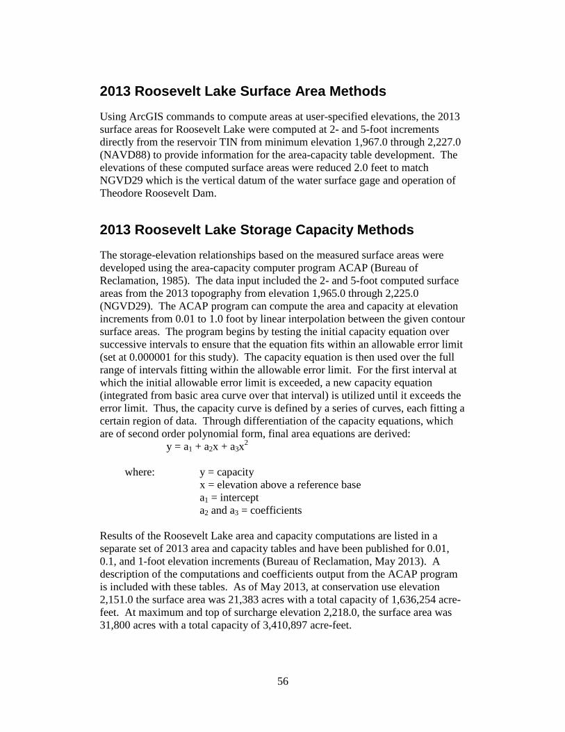
2013 Roosevelt Lake Surface Area Methods
Using ArcGIS commands to compute areas at user-specified elevations, the 2013
surface areas for Roosevelt Lake were computed at 2- and 5-foot increments
directly from the reservoir TIN from minimum elevation 1,967.0 through 2,227.0
(NAVD88) to provide information for the area-capacity table development. The
elevations of these computed surface areas were reduced 2.0 feet to match
NGVD29 which is the vertical datum of the water surface gage and operation of
Theodore Roosevelt Dam.
2013 Roosevelt Lake Storage Capacity Methods
The storage-elevation relationships based on the measured surface areas were
developed using the area-capacity computer program ACAP (Bureau of
Reclamation, 1985). The data input included the 2- and 5-foot computed surface
areas from the 2013 topography from elevation 1,965.0 through 2,225.0
(NGVD29). The ACAP program can compute the area and capacity at elevation
increments from 0.01 to 1.0 foot by linear interpolation between the given contour
surface areas. The program begins by testing the initial capacity equation over
successive intervals to ensure that the equation fits within an allowable error limit
(set at 0.000001 for this study). The capacity equation is then used over the full
range of intervals fitting within the allowable error limit. For the first interval at
which the initial allowable error limit is exceeded, a new capacity equation
(integrated from basic area curve over that interval) is utilized until it exceeds the
error limit. Thus, the capacity curve is defined by a series of curves, each fitting a
certain region of data. Through differentiation of the capacity equations, which
are of second order polynomial form, final area equations are derived:
y = a1 + a2x + a3x2
where: y = capacity
x = elevation above a reference base
a1 = intercept
a2 and a3 = coefficients
Results of the Roosevelt Lake area and capacity computations are listed in a
separate set of 2013 area and capacity tables and have been published for 0.01,
0.1, and 1-foot elevation increments (Bureau of Reclamation, May 2013). A
description of the computations and coefficients output from the ACAP program
is included with these tables. As of May 2013, at conservation use elevation
2,151.0 the surface area was 21,383 acres with a total capacity of 1,636,254 acre-
feet. At maximum and top of surcharge elevation 2,218.0, the surface area was
31,800 acres with a total capacity of 3,410,897 acre-feet.

57
Roosevelt Lake Surface Area and Capacity Results
This section provides 2013 surface area and capacity results for Roosevelt Lake
and changes over time. Table 1 provides a summary of the Roosevelt Lake
between the time of the original dam closure in May 1909, the resurveys of 1981
and 1995, and the May 2013 hydrographic survey. The 1981 survey was the last
survey prior to the modification of the dam that was completed in 1996. The
1995 survey was the first survey since the dam modification began and the first
ever detailed survey of the reservoir topography with the collection of above
water aerial data. The 1995 results were used by this study as the base for
measuring change over time. The 2013 survey collected more detailed
underwater data than the 1995 survey and as a result, the measured changes in
2013 are due to sediment deposition and data density differences between the
surveys. The area and capacity curves for the 1995 and 2013 surveys are plotted
on Figure 51 showing relatively minimal changes except between elevation 2,110
and 2,130 (NAVD88). Table 2 provides a summary of the survey’s computed
surface area and capacity values along with the changes due to sediment
accumulation and methodological differences. As stated previously, the area and
capacity values are tied to the vertical datum NGVD29 that is 2.0 feet lower than
NAVD88 (GEOID12A). The 2013 bathymetric survey and the data sources
summarized in the previous sections provided sufficient information for
computing the surface areas from elevation 1,965.0 through 2,225.0.
Reclamation’s ACAP program was used to compute the area and capacity values
from the 2- and 5-foot elevation input surface areas.
Longitudinal Distribution
To illustrate the bottom topography along the length of the reservoir Tonto Creek
and Salt River thalwegs were plotted from the dam upstream to the upper reach of
the reservoir, Figures 52 and 53. The plots started at the dam using the 1995
developed contours to determine the alignment of the thalweg for both reaches.
The elevations of the 1995 contours were shifted up 2.0 feet to match NAVD88
and the 2013 developed contours. The longitudinal profiles were developed by
cutting alignments through the 1995 and 2013 contours resulting in distance
versus elevation profiles. The profiles show the sediment accumulation that has
occurred since the 1995 survey, the inlet sill level of the outlet works at elevation
1,991.0 (NAVD88), and measured top of sediment deposition starting at the dam,
elevation 1,965. The Tonto Creek plot showed sediment accumulation near the
dam and small delta formations near elevation 2,095 (NAVD88) and 2,135
(NAVD88). The Salt River profile showed sediment deposition near the dam
along with delta formations near elevations 2,050; 2,090; and 2,110. Overall the
plots showed only a small accumulation of sediment starting at the lower
elevations from the dam through the main reservoir body. In the upper reaches,
the Tonto Creek profile showed only a small amount of deposition while Salt

58
River showed a much larger accumulation of sediment. The general conclusion is
that since 1995 the Salt River drainage area has contributed the largest percentage
of the reservoir sediment.

59
Table 1 - Reservoir sediment data summary (page 1 of 2).
1.
2. Salt River and Tonto Creek 3. STATE: Arizona
4. 5. Globe 6. COUNTY: Gila
7. ° 33 ' 13 " ° 26 ' 33 " 8.1
9. S P ILLW AY CRES T EL.2
10. 11. 12. GROSS STORAGE 15.
CAPACITY, AC-FT
a.3
b.
c.
d. 16.
e.
f.
g.
17. LENGTH OF RESERVOIR4
18.5
22.5
INCHES
19. NET S EDIMENT CONTRIBUTING AREA5
23. MEAN ANNUAL RUNOFF6
INCHES
20. LENGTH MILES AVG. W IDTH MILES 24. MEAN ANNUAL RUNOFF 6
ACRE-FEET
21. 25. °F °F 5
26. DATE OF 27. 28. 29. 30. 31.
26. DATE OF 35. 36.
6
6
26. DATE OF 37. 38.
26. DATE OF 39. AVG. DRY WT. 40. SED. DEP. TONS/MI.2-YR 41. STORAGE LOSS, PCT. 42.SEDIMENT
(#/FT3) b. TOTAL b. TOTAL TO INFLOW, PPM
TO DATE DATE a. PER. b. TOT.
C/I
21,383
2,744,900
Contour
38MIN. ELEVATION
726,678
RANGE
c. TOTALMAX. ANN.
717,131
14,496,790
50,199,184
TYPE OF
SURVEY
39
Contour (D)
b.
NAME OF RESERVOIR1
I
14.
BEGAN
DATE NORMAL
5/1909
OPERATIONS1,653,043
18,652
1,989.0
DATA SHEET NO.
DATE
STORAGE
2,218.0
V
13.
RESERVOIR SEDIMENT
DATA SUMMARY
2,100.0
ACRE-FEET
Theodore Roosevelt Reservoir
LONGM
STREAM:
NEAREST P.O.
D
A 4 N RANGETWP.
TOP OF DAM ELEVATION:
Salt River Project
12 E
SURFACE AREA, ACRES
ELEVATION
N
752,279
PER.
S
A
T
Y 104.05/2013
18.1
YRS
1,035,485
2,582,996
U
V 72.4 72.4
717,131
a.
49.3
D
PERIOD
9/1981 21
34.
22.5
PRECIPITATION
SURVEY ANNUAL
A 4/1995
10
33
OWNER:
SEC
LAT
20
10-ft 17,785
DEAD
32.5
SURCHARGE
INACTIVE
5/1909
TOTAL DRAINAGE AREA
21,493
ANNUAL TEMP, MEAN
NO. OF
1995
TOP OF POOL
POWER
104
1995
1,929
MAX. ELEVATION
2,218.0
2,175.0 556,196
31,852
24,978
1,223,169
FLOOD CONTROL
STORAGE
MEAN ANNUAL PRECIPITATION
SQUARE MILES
SQUARE MILES
1.5
1,184
AVG. WIDTH OF RESERVOIRMILES
2,151.0
MILES
JOINT USE
ALLOCATION
5,709
18,652
SURVEY
3,432,408
2,209,239
2.39
BEGAN
21.0
1,634,391
9/1981
33.
77to
2-ft
32.
5-ft
RATIO AF/AF
CAPACITY
AREA, AC. ACRE - FEETRANGES OR
INTERVALS
SURFACE
4/1995
Contour (D)
8
9
WATER INFLOW TO DATE, AF
2.27
1,636,254
a.
9
2.11
2.25
7
1.847
81,653,043
1,530,499
1,336,734
16,7895/2013
4/1995
928
11
TOTALb.MEAN ANN.
SURVEY
MEAN ANN.
50,199,184
4/1995
AVG. ANNUAL
504
PERIOD
0.1395
a.
1.01
21,493
17,337
8,769,477
PERIOD WATER INFLOW, ACRE-FEET
Range (D)
a.
928
504
1,278,287
50.175
c.AVG. ANN.
64,695,974
R
E
S
E
S
R
PER.
E 13.5 85.9
R
O
I
R
B
A
5,736
11,000
CONSERVATION
YRS
11
12
9/1981
SURVEY
PERIOD CAPACITY LOSS, ACRE-FEET
484,501
b.a. TOTAL
5/2013
9/1981
2,676
11.9013
12.67 3.054
3.050
0.0565/2013
193,765
/MI.2-YR.
16,789
182,185
0.469
2,121
TOTAL
0.16213
0.162
11
73,465,451
AVG. ANN.
193,765
2,676
b. /MI.2-YR. a.
0.372
0.469
c.
TOTAL SEDIMENT DEPOSITS TO DATE, AF
706,399

60
Table 2 - Reservoir sediment data summary (page 2 of 2).
1
Modification of Roosevelt Dam, completed in 1996, raised the original dam 77 feet to elevation 2,218.0. 2
3
4
5
6
7
8
1,348,314 acre-feet at elevation 2,136.0. 9
1,333,354 acre-feet at elevation 2,136.0. 10
11
12
13 2013 was first resurvey since the 1995 detailed survey and the 1995 raising of the dam. Computations reference to 1995.
lower sediment deposit estimate in 1995 compared to the 1981 survey result.
Total sediment calculation at conservation elevation 2,151.0. 2013 survey was a detailed underwater multibeam collection resulting in larger
volume in the lower elevations compared to the single beam 1995 survey. Accuracy difference of surveys affected the sediment calculations.
2,010.0
17,810
Maximum & minimum elevations by water year. Elevations tied to NGVD29.
Inflows through 1995 from 1996 survey report. Inflows from 1995 through 2013 from SLP operation records by water year.
10,005 469,176
6,122
15,160
1,135,827
902,725 2,115.0
2,090.0
1,990.0
2,060.0
4,992
12,704 634,946
2,075.0
1,510,727
2,105.0
2,130.0
11,3872,085.0
2,120.0 15,664
3,457
1,995.0
1,980.0
1,231
904
4231,970.00
18,244
6072013
ELEVATION
CAPACITY
1,094
1,544
1,965.0
17,0261,989.0 25,058
1,975.0 7,421685
2,093.7
AREA ELEVATION
ELEVATION - AREA - CAPACITY - DATA
2012
2013
CAPACITY
2010
2,109.92,100.0
AREA
2,124.7
2,152.1
415,270
190,6212,124.91,066,199
AREA CAPACITY
AGENCY MAKING SURVEY48. Bureau of Reclamation
47.
14,013
1,054,528
14,638
17,010
32,956
2,110.0
2,125.0
3,474,827
1,722,9981,636,254 21,957
AGENCY SUPPLYING DATA
Spillway crest elevation. Four top-seal radial gates control releases creating conservation storage at elevation 2,151.0.
1995 values computed, using Reclamation's program ACAP.
DATE
32,130
49. Bureau of Reclamation January 2014
From previous survey publications in 1981 and 1995.
2,225.0
Length of reservoir at elevation 2,218. Salt River Arm = 19.3 miles. Tonto Creek Arm = 13.2 miles.
All elevations in feet tied to design vertical datum NGVD29, that is 2.0 feet less than NAVD88.
2,220.0
Total sediment inflow since dam closure, May 1909, at original conservation elevation 2,136.0.
1995 study was first detailed survey, bathymetric and above water aerial from elevation 2,087 and above. Increased mapping detail resulted in
45. RANGE IN RESERVOIR OPERATION
MIN. ELEV. INFLOW, AF YEARYEAR MAX. ELEV. MAX. ELEV. MIN. ELEV. INFLOW, AF
442,468182,501 1997
281,476
2,106.4
2,108.1 2,050.4 783,430
2,078.4
2,136.5
1996
147,134
2005
2,065.0
1998 2,093.9 2,077.2
2,051.3
2,130.6
512,071
2007
2,078.2 2,051.82000
283,233
152,264
1999
2001
2,133.0
2,051.1
2004
2002
2006
2008 2,150.1 2,098.7 1,178,644
2,091.2
2009 2,151.2
2,089.0
2,067.3
1,985.0
322,358
2,090.3
2,073.2
2,033.0
ELEVATION
2003 2,037.2 501,736
2,120.2 2,100.1
2,074.2 1,278,2872,148.0
511,506
307,995
2011
0
2,113.0
212,284
2,146.4
2,005.0
12,428
46,441
2,020.0 4,305
2,7562,000.0
2,015.0
34,217
46.
SURVEY
3,909 80,048
2,134 3,385
100,581 4,687
1,204
2,025.0
2,080.0
147,301
229,827
334,961
977,351
123,076
8,603 376,271
12,723 696,948
7,923
520,964
2,035.02,030.0
2,045.0
10,707
1,222,971
5,670
7,291
9,284
200,399
296,951
420,975
576,251
13,371 762,217
2,040.0
2,055.0
2,070.0
2,100.0
61,746
173,010
261,993
1,614,958 2,151.0 21,383
3,316,239
2,095.0
830,829
3,161,616
1,314,500
2,050.0
2,065.0
5,302
31,305
2,140.0 19,603
6,703
Computed values at conservation elevation 2,151.0. 1995 survey measured a surface area of 19,075 acres and total volume of
Computed values at original conservation elevation 2,136.0. Conservation level raised to elevation 2,151.0 with dam modification.
3,637,610
2,210.0 30,544 3,410,89731,800
REMARKS AND REFERENCES
2,155.0
2,215.0
2,145.0
27,335
20,430
2,582,528
2,195.0 28,144 2,721,225 2,200.0 28,978 2,864,030 2,205.0 29,756 3,010,866
2,190.02,447,947
2,135.0 18,758 1,410,516
Computed values at conservation elevation 2,151.0. 2013 survey measured a surface area 18,950 acres and total volume of
2,218.0
2,160.0 22,659 1,834,662 2,165.0 23,352 1,949,754 2,175.0 24,884 2,190,994
2,180.0 25,682 2,317,500 2,185.0 26,497
2,150.0 21,209

61
Table 2 - Theodore Roosevelt Lake 2013 survey summary.
1 2 3 4 5 6 7 8
2013
1995 1995 2013 2013 Sediment Percent Percent
Elevation Area Capacity Area Capacity Volume Computed Reservoir
Feet Acres Ac-Ft Acres Ac-Ft Ac-Ft Sediment Depth
2,218.0 31,853 3,432,408 31,800 3,410,897 21,511 100.0
2,210.0 30,614 3,182,584 30,544 3,161,616 20,968 96.9
2,200.0 29,053 2,884,154 28,978 2,864,030 20,124 92.9
2,190.0 27,402 2,601,879 27,335 2,582,528 19,351 89.0
2,180.0 25,753 2,336,067 25,682 2,317,500 18,567 85.1
2,175.0 24,978 2,209,239 24,884 2,190,994 18,245 83.1
2,170.0 24,163 2,086,387 24,102 2,068,468 17,919 81.2
2,160.0 22,732 1,852,129 22,659 1,834,662 17,467 77.3
2,151.0 21,493 1,653,043 21,383 1,636,254 16,789 100 73.7
2,150.0 21,351 1,631,622 21,209 1,614,958 16,664 99 73.3
2,140.0 19,746 1,425,957 19,603 1,410,516 15,441 92 69.4
2,136.0 19,075 1,348,314 18,950 1,333,354 14,960 89 67.8
2,130.0 18,000 1,237,049 17,810 1,222,971 14,078 84 65.5
2,120.0 16,356 1,065,544 15,664 1,054,528 11,016 66 61.6
2,110.0 14,831 909,867 14,638 902,725 7,142 43 57.6
2,105.0 14,191 837,312 14,013 830,829 6,483 39 55.7
2,100.0 13,579 767,887 13,371 762,217 5,670 34 53.7
2,090.0 12,194 638,669 12,074 634,946 3,723 22 49.8
2,080.0 10,769 524,050 10,707 520,964 3,086 18 45.9
2,070.0 9,396 423,232 9,284 420,975 2,257 13 42.0
2,060.0 7,979 336,245 7,923 334,961 1,284 8 38.0
2,050.0 6,714 262,987 6,703 261,993 994 6 34.1
2,040.0 5,581 202,025 5,670 200,399 1,626 10 30.2
2,030.0 4,954 149,442 4,992 147,301 2,141 13 26.3
2,020.0 4,273 103,035 4,305 100,581 2,454 15 22.4
2,010.0 3,440 64,357 3,385 61,746 2,611 16 18.4
2,000.0 2,198 36,147 2,134 34,217 1,930 11 14.5
1,990.0 1,211 19,850 1,231 18,244 1,606 10 10.6
1,989.0 1,184 18,652 1,204 17,026 1,626 10 10.2
1,980.0 927 9,120 904 7,421 1,699 10 6.7
1,970.0 551 1,850 423 607 1,243 7 2.7
1,965.0 157 80 0 0 80 0 0.8
1,963.0 0 0 0 0 0 0 0.0
1 Reservoir water surface elevations tied to NGVD29 that is 2.0 feet higher
than NAVD88.
2 1995 reservoir surface area.
3 1995 developed reservoir capacity.
4 2013 measured reservoir surface area.
5 2013 reservoir capacity computed using ACAP.
6 2013 measured sediment volume, column (3) - column (5).
7 Percent of total sediment, 16,789 acre-feet at elevation 2,151.0.
8 Reservoir depth expressed in percentage total depth, 255 feet.

62
Figure 51 - Theodore Roosevelt Lake area and capacity plots.

63
Figure 52 - Longitudinal profile of the Tonto Creek from the dam upstream.

64
Figure 53 - Longitudinal profile of the Salt River from the dam upstream.

65
2013 Roosevelt Lake Analysis
Results of the 2013 Roosevelt Lake area and capacity computations are listed in
Table 1 and columns 5 and 6 of Table 2. Columns 2 and 3 in Table 2 list the 1995
area and capacity values. The 1995 surface areas were measured from 5-foot
contours of the reservoir area that were collected near the 1996 completion of the
dam modification that raised it 77 feet. The 1995 survey was the first detailed
collection of Roosevelt Lake topography and included 1994 aerial combined with
a May 1995 single beam bathymetric survey. Major modification of the dam
resulted in higher operation elevation levels, so the 2013 study used the 1995
results as the base for measuring change over time. The 2013 bathymetric survey
collected much greater detail of the underwater portion of the reservoir than the
1995 survey, resulting in computation differences that are affected by both
sediment inflows and accuracy differences between the collection methods.
The 2013 survey developed updated topography of Roosevelt Lake from which
elevation versus surface area and volume relationships were computed. The 2013
study was conducted near water surface elevation 2,109.7, about 141 feet below
reservoir conservation elevation 2,151.0. Following the 1995 survey, the
reservoir was operated near or above elevation 2,151 from water years 2008
through 2010, so changes would be expected from sediment deposition since the
1994 aerial collection. The 2013 study used LiDAR data collected in January
2012 near elevation 2,124 that reflected the changes since 1994 in the upper
elevations due to inflows and reservoir operations. The LiDAR data was of
greater detail than the 5-foot contours from the 1994 aerial meaning a portion of
the computed changes in the upper elevation range is also due to differences in
data precision. Visual comparisons of the contours indicate minimal changes.
The surface area and thalweg plots, Figures 51 through 53, also show minimal
differences.
The 2013 data sets allowed mapping of the reservoir topography from the dam,
minimum elevation 1967 (NAVD88), to above the top of the surcharge elevation
2,220.0 (NAVD88). The 2013 reservoir topography was extended to elevation
2,225.0 (NAVD88) to cover the operating range of the reservoir. As previously
discussed, there was about a mile gap between the 2012 LiDAR and 2013
bathymetric data. In these areas the 1995 developed 5-foot contours were used to
complete the topography assuming no changes except for lower elevations within
the active reservoir channel. These lower elevations were adjusted using the 2012
and 2013 data as a guide. The only means to truly measure the reservoir
topography above the collected bathymetric data would have been to obtain
additional data using methods such as aerial LiDAR to overlap with the 2013
survey. However, the data sets used for this analysis adequately reflect the
overall conditions as of May 2013.

66
The 2013 Roosevelt Lake topography was developed with the elevations tied to
NAVD88 (GEOID12A). The reservoir surface area, capacity, and sediment
accumulation results are tied to NGVD29 matching the vertical datum used to
measure the reservoir water surface and volumes. This study determined
NGVD29 was around 2.0 feet lower than NAVD88 (GEOID12A). The tables
within this report list the area and capacity results for the 2013 survey and
compare the 2013 results to the 1995 surface area and capacity values. Figure 51
illustrates the differences in the Roosevelt Lake surface area and capacity values
for the 1995 and 2013 surveys. Overall the differences were minimal.
The tables lists elevation 2,151.0 as the conservation level with elevation 2,218.0
as the maximum surcharge pool level. The area and capacity tables were
extended to elevation 2,225.0, allowing computation of reservoir volumes above
elevation 2,218.0 up to the parapet walls. From operation records, the reservoir’s
maximum water surface to date was elevation 2,152.1 in 2010, meaning the
reservoir extended into the flood zone about 1.1 feet. In 2009 the maximum
elevation was 2,151.2 and was only other year the reservoir operated in the flood
zone.
The surface area and volume differences on Table 1 are referenced to
conservation elevation 2,151.0 where the 2013 study measured a total decrease in
capacity of 16,789 acre feet since the April 1995 survey. The measured decrease
is due to sediment deposition and survey methodology differences between the
two studies. The computed average annual loss since 1995 was 928 acre feet.
For computing annual sediment accumulation for Roosevelt Lake the 1981 results
should be reviewed. The 1981 survey computed an average annual loss due to
sediment inflow of 2,676 acre-feet. The resurveys of the reservoir since dam
closure in 1909 through 1981 were by range line collection where the analysis
process measured bottom changes at specific range line locations. The collection
methodology differences between these surveys would have much less of an
impact compared to the detailed differences between the 1981 and 1995 and the
1995 and 2013 surveys. Other factors, such as water inflow, also need to be
considered. Table 1 shows that since 1995 the average inflow was 484,501 acre-
feet compared to an average inflow of 1,035,485 acre-feet from 1981 through
1995, and 752,279 acre-feet from 1909 through 1995. A resurvey should be
scheduled in the future if a significant change in the sediment basin runoff is
noted. The resurvey should consider detailed above water collection from the
dam upstream merged with overlapping underwater collection. If only an
underwater survey is conducted, it should be scheduled after high inflow years
and at high reservoir levels such as those that occurred 2008 through 2010.

67
Summary and Conclusions
This Reclamation report presents the results of the May 2013 survey of Roosevelt
Lake. The primary objective of the survey was to gather data needed to:
$ develop reservoir topography;
$ compute area-capacity relationships; and
$ storage depletion since the 1995 survey.
A control survey was conducted using the online positioning user service (OPUS)
and RTK GPS to establish a horizontal and vertical control network near the
reservoir for the hydrographic survey. OPUS is operated by the NGS and allows
users to submit GPS data files that are processed with known point data to
determine positions relative to the national control network. The GPS base was
set over a temporary rebar and cap located where it provided continuous radio
link throughout the bathymetric survey. From this location measurements were
obtained of the water surface and project features that were used to determine the
vertical datum (NGVD29) used for developing the May 2012 area and capacity
values.
The study’s horizontal control was in international feet, Arizona state plane east
coordinates, in NAD83 (2011). The vertical control, in US survey feet, was tied
to NAVD88 (Geoid12A) that is around 2.0 feet higher than the project’s vertical
datum, NGVD29. Unless noted, all elevations presented in this report are tied to
NGVD29. The developed reservoir topography presented in this report is
referenced to NAVD88 (GEOID12A). The May 2013 underwater survey was
conducted near reservoir elevation 2,109.7 as measured by the SRP gage at the
dam and confirmed by RTK GPS measurements.
The bathymetric survey used sonic depth recording equipment interfaced with a
RTK GPS for determining sounding locations within the reservoir. The system
continuously recorded depth and horizontal coordinates as the survey boat
navigated along grid lines covering Roosevelt Lake. The positioning system
provided information to allow the boat operator to maintain a course along these
grid lines. The above-water topography for the 2013 study was developed from
the 1995 developed 5-foot contours and 2012 LiDAR that covered the upper
reaches of the Tonto Creek and Salt River arms of the reservoir. The LiDAR
provided by SRP was collected in January 2012 at a higher reservoir level than
the May 2013 bathymetry survey. The data gap between these data sets was filled
in with the 1995 contours modified using the 2012 and 2013 data as a guide.
The 2013 Roosevelt Lake topographic map is a combination of the 1995 modified
contours, 2012 LiDAR, and 2013 underwater survey data, all tied to NAVD88. A
computer program was used to generate the 2013 topography and resulting
reservoir surface areas at predetermined contour intervals from the combined
reservoir data at elevation 2,225.0 and below. The 2013 area and capacity tables

68
were produced using a computer program (ACAP) that calculated area and
capacity values at prescribed elevation increments using a curve-fitting technique.
Tables 1 and 2 contain summaries of Roosevelt Lake and watershed
characteristics for the 2013 survey. The 2013 survey determined the reservoir has
a total storage capacity of 3,410,897 acre-feet with a surface area of 31,800 acres
at maximum reservoir water surface elevation 2,218.0. At conservation water
surface elevation 2,151.0 the total capacity was 1,636,254 acre-feet with a surface
area of 21,383 acres. Since 1995, this study a measured a loss of 16,789 acre-feet
below reservoir elevation 2,151.0. This measured 1 percent change was due to
sediment accumulation and collection method differences. A resurvey should be
scheduled in the future if a significant change in the sediment basin runoff is
noted.

69
References
American Society of Civil Engineers, 1962. Nomenclature for Hydraulics, ASCE
Headquarters, New York.
Bureau of Reclamation, 1985. Surface Water Branch, ACAP85 User's Manual,
Technical Service Center, Denver CO.
Bureau of Reclamation, 1982. Theodore Roosevelt Lake – 1981 Sedimentation
Survey, REC-ERC-82-18, Engineering and Research Center, Denver CO. .
(www.usbr.gov/pmts/sediment).
Bureau of Reclamation, 1996. Theodore Roosevelt Reservoir 1995
Sedimentation Survey, Technical Service Center, Denver CO. .
(www.usbr.gov/pmts/sediment).
Bureau of Reclamation, 2009. Standing Operating Procedures Theodore
Roosevelt Dam and Reservoir, U.S. Department of the Interior, Denver, CO.
Bureau of Reclamation, May 2013. Theodore Roosevelt Lake Area and Capacity
Tables, Salt River Project, Technical Service Center, Denver, CO. .
(www.usbr.gov/pmts/sediment).
Bureau of Reclamation, October 2012. Reservoir Survey Reports and Data Sets,
Sedimentation and River Hydraulics Group, Technical Service Center, Denver,
CO. (www.usbr.gov/pmts/sediment).
ESRI, 2012. Environmental Systems Research Institute, Inc. (www.esri.com)
Ferrari, R.L. and Collins, K. (2006). Reservoir Survey and Data Analysis,
Chapter 9, Erosion and Sedimentation Manual, Bureau of Reclamation,
Sedimentation and River Hydraulics Group. Denver, Colorado. .
(www.usbr.gov/pmts/sediment).
Intermap, 2011. Intermap Technologies, Inc. http://www.intermap.com/IFSAR.