thi auwicle ha been accepwed fou pblicaion and ndeugone
TRANSCRIPT

This article has been accepted for publication and undergone full peer review but has not been through the copyediting, typesetting, pagination and proofreading process which may lead to differences between this version and the Version of Record. Please cite this article as doi: 10.1029/2019PA003632
© 2019 American Geophysical Union. All rights reserved.
Khider Deborah (Orcid ID: 0000-0001-7501-8430) Emile-Geay Julien (Orcid ID: 0000-0001-5920-4751)
McKay Nicholas, P. (Orcid ID: 0000-0003-3598-5113) Gil Yolanda (Orcid ID: 0000-0001-8465-8341)
Bertrand Sébastien (Orcid ID: 0000-0003-0374-4040) Bothe Oliver (Orcid ID: 0000-0002-6257-8786)
Chevalier Manuel (Orcid ID: 0000-0002-8183-9881) Comas-Bru Laia (Orcid ID: 0000-0002-7882-4996) Csank Adam, Z (Orcid ID: 0000-0002-7001-4470)
DeLong Kristine, L. (Orcid ID: 0000-0001-6320-421X) Felis Thomas (Orcid ID: 0000-0003-1417-9657) Francus Pierre (Orcid ID: 0000-0001-5465-1966)
Frappier Amy, Benoit (Orcid ID: 0000-0002-1524-0854) Gray William, Robert (Orcid ID: 0000-0001-5608-7836)
Jonkers Lukas (Orcid ID: 0000-0002-0253-2639) Kahle Michael (Orcid ID: 0000-0001-8571-2821)
Kaufman Darrell, S. (Orcid ID: 0000-0002-7572-1414) Kehrwald Natalie (Orcid ID: 0000-0002-9160-2239)
Martrat Belen (Orcid ID: 0000-0001-9904-9178) McGregor Helen, V (Orcid ID: 0000-0002-4031-2282) Richey Julie, Nicole (Orcid ID: 0000-0002-2319-7980) Schmittner Andreas (Orcid ID: 0000-0002-8376-0843) Scroxton Nick, G (Orcid ID: 0000-0003-2315-9199)
Sutherland Elaine, Kennedy (Orcid ID: 0000-0001-7529-518X) Thirumalai Kaustubh (Orcid ID: 0000-0002-7875-4182)
Allen Kathryn, J (Orcid ID: 0000-0002-8403-4552) Arnaud Fabien (Orcid ID: 0000-0002-8706-9902)
Barrows Timothy, T (Orcid ID: 0000-0003-2614-7177) Bradley Elizabeth (Orcid ID: 0000-0002-4567-2543)
Capron Emilie (Orcid ID: 0000-0003-0784-1884) Cartapanis Olivier (Orcid ID: 0000-0001-8542-6884) Chiang Hong-Wei (Orcid ID: 0000-0002-5274-594X)
Cobb Kim, M. (Orcid ID: 0000-0002-2125-9164) Du Jianghui (Orcid ID: 0000-0002-3386-9314)
Dyez Kelsey, A (Orcid ID: 0000-0001-8347-3089) Emerick Suellyn, da Silva (Orcid ID: 0000-0002-4285-0113)
Erb Michael (Orcid ID: 0000-0002-1187-952X) Falster Georgina (Orcid ID: 0000-0001-8567-7413) Finsinger Walter (Orcid ID: 0000-0002-8297-0574)
Fortier Daniel (Orcid ID: 0000-0003-0908-6157) Gauthier Nicolas (Orcid ID: 0000-0002-2225-5827) George Steven (Orcid ID: 0000-0002-0396-0299) Grimm Eric, C. (Orcid ID: 0000-0002-6977-3859) Hibbert Fiona (Orcid ID: 0000-0002-3686-6514)
Hillman Aubrey (Orcid ID: 0000-0001-8182-5626) Hobbs William, R. (Orcid ID: 0000-0002-2061-0899)
Huber Matthew (Orcid ID: 0000-0002-2771-9977)

© 2019 American Geophysical Union. All rights reserved.
Hughes Anna, L.C. (Orcid ID: 0000-0001-8584-5202) Jaccard Samuel (Orcid ID: 0000-0002-5793-0896) Ruan Jiaoyang (Orcid ID: 0000-0003-4733-1125) Kienast Markus (Orcid ID: 0000-0002-5698-8105)
Konecky Bronwen, L (Orcid ID: 0000-0003-1647-2865) Novello Valdir, Felipe (Orcid ID: 0000-0002-0120-3745) Partin Judson, Wiley (Orcid ID: 0000-0003-0315-5545)
Pearce Christof (Orcid ID: 0000-0002-4866-3204) Phipps Steven, John (Orcid ID: 0000-0001-5657-8782)
Pignol Cécile (Orcid ID: 0000-0003-4411-8898) Schwanck Franciele (Orcid ID: 0000-0003-1046-8080) Stepanek Christian (Orcid ID: 0000-0002-3912-6271)
Swann George (Orcid ID: 0000-0002-4750-9504) Thomas Elizabeth, Ruth (Orcid ID: 0000-0002-3010-6493)
Thomas Zoe, A. (Orcid ID: 0000-0002-2323-4366) von Gunten Lucien (Orcid ID: 0000-0003-0425-2881) Waite Amanda, J (Orcid ID: 0000-0002-1863-666X)
Weitzel Nils (Orcid ID: 0000-0002-2735-2992) Williams Joseph, J. (Orcid ID: 0000-0003-4521-4902)
Winstrup Mai (Orcid ID: 0000-0002-4794-4004)
PaCTS 1.0: A Crowdsourced Reporting Standard for Paleoclimate Data
D. Khider1,2,*, J. Emile-Geay2, N.P. McKay3, Y. Gil1, D. Garijo1, V. Ratnakar1, M. Alonso-Garcia4, S. Bertrand 5, O. Bothe6, P. Brewer7, A. Bunn8, M. Chevalier9, L. Comas-Bru10,11, A. Csank12, E. Dassié13, K. DeLong14, T. Felis15, P. Francus16, A. Frappier17, W. Gray18, S. Goring19, L. Jonkers15, M. Kahle20, D. Kaufman3, N. M. Kehrwald21, B. Martrat22,23, H. McGregor24, J. Richey25, A. Schmittner26, N. Scroxton27, E. Sutherland28, K. Thirumalai29, K. Allen30, F. Arnaud31, Y. Axford32, Timothy T. Barrows24, L. Bazin18, S.E. Pilaar Birch33, E. Bradley34, J. Bregy35, E. Capron36, O. Cartapanis37, H.-W. Chiang38, K. Cobb39, M. Debret40, R. Dommain41, J. Du26, K. Dyez42, S. Emerick43, M. P. Erb3, G. Falster44, W. Finsinger45, D. Fortier46, Nicolas Gauthier47, S. George48, E. Grimm49, J. Hertzberg50, F. Hibbert51, A. Hillman52, W. Hobbs53, M. Huber54, A.L.C. Hughes55,56, S. Jaccard37, J. Ruan57, M. Kienast58, B. Konecky59, G. Le Roux60, V. Lyubchich61, V.F. Novello43, L. Olaka62, J.W. Partin63, C. Pearce64, S.J. Phipps65, C. Pignol31, N. Piotrowska66, M.-S. Poli67, A. Prokopenko68, F. Schwanck69, C. Stepanek70, G. E. A. Swann71, R. Telford72, E. Thomas73, Z. Thomas74, S. Truebe75, L. von Gunten76, A. Waite77, N. Weitzel78, B. Wilhelm79, J. Williams80, J.J. Williams81, M. Winstrup82, N. Zhao83, Y. Zhou84. 1Information Sciences Institute, University of Southern California, Marina del Rey, California, USA, 2Department of Earth Sciences, University of Southern California, Los Angeles, California, USA, 3School of Earth and Sustainability, Northern Arizona University, Flagstaff, Arizona, USA, 4Department of Geology, University of Salamanca, Salamanca, Spain, 5Renard Centre of Marine Geology, Ghent University, Ghent, Belgium, 6Helmholtz-Zentrum Geesthacht, Geesthacht, Germany, 7Laboratory of Tree-Ring Research, Tuscon, Arizona, USA, 8Western Washington University, Bellingham, Washington, USA, 9University of Lausanne, Lausanne, Switzerland, 10School of Earth Sciences, University of College Dublin, Belfied, Ireland, 11School of Archaeology, Geography and Environmental Sciences, Reading University, United Kingdom, 12University of Nevada, Reno, Nevada, USA, 13CNRS, Bordeaux University, Bordeaux, France, 14Louisiana State University, Baton Rouge,

© 2019 American Geophysical Union. All rights reserved.
Louisiana, USA, 15MARUM - Center for Marine Environmental Sciences, University of Bremen, Bremen, Germany, 16Institut National de la Recherche Scientifique, Québec, QC, Canada, 17Geosiences, Skidmore College, Saratoga Springs, New York, USA, 18Laboratoire des Sciences du Climat et de l’Environnement (LSCE/IPSL), Gif-sur-Yvette, France, 19Univerisity of Wisconsin-Madison, Madison, Wisconsin, USA, 20Physical Geography, University Freiburg, Freiburg, Germany, 21US Geological Survey, Geosciences and Environmental Change Science Center, Denver, Colorado, USA, 22Department of Environmental Chemistry, Institute of Environmental Assessment and Water Research, Spanish Council for Scientific Research, Barcelona, Spain, 23Department of Earth Sciences, University of Cambridge, Cambridge, United Kingdom, 24School of Earth, Atmospheric and Life Sciences, University of Wollongong, Wollogong, Australia, 25US Geological Survey, St. Petersburg, Florida, USA, 26College of Earth, Ocean, and Atmospheric Sciences, Oregon State University, Oregon, USA, 27School of Earth Sciences, University College Dublin, Dublin, Ireland, 28US Forest Service, Rocky Mountain Research Station, Jemez Pueblo, New Mexico, USA, 29Department of Geosciences, University of Arizona, Tucson, Arizona, USA, 30University of Melbourne, Richmond, Victoria, Australia, 31EDYTEM, Université Grenoble Alpes, University Savoie Mt Blanc, CNRS, Chambery, France, 32Department of Earth and Planetary Sciences, Northwestern University, Evanston, Illinois, USA, 33Department of Geography, University of Georgia, Athens, GA, USA, 34Department of Computer Science, University of Colorado, Boulder, Colorado, USA, 35Department of Geography, Indiana University – Bloomington, Bloomington, Indiana, USA, 36Physics of Ice, Climate and Earth, Niels Bohr Institute, University of Copenhagen, Copenhagen, Denmark, 37Institute of Geological Sciences, University of Bern, Bern, Switzerland, 38Department of Geosciences, National Taiwan University, Taipei City, Taiwan, 39School of Earth and Atmospheric Sciences, Georgia Tech, Atlanta, Georgia, USA, 40Université de Rouen Normandie, France, 41Institute of Geosciences, University of Potsdam, Potsdam, Germany, 42Earth and Environmental Sciences, University of Michigan, Ann Arbor, Michigan, USA, 43Instituto de Geociências, Laboratório de Sistemas Cársticos, Universidade de São Paulo, São Paulo, Brazil, 44The University of Adelaide, Adelaide, Australia, 45ISEM, CNRS, University Montpellier, Montpellier, France, 46Département de géographie, Université de Montréal, Montréal, Québec, Canada, 47Shcool of Human Evolution and Social Change, Arizona State University, Tempe, Arizona, USA, 48National Center for Atmospheric Science (NCAS), Department of Meteorology, University of Reading, Reading, United Kingdom, 49Department of Earth Sciences, University of Minnesota, Minneapolis, Minnesota, USA, 50Department of Ocean, Earth, and Atmospheric Sciences, Old Dominion University, Norfolk, Virginia, USA, 51Research School of Earth Sciences, The Australian National University, Canberra, Australia, 52School of Geosciences, University of Louisiana at Lafayette, Lafayette, Louisiana, USA, 53Antarctic Climate and Ecosystems Cooperative Research Center, University of Tasmania, Hobart, Australia, 54Earth, Atmospheric, and Planetary Sciences Department, Purdue University, West Lafayette, Indiana, USA, 55Department of Geography, School of Environment, Education, and Development, University of Manchester, Manchester, United Kingdom, 56Bjerknes Center for Climate Research, University of Bergen, Bergen, Germany, 57School of Earth Sciences and Engineering, Sun Yat-sen University, Guangzhou, China, 58Department of Oceanography, Dalhousie University, Halifax, Canada, 59Earth and Planetary Sciences, Washington University in St. Louis, St. Louis, Missouri, USA, 60EcoLab UMR5245 CNRS-Université de Toulouse, France, 61University of Maryland Center for Environmental Science, Cambridge, Maryland, USA, 62Geology Department, University of Nairobi, Nairobi, Kenya, 63Institute for Geophysics, the University of Texas at Austin, Austin, Texas, USA, 64Department of Geoscience, Aarhus University, Aarhus, Denmark, 65Institue for Marine and Antarctic Studies, University of Tasmania, Hobart, Australia,

© 2019 American Geophysical Union. All rights reserved.
66Institute of Physics-CSE, Silesian University of Technology, Gliwice, Poland, 67Department of Geography and Geology, Eastern Michigan University, Ypsilanti, Michigan, USA, 68Institut für Geologie und Mineralogie, University of Cologne, Cologne, Germany, 69Centro Polar e Climatico, UFRGS, Rio Grande do Sul, Brazil, 70Alfred Wegener Institute – Helmholtz Centre for Polar and Marine Research, Bremerhaven, Germany, 71School of Geography, University of Nottingham, Nottingham, United Kingdom, 72Department of Biological Sciences, Bergen University, Bergen, Germany, 73British Antarctic Survey, Cambridge, United Kingdom, 74School of Biological, Earth, and Environmental Science, UNSW, Sydney, Australia, 75Arizona State Parks and Trails, Benson, Arizona, USA, 76PAGES International Project Office, Bern, Switzerland, 77ANGARI Foundation, West Palm Beach, Florida, USA, 78Institute of Environmental Physics, Heidelberg University, Heidelberg, Germany, 79Université Grenoble Alpes, CNRS, IRD, Grenoble, INP, IGE, Grenoble, France, 80Department of Geography, University of Wisconsin Madison, Madison, Wisconsin, USA, 81Department of Social Sciences, Oxford Brookes University, Oxford, United Kingdom, 82University of Copenhagen, Copenhagen, Denmark, 83Max Planck Institute for Chemistry, Mainz, Germany, 84Lamont-Doherty Earth Observatory, Columbia University, Palisades, New York, USA.
*Corresponding author: Deborah Khider ([email protected])
Key Points: ● First version of a crowdsourced reporting standard for paleoclimate data
● The standards arose through collective discussions, both in-person and online, and via an innovative social platform
● The standard helps meet the interoperability and reuse criteria of FAIR (Findable, Accessible, Interoperable, and Reusable).

© 2019 American Geophysical Union. All rights reserved.
Abstract
The progress of science is tied to the standardization of measurements, instruments, and data.
This is especially true in the Big Data age, where analyzing large data volumes critically hinges
on the data being standardized. Accordingly, the lack of community-sanctioned data
standards in paleoclimatology has largely precluded the benefits of Big Data advances in the
field. Building upon recent efforts to standardize the format and terminology of paleoclimate
data, this article describes the Paleoclimate Community reporTing Standard (PaCTS), a
crowdsourced reporting standard for such data. PaCTS captures which information should be
included when reporting paleoclimate data, with the goal of maximizing the reuse value of
paleoclimate datasets, particularly for synthesis work and comparison to climate model
simulations. Initiated by the LinkedEarth project, the process to elicit a reporting standard
involved an international workshop in 2016, various forms of digital community engagement
over the next few years, and grassroots working groups. Participants in this process identified
important properties across paleoclimate archives, in addition to the reporting of uncertainties
and chronologies; they also identified archive-specific properties and distinguished reporting
standards for new vs. legacy datasets. This work shows that at least 135 respondents
overwhelmingly support a drastic increase in the amount of metadata accompanying
paleoclimate datasets. Since such goals are at odds with present practices, we discuss a
transparent path towards implementing or revising these recommendations in the near future,
using both bottom-up and top-down approaches.

© 2019 American Geophysical Union. All rights reserved.
1. Introduction
Paleoclimatology is a highly integrative discipline, often requiring the comparison of multiple
datasets and model simulations to reach fundamental insights about the climate system.
Currently, such syntheses are hampered by the time and effort required to transform the data
into a usable format for each application. This task, called “data wrangling”, is estimated to
consume up to 80% of researcher time in some scientific fields (Dasu and Johnson, 2003), an
estimate commensurate with the experience of many paleoclimatologists, particularly at the
early-career stage. Wrangling involves not only identifying missing values or outliers in the
time series, but also searching multiple databases for the scattered records, contacting the
original investigators for the missing data and metadata, and organizing the data into a
machine-readable format. Further, this wrangling requires an understanding of each dataset’s
originating field and its unspoken practices, and so cannot be easily automated or outsourced
to unskilled labor or software. There is therefore an acute need for standardizing paleoclimate
datasets.
Indeed, standardization accelerates scientific progress, particularly in the era of Big Data,
where data should be Findable, Accessible, Interoperable, and Reusable (FAIR, Wilkinson et
al., 2016). Standardization is critical to efficiently query databases and analyze and plot results
of analyses, to remove participation barriers for new scientists or people outside the specific
field by explicitly describing the data rather than relying on unspoken conventions, to reduce
unintended errors in data management, and to ensure appropriate and complete citations for the
work of the original authors. While the paleoclimate community has made great strides in this
direction (e.g., Williams et al., 2018), much work remains. The recent adoption of the FAIR
data principles (Wilkinson et al., 2016) by the American Geophysical Union (Stall et al., 2017)
elevates the urgency of defining what data and metadata should be archived, and how. This

© 2019 American Geophysical Union. All rights reserved.
article proposes a community-recommended set of preliminary reporting standards and an open
platform to determine which metadata are important for public archival, with an eye towards
maximizing the long-term value of hard-earned paleoclimate observations and ensuring
optimal reuse.
The need for standardization in paleoclimate research is beyond vocabulary agreement.
Consider the editorial of Wolff (2007), which tackled the ambiguous definition of time in the
paleoclimate community. The notation “before present (BP)” has become a de facto “standard”
in the community, although “present” means different things to different people. It is often
taken as Common Era (CE) 1950 (especially within the radiocarbon community), undefined,
or defined as some other date (e.g. CE 2000), or the year the study was performed/published.
For studies spanning several million years with age uncertainties in excess of 1000 years, a 50-
year difference is immaterial. However, for studies working at higher resolution (e.g, decadal
to subannual), concentrating on recent millennia, this difference is consequential. Thus, an
agreement over the precise meaning of the term “present” turns out to be critical to many uses
of these datasets. The same can be said of many other metadata properties, underscoring the
need for common practices in paleoclimate data reporting.
Given this acute need for standardization, the National Science Foundation (NSF) EarthCube-
funded LinkedEarth project nucleated a discussion on data reporting practices. EarthCube
(2015) defines a standard as “a public specification documenting some practice or technology
that is adopted and used by a community.” The emphasis on community and practice underlines
the cooperative nature of standard development. If only one person uses a technical
specification, it is not a standard. If it is voted on but not applied in practice, it is of little
practical use.

© 2019 American Geophysical Union. All rights reserved.
Standardization requires three distinct elements: (1) a standard format for the data, (2) a
standard terminology for metadata, and (3) standard guidelines for reporting paleoclimate data
(i.e., reporting standards). We note that some prior knowledge of standardization practices
(e.g., which data to include) can be useful in the planning stages of data collection. As an
analogy, consider the organization of library cards into an old-fashioned file cabinet. For this
system to function, one needs (1) a set of compartments and drawers to house the information;
(2) labels to identify and classify the contents of the drawers; and (3) a disciplined adherence
to the classification system. This entails including essential information required for
application and re-use of the cards and the information they contain. In other words, every user
follows similar guidelines to generate, use, and file the cards, otherwise the classification falls
apart and the cards may as well be stored in a random pile.
This article focuses on the last requirement, namely the creation of standards for reporting
paleo data and metadata. It builds upon recent efforts to address the first two points. On the
first point, the Linked PaleoData format (LiPD, McKay and Emile-Geay, 2016) and derived
vocabulary agreements to describe paleoclimate data (the LinkedEarth Ontology, Emile-Geay
et al., 2019) provide a data container for paleoclimate data (Section 2), which is currently used
in a range of data analysis software (Bradley et al., 2018, Khider et al., 2018a, McKay et al,
2018). On the second point, the National Oceanic and Atmospheric Administration (NOAA)
World Data Service for Paleoclimatology (WDS-Paleo) has created a set of standard names to
document paleoclimate variables, the Paleoenvironmental Standard Terms (PaST) Thesaurus
(National Oceanographic and Atmospheric Administration, 2018).
This article’s aim is twofold: firstly, to provide a snapshot of the first version of the
Paleoclimate Community reporTing Standard (PaCTS), as of 2019, with the understanding that

© 2019 American Geophysical Union. All rights reserved.
this standard will eventually evolve; secondly, to document the process of community
elicitation of such guidelines, so as to provide maximum transparency on why and how these
decisions were made. We start from the premise that sampling decisions predate these reporting
decisions, so the standard aims to guide an investigator’s decisions as to how they should report
existing measurements, e.g., at the time of publication.
The remaining sections are organized as follows: Section 2 summarizes the relevant prior
standardization efforts, which serve as the foundation for PaCTS v1.0. Section 3 describes the
standardization process, including eliciting community feedback. Section 4 presents
recommendation from a group of 135 international researchers actively engaged in
paleoclimate research. Section 5 illustrates the application of PaCTS v1.0 to an existing
paleoclimate record. Finally, Section 6 concludes with a plan to disseminate the first version
of PaCTS within the paleoclimate community and provides a roadmap for further standards
development and their future applications.
2. Background
2.1. The LinkedEarth Framework: an online approach to standard development
The LinkedEarth project established an online platform (Gil et al., 2017) that enables the
curation of metadata for publicly accessible datasets by experts and fosters the development of
terminology agreements and standards for paleoclimate metadata. Our approach builds on two
synergistic elements: (1) the LinkedEarth Ontology (Emile-Geay et al., 2019), which provides
an unambiguous structure and terminology to describe the metadata of a paleoclimate dataset;
and 2) the LinkedEarth Platform (Gil et al, 2017), which enables the collaborative authoring of
highly-structured metadata about paleoclimate datasets using the terms in the LinkedEarth
Ontology.

© 2019 American Geophysical Union. All rights reserved.
The LinkedEarth Ontology represents vocabulary agreements to describe paleoclimate
metadata. In a domain like paleoclimatology, we usually can distinguish the different kinds of
objects that we want to describe (i.e., a sample, a measurement, a dataset, etc…) and the
relationships used to describe those objects (e.g., a measurement is taken from a sample and
therefore they are related, the measurement in is a dataset and therefore they are related, etc…).
An ontology is a formal way to represent objects and their properties, and they represent
consensual knowledge that helps a community describe major concepts in the domain using
common terms. Specifically, an ontology formalism allows the representation of objects types
as “classes”, and relationships as “properties” of those classes. Classes can have subclasses,
and a given class can be a subclass of several classes. For example, the class “proxy archive”
can have “coral” as a subclass, and the class “repository item” can have “sample” as a
subclass”. A feature of ontologies is that they allow the creation of machine-readable metadata,
i.e., data descriptions that can be queried programmatically by machines to retrieve datasets of
interest. Thanks to the ontology, machines can navigate through metadata and discover data
that otherwise would be hidden to them. LinkedEarth relies on semantic web technologies to
represent ontologies, specifically the Web Ontology Language (OWL) standard of the World
Wide Web Consortium (W3C) (W3C OWL Working Group, 2012). More details are provided
in Emile-Geay et al. (2019).
The LinkedEarth Platform allows users to 1) describe paleoclimate datasets using the terms
available in the LinkedEarth Ontology, and 2) propose new terms if they cannot find an
appropriate one in the ontology. The LinkedEarth Platform is a sociotechnical system, and as
such it provides technology infrastructure coupled with social processes that support
terminology and standards convergence. When users describe a paleoclimate dataset, the terms
in the existing LinkedEarth Ontology are offered to them as editable forms and completion

© 2019 American Geophysical Union. All rights reserved.
commands, which promotes adoption. If a user does not find a term that is appropriate for their
dataset, they can create a new term on the fly. Such new terms can then be discussed on the
platform, building community consensus on their definitions and the essential status of their
inclusion to a dataset. The social extensions of the LinkedEarth Platform allow working groups
to organize activities by users with similar expertise to build a common vocabulary. Each
working group was assigned a special page on the LinkedEarth Platform to nucleate their
activities, including discussions and polls for rapid community feedback. The terms discussed
within these working groups form the crowdsourced part of the LinkedEarth Ontology. The
social editorial processes eventually will lead to a new version of the LinkedEarth Ontology.
The LinkedEarth Platform and its associated social processes are described in detail in Gil et
al. (2017).
The LinkedEarth Platform is implemented as an extension of the Semantic MediaWiki
framework (Krötzsch and Vrandečić, 2011), Semantic wikis augment traditional wikis with the
ability to structure information through: 1) semantic annotations, which enable the assignment
of a class (or category) to an object in a wiki page, and properties (or qualifiers) that are useful
to describe that object; and 2) automated reasoning capabilities that exploit those annotations
to organize the wiki's knowledge (Gil, 2013). For example, if the page for “Los Angeles” is
annotated as being in the class “city” and having a property “location=California”, and the page
for “California” has a property that “location=US” then the semantic wiki can infer that Los
Angeles is in the US even though that was not explicitly stated. Semantic wiki pages can also
include queries that are executed when the page is visited, so dynamic content is created in a
way that is up to date with the latest additions. Semantic wikis also have facilities to track edits
together with the data and contributor, so that the provenance of edits can be examined and
undesirable ones can be easily undone. The content of semantic wikis becomes part of the open

© 2019 American Geophysical Union. All rights reserved.
Semantic Web, as it can be published as a set of linked Web objects in the Web of Data,
following Linked Data Principles (Heath and Bizer 2011). With this approach, the metadata
for all paleoclimate datasets defined in the wiki becomes openly available on the Web, machine
readable, and can be queried programmatically by any application. More details are provided
in Gil et al. (2017).
2.2. Previous and concurrent efforts towards a data standard
The discussion below is non-exhaustive and only focuses on the relevant efforts that have
sparked the discussion about PaCTS.
2.1.1. Origins of a standard format for paleoclimate data
Climate modeling has greatly benefitted from the netCDF data format (Unidata, 2019),
designed to support the creation, access, and sharing of array-oriented data, including climate
model output. Despite the importance of paleoclimate data availability for model evaluation
(Masson-Delmotte et al, 2013), until recently there was no universal container to describe,
store, and share these datasets. Emile-Geay & Eshleman (2013) first introduced the idea of a
flexible container, where metadata would be stored semantically with the numeric data in
tabular form. This concept was the basis for the Linked Paleo Data (LiPD) format (McKay and
Emile-Geay, 2016).
LiPD is a universally readable data container that organizes paleoclimate data and metadata in
a uniform way. It is based on JSON-LD (JavaScript Object Notation for Linked Data), a JSON-
based format compliant with the Linked Data paradigm. JSON is a lightweight data interchange
format that is easy for humans and machines alike to read and write. LiPD has six distinct
components: root metadata (e.g., dataset name, investigator, version); geographic metadata
(e.g., coordinates, descriptive location such as a country or city); publication metadata (e.g.,
authors, title, journal, DOI); funding metadata (e.g., funding agency and grant number);

© 2019 American Geophysical Union. All rights reserved.
PaleoData, which includes all the measured (e.g., Mg/Ca) and inferred (e.g., sea surface
temperature) paleoenvironmental data; and ChronData, which mirrors PaleoData for
information pertaining to age. These components provide the rigidity necessary to write robust
codes around the format, while remaining extensible enough to capture (meta)data as rich as
the users want to provide for them. Utilities in Matlab, Python, and R (Heiser et al., 2018) allow
users to interact with the files (specifically, to read, write, query, or filter datasets matching
specified conditions).
In many ways, LiPD is intended to be the netCDF of paleoclimate observational data. However,
although both LiPD and the LinkedEarth Ontology provide a standard way to describe a
paleoclimate dataset, they say little about what information should be stored to ensure re-use.
The endorsement of netCDF by a broad community further benefited from the adoption of the
Climate and Forecast (CF) conventions (Gregory, 2003). The CF conventions define metadata
describing what the data in each variable represents, and the spatial and temporal properties of
the data. In other words, it defines both a set of common terms (a standard vocabulary) and a
reporting standard. Efforts toward standardization of common terms have been undertaken by
WDS-Paleo in the form of the PaST thesaurus (National Oceanographic and Atmospheric
Administration, 2018), which provides the preferred option for a standardized name and
definition. PaCTS details a crowdsourced approach for deciding what information should be
included when reporting paleoclimate data, a “CF convention” for paleoclimate datasets.
2.1.2. Archive-focused initiatives
Attempts at paleoclimate data standardization have a long history. For datasets derived from
wood archives, LinkedEarth relied on the tree-ring data standard, TRiDaS (Jansma et al., 2010),
which complies with established data standards such as Dublin Core (DCMI Usage Board,
2008). The TRiDaS project aimed at defining the properties that are used in the dendro

© 2019 American Geophysical Union. All rights reserved.
community and give them a consistent name (i.e., a controlled vocabulary) and identifying
whether the quantity should be mandatory and repeatable (i.e., best practices). These efforts
help inform the PaCTS one for wood archives, though it should be noted that tree-ring science
is far broader than dendroclimatology, involving applications to paleofire, landscape evolution,
paleoecology, art history, and archeology. Because PaCTS is focused on paleoclimate, we re-
used the relevant subset of the TRiDaS standard.
A discussion regarding paleoceanographic data standards was started during the Paleoclimate
Model Intercomparison Project (PMIP) Ocean Workshop 2013 - Understanding Changes Since
the Last Glacial Maximum (hereafter, PMIP LGM) in Corvallis, Oregon in December 2013.
Given the expertise of the working group members, the discussion focused on marine
sedimentary archives and was summarized into a document, which is available on the
LinkedEarth Platform (Kucera et al., 2013). Their recommendations served as the foundation
for a preliminary reporting standard for records based on marine sedimentary archives.
Although the group identified recommended properties to be included with marine datasets,
they did not propose a complete vocabulary nor a subset of required properties for acceptance
in a database.
The Marine Annually Resolved Proxy Archives (MARPA) working group, nucleated under the
EarthCube umbrella, is one of the first grassroots efforts within the paleoclimate community
to enhance and facilitate the archiving and sharing of paleoclimate data as they pertain to
annually resolved archives (e.g., corals, mollusks, coralline algae, and sclerosponges; Dassié
et al., 2017). Their efforts included a registry of physical samples as well as their associated
geochemical data and metadata, which are our primary focus here. The MARPA group
summarized their recommendations in a document that was circulated among the community

© 2019 American Geophysical Union. All rights reserved.
and constitutes the backbone of the recommendations presented here. Most of these
recommendations were also applicable to other archives, rather than MARPA-specific,
underscoring that despite their diversity, paleoclimate datasets retain common core properties
that facilitate multi-proxy syntheses and comparisons.
The Speleothem Isotopes Synthesis and Analysis (SISAL) group was formed under the
international Past Global Changes (PAGES) project and aimed at bringing together speleothem
scientists, process modelers, statisticians, and climate modelers to develop a global synthesis
of speleothem isotopes that can be used to further our understanding of past climate variability
and in model evaluation. As part of this initiative, a template was created, outlining the
necessary metadata for speleothem-based records (Atsawawaranunt et al., 2018). This template
(Comas-Bru & Harrison, 2019) forms the backbone of properties applicable to speleothems-
based records presented here.
2.3. Workshop on paleoclimate data standards
The workshop on paleoclimate data standards held in Boulder, USA in June 2016 (Emile-Geay
& McKay, 2016, Figure 1) served as a focal point to initiate a broader process of community
engagement and feedback solicitation, with the goal of generating a community-vetted standard
for reporting paleoclimate data. Workshop participants identified the necessity to distinguish a
set of essential, recommended, and desired properties for each dataset. By default, any and all
information was considered desired, though we shall see exceptions to this principle. A subset
of the archived information should be recommended to ensure optimal reuse of the dataset. Yet
a smaller subset of this information is defined as essential, meaning that the dataset cannot be
reused reliably or at all without these critical pieces of information.

© 2019 American Geophysical Union. All rights reserved.
A consensus emerged that these distinctions are archive-specific; for instance, what is needed
to meaningfully reuse MARPA records could be quite different from what is needed to
meaningfully reuse an ice core dataset. It was therefore decided that experts on particular
paleoclimate archives organized into working groups (WGs) would be best positioned to
elaborate and discuss the components of a data standard for their specific sub-field of
paleoclimatology. Consequently, seven WGs were created on the LinkedEarth Platform
centered around the main archives used in paleoclimate studies: historical documents, ice cores,
lake sediments, marine sediments, MARPA, speleothems, and tree rings. A call for additional
WGs was made in the fall of 2016. Observations common to two or more archives (e.g.,
alkenones) were discussed in one WG with a link to the discussion in other WGs. It is also
critical to ensure interoperability among standards to enable investigations using multiple
observations on the same archive as well as across archives; to that end, three longitudinal WGs
were created to deal with information common to all archives (such as publication,
geographical coordinates, funding information), to report uncertainties in the record, and to
report how chronologies were established.
The workshop participants also identified the need to have a separate set of requirements for
newly generated datasets and legacy datasets, for which less metadata would likely be
available. In PaCTS v1.0, a legacy dataset is defined as a dataset that is not being archived by
the author(s) of the original study.
3. Towards PaCTS
3.1. Working groups
Rules of engagement on the LinkedEarth Platform were published in the fall of 2016 along
with the establishment of seven WGs (ice cores, lake sediments, marine sediments, MARPA,
speleothems, trees, and uncertainties, Figure 1). Three WGs (chronologies, cross-archive, and

© 2019 American Geophysical Union. All rights reserved.
historical documents) followed in the spring of 2017 as additional archives and common
information to all archives were identified. Each WG leader was tasked to organize their
subcommunity either directly on the platform, through videoconferences, meetings at
conferences, and/or other working groups (e.g., MARPA group and the PAGES SISAL group).
The WG leaders were tasked to regularly update the discussion directly on the LinkedEarth
platform or provide a document for integration on the platform. One difficulty in defining
desired, essential, and recommended properties was related to the expected use of the data:
depending on what one wants to do with the data, one needs different metadata. By far, the
most important and metadata-hungry task is to perform queries to find datasets pertinent to a
scientific question.
As an example of finding datasets pertinent to a scientific question, consider a study conducted
by a paleoceanographer who wants to characterize millennial-scale sea surface temperature
(SST) variability during the Holocene epoch (Khider et al, 2016). In the current research
ecosystem, a typical workflow would consist of querying several databases to find suitable
records, extract the data, consult the original publication(s) for additional metadata (e.g.
author’s definition of ‘present’), reformat the data into a coherent format for analysis, apply
spectral analysis to examine the frequency content of the records, perform some statistical
analysis of the results, and visualize them. In an ideal world, the query, preferably from a single
database, should (1) find records that span the Holocene, (2) find the subset of those that
primarily reflect SST, and (3) find the subset of that subset with a specified resolution (e.g.,
finer than 200 years) to have at least five data points per 1,000-year cycle (a permissive
assumption for this sort of work). Simple though it may seem, this query requires the following
(meta)data: (1) a measure of age (time) and minimum and maximum values of the time series;
(2) an estimate of SST, as an inferred variable, and/or Mg/Ca, U k’37, TEX86, or microfossil

© 2019 American Geophysical Union. All rights reserved.
assemblages as measured variables from which SST can be inferred; and (3) temporal
resolution, calculated from the data.
Other types of basic queries include: searching for a particular publication, using either the
digital object identifier (DOI), title, journal, or authors; and searching by the type of archives.
Defining the search parameters for these complex queries on the LinkedEarth platform (Khider
& Garijo, 2018) sparked the discussion for the needed properties.
A standard helps not only with the menial task of searching for records in a database. Such a
standard can also assist with doing the science per se, by ensuring that the required information
is present in the dataset. For instance, making a simple map of all the records in a database by
archive types (Figure 1a of PAGES 2k Consortium, 2017) requires each dataset to report
latitude, longitude, and the archive type. More complex data analysis requires more
information: to investigate the effect of age uncertainties (e.g. with the Bchron (Haslett and
Parnell, 2008) or BACON (Blaauw and Christen, 2011) packages), or to establish new depth-
age models (Blois et al., 2011; Giesecke et al., 2014), one needs the raw radiocarbon
measurements, their measurement uncertainties, and associated depth in the archive.
3.2. Community surveys
To decide which of the properties identified within the various WGs should be considered
essential, recommended, or desired, we first gathered input via the LinkedEarth platform
(Figure 2a). As of August 1st 2018, it was home to 207 polls, with 796 votes given by 32
different users. On average, each question received 3 votes, with some questions receiving no
votes and others as many as 27. Note that some questions were duplicated across different WGs
and the final count presented here takes into account all votes received on the platform. The
low number of votes can be partially attributed to the fact that voting was only possible after

© 2019 American Geophysical Union. All rights reserved.
authentication onto the platform, creating a barrier to widespread participation. To broaden
community involvement, the polls were then threaded on Twitter from the LinkedEarth account
with voting allowed over a seven-day period (Figure 2b). The Twitter polls increased
engagement (by a factor of 3 on average), and also led to discussions that were then moved to
the LinkedEarth platform for traceability of decisions.
Finally, by request from the community, the questions were summarized in a survey distributed
to the paleoclimate community through the ISOGEOCHEM, CLIMLIST, paleoclimate and
cryolist list-servs as well as the PAGES e-news, website, and social media. The survey
contained 603 questions across all working groups for which respondents were asked to
determine whether each property is deemed essential, recommended, or desired for new and
legacy datasets, in addition to open-ended questions and prompts for community feedback. The
survey was more comprehensive than the polls on the LinkedEarth platform or Twitter since
all questions were framed to allow for a response for legacy and new datasets. On the other
hand, the LinkedEarth platform also contains duplicate questions across various WGs (e.g.,
“should depth be reported as essential, recommended, desired), polls aiming to define the scope
of the datasets housed on LinkedEarth (e.g., “should the LinkedEarth platform only contain
datasets that appear in peer-reviewed publications?”), and the operating definition of legacy
versus new datasets that was then used in the survey. Ninety-five scientists participated in the
survey. Each question on the survey received on average 54 answers.
Paleoclimatology is a multi-disciplinary effort where researchers typically have expertise in
one or more proxy systems (e.g., different observations on the same archive, similar
observations on different archives, or a mix of different sensors, observations and archives).
Scientists are often led to compare their own datasets to others obtained from proxy systems

© 2019 American Geophysical Union. All rights reserved.
with which they are less familiar. Consequently, the metadata they need tend to differ based on
their level of expertise (it is easier to “fill in the blanks” in one’s own area of expertise). For
instance, an ice core expert interested in comparing their deuterium record with a nearby record
of SST would most likely only require the age at each horizon and associated SST. On the other
hand, an expert on foraminiferal Mg/Ca-based SST reconstruction may also need information
about the cleaning methodology or the number of individual foraminifera in the sample. To
ensure that both needs were represented, respondents were encouraged to complete the entire
survey, rather than focus exclusively on their own areas of expertise.
3.3. Survey responses
The 95 survey responses were then combined with the Twitter and LinkedEarth platform poll
answers (Figures 3, 4 and Supplementary Information). In total, 135 participants from North
America (52%), Europe (36%), Australia (5%), Asia (4%), South America (2%) and Africa
(1%) were identified across the survey and LinkedEarth platform. Since voting on Twitter is
anonymous, it is impossible to identify these voters or establish whether they voted on other
platforms. We are aware that some researchers may have answered the same question several
times on the various platforms. Since the number of survey answers dwarfs the number of votes
on Twitter and the LinkedEarth platform (Supplementary Information) and Twitter does not
track the user names associated with the votes, we did not attempt to correct for multiple
responses. Therefore, 135 contributors represent our best estimate for the number of total
participants.
Most of the polls on Twitter and the LinkedEarth platform referenced legacy versus new
datasets. However, in the cases where the dataset status was not specified, we assumed that the
question referred to a new dataset only. Furthermore, if a question was repeated on various
WGs (e.g., latitude, longitude), the number of votes were tallied and included in the total count

© 2019 American Geophysical Union. All rights reserved.
for the cross-archive metadata reporting (see Section 4.1). Responses on the survey, Twitter,
and the LinkedEarth platform were given equal weight.
For each of the properties, we identified respondents’ recommendation for both new and legacy
datasets as the majority vote. We used mind maps to visually organize the hierarchical
information, keeping the relationship intact (Figures 5) and mosaic plots to display the
frequencies of the essential, recommended, and desired categories for each working group
(Figure 6). Overall, the community identified 208 properties (69% of polled properties) as
essential, 82 (27%) properties as recommended, and 12 (4%) as desired for new datasets. For
legacy datasets, fewer properties were deemed essential: 131 (44%) of polled properties versus
136 properties (45%) were considered recommended and 34 properties (11%) were identified
as desired. This difference is not unexpected and highlights the fact that legacy datasets,
although not as metadata-rich as new datasets, are still valuable to the community (Figure 6).
4. PaCTS v1.0: Paleoclimate Community reporTing Standard
This section is based on the recommendations made in the various WGs, which were then
subject to polling through the LinkedEarth platform, Twitter, and the survey. We are aware
that these recommendations may be incomplete for some archives, a point discussed in Section
6. A list of these properties, definitions, and associated recommendations are available on the
LinkedEarth platform.
4.1. Cross-Archive Metadata
Despite their diversity, paleoclimate records (and compilations thereof) share common
metadata properties such as contributors, geographical information (e.g., coordinates, site
name), publication information (e.g, authors, title, journal, DOI), funding information, and
general information about the paleoenvironmental and chronology data (e.g., “should the raw

© 2019 American Geophysical Union. All rights reserved.
data be included?”). In total, the community identified 54 properties applicable to all archives
(Figures 5 and 7).
For new datasets, 36 of these properties were identified as essential, 9 as recommended and 9
as desired. It is not surprising that 67% of the properties were voted as essential since these
properties are critical for the data reuse with no expert knowledge about the proxy systems or
paleoclimate. Likewise, 24 of these properties (44%) were identified as essential for legacy
datasets. For a dataset to be reused, information regarding the location, publication, and
interpreted chronology and paleoenvironmental variables is critical. Hence, several researchers
commented that new datasets should contain both the raw and interpreted data. The bar for
legacy datasets should be lower, recognizing that much of the desired data may no longer be
available, and that interpreted data are still useful for many applications.
In addition to the properties identified, a dataset DOI and a dataset license would also promote
data reuse. LinkedEarth is not setup to mint DOIs directly but they can be obtained through
other platforms such as PANGAEA, Dryad, or FigShare. The registry of research data
repositories, re3data, gives information on whether a repository provides persistent identifiers.
The Creative Commons (CC-BY) license is recommended for paleoclimate data since under
this license, other researchers are free to share and adapt materials while giving appropriate
credit to the original contributor of the resource.
4.2. Archive-specific metadata
4.2.1. Ice cores
The ice core WG identified 16 properties specific to glacier ice, including information
pertaining to the archive, such as melt in transport, storage conditions, the observations
available for the archive, and the chronology. For new datasets, eight properties were deemed

© 2019 American Geophysical Union. All rights reserved.
essential and eight recommended. The number of essential properties dropped to four for
legacy datasets with three properties deemed recommended (Figures 5, 6 and 8).
As with historical documents, most survey respondents were not experts on records generated
on ice cores and therefore only responded for properties they were likely to use.
4.2.2. Lake Sediments
The lake sediments WG reported 54 properties specific to this archive, which were grouped by
proxy sensor/observation types: particle size, mineralogy, imagery data, accumulation rate, and
compound specific isotopes. Whereas some properties were common across the various types
of observations (i.e., units, interpretation, pre-treatment methods), many were observation-
specific (e.g., source of compound for compound-specific isotopes), highlighting the necessity
of detailed sets of guidelines down to the proxy observation level to meet researchers’ needs.
For new datasets, 39 properties were identified as essential and 15 as recommended. For legacy
datasets, 25 were seen as essential, 28 as recommended, and 1 as desired (Figures 5, 6, and 9).
In addition to these 54 properties, the WG started a discussion on how to best report the concept
of depth in the archive. Although several WGs identified depth (i.e., position in the archive
sample) as an essential property, especially for new datasets, none had defined how this depth
should be reported. The majority of the respondents indicated a preference to report top and
bottom depth for both new and legacy datasets although several respondents proposed to lower
the bar for legacy datasets to whatever is available for these records.
Respondents also noted that pictures of the core after the sampling process would be useful.
Whether these pictures should be available with the data or stored in the database of the

© 2019 American Geophysical Union. All rights reserved.
physical sample repository is a decision best left to individual researchers, based on their
constraints and mandates by funding entities.
4.2.3. Marine sediments
The marine sediments WG identified 48 properties specific to this type of archives. These
properties were divided into 6 groups, according to the type of observation: general sampling,
bulk sediment geochemistry, foraminifera geochemistry, alkenones, the glycerol dialkyl
glycerol tetraether (GDGT) proxies, and micropaleontology. The foraminifera geochemistry
category was further subdivided into stable isotopes, boron isotopes, and trace elements.
Although some of the requirements were common to all observations, this WG included several
observation-specific properties such as the cleaning methodology for foraminiferal trace
elements or raw peak areas for GDGTs.
For new datasets, 36 properties were identified as essential and 12 as recommended. The
number of essential properties drops to 24 for legacy datasets, with the remainder considered
recommended (Figures 5, 6 and 10).
4.2.4. Coral, mollusks, and other annually resolved marine records
The properties for these archives were taken from the spreadsheet the MARPA group had
circulated online for feedback. Most of these properties were applicable to all archives
reporting geochemical properties and were therefore incorporated into the cross-archive WG
and questions. Two archive-specific properties were also identified: interpolated chronologies
(i.e., distance from core top translated to time usually a calendar day for each sample then
interpolated to even monthly intervals) and X-ray pictures (and associated drilling path). For
both new and legacy datasets, the raw (distance from core top), interpolated chronologies, and
X-ray pictures were considered essential and recommended, respectively (Figure 5 and 6). The

© 2019 American Geophysical Union. All rights reserved.
reporting of growth increments in mollusks and corals is still an ongoing discussion within
MARPA.
4.2.5. Speleothems
When constructing their database (Atsawawaranunt et al., 2018), the SISAL WG identified 23
properties specific to speleothem records. The SISAL database only focuses on stable isotopes
in speleothems and these properties only apply to this proxy system. These properties can be
further subdivided into four categories describing the cave and modern cave conditions, the
physical sample, and information about the sample data. For new datasets, 11 properties were
considered essential and 12 recommended. For legacy datasets, only 2 properties were
considered essential and 21 were marked as recommended (Figures 5, 6 and 11).
Although “evidence for equilibrium” (e.g., the Hendy test; Hendy, 1971, or monitoring data
that supports equilibrium precipitation of calcite) was narrowly voted as essential for new
datasets and recommended for legacy datasets, three respondents (two on Twitter and one on
the survey) expressed concerns about the value of this property as it “rarely shows up in
monitoring data” and the Hendy test has been “abused” by the paleoclimate community. This
illustrates the need for an evolving standard, one that fits the needs of the community and
changes as our scientific understanding about proxy systems increases.
4.2.6. Tree-based records
The tree ring community has a long history of developing and adopting data standards;
however, the metadata capacity or requirements in earlier data formats (e.g., Tucson,
Heidelberg, Sheffield, CATRAS and Belfast amongst many others) were limited by the
technology of the decade in which they were created (Brewer et al. 2011). The 35 properties
in the survey were taken from TRiDaS (Jansma et al., 2010) and from the proposed tree-ring
isotope databank (Csank, 2009). TRiDaS was chosen as a starting point as it was designed as

© 2019 American Geophysical Union. All rights reserved.
a standard to represent dendrochronological data across its many subdisciplines, including
dendroclimatology. TRiDaS therefore includes many (optional) properties as essential or
recommended that are not applicable to datasets collected for paleoclimate reconstructions.
For new datasets, 26 properties were considered essential, 7 recommended, and 2 desired. For
legacy datasets, 19 properties were voted on as essential, 9 as recommended, and 7 as desired
(Figures 5, 6, and 12). Several researchers were confused about the terms used in TRiDaS,
suggesting that the standard may be too broad for most paleoclimate applications and should
be further refined if it is to be widely adopted. The reason for this confusion may be because
TRiDaS was initiated by the cultural dendrochronology community (e.g., dendroarcheology,
art and building history) in a response to the more pressing need for standardized metadata in
these disciplines. Despite attempts to engage all subdisciplines of dendrochronology in the
development of TRiDaS, the cultural aspects of the standard were more fully implemented due
to the greater participation of users from these areas of research.
Nevertheless, a subset of the fields defined in TRiDaS were used as a starting point for
discussion for PaCTS v1.0. Many fields within TRiDaS are already addressed in the cross-
archive metadata and were disregarded, leaving only dendro-specific fields. These were then
supplemented by fields for tree-ring isotope data taken from the tree-ring isotope databank
proposed by Csank (2009). Regretfully, discussion of the suitability of these fields among the
dendroclimatology community has been limited and the list of initial fields was not
subsequently refined. The public voting process has resulted in a number of fields being marked
as ‘essential’ that are not routinely (if ever) collected for dendroclimatological research.
Furthermore, some of the quantities that are being proposed are difficult to measure or know,
raising the issue of whether these properties are even desired. Some of the properties are a

© 2019 American Geophysical Union. All rights reserved.
characteristic of the data themselves (‘ring count’) and not metadata per se. These may be
useful as convenience fields when querying large data collections (rather than having to extract
and calculate).
The confusion in the voting process could reflect confusion over whether PaCTS v1.0 is to be
a data standard applicable to all dendrochronological datasets or exclusively to those collected
for use in climate reconstructions, for which a smaller number of ‘essential’ fields would be
required. It could also reflect sampling bias in the voting process related to the composition of
the WG.
While the work described here is clearly an important step towards incorporating
dendroclimatological data into a universally applicable paleoclimate data standard, there
remains a great deal of work to be done. This work needs to begin with discussions that engage
a much broader cross-section of the dendroclimatological community and refined criteria in
subsequent surveys.
4.2.7. Documentary archives
Historical documents differ quite significantly from the other archive types presented in PaCTS
v1.0. Documentary data are extracted from written sources (books, chronicles, newspaper, etc)
and each of these sources in the dataset needs a reference to the publication metadata (in
addition to the scientific publication of the data in a journal). The raw data most comparable to
measurements on other archives are quotes, i.e., text strings in any language cited from the
source from which location, time, and event are extracted. Every single data point in the set
can thereby have a different location and a variety of parameters describing the event (Glaser,
1996). The time step can be, but is not necessarily, periodic. The quote might contain
information regarding the temperature in a city, precipitation conditions, and the resulting

© 2019 American Geophysical Union. All rights reserved.
water level in a river, as well as statements concerning harvest amount and quality of a certain
crop. The resulting data type can be boolean (for presence/absence), integer (for indices), real
numbers with units for measurements, or enumerations (Riemann et al., 2016).
The documentary archives WG identified nine properties which concerned the source material,
including original scans of the documents, quote ID, language, and reference to the source
material (e.g., DOI, license, page). Among these nine archive-specific properties, four (the
quote, reference to the quote, the quote ID and the quote’s DOI) were voted as essential and
five as recommended for new datasets. For legacy datasets, only two (the quote and its
reference) were identified as essential (Figures 5, 6 and 13). Four survey respondents indicated
that they were least familiar with this type of archive, which may help explain why fewer
properties compared to other archives were considered essential for optimal reuse of the
resource by researchers not familiar with the intrinsic details of the archive.
4.3. Uncertainties
The Uncertainties WG identified seven properties applicable to most records. These properties
fell into two broad categories concerning the uncertainty in the measured variable (analytical
uncertainty, number of repeat measurements, and reproducibility) and the uncertainty
associated with models to infer variables, including chronologies (output statistics, output
ensembles along with the parameters and the publication in which the model is described). For
new datasets, four properties (analytical uncertainty, number of repeat measurements, the
publication and parameters of the model) were deemed essential and the other three
recommended. For legacy datasets, only one was deemed essential (number of repeat
measurements) while the rest were recommended. This highlights the commitment of the
community to better characterize uncertainties in paleoclimate records and the

© 2019 American Geophysical Union. All rights reserved.
acknowledgement that uncertainty has often been ignored when reporting datasets in the past,
making it difficult to include metadata for legacy datasets (Figures 5, 6, and 14).
Respondents voted on reporting the analytical uncertainty and reproducibility as “2-sigma”
(estimated as the standard error of the mean), although a point was raised that the reporting
should be community-specific, following their own accepted standards (e.g., radiocarbon,
Stuiver et al., 1977, Millard et al., 2014), but clearly indicated in the metadata. A compromise
is to keep community-specific standards while encouraging 2-sigma reporting if there is no
preexisting standard.
For models, the method used should be documented both in the papers and with the data, with
publication information about the software and parameters used being considered essential for
new datasets. For legacy datasets, all information about the model is considered recommended.
The Uncertainties WG has barely scratched the surface of uncertainty reporting in paleoclimate
studies. Although several other WGs have reported that uncertainty should be an essential
parameter, there is not yet a clear path forward as to how this uncertainty should be
unambiguously reported. However, there is some consensus that the method of reporting does
not matter as long as the method is clearly described. To do so, the LinkedEarth Ontology
(Emile-Geay et al., 2019) offers several paths forward. The class “Uncertainty” can refer to a
single value for all the data values, to a list of values of equal length as the uncertain variable,
and to models output stored in ensemble, summary, and distribution tables.
Consider the example of radiocarbon dating. Each radiocarbon value is associated with an
uncertainty that is often reported in a separate column of the measurement table. This

© 2019 American Geophysical Union. All rights reserved.
radiocarbon-age uncertainty is then translated (via a calibration curve) into a calendar age
uncertainty that is also stored in a separate column. In both of these cases, the uncertainty is a
variable that can be described with the same richness as other columns in the data table.
Furthermore, probabilistic age modeling software such as Bchron (Haslett and Parnell, 2008)
and BACON (Blaauw et al., 2011) for radiocarbon, HMM-Match (Lin et al., 2014) for
stratigraphic alignments, and the Banded Age Model (Comboul et al., 2014) return possible
age distributions around the calendar age value as well as age model ensembles for each depth
in the paleorecord. In this particular example, each measured value has at least one associated
uncertainty value, possibly an entire probability distribution.
On the other hand, uncertainty associated with measurements of trace elements and stable
isotopes is often reported as the uncertainty of the standard or a handful of replicates that are
taken to represent the uncertainty for all values. The LinkedEarth Ontology (Emile-Geay et al.,
2019) allows for the specification of not only the values and units of the uncertainty, but also
how this uncertainty is estimated and the level at which it is being reported (e.g., one standard
error of the mean).
4.4. Chronologies
The Chronologies WG identified 54 properties, 43 of which were deemed essential for new
datasets, 10 recommended and 1 desired. For legacy datasets, 30 were identified as essential,
22 as recommended, and 2 as desired (Figures 5, 6 and 15).
Chronologies are obtained using two methods: absolute and relative. Relative chronologies
often involve the alignment of one paleoclimate time series with another of known age. For
instance, benthic foraminifera stable oxygen isotope (δ18O) records have often been aligned to
the dated LR04 benthic δ18O stack (Lisiecki and Raymo, 2005). For this type of chronology,

© 2019 American Geophysical Union. All rights reserved.
the original measurements (e.g., benthic foraminifera δ18O), the alignment target (e.g., LR04
benthic δ18O stack), its associated reference chronology (e.g., LR04 age model) and alignment
method (e.g., HMM-Match (Lin et al., 2014)) should be clearly identified (essential) for both
new and legacy datasets. We acknowledge that there is potentially more work to be done to
devise a standard for relative chronologies, which should include an integration framework for
biostratigraphy, paleomagnetism, stable isotopes chronologies, and orbitally-tuned
chronologies.
Absolute chronologies are based on radiometric measurements (commonly radiocarbon, lead,
and uranium-decay series, or terrestrial cosmogenic nuclide), layer-counting, counting of
annual cycles in geochemical/isotopic proxies, dendro- or tephrochronological crossdating, or
luminescence. In addition, some records are characterized by floating chronologies that are
absolutely dated (within the uncertainty of the radiometrically derived age), but which have a
precise internal chronology due to clear annual banding/cycles (e.g., U-series dated fossil
corals, radiocarbon-dated tree chronologies).
The radiocarbon community has a long history of standardizing the reporting of their
measurements. In 1977, Stuiver and Polach highlighted recommendations that have remained
mostly unchanged (Stuiver and Polach, 1977). For chronological studies using the Libby half-
life (Libby et al., 1949), Stuiver and Polach recommend reporting the δ13C ratio, the
conventional radiocarbon age (relative to CE 1950), associated error (expressed as ± one
standard deviation), the estimated reservoir correction, and (optionally) the per mil depletion
or enrichment with respect to 0.95 NBS Oxalic acid standard (Olson, 1970). For geochemical
samples, dendrochronological samples, reservoir equilibria, and diffusion models, they
recommend reporting the δ13C ratio, percent modern, and δ14C and Δ14C based on the

© 2019 American Geophysical Union. All rights reserved.
Cambridge half-life of 5730 years (Godwin, 1962). These guidelines were further extended to
include post-bomb 14C data (Reimer et al., 2004) and the reporting of calibrated dates (Millard,
2014) and formed the basis of the properties that were put to a vote. Given the long history of
standardization, it is not surprising that legacy radiocarbon datasets are also held at a stringent
reporting level.
For U-Th dating, the WG recommended the use of the standard proposed by Dutton et al.
(2017), with most properties recognized as essential when reporting U-series dates.
Survey respondents also defined what information should be included when reporting the use
of age modeling software. The method’s name is deemed essential for both legacy and new
datasets with most of the other properties identified as recommended. In addition, there is
interest in storing ensembles of posterior draws from Bayesian approaches to ensure that the
study is fully reproducible. The LiPD structure is already setup to handle multiple model output
instances, allowing updates of chronologies for legacy datasets when raw data are available.
They thus provide a natural container to store this information.
Finally, respondents were asked to define some nomenclature, including the use of “present”
in paleoclimate studies. Over 80% of respondents voted on keeping the concepts of age and
year separated. Age is represented on a time axis starting from the “present” and counting
positively back in time. On the other hand, “year” follows the Gregorian calendar and is
particularly useful for studies concentrating on the past 2,000 years. Over 60% of respondents
also voted on reporting years relative to CE (Common Era) rather than AD.

© 2019 American Geophysical Union. All rights reserved.
Asking for a definition of “present” yielded diverse results. Sixty-eight percent of respondents
voted in favor of using 1950 as the present, following the radiocarbon convention, 7% voted in
favor as defining present as the last year in a record (with no mention of uncertainty), 12%
voted in favor of using 2000 as the present, while the last 13% answered “other ” This last
category includes the use of 1950 for radiocarbon and either something else for the other
chronologies or readjusting to 1950 to stay in tune with radiocarbon and the use of either 1950
or 2000 as long as it is clearly defined with the data. In summary, there is a consensus that
“present” should be defined as an absolute date (and reported in the metadata), but it should be
archive-dependent, with practitioners of U-series dating leaning towards CE 2000 and
practitioners of radiocarbon dating leaning towards CE 1950.
One issue in reporting ages is, again, the lack of standards. The most common standard for time
and date reporting (e.g., ISO 8601) does not accommodate for geologic time. The more recent
OWL time ontology draws on the work of Cox and Richard (2015) and includes these concepts.
However, these authors offer no finer division of geologic time than eras. This means that the
vast majority of archived paleoclimate datasets (particularly, the totality of datasets archived
on the LinkedEarth platform) would represent a single time point (the Quaternary era). To
remedy this gap between ISO 8601 and the OWL time representation, we hereby propose a
precise mechanism to report the time axis in paleoclimate datasets:
Time (age) = significand . 10 exponent years direction datum
Where “significand” and “exponent” are components of standard floating-point
representation; “direction” indicates whether time flows forward (since a datum, as in the case
of AD dates), or backwards (before a particular datum, as in the case of ages). “Datum” here

© 2019 American Geophysical Union. All rights reserved.
refers to the origin point of the time (age) axis, which is arbitrary and (as recounted by Wolff,
2007) highly inconsistent among researchers.
Table 1 shows how this representation would work in practice. Note that variability in the
datum for rows 1 (21 ky BP, a common date for the Last Glacial Maximum) and 4 (127 ky BP,
a common date for Marine Isotope Stage 5e) could arise because of the date being reported
from a radiocarbon vs. U-series chronology, and is usually impossible to infer without
clarification from the original publication, or from its authors. The current proposal removes
such ambiguities and can accommodate both observed and simulated datasets, potentially
easing the task of model-data comparison if both communities start adopting it.
5. An example: MD98-2181
This section puts these recommendations into practice on a real-world dataset: the MD98-2181
marine sedimentary record from Khider et al. (2014). The purpose is twofold: (1) illustrate how
to implement these recommendations in practice and (2) draw attention to practical difficulties
that may impede large-scale adoption of PaCTS v1.0.
MD98-2181 is the most metadata-rich dataset currently available on the LinkedEarth platform
since it was used as an example to further develop the LiPD framework and later the
LinkedEarth Ontology. The dataset consists of measurements of Mg/Ca and δ18O made on the
planktic foraminifera Globigerinoides ruber (white, sensu stricto and lato) and δ18O made on
the benthic foraminifera Cibicidoides mundulus to infer surface and deep ocean variability in
the western tropical Pacific over the Holocene. The age model is based on radiocarbon
measurements for the Holocene and deglacial portion of the core.

© 2019 American Geophysical Union. All rights reserved.
Using the standards proposed for cross-archive metadata, Mg/Ca and δ18O on foraminifera,
radiocarbon-based chronology, and uncertainties, we calculated how many metadata properties
in the essential and recommended categories were present in the MD98-2181 datasets (Figure
16). Since, by default, all metadata are desired, we ignored this category for the purpose of this
example. In terms of its cross-archive metadata, the MD98-2181 record is nearly complete,
with 95% of the essential metadata and 78% of the recommended metadata present in the record
(Figure 16). The only missing component of essential metadata is the sample thickness. For the
recommended category, the International Geo Sample Number (IGSN) for the sample and date
at which the measurements were performed (i.e., analysis date) are missing. The core IGSN
should be assigned by the core repository directly (e.g., Bremen Core Repository, Oregon State
University core repository). Both analysis dates and sample thickness are metadata readily
available at the time of collection. Although both were collected in either a physical notebook
or by the instrument during analysis, they were not archived with the dataset on LinkedEarth
since the information was not deemed by the metadata authors as essential for reproducibility.
The paleodata for the record consists of Mg/Ca and δ18O measurements on foraminifera tests
from sediment core subsamples. For the essential reporting of δ18O on foraminifera, the MD98-
2181 record lacks metadata regarding the taxonomy scheme being followed and equilibrium
offsets. In the recommended category, only the volume of sediment analyzed is missing. For
Mg/Ca reporting, the contamination indicator values (Mn/Ca and Fe/Ca; Khider et al., 2014)
are missing from the archived record in addition to the taxonomy scheme being followed.
Neither were deemed useful for reproducibility by the authors of the study at the time of
reporting. In the recommended category, the volume of sediment analyzed and habitat depth
have not been reported. In both cases, the values are unknown, either because they were not

© 2019 American Geophysical Union. All rights reserved.
measured during sample preparation (sediment analyzed) or could not be accurately determined
(habitat depth) from previous studies in the region.
The MD98-2181 chronology was based on radiocarbon measurements. Ninety percent of the
raw radiocarbon dates used in Khider et al. (2014) were reported in Stott et al. (2004) and Stott
et al. (2007). The raw data necessary for the repeatability and replicability of the age model in
Khider et al. (2014) were re-reported in the later study. However, the archived record is missing
information about the modern fraction (F14C), the sample ID, and the matrix, which are
deemed essential. The archived record is also missing most of the recommended properties,
only reporting the reservoir age correction (ΔR), the ensemble statistics, and the ensemble age
models. The last two properties are essential in the context of the Khider et al. (2014) study to
reproduce the age-uncertain spectral analysis. The Stott et al. (2004) and Stott et al. (2007)
studies are also missing the essential and recommended properties with respect to reporting of
raw measurements.
For uncertainty quantification, the record metadata lack the number of repeated measurements
and the model parameters in the essential category, though it should be noted that the values of
repeated measurements are reported in the measurement table itself. The record is complete in
the recommended category.
This example highlights the difficulty of reporting all essential metadata, especially after the
study has been completed. We therefore present version 1.0 of PaCTS as an aspirational
standard, one that would theoretically ensure optimal reuse of paleoclimate datasets but is
difficult to observe in practice. Clearly, being aware of these requirements at the start of a study
would help scientists keep track of the necessary metadata and ensure that they are reported

© 2019 American Geophysical Union. All rights reserved.
when the dataset is digitally published (e.g., on WDS-Paleo or PANGAEA). We therefore
recommend that investigators plan ahead of time which properties they intend to report, and
structure their lab notebooks so this information is easier to track at the time of publication.
6. Discussion
This paper describes the first effort by the global paleoclimate community to define standards
for digitally archiving paleoclimate datasets. Such standards aim to make publicly archived
paleoclimate data more re-usable by clearly describing them with comprehensive metadata. In
combination with the LinkedEarth Ontology, these standards also help meet the interoperability
principle by using a formal, accessible, shared, and broadly applicable language for knowledge
representation. If the datasets are properly described using micro-data (e.g., Schema.org), they
are also findable. Together, these standards bring such datasets closer to compliance with
“FAIR” principles.
The standards arose through collective discussions, both in-person and online, and via an
innovative social platform (Gil et al 2017). The results of this collective decision-making reveal
an evident desire for archiving a rich set of metadata properties, with respondents identifying
roughly two thirds of properties (208 out of 302) as essential for new datasets. Respondents
also recognized that legacy datasets may not be as complete, so they identified less stringent
requirements in order not to overlook valuable datasets. Nonetheless, respondents identified
131 properties as essential for legacy datasets, highlighting the fact that a dataset loses its
usefulness if too many requirements are not met. Several respondents also indicated that, while
some properties should theoretically be essential (or recommended), they may be hard to obtain
in practice and/or variable in time. These include seasonality and habitat depth of foraminifera
and many of the properties from TRiDaS. Furthermore, although rich metadata are always
valuable, these requirements should be balanced with the researcher’s time. Scans of historical

© 2019 American Geophysical Union. All rights reserved.
documents or uploads of x-radiographs of archive samples would be highly valuable to the
community, but these activities are time-consuming and this use of time is rarely, if ever,
incentivized by funding agencies.
PaCTS v1.0 is also missing several proxy systems, including loess and continental records,
faunal and floral counts in lake sediments and does not incorporate recent standards such as
the one developed by Courtney Mustaphi et al. (2019) for 210Pb dating. Finally, although cross-
pollination was encouraged, common properties were not adequately identified across WGs,
resulting in duplicates. This is especially apparent in the lake and marine sediment WGs.
Another salient outcome is that this first version of PaCTS can only be described as
aspirational. Indeed, section 5 illustrates that even in the best of circumstances (the author
describing their own dataset, generated less than a decade ago), the compliance rate was far
from perfect. This points to the need for more realistic guidelines. It is indeed apparent that
many participants misinterpreted what was meant by “essential.” Further, the participation rate
is still far below what is needed for this standard to be representative of the worldwide
paleoclimate community, which would gain much from harmonization. How can this standard
be collectively refined and more broadly adopted? How should the standard, and its future
versions, be implemented in practice?
6.1 Broadening participation
The genesis of PacTS v1.0 serves as a useful template for future efforts. As detailed in section
2, the spark for the discussion came from the 2016 workshop on Paleo Data Standards. Nothing
replaces the immediacy of in-person communication for this sort of work. However, it would
be costly, carbon-intensive and unrealistic to expect large segments of the paleoclimate
community to travel for such an event, should it happen again. We therefore advocate that

© 2019 American Geophysical Union. All rights reserved.
further discussion take place within, or around, existing meetings. Examples include the annual
meetings of the American Geophysical Union and the European Geosciences Union, the
Goldschmidt conference, Ocean Sciences meeting, the PAGES Open Science Meeting, the
International Conference on Paleoceanography, meetings of the International Union for
Quaternary Research, as well as more focused meetings like WorldDendro, Karst Record, or
the ASLO Aquatic Sciences Meeting. We have also found PAGES-sponsored workshops to be
excellent opportunities to discuss data stewardship considerations, of which reporting
standards are an important aspect. At the very least, an annual session at an international
meeting would be useful for the community to touch base and take stock of progress and
challenges, but more frequent interactions will be desirable until adoption reaches a critical
threshold (e.g., 80% of submissions to public repositories like WDS-Paleo or PANGAEA).
Assuming such meetings will take place over the next few years in many corners of the
community, there is still a need for more sustained forms of communication. The virtual
working groups on the LinkedEarth platform is where many of our discussions took place, and
they remain available to complement to in-person discussions. Membership is open, and we
encourage interested readers to join LinkedEarth so they can participate in these forums or
create their own forums on a platform of their choice (traceability and transparency being of
paramount importance).
6.2 Roadmap to standardization
In practical terms, we recommend that the next iteration of PaCTS use the following steps:
(1) The procedure for ratification is developed in tandem with major stakeholders (scientific
societies, data repositories, chief editors).

© 2019 American Geophysical Union. All rights reserved.
(2) The proposed procedure is widely distributed to the community (e.g., through the PAGES
magazine, AGU and EGU communication channels, social media).
(3) The timeline for discussion and voting is clearly indicated, and voting occurs on the
LinkedEarth platform.
(4) The vote outcome is presented at a major international meeting and any additional
discussion is considered before the vote is certified at the meeting.
(5) The standard is widely disseminated and encouraged by appropriate incentives (see below).
6.3 Implementing Emerging Standards
We envision two main ways to encourage the adoption of the standard. The first is to use
technical innovation to lower the barrier to metadata archiving; the second is to change the
incentive structure to make it worthwhile for researchers to adopt the standard, despite the
inevitable opportunity cost that comes with providing more complete data records.
On the first point, the LinkedEarth project has recently implemented a web interface to convert
paleoclimate datasets into the LiPD format: the lipd.net “playground”
(http://lipd.net/playground). To promote standardization, the reporting recommendations
described herein will be flagged as users create LiPD files interactively on the lipd.net website,
pulling data and metadata from native archival formats (e.g., Excel spreadsheets). Ideally, all
records, especially those accepted on the LinkedEarth platform, will show their compliance
rate with PaCTS. This rate can be computed during creation of the LiPD file, allowing
“unavailable” as an answer for the essential fields. At present, the lipd.net playground displays
the rate of required fields that have been entered, but is not set up to track archive or proxy-

© 2019 American Geophysical Union. All rights reserved.
specific completeness, although this is possible with further development. The “unavailable”
category serves two purposes: (1) to encourage researchers to gather these metadata during
their next study and (2) to investigate how many of these essential properties are reported in
practice. Alternatively, LinkedEarth could appoint a Board of Data Editors to approve the
datasets for upload onto the platform. The Board presents several advantages over an automatic
process: (1) to answer specific questions, therefore taking into consideration the intricacies of
a dataset; (2) to identify needed changes to the reporting standards faster; and (3) to assist the
community with the online web service when needed. The major drawback is the volunteer
time of the Board of Data Editors. In our experience, the time of researchers is already stretched
thin, and they have little incentive to commit more of it to the relatively thankless task of
standardization.
How might the reward structure be changed? There are essentially two levers to activate. The
first is funding agencies. In the United States, for instance, the National Science Foundation
funds the vast majority of paleoclimate research. While the agency now requires a data
management plan to be submitted for each proposal, its reporting guidelines are very broad.
They could be made more specific, and point paleoclimate researchers to the latest version of
PaCTS. The European Research Council similarly supports Open Science, but with far less
specific guidelines than PaCTS v1.0. To the best of our knowledge, the situation is similar for
other countries (e.g., Canada, Australia). We therefore call on funding agencies to either
endorse this standard or propose a meaningful alternative.
The second lever is publishers and editors: while each publishing house encourages digital data
archiving to varying degrees, the decision of what (meta)data to include is ultimately up to the
author, and often fails to consider the long-term value proposition of the dataset. Publishers

© 2019 American Geophysical Union. All rights reserved.
could help ensure that the present standard is, at the very least, encouraged, if not mandatory.
In particular, the American Geophysical Union and Copernicus publishers recently endorsed
requirements to make data FAIR. Affiliated journals could use their leverage to promote more
stringent reporting standards. As an example, the recent PAGES 2k special issue of the journal
Climate of the Past piloted the implementation of open-data practices, which included some
reporting standards, and reported the challenges faced when requiring such practices (Kaufman
et al., 2018). Another avenue for promoting best practices, including adoption of reporting
standards, is through professional paleoscience organizations such as PAGES and INQUA.
We expect the present reporting standard to evolve to meet the needs of the paleoclimate
community. It is our hope that this publication will stimulate volunteers to join the effort and
organize discussions at all community levels; there can be no community standard without
community involvement. We are confident that improving paleoclimate data standards will
promote collaboration on international data syntheses and encourage the development of
software based on the new standards. In turn, such software will reduce the time to science, by
compressing the time researchers spend on the menial task of data wrangling.
Acknowledgments, Samples, and Data
Code and data to reproduce the figures of this article are available on GitHub and released on
Zenodo (doi:10.5281/zenodo.3165019). Definition of properties and recommendations are
summarized here: http://wiki.linked.earth/PaCTS_v1.0. This work was supported by the
National Science Foundation through the EarthCube Program with grant ICER-1541029.
Feedback solicitation on the standard was facilitated by the Past Global Changes (PAGES)
organization. The 2016 workshop on Paleoclimate Data Standards was hosted by the World
Data Service for Paleoclimatology (WDS/NOAA-Paleo), and the participation of international

© 2019 American Geophysical Union. All rights reserved.
attendees was made possible by a PAGES travel grant. Any use of trade, firm, or product names
is for descriptive purposes only and does not imply endorsement by the U.S. Government.
References Atsawawaranunt, K., et al. (2018), The SISAL database: a global resource to document
oxygen and carbon isotope records from speleothems, Earth System Science Data, 10(3), 1687-1713, doi: 10.5194/essd-10-1687-2018
Blaauw, M., and J. A. Christen (2011), Flexible Paleoclimate Age-Depth Models using an Autoregressive Gamma Process, Bayesian Analysis, 6(3), 457-474, doi: doi:10.1214/11-BA618
Blois, J. L., Williams, J. W. (Jack), Grimm, E. C., Jackson, S. T., & Graham, R. W. (2011). A methodological framework for assessing and reducing temporal uncertainty in paleovegetation mapping from late-Quaternary pollen records. Quaternary Science Reviews, 30(15), 1926–1939. doi:10.1016/j.quascirev.2011.04.017
Bradley, E., K. Anderson, L. de Vesine, T. Nelson, S. Soti, I. Weiss, and R. Yadav (2018), CSciBox – building age models of paleorecords, Zenodo, doi:10.5281/zenodo.1245175
Brewer, P.W., Murphy, D. and Jansma, E., 2011. TRiCYCLE: a universal conversion tool for digital tree-ring data. Tree-Ring Research, 67(2), pp.135-145. DOI: 10.3959/2010-12.1
Comas-Bru, L. and Harrison S.P. (2019), SISAL: Bringing added value to speleothem research, Quaternary, 2(1), 7; doi: 10.3390/quat2010007
Courtney Mustaphi, C. J., Brahney, J., Aquino-López, M. A., Goring, S., Orton, K., Noronha, A., et al. (2019). Guidelines for reporting and archiving 210Pb sediment chronologies to improve fidelity and extend data lifecycle. Quaternary Geochronology, 52, 77-87, doi:10.1016/j.quageo.2019.04.003
Cox, S. J. D., and S. M. Richards (2015), A geologic timescale ontology and service, Earth Science Informatics, 8(1), 5-19, doi: 10.1007/s12145-014-0170-6
Csank, A.Z. (2009), An International Tree-Ring Isotope Data bank—A proposed repository for tree-ring isotopic data, Tree-Ring Research 65(2),163- 164, doi:10.3959/1536-1098-65.2.163
Dassié, E.P. , et al. (2017), Saving our marine archives, EOS, 98, doi: 10.1029/2017EO068159
Dasu, T., and T. Johnson (2003), Exploratory Data Mining and Data Cleaning, 203 pp., Wiley
DCMI Usage Board, 2008. Dublin Core Metadata Initiative (DCMI)metadata terms. Retrieved on Ausgust 6th 2019 at http://dublincore.org/documents/dcmi-terms/
Dutton, A., Rubin, K., McLean, N., Bowring, J., Bard, E., Edwards, R.L., Henderson, G.M., Reid, M.R., Richards, D.A., Sims, K.W.W., Walker, J.D., Yokoyama, Y. (2017) Data reporting standards for publication of U-series data for geochronology and timescale assessment in the earth sciences. Quat. Geochron., 39:142-149, doi:10.106/j.quageo.2017.03.001
EarthCube Technology and Architecture Committee Standards Working Group: Report of the EarthCube Standards Working Group, finalized 10/05/2015. Accessed online on 08/13/2018 at https://www.earthcube.org/document/2015/ecstandardsrecs
Emile-Geay, J., and J. A. Eshleman (2013), Toward a semantic web of paleoclimatology, Geochemistry, Geophysics, Geosystems, 14(2), 457-469, doi: 10.1002/ggge.20067
Emile-Geay, J., and N. P. McKay (2016), Paleoclimate data standards, Past Global Change Magazine, 24(1), doi: 10.22498/pages.24.1.47

© 2019 American Geophysical Union. All rights reserved.
Emile-Geay, J., D. Khider, D. Garijo, N. P. McKay, Y. Gil, V. Ratnakar, and E. Bradley (2019), The Linked Earth Ontology: A Modular, Extensible Representation of Open Paleoclimate Data, Zenodo. http://doi.org/10.5281/zenodo.2577604
Giesecke, T., Davis, B., Brewer, S., Finsinger, W., Wolters, S., Blaauw, M., De Beaulieu, J.-L., Binney, H., Fyfe, R.M., Gaillard, M.-J., Gil-Romera, G., Knaap, W.O., Kuneš, P., Kühl, N., Leeuwen, J.F.N., Leydet, M., Lotter, A.F., Ortu, E., Semmler, M., Bradshaw, R.H.W. (2014), Towards mapping the late Quaternary vegetation change of Europe. Vegetation History and Archaeobotany 23, 75–86. doi:10.1007/s00334-012-0390-y
Gil, Y. (2013). Social Knowledge Collection. In P. Michelucci (Ed.), Handbook of Human Computation (pp. 285-296): Springer.
Gil, Y., D. Garijo, V. Ratnakar, D. Khider, J. Emile-Geay, and N. P. McKay (2017), A Controlled Crowdsourcing Approach for Practical Ontology Extensions and Metadata Annotations, in The Semantic Web - ISWC 2017. ISWC 2107. Lecture Notes in Computer Science, edited by C. e. a. d'Amato, pp. 231-246, Springer, Cham.
Glaser, R. (1996). Data and Methods of Climatological Evaluation in Historical Climatology HSR Historical Social Research, 21 (4) : 56-88.
Godwin, H. (1962), Half-life of radiocarbon, Nature, 195, 984, doi: 10.1038/195984a0 Gregory, J. (2003), The CF metadata standard, Retrieved from
http://cfconventions.org/Data/cf-documents/overview/article.pdf on May 28th 2019. Haslett, J., and A. Parnell (2008), A simple monotone process with application to
radiocarbon-dated depth chronologies, Journal of the Royal Statistical Society C, 57, 399-418, doi: 10.1111/j.1467-9876.2008.00623.x
Heath, T., Bizer, C., (2011), Linked Data: Evolving the Web into a Global Data Space (1st edition). Synthesis Lectures on the Semantic Web: Theory and Technology, 1:1, 1-136. Morgan & Claypool.
Heiser, C, McKay, N., Emile-Geay, J., Khider, D. (2018). LiPD-utilities (Version 1.0.0). Zenodo. doi:10.5281/zenodo.60813.
Hendy, C. H. (1971), The isotopic geochemistry of speleothems-I: The calculation of the effects of different modes of formation on the isotopic composition of speleothems and their applicability as paleoclimate indicators, Geochimica and Cosmochimica Acta, 35, 801-824
Jansma, E., P. W. Brewer, and I. Zandhuis (2010), TRiDaS 1.1: The tree-ring data standard, Dendrochronologia, 28(2), 99-130, doi: 10.1016/j.dendro.2009.06.009
Kaufman, D.S., PAGES 2k Special Issue Editorial Team, 2018. Technical Note: Open-paleo-data implementation pilot – The PAGES 2k special issue. Climate of the Past 14, 593-600. doi: 10.5194/cp-14-593-2018
Khider, D., C. S. Jackson, and L. D. Stott (2014), Assessing millennial-scale variability during the Holocene: A perspective from the western tropical Pacific, Paleoceanography, 29(3), 143-159, doi: 10.1002/2013pa002534
Khider, D., Emile-Geay, J., McKay, N. P., Jackson, C., & Rouston, C. (2016). Testing the millennial-scale Holocene solar-climate connection in the Indo-Pacific Warm Pool. Paper presented at the American Geophysical Union Fall Meeting, San Francisco, CA. Khider, D., F. Zhu, J. Hu, and J. Emile-Geay (2018a), LinkedEarth/Pyleoclim util: Pyleoclim release v0.4.0, Zenodo, doi:10.5281/zenodo.1205662
Khider, D., and D. Garijo (2018b), LinkedEarth Queries, edited, Zenodo, doi:10.5281/zenodo.1160672
Krötzsch, M., and D. Vrandečić (2011), Semantic MediaWiki. Foundations for the Web of Information and Services – A Review of 20 Years of Semantic Web Research, pp. 311–326. Springer

© 2019 American Geophysical Union. All rights reserved.
Kucera, M., D. Khider, and L. Lisiecki (2013), Reporting standards for Paleoceanographic/Paleoclimate data. Retrieved online from http://wiki.linked.earth/wiki/images/d/d4/Reporting_Standards_for_Paleoceanographic_PMIP3_Dec2013.docx on May 28th 2019.
Libby, W. F., E. C. Anderson, and J. R. Arnold (1949), Age determination by radiocarbon content: world-wide assay of natural radiocarbon, Science, 109(2827), 227-228, doi: 10.1126/science.109.2827.227
Lin, L., D. Khider, L. E. Lisiecki, and C. E. Lawrence (2014), Probabilistic sequence alignment of stratigraphic records, Paleoceanography, 29(976-989), 976-989, doi: 10.1002/2014PA002713
Lisiecki, L. E., and M. E. Raymo (2005), A Pliocene-Pleistocene stack of 57 globally distributed benthic δ18O records, Paleoceanography, 20(PA1003), doi: 1010.1029/2004PA001071
McKay, N. P., and J. Emile-Geay (2016), Technical Note: The Linked Paleo Data framework – a common tongue for paleoclimatology, Climate of the Past, 12, 1093-1100, doi: 10.5194/cp-12-1093-2016 McKay, N., J. Emile-Geay, C. Heiser, and D. Khider (2018), GeoChronR, doi:10.5281/zenodo.60812
Masson-Delmotte, V., M. Schulz, A. Abe-Ouchi, J. Beer, A. Ganopolski, J. G. Rouco, E. Jansen, K. Lambeck, J. Luterbacher, T. Naish, T. Osborn, B. Otto-Bliesner, T. Quinn, R. Ramesh, M. Rojas, X. Shao, and A. Timmermann (2013), Information from paleoclimate archives, in Climate Change 2013: The Physical Science Basis. Contribution of Working Group I to the Fifth Assessment Report of the Intergovernmental Panel on Climate Change, edited by T. Stocker, D. Qin, G.-K. Plattner, M. Tignor, S. Allen, J. Boschung, A. Nauels, Y. Xia, V. Bex, and P. Midgley, chap. 5, Cambridge University Press, Cambridge, United Kingdom and New York, NY, USA.
Millard, A. R. (2014). Conventions for reporting radiocarbon determinations. Radiocarbon, 56(2), 555-559. doi:10.2458/56.17455
National Oceanographic and Atmospheric Administration. (2018) PaST (Paleoenvironmental Standard Terms) Thesaurus. Retrieved from https://www.ncdc.noaa.gov/data-access/paleoclimatology-data/past-thesaurus on May 28th 2019.
Olsson, I. U. (1970), The use of Oxalic acid as a standard, in Radiocarbon variations and absolute chronology, Nobel symposium, 12th Proc, edited by O. I.U., p. 17, John Wiley & Sons, New York.
PAGES2k Consortium (2017), A global multiproxy database for temperature reconstructions of the Common Era, Sci Data, 4, 170088, doi: 10.1038/sdata.2017.88
Reimer, P. J., T. A. Brown, and R. W. Reimer (2004), Discussion: Reporting and calibration of post-bomb 14C data, Radiocarbon, 46, 1299-1304. doi: 10.1017/S0033822200033154
Riemann, D., Glaser, R., Kahle, M., Vogt, S. (2016). The CRE tambora.org – new data and tools for collaborative research in climate and environmental history. Geoscience Data Journal 2(2):63-77. DOI:10.1002/gdj3.30
Stall, S., E. Robinson, L. Wyborn, L. R. Yarmey, M. A. Parsons, K. Lehnert, B. Cutcher-Gershenfeld, B. Nosek, and B. Hanson (2017), Enabling FAIR data across the Earth and space sciences, EOS, 98, doi: 10.1029/2017EO088425
Stott, L., Cannariato, K., Thunell, R., Haug, G. H., Koutavas, A., & Lund, S. (2004). Decline of surface temperature and salinity in the western tropical Pacific Ocean in the Holocene epoch. Nature, 431, 56-59. doi:10.1038/nature02903

© 2019 American Geophysical Union. All rights reserved.
Stott, L., Timmermman, A., & Thunell, R. (2007). Southern Hemisphere and Deep-Sea Warming led to deglacial atmospheric CO2 rise and tropical warming. Science, 318, 435-438. doi:10.1126/science.1143791
Stuiver, M., and H. A. Polach (1977), Discussion: Reporting of 14C Data, Radiocarbon, 19(3), 355-363, doi: 10.1017/S0033822200003672
Unidata, (2019): Network Common Data Form version 4.7.0 [software]. Boulder, CO: UCAR/Unidata. doi:10.5065/D6H70CW6 Wilkinson, M. D., Dumontier, M., Aalbersberg, I. J., Appleton, G., Axton, M., Baak, A., et
al. (2016). The FAIR Guiding Principles for scientific data management and stewardship. Sci Data, 3, 160018. doi:10.1038/sdata.2016.18
Williams, J.W., Newton, A.J., Kaufman, D.S., von Gunten, L. (eds) (2018) Building and Harnessing open PaleoData, Past Global Changes Magazine, 26(2), 45-96, doi:10.22498/pages.26.2
Wolff, E. W. (2007), When is the “present”?, Quaternary Science Reviews, 26(25-28), 3023-3024, doi: 10.1016/j.quascirev.2007.10.008.
W3C OWL Working Group. (2012), OWL 2 Web Ontology Language Document Overview (Second Edition), Retrieved online on August 6th 2019 at https://www.w3.org/TR/owl2-overview/

© 2019 American Geophysical Union. All rights reserved.
Figure 1. Timeline of the community elicitation for best practices in paleoclimate data reporting. The Workshop on Paleoclimate Data Standard marks the official beginning of the
endeavor. PaCTS collects responses from the LinkedEarth platform, Twitter polls, and survey up to November 2017.

© 2019 American Geophysical Union. All rights reserved.
Figure 2. Example of polls on a. the LinkedEarth platform and b. Twitter (@Linked_Earth)

© 2019 American Geophysical Union. All rights reserved.
Figure 3. Example of a survey question for a new dataset. The histogram represents the number of votes on each platform (orange: LinkedEarth, purple: Twitter, and green: Google survey). The pie chart represents the fraction of the votes for essential (green), recommended
(pink), and desired (blue).

© 2019 American Geophysical Union. All rights reserved.
Figure 4. Same as Figure 3 for a legacy dataset.
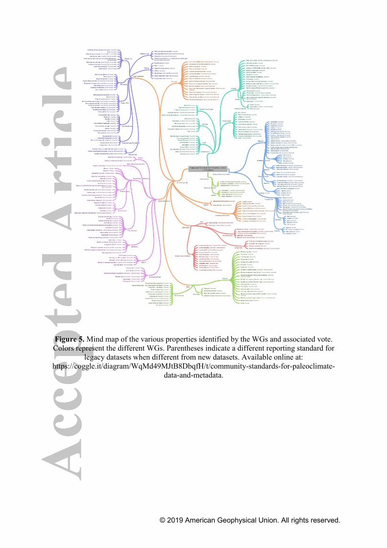
© 2019 American Geophysical Union. All rights reserved.
Figure 5. Mind map of the various properties identified by the WGs and associated vote. Colors represent the different WGs. Parentheses indicate a different reporting standard for
legacy datasets when different from new datasets. Available online at: https://coggle.it/diagram/WqMd49MJtB8DbqfH/t/community-standards-for-paleoclimate-
data-and-metadata.

© 2019 American Geophysical Union. All rights reserved.
Figure 6. Mosaic plots for a. new datasets and b. legacy datasets showing the number of essential, recommended, and desired metadata for the various WGs. The height of the bar
represents the fraction of total occurrences for essential (e), recommended (r), and desired (d) votes, while the width of the bar represents the number of properties voted on in each WG.

© 2019 American Geophysical Union. All rights reserved.
Figure 7. Mind map of the various properties identified by the cross-archive WG and associated vote. Color is the same as in Figure 5. Parentheses indicate recommendations for
legacy datasets when different from new datasets. Available online at: https://coggle.it/diagram/W4W9podcxp86PPvf/t/cross-archive-metadata

© 2019 American Geophysical Union. All rights reserved.
Figure 8. Mind map of the various properties identified by the ice core archives WG and associated vote. Color is the same as in Figure 5. Parentheses indicate recommendations for
legacy datasets when different from new datasets. Available online at: https://coggle.it/diagram/W4XNNeGhIngfjHzB/t/historical-documents

© 2019 American Geophysical Union. All rights reserved.
Figure 9. Mind map of the various properties identified by the lake sediments archives WG and associated vote. Color is the same as in Figure 5. Parentheses indicate recommendations
for legacy datasets when different from new datasets. Available online at: https://coggle.it/diagram/W4h9m-GhIjjbm3yX/t/lake-sediments

© 2019 American Geophysical Union. All rights reserved.
Figure 10. Mind map of the various properties identified by the marine sediments archives WG and associated vote. Color is the same as in Figure 5. Parentheses indicate
recommendations for legacy datasets when different from new datasets. Available online at: https://coggle.it/diagram/W4iIkodcxlDKTK6v/t/marine-sediments

© 2019 American Geophysical Union. All rights reserved.
Figure 11. Mind map of the various properties identified by the speleothem archives WG and associated vote. Color is the same as in Figure 5. Parentheses indicate recommendations for
legacy datasets when different from new datasets. Available online at: https://coggle.it/diagram/W4gwj-GhIl4VmfYP/t/speleothem

© 2019 American Geophysical Union. All rights reserved.
Figure 12. Mind map of the various properties identified by tree-based archives WG and associated vote. Color is the same as in Figure 5. Parentheses indicate recommendations for
legacy datasets when different from new datasets. Available online at: https://coggle.it/diagram/W4huaYdcxhdzTB9z/t/trees

© 2019 American Geophysical Union. All rights reserved.
Figure 13. Mind map of the various properties identified by the documentary archives WG and associated vote. Color is the same as in Figure 5. Parentheses indicate recommendations
for legacy datasets when different from new datasets. Available online at: https://coggle.it/diagram/W4XNNeGhIngfjHzB/t/historical-documents

© 2019 American Geophysical Union. All rights reserved.
Figure 14. Mind map of the various properties identified by the uncertainties WG and associated vote. Color is the same as in Figure 5. Parentheses indicate recommendations for
legacy datasets when different from new datasets. Available online at: https://coggle.it/diagram/W4gttodcxjfvSst0/t/uncertainties

© 2019 American Geophysical Union. All rights reserved.
Figure 15. Mind map of the various properties identified by the chronologies WG and associated vote. Color is the same as in Figure 5. Parentheses indicate recommendations for
legacy datasets when different from new datasets. Available online at: https://coggle.it/diagram/W4hzXeGhIi5Fm0q7/t/chronologies

© 2019 American Geophysical Union. All rights reserved.
Figure 16. Radar plot showing the completeness of the metadata reporting for core MD98-2181 (Khider et al., 2014) for properties considered a. essential and b. recommended in the current study. The axis refers to the working group standards recommendation applicable to
the record.

© 2019 American Geophysical Union. All rights reserved.
Table 1. Illustration of our proposed time representation with four time points. The first column gives examples of reported age/year in a paleoclimate paper while the last four columns show an implementation of the representation proposed here.
Reported
Age/year in
manuscript
Significand Exponent Direction Datum
21 ka BP 21 3 before 1950 CE
1816 AD 1816 0 since 0 CE1
2.7 Ma 2.7 6 before 1950 CE
127 ka BP 127 3 before 2000 CE