tim clark ken gorton david attaway · arcmap arcgis pro new side-by-side providing mapping,...
TRANSCRIPT

Tim Clark
Ken Gorton
David Attaway
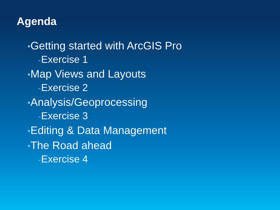
•Getting started with ArcGIS Pro
-Exercise 1
•Map Views and Layouts
-Exercise 2
•Analysis/Geoprocessing
-Exercise 3
•Editing & Data Management
•The Road ahead
-Exercise 4
Agenda

ArcGIS for Desktop
ArcMap ArcGIS Pro
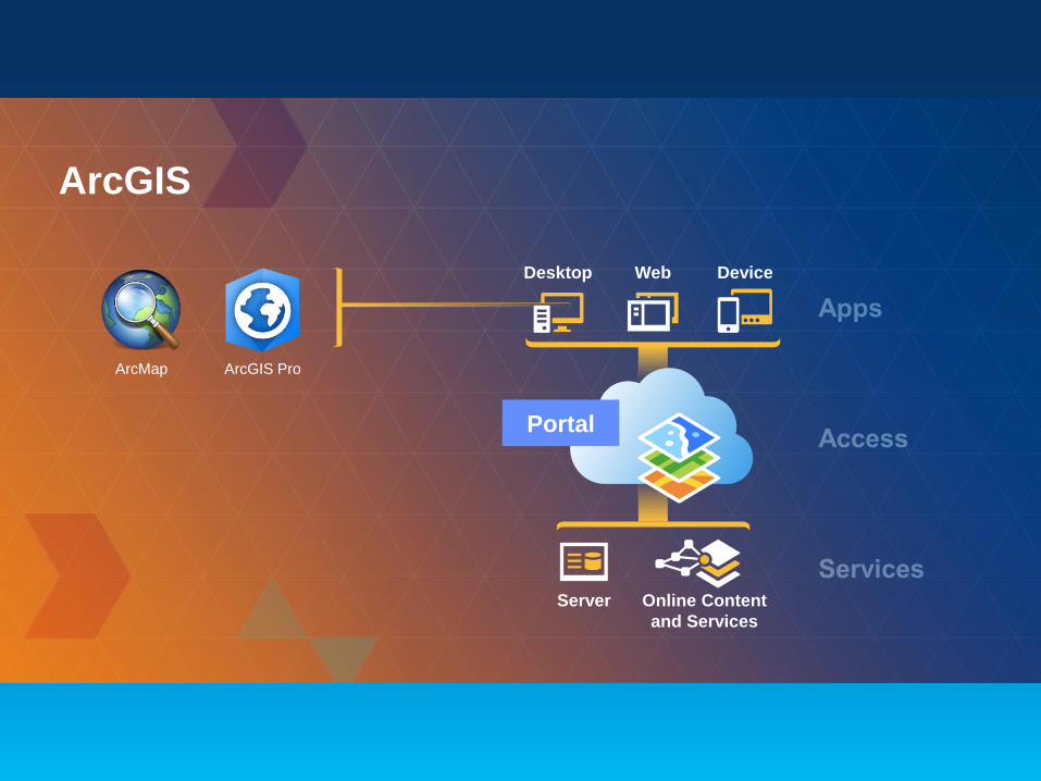
ArcGIS
Desktop Web Device
Server Online Content
and Services
Portal
ArcMap ArcGIS Pro

ArcMap
• Quality
• Performance
• Updates
• Analytics
• Image Processing
Continued Support . . .
. . . with Dramatic Improvement
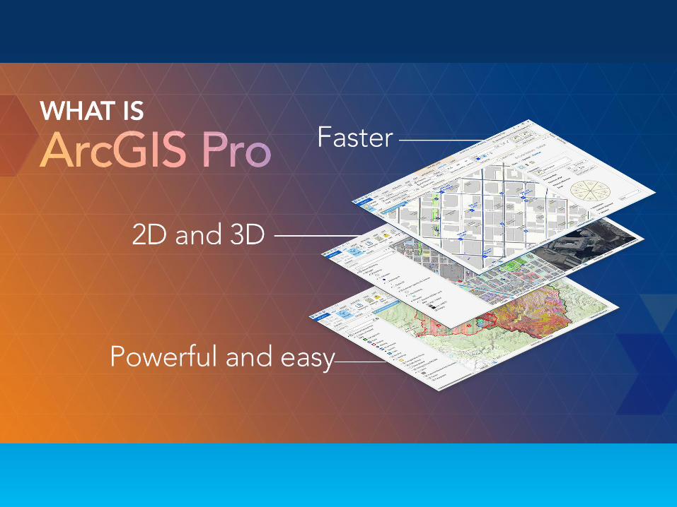
Professional GIS Desktop
Arc
GIS
ArcGIS Pro
• Intuitive
• Fast (64 bit)
• Multiple Layouts
• 2D/3D
• Share Web Maps
• Tasks and Projects
ArcMap ArcGIS Pro
New
Side-by-Side
Providing Mapping, Visualization, Editing, and Analysis
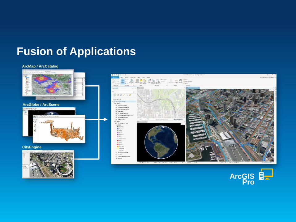
Fusion of ApplicationsArcMap / ArcCatalog
ArcGIS Pro
ArcGlobe / ArcScene
CityEngine
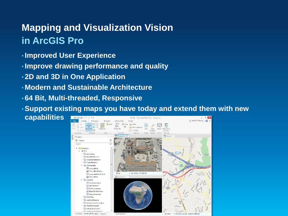
Mapping and Visualization Vision
• Improved User Experience
• Improve drawing performance and quality
• 2D and 3D in One Application
• Modern and Sustainable Architecture
• 64 Bit, Multi-threaded, Responsive
• Support existing maps you have today and extend them with new
capabilities
in ArcGIS Pro
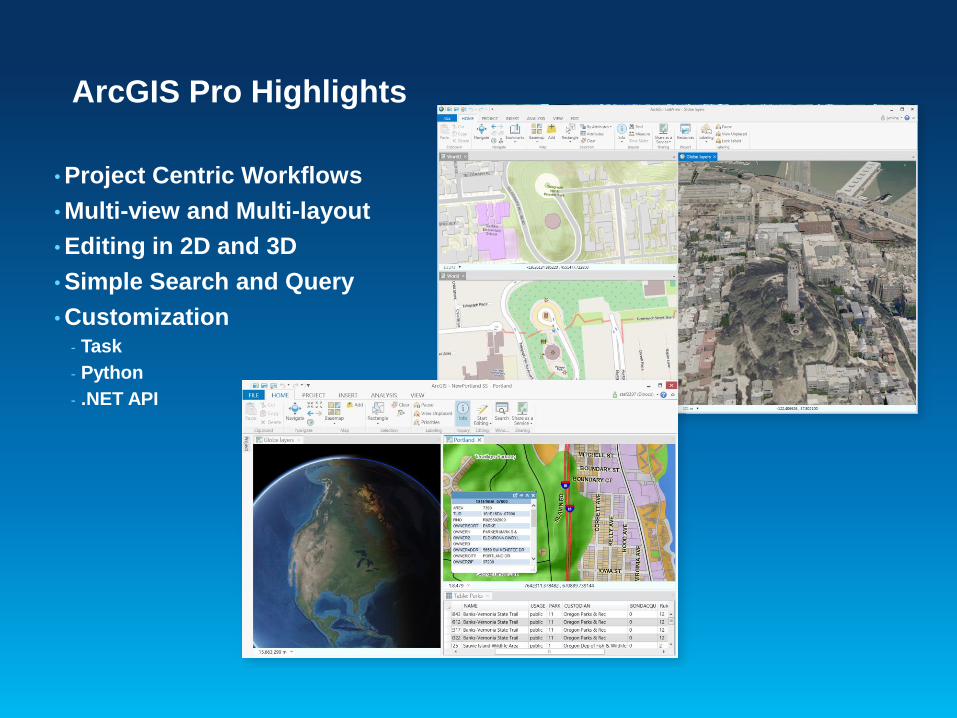
ArcGIS Pro Highlights
• Project Centric Workflows
• Multi-view and Multi-layout
• Editing in 2D and 3D
• Simple Search and Query
• Customization - Task
- Python
- .NET API
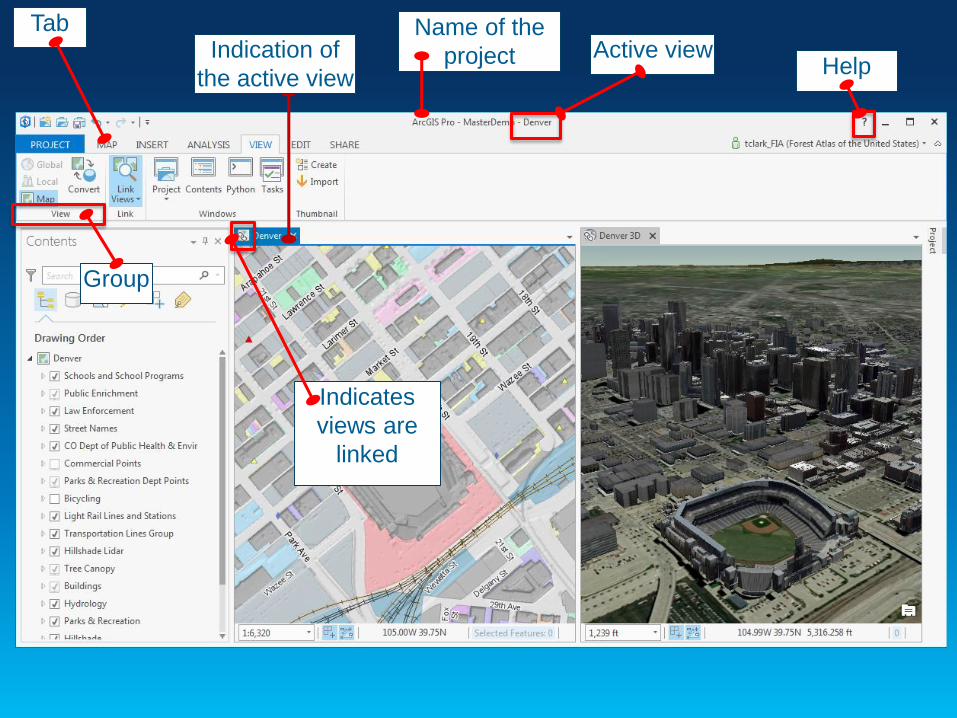
Name of the
projectIndication of
the active view
Active viewHelp
Indicates
views are
linked
Tab
Group
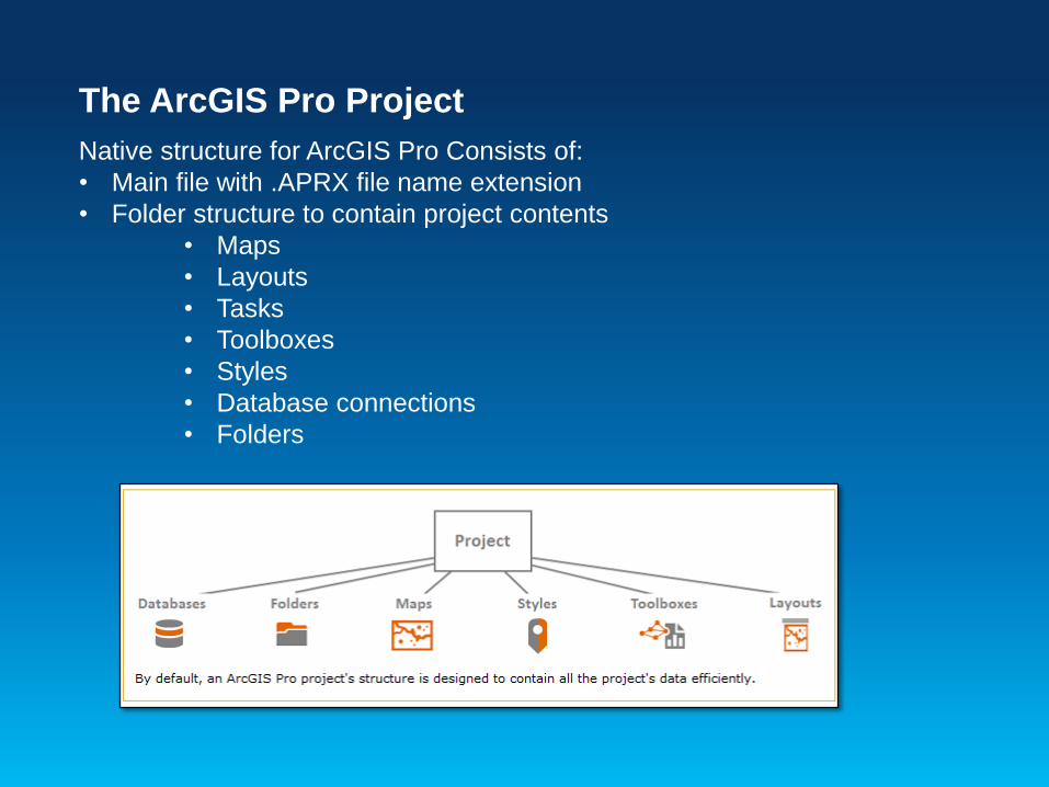
The ArcGIS Pro Project
Native structure for ArcGIS Pro Consists of:
• Main file with .APRX file name extension
• Folder structure to contain project contents
• Maps
• Layouts
• Tasks
• Toolboxes
• Styles
• Database connections
• Folders

Creating a new project
• When you open ArcGIS Pro, you are prompted to create a project
or open existing Project.
• When creating a new project, you enter
• Project Name
• Path to Project file and folder.
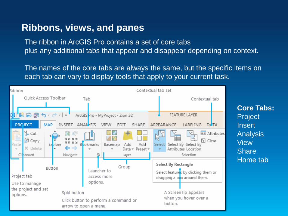
Ribbons, views, and panes
The ribbon in ArcGIS Pro contains a set of core tabs
plus any additional tabs that appear and disappear depending on context.
The names of the core tabs are always the same, but the specific items on
each tab can vary to display tools that apply to your current task.
Core Tabs:
Project
Insert
Analysis
View
Share
Home tab
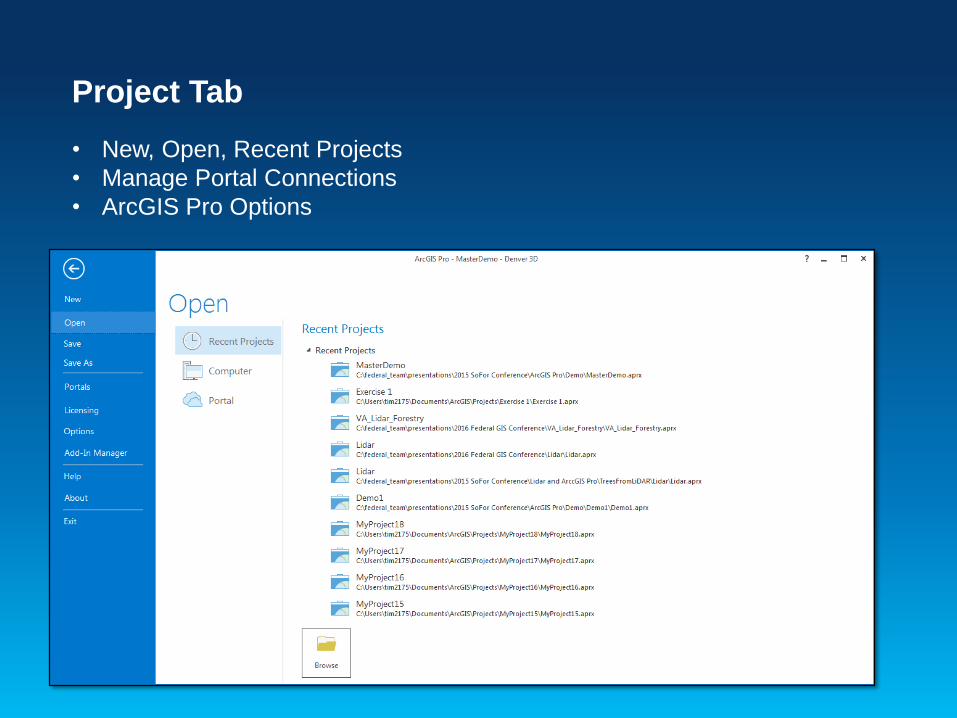
Project Tab
• New, Open, Recent Projects
• Manage Portal Connections
• ArcGIS Pro Options

ArcGIS Pro OptionsSetting the properties of the application
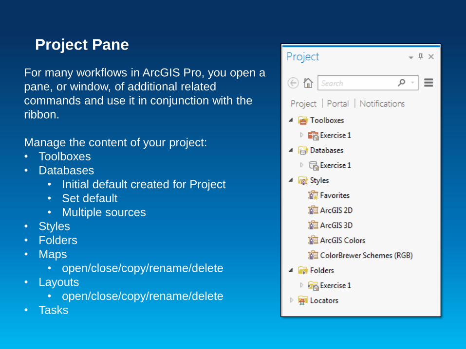
Project Pane
For many workflows in ArcGIS Pro, you open a
pane, or window, of additional related
commands and use it in conjunction with the
ribbon.
Manage the content of your project:
• Toolboxes
• Databases
• Initial default created for Project
• Set default
• Multiple sources
• Styles
• Folders
• Maps
• open/close/copy/rename/delete
• Layouts
• open/close/copy/rename/delete
• Tasks
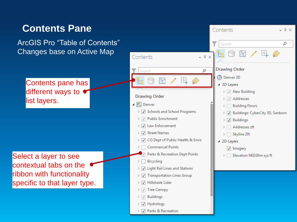
Select a layer to see
contextual tabs on the
ribbon with functionality
specific to that layer type.
Contents pane has
different ways to
list layers.
Contents Pane
ArcGIS Pro “Table of Contents”
Changes base on Active Map
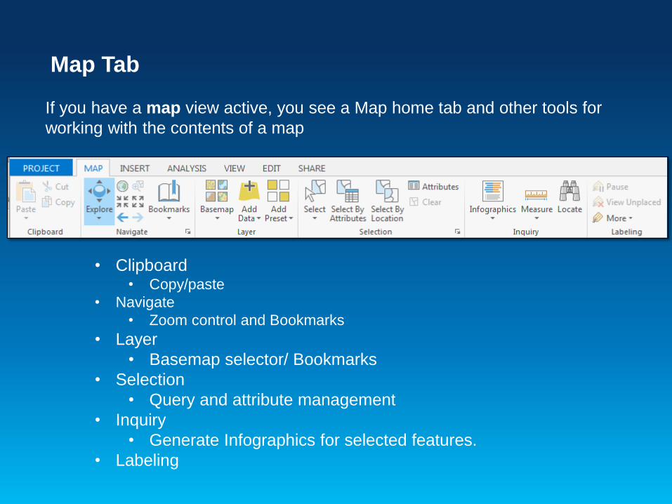
Map Tab
If you have a map view active, you see a Map home tab and other tools for
working with the contents of a map
• Clipboard• Copy/paste
• Navigate
• Zoom control and Bookmarks
• Layer
• Basemap selector/ Bookmarks
• Selection
• Query and attribute management
• Inquiry
• Generate Infographics for selected features.
• Labeling
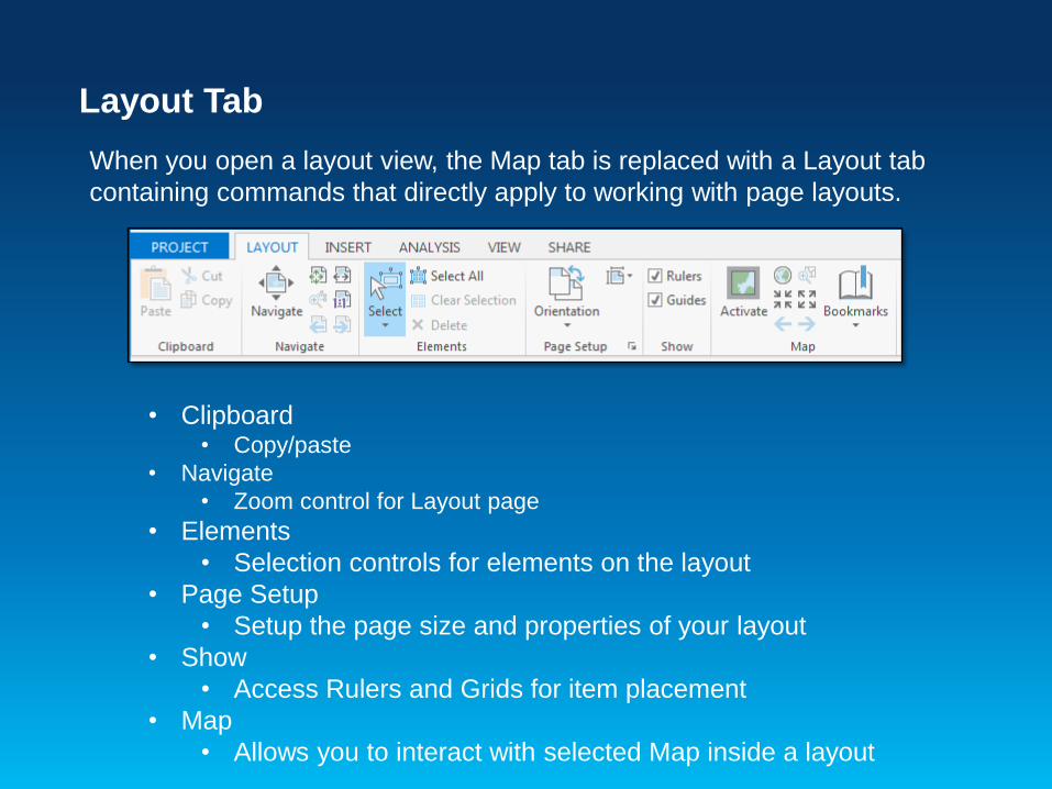
Layout Tab
When you open a layout view, the Map tab is replaced with a Layout tab
containing commands that directly apply to working with page layouts.
• Clipboard• Copy/paste
• Navigate
• Zoom control for Layout page
• Elements
• Selection controls for elements on the layout
• Page Setup
• Setup the page size and properties of your layout
• Show
• Access Rulers and Grids for item placement
• Map
• Allows you to interact with selected Map inside a layout

Insert Tab
Tools to insert objects into your project including Maps, Layouts and graphic
elements
Insert map
frame to Layout
by:
• Default map
• Bookmark
Insert elements to
your Project
• New Map
• New Layout
• Import .MXD
• Toolbox
• Folder
• Database
connection
Insert graphic elements to your Project
• Scale bar
• North Arrow
• Legend
• Titles and text
• Graphic shapes
• Pictures

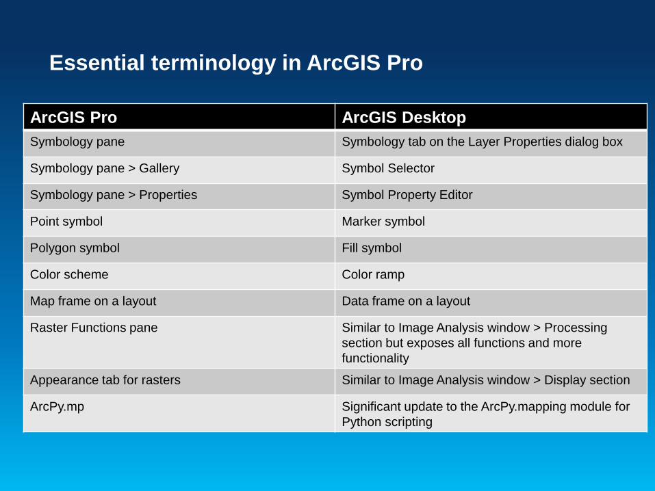
Essential terminology in ArcGIS Pro
ArcGIS Pro Description ArcGIS Desktop equivalent
Project A collection of related geographic datasets, maps,
layouts, tools, settings, and resources saved in an
.aprx file.
Map The project item used to display and work with
geographic data in two dimensions. A map opens in a
map view.
ArcMap document (.mxd).
Scene The project item used to display and work with
geographic data in three dimensions. A scene can open
as either a global or local perspective. A scene can be
converted to a map, and vice versa.
Global scene: ArcGlobe document
(.3dd).
Local scene: ArcScene document
(.sxd).
Basemap The project item that is often displayed under other
content to provide a geographical context to the map's
operational layers.
Similar to other basemaps.
Portal A connection to ArcGIS Onlineor Portal for ArcGIS. Similar to ArcGIS Administrator >
Add Portal Connection
Tab on the
ribbon
A region on the ribbon that groups related software
commands.
Toolbar
Pane A dockable window that contains a related set of
commands.
Dockable window.

Navigation Shortcuts
http://pro.arcgis.com/en/pro-app/help/mapping/navigation/keyboard-
shortcuts-for-navigation.htm
ArcGIS Pro – Interface
Demo

Getting Started with ArcGIS Pro
Exercise 1
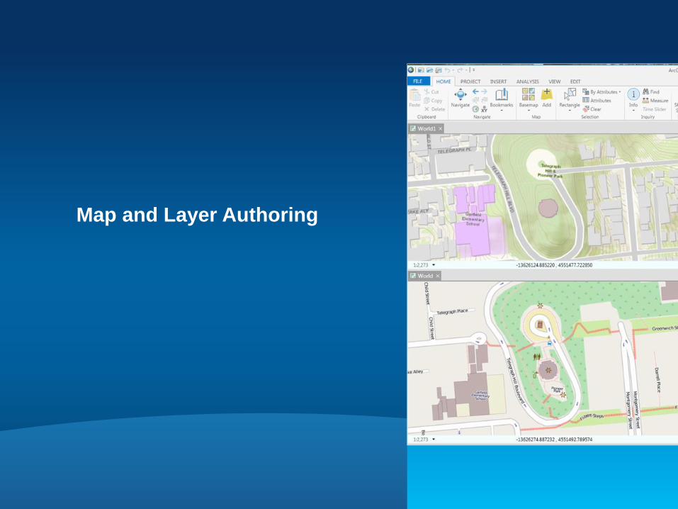
Map and Layer Authoring
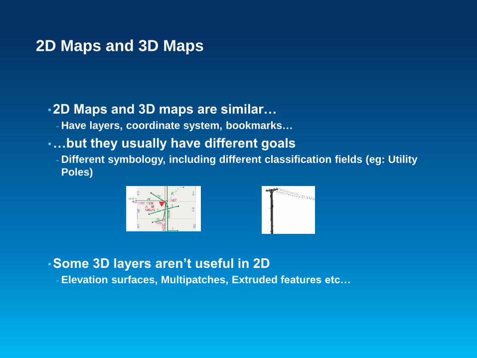
2D Maps and 3D Maps
•2D Maps and 3D maps are similar…- Have layers, coordinate system, bookmarks…
•…but they usually have different goals- Different symbology, including different classification fields (eg: Utility
Poles)
•Some 3D layers aren’t useful in 2D- Elevation surfaces, Multipatches, Extruded features etc…
Solution: 2 types of maps
•Maps (2D) and Scenes (3D)- .MXDs Maps
- .SXDs / .3DDs Scenes in Local or Global view
•You can create new Maps and Scenes- Then add in data, set coordinate systems, etc.
•You can convert a Map into a new Scene- And vice versa
•You can also:- Copy layers between them
- Re-use Bookmarks between them
- Link them together for interactive navigation
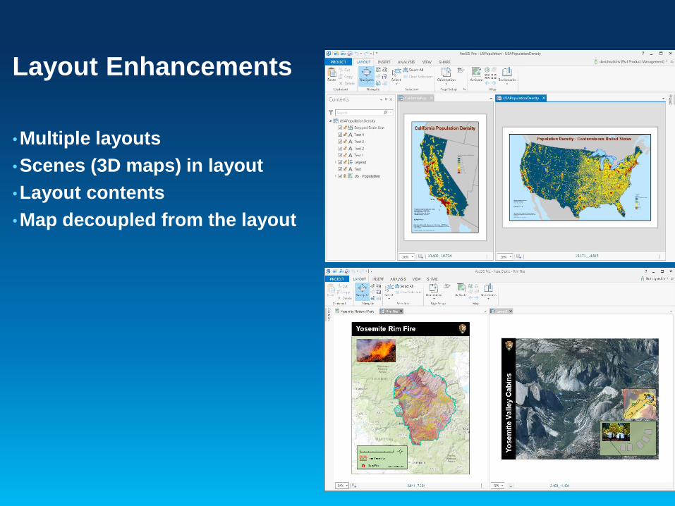
Layout Enhancements
•Multiple layouts
•Scenes (3D maps) in layout
•Layout contents
•Map decoupled from the layout
Map Automation
•Script redundant mapping workflows
•Create map books
•Update projects, maps and layers (i.e. data sources,
symbology)
•Automate the sharing of maps via export or publishing
•What changes?- Python 3.4
- Projects (.aprx)
- Layer file changes
- Multiple layouts
Continue to use arcpy.mapping scripts with some modifications

Authoring Maps & Layers
•Author maps and layers for use across your organization- Consistency for all editors
- Lessen learning curves
• Important aspects for editing- Feature templates and group templates
- Symbology
- Snapping
•Author additional parameters for 3D editing- Elevation
- Extrusion

•Layers can be defined to support Z
(elevation)- Create new feature class that are Z aware
- Convert existing 2D feature classes to 3D
feature classes
- Import 3D vector data from other formats (e.g.,
CAD, KML, etc)
•2D layers can still participate in 3D
scenes- Draped on the ground or surface
- Visualized with height using extrusion
Z Aware Layers
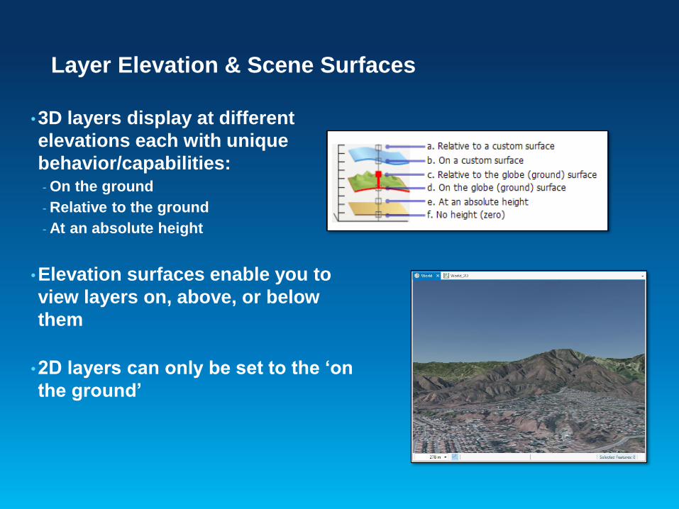
•3D layers display at different
elevations each with unique
behavior/capabilities:- On the ground
- Relative to the ground
- At an absolute height
•Elevation surfaces enable you to
view layers on, above, or below
them
•2D layers can only be set to the ‘on
the ground’
Layer Elevation & Scene Surfaces
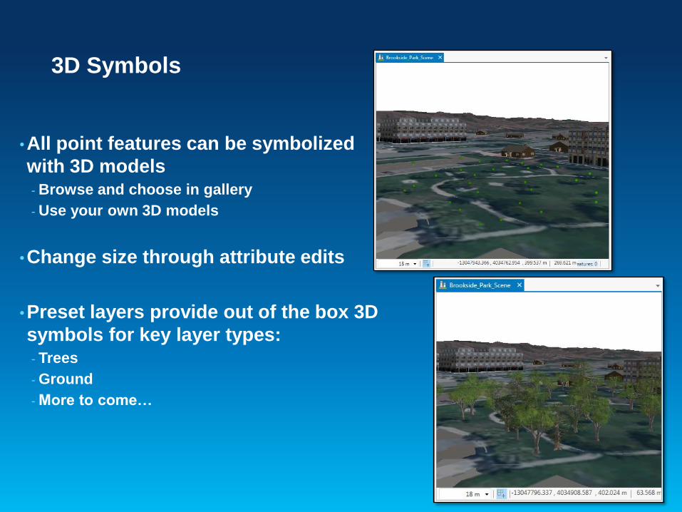
•All point features can be symbolized
with 3D models- Browse and choose in gallery
- Use your own 3D models
•Change size through attribute edits
•Preset layers provide out of the box 3D
symbols for key layer types:- Trees
- Ground
- More to come…
3D Symbols
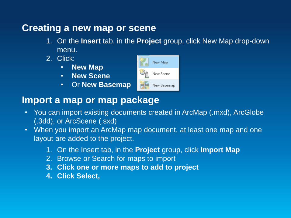
Creating a new map or scene
1. On the Insert tab, in the Project group, click New Map drop-down
menu.
2. Click:
• New Map
• New Scene
• Or New Basemap
Import a map or map package
• You can import existing documents created in ArcMap (.mxd), ArcGlobe
(.3dd), or ArcScene (.sxd)
• When you import an ArcMap map document, at least one map and one
layout are added to the project.
1. On the Insert tab, in the Project group, click Import Map
2. Browse or Search for maps to import
3. Click one or more maps to add to project
4. Click Select,
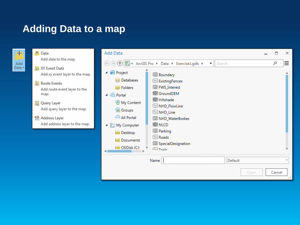
Adding Data to a map

Appearance Tab
If you have a layer active in the Contents pane, the Appearance tab is activated
that allows you to set the properties of that layer.
• Visibility Range• Set visible scale
• Effects
• Swipe tool
• Transparency
• Drawing
• Symbol properties
• Extrusion
• For 3D objects
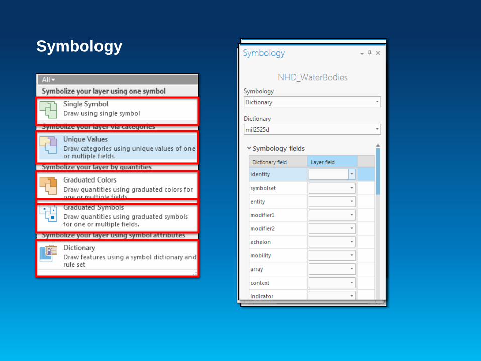
Symbology

Symbols
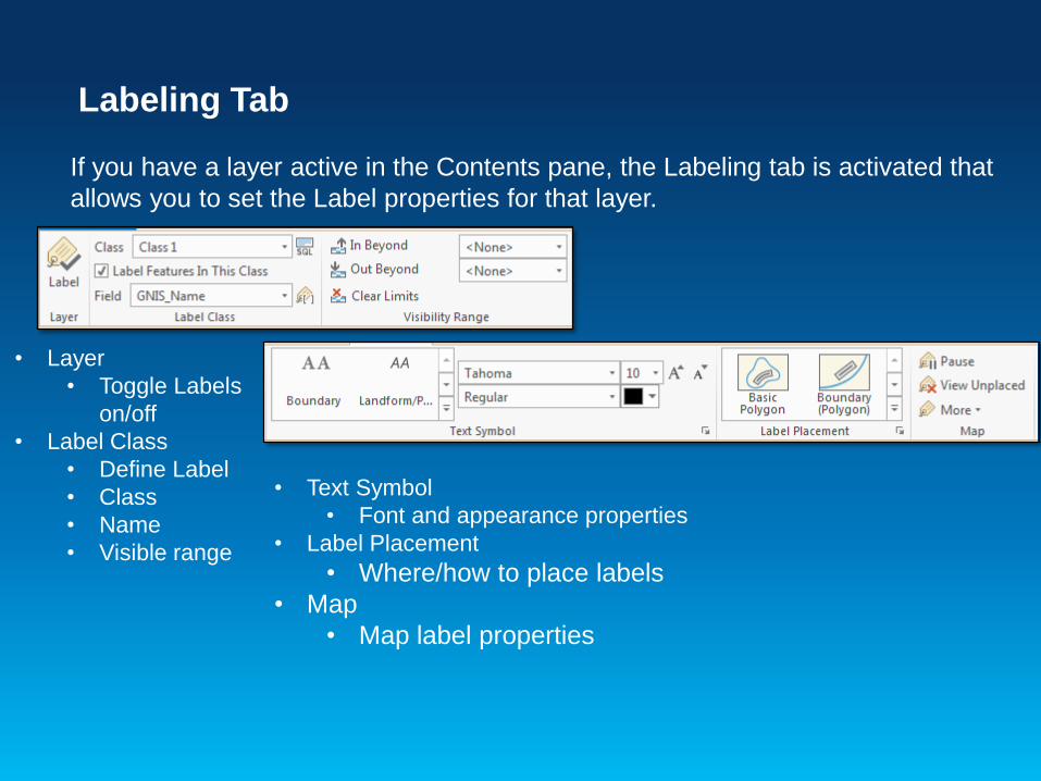
Labeling Tab
If you have a layer active in the Contents pane, the Labeling tab is activated that
allows you to set the Label properties for that layer.
• Layer
• Toggle Labels
on/off
• Label Class
• Define Label
• Class
• Name
• Visible range
• Text Symbol
• Font and appearance properties
• Label Placement
• Where/how to place labels
• Map
• Map label properties
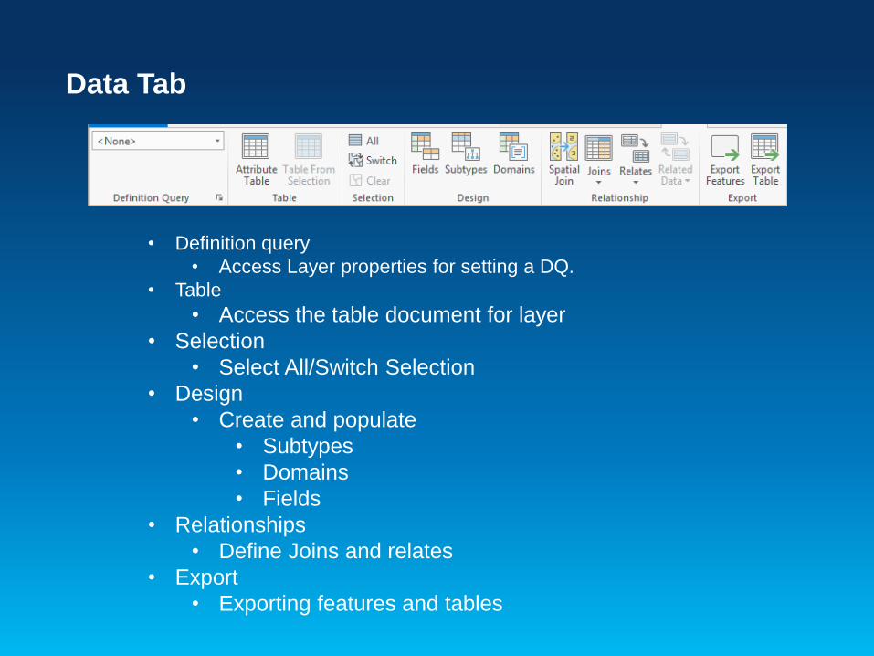
Data Tab
• Definition query
• Access Layer properties for setting a DQ.
• Table
• Access the table document for layer
• Selection
• Select All/Switch Selection
• Design
• Create and populate
• Subtypes
• Domains
• Fields
• Relationships
• Define Joins and relates
• Export
• Exporting features and tables
Essential terminology in ArcGIS Pro
ArcGIS Pro ArcGIS Desktop
Symbology pane Symbology tab on the Layer Properties dialog box
Symbology pane > Gallery Symbol Selector
Symbology pane > Properties Symbol Property Editor
Point symbol Marker symbol
Polygon symbol Fill symbol
Color scheme Color ramp
Map frame on a layout Data frame on a layout
Raster Functions pane Similar to Image Analysis window > Processing
section but exposes all functions and more
functionality
Appearance tab for rasters Similar to Image Analysis window > Display section
ArcPy.mp Significant update to the ArcPy.mapping module for
Python scripting

ArcGIS Pro – Interface
Demo 2

Map Views and Layouts
Exercise 2
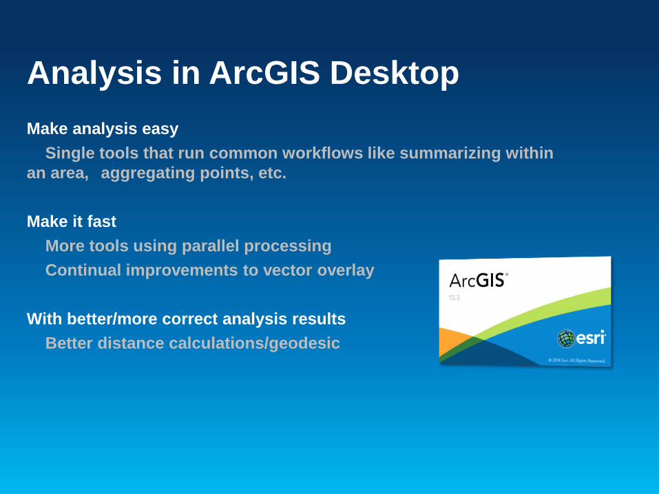
Analysis in ArcGIS Desktop
Make analysis easy
Single tools that run common workflows like summarizing within
an area, aggregating points, etc.
Make it fast
More tools using parallel processing
Continual improvements to vector overlay
With better/more correct analysis results
Better distance calculations/geodesic
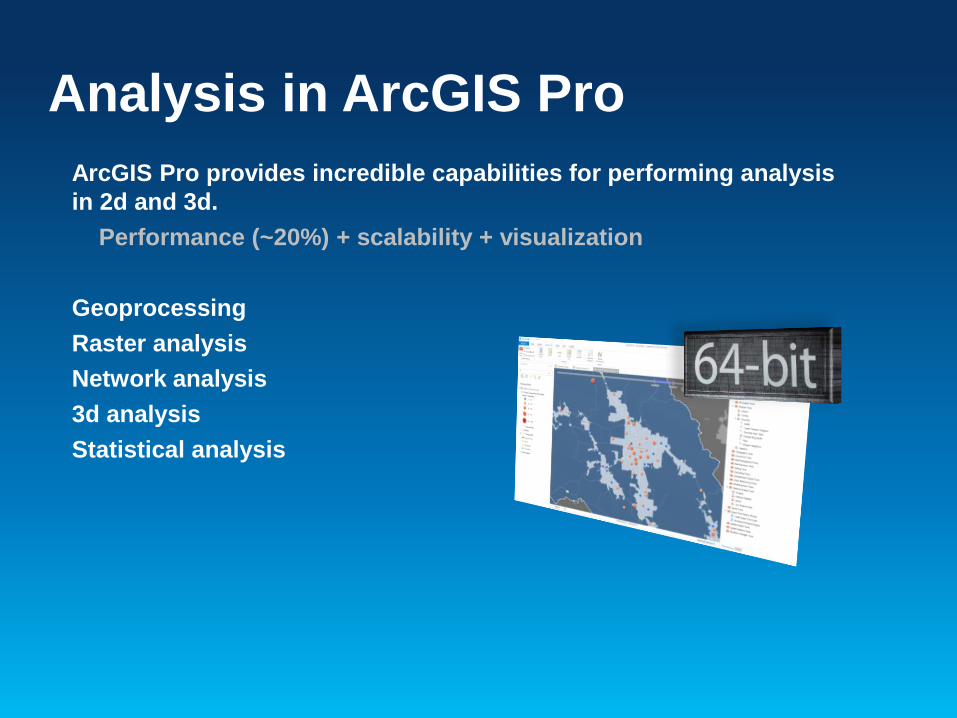
Analysis in ArcGIS Pro
ArcGIS Pro provides incredible capabilities for performing analysis
in 2d and 3d.
Performance (~20%) + scalability + visualization
Geoprocessing
Raster analysis
Network analysis
3d analysis
Statistical analysis
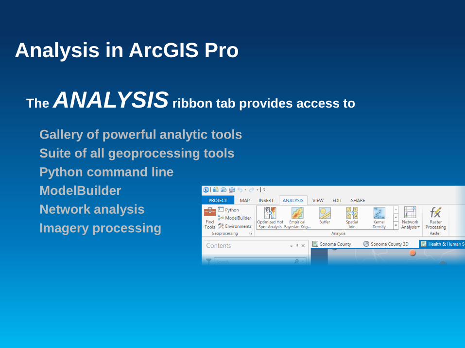
Analysis in ArcGIS Pro
The ANALYSIS ribbon tab provides access to
Gallery of powerful analytic tools
Suite of all geoprocessing tools
Python command line
ModelBuilder
Network analysis
Imagery processing

GeoprocessingProcessing geographic data
Geoprocessing is a framework and set
of tools for processing geographic and
related data. The large suite of
geoprocessing tools can be used to
perform spatial analysis or manage GIS
data in an automated way.

Analysis Tab
If you have a layer active in the Contents pane, the Appearance tab is activated
that allows you to set the properties of that layer.
• Geoprocessing
• Python, Modelbuilder, and Tools
• Set Geoprocessing environments
• Tools
• Commonly used tools for selected layer
• Raster
• Apply, edit and create functions

Familiar user experience with some key productivity
improvements.
Most tools, models, and Python scripts that work in ArcMap will
work in Pro.
ArcObjects-based custom tools are not supported.
Analyze for Pro tool checks models and scripts for unsupported
tools, data, and Python code.
Geoprocessing in ArcGIS Pro
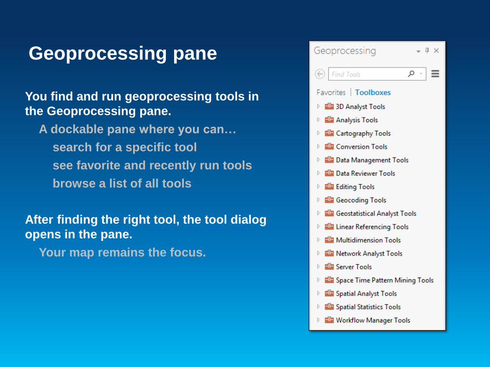
You find and run geoprocessing tools in
the Geoprocessing pane.
A dockable pane where you can…
search for a specific tool
see favorite and recently run tools
browse a list of all tools
After finding the right tool, the tool dialog
opens in the pane.
Your map remains the focus.
Geoprocessing pane

Enhanced Contextual tabs for imagery
Easy to work with Imagery
Image Processing Pane
• Intuitive visualization controls
• Symbology Pane
• Data Tab
• Processing pane
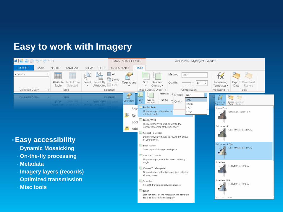
• Easy accessibility- Dynamic Mosaicking
- On-the-fly processing
- Metadata
- Imagery layers (records)
- Optimized transmission
- Misc tools
Easy to work with Imagery

Image Processing and Analysis
• Essential tools for image analysis and
exploitation- Raster Functions..
- Raster Processing Pane
- ‘Create-Manage-Share-Apply Processing tradecraft’
- New Function editor
- Auto Compensate for terrain and radiometric distortions
• Keeping it Quick and Easy- Simplify creation/access to rich Information products
- Refreshed user experience to chain processes

Analysis
Exercise 3
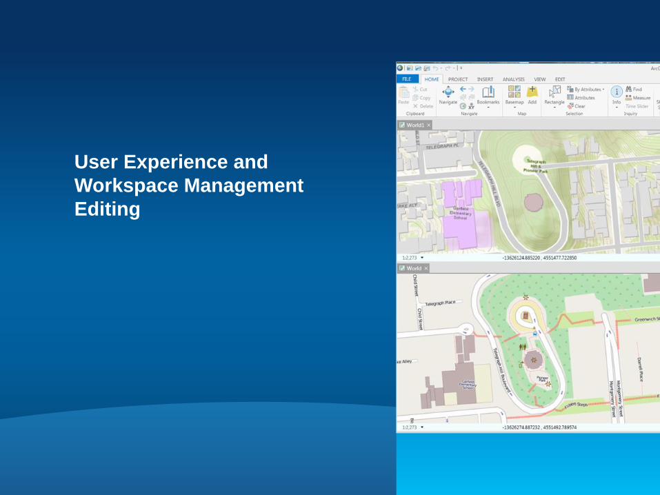
User Experience and
Workspace Management
Editing
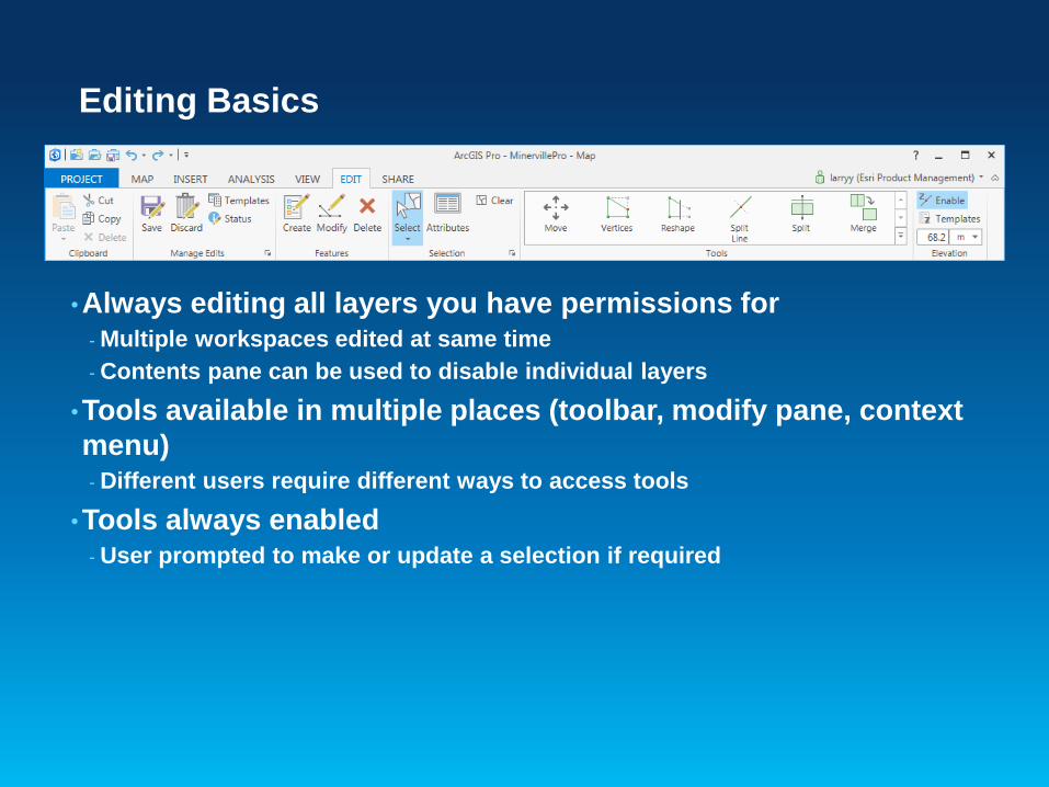
Editing Basics
•Always editing all layers you have permissions for- Multiple workspaces edited at same time
- Contents pane can be used to disable individual layers
•Tools available in multiple places (toolbar, modify pane, context
menu)- Different users require different ways to access tools
•Tools always enabled- User prompted to make or update a selection if required
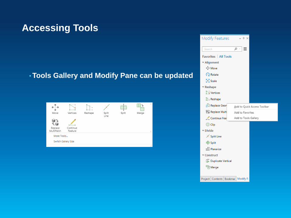
Accessing Tools
• Tools Gallery and Modify Pane can be updated
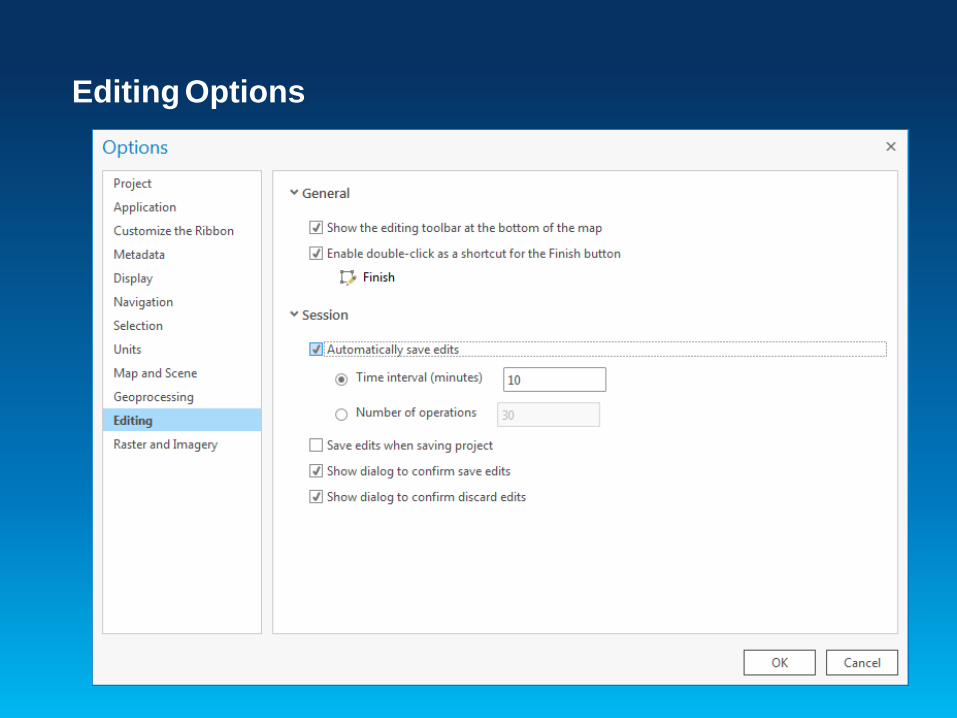
Editing Options
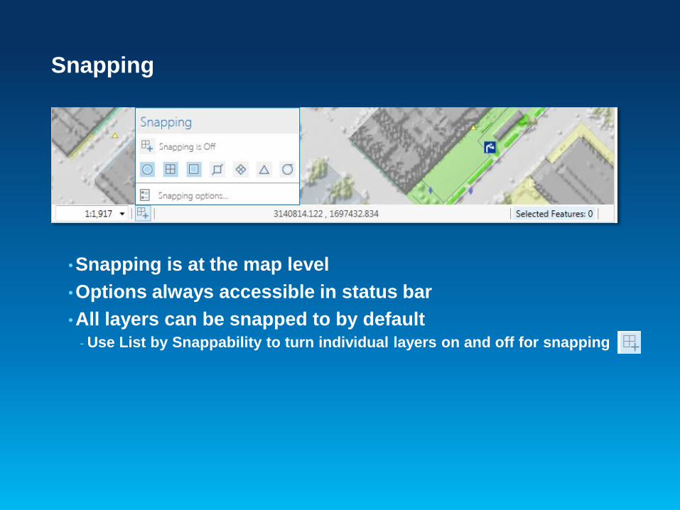
Snapping
•Snapping is at the map level
•Options always accessible in status bar
•All layers can be snapped to by default- Use List by Snappability to turn individual layers on and off for snapping
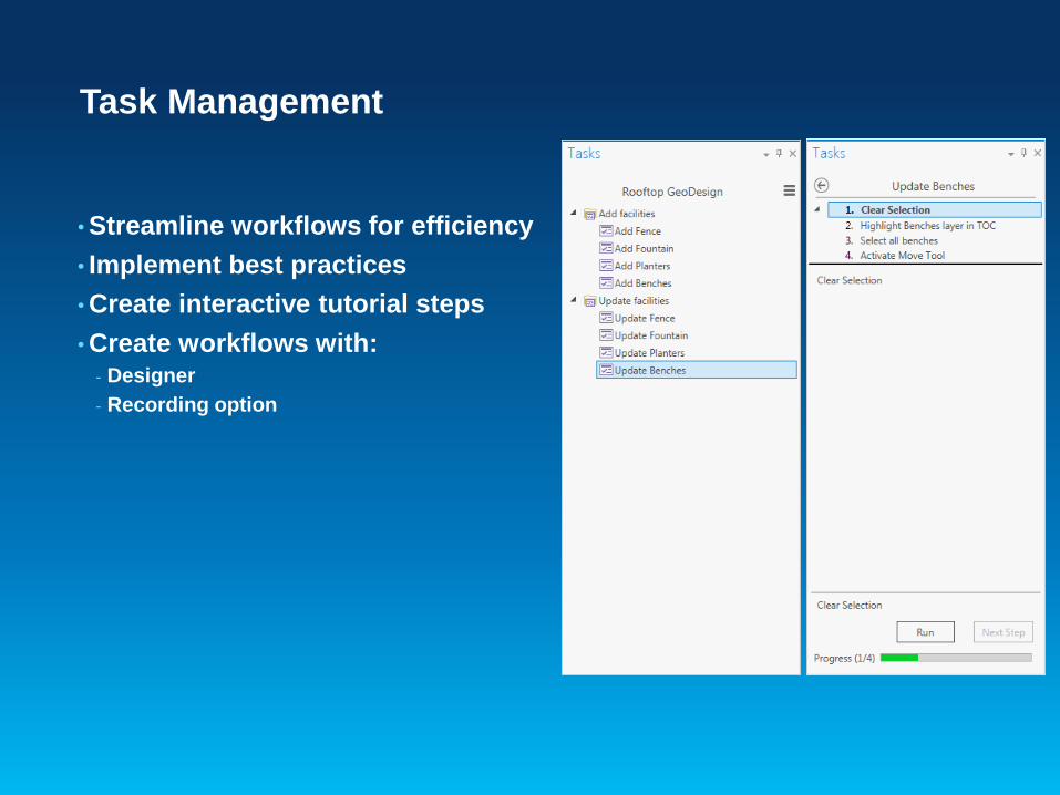
Task Management
• Streamline workflows for efficiency
• Implement best practices
• Create interactive tutorial steps
• Create workflows with:- Designer
- Recording option

Feature Templates
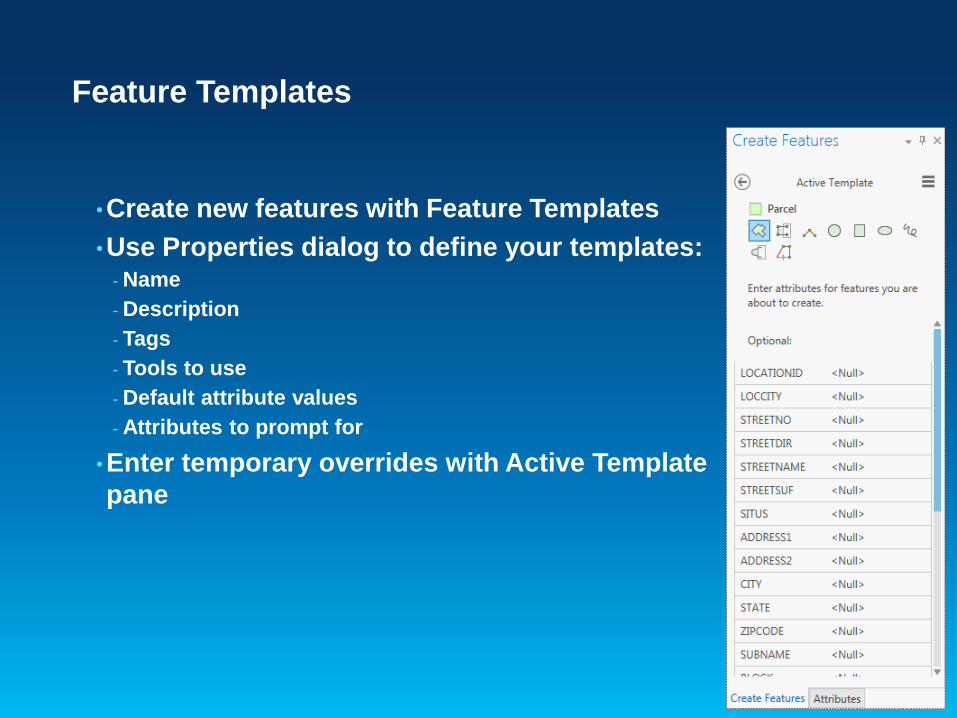
Feature Templates
•Create new features with Feature Templates
•Use Properties dialog to define your templates:- Name
- Description
- Tags
- Tools to use
- Default attribute values
- Attributes to prompt for
•Enter temporary overrides with Active Template
pane
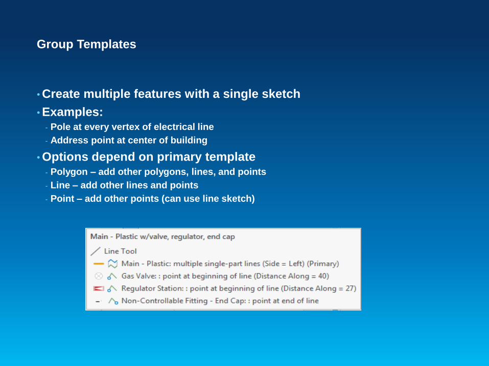
Group Templates
• Create multiple features with a single sketch
• Examples:- Pole at every vertex of electrical line
- Address point at center of building
• Options depend on primary template- Polygon – add other polygons, lines, and points
- Line – add other lines and points
- Point – add other points (can use line sketch)

Editing and Data Management
Exercise 4

ArcGIS Pro 1.2 and Beyond
Roadmap - ArcGIS Pro 1.2 Themes
• KML
• Mobile Map Packages
• Vector Tiles
• Publishing Enhancements for Enterprise
• 3D Web scenes (point, line, polygon)
• Topology
• Animations
• Charts and Graphs

Vector Tiles Maps
• High resolution
• Best resolution for all
displays
• Small efficient format
• Dynamic labeling
• More readable text
• On-the-fly labeling for
heads up display
• Adaptive Map Styling
• Streets, Topo, Canvas
from one dataset
• Day and Night mode
Map Authoring
• KML
• Expanded Symbolization- Smart maps
- Multi-scale
- Additional types (dot density, chart, etc.)
• Improved OGC layer support (WMS, WMTS, WCS etc)
• Improved support for ArcGIS Server map services (dynamic
layers)
• Expanded symbolization types (dot density, chart etc.)
• Full spatial reference editing
• Interactive Illumination
Layout
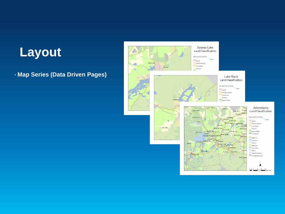
• Map Series (Data Driven Pages)

Editing
• Improve & extend 2D & 3D editing
• Map Topology / Shared edge editing
• Drawing constraints and guides
• Spatial Adjustment
• COGO

Geoprocessing and Analysis
• Share analysis with geoprocessing packages and services
• Interactive geostatistics/kriging wizard
• Charting- Bar chart, Histogram, Scatter plot, and more
• ModelBuilder enhancements
• Interactively draw inputs for analysis
• New tools for - Automated data transformation and conflation
- Suitability modeling
- Space time pattern mining
Raster
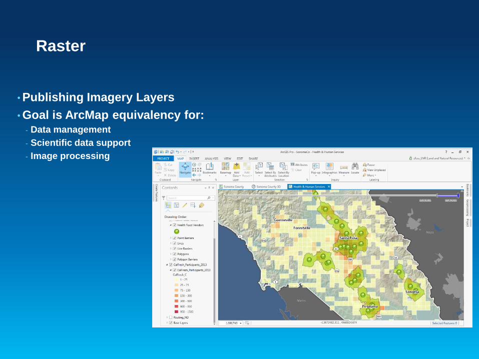
• Publishing Imagery Layers
• Goal is ArcMap equivalency for:- Data management
- Scientific data support
- Image processing
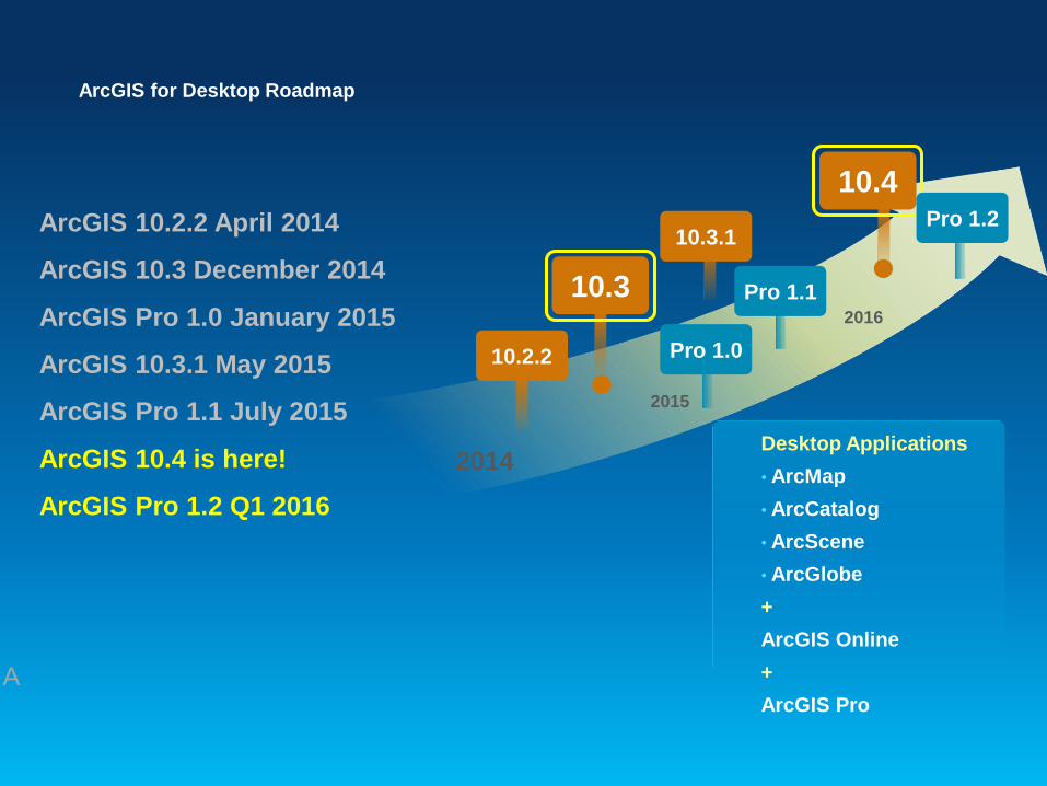
ArcGIS for Desktop Roadmap
ArcGIS 10.2.2 April 2014
ArcGIS 10.3 December 2014
ArcGIS Pro 1.0 January 2015
ArcGIS 10.3.1 May 2015
ArcGIS Pro 1.1 July 2015
ArcGIS 10.4 is here!
ArcGIS Pro 1.2 Q1 2016
Desktop Applications
• ArcMap
• ArcCatalog
• ArcScene
• ArcGlobe
+
ArcGIS Online
+
ArcGIS Pro
2014
10.2.2
10.3
2015
A
10.3.1
Pro 1.0
Pro 1.1
10.4Pro 1.2
2016