topicality - open-evidence.s3-website-us-east...
TRANSCRIPT

Topicality
T – In Cards
The plan violates T-In – has too many towers Dr. Robert Hermann Global Technology Partners, LLC , Co-Chairmen ET AL, Hon. James Schlesinger MITRE Corporation Task Force Members Mr. John Darrah Institute for Defense Analyses Mr. William Delaney MIT Lincoln Laboratory Mr. Arnold Donahue Project Director NAPA Mr. Kirk Lewis Institute for Defense Analyses Gen James McCarthy, USAF (Ret) United States Air Force Academy Mr. Steve Moran Raytheon Ms. Ruth Neilan NASA Jet Propulsion Laboratory Mr. Robert Nesbit MITRE Corporation Dr. Brad Parkinson Stanford University Dr. James Spilker Stanford University Hon. John Stenbit Private Consultant Gen Larry Welch, USAF (Ret) Institute for Defense Analyses Executive Secretary Mr. Ray Swider OSD (NII) DSB Representative LtCol David Robertson, USAF Government Advisors Mr. Robert Broussard Headquarters, USAF LtCol Hazel Kelly, USAF Office of the Secretary of the Air Force Ms. Pamela Hodge Headquarters, USAF Mr. Richard McKinney Headquarters, USAF Staff Dr. Evelyn Dahm Strategic Analysis Inc. Mr. Jules McNeff Overlook Systems Technologies, Inc, October 2005, “Defense Science Board Task Force on The Future of the Global Positioning System”, PDFThe GPS is a space-based positioning, navigation and timing (PNT) system
developed by the DoD and currently managed by the U.S. government through an interagency process that seeks to fuse civilian and military interests. That process was the subject of the recently signed Presidential Directive. The U.S. Air Force finances and operates the system of 24+ GPS satellites (distributed in six orbital planes) and a control segment with associated ground monitoring stations located around the world. GPS signals permit simultaneous determination of both precise three-dimensional position and precise time. GPS was the first and remains the only global, three-dimensional radio navigation and timing system providing continuous operational service today. Its civil signal represents a commodity service, provided as a public good by the U.S. government (for safe navigation, improved quality of life and diverse economical purposes) and freely available to all without direct cost or other encumbrance. Its military signals are encrypted for exclusivity of access by U.S. and allied military forces.
AND – the plan isn’t IN the united states – its THROUGHOUT the world Roftiel Constantine, Lt Col, USAF, A Research Report Submitted to Air Force Fellows, CADRE/AR, In Partial Fulfillment of the Graduation Requirements, April 2007, “GPS & GALILEO. FRIENDLY FOES?”, PDFThe ground portion of GPS synchronizes the atomic clocks on board the satellites into a common “GPS time” and tracks their flight paths. It consists of the master control station at Schriever AFB in Colorado Springs, five Air Force monitoring stations ( Hawaii, Kwajalein Atoll, Ascension Island, Diego Garcia, and
Colorado Springs ) and three ground antennas located throughout the world
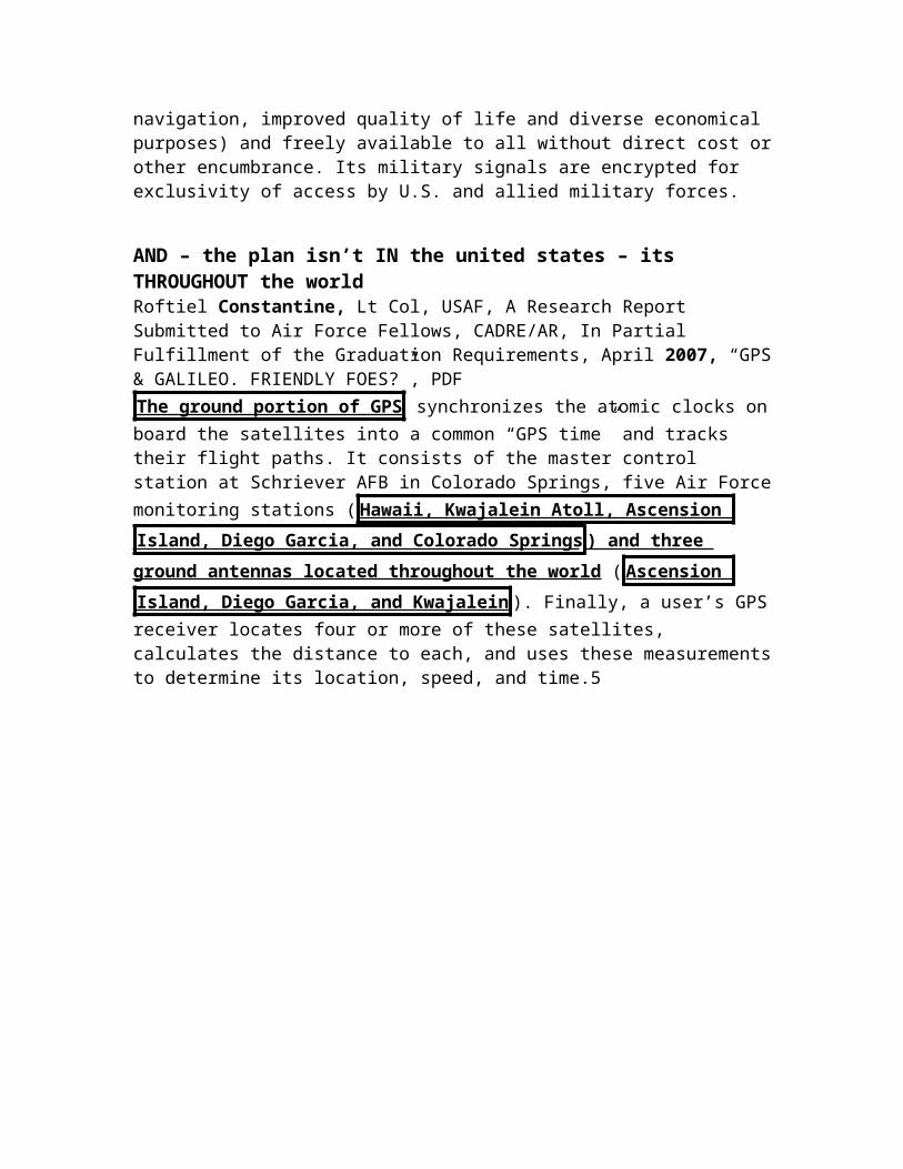
( Ascension Island, Diego Garcia, and Kwajalein ). Finally, a user’s GPS receiver locates four or more of these satellites, calculates the distance to each, and uses these measurements to determine its location, speed, and time.5
T – “Transportation Infrastructure” Helper
The plan is only communication transportation – their evidence is about supporting transportation infrastructure which is a distinct form of infrastructure Dr. Robert Hermann Global Technology Partners, LLC , Co-Chairmen ET AL, Hon. James Schlesinger MITRE Corporation Task Force Members Mr. John Darrah Institute for Defense Analyses Mr. William Delaney MIT Lincoln Laboratory Mr. Arnold Donahue Project Director NAPA Mr. Kirk Lewis Institute for Defense Analyses Gen James McCarthy, USAF (Ret) United States Air Force Academy Mr. Steve Moran Raytheon Ms. Ruth Neilan NASA Jet Propulsion Laboratory Mr. Robert Nesbit MITRE Corporation Dr. Brad Parkinson Stanford University Dr. James Spilker Stanford University Hon. John Stenbit Private Consultant Gen Larry Welch, USAF (Ret) Institute for Defense Analyses Executive Secretary Mr. Ray Swider OSD (NII) DSB Representative LtCol David Robertson, USAF Government Advisors Mr. Robert Broussard Headquarters, USAF LtCol Hazel Kelly, USAF Office of the Secretary of the Air Force Ms. Pamela Hodge Headquarters, USAF Mr. Richard McKinney Headquarters, USAF Staff Dr. Evelyn Dahm Strategic Analysis Inc. Mr. Jules McNeff Overlook Systems Technologies, Inc, October 2005, “Defense Science Board Task Force on The Future of the Global Positioning System”, PDFGPS Quietly Underpins Quality of Life and Economic/Military Performance -- GPS represents a quintessential enabling technology – but one whose contributions are not always apparent, recognized or widely publicized. GPS
services directly enable improved mobility, warfighting and communications and indirectly enable many other national infrastructure components to function more efficiently, safely and economically than they could in the absence of GPS. These infrastructure components interact to create quality of life for our citizens, enhance safety of life in our enterprises and produce efficiencies that sustain and enhance our economic performance and provide a critical advantage in military actions . Through its contributions, GPS has not only
created its own service infrastructure that must be maintained at a high level of robustness and availability, it has also become an indispensable component of many other infrastructures on which our nation depends. These include
telecommunications, electrical power distribution, banking and finance,
transportation, emergency services, and military operations and involve
hundreds of applications whose discrete contributions are virtually
impossible to quantify.
AND – the plan is only supportive of Transportation Infrastructure – it is distinct Dr. Robert Hermann Global Technology Partners, LLC , Co-Chairmen ET AL, Hon. James Schlesinger MITRE Corporation Task Force Members Mr. John Darrah
Institute for Defense Analyses Mr. William Delaney MIT Lincoln Laboratory Mr. Arnold Donahue Project Director NAPA Mr. Kirk Lewis Institute for Defense Analyses Gen James McCarthy, USAF (Ret) United States Air Force Academy Mr. Steve Moran Raytheon Ms. Ruth Neilan NASA Jet Propulsion Laboratory Mr. Robert Nesbit MITRE Corporation Dr. Brad Parkinson Stanford University Dr. James Spilker Stanford University Hon. John Stenbit Private Consultant Gen Larry Welch, USAF (Ret) Institute for Defense Analyses Executive Secretary Mr. Ray Swider OSD (NII) DSB Representative LtCol David Robertson, USAF Government Advisors Mr. Robert Broussard Headquarters, USAF LtCol Hazel Kelly, USAF Office of the Secretary of the Air Force Ms. Pamela Hodge Headquarters, USAF Mr. Richard McKinney Headquarters, USAF Staff Dr. Evelyn Dahm Strategic Analysis Inc. Mr. Jules McNeff Overlook Systems Technologies, Inc, October 2005, “Defense Science Board Task Force on The Future of the Global Positioning System”, PDFSince GPS reached operational status in the early 1990s, its consistently high-quality performance and low cost of use have created dramatic changes in the civil and commercial transportation infrastructure. Two federal agencies, the U.S. Coast Guard and the Federal Aviation Administration (FAA), have both embraced GPS and have initiated programs to augment GPS accuracy. The Coast Guard initially began with a differential augmentation service to provide sub-10 meter accuracy using marine radio-beacons around the contiguous US coastline (Maine-Texas and California-Alaska), the Great Lakes and St. Lawrence Seaway, and the Mississippi and Missouri River watersheds. That service is now fully operational at an actual precision of 1-2 meters. The service has also been expanded to interior land applications in the last several years in a cooperative venture with the Federal Railroad Administration and the Air Force and called Nationwide Differential GPS (NDGPS). NDGPS is transmitting augmentation signals to provide one-meter accuracy to rail and other land users across the U.S. using Low Frequency signals from the obsolete AF Ground Wave Emergency Network which is being dismantled. This service was originally intended to support positive train control, but has service implications far beyond railways. At the same time, the FAA has implemented a multi-billion dollar program called the Wide-Area Augmentation System (WAAS) to increase the accuracy, reliability and availability of GPS-
based services for aviation users by transmitting special augmentation
signals over satellite communications links . The FAA has also begun a companion project called the Local Area Augmentation System (LAAS) wherein signals are transmitted in the area of an airport to aid instrument landings and ground operations. The WAAS is a model for international civil aviation ventures in Europe and Japan to provide seamless global augmentation to GPS. Japan is also planning a complementary space-based adjunct to GPS, transmitting civil GPS signals, called the Quazi-Zenith Satellite System (QZSS). The QZSS comprises a small number of satellites in an orbital arrangement configured to increase the number of civil GPS signals over Japan to improve availability in dense urban areas. In addition to these activities, foreign differential GPS services, mostly (but not all) government- sponsored, are widely available to serve a diverse range of positioning (Geographic

Information Systems) and transportation needs. Together, these international activities reflect a growing commitment to satellite navigation services, and specifically to GPS. Though not directly related to transportation, another service called Global Differential GPS (GDGPS) uses a worldwide network of civil reference stations to develop differential GPS corrections. The GDGPS service was originally developed for NASA by the Jet Propulsion Laboratory and is now additionally offered through commercial vendors to enable precision agriculture. The GDGPS also provides a valuable source of monitoring information for civil GPS signals as will be addressed in Section 3 of this report. A common thread through all this activity is that each represents an augmentation to the core service provided by the GPS satellites – and none will operate on its own without the presence of the basic GPS signals. In most cases, the augmentations serve as checks on the quality of the basic signals, but together, they will soon represent an absolutely critical component of transportation economy and
public safety. 2.2.5 Emergency Services Closely related to GPS contributions to
both communications and transportation are its contributions to the emergency services infrastructure of police, fire, and ambulance providers and other emergency responders. Use of GPS is growing significantly among regional ambulance providers as a means of managing fleets of emergency vehicles. As its use increases in automobiles, it is becoming a significant factor in E-911-type situations, where emergency vehicles are dispatched to accident locations by activation of a GPS location keyed to activation of an air bag. Further, GPS-derived positions are now being included in planning for E-911 capabilities required by legislation from cellular telephone service providers. GPS has also proven its value to fire departments operating in devastated parts of the California hills after the Oakland fire of several years ago, to the diverse government emergency response teams dealing with the aftermath of hurricanes in the Southeast and with flooding in the Midwest. GPS use is growing in this sector and its incorporation in E-911 situations and in improving spatial interoperability among multi-jurisdictional response organizations will increase its importance in the future. Those improvements would be hastened even more by Federal Government leadership in promoting education regarding GPS benefits and training in the uniform application of its services to all participants in emergency response at federal, State and local levels (see discussion on spatial uniformity – Appendix E). This type of institutionalized spatial coordination will be especially important to rapid and efficient response in the case of an unpredictable widespread disaster resulting from terrorist or other hostile activity involving biological agents or nuclear devices.
DAs

Cost Overruns
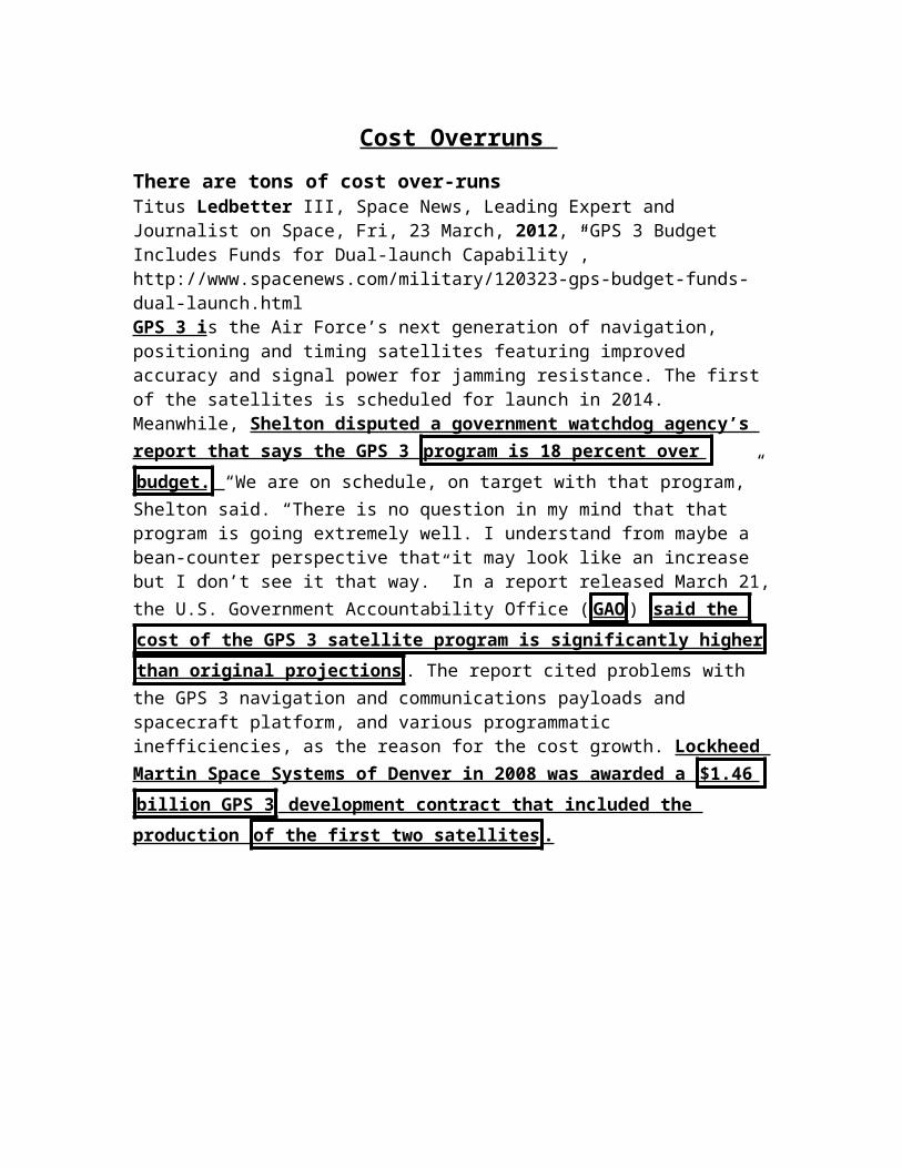
There are tons of cost over-runsTitus Ledbetter III, Space News, Leading Expert and Journalist on Space, Fri, 23 March, 2012, “GPS 3 Budget Includes Funds for Dual-launch Capability”, http://www.spacenews.com/military/120323-gps-budget-funds-dual-launch.htmlGPS 3 is the Air Force’s next generation of navigation, positioning and timing satellites featuring improved accuracy and signal power for jamming resistance. The first of the satellites is scheduled for launch in 2014. Meanwhile, Shelton disputed a government watchdog agency’s report that says the GPS 3 program is 18
percent over budget. “We are on schedule, on target with that program,” Shelton said. “There is no question in my mind that that program is going extremely well. I understand from maybe a bean-counter perspective that it may look like an increase but I don’t see it that way.” In a report released March 21, the U.S. Government Accountability Office ( GAO ) said the cost of the GPS 3 satellite program is
significantly higher than original projections . The report cited problems with the GPS 3 navigation and communications payloads and spacecraft platform, and various programmatic inefficiencies, as the reason for the cost growth. Lockheed Martin Space Systems of Denver in 2008 was awarded a $1.46 billion GPS 3
development contract that included the production of the first two satellites .

Plan Unpopular
AND – there is no support for the plan it kills PC – the entire aff’s inherency arguments only are proof of our links Dr. Robert Hermann Global Technology Partners, LLC , Co-Chairmen ET AL, Hon. James Schlesinger MITRE Corporation Task Force Members Mr. John Darrah Institute for Defense Analyses Mr. William Delaney MIT Lincoln Laboratory Mr. Arnold Donahue Project Director NAPA Mr. Kirk Lewis Institute for Defense Analyses Gen James McCarthy, USAF (Ret) United States Air Force Academy Mr. Steve Moran Raytheon Ms. Ruth Neilan NASA Jet Propulsion Laboratory Mr. Robert Nesbit MITRE Corporation Dr. Brad Parkinson Stanford University Dr. James Spilker Stanford University Hon. John Stenbit Private Consultant Gen Larry Welch, USAF (Ret) Institute for Defense Analyses Executive Secretary Mr. Ray Swider OSD (NII) DSB Representative LtCol David Robertson, USAF Government Advisors Mr. Robert Broussard Headquarters, USAF LtCol Hazel Kelly, USAF Office of the Secretary of the Air Force Ms. Pamela Hodge Headquarters, USAF Mr. Richard McKinney Headquarters, USAF Staff Dr. Evelyn Dahm Strategic Analysis Inc. Mr. Jules McNeff Overlook Systems Technologies, Inc, October 2005, “Defense Science Board Task Force on The Future of the Global Positioning System”, PDFIn many ways, GPS is analogous to autos and horse-drawn carriages or to calculators and slide rules. However, in those cases, evolving market- driven product lines provided steadily increasing functionality over previous alternatives. Acceptance in the marketplace was achieved and replacement and upgrade decisions for users was encouraged because awareness of value had been well-established through advertising and improvements were both marketed by manufacturers and sought by customers. GPS, on the other hand, offers multi-use applications derived by diverse users from a set of radio signals provided by the government for national security and as a public good. The applications create a market of national security and civil/commercial/scientific capabilities; however, broad market awareness is lacking, and application evolution is constrained for both domains by the willingness and ability of the government to improve or add to the signal set. The continued availability and improvement of
that signal set are subject to annual budgetary decisions at several levels
among different government agencies and from various committees of the
Congress . At the same time, however, efficiencies in positioning, movement and timing derived from the ubiquitous GPS signals have already quietly permeated virtually every level of our national infrastructures to the extent that, in many cases, there is no going back to earlier ways of doing things without tremendous but unrecognized penalties . All of the domains, missions and infrastructure components addressed by this Task Force are already affected to a greater or lesser degree by this dependency, and we believe the effects will only become more pronounced over time. The dilemma that results is peculiar to GPS. Our widespread dependency on it demands strong advocacy by military
and civilian leaders for its continued evolution and improvement. However, the executive and legislative environment where such decisions must be
made is skeptical of advocacy , absent a strong message from the market
(operational users), and so such decisions are delayed because of fiscal
constraints and competing priorities. This situation is a direct result of
institutional decisions regarding GPS operation and governance that guided
its original design and implementation . However, now that GPS has become operational and has established dependencies because of its value, the structures created for its initial implementation should be reassessed. The internal conflicts affecting GPS in the national security arena and global marketplace must be understood and mitigated by government leaders responsible for GPS at all levels because those decisions have real and far- ranging effects for our national security and economic competitiveness.

Space Mil
Space Militarization link Dr. Robert Hermann Global Technology Partners, LLC , Co-Chairmen ET AL, Hon. James Schlesinger MITRE Corporation Task Force Members Mr. John Darrah Institute for Defense Analyses Mr. William Delaney MIT Lincoln Laboratory Mr. Arnold Donahue Project Director NAPA Mr. Kirk Lewis Institute for Defense Analyses Gen James McCarthy, USAF (Ret) United States Air Force Academy Mr. Steve Moran Raytheon Ms. Ruth Neilan NASA Jet Propulsion Laboratory Mr. Robert Nesbit MITRE Corporation Dr. Brad Parkinson Stanford University Dr. James Spilker Stanford University Hon. John Stenbit Private Consultant Gen Larry Welch, USAF (Ret) Institute for Defense Analyses Executive Secretary Mr. Ray Swider OSD (NII) DSB Representative LtCol David Robertson, USAF Government Advisors Mr. Robert Broussard Headquarters, USAF LtCol Hazel Kelly, USAF Office of the Secretary of the Air Force Ms. Pamela Hodge Headquarters, USAF Mr. Richard McKinney Headquarters, USAF Staff Dr. Evelyn Dahm Strategic Analysis Inc. Mr. Jules McNeff Overlook Systems Technologies, Inc, October 2005, “Defense Science Board Task Force on The Future of the Global Positioning System”, PDFSince the inception of GPS, the civil and commercial sectors as well as the international community have been uneasy about an apparent military
dominance in GPS decisions. Even though Secretaries of Defense and Transportation, the President, and the Congress have produced policies and legislation emphasizing multi-agency management of GPS and its multi-use applications , the fact remains that GPS is primarily financed by the
Department of Defense and is a critical component of U.S. National Military
Strategy. That reality underlies the perception that the U.S. military could
“take away” GPS from other users at any time, and enables detractors of GPS
to create the misimpression that the U.S. or the military would do so
arbitrarily . In this climate, the emergence of Galileo, a system similar to GPS planned by the European Union (EU), has created motivation for a reevaluation of U.S. policies and practices with regard to GPS. Fundamental to these are the organization and governance structures by which the U.S. manages and operates GPS as a “national” program and as part of a “national and international” PNT infrastructure.
AND – the plan allows for the US to militarize space Trevor Brown (BA, Indiana University; MSc, S. Rajaratnam School of International Studies, Nanyang Technological University [Singapore]) is a new author interested in political, economic, and military strategy for the medium of space, March 2009, “Soft Power and Space Weaponization”, http://www.airpower.au.af.mil/airchronicles/apj/apj09/spr09/brown.html
A glance at the global strategic situation reveals many nations rushing to develop space capabilities. Ostensibly civilian, the capabilities in development around the world are largely dual use and will have profound effects on the balance of power. The United States, therefore, would be foolish to slow the pace of its own space development. The issue at hand is not whether to proceed with space weapons but how to proceed with these capabilities and effectively manage the security dilemmas that will inevitably arise. By assuming a posture which suggests that its intentions in space are competitive scientific and commercial pursuits—and which does not suggest the desire to barricade the medium in times of peace for the purpose of geopolitical leverage—the United States can proceed without causing undue angst in the international community. Once we have laid the foundation for commercial activities (i.e., “merchant shipping”), military capabilities—or “military shipping”—will follow in due course and with far less controversy. If US policy makers can showcase scientific and
commercial space endeavors while avoiding the perception of orbital
despotism, they can steadily build dominant military space capabilities and
retain soft power.

Ozone
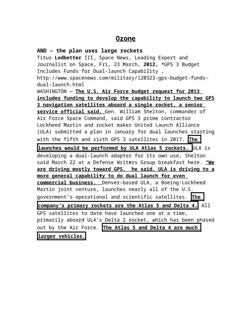
AND – the plan uses large rockets Titus Ledbetter III, Space News, Leading Expert and Journalist on Space, Fri, 23 March, 2012, “GPS 3 Budget Includes Funds for Dual-launch Capability”, http://www.spacenews.com/military/120323-gps-budget-funds-dual-launch.htmlWASHINGTON — The U.S. Air Force budget request for 2013 includes funding to develop the capability to launch two GPS 3 navigation satellites aboard a single rocket, a senior service official said. Gen. William Shelton, commander of Air Force Space Command, said GPS 3 prime contractor Lockheed Martin and rocket maker United Launch Alliance (ULA) submitted a plan in January for dual launches starting with the fifth and sixth GPS 3 satellites in 2017. The launches would be
performed by ULA Atlas 5 rockets. ULA is developing a dual-launch adapter for its own use, Shelton said March 22 at a Defense Writers Group breakfast here. “We are driving mostly toward GPS,” he said. ULA is driving to a more general capability to do dual launch for even commercial business.” Denver-based ULA, a Boeing-Lockheed Martin joint venture, launches nearly all of the U.S. government’s operational and scientific satellites. The company’s primary rockets are the
Atlas 5 and Delta 4. All GPS satellites to date have launched one at a time, primarily aboard ULA’s Delta 2 rocket, which has been phased out by the Air Force. The Atlas 5 and Delta 4 are much larger vehicles.

Galileo DA


*** 1NC
1NC
Galileo is ON THE BRINK – current failure of GPS 3 will allow it to operate and exist Roftiel Constantine, Lt Col, USAF, A Research Report Submitted to Air Force Fellows, CADRE/AR, In Partial Fulfillment of the Graduation Requirements, April 2007, “GPS & GALILEO. FRIENDLY FOES?”, PDFGalileo’s EU proponents see the potential for significant economic benefit to
the Galileo operator community if they can break into the market quickly . According to the EC, European industry’s market share in satellite navigation markets in the late 1990s was only around 15 percent of the European market and 5 percent of the global market. The satellite industry and its EU supporters framed the need to support Galileo in terms of ensuring a future European position in the space segment and end-user equipment markets around the world. According to the EC’s estimate in 2004, the global market in products and services linked to satellite-based positioning and navigation technology was on the order of €10 billion per year; growing at an annual rate of 25 per cent it was due to rise to
about €300 billion in 2020 . In addition, the EC estimated that some three billion receivers would be in service by 2020.22 However, PricewaterhouseCoopers’s 2001 analysis stressed that Galileo begin Phase 3 operations by 2008 in
order to secure an increased share for Europe of the user equipment and
related technologies markets. These markets would be in a rapid growth
phase by then, and GPS III was expected to commence operations one or two
years thereafter. According to PricewaterhouseCoopers, Galileo will become
established only if it is in the market in time to gain acceptance in the launch
of new equipment and services which will accompany this change. If this
happens before GPS III comes on line , the 2001 PricewaterhouseCoopers review
estimated that the annual sale of Galileo receivers would increase from 100
million units in 2010 to some 875 million units by 2020 which represents
market share rising from 13 per cent to 52 per cent .23 Since that 2001
estimate, the launch of the Galileo satellite constellation has slipped to 2010;
but Galileo’s window of opportunity is still open, as GPS III’s launch has
slipped to 2013.
Speeding up GPS 3 destroys economic growth in Europe Roftiel Constantine, Lt Col, USAF, A Research Report Submitted to Air Force Fellows, CADRE/AR, In Partial Fulfillment of the Graduation Requirements, April 2007, “GPS & GALILEO. FRIENDLY FOES?”, PDF

Galileo proponents have consistently stressed the potential commercial
benefits from the construction and operation of an independent European satellite-based positioning and navigation system ever since the EC feasibility studies in 1999. In discussing the implications of Europe’s GPS dependence for its Common Foreign and Security Policy, the EC stated “Europe is now in a position to decide whether to develop a new system. By contrast, failure to act would strengthen the present US market dominance and leave Europe entirely dependent on the US for many security-related matters.”18 The EC recognized both the economic benefits Europe would gain by developing Galileo and the sense of security from controlling the system on which its safety critical services would depend. Accordingly, EU discussions leading up to the decision to proceed with Galileo focused on job creation, technological spillover
effects, and monetary benefits, provided the EU could break into the satellite
navigation market at the right time; that is, before the advanced GPS III
constellation becomes fully operational and marginalizes the advantages of
Galileo over GPS. Europe’s approach to Galileo is unique in its stated focus on civilian, and categorically non- military, applications of space research programs and the diffusion of knowledge and related advantages to the benefit of the Galileo community. In a key aspect of their 1999 argument for Galileo, the EC emphasized the fact that the presence of European industry in this high technology field would greatly help secure and augment employment. It estimated that putting the satellite navigation infrastructure into place would create 20,000 jobs; its operation would create 2,000 permanent jobs with new employment opportunities in applications (hardware and services); and anticipated that, by 2008, approximately 100,000 jobs in direct, indirect and induced employment depended on going ahead with Galileo.19 In 2006, the EC increased its job creation estimate to 150,000 jobs , primarily in the high-tech sector.20 Building Galileo’s infrastructure and creating a large number of highly-skilled jobs will likely have significant spillover effects to the rest of
the EU economy. In addition, Galileo’s high value-added manufacturing can
lead to gains in the EU’s innovation, productivity, rapid development of
advanced products, and the accumulation of intellectual capital .21
AND – its reverse causal – failure of Galileo collapses it and the EURoftiel Constantine, Lt Col, USAF, A Research Report Submitted to Air Force Fellows, CADRE/AR, In Partial Fulfillment of the Graduation Requirements, April 2007, “GPS & GALILEO. FRIENDLY FOES?”, PDFThe Galileo program is a watershed in EU activity ; it is the largest project ever
organized on a European scale , and it will be the first public infrastructure
owned by the European institutions. It is seen by many as a way of developing

European cohesion while providing important economic benefits , such as
creating over 100,000 EU jobs , as well as generating a positive revenue
stream by charging fees for enhanced positioning and navigation services . In addition, Galileo can be seen as a political statement of European independence from the US, as Galileo furthers EU sovereignty and provides an alternative to US military and political hegemony in the area of global navigation. Galileo will assert Europe’s independence by giving the EU countries guaranteed access to a critical service that currently is provided by the US; similar drives for operational autonomy led to the Airbus consortium of European airplane manufacturers and the Ariane space rocket program

*** 2NC

2NC – Solves The Case
AND – GPS 3 will be even more accurate Roftiel Constantine, Lt Col, USAF, A Research Report Submitted to Air Force Fellows, CADRE/AR, In Partial Fulfillment of the Graduation Requirements, April 2007, “GPS & GALILEO. FRIENDLY FOES?”, PDFDeclarations of Galileo’s superior precision over GPS’s appear prominently in the EU’s numerous Galileo marketing brochures, which are designed to attract large amounts of foreign investment capital – a bold claim to make of a system that has fielded only one of 30 satellites in comparison to a system that has been fully operational for over two decades. The Galileo brochures state that, due to the geometry of Galileo’s proposed satellite constellation and the modern technology of its satellites and ground stations, Galileo’s signal will be more precise than that of GPS. However, the upcoming GPS-III satellites will improve GPS’s precision from today’s three meters to one meter, and GPS
users could see a further improvement in precision to less than one meter
when augmented by signals from Galileo’s compatible satellites .7 In this way, GPS III’s precision will very likely rival that of Galileo when both systems are fully operational.
2NC – Uniqueness
AND – Galileo is facing delays right now – but will get up soon Roftiel Constantine, Lt Col, USAF, A Research Report Submitted to Air Force Fellows, CADRE/AR, In Partial Fulfillment of the Graduation Requirements, April 2007, “GPS & GALILEO. FRIENDLY FOES?”, PDF
Despite all its promise, Galileo faces some tough challenges. Only one satellite
has been launched, in December 2005 . The second satellite, originally scheduled for launch in April 2006, then September, and then December, is now set to launch sometime in 2007, according to ESA’s general director, Jean-Jacques Dordain.37 The EU schedule still shows all 30 satellites in orbit by the end of the decade. The estimated cost of developing the system has soared far beyond the EC’s 1999 cost estimate of between €2.2 and €2.9 billion38 and is now projected at €3.8 billion.39 EU officials attributed Galileo’s cost overruns to increased security to prevent breakdowns, software upgrades, rising labor and marketing costs, and two additional test satellites needed to check the frequencies Galileo will use.40 When operational, the EU expects Galileo to cost €220 million per year to operate. Even though it has fewer satellites than Galileo, the US Air Force states GPS costs about €576 million annually to operate,41 suggesting that the EU may be underestimating Galileo’s true operating costs. And finally, recent arguments
among EU nations to acquire a portion of Galileo’s operations in their
territory, in addition to power struggles among the eight consortium
companies, have caused significant delays in Galileo’s development and
deployment schedule.42
2NC – Uniqueness – A2 Russia
Russia’s system can’t compete with Galileo
Roftiel Constantine, Lt Col, USAF, A Research Report Submitted to Air Force Fellows, CADRE/AR, In Partial Fulfillment of the Graduation Requirements, April 2007, “GPS & GALILEO. FRIENDLY FOES?”, PDF
Today there are only two independent global satellite navigation systems, and both were designed for national security needs during the Cold War: Russia’s GLONASS and the United States’ GPS. GLONASS is not fully operational and is
plagued by low levels of precision and reliability, problems that have
worsened with Russia’s political and economic crisis during recent years. Although this system will likely improve with India’s contribution of launch support and technical assistance to the Russian program, GLONASS cannot
realistically be considered as a competitive threat to European ambitions at
this time.

2NC – Link
AND Speeding up GPS 3 kills Galileo
PWHC, PriceWaterHouseCOopers, Independent Study Group, 20 November 2001, “Executive Summary”, Inception Study to Support the Development of a Business Plan for the GALILEO Programme, PDF
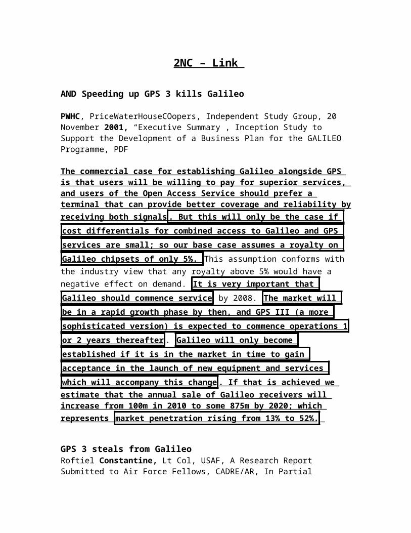
The commercial case for establishing Galileo alongside GPS is that users will be willing to pay for superior services, and users of the Open Access Service should prefer a terminal that can provide better coverage and reliability by receiving both signals . But this will only be the case if cost differentials for
combined access to Galileo and GPS services are small; so our base case
assumes a royalty on Galileo chipsets of only 5%. This assumption conforms with the industry view that any royalty above 5% would have a negative effect on demand. It is very important that Galileo should commence service by 2008.
The market will be in a rapid growth phase by then, and GPS III (a more
sophisticated version) is expected to commence operations 1 or 2 years
thereafter . Galileo will only become established if it is in the market in time
to gain acceptance in the launch of new equipment and services which will
accompany this change . If that is achieved we estimate that the annual sale of Galileo receivers will increase from 100m in 2010 to some 875m by 2020; which represents market penetration rising from 13% to 52%.
GPS 3 steals from GalileoRoftiel Constantine, Lt Col, USAF, A Research Report Submitted to Air Force Fellows, CADRE/AR, In Partial Fulfillment of the Graduation Requirements, April 2007, “GPS & GALILEO. FRIENDLY FOES?”, PDF
Scheduled for launch in 2008, the fourth-generation satellite, Block-IIF (for Follow-on), will have many improvements over its predecessors including a 15-year design life, advanced atomic clocks, improved reliability, increased and adjustable signal power, and the addition of a third civil signal for services where lives are at risk, such as commercial aviation.31 Scheduled to begin launching in 2013, GPS
Block-III (commonly referred to as GPS III) satellites will be the first to be fully compatible with Galileo satellites and are expected to increase signal transmitter power 500-fold, multiplying its resistance to jamming. In addition to all the features of the previous GPS satellites, GPS III will transmit a more robust signal and provide precision approaching real-time unaugmented one-

meter, as more GPS III satellites are placed in orbit; this would improve to less than one meter precision when augmented by signals from Galileo satellites.32 In this way, GPS III precision could very likely rival that expected
of Galileo. Boeing, the prime contractor for GPS III satellites, stated in a January 2007 press release that “GPS III sets a new standard for space-based navigation…GPS III will provide transformational capabilities, such as anti-jamming, to our customer and our warfighters, along with better precision and interoperability with Europe’s Galileo system for our commercial and civil users.”33
2NC – I/L - Cohesion
AND Galileo can save the EU
Roftiel Constantine, Lt Col, USAF, A Research Report Submitted to Air Force Fellows, CADRE/AR, In Partial Fulfillment of the Graduation Requirements, April 2007, “GPS & GALILEO. FRIENDLY FOES?”, PDF
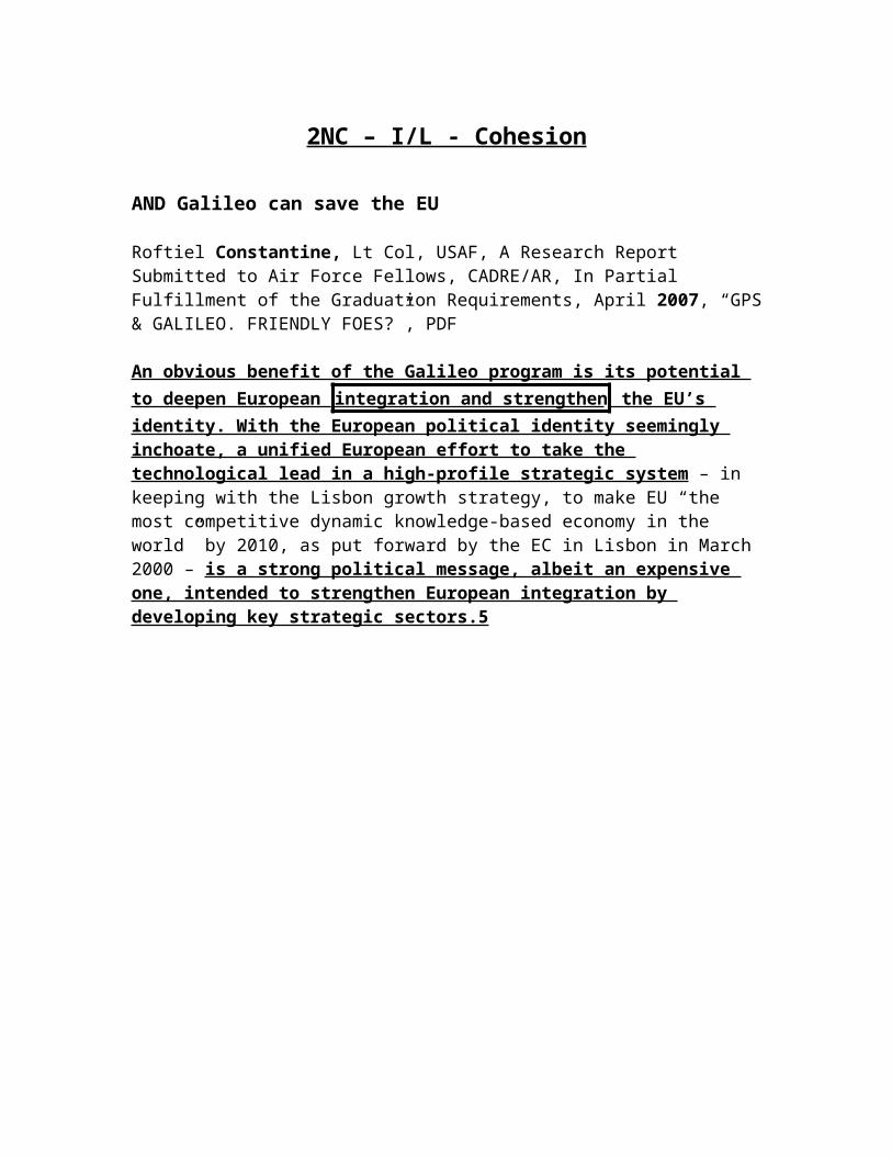
An obvious benefit of the Galileo program is its potential to deepen European integration and strengthen the EU’s identity. With the European political identity seemingly inchoate, a unified European effort to take the technological lead in a high-profile strategic system – in keeping with the Lisbon growth strategy, to make EU “the most competitive dynamic knowledge-based economy in the world” by 2010, as put forward by the EC in Lisbon in March 2000 – is a strong political message, albeit an expensive one, intended to strengthen European integration by developing key strategic sectors.5

2NC – I/L - Econ
Galileo is crucial to European economic growth and cohesion
Roftiel Constantine, Lt Col, USAF, A Research Report Submitted to Air Force Fellows, CADRE/AR, In Partial Fulfillment of the Graduation Requirements, April 2007, “GPS & GALILEO. FRIENDLY FOES?”, PDF
This concept was furthered in the EU’s November 2000 European Strategy for Space. Still the most current European space strategy document, it highlights the strategic importance of space for economic and political growth in
Europe, the global competitiveness of European industry as an industrial
policy priority, and the importance of Galileo . When first written, it represented a “sharp break from the past, with space contributions to security and defense being seriously considered for the first time above the national level. The strategy calls for the EU to provide a common policy framework by integrating European space and making its history of fragmentation along national lines a thing of the past.”3 The March 2005 report of the EC’s Panel of Experts on Space and Security concludes that during the Cold War it made sense for Europe to rely on non-European, i.e., US, space-based systems to support the EU’s security, as Europe largely relied on the US for its collective security and had no need for an organic expeditionary capability. The report goes on to note that since the end of the Cold War, Europe’s security situation has been rather different, and, with the establishment of the European Defense Force, Europe and its member states are increasing their capabilities to operate outside their borders in expeditionary forces on a variety of multinational military and civil operations. This expert panel stressed that Europe could no longer assume a fortuitous coincidence of interest with the US.4 Galileo’s business plan has
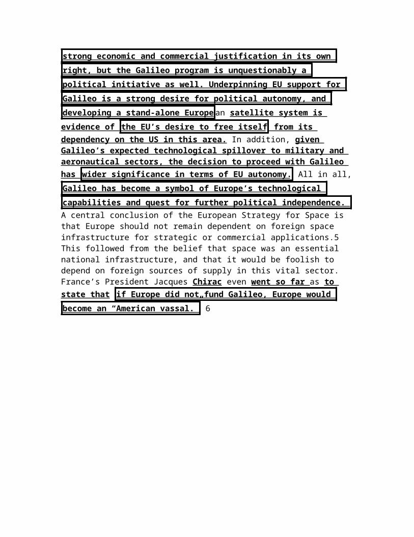
clearly provided strong economic and commercial justification in its own
right, but the Galileo program is unquestionably a political initiative as well.
Underpinning EU support for Galileo is a strong desire for political autonomy,
and developing a stand-alone Europe an satellite system is evidence of the
EU’s desire to free itself from its dependency on the US in this area. In addition, given Galileo’s expected technological spillover to military and aeronautical sectors, the decision to proceed with Galileo has wider
significance in terms of EU autonomy. All in all, Galileo has become a symbol
of Europe’s technological capabilities and quest for further political
independence. A central conclusion of the European Strategy for Space is that Europe should not remain dependent on foreign space infrastructure for strategic or commercial applications.5 This followed from the belief that space was an essential national infrastructure, and that it would be foolish to depend on foreign sources of

supply in this vital sector. France’s President Jacques Chirac even went so far as to state that if Europe did not fund Galileo, Europe would become an “American
vassal.” 6
2NC – Impact – A2 Relations
AND – No relations turns – it already happened – Success of Galileo is key to relation
Roftiel Constantine, Lt Col, USAF, A Research Report Submitted to Air Force Fellows, CADRE/AR, In Partial Fulfillment of the Graduation Requirements, April 2007, “GPS & GALILEO. FRIENDLY FOES?”, PDF
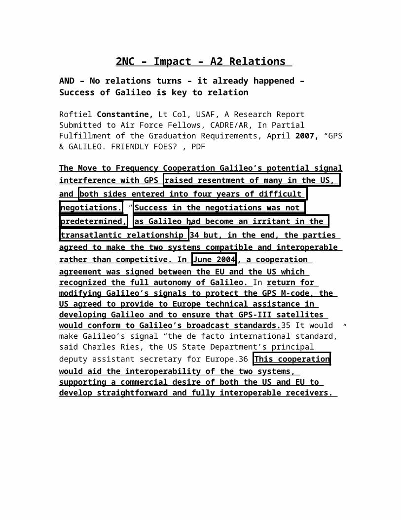
The Move to Frequency Cooperation Galileo’s potential signal interference with GPS raised resentment of many in the US, and both sides entered into
four years of difficult negotiations. “ Success in the negotiations was not
predetermined, as Galileo had become an irritant in the transatlantic
relationship” 34 but, in the end, the parties agreed to make the two systems
compatible and interoperable rather than competitive. In June 2004 , a cooperation agreement was signed between the EU and the US which recognized the full autonomy of Galileo. In return for modifying Galileo’s signals to protect the GPS M-code, the US agreed to provide to Europe technical assistance in developing Galileo and to ensure that GPS-III satellites would conform to Galileo’s broadcast standards.35 It would make Galileo’s signal “the de facto international standard,” said Charles Ries, the US State Department’s principal deputy assistant secretary for Europe.36 This cooperation would aid the interoperability of the two systems, supporting a commercial desire of both the US and EU to develop straightforward and fully interoperable receivers.

CPs

*** Secretary of Defense CP
1NC
The Secretary of Defense should:
- Clarify lines of authority and responsibility within the Department to eliminate ambiguity regarding GPS responsibilities,
- Designate a single focal point within the Office of the Secretary of Defense responsible for all GPS policy and oversight matters including clearly defined relationships with the Joint Staff,
- Use the DoD PNT Executive Committee process to conduct a top-to-bottom review and develop recommendations regarding organizational structure(s),
- Reemphasize in writing the criticality of GPS operations, similar to the emphasis he has previously issued for GPS acquisition,
- Direct STRATCOM to develop and maintain a roadmap for achieving joint, integrated, seamless, precision military operations, to coordinate Service-developed user equipment roadmaps for compatibility and to establish and maintain SPS and PPS performance standards.
That’s key Dr. Robert Hermann Global Technology Partners, LLC , Co-Chairmen ET AL, Hon. James Schlesinger MITRE Corporation Task Force Members Mr. John Darrah Institute for Defense Analyses Mr. William Delaney MIT Lincoln Laboratory Mr. Arnold Donahue Project Director NAPA Mr. Kirk Lewis Institute for Defense Analyses Gen James McCarthy, USAF (Ret) United States Air Force Academy Mr. Steve Moran Raytheon Ms. Ruth Neilan NASA Jet Propulsion Laboratory Mr. Robert Nesbit MITRE Corporation Dr. Brad Parkinson Stanford University Dr. James Spilker Stanford University Hon. John Stenbit Private Consultant Gen Larry Welch, USAF (Ret) Institute for Defense Analyses Executive Secretary Mr. Ray Swider OSD (NII) DSB Representative LtCol David Robertson, USAF Government Advisors Mr. Robert Broussard Headquarters, USAF LtCol Hazel Kelly, USAF Office of the Secretary of the Air Force Ms. Pamela Hodge Headquarters, USAF Mr. Richard McKinney Headquarters, USAF Staff Dr. Evelyn Dahm Strategic Analysis Inc. Mr. Jules McNeff Overlook Systems Technologies, Inc, October 2005, “Defense Science Board Task Force on The Future of the Global Positioning System”, PDFThe Secretary of Defense should also clarify lines of authority and responsibility within the Department to eliminate ambiguity regarding GPS responsibilities that hinders decision making internally and that perpetuates the perception externally that the DoD has lost sight of its GPS stewardship responsibilities. − Designate a single focal point within the Office of the Secretary of Defense responsible for all GPS policy and oversight matters
including clearly defined relationships with the Joint Staff and Services (including the Air Force) regarding GPS operations and acquisition, respectively. − Use the DoD PNT Executive Committee process to conduct a top-to-bottom review and develop recommendations regarding organizational structure(s) for DoD PNT role. − Sponsor and lead an interagency effort to develop a comprehensive national PNT architecture to guide future investment and implementation decisions regarding GPS and complementary systems and technologies. − The Secretary of Defense should reemphasize in writing the criticality of GPS operations, similar to the emphasis he has previously issued for GPS acquisition. Commander STRATCOM can quickly demonstrate improved operations through support of Commander 14th AF tasking to stand up a Joint GPS Service Support Center (as part of the Joint Space Operations Center). The center’s primary operational task would be improved position and time services to military users, achieving this initially through the collection and assessment of GPS monitor information from reliable, independent global sources and in the longer term by providing operational guidance for updating the control segment software. The center could also provide a source of information on all foreign GNSS available (GLONASS, Galileo, other systems), for space situation awareness. − In fulfilling its stewardship obligation for providing civil and military space-based PNT, the Commander, STRATCOM should be directed by the Secretary of Defense to develop and maintain a roadmap for achieving joint, integrated, seamless, precision military operations, to coordinate Service-developed user equipment roadmaps for compatibility and to establish and maintain SPS and PPS performance standards. STRATCOM could then task its component (Air Force Space Command) to implement standards and reporting criteria in accordance with routine joint system performance reporting instructions. − Include designated representatives from STRATCOM on all DoD and interagency executive committees and working groups involved with management and operation of GPS. − Ensure that the concept of stewardship for GPS operations as passed from the Secretary of Defense to STRATCOM includes responsibility for being aware of and meeting civil service performance needs as mutually agreed between the DoD and civil users and reflected in the GPS Civil Performance Standard.
Solves coordination, failures of the status quo, and international perception – these are the KEY reasons why GPS will fail Dr. Robert Hermann Global Technology Partners, LLC , Co-Chairmen ET AL, Hon. James Schlesinger MITRE Corporation Task Force Members Mr. John Darrah Institute for Defense Analyses Mr. William Delaney MIT Lincoln Laboratory Mr. Arnold Donahue Project Director NAPA Mr. Kirk Lewis Institute for Defense Analyses Gen James McCarthy, USAF (Ret) United States Air Force Academy Mr. Steve Moran Raytheon Ms. Ruth Neilan NASA Jet Propulsion Laboratory Mr. Robert Nesbit MITRE Corporation Dr. Brad Parkinson Stanford University Dr. James Spilker Stanford University Hon. John Stenbit Private Consultant Gen Larry Welch, USAF

(Ret) Institute for Defense Analyses Executive Secretary Mr. Ray Swider OSD (NII) DSB Representative LtCol David Robertson, USAF Government Advisors Mr. Robert Broussard Headquarters, USAF LtCol Hazel Kelly, USAF Office of the Secretary of the Air Force Ms. Pamela Hodge Headquarters, USAF Mr. Richard McKinney Headquarters, USAF Staff Dr. Evelyn Dahm Strategic Analysis Inc. Mr. Jules McNeff Overlook Systems Technologies, Inc, October 2005, “Defense Science Board Task Force on The Future of the Global Positioning System”, PDFSince the inception of GPS, the Secretary of Defense has been the effective Executive Agent for acquiring and operating GPS for all represented interests of the United States. Also, the Air Force, in various capacities over the life of the program, has been designated as Executive Agent for acquisition and operation of GPS for the Department of Defense. On behalf of the Secretary of Defense, the Commander, STRATCOM is also responsible for ensuring that required GPS services are available for all intended users and is separately accountable for exploiting GPS for Department of Defense missions. Other Departments and Agencies are separately accountable for exploiting GPS for their unique missions. Even in consideration of this specific definition of accountability and responsibility, policy and operational responsibilities for GPS within the DoD have been diffused by various management decisions over the last several years. The sometimes overlapping, sometimes disconnected roles of the
Office of the Secretary of Defense staff components, the Joint Staff and the Air
Force in the management of GPS have created considerable confusion over
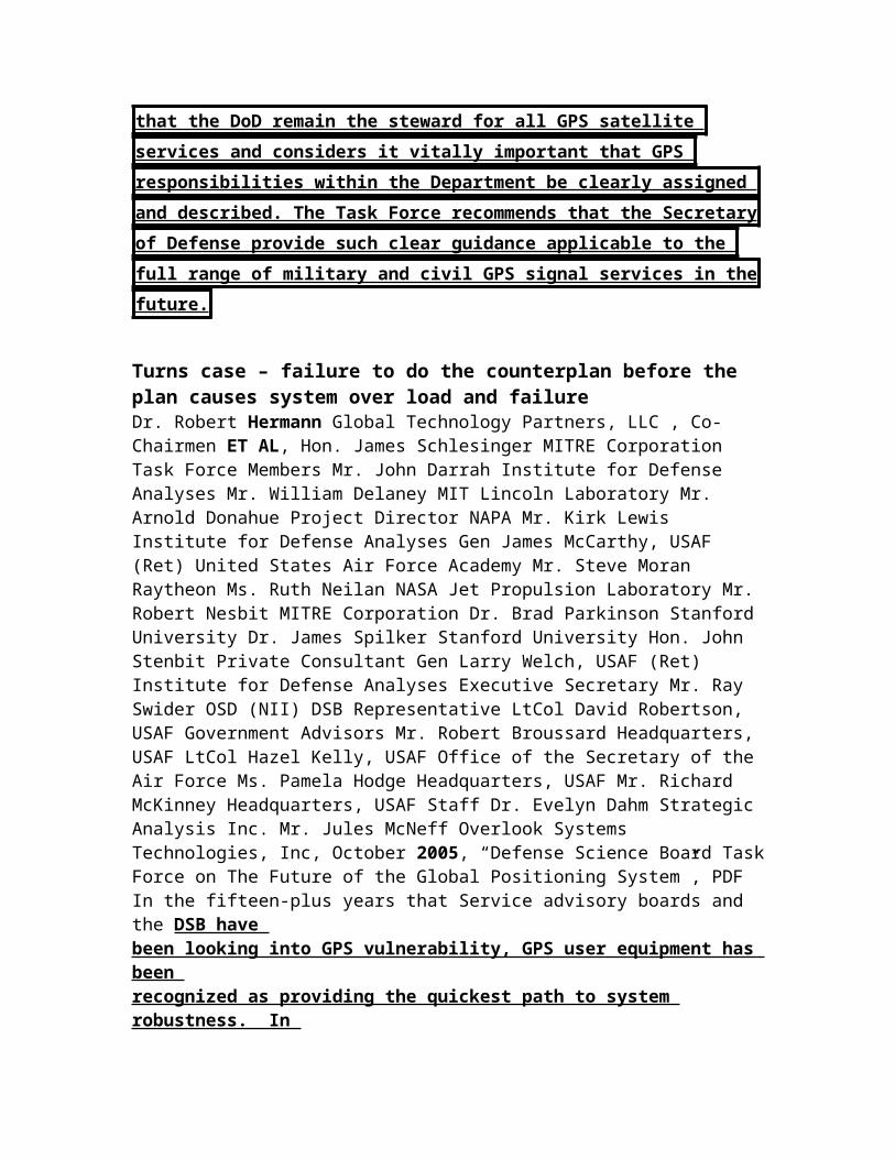
where responsibility for GPS actually rests. This sense of confusion has also impacted civil and international perceptions of the importance the U.S. places on GPS and the commitment of the U.S. to GPS sustainment and evolution. It is incumbent on the Secretary of Defense to redefine lines of authority and responsibility for the system and to reestablish the DoD position of leadership for GPS as the heart of the space-based PNT infrastructure both domestically and internationally. The Task Force recommends that the DoD remain the
steward for all GPS satellite services and considers it vitally important that
GPS responsibilities within the Department be clearly assigned and
described. The Task Force recommends that the Secretary of Defense provide
such clear guidance applicable to the full range of military and civil GPS
signal services in the future.
Turns case – failure to do the counterplan before the plan causes system over load and failure Dr. Robert Hermann Global Technology Partners, LLC , Co-Chairmen ET AL, Hon. James Schlesinger MITRE Corporation Task Force Members Mr. John Darrah Institute for Defense Analyses Mr. William Delaney MIT Lincoln Laboratory Mr. Arnold Donahue Project Director NAPA Mr. Kirk Lewis Institute for Defense

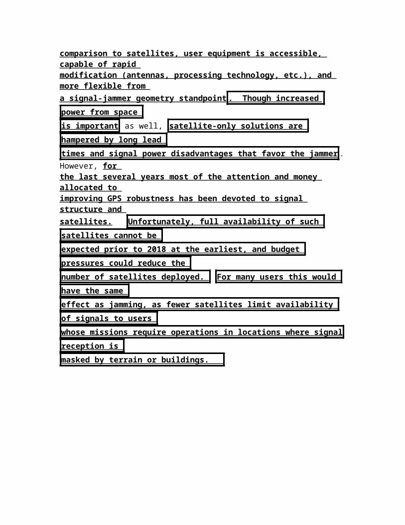
Analyses Gen James McCarthy, USAF (Ret) United States Air Force Academy Mr. Steve Moran Raytheon Ms. Ruth Neilan NASA Jet Propulsion Laboratory Mr. Robert Nesbit MITRE Corporation Dr. Brad Parkinson Stanford University Dr. James Spilker Stanford University Hon. John Stenbit Private Consultant Gen Larry Welch, USAF (Ret) Institute for Defense Analyses Executive Secretary Mr. Ray Swider OSD (NII) DSB Representative LtCol David Robertson, USAF Government Advisors Mr. Robert Broussard Headquarters, USAF LtCol Hazel Kelly, USAF Office of the Secretary of the Air Force Ms. Pamela Hodge Headquarters, USAF Mr. Richard McKinney Headquarters, USAF Staff Dr. Evelyn Dahm Strategic Analysis Inc. Mr. Jules McNeff Overlook Systems Technologies, Inc, October 2005, “Defense Science Board Task Force on The Future of the Global Positioning System”, PDFIn the fifteen-plus years that Service advisory boards and the DSB have been looking into GPS vulnerability, GPS user equipment has been recognized as providing the quickest path to system robustness. In comparison to satellites, user equipment is accessible, capable of rapid modification (antennas, processing technology, etc.), and more flexible from a signal-jammer geometry standpoint . Though increased power from space
is important as well, satellite-only solutions are hampered by long lead
times and signal power disadvantages that favor the jammer . However, for the last several years most of the attention and money allocated to improving GPS robustness has been devoted to signal structure and satellites. Unfortunately, full availability of such satellites cannot be
expected prior to 2018 at the earliest, and budget pressures could reduce the
number of satellites deployed. For many users this would have the same
effect as jamming, as fewer satellites limit availability of signals to users
whose missions require operations in locations where signal reception is
masked by terrain or buildings.

2NC – Organization
AND – Organization is the biggest problem now – only the counterplan solves
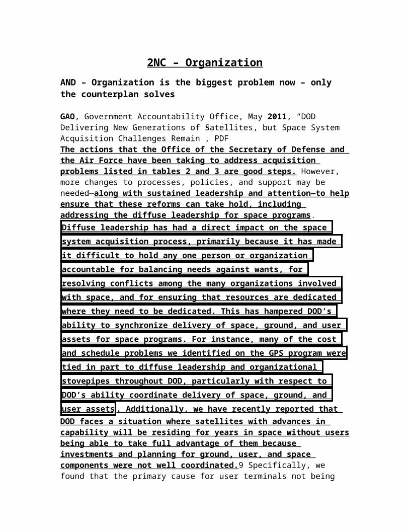
GAO, Government Accountability Office, May 2011, “DOD Delivering New Generations of Satellites, but Space System Acquisition Challenges Remain”, PDFThe actions that the Office of the Secretary of Defense and the Air Force have been taking to address acquisition problems listed in tables 2 and 3 are good steps. However, more changes to processes, policies, and support may be needed—along with sustained leadership and attention—to help ensure that these reforms can take hold, including addressing the diffuse leadership for space programs. Diffuse leadership has had a direct impact on the space system
acquisition process, primarily because it has made it difficult to hold any one
person or organization accountable for balancing needs against wants, for
resolving conflicts among the many organizations involved with space, and
for ensuring that resources are dedicated where they need to be dedicated.
This has hampered DOD’s ability to synchronize delivery of space, ground,
and user assets for space programs. For instance, many of the cost and
schedule problems we identified on the GPS program were tied in part to
diffuse leadership and organizational stovepipes throughout DOD,
particularly with respect to DOD’s ability coordinate delivery of space,
ground, and user assets . Additionally, we have recently reported that DOD faces a situation where satellites with advances in capability will be residing for years in space without users being able to take full advantage of them because investments and planning for ground, user, and space components were not well coordinated.9 Specifically, we found that the primary cause for user terminals not being well synchronized with their associated space systems is that user terminal development programs are typically managed by different military acquisition organizations than those managing the satellites and ground control systems.
*** Nunn McCurdy
Solvency
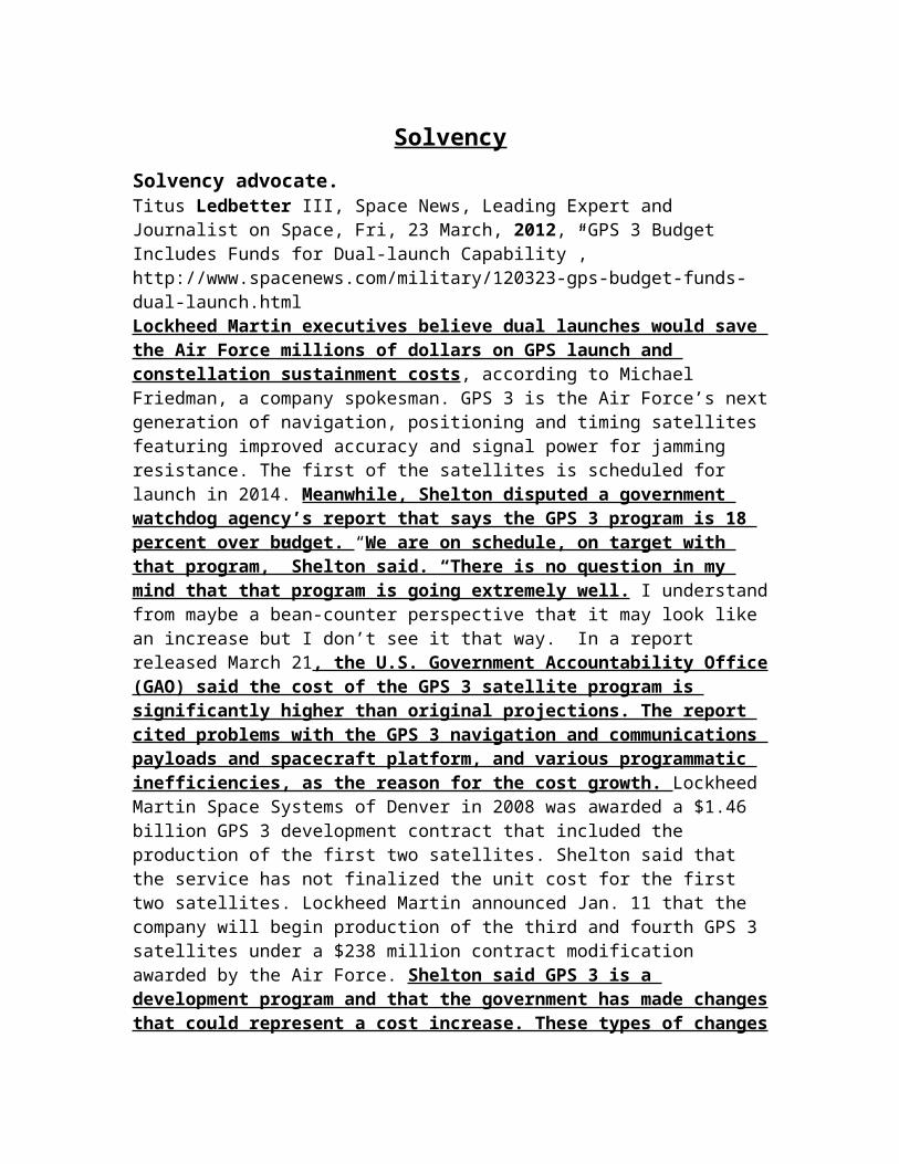
Solvency advocate.Titus Ledbetter III, Space News, Leading Expert and Journalist on Space, Fri, 23 March, 2012, “GPS 3 Budget Includes Funds for Dual-launch Capability”, http://www.spacenews.com/military/120323-gps-budget-funds-dual-launch.htmlLockheed Martin executives believe dual launches would save the Air Force millions of dollars on GPS launch and constellation sustainment costs, according to Michael Friedman, a company spokesman. GPS 3 is the Air Force’s next generation of navigation, positioning and timing satellites featuring improved accuracy and signal power for jamming resistance. The first of the satellites is scheduled for launch in 2014. Meanwhile, Shelton disputed a government watchdog agency’s report that says the GPS 3 program is 18 percent over budget. “We are on schedule, on target with that program,” Shelton said. “There is no question in my mind that that program is going extremely well. I understand from maybe a bean-counter perspective that it may look like an increase but I don’t see it that way.” In a report released March 21, the U.S. Government Accountability Office (GAO) said the cost of the GPS 3 satellite program is significantly higher than original projections. The report cited problems with the GPS 3 navigation and communications payloads and spacecraft platform, and various programmatic inefficiencies, as the reason for the cost growth. Lockheed Martin Space Systems of Denver in 2008 was awarded a $1.46 billion GPS 3 development contract that included the production of the first two satellites. Shelton said that the service has not finalized the unit cost for the first two satellites. Lockheed Martin announced Jan. 11 that the company will begin production of the third and fourth GPS 3 satellites under a $238 million contract modification awarded by the Air Force. Shelton said GPS 3 is a development program and that the government has made changes that could represent a cost increase. These types of changes are usually made because the government discovers issues that were not anticipated when the contract was signed, he said. The GPS 3
program is “not even close” to a Nunn-McCurdy breach, Shelton said,
referring to a law that requires the Pentagon to notify Congress of programs
that experience cost growth of 15 percent, and to recertify those whose costs
climb by 25 percent. In an email, Christina Chaplain, director of acquisition and sourcing management at the GAO, said the 18 percent cost growth estimate is the difference between the current and original projections for completing development and building the first two satellites. “There were two current estimates given to GAO — one from the program office of $1.6 billion and one from the contractor of $1.4 billion,” she said. “We used the $1.4 billion to calculate the 18 percent.” In a telephone interview, Chaplain, said it is important to closely watch costs on programs like GPS 3. “Otherwise, we won’t find something out until it is too late,” she said. Chaplain said there is no cause yet for alarm on GPS 3. Generally speaking, she said, the “program is doing the best it can and we still believe they are following
good practices.” The Air Force has budgeted about $1.3 billion for the GPS program in 2013, including $559 million for program procurement, which includes the purchase of two additional GPS 3 satellites, according to budget documents.
*** Consult EU
Cards / Advocates
Roftiel Constantine, Lt Col, USAF, A Research Report Submitted to Air Force Fellows, CADRE/AR, In Partial Fulfillment of the Graduation Requirements, April 2007, “GPS & GALILEO. FRIENDLY FOES?”, PDF
An EU decision to restrict access to or knowledge of Galileo’s signals could exclude US firms from the market for Galileo satellite navigation services and equipment, and the US must ensure that all information needed for Galileo receiver production must be made equally available to all manufacturers. Specifically, the US should work to ensure that the EU publishes all documentation for access to Galileo’s Open Service, just as is done for the GPS SPS. In addition, the EU must provide equal access to the specifications for Galileo’s Controlled Access services, to include openly publishing the encryption algorithms, ensuring the cryptographic key system does not exclude non-Europeans, and ensuring that any licensing arrangements and fees do not discriminate against non-European firms. The ESA did release the Galileo Open Service Signal in Space Interface Control Document in May 2006,6 a positive step toward providing access to Galileo’s technical information, but the US must remain vigilant and ensure that this vital information continues to flow freely, equitably, and in a timely manner to US manufacturers. The June 2004, EU-US cooperation agreement on the use of Galileo and GPS established a forum to address these two issues. The agreement states that the US and EU will consult with each other before establishing any measures that will have the effect of mandating the use of a particular system within its territory, and that measures should not be used as a disguised restriction on or as an unnecessary obstacle to international trade.7 To ensure that these critical aspects are upheld, the 2004 agreement established the Trade and Civil Applications working group to address non-discrimination and other trade-related issues; this group met for the first time in January 2007.8 The US must capitalize on this working group’s operational oversight to ensure that a fair and level playing field exists for all manufacturers of civil satellite-based navigation and timing end-user equipment, regardless of nationality.
Consult EU and China cardRoftiel Constantine, Lt Col, USAF, A Research Report Submitted to Air Force Fellows, CADRE/AR, In Partial Fulfillment of the Graduation Requirements, April 2007, “GPS & GALILEO. FRIENDLY FOES?”, PDF
The involvement of China in the Galileo program is particularly troubling for the US. As part of a larger program of military modernization, China has sought satellite navigation services for its armed forces. While technology transfer from Europe to China and input from China into Galileo’s design and operation will be limited, this cooperation will allow the Chinese to develop a more sophisticated understanding of navigational satellites. Also, China’s Compass Navigation System, which is expected to become fully operational over much of China in 2008, could use the

same radio frequency as Galileo and GPS, making US attempts to jam an adversary’s positioning and navigational signals much more difficult in times of crises. Ultimately, the Compass Navigation System could be used worldwide to provide precise positioning data for the Chinese military similar to information already produced by GPS to support military field commanders. Thus, China’s deepening space partnership with the EU could present an immediate national security dilemma for the US, since advanced technologies shared by cooperative EU nations would almost certainly enhance China’s military modernization and intelligence programs. In order to mitigate this situation, the US and the EU should enter into multilateral discussions with China to determine how best to proceed cooperatively with GPS, Galileo, and Compass, just as the US did with the EU in 2000. The US should discuss China's current and future participation in Galileo, starting with a few questions such as “What is China's role in Galileo? What kind of access will it have to sensitive technology? What firewalls are in place to make it more difficult for China to acquire sensitive technologies through Galileo?”14 Concurrently, the US and the EU should capitalize on the recently formed United Nations International Committee on GNSS to address compatibility and interoperability issues among the three systems. How amenable China will be to constructive and productive discussions to achieve cooperation and avoid competition between GPS, Galileo, and Compass has yet to be seen. The US and EU agreement took almost four years to conclude, and that was between two largely cooperative entities. In order to sweeten the deal and entice China to the discussion table, the US and EU could offer incentives such as a collection of GPS and Galileo lessons learned, coupled with technical assistance in developing the Compass system.

Ks

Communicative Rationality
The plan destroys communicative rationality – turns the case Dr. Robert Hermann Global Technology Partners, LLC , Co-Chairmen ET AL, Hon. James Schlesinger MITRE Corporation Task Force Members Mr. John Darrah Institute for Defense Analyses Mr. William Delaney MIT Lincoln Laboratory Mr. Arnold Donahue Project Director NAPA Mr. Kirk Lewis Institute for Defense Analyses Gen James McCarthy, USAF (Ret) United States Air Force Academy Mr. Steve Moran Raytheon Ms. Ruth Neilan NASA Jet Propulsion Laboratory Mr. Robert Nesbit MITRE Corporation Dr. Brad Parkinson Stanford University Dr. James Spilker Stanford University Hon. John Stenbit Private Consultant Gen Larry Welch, USAF (Ret) Institute for Defense Analyses Executive Secretary Mr. Ray Swider OSD (NII) DSB Representative LtCol David Robertson, USAF Government Advisors Mr. Robert Broussard Headquarters, USAF LtCol Hazel Kelly, USAF Office of the Secretary of the Air Force Ms. Pamela Hodge Headquarters, USAF Mr. Richard McKinney Headquarters, USAF Staff Dr. Evelyn Dahm Strategic Analysis Inc. Mr. Jules McNeff Overlook Systems Technologies, Inc, October 2005, “Defense Science Board Task Force on The Future of the Global Positioning System”, PDFOver the past two years, two separate studies were authorized by the Deputy Secretary of Defense to investigate the viability of alternative governance structures for managing and financing GPS to both sustain and enhance its services for its full complement of domestic and international users. The Task Force received a briefing on a preliminary phase of the study, termed Project Atlas, which had looked at generic concepts of financing applicable to GPS. A subsequent study, termed Project Herakles, was concluded in April 2005 and focused in detail on a more specific set of alternatives. Both studies indicated that alternative governance
strategies could be feasible; however, additional work is necessary before any changes could or would be implemented. Any substantive change in GPS governance would of course require extensive cooperation and support among the Executive and Legislative Branches of U.S. Government. Yet, given the end of the “natural monopoly” for GPS, and with the rapidly emerging prospect of an altered and competitive environment, the Task Force believes that the government should remain open-minded on the governance issues highlighted by Project Herakles. In its implementation and operation of GPS thus far, the U.S. Government has not made use of a comprehensive and commonly
accepted strategy accounting for all the national equities at stake in the
resolution of issues affecting acquisition and operation of the system. Similarly, there has not been a systematically constructed and commonly accepted architecture to foster consensus among the various agencies responsible for implementation of GPS and its components and complements. The recently signed Presidential Directive is intended to strengthen the interagency management process and requires the preparation and update of a 5-year space-based PNT Plan which could provide the basis for such a strategy. Unfortunately,
the Task Force notes that the implementation of the new management structure by all the Departments involved appears to be significantly lagging the schedules as defined in the Directive.

CASE


*** Solvency

1NC Frontline
Multiple problems to solvency
Dr. Robert Hermann Global Technology Partners, LLC , Co-Chairmen ET AL, Hon. James Schlesinger MITRE Corporation Task Force Members Mr. John Darrah Institute for Defense Analyses Mr. William Delaney MIT Lincoln Laboratory Mr. Arnold Donahue Project Director NAPA Mr. Kirk Lewis Institute for Defense Analyses Gen James McCarthy, USAF (Ret) United States Air Force Academy Mr. Steve Moran Raytheon Ms. Ruth Neilan NASA Jet Propulsion Laboratory Mr. Robert Nesbit MITRE Corporation Dr. Brad Parkinson Stanford University Dr. James Spilker Stanford University Hon. John Stenbit Private Consultant Gen Larry Welch, USAF (Ret) Institute for Defense Analyses Executive Secretary Mr. Ray Swider OSD (NII) DSB Representative LtCol David Robertson, USAF Government Advisors Mr. Robert Broussard Headquarters, USAF LtCol Hazel Kelly, USAF Office of the Secretary of the Air Force Ms. Pamela Hodge Headquarters, USAF Mr. Richard McKinney Headquarters, USAF Staff Dr. Evelyn Dahm Strategic Analysis Inc. Mr. Jules McNeff Overlook Systems Technologies, Inc, October 2005, “Defense Science Board Task Force on The Future of the Global Positioning System”, PDF
Serious Delays Affecting Military Signals and Equipment -- Full operational
availability of new military GPS signals , and the user equipment to receive them, is not forecast before 2013 (24 satellites), though the first new signals will be on GPS Block IIR-M satellites to be launched beginning in 2005. The GPS control segment has experienced significant problems over the last several years in activating new capabilities even as the GPS satellites have evolved, and those problems persist . There are also coverage gaps in the military GPS signal monitor network that have affected timely identification of satellite problems. The coverage problems will be mitigated to a large extent with the addition of data from six National Geospatial Intelligence Agency (NGA) monitor stations, improving the visibility of the constellation to the control segment. However, unanswered questions remain about use of additional global monitoring data collected by civil government and scientific organizations. To date the Air Force has not included the monitoring of the civil signals as an element of its mission of operating GPS. In consideration of its overall responsibilities for GPS operation, the Task Force included recommendations for the Air Force to add civil monitoring and performance measurement to its operational control mission.
AND – turn – plan makes future GPS systems impossible
Dr. Robert Hermann Global Technology Partners, LLC , Co-Chairmen ET AL, Hon. James Schlesinger MITRE Corporation Task Force Members Mr. John Darrah
Institute for Defense Analyses Mr. William Delaney MIT Lincoln Laboratory Mr. Arnold Donahue Project Director NAPA Mr. Kirk Lewis Institute for Defense Analyses Gen James McCarthy, USAF (Ret) United States Air Force Academy Mr. Steve Moran Raytheon Ms. Ruth Neilan NASA Jet Propulsion Laboratory Mr. Robert Nesbit MITRE Corporation Dr. Brad Parkinson Stanford University Dr. James Spilker Stanford University Hon. John Stenbit Private Consultant Gen Larry Welch, USAF (Ret) Institute for Defense Analyses Executive Secretary Mr. Ray Swider OSD (NII) DSB Representative LtCol David Robertson, USAF Government Advisors Mr. Robert Broussard Headquarters, USAF LtCol Hazel Kelly, USAF Office of the Secretary of the Air Force Ms. Pamela Hodge Headquarters, USAF Mr. Richard McKinney Headquarters, USAF Staff Dr. Evelyn Dahm Strategic Analysis Inc. Mr. Jules McNeff Overlook Systems Technologies, Inc, October 2005, “Defense Science Board Task Force on The Future of the Global Positioning System”, PDF
GPS III Cost & Weight are Critical Issues – In this context, there is also a very high level of concern among the Task Force membership regarding projected growth in cost and weight of future generation GPS satellites . Affordability is a driving factor in operating and sustaining a satellite constellation of this size, and the Task Force finds that the GPS III payload as currently envisioned
will probably not be affordable in terms of satellite cost and weight . Both factors together determine payload-to-orbit costs, which, if not closely controlled, create an unacceptable budgetary environment in which to
consider constellation size and replenishment rate decisions . History has shown that the Air Force has had chronic difficulty in adequately funding GPS, even in the absence of the more expensive GPS III satellites. If the Air Force continues to use its GPS investments as a funding source to offset other space/aircraft programs, then GPS service continuity will remain in jeopardy even without the more costly GPS III. The Task Force recommends that cost and weight of the GPS III satellites be key parameters in their design, and specifically recommends measures to limit GPS III weight to ensure two satellites may be launched aboard a medium-class launch vehicle.
AND – Galileo agreement solves
Dr. Robert Hermann Global Technology Partners, LLC , Co-Chairmen ET AL, Hon. James Schlesinger MITRE Corporation Task Force Members Mr. John Darrah Institute for Defense Analyses Mr. William Delaney MIT Lincoln Laboratory Mr. Arnold Donahue Project Director NAPA Mr. Kirk Lewis Institute for Defense Analyses Gen James McCarthy, USAF (Ret) United States Air Force Academy Mr. Steve Moran Raytheon Ms. Ruth Neilan NASA Jet Propulsion Laboratory Mr. Robert Nesbit MITRE Corporation Dr. Brad Parkinson Stanford University Dr. James Spilker Stanford University Hon. John Stenbit Private Consultant Gen Larry Welch, USAF (Ret) Institute for Defense Analyses Executive Secretary Mr. Ray Swider OSD (NII)
DSB Representative LtCol David Robertson, USAF Government Advisors Mr. Robert Broussard Headquarters, USAF LtCol Hazel Kelly, USAF Office of the Secretary of the Air Force Ms. Pamela Hodge Headquarters, USAF Mr. Richard McKinney Headquarters, USAF Staff Dr. Evelyn Dahm Strategic Analysis Inc. Mr. Jules McNeff Overlook Systems Technologies, Inc, October 2005, “Defense Science Board Task Force on The Future of the Global Positioning System”, PDF
Final Galileo Form Remains Uncertain, but Discussions Offer Promise – The June 2004 U.S.-EU agreement on GPS/Galileo cooperation is encouraging in that it appears to have resolved several technical compatibility issues and establishes an environment for further cooperation. Diverse perceptions that arose during negotiation of the agreement regarding comparability of service between the two systems remain to be resolved as cooperative discussions proceed under the agreement. Even with the agreement in place, uncertainty remains regarding the eventual form Galileo will take as well as regarding European resolve to bring it into full operation. In this context, the recently signed Presidential directive establishes as a goal that U.S.- provided civil GPS services and augmentations remain competitive with foreign civil systems. If/when Galileo is fully operational, its additional satellites should increase signal availability and overall system integrity for dual mode civil GPS-Galileo receivers. This should be particularly useful for users in urban “canyons” and other obstructed areas. In more open environments a single receiver may see a sufficient number of satellites to enable signal integrity verification within the receiver itself. The cooperative discussions now envisioned with the EU should have such improvements as an objective. From a military perspective, Galileo’s eventual form could present additional challenges with potential effects on Navwar implementation in the NATO environment. As Galileo evolution and adoption proceeds, the DoD must be prepared to address its possible use by one or more NATO nations or for NATO purposes.
AND – turn – plan uses internal trade offs makes jamming easy
Dr. Robert Hermann Global Technology Partners, LLC , Co-Chairmen ET AL, Hon. James Schlesinger MITRE Corporation Task Force Members Mr. John Darrah Institute for Defense Analyses Mr. William Delaney MIT Lincoln Laboratory Mr. Arnold Donahue Project Director NAPA Mr. Kirk Lewis Institute for Defense Analyses Gen James McCarthy, USAF (Ret) United States Air Force Academy Mr. Steve Moran Raytheon Ms. Ruth Neilan NASA Jet Propulsion Laboratory Mr. Robert Nesbit MITRE Corporation Dr. Brad Parkinson Stanford University Dr. James Spilker Stanford University Hon. John Stenbit Private Consultant Gen Larry Welch, USAF (Ret) Institute for Defense Analyses Executive Secretary Mr. Ray Swider OSD (NII) DSB Representative LtCol David Robertson, USAF Government Advisors Mr. Robert Broussard Headquarters, USAF LtCol Hazel Kelly, USAF Office of the Secretary of the Air Force Ms. Pamela Hodge Headquarters, USAF Mr. Richard McKinney Headquarters, USAF Staff Dr. Evelyn Dahm Strategic Analysis Inc. Mr. Jules McNeff

Overlook Systems Technologies, Inc, October 2005, “Defense Science Board Task Force on The Future of the Global Positioning System”, PDF
While those factors were synchronized during the initial stages of GPS operation, the program is now out of balance in several respects and that threatens to
delay availability of needed operational capabilities . The out of balance
situation has occurred for a variety of reasons, primarily related to technical
issues and funding. Since the satellites are the critical signal sources and even new satellites can be operated by the existing control segment to maintain legacy services, they have taken priority when technical problems arise that endanger future launch schedules. In some cases, those problems have required diversion of funding from the other segments, causing delays in their improvement and evolution. One operational capability that has been particularly affected has been anti- jamming performance , which requires both control and user segment improvements to take advantage of new satellite signals. Additionally, diversion of funding from user equipment development delays other improvements in signal processing that can provide anti-jam improvements independent of new satellite signals.
AND – those internal tradeoffs are more important than the aff
Dr. Robert Hermann Global Technology Partners, LLC , Co-Chairmen ET AL, Hon. James Schlesinger MITRE Corporation Task Force Members Mr. John Darrah Institute for Defense Analyses Mr. William Delaney MIT Lincoln Laboratory Mr. Arnold Donahue Project Director NAPA Mr. Kirk Lewis Institute for Defense Analyses Gen James McCarthy, USAF (Ret) United States Air Force Academy Mr. Steve Moran Raytheon Ms. Ruth Neilan NASA Jet Propulsion Laboratory Mr. Robert Nesbit MITRE Corporation Dr. Brad Parkinson Stanford University Dr. James Spilker Stanford University Hon. John Stenbit Private Consultant Gen Larry Welch, USAF (Ret) Institute for Defense Analyses Executive Secretary Mr. Ray Swider OSD (NII) DSB Representative LtCol David Robertson, USAF Government Advisors Mr. Robert Broussard Headquarters, USAF LtCol Hazel Kelly, USAF Office of the Secretary of the Air Force Ms. Pamela Hodge Headquarters, USAF Mr. Richard McKinney Headquarters, USAF Staff Dr. Evelyn Dahm Strategic Analysis Inc. Mr. Jules McNeff Overlook Systems Technologies, Inc, October 2005, “Defense Science Board Task Force on The Future of the Global Positioning System”, PDF
The GPS III satellite is still undergoing design by two contractor teams (led by Boeing and Lockheed-Martin/Spectrum Astro). Block III satellites will incorporate improved electronics, high data rate crosslinks (high frequency/narrow beam) providing continuous contact among satellites, and a high power spot beam (“theater” size) for anti-jam improvement. The spot beam is intended to meet the JROC-endorsed anti-jam requirement for +20 dB signal strength
improvement by providing additional power directly from the satellites in lieu of making substantial changes to user equipment antennas and processing technology. First launch for the GPS III satellite was originally planned for FY09 with fully populated constellation by 2016/17; however, go-ahead delays and
funding shortages elsewhere in the program have delayed the first launch
until at least FY13.
AND – even the worst funding solve enough of the aff
Dr. Robert Hermann Global Technology Partners, LLC , Co-Chairmen ET AL, Hon. James Schlesinger MITRE Corporation Task Force Members Mr. John Darrah Institute for Defense Analyses Mr. William Delaney MIT Lincoln Laboratory Mr. Arnold Donahue Project Director NAPA Mr. Kirk Lewis Institute for Defense Analyses Gen James McCarthy, USAF (Ret) United States Air Force Academy Mr. Steve Moran Raytheon Ms. Ruth Neilan NASA Jet Propulsion Laboratory Mr. Robert Nesbit MITRE Corporation Dr. Brad Parkinson Stanford University Dr. James Spilker Stanford University Hon. John Stenbit Private Consultant Gen Larry Welch, USAF (Ret) Institute for Defense Analyses Executive Secretary Mr. Ray Swider OSD (NII) DSB Representative LtCol David Robertson, USAF Government Advisors Mr. Robert Broussard Headquarters, USAF LtCol Hazel Kelly, USAF Office of the Secretary of the Air Force Ms. Pamela Hodge Headquarters, USAF Mr. Richard McKinney Headquarters, USAF Staff Dr. Evelyn Dahm Strategic Analysis Inc. Mr. Jules McNeff Overlook Systems Technologies, Inc, October 2005, “Defense Science Board Task Force on The Future of the Global Positioning System”, PDF
Based on the forgoing, the current schedule and future investment plan for GPS involves significant risk of sustaining sufficient satellites for a full constellation. The current on-orbit inventory is 28 satellites; however, with expected failures, the AF Space Command December 2004 PNT Functional Availability Report reflects a nominal probability between 5 – 20 percent and a worst-case probability between 20-40 percent that the constellation will fall to fewer than 24 satellites in the 2007-2012 period based on current satellite replacement schedules. The Air Force has committed for the long term to
maintaining only a 24 satellite constellation . While this may be satisfactory for aviation and open- ocean maritime missions, the Task Force does not consider it sufficient to support missions in confined urban areas and mountainous regions of the world. The nominal 24-satellite constellation only ensures consistent four- satellite coverage with mask angles (angle to horizon which cuts off GPS reception) above five degrees elevation, a value the Task Force finds to be inadequate for surface operations. For missions involving land operations, assuring availability of four satellites above a fifteen-degree mask angle will provide adequate signals to support operations in urban and mountainous areas. To achieve at least four satellite coverage above fifteen degrees elevation requires at least a thirty satellite constellation. The Task Force considers this to be

vitally important to obtaining the broadest military utility from GPS for future operations and a major factor in system design decisions for GPS III.
AND – there are software problems
Dr. Robert Hermann Global Technology Partners, LLC , Co-Chairmen ET AL, Hon. James Schlesinger MITRE Corporation Task Force Members Mr. John Darrah Institute for Defense Analyses Mr. William Delaney MIT Lincoln Laboratory Mr. Arnold Donahue Project Director NAPA Mr. Kirk Lewis Institute for Defense Analyses Gen James McCarthy, USAF (Ret) United States Air Force Academy Mr. Steve Moran Raytheon Ms. Ruth Neilan NASA Jet Propulsion Laboratory Mr. Robert Nesbit MITRE Corporation Dr. Brad Parkinson Stanford University Dr. James Spilker Stanford University Hon. John Stenbit Private Consultant Gen Larry Welch, USAF (Ret) Institute for Defense Analyses Executive Secretary Mr. Ray Swider OSD (NII) DSB Representative LtCol David Robertson, USAF Government Advisors Mr. Robert Broussard Headquarters, USAF LtCol Hazel Kelly, USAF Office of the Secretary of the Air Force Ms. Pamela Hodge Headquarters, USAF Mr. Richard McKinney Headquarters, USAF Staff Dr. Evelyn Dahm Strategic Analysis Inc. Mr. Jules McNeff Overlook Systems Technologies, Inc, October 2005, “Defense Science Board Task Force on The Future of the Global Positioning System”, PDF
As the system was becoming operational in 1993-1995, delays in control segment
software deliveries (IBM Federal Systems – Loral – Lockheed- Martin) began to be a problem. Since that time, the problems have been sporadically addressed but never really solved. The Block IIF contract placed responsibility for both the Block IIF space segment and control segment under the prime; however delivery delays continued, and coordination between BlockII/IIR and Block IIF software was an additional problem. A further change of contractor responsibility called the Single Prime Initiative was supposed to bring improvement, but it was accompanied by additional software delivery segmentation and capability deferrals – necessary to maintain baseline system performance. The control segment currently operates with a combination of Commercial Off-The- Shelf (COTS) and uniquely modified COTS products that are minimally adequate for maintaining system integrity.
AND – on the ground systems thump the case
Dr. Robert Hermann Global Technology Partners, LLC , Co-Chairmen ET AL, Hon. James Schlesinger MITRE Corporation Task Force Members Mr. John Darrah Institute for Defense Analyses Mr. William Delaney MIT Lincoln Laboratory Mr. Arnold Donahue Project Director NAPA Mr. Kirk Lewis Institute for Defense Analyses Gen James McCarthy, USAF (Ret) United States Air Force Academy Mr. Steve Moran Raytheon Ms. Ruth Neilan NASA Jet Propulsion Laboratory Mr. Robert

Nesbit MITRE Corporation Dr. Brad Parkinson Stanford University Dr. James Spilker Stanford University Hon. John Stenbit Private Consultant Gen Larry Welch, USAF (Ret) Institute for Defense Analyses Executive Secretary Mr. Ray Swider OSD (NII) DSB Representative LtCol David Robertson, USAF Government Advisors Mr. Robert Broussard Headquarters, USAF LtCol Hazel Kelly, USAF Office of the Secretary of the Air Force Ms. Pamela Hodge Headquarters, USAF Mr. Richard McKinney Headquarters, USAF Staff Dr. Evelyn Dahm Strategic Analysis Inc. Mr. Jules McNeff Overlook Systems Technologies, Inc, October 2005, “Defense Science Board Task Force on The Future of the Global Positioning System”, PDF
In addition to the chronic software problems , Air Force Space Command has routinely deferred equipment maintenance and modernization of the monitor stations and ground antennas. As of today, the control segment is operating the GPS constellation of Block IIA and Block IIR satellitesbasically as Block IIA satellites. Activations of improved signal processing capabilities already in space in the baseline Block IIR satellites have been deferred for up to 7 years, and attention is focused on delivery and test of operational software necessary to minimally operate the new versions of Block IIR-M and Block IIF that will be in space beginning in 2005 and 2007, respectively.
extra air force money solves any funding shortfall they can articulate
GPS T. R. A. C. K. E. R. , Information for Policymakers from the National Coordination Office for Space-Based Positioning, Navigation, and Timing (PNT) , national coordination office for space-based pnt, the central node within the government for gps-related policy matters, Jan 2012, “Congress Sets Final FY 2012 DoD Funding Levels for GPS Program”, PDF
Congress Sets Final FY 2012 DoD Funding Levels for GPS Program Last month, President Obama signed the appropriations (P.L. 112-74) and authorization (P.L. 112-81) acts for the Department of Defense. Both cut GPS III by $5 million and
the Next Generation Operational Control System (OCX) by $24 million . The
appropriations act also added $40 million to GPS IIF. Moreover, both authorizers and appropriators rescinded $122.5 million in FY 2011 advanced procurement funds at the request of the Air Force. This is due to a prior reprogramming that made the FY 2011 funds unnecessary. To view all FY 2012 GPS funding details, visit http://www.gps.gov/policy/funding/2012/. FY 2012 Line Item Request Authorized Appropriated Procurement: GPS IIF Satellites $67.689 million $67.689 million $107.689 million Procurement: GPS III Satellites $515.337 million $515.337 million $515.337 million Procurement: Ground Segment Equipment $7.6 million $7.6 million $7.6 million Development: GPS IIF and Control Segment $17.893 million $17.893 million $17.893 million Development: GPS III Satellites $463.081 million $458.081 million $458.081 million Development: Next Generation Control

Segment $390.889 million $366.889 million $366.889 million TOTAL $1.462 billion $1.433 billion $1.473 billion
AND – the 2013 budget process agree’s
GPS, Gov, Government run website about GPS, June 29, 2012, “Fiscal Year 2012 Program Funding”, http://www.gps.gov/policy/funding/2012/
Program Line Item President's Budget Request House Mark Senate Committee Mark Final Procurement: GPS IIF Satellites Appropriation 3020F (Missile Procurement, Air Force), Line Item 22, "Global Positioning System (Space)" $58.147M View source $58.147M View source $58.147M View source Procurement: GPS III Satellites Appropriation 3020F (Missile Procurement, Air Force), Line Item 19, "GPS III Space Segment" + Line Item 20, "GPS III Space Segment Advance Procurement" $492.910M ($410.294M + $82.616M) View source 1 View source 2 $492.910M ($410.294M + $82.616M) View source $492.910M ($410.294M + $82.616M) View source Procurement: Ground Segment Equipment Appropriation 3080F (Other Procurement, Air Force), Line Item 47, "Space Mods Space" + Line Item 71, "Spares and Repair Parts" (Note: Figures here only reflect GPS elements of multi-element line items) $7.741M ($7.353M + $0.388M) View source 1 View source 2 $7.741M ($7.353M + $0.388M) View source $7.741M ($7.353M + $0.388M) View source Development: GPS IIF and Control Segment Appropriation 3600F (RDT&E, Air Force), Line Item No. 199 / Program Element 0305165F, "NAVSTAR GPS (Space and Control Segments)" $14.335M View source $14.335M View source $14.335M View source Development: GPS III Satellites Appropriation 3600F (RDT&E, Air Force), Line Item No. 216 / Program Element 0305265F, "GPS III Space Segment" $318.992M View source $318.992M View source $318.992M View source Development: Next Generation Operational Control System (OCX) Appropriation 3600F (RDT&E, Air Force), Line Item No. 112 / Program Element 0603423F, "Global Positioning System III -- Operational Control Segment" $371.595M View source $370.095M −$1.5M vs request View source $370.095M −$1.5M vs request View source TOTAL $1.2637B $1.2622B −$1.5M vs request $1.2622B −$1.5M vs
request
The plan gets a ton of funding and most of its benefits have already been achieved
Geoff Duncan, Digital Trends expert writer, December 13, 2011, “GPS III explained: Everything you need to know about the next generation of GPS”, http://www.digitaltrends.com/mobile/gps-iii-explained-everything-you-need-to-know-about-the-next-generation-of-gps/#ixzz20JnwTFzR

The United States is preparing a $5.5 billion upgrade to GPS that should make
it stronger, more accurate, and interoperable with other positioning systems
worldwide. Can we have it now? These days, GPS positioning is a fact of life for many people. GPS receivers are built into everything from phones to tablets to cameras, and standalone GPS devices loaded with maps continue to be popular with travelers (as well as hikers, pilots, and boaters). These days most vehicles come with at least an option for built-in satellite navigation. The idea of going somewhere without satellite positioning and maps at your fingertips — or snapping photos without geotagging data — can be as alien to people these days as hitching up a wagon for a run to the feed store. It’s an anachronism from another era. But speaking of anachronisms: The GPS system we know today reached its operational goals in mid-1995. Tn technology terms, that’s kind of just one step up from MS-DOS. But the U.S. government is well underway on a $5.5 billion project to roll out GPS III, with the goal of making GPS more powerful and more accurate than ever. Today, Lockheed Martin announced it had
delivered its first test satellite for GPS III . This satellite isn’t intended to go into space: Instead, it’s a testbed prototype that will be be run through a broad range of tests, including being subjected to very low-temperature conditions and radiation to mimic the effects of being in orbit, along with interference tests. If all goes well,
the first launchable GPS III satellite should go into orbit in May 2014 . What benefits will GPS III bring, and when can we expect to use them? New civilian services The U.S. government started gearing up for GPS III all the way back in 1998, and authorized funding for the effort in 2000 — that means some benefits and improvements have begun rolling out already. As originally deployed for civilian use, the GPS system uses one type of radio signal, called L1 C/A. GPS III will add three new civilian signals to that mix — L2C, L1C, and L5 — while keeping the L1 C/A signal operational for a total of four civilian signals.
Patent ruling takes out solvency – (this also answers all Europe Cooperation arguments)
Alan Cameron, GPS World reporter, July 1, 2012, “The System: British Patent Filings Threaten GPS III and Galileo Progress”, http://www.gpsworld.com/gnss-system/system-british-patent-filings-threaten-gps-iii-and-galileo-progress-13174
Two British technologists backed by the U.K. Ministry of Defense have filed patents on the future interoperable GPS and Galileo signal designs that severely disrupt modernization plans for both systems and suddenly, unexpectedly place receiver manufacturers in a highly uncertain and unfavorable situation. Some of the patents have been granted in the U.K. and in Europe, and applications are pending in U.S. patent court, with a ruling expected at any time. Companies in the United States and outside the country are being
approached and asked to pay royalties, on the basis of the patent filings, for use of the European E1 Open Service signal and the modernized GPS L1C signal. Should such initiatives prevail, costs would presumably be passed along to end users of GPS and Galileo — the same taxpayers who have already paid once for the systems. The purveyor of the royalty solicitations is Jim Ashe, vice president for sales and intellectual property at Ploughshare Innovations Ltd., Hampshire, UK. The patents, if successfully used to collect fees from satellite manufacturers or receiver manufacturers, would have a chilling effect on the use of the new interoperable signals that all parties have labored so hard, for so long, to design. They could quite possibly lead to a return to a BOC(1,1) structure for these signals, losing the benefits of MBOC. “There’s quite an argument going on,” said one person familiar with the controversy. “Some of the methods of arguing have not been too kind.”
AND - Parent destroys short term solvency for the plan and causes roll back
Alan Cameron, GPS World reporter, July 1, 2012, “The System: British Patent Filings Threaten GPS III and Galileo Progress”, http://www.gpsworld.com/gnss-system/system-british-patent-filings-threaten-gps-iii-and-galileo-progress-13174
Cue the Antagonists. Part of the task force from Europe and the United States considering the future signals’ make-up were Tony Pratt and John Owen, who works for the U.K. Ministry of Defense and whose office sponsored Pratt’s work. The two participated heavily in all these signal discussions. They stated in early meetings they planned to file patents in some areas. “Frankly,” states one source, “people should have paid more attention when they said that, and asked ‘What do you mean, and how’s it going to work, etcetera?’ And secondly, there probably should have been a written agreement between parties that nobody will take advantage or patent any of these ideas that we are developing.” Pratt and Owen filed a number of patents domestically, in the U.K., and and in the European Union, in 2003 and in 2006, and in other places around the world, such as Japan, Canada, and in the United States as well. Some of the U.K. and European patents have been granted. The first of some of those U.S. patents may be issued in the near future. The original patent filings were later amended to include new claims. The new claims were much more specifically oriented toward TMBOC and CBOC, whereas the original claims were more generally oriented toward modulated methods. The claims have been modified over the years; this is fairly standard patent practice. As a result, the original 2003 patent doesn’t necessarily read on a particular signal, but its early filing date has precedence. The claims have been updated and modified, and if the patent office issues those, as a true patent, then the new claims apply . Plenty
of big patent battles have been fought over just such issues. Once the patent is
issued, a satellite or receiver manufacturer must assume that it is valid, and
has only two responses to make, other than acquiescing to royalty claims . The manufacturer can either say, if building a product, “No, my product does not
infringe, and I will prove that it doesn’t.’” The other choice for manufacturers is to go back into the patent office and sue the patent filer (and grantee) in the patent courts and prove that the patent was invalid in the first place that the patentee should not have been granted it. The United States and others were taken off-guard when the U.K. company Ploughshare, which is owned and controlled by a part of the British MoD called Defense Science and Technology Laboratory (DSTL), started making claims on manufacturers. The DSTL is similar to the U.S. Defense Advance Research Products Agency (DARPA), which is credited with inventing the Internet. If taxpayer money goes into something new and interesting, it is considered in some circles legitimate to file patents on those and attempt to recover taxpayer money through royalties on that taxpayer investment. That concept is not being challenged. Questions as to whether the patents are legitimate are very much in discussion. Ploughshare has contacted companies, saying, “If you use these signals coming from either the European satellites or the U.S. satellites, we will go after companies using these signals.” There are different patents issued, one by the European Patent Office, applying to most of the EU countries, that applies directly to the TMBOC signal, the E1 OS signal, and possibly also to Europe’s E5 signal, which is E5a and E5b; and there is also a patent for GPS III, the L1C signal.
AND – even if they get durable fiat it force a completely new design of the system which tanks solvency
Alan Cameron, GPS World reporter, July 1, 2012, “The System: British Patent Filings Threaten GPS III and Galileo Progress”, http://www.gpsworld.com/gnss-system/system-british-patent-filings-threaten-gps-iii-and-galileo-progress-13174
Some believe — and there is controversy and anger on this point — that, just as Galileo’s IOV satellites have the capability to transmit without the BOC(6,1) component, the United States should be able to do that with the GPS III satellites as well. Because if the signal is not there, and if the receivers are therefore not designed to process the signals that are not there, then the patent no longer has any relevance. “If we are to turn off the BOC(6,1) term for a period of time until the legal or diplomatic or other approaches worked, then we would be able to turn the BOC(6,10) term back on again, and return to the original agreed MBOC and TMBOC signals. That requires some coordination between the United States and Europe, and it requires some work to make that possible in the GPS III satellites, putting a switch in the GPS III satellites to permit the operators to turn that (6,1)BOC on and off. This is being hotly debated.” Some parties object, stating that L1C is too important a signal to mess with, and this proposal runs the risk of slowing down the program, and/or making it more expensive. They believe strongly that the off/on switch is not the best or most far-sighted option: why should the United States be forced to change its signal design due to an illegitimate patent, and in the end wind up with a less capable system?
AND – DOD satellite acquisition tanks solvency
GAO, Government Accountability Office, May 2011, “DOD Delivering New Generations of Satellites, but Space System Acquisition Challenges Remain”, PDF
Over the past two decades, DOD has had difficulties with nearly every space acquisition program, with years of cost and schedule growth, technical and design problems, and oversight and management weaknesses. However, to its credit, DOD continues to make progress on several of its programs—such as the Space Based Infrared System High and Advanced Extremely High Frequency programs—and is expecting to deliver significant advances in capability as a result. But other programs continue to be susceptible to cost and schedule challenges. For example, the Global Positioning System (GPS) IIIA program’s total cost has increased by about 10 percent over its original estimate, and delays in the Mobile User Objective System continue the risk of a capability gap in ultra high frequency satellite communications. In 2010, GAO assessed DOD’s efforts to (1) upgrade and sustain GPS capabilities and (2) commercialize or incorporate into its space acquisition program the space technologies developed by small businesses. These reviews underscore the varied challenges that still face the DOD space community as it seeks to complete problematic legacy efforts and deliver modernized capabilities—for instance, the need for more focused coordination and leadership for space activities—and highlight the substantial barriers and challenges that small businesses must overcome to gain entry into the government space arena.
AND – GPS IIF failure kills the aff’s solvency
GAO, Government Accountability Office, May 2011, “DOD Delivering New Generations of Satellites, but Space System Acquisition Challenges Remain”, PDF
GPS IIF (positioning, navigation, and timing) The first GPS IIF satellite, launched in May 2010, is designed to upgrade timing and navigation accuracy and add a new signal for civilian use . The satellite was delayed over 4 1/2 years from its
original launch date mostly because of development challenges . The cost of the GPS IIF program is expected to be about $1.6 billion—about $870 million over the original cost estimate of $729 million. (This approximately 119 percent cost increase is not apparent in figs. 3 and 4 because the GPS II modernization program includes the development and procurement of 33 satellites, only 12 of which are IIF satellites.) As a result of continued technical challenges in producing the GPS IIF satellites, the program continues to experience schedule delays as well as increased funding shortfalls.
Russia and India solve the impact
Roftiel Constantine, Lt Col, USAF, A Research Report Submitted to Air Force Fellows, CADRE/AR, In Partial Fulfillment of the Graduation Requirements, April 2007, “GPS & GALILEO. FRIENDLY FOES?”, PDF
In November 2006, Russian Defense Minister Sergei Ivanov laid out the plans for GLONASS, noting that, "Today, 14 spacecraft are in orbit," with another three satellites to be launched December 25, 2006. By the end of 2007, GLONASS is intended to cover all of Russia, which will require 18 satellites. (Three GLONASS satellites were successfully launched into orbit on December 25, 2006.)55 He added that the planned global coverage of the system by the end of 2009 will require 24 satellites.56 This aggressive schedule is facilitated by a Russia-India joint venture, concluded at the December 2005 summit between Indian Prime Minister Manmohan Singh and Russian President Vladimir Putin, in which India would launch two GLONASS-M satellites (an advanced GLONASS satellite with a seven-year lifespan) on its Geosynchronous Satellite Launch Vehicle platforms and share development costs of the next- generation K-series GLONASS satellites (several internal improvements, half the weight of the M-series spacecraft, and a 10-12 year lifespan.) In addition, Russia and India will jointly develop and market GLONASS receivers for commercial use.57 "At present India is the only country with which we want to develop all aspects of GLONASS,” Defense Minister Ivanov said during the seventh Indo-Russian summit in Bangalore on 23 January 2007.58 India's search for a GPS system had seen it engage in negotiations with the Galileo project, but the deal had run into security concerns. Indian negotiators were not satisfied that the information accessible on the proposed system was adequately firewalled against individuals and possible military users. GLONASS will attract international interest only if users can be assured that the system will meet its navigational requirements; India’s satellite launch capabilities and technological expertise will help GLONASS make great strides toward establishing a record of consistent performance characteristic of a mature and reliable navigational system.
AND – there will be ground delays kill solvency – if your aff is true – even a 1 year delay kills all solvency
GAO, Government Accountability Office, May 2011, “DOD Delivering New Generations of Satellites, but Space System Acquisition Challenges Remain”, PDF
GPS. We found that the GPS IIIA schedule remains ambitious and could be
affected by risks such as the program’s dependence on a ground system that
will not be completed until after the first IIIA launch . We found that the GPS constellation availability had improved, but in the longer term, a delay in the launch of the GPS IIIA satellites could still reduce the size of the constellation
to fewer than 24 operational satellites—the number that the U.S. government commits to—which might not meet the needs of some GPS users. We also found that the multiyear delays in the development of GPS ground control systems
were extensive. Although the Air Force had taken steps to enable quicker procurement of military GPS user equipment, there were significant challenges to its implementation. This has had a significant impact on DOD as
all three GPS segments—space, ground control, and user equipment—must
be in place to take advantage of new capabilities . Additionally, we found that DOD had taken some steps to better coordinate all GPS segments, including laying out criteria and establishing visibility over a spectrum of procurement efforts, but it did not go as far as we recommended in 2009 in terms of establishing a single authority responsible for ensuring that all GPS segments are synchronized to the maximum extent practicable.3 Such an authority is warranted given the extent of delays, problems with synchronizing all GPS segments, and importance of new capabilities to military operations. As a result, we reiterated the need to implement our prior recommendation.
2NC – 24 Sats Key
24 Sats are all that’s needed to offer 3-D tracking
Dr. Robert Hermann Global Technology Partners, LLC , Co-Chairmen ET AL, Hon. James Schlesinger MITRE Corporation Task Force Members Mr. John Darrah Institute for Defense Analyses Mr. William Delaney MIT Lincoln Laboratory Mr. Arnold Donahue Project Director NAPA Mr. Kirk Lewis Institute for Defense Analyses Gen James McCarthy, USAF (Ret) United States Air Force Academy Mr. Steve Moran Raytheon Ms. Ruth Neilan NASA Jet Propulsion Laboratory Mr. Robert Nesbit MITRE Corporation Dr. Brad Parkinson Stanford University Dr. James Spilker Stanford University Hon. John Stenbit Private Consultant Gen Larry Welch, USAF (Ret) Institute for Defense Analyses Executive Secretary Mr. Ray Swider OSD (NII) DSB Representative LtCol David Robertson, USAF Government Advisors Mr. Robert Broussard Headquarters, USAF LtCol Hazel Kelly, USAF Office of the Secretary of the Air Force Ms. Pamela Hodge Headquarters, USAF Mr. Richard McKinney Headquarters, USAF Staff Dr. Evelyn Dahm Strategic Analysis Inc. Mr. Jules McNeff Overlook Systems Technologies, Inc, October 2005, “Defense Science Board Task Force on The Future of the Global Positioning System”, PDF
To produce accurate positions in three dimensions, a user must be able to see four GPS satellites, separated sufficiently and geometrically oriented in three-dimensional space so that processing will define a precise signal intersection. After much analysis, this basic requirement for simultaneous multi-satellite global coverage resulted in a constellation design comprising at least 24 satellites at semi-synchronous altitude (about 11,000 nautical miles). The system was originally designed with eight satellites in each of three orbital planes, inclined at 63 degrees; however, as a result of budget fluctuations during system development, as well as a plan to launch GPS on the Space Shuttle (later abandoned), the current operational constellation was implemented in six orbital planes, each of which is inclined at 55 degrees (Figure 2).

2NC – Pounders
AND – IF WE WIN ONE POUNDER to the aff it tanks all solvency
Dr. Robert Hermann Global Technology Partners, LLC , Co-Chairmen ET AL, Hon. James Schlesinger MITRE Corporation Task Force Members Mr. John Darrah Institute for Defense Analyses Mr. William Delaney MIT Lincoln Laboratory Mr. Arnold Donahue Project Director NAPA Mr. Kirk Lewis Institute for Defense Analyses Gen James McCarthy, USAF (Ret) United States Air Force Academy Mr. Steve Moran Raytheon Ms. Ruth Neilan NASA Jet Propulsion Laboratory Mr. Robert Nesbit MITRE Corporation Dr. Brad Parkinson Stanford University Dr. James Spilker Stanford University Hon. John Stenbit Private Consultant Gen Larry Welch, USAF (Ret) Institute for Defense Analyses Executive Secretary Mr. Ray Swider OSD (NII) DSB Representative LtCol David Robertson, USAF Government Advisors Mr. Robert Broussard Headquarters, USAF LtCol Hazel Kelly, USAF Office of the Secretary of the Air Force Ms. Pamela Hodge Headquarters, USAF Mr. Richard McKinney Headquarters, USAF Staff Dr. Evelyn Dahm Strategic Analysis Inc. Mr. Jules McNeff Overlook Systems Technologies, Inc, October 2005, “Defense Science Board Task Force on The Future of the Global Positioning System”, PDF
Over the last several months, funding shortages have forced the Air Force to terminate work already on contract for Versions 6.0 and 6.1 of OCS software. These software versions are necessary to permit operation of all the new signals being launched on Block IIR-M and Block IIF satellites. Version 6.0 allows operational control of L2C and L5, and Version 6.1 allows operational control of the military M-Code. Version 6.0 was also intended to implement the flex-power initiative and permit power shifting among the available signals as dictated by operational priorities. Delivery of both versions had recently slipped to 2009 and 2010, respectively, and new delivery dates are now forecast in 2010-2011. With termination of those elements of control software from the current contract, the Task Force considers it essential that new signals be activated on launch of each Block IIR-M and Block IIF satellite and made available at the users’ risk for testing and other applications, even if they cannot be declared operational until some time in the future . Based on this history of chronic problems, the
intent of the GPS III effort is to replace rather than upgrade the existing
control infrastructure. However, even when GPS III satellites eventually begin
to replace the Block II versions, experience indicates that legacy satellites
will likely require operational support well beyond 2020. The ability of the
control segment to absorb further new requirements and implement
additional operational changes is non-existent within current resources . The Task Force believes new approaches are necessary as soon as possible to enable
consistent and timely operation of improved in- space capabilities. In this regard, the Air Force should also reevaluate the practice of a totally blue-suit operation at the MCS. Outsourcing of part of the operations mission or insertion of selected contractor support personnel could both aid in long-term operations continuity as well as in supporting consistent operation of new signal capabilities in advance of a “fully operational” declaration.

*** Hacking
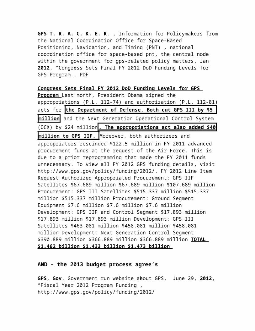
1NC Frontline
Plan doesn’t solve hacking until 2020Dr. Robert Hermann Global Technology Partners, LLC , Co-Chairmen ET AL, Hon. James Schlesinger MITRE Corporation Task Force Members Mr. John Darrah Institute for Defense Analyses Mr. William Delaney MIT Lincoln Laboratory Mr. Arnold Donahue Project Director NAPA Mr. Kirk Lewis Institute for Defense Analyses Gen James McCarthy, USAF (Ret) United States Air Force Academy Mr. Steve Moran Raytheon Ms. Ruth Neilan NASA Jet Propulsion Laboratory Mr. Robert Nesbit MITRE Corporation Dr. Brad Parkinson Stanford University Dr. James Spilker Stanford University Hon. John Stenbit Private Consultant Gen Larry Welch, USAF (Ret) Institute for Defense Analyses Executive Secretary Mr. Ray Swider OSD (NII) DSB Representative LtCol David Robertson, USAF Government Advisors Mr. Robert Broussard Headquarters, USAF LtCol Hazel Kelly, USAF Office of the Secretary of the Air Force Ms. Pamela Hodge Headquarters, USAF Mr. Richard McKinney Headquarters, USAF Staff Dr. Evelyn Dahm Strategic Analysis Inc. Mr. Jules McNeff Overlook Systems Technologies, Inc, October 2005, “Defense Science Board Task Force on The Future of the Global Positioning System”, PDFHigher Anti-Jam Margins are Essential ASAP – Recent experience in Iraq has shown that the ability to maintain GPS service to our military forces in the presence of hostile jamming is essential. The principal vulnerability affecting that objective is the threat of proliferated, inexpensive, low-power jammers. Improved versions of these jammers are now being offered in the international arms market. Potential enemies are undoubtedly aware of GPS effectiveness, and will take advantage of this jammer technology in future conflicts. It is imperative therefore that anti-jam margins for military GPS equipment be raised in order to mitigate the effect of these low power jammers. Additionally, the potential growth in the use of proliferated ultra-
wideband networking and communications devices and its effect on the noise
floor will likely make consistent reception of all GPS signals more
challenging, particularly in metropolitan areas. Anti-Jam Solutions are Known but Implementation Lags Need – Two principal techniques are available to decrease vulnerability: more power in the GPS satellite signal, and improved technology in GPS user equipment. While increasing the delivered power of the transmitted satellite signal using a spot beam antenna is in the current GPS III plan, it will not be available for the full constellation until at least 2020. The current GPS program of record for user equipment will not field such anti-jam capability improvements in significant numbers for 10-15 years. Development of new user equipment capable of receiving all military GPS signals is underway. However, preproduction prototypes will not be available until at least 2008, and those will only represent two card designs, one for avionics and one for ground receivers. Obtaining modernized user equipment in other form factors for other platforms and weapons will require separate development efforts not presently planned or
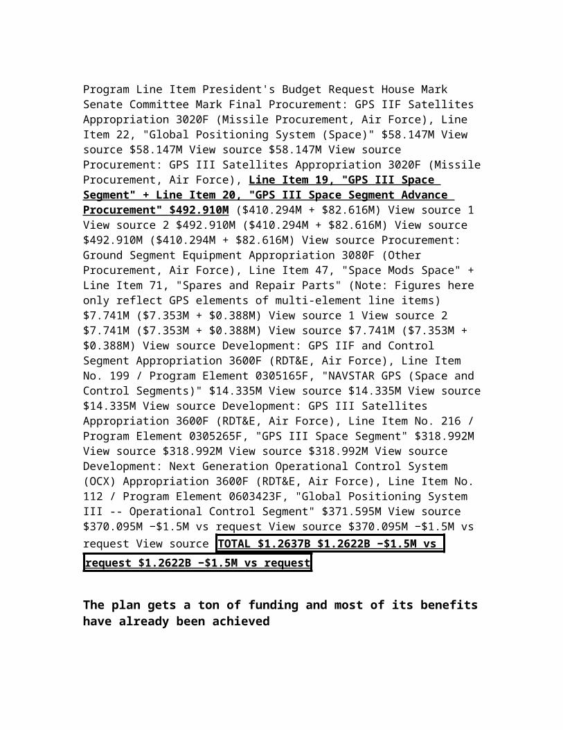
budgeted. Also, the current user equipment development program is focused on integrating the new military signal structure with existing GPS signals. Additional effort is needed to advance and integrate digital processing and antenna technologies that will provide sufficient anti-jam margin to defeat jammers already appearing on the international market. Because of the importance of these issues to the overall objective of achieving timely and affordable improvements in GPS anti-jam performance, the Task Force convened a separate sub- group to focus particular attention on them. Following that review, the Task Force concluded that schedule and cost risk in the GPS-III program are real and its very long procurement schedule leaves an
intolerable window of jamming vulnerability. These concerns can be
addressed by an approach that improves military receivers in the near term
as the GPS-III program proceeds.
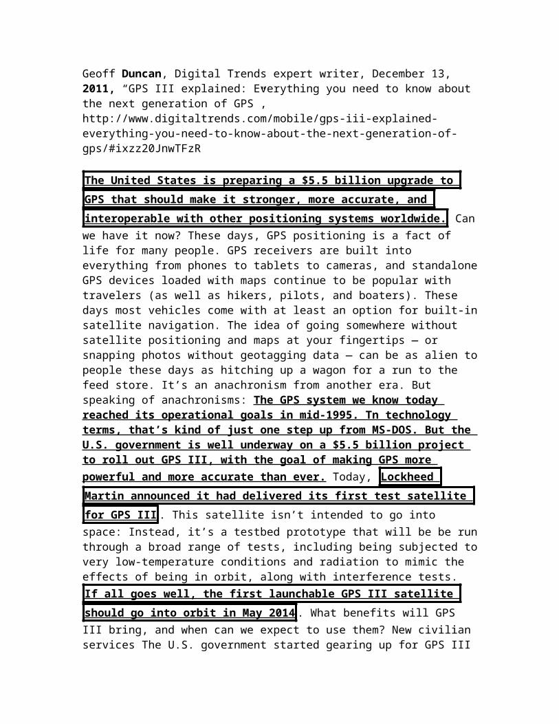
2NC – TF = Jamming
The aff’s long TF for solvency ensures jamming
Dr. Robert Hermann Global Technology Partners, LLC , Co-Chairmen ET AL, Hon. James Schlesinger MITRE Corporation Task Force Members Mr. John Darrah Institute for Defense Analyses Mr. William Delaney MIT Lincoln Laboratory Mr. Arnold Donahue Project Director NAPA Mr. Kirk Lewis Institute for Defense Analyses Gen James McCarthy, USAF (Ret) United States Air Force Academy Mr. Steve Moran Raytheon Ms. Ruth Neilan NASA Jet Propulsion Laboratory Mr. Robert Nesbit MITRE Corporation Dr. Brad Parkinson Stanford University Dr. James Spilker Stanford University Hon. John Stenbit Private Consultant Gen Larry Welch, USAF (Ret) Institute for Defense Analyses Executive Secretary Mr. Ray Swider OSD (NII) DSB Representative LtCol David Robertson, USAF Government Advisors Mr. Robert Broussard Headquarters, USAF LtCol Hazel Kelly, USAF Office of the Secretary of the Air Force Ms. Pamela Hodge Headquarters, USAF Mr. Richard McKinney Headquarters, USAF Staff Dr. Evelyn Dahm Strategic Analysis Inc. Mr. Jules McNeff Overlook Systems Technologies, Inc, October 2005, “Defense Science Board Task Force on The Future of the Global Positioning System”, PDFThe principal DoD plan to reduce GPS jamming vulnerability is to increase satellite power for GPS military signals, and in particular for the next generation signal called the M-Code. The GPS III plan involves a large, high-gain antenna added to the normal earth-coverage antenna. This may be a deployable reflector antenna or a phased-array antenna; the contractor and the particular mechanization have not yet been selected. The large antenna can produce a factor of one hundred or higher signal strength in a limited region or “spot” on the earth at least 1000 kilometers in diameter. All M-Code GPS receivers in this “+ 20 dB spot” would benefit from the increased signal power. The current plan would achieve a full constellation in the CY2019 era if no further delays occur. The Task Force notes the following advantages and concerns with the GPS III spot-beam approach: Advantages All authorized, M-code GPS users in an area of conflict benefit from the substantially increased signal power density. This GPS system enhancement involves only one major program versus the need to deal with a multiplicity of GPS individual programs which would be necessary in order to upgrade operational military GPS receivers Concerns The GPS III
schedule is long and likely to get even longer leaving an unacceptably long
window of vulnerability for GPS users if spot-beam is the only option to
improve anti- jam performance. The complexity and cost of the GPS III satellite is likely to grow due to the inevitable growth in “requirements”. The weight of the satellites may grow such that two satellites cannot be launched on a single medium-lift booster, dramatically escalating constellation sustainment costs. The 1000 km diameter spot may be too small to cover major areas of conflict.
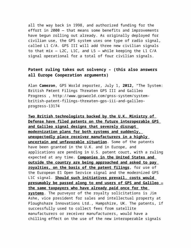
AND – that turns the aff in the short term
Dr. Robert Hermann Global Technology Partners, LLC , Co-Chairmen ET AL, Hon. James Schlesinger MITRE Corporation Task Force Members Mr. John Darrah Institute for Defense Analyses Mr. William Delaney MIT Lincoln Laboratory Mr. Arnold Donahue Project Director NAPA Mr. Kirk Lewis Institute for Defense Analyses Gen James McCarthy, USAF (Ret) United States Air Force Academy Mr. Steve Moran Raytheon Ms. Ruth Neilan NASA Jet Propulsion Laboratory Mr. Robert Nesbit MITRE Corporation Dr. Brad Parkinson Stanford University Dr. James Spilker Stanford University Hon. John Stenbit Private Consultant Gen Larry Welch, USAF (Ret) Institute for Defense Analyses Executive Secretary Mr. Ray Swider OSD (NII) DSB Representative LtCol David Robertson, USAF Government Advisors Mr. Robert Broussard Headquarters, USAF LtCol Hazel Kelly, USAF Office of the Secretary of the Air Force Ms. Pamela Hodge Headquarters, USAF Mr. Richard McKinney Headquarters, USAF Staff Dr. Evelyn Dahm Strategic Analysis Inc. Mr. Jules McNeff Overlook Systems Technologies, Inc, October 2005, “Defense Science Board Task Force on The Future of the Global Positioning System”, PDF
The actual size of the spot beam on the earth has not yet been finalized . There are
tradeoffs between spot size (antenna gain) and radiated RF power. A “fatter”
beam with a larger spot on the earth would alleviate the coverage concern
and it is a configuration to consider in the GPS III system tradeoffs . However, the main concern identified by the Task Force is the extended schedule for GPS III and its included spot beam approach. The long window of jamming vulnerability must be addressed by some augmentation, and the best way to do this is to upgrade individual GPS receivers with anti-jam enhancements, some of which are noted above. Such techniques are available today and they can be installed in a few years. The timing is propitious because weapon system managers will soon begin a major change-out of their receivers to accommodate the M-Code signal. One concern noted above is the cost of upgrading on the order of a million military receivers. However, most military receivers are in munitions and it is not necessary, for example, to upgrade all of the 230,000 Joint Direct Attack Munitions (JDAMs) being planned. Rather, the Task Force recommends upgrading 50,000 JDAMs to provide an inventory of “silver- bullet” munitions to use in the event jamming is encountered. Such an upgrade of selected military GPS receivers could cost in the vicinity of $1 billion as detailed in Appendix F. This is a significant cost but not exceedingly high in the context of major GPS satellite upgrades. The Task Force
concludes that the risk in the GPS III program is real and its extended
procurement schedule leaves an intolerable window of jamming
vulnerability . These concerns can be addressed by an approach that improves military receivers in the near term as the GPS-III program proceeds. Adding anti-jam

enhancements to individual receivers will buffer the overall program by providing critical early anti-jam capability, a risk reduction function, and a backup if the GPS III program is further delayed or fails to survive. Over the long term with some form of GPS III “spot” online and the individual receiver enhancements recommended above, the 40 to 60 dB of additional anti-jam capability will make GPS jamming a relatively hopeless tactic for an enemy.
TURN – the plan increases reliance on GPS makes hacking easier and the impact far worse
Roftiel Constantine, Lt Col, USAF, A Research Report Submitted to Air Force Fellows, CADRE/AR, In Partial Fulfillment of the Graduation Requirements, April 2007, “GPS & GALILEO. FRIENDLY FOES?”, PDF
The more the US military has come to depend on GPS, the more it must contemplate navigation warfare, or NAVWAR, being waged against US and allied forces, the object of which is to deny navigation capability to an enemy. Although the integrity of the GPS signal was maintained during the 2001 war with Iraq, attempts to corrupt it underscored the need to protect weapons and navigation systems that rely on GPS. There are two kinds of GPS countermeasures. The
simpler is jamming, where a noise signal covers the GPS signal and causes the
receiver to break track . When it comes to jamming, its low signal strength is GPS’s Achilles heel and the graph in Figure 2 below shows how vulnerable the GPS signal is to jamming. Less than one watt of jamming will prevent a civil receiver from tracking GPS across a range of 25 km; a one-watt jammer, antenna, and battery for 24 hours of operation will fit into a container the size of an aluminum beverage container and is relatively simple to construct; GPS jammers producing several hundred watts of effective radiated power (ERP) could be easily mounted with their power supplies in pickup trucks.37
GPS jamming fails
Roftiel Constantine, Lt Col, USAF, A Research Report Submitted to Air Force Fellows, CADRE/AR, In Partial Fulfillment of the Graduation Requirements, April 2007, “GPS & GALILEO. FRIENDLY FOES?”, PDF
GPS’s known vulnerability to jamming drove Iraq to purchase GPS jammers from Aviaconversiya, Ltd., a Russian company that has been promoting its GPS jamming systems at military hardware shows since 1999. Aviaconversiya claimed its products could jam GPS signals for a radius of several miles, and “the Iraqi military used at least six of these high- powered GPS jammers, which cost at least $40,000 each, during the war in 2003 . All six were quickly
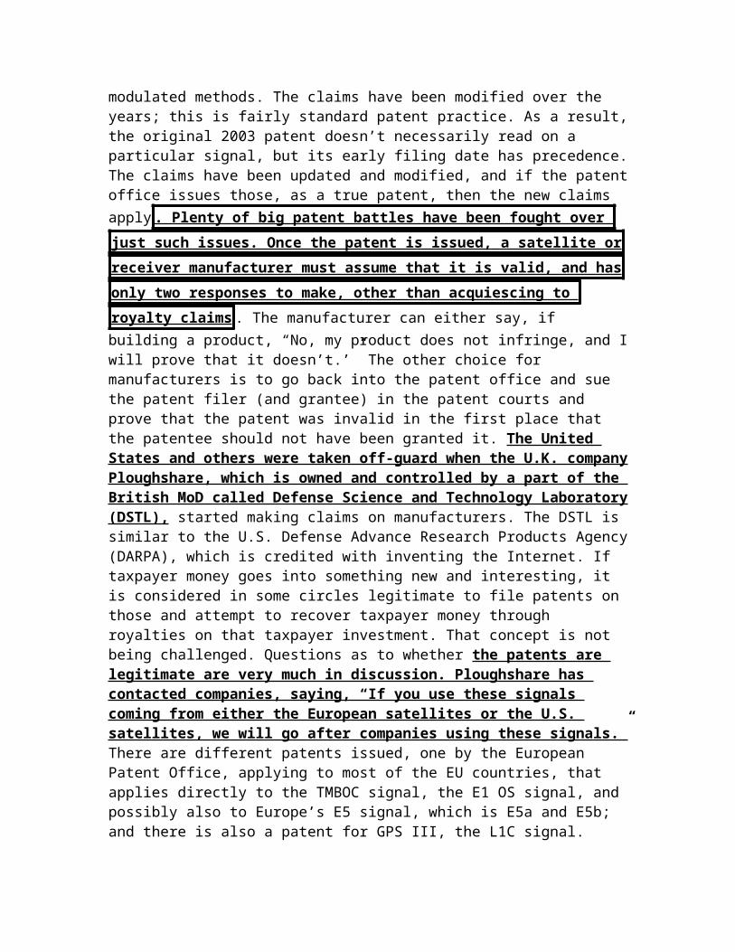
eliminated by US forces over the course of two nights.”42 GPS jamming can be
traced back to its origin; "We’ve killed every GPS jammer that’s come up --
with a GPS weapon - - so that hasn’t worked out very well for them," said then Air Force Lt Gen Michael Moseley, commander of the US-led coalition air forces, at a press conference in April 2003.43
Spoofing fails
Roftiel Constantine, Lt Col, USAF, A Research Report Submitted to Air Force Fellows, CADRE/AR, In Partial Fulfillment of the Graduation Requirements, April 2007, “GPS & GALILEO. FRIENDLY FOES?”, PDF
The other GPS countermeasure is spoofing, or broadcasting a pseudo-GPS signal designed to confuse GPS receivers by providing false and potentially misleading positioning data to the user, especially when GPS is used to compute target location coordinates based upon their position and the range and azimuth to the target. “If the GPS receiver gives the user a false reading for his location, the target location coordinates based on this false position will also be wrong by the same amount and could result in collateral damage,” according to a 2005 video published by the NAVSTAR Joint Program Office.44 Due to the inherent anti-spoofing qualities of the PPS signal, a civilian GPS receiver using the SPS signal is much more likely to succumb to spoofing and report a false position than a military GPS receiver using the PPS signal.45 For this and other reasons, the DOD mandates that its combatant users acquire, train with, and use GPS systems capable of receiving the encrypted military PPS signal.46 In addition, many missiles and aircraft employ tightly-coupled inertial navigation systems and GPS receivers, making the GPS receiver not only significantly more resistant to broadband jamming, but also to signal spoofing, where the inertial inputs can be used as a sanity check on the GPS receiver’s data.47
The US already has anti jamming tech
Roftiel Constantine, Lt Col, USAF, A Research Report Submitted to Air Force Fellows, CADRE/AR, In Partial Fulfillment of the Graduation Requirements, April 2007, “GPS & GALILEO. FRIENDLY FOES?”, PDF
The technology and ability of GPS receivers to resist jamming varies greatly. Acquiring the PPS signal (only possible with a military receiver and a current crypto key) improves jamming resistance by 10 decibels, and using a null antenna can boost a receiver’s jamming resistance by 15 decibels.38 While some US military anti-jam receivers lock onto eight rather than four satellites and average some of their data, others employ different techniques. United States defense contractor Lockheed Martin developed an anti-jam GPS receiver in 2000 for
its Joint Air-to-Surface Stand-off Missile, which relies on GPS to provide guidance to a target. Lockheed’s anti-jammer “uses digital technology to detect jamming signals and null them,” and it “digitally steers the GPS receiver’s antenna toward the GPS satellites and away from signals from the jammer.”39 In January 2003, the US Air Force asked Boeing Co. to develop an anti-jam antenna for its $20,000 GPS-guided Joint Direct Attack Munition (JDAM). The new antenna, comprised of a tail kit attached to a dumb bomb including adjustable fins, a control computer, an inertial guidance system and a GPS receiver, will be able to recognize and ignore a jammer’s signals.40
Plan doesn’t solve until 2021 and by then it would be windows 95
Geoff Duncan, Digital Trends expert writer, December 13, 2011, “GPS III explained: Everything you need to know about the next generation of GPS”, http://www.digitaltrends.com/mobile/gps-iii-explained-everything-you-need-to-know-about-the-next-generation-of-gps/#ixzz20JnwTFzR
So here’s the downside to all these GPS improvements : They take time develop, test, and get up into orbit. Once the systems are in space, users on the ground will need to upgrade to new GPS receivers that can use the new signals. That means your current smartphone isn’t going to support L2C, L1C,
or L5, nor are your handheld GPS or the satellite navigation system in your
car. You’ll have to buy new kit . The new GPS signals can’t be particularly effective until they’re available on at least 18 GPS satellites. Support for the L2C signal has been included in every Block IIR-M satellite that’s been launched since 2005: As of right now, L2C is supported by about 10 GPS satellites, and by 2016, that should be about two dozen. So L2C will get out the door first, improving GPS reception and accuracy. The first satellites with L5 signal capability were launched in 2010, and L5 is currently deployed for testing on two GPS satellites. Unfortunately, the GPS III rollout doesn’t have the L5 signal getting out to 24 satellites until about 2019. Finally, the L1C signal (which works with Galileo and other positioning systems) won’t start launching until 2013 with the GPS IIIA satellites. Current estimates put L1C on 24 GPS satellites around 2020 or 2021. So yes: by the
time GPS III is fully operational, it’ll probably seem as dated to us as Windows
95 and first-generation Pentium processors do now. But, it’s still better than
MS-DOS!
THE worst impact spoofing will have is we fail to arrest some people
Eric Bland, Discovery, Oct. 2, 2008, “GPS 'spoofing' could threaten national security”, PDF

The second, more sinister, method is called spoofing. In spoofing, the intended target doesn't know that the signal received from a GPS unit is wrong: A spoofer creates a false GPS signal that passes as a real GPS signal, and an incorrect time or location appears on the intended receiver. "It looks exactly like a real GPS signal," said Ledvina. "Everything looks completely normal, but the spoofer is controlling your position in time and space." Being a couple microseconds off of the real time might not sound like a big deal to the average consumer with a GPS car navigation system, but GPS has spread far beyond what
its creators envisioned in the 1970s. Being even 10 microseconds off could cause power generators, some of which use GPS signals to sync electrical grids to power stations, to explode, said Ledvina. Air traffic controllers use GPS to help avoid plane collisions. Banks time-stamp financial transactions using GPS. Police attach GPS receivers to criminals to monitor their activities. At its worst, successfully
spoofing a GPS receiver could mean plane crashes and exploding generators .
A more likely scenario, said Paul Kintner of Cornell University, is less
disastrous but still illicit -- people could falsify their geographic or
chronological position to avoid house arrest or authorities, for instance.
Spoofing is just too easy
Eric Bland, Discovery, Oct. 2, 2008, “GPS 'spoofing' could threaten national security”, PDF
"Apparently fisherman are required to carry a GPS monitoring unit and already have made crude attempts at spoofing," said Kintner. "There are likely more examples of where people do not want to be tracked that would gladly pay for a spoofer." The good news is that, for now, it is still pretty hard to create a spoofer. Some of the study authors have been working on GPS technology for more than 15 years now. Kintner estimates it cost them over $1 million to build their spoofer (including manufacturing costs). Ledvina says the hardware alone was about $1,000. The spoofer itself was the size of a briefcase and was plugged into the wall. The scientists also connected the spoofer to a GPS receiver with a cable instead of broadcasting the signal, which would have violated FCC regulations. If they had broadcast the signal it would only go a few meters, which means the spoofer and the intended receiver would have to be physically close. Eventually the size of a spoofer could decrease to about the
size of a pack of cigarettes . That said, it only took two part-time students
about a week of work each to build the spoofer. The cost of hardware and the
expertise necessary to build the next spoofer will drop quickly as well , as Ledvina illustrates. "Ten years ago it would have taken a grad student a few weeks to jam a GPS receiver," said Ledvina. "Now Virginia Tech probably has
100 students who, with the right equipment, could build a jammer in about ten minutes." Ledvina expects a similar trend to follow spoofing.
AND – spoofing impacts are super non-unique and the plan doesn’t solve anyway
Eric Bland, Discovery, Oct. 2, 2008, “GPS 'spoofing' could threaten national security”, PDF
Spoofing is not a new concern. In 2001, the U.S. Department of Transportation released a report on GPS that laid out six countermeasures to deter spoofing, such as adding additional, non-GPS instrumentation, or keeping humans in charge of decision instead of leaving them up to computers . But such measures can be expensive, and they don't necessarily
solve the problem. The Cornell and VT team has successfully found a way around five of the six countermeasures, and are currently working to crack the last one . The only GPS systems that can't be spoofed are military systems
used by some soldiers and GPS guided "smart-bombs," says Richard Langley, a GPS researcher at the University of New Brunswick who reviewed the Cornell and Virginia Tech research. "The military GPS signals are protected against spoofing by using a secret encryption, so that only receivers with that encryption technology can access the signal," said Langley. " There is no such protection
for civilian GPS use." The large number of civilian GPS devices makes civilian encryption impractical, but it also goes against the creator's original purpose in developing GPS, which was to provide free access to anyone anywhere, said Langley. Kitner and Ledvina are clearly concerned about the effect that releasing this information to the general public would have. They are, after all, exposing major flaws in vital systems. But ultimately, they released the information in the hope that it would inspire GPS manufacturers and others to put safety measures in place.
AND – the plan doesn’t even get 6 sats until 2017
Titus Ledbetter III, Space News, Leading Expert and Journalist on Space, Fri, 23 March, 2012, “GPS 3 Budget Includes Funds for Dual-launch Capability”, http://www.spacenews.com/military/120323-gps-budget-funds-dual-launch.html
WASHINGTON — The U.S. Air Force budget request for 2013 includes funding to develop the capability to launch two GPS 3 navigation satellites aboard a single rocket, a senior service official said. Gen. William Shelton, commander of Air Force Space Command, said GPS 3 prime contractor Lockheed Martin and

rocket maker United Launch Alliance (ULA) submitted a plan in January for dual launches starting with the fifth and sixth GPS 3 satellites in 2017. The launches would be performed by ULA Atlas 5 rockets.

*** Space Heg

1NC
Space heg doesn’t affect US power
Michael Robinson, AND is an assistant history professor at the University of Hartford’s Hillyer College in Connecticut. Dan Lester is an astronomer at the University of Texas, Austin, February 2, 2010, “The Death of the Constellation Program”, http://timetoeatthedogs.com/category/space/page/2/
The United States did gain prestige from landing astronauts on the moon in 1969, showing up our Cold War rival, the Soviet Union. But how much did that prestige, or “soft power” actually benefit the United States? Prestige did not stop the Vietnam War, or the Arab Oil Embargo, or the onset of stagflation. How much, then, is this type of prestige worth in the post-Cold War Age, a time when the United States is, arguably, supposed to reap the benefits of belonging to a multilateral world? What does the United States gain in winning the space race against China when they are losing the economic race to China back on Earth?
Turn flips the case – tanks US soft power and hegemony – it also makes future deployment of GPS impossible
Trevor Brown (BA, Indiana University; MSc, S. Rajaratnam School of International Studies, Nanyang Technological University [Singapore]) is a new author interested in political, economic, and military strategy for the medium of space, March 2009, “Soft Power and Space Weaponization”, http://www.airpower.au.af.mil/airchronicles/apj/apj09/spr09/brown.html
The problem for the United States is that other nations believe it seeks to monopolize space in order to further its hegemonic dominance.7 In recent years, a growing number of nations have vocally objected to this perceived
agenda. Poor US diplomacy on the issue of space weaponization contributes
to increased geopolitical backlashes of the sort leading to the recent decline
in US soft power —the ability to attract others by the legitimacy of policies
and the values that underlie them— which, in turn, has restrained overall US
national power despite any gains in hard power (i.e., the ability to coerce).8 The United States should not take its soft power lightly since decreases in that attribute over the past decade have led to increases in global influence for strategic competitors, particularly Russia and China. The ramifications have included a gradual political, economic, and social realignment, otherwise known as “multipolarism” and translated as waning US power and influence. “Soft power, therefore, is not just a matter of ephemeral popularity; it is a means of
obtaining outcomes the United States wants. . . . When the United States becomes so unpopular that being pro-American is a kiss of death in other countries’ domestic politics, foreign political leaders are unlikely to make helpful concessions. . . . And when U.S. policies lose their legitimacy in the eyes of others, distrust grows, reducing U.S. leverage in international affairs.”9 Due
to US losses of soft power, the international community now views with
suspicion any legitimate concerns that the United States may have about
protecting critical assets in space, making it far more difficult politically for
the Air Force to make plans to offer such protection.
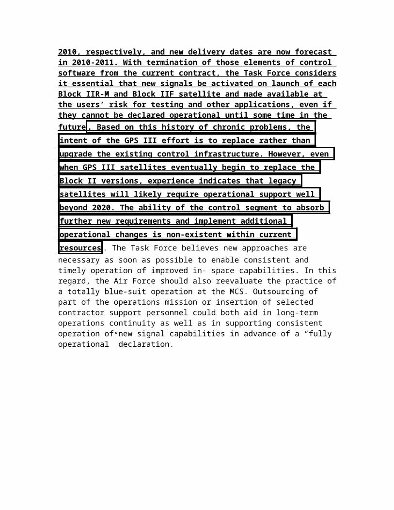
GPS Hurts China
GPS is key – it creates a TON of competition
Strategy Page, website on military competition and geopolitical analysis, May 4, 2012, “GPS Competition Is Catching Up”, http://www.strategypage.com/htmw/htspace/20120504.aspx
Then there is China, with its own GPS system. China has ten of 35 Beidou
("Compass") navigation satellites. This is sufficient to provide GPS type service for all of China. By the end of the decade all 35 satellites will be up and the entire planet will have access to Beidou. It was four years ago that China decided to expand its original Beidou 1 satellite navigation system to cover the entire planet and compete with GPS, Galileo, and Glonass. China is using the experience from this earlier Beidou 1 network to build a world-wide "Beidou 2" system over the next decade. The success of the U.S. GPS satellite
navigation system has generated all this competition. But so far these other
efforts have found the work much more difficult than expected. A European consortium went forward with Galileo despite growing costs and technical problems. Initially, Galileo was to be funded with private money. But the costs climbed beyond the most optimistic estimates of future income, so now Galileo is being paid for with tax dollars, as was GPS and the competing Russian and Chinese systems.
GPS success drives competition – other nations are just playing catch up now
Strategy Page, website on military competition and geopolitical analysis, April 13, 2008, “GPS Competition Closing In”, http://www.strategypage.com/htmw/htspace/articles/20080413.aspx
The success of the U.S. GPS satellite navigation system has generated lots of
competition. But so far, these other efforts have had rough going. A European consortium is going forward with its own version of GPS, called Galileo, despite growing costs and technical problems. Initially, Galileo was to be funded with private money. But the costs climbed beyond the most optimistic estimates of future income, so now Galileo will be paid for by tax dollars, as was GPS, and the competing Russian and Chinese systems. So far, only one Galileo satellite has been launched, simply for research, although the original plan called for four to be up there by now, to provide a sufficient number of birds for a test system. As it is, a second test satellite is to be launched this month. Originally, all 30 satellites were to

be up by this year, but now the target date is 2014. China has offered to invest in Galileo, and the Europeans are happy to have the help. Galileo will cost over $11 billion when completed, and the fifteen nations of the European Space Agency (ESA) have put in several hundred million dollars already. This however, is more than twice what the system was originally expected to cost. Galileo came about because the Europeans didn't like being dependent on an American system, and don't believe the Russians will be able to keep their GLONASS system viable. If Galileo becomes operational, the European nations will pay for it, but anyone can use it. Dual signal (GPS and Galileo) receivers won't cost much more (maybe 20 percent more) than GPS receivers do. Having two separate sets of signals makes for more reliable and accurate receivers. Also, the way Galileo is being set up, it will provide improved reliability in higher latitudes and in built up areas. Russia's answer to GPS, GLONASS, was at full strength (24 satellites) shortly after the Cold War ended (1995). But the end of the Cold War meant the end of the regular financing for GLONASS. Maintaining the system meant launching replacement satellites every 5-7 years. By the end of 2002, only seven GLONASS birds were still operational. However, a series of launches in 2003 increased the number of active satellites to twelve, and that went to 18 by the end of 2007. Russia plans to put eight more GLONASS satellites in orbit this year. That would expand the system to 24 navigation satellites. Russia plans to have the system fully operational next year. Right now, it is active for most of Russia. With 24 birds, it will cover the globe and be a competitor for GPS. The money for GLONASS is coming from a Russian government that does not want to be dependent on the American Department of Defense controlled GPS system. But the money is only there because of high oil prices. Most GLONASS receivers in use are actually combined GPS/GLONASS receivers. Russia will have to put billions of dollars into GLONASS over the next few years to get the system fully operational, and then spend even more money to maintain the satellite network. China has a satellite navigation system called BeiDou. Think of this system as GPS light. BeiDou only covers East Asia, and not even all of China. But it covers the areas along the coast, and Taiwan. The BeiDou system is less accurate than GPS, slower, but it does allow two way traffic. This is useful for sending short messages (up to 120 Chinese characters so, about a hundred words). Sort of IM (Instant Messaging) class stuff. The system can only handle a few hundred thousand users, but that would be sufficient for the number of Chinese troops involved in any major operation. BeiDou also suffers some reliability problems, and is apparently very vulnerable to jamming and spoofing. Because of all that, it is believed that BeiDou is just a first generation system. A training system, one where China learns the ins and outs of building satellite navigation systems.
AND – its empirically true – Better GPS causes other nations to counterbalance through nationalism
Taylor Dinerman is an author and journalist based in New York City, July 31, 2006, “Galileo gets a Chinese overlay”, http://www.thespacereview.com/article/668/1

Galileo originated as a “Euro-nationalist” response to the success of America’s GPS. As the program developed, some in Europe sought to use it as a way to limit and control US military power. This was the heart of the transatlantic “frequency overlay” dispute that ended with the EU backing down. The Europeans had registered certain frequencies with the International Telecommunication Union (ITU), that were dangerously close to the ones the US planned to use for the future military GPS 3 signal. They were hoping that the Pentagon would have to accept that the use of this signal would be regulated by a joint US-EU committee in which the EU, particularly France, would have a veto power over US satellite navigation warfare. In essence, the European goal was to insure that if the US went to war against the will of the EU, it would do so without the advantages that its GPS system has given it.
Hurts China Soft Power
And – the plan takes it from China
Trevor Brown (BA, Indiana University; MSc, S. Rajaratnam School of International Studies, Nanyang Technological University [Singapore]) is a new author interested in political, economic, and military strategy for the medium of space, March 2009, “Soft Power and Space Weaponization”, http://www.airpower.au.af.mil/airchronicles/apj/apj09/spr09/brown.html
The United States would do well to keep a low profile for its military space program and burnish its technological image by showcasing its commercial and scientific space programs. Doing so would enable it to accumulate rather than hemorrhage soft power. Such a rationale is not lost on the Chinese, who certainly have had their successes in recent years in building soft power and using it to extend their influence around the globe. According to National Aeronautics and Space Administration (NASA) administrator Michael Griffin, the Chinese have a carefully thought-out human-spaceflight program that will take them up to parity with the United States and Russia. They’re investing to make China a strategic world power second to none in order to reap the deals and advantages that flow to world leaders.30 Analysts believe that the United
States’ determination to maintain dominance in military space has caused it
to lose ground in commercial space and space exploration. They maintain that the United States is giving up its civilian space leadership—an action that will have huge strategic implications.31 Although the US public may be indifferent to space commerce or scientific activities, technological feats in space remain something of a marvel to the broader world. In 1969 the world was captivated by man’s first walk on the moon. The Apollo program paid huge dividends in soft power at a time when the United States found itself dueling with the Soviets to attract other nations into its ideological camp. Unless the United States has a strong presence on the moon at the time of China’s manned lunar landing, scheduled for 2017, much of the world will have the impression that China has approached the United States in terms of technological sophistication and comprehensive national power.32 If recent trends hold, this is likely to come at a time when the new and emerging ideological confrontation between Beijing and Washington will have intensified considerably.33 The most recent space race reflects the changing dynamics of
global power. “Technonationalism” remains the impetus for many nations’
space programs, particularly in Asia: “ In contrast to the Cold War space race between the United States and the former Soviet Union, the global competition today is being driven by national pride, newly earned wealth, a growing cadre of highly educated men and women, and the confidence that achievements in space will bring substantial soft power as well as military benefits. The planet-wide eagerness to join the space-faring club is palpable.”34 India and Japan are
also aggressively developing their own space programs.35 But the United States does not necessarily have to choose between civilian and military space programs since much of the technology developed for space is dual use . The space industry provides a tremendous opportunity for militaries that desire more affordable access and space assets that can significantly augment terrestrial forces. As Alfred Thayer Mahan pointed out, “Building up a great merchant shipping lays the broad base for the military shipping.”36 The US military can maximize its resources, not only financially but also politically, by packaging as much military space activity as possible into commercial space activity. One example involves satellite communications. The arrangement the Pentagon has with Iridium Satellite LLC gives the military unlimited access to its network and allows users to place both secure and nonsecure calls or send and receive text messages almost anywhere in the world.37 Another example involves space imagery. Even though the government must maintain sophisticated imaging capabilities for special situations, it could easily meet the vast majority of its routine requirements at lower cost by obtaining commercially available imagery.38
AND – letting China close the gap is key to stability
Stuart Wiggin, Global Times, leading news paper, October 24 2010, “Asian space race more about prestige than power”, http://opinion.globaltimes.cn/foreign-view/2011-04/585161.html
Through the space program, China not only gains legitimacy as a functioning
and capable nation in the eyes of outside observers, but more importantly, it
gains legitimacy among its own people. Success in space is a huge boost to
national pride and a strong sign of advances barely thought possible a decade
earlier . The official standpoint regarding China's space program is that it represents the fundamental task of humanity to research humanity's origin and develop a sustainable lifestyle, as stated by Qian Weiping, a chief designer of the Chang'e-2 mission. Qian went on to say that it is China's responsibility to carry out such research, rather than an act of imitation. Whether out of responsibility, or a desire to prove to the rest of the world that they are indeed capable of success in space, a large element of pride is at play within the motivating factors, evidenced by Qian's declaration to the nation that "we will shorten the gap (between China and the US/Russia) fast." China's space program is ambitious, but has a long way to go. But nobody seriously doubts that China will meet its goals in space, advertising both to foreigners and to a domestic audience its new status as a technological power.
Space power is key to China soft power and internal strength

Dr. Joan Johnson-Freese Chair, Department of National Security Studies, Naval War College, May 18, 2005, “Prepared Statement by Joan Johnson-Freese: "Human Space Flight - The Space Shuttle and Beyond"”, http://www.spaceref.com/news/viewsr.html?pid=16644
While many countries have shown interest over the years in developing autonomous human space programs, besides the United States only Russia and China, as of the October 2003 launch of the first Chinese taikonaut, have been successful. The Russian human space program was rescued from becoming moribund when it merged with NASA's human program to develop the International Space Station (ISS). Russia is still, however, unable to pursue new high-cost initiatives on its own, due to both economics and because they have learned that developing and maintaining support for a human space program is hard in democracies. While the European Space Agency (ESA) and countries like Japan and India likely have the technical wherewithal to have a successful human space program, they lack the requisite political will. In a Catch-22 scenario, however, having to always play a supporting role to the United States makes it even more difficult to garner public support and political will for human space activity. While Japan has long talked about a human space program, being responsible to an electorate, bureaucratic politics, economics and a cultural adversity to risk will likely keep them Earthbound. India too, as a democracy, remains constrained by public perceptions of priorities lying elsewhere . It is only
because China's program is driven from the top that it has successfully been
carried to fruition. So why is China, a country with 1.3+ billion people, willing to devote significant resources to human spaceflight capability? The Apollo program demonstrated the benefits that accrue to a nation able to claim a human spaceflight capability. In the movie Apollo 13 Tom Hanks shows a Congressional delegation around Kennedy Space Center pointing out constituent jobs in high tech fields that were politically distributed to all fifty states. Jobs are always a valued program benefit. Americans expressed interest in science and technology education unmatched either before or after Apollo. Technology developed for space translated into economic development. Dual-use technology with both civil and military applications was developed. And finally, America enjoyed the prestige of "winning" the space race against the Soviet Union, which translated into a unifying pride during the contentious Viet Nam War era, and also drew Third World countries to our side during the Cold War when East-West blocks competed for support. Those same benefits, jobs, education, economic development, dual-use technology and prestige are still motivating factors for space activity. Since the 1950's, Europe has pursued space under the premise that space activity generated technology, technology generated industry, and industry led to economic development. China learned from the Apollo playbook as well. Training and employing workers in high-technology aerospace jobs in China keeps large numbers of people employed, which is a Chinese priority. It also demonstrates to the world that China is able to, as one Chinese commentator put it, "make more than shoes," thereby supporting their overarching

economic development goal by attracting global industries to China. China is also experiencing growth in science and engineering education programs at unprecedented levels. China is clearly interested in modernizing its military, and, again learning from the U.S. playbook, China has seen the benefits space can yield in force enhancement capabilities. And finally, there is prestige. Prestige takes on two dimensions for China: first, domestically it bestows credibility on the Communist government much in the same way bringing the Olympics to Beijing does. In regional and international terms, prestige translates into techno-nationalism, where perceived technical prowess is equated to regional power. This is particularly important to China, which has been working hard and been largely successful at using economics and soft power to transform its regional image from that of the bully, to a rising power that countries can work with. For countries like Japan and India, these perceptions are important. Speculation about an Asian space race floats on the wind, but it is unlikely. After the Shenzhou V launch in October 2003, the Indian science community claimed it too could have accomplished such an achievement, but had simply chosen not to. That response was intended to quell concerns from both the Indian public and politicians about China's technical prowess compared to India's � techno-nationalism. Initial Japanese responses to the launch varied. Space officials downplayed the technical significance of the event, while nonetheless congratulating China. A Japanese official spoke to the media directly in geostrategic terms. "Japan is likely to be the one to take the severest blow from the Chinese success. A country capable of launching any time will have a large influence in terms of diplomacy at the United Nations and military affairs. Moves to buy products from a country succeeding in human space flight may occur." One woman on the street was quoted in Japanese media coverage as saying, "It's unbelievable. Japan lost in this field." While Japan's "losing" to China through the Shenzhou V launch was more perception than reality, China's success juxtaposed against power failures on both the Japanese environmental satellite Midori-2 and on its first Mars probe, Nozomi, as well as the November 2003 launch failure of two Information Gathering Satellites (IGS), resulted in calls for a reexamination of the Japanese program. However, because of the problems initiating and sustaining human space programs in democracies, combined with unique internal politics in both countries, the initiation of an autonomous human program in either Japan or India is unlikely.
No offense – the US can not prevent Chinese space power – the plan causes a trade-off which kills our alliances
Dr. Joan Johnson-Freese Chair, Department of National Security Studies, Naval War College, May 18, 2005, “Prepared Statement by Joan Johnson-Freese: "Human Space Flight - The Space Shuttle and Beyond"”, http://www.spaceref.com/news/viewsr.html?pid=16644
With China's entry into the exclusive human spaceflight club, the strategic gameboard was put in motion. Whereas the United States has pursued of path of simultaneously cooperation and competition with other countries in various aspects of space, such as cooperating with Europe on ISS but competing in the commercial launch field, with China the U.S. approach has been purely competitive. China has been excluded from partnership on the International Space Station, for many years their "brass ring." The reasoning for the U.S. purely competitive approach has been technical and political: seeking to stop China from acquiring sensitive dual use technology, concern that China will be the next U.S. peer competitor, and not wanting to support the largest remaining Communist government in the world, especially one charged with human rights abuses and other practices averse to democratic principles. While such an approach may be virtuous, realities are such that it increasingly appears counterproductive. We have to face an uncomfortable fact here: a country whose interests may very well some day conflict with our own is going to pursue a line of technological development that could enhance its ability to challenge us through multiple venues. And they are going to be aided in this by other countries, whether we like it or not. While the U.S. seeks to contain China, much of the rest of the world is eager to work with China, thereby negating much of the impact the United States is trying to achieve, and indirectly encouraging activities not necessarily in the interest of the U.S. Other countries, allies, have often held passive-aggressive feelings toward space partnerships with the U.S.: welcoming and grateful for the opportunities, while resenting being inherently consigned to a supporting role, and feeling that U.S. partners are often treated more as secondary participants or sub-contractors on projects. Working with China gives them a chance to level the playing field.

A2 Space Race Good
AND – no space race good offense
Dr. Joan Johnson-Freese Chair, Department of National Security Studies, Naval War College, May 18, 2005, “Prepared Statement by Joan Johnson-Freese: "Human Space Flight - The Space Shuttle and Beyond"”, http://www.spaceref.com/news/viewsr.html?pid=16644
It has been suggested that engaging China in a space race would provide the political will for the U.S. human program to move forward, as the Soviet Union's activities did for Apollo, or that it would trigger a spending spree in China with effects similar to those experienced by the Soviet Union trying to keep up with SDI. Both are flawed analogies. During the Cold War, two competing superpowers started from the same point technologically and engaged in an engineering race. Both were motivated to compete. Now, the Chinese have no reason to "race" the United States. Chinese spending will not increase to keep up or outpace the United States either, as they fully understand it is impossible. China needs only to incrementally continue their human space program to create the perception that it is "beating" the United States. China's activities place the U.S. in a race against itself, to maintain its leadership. Meanwhile, China will increasingly engage other countries in cooperative space activity. Technological containment of the U.S.S.R. took place in another time and under circumstances that are now impossible to replicate: there is no way to seal China off from the technologies it seeks. Our best hope, then, is to shape China's future in space, rather than watch it develop in 20 years � with assistance from others � into something that we will wish we could have diverted.
AND – trying to create a space race just causes a US loss
Dr. Joan Johnson-Freese Chair, Department of National Security Studies, Naval War College, May 18, 2005, “Prepared Statement by Joan Johnson-Freese: "Human Space Flight - The Space Shuttle and Beyond"”, http://www.spaceref.com/news/viewsr.html?pid=16644
Imagine if you will a few alternative, hypothetical scenarios. If the United States were to finish the ISS only to then turn it over to the partners so the U.S. could pursue the Moon/ Mars vision, but then got mired down in technical or political difficulties, which would not be hard to imagine, the U.S. could end up the only space-faring nation not involved in ISS. If the U.S. pursues the Moon/Mars vision with the ISS partners, but not China; it is China (the developing country) versus the rest of the (developed) world, magnifying the perceived importance of each small advancement China makes and every misstep we make. If
the U.S. pursues the Moon/Mars mission alone � other countries could see working with China as an opportunity to work on a human space program, and on a more level playing field, creating a U.S. versus China+ scenario. And finally, some have suggested that the U.S. simply forego human space activity.

CCP Stability I/L
AND – its key to internal CCP stability
Rob Chambers, Naval Post Graduate Thesis, March 2009 Thesis Advisor: James Clay Moltz Second Reader: Alice Miller, @ Naval Post Graduate School, “CHINA’S SPACE PROGRAM: A NEW TOOL FOR PRC “SOFT POWER” IN INTERNATIONAL RELATIONS?”, PDF
With an understanding of the background of China’s space program and how countries seek soft power advantages from their own space programs from the previous chapter, this chapter now focuses directly at how China is “selling” its space program domestically. It covers China’s space program as a legitimizing tool for the Chinese Communist Party (CCP), how it is played up in order to recruit future space scientists and technicians needed to fulfill its ambitions plans for manned space and unmanned Martian exploration with Russia, and also highlights some of the domestic applications and spin- off technologies that it hopes to reap from its space program effort.
AND – Space is crucial to CCP stability
Rob Chambers, Naval Post Graduate Thesis, March 2009 Thesis Advisor: James Clay Moltz Second Reader: Alice Miller, @ Naval Post Graduate School, “CHINA’S SPACE PROGRAM: A NEW TOOL FOR PRC “SOFT POWER” IN INTERNATIONAL RELATIONS?”, PDF
Morris Jones, an Australian-based space analyst says, “China’s space program reflects the power and legitimacy of the Communist Party. They are using manned space exploration as a political demonstration of their legitimacy”.75 Jones also notes that the launch date of the Shenzhou-7 came on the heels of not only the Beijing Olympics, but also close to the conclusion of the Paralympics and Chinese National Day on October 1, “making the space mission a nice bridge between two major nationalistic events”.76 Roger Launius, senior curator of space history at the National Air and Space Museum, focuses more on the symbolism of Chinese technological achievements in his perspective: It [China’s space program] is a prestige program, no question. I think China has entered the [manned spaceflight] arena for the same reasons that the United States and Soviet Union did in 1961. It is a demonstration of technological virtuosity. It’s a method for showing the world they are second to none – which is a very important objective for them.77


*** Drones
1NC
BIG DATAT solves – information overload
Yahoo, Daily News, 2012-03-30, “US Military Bets on 'Big Data' to Win Wars”, http://news.yahoo.com/us-military-bets-big-data-win-wars-134808389.html
All the robotic drones and battlefield sensors in the world can't win wars if the data deluge leads to information overload for military analysts' brains. That's why the U.S. military has announced it will spend $250 million each year on harnessing the power of "Big Data ." That means creating computer systems
that combine "computer speed, computer precision and human agility" to
collect and make sense of military intelligence at speeds 100 times faster
than today — a power that could also enable military analysts to speedily dig
up information from texts in any language. The effort could even lead to truly
autonomous war robots capable of making their own decisions on
tomorrow's battlefields. "These visions are not empty fantasy … they are being made possible through big bets the Department is placing on Big Data," said Zachary Lemnios, U.S. assistant secretary of defense for research and engineering. He introduced the effort as part of the Obama administration's new Big Data initiative announced today (March 29). The Department of Defense also announced plans for a series of related open prize competitions over the next several months — a tactic that has worked well for the Defense Advanced Research Projects Agency (DARPA) and the U.S. Air Force Research Laboratory. About $60 million of the available $250 million will go toward new research projects.
Squo information overload will result in a rapid curtailing of UAVs Jeff Black, msnbc.com, 04/05, 2012, “Drones inflicting information overload on Air Force”, http://usnews.msnbc.msn.com/_news/2012/04/05/11042161-drones-inflicting-information-overload-on-air-force?lite
The Air Force has such a glut of data – photos and videos and such – captured by its fleet of drone aircraft that it can’t keep up with analyzing the information , Air Force Secretary Michael Donley said Thursday. Because of the lack people and machinery to make sense of the information, the Air Force will cut back on how many of the drone aircraft it buys, Donley told a group of defense writers in Washington. National Defense magazine was among the publications attending the interview. "We’ve clearly playing catch-up," Donley said, according to Wired magazine's account of the interview. "It’s not just the pilots and manning the aircraft . It’s also the [data] processing exploitation behind that …. We’re collecting data at rates well above what we had in the past." Last year the Air Force bought 48 Reaper drones, according to National Defense, and will cut

back to 24 in the proposed 2013 budget. Donley said the fleet of Reaper and Predator drones will remain at 65 aircraft until the analysis backlog is figured out. According to John Villasenor, a fellow at the Center for Technology Innovation at the Brookings Institution think tank, the analysis challenges with large amounts of data are likely to continue to increase.
Pakistan is on the brink of collapse – expanding drones ensures total collapse New Statesman, award-winning British magazine on Current affairs, world politics, and the arts, 10 (Samira Shackle, contributing writer, “Drone attacks: what is America doing in Pakistan?”, NewStatesman, January 7th, http://www.newstatesman.com/blogs/the-staggers/2010/01/drone-attacks-pakistan-policy)
Seventeen people have been killed in two US drone attacks in North Waziristan, a tribal area and Taliban stronghold in Pakistan. The body count is still growing from the attacks, targeted at a compound alleged to be a militant training camp. These latest attacks are part of an expansion authorised by Barack Obama last month, in line with the troop surge in Afghanistan. It's a policy that is anything but transparent. For the uninitiated -- what is going on? Well, the first attacks were launched by George Bush in 2004 as part of the "war on terror". They feature unmanned aerial vehicles firing Hellfire missiles (that's actually what they're called, I'm not embellishing) at militant targets (well, vaguely), and have increased in frequency since 2008.Top US officials are extremely enthusiastic about the drone attacks. They stated in March 2009 that the strikes had killed nine of al-Qaeda's 20 top commanders. High-profile successes such as the death of Baitullah Mehsud, the former Taliban commander in Pakistan, have no doubt given further encouragement. The attacks' status in international law is dubious but, hey, when has that ever been a concern? Yet in terms of how the Pakistani public might receive it, it is an incredibly reckless policy for the US to pursue, and for the discredited Islamabad administration to allow. Since the strikes were stepped up in mid-2008, hundreds of people have been killed, many of them civilians. The American think tank the Brookings Institution released a report in July 2008 saying that ten civilians perished in the attacks for every single militant killed. The UN Human Rights Council, too, delivered a highly critical report last year. The investigator Philip Alston called on the US to justify its policy: Otherwise you have the really problematic bottom line, which is that the Central Intelligence Agency is running a programme that is killing significant numbers of people and there is absolutely no accountability in terms of the relevant international laws. Islamabad has publicly criticised the attacks on Pakistani territory as being counterproductive (though reports abound about the level of its complicity). Pakistan's foreign ministry today issued an angry statement saying that US and Nato forces "need to play their role inside Afghanistan". Pakistan is a
state on the verge of collapse. Amid poverty, the instability engendered by
frequent terrorist attacks, and a corrupt and fragile government, the very
extremism that the west's cack-handed Af-Pak strategy aims to counter has
fertile ground on which to grow. The Pakistani public is overwhelmingly and
consistently opposed to the drone attacks. A poll for al-Jazeera in August 2009
showed that 67 per cent of respondents "oppose drone attacks by the United
States against the Taliban and al-Qaeda targets in Pakistan". A poll in October for the International Republican Institute found that 73 per cent of respondents opposed US military incursions into the tribal areas and 76 per cent did not think
that Pakistan and the US should partner to carry out drone attacks. The "war on terror" is an increasingly meaningless phrase. But one thing is certain: as young Britons travel to Pakistan expressly for to attend training camps (frequently spurred on, I would argue, by their anger at western foreign policy) and the Taliban continue to expand across the country , we cannot -- to employ another
overused phrase -- afford to lose any more "hearts and minds". The escalation
of drone attacks does just that.
Drone warfare threatens civilization and violates due process – it’s a D-Rule
Glen Ford, Bar Executive Editor, 12/04/2012, “AMERICA’S DRONES THREATEN GLOBAL CIVILIZATION”, http://alexandravaliente.wordpress.com/2012/04/12/americas-drones-threaten-global-civilization/
Virtually all of the drones’ lethal missions are, in legal terms, assassinations, with or without “collateral damage.” They are also acts of terror, certainly in the broad sense of the word, and intended to be so. Drone warfare requires that due
process be destroyed everywhere, including within the borders of the United
States.” As Canadian political scientist David Model points out in a recent
article “Assassination by Drones“: “It is clearly evident that for a State to
launch an attack by a UAV is a violation of international law and those
responsible for such acts becomes suspects of war crimes. ” Drone warfare utterly shreds the very concept of the rule of law. In killing those “suspected” of committing or planning actions against the U.S., Washington “precludes the application of due process,” writes Model. Therefore, in the quest to make the entire world a free-fire (and law-free) zone, drone warfare requires that due process be destroyed everywhere, including within the borders of the United States. The Obama-shaped preventive detention bill signed into law this past New Years Eve is the logical extension of the international lawlessness called forth by drone warfare, and by the larger aims of full spectrum American dominance. Barack Obama is not just another “war president” – he is a destroyer of world

civilization, the terms by which humans deal with one another as states,
social groupings and individuals. It is not an exaggeration to describe this
leap into depravity as a war against humanity at-large, and against the
human historical legacy. The Obama-shaped preventive detention bill is the logical extension of the international lawlessness called forth by drone warfare.” Certainly, it is a war against peace, the highest international crime . If a state can kill individuals and designated (or alleged) organizations by fiat, without due process or any shred of accountability to any authority but the president of the superpower, that state can also “execute” other states at will. Under Obama, the U.S. has articulated an alternative notion of global legality that purports to replace the body of international law accrued over centuries and so elegantly codified after World War Two. “Humanitarian” military intervention is the fraudulent doctrine through which the U.S. seeks to justify its current, desperate offensive against all obstacles to its global dominance. Where George Bush often spoke in unilateralist terms of a U.S. mission to “spread democracy” as justification for his regime-changing aggression in Iraq and elsewhere, Obama invokes the higher calling of “humanitarian intervention” as a universal, pseudo-legal principle of international conduct. It is a doctrine designed for a Final Conflict for American supremacy on the planet, a doomsday construct that conflates perceived U.S. (corporate) geopolitical interests with the destiny of humankind – unbounded imperial criminality posing as the highest bar of justice! Since the Vietnam War era, the U.S. has traveled from being the
“greatest purveyor of violence in the world today,” in Dr. Martin Luther King’s
words , to an existential threat to world order, the rule of law, and the security
of the Earth’s inhabitants – to civilization itself. The nation’s first Black President has taken us on the final descent into international barbarity with his drone offensive. It is a joy stick to Hell.
Drones are the most important factor in terrorist recruiting Malou Innocent, foreign policy analyst at the Cato Institute, 09 (“The US Must Reassess Its Drone Policy”, The Cato Institute, apeared in the Lebanon Daily Star on August 25, 2009, http://www.cato.org/pub_display.php?pub_id=10479)
The death of the radical Taliban commander was a success for Pakistan and the United States. However, the method used may well produce dangerous unintended consequences in how it might undermine one of the United States' primary interests. Chaos in Afghanistan could spill over and destabilize
neighboring Pakistan. That's why the efficacy of missile strikes must be reassessed.The targeting of tribal safe havens by CIA-operated drone strikes strengthens the very jihadist forces that America seeks to defeat, by alienating hearts and minds in a fragile, nuclear-armed, Muslim-majority Pakistani state.

During a recent visit to the frontier region, I spoke with several South Waziri tribesmen about the impact of US missile strikes. They recounted how militants
exploit the popular resentment felt from the accidental killing of innocents
from unmanned aerial vehicles (UAVs), and defined themselves as a force
against the injustice of a hostile foreign occupation .The ability to keep militant groups off balance must be weighed against the cost of facilitating the rise of more insurgents.Missile strikes alienate thousands of clans, sub-clans and extended families within a tribal society that places high social value on honor and revenge. To the Pashtun tribes straddling the Afghanistan-Pakistan border, personal and collective vendettas have been known to last for generations, and are invoked irrespective of time and cost involved. Successive waves of Persian, Greek, Arab, Turk, Mughal, British and Soviet invaders have never successfully subdued this thin slice of rugged terrain. On August 12, the US special envoy for the region, Richard Holbrooke, told an audience at the Center for American Progress that the porous border and its surrounding areas served as a fertile recruiting ground for Al-Qaeda. One US military official, speaking on the condition of anonymity, called drone operations "a recruiting windfall for the Pakistani Taliban."Military strikes appear to be the only viable recourse against the tribal region's shadowy insurgents, with US officials pointing to the successful killing of high-value Al-Qaeda militants like Abu Laith al-Libi in January 2008 and chemical weapons expert Abu Khabab al-Masri in July 2008. However, even if tomorrow Osama bin Laden
were killed by a UAV, the jihadist insurgency would not melt away . The ability to keep militant groups off balance must be weighed against the cost of facilitating the rise of more insurgents.Citizens living outside the ungoverned tribal areas also detest drones. " Anti-US sentiment has already been increasing in Pakistan …
especially in regard to cross-border and reported drone strikes, which
Pakistanis perceive to cause unacceptable civilian casualties," conceded US Central Command chief General David Petraeus in a declassified statement written on May 27, 2009.Drone strikes also contribute to the widening trust deficit between Pakistanis and the US. A recent poll conducted by Gallup Pakistan for Al-Jazeera found that 59 percent believed the US was the greatest threat to Pakistan. Most Pakistanis oppose extremism; they simply disagree with American tactics.America's interests lie in ensuring the virus of anti-American radicalism does not infect the rest of the region. Yet Washington's attempts to stabilize
Afghanistan help destabilize Pakistan, because its actions serve as a
recruiting tool for Pakistani Taliban militants. Just as one would not kill a fly with a sledgehammer, using overwhelming firepower to kill a single insurgent creates collateral damage that can recruit 50 more. Military force against insurgents must be applied precisely and discriminately. On the ground, Pakistani security forces lack training, equipment, and communication gear to carry out a low-intensity counterinsurgency. But drones provide a poor substitute if the goal is to engage rather than alienate the other side.A better strategy in Afghanistan and
Pakistan is for the United States to focus on limiting cross-border movement by supporting local Pakistani security forces with a small number of US Special Forces personnel. To improve fighting capabilities and enhance cooperation, Washington and Islamabad must increase the number of military-to-military training programs to help hone Pakistan's counterterrorism capabilities and serve as a confidence-building measure to lessen the Pakistan Army's tilt toward radicalism. Ending drone strikes is no panacea for Pakistan's array of
problems. But continuing those strikes will certainly deepen the multiple
challenges the country faces . Most Pakistanis do not passively accept American actions, and officials in Islamabad cannot afford to be perceived as putting Washington's interests above those of their own people. Long-term
success in both Afghanistan and Pakistan depends on the people's
repudiation of extremism. Continued US actions add more fuel to violent
religious radicalism; it is time to reassess both US tactics and objectives in the
region