trail of two maps
TRANSCRIPT
Trail of Two MapsMark Goetz, GISP
Mark Hoover, GISP

Agenda
• Overview of trail
• Tips and Tricks for enhancing “paper map” in Adobe Illustrator
• Creating Shortlist Story Map
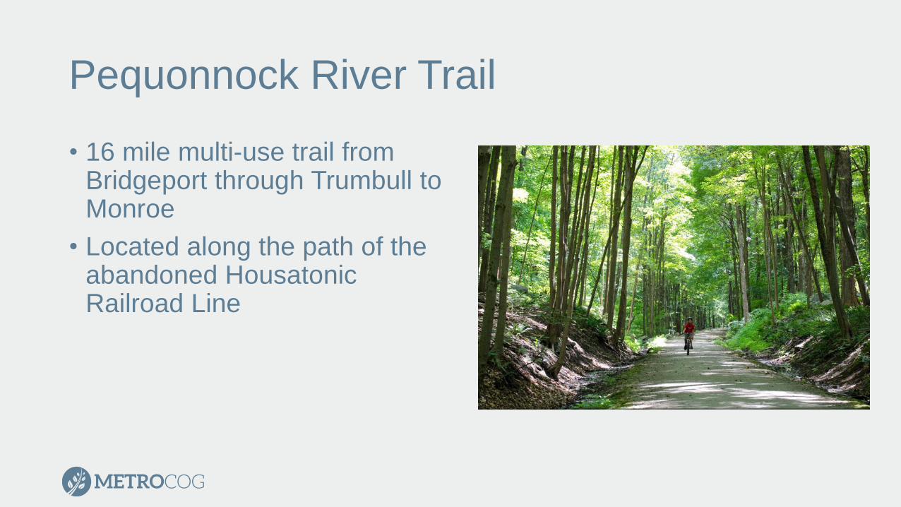
Pequonnock River Trail
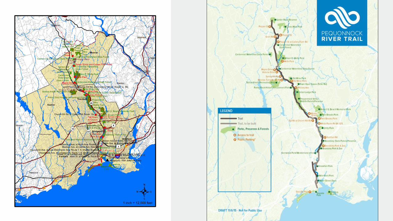
• 16 mile multi-use trail from Bridgeport through Trumbull to Monroe
• Located along the path of the abandoned Housatonic Railroad Line
Mapping the Trail
• MetroCOG provides GIS support for 6 member municipalities
• Two mapping products• Static “paper map”
• Use on website
• Handouts
• Story Map• Interactive
• More Information
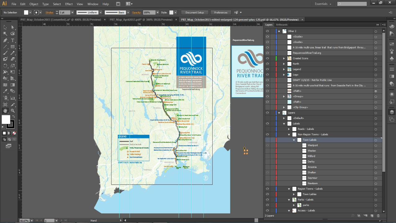
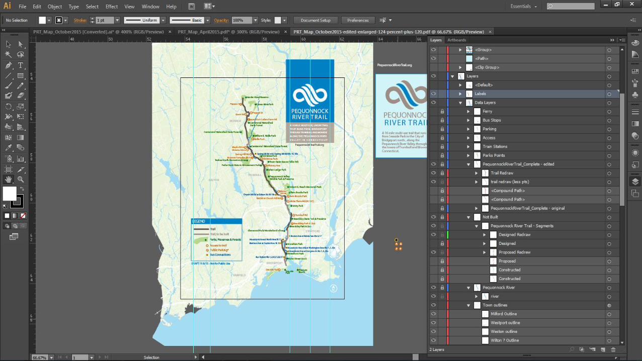
Static Map
• 8.5in x 11in
• Informative but readable
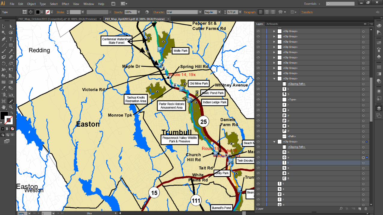
• Engaged graphic designer to enhance map with Adobe Illustrator
Tips and Tricks for Adobe Illustrator
• Through trial and error we found several methods to create an easier product for use in Adobe Illustrator
• Found several helpful websites• http://www.bgcarto.com/importing-an-arcmap-export-in-illustrator/
• http://www.bgcarto.com/some-tips-on-map-layout-exporting-a-map-to-illustrator/
• http://www.wwu.edu/huxley/spatial/tut/cart/argis_2_illustrator.htm
Tips and Tricks for Adobe Illustrator
• No Transparencies
• No Rasters
• Use Annotation!• Limit adding text in layout!• Use different color for each layers label
• Keep symbology simple
• Remove outlines from Polygons
• Dissolve features when possible• Limits the number of individual pieces that need to be altered
• Group features• Groups in ArcMap are grouped in Illustrator

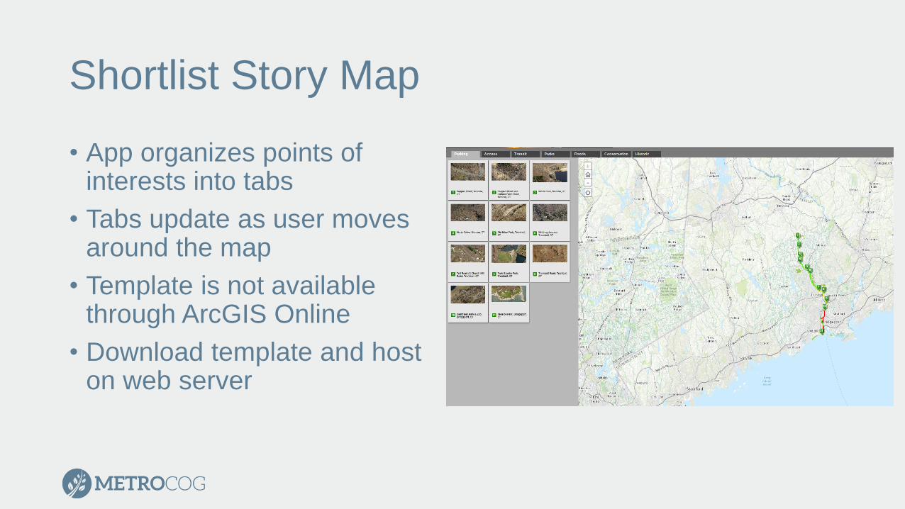
Shortlist Story Map
• App organizes points of interests into tabs
• Tabs update as user moves around the map
• Template is not available through ArcGIS Online
• Download template and host on web server
Shortlist Story Map
• https://storymaps.arcgis.com/en/app-list/shortlist/tutorial/
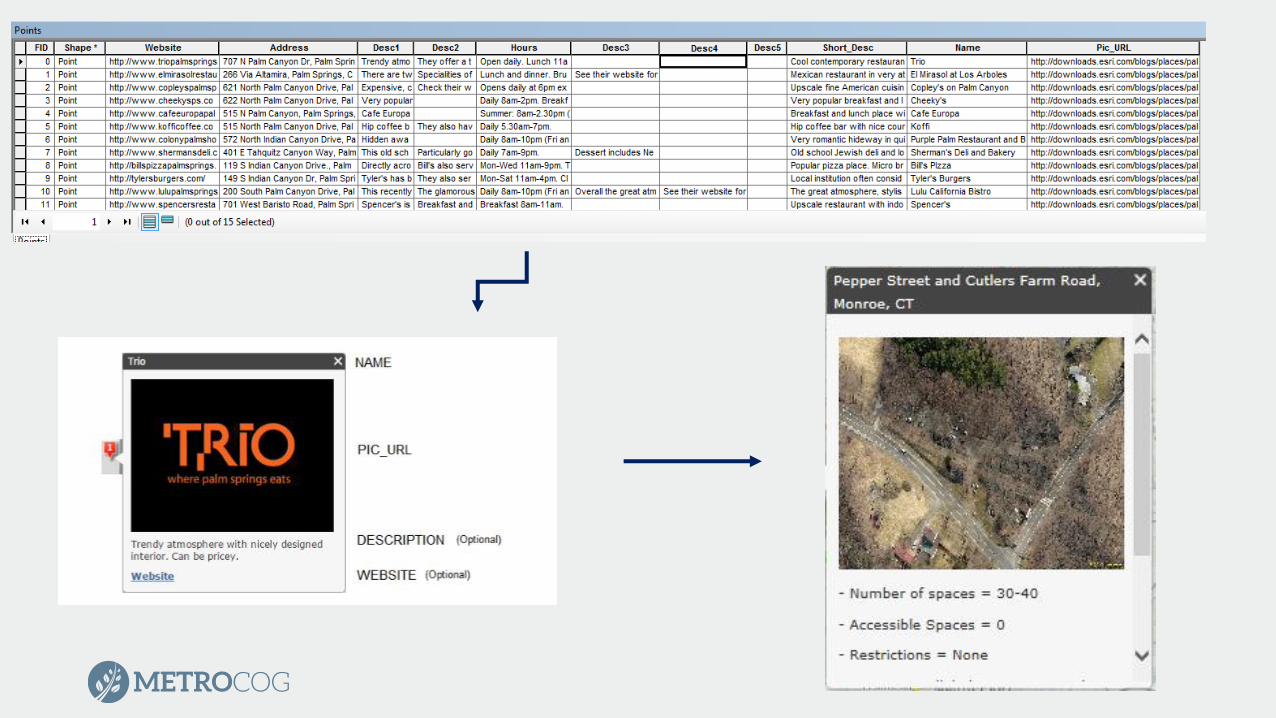
• Use sample files as template to configure point layers that define your tabs
• Shapefile or CSV
• Populate fields for text and images
• Load points directly into Web Map
• Save Web Map
• Copy the Web Map ID into the index.html file at appropriate location
• Copy template download onto web server
• Configure CSS/HTML files for personalization
Shortlist Story Map
• Cannot support • Rasters
• Services
• Feature Classes
• Can load rasters as basemap

Thank You!Mark Goetz
GIS Director
MetroCOG
Mark Hoover
GIS Technician
MetroCOG