transforming image processing - national park service · 2012-10-11 · transforming image...
TRANSCRIPT
ArcGIS for Imagery Management
Transforming Image Processing Kurt Schwoppe Federal Imagery Manager [email protected]
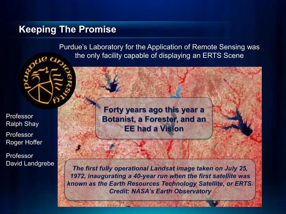
Keeping The Promise
The first fully operational Landsat image taken on July 25, 1972, inaugurating a 40-year run when the first satellite was
known as the Earth Resources Technology Satellite, or ERTS. Credit: NASA’s Earth Observatory
Forty years ago this year a Botanist, a Forester, and an
EE had a Vision
Purdue’s Laboratory for the Application of Remote Sensing was the only facility capable of displaying an ERTS Scene
Professor David Landgrebe
Professor Roger Hoffer
Professor Ralph Shay

Remote Sensing Extent of Usage Does the common user have access to remote sensing technology?
Are Farmers using remote
sensing to monitor the drought…
Commodity Brokers?
Did First Responders use remote sensing
during the Waldo Canyon fire?
Are Foresters using remote sensing to track the Emerald
Ash Borer?
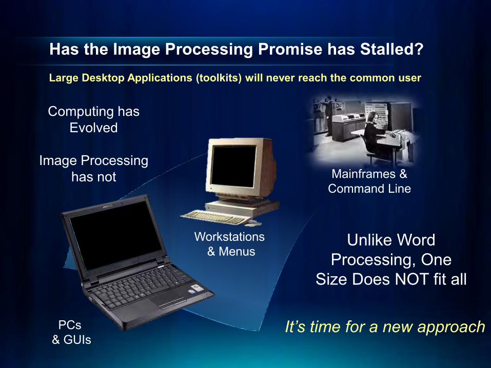
Has the Image Processing Promise has Stalled? Large Desktop Applications (toolkits) will never reach the common user
Mainframes & Command Line
Workstations & Menus
PCs & GUIs
It’s time for a new approach
Computing has Evolved
Image Processing
has not
Unlike Word Processing, One
Size Does NOT fit all
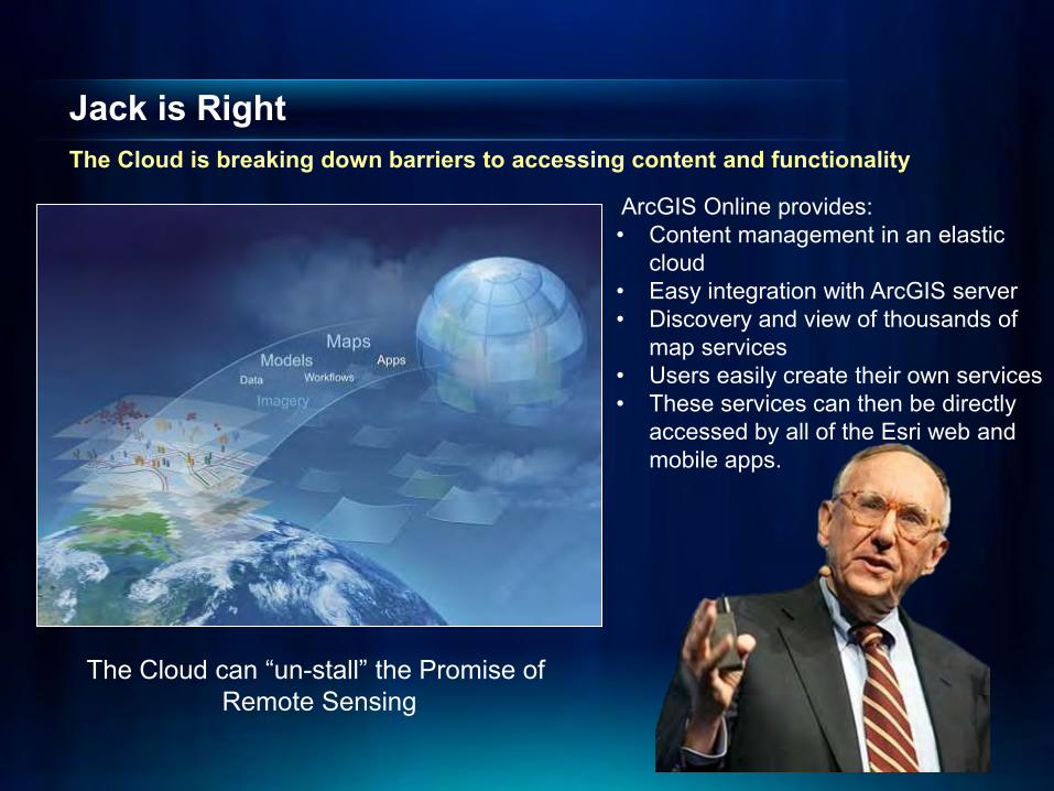
Jack is Right The Cloud is breaking down barriers to accessing content and functionality
The Cloud can “un-stall” the Promise of Remote Sensing
ArcGIS Online provides: • Content management in an elastic
cloud • Easy integration with ArcGIS server • Discovery and view of thousands of
map services • Users easily create their own services • These services can then be directly
accessed by all of the Esri web and mobile apps.
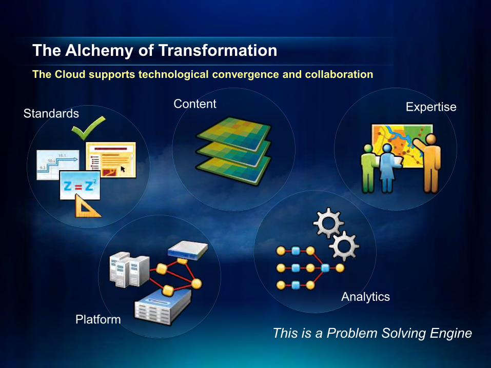
The Alchemy of Transformation The Cloud supports technological convergence and collaboration
Expertise Content
Platform
Standards
This is a Problem Solving Engine
Analytics
Simple Mgmt.
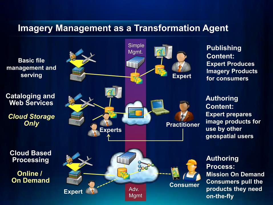
Imagery Management as a Transformation Agent
Expert
Publishing Content: Expert Produces Imagery Products for consumers
Basic file management and
serving
Cataloging and Web Services
Cloud Storage
Only Experts
Practitioner
Authoring Content: Expert prepares image products for use by other geospatial users
Adv. Mgmt
Cloud Based Processing
Online /
On Demand Consumer
Authoring Process: Mission On Demand Consumers pull the products they need on-the-fly
Expert
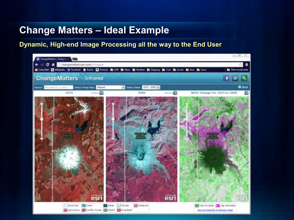
Change Matters – Ideal Example Dynamic, High-end Image Processing all the way to the End User

ArcGIS Is A Powerful Platform For Image Processing Visualization, Analysis, Feature Extraction and Management
Simplifies Workflows and Automates Processing
Extraction
Dynamic Mosaicking
Visualization Analysis
Any Imagery
Massively Scalable
Automatic Processing
Highly Accurate
Advanced Remotely Sensed Content
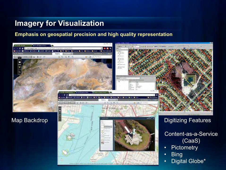
Imagery for Visualization Emphasis on geospatial precision and high quality representation
Map Backdrop Digitizing Features
Content-as-a-Service (CaaS)
• Pictometry • Bing • Digital Globe*

Imagery for Analysis Support for scientific methodologies and techniques for understanding
Water Quality and Runoff Analysis Vegetation Health and Brownfields
Change Detection and Analysis
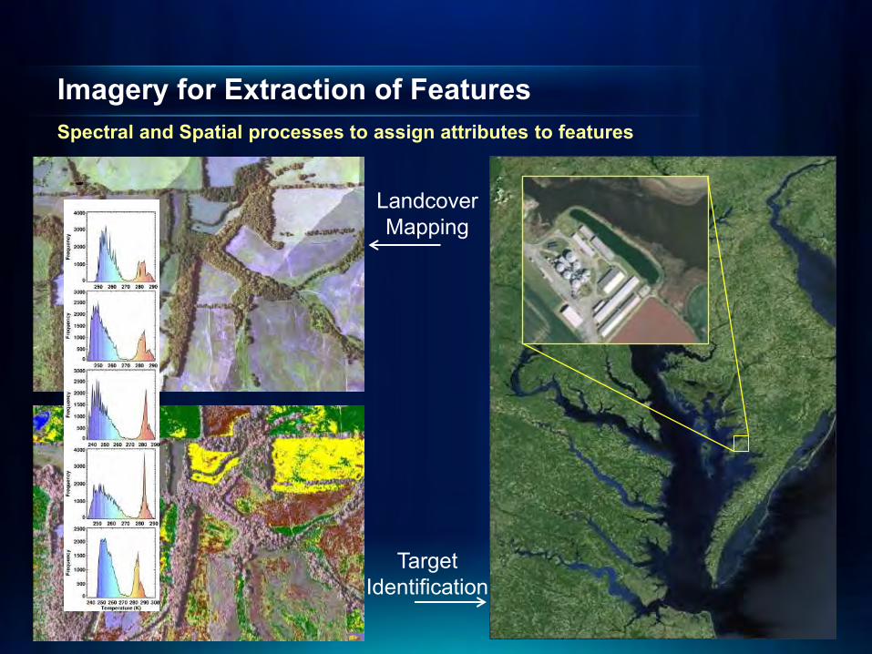
Imagery for Extraction of Features Spectral and Spatial processes to assign attributes to features
Landcover Mapping
Target Identification
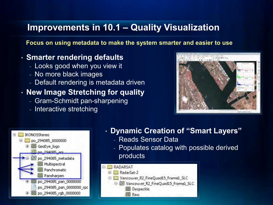
Improvements in 10.1 – Quality Visualization
• Smarter rendering defaults - Looks good when you view it - No more black images - Default rendering is metadata driven
• New Image Stretching for quality - Gram-Schmidt pan-sharpening - Interactive stretching
• Dynamic Creation of “Smart Layers”
- Reads Sensor Data - Populates catalog with possible derived
products
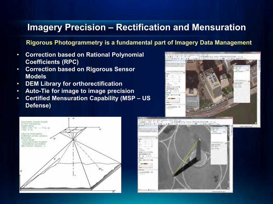
Imagery Precision – Rectification and Mensuration
• Correction based on Rational Polynomial Coefficients (RPC)
• Correction based on Rigorous Sensor Models
• DEM Library for orthorectification • Auto-Tie for image to image precision • Certified Mensuration Capability (MSP – US
Defense)
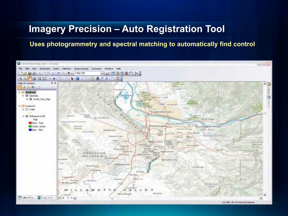
Imagery Precision – Auto Registration Tool Uses photogrammetry and spectral matching to automatically find control
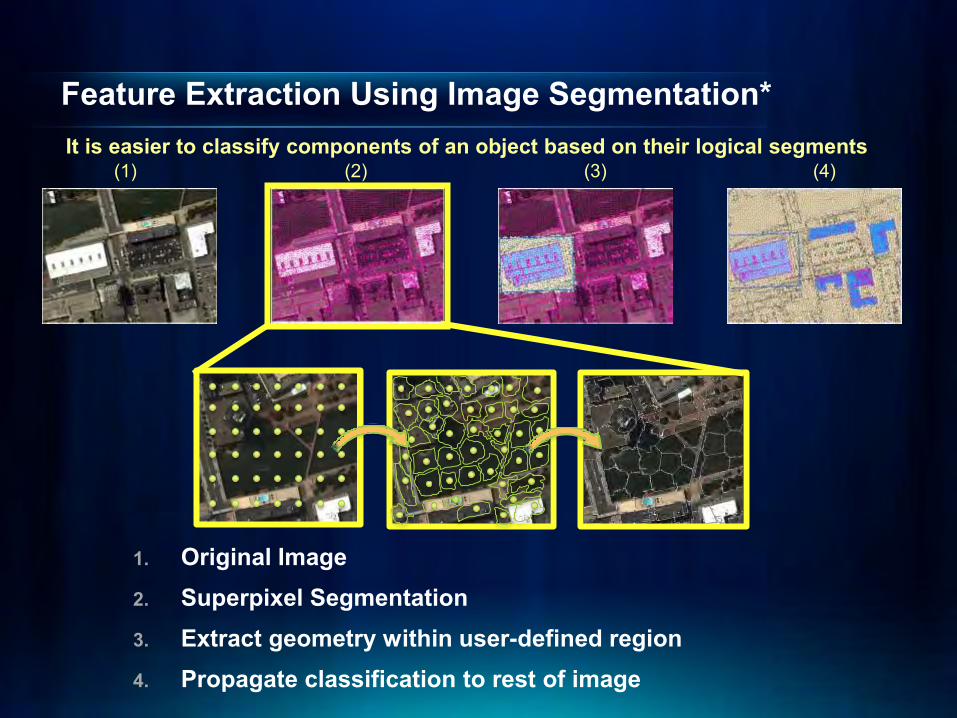
Feature Extraction Using Image Segmentation*
1. Original Image 2. Superpixel Segmentation 3. Extract geometry within user-defined region 4. Propagate classification to rest of image
(1) (2) (3) (4) It is easier to classify components of an object based on their logical segments
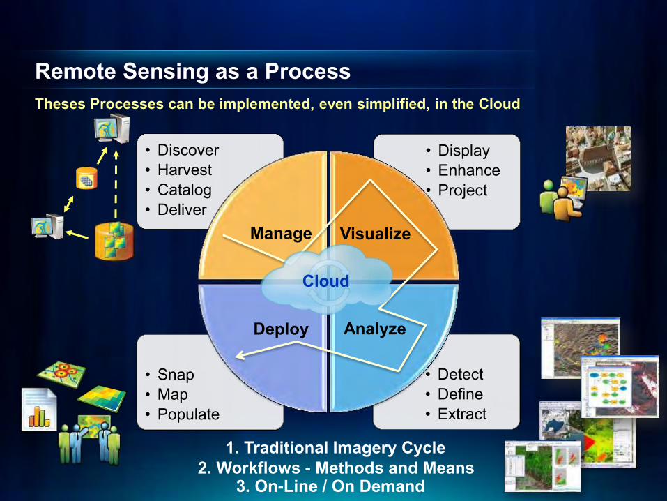
• Discover • Harvest • Catalog • Deliver
Manage
• Detect • Define • Extract
Analyze
• Display • Enhance • Project
Visualize
• Snap • Map • Populate
Deploy
1. Traditional Imagery Cycle 2. Workflows - Methods and Means
3. On-Line / On Demand
Cloud
Remote Sensing as a Process Theses Processes can be implemented, even simplified, in the Cloud

KING KONG Cloud Processing Environment
IKONOS Source
Selected Scenes
ArcGIS.com
Image Rectification Farm
Instances + Lustre + IDM
Image Processing Farm
Instances + Lustre + IDM Cache Processing Farm
Instances + Lustre + AGS
Deploy an Amazon Cloud-Based Compute & Storage Solution for Scalability
? ?
?
? Esri Sensitive
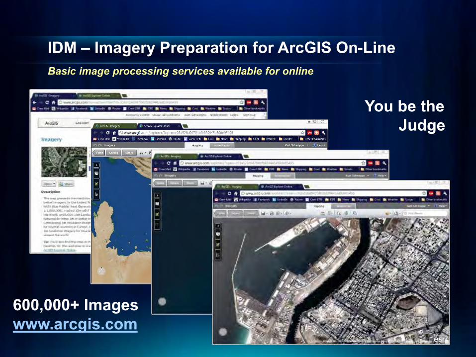
IDM – Imagery Preparation for ArcGIS On-Line Basic image processing services available for online
You be the Judge
600,000+ Images www.arcgis.com
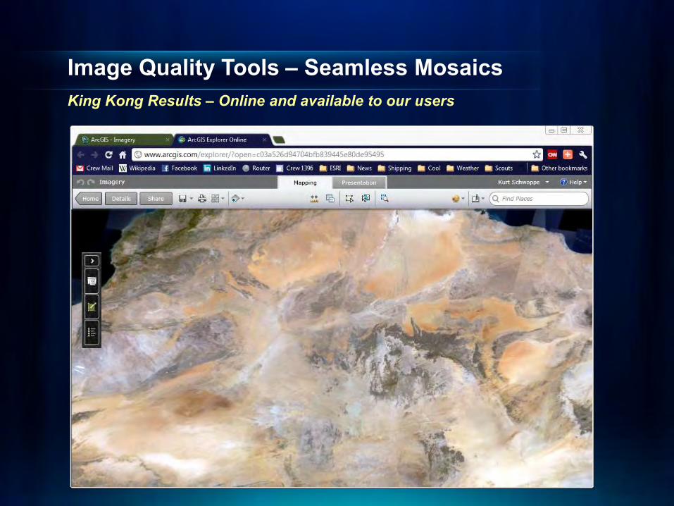
Image Quality Tools – Seamless Mosaics King Kong Results – Online and available to our users
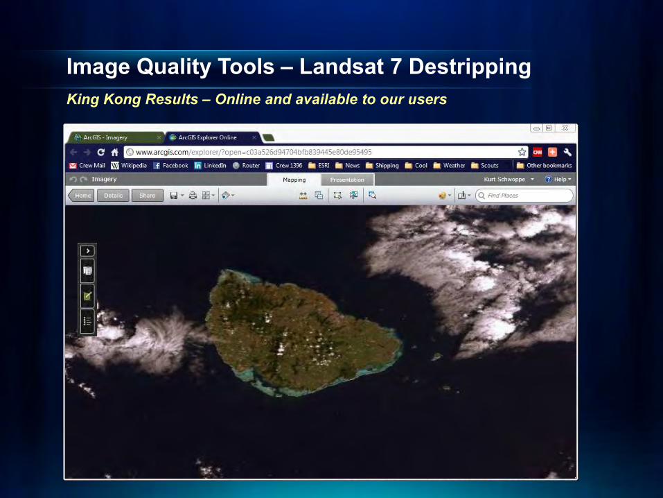
Image Quality Tools – Landsat 7 Destripping King Kong Results – Online and available to our users
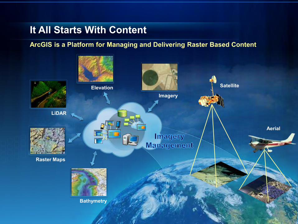
It All Starts With Content ArcGIS is a Platform for Managing and Delivering Raster Based Content
Raster Maps
Aerial
Satellite
LiDAR
Imagery Elevation
Bathymetry
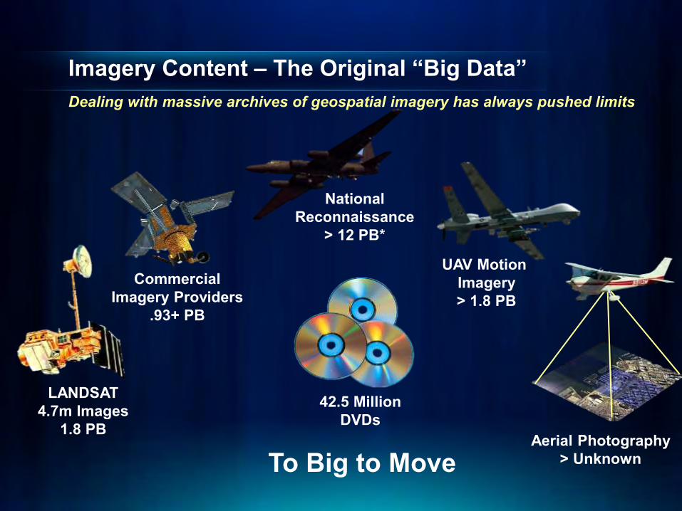
Imagery Content – The Original “Big Data” Dealing with massive archives of geospatial imagery has always pushed limits
LANDSAT 4.7m Images
1.8 PB
National Reconnaissance
> 12 PB*
Commercial Imagery Providers
.93+ PB
UAV Motion Imagery > 1.8 PB
Aerial Photography > Unknown
42.5 Million DVDs
To Big to Move
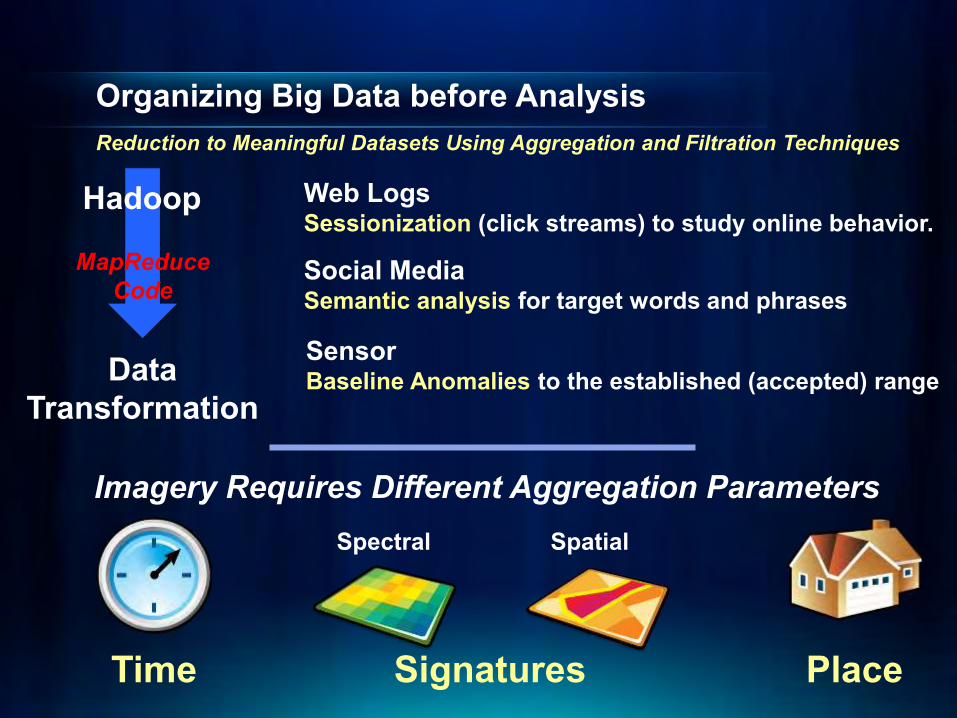
Organizing Big Data before Analysis Reduction to Meaningful Datasets Using Aggregation and Filtration Techniques
Web Logs Sessionization (click streams) to study online behavior.
Social Media Semantic analysis for target words and phrases Sensor Baseline Anomalies to the established (accepted) range
Hadoop
MapReduce Code
Data Transformation
Time Place
Imagery Requires Different Aggregation Parameters
Signatures
Spectral Spatial
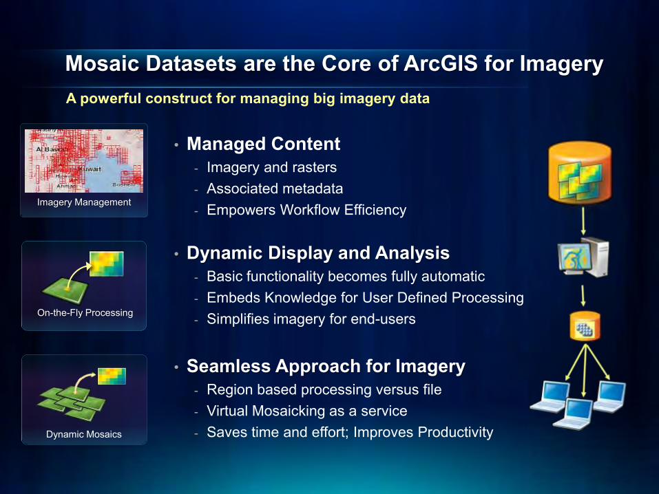
Mosaic Datasets are the Core of ArcGIS for Imagery
• Managed Content - Imagery and rasters - Associated metadata - Empowers Workflow Efficiency
• Dynamic Display and Analysis - Basic functionality becomes fully automatic - Embeds Knowledge for User Defined Processing - Simplifies imagery for end-users
• Seamless Approach for Imagery - Region based processing versus file - Virtual Mosaicking as a service - Saves time and effort; Improves Productivity
A powerful construct for managing big imagery data
On-the-Fly Processing
Dynamic Mosaics
Imagery Management
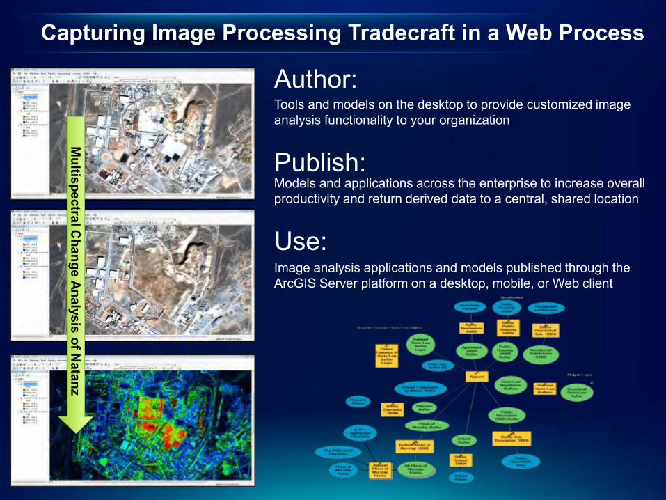
Capturing Image Processing Tradecraft in a Web Process
Multispectral C
hange Analysis of Natanz
Author: Tools and models on the desktop to provide customized image analysis functionality to your organization
Publish: Models and applications across the enterprise to increase overall productivity and return derived data to a central, shared location
Use: Image analysis applications and models published through the ArcGIS Server platform on a desktop, mobile, or Web client
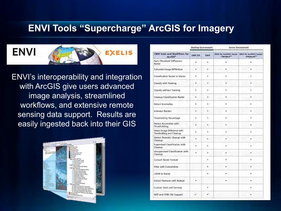
ENVI Tools “Supercharge” ArcGIS for Imagery
ENVI’s interoperability and integration with ArcGIS give users advanced
image analysis, streamlined workflows, and extensive remote
sensing data support. Results are easily ingested back into their GIS
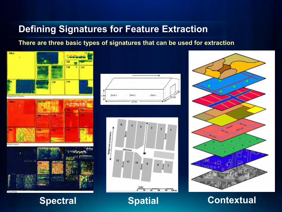
Contextual
Defining Signatures for Feature Extraction There are three basic types of signatures that can be used for extraction
Spatial Spectral
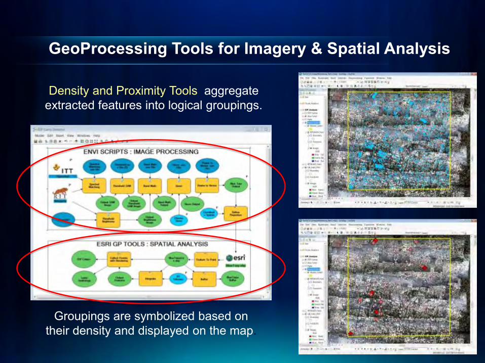
GeoProcessing Tools for Imagery & Spatial Analysis
Density and Proximity Tools aggregate extracted features into logical groupings.
Groupings are symbolized based on their density and displayed on the map.
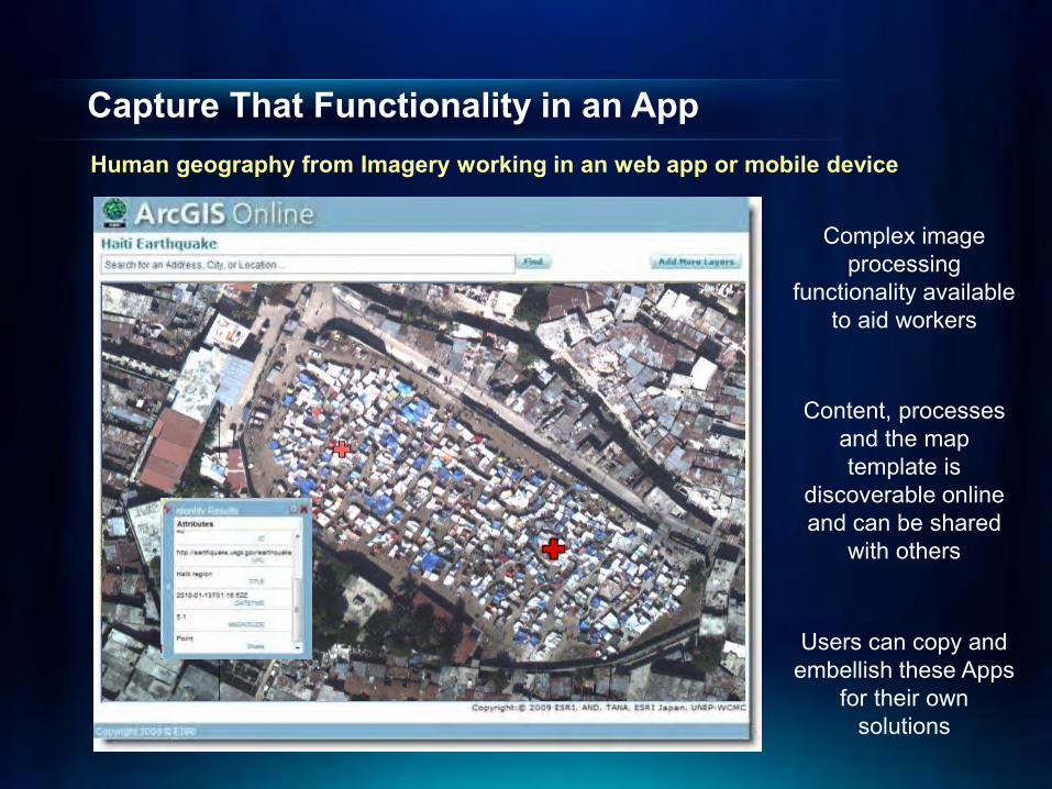
Capture That Functionality in an App Human geography from Imagery working in an web app or mobile device
Complex image processing
functionality available to aid workers
Content, processes and the map template is
discoverable online and can be shared
with others
Users can copy and embellish these Apps
for their own solutions
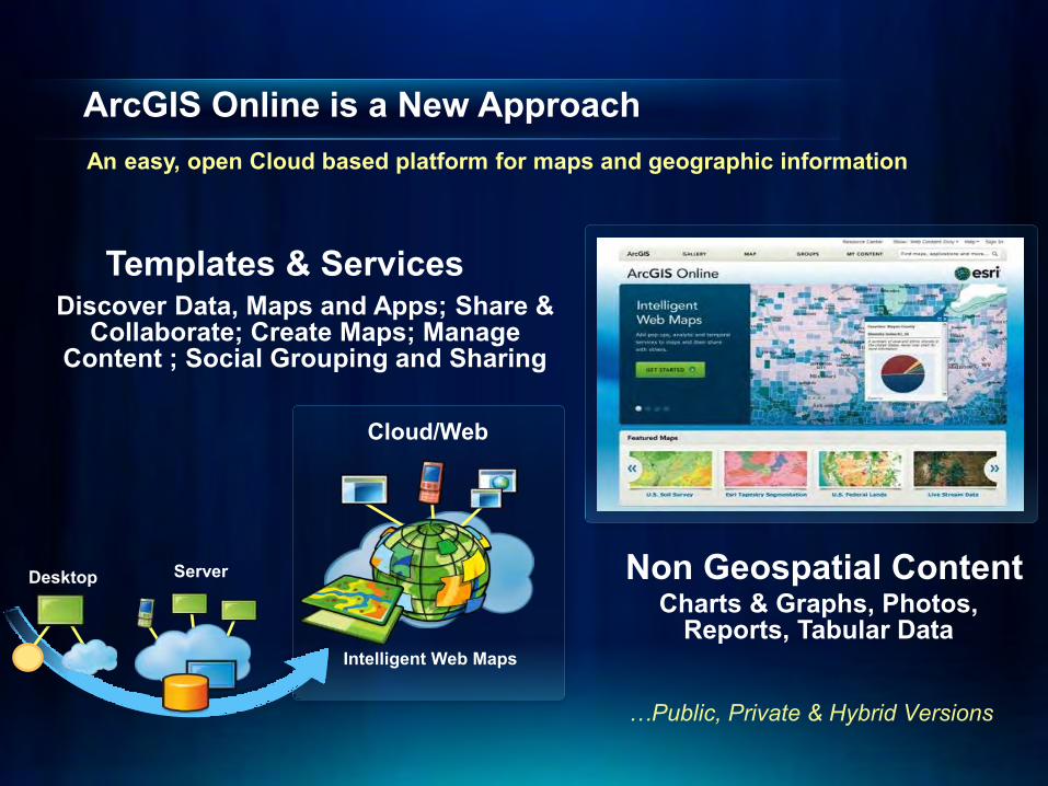
ArcGIS Online is a New Approach
Cloud/Web
Intelligent Web Maps
Server Desktop
Discover Data, Maps and Apps; Share & Collaborate; Create Maps; Manage
Content ; Social Grouping and Sharing
An easy, open Cloud based platform for maps and geographic information
Templates & Services
Charts & Graphs, Photos, Reports, Tabular Data
Non Geospatial Content
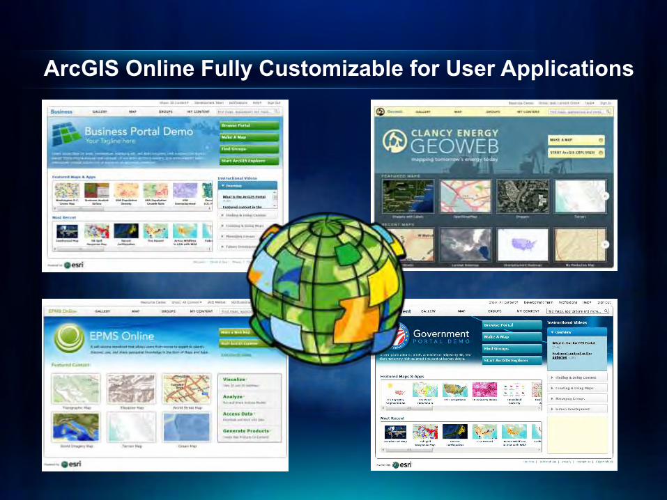
ArcGIS Online Fully Customizable for User Applications

Image Catalog Web (ICW) – Imagery Management

Focused Exploitation Image Processing tools are exposed through user defined templates
Environmental Monitoring
Template Library
Dedicated Exploitation Templates
Riparian Buffers
Impervious Surfaces
Buffer Analysis Template
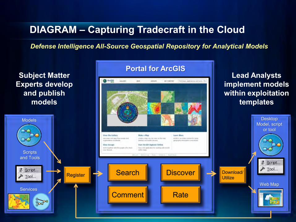
DIAGRAM – Capturing Tradecraft in the Cloud
Portal for ArcGIS
Download/ Utilize
Desktop Model, script
or tool
Web Map
Search Discover
Comment Rate
Models
Scripts and Tools
Services
Register
Defense Intelligence All-Source Geospatial Repository for Analytical Models
Subject Matter Experts develop
and publish models
Lead Analysts implement models within exploitation
templates
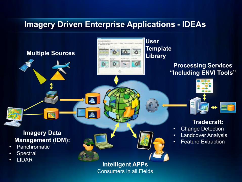
Imagery Driven Enterprise Applications - IDEAs
• Change Detection • Landcover Analysis • Feature Extraction
Processing Services “Including ENVI Tools”
Tradecraft:
• Panchromatic • Spectral • LIDAR
Multiple Sources
Imagery Data Management (IDM):
User Template Library
Intelligent APPs Consumers in all Fields
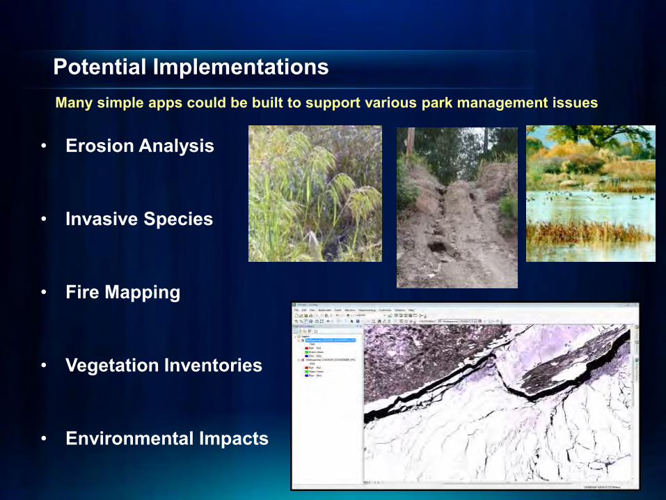
Potential Implementations Many simple apps could be built to support various park management issues
• Erosion Analysis
• Invasive Species
• Fire Mapping
• Vegetation Inventories
• Environmental Impacts

Dedicated AGOL Site for Federal Remote Sensing A place all members can collaborate and share in the promise of remote sensing
Remote Sensing User Group
Federal Remote Sensing
Questions Kurt Schwoppe Federal Sales Manager for Imagery Solutions [email protected] (703) 939-7580