understanding cultural and human geography - … culturalgeography.pdfthe importance of place ......
TRANSCRIPT

Science
& Mathematics
Topic
Earth Science
Subtopic
Professor Paul RobbinsUniversity of Wisconsin–Madison
Course Guidebook
Understanding Cultural
and Human Geography

PUBLISHED BY:
THE GREAT COURSESCorporate Headquarters
4840 Westfields Boulevard, Suite 500Chantilly, Virginia 20151-2299
Phone: 1-800-832-2412Fax: 703-378-3819
www.thegreatcourses.com
Copyright © The Teaching Company, 2014
Printed in the United States of America
This book is in copyright. All rights reserved.
Without limiting the rights under copyright reserved above,no part of this publication may be reproduced, stored in
or introduced into a retrieval system, or transmitted, in any form, or by any means
(electronic, mechanical, photocopying, recording, or otherwise), without the prior written permission of
The Teaching Company.
i
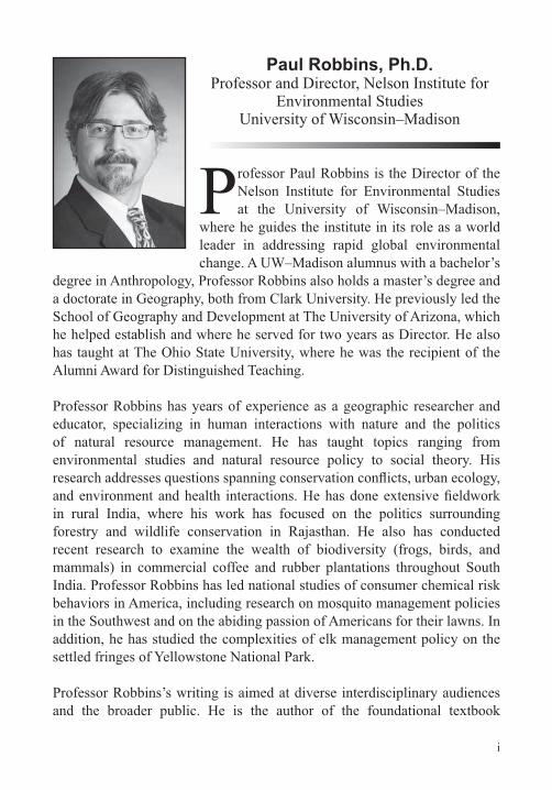
Paul Robbins, Ph.D.Professor and Director, Nelson Institute for
Environmental StudiesUniversity of Wisconsin–Madison
Professor Paul Robbins is the Director of the Nelson Institute for Environmental Studies at the University of Wisconsin–Madison,
where he guides the institute in its role as a world leader in addressing rapid global environmental change. A UW–Madison alumnus with a bachelor’s
degree in Anthropology, Professor Robbins also holds a master’s degree and a doctorate in Geography, both from Clark University. He previously led the School of Geography and Development at The University of Arizona, which he helped establish and where he served for two years as Director. He also has taught at The Ohio State University, where he was the recipient of the Alumni Award for Distinguished Teaching.
Professor Robbins has years of experience as a geographic researcher and educator, specializing in human interactions with nature and the politics of natural resource management. He has taught topics ranging from environmental studies and natural resource policy to social theory. His
in rural India, where his work has focused on the politics surrounding forestry and wildlife conservation in Rajasthan. He also has conducted recent research to examine the wealth of biodiversity (frogs, birds, and mammals) in commercial coffee and rubber plantations throughout South India. Professor Robbins has led national studies of consumer chemical risk behaviors in America, including research on mosquito management policies in the Southwest and on the abiding passion of Americans for their lawns. In addition, he has studied the complexities of elk management policy on the settled fringes of Yellowstone National Park.
Professor Robbins’s writing is aimed at diverse interdisciplinary audiences and the broader public. He is the author of the foundational textbook

iiii
Political Ecology: A Critical Introduction and numerous research articles in publications that address conservation science, social science, and the humanities. His award-winning book Lawn People: How Grasses, Weeds, and Chemicals Make Us Who We Are is widely recognized as one of the most accessible books on the environmental politics of daily life. He is the coauthor of several best-selling textbooks in geography, including World Regions in Global Context: Peoples, Places, and Environments and Environment and Society: A Critical Introduction. Professor Robbins has been interviewed by numerous media organizations, including The New York Times, and has been a guest on national radio and television programs, including National Public Radio’s Science Friday
iii
Table of Contents
LECTURE GUIDES
INTRODUCTION
Professor Biography ............................................................................ iCourse Scope .....................................................................................1
LECTURE 1Writing the World—The Mapmaker’s Craft .........................................3
LECTURE 2The Problem with Geographical Determinism .................................10
LECTURE 3Anthropocene—The Age of Human Impact ......................................17
LECTURE 4Climate Change and Civilization.......................................................24
LECTURE 5Global Land Change.........................................................................31
LECTURE 6The End of Global Population Growth ..............................................38
LECTURE 7The Agricultural Puzzle .....................................................................45
LECTURE 8 Disease Geography ..........................................................................52
LECTURE 9Political Ecology ...............................................................................58
LECTURE 10Economic Geography—Globalization Origins ..................................65
iv
Table of Contents
LECTURE 11The Columbian Exchange ................................................................72
LECTURE 12Uneven Development and Global Poverty .......................................79
LECTURE 13The New Global Economy ................................................................86
LECTURE 14Restless Humanity—The Migration Conundrum ..............................93
LECTURE 15Urbanization—The Rise of New World Cities .................................100
LECTURE 16Geography of Language .................................................................107
LECTURE 17Understanding Cultural Geography ................................................114
LECTURE 18The Importance of Place ................................................................121
LECTURE 19 ...............................................................128
LECTURE 20Culture, Power, and the Politics of Meaning ...................................135
LECTURE 21The Geopolitical Imagination ..........................................................141
LECTURE 22Regionalism and the Rise of New States .......................................148
LECTURE 23 Supranationalism—Taking on Big Problems ..................................155

v
Table of Contents
LECTURE 24Future Geographies........................................................................162
Bibliography ....................................................................................168
SUPPLEMENTAL MATERIAL

vi

1
Scope:
Why have some forests been cut down around the world while others still stand? Why is the economy in one place sluggish while
impact the political strategies and relationships of states? Why is population growth slowing, and why are people gravitating to cities?
The answers to all these questions lie in geography. Geography is the study of the distribution of features and objects across the Earth’s surface; it provides both a description as well as an explanation for why places vary, whether locations impact one another, and how regions change. Cultural and human geography focuses on the distribution and actions of people,
economies, cultures, and politics. Geography not only helps explain how the world is today but also allows us to imagine the way the world might look in the future.
These lectures on geography provide the major conceptual tools that cultural and human geographers use in their research into the complexities of the world, and point to surprising examples of the way our tumultuous planet is changing at an accelerating pace.
Understanding Cultural and Human Geography begins with a look at maps and mapping, providing the critical tools to look both creatively and skeptically at maps. We go on to explore the complex connections between environmental contexts and cultures and civilizations. The lectures address issues like our changing global climate, transformations in land cover around the world, population growth, provisioning of food, and circulation of diseases. We explore the development and transformation of the globe’s economic geography, starting with the emergence of the earliest global economies in the 14th and 15th centuries, through the tumultuous geography of colonialism and the 20th century, and into the modern map of our rapidly
Understanding Cultural and Human Geography

Scop
e
22
globalizing system of worldwide exchange. This leads us to mapping and examining trends in urbanization, worldwide migration, and the evolution of languages. We then examine trends in global culture, and the way demographic and economic change have withered many local cultures while invigorating others. Finally, we examine political geography, considering the relationships among global states, the rise of new states from regional
state. The lecture series concludes with a meditation on what the future of the world might be, given the current trends.
Using current examples that span from deforestation to urbanization to geopolitical transformation, Understanding Cultural and Human Geography emphasizes a single, crucial theme that lies at the heart of geographic research: All aspects of geographic context—regional and local environmental, economic, cultural, and political conditions—have a profound impact on people’s lives, the range of options available to them, and the imperatives they face. At the same time, our individual and collective decisions often lead to radical transformations of our environment, culture, economy, and politics.
In short, humans are a product of their geographies, but humans are

3
Writing the World—The Mapmaker’s CraftLecture 1
When we think about geography, we usually imagine maps. The word geography comes from the Greek word geographia, meaning “world writing” or “Earth writing.” Clearly, maps are
a fundamental part of world writing, since maps graphically describe the Earth’s’s surface, its contents, and its patterns. Maps are used to show how people, places, or features change over time. In this lecture, we will examine
political biases and sometimes indicate deliberate distortions. Because of potential biases and distortions, it is essential that we always read maps with a critical eye.
Round Earth, Flat MapsConsider one of the most basic goals of geography: mapping the Earth. The practical problem is how to represent a three-dimensional object on a two-dimensional surface. Geographers solve this problem using projections.
A projection is simply a mathematical way of taking the spherical coordinates of latitude and longitude and bending and stretching them into a two-dimensional representation to be seen as a map.
The mathematics of this presents problems, however. Once a spherical globe is represented in two-dimensional map form, it can never be fully accurate. Either the angles and shapes on the surface have to be distorted, or the proportions and sizes altered. If the shape of the continents and oceans is maintained, their size will be vastly distorted; if their proportion and sizes are maintained, their shapes will be changed.

4
Lect
ure
1: W
ritin
g th
e W
orld
—Th
e M
apm
aker
’s C
raft
The Mercator ProjectionA conformal projection maintains angles and shapes perfectly but at the expense of accuracy in proportion or size. The most noted of these is the Mercator projection.
The Mercator projection is named for the cartographer and navigator Gerardus Mercator; it was introduced in 1569. Mercator was interested in sailing and wanted to help facilitate transit from Europe to the New World and Asia. As a result, he was focused on producing a map that sailors could use, with right angles and proper shaping.
The problem with the Mercator projection was that, in seeking to maintain the angles and land shapes for sailing, it introduced vast distortions in the size of continents. The farther away from the equator in a Mercator projection, the greater the distortion in size, and the larger the continents become.
distortions in the sizes of continents.
© P
astic
cio/
iSto
ck/T
hink
stoc
k.

5
The Peters ProjectionAn alternative projection that more accurately represents the relative sizes of the continents is the equal-area projection. Equal-area projections maintain the proportional size of Earth features, so that a continent that is physically twice as large as another appears that way on the map.
The most prominent example is the Gall–Peters equal-area
solved this problem in 1855, and Arno Peters, who publicized the results in the 1970s.
The Gall–Peters equal-area projection, also called the Peters projection, makes up for the distortions in the Mercator projection by enlarging or stretching the sizes of the continents so that they are in proper proportion. The results, however, are extremely distorted; the continents appear quite elongated, stretched from north to south—certainly not an accurate depiction.
Still, the Peters projection of the 1970s had several strong political allies, and was very popular for a time. It was adopted by many international agencies to make the political point that the countries nearer to the equator, many of which were former colonies, are actually much larger than depicted on a Mercator map. The Peters projection was considered “fairer” than the traditional Eurocentric or America-centric conformal projection.
Maps Are ChoicesNo map can be fully accurate. In the case of a world map, there must either be a distortion of shape or of size. Each map represents a choice—a combination of decisions made by the mapmaker.
proportion of an area on a map relative to area in the real world. As the scale of a map becomes smaller, the amount of area in the real world is represented by decreasing increments on the map, allowing us to map larger areas.

6
Lect
ure
1: W
ritin
g th
e W
orld
—Th
e M
apm
aker
’s C
raft
For example, a map of Boston at 1:10 million would include the city, its outer suburbs, and much of Massachusetts Bay. A map at 1:25,000 would show only the commercial district, Old North Church, and the areas around the Charles River. Choosing a scale makes some features appear and others disappear.
Another decision in mapping is its orientation. We are most accustomed to maps with north at the top. This was a tradition that likely began with the Egyptian astronomer Ptolemy in the 2nd century C.E.—likely as a convenience, since it crams the most populous known land masses on top.
reader sees and interprets the world. Longitude lines, which run north to south on the map, are numbered eastward from the prime meridian. Interestingly, the prime meridian runs straight through the Royal Greenwich Observatory in England. When the system of longitude and latitude was developed, the most powerful entity in the world was the British Empire. As a result, the British literally wrote themselves into the center of the world.
Maps Are CultureMaps represent the worldview of the mapmaker. By looking back on the history of cartography, we can gain fascinating insights into some very different cultures by looking at their maps.
Early Christian maps were most notable in this regard. They positioned the continental space at the center, surrounded by a circular ocean, which stretched to the edges of the disk of the
orientation focused on Jerusalem. The word we use today for
is derived from this view of the world.
On these maps, the continents were separated by rivers that together formed a kind of cross, or T shape. The continents were surrounded by the circle of ocean, forming an O shape. We now

7
call these depictions T and O maps. But the more fundamental point
which the shape of the Earth and the relationship of the continents
Maps from the Middle Ages and Later Medieval world maps included the celebrated Tabula Rogeriana map of the world, drawn around 1150 by the noted cartographer
African and Iberian Muslim scholars, owing to the vast ocean trade linkages forged by Arab traders. The sophistication of the cartography of the Tabula Rogerianacontact between Asia, Europe, and Africa. Arab traders had reached the farthest reaches of Asia and Southeast Asia and returned home with detailed descriptions of coastlines, people, and places.
By the time the New World was discovered in the late 1400s, knowledge of the world had advanced greatly. A new colonial
among the most famous of the cartographic products of its time.
the atlas was likely made by a Portuguese cartographer working in the Dieppe school.
The Dieppe school was noteworthy in the 16th century for producing handmade maps for wealthy and royal patrons like Henry II of
what is most notable about them is the proliferation of place names; what’s more, land features that could be recognized from the sea are all treated in enormous detail. The interior spaces on these maps, however, have little cartographic detail, and instead provide a space for depictions of native life through pictures.
Mental MappingEven maps made today are geocentric (placing the cartographer at the center of the world) and ethnocentric (emphasizing the culture of the mapmaker).

8
Lect
ure
1: W
ritin
g th
e W
orld
—Th
e M
apm
aker
’s C
raft
This phenomenon has been studied by the geographer Thomas Saarinen, who helped develop a technique called mental mapping. He traveled around the world and asked people to draw sketch maps of their communities, their neighborhoods, and of the world. The resulting maps show not only how people think the world is shaped but, more profoundly, what their place in the world is.
Saarinen observed that many mental maps—even those of people living far from Europe—tended to be somewhat Eurocentric. In a sense, Europe has imposed its spatial imagination on the world.
Maps Are PoliticalCartographers have the ability to control our perception of the world. In his book How to Lie with Maps, geographer Mark Monmonier shows how choices in mapmaking can be used to deliberately shape opinion and manipulate political outcomes.
For example, cartographers during the Cold War made strategic choices about how to represent the world. The favored map for school textbooks was the Mercator projection, in part because it tended to exaggerate the size of the two superpowers.
Color choices in these maps also represented the politics of the era. The Soviet Union and China were often represented as large black or dark red blocks on the map, in contrast to the pastel blue NATO nations. The maps were often centered in a way that suggested the size of the threat of Soviet power.
Maps are windows into the culture and politics of the people who made them. By reading maps critically, we can understand how people think geographically and how their geographic view of the world is realized in depictions of space. However, making and interpreting maps is only a tiny fraction of what geographers do. Geographers study the world. Throughout the rest of the course, we will review the key lessons of human and cultural geography.

9
Crampton, Mapping.
Harley, Deconstructing the Map.
Monmonier, How to Lie with Maps.
1. What are some examples of choices that a cartographer makes that
2. Find a map and study it; what story does it tell? What does it tell us about the mapmaker? How might the map have been made differently to tell a different story?
Suggested Reading
Questions to Consider

10
Lect
ure
2: T
he P
robl
em w
ith G
eogr
aphi
cal D
eter
min
ism
The Problem with Geographical Determinism Lecture 2
A long-standing question facing geographers is how much our environment explains who we are—as individuals, in groups, and even as a species. In this lecture, we will review some of the
core concepts that geographers use to understand the world: place, region, and adaptation. Places set the context for individual people and their experiences; larger regions encompass distinct cultures; and adaptation to differing environments is a quality common to all humankind. We will also examine work by geographic thinkers to take these concepts to a more deeply historical level and explore the problematic argument that geography determines history and society.
A Sense of PlacePlaces are the local settings in which human activity occurs on a
describe. They comprise physical features, like mountains, beaches, and plant and animal life, as well as cultural and economic features, like architecture, forms of livelihood, and religion.
Geographers assert that experiencing and creating places are fundamental human qualities. Consider your neighborhood. A neighborhood has a distinctive kind of housing, topography, and a look and feel. You know when you have entered or exited your own neighborhood, even though it may not have a formal boundary, sign, or line on a map. In a sense, people make their own places, by assigning emotional or personal qualities to them: “This is my neighborhood.”
experience remarkably different health outcomes and life expectancies than those living in cleaner places. In another

11
example, living in a small town encourages different kinds of social interactions than living in a dense urban environment.
Regions: Physical, Social, Cultural, Political Geographers refer to larger areas, made up of numerous smaller
that shares a number of physiographic, economic, and social and cultural attributes.
Like places, we know most regions intuitively. When we say, for example, “upstate New York,” we are invoking a region. Without question, the areas contained within this larger region are incredibly diverse. The countless small towns of the region do not have a lot in common with the larger cities. Nonetheless, they share a regional topography and similar economic systems. Moreover, the region
Regions, such as upstate New York, tend to have shared characteristics, including economic systems or political commitments.

12
Lect
ure
2: T
he P
robl
em w
ith G
eogr
aphi
cal D
eter
min
ism
relationship with, the Eastern Seaboard region of the greater New York City megalopolis.
of a particular and distinctive culture or language. We speak of “Amish country” in Pennsylvania, Bretagne in France, or Catalonia in Spain. Regions are social and cultural in this sense, and also potentially political.
The Marvel of Human Adaptation
geographers call adaptations. Adaptations are the myriad creative solutions to the complex regional geographical conditions that people, societies, and civilizations face.
Adaptations are truly universal. They are seen in both “traditional” or nonindustrial areas as well as modern societies and economies.
Iceland is an excellent example of adaptation. The country lies in a cold region, and has limited fuel resources, yet it runs at a positive energy balance, depending on imported fossil fuels for less than 1 percent of its overall power. Its secret: adaptation to the environment. Iceland is perched atop a geological “hot spot” along the Mid-Atlantic Ridge—a place where two tectonic plates are moving apart from each another and new land is being created
power plants that use the molten heat of the Earth to produce about a quarter of the island nation’s energy.
This is the marvel of human adaptation. Geographic conditions can vary enormously, creating distinct regions. People, societies, cultures, and economies adapt to those conditions and thrive using a kind of genius loci—a “spirit of the place.”

13
Geography as DestinyConsider a more ambitious thesis of geography. Given that people adapt to their geographic conditions, it might be possible that certain geographies, owing to their special qualities, can promote more advanced, or sophisticated, civilizations over time. Geography, in this sense, may directly determine the outcomes of development.
There are several clues in the global landscape that might lead us to this hypothesis. Most notably, many regions near the equator currently experience far lower standards of living and economic growth than areas closer to the poles. Geographers have examined whether there is something in the climate or the geography of the equatorial region that determines or explains this.
The Case for DeterminismPerhaps the best-known and most thorough version of this argument was put forward by Jared Diamond, in his 1997 book Guns, Germs, and Steel. Diamond argued that those parts of the world that were
tended to become dominant civilizations with more advanced technology. These population densities were driven by the earlier advent of consistent and productive agriculture. Agriculture, in turn,
large areas east to west.
These conditions largely prevailed in the Near East and Europe,
in Europe, and the eventual European political and economic dominance of the world. Diamond also argued, as other geographers have, that the isolation of the Americas from the disease ecology of Europe, Asia, and Africa made people there highly vulnerable to epidemics that followed the European discovery of the New World at the end of the 15th century.
As Diamond correctly points out, the genetic differences between people in Africa, Europe, and Australia are so incredibly small and

14
Lect
ure
2: T
he P
robl
em w
ith G
eogr
aphi
cal D
eter
min
ism
trivial as to render them useless in explaining major differences in development. If it isn’t genetics, then it must be geography.
The Case against DeterminismThere are counterarguments to Diamond’s thesis. First, there are many places that were ideal for agriculture but where intensive agriculture did not evolve, as in parts of southern Africa and Australia.
Second, people in many places domesticated crops as early as, or even earlier than, Europe, including parts of Southeast Asia, yet these areas did not emerge as dominant. China, East Asia, and
for a dominant civilization, but these were very poor places until very recently. This cannot be explained simply through the use of geography. History, economics, colonialism, and other key factors have to be considered.
Part of the problem with Diamond’s argument is that it sets out to explain why Europe was politically and economically dominant in the 19th and 20th centuries—at the time the author was writing. But this date is an arbitrary choice. If Diamond had picked 1491 as his date, it would be far harder to say that Europe was dominant; or, if Diamond had written his book in 2060, it is very possible that different regions might be economically ascendant by that time.
The determinist argument is considered by some as overreaching and unidirectional. While we have seen that geography does
understand that human adaptation is a creative affair, and that people often alter the conditions of their geographical context to remarkable effect.
A Dialectical RelationshipPeople are a product of their places. However, place, region, and adaptation can be interpreted in an active sense. People make their own places; they create regions; and they adapt the Earth to suit their purposes. Humans are, by their natures, tinkerers—working

15
the Earth, recombining the elements of the world around them, and changing themselves, their cultures, and economies in the process.
Consider the rice economies of Asia. First domesticated in South Asia and Southeast Asia more than 7,000 years ago, rice plants proved capable of intensive growth, able to produce great food surpluses and support large increases in population. Over the millennia, agricultural systems evolved that used that large
growing by physically changing the geographic landscape, carving
The rice paddy system is one that requires complex social systems for management. People have to organize to open and close water gates and maintain and repair water systems. They have to cooperate
These social systems led to innovation, more sophisticated social interactions, and new rice cultures and economies. By the early 20th century, the rice economies of the region were among the most sophisticated and complex in the world.
The novel geographies and societies that emerge from this kind of ongoing interaction impinge on one another in a way that we would describe as dialectical—meaning that each is transformed through its relationship to the other. Rice and people are changed as they evolve together. In that sense, people make geographies, but never the geographies entirely of their own choosing.
The extent to which humans have transformed the Earth is so vast that today many scholars have proposed to give our current geological time period a new name: the Anthropocene epoch. We will turn to this remarkable trend in the next lecture.

16
Lect
ure
2: T
he P
robl
em w
ith G
eogr
aphi
cal D
eter
min
ism
Blaut, Environmentalism and Eurocentrism.
———, Eight Eurocentric Historians.
Diamond, Guns, Germs, and Steel.
1. What is the relationship between geographic adaptation and geographic determinism? How do they differ?
2. How is the relationship between people and their environment dialectical? Can you think of an example?
Suggested Reading
Questions to Consider

17
Anthropocene—The Age of Human Impact Lecture 3
Humans have had such far-reaching impacts on the planet that many observers have given our geological epoch an entirely new name: the Anthropocene. In this lecture, we will discuss some of these sweeping
transformations and explore whether nature is fundamentally separate from humanity, or whether environments and people are produced together as the
environments have been both created and destroyed by human activity. The Anthropocene epoch is an opportunity to reevaluate our role in the Earth’s history. To the degree that the Anthropocene has created positive opportunities, we need to think creatively about how we live in nature.
What Is the Anthropocene?Anthropocene is a term introduced by Paul Crutzen in 2002 to describe our current geological epoch, relative to previous periods, such as the Pliocene, Miocene, or Pleistocene, because human
In fact, stratigraphers have argued that future geologists digging through the strata of our time will observe a notable shift in the rock chemistry and layers. There is debate over when the Anthropocene epoch began. Crutzen suggested that it began when James Watt perfected his steam engine in 1784. Others have argued that the Anthropocene goes all the way back to the dawn of agriculture.
In an Anthropocene epoch, we invert the historic question asked by geographers. Instead of determining what impact the Earth has had on humanity, we ask ourselves what impact humanity has had on the Earth.
Unidirectional ChangeSome changes made by humans to modify the environment are unidirectional—that is, ceasing those behaviors does not

18
Lect
ure
3: A
nthr
opoc
ene—
The
Age
of H
uman
Impa
ct
always automatically mean that the environment will return to its previous condition.
In the grasslands of Eastern Cape Province in South Africa, for example, periodic burning by local peoples has turned the land into highly productive grazing ground. If burning is halted, however—as sometimes happens at the insistence of local authorities—the land does not always recover to its original mix of species.
Often it regrows into low-value scrubs rather than reverts to the indigenous grassland. For whatever reasons, transformations can be a one-way trip. In the Anthropocene, many landscapes and systems behave this way, meaning that sometimes there is simply no going back.
Effects of the AnthropoceneThe mark of humanity on the globe is vast and highly varied. Human beings have changed the climate, the landscape, and the diversity of life on Earth.
Since the dawn of the Industrial Revolution, human activities have released quantities of gases into the atmosphere. These gases have the potential to trap energy in the form of heat around the planet. Most notably, carbon dioxide, but also methane and other gases, are now found in far greater abundance due to the combustion of carbon-based energy.
The question facing human beings in the Anthropocene is whether we will create a world in which we ourselves can no longer live.
© m
icha
l kod
ym/iS
tock
/Thi
nkst
ock.

19
When carbon-based fuels are burned, they release carbon dioxide that had been trapped either in geologic strata or in plants. Once in the atmosphere, carbon dioxide can reside for a century or more—a situation that can, some have argued, have the capacity to warm the planet.
Another way humans impact the environment is by changing land cover. Human activities, especially agriculture and industry, have resulted in the reduction of forests around the world and the dramatic expansion of cropland. About 36 percent of the Earth’s surface that is considered bioproductive is dominated by humans. In fact, some estimate that nearly 20 percent of the total productive capacity of the Earth’s life system is harnessed by human beings.
Invasive Species
around the world. Sometimes, plants and animals are intentionally introduced to new regions, with both positive and negative effects. Other times, species are introduced to new regions incidentally as a result of some other human activity.
Other invasions are the product of poor decision making. Consider the cane toad. Originally introduced to Australia from Hawaii, the cane toad was intended to devour insects that preyed on valuable sugarcane crops. Once introduced to the Australian environment, however, the cane toad not only did not eat the insect it was intended to, it also began to multiply at an alarming rate. Because the toad had poison sacs, it killed its Australian predators, causing a serious impact on the predator population of Australia.
In another example, in Hawaii, the common house cat was introduced in the last century; its feral descendants are putting pressure on dozens of critically threatened native bird species. According to the U.S. Fish and Wildlife Service, of the 50,000 species in North America that are not native to this continent, more than 4,000 display invasive tendencies.

20
Lect
ure
3: A
nthr
opoc
ene—
The
Age
of H
uman
Impa
ct
The Production of Nature Some observers of our current global environmental situation have concluded that humanity has so fully transformed the Earth that our only hope is to disengage from environmental impacts, and retreat to a simpler ecology and economy. On the other hand, rather than insist on fewer entanglements with the natural world, many geographers and other thinkers have searched for better metaphors to encourage sustainability on a changing planet.
Smith, whose research was concerned with social equality and environmental sustainability around the world. He insisted that people and the environment are always bound up together; that they always transform one another; and that—given the industrious nature of humans—we have to think of nature as “produced.”
Smith did not mean that we can simply invent whatever kind of nature we choose, or that mastering nature is possible; instead, he argued that whatever people did always entangled them with nature—whether it was farming, crafting tools, creating art, or other activities. People are always producing nature.
The question for Smith was not to choose whether or not to produce nature but, rather, to debate what kinds of nature we want to produce and what kinds of people we want to become in the process. This, he insisted, allowed us to accept (in his words) “the inevitability and creativity of the social relationship with nature.”
The Rambunctious GardenJournalist Emma Marris follows a similar line of thinking. In her book Rambunctious Garden: Saving Nature in a Post-Wild World, she surveyed many intentionally and accidentally created environments around the world, and concluded that people and nonhumans—such as birds and plants—create the environment together.
In her description of the sandhill cranes gathering on the Platte River of Nebraska, she notes that the landscape into which the

21
birds are descending, and where they will glean resources along
agriculture and irrigation.
Every migratory season, more than half a million cranes stop
Marris asks herself if this means that the display of cranes is
In response, she says, “Nope. Not in my opinion. Humans and birds have collaborated to create this beauty. This conscious and responsible and joyful cohabitation is the future of our planet, our vibrant, thriving, rambunctious garden.”
Like Smith, Marris refuses to accept the Anthropocene epoch as a sign of decay and defeat, but insists instead that we must think about crafting new futures, living with other species on the planet.
of California that connects the Baja peninsula in Mexico to the
waterfowl make their way every year in ongoing cycles of migration north and south.
dramatically altered by agriculture, which draws on these landscapes
impacts, conservationists went to great lengths to create refuges,
But as geographer Robert Wilson demonstrates in Seeking Refuge, the migratory birds did not fully cooperate and take advantage of these refuges. They didn’t recognize the blurry lines between private land, suburban land, farmland, and refuges. This led to a
their proper natural place, and farmers and other landowners often

22
Lect
ure
3: A
nthr
opoc
ene—
The
Age
of H
uman
Impa
ct
What Wilson concluded is that people and birds have interacted to create new ecologies in which both seek to thrive. The question is not whether we can go back to a natural system for migration. This was precisely what managers attempted to do, but with frustrated results. The question is instead how to produce an environmental matrix in which farmers, suburbanites, and birds can share the land.
What these controversies tell us is that the Anthropocene epoch has led to complex arguments over humans and the environment. These are arguments that cannot be reduced to the simplistic one—where one side insists it is saving nature, and the other side claims it is protecting people and the human economy.
The new arguments center around which natures we want to
by choosing one kind of situation over another. One choice is not more “natural” than another. In the Anthropocene, humans have a new mission: making responsible choices in a world where human activity has enormous environmental impacts.
In the Anthropocene, we are confronted with an obligation to address the needs of people—and other species—and accept that changes have impacts that must be addressed. In Anthropocene geographies, therefore, there is an ethical injunction reminiscent of warnings from pottery stores around the world: You break it, you own it.
Marris, Rambunctious Garden.
Robbins, “Choosing Metaphors for the Anthropocene.”
Sayre, “The Politics of the Anthropogenic.”
Wilson, Seeking Refuge.
Suggested Reading

23
1. What are some major indicators that we may have entered the Anthropocene epoch?
2. Can you think of environmental transformations from your own experience that are essentially irreversible or “one way”?
Questions to Consider

24
Lect
ure
4: C
limat
e C
hang
e an
d C
ivili
zatio
n
Climate Change and CivilizationLecture 4
Wat the same time, these geographic conditions are constantly being altered, disturbed, and re-created by us. Climate is a case in point.
This lecture will demonstrate that the climates of the Earth are dynamic, with
our global climate, raising questions about how humans will adapt.
The Viking SpringAround the year 1000, a Norwegian seafaring culture—what we
years before Columbus. One theory about why their culture did not survive there concerns the climate.
coincidentally warm, by historic averages. In such a period, the sea ice would have been less extensive than it was later, allowing easier travel and communication to and from Europe. It would also mean
settlements would have faced serious resource challenges, in a place increasingly disconnected from their home settlements. The

25
Climate and Weather
patterns of an area or region. Climate is distinct from weather. Weather describes microscale and day-to-day variability of temperature and precipitation.
Weather change and climate change, moreover, are also very different. Going from a mild summer one year to an abnormally hot summer the year after is a question of changing weather. But if summers that are far hotter than historical averages begin to become the norm over decades, this is an issue of climate change.
The rise and fall of an individual farmer’s annual crop may be blamed on changes in the weather. The rise and fall of cultures over longer periods might be a product of climate change.
Conditions that prevailed at one period, during which a society adapted their technologies—that is, determined how they would
civilizations to either change how they do things, to abandon their systems, or even abandon their settlements.
PaleoclimatologyThe science of climatology is complex, and a full discussion is well beyond the scope of this course, but for our purposes it is important to understand that the Earth and its climate system are dynamic. That means that they do indeed change over time, for a variety of reasons.
Paleoclimatologists—scientists who study long-term trends in temperature and precipitation around the world and throughout history—use a wealth of data to track the Earth’s past climates and climate variability. Their data sources include tree rings, fossil pollen, glacial ice, lake sediments, marine sediments, and corals.
Reconstructions of climate change over the last 2,000 years show a great deal of volatility. On average, and up until the last century,

26
Lect
ure
4: C
limat
e C
hang
e an
d C
ivili
zatio
n
trending, but this pattern has seen spikes and periods of dramatic
and cooling events. For example, between 950 and about 1250, there was a time called the medieval warm period.
Historical trends and changes in climate were due to natural forces that have repeatedly acted on the Earth since before the time of humans, including volcanic activity and Earth’s orbital patterns.
dense haze of particles that can cool the Earth.
Climate change can also occur because of variations in the Earth’s orbit and tilt. Milankovich cycles are the result of complicated periodic changes in the Earth’s path around the sun and in the orientation of the Earth’s rotational axis. These lengthy cycles could help explain the variability of the Earth’s climate record over millions of years.
Maya Classic PeriodScientists speculate that climate change had implications for the Maya civilization. Beginning around 300 B.C.E., a group of people entered the lowlands of the Yucatán peninsula, in what today are Mexico and Guatemala, and began to organize their culture into a highly urbanized, hierarchical, agriculturally productive, literate, and complex civilization.
The Maya Classic period (200–900 C.E.) was characterized by vast temple complexes, trade networks, and enormous markets, but after 1000 C.E., Maya civilization largely departed the lowland Yucatán.
© P
ures
tock
/Thi
nkst
ock.

27
This civilization reached a pinnacle of achievement during the Maya Classic period, which is dated roughly between 200 and 900 C.E. After 1000, however, populations in the region dropped off dramatically, sites were abandoned, and the civilization departed.
Some fascinating and convincing research suggests that the rise
Perhaps the most spectacular data come from scientists dating recently discovered stalactites (hanging cave formations) near the sites of Maya cities. By dating these stalactites, they have
the wettest time in the record.
Indus Valley Civilization
Sometimes called the Harappan culture, this Bronze Age civilization thrived between 2500 and 1700 B.C.E. along the Indus
was characterized by numerous cities, linked across the region and beyond by extensive trade networks. The cities were supported by a massive agricultural system, even though they were perched on the edge of a desert. However, the civilization experienced deurbanization around 4,000 years ago and disappeared.
Climate change may be partly responsible. It appears that as the
Harappan agriculture became less reliable. Eventually, people abandoned many of the cities, settling eastward in the plains of the Ganges, giving rise to future Indian civilizations.
civilization. Many point to foreign invasions, social and political changes, and a collapse in the trade networks that had allowed the culture to thrive. But evidence suggests that challenging climate conditions played a key role.
28
Lect
ure
4: C
limat
e C
hang
e an
d C
ivili
zatio
n
The Greenhouse EffectToday, climate change is occurring more swiftly than in any of the historical examples. Global data sets from weather stations on land and sea show an average global increase of 1 to 2 degrees Centigrade, relative to temperatures between 1950 and 1980. Areas in the poles, especially the northern pole, have far greater increases, in excess of 3 degrees Centigrade.
One reason the climate is changing so dramatically now is that we are capturing more energy in the atmosphere. The Earth absorbs energy from the sun, which constantly bombards us with radiation. The sun’s energy enters the Earth’s system and is redistributed in complex interactions, through the movement of wind, water, and air currents. Then, energy is re-radiated from the Earth back into space.
But some energy entering the Earth system is trapped by the atmosphere. The atmosphere’s ability to capture radiation is called the greenhouse effect, an important element of the Earth system that has made life on Earth possible.
Some atmosphere gases trap more heat than others. Called greenhouse gases, they include water vapor, carbon dioxide, and methane. The greenhouse gas of greatest interest is carbon dioxide, which is closely associated with the Industrial Revolution, when fossil fuels began to provide more energy to advance the rapidly growing economy.
Climate’s Impact on HumansWhile climate and weather are distinct, changes in climate clearly mean changes in the weather. In the case of agriculture, increasing annual temperatures and prolonged drought can be catastrophic for crops. Of course, some areas may take advantage of warming, and we can expect that some places with lower agricultural production might become new frontiers for agriculture.
change. Some places may experience rainfall reductions; other

29
areas could see increased rainfall. This might be a boon for some regional economies, since water can be used to generate energy and support agriculture. If rainfall happens in severe events, however,
also the storm sewers of major metropolitan areas.
The relationship between climate change and major weather events—including hurricanes and tornadoes—is not well understood. However, climate shifts we are seeing now may result in high-intensity weather events. Such storms become more threatening if there is even a modest rise in sea levels. As it stands, sea levels worldwide are slowly rising, owing to both the warming
melting polar ice and glaciers.
Possibilities for the FutureWhile the current period of climate change is profoundly different from those in the past, human beings today have better information, concerning both weather and climate, than at any time in history. Our technical capacity to adapt to and cope with these changes is considerable.
We possess the technological tools to actually change the pace and trajectory of climate change. For example, owing to new extraction technologies for natural gas, the amount of available natural gas skyrocketed between 2008 and 2013, and prices for this resource simultaneously fell. Because burning natural gas has a lower impact on the climate than burning coal, the United States actually saw a
dials back the pressure on climate change.
many creative possibilities for the future. Much the same can be said for the ongoing transformations of the Earth’s surface, which we will address in the next lecture.

30
Lect
ure
4: C
limat
e C
hang
e an
d C
ivili
zatio
n
Maslin, Climate.
Offen, “Historical Geography III: Climate Matters.”
1. Maya? Why?
2. Provide an example of one way climate change might affect your own home, business, or industry/business sector? Is the effect all negative, or are there opportunities that accompany change?
Suggested Reading
Questions to Consider

31
Global Land ChangeLecture 5
Human beings have transformed an overwhelming proportion of the Earth’s surface, leading to the loss of forests. The driving forces behind global land change include economic integration,
infrastructure revolution, and population settlement, which show no signs of abatement. At the same time, however, there are signs, in many places, that we have arrived at the turning point on land-cover change and have already begun a transition back to historical land covers. In this lecture,
of geography. In the process, we will learn about the possibility of a forest transition, where forest landscapes can recover over time.
Land Change before 1700
have changed and altered the Earth’s surface, clearing forests and grasslands, creating cropland, and building structures.
Deforestation was a well-known phenomenon in the classical world. For example, the historian Strabo wrote in the 1st century B.C.E. that the lowland areas of Cyprus were once covered with forests. Strabo described how mining to supply smelters with copper and silver resulted in deforestation, and explained how
for farmland. Indeed, urbanization and the expansion of agriculture had enormous effects on the indigenous forest cover throughout the Mediterranean.
Global land change accelerated in the medieval period. The world after 1200 experienced a rise in urban populations, with increasing demand for food and farmland. At the same time, improved iron

32
Lect
ure
5: G
loba
l Lan
d C
hang
e
Nor was any of this unique to Europe. It is likely that the Chinese cleared land on a large scale as early as the 5th century, when large forest areas were felled for civil and military settlements. By the end of the Tang dynasty, around the year 900, large parts of northern China had been fully transformed. In fact, the Chinese imperial government from this period implemented protections against forest destruction for agriculture and limited cutting in important watersheds to decrease erosion.
Even the native peoples of the Americas engaged in large-scale land transformation. Despite some depictions of Native Americans living in a pristine and untouched wilderness, the native societies of North and South America cleared the land of forests, rerouted
Global Land ChangeLand-cover change would escalate to a global phenomenon following the revolutionary events of the Columbian Exchange, after 1492, and later with the dawn of the Industrial Revolution in the 1700s and 1800s.
One of the most comprehensive studies of historical global land change was led by National Academy of Sciences scholar and geographer Billie Lee Turner II. His study sought to determine how much land change had occurred in differing regions of the world over time. The results showed that between 1700 and 1850, nearly 5 percent of forest cover was lost in North America. Europe saw a loss of 10 percent of its forests during this same period.
Starting in 1700, forests were harvested heavily by colonial powers. This heavy deforestation continued in colonies after 1850, even when it was slowing in Europe and North America. Between 1700 and 1980, tropical Africa lost 20 percent of its forest cover, as did Latin America. South Asia lost 46 percent of its forest cover in the same period, and China experienced a remarkable 57-percent loss

33
of forest. Many of these regions, especially parts of Africa and Latin America, are still losing forest today.
Expansion of CroplandForest-cover change is not the only kind of transformation in the modern era; the amount of land dedicated to agricultural production has also increased throughout the world. This expansion of farmland came at the expense of not only forests but also the grasslands that once covered the Americas, Asia, and much of Africa.
Since 1700, lands dedicated to agriculture in China have increased from 29 million hectares to 234 million hectares. This growth in cropland is similar to increases in South Asia and tropical Africa. In the United States, by 1950, 206 million hectares of land were dedicated to agriculture, a fourfold increase from the century before.
It is estimated that human beings have captured, through their activities on the land, around 20 percent of the Earth’s net primary productivity—its photosynthesis, vegetative production, and growth.
Forces of Land ChangeThe acceleration of the loss of forest and grasslands, and the expansion of farmland, can be attributed to three interacting factors: economic integration, infrastructure revolution, and population settlement.
Consider the case of the deforestation of the Amazon rainforest. First, state development policy has put an emphasis on exploiting the resource frontier. Starting with the trans-Amazon highway in 1972, infrastructure development has led the way to deforestation in the decades since.
The process creates an unmistakable pattern. Initial forest-cover loss follows the main highway; then, secondary roads begin to emerge off the main road. Mining and timber companies clear the largest areas and trees, followed later by smallholding settlers, who raise crops and cattle.

34
Lect
ure
5: G
loba
l Lan
d C
hang
e
In another example, in Southeast Asia, a key driver of deforestation has been the proliferation of palm oil plantations. Whole native forests have been cleared, only to be replaced by this cash crop. Indonesia supplies more than half the world’s palm oil, and exports of the product have increased roughly 27 percent per year throughout the 2000s. Large swaths of tropical lowland forest have been cleared, resulting in the near-total destruction of the orangutan habitat.
Deforestation “Leakage”Some governments have tried to halt the pace of tropical deforestation, but their efforts have produced mixed results. The work of the geographer Eric Lambin helps explain why. He and his team at the Woods Institute for the Environment at Stanford University have puzzled over statistics and satellite imagery to understand patterns of forest cover changes.
The rise of plantation economies in the Americas and throughout Asia greatly increased the rate of land cover change and deforestation.
© y
otra
k/iS
tock
/Thi
nkst
ock.

35
To do this, they examined timber exports and wood processing throughout the tropical world. Their conclusion: Even when a country can control the rate of deforestation locally, this only moves the pressure for deforestation around, through what they call a kind of “leakage.”
in halting the cutting of upland hill country forests, to conserve their resources, decrease erosion, and protect habitat. They succeeded, with a matching decrease in hardwood production. Curiously, however,
other valuable wood products. The reason: They illegally imported hardwood forest timber from Laos, next door.
Forest TransitionEvidence from around the world suggests that some areas that were once deforested have, over time, shifted back into forest cover.
Europe lost more than 30 million hectares of forest between 1700 and 1950, only to see this trend reverse dramatically in the years since, recovering about half of the forest cover that was lost. Forest cover in the United States declined from around a billion acres after the 1600s to reach a low of about 700 million acres—a loss of 30 percent of forest cover—in the early 20th century. However, forest cover in the United States is around 747 million acres today.
There are many common drivers of this turnaround, which geographers refer to as a “forest transition.”
Rural to urban migration and declining population growth simply leave too few people in the countryside to work the land, resulting in abandonment of farms, and the slow natural return of forests.
Government policies in many cases can also strongly encourage forest recovery. Forest protection policies worldwide have had some impact, most typically where some kind of economic transition is already occurring.

36
Lect
ure
5: G
loba
l Lan
d C
hang
e
The boom in forest industries throughout the 20th century also created incentives for new forest plantations in the southeastern United States, a region where a major forestry industry still thrives today.
Anthropocene NatureNot all landscapes transformed by humans are inferior ones. Land covers that arise where people have transformed landscapes can be compatible with preserving native biodiversity and the health of ecosystems.
Consider the coffee plantations of India. Coffee was introduced to South Asia from Africa perhaps a millennium ago, but plantations expanded dramatically during the time of British colonialism. Unlike plantations in many other coffee regions, a vast majority of those in India grow their coffee in a complex shade system, where coffee plants are intercropped with tall, timber-generating tree
While the landscape is not the original one, the layers of canopy overhead are not so different from the complex layers of forest in the nearby “natural” and reserved forest areas. The plantations are also home to important indigenous birds, amphibians, and mammals. These are farms behaving like forests.
What’s more, many urban areas have become sites for the return of wildlife and birds. Farms can play a key role in maintaining important wild species.
can manufacture economically viable landscapes that serve many of the functions of native forest cover. Not all land-cover change is necessarily bad for biodiversity. This is sometimes referred to as “win-win ecology” or “reconciliation ecology.” In other words, this is Anthropocene nature.
In the next lecture, we will consider the continuing growth of the human population. While we may be able to share the planet if

37
we are only 7 or 8 billion people, an important question is what happens if our numbers become double or triple that.
Davis, Invasion Biology.
Lambin, Geist, and Lepers, “Dynamics of Land-use and Land-cover Change.”
Turner, Lambin, and Reenberg, “The Emergence of Land Change Science.”
Williams, Deforesting the Earth.
1. Are forests increasing worldwide, decreasing, or both? Where and why?
2. What is geographic “leakage” in forest-cover change, and why does it matter for making environmental policy?
Suggested Reading
Questions to Consider

38
Lect
ure
6: T
he E
nd o
f Glo
bal P
opul
atio
n G
row
th
The End of Global Population GrowthLecture 6
There are more than 7 billion human beings on the Earth today—compared to only 3 billion as recently as 1960. Yet, human population growth will likely end before 2050. This lecture invites us to think
about a world after population growth. Human population growth holds some implications for sustainability of the planet, especially since recent growth has been exponential. However, population is an effect of other processes, especially economic development and the rights and education of women. The question of population growth demonstrates the power of
micro conditions and patterns differ from place to place, we gain insight into global macro conditions and patterns.
Thomas MalthusThomas Malthus, an English economist living in the late 18th and early 19th
greater than the power in the Earth to produce subsistence for man.” In his way of thinking, known as Malthusianism, the Earth’s resources provide the most powerful limit for human population growth and expansion.
Malthus stressed the mathematical underpinnings of his theory, pointing out that population growth is exponential—that is, the rate of growth is itself always growing. For example, assuming six children from every couple, we can expect a growth from two
in the third, and so on.
On the other hand, Malthus argued, the food supply for this
can grow by putting more land under the plow, but not nearly at the rate that the population expands. Malthus’s key work, titled An Essay on the Principle of Population, also suggested that wars,

39
famine, and disease present natural limits to growth that keep populations in check.
In contrast, others have demonstrated that human populations have not grown faster than resources. They believe in the power of ingenuity and that population growth is the root of innovation and civilization.
Economist Ester Boserup demonstrated that, over long periods of history, the amount of food produced on the same amount of land has increased exponentially, precisely because demands for food rise when population increases. The period of the last 50 years in fact has been one in which more food has been produced than consumed, and in which more people have been moved above the level of starvation than in centuries prior.
Recent trends reveal that, after 200 years of demographic history, some of Malthus’s key claims hold true. It is clear that population has grown exponentially in the last few centuries.
At the time of the Roman Empire, 2,000 years ago, the entire world contained only 300 million people (roughly equivalent to the current population of the United States). Today, the Earth holds more than 7 billion, more than a 20-fold increase, most of which occurred in only the last century. The rate of population growth around the world has actually fallen in the last few decades, however, and some places are experiencing negative growth.
The global population growth rate, a statistic that measures the percentage rate of increase of the total number of people every year, peaked at around 2 percent growth per year, sometime around 1965. Today, we are approaching a rate below 1 percent, which means the world’s population is still growing, but at a much slower rate.
In places with historically huge and fast-growing populations, like India and China, growth is plummeting. In some parts of the world,

40
Lect
ure
6: T
he E
nd o
f Glo
bal P
opul
atio
n G
row
th
like Germany, Iceland, Portugal, and almost all of Eastern Europe, populations are actually shrinking. In fact, the world is nearing zero population growth (ZPG)—a condition where couples produce two or fewer offspring, replacing themselves but no more.
Birth Rates and Death RatesIn Europe, the population went from being relatively stable before 1800 to extremely high levels of growth at the dawn of the Industrial Revolution. This growth rate leveled off during the last century, and today we observe a state of population decline in many European countries.
To examine why this happened, we examine both birth rates and death rates. Each of these is a statistic that describes the numbers of births or deaths per 1,000 people in a population in a year. Places with a high birth rate have large family sizes and lots of children. Today, Somalia and Niger are examples of the relatively few countries with a high birth rate.
Most countries in the world today have low death rates. Many countries also have fairly low birth rates; the United States has a birth rate of about 13; Germany’s is only 8. In traditional agricultural societies, both the birth and death rates are high. People in these societies have large families, but they also experience
Demographic Transition ModelHigh rates of both births and deaths offset each other so that, typically, no more people are born than die, leading to overall low population growth. This was true for human populations from the dawn of agriculture to only a few hundred years ago.
In the case of Europe, things began to change in the late 18th century. Populations began to increase. This growth was not caused by an increasing birth rate; it was caused by a decline in the death rate.

41
Remarkably, however, in the years following, birth rates also began to fall. One reason may have been that, as people became more urban, the demand for family farm labor fell, while the costs of raising and educating children increased. Families had fewer children as a result. Once the birth rates and the death rates came to match again, population growth halted.
This general trend is called the demographic transition model (DTM). The demographic transition model assumes that as societies transition from agricultural to industrial economies, their populations enter a period of high growth, followed by a cessation of growth.
The DTM is an abstract generalization based on the European experience. We would have to examine other regions in order to prove the model and test the hypothesis that economic development leads to the end of population growth.
Women’s Rights and EducationEvidence from around the world suggests that population change is far more complicated than the DTM might predict. In some countries or regions, population growth has fallen dramatically, but
The state of Kerala in southern India is a textbook example. In 1951, this small rural state had the highest population growth rate in India: 44 per 1,000. By the 1990s, it had fallen to 18 per 1,000. Today, the average couple in Kerala has around two children.
Kerala remains mostly rural and poor, with a lower-than-average gross domestic product per capita. Contrary to the DTM, the low population growth lies outside strictly economic factors. As it turns out, Kerala has a higher-than-average level of women’s education and literacy, and a higher-than-average availability of rural health care, especially for women.

42
Lect
ure
6: T
he E
nd o
f Glo
bal P
opul
atio
n G
row
th
Place and Space: Thinking GeographicallyThere are some aspects of this outcome that geographers would suggest are an exception—that is, the results are due in part to the unique qualities of Kerala as a place, a unique context. Notably, Kerala is one of the few parts of India where property rights have historically been held by the women’s line of the family. Kerala, in this geographic sense, is a unique place.
But viewed through the lens of global comparison over geographic space, the experience of Kerala does indeed appear to be part of a global phenomenon: Women’s education and literacy consistently correlate with lower fertility rates everywhere.
Consider Afghanistan and Indonesia. In Afghanistan, the average woman has more than six children over her reproductive life (and many have double that number). In Indonesia, by contrast, women average only a little more than two children.
These countries have a lot in common—both are highly agricultural, both have mainly Muslim populations, and both have been through
Afghanistan, the literacy rate for adult women is around 12 percent, whereas in Indonesia, it is a remarkable 89 percent.
Policy Experiments in India and ChinaGiven that population growth may respond to the status of women, it is useful to compare the experience of both India and China in their efforts to control population growth in the 20th century.
In 1975, Indira Gandhi declared martial law and sought the end of population growth through drastic measures, including mass sterilization and the rationing of food and services contingent on family size. Most of these draconian measures were carried out on groups with the least political power, including low-caste communities and the urban poor.

43
However, none of these measures slowed or halted India’s population growth, which is only now slowing decades later as a result of complex social and economic factors, including women’s rights and access to education.
China’s notorious one-child policy approached the problem differently. It set strict quotas on births: one child for urban families and two for rural families. The policy—begun in the 1980s—involved rewards for families giving birth to only one child, including work bonuses and priority housing.
In terms of reducing population growth, the policy has been relatively successful. The average total fertility rate in China in 2005 was 1.5 children per woman, whereas in 1980, it was almost 3. But this program has also had numerous perverse side effects, including a lopsided population with more boy children than girl children. This so-called “missing women” situation has resulted from sex-selective abortion arising from a cultural preference for boy children.
especially considering that population growth has fallen in most other countries without this kind of intervention. In actuality, lower population growth probably would have occurred anyway.
In the 1970s, Indira Gandhi declared a national state of emergency in India; among the measures taken at the time was forced mass sterilization to address the country’s growing population.
© K
seni
a K
rylo
va/iS
tock
/Thi
nkst
ock.

44
Lect
ure
6: T
he E
nd o
f Glo
bal P
opul
atio
n G
row
th
Newbold, Population Geography.
Smith, “Intimate Geopolitics.”
1. What is the demographic transition model, and how does it work?
2. vary from place to place?
Suggested Reading
Questions to Consider

45
The Agricultural PuzzleLecture 7
As the previous lecture demonstrated, the world’s population could grow much larger before growth tapers off. A key question is how to feed us all. In this lecture, we’ll see how more food can be produced
with less land and how the Green Revolution helped agriculture outpace the growth of human populations. We will also analyze the intricate interaction between agriculture and technology and how farming relates to complex markets. Because some solutions to a hungry world affect sustainability, we will examine the debate over solving these geographic contradictions—
addressing food waste, or with innovations in local food systems.
Comparative Farming SystemsGeographers use an approach called comparative farming systems to provide a rigorous vocabulary to compare different ways of getting food out of the land. Three key descriptive factors are intensity, technology, and market orientation.
Intensity describes the quantity of food (usually measured in weight) that is produced from a given quantity of land (usually measured in area). A very low-intensity system of agriculture, like dry rice cultivation in northern Thailand, might produce as little as 1,000 kilograms of food per hectare, per year. Irrigated rice cultivation in northern California, by contrast, is high intensity, and may produce as much as 10 times that quantity. When the amount of food produced per hectare increases over
Technology refers to the amount of energy that goes into the farming system, typically measured in joules of energy. Low-technology systems, such as forest gardening in the Amazon, may use little more than the occasional work of a few farmers with simple hand tools. Higher-technology systems may mobilize enormous energy schemes, including tractors,

46
Lect
ure
7: T
he A
gric
ultu
ral P
uzzl
e
and fertilizers.
Market orientation refers to how much of the product is intended for the market, and how much will be consumed by the growers themselves. In Nepal, a majority of the cereal grain harvest is intended for the farmers. Contrast that with wheat production Canada, where 100 percent of the product is destined for the market.
For most of human history, the intensity of agricultural production
for a few seasons and then, as the soil became exhausted, rotate to
required large amounts of land for production.
Fallowing, however, was successful enough to lead to increases in population. Over time, these population increases put new pressures on the fallow system, which placed the whole food system in jeopardy and inevitably led to innovations in farming.
decades ago. As she recounts in her book The Conditions of Agricultural Growth, innovations and human ingenuity have improved farming. Farmers learned to supplement the nutrient inputs into their agricultural systems, innovative methods of irrigation allowed farming over longer or multiple seasons, and the productivity of laborers was enhanced enormously by the invention or importation of new kinds of tools and implements.
The result is that increases in population have historically resulted in great gains in the quantity of available food, rather than a decline. The United States is indicative of this trend. Between 1900 and 2010, the U.S. population grew from 76 million people to 308 million, while more than tripling its food output. Over the

47
same period, the percentage of the population actually involved in farming fell from 38 percent to less than a half-percent.
Global data support this further. Between 1961 and 2007, the world’s production of cereal grains increased from less than 1
outpacing population growth.
A Shift from an Internal, Independent Farming System
geographically. It changes farming systems from traditional, internally sourced systems to operations that are externally sourced and oriented, with global connections.
Traditional farming in the past was internally focused—it depended on locally available inputs, reproduced its own seed sources, and produced food for local consumption, rarely showing a bumper crop that might allow marketing food surpluses elsewhere.
Three measures—intensity, technology, and market orientation—are used by geographers to discuss all methods of food production around the world.
© m
urat
art/i
Stoc
k/Th
inks
tock
.

48
Lect
ure
7: T
he A
gric
ultu
ral P
uzzl
e
Two pressures began acting on this system throughout the colonial era and into the present. First, population increased in both urban and rural areas. This trend was tied to one that was even more important—the globalization of the economy and the integration of even the most faraway places into cash economies, banking and debt systems, and new markets. Farmers were increasingly pressured to increase production and market more of the farm’s products for cash.
This encouraged a radical reworking of the farm system.
available. These often-expensive inputs required the generation of capital, both through loans and the sale of farm products.
The Green RevolutionThe Green Revolution further accelerated changes to traditional farming. The Green Revolution was a massive system of innovations and investments into agriculture during the 1960s and 1970s, centered at key universities and international agencies, that created and disseminated new varieties of food crops that could produce bumper yields when paired with important industrial inputs, especially fertilizers.
Pioneered by scientists, including the American Nobel Prize winner Norman Borlaug, the Green Revolution created partnerships to foster experimentation and maintain support. Target countries were inundated with new seeds from experimental farms that crossbred crops to perform at high levels of intensity. Food-importing
process linked to increasing technological investments. More food was coming off the same amount of land because of increased inputs into the system: energy taking the form of tractors, fuel, paid labor, pesticides, and fertilizers.
The resulting farm system is one that is externally focused. In the language of geography, this farm system has become

49
spatially distributed, and tied to faraway sites of production and commodity markets.
A Question of SustainabilityGreen Revolution agricultural production demands much more out of the soil, especially nitrogen. One of the most important technological breakthroughs in human history was the Haber–Bosch process, which takes nitrogen from the air and, through a reaction of nitrogen gas and hydrogen gas, creates ammonia—the key input for fertilizer.
This remarkable achievement now provided an external source for soil nutrients that had historically been internally sourced. Amazingly, one-third of the world’s food depends entirely on fertilizers produced this way.
But once a farm comes to depend on purchased nutrient inputs, there is little chance of turning back. Lost nutrients must be replaced, often at a higher and faster rate. Similarly, chemical pesticides can raise production greatly, but over time their effectiveness tends to fall off, requiring continued and often-increased inputs of insecticides and herbicides.
This “chemical treadmill” has been observed all around the world since the Green Revolution, raising questions about the sustainability of this kind of agricultural system.
From Green Revolution to Gene RevolutionAs a result, scientists and farmers are looking toward new
worldwide. An important question is how to create new breeds of crops to be more pest resistant, to reduce dependency on chemicals.
are forms of traditional organisms with new gene sequences in the plant that cause it to express new traits. Two such innovations are

50
Lect
ure
7: T
he A
gric
ultu
ral P
uzzl
e
highly touted and increasingly common: “Roundup-ready” crops and “Bt crops.”
the crop to be resistant to the herbicide glyphosate (with the trade name Roundup), which is used to kill weeds. Bt crops possess genes that cause the plant to produce the Bt (Bacillus thuringiensis) protein, which wards off certain insect pest species without the use of pesticides.
These innovations suggest that the follow-up to the Green Revolution may be a gene revolution. While GMOs have become controversial in some circles, supporters of the gene revolution argue that this innovation is the necessary next step in advancing
Innovative Solutions Some observers have suggested that we need to improve food distribution and consumption to reduce food waste. Jonathan Foley, director of the Institute on the Environment at the University of Minnesota, has pointed out that perhaps as much as one-half of the world’s food is never consumed at all; it is wasted somewhere along the food chain.
Foley also draws attention to the amount of productive agricultural capacity that is not used to produce food at all. The corn yield in the United States, for example, is intensive and productive, but much of that crop—about 40 percent—is used for the production of biofuels.
Another 36 percent of U.S. corn is produced to feed cattle, pigs, and chickens. These animals produce a far lower number of
in food management. Critics of the food system argue for less meat consumption.
Other critics of the current food system support social innovations such as self-provisioning, using urban farms and gardens. For

51
example, the organization Growing Power, centered in Milwaukee, Wisconsin, has pioneered a community-focused and market-based farming system. For groups like this, the secret to feeding the population of the future is in the careful integration of food technology systems through local community development.
In the next lecture, we’ll address the global distribution of disease. As the world’s people are better connected through global travel and integrated through international trade, the diseases we carry with us are also increasingly mobile. We will take a geographic approach to the question of whether or not this increases our susceptibility to mass pandemics.
Boserup, The Conditions of Agricultural Growth.
Foley, “Changing the Global Food Narrative.”
Turner and Brush, eds., Comparative Farming Systems.
1. What is the relationship between agricultural intensity, technology, and market orientation?
2. What are some examples of innovations and technologies that have
ones in the last century?
3. Is total global food supply the only problem for feeding the world? What other factors are important?
Suggested Reading
Questions to Consider

52
Lect
ure
8: D
isea
se G
eogr
aphy
Disease GeographyLecture 8
Using the classic case of the Broad Street cholera outbreak of 1854, this lecture demonstrates how epidemiologist John Snow was able to track the disease and discover its cause. Snow solved the mystery
by means of geography, through rigorous spatial detective work, using the power of mapping. We will examine the concept of spatial epidemiology and illustrate that the movements of microbes tell us not only about diseases like West Nile virus and severe acute respiratory syndrome (SARS), but also about our own vulnerability to global pandemics in an increasingly interconnected world.
Broad Street Cholera OutbreakIn 1854, cholera was widespread in London. The main driver of the outbreak was the underdeveloped sewage system throughout the city, which allowed raw sewage to mix with sources of drinking water. But this was unknown in the 1850s, since most people believed in the “miasma” theory—that disease is caused by “bad air.” Cholera ran unchecked throughout the city, including an especially bad outbreak in the Broad Street area of the Soho district, where 127 people died.
Confronted by the outbreak, epidemiologist John Snow advanced his own explanation—germ theory—and was able to track the disease to its source: a single well on Broad Street used by all the victims of the disease.
experienced cholera. Using their locations, he scoured the streets in the densest areas of the cholera cases, and located a single water well that all the cases closely bordered. He performed further examinations of the well water, and was convinced that this was the source of the disease. After Snow requested that the authorities shut down the well, the cholera in the neighborhood disappeared.

53
To further emphasize his point, Snow published a map of the epidemic, showing the locations of all 13 public wells and using black bars to symbolize the cholera deaths in the area. The pattern was unmistakable: A prominent cluster of black bars appears around a single well on Broad Street.
most powerful tool at his disposal: a well-made map. Maps are an extraordinarily compelling tool both for analysis and for rhetoric. In the Broad Street case, it was the map that won the argument for Snow.
Spatial EpidemiologyDisease is a spatial phenomenon. In the Broad Street case, the distribution of the cholera cases provided evidence of its being a waterborne disease. The where of an event may reveal its why; this principle, applied to the problem of disease, is called spatial epidemiology—the study of the geographic distributions of disease cases to predict and control outbreaks.
Geographic correlation can be used to explore the relationship between disease and the prevalent environmental, demographic, or economic conditions. For example, consider the investigation of the
spatial units. Within these same spatial units, investigators collect data on geology. Running a statistical correlation between these
mostly where loose soil and dust are kicked up in outdoor areas. The disease agent is a fungus that thrives in dry soils; the inhaled fungus causes the disease.
Maps can be used for more than description; they can lead to an explanation of the causes of illness. A natural next question is whether mapping can be used to predict disease. The answer is yes, but we need more powerful tools, data collected over time, and a

54
Lect
ure
8: D
isea
se G
eogr
aphy
clear sense of how the disease is transferred—that is, how it moves through space.
West Nile VirusWest Nile virus belongs to the Flaviviridae family and is carried by mosquitoes. It gets its name from the site in Uganda where it
what is most interesting about West Nile virus is that it is quite new to the United States. By tracking it geographically, from its arrival on U.S. shores to its nationwide spread in the last few years, we have learned quite a bit about how the disease works, although prediction remains an elusive goal.
Nile virus in North America was reported in New York City in the late summer of 1999. Within weeks, dozens of birds contracted some kind
encephalitis. Early that fall, human cases of an unknown disease were also reported across New York and in nearby parts of New Jersey. By the end of the year, the Centers for Disease Control and
United States, and rarely seen outside Africa, Australia, and the Near East.
The year 2000 brought with it many more cases across New York, New Jersey, and into New England. In 2001, cases were reported up and down the Eastern Seaboard, especially in Florida. The rapid
People and other species, such as horses, can catch West Nile virus from mosquitoes but, for complex reasons, cannot pass the disease back to a new mosquito host.
© Y
en T
eoh/
iSto
ck/T
hink
stoc
k.

55
geographic diffusion of the disease had everything to do with its etiology—the system of causes and origins for the disease. The main vectors for the disease are birds. The geography of the disease
of birds.
Global PandemicsIncreasing interconnectedness between distant parts of the planet makes it easier for diseases to get around, usually through the animals or people who carry them. Globalization of commerce and international travel mean that an unknown disease can make a surprise appearance in a new location after just a 12-hour plane ride. The interconnectedness of the world increases the probability of a global pandemic: an epidemic spread across wide regions or multiple continents.
Pandemics are not a new phenomenon, however. The Black Death of the 14th century killed as many as 75 million people as it traveled from Asia to Europe, affecting a huge swath of humanity. The
day and age, however, where global travel, global commerce, and global connections are so much faster and more concentrated, the opportunities for diseases to have a global reach are greater.
SARSOne of the major pandemic scares of recent years was SARS (severe acute respiratory syndrome). SARS is transmitted by air, meaning that proximity to a sick person can allow exposure. The most startling aspect of the disease, and the reason it caused worldwide panic, was the speed with which it went from a very local outbreak
handful of people in farming communities in rural China, perhaps as early as 2002. By the end of the outbreak in 2003, there were more than 8,000 reported cases of the disease worldwide and 775 deaths, spread over dozens of countries.

56
Lect
ure
8: D
isea
se G
eogr
aphy
Global health authorities—the World Health Organization in
releasing travel warnings and otherwise seeking to slow the rate of the movement of people in an effort to inhibit the rate of the disease. The last reported case of the disease was 2004, although other viruses have circulated in the years since.
The lesson of the SARS case is that the global system, as an integrated network of free trade and largely unrestricted travel, is
The sudden emergence of Middle East respiratory syndrome, or MERS (a coronavirus like SARS), in 2012 raised similar widespread fears.
What these examples suggest is that the spatiality and geography of disease is more important now than ever before. We are at a higher risk of pandemics and the rapid spread of infectious diseases, given today’s environment of extensive air travel, global shipping, and relatively porous national borders.
HIV/AIDSSome places and populations are more vulnerable to disease than others. As we saw with the Broad Street outbreak of cholera in London, disease is unevenly distributed at local, regional, and global scales. But what makes some places more susceptible to disease often has little to do with the characteristics or qualities of the disease itself, but instead with the social, economic, and political conditions through which the disease travels.
stormed onto the scene in the early 1980s, it is estimated to have killed around 30 million people.
But if we glance at a map of the current distribution of the disease, we see fundamental disproportions. The adult prevalence of the

57
disease throughout all of sub-Saharan Africa is around 5 percent, compared to around a half-percent in North America, where the epidemic remains serious. In southernmost Africa, the prevalence rates exceed 20 percent. Today, the rates of people testing positive
highest in underdeveloped countries with fewer doctors and less access to essential medications. This precisely characterizes the conditions of southern Africa.
In Thailand, the country with the highest seroprevalence rates in Southeast Asia, the sex trade thrives amid poverty and extremely limited economic opportunities, especially for women. A map of high AIDS rates in the population is a map not only of economic poverty but also of political vulnerability.
AIDS in this sense is more than just a global pandemic. It actually has the remarkable capacity to seek out some of the poorest, most economically challenged, and most politically marginalized populations and places in the world. This is a disease, in other words, with a track record of highlighting spatial injustice.
In the next lecture, we will address the way global forces impact very local environments—a phenomenon geographers call political ecology.
Gatrell and Elliott, Geographies of Health.
1. What is spatial epidemiology, and how does it help us track and identify the causes of disease?
2.
Suggested Reading
Questions to Consider

58
Lect
ure
9: P
oliti
cal E
colo
gy
Political EcologyLecture 9
Political ecology is a discipline used to explore, explain, and describe interactions between humans and the environment in context. The political ecology approach emphasizes that the spatial relationships
conditions of a place. In this lecture, we will study the political ecology approach and its key elements: using chains of explanation, tracing the
application of the discipline to two very different problems—in Ghana and in the United States. We will analyze the similarities between these geographic
geographic dedication to thinking about both space and place.
What Is Political Ecology?Political ecology emphasizes that local environmental conditions are a result of larger-scale economic and political processes. By
immediate geographic context and into wider spheres and systems of interaction, we can determine the larger causes of environmental problems and crises. Political ecology relies on three core methods:
for structural constraints.A chain of explanation is a series of nested questions. Sometimes called “progressive contextualization,” this simple but powerful method invites us to ask what causes outcomes, what causes those phenomena that cause outcomes, and so on. The resulting explanation takes the form of a chain, with links that may stretch from a local problem to a regional set of institutions or markets, to government policies or national conditions, and outward to international systems.
explore a negative situation fully in order to determine if there

59
some local contribution.
The political ecology approach looks for structural constraint by encouraging a search for rigorous explanations, not by assigning blame. Structural constraint refers to the preordained,
choices available.
Using political ecology, geographers have a powerful methodology for explaining local environmental conditions. Starting locally, we
of explanation. Along the way, we can understand why people make the decisions they do—not because they are irresponsible, but because their choices are constrained by regional conditions, politics, and the economy.
Buruli Ulcers in GhanaConsider the disease geography of the Buruli ulcer, a skin infection caused by the bacterium Mycobacterium ulcerans. The Buruli ulcer appears most commonly in tropical areas, since the bacteria
contract the disease from water, rather than through person-to-person infection. The disease is found in West Africa, Central America, and Southeast Asia.
It would be reasonable to assume that the disease is simply a typical one found in warm, wet parts of the world where there is little access to health care—in other words, the disease is an unfortunate accident of physical geography and underdevelopment.
more complicated, and invites us to think about the political

60
Lect
ure
9: P
oliti
cal E
colo
gy
altered. In Ghana, the disease rates for Buruli ulcers are especially high and growing, with an average of around 21 cases per 100,000 people nationally. Recent studies suggest the disease is found in some districts at a rate eight times higher than that.
The Global Gold TradeIn many places where outbreaks are occurring, there has been a
to as “artisanal” mining. This kind of mining may account for up to one-quarter of the world’s gold production, and provides around 10 percent of the gold that Ghana produces. Research has shown a strong linkage between Buruli ulcers and artisanal gold mining in Ghana.
Driving the mining boom is the Ghanaian government’s interest in increasing its export earnings. This interest is coupled with two
in worldwide gold prices over the last 15 years. In 2000, gold traded for less than $300 per ounce. By 2011, the price averaged more than $1,500 per ounce.
Second, there have been expanding trade connections between Africa and the rest of the world, especially China. With growing demand for metals and rare Earth minerals in China, along with the growth of an inventive and internationally active entrepreneurial class in Asia, many more people are interested in developing Africa’s resources.
The consequence is an increase in cases of Buruli ulcers in the wildcat mining districts of Ghana. While not all cases of the disease are linked to gold mining, and while not all gold mining causes disease, the links that connect the two together in Ghana are strong, and have so far been immune to breaking through government regulation or international control.

61
Using Political Ecology: Buruli Ulcers in GhanaTo explain the root causes of an environmental problem like Buruli ulcers, we trace a chain of explanation—from the bacteria to workers in standing water, from standing water to the expansion of crude open-pit mining, from the increase in crude open-pit mining to state underregulation and international speculation, and from international speculators to the global system of gold exchange and accumulation.
Some of the value that
the world’s gold is an engine for proliferating a disease in a distant place. Although local conditions, like poor health care and poverty, are critical components of the problem in Ghana, very distant global forces are also at work.
Some political ecologies can be very close to home, like the turfgrass lawn in America. Lawns are the largest irrigated crop in the United States, and cover some 128,000 square kilometers (31 million acres).
While lawns may seem natural to us, in fact, there is nothing less native than a lawn. All the major turfgrass species used in lawns in the United States are actually imported or invasive varieties from Africa, Asia, and Europe.
Runoff from commercial agriculture is a detriment to waterways, but that from urban land uses, especially lawns, has been found to be a more serious contributor to the problem in many places.
© m
aria
kray
nova
/iSto
ck/T
hink
stoc
k.

62
Lect
ure
9: P
oliti
cal E
colo
gy
Lawns are also a monoculture. Since nature abhors a monoculture, to keep our lawns pristine, we have to either weed out all the possible competitors by hand, or use herbicides to keep them at bay. Lawns also make great meals for certain kinds of insects, and so we need to apply insecticides. And, since lawns are not naturally emerald green, they need to be fertilized heavily.
The result is a massive use of chemicals. Lawn owners typically apply the same kinds of chemicals that farmers do, but in quantities many times more per acre. These chemicals can be harmful to ecosystems and human health. People also use fuel in powering their lawn equipment, to say nothing of the water needed to keep lawns growing all season. Lawns, in other words, can affect the environment.
Using Political Ecology: Massive Use of ChemicalsIn a national random survey of hundreds of homeowners with lawns, results showed that a great many used chemicals and other inputs. Chemical users tended to be better educated, wealthier, and have higher home values. But, most surprisingly, those who used
chemicals were bad for the environment.
To address this contradiction, a political ecologist would argue that we need to consider what people really think, why they do what they do, and whether their decisions are linked to larger forces and to other places.
According to the survey, in part, homeowner’s motivations turned out to be positive ones. People reported that neighborhood pride was an important part of their decision making. They felt they did not have a choice—that they might face detrimental social effects from not keeping their lawns pristine.
This is a noteworthy example of structural constraint. People make environmental decisions, sometimes ones they do not prefer, because their range of choices is perceived to be limited. This is by no means

63
irrational. In the survey, people reported that they experienced pressure from neighbors to keep up their lawns’ appearance.
provide inputs and supplies. Consumer lawn chemicals are an industry that generates $10 billion annually. The companies that provide these inputs are themselves under pressure to maintain their markets and increase consumer demand.
The chain of explanation spirals farther outward. The companies that produce the raw chemicals are also under a great deal of pressure. Global agrochemicals are expensive to make, since their largest input component is petroleum, a product whose price rarely goes down. These global giants are very interested in pushing products into places outside their traditional market: agriculture. For them, lawn chemicals provide a rare frontier opportunity in an otherwise brutally competitive global market.
In the next lecture, we will study the global economy in terms of an ever-changing spatial economy.
Peet, Robbins, and Watts, Global Political Ecology.
Robbins, Lawn People.
———, Political Ecology.
Suggested Reading

64
Lect
ure
9: P
oliti
cal E
colo
gy
1. What is the difference between the proximate and ultimate drivers of environmental change and degradation? How are they related? Provide some examples.
2. What is the chain of explanation in political ecology? How might it help devise policies or innovations to address environmental problems or
Questions to Consider

65
Economic Geography—Globalization OriginsLecture 10
Global trade, which some consider a modern phenomenon, actually has its roots in events hundreds of years ago. From the Middle Ages into the 14th and 15th centuries, people were encountering
diverse and cosmopolitan contexts, unfamiliar languages, and vibrant social exchange. An unprecedented geography of global economic connections created new places, encouraged different ways of living, and revolutionized human perspectives. This lecture will introduce two key concepts in economic geography: 1) economic structure, which is the share of a regional economy dedicated to different activities; and 2) the notion of central places as concentrated areas of economic activity. Most important, however, this lecture reemphasizes the central point of this course—that people make, and are remade by, their geographies.
A core concept of global economic geography is the economic structure of a region, which includes primary, secondary, tertiary, and quaternary activities.
Primary economic activities are associated with developing and
Secondary economic activities are the processing of those materials into value-added goods or products. This includes traditional industries, ranging from craft activities to full-scale mechanized and assembly-line manufacturing.
Tertiary economic activities refer to commercial activities such as the marketing, sale, and exchange of goods, as well as accounting, warehousing, and personnel services.

66
Lect
ure
10: E
cono
mic
Geo
grap
hy—
Glo
baliz
atio
n O
rigin
s
Quaternary economic activities, where they exist, comprise the knowledge and information economy, including information and data management, education, and research and development.
functions. This specialization often gives a place or region its signature. Some towns or regions are mainly agricultural—like certain areas of the American Midwest. The newly burgeoning cities of China, on the other hand, are booming sites of secondary
India, are prominent hubs of quaternary activity.
Central PlacesOne of the most important developments in the 12th and 13th centuries was the widespread growth of market towns and early manufacturing sites—places that had more than primary economic activity and began to serve as commercial and trade centers.
Although main trading hubs and ports existed since ancient times, the period before 1400 had no network of trade or widespread distribution of goods. Prior to this period, the world consisted mainly of isolated agrarian settlements, with limited connectivity and only primary agricultural productivity.
By the 15th century, centers of secondary and tertiary economic activity could be found across Asia, Africa, Europe, and the Americas. Market towns began to emerge in this period, scattered around the world. These market towns usually centered around a single larger town—one that might hold a major annual trading fair or maintain a regular market, and that eventually emerged as a cultural, administrative, religious, or educational center as well.
settlements, with larger ones interspersed among them, and a handful of very large market areas dispersed evenly among these.

67
This pattern follows what traditional economic geographers call central-place theory.
Central-Place TheoryCentral-place theory was a concept made famous by Walter Christaller, a German geographer interested in the pattern of settlements across landscapes. Using geometry, Christaller made mathematical predictions about the distribution of different-size
smaller towns, based on markets for goods.
Central places represent the increasing sophistication and specialization of economic structure. Those central places with the greatest commercial and industrial activity were often strategically located to link the regions they served with larger networks of even more exotic trade.
The region of Champagne, in northeastern France, is a prime example. Champagne was a place where renowned trading fairs and markets emerged in the 12th century. The economic structure of these areas—with secondary and tertiary activities and even permanent markets—was far different from surrounding rural towns. Areas like Champagne served as important central places and markets for higher-order goods.
But they did more than this. As they grew, their strategic location made them ideal places to link local economies to global trade. Champagne was well situated in relation to the developing Mediterranean ports of Italy, which received exotic goods like silk from China, and the emerging industrial textile mills of Flanders. The result was an enormously vibrant hub in a complex international network. Globalization had begun.
Global Trade in the 14th and 15th CenturiesGlobal trade in the 14th and 15th centuries had many of the key elements of contemporary capitalism, although on a very

68
Lect
ure
10: E
cono
mic
Geo
grap
hy—
Glo
baliz
atio
n O
rigin
s
constrained scale. Three constituents were already in place: money and credit, pooled capital, and concentrated wealth.
Asia, Europe, and the Arab world already used currencies; however, before the discovery of the Americas, there simply was not enough silver in Europe to jump-start large-scale production and standardization of money. Paper money was even rarer, although the Chinese had paper money as early as the Tang dynasty in the 9th century. Credit did exist; traders moved goods with the promise of
it was in practice all over the world by the 1300s.
is the pooling of investments and capital. Complex partnerships for investment emerged. Families joined together to invest in voyages and caravans. The famed Marco Polo was part of a very innovative family business that gathered investors together to undertake wide-ranging trade expeditions.
In Asia, the Near East, and Europe, there was an emerging class of
risks. Many of them were tied closely to states and governments, and so they did not resemble today’s modern, independent entrepreneur or venture capitalist. However, the growth of local economic activities and market towns had provided the undergirding of wealth for a handful of people to invest in trading ventures.
Archipelago of Trade ZonesIn the past, the world’s economic system was never fully global (and still is not today). Much of the world of 1450 was dominated by dispersed agricultural populations, largely disconnected from the growing regional and worldwide trade connections. Nonetheless, a kind of network, or archipelago, of central places was emerging in this period, which began to stitch together commerce over vast distances.

69
Rather than a seamless web of trade, the worldwide economic system comprised a set of overlapping spheres of trade. The sociologist and economic historian Janet Abu-Lughod suggests that there were perhaps seven or eight of these spheres, which constituted the range of major trading efforts within world regions.
stretching from the East China Sea southwards, connecting the great spice ports of Melaka and islands in Southeast Asia with silk markets in east China.
Another trade zone was carved out by the famous Silk Road, really a network of routes, which brought the silks of China westward, through booming trade cities like Samarkand and Bukhara to port cities like Caffa on the Black Sea.
A trade region straddled the Persian Gulf, stretching from the Arabian Sea ports of Hormuz and Muscat to eastern Mediterranean ports.
A trade zone in the Indian Ocean went as far south as the coastal ports of the Horn of Africa and eastward to India and Sri Lanka. This Indian trade route was also connected eastward, across the Bay of Bengal.
of Africa and opened them to the north and east.
There was well-established trade in the Mediterranean, as well as a separate trade network that stitched together Europe. This European zone was the tail end of the global trade chain—a
Of course, these trade regions overlapped and intersected at their edges, connecting one sphere of trade to another. This arrangement fostered the development of entrepôts—intermediary trading stations where merchants at the far edge of their journeys sold goods to traders from adjacent trade regions.

70
Lect
ure
10: E
cono
mic
Geo
grap
hy—
Glo
baliz
atio
n O
rigin
s
On the Eve of 1492On the eve of 1492, the global economy connected much of the world—excluding the Americas. It was an economy that created opportunities for high-intensity accumulation and investment of capital. Some elements within the global trade network became very wealthy and powerful indeed.
The most commercially active, wealthy, and interconnected of all the regional economies was East Asia. The empires of China were noteworthy for a number of reasons, including a sophisticated civil service system, a complex and well-organized agricultural production system, and a rich cultural tradition governing social life. They were propelled to a great degree, however, by their central position in a growing web of global trade.
Europe traded successfully in this complex global web, with exports like wine, oil, timber, and textiles. But Europe also had many disadvantages: It had little in the way of precious metals to accelerate trade; it came late to the development of paper money;
transport than the silk and spices of Asia. If you were betting on the future of the world economy in 1400, you would have put your money on China.
In the next lecture, we will explore the geography of the Columbian Exchange—when the Old World met the New World, and thereby changed the whole world.
Abu-Lughod, Before European Hegemony.
Braudel, Civilization and Capitalism.
Frank, ReORIENT.
Suggested Reading

71
1. What are primary, secondary, tertiary, and quaternary economic activities? Provide some examples.
2. What are some of the prerequisites of the modern global economy, and which of them were present in different parts of the world by 1491?
3. Provide some examples of regional trade networks in the 14th and 15th
centuries. Where were they? What were they trading?
4. What was the position of Europe, before 1492, in global trade networks?
Questions to Consider

72
Lect
ure
11: T
he C
olum
bian
Exc
hang
e
The Columbian ExchangeLecture 11
In 1492, the global economic system of the 15th century was thrown into upheaval when the Old World economy was connected to the New World of the Americas. New World settlement brought about massive global
economic change, opening up new commodity markets and expanding the productive resources available to European powers. Silver and gold
investment. This period also saw the rise of a global-scale core–periphery model of economic development. The modern world economy was born, in this sense, in 1492. In this lecture, we’ll discover how the Columbian Exchange advanced Europe in the world economic system, setting the stage for colonialism and the Industrial Revolution.
The Columbian ExchangeThe Columbian Exchange is a term geographers and historians use to describe the complex movement of people, species, and materials back and forth between the Americas and the Old World during the 16th and 17th centuries.
The arrival of European vessels and the sustained commerce between the Americas and Africa, Europe, and Asia would start a revolution—in both genetics and economics—that would change
in the New World that is most important for our story. Instead, it was what happened afterward.
First, an ecological transformation would completely alter both the Old World and the New World through the exchange of plants, animals, and diseases.
access to enormous quantities of gold and especially silver, enough to help break the stranglehold of Asian trade.

73
Finally, and most important, Europeans would use their newfound wealth and the additional environments they had under their control to create a new kind of economy.
Portmanteau BiotaEuropeans did not arrive unaccompanied to the Americas. They brought with them ecological allies: domesticated animals, food crops, and many other wild creatures, plants, and microbes.
As historian Alfred Crosby describes in his book Ecological Imperialism, these new species actually worked together, as a kind of team. For example, foreign pasture grasses came across from Europe in vessels, often hitchhiking in cargo holds. These grasses displaced native varieties in America.
European cattle ruminated on these grasses, which had coevolved with them back in Africa and Europe, and the cattle spread the seeds farther. Both dandelions and Kentucky bluegrass are actually natives of Europe.
Crosby describes these collections of animals and plants as “portmanteau biota.” The expression suggests that the Europeans simply opened up their suitcases—their portmanteaux—when arriving in the New World, and out jumped all the ecology of the Old World.
These alien species very quickly overran many of the native environments of the Americas, making a kind of hybrid ecology, stretching from the highlands of the Andes to the forests of New
Anthropocene epoch—one in which human beings have become the prime actors in the global environment—has its roots right here.
A Deadly ConsequenceA deadly consequence of the discovery of the Americas was the illnesses Europeans brought with them. While Africans, Asians, and Europeans had some immunity to the countless diseases of

74
Lect
ure
11: T
he C
olum
bian
Exc
hang
e
the Old World, natives of the New World had none. Smallpox swept through native populations, as did a host of respiratory and dysenteric diseases. On the other hand, syphilis traveled from the Americas to Europe.
Determining how many native people were killed by disease
outnumbered those killed through violence. In 1491, there were between 50 and 100 million native peoples in the New World. By the 17th century, fewer than 20 million would remain.
Plant Life and Precious MetalsIt is important to note that not all exchanges moved from east to west. In fact, many domesticated foods and products of native peoples made the reverse transit. These include many of the most
maize, vanilla, rubber, cacao, and tobacco would soon become crucial to the global economy, but all were unknown to Europeans or Asians prior to 1492.
The Europeans not only brought home plants, they brought home precious metals, especially gold and silver. According to the economic historian Andre Gunder Frank, 17,000 tons of silver moved from the Americas to Europe in the 16th century; 27,000 tons moved in the 17th century; and, during the 18th century, just in time to feed an industrial boom, 54,000 tons of silver found its way from the New World to the Old World.
The Europeans used that money to invest, and European traders bought and shipped all kinds of Chinese and Indian goods, textiles, and silk. Europe now moved from the sidelines of the global trade system to the center. What’s more, newfound wealth and well-integrated global markets allowed the emerging European industrial system, coming into its own at the end of the 1700s, to get access to other markets around the world. Investments in infrastructure, shipping, and trade were fed by wealth from the New World.

75
European industry and commerce expanded. Spanish power in the New World gave way to Dutch and French colonial ambitions in Africa and Asia, which were then followed by those of the English. But the overall trend was the same: growing wealth and reinvestment in industry and commerce.
Plantation EconomiesEspecially aggressive was the Europeans’ investment in different kinds of production systems—colonial plantations—throughout the world. The model of the colonial economy is complex, but the core concept is this: Produce primary goods, like timber, cotton, or tobacco, in colonial contexts using extensive labor, including slaves; import those materials to the home country; process them in local industries; and then re-export them.
The geographic opportunity provided by the New World, along with new colonies in Africa and Asia, was perfect for this model. After all, many of these important commodities needed large areas, warm or wet production conditions, and lots of cheap labor. Colonies provided most of this.
Take sugar cane as an example. Sugar cane was actually domesticated in Southeast Asia thousands of years prior to the Columbian Exchange. Arab traders
Production of tobacco, as well as sugar, cotton, and other commodities, contributed to the development of new economic geographies during the period of colonialism.
© G
reen
Stoc
k/iS
tock
/Thi
nkst
ock.

76
Lect
ure
11: T
he C
olum
bian
Exc
hang
e
brought this precious commodity to North Africa, where it was grown and then traded in European markets. Until 1500, sugar was an expensive rarity, meant only for elites.
But the colonization of the Caribbean changed all that. With land under extensive plantations, massive amounts of sugar could be returned to Europe, processed, and resold on global markets. Unfortunately, the answer to the labor shortage was often slavery.
As it had with sugar, an economic geography was also forming around tobacco, timber, cotton, cacao, and many other commodities.
Portugal, but later in France, the Netherlands, and England.
Core–Periphery SystemDuring the colonial era, the emerging textile industry in England faced serious competition from sophisticated, indigenous textile industries in India. India had been a major textile exporter for centuries, long before British colonialism. Indian textiles, including calicoes and muslins, were very popular in England.
In order to make the English textile industry more competitive,
economy. They expanded Indian cotton production, but at the same time, controlled and reduced textile exports from India, deliberately reducing the competition for the textile mills in Manchester and Lancashire. The result was a new kind of division
Geographers call this new mercantile pattern of economic relationships a “core–periphery” system. Britain had become the core producer and India had become the periphery producer.
The core is the site where the greatest value is added through industrial and technological development, wealth is generated, and goods are produced in abundance. Generally, the core

77
experiences a growth in economic prosperity and the ancillary
being. The underlying activity of the core is rooted in access to raw materials and industrial inputs.
In a core–periphery model of the global economy, those inputs are produced outside the core, in the periphery—in countries where labor power is stressed, where less industrial development has occurred, and where the economy is focused on primary production. Those areas tend to have a relatively depressed set of indicators for prosperity and education.
Postcolonial Modern EconomyEven after the period of colonialism, many of these core–periphery economic relationships persisted. Even today, most of the formerly colonized world remains heavily in primary extractive industries—
decades after the global empires of the British, French, and others disintegrated at the end of World War II.
At the same time, for most of the 20th century, the main trading partners of underdeveloped nations were industrial urban powers, like France, Great Britain, and the United States. Peripheral countries in Africa and Asia rarely traded with one another, but instead traded almost exclusively with the core.
Many formerly colonial countries in Africa, Asia, and Latin th
century that matched exactly what they had been exporting under colonialism. Many countries remained, effectively, one-product exporters for nearly a century.
In 2000, Cuba still depended on sugar for 35 percent of its export earnings. Cacao, the primary ingredient in chocolate, represents 24 percent of Ghana’s export income. Burkina Faso depends on cotton lint for 39 percent of exports; Burundi depends on coffee for more than 75 percent of its export earnings. China and India, once global

78
Lect
ure
11: T
he C
olum
bian
Exc
hang
e
economic leaders, became laggards throughout the 20th century. While European nations, the United States, and Canada urbanized during the early 20th century, many former colonies remained persistently rural.
In the next lecture, we’ll examine the patterns of economic development worldwide and explore what makes some countries rich and others poor.
Blaut, 1492.
Crosby, Ecological Imperialism.
1. What is the Columbian Exchange, and why was it important for European economic development after 1492?
2. What regions were economically eclipsed between the 16th and 19th
centuries? What were the impacts of this period on their economies?
Suggested Reading
Questions to Consider

79
Uneven Development and Global PovertyLecture 12
In this lecture, we explore the geography of wealth and poverty, reviewing the distribution of economic activity and development around the world. Despite two centuries of meteoric global economic growth,
poverty persists worldwide. Geographers should exercise care in describing economic development, however, because the way we measure and map economies can vary depending on our metrics. What’s more, an abundance of resources may not correlate with economic development. This lecture demonstrates that corruption and lack of transparency are key contributors to economic stagnation. Finally, we emphasize here that the geographic
which can be quite resistant to change.
Mapping Wealth and PovertyA map is the product of a series of decisions made by the mapmaker, and maps of income are no exception. Because there are differing statistics to express wealth and poverty, and they can be aggregated at different scales, maps of wealth and poverty can vary widely.
Consider GDP, or gross domestic product, which combines all economically productive activities within a national boundary. It is usually a very large number, even in poorer countries. In 2012, U.S. GDP was more than $15 trillion. China, Japan, and the nations of the European Union all have GDPs larger than $5 trillion. India has a GDP of $1.8 trillion. Some countries fare very poorly on this index, especially countries in sub-Saharan Africa.
One of the problems with GDP as a statistic is that it favors countries with lots of people. If we map the world in terms of GDP per capita, however, the economic map looks a little different. Some economic behemoths, like China, now register at around $9,000 per year. In terms of GDP per capita, very small but vibrant economies excel. Iceland’s GDP is one-tenth that of the United

80
Lect
ure
12: U
neve
n D
evel
opm
ent a
nd G
loba
l Pov
erty
States, but on a per capita basis, the country is only 20 percent lower. In a GDP per capita map of the world, the United States, Australia, and Europe stand out, but several other countries appear in a prominent second tier, including Brazil, Mexico, and Turkey.
Another way to map wealth and poverty is to break down GDP into subnational units—creating a map of “GDP density.” We might conclude from such a map that the biggest variation is not between rich and poor countries but between urban and rural areas.
Human Development IndexQuality of life is inadequately captured by GDP statistics. While, in general, very low GDP per capita is unquestionably associated with a poor quality of life, people in many countries may experience a high quality of life, even though the overall size and vibrancy of the economy is low.
One of the statistics that measures quality of life is the Human Development Index (HDI), which combines life expectancy,
Maps of GDP density tend to highlight the wealth of urban areas and corridors around the world relative to poorer rural areas.
© a
med
ved/
iSto
ck/T
hink
stoc
k.

81
education, and income together to get a fuller picture about development in a country.
Some interesting data arise from this method, however. Some
owing in part to expenditures on public services, like hospitals and schools.
Resource CurseIt would be logical to assume that the quantity of natural resources within a country would determine its level of poverty or wealth. However, some areas of the world richest in resources are also among the poorest places on Earth.
Many sub-Saharan African nations have valuable exportable resources, especially mineral resources. Yet these countries are consistently ranked amongst the world’s poorest countries, by any of the measures outlined above—GDP, GDP per capita, and the Human Development Index. This has led many geographers and economists to wonder whether having such resources might actually be detrimental to a national economy. This is often referred to as the “resource curse.”
The reasoning behind the resource curse is that the presence of valuable, but nonrenewable, resources (like diamonds or oil) depresses economic outcomes over time. Investments in resource extraction sometimes come at the expense of investments in industrial development.
Another rationale for the resource curse in some countries is that resource revenues tend to concentrate in a very small population, especially through corruption. In Nigeria, for example, roughly 85 percent of oil revenues go to only 1 percent of the nation’s population. Worse yet, according to the World Bank, since 1960, of the $400 billion earned from oil, something on the order of $100 billion simply “went missing.”

82
Lect
ure
12: U
neve
n D
evel
opm
ent a
nd G
loba
l Pov
erty
A country like Angola, rich in diamonds, also performs very poorly in terms of development. In part, the reason is that the country depends almost exclusively on a single export, and one that has very volatile prices. The term “banana republic” was coined to describe a national economy dependent on one product, but the term can be used to refer to all natural resources, not just bananas.
Geography of CorruptionAnother key factor in mapping wealth and poverty is the quality of the institutions in a country, especially their transparency and level of corruption.
Transparency means the openness of a political system and the degree to which citizens can determine where money goes and the rules that govern such transactions. Where transparency is low,
of resources are broken or nonexistent. With that in mind, a map of corruption worldwide might be predicted to correlate with a map of poverty.
Corruption is hard to map, but it’s not impossible. The organization Transparency International has combined surveys of people from around the world to provide a Corruption Perceptions Index of places that are prone to bribery and less transparent overall.
Correlating the Corruption Perceptions Index with the Human Development Index shows some relationship. While countries with the best HDI ratings had a wide range of perceived levels of corruption, the countries with the lowest HDI ratings very consistently performed poorly in terms of corruption.
Modernization TheoryInternational debt arose as a result of international experiments in development just after the colonial period and World War II. During this time, when many countries were just emerging as new nations, it was strongly believed that creating large-scale infrastructure,

83
along with European- and American-style institutions in education, governance, and banking, would encourage development.
This perspective is known as “modernization theory,” made famous by the economist Walt Whitman Rostow. His 1960 book, The Stages of Economic Growth, stressed that capital investment on a large scale, into fundamental economic infrastructure, would provide a springboard for poor nations to become wealthy.
Geography of DebtRostow’s ideas became widespread, and poor nations began
investments recommended by the World Bank and the International Monetary Fund. As a result, debt in the underdeveloped world tripled between 1976 and 1982, amounting to hundreds of billions of dollars.
At that time, a great deal of money was circulating in the global economy owing to the oil boom, which made it easy to get credit, even for the poorest countries. A map of international debt at that time would highlight some of the poorest nations in the world, especially those across Africa and Latin America.
crashing halt. Money dried up in international markets in the 1980s, and the poorest places in the world were unable to make their
debt payments—equal to a large proportion of their annual earnings—there is little capital left to reinvest in economic growth, industrial development, or even basic human needs. International debt, in other words, had become a shackle on development for poor nations, instead of a means of liberation.
In 2005, a decision was made by the leading world powers—including the United States—to write off the debt of the 18 poorest countries in the world. This had a $50 billion price tag, but it also had a powerful positive impact. There has been a notable

84
Lect
ure
12: U
neve
n D
evel
opm
ent a
nd G
loba
l Pov
erty
improvement in human development across sub-Saharan Africa in
literacy, and economic integration.
Persistence of Uneven DevelopmentNevertheless, underdevelopment persists, and precisely in those parts in the world where it has prevailed since the mid-20th century. The answer may lie in the structure relationships that were set in place a century prior, during the time of the colonial system. Countries in peripheral trade relationships still export little and have few trading partners.
These persistent relationships are what the geographer Neil Smith describes as “uneven development.” For Smith, the growth of economies in one place was inevitably tied to stagnation in other places. According to him, modern economic relationships had a
Smith’s formulation also raised another issue—the question of where would wealth go if economic geographies changed, if economic relationships changed, or if trade shifted geographies.
As it turns out, the kind of economic change that would shift the terms of trade is going on right now. Since the late 20th century and now in the 21st century, it is clear that the modern world economy, centered in Europe and North America and built on core–periphery relationships, has gone through dramatic upheaval. An emerging world economy centered in Asia and built on entirely new geographic relationships of trade and economics is the one in which
Observing these revolutionary changes through the lens of economic geography gives us insight into the economy in which we live now. In the next lecture, we’ll turn to this new global economy.

85
Peet and Hartwick, Theories of Development.
Sheppard et al. A World of Difference.
1. What is GDP per capita? What are its advantages as a measure of development? Its disadvantages? What are some alternatives?
2. What regions were amongst the poorest in the 20th century? To what degree do debt and corruption explain this distribution? To what degree do they not?
Suggested Reading
Questions to Consider

86
Lect
ure
13: T
he N
ew G
loba
l Eco
nom
y
The New Global EconomyLecture 13
Today’s highly sophisticated transportation and information technologies have altered the economic geography of the world and
freight transport, as well as information technology that transfers money at the speed of light, have turned traditional laws of geography upside down, and allowed the growth of entirely new centers of economic power. After several centuries of concentrated wealth and economic growth in the West, we have seen a transition to the East—as the economic theorist Andre Gunder Frank predicted in his 1998 book ReORIENT.
Location TheoryLocation economics is rooted in mathematical predictive models that emphasize transportation. One of the most important thinkers in the area of location economics was German economist and geographer Alfred Weber.
Weber and others predicted that economic activity would take place in a location where the overall costs of transportation were minimized, somewhere between the source of raw materials and the location of consumers or buyers. That location could literally be triangulated, in theory, by looking at shipping costs.
The U.S. steel industry in the 19th century was a classic case. The steel industry, with its very heavy inputs, was long at the mercy of transportation; strategic location was everything. Pittsburgh, then, was ideally located. The city not only had access to coal from the Appalachians and iron from the Minnesota iron ranges, it also
Allegheny and Monongahela rivers.
location of businesses, using transportation costs as a key factor.

87
Location theory and the laws of geography that it gives rise to are extremely reliable in traditional industrial economics.
If we combine the insights of location economics with economic growth patterns, we can create a map of the world economy between 1870 and 1970. At that time, manufacturing was focused in urban centers, along coasts and rivers, with raw materials coming in from surrounding localities, or from less-developed parts of the
this pattern.
While a map of GDP would still show Europe and America as strong overall, a map of GDP growth highlights a completely different part of the world. On such a map, China and India take prominence. The difference between these emerging markets and
Between 1947 and 2013, the U.S. GDP growth rate averaged 3.2 percent. India in 2010 had a GDP growth rate of 10 percent. Also in 2010, China, the second largest economy in the word, experienced 10.4 percent growth.
High rates of growth are often associated with an increase in
foreign investment into facilities and infrastructure for production and transportation.
Zhongshan in southeast China is characteristic in this regard. This historically sleepy coastal river port now has a population of more than 3 million people, situated in 18 different manufacturing towns, each of which specializes in its own production and export system. Many of the industrial facilities are state-owned enterprises, but a bulk of the capital is direct foreign investment.
After a long period where the map of the global economy was focused on the North Atlantic, there has been a sudden, rapid,

88
Lect
ure
13: T
he N
ew G
loba
l Eco
nom
y
and turbulent shift of investment and growth to Asia and elsewhere. The location of economic activity and growing employment has moved away from its historical center.
Annihilation of Space by Time
In the recent dynamic global shift of economic activity, transportation is key. Using commercial intermodal freight transport, which ties shipping together in a hub-and-spoke pattern, and tracks containers of goods through complex computerized systems, the world is connected seamlessly in a way never before seen. That connectivity makes it far easier to link the factories of Zhongshan with buyers of consumer goods in London or New York.
This economic revolution is supported by cheap and available
telecommunications, whereby money can move instantly, is also essential to this boom.
This means the end of geography—that is, of the distance between production and consumption—as a factor in location.
Since the rise of the railroad in the 19th century, the distance between the places where goods are produced and the places where they are consumed has grown ever larger. Political economist Karl
The connectivity enabled by commercial intermodal freight transport links manufacturers and exporters in China with consumers in London or New York.
© L
iufu
yu/iS
tock
/Thi
nkst
ock.

89
Marx observed this as early as 1857, noting that speed—the rate at which goods and raw materials could move—was accelerating dramatically and changing relative distances. He called this nothing less than the “annihilation of space by time.”
In this sense, we can think of distance as a kind of friction for economic relationships. As transportation and communication technologies begin to ease that friction, distance “shrinks” in an economic sense, and space “contracts.”
The Spatial FixOnce transportation costs are minimized, and investment reaches the farthest corners of the planet, other factors of production take prominence—for example, the cost of inputs, including raw materials and infrastructure. Of all the inputs that go into production, labor is among the most important. The cost of labor can be very different from one country to the next.
That differential represents an enormous competitive advantage for
manufacturing site. On a global scale, capital has been unleashed to uproot from its historical locations of economic growth in order to transfer to new arenas. In other words, the annihilation of space has allowed and accelerated the restless movement of investments,
This process is one famously referred to by geographer David
is always running into barriers to growth. An economic system may be unable to realize value because the wage rate is too high,
some of the factors of production around geographically, however, a logjam in production can be broken, at least temporarily.
When regional growth stagnates in one location or for one sector, Harvey reasoned, the frontiers of the regional economy can be “rolled back” by exports of money, manufacturing capacity, or

90
Lect
ure
13: T
he N
ew G
loba
l Eco
nom
y
the import of new workers. In other words, declining business and economic systems can be propped up by moving stuff around.
Geography Impacts the Economy—and Vice VersaDisinvestment is not always a positive development, however.
can sometimes be left behind. The most dramatic examples of this are places like Detroit in the United States or Manchester in
after being left behind in the wake of globalization.
For those on the receiving end, however, disinvestment is a positive trend. For example, Chinese annual wage increases have exceeded 10 percent for many years, lifting large populations out of poverty. The shining crystal towers of urban centers along the Chinese eastern seaboard, which have sprung from the ground in a few short years, are the physical embodiment of moving capital.
However, the restless quality of the global economy means that after some real wage growth, there is no guarantee that investors won’t just move on to a new destination, where wages are lower, leaving behind populations that may have just had a taste of positive economic change.
question. Geographic changes in the structure of the economy—importing low-wage workers or shifting facilities offshore, for example—can address temporary crises and open up new opportunities for the present, but they cannot solve deeper, more fundamental problems in the modern economy.
and where economic investment occurs. Geography impacts the economy. But once investment occurs, wages may rise, causing the actual economic geography of the world to change. Economy impacts geography. This recursive dialectical relationship is one we have seen time and again.

91
Asia in AfricaChina has become its own engine of economic expansion, with huge implications for other parts of the world. Nowhere is this clearer than in the case of Africa. For many years, trade between Africa and China has totaled more than $100 billion.
The foremost investments by China in Africa are in raw materials and land, as well as in industries that extract resources. In fact, many geographers and other scholars of the region predict a massive buyout of African land by Chinese investors to acquire farms to feed Chinese populations.
A recent study in Proceedings of the National Academy of Scienceshas estimated land grabs in Africa to be between 32 and 82 million hectares—the equivalent of more than 300,000 square miles. Acquired African land accounts for 47 percent of those transactions, and China accounts for a large proportion of the acquisitions.
Even if a land grab is not going on in Africa, this investment by
cheaper resources and labor to maintain growth at home. Africa becomes a geographical solution to China’s economic problems.
The world’s shifting economic geography has implications for culture and society. For example, most of the new economic growth is occurring in cities. And as investment and economic growth have moved around, people have also followed—restlessly pursuing
human migration is the topic of our next lecture.
Coe, Kelly, and Yeung, Economic Geography.
Dicken, Global Shift.
Suggested Reading

92
Lect
ure
13: T
he N
ew G
loba
l Eco
nom
y
1. What does the “annihilation of space by time” mean, and what impacts does this effect have on global economic development?
2.
3. What regions have experienced rapid economic growth and global investment in the last three decades? What are some factors explaining this shift?
Questions to Consider

93
Restless Humanity—The Migration ConundrumLecture 14
Ssignature of our species. The restless movement of people worldwide has only increased. Around 15 million immigrants came to the United
th century alone. In 2013, according to the United Nations, more than 232 million people were living outside their country of origin. The migrations of people are often efforts to solve existential problems, like the need to escape from violence or starvation, or to meet economic aspirations. Tracking where people come from and where they are going is an important part of geography. Looking at global migration patterns, we discover fascinating insights into the world’s economic and political conditions.
Global Geography of MigrationA common index of migration is the net migration rate, which represents the number of people moving in and out of a country
in a country where the population is increasing and negative in a country where the population is decreasing.
Consider the United States, famously known as a nation of immigrants; it had a net migration rate of +3.64 in 2013. Qatar had an astonishing net migration rate of +33; Singapore’s was +15, and Spain’s was +6.
Many countries also have high negative scores in this index, meaning that they are sources of migrants. In 2013, Mexico’s
A map of the global geography of migration would show some fairly strong regional trends. Countries that have high positive net migration rates include many parts of Europe, the United States,

94
Lect
ure
14: R
estle
ss H
uman
ity—
The
Mig
ratio
n C
onun
drum
Canada, Australia, and a few wealthy Persian Gulf countries. Countries that have high negative net migration rates include many parts of sub-Saharan Africa, central South America, and South Asia.
many countries are attractive because of relative economic prosperity, while others are characterized by poverty. Some of these
Factors of Push and Pull
are in two categories: pull factors and push factors. Pull factors, which attract people to new places, include economic strength and jobs, the rule of law, amenities like health care and infrastructure, and enhanced adherence to human rights or the rights of minorities. Push factors include economic problems and lack of employment, oppressive political systems, or even ecological conditions like
The distribution of push factors and pull factors also helps explain the ever-shifting geographic patterns of human migration. If the factors directing one stream of migration include economic opportunity, for example, the destination of that migration stream may abruptly shift from one country to another if economic conditions change.
Crisis MigrationThe most dramatic push drivers for global migration are major crises, including war and famine. These cause widespread displacement and the precipitous large-scale movements of people. In 2009, more than a dozen countries around the world were major sources of refugee populations: Afghanistan sent 2.9 million people abroad; Iraq, 1.8 million; and Somalia, 678,000.
What all these countries have in common is violence. Under brutal conditions, people are often willing to abandon everything—their

95
Typically, these populations wind up in refugee camps. The term camp is somewhat misleading because these sites can be the size of cities, with improvised infrastructure, markets, and local economies. They represent a temporary solution that often becomes permanent. Millions of refugees worldwide place tremendous demands on international organizations, ranging from the United Nations to nongovernmental humanitarian organizations like Doctors Without Borders.
Climate MigrationEnvironmental factors have always been one of the foremost drivers of migration. The prolonged droughts and conditions in the Dust Bowl of the United States in the 1930s shifted the population westward and northward, resulting in a permanent demographic change. Predicting where large-scale displacements might happen in the future is the focus of geographers who research environmental migration.
According to the International Organization for Migration, 20
more than four times the number who were displaced by violence. Predicting climate is a tricky business, however. The most obvious place to start looking for future migrants is near sea level because of the recent trend of melting arctic ice sheets and the decline in glaciers worldwide.
ice, in the form of water, into the world’s oceans has raised the sea levels. Recent research suggests that we could see
Push factors in migration may include ecological conditions, such as natural disasters and, more globally, rising sea levels.
© Jo
hn P
anel
la/iS
tock
/Thi
nkst
ock.

96
Lect
ure
14: R
estle
ss H
uman
ity—
The
Mig
ratio
n C
onun
drum
the sea level rise between 2.5 and 6.5 feet by the end of this century. For people living on large continents, it is conceivable there
higher ground.
Economic MigrationMost economic drivers of migration—those centered on increasing opportunities for the migrant—are voluntary. Economic migrations are also among the most common cases of migration. Of the approximately 230 million international migrants worldwide, the
made of legal “guest workers”—people in temporary positions in another country with the intention of ultimately returning to their
of such guest workers.
For example, countries with the highest net positive migration rates are wealthy Persian Gulf States, like Qatar and the United
Legal economic migration often also brings highly skilled workers into regional economies. The U.S. government grants 85,000 H-1B visas every year to foreign workers with specialized knowledge.
well. In the United States, the number of undocumented workers peaked at around 11.9 million in 2008. The number has dropped off in recent years, owing to recession and weak overall economic
economy come from a stream of migrant workers without formal legal documentation.
Whether legal or illegal, international economic migration is
wages earned by migrant workers and sent back to their homes and
global economy. A 2009 study by the World Bank estimated that

97
than 75 percent of which went to developing countries.
Economic migration is subject to frequent changes. For example, while Mexico still has a negative net migration rate, its foreign-born population nearly doubled between 2000 and 2010. The country is becoming a destination for foreign migrants. One reason
rate. What’s more, rising wages in China have made manufacturing in Mexico more attractive to outside investors. Thus, voluntary
where capital can move at the speed of light.
Overlapping GeographiesThe phenomenon of human migration underscores some
the case of voluntary economic migration, geographers see a spatial overlapping of three different factors: capital, labor, and territory.
Geographic distribution of capital investment is inherently unstable. Capital moves worldwide at an accelerating rate. Money, industrial infrastructure, and resource development can arise overnight in one place if investors and speculators sense an opportunity. That economic opportunity can disappear just as quickly. Economic geography is highly mobile.
The migration of labor is also highly mobile. People are
opportunity for themselves and their families. The sustained and increasing mobility of the workforce is made all the easier through the technologies that have also allowed capital to move, including computers, cell phones, and international
On the other hand, the political geography of borders, boundaries, and legal jurisdictions is not so mobile. For example, for a Pakistani worker in the United Arab Emirates, options and rights are extremely circumscribed, as they

98
Lect
ure
14: R
estle
ss H
uman
ity—
The
Mig
ratio
n C
onun
drum
typically are for both legal and illegal workers outside the bounds of their nation.
If we overlay these three geographies—restlessly moving capital, slowly following labor, and the jigsaw puzzle of national boundaries—we see a jumble of poorly matched and ever-shifting
excesses, or shortages.
A Spatial MismatchIn other words, the problem of migration is a problem of spatial mismatch. One might speculate that people are the problem; that is, people who move around are out of place, and this causes legal and jurisdictional problems. But geography might suggest that it’s the other way around.
People are in a state of constant motion, out of necessity and out of choice; however, the legal mechanisms and rigid jurisdictional borders of global political geography are poorly adapted to that
out of place in an increasingly mobile world.
Nowhere is the energy of human movement, with all its accompanying problems, more evident than in cities. As humanity undergoes its greatest period of urbanization over the next few decades, we will have the opportunity to observe one of the greatest cultural and ecological transitions in the history of our species. We turn to this extraordinary process of urbanization in our next lecture.
Bacci, A Short History of Migration.
Samers, Migration.
Suggested Reading

99
1. Provide examples of countries with positive net migration rates, and those with negative ones. What are some factors explaining the differences between them?
2. How does crisis migration differ from voluntary migration? To what degree are they hard to distinguish, and why?
Questions to Consider

100
Lect
ure
15: U
rban
izat
ion—
The
Ris
e of
New
Wor
ld C
ities
Urbanization—The Rise of New World CitiesLecture 15
When the People’s Republic of China came into being in 1949, the proportion of people living in Chinese cities was between 10 and 20 percent. Today, it is closer to 50 percent, and the Chinese
will explore the phenomenon of urbanization, examining the current state and rate of urbanization worldwide, the history of urbanization, and the costs
growth of urban populations worldwide means the emergence of entirely new types of citizens and different environments. Although there is a risk of overurbanization and ecological pressures, the economic and environmental opportunities of urbanization are compelling.
Urbanization and Economics
the United States itself is about 80 percent urban. A map of urbanization worldwide would show the following countries as urbanized areas: United States and Canada, most European states, Brazil, Argentina, Chile, Australia, New Zealand, and several Persian Gulf states. Countries that are mostly rural, with an urban population of 40 percent or less, would span much of sub-Saharan Africa and parts of Southeast Asia. China and India would fall somewhere in between urban and rural.
A map of urban populations worldwide resembles a map of greatest economic activity or the wealth of nations. This is no coincidence; cities make perfect hubs for economic activity. It is far easier to move and exchange goods and materials in an urban setting. Also, the density of population and availability of labor allow for secondary, tertiary, and quaternary economic activities—from

101
These have a far higher value-added contribution to the economy than primary extractive industries and farming.
The link between growing cities and growing economies is not meant to suggest that rural resources and people are unimportant to modern economies—quite the opposite. It simply suggests that the services provided in rural areas, like farming or mining, can increasingly be provided by fewer people, opening the way for more people to live in cities.
There are also, in some places, moves towards “counterurbanization,” where people have moved to rural areas or small towns to retire or to telecommute in ways made possible by innovative technologies. Even with 75 percent of people living in cities in the next few decades, billions of people will continue to live in rural areas.
The Coming Urban CenturyUrban centers in many countries account for a vast majority of the economic activity of the nation, sometimes commanding more
For example, the capital of Bangladesh, Dhaka, accounts for almost half the country’s manufacturing, even though it holds less than 10 percent of the population. In some countries, a major city represents an outsized proportion of both population and economic activity. These are “primate cities”—so named by the geographer Mark Jefferson in 1939.
If we look at a map of urbanization that shows the rate of increase in urban populations, we would see poorer countries predominate, as well as those experiencing the greatest current growth in economic activity.
For example, in 2013, the United States experienced a 1.2 percent annual rate of increase in its urban population. In the same year, Benin saw urban growth increase at more than 4 percent. India had a 2.4 percent rate, and China had a 2.85 percent rate of urbanization.

102
Lect
ure
15: U
rban
izat
ion—
The
Ris
e of
New
Wor
ld C
ities
The coming century will be the great urban century. Future geographers and historians will undoubtedly look back at this moment in history as a transformational one, in which the world’s societies underwent one of the greatest transitions since the advent of agriculture.
A Brief History of UrbanizationSome of the world’s earliest cities, like Ur, Thebes, and Harappa, were striking innovations when they appeared on the scene nearly 5,500 years ago. More than just architectural wonders, these places promoted societal changes, such as complex social organization, occupational specialization, and the growth of administration. What’s more, enhanced information exchange within cities and between urban centers connected by trade encouraged technological innovation.
Ancient cities were followed millennia later by the formation of dense networks of market towns, which became the springboard for economic growth and the creation of new trading classes. The Middle Ages saw the rise of guilds—social organizations that consolidated
Guilds were unlike more-traditional forms of exchange, including
institutions, all the way up to the modern corporation, that were
activity mixed with social exchange.
As urban areas became linked to the rise of global trade, especially during the Industrial Revolution, further social transformations took place in cities. Cities fostered the growth of civic organizations, charitable societies, unions, business organizations, and new political ideologies and parties.
Geographers predict that, in the coming century, global urbanization will be characterized by burgeoning economic activity, stark

103
inequalities in income, increasingly independent citizens, pioneering cultural innovations, and sophisticated social organization.
Megacities and OverurbanizationMegacity is a term used by geographers to describe urban areas in excess of 10 million people. This describes the 30 largest cities in the world—a list that would include many wealthy cities, such as Tokyo (the world’s largest municipal area by population and population density), as well as New York City, Paris, and Moscow.
The complete list of megacities, however, contains poorer but faster-growing cities, such as Jakarta, Karachi, and Guangzhou. For example, Karachi has more than 23 million residents, in a country whose annual GDP (gross domestic product) per capita is less than $3,000, and whose population is growing at a rate approaching 5 percent per year. It is reasonable to ask whether Karachi is actually overurbanized.
Overurbanization is a situation in which the growth of a city outpaces its ability to provide employment, basic infrastructure, and resources. The growth of informal settlements is a sign of
Jakarta, the capital of Indonesia, is among the poorer of the world’s megacities.
© W
arre
n G
olds
wai
n/iS
tock
/Thi
nkst
ock.

104
Lect
ure
15: U
rban
izat
ion—
The
Ris
e of
New
Wor
ld C
ities
capacity to provide housing, roads, or even water for new residents. Although such informal areas are indeed thriving, they also suffer from overcrowding, polluted water, lack of sewage facilities, and other problems.
A Green Urban Future?
with resources, however; an urban future might very well be a green one. Urban populations have lower fertility and birth rates than rural populations. The reasons for this are numerous, but the nature of urban culture and the household economics of urban living tend to encourage smaller families. This has an overall positive implication for demands that people might place on resources, in a global sense.
Urban infrastructure can be environmentally friendly. Mass transit is a case in point: 56 percent of residents of New York City do not own a car. If we consider the fact that every car puts its own weight in greenhouse gases into the atmosphere each year, and that the pollution associated with automobiles can be a major detriment to human health, mass transit is a major green asset for cities. This situation is only possible through the density of city infrastructure and the proximity of housing and jobs.
and sewage, and minimizes the energy required to treat and deliver water. High-rise structures lose less energy in either heating or cooling than freestanding rural or suburban homes. Urban households emit less carbon dioxide than suburban or rural ones. With more people in cities, surrounding lands can also be better managed for wildlife or other ecological services.
Water Management
in resource use. Research in the barrios of Tijuana, by geographer Katharine Meehan at the University of Oregon, has shown that people’s know-how in managing water is formidable. In these

105
neighborhoods, there’s no formal connection to the water grid; no water is delivered to individual homes; and public supplies are distant. Most residents drink bottled water, which they husband carefully. For bathing, gardening, laundry, and other uses, Meehan demonstrated that the residents of Tijuana have developed ingenious systems for harvesting rainwater.
This is not to say that current infrastructure, even in wealthier,
as only one example the problem of water leakage from pipes. In the United States, even with its long history of modern utility development and management, water is lost in huge quantities.
The American Water Works Association has estimated that New York City loses around 15 percent of its water simply through pipe leakage; Pittsburgh, 26 percent; and Atlanta, a whopping 31 percent. If we consider that New York City alone uses more than a billion gallons of water a day, the annual loss rate is enough to supply numerous cities around the region. For an urbanizing world, there are many opportunities simply to capture more of our resources
The collection of diverse populations into a vast urban melting pot raises the question of whether languages, customs, and ways of
considerations for geographers is what will happen to different languages as a result of global urbanization. We’ll consider the question of the geography of language in our next lecture.
Davis, Planet of Slums.
Knox and McCarthy, Urbanization.
Suggested Reading

106
Lect
ure
15: U
rban
izat
ion—
The
Ris
e of
New
Wor
ld C
ities
1. Which world regions are the most urbanized? What are some factors that explain this, and how are these factors changing?
2. What are megacities? Are they a positive or negative social and environmental development?
Questions to Consider

107
Geography of LanguageLecture 16
Today, the world is in a state of linguistic decline. Many global forces, including demographic change, migration, economic growth, and urbanization, are eroding linguistic diversity. By the year 2100,
between 50 percent and 90 percent of languages spoken today will likely have no remaining speakers. In this lecture, we will review the global distribution of language families and languages, and demonstrate how the
contacts between closely linked cultures. Amid the vast diversity within language groups, a small handful of languages have come to dominate globally, including Mandarin, Spanish, English, and Arabic.
Language FamiliesThe world’s languages are divided into language families that have linguistic similarities and are assumed to have descended from common ancestral roots.
Indo-European is by far the largest of the language families and comprises about 45 percent of the languages in the world today. Indo-European includes English, German, Romance languages, Persian, and Hindi. These diverse but related languages are the common descendants of languages spoken by herding peoples who moved throughout Europe and Asia roughly 3,000 years ago.
A major breakthrough in the science of linguistics was the discovery that the ancient language of Sanskrit was related to Latin. The British jurist and linguist William Jones, serving for the British Empire in India in the late 1700s, came to master Sanskrit, along with a dozen other ancient languages. He made the connection that European classical languages and Sanskrit were related.
The common history of the Indo-European language family also accounts for its coherent linguistic geography. Language families

108
Lect
ure
16: G
eogr
aphy
of L
angu
age
like Indo-European tend to cluster into connected geographic areas. Indo-European languages, for example, stretch across Europe and central Asia, through contemporary Iran and down into Pakistan and northern India.
includes about 22 percent of the world’s languages. It comprises many Chinese languages—including Mandarin, the most dominant language worldwide, spoken by 845 million people. Sino-Tibetan languages span East Asia and extend to northeast India and Burma.
The Niger-Congo group, the largest language group in Africa, comprises hundreds of languages, including Yoruba and Zulu. Although the Niger-Congo language family represents only about 6 percent of the world’s languages, it includes the critically important Swahili, a dominant trade language. Niger-Congo languages span much of sub-Saharan Africa.
Nine “Lingua Francas”A map of language families would show connected areas of the globe where related languages tend to predominate. It would show, in a sense, a map of migrations and settlements of associated peoples over thousands of years.
Only nine languages have more than 100 million speakers; these are the “lingua francas”—the common or commercial languages—of the world. In descending order of number of speakers, these languages are:
Mandarin, which dominates in China and Taiwan
Spanish, spoken throughout South America and Central America
English, common to all the former British colonies, including the United States and Australia
Arabic, spoken across North Africa and Southwest Asia

109
Hindi, a main language of north India
Bengali, spoken by the people of Bangladesh and surrounding regions
Portuguese, whose 200 million speakers mainly live in Brazil
Russian, spoken throughout the former republics of the Soviet Union
Japanese, unique to the Japanese island chain
A map showing just these nine languages would cover much of the world, and would include an impressive 3 billion people. However, such a map would also leave out about half the people on the planet, and exclude the other languages spoken today, which number more than 6,000.
Migrants often adopt the dominant language of the urban area to which they move, and their children are less likely to learn the family’s original language.
© In
gram
Pub
lishi
ng/iS
tock
/Thi
nkst
ock.

110
Lect
ure
16: G
eogr
aphy
of L
angu
age
The Disappearance of LanguagesWith 6,000 languages spoken today, one might assume that language diversity is as vigorous as ever. As it turns out, however, humans are experiencing a period of dramatic linguistic extinction, which has important implications for the future.
Of the more than 6,000 languages in the world, perhaps 2,000 of them have fewer than 1,000 speakers. The Potawatomi language, one of the Algonquian languages of American Indians living in the upper Midwest of the United States and parts of Canada, has no more than 1,300 speakers.
In a more dramatic case, there are Australian aboriginal languages with as few as eight living speakers remaining. In addition, the last single speakers of the languages of Wappo and Yuki, native Californian languages, were interviewed in the early 1980s. It’s hard to know how many languages die every year, but estimates by linguists suggest that a language disappears as often as every two weeks.
At the dawn of agriculture, when the world had only about 10 million people, it is likely that there were as many as 5,000–10,000 languages. Now, with more than 7 billion people in the world, the number of languages is actually decreasing.
Causes of Linguistic ExtinctionThe accelerated connectivity of global commerce and
of globalization, has been a major contributor to the erosion of language diversity.
As global interconnections accelerate, historically isolated locations are often overrun by dominant global languages. For example, 50 years after the Spanish arrived in the New World, many native languages of the Caribbean had already died out.

111
Demographic growth of speaker communities is another major force. Mandarin Chinese and Hindi are spoken widely because of the recent population boom in speakers. Urbanization also plays an important role, as migrants to urban areas often adopt the dominant language spoken there.
diversity. With the rise of powerful empires and nation-states came
which depended heavily on standardized communication.
For example, whereas hundreds of languages and thousands of dialects are spoken throughout sub-Saharan Africa, the states of
French—a product not only of colonialism, but also of the necessity of linking to the global economy in the post-colonial era. In Nigeria
been recorded to have become extinct, and another 17 are threatened.
Languages are, in a sense, our collective cultural heritage—an
down to us by people living in an extraordinary range of places
to the diversity of humanity. This variety, of course, is captured in the language itself. All languages have unique vocabulary and
knowledge.
Each lost language, then, lessens us all as human beings—like burning the last copy of a book. For those communities whose language is dying, the stakes are very high indeed. For them, the loss of a language represents the death of a way of being and knowing the world. Many of these groups will not give up their

112
Lect
ure
16: G
eogr
aphy
of L
angu
age
Another issue is that the extinction of a language means the loss of a kind of knowledge that we may need later, as a people, as the world changes and new challenges arise. From a practical point of view, some kinds of insights may only come from some kinds of languages. A monoculture of language makes it harder for us to cope and adjust to change. As the linguist Nicholas Evans noted in Dying Wordsthe reservoir of adaptability.”
There are a number of examples of languages that have made a rebound; Hebrew, Hopi, and Gaelic provide interesting comparisons.
Although Hebrew was a principal language for sacred text for
creation of the state of Israel in the wake of the World War II, tied to an explicit ideology of cultural survival, encouraged a robust revival and reanimation of Hebrew throughout the latter half of the 20th century. Modern Hebrew is spoken today by approximately 6 million Israelis, and a great many others worldwide.
The case of the revival of Hopi demonstrates how a deliberate cultural effort can make a huge difference in the fate of a small language. The Hopi language is spoken by members of the Hopi community, a population of around 18,000 native peoples who have made their home in the southwestern United States for thousands of years. In the early and mid-20th century, the Hopi language was threatened with extinction. But starting in the late 20th century, the community set about a total restoration of the language. Hopi scholars working at the University of
children were paired with elders to learn Hopi; and, most dramatically, a radio station began to broadcast in Hopi.
Until the 16th century, Gaelic was the dominant spoken language throughout much of Scotland. The political and

113
economic forces that swept through Scotland, including the Industrial Revolution and the ascendance of Great Britain, meant a total decline of the language. By the late 20th century, Gaelic had retreated to only the most isolated islands. But Gaelic has become increasingly important for an emerging sense of Scottish nationalism and cultural identity. What’s more, with the rise of the European Union, a wealth of new cultural activities emerged to restore the language in Scotland.
If language diversity is eroding in the face of global change, it is possible that other key components of human culture are at risk, such as the unique local characteristics of geographic locations. In the next lecture, we turn to cultural geography and the sense of place.
Evans, Dying Words.
1. List some of the languages that are most dominant worldwide. Provide some examples of smaller languages and language families as well as disappearing languages.
2. What are some factors that contribute to the global erosion in language diversity? Are all language losses irreversible or one-way?
Suggested Reading
Questions to Consider

114
Lect
ure
17: U
nder
stan
ding
Cul
tura
l Geo
grap
hy
Understanding Cultural GeographyLecture 17
In this lecture, we’ll discover how and why human cultures vary geographically. Culture is a system of shared meanings and collective practices that arise out of distinctive regional conditions and histories.
A people’s culture intersects in a fundamental way with social structures and politics. We will study how the local geographies and languages of a region lend a certain distinctiveness to the way of life there, and explore how dominant cultures—“cultural hEarths”—emerged from certain central areas with early agriculture and written languages. Finally, we will emphasize that cultural variety is the product of the interaction between cultural systems to create new hybrids. New cultures are constantly being created from the clash of global connections.
Meanings and PracticesGeographers and anthropologists understand culture to be a set of distinct meanings and practices shared by a group of people.
objects and concepts. Consider a simple example: a tree. For members of one culture, a copse of trees might be seen as timber or a source of shade. But in other communities, those same trees might be the residence or connection to family ancestors. We are part of a shared culture to the degree that we share our meanings in common with people around us.
“Practices” refers to the way people perform actions. Think about how humans eat. In rural India, no silverware is used; people eat from large plates with their hands. In a restaurant in Paris, however, table settings and appropriate use of silverware is understood. A
Practices and meanings are bound up together. Culture, in other

115
Culture and Gender Roles
cultural meanings and practices. Some sets of meaning and practice have more far-reaching implications.
Consider different expectations about women’s role in society. In some matrilineal cultures, where family lineage is traced through the mother’s side of the family, women are also the main line of inheritance of property. That is radically different from European or American cultures, where historically all property has been controlled by men and handed down only to sons.
Some cultures heavily circumscribe women’s spheres of activity. The tradition of purdah is notable in this regard. Purdah, which originated in the Persian culture, is the cultural expectation that women operate in a separate physical sphere from men, are physically segregated from men, and are covered while moving around in public.
Culture and GeographyGeography and history help determine cultural differences. In earliest human prehistory, herding communities moved their animals across the plains; hunters and gatherers lived in forests; and agricultural peoples settled in irrigated river basins. Each of these separate peoples had their own worldview, their own way of performing actions, and their own language to communicate and capture their understanding of the world.
A distinctive geography and way of life is connected to systems of meaning and practice that we call culture. Culture varies geographically for the simple reason that people interact with their geographic context in highly varied ways.
Cultural HEarthsIn early human history, after large urban and agricultural civilizations arose and became politically organized into empires, a consolidation of languages followed. As a notable example,

116
Lect
ure
17: U
nder
stan
ding
Cul
tura
l Geo
grap
hy
although dozens of languages could be found on the Italian peninsula prior to the Roman Republic and Roman Empire, the Latin language became hegemonic across much of Europe and North Africa.
With language consolidation came cultural consolidation. Meanings and practices became controlled, imposed, and generalized, as evidenced in Roman law, social norms, and political systems. Roman “civilization,” in this way, was about the creation of a shared culture—which would include worshipping Roman gods, eating Roman foods and drinking Roman wine, and thinking in the Roman way.
More generally, the Roman example indicates that concentrated urban and agricultural civilizations in different regions of the world were important engines for generating and expanding key historic cultural traditions. Many traditional cultural geographers have attempted to map the origins of the great “cultural hEarths”—the sources of major world cultures.
A map of cultural hEarths would highlight the earliest areas of agricultural and urban growth, including Mesopotamia, the Mesoamerican heartland of the Aztec and Maya, coastal West
are practices and systems of belief that emerged thousands of years ago from the valley of the Yellow River, a region including the Huang He and its tributary Wei He.
A map of cultural hEarths suggests that predominant central cultural regions emerged in early human history, from which
most dominant global languages and cultures have emerged from these cultural hEarths.

117
Regional Cultures and HybridsWithin these cultural hEarths, or major historic culture regions, tremendous differentiation and diversity are found. What’s more, an equally important cultural process is the interaction of diverse cultures to create new meanings, practices, and traditions.
Consider what makes the culture of the Quechua, an Andean people, distinctive. Some aspects of the Quechua culture are deeply rooted in local geography and history. The potatoes grown by Andean
Quechua language is a descendant of the language spoken by the people living within the Incan Empire centuries before.
The Quechua people’s Catholic faith, however, which is grafted onto indigenous beliefs, was adopted from their Spanish conquerors. What’s more, the distinctive bowler hats worn by the indigenous women are clearly imported, probably arriving with railroad construction in the 19th and early 20th centuries.
Therefore, what we today know to be Quechua culture is partly created by the impact of other cultures, fused together into a new and distinctive form. Most regional cultures are, in this way, hybrids of cultures intersecting over space and time.
These hybrid cultures are no less real than the culture of their ancestors or more dominant neighbors, and are probably more widespread than a “purer” cultural form emerging from a historic cultural hEarth. Most cultural vibrancy, in this sense, is a product of cultural geographic interaction and mixing.
The Geography of Rock and RollWe’ll draw an example of cultural geography from the evolution of rock and roll. A proper genealogy of rock and roll is deeply geographical, and characterized by hybrids. One of the greatest
1960s Great Britain, when The Rolling Stones and The Beatles were innovating fresh and extremely distinctive sounds.

118
Lect
ure
17: U
nder
stan
ding
Cul
tura
l Geo
grap
hy
These sounds were directly inspired by American traditions, including blues circuits that traveled between Kansas City and Chicago, the empire of rhythm and blues in Detroit, and the studio groups of the central South, most notably in Memphis, Tennessee.
Of course, this music was, in turn, the product of earlier geographical migrations. The sounds that we’d recognize today as the blues were carried by African American people as part of a great migration out of the South during the industrialization of the northern United States in the early 20th century.
The exact path and process of musical hybrids that ultimately came out of Africa is best left to musical historians; however, the important lesson here is the remarkable and dynamic geography of the process. Rock and roll arose through displacements of core cultural features into new contexts, and through interactions between styles with different geographic roots.
The Geography of BuddhismThe cultural hybridization described above is not unique to “popular culture.” Consider Buddhism. Buddhism developed in the Indo-Gangetic Plain in what today is India around the 6th century B.C.E. Part religion, part philosophy, Buddhism was practiced in a distinctive way throughout India in the centuries following the birth of the tradition.
Buddhism originated in India and has made a modern comeback there, but it is found much more extensively in other parts of Asia.
© In
gram
Pub
lishi
ng/iS
tock
/Thi
nkst
ock.

119
Surprisingly, however, Buddhism vanished from India before the 13th
it everywhere else in Asia—but in very different forms. In the high plateaus of the Himalayas, Tibetan Buddhism is characterized by a
bodhisattvas. In Japan, Zen Buddhism prevails, which has its own unique traditions, including the importance of a teacher or master.
In fact, a map illustrating the extent of Buddhism around the world
Southeast Asia as well as in Western countries—all with different local forms of practice and belief, but still rooted in common central understandings.
Like rock and roll, differing Buddhist traditions are the product of the movement of a set of cultural meanings and practices over space. As Buddhism settled into each distinctive geographical context, it hybridized with local cultural conditions and preexisting social systems and created its own regional forms.
Cultural difference is far more predictable than cultural sameness.
form of culture, and an increase in urbanization suggest that cultural differences might be in peril. In the next lecture, we’ll address the importance of place and explore whether distinctive places are likely to vanish from the Earth.
Anderson, Understanding Cultural Geography.
Horton and Kraftl, Cultural Geographies.
Suggested Reading

120
Lect
ure
17: U
nder
stan
ding
Cul
tura
l Geo
grap
hy
1.
2. What accounts for the large-scale historic “culture regions” around the world?
3. Why does culture continue to vary worldwide despite globalization? Can you provide some regional examples from your own experience?
Questions to Consider

121
The Importance of PlaceLecture 18
Distinctive places are the products of local culture. In this lecture, we’ll consider the fate of distinctive places in the face of an increasingly globalized society. Along the way, we’ll explore the
sense of place and the process of place making; and describe the concept of the cultural landscape. In the words of the geographer Michael Watts, “Globalization does not so much mark the erasure of place, but in a curious way contributes to its revitalization.” With that in mind, we will study experiments in creating urban places that demonstrate that the best outcomes arise from unforeseen cultural combinations and encounters. Because people impart meaning to places, even amid the destruction of old places, new ones can form.
One of the core concepts in geography is place. Places are made up of a particular combination of landscapes, natural features, buildings, and other elements that lend a unique quality to different locales. Places are distinctive not only because of their natural and human-made elements, but also for the meaning that people bring to them. The following examples demonstrate the power of place.
Consider sacred places: Churches, shrines, and other sacred places are imbued with special meaning by people—in fact, they are made by the people who experience them. By entering a simple wooden church in Scandinavia, for example, religious practitioners are transported, in some fundamental way, by religious experience.
In India, a group of trees might be viewed as a sacred grove, a holy place where a goddess might dwell. Even people who do not consider themselves religious may still have a mystical experience
location of profound natural beauty.

122
Lect
ure
18: T
he Im
port
ance
of P
lace
Gathering PlacesPlace is not only about the sacred, however. People may imbue their childhood neighborhood with near-mystical qualities. And, as sociologist Ray Oldenburg described in The Great Good Place, some of the most important places in people’s lives are those where people gather and interact with each other, such as cafés, pubs, main streets, or general stores.
who congregate there. Gathering places take on an altogether different meaning than home and work places—they make up a critical “third place,” according to Oldenburg.
Gathering places are also crucial to public life and the feeling of any city or town. The zocalos, or central plazas, of Mexico are emblematic of the power of place. The zocalo in Mexico City is massive yet somehow manages to maintain a meaning-rich sense of place. On any given day, spread across this huge cobblestone space,
after school, and seniors out walking.
Zocalos in smaller towns are typically located between the seat of political power and the local church. Like churches, national parks, the childhood neighborhood, or main streets, zocalos are distinctive places because people instill them with meaning.
Cultural LandscapesCulture is not only about meaning, it is about practice. People create places by constructing the world around them in the image of their culture. People’s distinctive priorities and beliefs are written onto the land.
Consider a small town in Texas, for example. Many of its
South Korea or Germany. But a glance around reveals highly local

123
We take note of the prominent location of the high school football stadium, a sort of shrine unto itself, lit up brightly on Friday nights. We’re not in South Korea or Germany anymore.
of their culture on the land over time. Carl Sauer, a 20th-century geographer from the University of California–Berkeley, pioneered an approach to geography that focused on cultural landscapes and stressed the role of geographers in documenting and interpreting places around them.
For Sauer, a discerning look at the landscape reveals the systems of meaning and the economic and social priorities of the people who created it. In more complex contexts, geographers can detect the successive impacts of a series of groups who occupied the same landscape over time.
gather, display, and interact.
© T
orre
sign
er/iS
tock
/Thi
nkst
ock.

124
Lect
ure
18: T
he Im
port
ance
of P
lace
These successive and interacting cultural patterns, Sauer reasoned, give the region its own distinctive set of landscapes. People create
cultural landscapes persist and impress their characteristics on those who come after.
Sauer’s model of cultural landscapes reinforces the central theme of this course: People make landscapes, both by creating places that
We make geographies even as they make us.
The Great AccelerationPeople’s capacity to make places, both by investing meaning and constructing landscapes, should bode well for the future of cultural diversity. However, the world is in the midst of extraordinarily rapid change—in economics, political cycles, ecology, transportation, and communication.
Humans are going through the Great Acceleration—a term adopted by the International Geosphere-Biosphere Programme and described as “the massive acceleration in human activity since 1950 and the impact this has had on the Earth system.” In the face of this change, we are called upon not only to protect our traditions, but also to create new ones as we go.
The two examples that follow are experiments in building new places—attempts to create authentic cultural landscapes.
Sky CityAs Asia accelerates its process of urbanization, Chinese planners have attempted to create urban areas that precisely mimic architecture, styles, and neighborhoods borrowed from Europe.
Sky City, a new urban development for wealthy Chinese, is nothing less than a miniature replica of France’s capital, right down to the replica Eiffel Tower, which stands about a third the size of the

125
original. In their fastidious design replete with all the trappings of a French city, the urban designers of Sky City made a remarkable effort to bring Paris to China.
The problems with this form of design are too many to recount. A place created like this, as a sort of immaculate theme park, is not one that allows much place making, where people spontaneously impress their own sense and meanings onto the landscape around them.
At the same time, there is not much of Sauer’s cultural landscape here, either. There has been no opportunity for people moving from other places to bring with them their cultural priorities and slowly instill them into the built environment. Sky City is so meticulously prefabricated that the landscape almost entirely disallows reworking by locals.
Without providing people an opportunity to impose new meanings on the landscape, Sky City is strangely “placeless.”
Chandigarh
Consider the city of Chandigarh in northern India. Chandigarh was created in 1947 when India was divided to create the sovereign states of Pakistan and India.
The city of Chandigarh was designed and built as the capital of Punjab. Its design was created by the brilliant and eccentric architect Le Corbusier, whose vision includes large public spaces, highly ordered blocks, and gridlike structures that are seen as nonorganic. Indeed, Chandigarh is formed from a set of modules with a uniform size of 800 by 1,200 meters. These modules comprise neighborhoods called sectors.
One might predict that such a plan is destined for failure, like Sky City. And yet, over time, this sterile grid came vibrantly to life. A visit to Chandigarh does show some of the desired order that Le

126
Lect
ure
18: T
he Im
port
ance
of P
lace
But the city is by no means sterile. Where large empty plazas were originally designed for public gathering, they’re now used for cricket matches. In places where abstract statues and architectural cubes are meant to symbolize civic order, people congregate for recreation and meetings.
Road Map for the Future
kind of meaning and set of uses, his open plan allowed local people to begin to project their own sense of place onto the city, and to bring new meanings to the landscape. Whereas Sky City is “placeless,” Chandigarh possesses the power of place.
Chandigarh is an encounter between a free-wheeling street culture—a hallmark of India’s urban life—and the abstract forms of Le Corbusier’s right-angled modernism. These two systems, integrated over time, create something truly new and persistent.
Chandigarh, in this sense, may provide a road map for maintaining a sense of place in our bustling global future. The solution may be to foster new kinds of places, but ones that allow diverse meanings and practices to migrate into them and interact more spontaneously. These places would encourage a kind of geography of cultural experimentation populated by no single dominant culture, but formed out of many.
In the midst of global change, an underlying problem humans face is that cultural products are becoming commodities. In the next lecture, we explore whether distinct traditions are disappearing into a worldwide generic, uniform culture.

127
Cresswell, Place.
Kunstler, The Geography of Nowhere.
Sauer, “The Morphology of Landscape.”
Tuan, Space and Place.
1.
2. Are all places a part of local historical tradition, or can people make new places? How?
Suggested Reading
Questions to Consider

128
Lecture 19
Because cultural features can be turned into commodities, geographers are concerned about the rate at which the global economy embraces
is a complex one. For producers of traditional culture, the rise of cultural globalization has forced many alterations for new audiences. At the same time, however, the opportunities in global markets have allowed many traditional arts to survive or be revived, even affording some regions unexpected economic and political opportunities. For worldwide consumers, cultural globalization is a mixed blessing. While major economic players have tremendous power to dominate and homogenize cultural products, the explosion in the global circulation of culture has allowed fresh and unique cultural traditions to emerge.
Culture and GlobalizationEvidence that the global economy blurs the distinctiveness of cultures is inconclusive. While certain cultures in the world are coming to look the same as a result of globalization, many localities have become more culturally diverse.
Local and regional cultures are very tenacious. It’s typically the case, in fact, that global commercial forces are actually forced to adapt to local cultural conditions. A look at the international menus of McDonald’s restaurants provides a case in point. Although the franchise has a universal and generic look and feel, McDonald’s adapts its menus in deference to local tastes and culture.
Across Southwest Asia and North Africa, McDonald’s serves a pita sandwich with chicken and beef patties served with tahini. McDonald’s in Japan offers a shrimp burger (of sorts). Indian vegetarians who frequent the franchise have a number of options, including a rice-and-vegetable burger or a potato-vegetable patty.

129
iconic Australian vegetable food paste; and in Malaysia, diners can enjoy a thick rice porridge with chicken and chilies.
Thus, even the most global and generic of commercial forces cannot
those who treasure difference, as most geographers do.
A development that has come to trouble geographers, however,
culturally organic and local, which emerges freely out of regional tradition, is “packaged” to become a source of revenue, and marketed for people to consume as a good.
not only to the consumer of cultural commodities, but also to the
an intimate relationship between the two parties becomes more complicated, as the process gets entangled in a global economy.
For the producer, the consequence could be a shift from authentic cultural expression in favor of marketed products. The consumer might feel a bland uniformity in the experience and a kind of alienation, where the immediate and genuine cultural encounter is replaced merely by the process of purchasing something.
Geographer Peter JacksonThe global economy moves at a rapid and reckless pace. Local objects that we feel are meaningful could vanish in an instant, drawn into the global economic machine, only to suddenly reappear as a product, sold back to us. Many cultural geographers view global culture this way. Others, such as geographer Peter Jackson at the
economy can alienate people from their own cultural experience

130
Jackson argues that it is possible to overstate the degree to which
to some degree, are already a result of economic interactions and global translations.
For example, the Romans imitated the Greeks, directly as a result of their brisk tourist trade in Greek ruins. Ancient Olmec cultures intertwined with other Mesoamerican cultures through trade. “All cultures,” Jackson asserts, “are commodity cultures to some degree.” What’s more, just because a cultural object enters an economy of trade doesn’t mean it loses its meaning for people.
Jackson also notes that the search for “authenticity,” untainted by modern economies, is paternalistic and colonial. He speculates whether it is condescending to assume that aboriginal people maintain their “authentic” culture, while the rest of us enjoy a cosmopolitan world.
Langha and Manganiar MusicTwo case studies of indigenous and traditional ethnic music provide
and Manganiar castes in India are musicians whose distinctive music was traditionally played at the royal courts in India. In the decades following Indian independence in 1947, however, their music began to disappear. Without court sponsors, there wasn’t much money to be made in music. Their distinctive cultural tradition was on the brink of extinction.
This changed as tourism began to surge in the region. People from
Langhas and Manganiars. Their musical tradition was revived—with help from cultural researchers and archivists, as well as the hotel industry, tour guides, and international travel packagers. The musicians began to tour the world. A sudden interest in learning traditional music swept through these communities. Cultural globalization meant cultural revival.

131
On the other hand, the price of this change was high. Where these groups used to play a repertoire of thousands of songs, now a night’s concert consisted of perhaps a dozen themes, constantly repeated. The music of the Langhas and Manganiars had returned, but in an impoverished form. It had become a global commodity.
Naxi MusicConsider the similar case of the Naxi, an indigenous people in southwestern Yunnan Province in China. The Naxi have an extremely distinctive language and local cultural traditions, including emblematic musical forms.
Their music, which was banned during the Cultural Revolution, has only begun to reemerge in the last few years, as tourism has increased in the region. In fact, Chinese local and regional authorities have begun to carefully position, package, and market Naxi music to lure tourists into a unique cultural space. Marketers explicitly describe Naxi music as an important part of the local “brand”: a Chinese niche product, a commodity.
Without the tourist trade, there would be no Naxi music. Young people are now inspired to learn it. In this sense, the opportunity to sell their culture allows musicians to retain it and pass it along to others. Conversely, the Naxi presentations are carefully crafted performances, not at all traditional, with carefully staged modern elements.
Interestingly, however, the popularity of Naxi music has allowed the Naxi minority community to claim an important economic and political position in China. Naxi musicians, as they innovate new kinds of authenticity, are gaining both money and power.
Cinema, a ubiquitous consumer product, is a bellwether for globalization. Given the overwhelming power of the American movie industry, its global reach, and Hollywood’s marketing

132
strategy, we are persuaded to predict the elimination of local and
The action-packed blockbuster dominates screens across the United States—and the rest of the world. Despite the massive
they remain the largest area of industry emphasis. In part, this
international markets.
Surprisingly, however, the global cinema landscape remains
thriving all over the world.
Bollywood. Named for being the “Indian Hollywood” in Mumbai,
more than 3 billion people every year—likely as large or larger an audience than the one for Hollywood cinema.
While Bollywood plots are borrowed from a jumble of sources, including Hindu mythology, Shakespeare, American westerns, and contemporary Indian politics, their cultural uniqueness is
Nollywood cranks out hundreds of movies every month that
In a country stricken by development challenges and poverty, Nollywood is a major commercial success. The industry grosses in the hundreds of millions of dollars annually, even though the production system couldn’t differ more from that of the major studios of India and the United States.

133
Nollywood movies are typically shot on location, in homes, and in vacant lots, by people using easily available digital cameras. Although there are important regional stars, many of the actors are amateurs or novices. The
feel to them, a kind of superrealism that is powerful and—most important—regionally and culturally unique.
Globalization of cinema has driven
of culture; yet, for consumers worldwide, a single, homogeneous,
While some cultural changes are desirable for certain groups of people, others are not. New cultural views and practices can collide with traditional ones; sometimes, the imposition of one form of culture over another can produce a violent encounter. In other words, there is not only an economics but also a politics to cultural geography—a topic we’ll cover in the next lecture.
Marston, Woodward, and Jones, “Flattening Ontologies of Globalization.”
Mitchell, Cultural Geography.
industry attests to the remarkable diversity of the global cinema landscape.
© C
asta
ldoS
tudi
o/iS
tock
/Thi
nkst
ock.
Suggested Reading

134
1. produce culture and those who consume it?
2. How has the growth of endeavors like international tourism and world music impacted local cultures?
Questions to Consider

135
Culture, Power, and the Politics of MeaningLecture 20
To paraphrase Clausewitz, culture is sometimes politics by other means. In this lecture, we’ll discover how cultural practices or norms
political, and economic issues are bound up in the microcultural practices we see every day. We will also explore the concept of social construction—that
within society. The tradition of the veil, in both Turkey and France, provides insights into cultural geography, power, and politics.
Wild Horses or Feral Equids?
magical cultural potency in the United States. These animals are also part of the symbolic history of the American West. Many people have united to protect the wild horse.
On the other hand, feral equids, which breed abundantly on public lands throughout the West, threaten the native prairie and grasslands. According to The New York Times, each feral equid in New Mexico consumes 5 gallons of water and 18 pounds of forage every day. Native tribes in New Mexico, Oklahoma, and elsewhere have begun plans for the slaughter of feral equids.
Of course, wild horses and feral equids are the same creature—the animal that was brought to the United States by Spanish conquistadors as part of the Columbian Exchange. While these horses were critically important to many Plains Indian tribes, as countless herds populated the land, they became a threat to indigenous ecosystems.
Since the wild horse and the feral equid are the same animal, it is only their meaning that is different. Are they a symbol of native

136
Lect
ure
20: C
ultu
re, P
ower
, and
the
Polit
ics
of M
eani
ng
sovereignty, or a representation of oppression? An invasive exotic species or an integral part of the local landscape? Their meaning varies from place to place and population to population, and has become part of a complex political struggle.
This account of wild horses and feral equids demonstrates a universal principle of cultural geography. If culture is a system of meaning, and if meaning varies geographically, and if meaning
of culture are inseparable from politics.
Social ConstructionFor many cultural geographers, culture, history, geography, and
to several philosophers, including Friedrich Nietzsche and his later disciple, Michel Foucault. They reasoned that how we understand the world, and the basic assumptions we make about it, are the product of received wisdom, which we have come to accept without the opportunity to question. In other words, our knowledge and assumptions are a social construction—a product invented by society.
Consider the wild horses. For both Plains Indians and Spanish conquistadors, the wild horse was a piece of property, not a concept
centuries later, the wild horse became a powerful symbol. A cultural historian or geographer would describe the “wild horse” as a social construction. The horses physically exist, but their meaning is constructed.
The study of cultural geography forces us to take a more relativistic perspective on what is often accepted as true. It also leads us to
in a rapidly changing geographic context. The last 20 years have

137
seen a dramatic change in settlement throughout the American West, owing to urbanization and shifts of economic growth. This
bring with them a different set of cultural assumptions.
Politics enters the situation when the new settlers with their own ideas about horses attempt to stop the activities of those trying to cull the horse population. Culture and power are woven together in a complicated way.
way these problems are understood, or framed, and the norms or rules we typically use to address them. When two ways of thinking
Wearing the Veil in TurkeyConsider the example of the veil. Many Muslim women practice veiling, which involves the partial covering of the head with a scarf, or hijab. In many religions, there is a general sense that keeping covered is consistent with proper behavior before other people and before God. But the same rules do not typically apply for women and men, and
of North Africa and Southwest Asia.
The veil has both a physical as well as metaphysical importance within the faith, and is an important symbolic component of how people
Since the time of earliest Western contact with Southwest Asian cultures through the colonial period and into our own time, the practice of veiling has been a source of fascination and frustration.
© Ju
anm
onin
o/iS
tock
/Thi
nkst
ock.
138
Lect
ure
20: C
ultu
re, P
ower
, and
the
Polit
ics
of M
eani
ng
conduct themselves. What’s more, the veil came to take on more cultural and political content throughout the 19th and 20th centuries.
especially colonial authorities, that the veil was a sign of
of post-war Turkey—Kemal Atatürk—waged a campaign for the unveiling of women in public. Customary head scarves were discouraged everywhere and even banned in some public locations and professions.
Consider how the practice of veiling illustrates the elements of cultural geography. A simple norm, the practice of wearing a head
modern nation building.
Culture Is Politics by Other MeansWhether or not women in Turkey were relieved to shed the veil from the 1930s onward is a question we cannot adjudicate here. Either way, we see a relatively simple cultural practice becoming deeply politicized.
Interestingly, since the 1990s in Turkey, there has been a resurgence of women wearing veils in public. This is partly the result of efforts by women themselves to assert their right to wear head scarves. The veil represents a new form of politics about who gets to control
only with government authorities, but also with one another.
As more veils appear on the street, moreover, the geography of the
places like universities, movie theaters, or bars. For some women, the veil is an invitation to rewrite the political geography of the city. It’s a political symbol of a larger struggle.
place between personal faith, regional politics, and global

139
economics. The reason is that veils have become part of a major
demonstrates modesty and piety to an object of consumer desire. It has become a commodity.
To reiterate, culture is sometimes politics by other means. Cultural practices and artifacts, like head scarves, are given meaning by people as part of ongoing political struggles. These new meanings, or new social constructions, are an integral part of the disputes over political geography.
Banning the Veil in FranceCompare the issue of veiling in Turkey with the way the hijab is treated in France. In France, public wearing of the head scarf has become a divisive political and cultural struggle. A French law passed in 2004 effectively disallows the use of the veil in school.
The law arises from a push for modernism and secular democracy. The display of religious symbols in public places, especially state-sponsored public schools, is viewed by some as a violation of the Enlightenment principles that separate spiritual acts or religious priorities from government functions. Defenders of the law also argue that it protects women; to them, the veil hides, discriminates against, and oppresses women.
Geographer Claire Hancock, of the Université de Paris, suggests, however, that the position against veiling has less to do with religion, women, freedom, or even modernism than it does with ethnic minorities. Looking at the issue from the point of view of geography, Hancock studied the debates of the commission in France that argued control of the veil. She demonstrated that some members of this key government commission perceived that the veil is a problem emanating out of particular places— les banlieues.
These areas, which consist of low-income housing projects populated by immigrants, are the product of many of the forces

140
Lect
ure
20: C
ultu
re, P
ower
, and
the
Polit
ics
of M
eani
ng
reviewed in this course, including economic globalization, urbanization, and human migration. Yet these larger forces are not the question under discussion; instead, the debate focuses on the veil. In essence, the cultural geography stands in for political geography, economic geography, and the politics of migration.
If we compare the cultural geographies of the veil in both Turkey and France, we see similarities and differences. In both cases, the veil symbolizes something else. Arguments about veils are a proxy
meaning.
In the next lecture, we’ll turn from cultural geography to human geography and explore the realm of geopolitics.
Gökariksel and Secor, “New Transnational Geographies.”
———, “‘Even I Was Tempted.’”
Rikoon and Albee, “‘Wild and Free, Leave ’em Be.’”
1. What does “social construction” mean?
2.
3.
geographic differences in the social construction of the veil?
Suggested Reading
Questions to Consider

141
The Geopolitical ImaginationLecture 21
Gof certain kinds of global leaders, especially during the eras of colonialism and the Cold War.
Political GeographyOn October 7, 2001, the United States and its allies invaded Afghanistan in an effort to rout its Taliban rulers, as well as the forces of al-Qaeda located there before the attacks of September 11.
of the Taliban in Afghanistan was itself the downstream effect
Soviet invasion that came in 1979. What’s more, the British fought no fewer than three wars in Afghanistan in the 19th and early 20th
centuries.
Time and again, history has put Afghanistan in the middle of tragic violence. In this lecture, we’ll explore whether Afghanistan has
Mackinder and the Heartland TheoryBritish political geographer Halford John Mackinder, who lived from 1861 to 1947, made geopolitics a major force in intellectual history. His goal was to develop a theory of global geographic power that explained the hegemony of Great Britain. Mackinder suggested that a glance at the global map revealed a simple pattern: The world, in his view, was divided into three zones of power.

142
Lect
ure
21: T
he G
eopo
litic
al Im
agin
atio
n
the seas from the North Atlantic down to the Cape of Good Hope, eastward across the Indian Ocean into maritime Asia
had always been triumphant, owing to the power of its navy.
This area, which spanned Western Europe, South Asia, and mainland China, represented parts of the world where Britain exerted colonial power.
In the center of these two crescents lay Mackinder’s third zone of power, which he called the “geographical pivot of history.” That zone marked the vastness of interior Asia starting east of
much of the Himalayas and western China. That area, Mackinder insisted, was impenetrable to British sea power. If it was controlled, crossed with railroad networks, and integrated
to strike out for world domination.
Mackinder’s argument was called the “heartland” theory, because it suggested that by controlling this heartland, you could ultimately command the world. The heartland theory is of interest because of the cartographic imagination that it required—the vision to read the
strategy to control the world.
The Great GameModern geopolitics developed from the concept that geographic
there are a range of geopolitical theories that attest to the power of “buffer states.” Buffer states are autonomous or independent nations that sit at the boundaries of major powers and are controlled and supported to provide a nonmilitarized border between the major power and any hostile neighbors. A strategic plan involving buffer
143
states typically stresses the management of adjacent countries for defensive purposes.
As an example, beginning in the early 1800s, India became of paramount importance to the British Empire and its economy. At that time, British access to the subcontinent, and all its key trade goods and large markets, was by sea. At that same time, however, the Russian Empire was in a state of expansion, consolidating its
southward. From the British perspective, a direct Russian border with India would constitute a threat.
The decision was made to advance a vast intelligence network into the border regions of India, especially Tibet and Afghanistan. This they called the “Great Game,” although it was followed by a full offensive to secure Afghanistan as a buffer state to forestall possible Russian aggression. The Great Game was anything but playful.
Geographical Pivot of HistoryThe three Afghan Wars fought by the British were notable for their
1842, began with a British victory but concluded with an uprising and defeat. The second war, from 1878 to 1880, went far better for the British, and left Afghanistan as a puppet state for the empire in the late 19th
was fought to a standstill but resulted in ongoing tribal uprisings in border areas. These uprisings would plague the British for years.
Even though the British were victorious, they achieved very little
Mackinder worldview, in which the geographical pivot of history lay in Central Asia.
In this sense, Afghanistan’s tragic location may not have had much actual geopolitical importance, but it had theoretical geopolitical
of the day imagined the world.
144
Lect
ure
21: T
he G
eopo
litic
al Im
agin
atio
n
Despite the lessons of Central Asia, the allure of geopolitical thinking survived into the 20th century. The theory of buffer zones unquestionably held sway in Moscow during the time of the Soviet Union and accounts for the creation of the Warsaw Pact—a coercive military treaty to offset NATO (North Atlantic Treaty Organization) that enrolled the Eastern European countries bordering the Soviet Union.
on the major land invasion routes into Russia, across which armies had marched successfully in both the 19th and 20th centuries. Maintaining this buffer system became politically and economically untenable for the Soviet Union, however. Geopolitical thinking may have undone Soviet power even as, at one point, it was deemed essential for Soviet survival.
Domino TheoryOn the other side of the Cold War, another key modern geopolitical theory with real-world consequences was the “domino theory.” In 1954, President Dwight Eisenhower described the domino effect:
and what will happen to the last one is a certainty that it will go over very quickly.”
The domino theory demonstrated large-scale geopolitical thinking with potentially enormous strategic implications. In particular, Eisenhower was concerned about the expansion of communist power in Asia, with countries adjacent to China coming into risk of collapsing to communism.
As France’s colonial power in Southeast Asia dwindled in 1954, moreover, this theory portended some serious issues for the United States. The degree to which the domino theory drove the United

145
What is clear in both the case of the Warsaw Pact and the domino theory, 20th-century Cold War geopolitics, born of Mackinder’s way of thinking, operated on a global scale and encouraged strategy by powerful players.
Pipeline PoliticsGeopolitics invites us to look at the world map from the point of view of different actors. Consider Ukraine, a former Soviet Socialist Republic north of the Black Sea and west of Russia.
Some of the geopolitical importance of Ukraine lies in its demographics. The country has a large minority—around 17 percent—of ethnic Russians. But what really makes Ukraine geopolitically important is its pipelines. Russia’s major exports—65 percent—are oil and natural gas. Nearly 25 percent of the European Union’s natural gas comes from Russia.
Russia moves 80 percent of its gas through pipelines in Ukraine. Therefore, while Ukraine’s unique geographical position makes it a political target for Russia, it also gives it bargaining power in disputes over resources and debt.
From the point of view of the West, Ukraine’s position is that of a buffer state, whose allegiances might be lured away from an eastern center of gravity. But the view from Russia is that Ukraine is a geostrategic bottleneck, a political and economic chokepoint on Russia’s emergence as a global energy power.
The Map MattersLet’s reconsider the geographical importance of Afghanistan. Concerning the United States, Afghanistan is one of many states that harbor terrorism. The country has further importance owing to its location across major resource and pipeline routes.
Pakistan’s frontier districts lie along the Afghan border. The Afghanistan War conducted by the United States and its allies has

146
Lect
ure
21: T
he G
eopo
litic
al Im
agin
atio
n
leaders of terrorist networks take refuge. This frays the relationship between the United States and Pakistan—an alliance rooted in Cold War–era politics, when the United States’ tilt toward Pakistan was intended to offset India’s warmer relations with the Soviet Union.
The terrible tragedy of the war in this region is part of an ongoing history that arguably can be traced back to the colonial politics
Anglo-Afghan War. Equally important, however, the situation is one that has resulted from the tangled and often violent political ambitions of a number of states. It is impossible to drop a stone into Afghanistan and not send ripples through Pakistan and on to India. One problem is tied to another, precisely because of geography.
The concept of territory, and the political outcomes that arise when people attempt to carve out new states for themselves, is the topic of our next lecture.
Gregory, The Colonial Present.
Ó Tuathail, Critical Geopolitics.
Painter and Jeffrey, Political Geography.
The geography of Afghanistan puts the country in the path of violent outside actors who have created its history of tragedy.
© z
abel
in/iS
tock
/Thi
nkst
ock.
Suggested Reading

147
1. What does geopolitical thinking (in the tradition of Mackinder as well as the domino theory) hold concerning global geography and the distribution of power?
2. Has it always enhanced strategic decisions and outcomes?
3. Provide a few examples of where the proximity, adjacency, or regional
Questions to Consider

148
Lect
ure
22: R
egio
nalis
m a
nd th
e R
ise
of N
ew S
tate
s
Regionalism and the Rise of New StatesLecture 22
States—those abstract cartographic objects that we call France, or Namibia, or Kazakhstan—are a relatively recent phenomenon. For most of human history, sovereign leaders had power over complex
familial, tribal, and ethnic territories. In this lecture, we’ll explore the history of the nation-state and demonstrate how new political geographies
Complex identities and ethno-linguistic and cultural differences map poorly into discrete territories, however. We conclude with case histories of the independent states of South Sudan and East Timor, which demonstrate that while people are forged in their geographies, they are also capable of remaking the world.
Peace of Westphalia: Creation of the Sovereign StateMost political geographers assign the moment of the state’s appearance on the world scene to the Peace of Westphalia in 1648. That settlement was the culmination of several peace treaties that ended a period of religious war in Europe. The main effect of the treaty, and one that had perhaps the most profound reach into our time, was that it established into law the idea that a discrete territory held the status of a sovereign state.
A sovereign state’s territory enclosed its citizens, who were subject to the rules of that state and not another one, and who, in a sense, belonged to the state. States would bargain or negotiate on their own behalf with other states. States would have consistent rules and institutions within themselves, but different states might be expected to govern their own affairs differently.
Of course, the next 300 years would see a number of exceptions to the sovereign state, as economic empires captured and came to control colonial holdings that were not treated as sovereign.

149
Furthermore, the lines on the map rarely contain a coherent human experience. Differences in religion, language, and history among people within a state territory are inevitable. People with a common culture might be arbitrarily divided by a line on the map.
Regionalism and Irredentism
and it is often characterized by movements for independence or autonomy.
Europe has a number of examples of regionalist movements: Galician and Catalan minorities in Spain, Bretons in northwestern France, Sicilians in Italy, Germans in Denmark, and Danish in Germany. For the most part, these regionalist movements work themselves out through the political process; for example, the Scottish have achieved autonomy within Great Britain.
In Spain, Basque separatism reached a fever pitch in the 20th century. Basque nationalists formed a revolutionary separatist group that engaged in targeted, brutal violence. Eventually, the Basque region obtained a limited level of autonomy and self-determination within the larger Spanish state. Even so, some Basque communities are still contending for full independence—the creation of a state of their own.
In some cases, states with a majority national community may look across the border to their neighbors, where their fellow nationals are in the minority, and make claims on the status or interest of those citizens, and also on the territory where they live. Such a situation is commonly referred to as irredentism, which can also result in violence or coercion.
BalkanizationRegionalism and irredentism make a potent political cocktail, but they become even more disruptive and dangerous in complex ethno-linguistic landscapes, especially when fueled by narrow

150
Lect
ure
22: R
egio
nalis
m a
nd th
e R
ise
of N
ew S
tate
s
political interests. Consider the case of the breakup of Yugoslavia in the 1990s.
The history of the Balkan region is a picaresque tale, peopled
knights, and a jigsaw puzzle of ethnic communities—including Albanians, Bosnians, Croats, Montenegrins, Macedonians, Serbs, Slovenes, Bulgarians, and Hungarians.
Although there are some areas with strong, coherent, and singular ethnic territories, for the most part, the region is a patchwork of small pockets of communities. Indeed, the adjective that was created for this region is Balkanized—characterized by the jumbled breakup and re-creation of new states from larger ones.
At the turn of the 20th century, the Balkans comprised many ethno-nationalist communities spread over a loose set of political territories, which were assembled out of preexisting states as well as the Austro-Hungarian Empire. These communities were herded together into a single state at the end of World War I. The region was wrenched apart again in World War II and then incorporated into the socialist state of Yugoslavia until the time of the fall of the Soviet Union, when cartographic upheavals began all over the world.
In terms of theory, what we see in the Balkans was an attempt to incorporate a complex pixelated map of ethnic national identities with the boundaries of a set of Westphalian states. The result was a
The Case of KosovoThe situation in Kosovo was an especially tragic result of the process of Balkanization. While Kosovo historically had a very important relationship to Serbia, by the 20th century, a majority of the residents of Kosovo were ethnic Albanians. Within Yugoslavia, the region enjoyed political autonomy.

151
In the late 1980s, as Serbian nationalism grew stronger within Yugoslavia, Kosovo was stripped of its autonomy. Throughout the
In 1999, the international community intervened through a massive bombing campaign to drive the Serbian army out of Kosovo. United Nations forces moved in to occupy and pacify the region in the early 2000s, and in 2008, Kosovo declared independence. While many countries recognized Kosovo as independent, even as late as 2014, some have not—including the European Union. Although the region is peaceful, the matter is not wholly settled.
The case of Kosovo tells us much about the complexities of nationhood and statehood, the way the two map differently, and the dangers of assuming that formalizing a state boundary might solve problems born of nationalism. The irredentism of Serbia was unquestionably an extension of a Westphalian logic projected through a racial and nationalist imagination. The idea that an Albanian Kosovo would solve ethnic issues was equally problematic.
South SudanThe Kosovo situation raises questions about whether redrawing maps can settle ethno-national problems. To answer those questions, we’ll explore the case histories of South Sudan and East
regionalism and irredentism become even more disruptive and dangerous in complex ethno-linguistic landscapes.
© P
awel
Gau
l/iSt
ock/
Thin
ksto
ck.

152
Lect
ure
22: R
egio
nalis
m a
nd th
e R
ise
of N
ew S
tate
s
Timor. Both these states have achieved independence within the new millennium and are among the newest nations on Earth.
Sudan is a territory located south of Egypt, whose borders enclose most of the source waters of the Nile River. Politically and culturally, the region comprises very different cultures and religions. The main language of northern Sudan is Arabic, while southern Sudanese speak Eastern Sudanic languages. Islam dominates in the north, whereas Christianity and traditional religions are more common in the south.
Everyone was thrown together when Sudan emerged—like all Africa—from colonialism in the 20th century. Sudan had been under Ottoman and Egyptian rule for decades before the British colonized the region in the late 1800s. The British administered the northern and southern halves of the country somewhat differently and autonomously, leading to an increased and enhanced separation of the two.
Suffering from neglect and widespread misrule and discrimination, southern Sudanese began a campaign of separatism and resistance that lasted decades. Darfur, in western Sudan, was the site of
local non-Arab ethnic populations. As many as 500,000 people were killed in Darfur in the early 2000s.
However, in 2011, the people of South Sudan held a referendum and declared independence. While there are still border skirmishes
Sudan is a case where new lines on the map may have opened up political possibilities for minority communities.
East TimorEast Timor may also provide promise for the creation of independent states. Timor is an island in Southeast Asia, in the Malay Archipelago. The island was split in two under colonialism, with the Portuguese occupying the east and the Dutch occupying

153
the west. After the Portuguese left in 1975, Indonesia occupied the area.
Popular resistance to Indonesian rule was widespread and unsparingly crushed by the Indonesian military. An army of national liberation formed, and a protracted war followed. People in East Timor spoke a language different from their Indonesian neighbors to the west, they had a separate political history, and
Indonesia saw East Timor as a natural geographic extension of the sphere of its state territory, which included the vast chain of islands stretching east of Java.
The people of East Timor held a referendum in 1999 on the question of independence from Indonesia. This was met with more violence.
in 2002, the independent nation called the Democratic Republic of Timor-Leste arrived on the world scene.
For political geographers, the case of East Timor, like South Sudan, underscores how national geographies and state boundaries are
for self-determination is a strong one, which sometimes sorts itself out in ways that bring new countries into the world.
If we assume that the political geography of the world is one of sovereign states, with discrete territories allotted to them on maps, an important question is what happens when borders are breached and we face problems with what moves between states—trade, carbon dioxide, refugees, drugs, crime. We’ll address this question in the next lecture.
Delaney, Territory.
Toal and Dahlman, Bosnia Remade.
Suggested Reading

154
Lect
ure
22: R
egio
nalis
m a
nd th
e R
ise
of N
ew S
tate
s
1. What was the Peace of Westphalia, and how did it reorganize political geography for the modern era?
2. Provide some recent examples of “Balkanization.” What are the effects of these political reorganizations and remappings?
Questions to Consider

155
Supranationalism—Taking on Big ProblemsLecture 23
Global political geography, made up of nation-states, is regularly confronted with problems that reach beyond an individual nation’s borders and prove too large and complex for one country
to solve alone. Many environmental and ecological challenges fall into this category—climate change, deforestation, or control of agricultural
a country’s borders, calling for a multistate management of trade. In fact, many problems of national importance are actually international in nature, necessitating the innovation of transnational or supranational organizations. Even so, as we’ll demonstrate in this lecture, the structure of modern states does not easily lend itself to international governance.
International TreatiesInternational treaties are the most obvious way to deal with problems that reach beyond a nation’s borders. All military treaties are, in a sense, supranational. The North Atlantic Treaty Organization (NATO) organizes a set of military obligations for all member states and creates a chain of command separate from that of individual nations. It is a politically complicated construct.
The Geneva Conventions are a series of international treaties that bind their signatories to certain restrictions on behavior with regard
weapons, and management of civilian populations.
Conventions and agreements like these represent the planks that make up a rough architecture of international law—an area of enormous complexity. All these kinds of agreements are rooted in the tacit notion of “universal jurisdiction,” with monitoring and enforcement by the United Nations and its Security Council.

156
Lect
ure
23: S
upra
natio
nalis
m—
Taki
ng o
n B
ig P
robl
ems
Convention, an international treaty that holds its signatories to the termination of their chemical weapons capacity. In 2013, at the
were used, under threat of force, the government of Syria actually acknowledged the weapons’ existence. A notoriously intractable state surrendered its sovereignty—albeit in a very limited way—to a transnational agreement.
An example of the strengths and weaknesses of international governance is the United Nations Framework Convention on Climate Change (UNFCCC), which states that the international community will work toward a solution for climate change.
But climate change is an issue where it only makes sense for one country to curtail emissions if everyone else does. Consider the possible costs of switching a national energy portfolio to renewable energy like wind or solar and away from easily available resources like coal. It would be economically unwise, from an individual
assurance that other major emitters will do likewise.
including the United States. A follow-up treaty, the Kyoto Protocol, obligated its signatories to reduce their own national greenhouse gas emissions, by 2012, to a level that was 5 percent lower than their 1990 levels. At a meeting in Doha in 2012, the signatories agreed to push their emissions even lower by 2020.
To many observers, the UNFCCC is a failure. Some of the most
follow-up measures, including the United States. Previous signatories, such as Russia, Canada, and Japan, have pulled out. What’s more, most countries did not accomplish their obligated emissions reductions by 2012.

157
From the perspective of political geography, the more narrow demands of sovereign states seem to have trumped international needs. A treaty-based approach to climate change may one day succeed, but for now, the situation demonstrates the limits of internationalism through treaties.
Supranational Organizations
multiple countries and requires a higher-order organizing body and decision-making authority. The most obvious example is the governance of international trade, an area where individual countries have historically had autonomy and self-rule.
polices, coordinated delegations from member countries, and a framework for laws and regulations that exists apart from national ones, with external oversight and enforcement procedures.
For that, a supranational organization is needed. In theory, a supranational organization is an institution or set of rules that a collection of states agrees to follow. By implication, any state that enters into such an organization is surrendering its right to govern some facet of what goes on within its own borders.
If we meditate on this for a minute, we can appreciate the magnitude of the model of the supranational organization: It represents a major institutional challenge to the Westphalian concept of the state.
The European UnionThe European Union (EU) is one of the most ambitious experiments in supranationalism, and it has shown both historic victories and catastrophic failures. The EU is a relatively recent development, but it has deep roots that stem from the ruination of Europe following World War II. At that time, observers and geographical theorists alike saw the need for enhanced economic integration.

158
Lect
ure
23: S
upra
natio
nalis
m—
Taki
ng o
n B
ig P
robl
ems
The place to start was to encourage trade between France and Germany, among the oldest and staunchest antagonists in the region.
to integrate the coal and steel industries in Europe, it created the Common Market—over which national governments surrendered most regulatory control. In a sense, the EU was born then.
Subsequently, more treaties were signed, expanding the European Common Market and creating additional higher-order governance institutions. This process culminated in the signing of the Maastricht Treaty in 1992, and the formal creation of the European Union, a body that had the ability to govern certain facets of the regional economy, and in which member states surrendered some control of their policy, especially economic policy.
For Europe, the EU’s focus on a common agricultural policy has allowed the region’s farming to survive and thrive, despite an increasingly competitive global market. The policy involves
states. Also, EU policies have opened up labor migration across European boundaries, which has allowed some areas of economic activity to expand.
however. Poorer and more peripheral regions tend to send labor to wealthier countries under this arrangement and experience far less economic growth. Countries like Portugal and Greece, although
The European Union is now only one among many supranational interstate organizations, including the African Union and the Association of Southeast Asian Nations.
© e
mar
to/iS
tock
/Thi
nkst
ock.

159
longtime members of the EU, never experienced the economic prosperity that core European nations did.
Lessons from the Eurozone CrisisA bold step forward for supranationalism was the creation of the eurozone, an area within the EU where nations altogether relinquished their currency to adopt the euro. The geography of the EU, however, is not the same as that of the eurozone. For example, the United Kingdom never joined the eurozone. Most important, some economic giants, like Germany, are in the eurozone, but so are some of the most lagging economies, including Portugal, Greece, and Spain. That is where the trouble begins.
The eurozone crisis, beginning in 2009, had many causes, including
markets. But one of the central issues was a set of debt crises, especially in Greece, that dragged Europe into a collective quagmire.
If Greece had retained its own national economy, with its own separate federal bank, it may have been able to solve its problems, taking steps such as revaluing its currency or changing the rate at which it printed money. But as a member of the eurozone, it could not.
Greece could not control its own monetary policy; only the EU’s Central Bank could. The Central Bank did attempt to stabilize the situation, including buying bonds in distressed countries, including Greece. The EU, however, could not directly control Greece’s domestic spending or other policies or budgets.
In the language of political geography, the site of sovereign state decision making had become disconnected from the site of economic impact. There was a geographic mismatch between currency and governance.

160
Lect
ure
23: S
upra
natio
nalis
m—
Taki
ng o
n B
ig P
robl
ems
Beyond the Nation-StateThere are many powerful organizations that have few ties to any single nation. The most obvious of these are international corporations, whose headquarters may be in one location, but whose reach and decision-making capacity may extend throughout the world. British Petroleum and the Coca-Cola Company have
countries.
The same goes for international humanitarian or environmental organizations, ranging from Greenpeace to Amnesty International. These nongovernmental organizations play a major role in
transnational reach.
In addition, more and more, we are seeing very different levels and types of organizations developing. Governors of individual states within the United States frequently go on trade delegations to other countries. At a more local level, mayors around the world are busy visiting one another’s cities, learning new techniques to manage urban problems, and exchanging data, technologies, and even personnel. These new experiments in international activity suggest a subtle erosion in modern assumptions about discrete states and absolute sovereignty.
With all these forces at work outside the traditional nation-state structure, we can imagine a world after geography—where space and place are inconsequential. What might the geographies of the future look like? We’ll explore that fascinating question in our next,
Agnew, Globalization and Sovereignty.
Agnew and Muscarà, Making Political Geography.
Suggested Reading

161
1. Provide some examples of supranational or international problems and the supranational institutions designed to address them.
2. What are some frictions between national sovereignty and international
3. What other nonstate actors are important in global politics?
Questions to Consider

162
Lect
ure
24: F
utur
e G
eogr
aphi
es
Future GeographiesLecture 24
Iway, a possible future for humanity. Along the way, we’ll reexamine the main points of this course. First, the world is characterized by geographic differences—economic, cultural, environmental, and political—that are the product of human actions. These geographic differences form patterns, and reading geographical patterns is what geographers do. Second, while human beings inherit their geographies, they are always remaking the world and changing the geographies they inhabit. Third, our current era is characterized by rapid acceleration and globalization. However, globalization does not spell the end of geography; it means the proliferation of new and different geographies.
Environmental Geographies of the Future: Lake Poyang, ChinaSome geographers have called the current era the Anthropocene epoch, a time when every ecological, atmospheric, and physical system is intertwined with humanity. Trends toward deforestation, invasive species, and climate change could encourage a dystopian view of our environmental future.
Lake Poyang represents an concentrated interaction between humans and the natural world. The largest freshwater lake in China, Lake Poyang is one of the most intensively used and managed
duck farming, crabbing, and sand dredging. With complex sets of dams and water management systems all around the lake’s inlets, and heavy demands for agriculture, water moves in and out of the system constantly.
The lake has an amazing variety of life, however. Water birds and other wildlife abound: Siberian cranes, spoonbills, whistling swans, Oriental white storks, water deer. This is a highly utilized

163
and engineered landscape, but it’s also a wonder of Anthropocene diversity.
Unfortunately, the current hydrology is not considered desirable by central planners in Beijing. Instead, their plan is to manufacture a lake that is more predictable and less variable by building a single massive dam.
From Lake Poyang, we can conclude that intensive use of the lake by people is not incommensurate with a diversity of wildlife and rare birds. The future of environmental geography and biodiversity is not that people will be absent, but that they will be faced with an important choice about what to do with the land.
Agricultural Geographies of the Future: La Farge, WisconsinIn the future, demands on the food system will continue to accelerate. Given the trend toward consolidation of the agricultural system, it’s not unreasonable to predict that the future of food is a uniform agro-industrial system of monoculture cultivation. On the other hand, however, we have strong evidence of the inventiveness of farmers.
Consider La Farge, Wisconsin, home to the Wild Rose Dairy. Wild Rose is no small operation, housing nearly a thousand milk cows. The dairy’s system is highly intensive, with automated systems for round-the-clock milking, and a major focus on moving the never-ending supply of manure off the farm site.
In most dairy operations, large or small, the animal waste is put in lagoons and then applied directly to the farm soil. This concentrates high levels of phosphorus in local waters, which leads to destruction of streams and local habitats.
But at Wild Rose Dairy, the waste is being directed into a giant metal cylinder, where it is digested by billions of tiny microbes, which devour the organic material, metabolize it, and produce biogas. The gas is burned to power a generator, and the electricity

164
Lect
ure
24: F
utur
e G
eogr
aphi
es
is sold back to the electrical grid; the digester has a remarkable capacity of 775 kW. The material that comes out of the back end of the digester, moreover, is a concentrated fertilizer with a far lower ecological impact than traditional fertilizers.
A different experiment in food production sits just down the road
cooperative that is the largest source of organic milk in the country.
farmers, combines their products under one brand name, and markets them together—reaping the advantages of a large corporation.
Ongoing experiments in food production around the world are
as well as our ecological problems. The future of agricultural geography is likely to be one of improvisation and innovation.
Economic and Cultural Geographies of the Future: Abasto Mall, Buenos Aires, Argentina
The global economy moves production and consumption systems around the world at an increasingly rapid pace. Sometimes, local and indigenous cultures are either swept aside or captured by commodity economics.
Shopping malls are classic examples of a bland and uniform global “nonculture.” However, consider the Abasto shopping mall in central Buenos Aires, Argentina. The mall—Argentina’s largest—was created inside the Abasto building, a distinctive structure, built in the 1890s, that formerly housed the city’s agricultural market.
Upon entering, one is confronted with the usual escalators, storefronts, and familiar global brands. The typical mall experience has been engineered by marketers to maximize consumption.
However, geographer Jacob Miller of the University of Arizona, who researched use of the mall, concluded that the Abasto experience was not at all typical. He observed people colonizing

165
steps and spaces for informal recreation and socializing. His interviews with shoppers revealed that they use the mall as an extension of, or even a way to recover, public spaces that have been lost to people as the city has become larger and more crowded over the years.
Miller’s research underscores humans’ remarkable capacity for place making—our mysterious ability to imbue locations with meaning and to appropriate spaces to suit our own purposes. Future
the attempt to discipline people into certain behaviors and uses of space, and the inevitable and ongoing tendency for people to recreate the world as they go along.
Urban Geographies of the Future: Fortaleza, BrazilThe future of urbanization could be terribly bleak, with a potential world population of as many as 11 billion people—three-quarters of whom will live in urban areas. The city of Fortaleza provides an example of what our urban future might be. Fortaleza, Brazil, a city of more than 2 million people, has a healthy economy, driven in part by tourism. However, it’s also a destination for the rural poor, who live in slums, or favelas.
The community of Pirambu is a typical favela. Pirambu is a shanty town of hundreds of homes and 200,000 residents, stretching along the line of beachfront in Fortaleza. Pirambu’s homes are cobbled together with a mixture of formal building supplies and found materials; and, like most favelas, it has limited infrastructure and few connections to water or other municipal amenities. In many ways, however, Pirambu is unlike most Brazilian favelas, which are rife with drug crime, violence, unsanitary conditions, and social unrest.
According to research in these communities by Jeff Garmany, a geographer at King’s College London, crime is remarkably absent in Pirambu. It appears that the northern regions of Brazil, unlike the
166
Lect
ure
24: F
utur
e G
eogr
aphi
es
areas of concentrated wealth in Rio de Janeiro, seem to draw little action or interest for the drug market.
Further, Garmany reported dense networks of community activity in Pirambu, where informal civic groups and churches organize access to health clinics, legal aid, and political decision makers. Communities work together to get the streets swept and to keep the place as clean as humanly possible. Pirambu demonstrates that our urban future is one of improvisation and human ingenuity.
Political Geographies of the Future: Mostar, Bosnia and Herzegovina
around the world, it’s possible to imagine a political future of divided peoples and ongoing violence. A trip to Mostar might undermine some of these assumptions about future political geographies. Mostar is a city of a little more than 100,000 people
the war in Bosnia after the breakup of Yugoslavia in the 1990s, especially between Croat and Muslim forces.
Before 1992, Mostar was a place with the highest incidence of religious intermarriage. Now, Croats and Muslims live apart, albeit interwoven in the urban fabric. As geographers Guy Robinson and Alma Pobric, of Kingston University and the University of Sarajevo, explain, the two groups have built parallel worlds, layered on top of each another. The city has two football teams, two hospitals, two universities, and two bus services. Despite the best intentions and efforts of the international community, the dream of
failed. People in Mostar move among one another as if in two different ethnic worlds.
Yet, a survey conducted in 2005 by political geographer John O’Loughlin determined that for 41 percent of respondents in Mostar, most of their friends were from their own ethnic nationality. That means that a majority of people in Mostar have friends from beyond their own community. People further reported

167
that they wanted more interactions with people from outside their ethnic community.
Despite some of the worst violence in recent European history and an ethnically divided urban landscape, the boundaries of narrow ethnic chauvinism can be breached. Even in places like Mostar, it is possible for diverse ethnic communities to come to terms with one another within a single political geography.
Writing the WorldGeographers have a remarkable ability to communicate the unexpected about the world and the people who live in it. Geographers are in the business of telling Earth’s stories; through the practice of geographia—“writing the world”—geographers help us to understand ourselves.
That’s where we hope the journey in this course has taken you. You now have our permission to go out and explore the world!
1. Do you tend to think about the future of the Earth in utopian terms? Dystopian ones? Neither? Both? Why?
2. What trends in cultural and human geography (agricultural
Where do you think these trends are headed, and why?
Questions to Consider

168
Bib
liogr
aphy
Bibliography
Abu-Lughod, J. L. Before European Hegemony: The World System A.D. 125–1350. Oxford: Oxford University Press, 1989.
Agnew, J. Globalization and Sovereignty. Lanham, Md.: Rowman &
Agnew, J., and L. Muscarà. Making Political Geography. Lanham, Md.:
Anderson, J. Understanding Cultural Geography: Places and Traces. New York: Routledge, 2009.
Bacci, M. L. A Short History of Migration. New York: Wiley, 2012.
Northern Ivory Coast.” Annals of the Association of American Geographers 78 (1988): 453–472.
Blaut, J. M. 1492: The Debate on Colonialism, Eurocentrism, and History. Trenton, N.J.: Africa World Press, 1992.
———. “Environmentalism and Eurocentrism.” Geographical Review 89 (1999): 391–408.
———. Eight Eurocentric Historians. New York: Guilford Press, 2000.
Boserup, E. The Conditions of Agricultural Growth: The Economics of Agrarian Change under Population Pressure. Chicago: Aldine, 1965.
Braudel, F. Civilization and Capitalism 15th–18th Century, vol. III. The Perspective of the World. New York: Harper & Row, 1984.
Coe, N., P. Kelly, and H. W. C. Yeung. Economic Geography: A Contemporary Introduction. New York: Wiley-Blackwell, 2013.

169
Crampton, J. W. Mapping: A Critical Introduction to Cartography and GIS. New York: Wiley-Blackwell, 2010.
Cresswell, T. Place: A Short Introduction. Malden, Mass.: Blackwell, 2004.
Crosby, A. W. Ecological Imperialism: The Biological Expansion of Europe, 900–1900. Cambridge: Cambridge University Press, 1986.
Davis, M. Planet of Slums.
Davis, M. A. Invasion Biology. Oxford: Oxford University Press, 2009.
Delaney, D. Territory: A Short Introduction. Malden, Mass.: Blackwell, 2005.
Diamond, J. Guns, Germs, and Steel: The Fates of Human Societies. New York: W. W. Norton, 1997.
Dicken, P. Global Shift: Mapping the Changing Contours of the World Economy. 6th ed. New York: Guilford Press, 2011.
Evans, N. Dying Words: Endangered Languages and What They Have to Tell Us. New York: Wiley-Blackwell, 2010.
Foley, J. “Changing the Global Food Narrative.” Ensia (2013). http://ensia.com/voices/changing-the-global-food-narrative/.
Frank, A. G. ReOrient. Berkeley: University of California Press, 1998.
Gatrell, A. C., and S. J. Elliott. Geographies of Health: An Introduction. 2nd ed. New York: Wiley-Blackwell, 2009.
Gökariksel, B., and A. J. Secor. “New Transnational Geographies of
Turkey.” Area 41 (2009): 6–18.

170
Bib
liogr
aphy
———. “‘Even I Was Tempted’: The Moral Ambivalence and Ethical Annals of the Association of
American Geographers 102 (2012): 847–862.
Gregory, D. The Colonial Present. Malden, Mass.: Blackwell, 2004.
Harley, J. “Deconstructing the Map.” Cartographica 26 (1989): 1–20.
Horton, J., and P. Kraftl. Cultural Geographies: An Introduction. New York: Routledge, 2013.
Knox, P. L., and L. M. McCarthy. Urbanization: An Introduction to Urban Geography. New York: Prentice Hall, 2011.
Kunstler, J. H. The Geography of Nowhere: The Rise and Decline of America’s Man-Made Landscape. New York: Touchstone, 1994.
Lambin, E. F., H. J. Geist, and E. Lepers. “Dynamics of Land-use and Land-cover Change in Tropical Regions.” Annual Review of Environment and Resources 28 (2003): 205–241.
Marris, E. Rambunctious Garden: Saving Nature in a Post-Wild World. New York: Bloomsbury, 2011.
Marston, S. A., K. Woodward, and J. P. Jones. “Flattening Ontologies of Globalization: The Nollywood Case.” Globalizations 4 (2007): 45–63.
Maslin, M. Climate: A Very Short Introduction. Oxford: Oxford University Press, 2013.
Mitchell, D. Cultural Geography: A Critical Introduction. Malden, Mass.: Blackwell, 2000.
Monmonier, M. How to Lie with Maps. Chicago: University of Chicago Press, 1996.

171
Newbold, B. K. Population Geography: Tools and Issues. Lanham, Md.:
Offen, K. “Historical Geography III: Climate Matters.” Progress in Human Geography (2013).
Ó Tuathail, G. Critical Geopolitics. London: Routledge, 2000.
Painter, J., and A. Jeffrey. Political Geography: An Introduction to Space and Power. Thousand Oaks, Calif.: SAGE, 2009.
Peet, R., and E. Hartwick. Theories of Development. New York: Guilford Press, 2009.
Peet, R., P. Robbins, and M. Watts. Global Political Ecology. New York: Routledge, 2010.
Rikoon, S., and R. Albee. “‘Wild and Free, Leave ’em Be’: Wild Horses and the Struggle over Nature in the Missouri Ozarks.” Journal of Folklore Research 35 (1998): 203–222.
Robbins, P. Lawn People: How Grasses, Weeds, and Chemicals Make Us Who We Are. Philadelphia: Temple University Press, 2007.
———. Political Ecology: A Critical Introduction. New York: Wiley-Blackwell, 2012.
———. “Choosing Metaphors for the Anthropocene: Cultural and Political Ecologies.” In The Wiley-Blackwell Companion to Cultural Geography, edited by N. Johnson, R. Schein, and J. Winders. Malden, Mass.: Wiley-Blackwell, 2013.
Samers, M. Migration. Key Ideas in Geography. New York: Routledge, 2010.
Sauer, C. O. “The Morphology of Landscape.” In Land and Life, edited by J. Leighly. Berkeley: University of California Press, 1965.

172
Bib
liogr
aphy
Sayre, N. F. “The Politics of the Anthropogenic.” In Annual Review of Anthropology, vol. 41, edited by D. Brenneis and P. T. Ellison. Palo Alto: Annual Reviews, 2012.
Sheppard, E. S., P. W. Porter, D. R. Faust, and R. Nagar. A World of Difference: Encountering and Contesting Development. 2nd ed. New York: Guilford Press, 2009.
Smith, S. “Intimate Geopolitics: Religion, Marriage, and Reproductive Bodies in Leh, Ladakh.” Annals of the Association of American Geographers 102 (2012): 1511–1528.
Toal, G., and C. Dahlman. Bosnia Remade: Ethnic Cleansing and its Reversal. Oxford: Oxford University Press, 2011.
Tuan, Y.-F. Space and Place: The Perspective of Experience. Minneapolis: University of Minnesota Press, 1977.
Turner, B. L., and S. B. Brush, eds. Comparative Farming Systems. New York: Guilford Press, 1987.
Turner, B. L., E. F. Lambin, and A. Reenberg. “The Emergence of Land Change Science for Global Environmental Change and Sustainability.” Proceedings of the National Academy of Sciences of the United States of America 104 (2007): 20666–20671.
States and a Detailed Look at Kerala.” Asian Population Studies 9 (2013): 301–321.
Williams, M. Deforesting the Earth: From Prehistory to Global Crisis (An Abridgment). Abridged ed. Chicago: University of Chicago Press, 2006.
Wilson, R. M. Seattle: University of Washington Press, 2010.