unit 8 geographical information systems (gis) in underwater
TRANSCRIPT
Unit 8 Geographical Information Systems (GIS) in Underwater Archaeology
Authors Manithaphone Mahaxay, Will Brouwers and Martijn R. Manders
The Protection of the Underwater Cultural Heritage

Published by UNESCO BangkokAsia and Pacific Regional Bureau for EducationMom Luang Pin Malakul Centenary Building920 Sukhumvit Road, Prakanong, KlongtoeyBangkok 10110, Thailand
© UNESCO 2012All rights reserved
ISBN: 978-92-9223-413-3 (Print version) ISBN: 978-92-9223-414-0 (Electronic version)
The designations employed and the presentation of material throughout this publication do not imply the expression of any opinion whatsoever on the part of UNESCO concerning the legal status of any country, terri-tory, city or area or of its authorities, or concerning the delimitation of its frontiers or boundaries.
The authors are responsible for the choice and the presentation of the facts contained in this book and for the opinions expressed therein, which are not necessarily those of UNESCO and do not commit the organization.
UNESCO Bangkok is committed to widely disseminating information and to this end welcomes enquiries for reprints, adaptations, republishing or translating this or other publications. Please contact [email protected] for further information.
Technical editing: Martijn R. Manders and Christopher J. UnderwoodCopy-editing: Sara M. Mabelis Design/Layout/Illustration: Warren FieldCover photo: The MACHU Geographic Information System (GIS). © MACHU Project
Printed in Thailand
CLT/12/OS/015
Unit 8 Contents
Core Knowledge of the Unit ........................................................... 2
Introduction to the Unit ................................................................... 2
1 What is a GIS? ......................................................................... 3
2 Defining GIS ............................................................................ 6
3 Advantages of GIS ................................................................ 7
4 Components of GIS ............................................................... 7
5 Major Areas of Application ................................................ 8
6 What is Unique about GIS? ................................................ 9
7 GIS Tasks .................................................................................. 12
8 How Does a GIS Work? ....................................................... 13
9 GIS Case Study .......................................................................16
Unit Summary .....................................................................................19
Suggested Timetable ...................................................................... 20
Teaching Suggestions ......................................................................21
Suggested Reading: Full List ......................................................... 23
2
Training Manual for the UNESCO Foundation Course on the Protection and Management of Underwater Cultural Heritage in Asia and the Pacific U N I T 8 G E O G R A P H I C A L I N F O R M AT I O N S y S T E M S ( G I S ) I N U N D E R WAT E R A R C H A E O LO G y
3
Unit 8
Core Knowledge of the UnitThis unit introduces students to Geographic Information Systems (GIS) and provides guidance on how they can be utilized in underwater archaeology.
On completion of the Geographic Information Systems unit students will have an understanding of:
• What a Geographical Information System is
• How GIS works and why it is important
• The benefits of using GIS and data sharing
• The applications of a GIS in the field of underwater archaeology.
Introduction to the UnitThe number of shipwrecks discovered each year has grown so rapidly that there is no longer enough capacity to undertake the research required to investigate each wreck. As on land, underwater archaeo-logical sites are becoming more easily accessible. Equipment that can ‘look’ through water of even low visibility (side scan sonar and multibeam sonar) has developed quickly, alongside equipment that can penetrate deep into the seabed (sub-bottom profilers). This has caused more archaeologically inter-esting shipwrecks to be listed in monument registers and other archaeological databases all over the world. This burgeoning access to information about our maritime past has created an immense prob-lem; to be able to keep pace with the amount of wreck sites reported every year and to investigate those that can be reached, the maritime archaeological community would need thousands more archaeolo-gists to do the job.
A fundamentally important factor of site management is to know where sites are located and to know what factors threaten their preservation. With so many existing sites there is an enormous amount of information that needs to be managed.
An effective tool to deal with this is a Geographic Information System which has the capacity to combine all disciplines concerning the management of underwater sites. The idea is to create an online archive of underwater cultural heritage that is accessible for scientists, policy-makers and to a lesser extent the general public. A GIS or numerous regional or national GIS’ will be helpful tools for the preservation and management of the underwater cultural heritage.
1 What is a GIS?
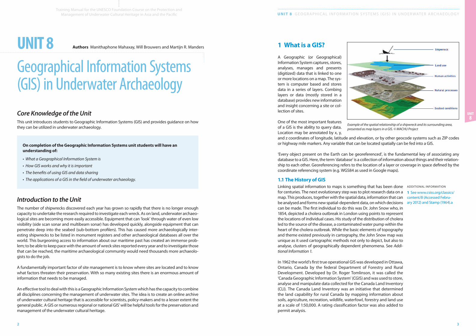
A Geographic (or Geographical) Infor mation System captures, stores, analyses, manages and presents (digitized) data that is linked to one or more locations on a map. The sys-tem is computer based and stores data in a series of layers. Combing layers or data (mostly stored in a database) provides new information and insight concerning a site or col-lection of sites.
One of the most important features of a GIS is the ability to query data. Location may be annotated by x, y, and z coordinates of longitude, latitude and elevation, or by other geocode systems such as ZIP codes or highway mile markers. Any variable that can be located spatially can be fed into a GIS.
‘Every object present on the Earth can be georeferenced’, is the fundamental key of associating any database to a GIS. Here, the term ‘database’ is a collection of information about things and their relation-ship to each other. Georeferencing refers to the location of a layer or coverage in space defined by the coordinate referencing system (e.g. WGS84 as used in Google maps).
1.1 The History of GISLinking spatial information to maps is something that has been done for centuries. The next evolutionary step was to plot research data on a map. This produces, together with the spatial data, information that can be analysed and forms new spatial-dependent data, on which decisions can be made. The first individual to do this was Dr. John Snow who, in 1854, depicted a cholera outbreak in London using points to represent the locations of individual cases. His study of the distribution of cholera led to the source of the disease, a contaminated water pump within the heart of the cholera outbreak. While the basic elements of topography and theme existed previously in cartography, the John Snow map was unique as it used cartographic methods not only to depict, but also to analyse, clusters of geographically dependent phenomena. See Addi-tional Information 1.
In 1962 the world’s first true operational GIS was developed in Ottawa, Ontario, Canada by the federal Department of Forestry and Rural Development. Developed by Dr. Roger Tomlinson, it was called the ‘Canada Geographic Information System’ (CGIS) and was used to store, analyse and manipulate data collected for the Canada Land Inventory (CLI). The Canada Land Inventory was an initiative that determined the land capability for rural Canada by mapping information about soils, agriculture, recreation, wildlife, waterfowl, forestry and land use at a scale of 1:50,000. A rating classification factor was also added to permit analysis.
Unit 8 Geographical Information Systems (GIS) in Underwater Archaeology
Authors Manithaphone Mahaxay, Will Brouwers and Martijn R. Manders
Example of the spatial relationship of a shipwreck and its surrounding area, presented as map layers in a GIS. © MACHU Project
ADDITIONAL INFORMATION
1 See www.csiss.org/classics/content/8 (Accessed Febru-ary 2012) and Stamp (1964).a
4
Training Manual for the UNESCO Foundation Course on the Protection and Management of Underwater Cultural Heritage in Asia and the Pacific U N I T 8 G E O G R A P H I C A L I N F O R M AT I O N S y S T E M S ( G I S ) I N U N D E R WAT E R A R C H A E O LO G y
5
Unit 8
Tomlin was one of the first to recognize the benefits of combining all kinds of data in a computer pro-gramme and using it to analyse and manage land use in Canada. Since then computer use and technol-ogy has advanced rapidly. Today, GIS is a multi-billion dollar industry employing hundreds of thousands of people worldwide. GIS is taught in schools, colleges and universities throughout the world. Profession-als in every field are increasingly aware of the advantages of thinking and working geographically. It should be noted that any task begins and ends with the real world, which is what data is all about. Out of necessity, any system can only provide an abstraction, a model; it is not possible (or desirable) from them to handle every last detail. After the data is analysed, information has to be compiled for decision-makers and based on this information, actions are taken and plans implemented.
Public access to geographic information is dominated by online resources such as Google Earth and Google Maps. Some of them, such as Google Maps and Open Layers, expose an Application Program-ming Interface (API). An API enables users to create custom applications. These toolkits commonly offer street maps, aerial/satellite imagery, geocoding, searches and routing functionality.
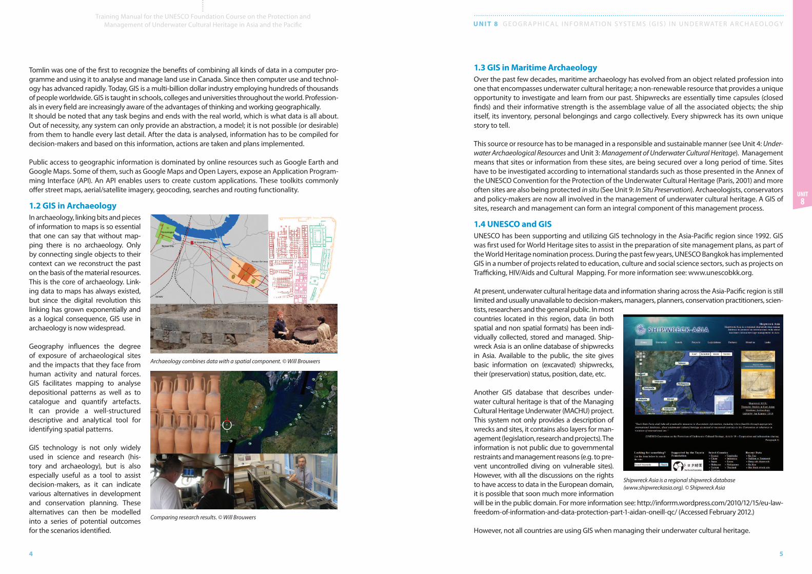
1.2 GIS in Archaeology In archaeology, linking bits and pieces of information to maps is so essential that one can say that without map-ping there is no archaeology. Only by connecting single objects to their context can we reconstruct the past on the basis of the material resources. This is the core of archaeology. Link-ing data to maps has always existed, but since the digital revolution this linking has grown exponentially and as a logical consequence, GIS use in archaeology is now widespread.
Geography influences the degree of exposure of archaeological sites and the impacts that they face from human activity and natural forces. GIS facilitates mapping to analyse depositional patterns as well as to catalogue and quantify artefacts. It can provide a well-structured descriptive and analytical tool for identifying spatial patterns.
GIS technology is not only widely used in science and research (his-tory and archaeology), but is also especially useful as a tool to assist decision-makers, as it can indicate various alternatives in development and conservation planning. These alternatives can then be modelled into a series of potential outcomes for the scenarios identified.
1.3 GIS in Maritime ArchaeologyOver the past few decades, maritime archaeology has evolved from an object related profession into one that encompasses underwater cultural heritage; a non-renewable resource that provides a unique opportunity to investigate and learn from our past. Shipwrecks are essentially time capsules (closed finds) and their informative strength is the assemblage value of all the associated objects; the ship itself, its inventory, personal belongings and cargo collectively. Every shipwreck has its own unique story to tell.
This source or resource has to be managed in a responsible and sustainable manner (see Unit 4: Under-water Archaeological Resources and Unit 3: Management of Underwater Cultural Heritage). Management means that sites or information from these sites, are being secured over a long period of time. Sites have to be investigated according to international standards such as those presented in the Annex of the UNESCO Convention for the Protection of the Underwater Cultural Heritage (Paris, 2001) and more often sites are also being protected in situ (See Unit 9: In Situ Preservation). Archaeologists, conservators and policy-makers are now all involved in the management of underwater cultural heritage. A GIS of sites, research and management can form an integral component of this management process.
1.4 UNESCO and GISUNESCO has been supporting and utilizing GIS technology in the Asia-Pacific region since 1992. GIS was first used for World Heritage sites to assist in the preparation of site management plans, as part of the World Heritage nomination process. During the past few years, UNESCO Bangkok has implemented GIS in a number of projects related to education, culture and social science sectors, such as projects on Trafficking, HIV/Aids and Cultural Mapping. For more information see: www.unescobkk.org.
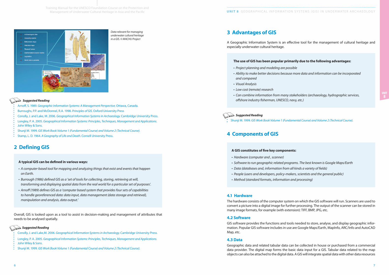
At present, underwater cultural heritage data and information sharing across the Asia-Pacific region is still limited and usually unavailable to decision-makers, managers, planners, conservation practitioners, scien-tists, researchers and the general public. In most countries located in this region, data (in both spatial and non spatial formats) has been indi-vidually collected, stored and managed. Ship-wreck Asia is an online database of shipwrecks in Asia. Available to the public, the site gives basic information on (excavated) shipwrecks, their (preservation) status, position, date, etc.
Another GIS database that describes under-water cultural heritage is that of the Managing Cultural Heritage Underwater (MACHU) project. This system not only provides a description of wrecks and sites, it contains also layers for man-agement (legislation, research and projects). The information is not public due to governmental restraints and management reasons (e.g. to pre-vent uncontrolled diving on vulnerable sites). However, with all the discussions on the rights to have access to data in the European domain, it is possible that soon much more information will be in the public domain. For more information see: http://inforrm.wordpress.com/2010/12/15/eu-law-freedom-of-information-and-data-protection-part-1-aidan-oneill-qc/ (Accessed February 2012.)
However, not all countries are using GIS when managing their underwater cultural heritage.
Archaeology combines data with a spatial component. © Will Brouwers
Comparing research results. © Will Brouwers
Shipwreck Asia is a regional shipwreck database (www.shipwreckasia.org). © Shipwreck Asia
6
Training Manual for the UNESCO Foundation Course on the Protection and Management of Underwater Cultural Heritage in Asia and the Pacific U N I T 8 G E O G R A P H I C A L I N F O R M AT I O N S y S T E M S ( G I S ) I N U N D E R WAT E R A R C H A E O LO G y
7
Unit 8
Suggested Reading
Arnoff, S. 1989. Geographic Information Systems: A Management Perspective. Ottawa, Canada.
Burroughs, P.P. and McDonnel, R.A. 1998. Principles of GIS. Oxford University Press
Conolly, J. and Lake, M. 2006. Geographical Information Systems in Archaeology. Cambridge University Press.
Longley, P. A. 2005. Geographical Information Systems: Principles, Techniques, Management and Applications. John Wiley & Sons.
Shunji M. 1999. GIS Work Book Volume 1 (Fundamental Course) and Volume 2 (Technical Course).
Stamp, L. D. 1964. A Geography of Life and Death. Cornell University Press.
2 Defining GIS
A typical GIS can be defined in various ways:
• A computer-based tool for mapping and analyzing things that exist and events that happen on Earth.
• Burrough (1986) defined GIS as a ‘set of tools for collecting, storing, retrieving at will, transforming and displaying spatial data from the real world for a particular set of purposes’.
• Arnoff (1989) defines GIS as a ‘computer based system that provides four sets of capabilities to handle georeferenced data: data input, data management (data storage and retrieval), manipulation and analysis, data output.’
Overall, GIS is looked upon as a tool to assist in decision-making and management of attributes that needs to be analysed spatially.
Suggested Reading
Conolly, J. and Lake,M. 2006. Geographical Information Systems in Archaeology. Cambridge University Press.
Longley, P. A. 2005. Geographical Information Systems: Principles, Techniques, Management and Applications. John Wiley & Sons.
Shunji M. 1999. GIS Work Book Volume 1 (Fundamental Course) and Volume 2 (Technical Course).
3 Advantages of GIS
A Geographic Information System is an effective tool for the management of cultural heritage and especially underwater cultural heritage.
The use of GIS has been popular primarily due to the following advantages:
• Project planning and modeling are possible
• Ability to make better decisions because more data and information can be incorporated and compared
• Visual Analysis
• Low cost (remote) research
• Can combine information from many stakeholders (archaeology, hydrographic services, offshore industry fisherman, UNESCO, navy, etc.)
Suggested Reading
Shunji M. 1999. GIS Work Book Volume 1 (Fundamental Course) and Volume 2 (Technical Course).
4 Components of GIS
A GIS constitutes of five key components:
• Hardware (computer and , scanner)
• Software to run geographic related programs. The best known is Google Maps/Earth
• Data (databases and, information from all kinds a variety of fields)
• People (users and developers, policy-makers, scientists and the general public)
• Method (standard formats, information and processing)
4.1 HardwareThe hardware consists of the computer system on which the GIS software will run. Scanners are used to convert a picture into a digital image for further processing. The output of the scanner can be stored in many image formats, for example (with extension): TIFF, BMP, JPG, etc.
4.2 SoftwareGIS software provides the functions and tools needed to store, analyse, and display geographic infor-mation. Popular GIS software includes in use are Google Maps/Earth, MapInfo, ARC/Info and AutoCAD Map, etc.
4.3 DataGeographic data and related tabular data can be collected in house or purchased from a commercial data provider. The digital map forms the basic data input for a GIS. Tabular data related to the map objects can also be attached to the digital data. A GIS will integrate spatial data with other data resources
Data relevant for managing underwater cultural heritage in a GIS. © MACHU Project
8
Training Manual for the UNESCO Foundation Course on the Protection and Management of Underwater Cultural Heritage in Asia and the Pacific U N I T 8 G E O G R A P H I C A L I N F O R M AT I O N S y S T E M S ( G I S ) I N U N D E R WAT E R A R C H A E O LO G y
9
Unit 8
and can be incorporated into a database management system (DBMS) used by most organizations to maintain and manage their data.
4.4 PeopleGIS users range from technical specialists who design and maintain the system, to those who use it to help them perform everyday tasks, such as scientists, researchers and policy-makers.
4.5 Making Maps for GISThere are various techniques used to create a map. This can either be made using an automated raster to vector creator (software that recognizes raster drawings and automatically transforms them into geometrical features such as vectorised points, lines and polygons) or it can be manually vectorised using scanned images. The source of these digital maps can either be prepared by a survey agency or by using satellite imagery.
Suggested Reading
Conolly, J. and Lake, M. 2006. Geographical Information Systems in Archaeology. Cambridge University Press.
Longley, P. A. 2005. Geographical Information Systems: Principles, Techniques, Management, and Applications. John Wiley & Sons.
Shunji M. 1999. GIS Work Book Volume 1 (Fundamental Course) and Volume 2 (Technical Course).
5 Major Areas of Application
• GIS can be used in different streams of planning, such as urban planning, housing, transpor-tation planning and urban design.
• Specific maritime examples are wind farm planning, planning of dredging areas, sea level rising monitoring, etc.
• GIS is also used in the management process. For example, as part of a management and environmental impact analysis of wild and scenic recreational resources, flood plain, wet-lands, aquifers, forests and wildlife. During a wild life habitat study, incorporating a GIS can help facilitate management.
• GIS can also locate underground pipes and cables for maintenance, planning and tracking energy use. This makes it integral in archaeology and the management of cultural resources.
• It can also predict (maritime) archaeological sites in specific areas using statistical models based on previously identified site locations and or historic (sea) maps.
• GIS can facilitate modelling by simulating changes in past landscapes and future changes of the seabed (sediment erosion). This helps predict where underwater cultural heritage will be in danger in the future.
• GIS as a tool on site level analysis.
Suggested Reading
Delgado, J. P. 1997. Encyclopaedia of Underwater and Maritime Archaeology. British Museum Press
Conolly, J. and Lake, M. 2006. Geographical Information Systems in Archaeology. Cambridge University Press.
Bowens, A. (ed.). 2009. Underwater Archaeology: The NAS Guide to Principles and Practice, Second Edition. Nautical Archaeology Society. Blackwell.
Longley, P. A. 2005. Geographical Information Systems: Principles, Techniques, Management and Applications. John Wiley & Sons.
UNESCO. 1999. GIS and Cultural Resource Management. Manual for Heritage Managers. Keen Publishing Thailand Co. Ltd.
6 What is Unique about a GIS?
6.1 Information RetrievalThis is a crucial component of GIS since it greatly affects the user’s ability to interact with the data, and the way the user is able to restructure the data to solve specific problems. Many variations of the data are retrievable, for example, by specified area or region, theme or class, etc. These may also be retrieved using two separate retrieval systems; one for map data (lines, points, polygons) and one for non-map data e.g. attributes.
6.2 Topological ModellingA GIS can recognize and analyse the spatial relationships between mapped phenomena. For example, between 2009 and 2012 a pipeline (Northstream) was planned and built between Russia and Germany in the Baltic Sea. During the project a variety of data could be fed into a GIS to plan and manage the construction. Questions could be asked such as: what is the geological condition of the seabed? What
Raster and vector data structures and how they represent real world features. © Lincoln University
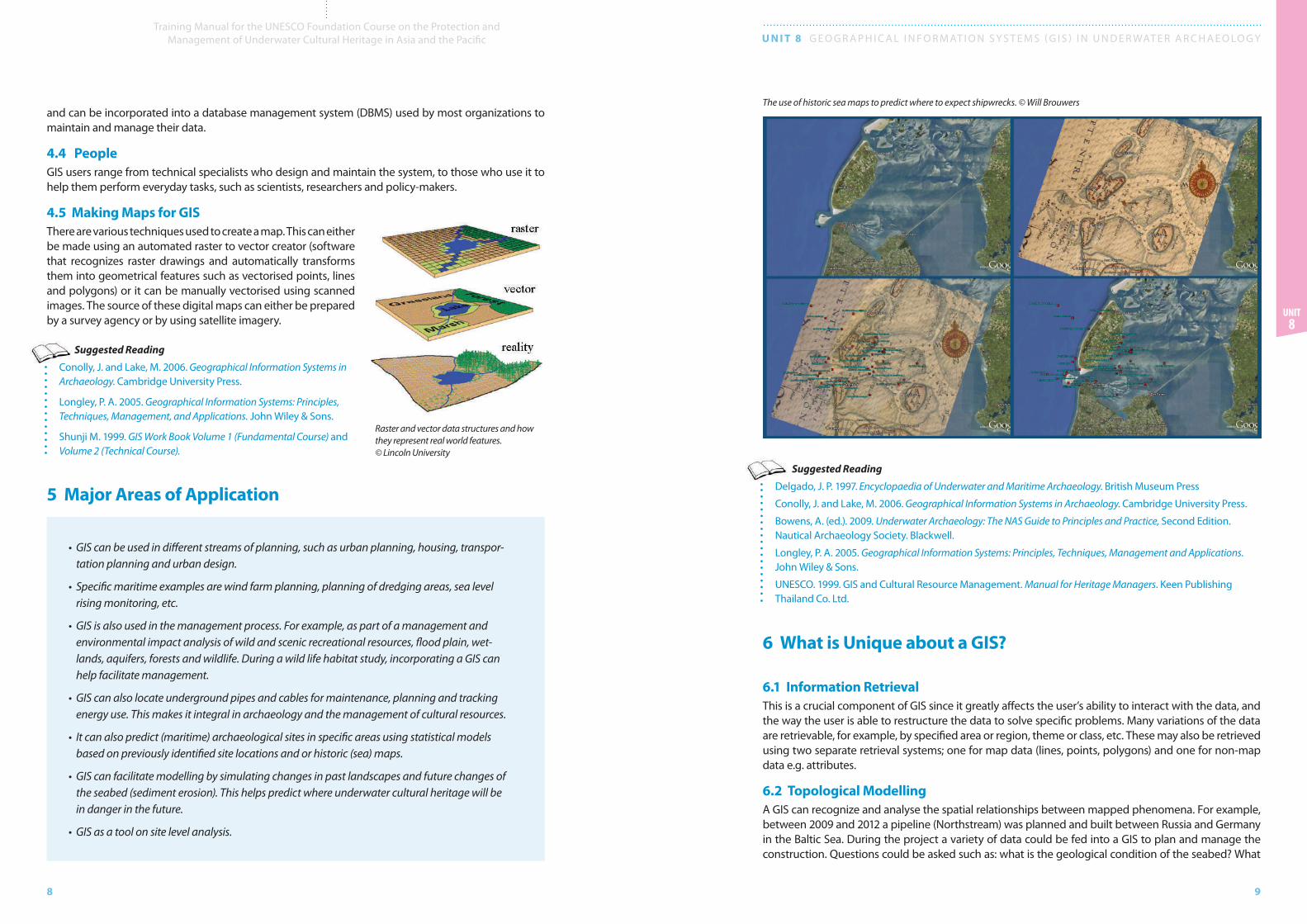
The use of historic sea maps to predict where to expect shipwrecks. © Will Brouwers
10
Training Manual for the UNESCO Foundation Course on the Protection and Management of Underwater Cultural Heritage in Asia and the Pacific U N I T 8 G E O G R A P H I C A L I N F O R M AT I O N S y S T E M S ( G I S ) I N U N D E R WAT E R A R C H A E O LO G y
11
Unit 8
6.4 Overlay GIS can also produce a series of new map layers or can be used to overlay natural conditions and human interventions.
6.5 Data Output A critical component of a GIS is its ability to produce graphics on the screen or on paper, to convey the results of analyses to the people who make decisions about resources. Wall maps, Internet-ready maps, interactive maps and other graphics can be generated, allowing decision-makers to visualize and thereby understand the results of analyses or simulations of potential events.
Suggested Reading
Harmon, J. E. and Anderson S. J. 2003, The Design and Implementation of Geographic Information Systems. John Wiley & Sons Inc.
Shunji, M. 1999. GIS Work Book Volume 1 (Fundamental Course) and Volume 2 (Technical Course).
is the known infrastructure (e.g. pipes and cables)? What are the known archaeological resources? And the unknown archaeological resources? Are there any other obstacles (such as explosives from Second World War) to be considered? What are the conditions of adjacency (i.e. what is next to what), contain-ment (i.e. what is enclosed by what), and proximity (i.e. how close something is to something else)? All these questions can be determined with a GIS.
6.3 NetworksWhen nutrients from farmland run off into streams, it is important to know the direction in which the streams flow and which empty into other streams. This is done by using a linear network. It allows the computer to determine how the nutrients are transported downstream. Additional information on water volume and speed throughout the spatial network can help a GIS determine how long it will take the nutrients to travel over a given distance.
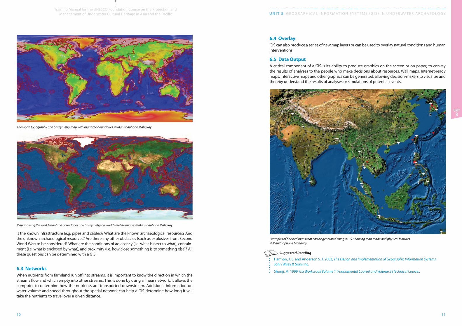
The world topography and bathymetry map with maritime boundaries. © Manithaphone Mahaxay
Map showing the world maritime boundaries and bathymetry on world satellite image. © Manithaphone Mahaxay
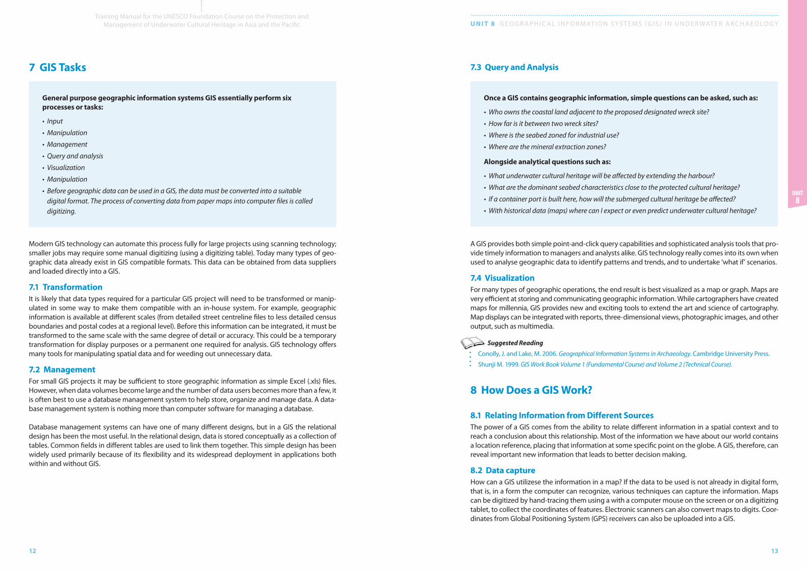
Examples of finished maps that can be generated using a GIS, showing man made and physical features. © Manithaphone Mahaxay
12
Training Manual for the UNESCO Foundation Course on the Protection and Management of Underwater Cultural Heritage in Asia and the Pacific U N I T 8 G E O G R A P H I C A L I N F O R M AT I O N S y S T E M S ( G I S ) I N U N D E R WAT E R A R C H A E O LO G y
13
Unit 8
7 GIS Tasks
General purpose geographic information systems GIS essentially perform six processes or tasks:
• Input
• Manipulation
• Management
• Query and analysis
• Visualization
• Manipulation
• Before geographic data can be used in a GIS, the data must be converted into a suitable digital format. The process of converting data from paper maps into computer files is called digitizing.
Modern GIS technology can automate this process fully for large projects using scanning technology; smaller jobs may require some manual digitizing (using a digitizing table). Today many types of geo-graphic data already exist in GIS compatible formats. This data can be obtained from data suppliers and loaded directly into a GIS.
7.1 TransformationIt is likely that data types required for a particular GIS project will need to be transformed or manip-ulated in some way to make them compatible with an in-house system. For example, geographic information is available at different scales (from detailed street centreline files to less detailed census boundaries and postal codes at a regional level). Before this information can be integrated, it must be transformed to the same scale with the same degree of detail or accuracy. This could be a temporary transformation for display purposes or a permanent one required for analysis. GIS technology offers many tools for manipulating spatial data and for weeding out unnecessary data.
7.2 ManagementFor small GIS projects it may be sufficient to store geographic information as simple Excel (.xls) files. However, when data volumes become large and the number of data users becomes more than a few, it is often best to use a database management system to help store, organize and manage data. A data-base management system is nothing more than computer software for managing a database.
Database management systems can have one of many different designs, but in a GIS the relational design has been the most useful. In the relational design, data is stored conceptually as a collection of tables. Common fields in different tables are used to link them together. This simple design has been widely used primarily because of its flexibility and its widespread deployment in applications both within and without GIS.
7.3 Query and Analysis
Once a GIS contains geographic information, simple questions can be asked, such as:
• Who owns the coastal land adjacent to the proposed designated wreck site?
• How far is it between two wreck sites?
• Where is the seabed zoned for industrial use?
• Where are the mineral extraction zones?
Alongside analytical questions such as:
• What underwater cultural heritage will be affected by extending the harbour?
• What are the dominant seabed characteristics close to the protected cultural heritage?
• If a container port is built here, how will the submerged cultural heritage be affected?
• With historical data (maps) where can I expect or even predict underwater cultural heritage?
A GIS provides both simple point-and-click query capabilities and sophisticated analysis tools that pro-vide timely information to managers and analysts alike. GIS technology really comes into its own when used to analyse geographic data to identify patterns and trends, and to undertake ‘what if’ scenarios.
7.4 VisualizationFor many types of geographic operations, the end result is best visualized as a map or graph. Maps are very efficient at storing and communicating geographic information. While cartographers have created maps for millennia, GIS provides new and exciting tools to extend the art and science of cartography. Map displays can be integrated with reports, three-dimensional views, photographic images, and other output, such as multimedia.
Suggested Reading
Conolly, J. and Lake, M. 2006. Geographical Information Systems in Archaeology. Cambridge University Press.
Shunji M. 1999. GIS Work Book Volume 1 (Fundamental Course) and Volume 2 (Technical Course).
8 How Does a GIS Work?
8.1 Relating Information from Different SourcesThe power of a GIS comes from the ability to relate different information in a spatial context and to reach a conclusion about this relationship. Most of the information we have about our world contains a location reference, placing that information at some specific point on the globe. A GIS, therefore, can reveal important new information that leads to better decision making.
8.2 Data captureHow can a GIS utilizese the information in a map? If the data to be used is not already in digital form, that is, in a form the computer can recognize, various techniques can capture the information. Maps can be digitized by hand-tracing them using a with a computer mouse on the screen or on a digitizing tablet, to collect the coordinates of features. Electronic scanners can also convert maps to digits. Coor-dinates from Global Positioning System (GPS) receivers can also be uploaded into a GIS.
14
Training Manual for the UNESCO Foundation Course on the Protection and Management of Underwater Cultural Heritage in Asia and the Pacific U N I T 8 G E O G R A P H I C A L I N F O R M AT I O N S y S T E M S ( G I S ) I N U N D E R WAT E R A R C H A E O LO G y
15
Unit 8
8.3 Data IntegrationA GIS makes it possible to link or integrate information that is difficult to associate through any other means. Thus, a GIS can use combinations of mapped variables to build and analysze new variables.
8.4 Projection and RegistrationProjection is a fundamental component of map making. It is a mathematical means of transferring information from the Earth’s three-dimensional, curved surface, to a two-dimensional medium e.g. paper or a computer screen. Different projections are used for different types of maps because each projection is particularly appropriate for certain uses. The most common projection is the Mercator projection, while the most used coordinate system is the World Geodetic System (WGS84).
Data integration is the linking of information in different forms through a GIS. © Manithaphone Mahaxay
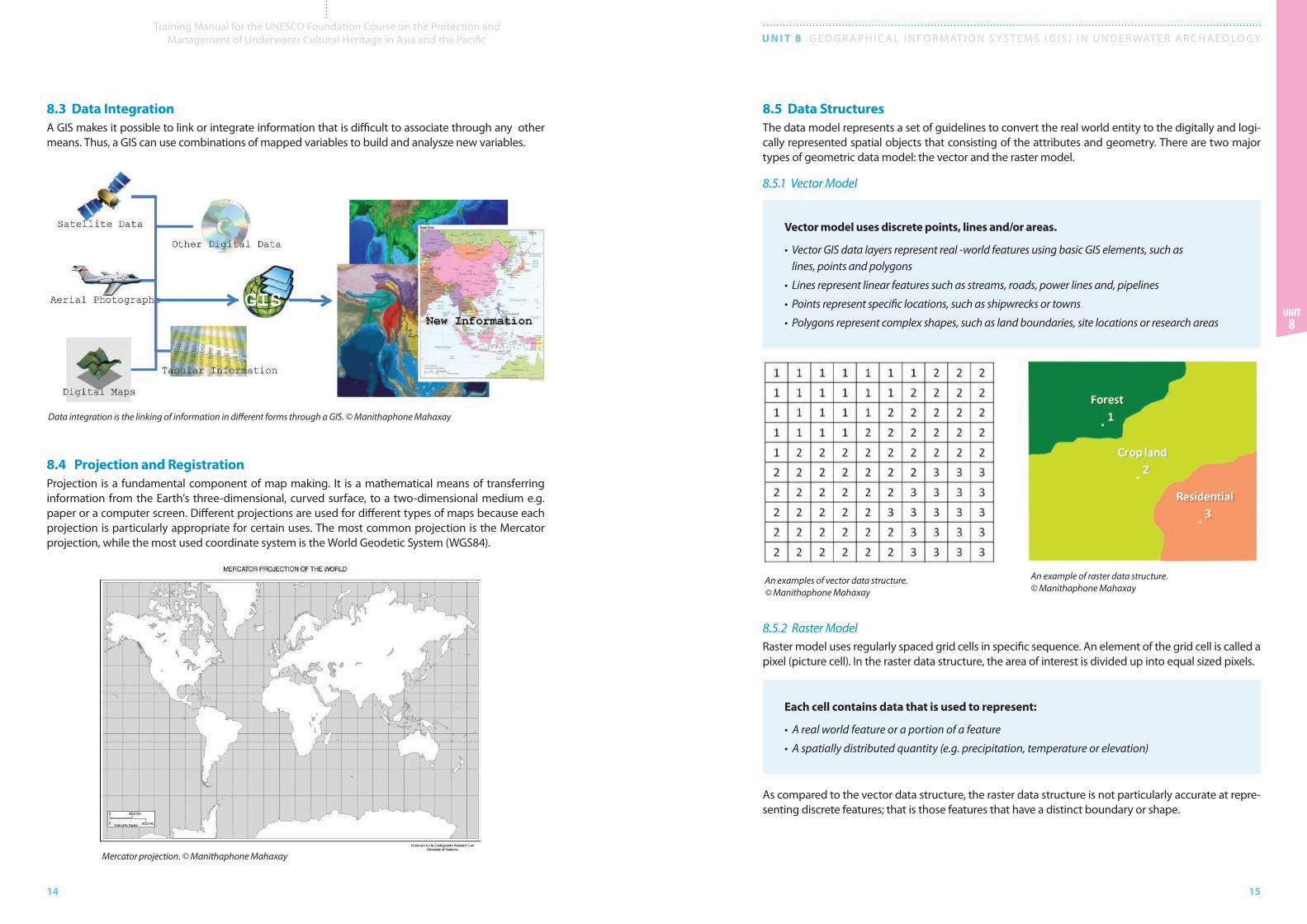
8.5 Data Structures The data model represents a set of guidelines to convert the real world entity to the digitally and logi-cally represented spatial objects that consisting of the attributes and geometry. There are two major types of geometric data model: the vector and the raster model.
8.5.1 Vector Model
Vector model uses discrete points, lines and/or areas.
• Vector GIS data layers represent real -world features using basic GIS elements, such as lines, points and polygons
• Lines represent linear features such as streams, roads, power lines and, pipelines
• Points represent specific locations, such as shipwrecks or towns
• Polygons represent complex shapes, such as land boundaries, site locations or research areas
8.5.2 Raster Model Raster model uses regularly spaced grid cells in specific sequence. An element of the grid cell is called a pixel (picture cell). In the raster data structure, the area of interest is divided up into equal sized pixels.
Each cell contains data that is used to represent:
• A real world feature or a portion of a feature
• A spatially distributed quantity (e.g. precipitation, temperature or elevation)
As compared to the vector data structure, the raster data structure is not particularly accurate at repre-senting discrete features; that is those features that have a distinct boundary or shape.
Mercator projection. © Manithaphone Mahaxay
An examples of vector data structure. © Manithaphone Mahaxay
An example of raster data structure. © Manithaphone Mahaxay
16
Training Manual for the UNESCO Foundation Course on the Protection and Management of Underwater Cultural Heritage in Asia and the Pacific U N I T 8 G E O G R A P H I C A L I N F O R M AT I O N S y S T E M S ( G I S ) I N U N D E R WAT E R A R C H A E O LO G y
17
Unit 8
8.6 Data Modelling It is impossible to collect data over every square meter of the Earth’s surface. Therefore, samples must be taken at discrete locations. A GIS can be used to depict two and three-dimensional characteristics of the Earth’s surface, subsurface and atmosphere, from points where samples have been collected.
Suggested Reading
Longley, P. A. 2005. Geographical Information Systems: Principles, Techniques, Management and Applications. John Wiley & Sons.
Shunji M. 1999. GIS Work Book Volume 1 (Fundamental Course) and Volume 2 (Technical Course).
9 GIS Case Study
The MACHU project is an example of cooperation and joint management of underwater cultural heri-tage in Europe. The countries involved are Germany, Belgium, Poland, Portugal, England, the Neth-erlands and Sweden and the project is sponsored by the European Union’s Culture 2000 program. One of the main project outputs was the building of a web-accessible GIS application that contains archaeological and historical information on underwater sites. The application includes, soundings, multibeam and side scan sonar images, geological, climatological, geochemical and biological infor-mation, and information about relevant human activities.
The main objective of the project is to find better and more efficient ways to manage the underwater cultural heritage and serve as a network for international cooperation and exchange.
9.1 MACHU and GISMuch of the information that is important for the management of the underwater cultural heritage has a spatial component and is, therefore, related to a specific location or area. This again means that it is possible to link this information to other area related subjects.
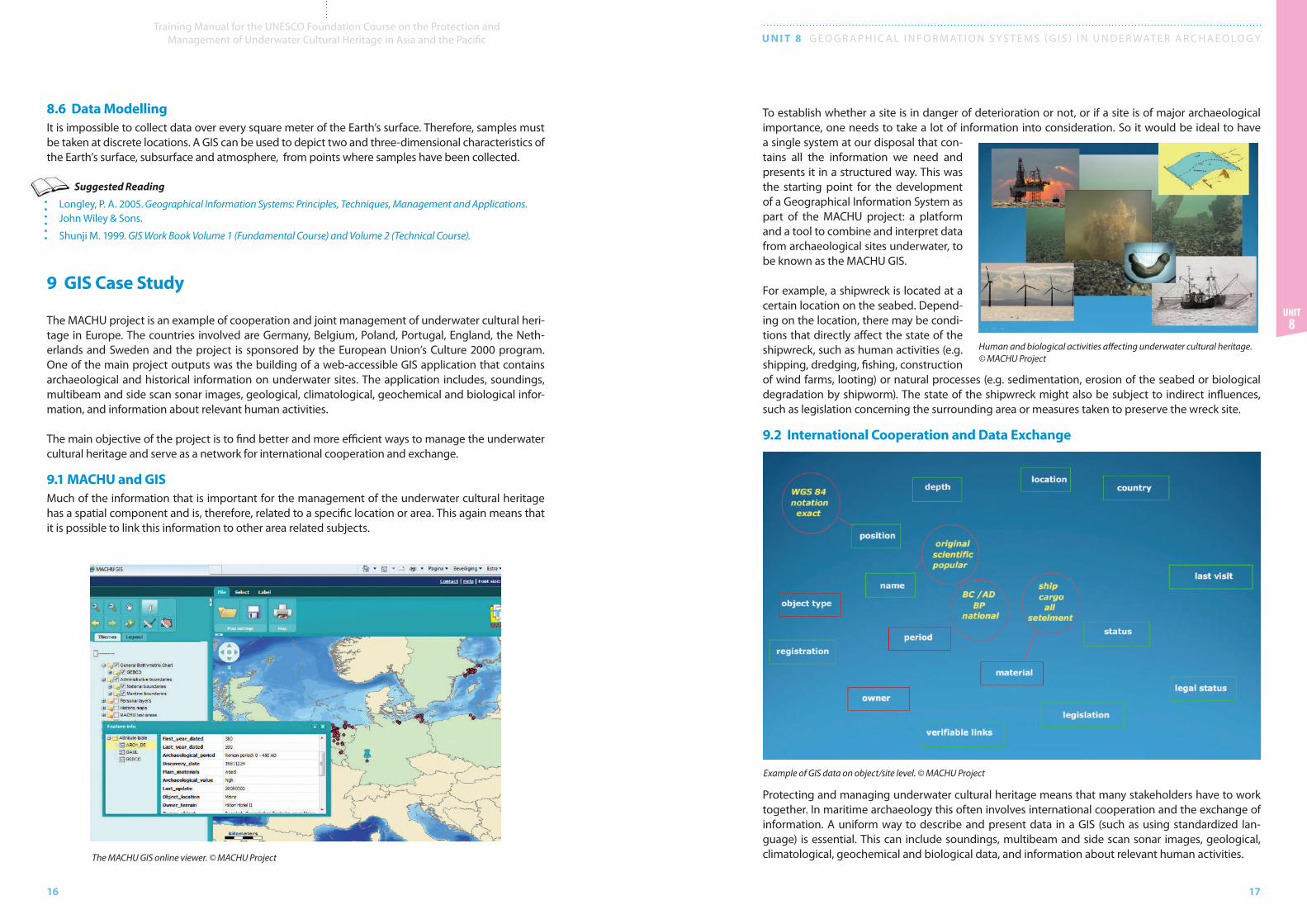
To establish whether a site is in danger of deterioration or not, or if a site is of major archaeological importance, one needs to take a lot of information into consideration. So it would be ideal to have a single system at our disposal that con-tains all the information we need and presents it in a structured way. This was the starting point for the development of a Geographical Information System as part of the MACHU project: a platform and a tool to combine and interpret data from archaeological sites underwater, to be known as the MACHU GIS.
For example, a shipwreck is located at a certain location on the seabed. Depend-ing on the location, there may be condi-tions that directly affect the state of the shipwreck, such as human activities (e.g. shipping, dredging, fishing, construction of wind farms, looting) or natural processes (e.g. sedimentation, erosion of the seabed or biological degradation by shipworm). The state of the shipwreck might also be subject to indirect influences, such as legislation concerning the surrounding area or measures taken to preserve the wreck site.
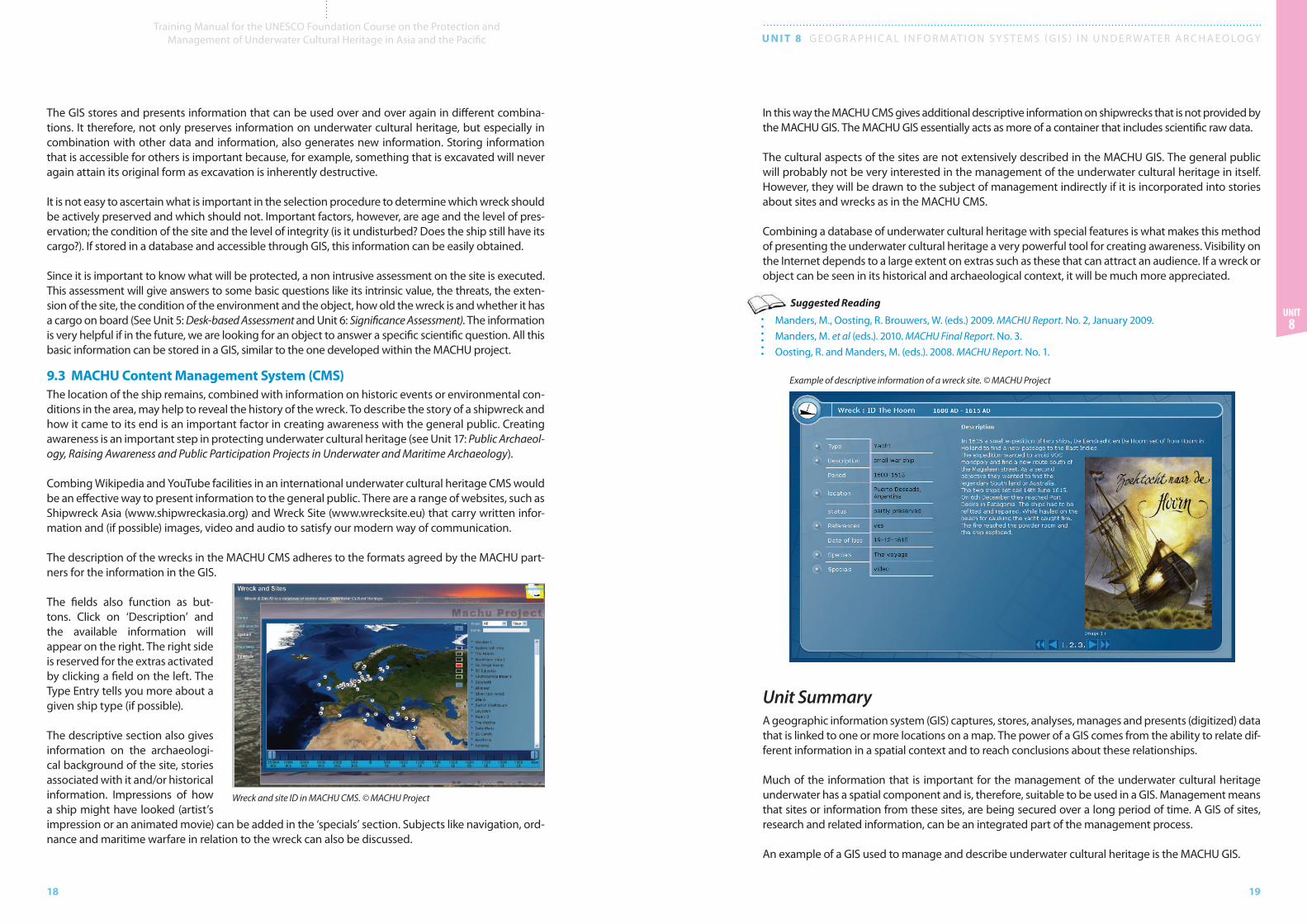
9.2 International Cooperation and Data Exchange
Protecting and managing underwater cultural heritage means that many stakeholders have to work together. In maritime archaeology this often involves international cooperation and the exchange of information. A uniform way to describe and present data in a GIS (such as using standardized lan-guage) is essential. This can include soundings, multibeam and side scan sonar images, geological, climatological, geochemical and biological data, and information about relevant human activities. The MACHU GIS online viewer. © MACHU Project
Human and biological activities affecting underwater cultural heritage. © MACHU Project
Example of GIS data on object/site level. © MACHU Project
18
Training Manual for the UNESCO Foundation Course on the Protection and Management of Underwater Cultural Heritage in Asia and the Pacific U N I T 8 G E O G R A P H I C A L I N F O R M AT I O N S y S T E M S ( G I S ) I N U N D E R WAT E R A R C H A E O LO G y
19
Unit 8
The GIS stores and presents information that can be used over and over again in different combina-tions. It therefore, not only preserves information on underwater cultural heritage, but especially in combination with other data and information, also generates new information. Storing information that is accessible for others is important because, for example, something that is excavated will never again attain its original form as excavation is inherently destructive.
It is not easy to ascertain what is important in the selection procedure to determine which wreck should be actively preserved and which should not. Important factors, however, are age and the level of pres-ervation; the condition of the site and the level of integrity (is it undisturbed? Does the ship still have its cargo?). If stored in a database and accessible through GIS, this information can be easily obtained.
Since it is important to know what will be protected, a non intrusive assessment on the site is executed. This assessment will give answers to some basic questions like its intrinsic value, the threats, the exten-sion of the site, the condition of the environment and the object, how old the wreck is and whether it has a cargo on board (See Unit 5: Desk-based Assessment and Unit 6: Significance Assessment). The information is very helpful if in the future, we are looking for an object to answer a specific scientific question. All this basic information can be stored in a GIS, similar to the one developed within the MACHU project.
9.3 MACHU Content Management System (CMS)The location of the ship remains, combined with information on historic events or environmental con-ditions in the area, may help to reveal the history of the wreck. To describe the story of a shipwreck and how it came to its end is an important factor in creating awareness with the general public. Creating awareness is an important step in protecting underwater cultural heritage (see Unit 17: Public Archaeol-ogy, Raising Awareness and Public Participation Projects in Underwater and Maritime Archaeology).
Combing Wikipedia and youTube facilities in an international underwater cultural heritage CMS would be an effective way to present information to the general public. There are a range of websites, such as Shipwreck Asia (www.shipwreckasia.org) and Wreck Site (www.wrecksite.eu) that carry written infor-mation and (if possible) images, video and audio to satisfy our modern way of communication.
The description of the wrecks in the MACHU CMS adheres to the formats agreed by the MACHU part-ners for the information in the GIS.
The fields also function as but-tons. Click on ‘Description’ and the available information will appear on the right. The right side is reserved for the extras activated by clicking a field on the left. The Type Entry tells you more about a given ship type (if possible).
The descriptive section also gives information on the archaeologi-cal background of the site, stories associated with it and/or historical information. Impressions of how a ship might have looked (artist’s impression or an animated movie) can be added in the ‘specials’ section. Subjects like navigation, ord-nance and maritime warfare in relation to the wreck can also be discussed.
In this way the MACHU CMS gives additional descriptive information on shipwrecks that is not provided by the MACHU GIS. The MACHU GIS essentially acts as more of a container that includes scientific raw data.
The cultural aspects of the sites are not extensively described in the MACHU GIS. The general public will probably not be very interested in the management of the underwater cultural heritage in itself. However, they will be drawn to the subject of management indirectly if it is incorporated into stories about sites and wrecks as in the MACHU CMS.
Combining a database of underwater cultural heritage with special features is what makes this method of presenting the underwater cultural heritage a very powerful tool for creating awareness. Visibility on the Internet depends to a large extent on extras such as these that can attract an audience. If a wreck or object can be seen in its historical and archaeological context, it will be much more appreciated.
Suggested Reading
Manders, M., Oosting, R. Brouwers, W. (eds.) 2009. MACHU Report. No. 2, January 2009. Manders, M. et al (eds.). 2010. MACHU Final Report. No. 3.Oosting, R. and Manders, M. (eds.). 2008. MACHU Report. No. 1.
Unit SummaryA geographic information system (GIS) captures, stores, analyses, manages and presents (digitized) data that is linked to one or more locations on a map. The power of a GIS comes from the ability to relate dif-ferent information in a spatial context and to reach conclusions about these relationships.
Much of the information that is important for the management of the underwater cultural heritage underwater has a spatial component and is, therefore, suitable to be used in a GIS. Management means that sites or information from these sites, are being secured over a long period of time. A GIS of sites, research and related information, can be an integrated part of the management process.
An example of a GIS used to manage and describe underwater cultural heritage is the MACHU GIS.
Wreck and site ID in MACHU CMS. © MACHU Project
Example of descriptive information of a wreck site. © MACHU Project
20
Training Manual for the UNESCO Foundation Course on the Protection and Management of Underwater Cultural Heritage in Asia and the Pacific U N I T 8 G E O G R A P H I C A L I N F O R M AT I O N S y S T E M S ( G I S ) I N U N D E R WAT E R A R C H A E O LO G y
21
Unit 8
Suggested Timetable
15 mins Introduction
45 mins
Introduction to GIS
- Defining GIS - Advantages of GIS - Components of GIS - Major Areas of Application
Break
90 mins
Using GIS
- What is unique about GIS- GIS Tasks- How does GIS Work?- Demonstration of Arc GIS
Break
90 mins GIS Case Study: MACHU Project
Break
70 mins Practical Session
Teaching Suggestions
This unit introduces students to geographic information systems and provides guidance on how they can be used in underwater archaeology. It is recommended that the information should be presented to students in the form of two lectures, followed by a demonstration and practical session. In advance of the training session, trainers should brief students to collate a selection of raw data concerning underwater sites from their home country.
DemonstrationA practical demonstration of a GIS system provides students with the opportunity to gain a better understanding of how the information is stored and how it can be used.
Trainers should demonstrate the functions and capabilities of a system (such as Arc GIS) and then run through a basic analysis using selected GIS spatial and attribute data. Students should then be shown how to upload their own underwater cultural heritage database and how to manipulate the data.
It can also be useful for trainers to demon-strate how to create a GIS database formed from other underwater cultural heritage data-bases, such as those that can be purchased from www.shipwreckregistry.com.
Demonstration sessions can either be sched-uled at the end of the introductory lectures or split according to topics.
Discussions can also be a useful way for stu-dents to explore the issues presented in the unit. If there is time available, trainers should facilitate a discussion with students regarding how underwater cultural heritage data is man-aged and shared in their home countries.
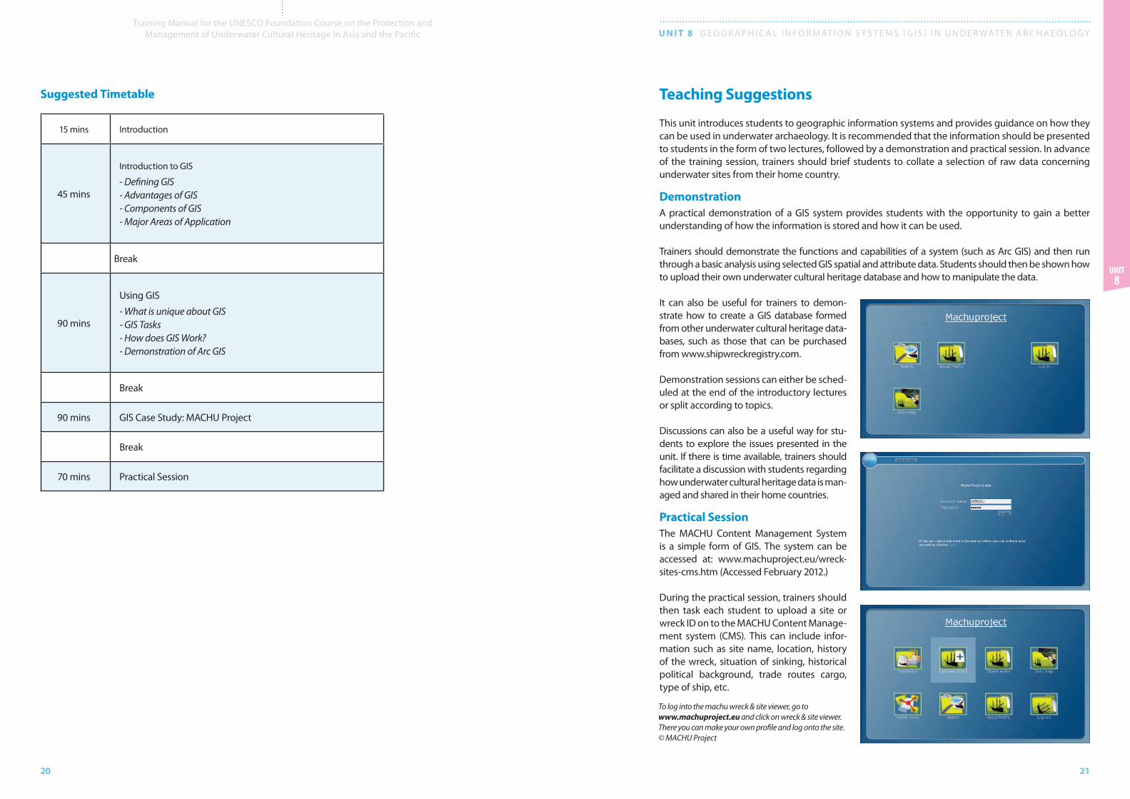
Practical SessionThe MACHU Content Management System is a simple form of GIS. The system can be accessed at: www.machuproject.eu/wreck-sites-cms.htm (Accessed February 2012.)
During the practical session, trainers should then task each student to upload a site or wreck ID on to the MACHU Content Manage-ment system (CMS). This can include infor-mation such as site name, location, history of the wreck, situation of sinking, historical political background, trade routes cargo, type of ship, etc.
To log into the machu wreck & site viewer, go to www.machuproject.eu and click on wreck & site viewer. There you can make your own profile and log onto the site. © MACHU Project
22
Training Manual for the UNESCO Foundation Course on the Protection and Management of Underwater Cultural Heritage in Asia and the Pacific U N I T 8 G E O G R A P H I C A L I N F O R M AT I O N S y S T E M S ( G I S ) I N U N D E R WAT E R A R C H A E O LO G y
23
Unit 8
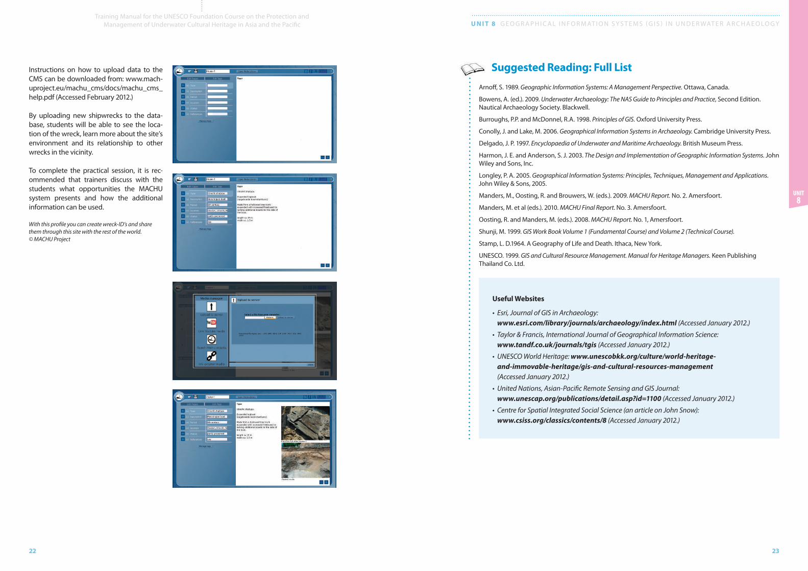
Instructions on how to upload data to the CMS can be downloaded from: www.mach-uproject.eu/machu_cms/docs/machu_cms_help.pdf (Accessed February 2012.)
By uploading new shipwrecks to the data-base, students will be able to see the loca-tion of the wreck, learn more about the site’s environment and its relationship to other wrecks in the vicinity.
To complete the practical session, it is rec-ommended that trainers discuss with the students what opportunities the MACHU system presents and how the additional information can be used.
Suggested Reading: Full List
Arnoff, S. 1989. Geographic Information Systems: A Management Perspective. Ottawa, Canada.
Bowens, A. (ed.). 2009. Underwater Archaeology: The NAS Guide to Principles and Practice, Second Edition. Nautical Archaeology Society. Blackwell.
Burroughs, P.P. and McDonnel, R.A. 1998. Principles of GIS. Oxford University Press.
Conolly, J. and Lake, M. 2006. Geographical Information Systems in Archaeology. Cambridge University Press.
Delgado, J. P. 1997. Encyclopaedia of Underwater and Maritime Archaeology. British Museum Press.
Harmon, J. E. and Anderson, S. J. 2003. The Design and Implementation of Geographic Information Systems. John Wiley and Sons, Inc.
Longley, P. A. 2005. Geographical Information Systems: Principles, Techniques, Management and Applications. John Wiley & Sons, 2005.
Manders, M., Oosting, R. and Brouwers, W. (eds.). 2009. MACHU Report. No. 2. Amersfoort.
Manders, M. et al (eds.). 2010. MACHU Final Report. No. 3. Amersfoort.
Oosting, R. and Manders, M. (eds.). 2008. MACHU Report. No. 1, Amersfoort.
Shunji, M. 1999. GIS Work Book Volume 1 (Fundamental Course) and Volume 2 (Technical Course).
Stamp, L. D.1964. A Geography of Life and Death. Ithaca, New york.
UNESCO. 1999. GIS and Cultural Resource Management. Manual for Heritage Managers. Keen Publishing Thailand Co. Ltd.
Useful Websites
• Esri, Journal of GIS in Archaeology: www.esri.com/library/journals/archaeology/index.html (Accessed January 2012.)
• Taylor & Francis, International Journal of Geographical Information Science: www.tandf.co.uk/journals/tgis (Accessed January 2012.)
• UNESCO World Heritage: www.unescobkk.org/culture/world-heritage-and-immovable-heritage/gis-and-cultural-resources-management (Accessed January 2012.)
• United Nations, Asian-Pacific Remote Sensing and GIS Journal: www.unescap.org/publications/detail.asp?id=1100 (Accessed January 2012.)
• Centre for Spatial Integrated Social Science (an article on John Snow): www.csiss.org/classics/contents/8 (Accessed January 2012.)
With this profile you can create wreck-ID’s and share them through this site with the rest of the world. © MACHU Project