dr noordin ahmad gis. remote sensing. gps. digital mapping. surveying application of geographical...
TRANSCRIPT
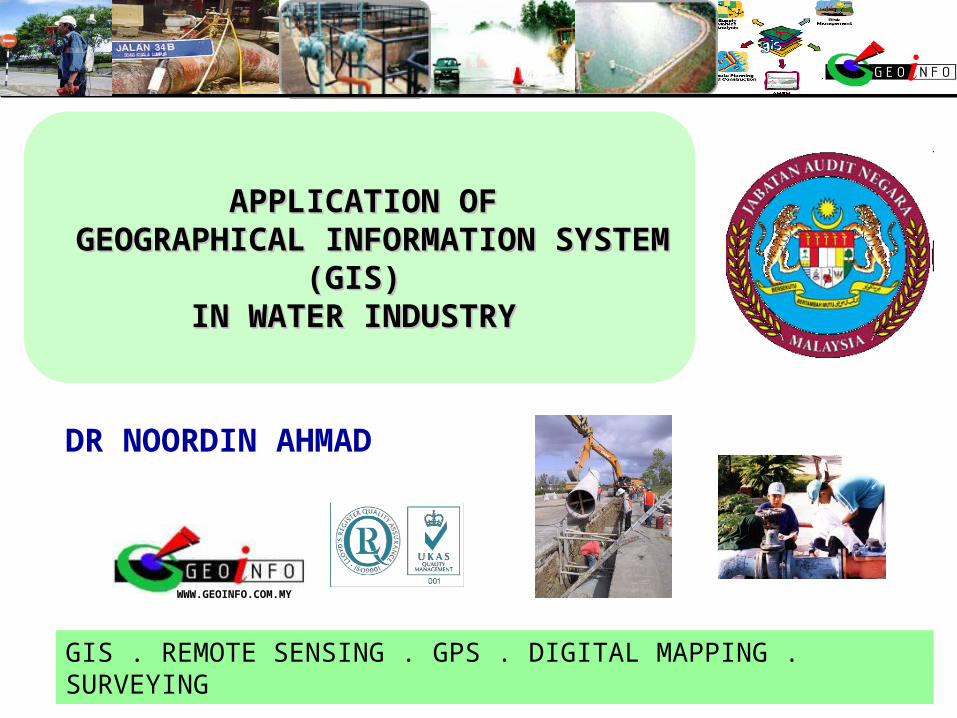
DR NOORDIN AHMAD
WWW.GEOINFO.COM.MY
GIS . REMOTE SENSING . GPS . DIGITAL MAPPING . SURVEYING
APPLICATION OFAPPLICATION OF GEOGRAPHICAL INFORMATION GEOGRAPHICAL INFORMATION
SYSTEM (GIS) SYSTEM (GIS) IN WATER INDUSTRYIN WATER INDUSTRY
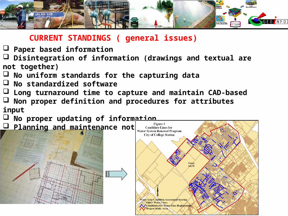
Paper based information Disintegration of information (drawings and textual are not together) No uniform standards for the capturing data No standardized software Long turnaround time to capture and maintain CAD-based Non proper definition and procedures for attributes input No proper updating of information Planning and maintenance not based on proper analysis
CURRENT STANDINGS ( general issues)
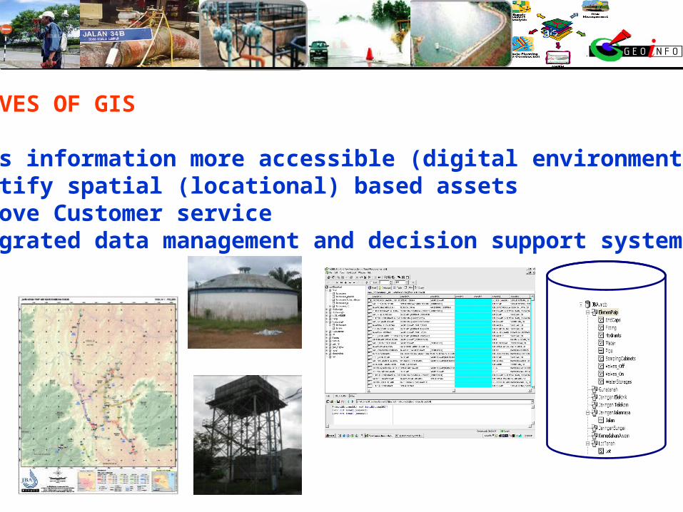
OBJECTIVES OF GIS
1. Makes information more accessible (digital environment)2. Identify spatial (locational) based assets3. Improve Customer service 4. Integrated data management and decision support system
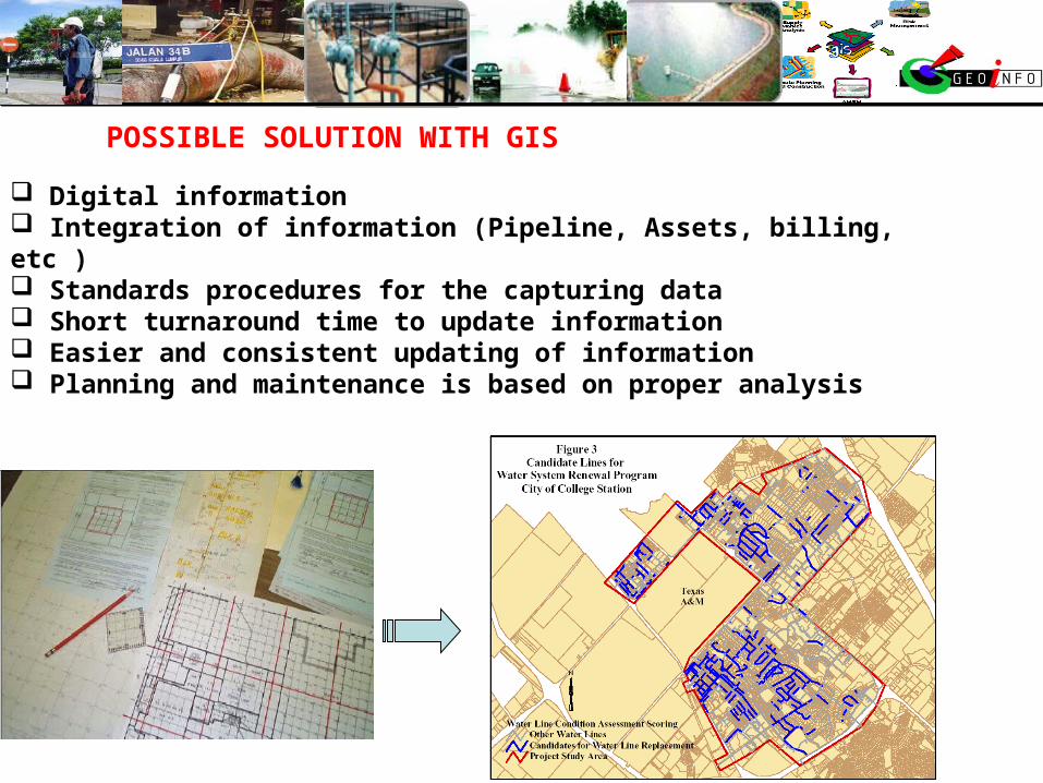
Digital information Integration of information (Pipeline, Assets, billing, etc ) Standards procedures for the capturing data Short turnaround time to update information Easier and consistent updating of information Planning and maintenance is based on proper analysis
POSSIBLE SOLUTION WITH GIS
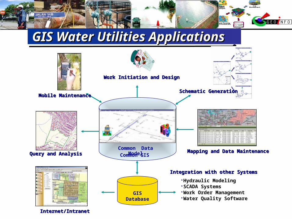
GIS Water Utilities ApplicationsGIS Water Utilities Applications
Common Data Model
Common GIS
GISDatabase
Schematic GenerationSchematic Generation
Work Initiation and DesignWork Initiation and Design
Mobile MaintenanceMobile Maintenance
Internet/IntranetInternet/Intranet
Integration with other SystemsIntegration with other Systems
•Hydraulic Modeling•SCADA Systems•Work Order Management•Water Quality Software
Query and AnalysisQuery and Analysis Mapping and Data MaintenanceMapping and Data Maintenance

PLANNING
DEVELOPMENT
PROJECT MANAGEMENT
MONITORING
MAINTENANCE
GIS can be used at all stagesGIS can be used at all stages
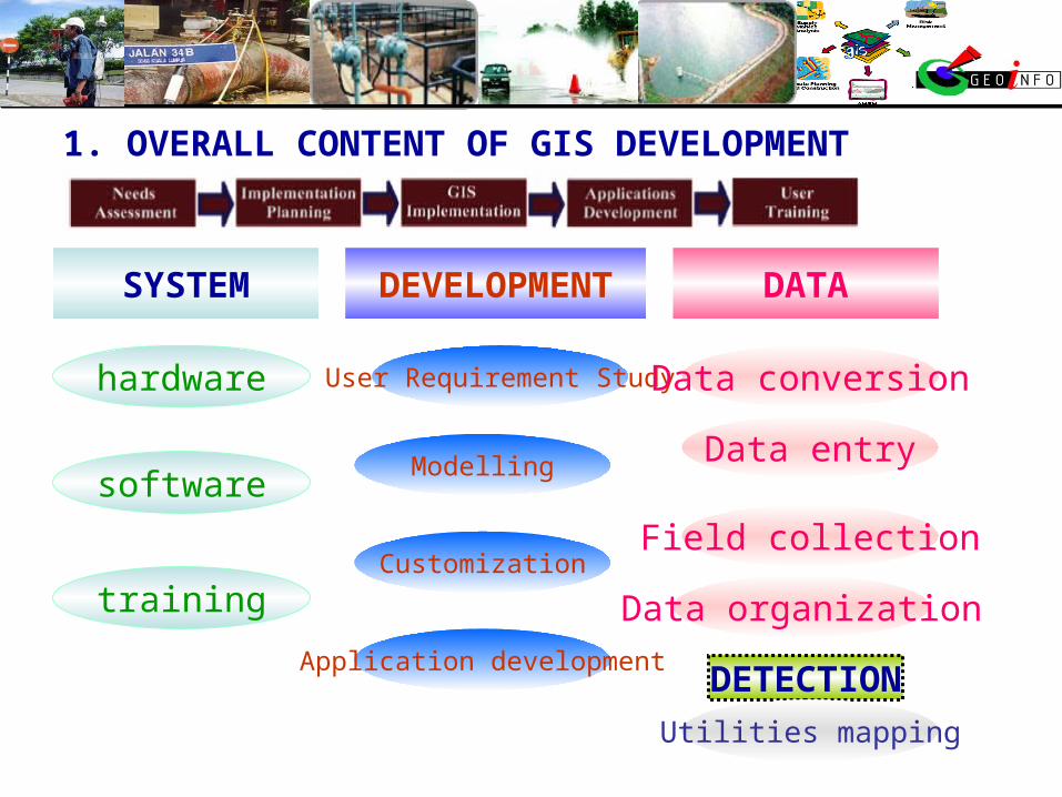
1. OVERALL CONTENT OF GIS DEVELOPMENT
SYSTEM DATA
DETECTION
DEVELOPMENT
hardware User Requirement Study Data conversion
Utilities mapping
software
training
Modelling
Customization
Application development
Data entry
Data organization
Field collection

points, lines, areas
features
layers
GIS
Data
SurveyingMaps
TablesSatellite data
Aerial
photoPaper files
Existing data
INTEGRATEDDATA MANAGEMENT
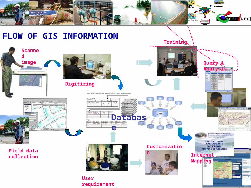
FLOW OF GIS INFORMATION
Scanned image
Field data collection
Digitizing
User requirement Study
Customization
Database
Internet Mapping
Training
Query & Analysis
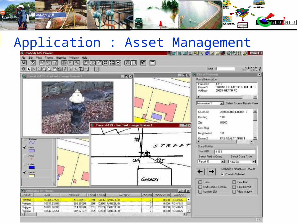
Application : Asset Management
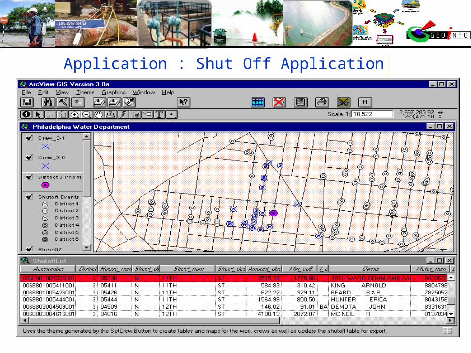
Application : Shut Off Application
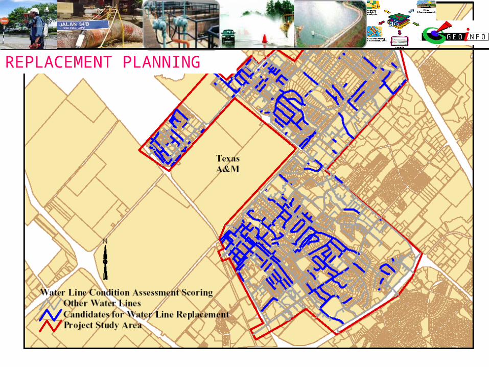
REPLACEMENT PLANNING
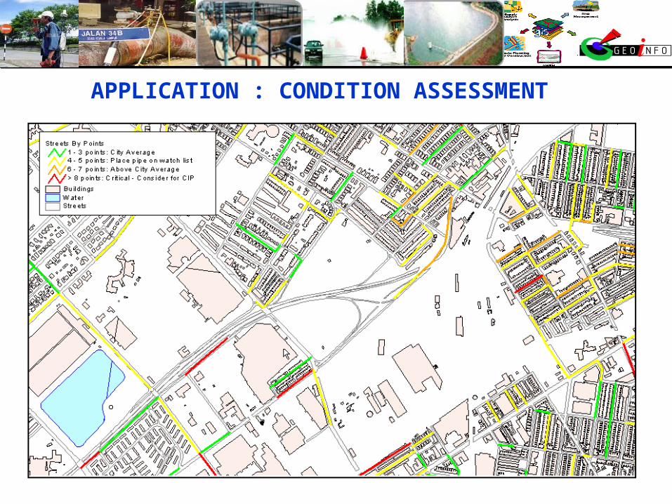
APPLICATION : CONDITION ASSESSMENT

Analysis - sample
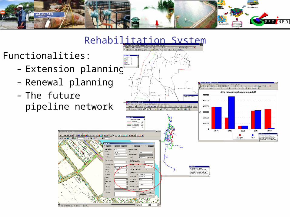
Rehabilitation System
Functionalities:– Extension planning– Renewal planning– The future pipeline
network

Call Centre: Locating Consumer Call Centre: Locating Consumer
Finding caller by name or Acc No. The red highlight indicated the location of the water meter of the caller. The attribute shows that the water meter is
linked to the consumer info table, enable a quick query on consumer location to be carried out.
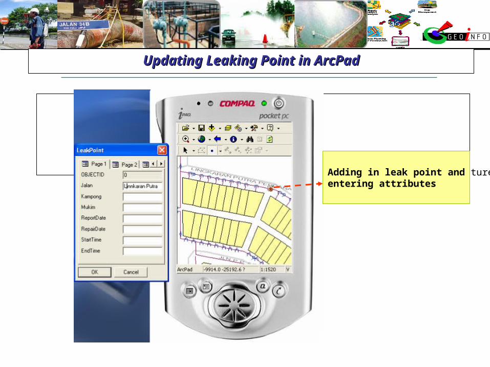
Updating Leaking Point in ArcPadUpdating Leaking Point in ArcPad
Setting the LeakPoint feature Class to edit mode.Adding in leak point and entering attributes
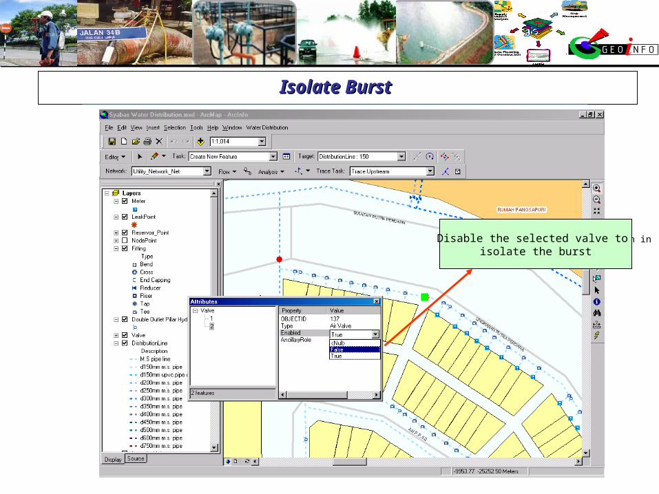
Isolate Burst Isolate Burst
Water leakage point
Locate the nearest valve to close as shown in red highlight point.
Disable the selected valve to isolate the burst
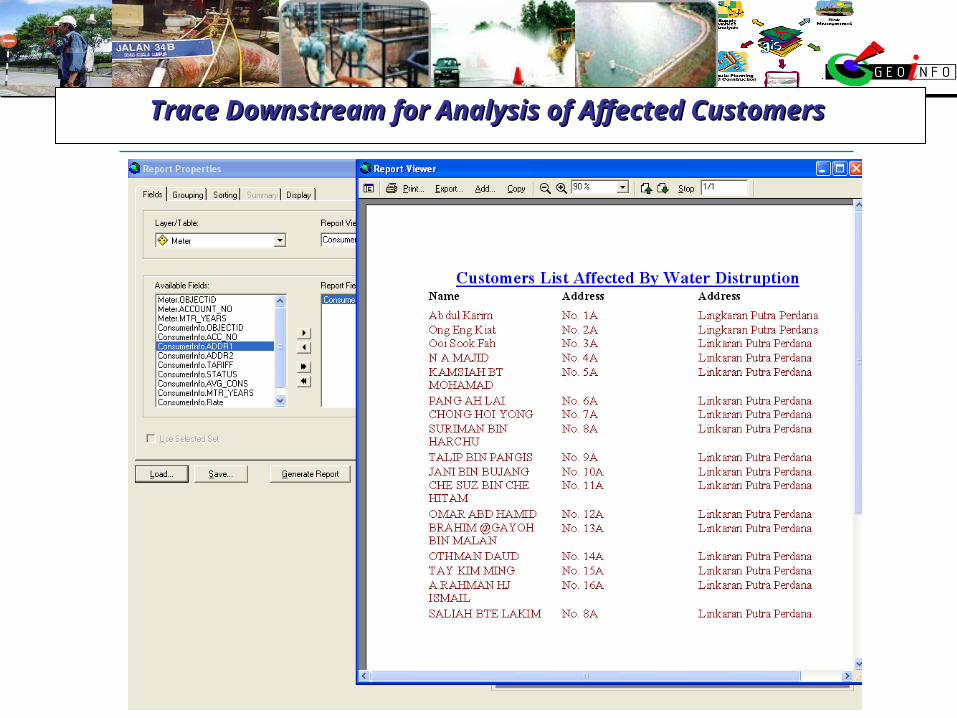
Trace Downstream for Analysis of Affected Customers Trace Downstream for Analysis of Affected Customers
Create report for affected customers. Reporting can be in normal report or
Crystal report.
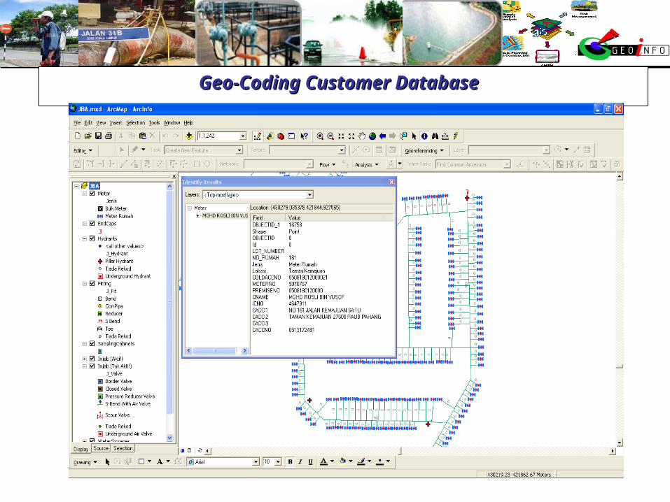
Geo-Coding Customer Database Geo-Coding Customer Database
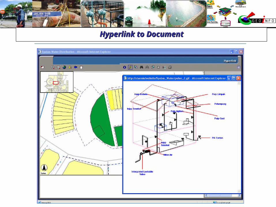
Hyperlink to DocumentHyperlink to Document

POTENTIAL EXPANSION
Billing System
Job Management System (JMS)
Supervisory Control & Data Acquisition (SCADA)
Telemetry System
Hydraulic Modeling
Risk Management System