urisa gis management institute® the gis capability maturity model and the gmi® gis assessment...
TRANSCRIPT

URISA GIS Management Institute®
The GIS Capability Maturity Model and the GMI®
GIS Assessment Service
Esri User Conference San Diego, California
July 16, 2014
Instructor Greg Babinski
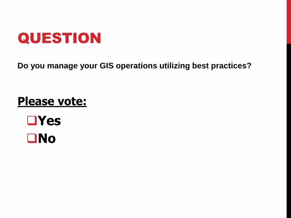
QUESTION
Do you manage your GIS operations utilizing best practices?
Please vote:
Yes
No
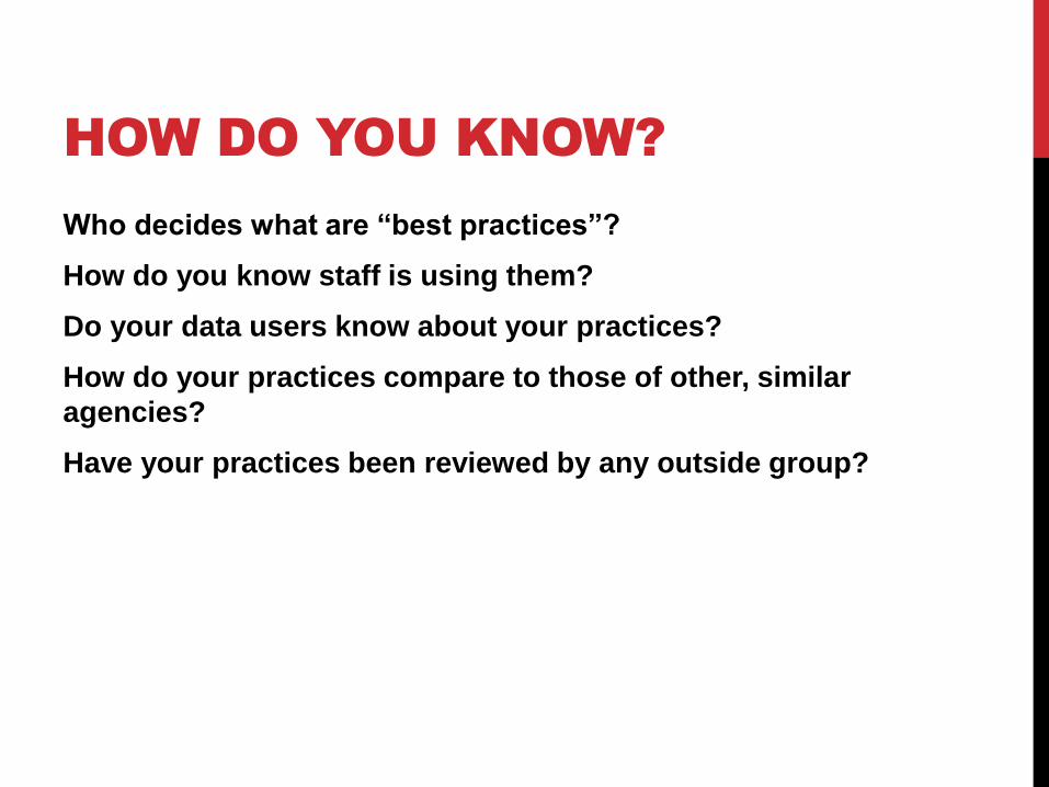
HOW DO YOU KNOW?
Who decides what are “best practices”?
How do you know staff is using them?
Do your data users know about your practices?
How do your practices compare to those of other, similar
agencies?
Have your practices been reviewed by any outside group?
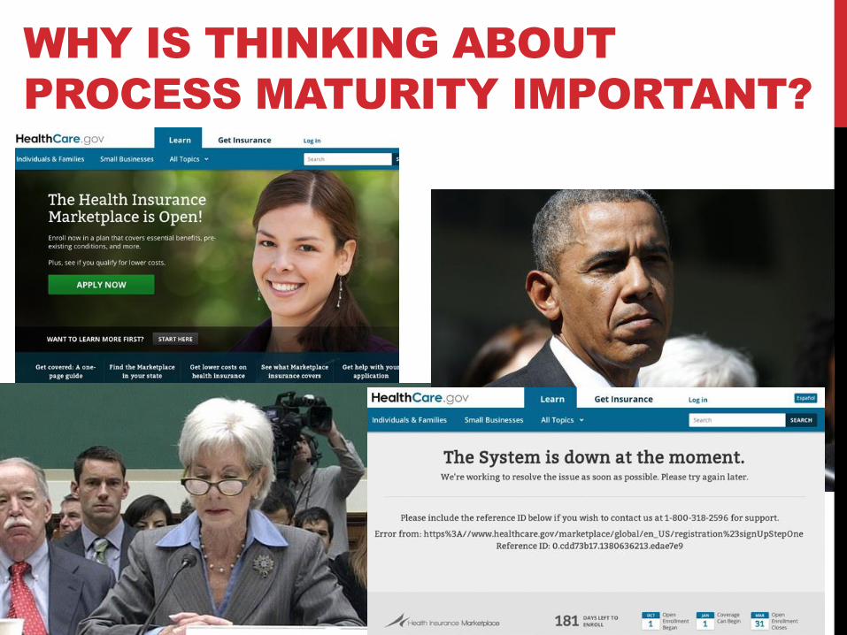
WHY IS THINKING ABOUT
PROCESS MATURITY IMPORTANT?
THE GEOSPATIAL REVOLUTION
Developed upon a foundation of geographic theory
Enabled by the development of modern computers and information technology
Built upon digital data with location attributes
Aided by allied geospatial technology
Turned into a viable business support tool by geospatial software
Transformed into a successful revolution by combining all these components into geographic information system (GIS) operations
Supported by cadres of GIS professionals and managers
CURRENT STATE
Geospatial technology has been proven beyond question as a key tool for effective government administration and business processes.
Geospatial technology has become ubiquitous within private industry, agriculture, research, and academic entities, and for use by citizens.
Growing body research proves that geospatial technology delivers significant financial return on investment (ROI).
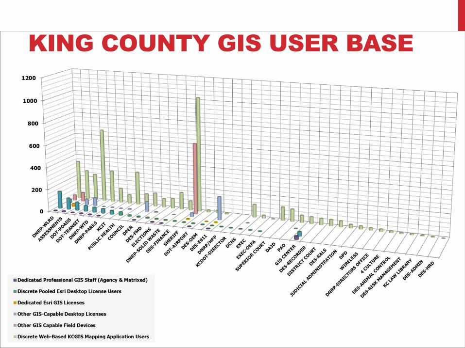
KING COUNTY GIS USER BASE
ORGANIZATIONAL
MATURITY CONCEPTS
Like technology, organizations evolve
Nature of maturity to be explored is that of organizational
capability and execution ability
Capability refers to potential of a suite of technology
components
Execution ability refers to the maturity of work processes
Developed by the software industry
Application to GIS organizations is based on the concept that
GIS is a highly complex operation
Expressed as a capability maturity model
WHAT IS MATURITY?
Progression of an organization toward GIS capability that
maximizes the output generated for the inputs provided
Capability comes in two forms
• Enabling capability (inputs)
• Execution ability (outputs)

WHAT IS MATURITY?
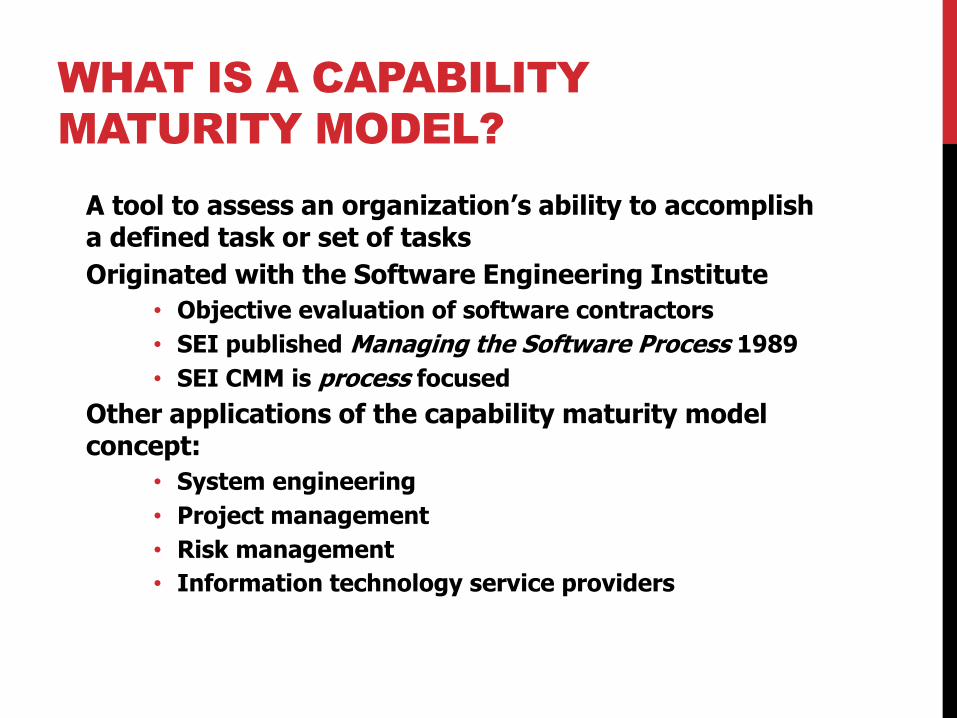
WHAT IS A CAPABILITY
MATURITY MODEL?
A tool to assess an organization’s ability to accomplish a defined task or set of tasks
Originated with the Software Engineering Institute
• Objective evaluation of software contractors
• SEI published Managing the Software Process 1989
• SEI CMM is process focused
Other applications of the capability maturity model concept:
• System engineering
• Project management
• Risk management
• Information technology service providers
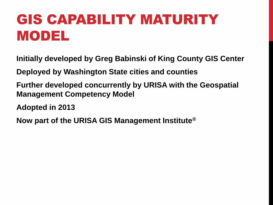
GIS CAPABILITY MATURITY
MODEL
Initially developed by Greg Babinski of King County GIS Center
Deployed by Washington State cities and counties
Further developed concurrently by URISA with the Geospatial
Management Competency Model
Adopted in 2013
Now part of the URISA GIS Management Institute®
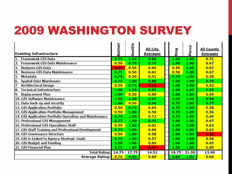
2009 WASHINGTON SURVEY
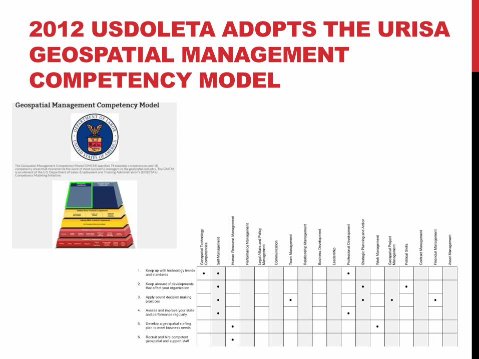
2012 USDOLETA ADOPTS THE URISA
GEOSPATIAL MANAGEMENT
COMPETENCY MODEL
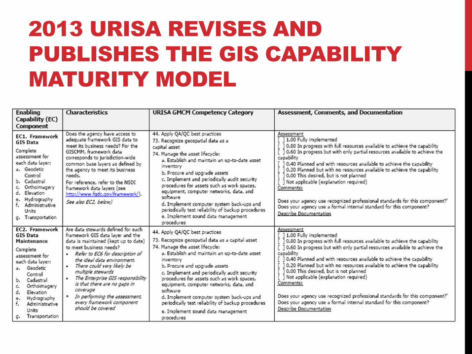
2013 URISA REVISES AND
PUBLISHES THE GIS CAPABILITY
MATURITY MODEL
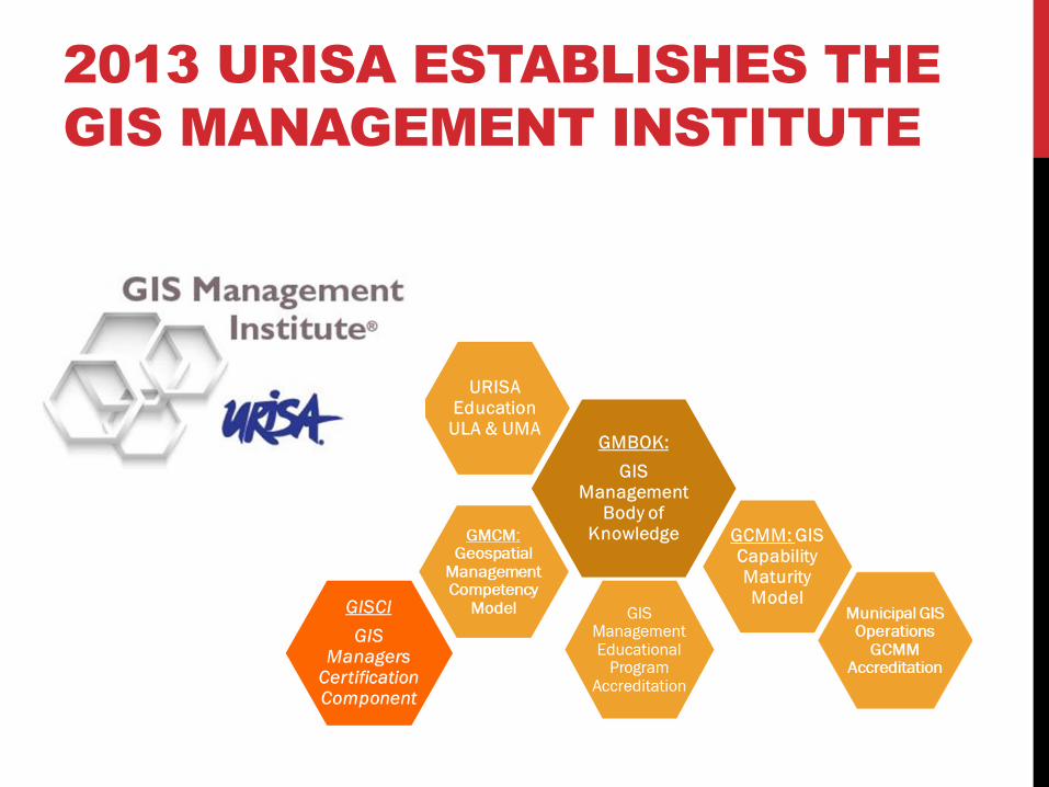
2013 URISA ESTABLISHES THE
GIS MANAGEMENT INSTITUTE
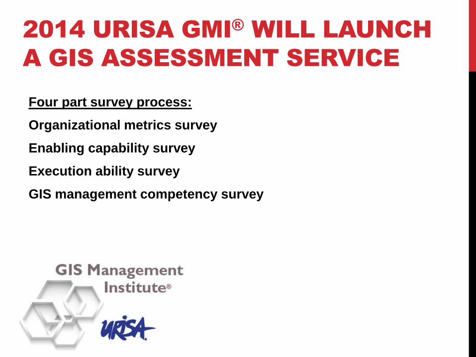
2014 URISA GMI® WILL LAUNCH
A GIS ASSESSMENT SERVICE
Four part survey process:
Organizational metrics survey
Enabling capability survey
Execution ability survey
GIS management competency survey
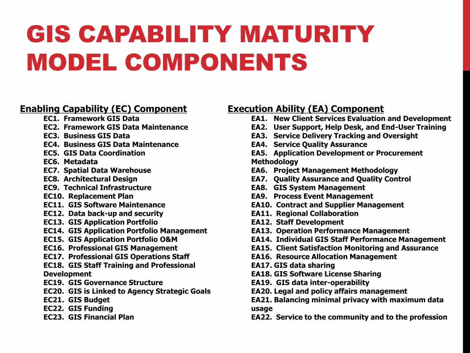
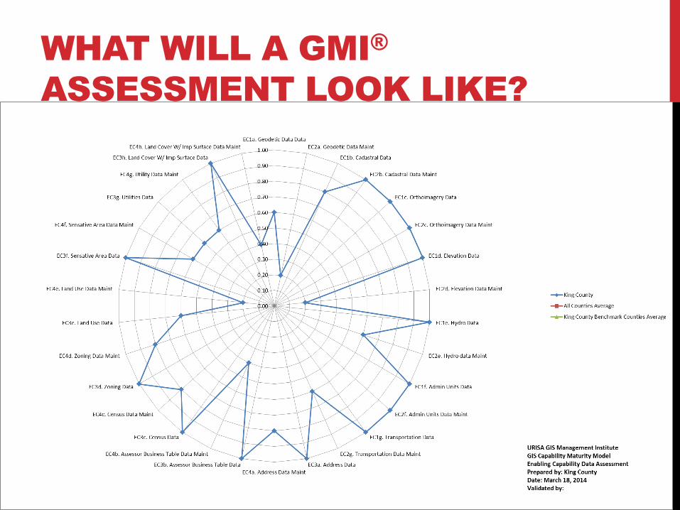
Enabling Capability (EC) Component EC1. Framework GIS Data EC2. Framework GIS Data Maintenance EC3. Business GIS Data EC4. Business GIS Data Maintenance EC5. GIS Data Coordination EC6. Metadata EC7. Spatial Data Warehouse EC8. Architectural Design EC9. Technical Infrastructure EC10. Replacement Plan EC11. GIS Software Maintenance EC12. Data back-up and security EC13. GIS Application Portfolio EC14. GIS Application Portfolio Management EC15. GIS Application Portfolio O&M EC16. Professional GIS Management EC17. Professional GIS Operations Staff EC18. GIS Staff Training and Professional Development EC19. GIS Governance Structure EC20. GIS is Linked to Agency Strategic Goals EC21. GIS Budget EC22. GIS Funding EC23. GIS Financial Plan
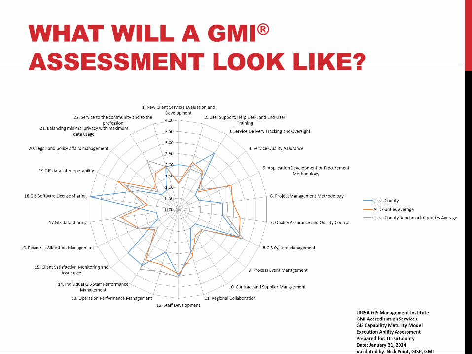
Execution Ability (EA) Component EA1. New Client Services Evaluation and Development EA2. User Support, Help Desk, and End-User Training EA3. Service Delivery Tracking and Oversight EA4. Service Quality Assurance EA5. Application Development or Procurement Methodology EA6. Project Management Methodology EA7. Quality Assurance and Quality Control EA8. GIS System Management EA9. Process Event Management EA10. Contract and Supplier Management EA11. Regional Collaboration EA12. Staff Development EA13. Operation Performance Management EA14. Individual GIS Staff Performance Management EA15. Client Satisfaction Monitoring and Assurance EA16. Resource Allocation Management EA17. GIS data sharing EA18. GIS Software License Sharing EA19. GIS data inter-operability EA20. Legal and policy affairs management EA21. Balancing minimal privacy with maximum data usage EA22. Service to the community and to the profession
GIS CAPABILITY MATURITY
MODEL COMPONENTS
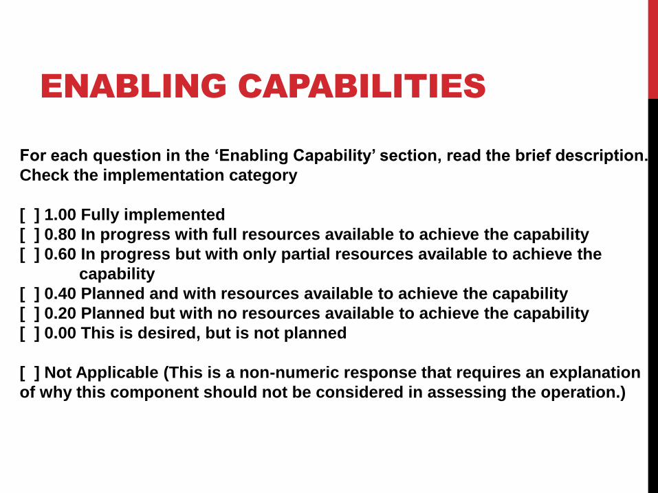
For each question in the ‘Enabling Capability’ section, read the brief description.
Check the implementation category
[ ] 1.00 Fully implemented
[ ] 0.80 In progress with full resources available to achieve the capability
[ ] 0.60 In progress but with only partial resources available to achieve the
capability
[ ] 0.40 Planned and with resources available to achieve the capability
[ ] 0.20 Planned but with no resources available to achieve the capability
[ ] 0.00 This is desired, but is not planned
[ ] Not Applicable (This is a non-numeric response that requires an explanation
of why this component should not be considered in assessing the operation.)
ENABLING CAPABILITIES
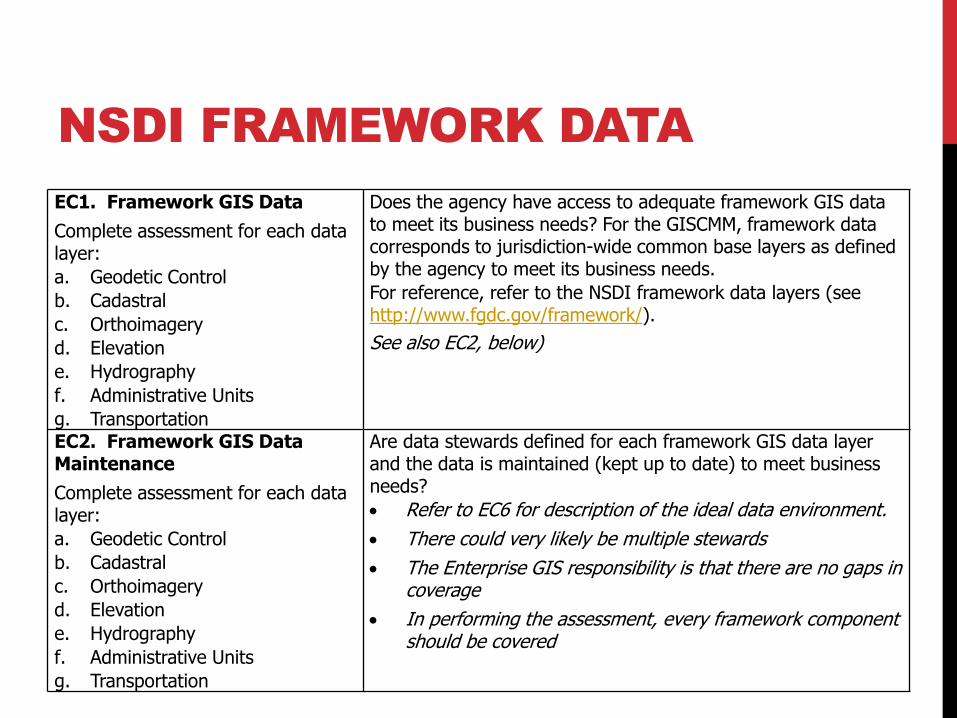
EC1. Framework GIS Data
Complete assessment for each data layer:
a. Geodetic Control
b. Cadastral
c. Orthoimagery
d. Elevation
e. Hydrography
f. Administrative Units
g. Transportation
Does the agency have access to adequate framework GIS data to meet its business needs? For the GISCMM, framework data corresponds to jurisdiction-wide common base layers as defined by the agency to meet its business needs.
For reference, refer to the NSDI framework data layers (see http://www.fgdc.gov/framework/).
See also EC2, below)
EC2. Framework GIS Data Maintenance
Complete assessment for each data layer:
a. Geodetic Control
b. Cadastral
c. Orthoimagery
d. Elevation
e. Hydrography
f. Administrative Units
g. Transportation
Are data stewards defined for each framework GIS data layer and the data is maintained (kept up to date) to meet business needs?
Refer to EC6 for description of the ideal data environment.
There could very likely be multiple stewards
The Enterprise GIS responsibility is that there are no gaps in coverage
In performing the assessment, every framework component should be covered
NSDI FRAMEWORK DATA
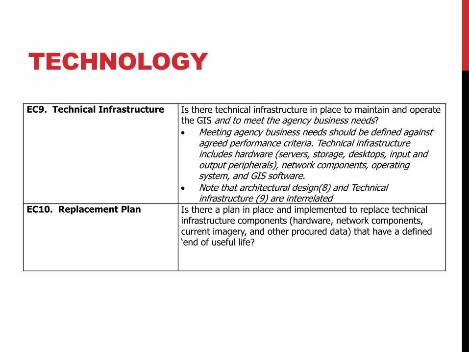
EC9. Technical Infrastructure
Is there technical infrastructure in place to maintain and operate the GIS and to meet the agency business needs?
Meeting agency business needs should be defined against agreed performance criteria. Technical infrastructure includes hardware (servers, storage, desktops, input and output peripherals), network components, operating system, and GIS software.
Note that architectural design(8) and Technical infrastructure (9) are interrelated
EC10. Replacement Plan Is there a plan in place and implemented to replace technical infrastructure components (hardware, network components, current imagery, and other procured data) that have a defined ‘end of useful life?
TECHNOLOGY
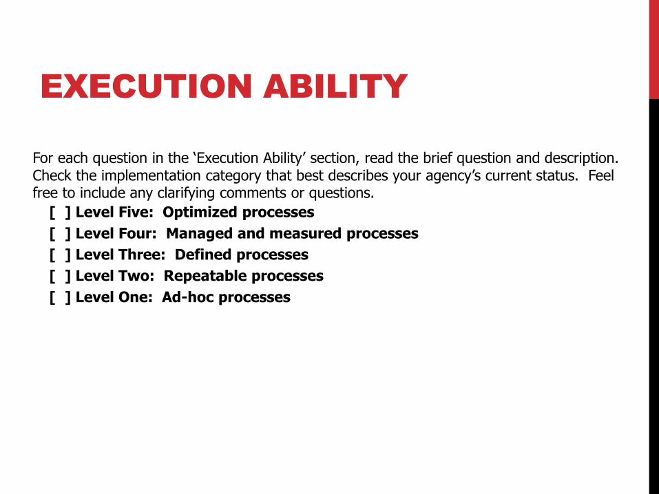
For each question in the ‘Execution Ability’ section, read the brief question and description. Check the implementation category that best describes your agency’s current status. Feel free to include any clarifying comments or questions.
[ ] Level Five: Optimized processes
[ ] Level Four: Managed and measured processes
[ ] Level Three: Defined processes
[ ] Level Two: Repeatable processes
[ ] Level One: Ad-hoc processes
EXECUTION ABILITY
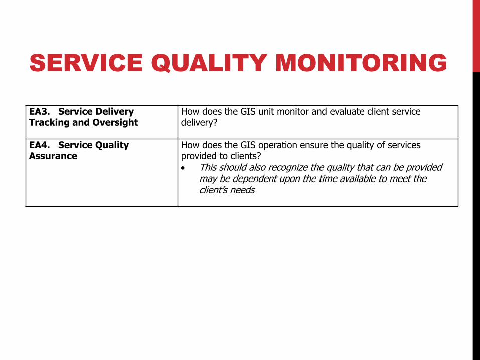
EA3. Service Delivery Tracking and Oversight
How does the GIS unit monitor and evaluate client service delivery?
EA4. Service Quality Assurance
How does the GIS operation ensure the quality of services provided to clients?
This should also recognize the quality that can be provided may be dependent upon the time available to meet the client’s needs
SERVICE QUALITY MONITORING
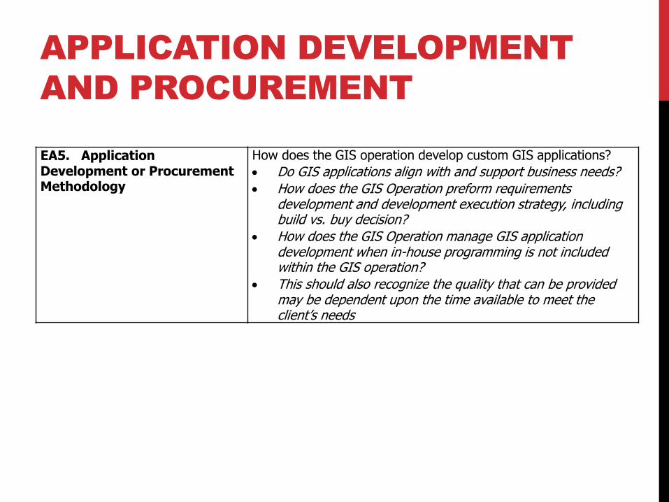
EA5. Application Development or Procurement Methodology
How does the GIS operation develop custom GIS applications?
Do GIS applications align with and support business needs?
How does the GIS Operation preform requirements development and development execution strategy, including build vs. buy decision?
How does the GIS Operation manage GIS application development when in-house programming is not included within the GIS operation?
This should also recognize the quality that can be provided may be dependent upon the time available to meet the client’s needs
APPLICATION DEVELOPMENT
AND PROCUREMENT
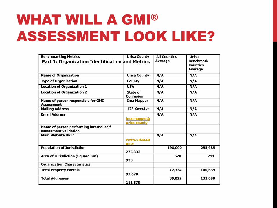
WHAT WILL A GMI®
ASSESSMENT LOOK LIKE?
Benchmarking Metrics Urisa County All Counties Average
Urisa Benchmark Counties Average
Name of Organization Urisa County N/A N/A
Type of Organization County N/A N/A
Location of Organization 1 USA N/A N/A
Location of Organization 2 State of Confusion
N/A N/A
Name of person responsible for GMI Assessment
Ima Mapper N/A N/A
Mailing Address 123 XxxxAve N/A N/A
Email Address [email protected]
N/A N/A
Name of person performing internal self assessment validation
Main Website URL: www.uriza.county
N/A N/A
Population of Jurisdiction 275,333
198,000 255,985
Area of Jurisdiction (Square Km) 933
670 711
Organization Characteristics
Total Property Parcels 97,678
72,334 100,639
Total Addresses 111,879
89,022 132,098
Part 1: Organization Identification and Metrics
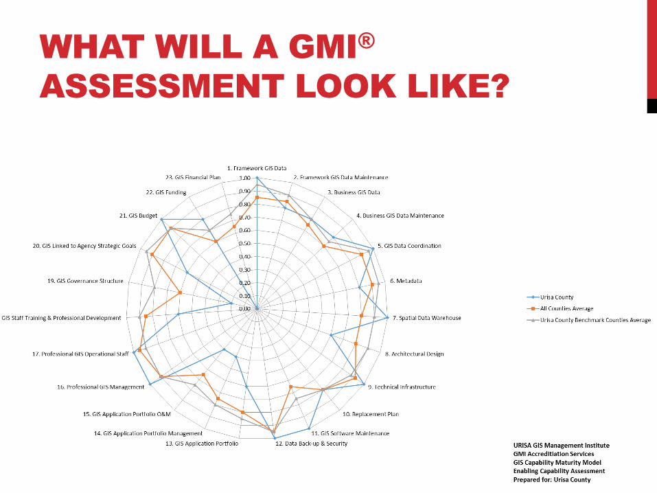
WHAT WILL A GMI®
ASSESSMENT LOOK LIKE?
WHAT WILL A GMI®
ASSESSMENT LOOK LIKE?
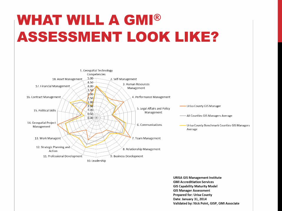
WHAT WILL A GMI®
ASSESSMENT LOOK LIKE?
WHAT WILL A GMI®
ASSESSMENT LOOK LIKE?
GMI® BUSINESS CASE
GIS professionals and practitioners invest considerable time and money in their initial education and continual training, yet recognized professional practice standards and guidelines are lacking in the GIS profession
Public agencies and private entities have invested very large sums of money to develop and operate enterprise and program-specific GIS operations, yet best practices and investment validation for GIS operations are both absent
Most GIS managers, professionals, and practitioners deliver value to society through the work that they do
But there remains a need for an environment where best practices and professional standards can be developed, validated, and promoted to maximize the value and effectiveness of GIS operations
The competency of the GIS manager is one of the key success factors for an effective enterprise GIS
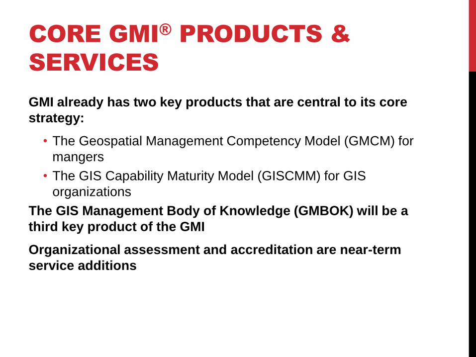
CORE GMI® PRODUCTS &
SERVICES
GMI already has two key products that are central to its core
strategy:
• The Geospatial Management Competency Model (GMCM) for
mangers
• The GIS Capability Maturity Model (GISCMM) for GIS
organizations
The GIS Management Body of Knowledge (GMBOK) will be a
third key product of the GMI
Organizational assessment and accreditation are near-term
service additions
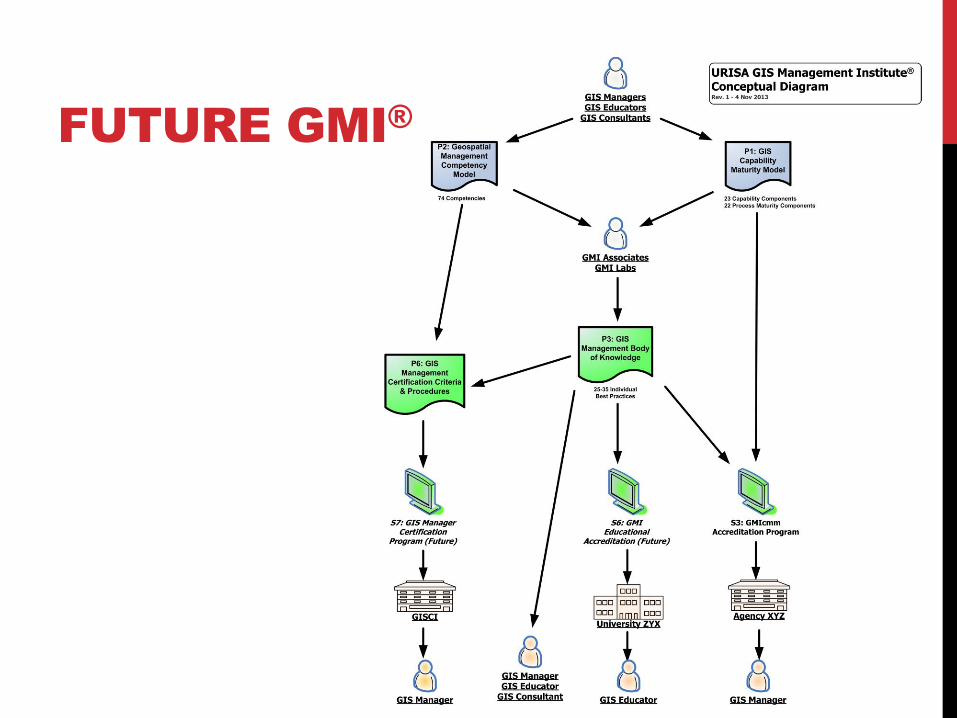
FUTURE GMI®
FINAL REMARKS
Questions?
Suggestions?
Criticisms?
Ideas for using the capability maturity assessment process?
Other comments?
GMCM Development Contributors:
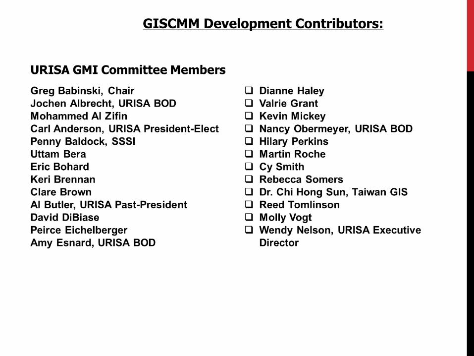
GISCMM Development Contributors:
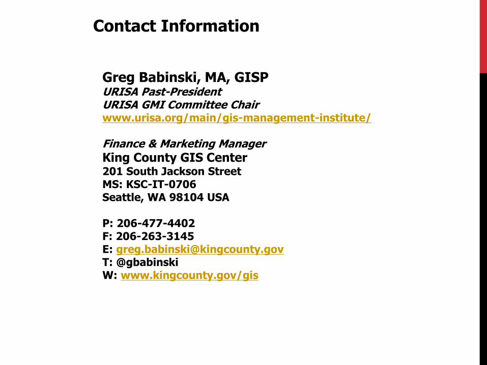
Contact Information
Greg Babinski, MA, GISP URISA Past-President URISA GMI Committee Chair www.urisa.org/main/gis-management-institute/ Finance & Marketing Manager
King County GIS Center 201 South Jackson Street MS: KSC-IT-0706 Seattle, WA 98104 USA P: 206-477-4402 F: 206-263-3145 E: [email protected] T: @gbabinski W: www.kingcounty.gov/gis