usgs summary of selected studies
TRANSCRIPT

1
July 11, 2014
Summary of selected Studies Related to Possible Effects of Energy
Development on Water Quantity, Water Quality and Ecosystems Conducted
by USGS Water Science Centers
Of recent importance is the issue that involves possible impacts of oil and gas production and
hydraulic fracturing on groundwater and surface-water quantity and quality and ecosystems.
Monitoring, assessments, and research are ongoing within USGS Water Science Centers in
cooperation and partnership with localities, States, Tribes, and other Federal agencies. In general
the jointly planned projects help to establish baseline water quantity, quality, and ecosystem
measurements and help to better characterize water resources as natural gas exploration and
production accelerates among different geologic and environmental settings across the U.S. Such
understanding is critical to protect sources of water used for drinking and to sustain ecosystem
health in our Nation’s streams, lakes, and reservoirs.
Specific products are summarized in this document, spanning efforts across the Nation, including
in the Marcellus Shale in the east, Bakken in the north-central, and Fayetteville Shale in the
Southeast.
National analysis and synthesis also is ongoing by the USGS John Wesley
Powell Center.
Maps related to oil and gas production and hydraulic fracturing are included
in the USGS Fact Sheet “Water Quality Studied in Areas of Unconventional
Oil and Gas Development, Including Areas Where Hydraulic Fracturing
Techniques are Used in the U.S.” Specifically, maps show oil- and gas-
related wells in the U.S.; major areas of unconventional oil and gas
development in the U.S.; number of groundwater-quality samples in areas of
unconventional oil and gas development; and number of surface-water
quality samples in areas of unconventional oil and gas development.
This Fact Sheet was developed by the USGS John Wesley Powell Center for
Analysis and Synthesis, which is hosting a work group to (1) better
understand hydraulic fracturing in the U.S., (2) assess quality of surface
water and groundwater in areas of unconventional oil and gas production,
(3) evaluate potential changes in water quality over time, (4) determine
baseline concentrations of major ions in waters in areas of unconventional
oil and gas production, (5) identify spatial and temporal gaps, and (6)
identify future research needed to better understand effects of oil and gas
production and hydraulic fracturing on surface-water and groundwater
quality. (Contact: [email protected] ).
2
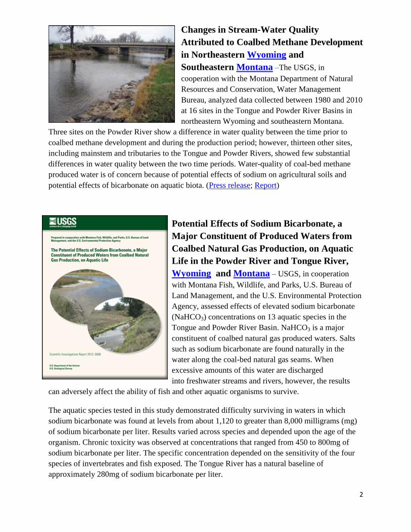
Changes in Stream-Water Quality
Attributed to Coalbed Methane Development
in Northeastern Wyoming and
Southeastern Montana –The USGS, in
cooperation with the Montana Department of Natural
Resources and Conservation, Water Management
Bureau, analyzed data collected between 1980 and 2010
at 16 sites in the Tongue and Powder River Basins in
northeastern Wyoming and southeastern Montana.
Three sites on the Powder River show a difference in water quality between the time prior to
coalbed methane development and during the production period; however, thirteen other sites,
including mainstem and tributaries to the Tongue and Powder Rivers, showed few substantial
differences in water quality between the two time periods. Water-quality of coal-bed methane
produced water is of concern because of potential effects of sodium on agricultural soils and
potential effects of bicarbonate on aquatic biota. (Press release; Report)
Potential Effects of Sodium Bicarbonate, a
Major Constituent of Produced Waters from
Coalbed Natural Gas Production, on Aquatic
Life in the Powder River and Tongue River,
Wyoming and Montana – USGS, in cooperation
with Montana Fish, Wildlife, and Parks, U.S. Bureau of
Land Management, and the U.S. Environmental Protection
Agency, assessed effects of elevated sodium bicarbonate
(NaHCO3) concentrations on 13 aquatic species in the
Tongue and Powder River Basin. NaHCO3 is a major
constituent of coalbed natural gas produced waters. Salts
such as sodium bicarbonate are found naturally in the
water along the coal-bed natural gas seams. When
excessive amounts of this water are discharged
into freshwater streams and rivers, however, the results
can adversely affect the ability of fish and other aquatic organisms to survive.
The aquatic species tested in this study demonstrated difficulty surviving in waters in which
sodium bicarbonate was found at levels from about 1,120 to greater than 8,000 milligrams (mg)
of sodium bicarbonate per liter. Results varied across species and depended upon the age of the
organism. Chronic toxicity was observed at concentrations that ranged from 450 to 800mg of
sodium bicarbonate per liter. The specific concentration depended on the sensitivity of the four
species of invertebrates and fish exposed. The Tongue River has a natural baseline of
approximately 280mg of sodium bicarbonate per liter.
3
Deionization treatment practices employed in the Tongue and Powder River watersheds appear
to reduce the concentrations of sodium bicarbonate and reduce the toxicity of untreated effluent
water. Areas with concentrations likely to cause significant mortality in the Tongue and Powder
River Basins appear to be limited to tributaries and parts of mixing zones with considerable
additions of untreated discharge.
Though this investigation focuses on the Tongue and Powder River Basins, the information is
applicable to other watersheds where sodium bicarbonate is a principle component of product
water either from coalbed natural gas extraction or from traditional or unconventional oil and gas
development. These data can also be used to separate effects of saline discharges from those
potentially posed by other constituents. Finally, this research effort and the additional
collaboration with USGS Water Resources and Mapping, Bureau of Land Management, U.S.
Environmental Protection Agency, State of Montana, State of Wyoming, Montana State
University, University of Wyoming, and others as part of a Powder River Aquatic Task Group,
can be used as a model for successful approaches to studying landscapes with energy
development. (Report; Press Release)
Effects of coalbed natural gas development on
ecological conditions in selected streams
in Wyoming and Montana –A USGS study, done in
cooperation with the Bureau of Land Management, Montana
Department of Environmental Quality, Montana Department of
Fish, Wildlife, and Parks, U.S. Environmental Protection
Agency, Wyoming Department of Environmental Quality,
and Wyoming Game and Fish Department, evaluated the effects
of water produced from coalbed natural gas development on
biological communities—aquatic insects, algal, and fish—in
selected streams in the Powder River basin in Wyoming and
Montana. Findings showed that macroinvertebrate, algal, and fish community composition
varied between drainage basins, among sites within drainage basins, and by year.

4
Brine-Contaminated Groundwater in
Northeastern Montana –USGS, in cooperation
with the Fort Peck Tribe, reports on the extent and
movement of contamination in the East Poplar oil
field area in northeastern Montana. The
contamination in shallow groundwater and the Poplar
River is brine, which is saltier than seawater and is a
byproduct as part of the process of extracting crude
oil in the East Poplar oil field. Findings show that
brine contaminated groundwater is generally moving
towards the southwest, eventually discharging into the Missouri River. For more than half a
century, millions of gallons of brine have been produced along with oil from the East Poplar oil
field on the Fort Peck Indian Reservation. Until recently, the waste brine was placed in pits and
ponds or injected into the ground through deep disposal wells and has made its way to the
shallow groundwater and the Poplar River. Currently, the only approved method of brine
disposal is to inject it deep into the ground. When the brine mixes with the groundwater in the
area, it often makes the water unsuitable for domestic purposes. Currently, treated water from the
Missouri River about 20 miles upstream of the city of Poplar is piped to the city and nearby
residents. This information is used by the Fort Peck Tribes to direct future natural resource
conservation efforts. (Report; Press Release)
Groundwater-Quality Sampling Near Pavillion, Wyoming –
USGS sampled two deep monitoring wells for groundwater-quality,
quality-control, and well yield data f near Pavillion, Wyoming at the
request of the State of Wyoming and in coordination with the U.S.
Environmental Protection Agency. Groundwater-quality samples were
analyzed for water-quality properties; inorganic constituents including
naturally occurring radioactive compounds; organic constituents;
dissolved gases; stable isotopes of methane, water and dissolved
inorganic carbon; and environmental tracers. Consistent with a
cooperative agreement with Wyoming, the USGS did not interpret data as part of this sampling
effort. Results are being provided to the Wyoming Department of Environmental Quality, EPA
and the public. The first USGS report describes the sampling and analysis plan developed by the
USGS in consultation with an interagency technical team which included representatives from
the State of Wyoming, EPA, and the Northern Arapahoe and Eastern Shoshone Tribes. A second
report provides the raw data and information from the groundwater-quality samples. (Press
release)

5
Hydrologic and Geochemical Data Collected
Near Skewed Reservoir, an Impoundment for
Coal-Bed Natural Gas Produced Water, Powder
River Basin, Wyoming – USGS, in cooperation with the
Bureau of Land Management assessed groundwater flow and
subsurface flows and subsurface water and soil chemistry in
an unlined surface impoundment, Skewed Reservoir, in the
Powder River Structural Basin. The Powder River Structural
Basin is one of the largest producers of coal-bed natural gas
(CBNG) in the United States. An important environmental
concern in the Basin is the fate of groundwater that is
extracted during CBNG production. Most of this produced
water is disposed of in unlined surface impoundments. USGS
data include chemistry of groundwater obtained from a
network of 21 monitoring wells and three suction lysimeters
and chemical and physical properties of soil cores including chemistry of water/soil extracts,
particle-size analyses, mineralogy, cation-exchange capacity, soil-water content, and total carbon
and nitrogen content of soils. (Data Report)
Groundwater Well Inventory and Assessment
in the Area of the Proposed Normally
Pressured Lance Natural Gas Development
Project, Green River Basin, Wyoming – USGS,
in cooperation with the Bureau of Land Management,
inventoried and assessed existing water wells in
southwestern Wyoming for inclusion in a possible
ground-water-monitor network. Records were located for
3,282 wells in the upper Green River Basin, which
includes the U.S. Geological Survey study area and the
proposed “Normally Pressured Lance” natural gas
development project area. Of the 376 wells in the U.S.
Geological Survey Normally Pressured Lance study area,
141 well records had sufficient documentation, such as
well depth, open interval, geologic log, and depth to
water, to meet many, but not always all, established monitor well criteria. Efforts were made to
locate each of the 141 wells and to document their current condition. Field crews were able to
locate 121 of the wells, and the remaining 20 wells either were not located as described, or had
been abandoned and the site reclaimed. Of the 121 wells located, 92 were found to meet
established monitor well criteria. Results of the field efforts during May through September
2012, and specific physical characteristics of the 92 wells, are presented in this report.
6
USGS Studies Groundwater
Availability in the Williston and
Powder River Basins Spanning
the States of Wyoming, Montana,
South Dakota, North Dakota, and
Select Canadian Provinces - The
development of two nationally important
energy-producing areas, the Williston
structural basin (containing the Bakken
Formation) and Powder River structural
basin, provide a critical opportunity to
study the water-energy nexus within a groundwater context. Large volumes of water are needed
for energy development in these basins. The hydraulically connected aquifers in the regional
glacial, lower Tertiary, and Upper Cretaceous aquifer systems are the shallowest, most
accessible, and in some cases, the only potable aquifers within the Northern Great Plains.
The Williston and Powder River structural basins contain energy resources of national
importance. Coal/lignite, oil, natural gas, and uranium, present in both structural basins in large
quantities, currently are extracted from Tertiary-age and older geologic units; however, rapid
technological advances (for example, horizontal drilling and hydraulic fracturing), coupled with
ever-increasing resource discovery and characterization, are predicted to dramatically increase
development of these energy resources in both basins in the near future. Increased extraction of
these energy resources will require withdrawal of ever-increasing volumes of groundwater from
the glacial, lower Tertiary, and Upper Cretaceous aquifer systems.
This study will provide information on important aquifers in the States of Wyoming, Montana,
South Dakota, North Dakota, and the Provinces of Saskatchewan and Manitoba in Canada. The
study will provide an improved understanding of the glacial and bedrock aquifer systems in the
context of a large regional system that is undergoing developmental pressure with current and
future competing water uses. Simulation of groundwater flow also will allow evaluation of
different water-use and energy-development scenarios, as well as evaluation of possible future
climatic effects on these aquifers. Perhaps most importantly, the study provides a unique
opportunity to understand this regional system prior to large-scale energy development. Data
compiled as part of the study will become part of the national USGS water-resources database,
and will contribute to the USGS mission by describing and increasing the understanding of the
Nation’s groundwater resources. (Read more about this USGS Groundwater Resources Program
Study)

7
Water Quality Data Repository in Colorado –As
large-scale energy development continues in the Piceance Basin
in northwestern Colorado, there is potential for changes in
surface-and groundwater resources. USGS, in cooperation with
over 25 entities created a public, web-accessible common data
repository combining water-quality data from various sources to
establish a baseline assessment of the region’s water resources.
Collaborative partners supporting the project include the energy
industry, local citizens, cities and counties, state agencies, the
Bureau of Land Management, private consultants, the West
Divide Water Conservancy District, and the Colorado River
Water Conservation District. The data will be used to develop regional monitoring strategies
needed to fill identified data gaps, and minimize redundancies in current and future water-
resource monitoring.
Groundwater Ages and Mixing in the Piceance Basin Natural Gas Province,
Colorado – USGS used chemical, isotopic, and age tracers to characterize groundwater ages
and mixing with deeper saline water in three areas of the Piceance Basin natural gas province.
Groundwater age and mixing data can strengthen interpretations of monitoring data from those
areas by providing better understanding of groundwater flow systems and the time scales at
which water quality changes in aquifers may occur. This information can help to establish
maximum allowable distances of monitoring wells from energy development activity and the
appropriate duration of monitoring and tracking. (Detailed study in the (ES&T Journal)

8
Water Quality and Streambed Sediment from
Streams in and near an Area of Oil and Natural
Gas Development, South-Central Texas – USGS,
in cooperation with the San Antonio River Authority and
the Guadalupe-Blanco River Authority, analyzed surface-
water and streambed-sediment samples collected from 10
sites in the San Antonio River Basin during 2011-2013 to
provide data for a broad range of constituents that might be
associated with hydraulic fracturing and the produced
waters that are a consequence of hydraulic fracturing. (Data
Report).
Fresh and Saline Groundwater above the Marcellus Formation, Bradford
County, Pennsylvania – USGS, in cooperation with the Pennsylvania Geological Survey,
characterized the geohydrology and water quality of a 1,664-foot-deep test hole in western
Bradford County, Pennsylvania using rock core, geophysical logs, and water samples. The study
(Open-File Miscellaneous Investigation 13-01.1; USGS reference) determined that the deepest
active, fresh groundwater circulation was 700 to 900 feet below land surface at the upland
location of the test hole. Highly saline water that flowed into the well at discrete fracture zones
more than 900 feet deep had similar composition to Appalachian Basin brines that had been
diluted with fresh water. Dissolved methane concentrations ranged from 7.8 to 37 milligrams per
liter and isotope ratios of the methane indicated a thermogenic origin.
In the text, the authors discuss their methods of investigation, summarize physical and analytical
results, and place those results in context. Four appendices include (1) a full description of the
core in an Excel worksheet; (2) water-quality and core-isotope analytical results in Excel
workbooks; (3) geophysical logs in LAS and PDF files, and an Excel workbook containing
attitudes of bedding and fractures calculated from televiewer
logs; and (4) MP4 clips from the downhole video at selected
horizons.
Because of the large file size of the video clips, this report is
provided as two downloadable ZIP files: one file contains the
text and first three appendices (22.5 MB), and the other file
contains the Appendix 4 video clips (351 MB) (Available on the
web).
9
Baseline Groundwater Quality from 20
Domestic Wells in Sullivan County,
Pennsylvania – USGS, in cooperation with the
Pennsylvania Department of Conservation and Natural
Resources, Bureau of Topographic and Geologic Survey
(Pennsylvania Geological Survey), released a study that
provides a groundwater-quality baseline for central and
southern Sullivan County prior to drilling for natural gas
in the Marcellus Shale. Residents of the largely rural
county rely on groundwater for water supply, primarily
from bedrock aquifers (shales and sandstones). USGS
collected water samples from 20 domestic wells during
August and September 2012 and analyzed for
47 constituents and properties, including nutrients, major
ions, metals and trace elements, radioactivity, and
dissolved gases, including methane and radon-222.
The quality of the sampled groundwater was generally within U.S. Environmental Protection
Agency (USEPA) drinking-water standards, although in some samples, the concentrations of a
few constituents exceeded USEPA drinking-water standards and health advisories.
Specifically, gross-alpha radioactivity in one sample was found to exceed the USEPA primary
drinking water maximum contaminant level (MCL) of 15 pCi/L. Water samples from 85 percent
of the sampled wells exceeded the proposed USEPA MCL of 300 picocuries per liter (pCi/L) for
radon-222; however, only two water samples (10 percent of sampled wells) exceeded the
proposed USEPA alternate maximum contaminant level (AMCL) of 4,000 pCi/L for radon-222.
In general, most of the water-quality problems involved aesthetic considerations, such as taste or
odor from elevated concentrations of total dissolved solids, iron, manganese, and chloride that
develop from natural interactions of water and rock minerals in the subsurface. For example, in a
few samples, the concentrations of total dissolved solids, iron, manganese, and chloride exceeded
USEPA secondary maximum contaminant levels (SMCL). In addition, water samples from two
wells contained methane concentrations greater than 1 milligram per liter (mg/L).
Methane was not detected in water samples from 13 wells, and the methane concentration was
less than 0.07 mg/L in samples from five wells. The highest dissolved methane concentrations
were 4.1 and 51.1 mg/L, and the pH of the water from both wells was greater than 8. Water
samples from these wells were analyzed for isotopes of carbon and hydrogen in the methane. The
isotopic ratio values fell in the range for a thermogenic (natural gas) source. The water samples
from these two wells had the highest concentrations of arsenic, boron, bromide, chloride,
fluoride, lithium, molybdenum, and sodium of the 20 wells sampled.

10
Domestic Wells Sampled in Marcellus Shale, Wayne County, Pennsylvania –
USGS, in cooperation with the Pennsylvania Department of Conservation and Natural
Resources, Bureau of Topographic and Geologic Survey (Pennsylvania Geological Survey), will
provide a groundwater-quality baseline for Wayne County, Pennsylvania prior to development of
the natural gas resource in the Marcellus Shale (similar to the study for Sullivan County). The
report is expected in the Summer 2014, titled "Baseline groundwater quality from 34 wells in
Wayne County, Pennsylvania, 2011 and 2013".
Radon-222 Content of Natural Gas Samples from
Upper and Middle Devonian Sandstone and Shale
Reservoirs in Pennsylvania – USGS sampled natural gas as
part of a study of formation water chemistry in oil and gas reservoirs
in the Appalachian Basin (Preliminary data and report). Nineteen
samples (plus two duplicates) were collected from 11 wells
producing gas from Upper Devonian sandstones and the Middle
Devonian Marcellus Shale in Pennsylvania. The samples were
collected from valves located between the wellhead and the gas-
water separator. Analyses of the radon content of the gas indicated
222Rn (radon-222) activities ranging from 1 to 79 picocuries per
liter (pCi/L) with an overall median of 37 pCi/L. The radon activities of the Upper Devonian
sandstone samples overlap to a large degree with the activities of the Marcellus Shale samples.

11
Landscape Consequences of Natural Gas Extraction in Bedford, Blair,
Cambria, Centre, Clearfield, Clinton, Columbia, Huntingdon, and Luzerne
Counties, Pennsylvania –
Increased demands for cleaner burning energy, coupled with the relatively recent technological
advances in accessing unconventional hydrocarbon-rich geologic formations, have led to an
intense effort to find and extract natural gas from various underground sources around the
country. One of these sources, the Marcellus Shale, located in the Allegheny Plateau, is currently
undergoing extensive drilling and production. The technology used to extract gas in the
Marcellus Shale is known as hydraulic fracturing and has garnered much attention because of its
use of large amounts of fresh water, its use of proprietary fluids for the hydraulic-fracturing
process, its potential to release contaminants into the environment, and its potential effect on
water resources. Nonetheless, development of natural gas extraction wells in the Marcellus Shale
is only part of the overall natural gas story in this area of Pennsylvania. Conventional natural gas
wells, which sometimes use the same technique, are commonly located in the same general area
as the Marcellus Shale and are frequently developed in clusters across the landscape. The
combined effects of these two natural gas extraction methods create potentially serious patterns
of disturbance on the landscape.
This document quantifies the landscape changes and consequences of natural gas extraction for
Bedford, Blair, Cambria, Centre, Clearfield, Clinton, Columbia, Huntingdon, and Luzerne
Counties in Pennsylvania between 2004 and 2010. Patterns of landscape disturbance related to
natural gas extraction activities were collected and digitized using National Agriculture Imagery
Program (NAIP) imagery for 2004, 2005/2006, 2008, and 2010. The disturbance patterns were
then used to measure changes in land cover and land use using the National Land Cover
Database (NLCD) of 2001. A series of landscape metrics is also used to quantify these changes
and is included in this publication.
Similar Pennsylvania studies showing “Landscape Consequences of Natural Gas
Extraction” are available for:
Lackawanna and Wayne Counties, 2004-2010 (Report)
Sullivan and Wyoming Counties, Pennsylvania, 2004–2010 (Report)
Armstrong and Indiana Counties, Pennsylvania, 2004–2010 (Report)
Beaver and Butler Counties, Pennsylvania, 2004–2010 (Report)
Somerset and Westmoreland Counties, Pennsylvania, 2004–2010 (Report)
Fayette and Lycoming Counties, Pennsylvania, 2004–2010 (Report)
Allegheny and Susquehanna Counties, Pennsylvania, 2004—2010 (Report)
Greene and Tioga Counties, Pennsylvania, 2004-2010 (Report)
Bradford and Washington Counties, Pennsylvania, 2004-2010 (Report)

12
Baseline Groundwater Quality in National
Park Units Within the Marcellus and Utica
Shale Gas Plays, New York, Pennsylvania,
and West Virginia – USGS, in cooperation with the
National Park Service, characterized the quality of
water supplies; groundwater samples were collected
from 15 production wells and 1 spring at 9 national park
units in New York, Pennsylvania, and West Virginia in
July and August 2011. (Report)
The sample sites generally were selected to represent
areas of potential effects on water quality by drilling
and development of gas wells in Marcellus Shale and
Utica Shale areas of the northeastern United States. The
groundwater samples were analyzed for 53 constituents,
including nutrients, major inorganic constituents, trace
elements, chemical oxygen demand, radioactivity, and dissolved gases, including methane and
radon-222.
Results indicated that the groundwater used for water supply at the selected national park units is
generally of acceptable quality, although concentrations of some constituents exceeded at least
one drinking-water guideline at several wells.
Nine analytes were detected in concentrations that exceeded Federal drinking-water standards,
mostly secondary standards that define aesthetic properties of water, such as taste and odor.
One sample had an arsenic concentration that exceeded the U.S. Environmental Protection
Agency maximum contaminant level (MCL) of 10 micrograms per liter (μg/L).
The pH, which is a measure of acidity (hydrogen ion activity), ranged from 4.8 to 8.4, and in 5 of
the 16 samples, the pH values were outside the accepted U.S. Environmental Protection Agency
secondary maximum contaminant level (SMCL) range of 6.5 to 8.5.
The concentration of total dissolved solids exceeded the SMCL of 500 milligrams per liter
(mg/L) at four sites. The sulfate concentration exceeded the SMCL of 250 mg/L concentration in
one sample, and the fluoride concentration exceeded the SMCL of 2 mg/L in one sample.
Sodium concentrations exceeded the U.S. Environmental Protection Agency drinking water
health advisory of 60 mg/L at four sites. Iron concentrations exceeded the SMCL of 300 μg/L in
two samples, and manganese concentrations exceeded the SMCL of 50 μg/L in five samples.
Radon-222 concentrations exceeded the proposed U.S. Environmental Protection Agency MCL
of 300 picocuries per liter in eight samples.

13
Dissolved Methane in New York Groundwater–
USGS, in cooperation with the New York State Department
of Environmental Conservation, sampled groundwater from
more than 200 wells across New York State and found levels
of naturally-occurring methane high enough to warrant
monitoring or other actions in nine percent of the water
samples tested. In the state of New York, an estimated six
million people get their drinking water from groundwater.
The findings of this study highlight the importance of well
owners understanding the source and quality of their drinking
water. Methane in groundwater has been much in the news
on account of the potential association with unconventional
energy development, but methane also occurs naturally in
some groundwater systems. With ongoing unconventional
gas development in Pennsylvania and surrounding states and possible unconventional gas
development in New York State, knowing the current quality of groundwater is important to
establish baseline water-quality conditions for individual and public water-supply wells. (Fact
Sheet; Technical announcement)
Groundwater Potential Mapped in the
Susquehanna River Valley, New York –USGS,
in cooperation with New York State Department of
Environmental Conservation, assessed and mapped a
variety of aquifer types and described their current use
and potential as groundwater sources in the valley-fill
aquifer along a 32 mile reach of the Susquehanna River
valley and adjacent areas was evaluated in eastern
Broome and southeastern Chenango Counties, New
York. The study area includes part of south-central New
York that has substantial natural gas potential in the
underlying Marcellus and Utica shale formations.
Findings help managers make decisions on future
groundwater use and protection. (Press release; Report
and interactive map)
14
Natural Occurrence of Methane in Groundwater of South-Central New
York—Systematic Evaluation of a Glaciated Region by Hydrogeologic Setting
– USGS conducted a survey in 2012 of methane in groundwater in a hydrogeologic setting
within a glaciated 1,810 square mile area of south-central New York along the Pennsylvania
border. The study found that 15 percent of groundwater samples from 66 household wells across
south-central New York contained methane at levels high enough to warrant monitoring or
mitigation. Methane was more common and had higher concentrations in wells located in
valleys rather than wells located in uplands. Valley wells that tap confined bedrock were the
most likely to contain high levels of methane. Nearly 30 percent of groundwater samples from
valleys tested at or above the recommended monitoring level -- no samples from wells in uplands
exceeded that level. Methane in valley groundwater was mostly thermogenic in origin, derived
over millions of years by processes deep within the earth that produce fossil fuels. In contrast,
methane found in upland groundwater was mostly generated by bacteria. This study provides
baseline water-quality data that will be useful for decision makers, regulators, industry, and
stakeholders concerned about water quality, and a framework to help characterize the occurrence
of methane in south-central New York that can be refined as additional data are collected. (Press
Release)

15
Water Quality in the Fayetteville Shale Gas-
Production Area, North-Central Arkansas –USGS, in
cooperation with the Arkansas Natural Resources Commission,
Arkansas Oil and Gas Commission, Duke University, Faulkner
County, Shirley Community Development Corporation, and the
University of Arkansas at Fayetteville, examined water quality in
127 shallow domestic wells in the Fayetteville Shale natural gas
production area of Arkansas and found no groundwater
contamination associated with gas production. Scientists analyzed
water-quality data from samples taken in Van Buren and Faulkner
counties in 2011, focusing on chloride concentrations from 127
wells and methane concentrations and carbon isotope ratios from a
subsample of 51 wells. Chloride is a naturally occurring ion that is
found at elevated levels in waters associated with gas production. Chloride moves easily through
groundwater without reacting with other ions or compounds in solution, which thereby makes it
a good indicator of whether chemicals used during hydraulic fracturing are reaching
groundwater. In this case, the chloride concentrations from this study were not higher than
samples taken from nearby areas from 1951 through 1983. Methane is the primary component of
natural gas, but also can be found naturally in shallow shale formations in the Fayetteville Shale
area that are used as sources of water for domestic supplies. What methane was found in the
water, taken from domestic wells, was either naturally occurring, or could not be attributed to
natural gas production activities. (Full report; Press release)
Simulated Effects of Existing and
Proposed Surface-Water Impoundments
and Gas-Well Pads on Streamflow and
Suspended Sediment in the Cypress Creek
Watershed, Arkansas – USGS, in cooperation
with the Southwestern Energy Company, modeled
different potential gas-extraction activities in the
Cypress Creek Watershed. Cypress Creek is located
in central Arkansas and is the main tributary to
Brewer Lake, which serves as the primary water
supply for Conway, Arkansas, and the surrounding
areas.
The model was based on detailed precipitation, streamflow, and discrete suspended-sediment
data collected from 2009 through 2012. The model simulated four land-use scenarios and
examined the potential effects of these land-use changes on the streamflow and water quality
within the Cypress Creek watershed. These simulated scenarios included (1) the conversion of all
non-forested land to forest, representing a time period before extensive grazing activities and no
gas-extraction activities; (2) a land-use change to that of 1949, representing a time period with

16
some grazing activities and no gas-extraction activities; (3) a time period with current land-use
conditions, but without any gas-extraction activities, that is, the exclusion of gas-well
pads/pipelines, associated gravel roads, and surface-water impoundments; and (4) a time period
with current land-use conditions, but with increased gas-extraction activities (for example,
increased gas-well pad and surface-water impoundment activities) to represent a possible future
natural gas full-development condition for the area.
The Arkansas Natural Resources Commission and the Arkansas Department of Environmental
Quality list suspended sediment from “poor pastures” as a primary source of nonpoint-source
pollution in north-central Arkansas, but unpaved (gravel) roads are another important source of
suspended sediment. Because of the high sediment-loading rates associated with gravel roads
and the large amount of pasture within the watershed, the factors most responsible for suspended
sediment within the Cypress Creek watershed are likely associated more with the pastureland
and gravel roads, than factors associated with gas-well pads/pipelines. (Report)
Groundwater Sampled in Lee and Chatham Counties, North Carolina Before
Shale Gas Exploration – USGS, in cooperation with the North Carolina Department of
Environment and Natural Resources and the Duke University Nicholas School of the
Environment, began sampling and testing water from public and private wells in Lee and
Chatham counties, North Carolina for baseline information because of potential for shale gas
exploration in these areas (Press release; Study Area Map; More detail). The baseline data
collected from both private and public water supply wells will be used by state and local
agencies to identify background concentrations of major ions, metals, volatile organic
compounds, methane gas, and stable isotopes in the aquifer prior to increased shale gas
exploration in North Carolina. If shale gas exploration occurs, this data will be used to compare
to post-drilling water-quality samples.