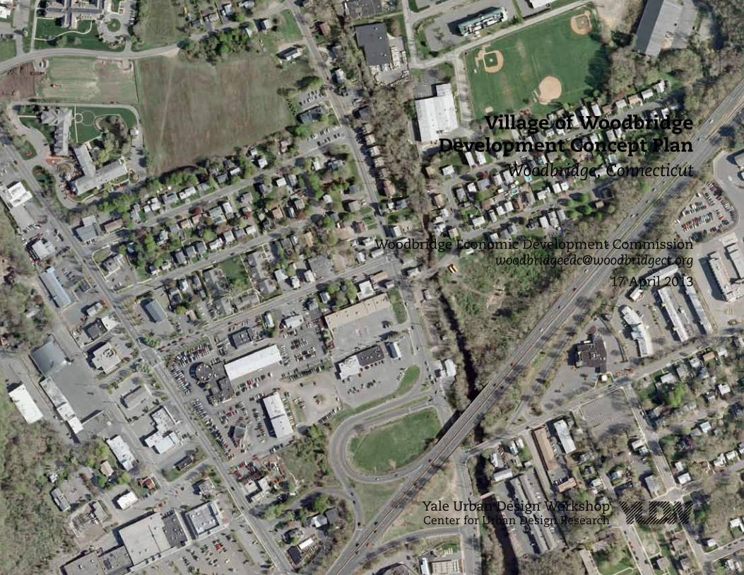
village of woodbridge development concept plan · woodbridge, connecticut village of woodbridge...
TRANSCRIPT
Yale Urban Design WorkshopCenter for Urban Design Research
17 April 2013
Woodbridge, Connecticut
Village of WoodbridgeDevelopment Concept Plan
Woodbridge Economic Development [email protected]

The Yale Urban Design Workshop is a community design center based at the Yale School of Architecture, providing urban design, planning and architectural consulting services to communities in the region.
Copyright ©2013 The Yale Urban Design Workshop / Yale School of Architecture, all rights reserved.
Yale Urban Design WorkshopYale School of ArchitectureBox 208242, 180 York StreetNew Haven, CT 06511
www.architecture.yale.edu/udw
Alan J. Plattus, DirectorAndrei Harwell, AIA, Project ManagerNicholas Caruso, Student Fellow
Woodbridge Economic Development [email protected]
Above: 1914 Map of the Woodbridge Gateway area

CONTENTS
Introduction ...............................................................................5
Overview and Executive Summary ........................................... 5
Principal Recommendations ..................................................... 7
Existing Conditions ...................................................................11
Issues and Opportunities ........................................................ 11
Precedents and Best Practices ..................................................15
Village Commercial Districts ................................................... 15
Nodes and Connections ............................................................19
Parking to Public Spaces ...........................................................23
Creating Local Identity ............................................................ 23
Streetscape and Sidewalk Improvements .................................29
Infill Development ....................................................................33
Wayfinding and Identity ...........................................................37
Management and Promotion ....................................................39
Business Map, Website, Special Services District .................... 39
Next Steps ................................................................................41
Appendix 1: Sidewalk Improvements ........................................43
Appendix 2: Memorandum on Interchange 59 ..........................45
Appendix 3: DOT Study .............................................................49
Route 15 Interchange 59 Deficiencies and Needs Study ......... 49
Acknowledgements ..................................................................51

4 Village of Woodbridge Woodbridge, Connecticut

5Introduction
Since 2008 the Yale Urban Design Workshop has been working with the Woodbridge Economic Development Commission and the Town of Woodbridge to develop strategies for the improvement and future development of the area to be known as the Village of Woodbridge. During this time the YUDW has attended Commission meetings and consulted with the Commission and Town officials not only on future plans for the Village, but also on current issues and projects as they have arisen. The YUDW has also met on several occasions with local business and property owners, making presentations on work in progress, as well as leading discussions of business development opportunities, such as an EDC website and the possibility of a Special Services District to serve businesses in the area. This report represents a broad summary of this work and discussion, emphasizing recommendations for both short-term improvements and long-range planning intended to develop and promote the Village as a lively, mixed-use, pedestrian friendly and attractive commercial and residential center serving Woodbridge and the region.
In many important respects, this report
builds upon and reinforces the Architectural Review Guidelines for the Woodbridge Village District adapted as part of the Town’s Zoning Regulations in 2006. The recommendation to establish the Village District is made in the Town’s current plan of Conservation and Development, adopted in 2003. Both of these documents envision an attractive, pedestrian friendly mixed-use district, with strong connections to the surrounding landscape, and while this report considers a somewhat larger area and broader agenda, driven by a primary focus on economic development, it is intended to complement and strengthen the good work and directions established by the Village District, and to form the basis of a cooperative effort on the part of the Economic Development Commission and the Town of Woodbridge Plan and Zoning Commission, which is charged with the administration of the Village District regulations, to create, proactively, a vibrant commercial area.
The Village of Woodbridge is the primary business district of the Town, with a high percentage of the Town’s commercial tax base, but also includes a significant amount
of residential development that effectively constitutes a loosely connected neighborhood straddling the Litchfield Turnpike (Route 69). While the main focus has been on improving the appearance and functionality of commercial development, these recommendations would also benefit the residential community by improving traffic flow and parking, strengthening the pedestrian network, and giving residents of the Village as well as visitors better access to businesses and services in the Village.
Historically the Village has had a fairly weak identity as an independent place, both with respect to the civic center and residential areas of Woodbridge, which are most people’s image of the Town, as well as with respect to the much more developed commercial areas along Amity Road in New Haven, just to the south. Going forward, the Village should develop more of its own identity as the “downtown” of Woodbridge, while taking better advantage of its close physical relationship with the large concentration of shopping in the adjacent areas of New Haven.
Overview and Executive Summary
INTrODuCTION

6 Village of Woodbridge Woodbridge, Connecticut
Street View. Artists rendition of what a reconfigured Selden Street might look like.

7Introduction
Many of the Village’s problems, as well as opportunities, as described in more detail below, are a result of its almost complete circumscription by the heavily trafficked regional corridors of the Wilbur Cross Parkway (Route 15), Amity Road (Route 63) and the Litchfield Turnpike (Route 69). Because of these mainly suburban corridors, the Village has developed mainly as an auto-oriented commercial area, characterized by strip-style retail, drive-through banks, automobile repair shops, and auto dealerships. Developing a more contemporary, pedestrian-friendly, Village will be, therefore, both a significant challenge and a huge opportunity, and will need to include the State, the owner and custodian of the main roads, as a major partner.
The principal recommendations of this study, described and illustrated in greater detail below, are as follows:
• Encourage the development of a lively, mixed-use, pedestrian friendly and attractive commercial and residential center serving
Woodbridge and the region. Support and enhance existing businesses and residential areas while encouraging appropriate and complementary new, expanded and infill development that contributes to local character, accessibility and a distinctive commercial mix.
• Develop policies and programs to create incentives for property owners to improve existing sites, facades, signage, etc., and, where appropriate, to add both commercial and residential space to existing properties in the interest of creating greater density to support the concept of a pedestrian-oriented mixed-use village.
• Encourage shared parking throughout the Village to take advantage of, and gradually reduce, the excessive amount of paved surface devoted to single-use parking and vehicular circulation, making new and existing parking areas more attractive and functional through careful planning, landscaping, lighting and signage.
• Comprehensively improve, extend
and connect the network of sidewalks and crosswalks in the Village to create a fully accessible pedestrian system, including improved signage and special treatment for sidewalks and crosswalks at key nodes and intersections. Wherever possible, include provision for bike routes as well, with signage and bicycle racks at strategic locations.
• Work with the DOT in the context of their current study of the intersection of Routes 15, 63 and 69 (Interchange 59) to ensure that all possible improvements to enhance safety and smooth flow of traffic are implemented in a timely manner, and that those improvements also enhance the quality of commercial and residential life in the Village of Woodbridge. Specific recommendations and details are included in Appendix 2.
• Pending the results of the DOT study, work towards improving the vehicular network throughout the Village, to better distribute traffic entering and exiting the Parkway, as well as through-traffic, especially local traffic. Ideally, the street network should function more as a differentiated grid, with major and
Principal Recommendations

8 Village of Woodbridge Woodbridge, Connecticut
Street View. Artists rendition of what a reconfigured Lucy Street / Route 69 intersection might look like.

9Introduction
minor streets, and local connectors which complement the regional arteries. In particular, there should be more and better local east-west connections in the Village, as well as improved connections to the areas east of Route 69 and the West River. These improvements should also extend and enhance pedestrian and bicycle connections within the Village, including recreational access to the West River corridor and West Rock trails.
• The first phase of streetscape and sidewalk improvements should focus on the Lucy and Bank Street and Selden Street corridors as the principal local and pedestrian framework for the future development and improvement of the Village, as noted above. Lucy Street and Bank Street should have improved sidewalks, landscaping, lighting and signage on both sides, connecting across Route 69 to the West River corridor and eastern areas of the Village, and across Route 63 to the Selden Avenue area, as well as north along Route 63 to Bradley Road. Selden Avenue and its commercial properties should be comprehensively improved over time as a miniature “Main Street” for the Village,
connecting better to the Amity Plaza Shopping Center in New Haven, providing curbs and sidewalks (or a “complete street” section), and encouraging new development and/or landscaping to make the eastern side of the street feel more like a front, rather than a back, as is currently the case.
• Underground all overhead utility lines whenever streetscape improvements are undertaken.
• Village signage (i.e. public signage) should be coordinated with the information and publicity program, and website, being developed for local businesses, while local businesses should be encouraged to develop appropriate and distinctive signage that matches their general presentation in advertising as well as architecture.
• Longer-term planning should consider the ultimate build-out of the Village as envisioned here, including possible redevelopment of the larger sites associated with automobile-related uses, the conversion of strip-style development to street-
oriented development, the addition of new developments such as the proposed 55 and over mixed-use project to be located on a portion of property contiguous to Litchfield Turnpike and Bradley Road, currently known as the “Woodbridge Village” project, and the eventual redevelopment of the Development District 2 business park area.
• Ongoing management strategies for the Village should be considered as an integral part of the plan, including the possibility of a Business Improvement District (BID) or Special Services District (SSD) that engages the local businesses in the management, promotion and marketing of the Village, including parking management, maintenance and clean-up, management of the website, and periodic review and updating of this plan.
• Establish a structure to facilitate ongoing cooperation and sharing of information between the Economic Development Commission and the Plan and Zoning Commission in the planning and development of the Village.

10 Village of Woodbridge Woodbridge, Connecticut
Sidewalk Conditions Survey. Existing sidewalks are disconnected, fracturing the pedestrian experience of the Village. Where sidewalks exist, they are often in poor condition.
Existing Streetscape. Signage in the Village is a jumble of types, scales, and styles, sidewalks don’t connect, and curb cuts are extremely wide and uncontrolled.
11Existing Conditions
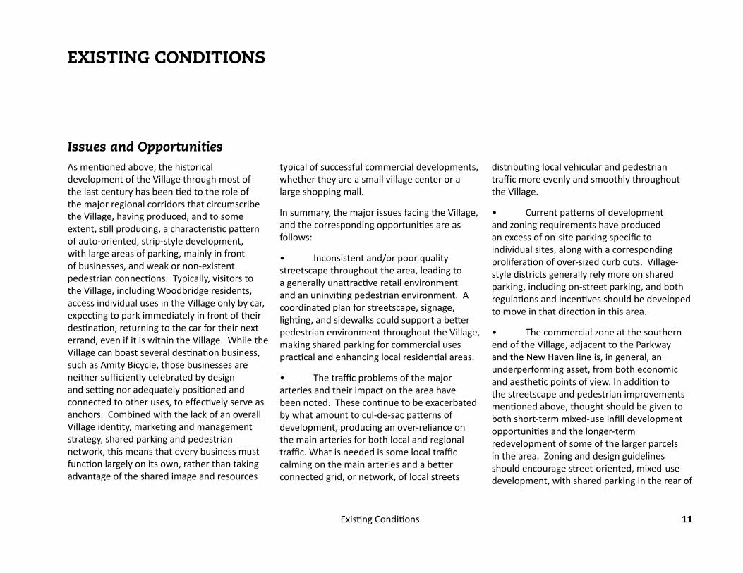
As mentioned above, the historical development of the Village through most of the last century has been tied to the role of the major regional corridors that circumscribe the Village, having produced, and to some extent, still producing, a characteristic pattern of auto-oriented, strip-style development, with large areas of parking, mainly in front of businesses, and weak or non-existent pedestrian connections. Typically, visitors to the Village, including Woodbridge residents, access individual uses in the Village only by car, expecting to park immediately in front of their destination, returning to the car for their next errand, even if it is within the Village. While the Village can boast several destination business, such as Amity Bicycle, those businesses are neither sufficiently celebrated by design and setting nor adequately positioned and connected to other uses, to effectively serve as anchors. Combined with the lack of an overall Village identity, marketing and management strategy, shared parking and pedestrian network, this means that every business must function largely on its own, rather than taking advantage of the shared image and resources
typical of successful commercial developments, whether they are a small village center or a large shopping mall.
In summary, the major issues facing the Village, and the corresponding opportunities are as follows:
• Inconsistent and/or poor quality streetscape throughout the area, leading to a generally unattractive retail environment and an uninviting pedestrian environment. A coordinated plan for streetscape, signage, lighting, and sidewalks could support a better pedestrian environment throughout the Village, making shared parking for commercial uses practical and enhancing local residential areas.
• The traffic problems of the major arteries and their impact on the area have been noted. These continue to be exacerbated by what amount to cul-de-sac patterns of development, producing an over-reliance on the main arteries for both local and regional traffic. What is needed is some local traffic calming on the main arteries and a better connected grid, or network, of local streets
distributing local vehicular and pedestrian traffic more evenly and smoothly throughout the Village.
• Current patterns of development and zoning requirements have produced an excess of on-site parking specific to individual sites, along with a corresponding proliferation of over-sized curb cuts. Village-style districts generally rely more on shared parking, including on-street parking, and both regulations and incentives should be developed to move in that direction in this area.
• The commercial zone at the southern end of the Village, adjacent to the Parkway and the New Haven line is, in general, an underperforming asset, from both economic and aesthetic points of view. In addition to the streetscape and pedestrian improvements mentioned above, thought should be given to both short-term mixed-use infill development opportunities and the longer-term redevelopment of some of the larger parcels in the area. Zoning and design guidelines should encourage street-oriented, mixed-use development, with shared parking in the rear of
Issues and Opportunities
ExISTINg CONDITIONS

12 Village of Woodbridge Woodbridge, Connecticut

13Existing Conditions
buildings. Options should be studied for a more comprehensive approach to planning, including new patterns of vehicular circulation to improve access and flow.
• The area currently zoned as Development District 2 to the east of Route 69 should be studied with an eye to future phased redevelopment. The area needs improved access and circulation and a comprehensive plan to encourage more intense and attractive use of what is, potentially, a spectacular site, looking north across the pond and flanked by the West River and West Rock. The entire area should take better advantage of these scenic assets, but the DD2 area, in particular, should be re-planned with respect to these features and access to Routes 15 and 69.
• Over time, auto-related uses and auto-oriented development should be replaced by a lively, mixed-use, commercial and residential village center for southern Woodbridge and the region. A range of appropriate examples within the region, such as West Hartford center, Branford center, and Westville Village, provide models of pedestrian-friendly development
of a scale and character to which this area of Woodbridge might aspire. New developments, such as the proposed Woodbridge Village active adult residential development may provide both an impetus and a standard, and should be fully integrated into the planning for this area.
• Finally, the recently discussed commitment of the State Department of Transportation to study and improve the intersections of Routes 15, 63, and 69 in this area represents a huge opportunity for Woodbridge to coordinate planning for the Village of Woodbridge with potentially significant infrastructure improvements. This particular opportunity should not be missed. Preliminary recommendations include several items that have been discussed in the context of this study, including a “new north-south connector road” inking Routes 63 and 69 and serving both the entrance and exit from Route 15 for southbound traffic. This link would go a long way towards rationalizing the traffic patterns in the Village especially if the new road is eventually connected to more continuous street grid providing the local circulatory framework for the Village.

14 Village of Woodbridge Woodbridge, Connecticut
Lively pedestrian, mixed use districts. Scenes from Westville, New Haven’s annual Art Walk festival.

15Precedents And Best Practices
While a section of the Village of Woodbridge is currently designated as a “village district” under Connecticut General Statutes, Title 8, Chapter 124, Section 8-2, these regulations are generally designed and intended to “protect the distinctive character, landscape, and historic structures within such districts.” Unfortunately, in the Village of Woodbridge there is relatively little to protect, except perhaps the local scale and dramatic views of the landscape, particularly the ridge of West Rock. While the architecture of recent developments within the Village has been in part shaped by the Village District regulations, which have encouraged a more or less traditional treatment, as well as mandating sidewalks, those developments and sidewalks are relatively isolated, acting as fragments of a coherent district, and sometimes still exhibit suburban-style planning practices, such as front yard parking, which detract from the pedestrian environment. In any case, the real issues facing the Village depend less on the architecture of individual developments or buildings, and much more on the overall relationships between buildings, the relationship of buildings to streets and streetscape, the continuity, appearance
and safety of the pedestrian environment, and the general sense of a distinctive place that can become a destination and a source of identity for businesses and local citizens. In fact, the State Statutes do speak to these issues, but generally in the context of preserving, connecting to, and extending existing patterns.
Insofar as the Plan and Zoning Commission is charged with the application of the Village District guidelines on a project-by-project basis, as proposed projects come before that body for review and approval, while the Economic Development Commission is concerned with the proactive promotion, recruitment and retention of businesses and supporting development in the Town, these bodies will need to work closely and cooperatively going forward. This will ensure that both comprehensive plans and individual projects are part of a coordinated agenda to shape the Village in the manner envisioned by the Village District regulations and this plan. Since the success of the Village is not (yet) primarily a matter of preserving existing character, but rather of creating opportunities and incentives for the ongoing development of the Village in accordance with a shared vision of the desired character and
performance, the three functions of planning, economic development and regulation must work in concert as the Town moves ahead.
Models of the sort of mixed-use retail environment that the recommendations of this report would seek to create are not difficult to find. Westville Village, just across the New Haven line, comes immediately to mind. And while it too is challenged by the central presence of Route 63 (Whalley Avenue) as its main corridor, with all the regional traffic carried by that corridor, Westville strikes a balance between traffic calming, pedestrian-oriented businesses, parking, and the usually lively congestion that is created by the narrowing of a major road and its necessary coexistence with a retail center. In recent years, as a participant in the Connecticut Main Street Center Program, Westville Village has moved towards an even greater density of mixed use development and walkability that has visibly improved commercial performance in the area.
Other commercial districts around the state, which often have a state road as their “main street,” illustrate a broad array of approaches and configurations that manage traffic and parking
Village Commercial Districts
PrECEDENTS aND BEST PraCTICES

16 Village of Woodbridge Woodbridge, Connecticut
Lively pedestrian, mixed use districts. West Hartford, above left, Blueback Square, Hartford, below left, and Niantic, above.

17Precedents And Best Practices
while creating a pedestrian friendly, distinctive and successful retail environment, often combined with existing and new residential development. West Hartford is a well-known example, both for its traditional role as an independent center to its own community and as a regional sub-center in relation to Hartford, and for the more recent development of Blue Back Square. Towns such as Middletown and Niantic, like Westville Village, have worked successfully with the Connecticut Main Street Program to strengthen local character as a vehicle for improving the performance of local retail and as a general economic development strategy.
What these examples have in common is a systematic and comprehensive approach to the often separated issues of streetscape, traffic and parking, retail and mixed-use development, as well as architecture. They often begin, however, with a more abstract understanding of the underlying structure and scale of the targeted area, and its relationship to regional networks.
Diagram illustrating the boundaries of the Village of Woodbridge Development Concept Plan study area and the Village District Statutory Boundary (as delineated in the Woodbridge Zoning Code, Section 11, Appendix 1)

18 Village of Woodbridge Woodbridge, Connecticut

19Nodes And Connections
For all its challenges, the Village of Woodbridge is strategically situated in a larger regional context, and is quite well-connected to that larger area, even though it is separated from the traditional center of the Town of Woodbridge, which is home to governmental, civic and religious institutions, monuments and public space, but no businesses. This separation is not unique, but it does create some special issues, and requires that the Village act in some respects as an extension to the Whalley Avenue commercial corridor, running from Downtown New Haven all the way to the Amity Shopping Center at the Woodbridge line.
In this context, the Village of Woodbridge should be seen as an important node, like the Broadway area in New Haven, largely owned and managed now by Yale University, the more diffuse Whalley Avenue Special Services District further to the west, Westville Village, and then the Amity node from the split of Routes 63 and 69 to the Wilbur Cross Parkway and the Woodbridge Line. This latter node ultimately encompasses the Village of Woodbridge as well, which nonetheless needs to have more of
its own identity while exploiting its adjacency to the major retail concentration to which it is adjacent. To some degree, this peculiar condition of being a subsidiary and relatively underdeveloped part of a larger node centered in another city, while wanting to become its own place and the retail and commercial hub of another town whose symbolic center is elsewhere, has held the Village back. Its image has been one of auto dealerships and repair shops, suburban-style development with drive-throughs and front yard parking, rather than a distinctive local center, with a healthy mix of residential development and therefore also a neighborhood center.
So while the Selden Street area, which is a strategic local parallel to the regional corridor of Route 63, should further exploit its almost invisible connection at its southern end to the Amity Shopping Center, it should also be designed and developed to cultivate its own distinctive character as a place, trading auto-oriented planning and an image of an alleyway vis-à-vis businesses fronting Route 63, for a positive pedestrian environment.
That transformation depends not only on a program of streetscape improvements, façade improvements, and eventually additional infill development; it also depends on strengthening the connections of the now relatively isolated Selden Avenue area to the rest of Village, primarily along Bank Street and Lucy Street. This connection would include important nodes at both Routes 63 and 69, where significant pedestrian improvements should occur, through the residential fabric between the two main regional corridors, where significant sidewalk improvements should occur, and ideally across Route 69 to the residential neighborhoods east of the West River, the almost completely isolated business park to the north, and the open space resources of the local ball fields and West Rock itself. From a structural and functional point of view, the T formed by Selden Avenue and Lucy Street (with Bank Street) should form the core and focus of a first campaign of streetscape and pedestrian improvements, along with a continuous sidewalk connection along the east side of Route 63 from the intersection of Lucy Street and Route 63 running north to Bradley Road.
NODES aND CONNECTIONS

20 Village of Woodbridge Woodbridge, Connecticut
Diagram of the Village of Woodbridge. This diagram illustrates the existing structure of the Village. The gray line indicates Route 15 / Wilbur Cross Parkway, the blue regional connections to New Haven and Woodbridge, and red indicates local roads.

21Nodes And Connections
More generally, this initial focus can provide an example of a broad approach to the fundamental structural and planning challenges of the Village: 1) the fact that it is mainly cut off, rather than served, by the important regional highway of the Wilbur Cross Parkway, which is both exited and entered in a confusing way that has the result of privileging connections east to New Haven rather than to Woodbridge and its Village (our recommendations with respect to this area are summarized in Appendix 2 below), 2) the design of the Route 63 and 69 corridors to favor through-traffic over the relationship to the Village, and 3) the relatively weak east-west connections along Lucy and Bradley Streets, which form very long blocks that end in regional corridors.

22 Village of Woodbridge Woodbridge, Connecticut
Palos Verdes Malagna Cove Plaza. Designed by Charles Cheney and laid out by Olmstead in the 1920’s, this shopping center creates an attractive public space from its parking areas through the integration of attractive facades and streetscape. Plan (facing page)
Selden Street. In this artists rendition, Selden Street Plaza is transformed through streetscape, including paving, greenery and signage, and through new facades.
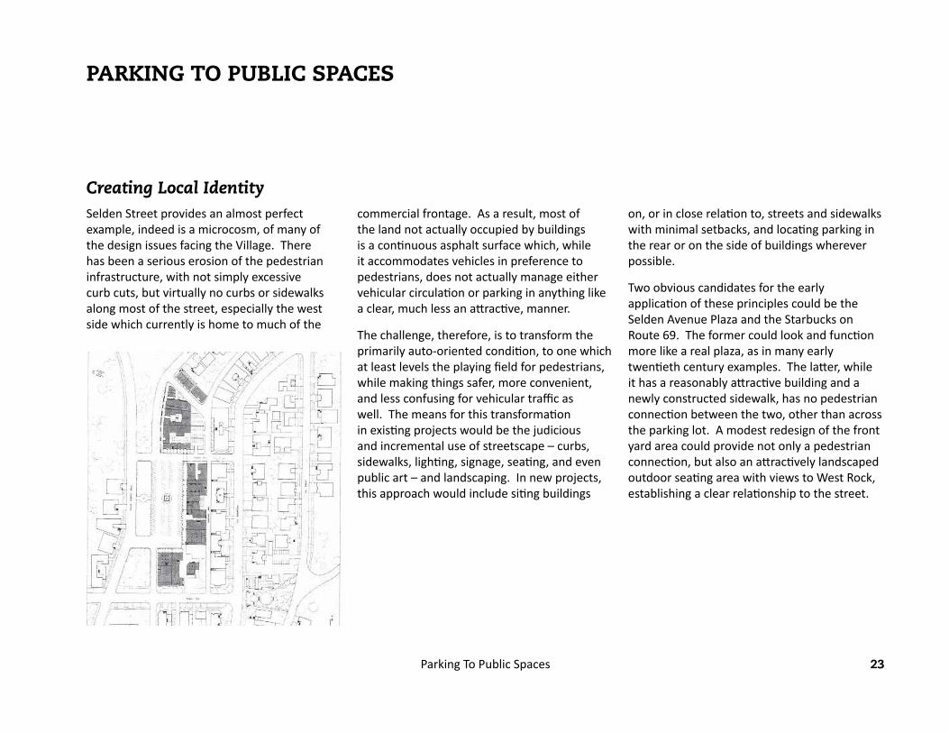
23Parking To Public Spaces
Selden Street provides an almost perfect example, indeed is a microcosm, of many of the design issues facing the Village. There has been a serious erosion of the pedestrian infrastructure, with not simply excessive curb cuts, but virtually no curbs or sidewalks along most of the street, especially the west side which currently is home to much of the
commercial frontage. As a result, most of the land not actually occupied by buildings is a continuous asphalt surface which, while it accommodates vehicles in preference to pedestrians, does not actually manage either vehicular circulation or parking in anything like a clear, much less an attractive, manner.
The challenge, therefore, is to transform the primarily auto-oriented condition, to one which at least levels the playing field for pedestrians, while making things safer, more convenient, and less confusing for vehicular traffic as well. The means for this transformation in existing projects would be the judicious and incremental use of streetscape – curbs, sidewalks, lighting, signage, seating, and even public art – and landscaping. In new projects, this approach would include siting buildings
on, or in close relation to, streets and sidewalks with minimal setbacks, and locating parking in the rear or on the side of buildings wherever possible.
Two obvious candidates for the early application of these principles could be the Selden Avenue Plaza and the Starbucks on Route 69. The former could look and function more like a real plaza, as in many early twentieth century examples. The latter, while it has a reasonably attractive building and a newly constructed sidewalk, has no pedestrian connection between the two, other than across the parking lot. A modest redesign of the front yard area could provide not only a pedestrian connection, but also an attractively landscaped outdoor seating area with views to West Rock, establishing a clear relationship to the street.
Creating Local Identity
ParkINg TO PuBlIC SPaCES

24 Village of Woodbridge Woodbridge, Connecticut
Transformation of Selden Street Plaza. Existing Aerial (above, right), Proposed plan (above center), Phased Implementation (right).

25Parking To Public Spaces

26 Village of Woodbridge Woodbridge, Connecticut
Proposed changes at Wilbur Cross ramp / Route 69 area including adjacent strip centers with new connector street proposed by CTDOT (plan, left)
Improvements around Starbuck’s with new landscaping and outdoor seating area. Artist’s view of phased construction (above and right)

27Parking To Public Spaces

28 Village of Woodbridge Woodbridge, Connecticut

29Streetscape And Sidewalk Improvements
In principle, the Village of Woodbridge should be a thoroughly walkable area given its scale and mix of uses. In good weather, residents and visitors should be comfortable parking their cars once and walking to multiple destinations, or taking a bus from New Haven to a stop on Route 63 and walking to destinations in at least the southeastern section of the Village. In practice, this behavior and the environment it would foster are disrupted by a poorly constructed and maintained , and often simply discontinuous and interrupted system of sidewalks and crosswalks that sometimes lead nowhere.
The goal of streetscape and sidewalk improvements throughout the Village is ultimately to create a continuous pedestrian
network of attractive and accessible sidewalks and public spaces. This should be incrementally developed, as resources are available, either directly for such improvements, or as part of individual development projects or road improvements. The first phase of these improvements is outlined in Appendix 1 below.
In the development of this pedestrian network it is important to establish and maintain reasonably consistent standards for sidewalk treatment and dimension, as well as lighting, signage, street trees and plantings, and other streetscape elements. Crosswalks, in particular, should be given distinctive and special treatment, with appropriate signage and controls, to encourage and protect pedestrians,
including raised intersections at key nodes.
In addition, serious consideration should be given to accommodating bicycle circulation and accessibility in the Village. Striping and signage for bicycle lanes, as well as bike racks at businesses and other key locations should be part of this program.
STrEETSCaPE aND SIDEWalk ImPrOVEmENTS
Phase 1 New / Repaired Sidewalks. The map (far left) illustrates where new sidewalks could extend and enhance the existing network. Selden Street has no sidewalks and in some places is a continuous curb cut (facing, top photo). Examples of streetscape in Branford and Madison. (facing, below).
Streetscape Improvements. Textured crosswalk in Middletown (right) and examples of bike accommodations including racks and bike lanes (far right).

30 Village of Woodbridge Woodbridge, Connecticut
Transformation of Lucy Street and Route 69 Intersection. The existing intersection is dangerous and unpleasant for pedestrians (above), Phasing (right) and final reconfigured intersection, with new signage, better crosswalks, streetscape improvements, underground utilities, and infill development.

31Streetscape And Sidewalk Improvements

32 Village of Woodbridge Woodbridge, Connecticut
Mixed Use Infill Examples. Top: A Walgreen’s in Hollywood with residential units above. Below: residential and commercial over retail in San Jose, California. Above: mixed use buildings in Blueback Square, Hartford.

33Infill Development
INfIll DEVElOPmENT
In order to support the pedestrian-oriented, modestly dense, mixed-use commercial center and residential neighborhood that is characteristic of successful village centers around the country, Woodbridge needs to encourage over time both infill development and new development that will move the Village away from the current pattern of disconnected suburban style, auto-oriented development. The recommendations in this area fall within the jurisdiction of Planning and Zoning, and therefore will require a collaborative effort on the part of the Economic Development Commission, Planning and Zoning, as well as merchants, residents and property owners in the Village.
There are important opportunities for new infill building and reconfiguration of underperforming, strip-style commercial sites,
that should have the effect of making them more attractive and pedestrian-friendly, while also increasing their commercial performance and contribution to the overall character of the Village.
Infill development should include not only new building on undeveloped and underdeveloped parcels, but also the selective densification of key sites, especially those adjacent to significant nodes. This might include the addition of one or more stories to existing one-story development, where feasible, as well as selective demolition and rebuilding to accommodate mixed-use at higher densities as a stimulus to pedestrian activity. In general, the addition of upper floor apartments above retail is a tested way to increase activity and value in a village center.
Woodbridge should consider adjusting or amending existing regulations to accommodate, and provide incentives for, this sort of mixed-use infill development within the Village. The Town may want to consider a form-based zoning code for the Village, such as been implemented in Hamden. In particular, requirements for on-site parking often make it difficult to realize even modestly increased density and mixed-use as of right currently. Therefore, consideration should be given to shared parking, as it has been employed in town center areas such as Ridgefield, based on differing times of peak use, as well as targeting areas with significant amounts of currently under-utilized parking for more intensive use.
“T” Plan Phased Redevelopment. The following sequence of plans illustrates how the Village might be transformed through a series of phases.

34 Village of Woodbridge Woodbridge, Connecticut
“T” Plan Phase 1. Streetscape along Lucy Street and Selden Street are improved with continuous sidewalks, street trees, and signage, Intersections at Whalley Avenue and Route 69 are also improved.

35Infill Development
“T” Plan Phase 2. Mixed-use infill and Development along Selden Street and in Selden Plaza reinforce it’s identity as a pedestrian zone and not an alley, while giving it a commercial character and providing additional housing units in the district. Infill on Lucy Street better defines corners and creates the character of a lively area.

36 Village of Woodbridge Woodbridge, Connecticut
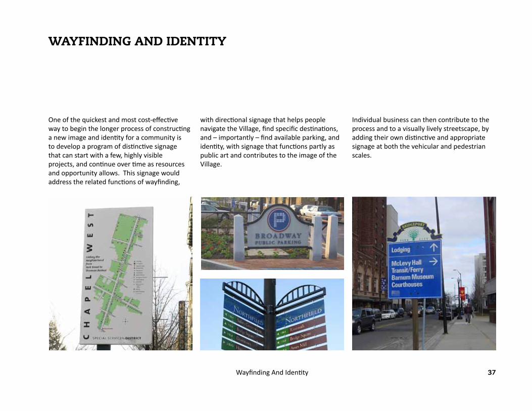
Woodbridge Signage. Above: Design for coordinated signage for the Village takes advantage of local landmarks to create an identity for the Village. Right: examples of business signage that contributes to neighborhood identity. Facing Page: Examples of a variety of urban signs from New Haven, Bridgeport, and Northfield.
37Wayfinding And Identity
One of the quickest and most cost-effective way to begin the longer process of constructing a new image and identity for a community is to develop a program of distinctive signage that can start with a few, highly visible projects, and continue over time as resources and opportunity allows. This signage would address the related functions of wayfinding,
with directional signage that helps people navigate the Village, find specific destinations, and – importantly – find available parking, and identity, with signage that functions partly as public art and contributes to the image of the Village.
Individual business can then contribute to the process and to a visually lively streetscape, by adding their own distinctive and appropriate signage at both the vehicular and pedestrian scales.
WayfINDINg aND IDENTITy

38 Village of Woodbridge Woodbridge, Connecticut
Programmed Events. Top: Wooster Square Farmers Market, New Haven. Middle: Windsor Farmers Market. Bottom: Art Walk, Westville, New Haven.
Woodbridge Business Map. (left)
Business Maps. (Facing Page) Maps from Chestertown, MD and George Town, Grand Cayman Island

39Management And Promotion
Some of the issues facing the Village will be best solved by a combination of design and management. Indeed, better collective management of parking, publicity and promotion are in some respects a necessary preliminary to investing in the design improvements recommended. Then good management will be needed on an ongoing basis to maintain and sustain the improvements.
The appropriate vehicle for the local management of the Village might be a partnership of the Town of Woodbridge and a local merchant’s association, ideally a Special Services District (SSD) as authorized in Connecticut General Statutes, Chapter 105a. Local examples of such a SSD include
the Chapel West SSD and the Whalley Avenue (SSD) in New Haven, as well as several others around the state that operate in local village or neighborhood centers, as opposed to full scale downtowns. In addition to the daily tasks associated with maintenance and beautification, these groups can help to professionalize, coordinate, and keep up to date the promotional and advertising functions of a district.
In particular, it is recommended that the Woodbridge Economic Development Commission and the Village of Woodbridge establish and maintain a website, with an on-line business directory, and a coordinated business map of the Village, in both interactive digital format as well as paper and other hard
copy formats. This business map could also be a distinctive piece of signage in either banner or conventional signage formats. The job of distributing and updating this database in its various formats would be a regular task for the custodian of the website to insure fresh content and up-to-date information.
Another task might be the programming of events that attract people to the Village, to local businesses, or just attract attention. This is an important aspect of managing and promoting a lively commercial Village. Events which are usually focused on the traditional town center of Woodbridge might also occasionally visit the Village, which could also promote successful new events in its own right. Events such as the annual Westville Village Arts Walk can interact with and promote arts and crafts oriented businesses, and the numerous farmers markets in neighborhood and town centers, such as Wooster Square in New Haven or the Green in Windsor, can powerfully reinforce the food and entertainment sector. There should also be a place for concerts, walks and bicycle rides in good weather, that bring people and publicity to the Village.
Business Map, Website, Special Services District
maNagEmENT aND PrOmOTION

40 Village of Woodbridge Woodbridge, Connecticut
Short-term (1-2 years):• Establish a Woodbridge Business Special Services District, or similar association to manage, maintain and promote the Village and its businesses.
• Develop a plan for shared parking to be managed collectively by the Town of Woodbridge and the Village SSD.
• Develop a website for the Village, with an on-line business directory and map.
• Establish a structure to facilitate ongoing cooperation and sharing of information between the Economic Development Commission and the Plan and Zoning Commission in the planning and development of the Village.
• Maintain close and continuous coordination through the Economic Development Commission, Planning and Zoning and the Woodbridge Traffic Commission with the DOT study, with respect not only to large scale planning issues such as the location and configuration of ramps and intersections, but also the relevant details of landscape, lighting and signage.
• Design one or more public installations of the business map at strategic locations in the Village.
• Proceed with the implement the program of sidewalk construction as outlined in Appendix 1 below, in order to establish a continuous pedestrian network throughout the Village. Underground overhead utility lines whenever undertaking streetscape improvements.
Mid-term (2-4 years):• Complete a comprehensive program of sidewalk construction and improvement, with crosswalks and associated streetscape elements to establish a continuous pedestrian network throughout the Village. Underground overhead utility lines whenever undertaking streetscape improvements.
• Develop and implement a bike lane system within the Village, including signage and bike racks.
• Develop a façade and landscape improvement program with matching funds to encourage property owners to improve facades, parking and pedestrian areas, signage and landscaping at their businesses.
• Focus on the T formed by Selden Street and Bank Street continuing along Lucy Street to Route 69, as well as the connection north along Route 63 to Bradley Road, with the goal of giving Selden Street and the Intersection of Lucy and Route 69 a more local Main Street character.
• Work with Connecticut DOT to plan the needed improvements to Interchange 59 on the Wilbur Cross Parkway and adjacent sections of Routes 63 and 69, as discussed in Appendix 2 below.
• Working with Planning and Zoning, develop a zoning overlay for the Village that encourages infill development and redevelopment of underdeveloped and under-performing sites, with higher density mixed-use development as illustrated in this report, aiming to make two to three story buildings with retail ground floors and office or residential above, street and pedestrian oriented with minimal setbacks and rear parking the norm for new development in the Village.
Long-term (4-10 years):• Plan for the eventual improvement and redevelopment of large sites within the Village to be more compatible with the concept of a Village Center as discussed and illustrated in this report.
• Implement major improvements to the vehicular network within the Village in concert with DOT improvements to Interchange 59, to establish a well-functioning vehicular grid of local and regional streets.
NExT STEPS

41Next Steps
This Plan is intended to be used as a framework and guide for ongoing planning, improvement and development of the Village. In the section that follows, projects discussed in the body of the report are organized according to priority and phasing. While most of the recommendations of the report have long-term implications in terms of funding, maintenance and management, some projects, due to their scale, complexity and expense may take years to develop. In the meantime, it is extremely important to identify short-term projects that can translate the energy and concerns
of the planning process into immediate and visible action. While these short-term project are intended to address, if not resolve, real issues, they have over-riding importance as momentum builders and as a demonstration of the commitment of the Economic Development Commission and residents to working towards their goals.
In order to monitor and maintain progress towards the realization of this plan and its recommendations, and to keep the Plan current and fresh by continuing the discussion and the
planning process, it is recommended that the Economic Development Commission establish a Planning Sub-Committee to liaise and work with the Plan and Zoning Commission and to be the custodian and executor of this Plan, and to revisit and update its recommendations periodically, with a comprehensive review and revision no later than 5 years from the adoption of this Plan. Of course any of these phased recommendations can change places in line, as circumstances, needs and opportunities arise.
NExT STEPS

42 Village of Woodbridge Woodbridge, Connecticut

43Appendix 1: Sidewalk Improvements
Phase I (Revised 5.18.2011)
Standard concrete sidewalks – 5’-6’ width@$110.00 per linear foot including granite curb and gutter
Sidewalk corners with curb ramps@$2,500.00 per corner
Crosswalk striping to international standards$300.00 per crosswalk
Section 1:East side of Amity Road from Bradley Road to Lucy Street (in design)800 feetCrosswalk at Lucy Street
Section 2:North side of Bank Street from Selden Street to Amity Road210 feet ($23,100)2 corners ($5,000.00)Crosswalk at Selden Street ($300.00)
Section 3:North side of Lucy Street from Amity Road to Litchfield Turnpike630 feet (not including existing sections in satisfactory condition) ($69,300.00)2 corners ($5,000.00)Crosswalk at Amity Road ($300.00)Crosswalks at Litchfield Turnpike ($300.00)
Section 4:West side of Amity Road north to Landin Street515 feet ($56,650.00)
Total for Phase I improvements (not including Section 1, or lighting and signage): $159,650.00
aPPENDIx 1: SIDEWalk ImPrOVEmENTS

44 Village of Woodbridge Woodbridge, Connecticut

45Appendix 2: Memorandum On Interchange 59
To: Woodbridge Economic Development CommissionFrom: Alan J. Plattus, Director Yale Urban Design WorkshopDate: June 16, 2009Re: Proposed DOT Study of Route 15 Interchange 59, Routes 69 and 63
Given the extraordinary importance of this intersection for the performance and appearance of the entire Woodbridge Business District, the Economic Development Commission would propose the following issues for attention and consideration as part of the proposed study, in addition to the overriding issues of safety and improved traffic flow that are already highlighted in the proposed DOT Scope of Services:• Route 15 and Interchange 59, with its ramps, landscaping, lighting and signage, are a critical part of this major gateway to the whole Town of Woodbridge and its principal commercial district, and the Commission urges that appropriate consideration be given to the ways in which improvements to the safety and flow of traffic in the area can also contribute to a sense of local arrival and identity, as well as the enhancement of both the function and aesthetics of this important mixed-use district as it develops.• To this end, the Commission suggests that there be close and continuous coordination between their ongoing design and economic development study of the area and the proposed DOT study, with respect not only to large scale planning issues such as the location and configuration of ramps and intersections, but also the relevant details of
landscape, lighting and signage, so that those aspects of any proposed improvements both satisfy DOT requirements and are compatible with standards for local streetscape being developed through the EDC study.• The configuration, alignments and points of connection of highway ramps to the local street network are vital to the proper functioning of that network for local vehicular and pedestrian traffic, as well as for vehicular traffic entering and exiting Route 15. Currently, the configuration of both Interchange 59 and the local street network conspire to create a situation that is far from ideal for both local commercial and residential traffic and regional traffic, and even more discouraging for pedestrians. In particular, north-south traffic, whether regional or local, moves almost exclusively on Routes 69 and 63, while east-west traffic is badly served by a non-hierarchical and poorly aligned set of local streets.• With respect to pedestrians, there is no consistent or continuous network of coordinated and comprehensively designed sidewalks, pathways and crosswalks. Improvements in this area, with the goal of supporting both local business development and quality of residential life and access will again require close coordination of DOT and local planning and design standards. We recognize that it is not common to have a major limited access highway interchange so thoroughly implicated and enmeshed with a local neighborhood and small-scale commercial district, but this is the case in this area and improvements should be sensitive to the need for greater compatibility with both auto-oriented and pedestrian-oriented uses and patterns. Furthermore, a more pedestrian-friendly environment could have the long-term result of
aPPENDIx 2: mEmOraNDum ON INTErChaNgE 59

46 Village of Woodbridge Woodbridge, Connecticut

47Appendix 2: Memorandum On Interchange 59
reducing local vehicular trips, even as development intensifies.• Attention should be paid to the flow of traffic on both Routes 69 and 63, particularly southbound flow into the Gateway District, which, in distinction to northbound flow from New Haven, has very few required stops and little of the sort of traffic calming appropriate for regional traffic moving through local commercial areas, until it actually arrives at the highway ramp intersections, where it then tends to back up.• Drainage and storm water management issues in this area present an opportunity to use grading and landscaping in a more innovative and attractive way to address these issues.• Consideration should be given to plans for a new bridge across the West River and the potential rationalization of the Merritt Street-Lucy Street alignment in connection with that project. In general, there is a need for improved access to the area east of Route 69.• In addition to and/or as part of the Stakeholder and Public Meetings outlined in the proposed DOT Scope of Services, provision should be made for discussions and working sessions to coordinate with the ongoing EDC Gateway District study, as suggested above.• Consideration should also be given to the new level of mixed-use development under consideration by the EDC study and its implications not only for vehicular trip-generation, but also for future use of public transit in the area, as well as pedestrian and bicycle alternatives to local vehicular trips.
The goal of these suggestions is not to burden unduly the proposed DOT study with distracting or irrelevant additional issues, and certainly not to deflect the study from its legitimate focus on improved safety and traffic flow, but rather to take advantage of the opportunity afforded by the study and potential improvements to further the related goals of enhanced economic performance, appearance and general quality of life that the EDC has articulated for this area. The Commission fully endorses the DOT proposal “that the entire area should be studied as a whole, rather than as individual locations.” This could then be a prime case of the sort of win-win planning associated with smart-growth and new development models, where instead of the demands of traffic and more intense mixed-use development being pitted against each other, they can not only coexist, but even contribute to a comprehensive solution.

48 Village of Woodbridge Woodbridge, Connecticut

49Appendix 3: Dot Study
The full text of the attached study and supporting documents may also be found online at www.exit59study.com.
Route 15 Interchange 59 Deficiencies and Needs Study
aPPENDIx 3: DOT STuDy

50 Village of Woodbridge Woodbridge, Connecticut

51Acknowledgements
Woodbridge Economic Development Commission
Jody P. Ellant, Chair
Paul Rossi, Vice-Chair
Mica Cardozo
Roger M. Harrison
Garett Luciani
Herbert Mendelsohn
Robert Ritchie
Diane Urbano
Barry M. Wolff
aCkNOWlEDgEmENTS
Yale Urban Design Workshop
Alan Plattus, Director
Andrei Harwell
Nicholas Caruso