washington volcanic ash advisory center€¦ · washington volcanic ash advisory center ... goes,...
TRANSCRIPT
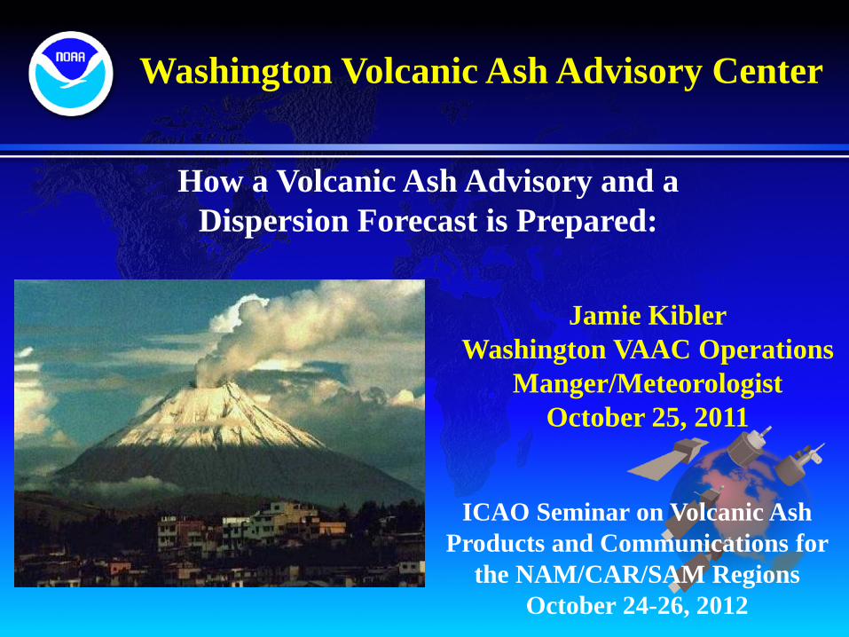
Washington Volcanic Ash Advisory Center
How a Volcanic Ash Advisory and a Dispersion Forecast is Prepared:
Jamie Kibler Washington VAAC Operations
Manger/Meteorologist October 25, 2011
ICAO Seminar on Volcanic Ash Products and Communications for
the NAM/CAR/SAM Regions October 24-26, 2012

Many costly and life-threatening encounters of aircraft with airborne ash
clouds and airport disruptions have occurred over the decades
Eruption warnings, ash-cloud tracking, and education have prevented disasters
Quito, 2002
Chaitén, 3 May 2008
Washington Volcanic Ash Advisory Center

Washington Volcanic Ash Advisory Center
• Advising airlines to avoid flying through ash clouds - Ash is severely abrasive to sensitive jet engine parts
- Volcanic ash melts and consolidates on essential aviation parts
- Can lead to erroneous readings and potential engine failure
Left: Damage done to windscreen of a plane that
encountered ash. It is nearly opaque.
Right: Damage done to grounded plane. Not only did
the ash weigh down the plane, but it also did heavy structural damage, as well

Washington Volcanic Ash Advisory Center
What does the Washington VAAC use/need to disseminate a
Volcanic Ash Advisory

Washington VAAC
GOES, POES, MTSAT
& Meteosat IR GOES & POES CIRA products
MODIS AQUA-TERRA
GOES PCI (Principle Component
Image )
GOES, POES, MTSAT + Meteosat Visible
GOES & POES Ellrod
Product
GOES, POES & MTSAT Channel
Differencing Product
Satellite Imagery
GOES, POES, MTSAT
& Meteosat shortwave IR Overlays
Boundaries – Countries, Airspaces
Winds – Cloud motion, models, soundings , and
streamlines
Volcano locations
HYSPLIT model output
Washington Volcanic Ash Advisory Center
Satellite Imagery – very important piece to the puzzle
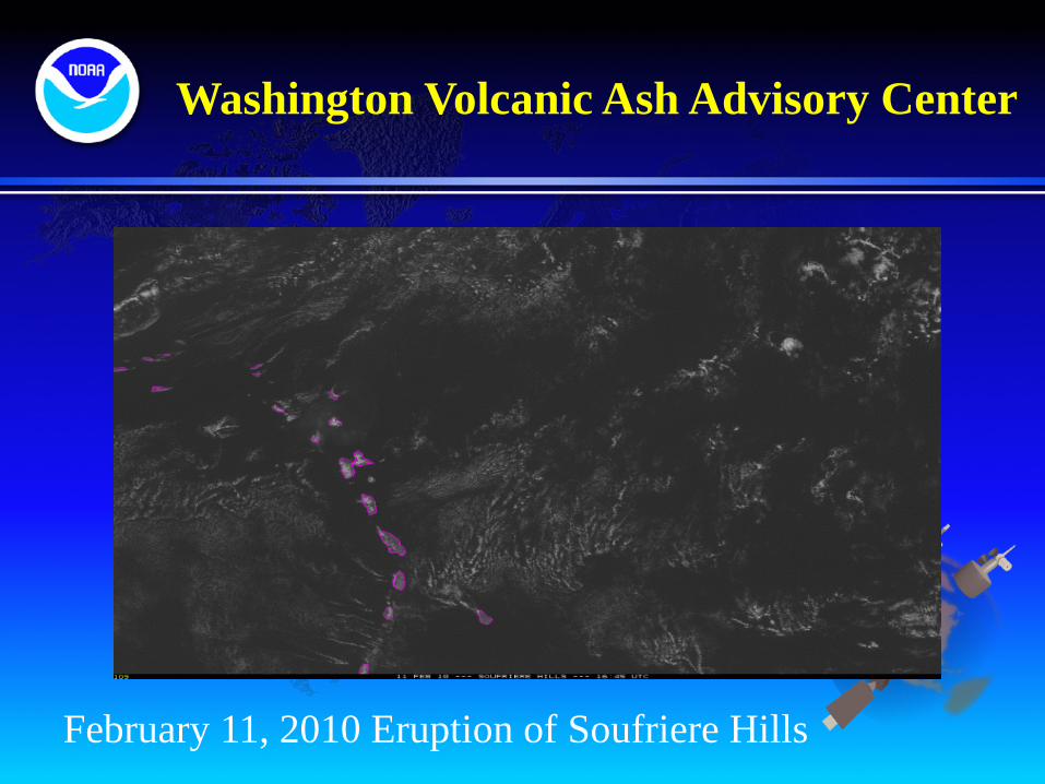
Washington Volcanic Ash Advisory Center
February 11, 2010 Eruption of Soufriere Hills
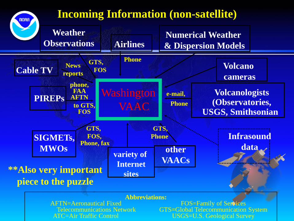
Washington VAAC
Airlines
Cable TV Phone
News reports
e-mail,
variety of Internet
sites
SIGMETs, MWOs
GTS, FOS,
phone,FAA
AFTN PIREPs
Weather Observations
GTS, FOS
AFTN=Aeronautical Fixed Telecommunications Network
ATC=Air Traffic Control
other VAACs
Phone
GTS, Phone
to GTS, FOS
Phone, fax
FOS=Family of Services GTS=Global Telecommunication System
USGS=U.S. Geological Survey
Abbreviations:
Volcanologists (Observatories,
USGS, Smithsonian)
Incoming Information (non-satellite)
Volcano cameras
Infrasound data
Numerical Weather & Dispersion Models
**Also very important piece to the puzzle

Washington Volcanic Ash Advisory Center
WVMX31 MMEX 100413 MMEX SIGMET 3 VALID 100413/101013 MMEX MEXICO FIR/UIR/SRR VA POPOCATEPETL 01901.2N 09837.2W OBS AT 100402Z VERTICAL CLD VA UP TO FL200 FM SUMMIT EXTD 5NM W BTW FL180 FL200 MOV W 10KT. WKN. OUTLK DISSIPATED AT 100500Z= VAAC received informacion from MWO
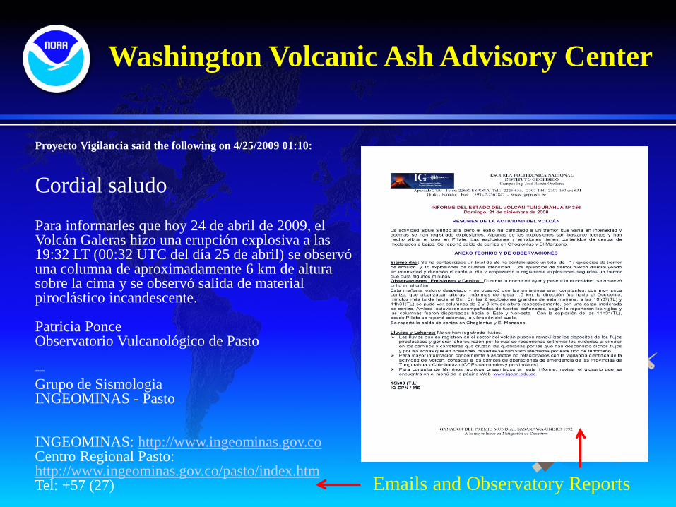
Washington Volcanic Ash Advisory Center
Proyecto Vigilancia said the following on 4/25/2009 01:10: Cordial saludo Para informarles que hoy 24 de abril de 2009, el Volcán Galeras hizo una erupción explosiva a las 19:32 LT (00:32 UTC del día 25 de abril) se observó una columna de aproximadamente 6 km de altura sobre la cima y se observó salida de material piroclástico incandescente. Patricia Ponce Observatorio Vulcanológico de Pasto -- Grupo de Sismologia INGEOMINAS - Pasto INGEOMINAS: http://www.ingeominas.gov.co Centro Regional Pasto: http://www.ingeominas.gov.co/pasto/index.htm Tel: +57 (27) Emails and Observatory Reports

VOLCANIC ASH ALERTS
SIGMET NOTAM
Call to MWO
PIREPS
Instituto Geofisico
Guayaquil MWO
Avi
ati
on c
omm
uni
ty
Washington VAAC
Simplified volcano warning
information flow to aviation
in Ecuador
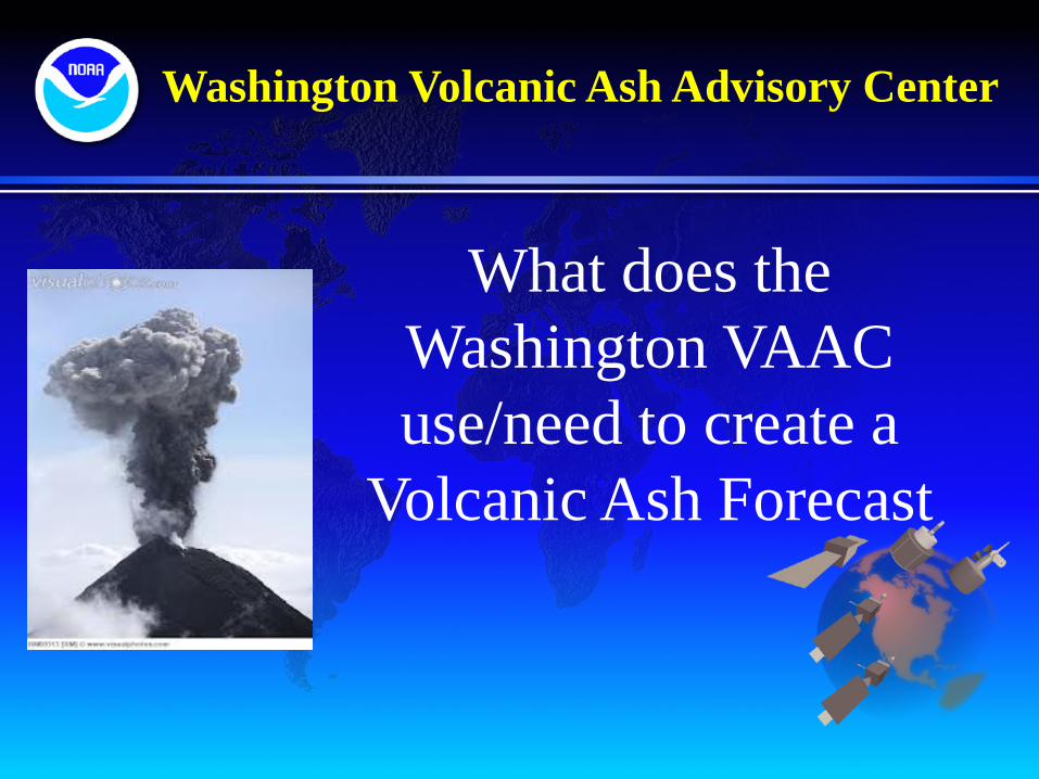
What does the Washington VAAC use/need to create a
Volcanic Ash Forecast
Washington Volcanic Ash Advisory Center

Washington Volcanic Ash Advisory Center
HYSPLIT Forecast Step 1 The Washington VAAC provides volcanic ash information to
the NCEP Senior Duty Meteorologist to run the Forecast Model Information provided is:
• Location of the Volcano • Eruption time • Eruption duration • Estimated height of volcanic ash
Information is fed into the HYSPLIT model with the GFS or NAM model used for meteorological conditions.
Running the HYSPLIT Model
Washington Volcanic Ash Advisory Center
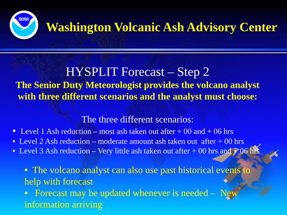
HYSPLIT Forecast – Step 2 The Senior Duty Meteorologist provides the volcano analyst with three different scenarios and the analyst must choose:
The three different scenarios:
• Level 1 Ash reduction – most ash taken out after + 00 and + 06 hrs • Level 2 Ash reduction – moderate amount ash taken out after + 00 hrs • Level 3 Ash reduction – Very little ash taken out after + 00 hrs and + 06 hrs
• The volcano analyst can also use past historical events to help with forecast • Forecast may be updated whenever is needed – New information arriving
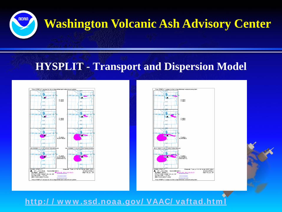
HYSPLIT - Transport and Dispersion Model
http://www.ssd.noaa.gov/VAAC/vaftad.html
Washington Volcanic Ash Advisory Center

HYSPLIT Model (1hr and 2hr time steps)

Washington Volcanic Ash Advisory Center
NCEP Advanced Weather Interactive Processing System (N-AWIPS)

Washington VAAC Website:
Washington Volcanic Ash Advisory Center
http://www.ospo.noaa.gov/Products/atmosphere/vaac/index.htm
Washington Volcanic Ash Advisory Center
Thanks! Any Questions
Jamie [email protected]
Washington VAAC Email and Telephone [email protected]
301-683-1401