web mapping applications with arcgis server: case studies 4 th annual gis symposium and workshop...
Post on 21-Dec-2015
227 views
TRANSCRIPT

Web Mapping Applications with ArcGIS Server:
Case Studies
4th Annual GIS Symposium and Workshop
Kevin Stewart
Web Mapping Applications with ArcGIS Server:
Case Studies
4th Annual GIS Symposium and Workshop
Kevin Stewart

IntroductionWho we are… The Basics
• A professional services firm that helps organizations:– Turn data into insight– Derive maximum value from their ESRI investments
• Founded in 1991
• Headquartered in Birmingham, AL– Staff in: CA, VA, AZ, SC, MS– Global execution
• Strong ESRI Business Partner– One of the first, founded by ex-ESRI employee– “Trusted Partner”– Award Winning
• Certified Small Business (SBA)
• GSA Schedule (GS-35F-0682R)
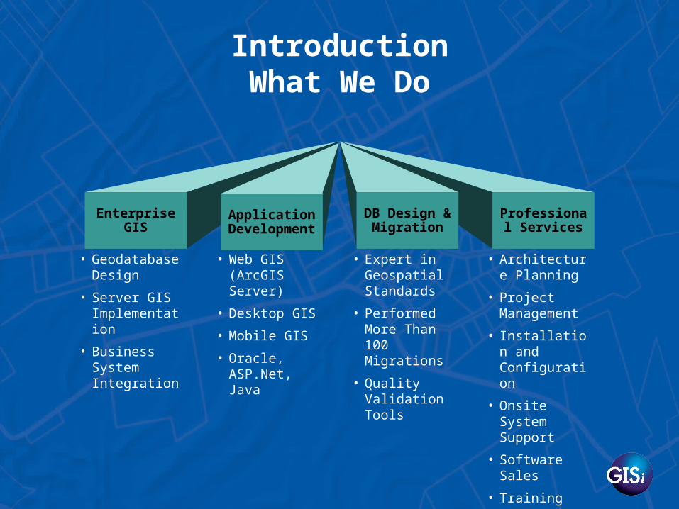
IntroductionWhat We Do
Application Development
Enterprise GIS
DB Design & Migration
Professional Services
• Geodatabase Design
• Server GIS Implementation
• Business System Integration
• Web GIS (ArcGIS Server)
• Desktop GIS
• Mobile GIS
• Oracle, ASP.Net, Java
• Expert in Geospatial Standards
• Performed More Than 100 Migrations
• Quality Validation Tools
• Architecture Planning
• Project Management
• Installation and Configuration
• Onsite System Support
• Software Sales
• Training

IntroductionServer GIS… What is it?
Graphic courtesy of ESRI

Case Studies
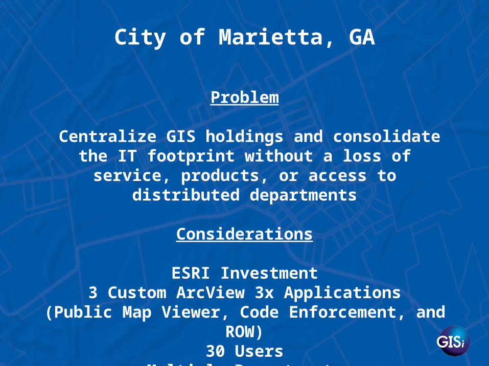
Problem
Centralize GIS holdings and consolidate the IT footprint without a loss of service, products, or
access to distributed departments
Considerations
ESRI Investment3 Custom ArcView 3x Applications
(Public Map Viewer, Code Enforcement, and ROW)30 Users
Multiple DepartmentsScripted Shapefile Updates
City of Marietta, GA
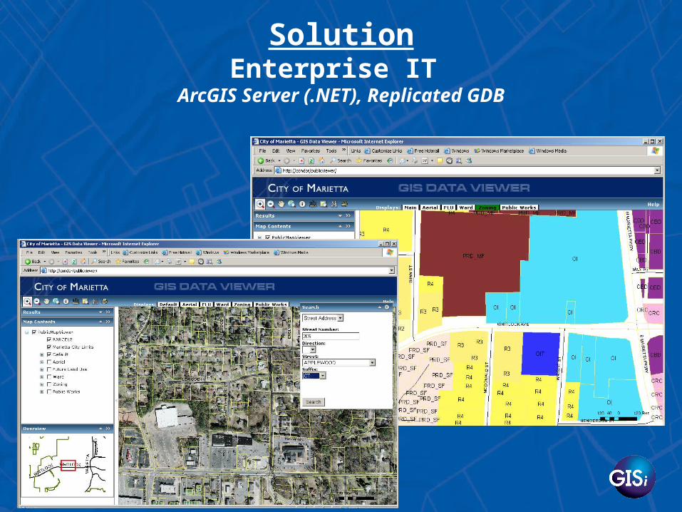
SolutionEnterprise IT
ArcGIS Server (.NET), Replicated GDB

The Right Fit…
•25% reduction in maintenance costs
•Reduced downtime for Public facing map viewer
•Admin & IT Footprint consolidation
•Training & Support
Problem
Provide mapping to city decision makers and residents via the internet at a low cost and without a
robust IT infrastructure
Considerations
ESRI InvestmentNo current web mapping application
No current web infrastructure Minimal funding for hardware/software
City of Show Low, AZ

SolutionTemplate Web Application
ArcGIS Server (.NET)

The Right Fit…
•Low Administrative Overhead/Learning Curve
•Use existing HW / Scalable
•Grow with Technology

Problem
Enable users to study encroachment issues, employ analysis models, site and edit roads in a
distributed, interactive environment
Considerations
Geographically Dispersed User BaseJava-Centric Front-End & Models
Pluggable architecture
U.S. Army Corps of Engineers

Solution
Fort Future Web-Based WorkBench ArcGIS Server (Java)
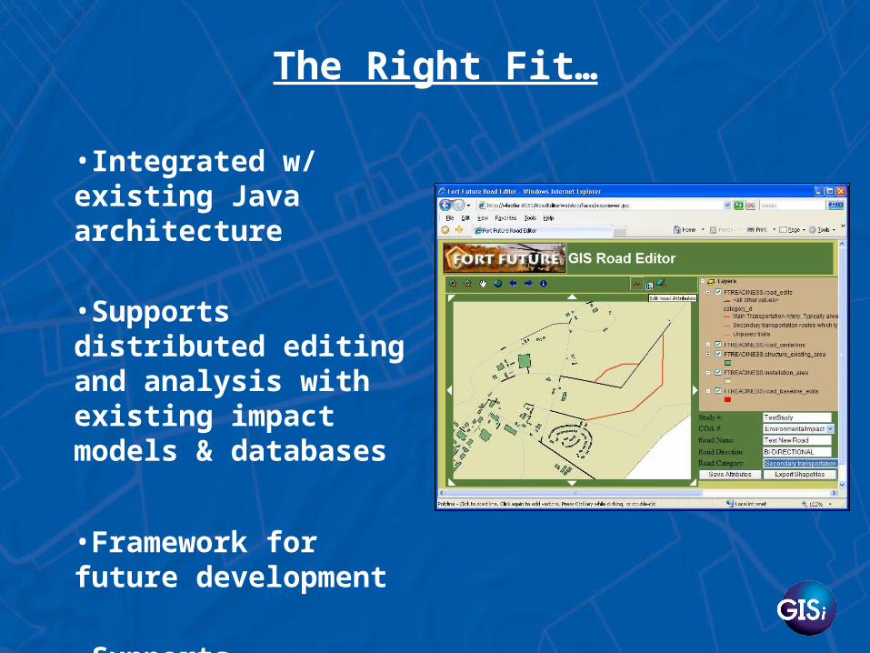
The Right Fit…
•Integrated w/ existing Java architecture
•Supports distributed editing and analysis with existing impact models & databases
•Framework for future development
•Supports Alternative Scenarios

Problem
Coordinating hundreds of troops involved in multiple live fire exercises at training ranges across
the globe
Considerations
ESRI InvestmentComplex Data Parameters & Spatial Analysis
Existing Web InterfaceDesktop ToolkitEnd-User Speed
U.S. Army

SolutionArmy SRP Mapper - RMTK
ArcIMS & ArcGIS Server Hybrid

The Right Fit…
•Integrated w/ existing GUI
•Supports complex spatial analysis
•Desktop code reusable
•Maximize speed against processing time

Problem
Ensuring the safety of Military, Civilian and Contractor personnel while Efficiently Rebuilding
the Iraqi Infrastructure
Considerations
ESRI InvestmentComplex Data Parameters & Spatial Analysis
Existing Web InterfaceWorldwide Access
U.S. Army Corps of Engineers

SolutionIraq Reconstruction Web-Based Tracker
ArcIMS & ArcGIS Server Hybrid
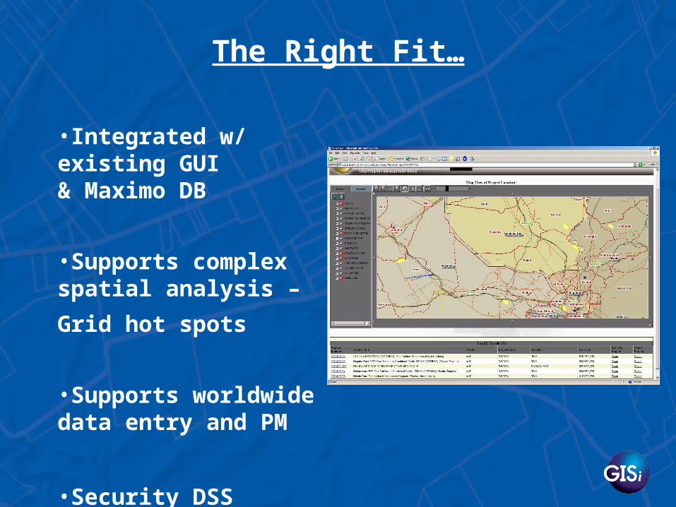
The Right Fit…
•Integrated w/ existing GUI& Maximo DB
•Supports complex spatial analysis –
Grid hot spots
•Supports worldwide data entry and PM
•Security DSS
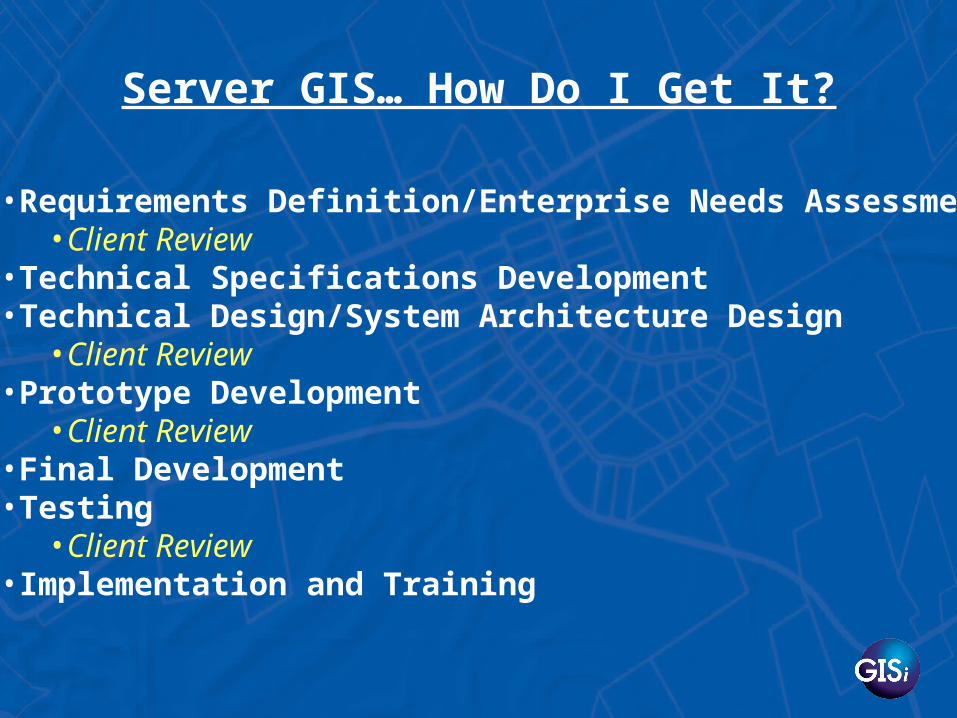
Server GIS… How Do I Get It?
•Requirements Definition/Enterprise Needs Assessment•Client Review
•Technical Specifications Development•Technical Design/System Architecture Design
•Client Review•Prototype Development
•Client Review •Final Development •Testing
•Client Review•Implementation and Training