whittlesey walk - cambridge · further information whittlesey station coates the whittlesey walk a...
TRANSCRIPT
Whittlesey was historically an island of dry groundsurrounded by marshy fen, its name deriving from Whittle’sEa. Ea is the Anglo-Saxon for ‘island’. The town has a longhistory. Bronze age settlers built a kilometre-long timbercauseway across the marsh between Whittlesey island andPeterborough island (remains of which can still be seen atthe nearby Flag Fen centre). The Romans built a raisedgravel road through the marsh north of Whittlesey (the FenCauseway). Whittlesey Museum contains fascinating historicexhibits dating back to the Neolithic period. The town ismentioned, as Whitesig, in the Anglo-Saxon Chronicle.Famous Whittlesey men include William de Whittlesey,Archbishop of Canterbury 1368-1374, and Sir Harry Smith,the ‘Hero of Aliwal’ who rose to high rank in the British army.
Attempts were made in medieval times to improve drainageso that the marsh could be brought into productive use. Inthe 1470s Bishop Morton of Ely caused Morton’s Leam tobe built to improve the River Nene navigation betweenPeterborough and Wisbech. This was superseded in 1728by Smith's Leam, a straight cut from Peterborough toGuyhirn made by the Bedford Level Corporation.The widedrain of Morton’s Leam now seems to be part of thenatural landscape of the Wash and there is a lovely walkalong a green drove along its southern bank.
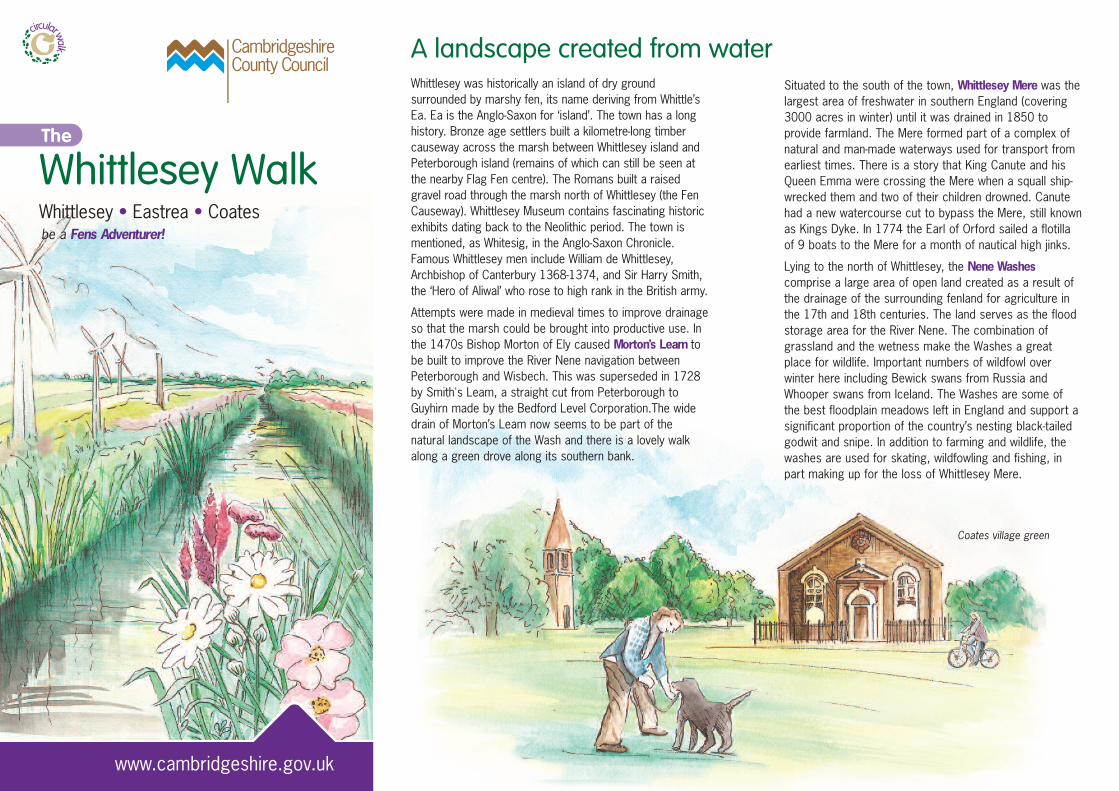
Whittlesey Walk
www.cambridgeshire.gov.uk
The
Whittlesey • Eastrea • Coatesbe a Fens Adventurer!
Situated to the south of the town, Whittlesey Mere was thelargest area of freshwater in southern England (covering3000 acres in winter) until it was drained in 1850 toprovide farmland. The Mere formed part of a complex ofnatural and man-made waterways used for transport fromearliest times. There is a story that King Canute and hisQueen Emma were crossing the Mere when a squall ship-wrecked them and two of their children drowned. Canutehad a new watercourse cut to bypass the Mere, still knownas Kings Dyke. In 1774 the Earl of Orford sailed a flotillaof 9 boats to the Mere for a month of nautical high jinks.
Lying to the north of Whittlesey, the Nene Washescomprise a large area of open land created as a result ofthe drainage of the surrounding fenland for agriculture inthe 17th and 18th centuries. The land serves as the floodstorage area for the River Nene. The combination ofgrassland and the wetness make the Washes a greatplace for wildlife. Important numbers of wildfowl overwinter here including Bewick swans from Russia andWhooper swans from Iceland. The Washes are some ofthe best floodplain meadows left in England and support asignificant proportion of the country’s nesting black-tailedgodwit and snipe. In addition to farming and wildlife, thewashes are used for skating, wildfowling and fishing, inpart making up for the loss of Whittlesey Mere.
A landscape created from water
Coates village green
Whittlesey is still connected to the River Nene to the northby Kings Dyke, part of the Nene-Ouse Navigation Link, andthere are attractive moorings on the Briggate River on thesouth side of the town centre.
Drainage of the Fens
The great enterprise of the drainage of the fens began inearnest in the mid-seventeenth century when syndicatesof investors (or ‘Adventurers’) led by the Earl of Bedfordcontracted with Dutch engineers to construct greatdrainage channels (the Old and New Bedford Rivers) atthe heart of a network of local drains and dykes. Waterwas pumped from the surrounding land into thesedrainage channels, and the land was then available foragriculture. Pumping was initially powered by inefficientwindpumps. Success was only properly achieved in thenineteenth-century with the introduction of steam pumps.Today internal drainage boards maintain 286 electricpumping stations and 3800 miles of watercourses whichkeep the valuable agricultural land of the Fens free fromregular inundation.
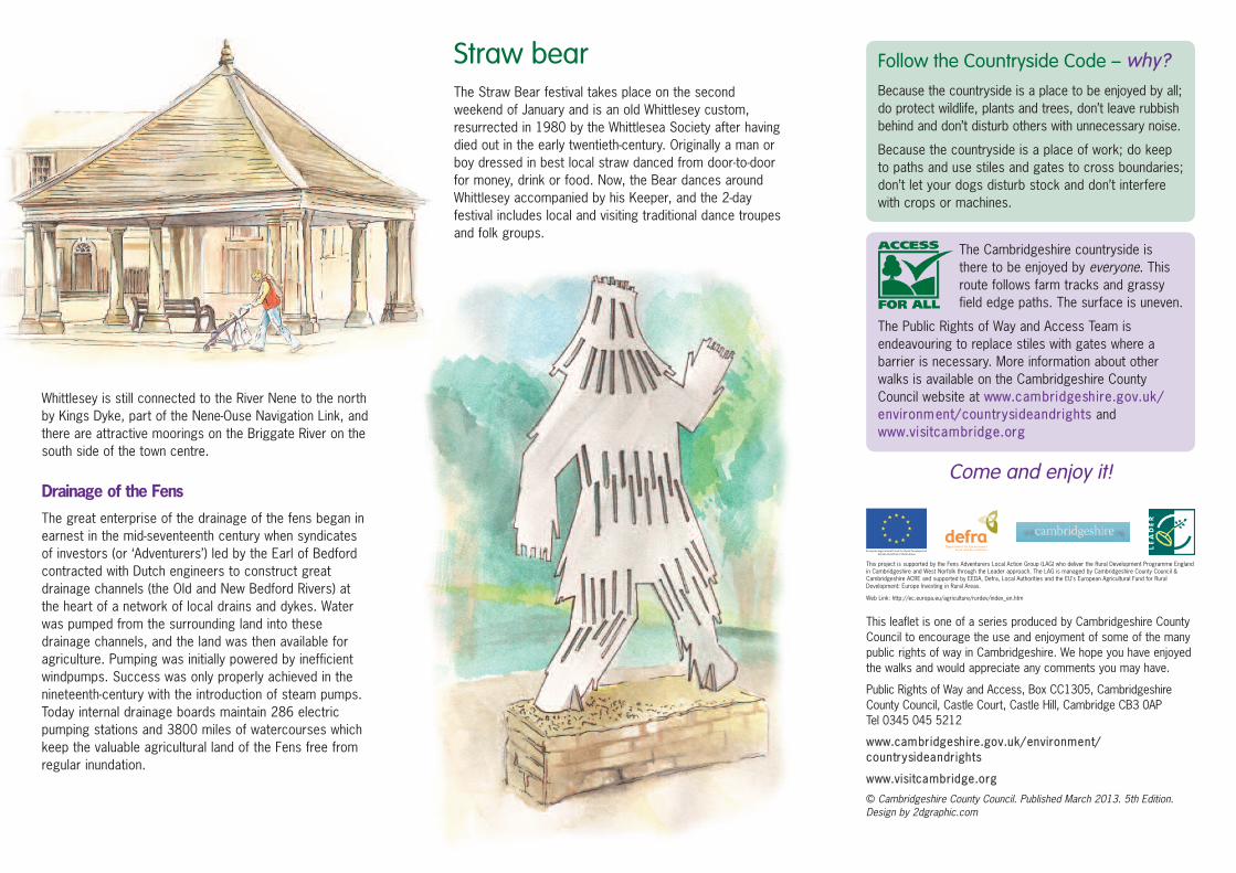
Straw bearThe Straw Bear festival takes place on the secondweekend of January and is an old Whittlesey custom,resurrected in 1980 by the Whittlesea Society after havingdied out in the early twentieth-century. Originally a man orboy dressed in best local straw danced from door-to-doorfor money, drink or food. Now, the Bear dances aroundWhittlesey accompanied by his Keeper, and the 2-dayfestival includes local and visiting traditional dance troupesand folk groups.
This leaflet is one of a series produced by Cambridgeshire CountyCouncil to encourage the use and enjoyment of some of the manypublic rights of way in Cambridgeshire. We hope you have enjoyedthe walks and would appreciate any comments you may have.
Public Rights of Way and Access, Box CC1305, CambridgeshireCounty Council, Castle Court, Castle Hill, Cambridge CB3 0AP Tel 0345 045 5212
www.cambridgeshire.gov.uk/environment/countrysideandrights
www.visitcambridge.org
© Cambridgeshire County Council. Published March 2013. 5th Edition.Design by 2dgraphic.com
The Cambridgeshire countryside isthere to be enjoyed by everyone. Thisroute follows farm tracks and grassyfield edge paths. The surface is uneven.
The Public Rights of Way and Access Team isendeavouring to replace stiles with gates where abarrier is necessary. More information about otherwalks is available on the Cambridgeshire CountyCouncil website at www.cambridgeshire.gov.uk/environment/countrysideandrights andwww.visitcambridge.org
Come and enjoy it!
Follow the Countryside Code – why?
Because the countryside is a place to be enjoyed by all;do protect wildlife, plants and trees, don’t leave rubbishbehind and don’t disturb others with unnecessary noise.
Because the countryside is a place of work; do keepto paths and use stiles and gates to cross boundaries;don’t let your dogs disturb stock and don’t interferewith crops or machines.
This project is supported by the Fens Adventurers Local Action Group (LAG) who deliver the Rural Development Programme Englandin Cambridgeshire and West Norfolk through the Leader approach. The LAG is managed by Cambridgeshire County Council &Cambridgeshire ACRE and supported by EEDA, Defra, Local Authorities and the EU’s European Agricultural Fund for RuralDevelopment: Europe Investing in Rural Areas.
Web Link: http://ec.europa.eu/agriculture/rurdev/index_en.htm
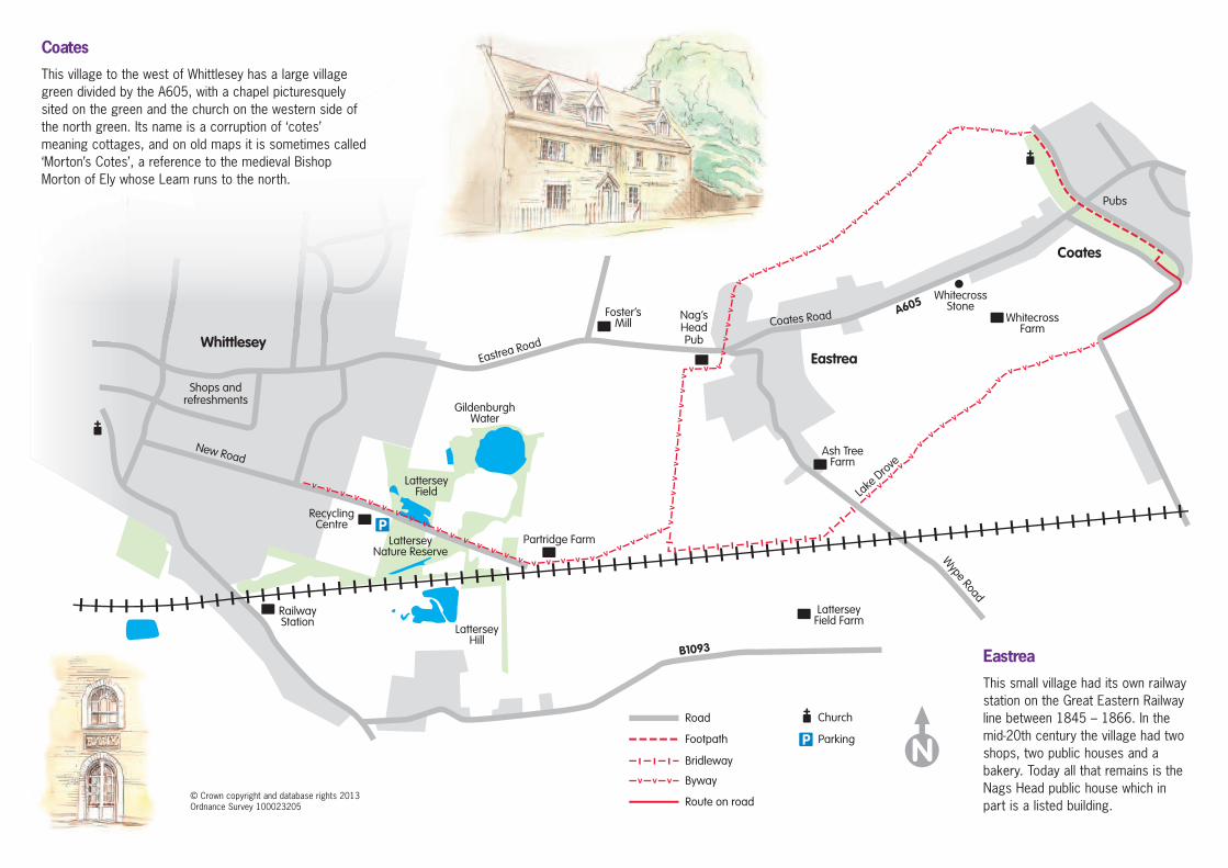
Coates
This village to the west of Whittlesey has a large villagegreen divided by the A605, with a chapel picturesquelysited on the green and the church on the western side ofthe north green. Its name is a corruption of ‘cotes’meaning cottages, and on old maps it is sometimes called‘Morton’s Cotes’, a reference to the medieval BishopMorton of Ely whose Leam runs to the north.
Eastrea
This small village had its own railwaystation on the Great Eastern Railwayline between 1845 – 1866. In themid-20th century the village had twoshops, two public houses and abakery. Today all that remains is theNags Head public house which inpart is a listed building.
© Crown copyright and database rights 2013Ordnance Survey 100023205
Further information
WhittleseyStation
Coates
The Whittlesey WalkA circular walk of 5 milesAllow approximately 2 hours
Following grassy droves this route takes you on a walkthrough the history of this evocative part of thecountryside, where you will see medieval and modernindustry tempered by nature to produce a distinctive andattractive fenland landscape.
How to get thereBy bus Stagecoach in Peterborough 01733 554575
By train Nearest station is WhittleseyNational Rail Inquiries 08457 484950
By road A605 east of Peterborough
Inquiries Cambridgeshire County Council Passenger Transport Inquiries 0345 045 0675
Lattersey nature reserveNow a Wildlife Trust nature reserve, this area used to be a quarry for brick clay for the nearby railway line. Theabandoned pits filled with water and have been colonisedby local wildlife. As the surrounding land was taken overfor agriculture, the reserve became a haven for birds suchas woodcock, sparrowhawk and tawny owl, insects suchas dragonflies, damselflies, moths andbeetles, and small mammals such watervoles and shrews. Flowers including bee-and common spotted orchids thrive onthe drier grassland.
Towers, chimneys and turbines
An extensive outcrop of Lower Oxfordclay to the west of Whittlesey makesthis a major area of brick production.The chimneys of the Kings Dyke brickworks can be seen for miles acrossthe surrounding fenland. Althoughbrick production is in decline, it hasprovided many valuable jobs for the town. A recent additionto the Whittlesey skyline are the three 80-metre high windturbines powering a local factory – one of the largest on-shore wind turbines in England. In contrast to these modernlandmarks, the towers of the two parish churches ofWhittlesey can also be seen from a long distance – the townwas divided into two separate parishes until 1849.
Footwear: Most of the route follows grassy droveswhich can become very muddy in winter, particularlyafter heavy rain. Strong waterproof footwear isessential.
Maps: The route can be followed on Ordnance Survey1:50000 Landranger Sheet 142 or on 1:25000Explorer Sheet 227.
Waymarking: Green signs indicate the route where pathleave the tarmaced road. Smaller waymark arrowsindicate the route in open country.
Refreshments: Plenty of cafes and shops in Whittlesey.Shop and pub in Coates and pub in Eastrea. However,it’s a good idea to take a snack with you for when youstop to rest and enjoy the countryside.
Detailed information from: Whittlesey Town Council,Grosvenor House, Grosvenor Road, Whittlesey PE7 1AQ• Tel: 01733 351296 • Email: [email protected]
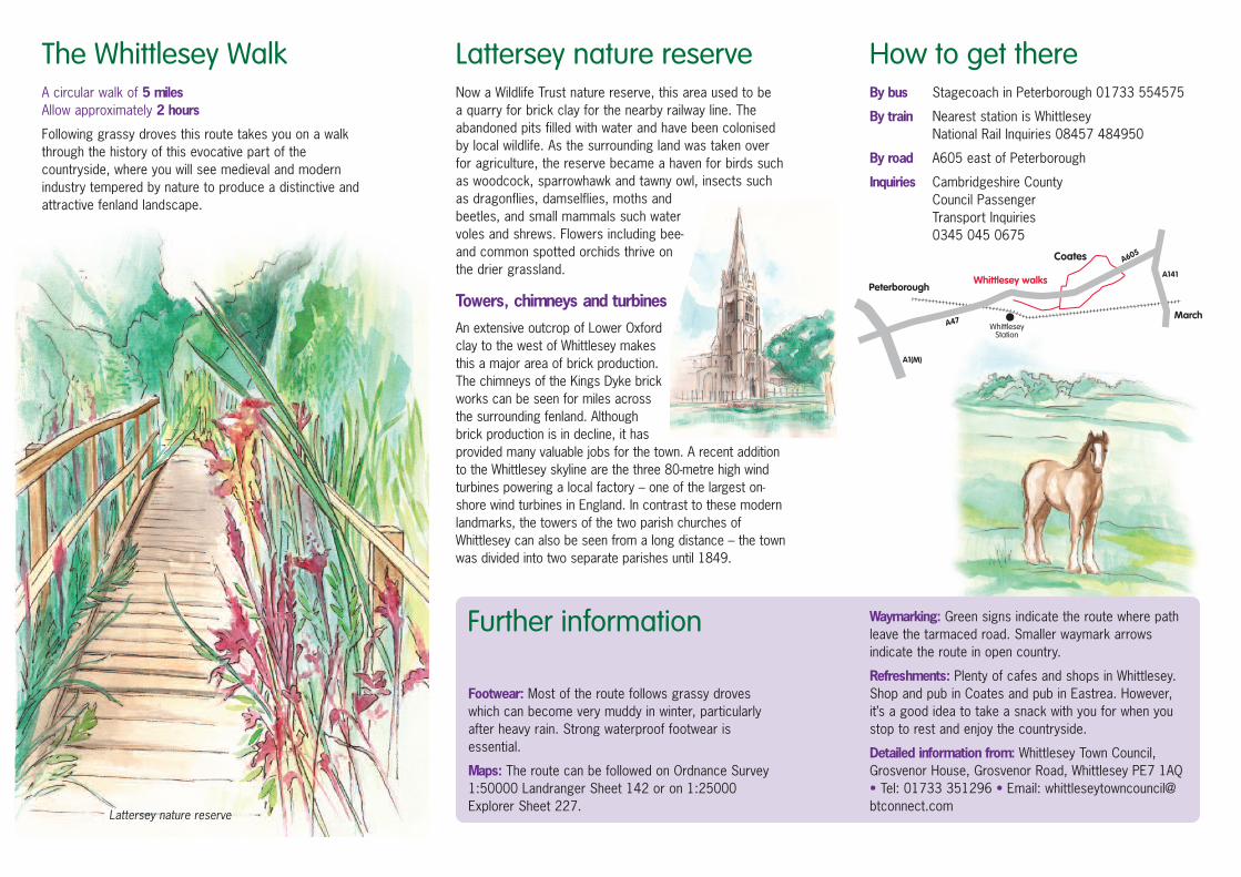
Lattersey nature reserve