wildland fire decision support tools managing long duration wildfires workshop salt lake city, ut...
TRANSCRIPT

Wildland Fire Decision Support Tools
Managing Long Duration Wildfires Workshop
Salt Lake City, UTApril 30 – May 1, 2008
Missoula, MTMay 6-7, 2008
Wildland Fire Decision Support Tools
Managing Long Duration Wildfires Workshop
Salt Lake City, UTApril 30 – May 1, 2008
Missoula, MTMay 6-7, 2008

NIXON WEATHER STATION (#020113) ENERGY RELEASE COMPONENT
0
10
20
30
40
50
60
5/1
5/8
5/1
5
5/2
2
5/2
9
6/5
6/1
2
6/1
9
6/2
6
7/3
7/1
0
7/1
7
7/2
4
7/3
1
8/7
8/1
4
8/2
1
8/2
8
9/4
9/1
1
9/1
8
9/2
5
10
/2
10
/9
10
/16
10
/23
10
/30
DATE
ER
C
Average
Maximum
Minimum
1999
Bridger-Knoll Fire, 6/20/96, ERC 48
Mt. Emma Fire, 6/3/99, ERC 19
•National Fire and Aviation Executive Board chartered WFDSS in June 2005:
•Goal:• develop a scaleable decision
support system for agency administrators,
• utilize appropriate fire behavior modeling, economic principles, and information technology,
• support effective wildland fire decisions consistent with Resource and Fire Management Plans.
Wildland Fire Decision Support SystemWildland Fire Decision Support System
NIXON WEATHER STATION (#020113) ENERGY RELEASE COMPONENT
0
10
20
30
40
50
60
5/1
5/8
5/1
5
5/2
2
5/2
9
6/5
6/1
2
6/1
9
6/2
6
7/3
7/1
0
7/1
7
7/2
4
7/3
1
8/7
8/1
4
8/2
1
8/2
8
9/4
9/1
1
9/1
8
9/2
5
10
/2
10
/9
10
/16
10
/23
10
/30
DATE
ER
C
Average
Maximum
Minimum
1999
Bridger-Knoll Fire, 6/20/96, ERC 48
Mt. Emma Fire, 6/3/99, ERC 19
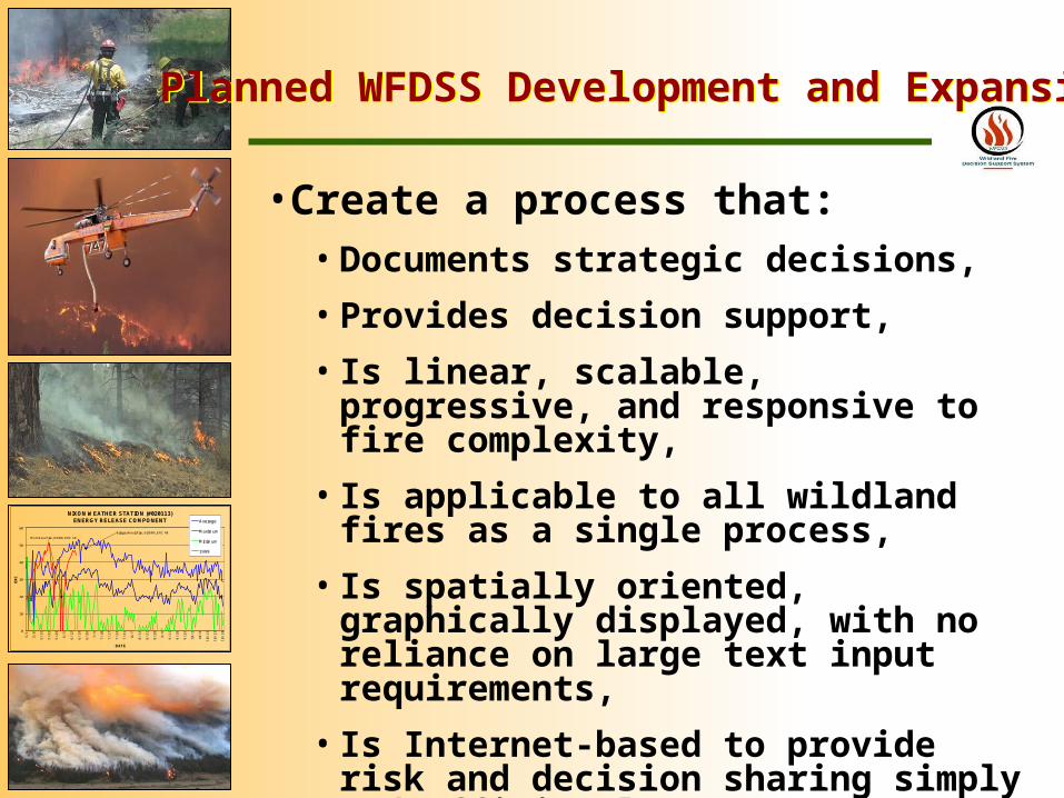
•Create a process that:• Documents strategic decisions,
• Provides decision support,
• Is linear, scalable, progressive, and responsive to fire complexity,
• Is applicable to all wildland fires as a single process,
• Is spatially oriented, graphically displayed, with no reliance on large text input requirements,
• Is Internet-based to provide risk and decision sharing simply and efficiently.
Planned WFDSS Development and ExpansionPlanned WFDSS Development and Expansion

NIXON WEATHER STATION (#020113) ENERGY RELEASE COMPONENT
0
10
20
30
40
50
60
5/1
5/8
5/1
5
5/2
2
5/2
9
6/5
6/1
2
6/1
9
6/2
6
7/3
7/1
0
7/1
7
7/2
4
7/3
1
8/7
8/1
4
8/2
1
8/2
8
9/4
9/1
1
9/1
8
9/2
5
10
/2
10
/9
10
/16
10
/23
10
/30
DATE
ER
C
Average
Maximum
Minimum
1999
Bridger-Knoll Fire, 6/20/96, ERC 48
Mt. Emma Fire, 6/3/99, ERC 19
• Accelerated working decision components available June 2007,
• Working prototype available June 2008,• May have limited structural
components available,
• Will be tested as replacement for WFSA, WFIP, LTIP,
• Delivery of WFDSS by February 2009.
Planned WFDSS MilestonesPlanned WFDSS Milestones
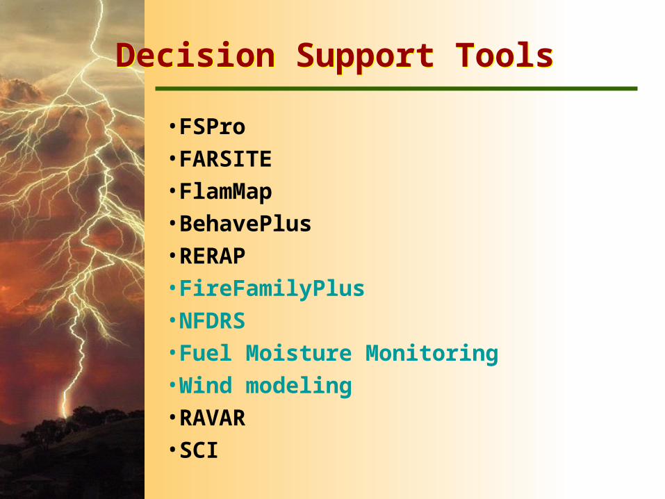
Decision Support ToolsDecision Support Tools
•FSPro •FARSITE •FlamMap •BehavePlus •RERAP •FireFamilyPlus •NFDRS •Fuel Moisture Monitoring •Wind modeling•RAVAR •SCI

NIXON WEATHER STATION (#020113) ENERGY RELEASE COMPONENT
0
10
20
30
40
50
60
5/1
5/8
5/1
5
5/2
2
5/2
9
6/5
6/1
2
6/1
9
6/2
6
7/3
7/1
0
7/1
7
7/2
4
7/3
1
8/7
8/1
4
8/2
1
8/2
8
9/4
9/1
1
9/1
8
9/2
5
10
/2
10
/9
10
/16
10
/23
10
/30
DATE
ER
C
Average
Maximum
Minimum
1999
Bridger-Knoll Fire, 6/20/96, ERC 48
Mt. Emma Fire, 6/3/99, ERC 19
•A modeling tool developed from FARSITE, FlamMap, and RERAP applications,
•Calculates and maps fire spread probability across a landscape and uses many weather scenarios,
•Is probabilistic not deterministic,
•Gives managers:
•Visual indication of probabilities of spread,
•Supports formulation of strategy and tactics,
•Helps prioritize actions,
•Is not a fire spread perimeter map,
•Available in WFDSS.
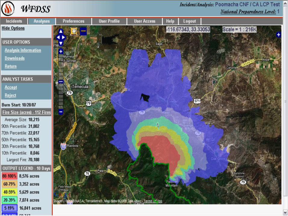
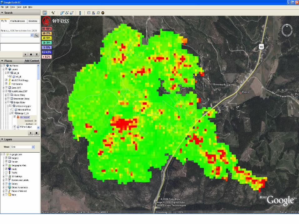
FSPro – Fire Spread ProbabilityFSPro – Fire Spread Probability


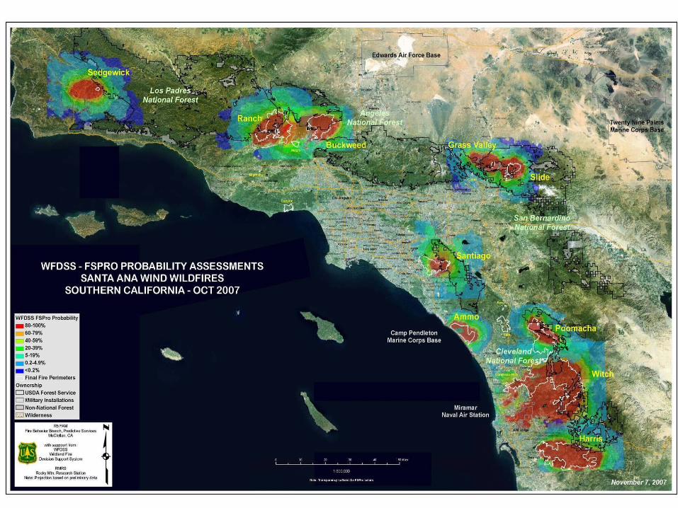
Fire Spread Probability ResultsFire Spread Probability Results
What is the probability of each point What is the probability of each point of concern being affected by fire?of concern being affected by fire?
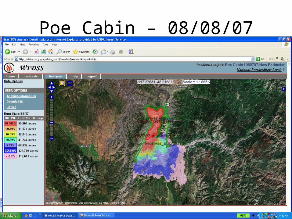
Poe Cabin – 08/08/07

Summer 2007:Pattengail Fire results helped Area Command decided to move resources to another fire for a few days
*FSPro results displayed in WFDSS on Topographic map

Summer 2007:Meriwether Fire results also helped decision makers relocate resources
*FSPro results displayed in WFDSS with fire perimeter and Google Earth
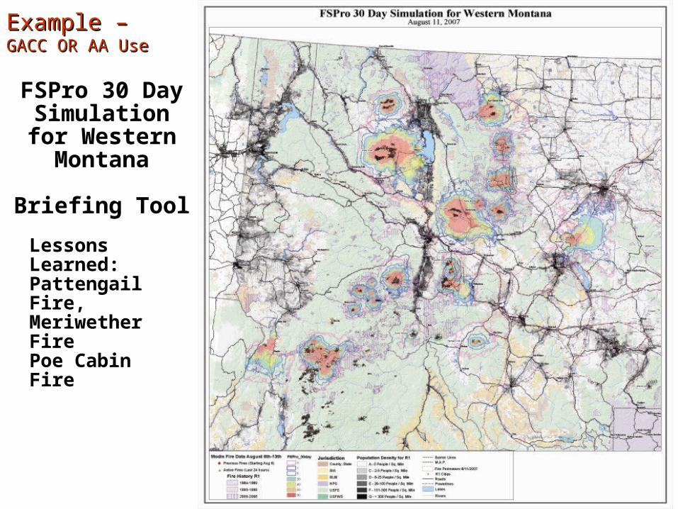
FSPro 30 Day Simulation for Western
Montana
Briefing Tool
Lessons Learned:Pattengail Fire,Meriwether FirePoe Cabin Fire
Example –Example –GACC OR AA UseGACC OR AA Use
For more information and login IDs, go to: http://wfdss.nwcg.gov
For more information and login IDs, go to: http://wfdss.nwcg.gov

NIXON WEATHER STATION (#020113) ENERGY RELEASE COMPONENT
0
10
20
30
40
50
60
5/1
5/8
5/1
5
5/2
2
5/2
9
6/5
6/1
2
6/1
9
6/2
6
7/3
7/1
0
7/1
7
7/2
4
7/3
1
8/7
8/1
4
8/2
1
8/2
8
9/4
9/1
1
9/1
8
9/2
5
10
/2
10
/9
10
/16
10
/23
10
/30
DATE
ER
C
Average
Maximum
Minimum
1999
Bridger-Knoll Fire, 6/20/96, ERC 48
Mt. Emma Fire, 6/3/99, ERC 19
•A two-dimensional fire growth simulation model,
•Computes fire behavior and spread over a range of time under heterogeneous conditions of terrain, fuels, and weather,
•Is deterministic not probabilistic,
•Provides information on:
•Where will the fire go?
•How large will the fire get?
•When might the fire reach a location?
•When weather data quality is high – is the best tool.
FARSITE – Fire Area SimulatorFARSITE – Fire Area Simulator

NIXON WEATHER STATION (#020113) ENERGY RELEASE COMPONENT
0
10
20
30
40
50
60
5/1
5/8
5/1
5
5/2
2
5/2
9
6/5
6/1
2
6/1
9
6/2
6
7/3
7/1
0
7/1
7
7/2
4
7/3
1
8/7
8/1
4
8/2
1
8/2
8
9/4
9/1
1
9/1
8
9/2
5
10
/2
10
/9
10
/16
10
/23
10
/30
DATE
ER
C
Average
Maximum
Minimum
1999
Bridger-Knoll Fire, 6/20/96, ERC 48
Mt. Emma Fire, 6/3/99, ERC 19
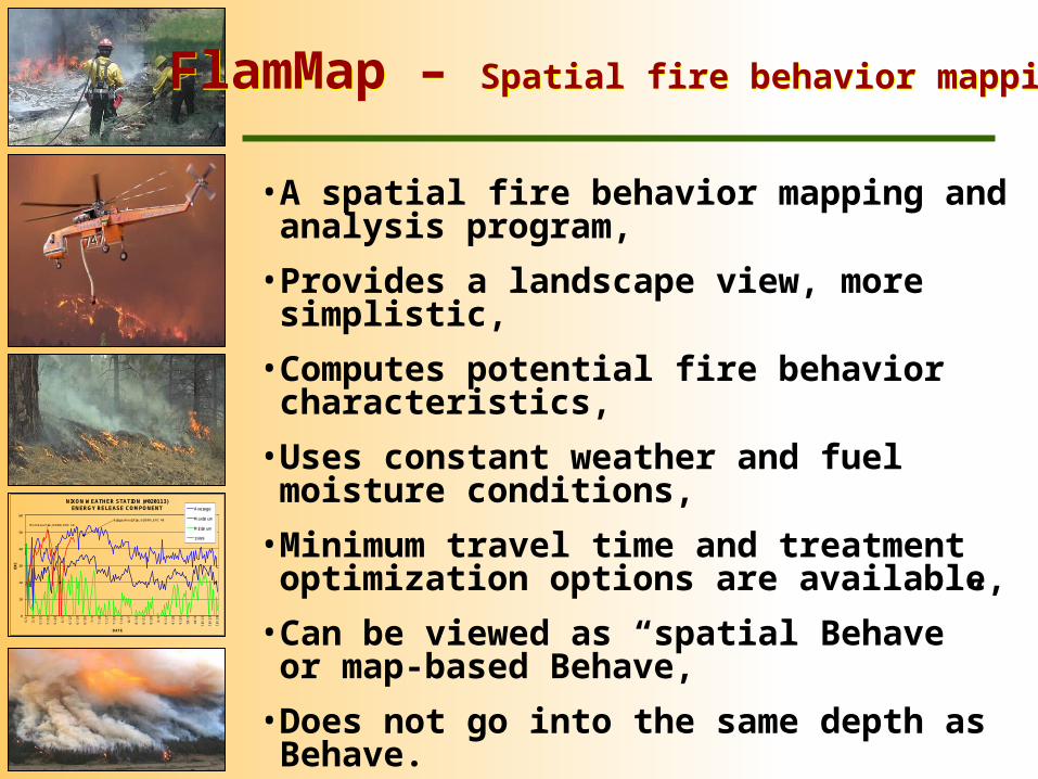
•A spatial fire behavior mapping and analysis program,
•Provides a landscape view, more simplistic,
•Computes potential fire behavior characteristics,
•Uses constant weather and fuel moisture conditions,
•Minimum travel time and treatment optimization options are available,
•Can be viewed as “spatial Behave” or map-based Behave,
•Does not go into the same depth as Behave.
FlamMap – Spatial fire behavior mappingFlamMap – Spatial fire behavior mapping

MT
T -
D
amm
ero
n F
ire
2005
S U
TFlamMap - Minimum Travel Times FlamMap - Minimum Travel Times

NIXON WEATHER STATION (#020113) ENERGY RELEASE COMPONENT
0
10
20
30
40
50
60
5/1
5/8
5/1
5
5/2
2
5/2
9
6/5
6/1
2
6/1
9
6/2
6
7/3
7/1
0
7/1
7
7/2
4
7/3
1
8/7
8/1
4
8/2
1
8/2
8
9/4
9/1
1
9/1
8
9/2
5
10
/2
10
/9
10
/16
10
/23
10
/30
DATE
ER
C
Average
Maximum
Minimum
1999
Bridger-Knoll Fire, 6/20/96, ERC 48
Mt. Emma Fire, 6/3/99, ERC 19
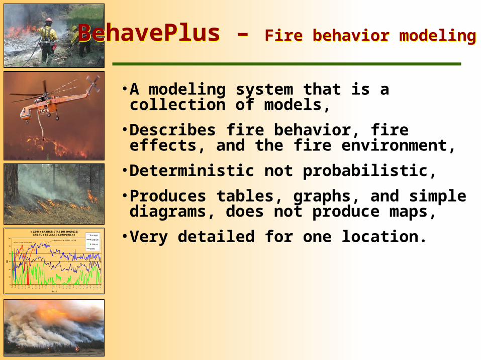
•A modeling system that is a collection of models,
•Describes fire behavior, fire effects, and the fire environment,
•Deterministic not probabilistic,
•Produces tables, graphs, and simple diagrams, does not produce maps,
•Very detailed for one location.
BehavePlus – Fire behavior modelingBehavePlus – Fire behavior modeling
NIXON WEATHER STATION (#020113) ENERGY RELEASE COMPONENT
0
10
20
30
40
50
60
5/1
5/8
5/1
5
5/2
2
5/2
9
6/5
6/1
2
6/1
9
6/2
6
7/3
7/1
0
7/1
7
7/2
4
7/3
1
8/7
8/1
4
8/2
1
8/2
8
9/4
9/1
1
9/1
8
9/2
5
10
/2
10
/9
10
/16
10
/23
10
/30
DATE
ER
C
Average
Maximum
Minimum
1999
Bridger-Knoll Fire, 6/20/96, ERC 48
Mt. Emma Fire, 6/3/99, ERC 19
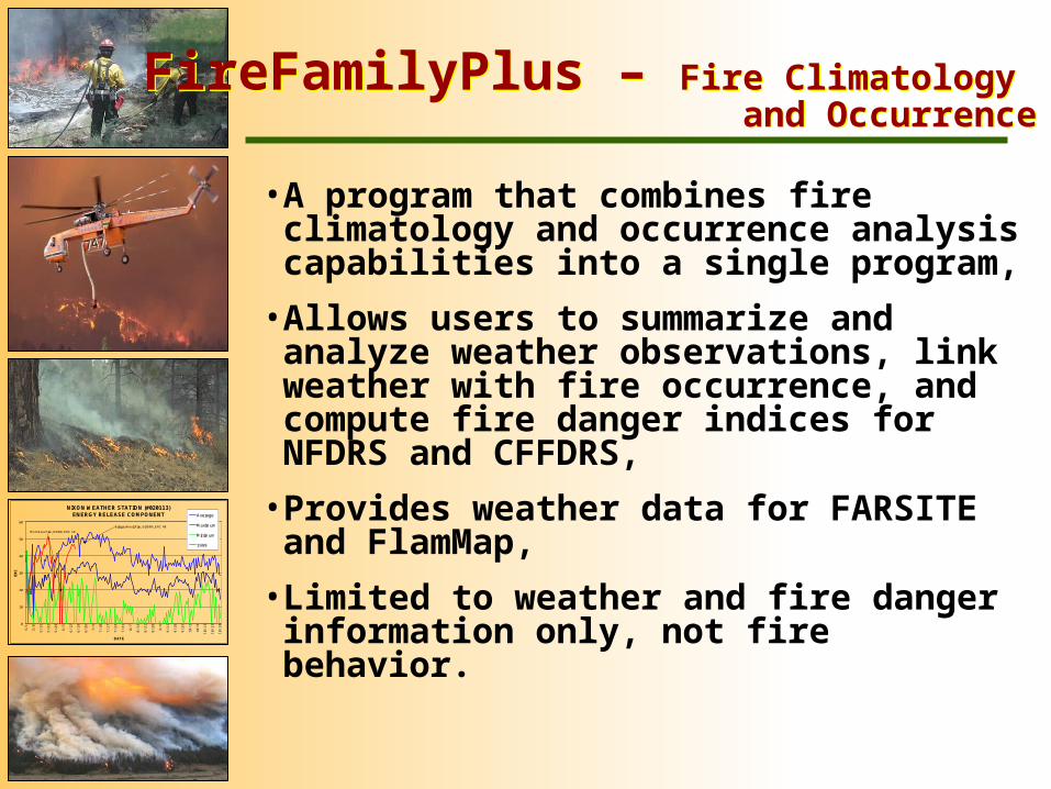
•A program that combines fire climatology and occurrence analysis capabilities into a single program,
•Allows users to summarize and analyze weather observations, link weather with fire occurrence, and compute fire danger indices for NFDRS and CFFDRS,
•Provides weather data for FARSITE and FlamMap,
•Limited to weather and fire danger information only, not fire behavior.
FireFamilyPlus – Fire Climatology and Occurrence
FireFamilyPlus – Fire Climatology and Occurrence

NIXON WEATHER STATION (#020113) ENERGY RELEASE COMPONENT
0
10
20
30
40
50
60
5/1
5/8
5/1
5
5/2
2
5/2
9
6/5
6/1
2
6/1
9
6/2
6
7/3
7/1
0
7/1
7
7/2
4
7/3
1
8/7
8/1
4
8/2
1
8/2
8
9/4
9/1
1
9/1
8
9/2
5
10
/2
10
/9
10
/16
10
/23
10
/30
DATE
ER
C
Average
Maximum
Minimum
1999
Bridger-Knoll Fire, 6/20/96, ERC 48
Mt. Emma Fire, 6/3/99, ERC 19
•A program to estimate the risk of a fire reaching a specific point of concern,
•Incorporates weather, fuels, topography, and fire spread model,
•Produces straight line transects,
•Is probabilistic, not deterministic,
•Weather data dependent,
•Requires significant user interpretation and adjustment.
RERAP – Rare Event Risk Assessment ProcessRERAP – Rare Event Risk Assessment Process

Projected fire area,Probability of fire movement


Idaho Season Ending Event Probability
NIXON WEATHER STATION (#020113) ENERGY RELEASE COMPONENT
0
10
20
30
40
50
60
5/1
5/8
5/1
5
5/2
2
5/2
9
6/5
6/1
2
6/1
9
6/2
6
7/3
7/1
0
7/1
7
7/2
4
7/3
1
8/7
8/1
4
8/2
1
8/2
8
9/4
9/1
1
9/1
8
9/2
5
10
/2
10
/9
10
/16
10
/23
10
/30
DATE
ER
C
Average
Maximum
Minimum
1999
Bridger-Knoll Fire, 6/20/96, ERC 48
Mt. Emma Fire, 6/3/99, ERC 19
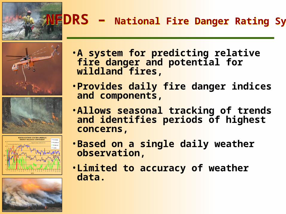
•A system for predicting relative fire danger and potential for wildland fires,
•Provides daily fire danger indices and components,
•Allows seasonal tracking of trends and identifies periods of highest concerns,
•Based on a single daily weather observation,
•Limited to accuracy of weather data.
NFDRS – National Fire Danger Rating SystemNFDRS – National Fire Danger Rating System

NIXON WEATHER STATION (#020113) ENERGY RELEASE COMPONENT
0
10
20
30
40
50
60
5/1
5/8
5/1
5
5/2
2
5/2
9
6/5
6/1
2
6/1
9
6/2
6
7/3
7/1
0
7/1
7
7/2
4
7/3
1
8/7
8/1
4
8/2
1
8/2
8
9/4
9/1
1
9/1
8
9/2
5
10
/2
10
/9
10
/16
10
/23
10
/30
DATE
ER
C
Average
Maximum
Minimum
1999
Bridger-Knoll Fire, 6/20/96, ERC 48
Mt. Emma Fire, 6/3/99, ERC 19
Seasonal Severity

NIXON WEATHER STATION (#020113) ENERGY RELEASE COMPONENT
0
10
20
30
40
50
60
5/1
5/8
5/1
5
5/2
2
5/2
9
6/5
6/1
2
6/1
9
6/2
6
7/3
7/1
0
7/1
7
7/2
4
7/3
1
8/7
8/1
4
8/2
1
8/2
8
9/4
9/1
1
9/1
8
9/2
5
10
/2
10
/9
10
/16
10
/23
10
/30
DATE
ER
C
Average
Maximum
Minimum
1999
Bridger-Knoll Fire, 6/20/96, ERC 48
Mt. Emma Fire, 6/3/99, ERC 19
•Gridded wind model that includes WindWizard and WindNinja,
•Provides gridded wind data that can be used for visualization, display and review, and input to fire behavior models,
•Highest resolution wind data – displays effects of terrain on wind,
•Useful for identifying where fire intensity may be highest, spread rates may be highest, and where spotting may occur,
•Increases accuracy of FARSITE and decision making.
WindWizard- Gridded wind modelWindWizard- Gridded wind model
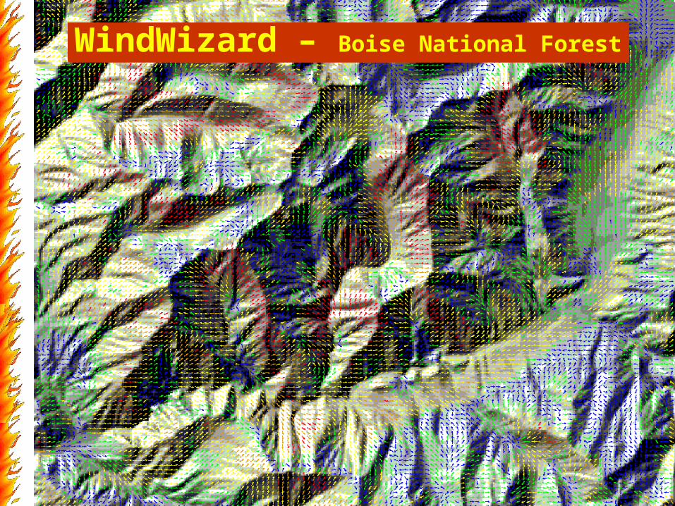
WindWizard – Boise National ForestWindWizard – Boise National Forest

WW
- S
ou
th C
anyo
n F
ire
(dis
pla
yed
in
Go
og
le E
arth
)
WindWizard – South Canyon Fire, ColoradoWindWizard – South Canyon Fire, Colorado
NIXON WEATHER STATION (#020113) ENERGY RELEASE COMPONENT
0
10
20
30
40
50
60
5/1
5/8
5/1
5
5/2
2
5/2
9
6/5
6/1
2
6/1
9
6/2
6
7/3
7/1
0
7/1
7
7/2
4
7/3
1
8/7
8/1
4
8/2
1
8/2
8
9/4
9/1
1
9/1
8
9/2
5
10
/2
10
/9
10
/16
10
/23
10
/30
DATE
ER
C
Average
Maximum
Minimum
1999
Bridger-Knoll Fire, 6/20/96, ERC 48
Mt. Emma Fire, 6/3/99, ERC 19
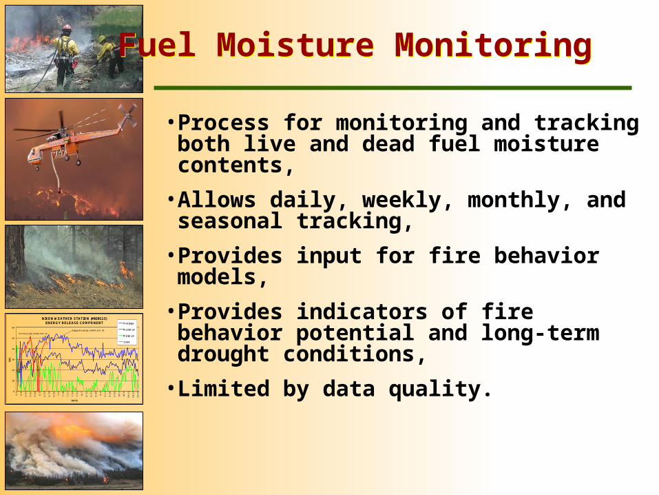
•Process for monitoring and tracking both live and dead fuel moisture contents,
•Allows daily, weekly, monthly, and seasonal tracking,
•Provides input for fire behavior models,
•Provides indicators of fire behavior potential and long-term drought conditions,
•Limited by data quality.
Fuel Moisture MonitoringFuel Moisture Monitoring
SummarySummary
•Decision support is markedly important to fire management success and useful at all levels,
•Decision support tools provide a range of information, from subjective to quantitative long-term analyses,
•Decision support tools incorporate science and technology to reduce uncertainty, better understand complexity and risks, help develop management strategies and operational tactics, and define the situation,
•Decision support information does not make decisions, only facilitates them,
•Don’t be hesitant to ask for and use decision support information.