wolverhampton city council open decision item committee ... committee... · agenda item no: 6...
TRANSCRIPT

Agenda Item No: 6 Wolverhampton City Council OPEN DECISION ITEM Committee / Panel PLANNING COMMITTEE Date: 6th January 2009 Originating Service Group(s) REGENERATION AND ENVIRONMENT
Contact Officer(s) Stephen Alexander (Head of Development Control)
Telephone Number(s) (01902) 555610
Title/Subject Matter PLANNING APPLICATIONS
Recommendation That Members determine the submitted applications according to the recommendation made in respect of each one.

2
PLANNING COMMITTEE (6th January 2009) REFERENCE SITE ADDRESS PAGE NO 08/01197/FUL 38 Lyndhurst Road
Wolverhampton West Midlands WV3 0AA
Graiseley Page 4
Application Type Change of use
08/01293/FUL 84 Bhylls Lane
Wolverhampton West Midlands WV3 8DZ
Merry Hill Page 9
Application Type Minor Dwellings
08/01363/FUL Site Of Former Hare And
Hounds Stowheath Lane Wolverhampton West Midlands WV1 2QN
East Park Page 13
Application Type Smallscale Major All Other Development
08/01266/OUT Land At Junction With Canal
Bridge And Birmingham Canal Highfields Road Wolverhampton West Midlands
Bilston East Page 20
Application Type Largescale Major Dwellings
08/01395/FUL Former International Metals
Pool Street Wolverhampton West Midlands WV2 4HN
Blakenhall Page 27
Application Type Smallscale Major All Other Development

3
07/01800/OUT Land At Steelhouse Lane/ Cable Street Wolverhampton West Midlands
Ettingshall Page 32
Application Type Smallscale Major Dwelling
08/01194/FUL Tettenhall Goods Station
Henwood Road Wolverhampton West Midlands WV6 8NY
Tettenhall Wightwick
Page 47
Application Type Minor Retail
08/01276/FUL 40 Broad Lane South
Wolverhampton West Midlands WV11 3RY
Wednesfield South
Page 54
Application Type Minor Dwellings
08/00983/FUL Bilaal Jamia Masjid Mosque
Newhampton Road West Wolverhampton West Midlands WV6 0AX
Park Page 61
Application Type Minor All Other Development
08/01198/FUL Nursing Home 98 To 100
Richmond Road Wolverhampton West Midlands WV3 9JJ
Park Page 66
Application Type Minor All Other Development
4
PLANNING COMMITTEE - 06-Jan-09
COMMITTEE REPORT: 1. Site Description 1.1 The application property is an older type semi-detached house on the southern side of
Lyndhurst Road, which is a residential street running between Penn Road and Lea Road. To the north of Lyndhurst Road is the sports ground of the Royal Wolverhampton School.
1.2 The property has four bedrooms, including one bedroom contained within the roof
space. The property has a long rear garden and a short walled-off garden at the front. The property also has a garage at the end of the rear garden, with access from a right of way off Copthorne Road. This right of way is very narrow, and runs between Nos. 10 and 12 Copthorne Road; it seems to be very lightly used and has grass in the middle of it.
2. Application Details 2.1 The proposal is for a small care home to cater for the needs of adults (age 18 to 65) to
provide accommodation, together with nursing or personal care for people with physical and learning difficulties and mental health problems in a domestic scale environment. Two carers would be on duty during the day and one carer at night.
2.2 Minor internal physical alterations are proposed, including the provision of ensuite bathrooms in a bedroom on the ground floor and in two bedrooms on the first floor. The basic layout, however, would remain as existing but with a rear living room on the ground floor being converted to a bedroom and a small bedroom on the first floor being converted to a manager’s retiring room.
APP NO: 08/01197/FUL WARD: Graiseley
DATE: 18-Sep-08 TARGET DATE: 13-Nov-08
RECEIVED: 18.09.2008
APP TYPE: Full Application
SITE: 38 Lyndhurst Road, Wolverhampton, West Midlands, WV3 0AA
PROPOSAL: Conversion of existing dwelling house to 4 bedroom care home for 4 adult residents with physical and learning disabilities. Amended Plans received 09 December 2008 omitting rear access/parking
APPLICANT: Mr Steven Jonathan Decourcy 23 Prestwood Road Wolverhampton West Midlands WV11 1RA
AGENT: Mr K. S. Rooprai Rai Consultancy 3 Jeffrey Avenue Parkfields Wolverhampton WV4 6HU

5
2.3 External alterations would be confined to the provision of patio doors in the ground floor bedroom and a disabled access ramp from Lyndhurst Road which would pass along the side of the property to give access to doors at the rear.
2.4 The proposal as originally submitted provided for the demolition of the garage in the
rear garden and the provision of a hard standing to provide parking for three cars, with access from the right of way from Copthorne Road. However, this element of the proposal has subsequently been omitted from the scheme and the amended site boundary now excludes the rear right-of-way. The amended proposal provides for two cycle parking spaces in the rear garden, with access from the front of the property.
3. Planning History 3.1 None. 4. Constraints 4.1 The rear boundary of the application property adjoins the Copthorne Road
Conservation Area. The right of way from Copthorne Road is therefore within the Conservation Area but the property itself is outside it.
5. Relevant Policies UDP Policies 5.1 H6 - Design of Housing Development. H11 - Special Needs Accommodation. D10 - Community Safety. AM12 - Parking and Servicing Provision. HE4 - Proposals Affecting a Conservation Area. HE5 - Control of Development in a Conservation Area. 6. Publicity 6.1 A petition of objection, containing 44 signatures and 6 individual letters has been
received from residents of Copthorne Road. The objections originally included objections to the use of the “green lane” right of way as an access route for a hard surfaced car park. This element has since been excluded from the scheme. Grounds of objection are now as follows:-
� The application would be detrimental to the street scene and to the
Conservation Area. � The proposal would impinge significantly on the privacy of residents of Nos. 10
and 12 Copthorne Road. � The proposal would require the removal of trees, in particular an ancient but
healthy Cedar tree in the garden of 38 Lyndhurst Road.

6
6.2 Three letters of objection have also been received from occupiers of 36 Lyndhurst Road (adjoining the application site), one of which is also signed by the occupiers of No 34. Additional points to those made above are as follows:- � Increased parking and congestion in Lyndhurst Road. � Disturbance to neighbouring residents (a resident of No 36 states that he
suffers from ill-health and the proposal is putting him under further distress). � Concern with regard to the quality and regulation of the care provision.
6.3 The above representations were made in response to the original scheme, which included the rear access from Copthorne Road and the provision of on-site parking in the rear garden. A fresh round of publicity has been carried out following the receipt of the amended scheme, which omits these elements, and any response will be reported orally at your Committee’s meeting.
7. Internal Consultations 7.1 Conservation:- No objections to revised scheme 7.2 Transport Strategy:- No objection to the revised scheme, which omits the rear access
and car park 7.3 Social Services:- No comments 7.4 Environmental Services:- No observations 8. Appraisal 8.1 It is considered that the key determining issues are as follows:-
� Impact on the appearance and character of the area, including the Copthorne
Road Conservation Area. � Impact of amenities of neighbouring residential property. � Traffic and parking. Appearance and character of the area
8.2 In terms of the impact of the proposal on the appearance and character of Lyndhurst
Road, there would be no material change to the appearance of the building. Whilst it could be argued that there would be increased comings and goings at the property, from employees and visitors, it is not considered that this would give rise to a material change in the ambience of the immediate locality. The houses in this part of Lyndhurst Road are large properties and face onto a wide road with playing fields beyond and it is therefore considered that the proposed use could be absorbed without any undue impact on the appearance and character of the street. It should be noted that several of the properties in Lyndhurst Road, including No. 40 next door to the east, have been converted into flats.

7
Amenities of neighbouring residential property 8.3 It is not considered that any noise and disturbance from comings and goings would be
such as to be significantly detrimental to neighbours’ amenities. It is noted that there is a 1.8m high screen fence dividing the side passageway of the property from the house at 36 Lyndhurst Road.
8.4 Omission of the rear access and on-site parking removes the issue of disturbance
anticipated by residents of Copthorne Road. Traffic and parking
8.5 Lyndhurst Road is wide and this section of it has development on one side only. It is considered that any increase in parking generated by the proposal can be accommodated on-street without undue detriment to traffic safety.
8.6 Transport Strategy has no objections to the amended scheme.
Other matters 8.7 The quality of the care to be provided at the proposed home cannot be regulated
through planning legislation and this is not, therefore, considered to be a material planning consideration.
8.8 Whilst the ill-health of one of the occupiers of the adjoining property is to be
sympathised with, it is not considered that this personal matter should carry such weight that a refusal of permission could be justified.
9. Conclusion 9.1 It is concluded that the proposed use is acceptable in this location 9.2 However, it would be prudent to restrict the use to the use applied for, to avoid the
introduction of other uses within Class C2 that might be unsuitable in this residential area.
10. Recommendation 10.1 Grant permission subject to the following conditions:-
� Restriction of use to use as a care home for adults with physical and learning disabilities.
� Provision of cycle parking.
Case Officer : Rob Hussey Telephone No : 551130 Head of Development Control – Stephen Alexander

8
DO NOT SCALE Reproduced from the Ordnance Survey mapping with the permission of the Controller of Her Majesty’s Stationery Office © Crown Copyright. Wolverhampton CC Licence No 100019537. Unauthorised reproduction infringes Crown copyright and may lead to prosecution or civil proceedings.
Planning Application No: 08/01197/FUL
Location 38 Lyndhurst Road, Wolverhampton,West Midlands,WV3 0AA
Plan Scale (approx) 1:1250 National Grid Reference SJ 390488 297183
Plan Printed 18.12.2008 Application Site Area 408m2

9
COMMITTEE REPORT: 1. Site Description 1.1 The application site is situated within a wholly residential area. The plot is presently
occupied by one detached bungalow set in a row of four detached two storey houses, which are all set well back from the highway on Bhylls Lane and which all have very large rear gardens. The land slopes quite markedly down from east to west, with the result that the house on the plot immediately to the east of this plot ( No. 82 Bhylls Lane) is approximately 0.5m higher than the application plot.
2. Application details 2.1 The application seeks full planning consent for a pair of semi detached two-storey
houses with rooms also set within the roof space. 3. Planning History 3.1 03/1480/OP/R for Erection of 2 no. detached bungalows,
Refused,dated 25.02.2004. 3.2 Under planning application ref; 08/00382 a similar scheme was refused on 4 June
2008 on the grounds that ‘by reason of its height, bulk and position relative to the rear garden of 82 Bhylls Lane’ it would have an adverse overbearing effect on the outlook and sunlight. The current scheme has been amended in order to address this reason for refusal.
APP NO: 08/01293/FUL WARD: Merry Hill
DATE: 23-Oct-08 TARGET DATE: 18-Dec-08
RECEIVED: 10.10.2008
APP TYPE: Full Application
SITE: 84 Bhylls Lane, Wolverhampton, West Midlands, WV3 8DZ
PROPOSAL: Demolition of existing bungalow and erection of a pair of semi detached houses.
APPLICANT: Mrs Maggie Kirby-Walker 84 Bhylls Lane Wolverhampton West Midlands WV3 8DZ
AGENT: Mr Jake Sedgemore 24A Gable Cottage Church Road Codsall Wolverhampton West Midlands WV8 1ED

10
4. Relevant policies 4.1 D3 - Urban Structure
D8 - Scale - Massing H6 - Design of Housing Development HE1 - Preservation of Local Character and Dist HE1 - Preservation of Local Character and Dist
5. Neighbour notification and representations 5.1 Three responses have been received objecting on the following grounds;
No. 82 Bhylls Lane--- loss of light and outlook; overlooking; cramped appearance. No. 86 Bhylls Lane—Over development at three storey; loss of outlook to front compared to the present bungalow; additional traffic. No. 88 Bhylls Lane—any three storey building on this site would be out of keeping
6. Internal consultees 6.1 Building Control:- no comment. 6.2 Access Team:- condition ramped or level access. 6.3 Environmental Services:- restriction on hours of demolition works recommended. 6.4 Transportation Development:- no comment. 7. Appraisal 7.1 The existing site contains a small detached bungalow. This is set well back from the
road in line with houses either side and set within a very large plot. It is one of a small group of four detached units on this side of Bhylls Lane, although this is the only bungalow in the group, the other three being two-storey high houses.
7.2 The size and position of the present bungalow is such that it has very little impact on
the adjoining two storey dwellings, all being set in very large plots. The proposal is to demolish the bungalow and replace it with a pair of 3 bedroom, semi-detached two-storey dwellings. These are shown set in a staggered layout to reflect the staggered positions of the two house on either side. In height, the new dwelling will be similar to the two houses on either side, but will be set lower than No. 82 as a result of the difference in ground levels. This is illustrated in a street elevation submitted with the application. The roof design reflects the hipped style of those on either side, but the roof space will be used as an additional floor of accommodation.
7.3 In the earlier refused scheme, the units were set on the site to project 6m to the rear
beyond the rear wall of the house at No 82. It was this, combined with the then full-gable with dormers design of the roof, which it was felt would have had an adverse effect on the outlook from the rear garden area of No. 82. This design has now been altered by reducing the rear projection to 4m and using a fully hipped roof design with roof lights in place of dormers.

11
7.4 The impact on the outlook from No. 86 was not a reason for refusing the earlier scheme and remains the same in this scheme as in that earlier scheme. The outlook from the front windows (including a corner bedroom window on this side) presently looks out over the gable wall of the bungalow which projects approximately 10m beyond the front wall of this house. This and the earlier scheme would result in a projection of approximately 8m length, but at two storey height. This will clearly have an impact on the front outlook from No.86. But the revised design of the roof will effectively reduce the bulk. As the view is from rooms that have other aspects and given the general spaciousness about this dwelling as a whole, it is still felt that the impact could not be a valid reason for refusal in this scheme also.
8. Conclusion 8.1 Compared to the earlier scheme, this now reduces the likely impact on the outlook
from the rear of No. 86. It therefore overcomes the earlier reasons for refusal. Its impact on the outlook from No. 82 has also been further reduced by the use of a hipped roof.
9. Recommendation
Grant subject to standard conditions and removal of permitted development rights for rear extensions on plot shown as 84A and for the insertion of dormer windows.
Case Officer : Alan Murphy Telephone No : 555623 Head of Development Control – Stephen Alexander

12
DO NOT SCALE Reproduced from the Ordnance Survey mapping with the permission of the Controller of Her Majesty’s Stationery Office © Crown Copyright. Wolverhampton CC Licence No 100019537. Unauthorised reproduction infringes Crown copyright and may lead to prosecution or civil proceedings.
Planning Application No: 08/01293/FUL
Location 84 Bhylls Lane, Wolverhampton,West Midlands,WV3 8DZ
Plan Scale (approx) 1:1250 National Grid Reference SJ 387912 297485
Plan Printed 18.12.2008 Application Site Area 795m2

13
COMMITTEE REPORT: 1. Site Description 1.1 The Hare and Hounds is approximately 2.5km South-East of the city centre. The
application site does not include all of the land associated with the public house, as the south-west corner fronting Stowheath Lane is omitted. The application site covers an area of approximately 0.6 hectares. Less than half of this area is occupied by the building and associated car park. The remainder of the site is open ‘scrub’, which is designated as recreational open space in the UDP, through which a designated Greenway provides a pedestrian link between Stowheath Lane and Stowheath public open space.
1.2 Adjacent residential development is predominantly 1930’s, semi-detached, houses.
Wolverhampton Training Centre is located on the opposite side of Stowheath Lane. Between the public house and the training centre is a zebra crossing. Wolverhampton College - Bilston Campus is located close to, but at the rear of the site.
1.3 Along the northern boundary of the site, to the rear of those properties along Lilac
Road, is the culverted River Tame. 1.4 The public house was constructed in the 1960s and was previously known as ‘The
Manor’. The building is mostly two-storey with a mono-pitch roof. To the rear is a single storey element with a flat roof. It is mostly constructed of yellow brick and has little architectural detailing. The public house ceased trading approximately 18 months ago and is now dilapidated.
APP NO: 08/01363/FUL WARD: East Park
DATE: 03-Nov-08 TARGET DATE: 02-Feb-09
RECEIVED: 24.10.2008
APP TYPE: Full Application
SITE: Site Of Former Hare And Hounds, Stowheath Lane, Wolverhampton, West Midlands
PROPOSAL: Demolition of existing public house and redevelopment. Construction of elderly persons carehome and associated landscaping/parking including a new pedestrian footpath from Giffard Road to Green Park.
APPLICANT: Mr D Wormald Care Developments Ltd 31 Davenport Road Yarm Stockton On Tees TS15 9TN
AGENT: Mr Paul Burton A P Architecture Ltd E-Inovation Centre Suite SE219 University Of Wolverhampton Telford Campus Telford Shropshire TF2 9FT

14
2. Application details 2.1 The applicant states that the scheme would provide approximately 70-75 jobs and
represent an investment of circa £5 million. 2.2 The applicant seeks permission for an elderly persons care home (Use Class C2) and
associated parking and landscaping. 2.3 The proposed building is roughly L-shaped, with a small central projecting wing. The
building would be two storeys (8-9m ridge height) closest to Stowheath Lane, rising to three storeys (9-10m) high.
2.4 A new vehicular access from Stowhealth Lane, near to the northern edge of the site,
would be created as part of the new development. Pedestrian access to the building would also be along this access road. The rest of the Stowheath Lane frontage has been excluded from this application. In order to demonstrate that this space would be developable at a later date, the applicants have illustrated that the excluded space could accommodate a pair of semi-detached properties.
2.5 The care home would provide accommodation for 92 residents as well as other
ancillary facilities such as an office and hairdressing suite. Residents’ bedrooms would be single aspect, approximately 24 sqm, and include an en-suite bathroom.
2.6 The scheme would provide 27 vehicular parking spaces including 2 disabled spaces.
Parking for a maximum of 6 cycles and motorcycles are also proposed. A communal amenity space, in excess of 1000 metres square, would also be provided.
2.7 As the proposed development would remove the existing pedestrian link from
Stowheath Lane to Green Park open space, a new pedestrian route is indicated from the end of Giffard Road.
3. Constraints 3.1 Current Open Space
Mining Areas 4. Relevant policies 4.1 National Policies
PPS1 Delivering Sustainable Development PPS3 Housing PPG17 Planning for Open Space, Sport and Recreation
4.2 UDP Policies
D1 Design Quality D2 Design Statement D3 Urban Structure D4 Urban Grain D5 Public Realm Public Open Private Space D6 Townscape and Landscape D7 Scale - Height D8 Scale - Massing D9 Appearance D10 Community Safety

15
D11 Access for People with Disabilities part D13 Sustainable Development Natural Energy D14 The Provision of Public Art EP16 Energy Conservation C1 Health, Education and Other Community Services C3 Community Meeting Places R1 Local standards for Open Space, Sport and Recreation Facilities R3 Protection of Open Space, Sport and Recreation. R6 The Greenway Network R7 Open Space Requirements for New Development H3 Housing Site Assessment Criteria H6 Design of Housing Development H9 Housing Density and mix H12 Residential Care Homes AM1 Access, Mobility and New Development AM12 Parking and Servicing Provision AM15 Road Safety and Personal Security
4.3 Supplementary Planning Guidance
SPG3 Residential Development 5. Publicity 5.1 The application was advertised by letter to neighbouring occupiers as well as by press
and site notice. Two letters of concern were received, one from a local resident, the other from CAMARA. The local resident is concerned about the proximity of the building to the boundary of their garden and believes that the proposal will reduce privacy levels. They also believe that the proposed access will lead to unacceptable levels of traffic along Stowheath Lane.
5.2 CAMARA objects to the loss of public house and considers the proposal to be of poor
design, orientated incorrectly, too high, and fails to respond to the context of the area. 6. Internal consultees 6.1 Transportation Development – Comments awaited 6.2 Environmental Services - No objections in principle subject to suitable conditions to
control refuse storage and submission of details of any ventilation systems. Should permission be granted, then construction should be restricted to between 0800 -1800 hours Monday to Friday and 0800 - 1300 Saturdays and at no time Sundays or Bank/Public Holidays..
7. External consultees 7.1 Severn Trent Water - No objection subject to a condition requiring the submission of
sustainable drainage details and an assessment of the hydrological and hydrogeological context.
7.2 Environment Agency - No objection subject to submission of drainage details and a
condition preventing the construction of any buildings, structures (including gates, walls, fences or raised ground levels) within the easement strip of the River Tame.

16
7.3 Police - The Police are seeking a contribution of £195.68 per household equating to a total sum of £18,002.48 in order to help meet the draw on existing police resources which they consider will arise from this development.
8. Appraisal 8.1 In determining this application, the main issues are:
• The loss of the public house as a community facility
• Demolition of the building
• Loss of recreational open space
• Redevelopment for a care home for the elderly
• Design & layout
• Residential amenities
• Transportation
• Police contribution Loss of Public House as Community Facility 8.2 The application proposes the loss of a community meeting place, which UDP policy C3
states will only be permitted where specified tests are met:
• There is no need for the facility;
• There are alternative facilities nearby;
• The proposal involves a replacement facility; or
• Retention of the facility would not be economically viable. 8.3 The applicant states that the public house was closed by the brewery 18 months ago,
following a series of changes in landlord, primarily due to the trade not being sufficient to support the costs of running the establishment. However, no evidence has been submitted which substantiates this.
8.4 Within walking distance of the site are other public houses which could have taken the
displacement of patrons as a result of the closure of the business. The closest of these are The Gate and The Angel, both approximately 400m from the site on Bilston Road.
8.5 It is considered that insufficient information has been submitted to demonstrate
compliance with Policy C3. However, given the poor architectural quality of the building, the fact that the pub has been closed for 18 months and the community benefits that would arise from the provision of a care home for the elderly, it is considered that a departure from the policy is justified.
Demolition of the building
8.6 The existing public house is not considered to be of architectural merit and therefore not worthy of retention.
Loss of recreational open space
8.7 The site is allocated in the UDP as Recreational Open Space and also has a “Greenway” running through it, linking Stow Heath open space to East Park.
8.8 The Wolverhampton Open Space, Sport and Recreation Study concludes that there is
a quantitative surplus of open space in the Bilston area, although the quality is poor and certain types of open space are not well represented. This indicates that there is scope to dispose of certain poorer quality areas of open space, whilst requiring compensatory payments to invest in qualitative improvements to retained open space, sport and recreation facilities in the local area.

17
8.9 UDP Policy R3 seeks to protect defined open spaces. Where permission is granted for development of an open space, compensatory provision is required. Policy R6 seeks to safeguard Greenways from development.
8.10 In this case, it would be difficult to provide a wide public access through the site without
compromising the redevelopment of the site. Also such an access would be approximately 130m long, with no means of escape once entered. It would therefore be preferable for the developer to fund an access to the public open space from Giffard Road.
8.11 The area of recreational open space to be lost amounts to 5470 sqm. Using the
formula for the cost of open space creation and maintenance for 10 years, a compensatory payment of £277,603 would be required. However, if a suitable access to the open space is provided from Giffard Road, the amount would be reduced to £138,800. This amount should be BCIS indexed as of 1st January 2009.
Redevelopment for a care home for the elderly
8.12 The site is considered suitable for redevelopment as a care home for the elderly.
Design and Layout 8.13 In order to make the most of the development potential of the site and take advantage
of the widening of the site towards the rear, the building has been positioned towards the ‘rear’ of the site. While this means that the nursing home would not have much presence on Stowheath Lane, the applicant has demonstrated that sufficient space would still be available to build a pair of semi-detached properties fronting Stowheath Lane.
Residential amenities
8.14 The application proposes a number of single-aspect rooms which would have a northerly orientation. Given the orientation of the site, the nature of the proposed use and the availability of a several communal areas to the proposed residents, this is considered acceptable in this instance. In addition, the future residents would have access to over 1,000 square metres of private, communal, open space which is considered acceptable.
8.15 The distance between the windows at the rear of properties on Giffard Road, to those
within the proposed scheme is in excess of 20m, but does not meet the 22m which is advised in SPG3. With additional planting along the boundary between the proposed and existing properties it is not considered that this small shortfall in separation distance would result in an unacceptable level of privacy to existing or future residents.
8.16 The three storey aspect of the proposed building would not be directly adjacent to any
of the existing houses. It would also not have any windows which would directly overlook the existing properties. It is therefore considered that the proposal would not be detrimental in terms of overbearing or loss of privacy.
Highway Safety
8.17 Comments from Transportation are awaited. Given the nature of the proposed development, it is considered that trip generation is likely to be relatively low and therefore the scheme is unlikely to have a detrimental impact on highway safety.
Police contribution
8.18 The Police seek a financial contribution. However, S106 obligations should be directly proportionate and reasonably related to the impacts of the proposed scheme. No increase in crime can be predicated with any certainty as a result of this scheme and therefore it is not considered appropriate to request such a contribution.

18
9. Conclusion 9.1 The loss of the public house, the open space and the Greenway are acceptable,
subject to a compensatory payment for the loss of the open space, access to the open space to the east from Gifford Road and the redevelopment of the site as a care home for the elderly.
9.2 It is considered that the design responds well to the numerous constraints of the site
but will require high quality architectural detailing and materials in order to be successful.
10. Recommendation 10.1 Delegated authority to grant permission, subject to:
(i). No overriding issues being raised from outstanding consultees.
(ii). Negotiation of a S106 agreement to secure a compensatory payment for the loss of recreational open space, a pedestrian route from Giffard Road to the open space to the east, public art and targeted recruitment and training.
(iii). Conditions to include:
• Use as a care home for the elderly only
• Submission of materials
• Large scale architectural details
• Landscaping including boundary treatments
• Drainage
• Car parking – provision, retention and management
• Cycle/motorcycle parking
• External lighting
• Bin stores
• Construction management plan
• Amenity space provided as shown
• No external meter boxes, vents, flues, aerials, satellite dishes etc without written approval.
• Exterior of the building to be completed in accordance with approved plans and details prior to occupation
• The public house to be demolished and site cleared prior to commencement of development.
• South west corner of pub site omitted from application to be landscaped and maintained in accordance with a schedule agreed by the Local Planning Authority.
Note for information
• The site is within a mining area. Developers should seek advice of Coal Authority before undertaking any operations.
Case Officer : Richard Pitt Telephone No : 551674 Head of Development Control – Stephen Alexander

19
DO NOT SCALE Reproduced from the Ordnance Survey mapping with the permission of the Controller of Her Majesty’s Stationery Office © Crown Copyright. Wolverhampton CC Licence No 100019537. Unauthorised reproduction infringes Crown copyright and may lead to prosecution or civil proceedings.
Planning Application No: 08/01363/FUL
Location Site Of Former Hare And Hounds, Stowheath Lane,Wolverhampton,West Midlands
Plan Scale (approx) 1:1250 National Grid Reference SJ 393703 297508
Plan Printed 18.12.2008 Application Site Area 6261m2

20
COMMITTEE REPORT: 1. Site Description 1.1 This, broadly rectangular, site covers an area of approximately 0.2 hectares and is
located 5km south-east of Wolverhampton City Centre and 1km south of Bilston Centre. The Birmingham Canal, which runs along the eastern boundary of the site, defines the border between Wolverhampton and Dudley. The canal towpath is on the west side of the canal, adjacent to the application site. The site is designated as Recreational Open Space (ROS) in the UDP and is located adjacent to a Site of Importance for Nature Conservation (SINC) which has a Greenway running through it.
1.2 The site was formerly occupied by 7 houses, but these were demolished in the 1970s.
Although designated as Recreational Open Space in the UDP the site was used for the storage of building materials until last year, 2007. The site is now vacant.
1.3 On the opposite side of Highfields road is another, still occupied, industrial yard which
forms part of the Bilston Urban Village Scheme. 1.4 The majority of the nearby residential properties are 1930s semi-detached houses
although a scheme for apartments has, fairly recently, been completed at the junction of Broad Lanes and Highfields Road.
1.5 The site is largely flat, although set within a hollow. The bank up to Highfields Road
and the bridge over the canal is fairly steep, whereas the banks around the remainder of the site are shallower. The main part of the site is approximately 1.2m below canal towpath level.
1.6 A public sewer crosses the site.
APP NO: 08/01266/OUT WARD: Bilston East
DATE: 28-Oct-08 TARGET DATE: 27-Jan-09
RECEIVED: 01.10.2008
APP TYPE: Outline Application
SITE: Land At Junction With Canal Bridge And Birmingham Canal, Highfields Road, Wolverhampton, West Midlands
PROPOSAL: Outline Application for residential development comprising of 12No. apartments
APPLICANT: Miss J Palin 9 Denville Close Bilston Wolverhampton WV14 6JW
AGENT: Mr S Lymer Barnett Ratcliffe Partnership The Old Library Rowley Street Stafford Staffordshire ST16 2RH

21
2. Application details 2.1 The application is in outline with all matters apart from access reserved for future
determination. The application proposes 12 apartments and an illustrative layout has been provided.
2.2 Two, three-storey buildings are shown illustratively. The larger building, which would
contain 8 apartments, would front the Canal whilst the other building, containing the remaining four apartments would be along the southern boundary of the site.
2.3 The illustrative layout also shows 18 car parking spaces (including one disabled
space). The majority of the spaces are shown as undercroft parking. The remainder of the site would form an area of private, communal, amenity space for the occupants of the properties.
2.4 The existing buffer of trees, along the Highfields Road embankment, would be
retained. 3. Planning History 3.1 07/00711/FUL for Residential development of 11 two bedroom apartments. This
scheme was refused, on the 20th of September 2007, as it was considered to represent poor design, with a cramped layout and over dominance of parking. It also provided poor levels of residential amenity and provided insufficient information to address highway safety.
3.2 08/00251/FUL for Residential development of 11 two bedroom apartments.
This scheme was withdrawn. 4. Constraints 4.1 Current Open Space
Landfill Gas Zone Mining Areas Site of Importance for Nature Conservation
5. Relevant policies 5.1 National Guidance
PPS1 - Delivering Sustainable Development PPS3 - Housing PPG17 - Planning for Open Space, Sport and Recreation
5.2 UDP Policies
D1 Design Quality D3 Urban Structure D4 Urban Grain D5 Public Realm Public Open Private Space D6 Townscape and Landscape D7 Scale - Height D8 Scale - Massing D9 Appearance D10 Community Safety

22
D11 Access for People with Disabilities part D12 Nature Conservation and Natural Features D13 Sustainable Development Natural Energy D14 The Provision of Public Art EP6 Prot of Ground Water, Watercourses, Canals EP9 Sustainable Drainage Arrangements for Development HE1 Preservation of Local Character and Dist N1 Promotion of Nature Conservation N3 Protection of Sites of Importance for Nature Conservation B10 Redevelopment of Business Land and Premises R3 Protection of Open Space, Sport and Recreation R7 Open Space Requirements for New Development H1 Housing H3 Housing Site Assessment Criteria H6 Design of Housing Development H8 Open Space, Sport and Rec. Req. new Dev. H9 Housing Density and mix AM1 Access, Motability and New Development AM12 Parking and Servicing Provision AM15 Road Safety and Personal Security
5.3 Supplementary Planning Guidance
SPG3 – Residential Development 6. Publicity 6.1 The application was advertised by press and site Notices. Letters were also sent to
neighbouring occupiers. Letters of objection were received from the Inland Waterways Association and Birmingham Canal Navigation Society, who are concerned that the large glazed links would confuse local birds which migrate between the canal and the large pool to the west of the site.
7. Internal consultees 7.1 Parks & Contracts - No objection in principle. The land adjoins Ladymoor Pool open
space which is a sensitive natural area, designated as a Site of Interest for Nature Conservation (SINC). They also provide detailed comments on the proposed boundary treatment and design of the communal open space.
7.2 Transportation Development - Comments awaited. 7.3 Environmental Services - No objection in principle subject to submission of noise
mitigation measures and contaminated land survey. 8. External consultees 8.1 Dudley MBC - No objection providing that the trees and hedging along the canal
boundary are retained. 8.2 Police - They are concerned that the proposed undercroft parking spaces will be
disused as they are not readily visible from the owners property. However, they do consider that the proposed layout gives good natural surveillance to the application site in general.

23
8.3 Local Area and Neighbourhood Arrangements - Comments awaited. 8.4 Severn Trent Water Ltd - No objection in principle subject to conditions requiring the
submission of sustainable drainage scheme, including an assessment of the hydrological and hydrogeological context. In addition, no buildings shall be erected or trees planted with 2.5m of the public sewer which cross the site.
8.5 Centro - No objection in principle. The development is located near to bus services
which link the site to Wolverhampton and Dudley at a frequency of 15 mins during Monday-Saturday. There are no services on Sundays or evenings, but given the nature of the development it is unlikely that an increase in bus services will be required.
8.6 British Waterways - They are also concerned at the proposed scale of the buildings is
not characteristic of waterside developments in the area. Furthermore, development should face onto the canal and encourage activity to take place along the waterfront. However, they state that there is little space between the proposed building and the retaining wall in order for activities to take place.
8.7 In addition, the submitted forms indicate the use of a soakaway and discharge of
surface water into the watercourse. This would require agreement with British Waterways.
9. Appraisal 9.1 The proposal is to be considered in light of the following key issues:
• Principle of residential development • Scale & appearance • Layout • Residential amenities • Parking & access • Open space requirements
Principle of residential development
9.2 The site adjoins a Site of Importance for Nature Conservation (SINC). A residential
development on the application site will be acceptable, subject to minimal impact on the adjacent SINC. This will be taken into account at the reserved matters stage.
9.3 In locations such as this, a density of between 30-50 dwellings per hectare is most
appropriate. The proposal has a density of 54 dwellings per hectare, this is considered appropriate subject to high quality design.
Scale & Appearance
9.4 Scale and appearance are reserved for subsequent approval. No indication of the
proposed appearance has been submitted although reference to glazed ‘links’ on the submitted plans suggests a contemporary approach which would be accepted, subject to detail.
9.5 Because the majority of the site is at a lower level than the Canal towpath and
significantly lower than Highfields Road, three storey buildings are acceptable in principle.

24
Layout 9.6 Layout is also reserved for subsequent approval. The layout of the proposed buildings
has been restricted due to a number of factors. These include the existing main sewer which runs across the site, the steep embankment along the Highfield Road frontage and the position of the vehicular access into the site.
9.7 The illustrative layout responds to the constraints of the site in a positive way ‘fronting’
both the canal and the area of open space to the south. 9.8 Due to the morphology of the site, it has not been possible to create a ‘private’ rear and
a ‘public’ front to the buildings. Instead the proposed apartments are seeking to generate vitality and activity to both the canal and the access road/communal garden. It is considered that the proposed scheme does this reasonably well. The inclusion of the undercroft parking spaces does reduce ground floor activity. However, it is considered that the creation of undercroft parking is an efficient use of space on this constrained site.
9.9 The concerns raised by the Police regarding the undercroft spaces are acknowledged.
The agents have been asked to demonstrate that each flat will have a private, secure, parking space.
Residential amenity of future occupants
9.10 The illustrative layout shows a communal garden, which covers an area of
approximately 225 sq metres. It is considered that this a good and usable area of open space which, depending on the type of boundary treatment, could allow the adjacent SINC to be visually ‘brought into’ the proposed development.
9.11 In addition, balconies are shown on the illustrative plan, fronting the canal. Depending
on the detailed design, these could also form a useful amenity space for future residents and provide activity on the Canal frontage.
9.12 Internal floor plans of the apartments have not been provided, but the submitted plans
illustrate that each apartment would be dual aspect. This is considered acceptable, subject to detail.
Access
9.13 Highway comments are awaited. The proposed scheme reuses the existing site
access. Visibility along Highfields Road is somewhat hindered due to the bridge over the canal. Nevertheless, the proposed number of apartments is relatively small and is considered that any impact on highway safety would be minimal.
Open Space Requirement
9.14 Policy H8 of the UDP states the any housing development of 10 dwellings or more will
be required to contribute towards the provision and/or enhancement of open space, sport and recreation facilities sufficient to service new residents. Based on adopted UDP policy, the appropriate level of compensation is considered to be £36, 337 subject to BCIS annual percentage increase in prices from 1st of January 2009.
9.15 Although designated as recreational open space within the UDP, the site has never
formed part of Ladymoor Pool open space. The designation is therefore considered to be incorrect and no compensatory payment will be required.

25
10. Conclusion 10.1 The site is considered suitable for residential development. Access is the only matter
submitted for determination and is considered broadly acceptable, although detailed Transportation comments are awaited.
10.2 The illustrative material shows a development with a broadly acceptable layout and
scale. 11. Recommendation 11.1 Delegated Authority to grant permission subject to
1. No overriding issues being raised from outstanding consultees
2. Negotiation of a S106 agreement to provide £36, 337 BCIS & public art towards the off-site provision of improvement of recreational open space.
3. Conditions are recommended to cover:
o Landscaping scheme – implementation and maintenance o Drainage o External lighting o Details of cycle/motorcycle stores o Bin stores o Parking provision as approved as reserved matter o Amenity space provided as shown o No external meter boxes, vents, flues, aerials, satellite dishes etc
without written approval. o Exterior of the building to be completed in accordance with approved
plans and details prior to occupation o Permission for maximum of 12 apartments, exact number to be in
accordance with floor plans to be submitted and approved. O Security of site & buildings Note for information o The site is within a mining area. Developers should seek advice of Coal
Authority before undertaking any operations. o The site is within 250m of a former landfill site. Anyone intending to
implement this permission should contact Environmental Services for up to date information.
Case Officer : Richard Pitt Telephone No : 551674 Head of Development Control – Stephen Alexander

26
DO NOT SCALE Reproduced from the Ordnance Survey mapping with the permission of the Controller of Her Majesty’s Stationery Office © Crown Copyright. Wolverhampton CC Licence No 100019537. Unauthorised reproduction infringes Crown copyright and may lead to prosecution or civil proceedings.
Planning Application No: 08/01266/OUT
Location Land At Junction With Canal Bridge And Birmingham Canal, Highfields Road,Wolverhampton,West Midlands
Plan Scale (approx) 1:1250 National Grid Reference SJ 394555 295207
Plan Printed 18.12.2008 Application Site Area 2226m2

27
COMMITTEE REPORT: 1. Site Description, Findings and Background 1.1 The application premises are located approximately 1 mile to the south of
Wolverhampton City Centre, within an industrial area to the east of Penn Road and west of Dudley Road. The site is approximately 0.196 hectares in size.
1.2 The site is currently occupied by a two storey factory building (456 square metres of
floor space) which has approximate frontages of 35 metres along Pool Street and 14 metres along Sidney Street.
1.3 The surrounding premises are mainly two storeys and aligned along the back edge of
the pavement, with limited off-street parking. 2. Application Details 2.1 The application seeks permission to demolish the existing factory building and erect a
new two storey building in its place. The proposed building would be 31 metres wide, 35 metres long and 8.5 metres high. The building would be positioned 3.5 metres from Pool Street and 12 metres from Sidney Street. It would be constructed from brick work and profiled metal cladding. Dwarf walls and railings would define the street frontages.
2.2 Five car parking bays would be provided to the Pool Street frontage and twenty spaces
to the rear yard adjacent to Sidney Street. Cycle parking and motorcycle parking is also proposed.
APP NO: 08/01395/FUL WARD: Blakenhall
DATE: 05-Nov-08 TARGET DATE: 04-Feb-09
RECEIVED: 05.11.2008
APP TYPE: Full Application
SITE: Former International Metals, Pool Street, Wolverhampton, West Midlands
PROPOSAL: Demolition of existing factory and erection of a new two storey building to be used as a disabled persons vehicle depot including ancillary staff and office facilities
APPLICANT: Mr JS Dudrah C/O Midland Polishing & Plating Ltd Unit 1 Marston Rd Ind Estate Marston Road Wolverhampton West Midlands WV2 4LX
AGENT: Mr D McGuire David McGuire & Associates Churchill House Hyssop Close Hawks Green Cannock Staffordshire WS11 7FU

28
2.3 The applicant states that the proposed user of the building is ‘Ring and Ride’, a charity organisation that provides transport for people with disabilities and special needs. The building would be used for vehicle storage (sui generis use) and ancillary office uses (B1).
2.4 The majority of the ground floor of the building would be used for the storage of
vehicles and the applicant states that there would be room to store twenty vehicles. The remainder of the ground floor and first floor would be used as ancillary offices. The applicant states that 51 jobs would be created.
3. Planning History 3.1 None 4. Constraints
Authorised Process
ABCD Regeneration Area Warehouse Quarter 5. Relevant Policies 5.1 Unitary Development Plan Policies
D1 Design Quality D2 Design Statement D3 Urban Structure D4 Urban Grain D5 Public Realm Public Open Private Space D6 Townscape and Landscape D7 Scale - Height D8 Scale - Massing D9 Appearance D10 Community Safety D11 Access for People with Disabilities part D12 Nature Conservation and Nature Features D13 Sustainable Development EP1 Pollution Control EP3 Air Pollution EP4 Light Pollution EP5 Noise Pollution EP6 Protection of Groundwater, Watercourses and Canals EP9 Sustainable Drainage Arrangements for Development B1 Economic Development B5 Design Standards for Employment Sites B6 Offices B8 Warehousing B9 Defined Business Areas B11 Ancillary Uses in Employment Areas and Premises B14 All Saints and Blakenhall Community Development Area AM1 Wolverhampton – The Accessible City AM7 Travel Plans AM9 Provision for Pedestrians AM10 Provision for Cyclists AM12 Parking and Servicing Provision

29
AM15 Road Safety and Personal Security
5.2 Supplementary Planning Guidance
SPG No.1 - Warehousing 6. Publicity 6.1 No reply or response 7. Internal Consultees 7.1 Environmental Services – Request conditions relating to pollution, noise and
vibration control, contaminated land investigation and remediation. 7.2 Building Regulations (Fire) – No objections 7.3 Access – Request conditions relating to car parking lighting and disabled car parking
provision. 7.4 Transportation –
• Motorcycle and cycle parking to be covered and secure.
• Parking bay no.13, is too small to accommodate a car. It is recommended that the parking bay be hatched and made available for motorcycles only.
• Due to its proximity to the van exit, the disabled bay should replace one of parking bays 3, 4 or 5.
7.5 ABCD Regeneration – Comments awaited 8. External Consultees 8.1 None 9. Appraisal 9.1 The key issues for consideration are:
• Principle of proposed development
• Design and layout
• Access and parking Principle of proposed development
9.2 The application site is located within the northern area of the ABCD – Warehouse Quarter. UDP policy B14 states that within this area, refurbishment and reuse of historic buildings and mixed use development with an emphasis on creative and technology and light industrial activity will be encouraged.
9.3 The proposal is for a sui-generis use (vehicle storage) with ancillary offices (B1a). Sui-
generis uses are not included in UDP policy B14 as uses which will be permitted. However, the proposed sui-generis use would have similar employment characteristics to light industrial uses and it is therefore considered that the principle of the proposed development is acceptable.

30
Design and layout 9.4 The scale and massing of the proposed development would respond positively to the
surrounding development and street scene. The external appearance of the building would be appropriately detailed and constitute good quality design.
Access and parking 9.5 The proposed access and parking layout is broadly acceptable. However, the
motorcycle and cycle parking should be covered and secure. Parking bay no.13 is considered too small to accommodate a car. That parking bay should be hatched and made available for motorcycles only. Due to its proximity to the van exit, the disabled bay should replace one of parking bays 3, 4 or 5. The applicant has been requested to submit amended plans that show these recommended changes prior to Planning Committee.
10. Conclusion 10.1 The proposed development is considered to be acceptable subject to receiving
satisfactory amended plans and relevant conditions. 11. Recommendation 11.1 Subject to receiving satisfactory amended plans, it is recommended that permission be
granted with the following conditions:
I. Materials II. Large scale architectural details III. Boundary treatments IV. Hard surfacing V. Contaminated land VI. Pollution control VII. Sustainable drainage VIII. Car parking layout and lighting
Case Officer : Phillip Walker Telephone No : 555632 Head of Development Control – Stephen Alexander

31
DO NOT SCALE Reproduced from the Ordnance Survey mapping with the permission of the Controller of Her Majesty’s Stationery Office © Crown Copyright. Wolverhampton CC Licence No 100019537. Unauthorised reproduction infringes Crown copyright and may lead to prosecution or civil proceedings.
Planning Application No: 08/01395/FUL
Location Former International Metals, Pool Street,Wolverhampton,West Midlands
Plan Scale (approx) 1:1250 National Grid Reference SJ 391204 297813
Plan Printed 18.12.2008 Application Site Area 2023m2

32
COMMITTEE REPORT: 1. Purpose of Report 1.1 To update Committee and make a recommendation 2. Background 2.1 The application was reported to Planning Committee on 20th May 2008. The
Committee report and minutes are appended. 2.2 Committee resolved to delegate authority to the Director to grant planning permission
subject to the requirements set out in paragraph 11.2 of the original report. 3. Updating Referral to the Secretary of State 3.1 The site is allocated in the UDP as a defined business area. Because the amended
application is for residential development and care facility it would constitute a departure from the Development Plan. The application was referred to the Secretary of State, who decided not to intervene (confirmed by letter 9th July 2008).
Environment Agency Objection 3.2 The Environment Agency withdrew its objection by letter dated 5th June 2008.
Amendments to the Application 3.3 Since May 2008 discussions have continued with the applicant and the application has
been amended by the withdrawal of access and layout as matters to be considered for determination. The application is now an outline application with all matters reserved for subsequent approval. The previously considered layout drawing 2K5.B47 P10 was withdrawn and a new indicative layout drawing 7150 SK001 Rev A was submitted on 4th December 2008.
APP NO: 07/01800/OUT WARD: Ettingshall
DATE: 27-Dec-07 TARGET DATE: 27-Mar-08
RECEIVED: 27.12.2007
APP TYPE: Outline Application
SITE: Land At Steelhouse Lane/, Cable Street, Wolverhampton, West Midlands
PROPOSAL: Mixed use development including residential, care facility, public open space, landscaping and access works. [Outline - all matters reserved]
APPLICANT: Bovale Ltd 4 Belmont Shrewsbury SY1 1TE
AGENT: Harris Lamb Ltd 75 - 76 Francis Road Edgbaston Birmingham B16 8SP

33
3.4 The amended layout reduces the area of the site occupied by the facility though the
floor area remains the same (14,287m2). Other changes are:-
• The number of houses increase from 82 to 105 (+23)
• The number of flats reduce from 146 to 145 (-1).
• The number of sheltered apartments reduce from 94 to 30 (-64). 3.5 The amended plans are broadly acceptable. However, there are a number of concerns
which would need to be addressed if the layout were submitted for approval, including a number of flats with no amenity space, car parking provision and the arrangement of the buildings and spaces comprising the care facility. These concerns can be resolved at the reserved matters stage.
4. Affordable Housing and Economic Viability 4.1 The delegation from Planning Committee on 20th May 2008 was on the basis that if a
relaxation of the normal 25% affordable housing S106 requirements is justified on financial viability grounds then a clawback clause will be required.
4.2 Subsequent to 20th May 2008 a financial viability appraisal was submitted and
independently assessed. The conclusion is that the site is economically unviable. 4.3 The applicant is unwilling to enter into a planning obligation which includes clawback
provision, on the basis that this would inhibit potential purchasers of the site. Therefore even though the waiving of the affordable housing requirement can be justified on financial viability grounds, the applicant has offered 30 sheltered housing units for affordable rent, in lieu of clawback. The 30 units would be 11% of the total number of 280 dwellings.
4.4 The benefits of their offer over clawback is that there would be certainty in terms of the
number of affordable units to be secured. With clawback an unknown sum of money may come to the Council, to be spent on off-site affordable housing, though this would depend on future viability and it is possible that no money would be forthcoming.
4.5 However, there would need to be a mechanism which ensures that the 30 units are
delivered in a reasonable timeframe. The danger is that a developer may buy the site, do minimal works to activate the permission (e.g. construct the access) so that it will not expire, then delay the rest of the development until the economy recovers and then gain the benefit of the reduced S106 contributions. It is therefore recommended that the S106 agreement requires the affordable housing to be provided within a specified timescale and as part of the phased development of the site, subject to negotiation with the applicant
5. Other S106 Requirements and Financial Viability 5.1 On the grounds that the proposed development is not financially viable, Members may
consider that the waiving of the other S106 requirements (off-site open space contribution and public art) is justified.

34
6. Conclusion 6.1 The illustrative layout is broadly acceptable. Concerns can be addressed at the
reserved matters stage. 6.2 The offer of 30 sheltered flats for affordable rent is acceptable as an alternative to
clawback, subject to safeguards. 6.3 The waiving of the requirement for off-site open space contributions and public art is
justified on financial viability grounds. 7. Recommendation 7.1 Delegated Authority to the Director to Grant subject to:
1. The negotiation and signing of a Section 106 Agreement for the following:-
• Affordable housing – 30 sheltered flats for affordable rent, with specified timescale and phasing.
• Provision and maintenance of on-site POS prior to the completion or occupation of more than 50 residential units and in accordance with approved phasing plan
• Management company for communal areas
• Travel Plan – workplace and residential
• Targeted recruitment and training 2. Conditions to include:
• Phasing plan
• Additional and/or improved bus stops on Steelhouse Lane
• Pedestrian crossing to Steelhouse Lane
• Access Control for parking courts
• Number of dwellings and care home floorspace specified to be the maximum; the exact number to be in accordance with approved layout/floor plans
• Exterior of buildings to be completed in accordance with approved plans prior to occupation
• C2 use only for care for elderly
• Removal of PD rights for extensions – specified plots
• Site investigation and scheme of mitigation for all of the site
• Details of building design
• Landscape – implementation of approved details
• Cycle stores – provision and retention
• Motorcycle/car parking – provision and retention
• Foundations for any subsurface construction
• Sustainable drainage
• External lighting
• Site remediation including for landfill gas
• Noise assessment and mitigation measures
• No vents, flues, aerials, dishes etc. without prior approval
• Improved radii to Steelhouse Lane / Cable Street junction
• Bin storage Case Officer : Jenny Davies Telephone No : 555608 Head of Development Control – Stephen Alexander

35
DO NOT SCALE Reproduced from the Ordnance Survey mapping with the permission of the Controller of Her Majesty’s Stationery Office © Crown Copyright. Wolverhampton CC Licence No 100019537. Unauthorised reproduction infringes Crown copyright and may lead to prosecution or civil proceedings.
Planning Application No: 07/01800/OUT
Location Land At Steelhouse Lane/, Cable Street,Wolverhampton,West Midlands
Plan Scale (approx) 1:5000 National Grid Reference SJ 392411 297761
Plan Printed 18.12.2008 Application Site Area 36872m2

36

37

38

39

40

41

42

43

44

45

46
47
COMMITTEE REPORT: 1. Site Description 1.1 The application site is part of the former Tettenhall Railway Station which has
pedestrian and vehicle access from Meadow View Terrace, off the Henwood Road. The Tettenhall Railway Station site contains four buildings, the former ticket office and weighbridge office fronting onto Meadow View Terrace, the former waiting room on the platform and the former goods shed, which is the largest building on the site.
1.2 The former ticket office, weighbridge office and waiting room have recently been
completely refurbished, the car park resurfaced, re-landscaped and frontage railings refurbished with ERDF funding. There were inadequate funds available to refurbish the warehouse building.
1.3 The Staffordshire and Worcestershire canal runs immediately parallel to the east of the
site. Recreational grass land adjoins the canal corridor, whilst the remainder of the surrounding land use is predominantly residential, the site backing on to dwellings which front Henwood Road.
2. Planning History 2.1 The application site was developed as a railway station prior to the First World War
with the erection of the ticket office and weighbridge office. The construction of the goods shed did not take place until after the end of the war. Passenger services which proved unsuccessful were withdrawn in 1932 and freight traffic ran through Tettenhall until 1965.
APP NO: 08/01194/FUL WARD: Tettenhall Wightwick
DATE: 30-Sep-08 TARGET DATE: 25-Nov-08
RECEIVED: 18.09.2008
APP TYPE: Full Application
SITE: Tettenhall Goods Station, Henwood Road, Wolverhampton, West Midlands
PROPOSAL: Change of use to A3 (Restaurants and Cafes) including new front canopy.
APPLICANT: Mr M Rahman C/o Agent
AGENT: Tyler-Parkes Partnership Centre Court 1301 Stratford Road Hall Green Birmingham B28 9HH

48
2.2 Following the decline of the Railway Line, the route was retained to provide a pedestrian link to Wombourne as part of the Smestow Valley Nature Reserve. The former Weighbridge office is now used as a tool store for the reserve, the former ticket office has been converted to the Rangers Station and the former platform building is used as an educational resource centre. The former goods warehouse lies derelict and disused.
3. Application Details 3.1 The application is for the change of use of the former goods warehouse to an A3
(restaurant and café) including new front canopy. 3.2 The application proposal would include the insertion of a mezzanine floor to create a
two tiered dining area to accommodate approximately 100 covers. The proposal would also include the provision a bar/waiting area, toilets, cloakroom, private dining room, kitchen with cold room, staff wc/locker room and internal bin store. The proposal includes the provision of a new ramped access for people with disabilities and underground ducting to remove fumes and smells from the kitchen extraction system which would vent into a landscaped area within the site. The proposal would include an area to the front of the building to provide tables and chairs under a proposed new canopy. The proposal involves the removal of the existing roller shutters as each end of the building and replacement with timber doors.
3.3 The proposed restaurant/café use would utilise the 28 parking spaces recently laid out
within the site. These would be shared with the users of the Smestow Valley Nature Reserve.
4. Relevant Policies 4.1 Within the Council’s adopted Unitary Development Plan 2006, the application site falls
within a larger area allocated as part of the Smestow Valley Local Nature Reserve and also falls within the Green Belt and linear Conservation Area. Relevant UDP Policies include:
• D1: Design Quality
• D2: Design Statement
• D9: Appearance
• D10: Community Safety
• D11: Access for people with disabilities
• D12: Nature Conservation and Natural Features
• HE1: Preservation of Local Character and Distinctiveness
• HE3: Preservation and Enhancement of Conservation Areas
• N5: Protection of Sites of Local Importance for Nature Conservation and Landscaped Features of Value for Wildlife or Geology.
• G2: Control of Development in the Green Belt
• AM10: Provision for Cyclists
• AM12: Parking and Servicing Provision
• N4: Protection, Declaration and Enhancement of Local Nature Reserves
49
5. Publicity 5.1 Eleven individual letters of objection have been received and a petition of objection
containing 60 signatures. The reasons for objection relate to the following issues;
• Close proximity to adjacent residential dwellings
• Overlooking from high level windows
• Loss of integral character to the site
• Possible smells
• Additional noise from traffic and people
• Detrimental neighbour impact
• Possible impact on wild life habitat
• Possible anti social behaviour
• Inadequate car parking arrangements
• Availability of other nearby restaurants
• Non complementary use
• Possible provision of external smoking area 5.2 A letter from Rob Marris MP raises concern about the proposed joint use of the car
park. 6. External Consultees 6.1 British Waterways - no objections. 7. Internal Consultees 7.1 Environmental Services - a system for the effective control of cooking odours would
need to be designed for the proposed use. There is no indication of large chiller equipment.
7.2 Access Officer - as the proposed access ramp for people with disabilities is 1:12, there
would need to be level landings along the ramp and at the top and bottom of the ramp. Therefore, the ramp is currently inadequately designed.
7.3 Conservation Officer - as the larger site and buildings have been restored it is
important that this building is brought back into use as soon as possible. Each of the four buildings on the site is of interest in its own right, but the special interest of each of the individual buildings is further enhanced by its context and by its relationship with all the other buildings in the group. No objection in principle to the use of the building, however comment that the proposed disabled access ramp would be very obtrusive and unsightly. There are many unsatisfactory details. Issues include proposed glazed doors in lieu of timber doors at the main entrance, the lack of detail in respect of removal of roller shutters, the missing balustrade to the fire escape, the lack of specification for brick and stone repairs and details in respect of the replacement of the goods depot sign, with the details of the proposed canopy, the positioning of the doors on the south elevation, lack of details in respect of window protection, and a general lack of details in respect of extensive external repairs regarding re-roofing, brick work, stone work, windows and rain water goods.
7.4 Environment and Countryside Manager of Parks and Contracts - the application
contains limited detail on which to comment in full. The site Manager confirms he needs more information regarding the proposed alterations to the building and surrounding area. The building is situated within a Local Nature Reserve and therefore any alterations would need to be sympathetic to the site and its wildlife. Further detail is required as to provision of facilities such as lighting and levels of use

50
through the day and year. In addition, the manager is concerned in respect of levels of noise and disposal of waste. Due to the proximity of the Local Nature Reserve, it is suggested that the applicant commission a Bat survey of the building and surrounding area together with a general ecological survey to ascertain if Bats (which are a protected species) are using the building and to provide basic recommendations to ensure that operation of the restaurant is compatible with the nature conservation interest of the area. The manager is also concerned about the capacity of the car park, and possible lack of sufficient parking spaces during the day time and any servicing arrangements.
8. Appraisal 8.1 The key issues to consider in respect of the application proposals include the
following:
• Neighbour Impact
• Conservation Issues
• Car parking / Servicing Arrangements Neighbour Impact 8.2 The Tettenhall Station site is physically gated and is closed at dusk every evening.
This longstanding situation provides a quiet evening environment for the residents of Meadow View Terrace and those residents who back onto the site fronting toward Henwood Road. If approved, the proposed restaurant use would operate until 11.00pm every night including Saturday, Sunday and Bank Holidays. This would provide a significant change in evening environmental noise levels for people living adjacent to and near by the site. This would include the general noise of vehicles coming and going, doors banging, people talking and car radio noise.
8.3 In respect of possible smells, although the proposal includes the provision of
underground ducting to vent some 12 metres from rear boundaries, there is likely to be some residual odour from this venting and from the building itself if any windows are to be opened as would be expected on a warm summer evening. By virtue of the very close proximity of the building to the rear of dwellings in Henwood Road, this would be likely to adversely affect the amenities of residents in respect of unacceptable smell.
8.4 The application proposal includes the provision of a mezzanine floor with tables and
chairs immediately adjacent to high level windows. The application includes inadequate detail as to precisely where this floor would cut across the windows, however, it is likely that diners would have a direct view from this high level position into adjacent dwellings fronting Henwood Road and their gardens. This would lead to an unacceptable loss of privacy for these residents.
8.5 As the larger Tettenhall Station site closes at dusk, the site remains in darkness through the evening and night time hours. The provision of a commercial enterprise would require lighting to the car park itself and to the building. This would be a significant change to the amenity of residents particularly those who back onto the site.

51
Conservation Issues 8.6 The building lies within the Staffordshire and Worcestershire and Shropshire Union
Canals Conservation Area which was designated on 14 October 1993. The building also lies within the Smestow Valley Local Nature Reserve. The adjacent buildings, car park and landscaping have been refurbished to a particularly high standard in association with the wider aims of the nature reserve, via funding from the European Regional Development Fund. As the application building forms part of this group of structures, then it would be expected that the building is refurbished to a similar high standard. However, the proposal submitted in respect of design and Conservation Area impact include unacceptable elements and significant areas of inadequate detailing. The proposed access ramp for people with disabilities would be obtrusive and unsightly, the provision of glazed doors in lieu of timber doors would be unacceptable, the proposed canopy detailing is poor and there are inadequate details in respect of removal of roller shutters, the refurbishment of the goods depot sign, window protection, internal cast iron column, base of crane, mezzanine floor insertion, roof trusses/suspending ceiling details, window refurbishment in respect of noise and heat insulation and neighbour amenity, heating, plumbing and ventilation and lighting, and in respect of noise, waste and pollutants.
8.7 With regard to nature conservation and ecological compatibility, inadequate details
have been submitted. There is no ecological survey with the application, there is no reference or provision of a survey in respect of bats, and no report in respect of the compatibility of the use with the nature conservation interest of the area.
Car Parking/Servicing Arrangements 8.8 The Environment and Countryside Manager (Parks and Contracts) confirms that the
site has current maximum of 25 car parking spaces which have been created for visitors to the reserve. The applicant proposes to open the restaurant during the day time but does not indicate how he would ensure that spaces remain available to those people wishing to visit the reserve. Average summer time usage prior to the recent refurbishment programme and creation of the all mobility
trail was around 5-8 cars per hour. This figure can be expected to increase following the programme to make the reserve more accessible. In addition, the applicant does not provide information in respect of how and when supplies will be delivered to the restaurant and how much space would be required in the car park to facilitate those deliveries.
9. Conclusion 9.1 Following a significant investment (£500-£600,000) from European Regional
Development Fund funding, three of the smaller buildings, the car park and landscaping have been dramatically improved as part of the Smestow Valley Local Nature Reserve. Due to the inadequacy of funds, the large warehouse building at the site was unfortunately not included in these refurbishment works. The Council has therefore sought external interest for a user of the building who would be prepared to make a capital investment in refurbishing the structure internally and externally. The applicant of this proposal has confirmed a willingness to improve the building generally. However, following a detailed analysis of the proposals, it is readily evident that the proposed use would not be compatible with the aims and objectives of the Smestow Valley Nature Reserve and by virtue of its very close proximity to the rear of dwellings in Henwood Road, would be inappropriate for restaurant use. The scheme submitted is severely lacking in details in respect of internal and external refurbishment, usage, smells, noise and car parking/servicing arrangements.

52
10. Recommendation 10.1 Refuse planning permission:
(i) unacceptable neighbour impact in respect of noise, smells, privacy, impact from lighting.
(ii) Inadequate proposals/detailing in respect of the conservation of the building, lack of appropriate ecological survey and compatibility with nature conservation interest of the area. (iii) Inadequate assessment of car parking/servicing arrangements.
(iv) Contrary to UDP Policies: D1: Design Quality, D9: Appearance, D11: Access
for people with Disabilities, D12: Nature Conservation and Natural Features, HE3: Preservation and Enhancement of Conservation Areas, N5: Protection of Sites of Local Importance for Nature Conservation and Landscaped Features of Value for Wildlife or Geology, G2: Control of Development in the Green Belt, AM12: Parking and Servicing Provision. Case Officer : Martyn Gregory Telephone No : 551125 Head of Development Control – Stephen Alexander

53
DO NOT SCALE Reproduced from the Ordnance Survey mapping with the permission of the Controller of Her Majesty’s Stationery Office © Crown Copyright. Wolverhampton CC Licence No 100019537. Unauthorised reproduction infringes Crown copyright and may lead to prosecution or civil proceedings.
Planning Application No: 08/01194/FUL
Location Tettenhall Goods Station, Henwood Road,Wolverhampton,West Midlands
Plan Scale (approx) 1:1250 National Grid Reference SJ 389099 299881
Plan Printed 18.12.2008 Application Site Area 469m2

54
COMMITTEE REPORT: 1. Background This application was reported to the Planning Committee on 2 December 2008. The
neighbouring resident from 38c Broad Lane South spoke at the meeting and Committee resolved to undertake a site visit to view the proposals. It was agreed that the proposed dwelling should be pegged out to aid the assessment.
2. Site Description 2.1 The application site is located in a predominately residential area on the south east
side of Broad Lane South. The application site consists of approximately 50% of the rear garden area of No. 40 Broad Lane South. The site is rectangular in arrangement, the site would be accessed from a new driveway created for six new properties which were approved under application reference 06/01577/FUL.
2.2 The site backs onto public open space in Walsall. 2.3 The application site is level and grassed with boundary shrubbery. There is a tree
screen to the rear of the site and one tree in the centre of the site. 3. Application Details 3.1 The application is for the construction of a large detached five bedroom two storey
dwelling house with a double garage to the frontage. 3.2 The proposed new dwelling would be positioned between an existing bungalow at
38C Broad Lane South and a new dwelling currently under construction. 3.3 The majority of the first floor element would be of a dormer style to provide a stepping
within the street scene and lessen the impact on neighbouring residents.
APP NO: 08/01276/FUL WARD: Wednesfield South
DATE: 03-Oct-08 TARGET DATE: 28-Nov-08
RECEIVED: 03.10.2008
APP TYPE: Full Application
SITE: 40 Broad Lane South, Wolverhampton, West Midlands, WV11 3RY
PROPOSAL: Erection of 1No. dwelling.
APPLICANT: Kendrick Homes Ltd Tasker Street Walsall WS1 3QW
AGENT:
55
3.4 The proposed dwelling would be accessed from a newly constructed driveway from Broad Lane South which serves six new dwellings which were approved under application reference 06/01577/FUL.
3.5 The proposal involves the felling of one tree and the dwelling would have large front
and rear gardens. 4. Planning History 4.1 There is relevant planning history to the development at this site which includes a
larger site were the development of six new dwellings are under construction. The relevant history is as follows:
• Application 05/0638/FP/M, development of 9 x 5 bedroom detached dwellings and 5 x 4 bedroom detached dwellings - application withdrawn on 28 June 2005.
• Application 05/1455/FP/M for the development of 7 x 5 bedroom detached dwellings and 4 x 4 bedroom detached dwellings - refused by Planning Committee 25 October 2005. The applicants appealed against the Council decision and the Inspector dismissed the appeal.
• Application 06/01577/FUL for the development of six, 5 and 6 bedroom dwellings, the application was reported to Planning Committee on 4 September 2007 where the Committee resolved to grant planning permission. The current application site was not included in this latter application.
• Application 08/00446/FUL for the development of 1 detached dwelling - application withdrawn on 23 September 2008.
5. Constraints 5.1 The only constraint identified in respect of redevelopment on this garden land is the
ecological interest in respect of possible use of the site by Great Crested Newts. 6. Relevant Policies 6.1 Relevant UDP Policies include:
• Policy D1: Design Quality
• Policy D3: Urban Structure
• Policy D4: Urban Grain
• Policy D6: Townscape and Landscape
• Policy D7: Scale - Height
• Policy D8: Scale - Massing
• Policy D9: Appearance
• Policy D10: Community Safety
• Policy D13: Sustainable Development (natural resources and energy use)
• Policy N1: Promotion of Nature Conservation
• Policy N5: Protection of Sites of Local Importance for Nature Conservation and Landscape Features of Value for Wildlife or Geology
• Policy N7: The Urban Forest
• Policy N9: Protection of Wildlife Species
• Policy H1: Housing
• Policy H6: Design of Housing Development

56
• Policy AM10: Provision for Cyclists
• Policy AM12: Parking and Servicing Provision 6.2 PPS1: Creating Sustainable Development and PPG3 - Housing are also relevant. 7. Publicity 7.1 Neighbouring residents have been informed of the application and a site notice
displayed with time for comment expiring on 12 November 2008. 7.2 In response to the publicity of the application, four letters of objection have been
received from residents at 27, 31, 38b and 38C Broad Lane South and from Councillor Matt Holdcroft. The resident from 38C Broad Lane South spoke at the last Planning Committee. The reasons for objection include the following:
• Further disruption during construction
• Cramped development
• Loss of outlook
• Highway safety
• Ineffective traffic calming measures
• Possible impact on wildlife
• Intensity of development
• Loss of privacy
• Increased overlooking
• Overbearing impact
• Loss of tree
• That the proposal is not really a bungalow but a two storey house. 8. External Consultees 8.1 Natural England confirm that as a mitigation strategy has been prepared for the
development of this site and that a Natural England European Protected Species Licence has been issued, Natural England has no objection to this application subject to the Council securing, through the development control process, a Great Crested Newt mitigation scheme that is either the same as or equates to the one prepared in connection with the previous application.
9. Internal Consultees 9.1 Environmental Services comment that there are residential premises in close proximity
to the site. In order to limit the potential for complaint, the following is recommended:
• Operational Hours during construction, including commercial vehicle movements to or from the site are restricted to 0800 - 1800 hours Monday to Friday and 0800 - 1300 Saturday and at no time on Sundays or Bank and Public Holidays. Environmental Services also confirm that there are no permitted processes within 250m of the proposed site.
9.2 The Council’s Tree Officer confirms that the Pine tree in the centre of the site is
diseased and therefore it would be appropriate to remove it. 9.3 Transportation confirm that the proposed garage is now of an appropriate scale to
accommodate 2 cars. However, they remain concerned about the provision of 7 dwellings accessed off a private drive.

57
10. Appraisal 10.1 The key considerations in this case are as follows:
• The principle of backland development.
• Impact on neighbouring dwellings.
• Impact on trees and nature conservation.
• Transportation and access arrangements. 10.2 Principle of Backland Development The surrounding area predominately consists of dwellings fronting onto main roads.
However, there are now several examples of backland development along Broad Lane South, and more importantly, immediately adjacent to the site, there are the properties numbered 38A, B and C Broad Lane South and the new development of six dwellings to the rear of 44 Broad Lane South. In fact, this piece of land is somewhat of an oddity in not being developed and quite reasonably provides a plot of land to support a large detached dwelling whilst retaining adequate private amenity space for the new proposal and the existing dwelling fronting Broad Lane South. This development would accord with Government policy and make more efficient use of land in built up areas as required in Planning Policy Guidance Note No. 3: Housing (PPG3), without harming the character and appearance of the area.
10.3 With regard to vehicular and pedestrian access, the new private drive created from
Broad Lane South to the six new dwellings under construction by Kendrick Homes, would provide the vehicular and pedestrian access to the site.
10.4 Impact on Neighbouring Residents This application is a re-submission for a dwelling house in this location following the
withdrawal of application 08/00446/FUL. That application was also for one dwelling, however, the applicant withdrew the application because following consideration of the proposed siting of the dwelling, this would have had unacceptable impacts on both its neighbouring properties, those at 38C Broad Lane South and the neighbouring property which is currently under construction where the scheme would have lead to an overbearing impact and loss of sunlight, daylight and outlook. The proposed new dwelling has now been re-sited and redesigned to take these issues into consideration. The proposed new dwelling has also been set further forward so that it is in line with the adjacent dwelling under construction, and also set forward of bedroom and bathroom windows at first floor and living room windows at ground floor of the adjacent property, 38C Broad Lane South. The side facing window of 38C Broad Lane South would now be set behind the rear elevation of the new dwelling and prevent loss of sunlight, daylight and outlook. The proposed roof of the dwelling has also been redesigned by the proposed creation of a full hip design rather than a clipped hip design to again lessen the impact on 38C Broad Lane South.
10.5 The proposed design of the new dwelling has similar elements to the adjacent
properties. A full two storey element with gable design to the front is similar to that of the adjacent newly constructed properties. A single storey element with dormer windows in the roofscape relates to the adjacent bungalow at 38C Broad Lane South. The proposed roof height would step up from the adjacent bungalow but would be lower than the adjacent newly constructed two storey dwelling. This would provide an appropriate transitional building between the two existing residential buildings.

58
10.6 Impact on Trees and Nature Conservation Although the site is not identified in the Unitary Development Plan as a Site of Local
Importance for Nature Conservation or a Site of Importance for Nature Conservation, the site in the recent past has had a number of ponds and it is apparent from ecological analysis that Great Crested Newts may be migrating onto the site from the adjacent public open space in Walsall. With the previous application, the applicants submitted a specialist detailed survey in respect of the Great Crested Newts. In addition to this survey, a mitigation report was submitted which were forwarded onto Walsall’s Ecologist and English Nature for comment. The findings confirmed that the proposed scheme accords with published guidance. Prior to the construction of the adjacent six dwellings, Kendrick Homes implemented the mitigation measures which have now been extended to the rear of the application site in preparation for development of this land.
10.7 In respect of trees, there would be one tree affected by the proposed development
which is not in a TPO and the Council’s Tree Officer confirms that the tree is diseased and has a limited life and therefore it would be appropriate to remove this tree. New trees would be required by the recommended landscaping condition.
10.8 Transportation and access arrangements With regard to vehicular and pedestrian access, the new private drive created from
Broad Lane South to the six new dwellings under construction by Kendrick Homes, would provide the vehicular and pedestrian access to the site. Although this area is not built to adoptable standards, in accordance with By Design, the provision of 1 extra dwelling would not be of such significance as to warrant a reason for refusal. During this year, the Council has installed traffic calming measures along Broad Lane to slow traffic in the interests of highway safety.
11. Conclusions 11.1 In consideration of the two immediately adjacent residential developments, the
principle of providing one dwelling on this site would be appropriate, this site readily lends itself to the development of one infill dwelling. No. 40 Broad Lane South is the only dwelling remaining with a garden length in excess of 150m.
11.2 The proposed dwelling has been specifically designed and located to consider the
immediately adjacent dwellings, it would be sited to the north east of 38C Broad Lane South therefore having little impact on loss of sunlight and daylight, in addition the side windows to 38 Broad Lane South would now lie behind the proposed new dwelling. With regard to the newly constructed dwelling, the proposed dwelling would be in line with this which has a blank gable and therefore no immediate impact. The dwelling has been designed to be a transitional element in the street scene rising from the single storey bungalow at 38C Broad Lane South to the two storey dwelling adjacent. The proposed vehicular access arrangements from the new access road would be appropriate for one additional dwelling. Traffic calming measures along Broad Lane South have already been installed to slow traffic in this area.
11.3 The proposed development would not have any impact on the ecology of the area, by
virtue of mitigation measures already being in place and would only involve the loss of one tree which has been identified as being diseased.

59
12. Recommendation 12.1 Grant planning permission subject to the following conditions:
• Submission of samples of materials of construction.
• Large scale drawings in respect of window reveals and eave details etc.
• Landscaping of the site.
• Details of walls, fences and other means of enclosure.
• Details of hours of construction.
• Details of appropriate drainage of the site.
• Appropriate level or ramped access arrangements for people with disabilities. Case Officer : Martyn Gregory Telephone No : 551125 Head of Development Control – Stephen Alexander

60
DO NOT SCALE Reproduced from the Ordnance Survey mapping with the permission of the Controller of Her Majesty’s Stationery Office © Crown Copyright. Wolverhampton CC Licence No 100019537. Unauthorised reproduction infringes Crown copyright and may lead to prosecution or civil proceedings.
Planning Application No: 08/01276/FUL
Location 40 Broad Lane South, Wolverhampton,West Midlands,WV11 3RY
Plan Scale (approx) 1:1250 National Grid Reference SJ 396006 300120
Plan Printed 18.12.2008 Application Site Area 1853m2

61
COMMITTEE REPORT: 1. Site Description 1.1 The existing Newhampton Road West Mosque occupies buildings which were formerly
the Wolverhampton Steam Laundry. These buildings still have a somewhat utilitarian appearance. The Mosque is set back from Newhampton Road West with a car park at the front and side. On the Newhampton Road frontage is an area of Council owned and maintained open space which forms part of the application site. This has a frontage of 35 metres, depth 16 m, area 560 sq.m.
2. Application Detail 2.1 Two storey Mosque style front extension, entrance and lobby on ground floor, stairs to
existing first floor worship hall, dome and minaret towers. 2.2 New façade treatment to existing 2 storey building to match similar treatment to the
single storey part of the Mosque. 2.3 Car park extension at the front of the site, occupying the Council owned open space,
associated boundary treatment, resurfacing and marking out parking spaces. 2.4 If Planning Permission is granted, the Mosque would have to acquire the land on
Newhampton Road from the Council and make a compensatory payment for loss of open space. This would involve a Section 106 Agreement.
APP NO: 08/00983/FUL WARD: Park
DATE: 08-Aug-08 TARGET DATE: 03-Oct-08
RECEIVED: 23.07.2008
APP TYPE: Full Application
SITE: Bilaal Jamia Masjid Mosque, Newhampton Road West, Wolverhampton, West Midlands
PROPOSAL: Two storey extension with dome on top, a new facade treatment to existing mosque, with associated car parking and boundary treatment.
APPLICANT: Newhampton Road Mosque 158 Newhampton Road West Wolverhampton West Midlands WV6 0RR
AGENT: Mr Mathew Adams Zebra Architects 11 Malvern Road St Johns Worcester Worcestershire WR2 4LE

62
3. Planning History 3.1 Planning Permissions were granted in 2002 to 2003 for re-cladding to the front and
side of the Mosque building, this included a forward projecting minaret tower on the front which was more modest than the current proposal. Part of these permissions have been implemented; brick cladding and mosque style windows have been applied to the single storey part of the building.
4. Relevant Policies 4.1 The land fronting Newhampton Road West is allocated as recreational open space.
Unitary Development Plan Open Space Policies R1: Local Standards for Open Space and Recreation and R3: Protection of Open Space and Recreation Facilities, apply.
4.2 The following Unitary Development Plan Policies are also relevant; Design Policies D1:
Design Quality, D4: Urban Grain, D5: Public Realm, D6: Townscape and Landscape, D9: Appearance, Wolverhampton Council’s Supplementary Planning Guidance on Places of Worship.
5. Publicity 5.1 Two letters have been received in response to public consultation, from 55 and 56
Newhampton Rd West. Views are summarised as;
• The land (next to number 56) is a wildlife habitat.
• Parking and congestion is a problem when prayer days occur. Cars park outside adjacent properties and on the pavement. Customers to surrounding businesses find difficulty parking.
• It will take away privacy from number 56.
6. Consultations 6.1 Property Services - The application includes development on Council land. If
Planning Permission is granted, the Mosque could be invited to enter negotiations for the purchase of the land. The Mosque has a 20 year lease of the strip of land that provides an exit from the car park to Newhampton Road West.
6.2 Transport Strategy - The 2 storey extension does not affect the size of the meeting
rooms, therefore traffic generation is unlikely to be affected. The formalised parking should be more effective than the current ad hoc system. 6.3 Parks and Contracts (Cultural Services) - The site fronting Newhampton Road West
is maintained amenity land. Its loss would leave the remaining area adjacent to the west. These green spaces have some street scene value, but they are not small parks that people use. In this area, Parks and Contracts are focusing on a larger area of open space nearby between Coleman Street, Gibbs Street and Newhampton Road West to create a local neighbourhood park. If the Newhampton Road site is released, a compensatory payment of approximately £30,000 would be required via a Section 106 Agreement. The loss of this site, which is relatively unimportant in terms of useable and accessible open space, could be compensated for by improvements to the more valuable Coleman Street site. Boundary treatment to the frontage of the application site will be important.

63
7. Appraisal 7.1 Key issues for this application are:
• Building extension and façade treatment
• Loss of open space
• Car park extension
• Neighbour amenity issues.
Front Two Storey Extension and façade treatment 7.2 The front main entrance, minaret towers and dome offers an opportunity to significantly
enhance the appearance of these premises and provide a landmark building. Large scale drawings will be needed to ensure that certain building elements, such as the minaret towers, are satisfactorily detailed.
7.3 The façade treatment to the two storey existing building is in the same style as that
used for the single storey part on the left side of the front elevation. Provided brickwork and detailing is the same, this should be satisfactory.
7.4 Overall, it is considered that these proposals will enhance this building and improve
the street scene in this part of Newhampton Road West. Loss of Open Space 7.5 It is considered that the loss of the area of Council owned open space is not critical to
the street scene in this part of Newhampton Road West. On the opposite side of the road is a much larger, tree planted area which extends from Hunter Street to Gibbs Street. Compensatory improvements to the Coleman Street/Gibbs Street open space would compensate for the loss of this area; the Coleman Street open space has the potential to be a small neighbourhood park,
Car Park Extension 7.6 The proposed front extension would displace some parking spaces. The existing
unmarked site could provide approximately 52 spaces, the proposed extended car park would provide an additional 23 spaces, total 75 spaces. This is welcomed, in view of the comments from residents about overspill of parking at worship times.
7.7 As submitted, the boundary proposals for the car park frontage were not satisfactory.
Amendments in the form of a low wall with metal railings, to a height of 1.8m, recessed entrance and exit gates and landscaping areas behind the fence, have been required.
Neighbours Amenity 7.8 The two storey front extension would be 42 metres away from the rear of number 56
Newhampton Road West. The extension would be seen from this house but it could not be argued that it would cause loss of privacy or be obtrusive in any way. The proposal would not adversely affect any other houses.
7.9 The wildlife habitat site referred to is not part of the Mosque site but is adjoining
overgrown land that has planning permission for a terrace of 3 houses.

64
8. Recommendation 8.1 Delegated authority be granted to the Director to permit, subject to the receipt of a
satisfactory amended plan of the extended car park and boundary treatment and the negotiation and signing of a Section 106 Agreement to secure a compensatory payment for loss of open space.
8.2 Conditions on any planning permission will include:
I. Submission of large scale architectural details and submission of materials. II. Provision of cycle storage within the site III. The extended car park must be provided before work commences on the front
extension IV. The car park is to be properly marked out with parking bays and traffic
circulation arrows before the new extension is brought into use. Case Officer : Ken Harrop Telephone No : 550141 Head of Development Control – Stephen Alexander
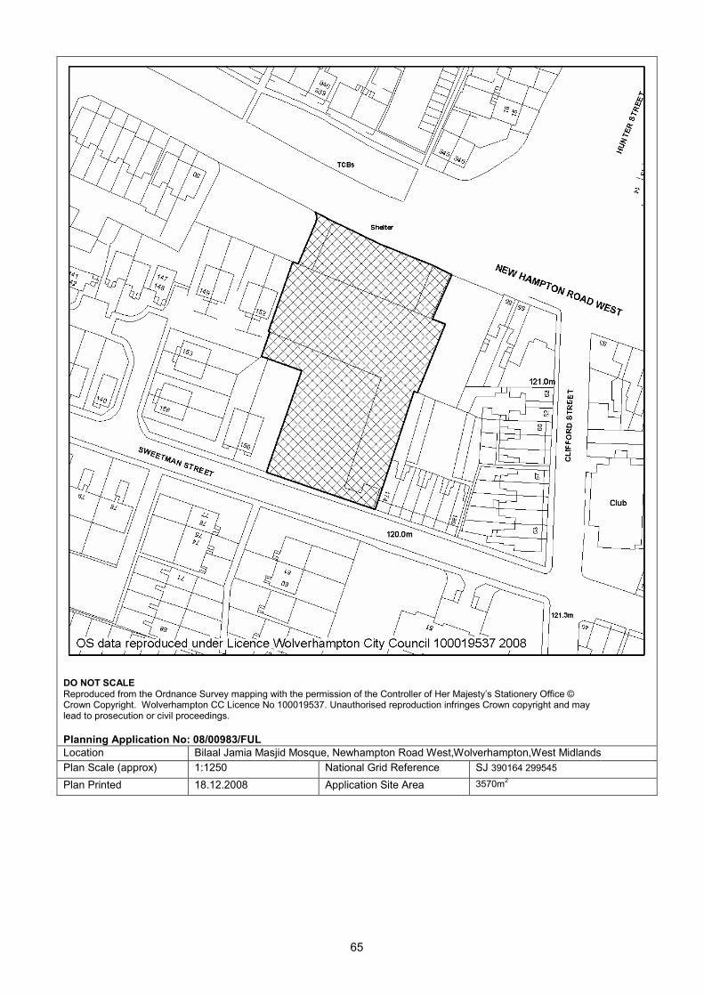
65
DO NOT SCALE Reproduced from the Ordnance Survey mapping with the permission of the Controller of Her Majesty’s Stationery Office © Crown Copyright. Wolverhampton CC Licence No 100019537. Unauthorised reproduction infringes Crown copyright and may lead to prosecution or civil proceedings.
Planning Application No: 08/00983/FUL
Location Bilaal Jamia Masjid Mosque, Newhampton Road West,Wolverhampton,West Midlands
Plan Scale (approx) 1:1250 National Grid Reference SJ 390164 299545
Plan Printed 18.12.2008 Application Site Area 3570m2
66
COMMITTEE REPORT: 1. Site Description and background 1.1 This application was deferred at the meeting of the Committee on 2 December to
enable a site visit to be made.
1.2 The site is approximately 2 miles to the west of Wolverhampton City Centre, and 100m from the junction of Richmond Road with Compton Road.
1.3 The area is characterised by large Victorian and Edwardian detached and semi-
detached residential villas set back from the road frontage and with generous gardens to the rear. There is a significant degree of tree cover in the gardens of and along the frontages of Richmond Road which gives the area a green and leafy appearance. 94 Richmond Court to the south is a residential care home. 104 Richmond Road to the North is a dwelling house.
1.4 The application site fronts onto Richmond Road with a pair of late Victorian/Edwardian
semi-detached villas, with a former coach house to its south side and a modern garage and parking area to its north side. There are several phases of extension already existing on the site to the rear, a combination of both single and two storey.
1.5 The site is an irregular rectangle, 0.52 Ha in area, which runs along the boundary of
104 Richmond Road projecting behind its garden, runs along the backs of 147, 149 and 151 Compton Road, forms a boundary with the allotment site to the rear and runs the full length of the boundary with 94 Richmond Road. It lies below the level of gardens to the south on Richmond Road and those on Compton Road.
1.6 There are significant trees on the site including cypress, which are protected under
TPO 02/2/175-161 and other trees which contribute to the 'green and leafy' appearance of the local area.
APP NO: 08/01198/FUL WARD: Park
DATE: 18-Sep-08 TARGET DATE: 13-Nov-08
RECEIVED: 18.09.2008
APP TYPE: Full Application
SITE: Nursing Home 98 To 100, Richmond Road, Wolverhampton, West Midlands
PROPOSAL: Extensions and alterations to nursing home to provide 14 additional bedrooms.
APPLICANT: Mr S Jakhu Caram (AH) Ltd C/O Agent
AGENT: Mr David Stentiford Pegasus Planning Group 5 The Priory Old London Road Canwell Sutton Coldfield B75 5SH

67
1.7 The existing premises comprise the semi-detached villas on the Richmond Road
frontage and a long, rear extension. The rear extension does not follow a continuous line. However, in total the building measures approximately 81m from front to back. The frontage buildings are 3 storey the 2nd floor is coved into the roofspace at 12m high; the first part of the extension falls to single storey with a large roof measuring between 5.5m and 6.5m high variously over 32 metres where it meets the two storey extension with a hipped roof which is 9m high.
1.8 Approval exists (06/0446) for the creation of a very large, long extension to the rear
(shaped like a backwards question mark) replacing parts of the existing 81metre building. The rear portion at right angles to the main extension would be approximately 33m long and 10m wide and the long extension would total 60m and approximately 10m wide with the rear 31m offset to the 8m towards the north west. This extension would be 2 storey and 9m high, with a traditional hipped roof to tie in with the adjoining part of the existing building. There would be 16 additional bedrooms in the approved extension along with the necessary care facilities, work has commenced on site, making a total of 56 bedrooms for a total of 56 residents compared to the existing total of 40 bedrooms and 40 residents.
2. Application details 2.1 The proposal involves the addition of a further floor of bedroom accommodation above
the two storey block approved under terms of permission 06/0446/FP. This second floor of accommodation would also extend over the rear most section of the existing rear two storey block. The resulting additional floor of accommodation would provide 2 day rooms. 10 single bedrooms, and assisted bathroom, nurse station, treatment roof, toilets and associated facilities.
2.2 The application also proposes the formation of 4 bedrooms by alterations to the roof of
the single storey link building which will enable a first floor corridor link between the original frontage building and the modern 2/3 storey extensions to the rear through the roof space of the link building which will also accommodate 4 further bedrooms, making a total of 70 bedrooms (including the 16 approved under 06/0446) and a total of 70 residents. The 4 No. bedrooms within the existing roof would result in the formation of 4 dormer windows and 4 velux windows overlooking the internal gardens to the site.
2.3 The development proposals also incorporate alterations to the external layout of the
site, these being as follows:
• Secure cycle parking area
• Visitor and disabled parking spaces
• Bin store
• 5 parking spaces to the rear of the coach house
• minor external works: resurfacing of car park and new paving areas and various boundary and internal walls.
2.4 There will be an increase in height of the existing/approved building to the centre/rear
of the site, with the ridge height of the building being some 1-2 metres above that of the existing. The northeast elevation of the proposed building is a three storey block with eight small projecting bays and an extension of the previous application to a further floor in height. The roof design incorporates a shallower pitch than that of the former building.

68
3. Planning History 3.1 08/00203/FUL for 2nd Floor extension and enlargement of previously approved
proposals, restoration of garage, first floor extension over single storey link, reconfiguration of parking area Refused, dated 10.04.2008.
3.2 07/00602/FUL for Demolition of existing extensions, erection of 80 bed care home and 14no. Retirement apartments with associated parking and external works, Withdrawn dated 13.07.2007.
3.3 07/01558/FUL for 2nd Floor extension and enlargement of previously approved
proposals Refused, dated 27.12.2007. 3.4 06/0446/FP/C for Extensions to existing nursing home, Granted, dated 29.08.2006. 3.5 C/1387/88 for Medical Nursing Home in conjunction with 100 Richmond Road,
Granted, dated 23.11.1988. 3.6 C/0575/88 for Change of use to medical nursing home in combination with 100
Richmond Road, Refused, dated 10.06.1988. 4. Constraints 4.1 Tree Preservation Order - TPO Ref: 06/00636/TPO
Tree Preservation Order - TPO Ref: 06/00266/TPO 5. Relevant policies 5.1 D1 - Design Quality
D3 - Urban Structure D4 - Urban Grain D6 - Townscape and Landscape D7 - Scale - Height D8 - Scale - Massing D9 – Appearance D11 - Access for People with Disabilities part D12 - Nature Conservation and Natural Features D13 - Sustainable Development Natural Energy HE1 - Preservation of Local Character and Dist N7 - The Urban Forest EP1 - Pollution Control EP5 - Noise Pollution H6 - Design of Housing Development H12 - Residential Care Homes AM1 - Access, Motabaility and New Development AM7 - Travel Plans AM10 - Provision for Cyclists AM12 - Parking and Servicing Provision SPG3 - Residential Development

69
6. Publicity 6.1 The nature of the proposal did not require the application be the subject of press
advertisement. A site notice was posted on 26/9/08. 7. Neighbour notification and representations 7.1 Two objections on the grounds of access for fire engines, affect trees on site, increase
traffic flows, undesirable impact on the amenities of the area, outlook of neighbours, increase in on street parking, and disturbance from increase in parking, delivery and general staff use of the car park and driveway adjacent to boundary.
8. Internal consultees 8.1 Transportation Development: No objections . Condition the submission of a Travel
Plan. 8.2 Building Control: Awaiting Fire Officer Comments. 8.3 Access Team: Parking and entrances need to be well lit. Flush dropped kerbs with
buff blister tactile paving at road junctions and crossings are necessary, entrance doors need to be 825mm, disable w.c's need to be 2.2m by 1.5m, nurses station should be accessible to both standing and seated visitors at a height of 760mm and a loop system. Lifts must comply with Part M and minimum dimensions 1.1m by 1.4m.
8.4 Landscape: Detail hard and soft landscape plan will be required with details of fencing,
bollards, parking and types and sizes of trees and shrubs to be planted. 8.5 Food Safety – no objection. Currently bin/refuse containers are stored where the
proposed bin store is to be erected. If anything a bin store would reduce risk of causing an odour nuisance. Condition recommended.
8.6 Environmental Protection – limitations on construction phase and note for information
to limit the potential for complaint. 9. Appraisal 9.1 The key issues are as follows:
• Principle of the development
• Design
• Trees.
• Transportation
• Amenity 9.2 Principle of the extension of the existing use The site is considered to be an appropriate location for a nursing home. There is
planning permission for a 16 bedroom extension taking the total number of bedrooms to 56 which can be accommodated on the site although the shape of the approved proposal is not the optimal design to fit with the frontage buildings or the pattern of neighbouring development. The additional bedrooms proposed in this application take the total to 70 bedrooms which is a 75% increase from the existing and which is considered to be excessive and out of scale for the site for the reasons set out below.

70
9.3 There would be sufficient private amenity space in the proposal for the use of the occupants if the form of the development were acceptable.
9.4 Design Wolverhampton's Unitary Development Plan requires development to respect the
existing urban grain - Policy D4. The existing pattern of dwellings and gardens in the surrounding vicinity are large dwelling houses fronting roads and substantial garden areas to the rear. The rear gardens occupy upwards of 70% of the residential plot. The density of occupation of this part of Wolverhampton is therefore very low. This pattern has already been adversely affected by extensions within the application site and the adjacent site, 94 Richmond Road. Nevertheless the character of the area remains of large attractive gardens with mature vegetation.
9.5 The proposed new scheme has a hipped roof design. This is in keeping with the
existing villas but due to the size and layout of the ground floor footprint, the consequent mass and height of the extension are considered to be at odds with the character and appearance of the area.
9.6 The alterations to the central element have managed to maintain the appearance of a
lower roof, than the previously refused scheme 08/0203 however, it is still considered that the proposed extensions are not sufficiently low in height over the majority of their length to adequately respect the frontage villas as the dominant element and would therefore not be read as being subservient to the frontage villas. It is therefore, considered, that in combination with the existing extensions, the design would generate a very poor and alien form of development in the context of the frontage villas and its scale and particularly its volume would be very significantly detrimental to the open nature of the large gardens in the vicinity. The slope of the roof on the rear tree storey section has been halved, to 20 degrees, by comparison with that of the already refused scheme, in an attempt to reduce the impact on surrounding gardens. However this has resulted in a much shallower pitch to the roof this section of the building, not in keeping with the steeper pitch (40 degrees) of the existing roofs and those proposed for the other new elements. The pitch will be so low that for some distance back from the building it will appear almost as a flat roof, detracting seriously from the established character of the original building and that of the other new section which do respect the original pitch.
9.7 The footprint of the proposal is significantly different from development to the rear of
other properties in the immediate locality and while a similar shaped extension has previously been approved at the site, the additional size and height of this proposal exacerbates its impact. Therefore it is considered that the proposal demonstrates an unacceptable departure from the existing pattern of development.
9.8 Therefore, as in the previous application (08/0203), the combination of bulk and height
of the proposal at 9, 10m and 6m in the rear garden, is not sufficiently subservient to the original building on Richmond Road frontage villas 11.5m and 10.5m at ridge and is therefore out of scale with them. In this respect the proposal does not meet policies D1, D4, D7, D8, D9 or H12.
9.9 Trees
The application does not involve the removal of any trees above and beyond those which have already been consented for removal as a consequence of the earlier planning consent.

71
9.10 The criticism of the previous scheme based upon loss of trees has been overcome through the retention of the three Cypress trees on the site frontage. All other alterations to protected trees have been approved pursuant to permission 06/0446/FP. It is therefore accepted that there is no harm arising from the removal of protected trees.
9.11 Transportation Issues
The proposed level of parking in the application is considered to be acceptable. The drawing up and subsequent submission for approval of a Travel Plan is recommended as a planning condition.
9.12 Amenity issues
Compared to the scheme refused under 08/0203 the proposal has now reinstated the garage and removed one parking space along part of the boundary with 104 Richmond Road, and moved it to the opposite side of the site along the boundary and parking area to the neighbouring residential home at 94, along with a further three car parking spaces. The agents suggest the reinstatement of the garage acts as a buffer zone between parking and manoeuvring areas and the neighbouring property, and the addition of car parking spaces will also reduce the level of traffic movement along the neighbouring property at No. 104. However, there is still a large number of parking spaces along this boundary (as already exists), but with an increase in number of bedrooms, and the possibility for an increase in traffic movement, It is considered that the disturbances from vehicle movement would be unacceptable along this boundary even with additional parking spaces to the opposite side.
9.13 As highlighted in the previous refusal, the closest access to the entrance door would
be along the boundary with No. 104 and as the home would be enlarged to have 75% more bedrooms for residents, the amount of activity would also be expected to increase by 75%. This would generate a significant and unacceptable detrimental impact on the living environment of the occupants of 104 Richmond Road. This would be contrary to policies D1, H6, EP1 and EP5 and potentially EP3.
9.14 As also stated in the previous refusal, the proposal would exacerbate the poor outlook
and an overbearing visual impact for the occupants of the properties 147- 151 Compton Road as a result of the scale and height of the proposal and despite level differences there is serious potential for overlooking of their garden areas from the new bedrooms on the second floor rear where windows are so designed as to project out from the main façade. Those of the second floor windows which are closest to these gardens (a window to a treatment room and corridor window) are indicated as to be obscurely glazed, but this can still result in a ‘perceived’ overlooking by occupants of the adjoining gardens, adding to the sense of ‘overbearing’. This would be contrary to policies D1 and H6.
9.15 The proposal now identifies the position of kitchens and cooking areas, and storage of
bins, there is however no detail on provision of ventilation equipment for the development. This could be required by condition.
10. Conclusion 10.1 The applicant has made significant improvements on the design of the extension that
recently refused planning permission and is soon to heard on appeal. However, the proposal is still considered to be overdevelopment of the site, being out of scale and so detracting from the established spacious character of the area, having a detrimental impact on neighbouring amenities due to smells, outlook, and privacy.

72
11. Recommendation 11.1 Refuse, for the following reasons:
1. Out of scale and character with the existing building and surrounding development. Policies:D1 - Design Quality, D3 - Urban Structure, D4 - Urban Grain, D6 - Townscape and Landscape, D7 Scale-Height.
2. Neighbouring amenity – noise disturbance from increased level of traffic, manoeuvring, and accessing the front entrance of the development. Policies: EP1 - Pollution Control, EP5 - Noise Pollution, EP3 Air Pollution, D1 Design Quality, H6 Design of Housing Development and H12 Residential Care Homes.
3. Neighbouring amenity – overbearing, outlook and privacy. Policies D1 Design Quality, D7 Scale-Height, D8 Scale-Massing, D9 Appearance, H6 Design of Housing Development, and H12 Residential Care Homes.
Case Officer : Tracey Homfray Telephone No : 555641 Head of Development Control – Stephen Alexander

73
DO NOT SCALE Reproduced from the Ordnance Survey mapping with the permission of the Controller of Her Majesty’s Stationery Office © Crown Copyright. Wolverhampton CC Licence No 100019537. Unauthorised reproduction infringes Crown copyright and may lead to prosecution or civil proceedings.
Planning Application No: 08/01198/FUL
Location Nursing Home 98 To 100, Richmond Road,Wolverhampton,West Midlands
Plan Scale (approx) 1:1250 National Grid Reference SJ 389406 298661
Plan Printed 18.12.2008 Application Site Area 5276m2