‘zeb1 for mining’
TRANSCRIPT

ZEB1 Mobile Hand-Held Laser Scanner for Mining Applications
Presenter: Henno Morkel – Laser Scanning Specialist
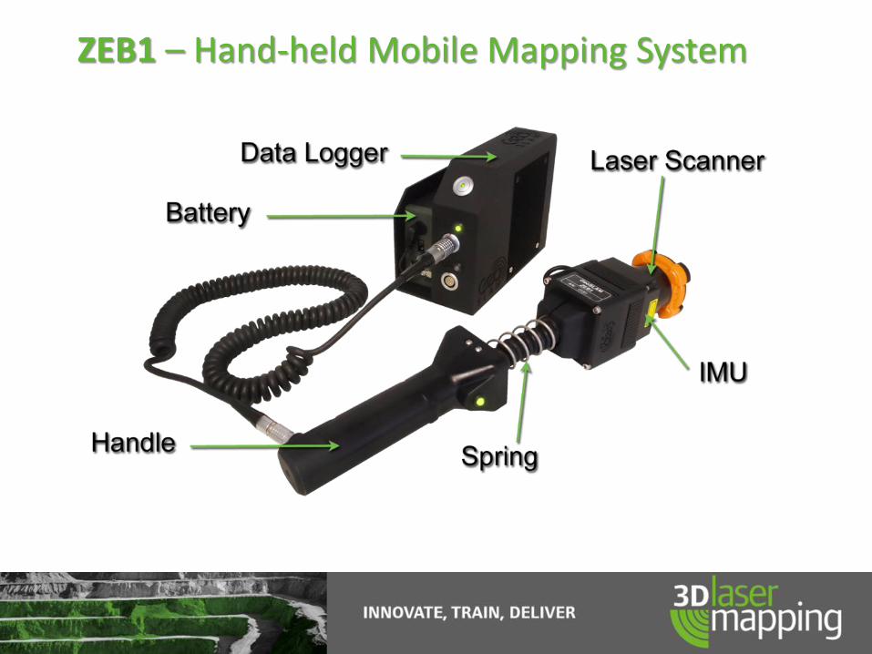
ZEB1 – Hand-held Mobile Mapping System

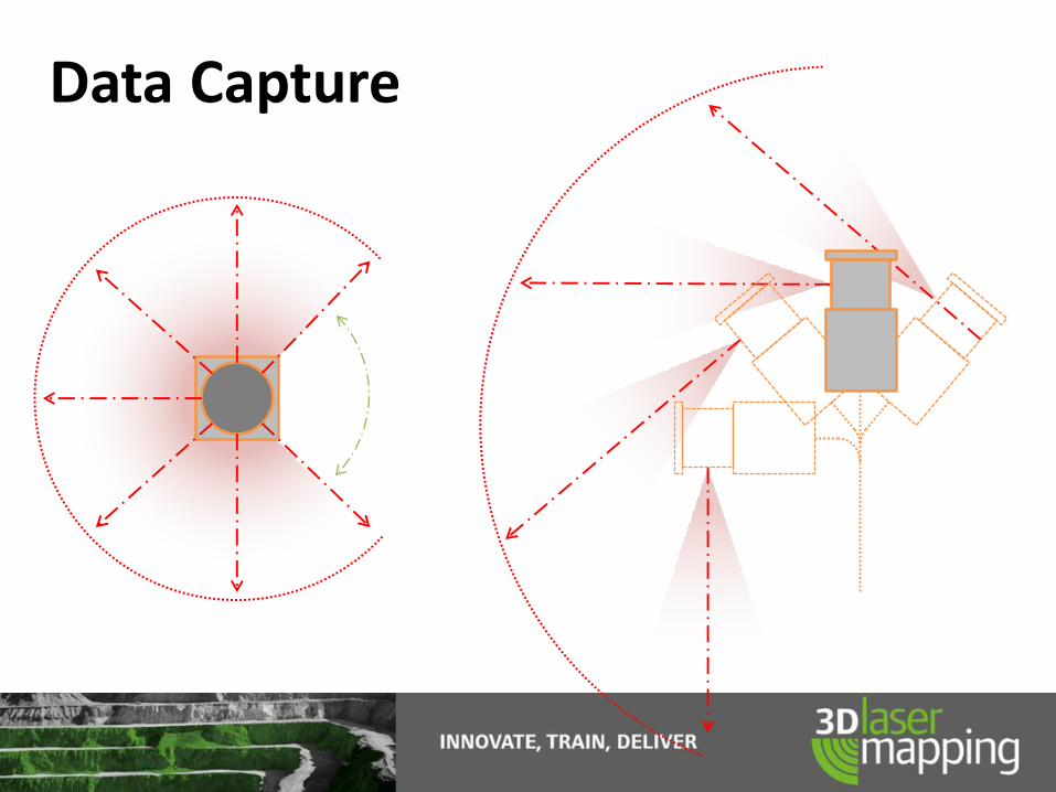
Data Capture
ZEB1 Top View
90°
Blin
d S
po
t
ZEB1 Side View
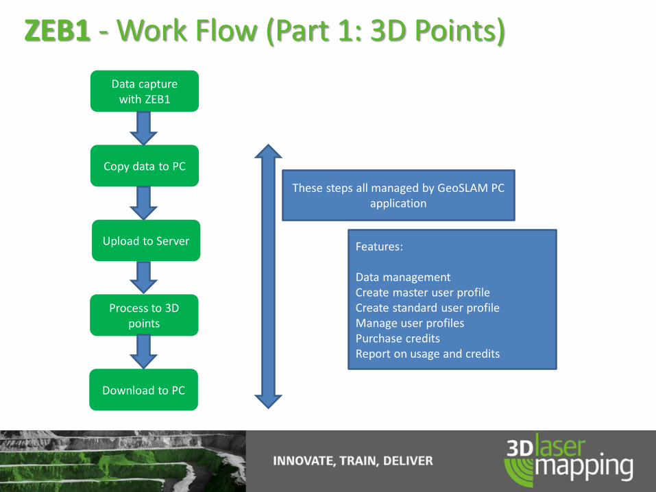
Data capture with ZEB1
Copy data to PC
Upload to Server
Process to 3D points
Download to PC
These steps all managed by GeoSLAM PC application
Features:
Data managementCreate master user profileCreate standard user profileManage user profilesPurchase creditsReport on usage and credits
ZEB1 - Work Flow (Part 1: 3D Points)
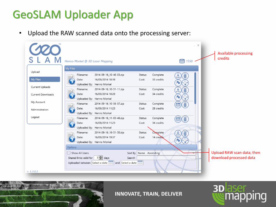
GeoSLAM Uploader App
• Upload the RAW scanned data onto the processing server:
Available processing credits
Upload RAW scan data; then download processed data
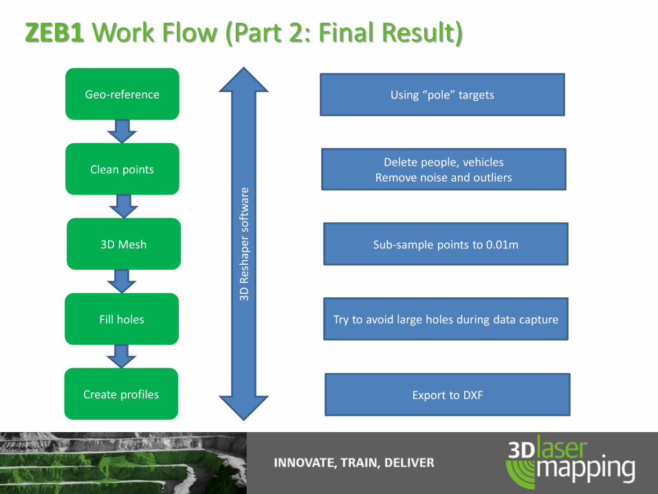
Geo-reference
Clean points
3D Mesh
Fill holes
Create profiles
Using “pole” targets
3D R
esh
aper
so
ftw
are
Delete people, vehiclesRemove noise and outliers
Sub-sample points to 0.01m
Try to avoid large holes during data capture
Export to DXF
ZEB1 Work Flow (Part 2: Final Result)

Geo-referencing RAW scan data to control
Intersection of pole and
roof is control point
Hang short pole
from roof peg
Sphere picked up
in scan data

Data Processing Calculation

Board-and-pillar underground coal mine example -Scanning time 13 min - Processing time 13 min

Mining Applications
• Underground Mine Mapping: Mapping areas without previous (or outdated) survey information
• Precise Offsetting - Rapidly scan a big area for measuring your offsets
• Roof support bolts inspection - Inspect the layout and locations of your underground roof supporting bolts
• Accurate monthly mining advance volume calculations - By creating a triangulated solid mesh from the point cloud generated one can quickly
calculate your monthly advance volumes
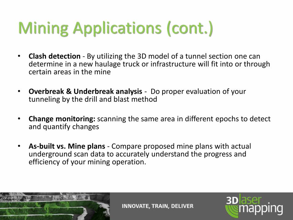
Mining Applications (cont.)
• Clash detection - By utilizing the 3D model of a tunnel section one can determine in a new haulage truck or infrastructure will fit into or through certain areas in the mine
• Overbreak & Underbreak analysis - Do proper evaluation of your tunneling by the drill and blast method
• Change monitoring: scanning the same area in different epochs to detect and quantify changes
• As-built vs. Mine plans - Compare proposed mine plans with actual underground scan data to accurately understand the progress and efficiency of your mining operation.

Mining Applications (cont.)
• Restricted area mapping: use of the ZEB1 along a remote vehicle to safely scan in areas of difficult access (ZEB+ZEBRA combo)
• Incident recording: use to record all details surrounding an incident scene
• Advance tracking: to quantify advances in underground tunnels
• Volume calculation: measure stockpile volumes and other materials
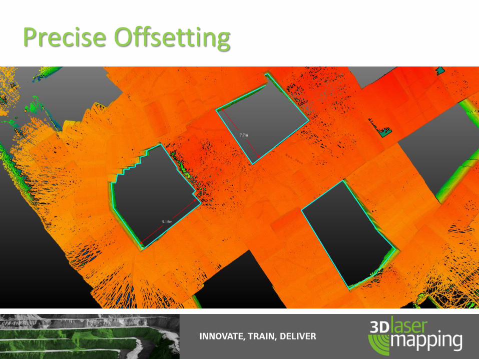
Precise Offsetting

Roof bolts Support Inspection

Roof bolts Support Inspection (cont.)
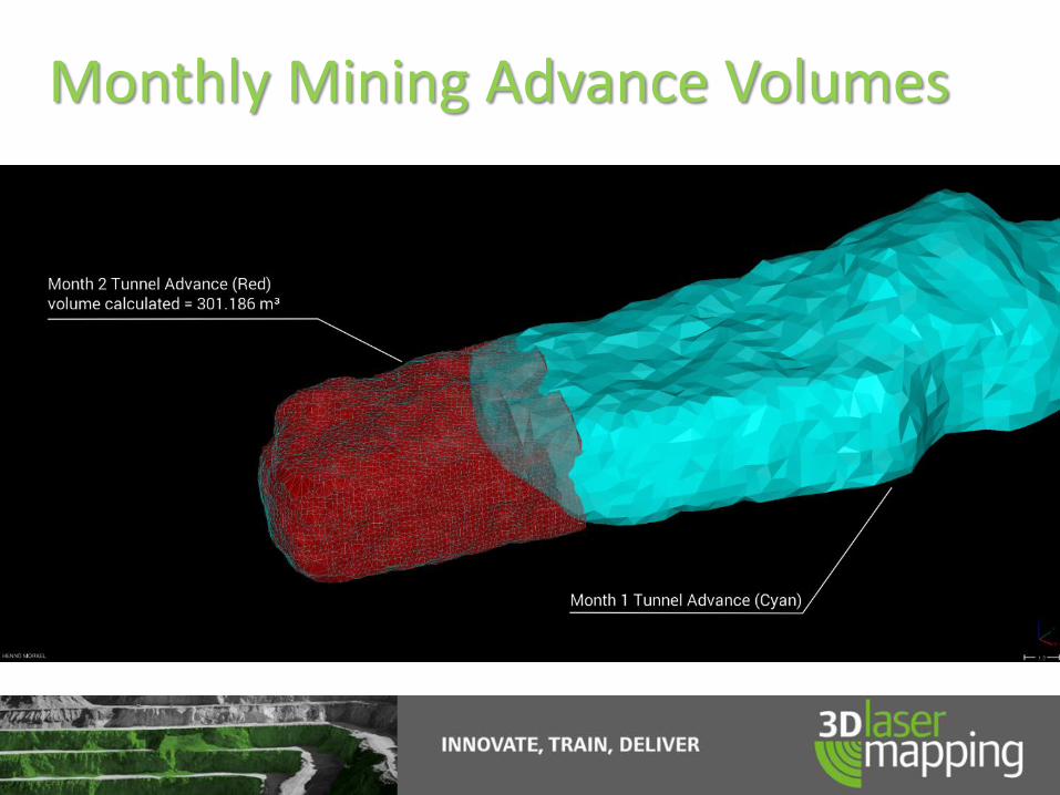
Monthly Mining Advance Volumes

Clash detection
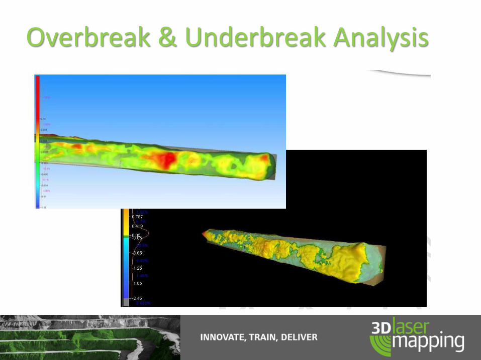
Overbreak & Underbreak Analysis
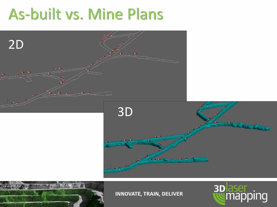
As-built vs. Mine Plans
2D
3D

ZEB1 - Scanning Examples – Underground tunnels
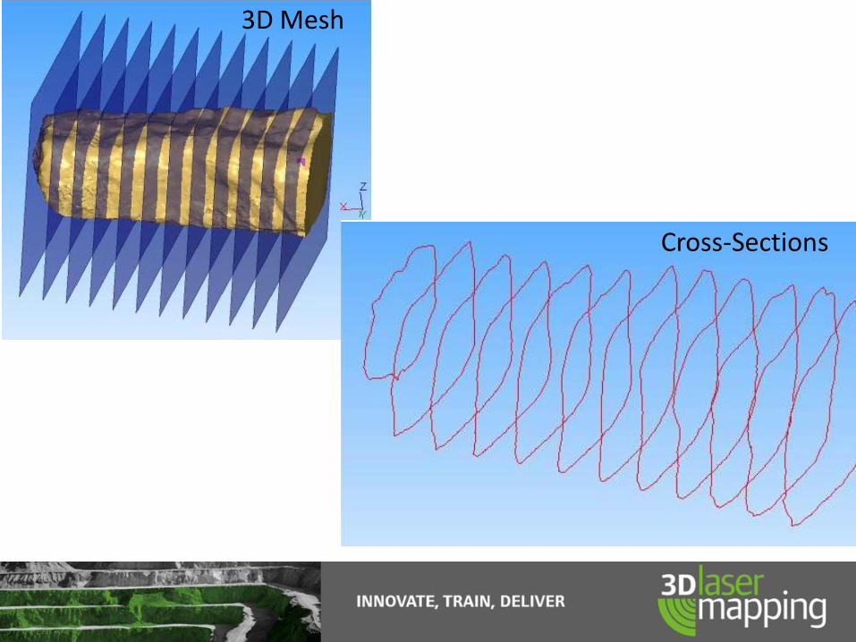
Cross-Sections
3D Mesh

ZEB1 - Scanning Example-Sections

ZEB1 - Scanning Example – Stockpile scan

ZEB Data Works With

ZEB Data Works With

Best Practice Guidance
SurveyENCLOSED
environments
SurveyFEATURE-RICHenvironments
SurveyEXTERNAL
environments
PerformCONTINGENCY
PLANNING
ConductREAL ESTATEVALUATIONS
ConductSTOCK PILEANALYSIS
SurveyWIDE-OPEN
environments
SurveyMULTI-LEVELEnvironments
SurveyFEATURE-LESSenvironments
SurveyUNDERGROUND
MINES
SurveyBUILDINGS for
SKETCH DESIGN
REDUCE COSTof survey
ELIMINATEsoftware
PURCHASE costs
REDUCE TIMEon-site
SurveyFOR LONGERthan 30 mins.
SurveyBUILDINGS forDETAIL DESIGN
SurveyFORESTS
Obtain dimensions forFABRICATINGSTEELWORK
CRIME SCENERECORDING
SurveyTO ACHIEVE
+/- 1mm

ZEB1 Users
ZEB1 Shaft ScanningCase Study at Kiruna Mine, Sweden with ÅF Consult

The Challenge:
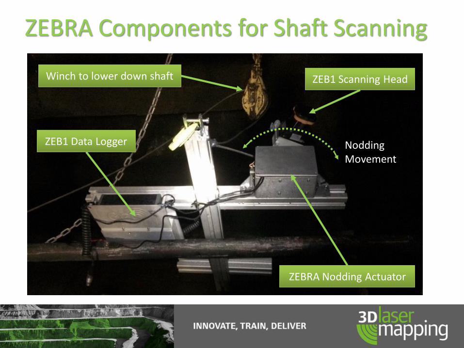
ZEBRA Components for Shaft Scanning
ZEB1 Scanning Head
ZEBRA Nodding Actuator
ZEB1 Data Logger
Winch to lower down shaft
Nodding Movement
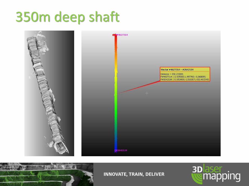
350m deep shaft

View Down Shaft
View from Top – showing scan head trajectory

ZEB1 Survey Process
• Lower ZEB1 down shaft and raise back up.
– 30 mins
• Upload for automatic processing.
– 30 mins processing
• Data available for analysis.
– Immediate review of results
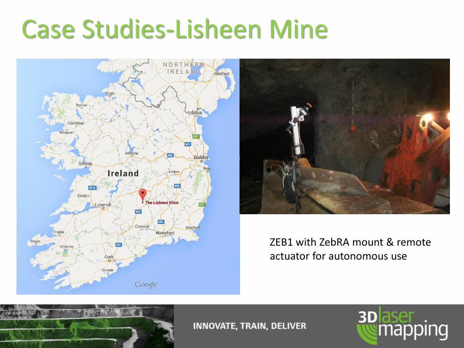
Case Studies-Lisheen Mine
ZEB1 with ZebRA mount & remote actuator for autonomous use

Case Studies-Lisheen Mine
Section of tunnel measured with Total Station and Modelled using 3DReshaper. Note the accurate roof surface and the approximate tunnel profile generated by reducing the number of measurement points used to create the walls.

Case Studies-Lisheen Mine
Identical section of tunnel measured this time with ZEB1 and modelled again using 3D Reshaper. Note this time the improved accuracy for all tunnel surfaces including roof and walls leading to more accurate tunnel volume calculations.

Worldwide
Thank You!
Questions?