laurie waite final project presentation elluminate session december 6, 2009
TRANSCRIPT

Laurie WaiteFinal Project Presentation
Elluminate SessionDecember 6, 2009
Daily Use of Maps:A Case Study!
Laurie WaiteDecember 2, 2009
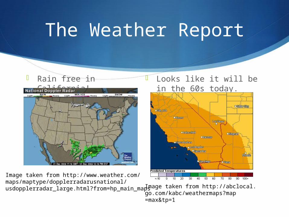
The Weather Report
Rain free in California! Looks like it will be in the 60s today.
Image taken from http://www.weather.com/maps/maptype/dopplerradarusnational/usdopplerradar_large.html?from=hp_main_maps Image taken from http://abclocal.
go.com/kabc/weathermaps?map=max&tp=1

Traffic Report
Before heading out to LAX to pick up my parents, I use the Google maps app on my iPhone. The purple line indicates my route. The green lines shows traffic moving at full speed, yellow at medium and red as stop-and-go. For Los Angeles, the traffic report looks great!

Guidanceto LAX
In order not to get lost, I set my in car Panasonic GPS unit that was included in the purchase of the car. The program gives me turn by turn instructions at the top. It also shows how many miles I must go before I make another turn. I can zoom in or out if needed.
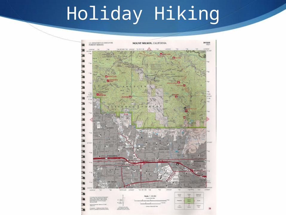
Holiday Hiking
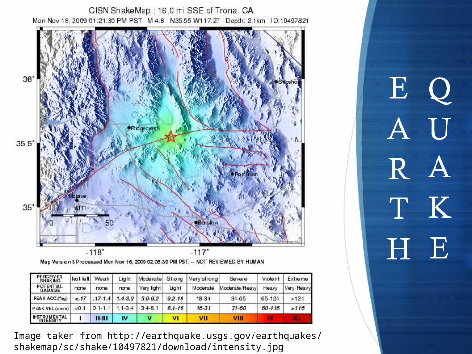
Image taken from http://earthquake.usgs.gov/earthquakes/shakemap/sc/shake/10497821/download/intensity.jpg
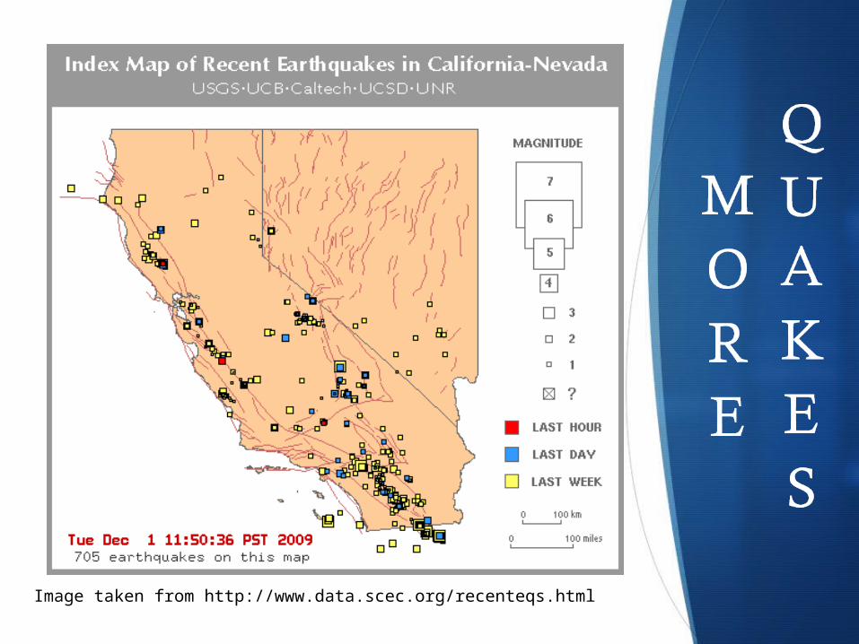
Image taken from http://www.data.scec.org/recenteqs.html
Homework Help
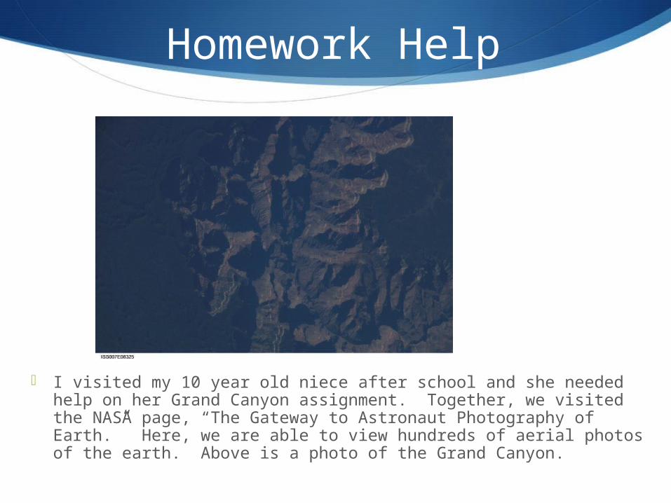
I visited my 10 year old niece after school and she needed help on her Grand Canyon assignment. Together, we visited the NASA page, “The Gateway to Astronaut Photography of Earth.” Here, we are able to view hundreds of aerial photos of the earth. Above is a photo of the Grand Canyon.
Image taken from the
International Space Station
http://earth.jsc.nasa.gov/
scripts/sseop/QuickView.
pl?directory=ESC&ID=
ISS007-E-8325
More Homework Help
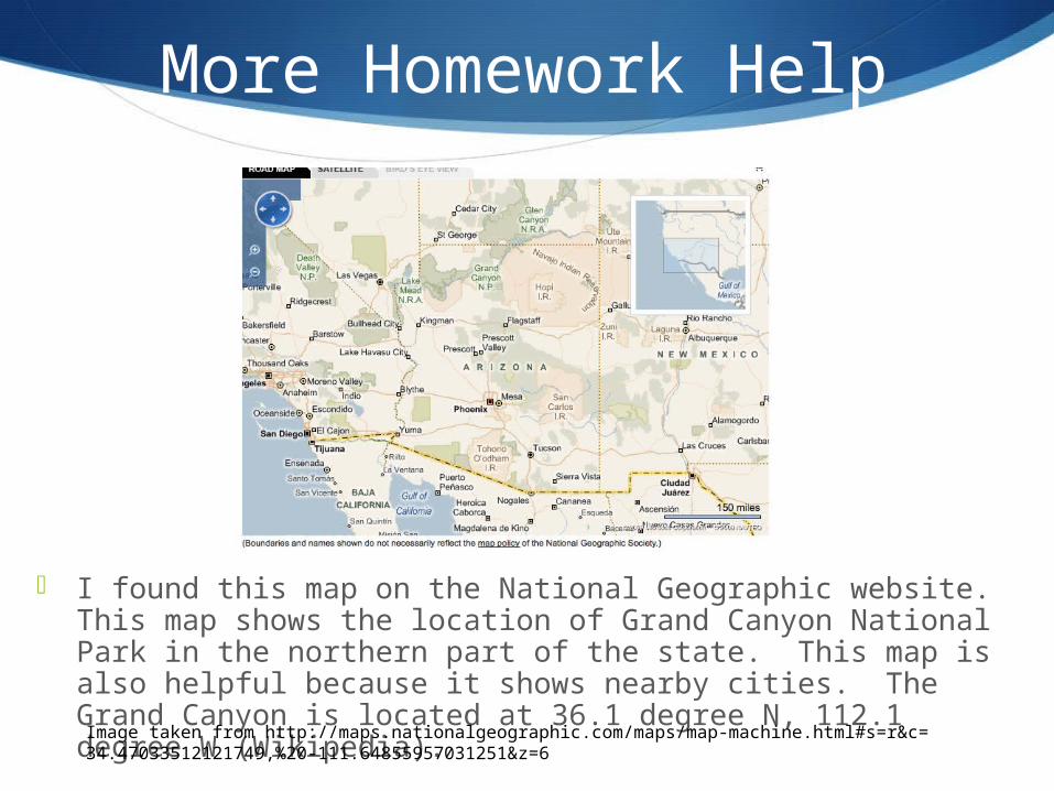
I found this map on the National Geographic website. This map shows the location of Grand Canyon National Park in the northern part of the state. This map is also helpful because it shows nearby cities. The Grand Canyon is located at 36.1 degree N, 112.1 degree W (Wikipedia).
Image taken from http://maps.nationalgeographic.com/maps/map-machine.html#s=r&c=34.47033512121749,%20-111.64855957031251&z=6
California Drought
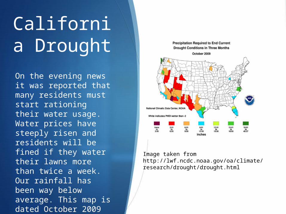
On the evening news it was reported that many residents must start rationing their water usage. Water prices have steeply risen and residents will be fined if they water their lawns more than twice a week. Our rainfall has been way below average. This map is dated October 2009 and illustrates how much rainfall is needed to end the drought.
Image taken from http://lwf.ncdc.noaa.gov/oa/climate/research/drought/drought.html
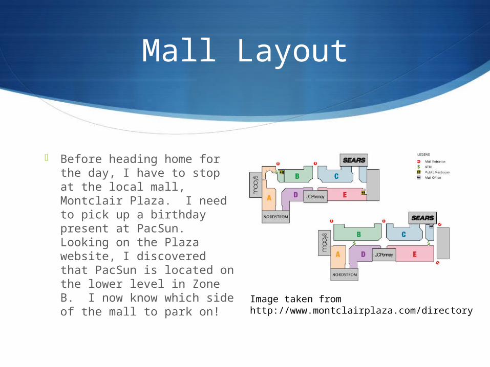
Mall Layout
Before heading home for the day, I have to stop at the local mall, Montclair Plaza. I need to pick up a birthday present at PacSun. Looking on the Plaza website, I discovered that PacSun is located on the lower level in Zone B. I now know which side of the mall to park on!
Image taken from http://www.montclairplaza.com/directory
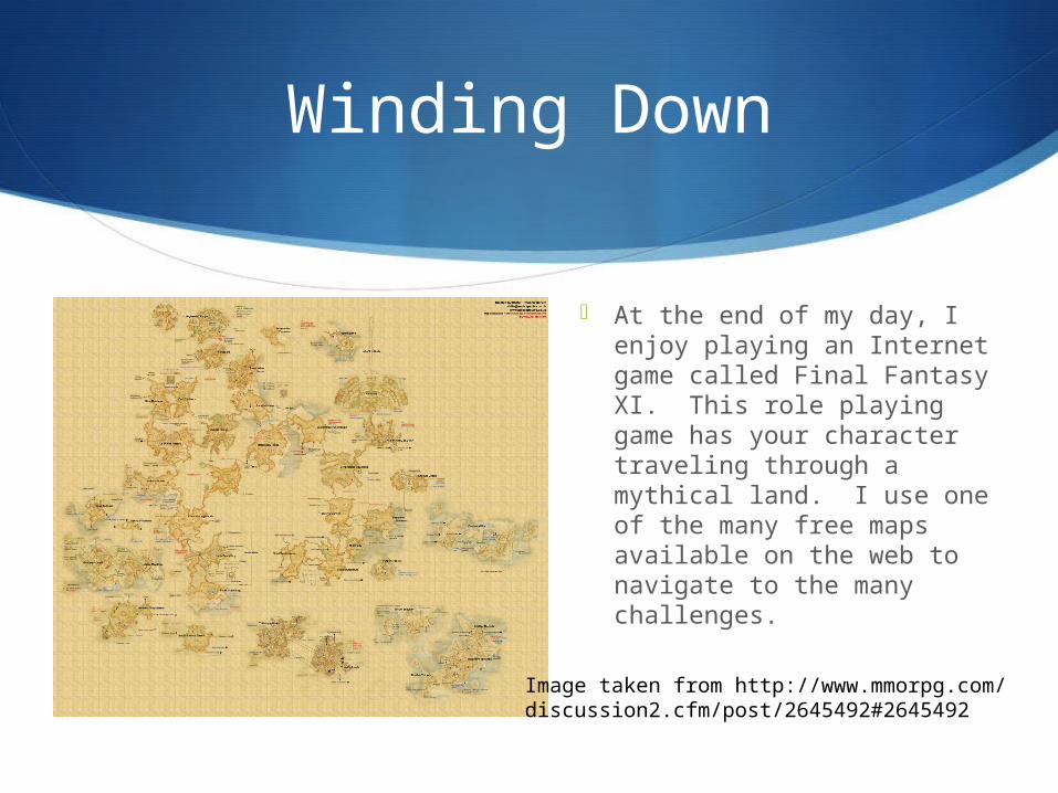
Winding Down
At the end of my day, I enjoy playing an Internet game called Final Fantasy XI. This role playing game has your character traveling through a mythical land. I use one of the many free maps available on the web to navigate to the many challenges.
Image taken from http://www.mmorpg.com/discussion2.cfm/post/2645492#2645492
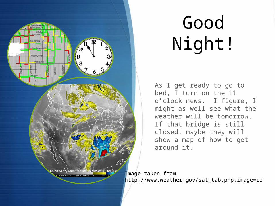
Good Night!
As I get ready to go to bed, I turn on the 11 o’clock news. I figure, I might as well see what the weather will be tomorrow. If that bridge is still closed, maybe they will show a map of how to get around it.
Image taken from http://www.weather.gov/sat_tab.php?image=ir