cherokeehazel.files.wordpress.com · web viewspatial analysis location 18.1167 n, 65.4167 w vieques...
TRANSCRIPT

VIEQUES, PUERTO RICO
Fig. 1 courtesy of: http://www.perpetualexplorer.com
Who Glows There?Spatial Analysis
LOCATION 18.1167° N, 65.4167° W
BIOLUMIESCENT BAY

Vieques (vee-AI-kais) is an island 76 miles south of Puerto Rico. The number above is the
latitude and longitude coordinate features that help us to locate Vieques on a map. But where is Vieques?
Montana is 3224 miles from the island of Vieques. The route to Vieques is taken through Florida to the
Commonwealth of Puerto Rico. Vieques was established as a U.S. territory in 1884.
Puerto Rico is a much larger island than Vieques, spanning 100 miles long as opposed to Vieques which is
only 21 miles long. Vieques neighbors
Culebra which is 15 miles north. These
islands are sometimes referred to as the
Spanish Virgin Islands owned by the Spanish
before the Spanish-American War of 1898 (Spanish American War, n.d., documentary).
http://islandsofpuertorico.com/regions-of-puerto-rico/.
BIOLUMINESCENCE AND PEOPLEWhat is bioluminescence?
Bioluminescence occurs in many species of insects, plants, micro-organisms and occur all over
the world. Most sea animals have a degree of bioluminescence especially in the deep sea.
Bioluminescence means “life glow”. A chemical reaction using a product known as “luciferin” is
synthesized in an organism or creature and the effect is an incandescent blueish green (as in fireflies) or
blueish purple as in many lagoons.
This reaction from creatures is a defense response. The creature feels threatened and therefore
glows as a response to vibrations, agitation or mating. There is no freshwater stream leading into the big
bio bay that could lower the salinity to undesirable levels. Human contamination from sewage which
seriously degraded a bio bay on the Big Island is not a problem in Vieques” ("Abe's Snorkeling & Bio
Bay Tours - Vieques Puerto Rico"). The bay is secluded and encircled to keep the dinoflagellates safe
and the water consistent.
Courtesy: http://viequesfineproperties.com/wp-content/gallery/about-vieques/property_map.jpg
Why is it in Vieques-Mosquito Bay?

Puerto Rico has three Bio Bays as seen in the map below*. Dinoflagellates are the organisms that
make the Bioluminescent Bay in Vieques glow and there are 750,000 for every gallon of water. The
perfect habitat exists in the Bioluminescent (Mosquito) Bay. Mangrove trees are abundant and live at the
coastline providing shelter and food from its dead leaves that the dinoflagellates eat ("Descriptions and
articles about the Red Mangrove (Rhizophora mangle) - Encyclopedia of Life"). The water is calm, with
consistent temperatures year round. The balance in the bay contributes to why Vieques has the brightest
and healthiest Bioluminescent Bay in the entire world.
Three Bioluminescent Bays in Puerto Rico
Map source: http://www.biobaypuertorico.com
The tours are taken via silent boats. There are other bioluminescent bays, lagoons and lakes that
people can swim in. The Maldives in the Indian Ocean have many bays, Northwestern coast of Australia
has a lake and there are caves in Australia dripping with green glowing slime from glow worms.

People play a vital role in the
preservation of the Bio Bay in Vieques.
Now that the island is economically
dependent on eco-tourism, thousands of
people flock to the brightest glowing bay in
the world. The tours are careful to not
endanger the dinoflagellates with
Photo:
http://www.abessnorkeling.com/images/photos/biobay_tato.jpg
VIEQUES, PR AND MISSOULA, MTGeographic Size
Vieques is approximately 21 miles long and the city of Missoula is a staggering 551 miles long. You
could perceivably fit 26 Vieques Islands inside of the city of Missoula.
Vieques Map(Left): http://www.elenas-vieques.com/decem/Vieqmap.jpeg
Map of Missoula neighborhoods (right): ftp://ftp.ci.missoula.mt.us/Maps%20and%20Graphics/City%20Maps/PDF/Citymap.pdf

What is in a name?
Vieques is the Spanish word that means:”small island” given by the Taino Indians.
Missoula is a “Salish Indian word meaning: near the cold, chilling waters,” (The Missoula County History.
(n.d.) Historical Museum at Fort Missoula. Retrieved from: http://www.fortmissoulamuseum.org/history.php)
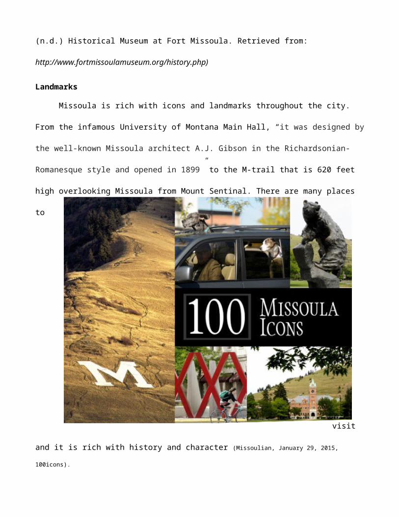
Landmarks
Missoula is rich with icons and landmarks throughout the city. From the infamous University of
Montana Main Hall, “it was designed by the well-known Missoula architect A.J. Gibson in the
Richardsonian-Romanesque style and opened in 1899” to the M-trail that is 620 feet high overlooking
Missoula from Mount Sentinal. There are many places to visit and it is rich with history and character
(Missoulian, January 29, 2015, 100icons).
http://bloximages.chicago2.vip.townnews.com/missoulian.com/content/tncms/assets/v3/editorial/a/d2/ad2e4ba4-fe23-11e3-a57c-
0019bb2963f4/53adaf260a8bc.preview-620.jpg

Vieques is identified as the largest, brightest and healthiest Bioluminescent Bay in the world. It can be
seen year round and glows a greenish blue when activated by motion. This is a protected area as the
unique ecosystem is so impressive relying on a delicate balance.
Bioluminescent (Mosquito) Bay
Photo at top by Phil Heart http://www.yurtopic.com/travel/destinations/puerto-rico-places.html, Bottom: Mosquito Bioluminescent Bay in Vieques, Puerto Rico / Google Maps Image
El Fortin
Fortin Conde de Mirasol is another
landmark of history and rich landscape. “El
Fortin Code de Mirasol was built between
1845 and 1855. “El Fortin” (The fort) is
the best place on the island to learn about
the island’s history”
(http://vieques.com/fortin-spanish-fort,
March 2015).
Taino Indian Site
Part of the archaeological studies of the first inhabitants of Vieques, these stones are the remnants of a culture lost.
http://
www.casavioleta.com/galleryOne/pictures/image11.jpg
Photo courtesy: http://vieques.com/fortin-spanish-fort,

Population: Indian Origins
Vieques and Missoula have Indian Native origins. The first people that inhabited the Isle of
Vieques were the Taino Indians. ” When the Spanish settlers first came in 1508, since there is no reliable
documentation, anthropologists estimate their numbers to have been between 20,000 and 50,000, but
maltreatment, disease, flight, and unsuccessful rebellion had diminished their number to 4,000 by 1515”.
(Taino Indian Culture.(n.d.) Welcome to Puerto Rico. Retrieved from:
http://welcome.topuertorico.org/reference/taino.shtml).
From first contact with Columbus in 1493, the Taino Indigenous Peoples population were nearing
extinction due to diseases like smallpox in Vieques. The Spanish controlled Vieques for many years
using brutality and greed. In the Library of Congress exhibits, the historical encounter of the Taino
Indians and Columbus is preserved and shared:
Courtesy of: http://www.loc.gov/exhibits/exploring-the-early-americas/columbus-and-the-taino.html.
Taino Indians are not a tribe lost to the archives of history, they thrived through the female Taino women
that Columbus and his settlers took as wives. The Taino
people celebrate their heritage today many in Jamaica and
Cuba.

Photo courtesy of: http://www.jar2.com/2/Taino/TAINO.htm
Missoula, Montana is very rich in several native tribes that call it home today.” The first
inhabitants of the Missoula area were American Indians from the Salish tribe.
Photo: http://www.flatheadwatershed.org/cultural_history/images/fig3_7_salish_map08_31_2010.jpg
They called the area "Nemissoolatakoo," from which "Missoula" is derived. The word translates roughly
to "river of ambush/surprise," a reflection of the inter-tribal fighting common to the area. The Indians'
first encounter with whites came in 1805, when the Lewis and Clark expedition passed through the
Missoula Valley” (Destination Missoula, (n.d.), History. Retrieved from: http://destinationmissoula.org/history).

“The Flathead Indian Reservation, home to the Confederated Salish and Kootenai tribes. They
are a combination of the Salish, the Pend d'Oreille and the Kootenai. Of the approximately 6,950 enrolled
tribal members, about 4,500 live on or near the reservation. The reservation comprises over 1.2 million
acres between Missoula and Kalispell.” (“Missoula Measures.(n.d.), Missoula County Official Website.
Retrieved from: http://www.co.missoula.mt.us/measures/Social/amindian.htm). The Blackfeet Indian
tribe are also prevalent in the Missoula area. These tribes have inhabited the area for centuries and are a
preserved and profound culture within Missoula adding to its diversity.
MIGRATION OF LIFE
Vieques has a long history of its inhabitants being removed from their homes by imperialistic
rulers. The first recorded history speaks to that of the Indigenous Peoples that Columbus encountered in
1493. Inhabitants of the island were known as Arawak Indians which inhabited Venezuela, the Caribbean
Islands and Central America leading to Florida in America (Corbet, 1995). The Taino Indians were
considered “peaceful” people and defended themselves in battle but did not often initiate warfare.
The estimated
population of the Taino
people has a wide range
in which scholars and
locals neither can decide.
Approximately 60,000 in
1507 and by 1531 the
number was down to 600
(Corbet, 1995). As
pestilence and disease spread through the Taino Indians, their immune systems were compromised

Photo courtesy: http://theageofdiscovery.wikispaces.com/Christopher+Columbus%27+second+voyage
having never been exposed to diseases of the Spanish. Many died from illness as they were captured and
worked and died as slaves for the Spanish inhabitants while they stole gold and goods (National Library
of Medicine, "Taíno meet Columbus; "New World" gets new diseases - Timeline - Native Voices").
Timeline information courtesy of: (National Library of Medicine, "Taíno meet Columbus; "New World" gets new diseases - Timeline - Native Voices" and Corbet, 1995)
“Amerindian” women were captured and intermarried the Spanish while only a few others escaped into
the mountains of Haiti ("Vieques' People", 2015). The Spanish dominated Vieques and “colonized it in
the early 19th century”. Being independent from Puerto Rico, by 1847, the sugar industry boomed and by
this time many colonists had transported black slaves and Chinese workers to build roads and the fort in
Vieques.
The diversity of population was at its peak when the U.S. obtained control of Puerto Rico and
Vieques in 1898 after the Spanish-American War ("Vieques' People", 2015). Throughout the history of
Vieques, many more people left or died on the island than resided there. There are several accounts of
colonialism and domination by foreign lands including (in many opinions) the United States. After
slavery was abolished in Puerto Rico during the prolific sugar cane production era (1873), black slaves
AD 1000Taino Indians known as Taíno settled in Puerto
Rico and Vieques.
1493On his second voyage, Christopher Columbus
claims the island for Spain and encounters
the Taino Indians.
1507Taino population drops from millions to 60,000
as diseases spread.
1531Only 600 Taino remain
as the women were taken as brides to the
Spanish and many more killed and dying

revolted against poor working conditions of the fields and burned the crops in protest. The population
was primarily workers of the land and not landowners from the “Census of 1899, 85.9% were considered
landless” (J. Ayala, 2001).
Family of former slaves in Puerto Rico 1898
Photo courtesy:https://writetofight.files.wordpress.com/2010/08/untitled12.jpg?w=500
U.S. CONTROL IN VIEQUES
In 1898, the U.S. gained control over the Commonwealth of Puerto Rico and this included the
islands of Vieques and Culebra. “Representatives of Spain and the United States signed a peace treaty in
Paris on December 10, 1898, which established the independence of Cuba, ceded Puerto Rico and Guam
to the United States, and allowed the victorious power to purchase the Philippines Islands from Spain for
$20 million. The war had cost the United States $250 million and 3,000 lives, of whom 90% had perished

from infectious diseases” (Library of Congress, "The World of 1898: The Spanish-American War",
2011). There were over 10,000 inhabitants in Vieques enjoying thousands of pounds of sugar cane
production each year. The land was flourishing and the population growing. The industry of sugar was
making some landowners very rich and keeping unemployment rates down. As seen in the chart below,
the increase of productivity from the four sugar mills in Vieques continued to rise (1907-1910) despite
former grievances. The President of the United States also governs Puerto Rico as do Congress.
courtesy:(Ayala, 2001)

Sugar plantation owners were very rich and
there were very few of them. In the year of
1941, 8000 lbs. of sugar cane were produced.
Landowners benefitted financially even more
when the U.S. Navy bought their crops and
displaced many inhabitants to form their testing
sites on the island. The livelihood of Vieques
would forever change. A culture lost, where
only poverty and pollution were abundant.
Many Viquenses flee north to Puerto Rico where they would find jobs in a more stable environment.
LANDSCAPE CHANGES
In 1941, the United States “Navy expropriated two thirds of the total land, including most of the
land used for farming” yet, employment remained steady due to workers now building the U.S. Naval
Bases. ("BRIEF HISTORY OF VIEQUES", 2015). The drop in civilian ownership of farms drops
drastically
(Table 4) after

the U.S. locates the naval base on the land used for sugar cane at the opposite ends of the island (see Map
5).
MAP 5: Source: http://merlintm.eth7.com/images/vieques1.jpg
The value of property plummeted (see Table 8 )and as the resource of sugar cane was no longer
functioning in Vieques, people fled to Puerto Rico and other islands in order to survive.
Bioluminescent Bay

Landscape changes occurred from the 60 year reign of the Navy on the water and land of Vieques.
What once flourished as sugar cane fields as well as other resources such as pineapple were all depleted
and forbidden zones. The main inhabitable land was a strip through the center of Vieques with most of its
residents living opposite of the Bio Bay on the north side of the island nearest to Puerto Rico.
The potential landscape rich with thriving ecosystems such as the mangrove trees that protect and
nurture organisms in the Bioluminescent Bay are threatened by the landfill during Naval clean up on the
island. Mangrove trees line the edges of Vieques and are support, shelter food and growth that many
plants and animals are dependent on. In a study “Coverage of Mangrove Ecosystem along Three Coastal
Zones of Puerto Rico using IKONOS Sensor” the dedicated land use on Vieques are over 50% for
mangrove trees.
Graph 3: http://gers.uprm.edu/geol6225/pdfs/j_toledo.pdf

Mangrove Trees-Photo: Warren Philipson
Prominent ecologist John Todd stated: “Vieques may
one day be nostalgic for the era of Navy occupation,” saying
that the Sun Bay project would destroy mangrove areas”
(Arbona, 2005). The Sun Bay project is resort and marketing
development to encourage eco-tourism to the island of Vieques.
Building over the coastal areas could disrupt the mangrove
population from overdevelopment and disturbing the natural
balance of the ecosystem contained. Many ecological
preservation debates exist on the island and
partitioning the eastern and western ends of the island
which are still restricted areas because of dangers and
pollution.
Mangrove Tree amidst construction Matthew D. Potenski, MDP Photography/Marine Photobank
There are many landscape changes in Vieques from before the U.S. Navy site to after the U.S.
Navy left. The economic and social ramifications of the lack of usable land for the inhabitants of Vieques
as it once was during their abundance in employment and bounty of the sugar crops. The sugar crops
brought diversity and stability. Driven away from the eastern and western coast lines with large areas
restricted and dangerous, many inhabitants experienced containment in their own land by dominant
military and U.S. conservation groups. Their economy now rests on development of resorts and
capitalizing on the National Wildlife Refuge and eco-tourism in order to survive. Crops are meager yet
farms have increased in number, their sizes are small and not independent of supplementation.

The following maps are retrieved from http://ccma.nos.noaa.gov/ecosystems/coralreef/vieques/vieques_ch1.pdf

U.S. NAVY AND ECOSYSTEM ASSOCIATION
“Never again shall we tolerate abuse of a magnitude and scope the likes of which no community in any of the fifty states would ever be asked to tolerate. Never again shall we tolerate such abuse: not for sixty years, and not for sixty months, or sixty hours, or sixty minutes.”
-- Puerto Rico Governor, Pedro Roselló, October 19, 1999. Statement before the U.S. Senate Armed Forces Committee.
Environmental contamination, noise pollution and ecosystem imbalance and wildlife threats were
directly associated with the presence of the U.S. Navy on the island of Vieques. The careless operations
of the navy destroyed the natural habitat and delicate ecosystems supporting the Bioluminescent
(Mosquito) Bay, green sea turtles, manatees and mangroves that are vital to the support, growth and
health of the people and the land for over 60 years ("BRIEF HISTORY OF VIEQUES", 2015). The
Bioluminescent Bay has been a source of wonder and amazement for people since the Spanish invasion
of 1493 when they thought it was not holy and tried to close it off but only making it brighter by its
confinement.
Cleaning up after the military departure began in “2007, as result of the Superfund listing, the Navy,
EPA, EQB and the U.S. Fish and Wildlife Service entered into a Federal Facilities Agreement, which sets
forth the roles of each party in the investigation, development, selection and implementation of responses to
releases or threatened releases of hazardous substances, contaminants or pollutants that resulted from Navy

activities and/or operations at the site” ("Vieques Island/Atlantic Fleet Weapons Training Area", 2013).
Testing contaminates have been positive for some crabs and other wildlife is susceptible to drastic changes
due to the amount of dangerous metals, large artillery and explosives line the island. The vegetation
consumed and grown around the civilian area of Vieques is contaminated with lead and poisons blown
ashore from the surrounding waters. Affecting grasses and root systems of plants and ecosystems such as
the mangrove trees, dinoflagellates in the glowing bay and manatees and green sea turtles, there are
chemicals and large debris in the water that prohibits natural growth and progression (Lindsey-
Poland,2001).
As seen in the maps below, restricted areas are in close proximity to beaches on the southern side of
the island. The Bioluminescent Bay glows the brightest because of its niche carved out and undisturbed in
the landscape. With high heavy metals present in the waters and military the ecosystems are threatened.
Map source: http://public.lantops-ir.org/sites/public/vieques/Munitions/MRonVieques_old.aspx

Courtesy of: http://public.lantops-ir.org/sites/public/vieques/Munitions/MRonVieques_old.aspx
A night view of Mosquito Bay on the island of Vieques, P.R. The prolonged blackout of one of the world’s most famous bioluminescent bays has alarmed scientists.
Credit: Dennis Rivera for The New York Times
The darkening of the bay occurred June of 2014 and alarmed many hoping to see this bright and
glowing wonder. “We know the bay is not behaving consistently, and for that we need to study and
investigate,” said Carmen Guerrero Pérez, secretary of the Department of Natural Resources (Alvarez,
2014). Could this event be only one of many due to the military forces that occupied the island for
several decades? Balance is crucial to the delicacy of ecosystems experienced by the island. Global
changes and environmental contamination can destroy organisms and their natural life cycles. Currently,

the Environmental Protection Agency is studying the various forms of contamination that affects the
land, animals and people living on the island.
U.S. NAVAL BASE TO WILDLIFE REFUGE
The land once used by the U.S. Navy were returned to the island of Vieques as 18,000 acres of
wildlife refuge area in 2003 (Henion, 2011). Due to the massive amounts of clean up and restoration of

the landscape caused by live munitions and military neglect, many of the areas are closed as seen
below.Courtesy:http://www.enchanted-isle.com/images/vieques/maps/national-wildlife-refuge-map.jpg
The National Wildlife Refuge website states: “The marine environment surrounding the refuge
contains coral reefs and sea grass beds. The refuge and its surrounding waters are home to at least two
plants and eight animals on the Federal endangered species list including; the West Indian Manatee, the
Brown Pelican, and four species of sea turtles. In addition to its ecological value, the refuge contains
important resources of archeological and historic significance, and legacies of the Taíno culture and sugar
cane era” ("Vieques National Wildlife Refuge", 2008). The conservation efforts are a combined effort of
the civilians, law enforcement and ecological protective agencies. There is a true dedication to preserve
the diverse wildlife present on the island, encouraging the industry of eco-tourism to fortify the waning
economy of Vieques.
Tracking species such as the delicate manatee as shown below in a map by the USGS, helps to set
a baseline and encourage further monitoring for these species. It is disputable if the effects of the Navy
inhabiting the land will destroy ecosystems, but it is certain that the efforts poured into conservation and
pride in the island of Vieques are unmatched.

Map of Tracked ManateesSource: http://fl.biology.usgs.gov/Manatees/products/argos.html
Since the U.S. Navy left Vieques more in 2003, the increase of farms and production has
markedly changed. Improvement in agriculture according to the 2007 Census of Agriculture-Vieques,
Puerto Rico has risen steadily. The value of the crops still suffers, however, the number of farms
increased almost 250%.
VIEQUES AND JAMAICA ECO-PATTERNS
The eco-patterns of the two Caribbean islands of Jamaica and Vieques are similar and mirror one
another. Both islands have the occurrence of bioluminescence. In Jamaica, the Luminous Lagoon is
enjoyed by tourists and natives alike in Trelawny, Jamaica. Jamaica suffers a wide variety of eco-patterns
due to weather, global warming projections and inhabitants. The Caribbean Islands have been prime
candidates for military upheaval and domination. Agriculture has been negatively impacted through
hurricanes. Crops in Jamaica consist mostly of bananas, citrus and sugar cane. The shape of the island
resembles the much smaller Vieques. Sugar cane harvested on the eastern and western ends of both
islands. Here we see the mirror image of the topographical similarities between Jamaica and Vieques.

Photo below: Luis Esteves
Photos of Luminous Lagoon Trelawny, Jamaica
Courtesy: Phil Hart
Jamaica and Vieques have similar weather patterns with Jamaica experiencing more destructive
hurricanes than Vieques. Hurricans wipe out the crops and make for expensive recovery. Consistent
temperatures are ideal for sugar cane and both islands enjoy mangroves, sea turtles and glowing waters.
Vieques is surrounded by coral reefs and Mangrove Forests, most of which are located in the Danger
Zone or Restricted Areas of the island. The interesting fact about the study: “Spatial analysis of the
benthic habitats within the limited-use zones around Vieques, Puerto Rico” by Matthew Kendall and
Katherine Eschelbach, are the results of benthic habitat data resulted in the former Navy occupancy

serving as a protective zone for important ecological habitats such as mangroves around the island. The
highest concentration of coral reef also lie in the waters outside of the restricted zones and danger zone of
Vieques, sheltering it from destruction through development and inhabitants (Kendall, 2008, p. 389-398).
The question persists whether the cleanup projects of the areas formerly occupied by the U.S. Navy are
contributing to endangering native plants and ecosystems within the borders of Vieques.
(Kendall, 2008, p. 391)

(Kendall, 2008, p. 395)
(Kendall, 2008, p. 396)

POPULATION STANDSTILL
The population in Vieques for well over 25 years has never been more than 10.000. Currently
there are only 9,350 (2011 Census) compared to over 3 million in Puerto Rico Commonwealth in 2011.
The lack of economic growth, contributes to the livelihood of the residents. Once jobs were plenty, the
Viequense worked the land, they were able to enjoy the bounty of the land in the form of their most
prolific crop to date, sugar cane. After the tragedy at Pearl Harbor, the U.S. Military captured Vieques
strategically planning maneuvers, disregarding the people.
The residents are all centrally located and many have joined families that were exiled when the
U.S. Navy came or other political powers from Europe that corralled them into small compartments in
order to exploit their land and gain their own prosperity. There are positive and negative things that the
U.S. brought to Vieques. Many Viequense applauded what seemed like a victory when the U.S. was
forced to leave the island. It was the general consensus among many they would have the land re-
allocated to the civilians. When the National Wildlife Refuge took the ruins the U.S. Navy left behind,
resentments magnified. Vieques now promotes tourism and raises awareness in the preservation of their
land, culture and people.

WHAT THEY LEFT BEHINDCourtesy: http://public.lantops-ir.org/sites/public/vieques/RegOverview/IRPandMRP.aspx
Vieques Bombing Footage
Left: http://archive.navytimes.com/article/20080418/NEWS/804180324/Unexploded-munitions-cleared-Vieques
Right: http://article.wn.com/view/2014/12/11/Puerto_Rico_officials_close_beach_in_Vieques_as_US_Navy_clea/

Live munitions still exist on Vieques that have been part of a long range plan to recover the land
and safety of the people. The top photo identifies the clean up project by EPA and similar organizations
in an effort to restore the land and protect the environment. The
pollution and ruins of several areas are slow to improve.
U.S. Navy Protest poster
http://www.thegully.com/essays/puertorico/puertorico_img/bomba2.jpg
http://www.thegully.com/essays/puertorico/010212
depleted_uranium.html
The recurring problems that the people in Vieques suffer from a
wide array of health problems has increased since the U.S. Navy’s occupation on the island. Live
munitions, careless behavior, all in the name of military tactics has left the Viequense bitter and sick.
“The Navy said DU shells were used by mistake, and they made some efforts to recover the radioactive
shell casings afterwards. They now say the unrecovered casings don't matter, anyway, because DU is a
"natural" material of relatively low radioactivity” (Eglund, " Depleted Uranium: the Vieques-Kosovo
Connection").

VIEQUES THEN AND NOW
Once a thriving economy based on agriculture, many areas are ruins, abandoned sugar cane mills. Below
is a map of the vitality of the areas that built a life around sugar mills, now abandoned. The economy
now focuses on preservation and eco-tourism to enjoy the diverse exotic animals, habitats and
Bioluminescent Bay.
THEN
courtesy of: http://www.adventurebibleschool.com/playa-grande-sugar-plantation/
NOW

THEN
U.S. Navy in ViequesSource:http://upload.wikimedia.org/wikipedia/commons/a/aa/Graham_County_LST-1176.jpg
A common sight for over 60 year the U.S. Navy monopolized,
polluted and abandoned live munitions. Bombing exercises
lending noise pollution to the quiet island. Many Viequense
resent the “help” the U.S. imposed on them in the form of jobs
and betterment. Another vicious takeover by outside countries
exerting power over the small island.
NOW
Focused on eco-tourism,
Vieques is one of the most
popular vacation destinations.
The island depends on the
development and competitive
resort market as it embraces
tourists and the money they
bring to the island.

Works Cited2007 Census of Agriculture Municipio Profile-Vieques, Puerto Rico. (2007, January 1). Retrieved March
15, 2015, from
http://www.agcensus.usda.gov/Publications/2007/Online_Highlights/County_Profiles/
Puerto_Rico/cppr147.pdf
Abe's Snorkeling & Bio Bay Tours - Vieques Puerto Rico. (n.d.). Retrieved March 15, 2015, from
http://www.abessnorkeling.com/vieques_bio_bay.shtml
Arbona, J. (2005, January 1). Vieques, Puerto Rico: From Devastation to Conservation and Back Again.
Retrieved March 15, 2015, from http://iaste.berkeley.edu/pdfs/17.1d-Fall05arbona-sml.pdf
Alvarez, L. (2014, June 4). Puerto Rico Debates Who Put Out the Lights in Mosquito Bay. Retrieved
March 15, 2015, from http://www.nytimes.com/2014/06/05/us/puerto-rico-debates-who-put-out-
the-lights-in-a-bay.html?_r=0
Ayala, C. J. (2001, January 1). From sugar plantations to military bases: The U.S. Navy's Expropriations
in Vieques, Puerto Rico, 1940-45. Retrieved March 15, 2015, from
http://www.sscnet.ucla.edu/soc/faculty/ayala/vieques/web/07ayalasugaroplanttomilitary.pdf
Becker, M. (2003, November 1). Vieques: Long March to People's Victory. Retrieved March 15, 2015,
from http://www.solidarity-us.org/node/503
Bernhard Riegl, Ryan P. Moyer, Brian K. Walker, Kevin Kohler, David Gilliam, and Richard E. Dodge
(2008) A Tale of Germs, Storms, and Bombs: Geomorphology and Coral Assemblage Structure at
Vieques (Puerto Rico) Compared to St. Croix (U.S. Virgin Islands). Journal of Coastal Research:
Volume 24(4), 1008 – 1021.

Bioluminescence. (n.d.). Retrieved March 16, 2015, from
http://education.nationalgeographic.com/education/encyclopedia/bioluminescence/? ar_a=1
Bioluminescent bay in Vieques Puerto Rico biobay. (n.d.). Retrieved March 16, 2015, from
http://www.golden-heron.com/biobay.html
BRIEF HISTORY OF VIEQUES. (2015, January 1). Retrieved March 15, 2015, from
http://www.vieques-island.com/history.shtml
CCMA. (2008, January 1). Retrieved March 15, 2015, from
http://ccma.nos.noaa.gov/ecosystems/coralreef/vieques/vieques_ch1.pdf
Christopher Columbus' Second Voyage. (n.d.). Retrieved March 15, 2015, from
http://theageofdiscovery.wikispaces.com/ChristopherColumbus'second voyage
Corbet, Bob (Summer 1995). Pre-Columbian Hispanola: Arawak/Taino Indians. [website:
http://www.hartford-hwp.com/archives/43a/100.html].
Cruz Soto, M. (2008). Myths of Origin and Foundational Figures, 1514. In Inhabiting Isla Nena, 1514--
2003: Island Narrations, Imperial Dramas and Vieques, Puerto Rico (pp. 25-30), (pp. 164-191).
Ann Arbor, MI: ProQuest.
Daly, C., Helmer, E., & Quiñones, M. (2003). Mapping the climate of Puerto Rico, Vieques and
Culebra. International Journal of Climatology, 23(11), (pp.1359–1381).
Davis, J. S., Hayes-Conroy, J. S., & Jones, V. M. (2007). Military pollution and natural purity: Seeing
nature and knowing contamination in Vieques, Puerto Rico. GeoJournal, 69(3), 165-179.
Descriptions and articles about the Red Mangrove (Rhizophora mangle) - Encyclopedia of Life. (n.d.).
Retrieved March 16, 2015, from http://eol.org/pages/2942884/details

Eglund, T. (n.d.). Depleted Uranium: The Vieques-Kosovo Connection. Retrieved March 15, 2015, from
http://www.thegully.com/essays/puertorico/010212depleted_uranium.html
Ellison, A. M., & Farnsworth, E. J. (1996). Anthropogenic disturbance of Caribbean mangrove
ecosystems: past impacts, present trends, and future predictions. Biotropica, 549-565.
Facts about Vieques. (2013, December 5). Retrieved March 16, 2015, from http://www.vieques.net/facts/.
Faust, D. (2003, December 1). Inventory of Conflict and Environment (ICE), Template. Retrieved March
15, 2015, from http://www1.american.edu/ted/ice/vieques.htm
Grusky, S. (1992). The Navy as Social Provider in Vieques, Puerto Rico.Armed Forces & Society, 18(2),
215-230.
Henion, L. (2011, September 17). In The Glow of Night. Retrieved March 15, 2015, from
http://www.washingtonpost.com/lifestyle/magazine/2011/08/25/gIQALpVxUK_story.html
Kendall, M., & Eschelbach, K. (2006). Spatial analysis of the benthic habitats within the limited-use
zones around Vieques, Puerto Rico. BULLETIN OF MARINE SCIENCE, 79(2), 389-400.
Retrieved February 28, 2015.
Lindsey-Poland, J. (2001, April 30). Health and the Navy in Vieques. Retrieved March 15, 2015, from
http://forusa.org/blogs/for/health-navy-vieques/7914
Missoula County History. (n.d.). Retrieved March 16, 2015, from
http://www.fortmissoulamuseum.org/history.php
Missoula International Airport. (n.d.). Retrieved March 16, 2015, from
http://www.flymissoula.com/Area_Information/About_Missoula

Puerto Rico Geography Stats: NationMaster.com. (n.d.). Retrieved March 16, 2015, from
http://www.nationmaster.com/country-info/profiles/Puerto-Rico/Geography
Selvaraju, R., Trapido, P., Santos, N., Del Mar Polo Lacasa, M., & Hayman, A. (2013, January 1).
Climate Change and Agriculture in Jamaica Agricultural Sector Support Analysis. Retrieved
February 21, 2015, from http://www.fao.org/3/a-i3417e.pdf
St. John Life. (n.d.). Retrieved March 15, 2015, from
http://seestjohn.com/st_john_life/st-john-day-trips/caribbean-travel-vieques-the-fishermans-war/
Taíno meet Columbus; "New World" gets new diseases - Timeline - Native Voices. (n.d.). Retrieved
March 15, 2015, from http://www.nlm.nih.gov/nativevoices/timeline/168.html
The Puerto Rican Culture of Resistance (2010). (2010, August 18). Retrieved March 15, 2015, from
https://writetofight.wordpress.com/the-puerto-rican-culture-of-resistance/
The World of 1898: The Spanish-American War. (2011, June 11). Retrieved March 15, 2015, from
http://www.loc.gov/rr/hispanic/1898/intro.html
Vieques Island/Atlantic Fleet Weapons Training Area. (2013, May 1). Retrieved March 15, 2015, from
http://www.epa.gov/region2/vieques/
Vieques National Wildlife Refuge. (2008, September 5). Retrieved March 15, 2015, from
http://www.fws.gov/caribbean/Refuges/Vieques/
Vieques' People. (n.d.). Retrieved March 15, 2015, from
http://www.isla-vieques.com/puerto-rico/inhabitants.html