2015 gis in colorado: finding the mcmanus': gis applications in mountain search and rescue by...
TRANSCRIPT
FINDING THE MCMANUS’:
GEOSPATIAL DATA IN
WILDERNESS SEARCH &
RESCUE
23 September 2015
Loren Pfau
Alpine rescue Team
Evergreen, CO
OUTLINE
Introduction
Mission Background
Initial Search Days
Cellular Data Analysis
Subsequent Searches
Subjects Found
Lessons Learned
ACRONYMS AND ABBREVIATIONS
CCCSO – Clear Creek County Sheriff’s Office
CSRB – Colorado Search and Rescue Board
AFRCC – Air Force Rescue Coordination Center
CAP – Civil Air Patrol
FFL – Flight for Life air ambulance service
MRA – Mountain Rescue Association
ART – Alpine Rescue Team
ML – Mission Leader, designated ART lead for managing search and rescue missions
WiSAR – Wilderness Search and Rescue
MISSION BACKGROUND
Damian and Evan McManus of St. Louis Park, MN
on a late March / early April spring break road
trip through the west
One of the largest, longest-running searches in
CO history
107 days duration
Over 5000 man-hours
Multiple agencies involved
THE START
Family members contact Jefferson County SO on 6
April 2014 to report overdue parties
Subjects’ car located by CCCSO at Echo Lake
parking west of Denver
Alpine call out from CCCSO at approximately 1600
Initial search begins

ECHO LAKE PARKING LOT

MOUNT EVANS AREA
Arapaho National Forest:
724,000 acres
Pike National Forest:
1,107,000 acres
Mount Evans Wilderness:
74,000 acres
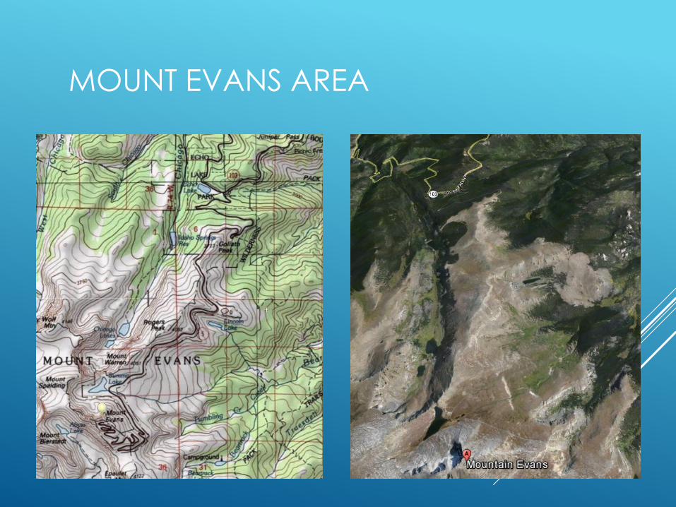
MOUNT EVANS AREA
INITIAL SEARCH – DAY 1
Hasty search of trails originating from the parking lot area
Car searched for clues
CSRB engages AFRCC to conduct cellphone data
analysis
Subject’s PC’s examined
Subjects’ belongings from hotel examined
Girlfriend of son interviewed on received last text
message
Planning for next operational period
APRIL 2, 2014 – I-70 WEST OF DENVER
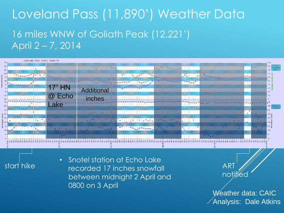
Loveland Pass (11,890’) Weather Data
16 miles WNW of Goliath Peak (12,221’)
April 2 – 7, 2014
start hike
17” HN
@ Echo
Lake
Additional
inches
Weather data: CAIC
Analysis: Dale Atkins
ART
notified
• Snotel station at Echo Lake
recorded 17 inches snowfall
between midnight 2 April and
0800 on 3 April
CLUES
Car search yields receipts indicating subjects had breakfast
in Lakewood, CO the morning of 2 April
Analysis of browsing history of both PC’s found searches on the trail systems around Echo Lake and Mount Evans
Girlfriend interviewed - the last text message from the son on
2 April was “We are going to scale a mountain.”
Subjects had not returned to their hotel to check out on the
date they had indicated; belongings had been put in
storage. No significant findings in belongings
AFRCC contacted and requested to perform forensic
cellphone analyses
AFRCC ENGAGEMENT
At the request of the CCCSO the CSRB asks the
AFRCC to retrieve subjects’ cellphone data from
their carrier
Last cell tower transactions occur in the early evening
of 2 April
Using tower locations transaction distance
estimates the AFRCC uses RF propagation
models to generate likely areas in which
transactions occurred
AFRCC provides ART ML with their
recommendations early in the morning of 7 April
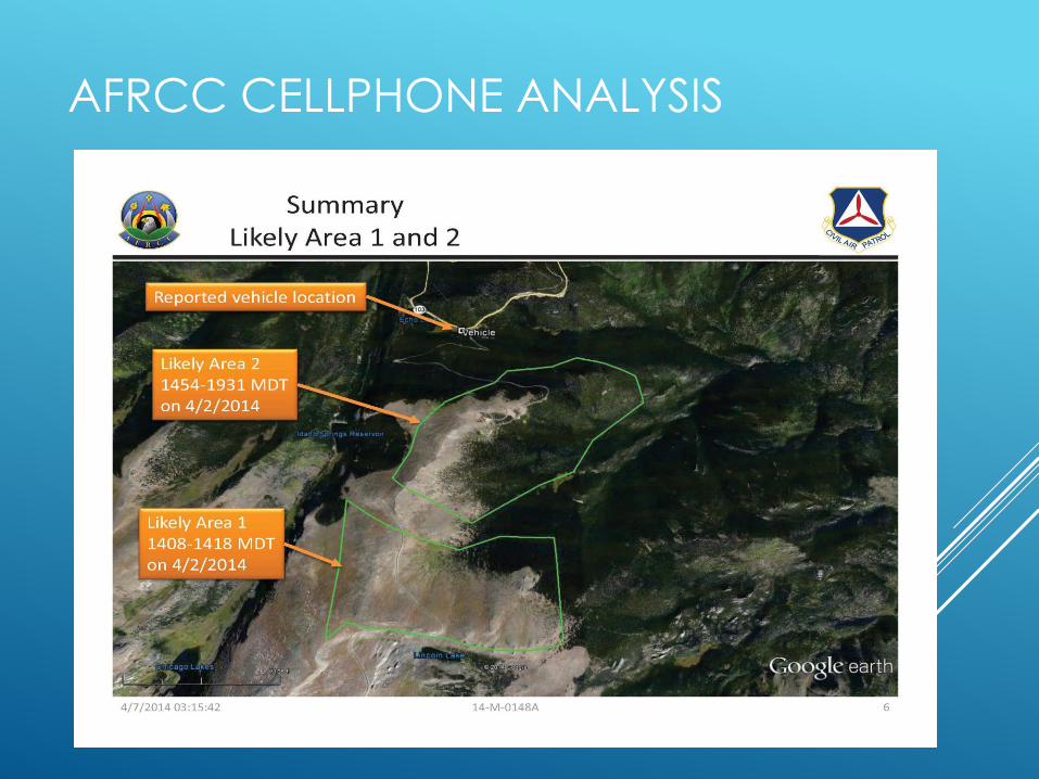
AFRCC CELLPHONE ANALYSIS

AFRCC CELLPHONE ANALYSIS
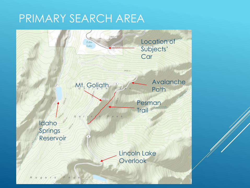
PRIMARY SEARCH AREA
Location of
Subjects’
Car
Lincoln Lake
Overlook
Pesman
Trail
Mt. Goliath
Idaho
Springs
Reservoir
Avalanche
Path
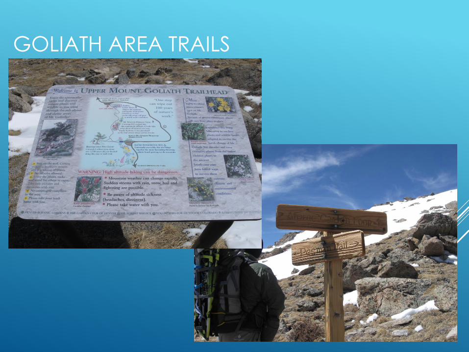
GOLIATH AREA TRAILS
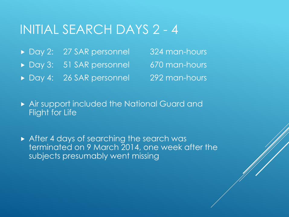
INITIAL SEARCH DAYS 2 - 4
Day 2: 27 SAR personnel 324 man-hours
Day 3: 51 SAR personnel 670 man-hours
Day 4: 26 SAR personnel 292 man-hours
Air support included the National Guard and Flight for Life
After 4 days of searching the search was terminated on 9 March 2014, one week after the subjects presumably went missing
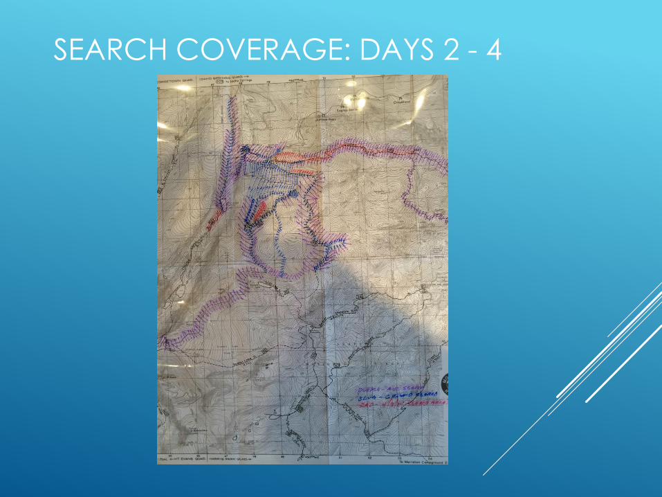
SEARCH COVERAGE: DAYS 2 - 4
SUBSEQUENT CELL DATA ANALYSIS
Analyzed detailed transaction data collected by
the AFRCC
Not calls or text messages; cell system signaling
data records
Key data elements:
Timestamp
Tower ID
Distance estimates
Developed coverage area viewsheds
Looked at intersections of distance radius as
handsets connected with different towers to
estimate locations
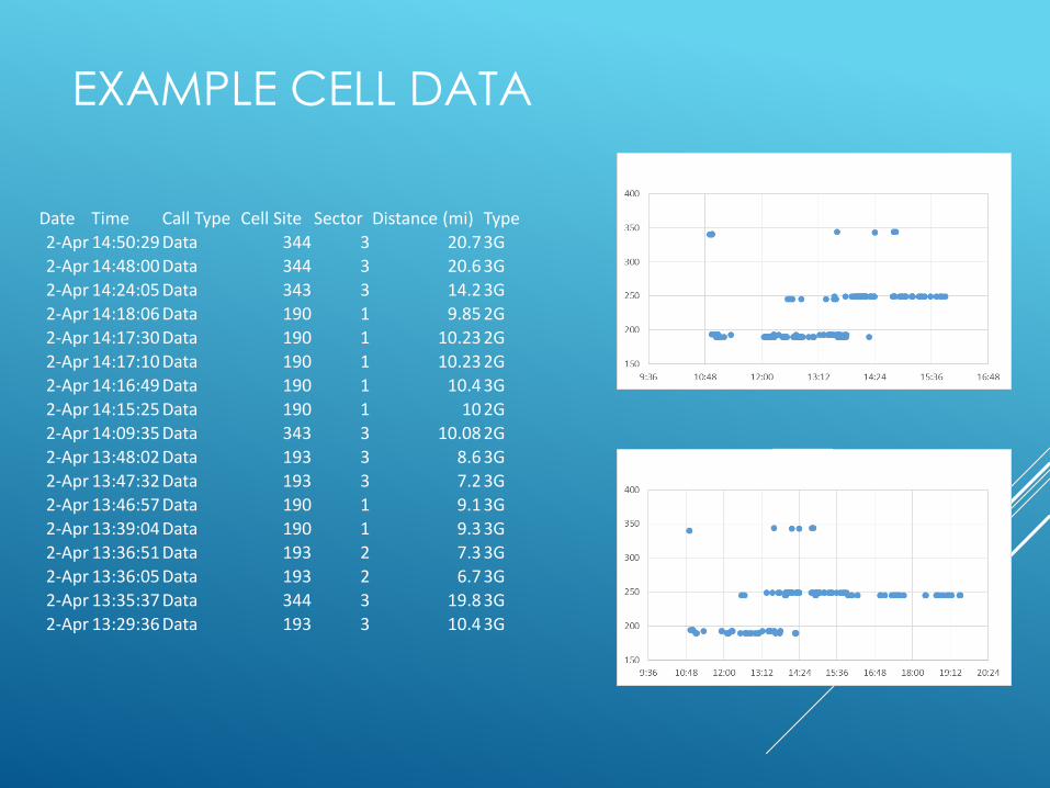
EXAMPLE CELL DATA
Date Time Call Type Cell Site Sector Distance (mi) Type
2-Apr 14:50:29 Data 344 3 20.7 3G
2-Apr 14:48:00 Data 344 3 20.6 3G
2-Apr 14:24:05 Data 343 3 14.2 3G
2-Apr 14:18:06 Data 190 1 9.85 2G
2-Apr 14:17:30 Data 190 1 10.23 2G
2-Apr 14:17:10 Data 190 1 10.23 2G
2-Apr 14:16:49 Data 190 1 10.4 3G
2-Apr 14:15:25 Data 190 1 10 2G
2-Apr 14:09:35 Data 343 3 10.08 2G
2-Apr 13:48:02 Data 193 3 8.6 3G
2-Apr 13:47:32 Data 193 3 7.2 3G
2-Apr 13:46:57 Data 190 1 9.1 3G
2-Apr 13:39:04 Data 190 1 9.3 3G
2-Apr 13:36:51 Data 193 2 7.3 3G
2-Apr 13:36:05 Data 193 2 6.7 3G
2-Apr 13:35:37 Data 344 3 19.8 3G
2-Apr 13:29:36 Data 193 3 10.4 3G
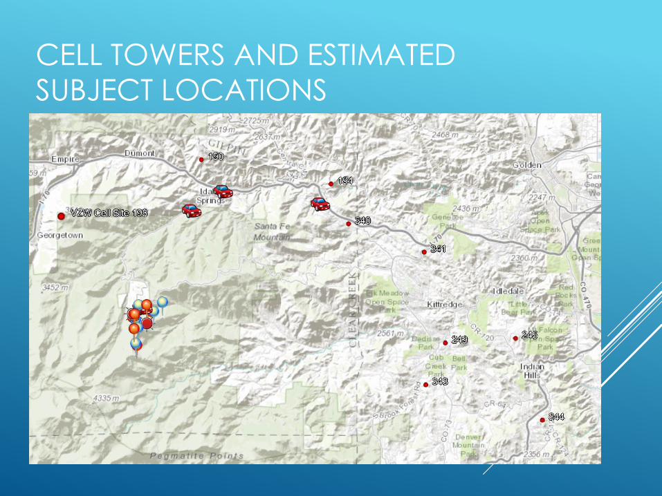
CELL TOWERS AND ESTIMATED
SUBJECT LOCATIONS
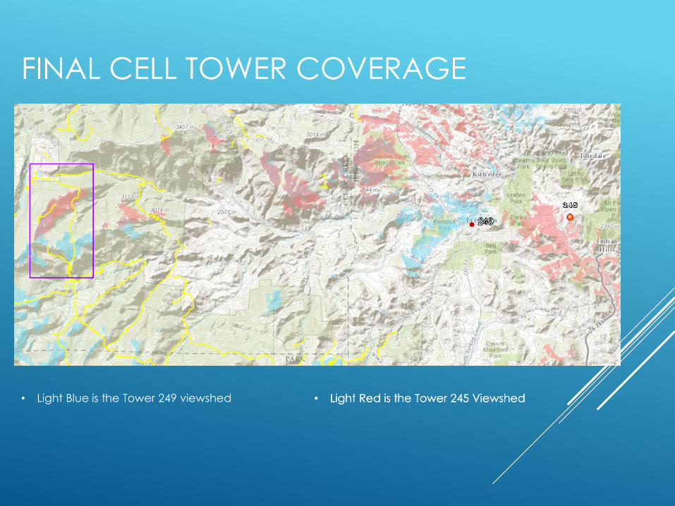
FINAL CELL TOWER COVERAGE
• Light Blue is the Tower 249 viewshed • Light Red is the Tower 245 Viewshed• Light Red is the Tower 245 Viewshed
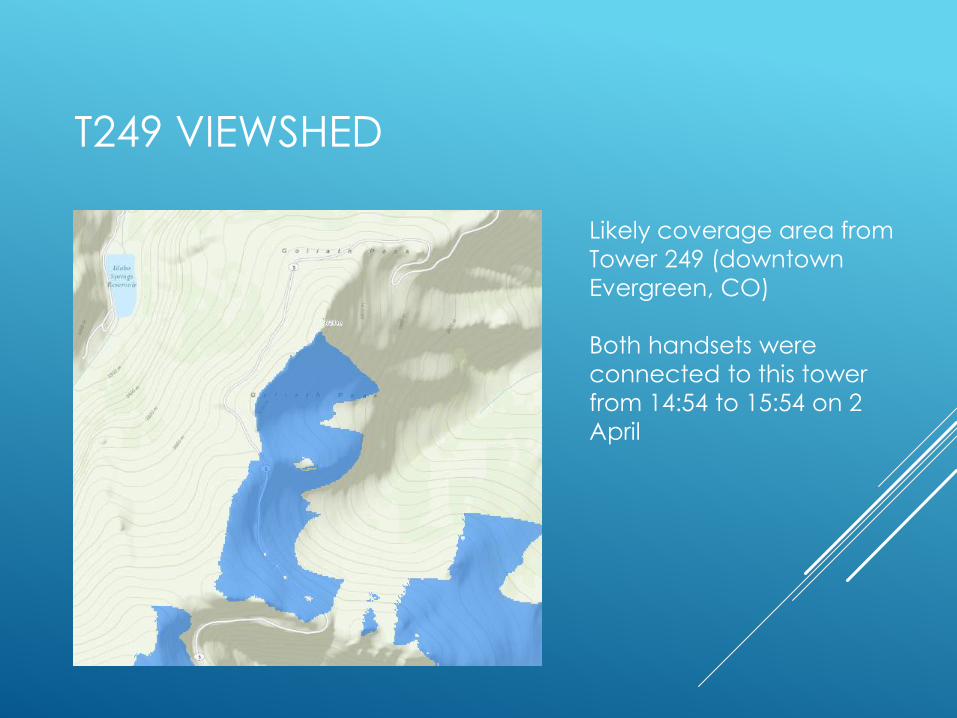
T249 VIEWSHED
Likely coverage area from
Tower 249 (downtown
Evergreen, CO)
Both handsets were
connected to this tower
from 14:54 to 15:54 on 2
April

T245 VIEWSHED
Likely coverage areas from
Tower 245 near Indian Hills
Handset 4235 connected to
this tower, and only this
tower, from 15:57 to 19:31
No tower connections from
either Handset after 19:31

VIEWSHEDS FROM BOTH
Possible area of transition
from Tower 249 to Tower
245
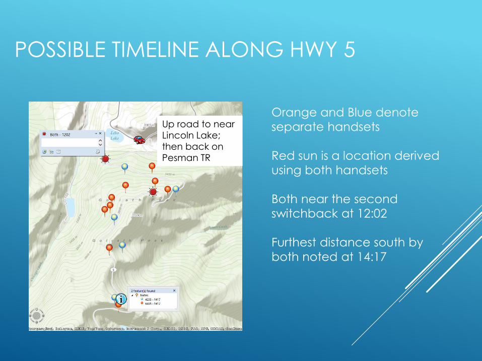
POSSIBLE TIMELINE ALONG HWY 5
Orange and Blue denote
separate handsets
Red sun is a location derived
using both handsets
Both near the second
switchback at 12:02
Furthest distance south by
both noted at 14:17
Up road to near Lincoln Lake; then back on Pesman TR
Up road to near Lincoln Lake; then back on Pesman TR
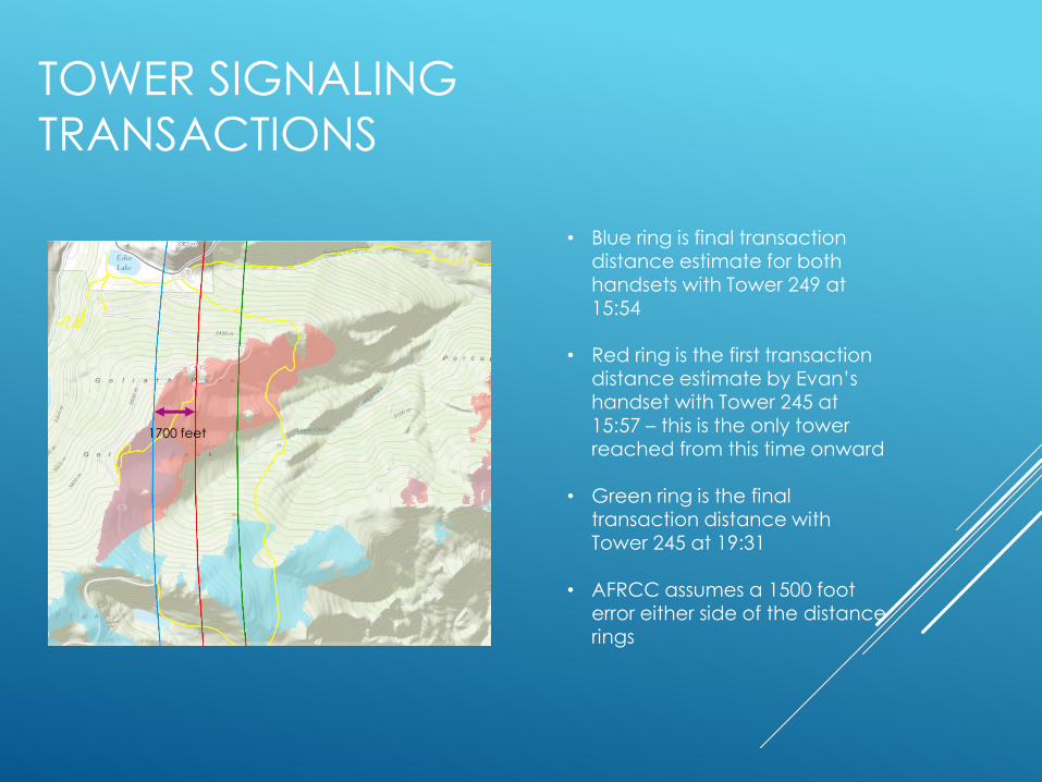
TOWER SIGNALING
TRANSACTIONS
• Blue ring is final transaction distance estimate for both handsets with Tower 249 at 15:54
• Red ring is the first transaction distance estimate by Evan’s handset with Tower 245 at 15:57 – this is the only tower reached from this time onward
• Green ring is the final transaction distance with Tower 245 at 19:31
• AFRCC assumes a 1500 foot error either side of the distance rings
1700 feet
ANALYSIS AND LIMITATIONS
The AFRCC and subsequent cell transaction analyses
increase confidence of the likely area where they had
been the afternoon and evening of 2 April
Focus became the face east of the Goliath ridge
The question remained: where did and could they travel
to after the cell transactions ceased?
Due to the weather, darkness, snow, slope and dense tree conditions travel would have been difficult
No comparable lost person behavior statistics match this
particular situation

SUBSEQUENT SEARCHES
Formal and informal searches of the area
3 May search training
10 May formal search employing multiple SAR teams
MANY individual and small group informal search days
Not all tracks captured
Based on the cellphone analysis focus was placed on the
east face of the Goliath ridge
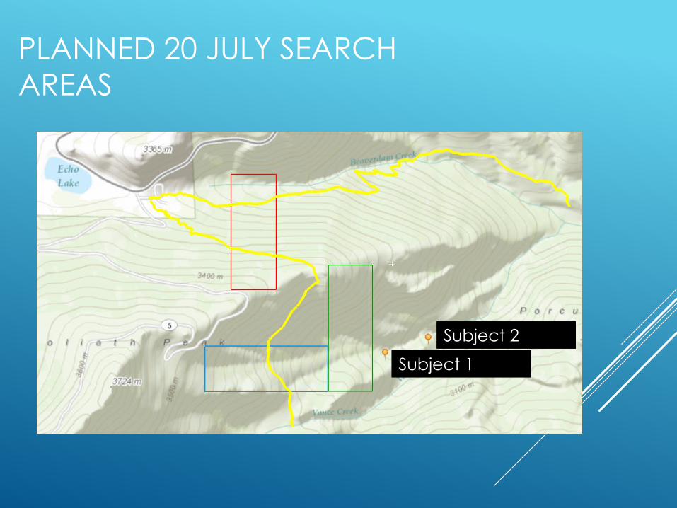
A major search of the area was planned for 20 July
100+ searchers and dog teams
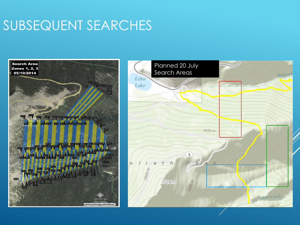
Planned 20 July Search Areas
SUBSEQUENT SEARCHES
Planned 20 July Search Areas
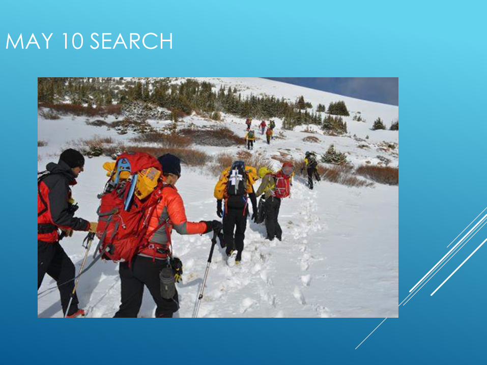
MAY 10 SEARCH
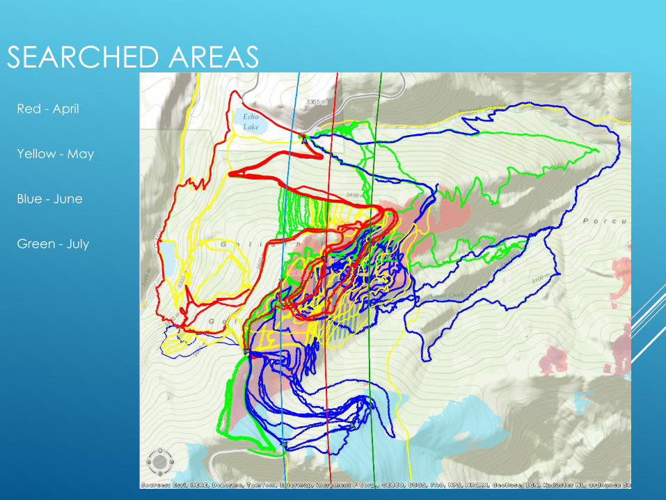
SEARCHED AREAS
Red - April
Yellow - May
Blue - June
Green - July
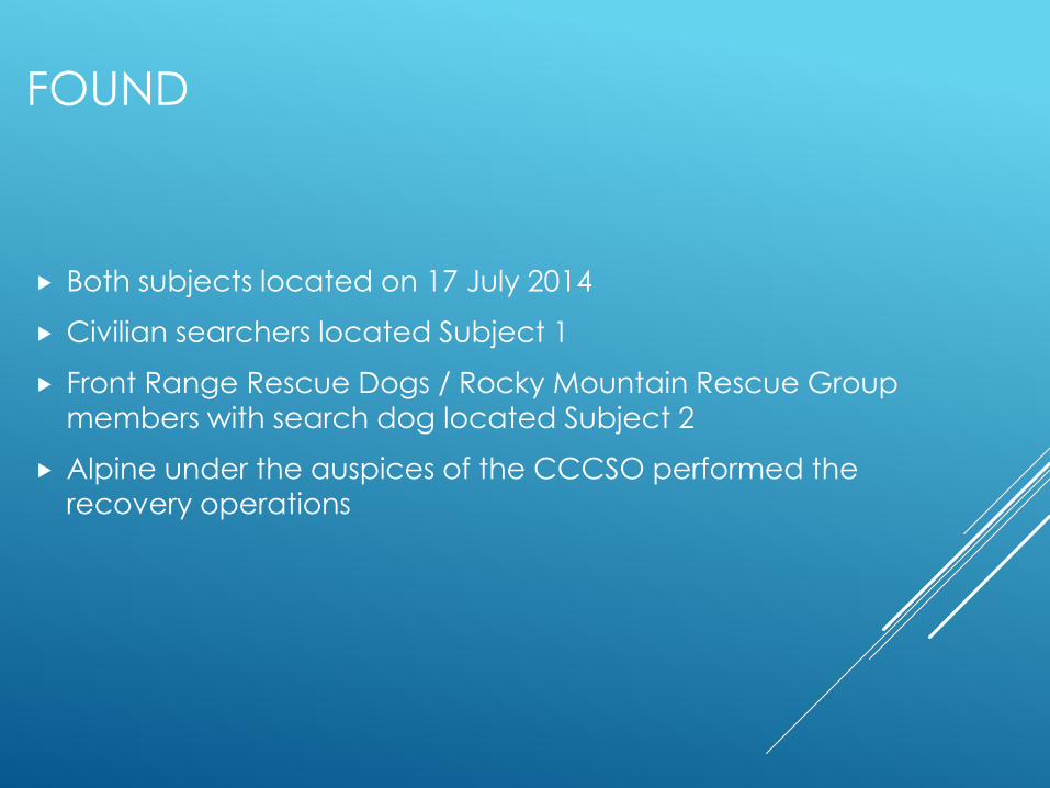
FOUND
Both subjects located on 17 July 2014
Civilian searchers located Subject 1
Front Range Rescue Dogs / Rocky Mountain Rescue Group
members with search dog located Subject 2
Alpine under the auspices of the CCCSO performed the
recovery operations
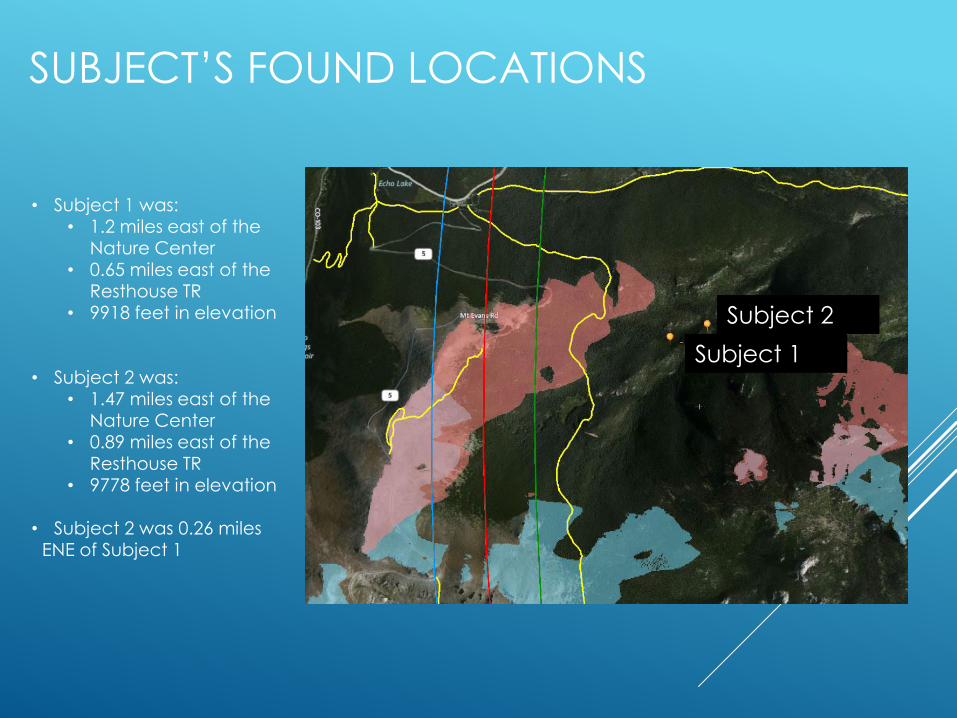
SUBJECT’S FOUND LOCATIONS
• Subject 1 was:• 1.2 miles east of the
Nature Center• 0.65 miles east of the
Resthouse TR• 9918 feet in elevation
• Subject 2 was:• 1.47 miles east of the
Nature Center• 0.89 miles east of the
Resthouse TR• 9778 feet in elevation
• Subject 2 was 0.26 miles ENE of Subject 1
Subject 2
Subject 1
Subject 2
Subject 1
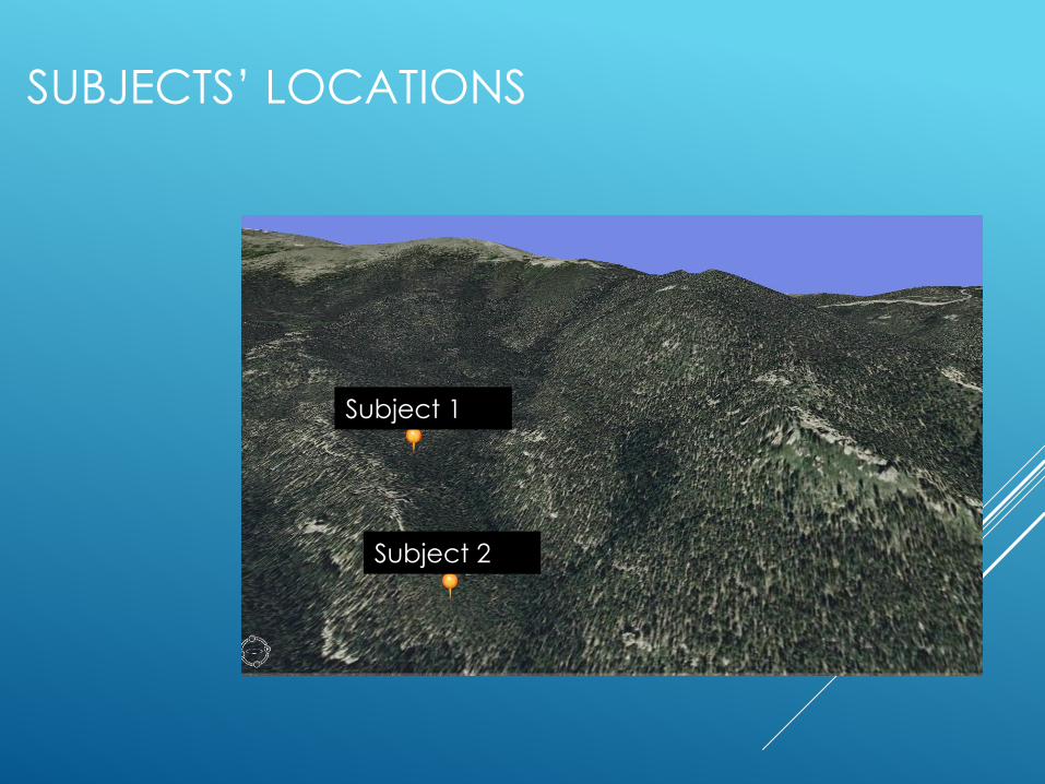
SUBJECTS’ LOCATIONS
Subject 2
Subject 1
Subject 2
Subject 1
PLANNED 20 JULY SEARCH
AREAS
Subject 2
Subject 1
Subject 2
Subject 1
POST-RECOVERY ACTIVITIES
CCCSO and the CO Bureau of Investigation were
able to recover photos from one of the subject’s
phones
These photos had EXIf time and date stamps and
geotags so it was possible to plot the subjects’
track throughout the day
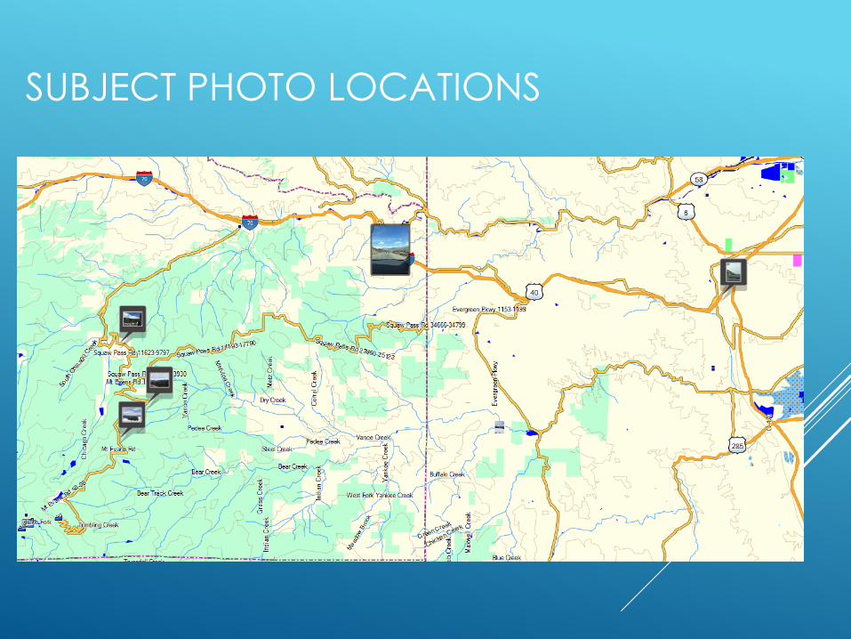
SUBJECT PHOTO LOCATIONS
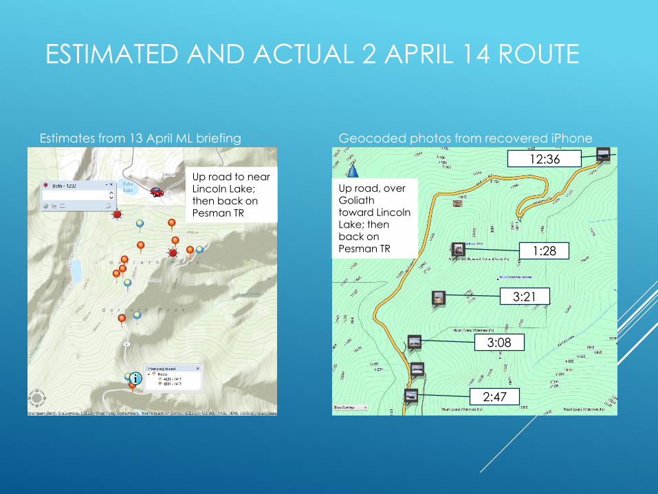
ESTIMATED AND ACTUAL 2 APRIL 14 ROUTE
Estimates from 13 April ML briefing Geocoded photos from recovered iPhone
12:36
1:28
3:21
2:47
3:08
Up road to near Lincoln Lake; then back on Pesman TR
Up road, over Goliath toward Lincoln Lake; then back on Pesman TR
Up road to near Lincoln Lake; then back on Pesman TR
Up road, over Goliath toward Lincoln Lake; then back on Pesman TR

CELL DATA ANALYSIS – COMPARISON OF
CELL SYSTEM DISTANCE ESTIMATES TO GPS
LOCATION ON PHOTOS
Cell System Handset Distance EstimatesPicture Location to
Tower Delta
Time Call Type Cell Site SectorDistance
(mi) Type Picture # TimeMeasured Tower Dist.
Dist. Diff % Diff.
15:20:12 Data 249 3 15.50 3G 829 15:20 15.28 0.22 1.4%
15:10:58 Data 249 3 15.50 3G 826 15:08 15.44 0.06 0.4%
15:03:23 Data 249 3 15.40 3G 822 15:03 15.42 -0.02 -0.1%
15:01:37 Data 249 3 15.80 3G 819 15:00 15.46 0.34 2.2%
14:59:01 Data 249 3 15.20 3G 816 14:59 15.44 -0.24 -1.6%
14:54:42 Data 245 1 18.79 2G 815 14:54 18.88 -0.09 -0.5%
14:54:31 Data 249 3 15.00 2G 814 14:54 15.44 -0.44 -2.8%
14:48:58 Data 249 3 15.60 3G 810 14:49 15.44 0.16 1.0%
14:47:01 Data 249 3 15.40 3G 807 14:46 15.47 -0.07 -0.5%
13:36:05 Data 193 2 6.70 3G 805 13:36 7.04 -0.34 -4.8%
13:35:37 Data 344 3 19.80 3G 802 13:34 20.49 -0.69 -3.4%
13:32:16 Data 249 3 15.30 3G 800 13:02 15.25 0.05 0.3%
13:26:59 Data 193 3 8.90 3G 799 13:27 7.04 1.86 26.4%
13:04:55 Data 190 1 8.50 3G 797 13:05 8.88 -0.38 -4.3%
12:41:37 Data 190 1 8.50 3G 793 12:41 8.56 -0.06 -0.7%
12:35:16 Data 245 1 17.88 2G 791 12:36 17.99 -0.11 -0.6%
10:56:38 Data 194 1 1.20 3G 785 10:57 1.13 0.08 6.7%
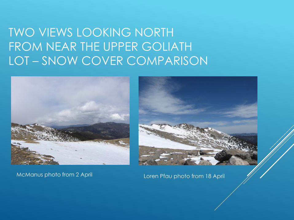
TWO VIEWS LOOKING NORTH
FROM NEAR THE UPPER GOLIATH
LOT – SNOW COVER COMPARISON
McManus photo from 2 April Loren Pfau photo from 18 April
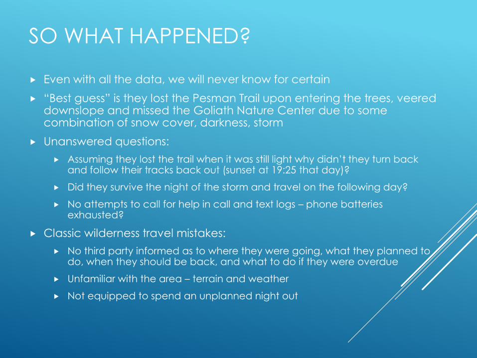
SO WHAT HAPPENED?
Even with all the data, we will never know for certain
“Best guess” is they lost the Pesman Trail upon entering the trees, veered downslope and missed the Goliath Nature Center due to some combination of snow cover, darkness, storm
Unanswered questions:
Assuming they lost the trail when it was still light why didn’t they turn back and follow their tracks back out (sunset at 19:25 that day)?
Did they survive the night of the storm and travel on the following day?
No attempts to call for help in call and text logs – phone batteries exhausted?
Classic wilderness travel mistakes:
No third party informed as to where they were going, what they planned to do, when they should be back, and what to do if they were overdue
Unfamiliar with the area – terrain and weather
Not equipped to spend an unplanned night out

WHAT DID WE LEARN?
• Variety of clues and information to employ (though virtually none on the
first few days)
• Physical search of car and belongings
• Analysis of computer browsing history
• Cellphone data adds a new dimension to wilderness SAR – we need
to learn how to capture and analyze it properly
• What tripped us up: the “they couldn’t get very far” mindset
• No snow travel gear
• Assumed inadequate clothing and footwear
• Prior mission 6 weeks earlier 3 miles away
• Field team reports of conditions
• Experience in planning and running large-scale searches using some
new tools – GIS grids, pre-set section markers, assignments before teams
were onsite, raw cell system data analysis
• Get additional opinions from unbiased searchers


THANK YOU!
• Alpine Rescue Team – www.alpinerescueteam.org