2.06 gis for coordination and cooperation in the...
TRANSCRIPT
G I S C O O K B O O K F O R L G U S
2.06 GIS for Coordination and Cooperation in the LGU 40
2.06 GIS for Coordination and Cooperation in the LGU
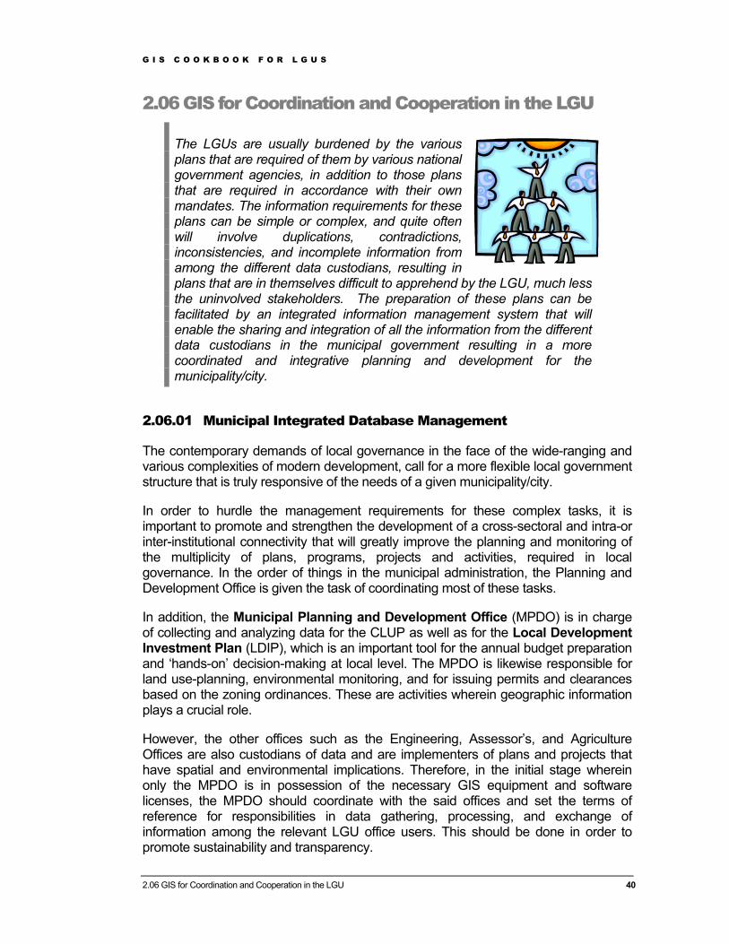
The LGUs are usually burdened by the various plans that are required of them by various national government agencies, in addition to those plans that are required in accordance with their own mandates. The information requirements for these plans can be simple or complex, and quite often will involve duplications, contradictions, inconsistencies, and incomplete information from among the different data custodians, resulting in plans that are in themselves difficult to apprehend by the LGU, much less the uninvolved stakeholders. The preparation of these plans can be facilitated by an integrated information management system that will enable the sharing and integration of all the information from the different data custodians in the municipal government resulting in a more coordinated and integrative planning and development for the municipality/city.
2.06.01 Municipal Integrated Database Management
The contemporary demands of local governance in the face of the wide-ranging and various complexities of modern development, call for a more flexible local government structure that is truly responsive of the needs of a given municipality/city.
In order to hurdle the management requirements for these complex tasks, it is important to promote and strengthen the development of a cross-sectoral and intra-or inter-institutional connectivity that will greatly improve the planning and monitoring of the multiplicity of plans, programs, projects and activities, required in local governance. In the order of things in the municipal administration, the Planning and Development Office is given the task of coordinating most of these tasks.
In addition, the Municipal Planning and Development Office (MPDO) is in charge of collecting and analyzing data for the CLUP as well as for the Local Development Investment Plan (LDIP), which is an important tool for the annual budget preparation and ‘hands-on’ decision-making at local level. The MPDO is likewise responsible for land use-planning, environmental monitoring, and for issuing permits and clearances based on the zoning ordinances. These are activities wherein geographic information plays a crucial role.
However, the other offices such as the Engineering, Assessor’s, and Agriculture Offices are also custodians of data and are implementers of plans and projects that have spatial and environmental implications. Therefore, in the initial stage wherein only the MPDO is in possession of the necessary GIS equipment and software licenses, the MPDO should coordinate with the said offices and set the terms of reference for responsibilities in data gathering, processing, and exchange of information among the relevant LGU office users. This should be done in order to promote sustainability and transparency.
G I S C O O K B O O K F O R L G U S
2.06 GIS for Coordination and Cooperation in the LGU 41
The challenge for the municipal planner and the MPDO is to promote the need for, and the importance of GIS among the various stakeholders in the municipal government structure (politicians, heads of departments, etc.). This should also ensure that data is acquired and maintained by all the relevant offices in such a way that this data can be easily imported to the GIS system.
A feasible approach is to develop, within the municipal/city government organization’s computer environment, a common computer file directory structure for all the different offices (and their corresponding computer environments) involved in CLUP and other planning activities.
If the municipality/city has a network then this computer file directory structure is only necessary on the server. If it is a stand-alone computer or series of stand-alone computers, then the computer file directory structure is necessary on the stand-alone computer(s). The common computer file directory structure allows a stable environment to update information, develop meta-data structures and develop user-friendly applications.
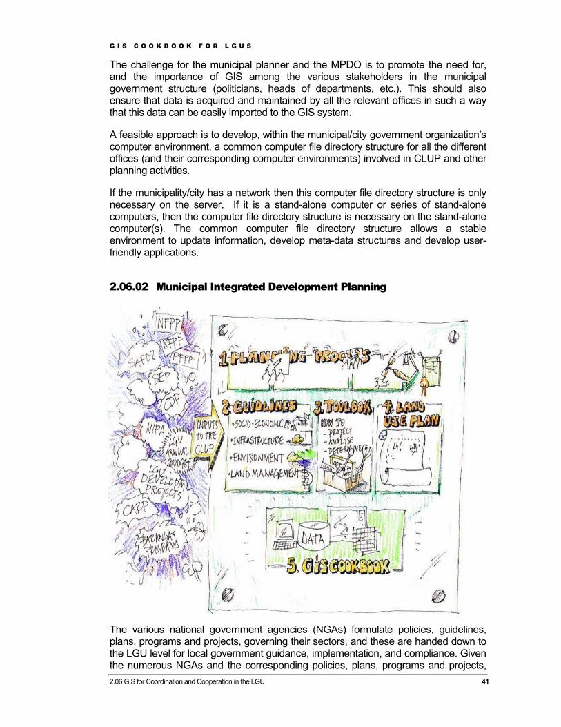
2.06.02 Municipal Integrated Development Planning
The various national government agencies (NGAs) formulate policies, guidelines, plans, programs and projects, governing their sectors, and these are handed down to the LGU level for local government guidance, implementation, and compliance. Given the numerous NGAs and the corresponding policies, plans, programs and projects,

G I S C O O K B O O K F O R L G U S
2.06 GIS for Coordination and Cooperation in the LGU 42
that the LGUs have to contend with, it is usually left to them to integrate all of these within the local government context, and arrive at a set of plans, programs and projects that are aligned to the policies, and compliant to the guidelines. The LGU therefore plays a vital integrative role at the local level
In order to facilitate the tasks of the LGU, the GIS Cookbook identifies possible data sharing ‘shortcuts’ between information products needed for the CLUP and information prepared in other municipal plans and programs such as the examples found below.
The following are some of the kinds of plans that the LGU is expected to prepare, in coordination with the appropriate national government agencies:
(1) Agriculture and Fisheries Management Plan, including the Strategic Agriculture and Fisheries Development Zone (SAFDZ)
(2) Forest Management Plan or Forest Land Use Plan (FLUP)
(3) Sustainable Integrated Area Development Plan or Local Agenda 21 (SIADP)
(4) Coastal Resources Management Plan (CRMP)
(5) Solid Waste management Plan (6) Agrarian Reform Community
Development Plan Examples of plans that require inter-sectoral functional committees are: a) Local Poverty Reduction Action
Plan b) Disaster Management Plan c) Sustainable Development Plan d) Gender and Development Plan
e) Food Security Plan f) Integrated Area Community Peace
and Order and Public Safety Plan g) Local Development Plan / Local
Investment Plan for Children h) Ecological Solid Waste
Management Plan i) Human Resource Management
Plan j) Revenue Enhancement Plan Plans that fall within the concern of individual sectors: (a) Action Plan for the Council for the
Protection of Children (b) Annual Culture and Arts Plan (c) Agriculture and Fisheries
Management Plan (d) Local Tourism Plan (e) Small and Medium Enterprise
Development Plan Body (f) Local Health & Nutrition Plan
2.06.03 Examples on Coordination and Cooperation in an LGU
The use of digital data and the application of GIS open the door to improved coordination and cooperation among the different offices / departments in the municipal/city government. For example, the same digital road database that has been used and presented in the CLUP can also be used by the engineering department. Information regarding schools can be used and maintained by the education department and be analyzed in the CLUP, etc. Extracts from some case studies done in the GIS Cookbook Pilot LGUs are presented below. The full case studies are found in Chapter 4.01 in the Toolbox.
G I S C O O K B O O K F O R L G U S
2.06 GIS for Coordination and Cooperation in the LGU 43
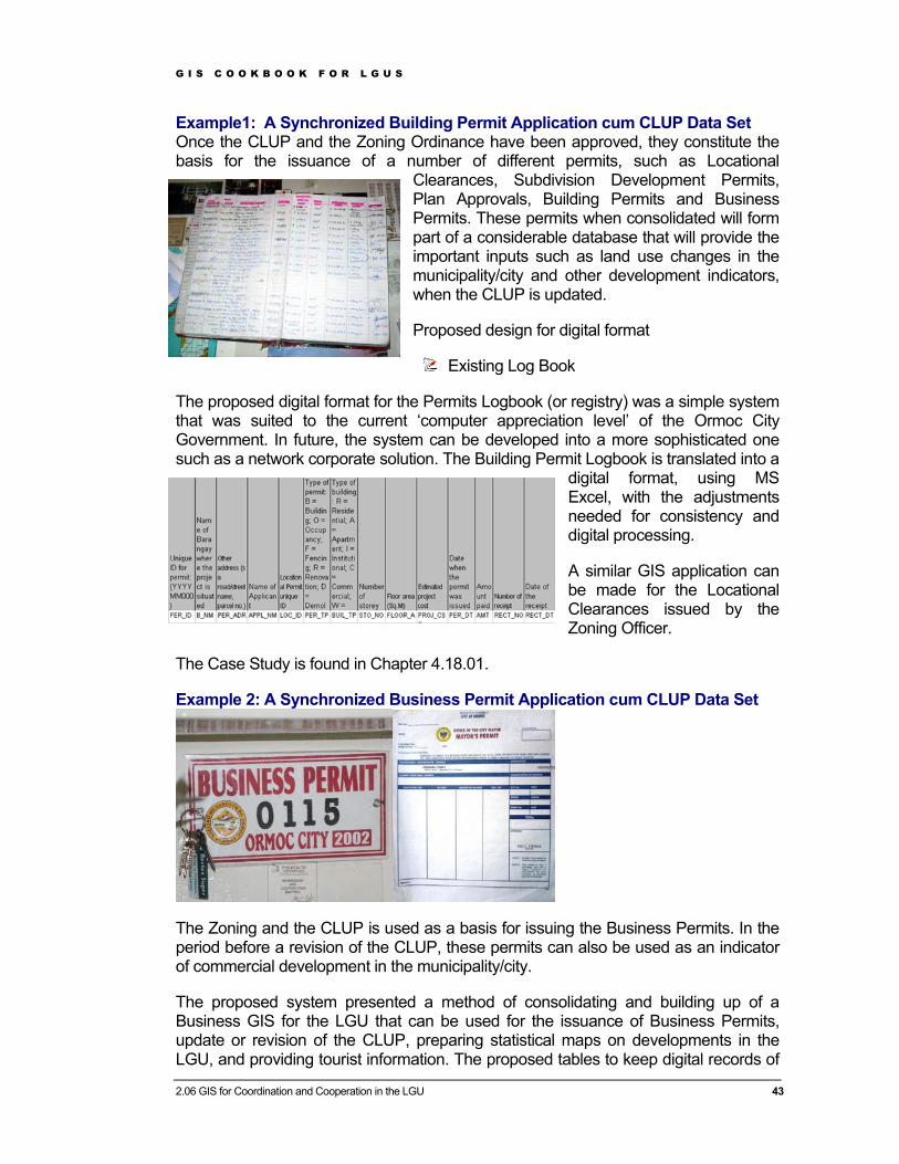
Example1: A Synchronized Building Permit Application cum CLUP Data Set Once the CLUP and the Zoning Ordinance have been approved, they constitute the basis for the issuance of a number of different permits, such as Locational
Clearances, Subdivision Development Permits, Plan Approvals, Building Permits and Business Permits. These permits when consolidated will form part of a considerable database that will provide the important inputs such as land use changes in the municipality/city and other development indicators, when the CLUP is updated.
Proposed design for digital format
Existing Log Book
The proposed digital format for the Permits Logbook (or registry) was a simple system that was suited to the current ‘computer appreciation level’ of the Ormoc City Government. In future, the system can be developed into a more sophisticated one such as a network corporate solution. The Building Permit Logbook is translated into a
digital format, using MS Excel, with the adjustments needed for consistency and digital processing.
A similar GIS application can be made for the Locational Clearances issued by the Zoning Officer.
The Case Study is found in Chapter 4.18.01.
Example 2: A Synchronized Business Permit Application cum CLUP Data Set
The Zoning and the CLUP is used as a basis for issuing the Business Permits. In the period before a revision of the CLUP, these permits can also be used as an indicator of commercial development in the municipality/city.
The proposed system presented a method of consolidating and building up of a Business GIS for the LGU that can be used for the issuance of Business Permits, update or revision of the CLUP, preparing statistical maps on developments in the LGU, and providing tourist information. The proposed tables to keep digital records of

G I S C O O K B O O K F O R L G U S
2.06 GIS for Coordination and Cooperation in the LGU 44
the Business Permits can be the start up level for those LGUs without current digital records. The system allows the LGUs to get started in MS Excel where a spread sheet containing the attributes, are stored and then linked to a GIS layer holding the surveyed locations of the business establishments that have been given the permits. In the case of LGUs with current digital systems, the suggestion is to instead keep the attribute database they are now using, and extend it with a link to the GIS.
The Case Study is found in Chapter 4.18.02.
Example 3: Preparation of an ‘LGU Urban Poor’ GIS While evaluating the prepared CLUPs in the pilot municipalities/cities, it was found that the housing sector of the Plans do not fully recognize the need to focus on the situation for the urban poor, and the corresponding actions needed to improve the situation of the informal settlers. The CLUPs merely describe the policies and whatever pilot projects are existing, and fail to provide comprehensive information and analysis of the housing situation, particularly on informal settlements.
The proposed system presented a simple method again based on the current ‘computer appreciation level’ in Ormoc City, and this system can be developed into a more sophisticated one such as a network corporate solution in the future. Two Excel spreadsheets have been designed to start with. One which shows the distribution of informal settlers’ families by Barangays with the indicators as shown in the matrix below.
Sample Map showing Business Permits and their classification in Barangay District 7, Ormoc City Sample Map showing Business Permits and their classification in Barangay District 7, Ormoc City
G I S C O O K B O O K F O R L G U S
2.06 GIS for Coordination and Cooperation in the LGU 45
Current Zoning/Land Use Map covering the Barangay Linao
The Case Study is found in Chapter 4.18.03.
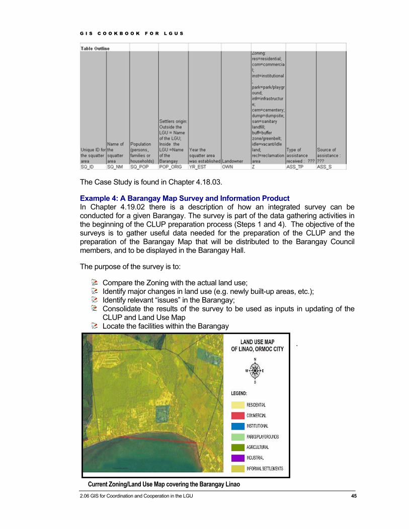
Example 4: A Barangay Map Survey and Information Product In Chapter 4.19.02 there is a description of how an integrated survey can be conducted for a given Barangay. The survey is part of the data gathering activities in the beginning of the CLUP preparation process (Steps 1 and 4). The objective of the surveys is to gather useful data needed for the preparation of the CLUP and the preparation of the Barangay Map that will be distributed to the Barangay Council members, and to be displayed in the Barangay Hall.
The purpose of the survey is to:
Compare the Zoning with the actual land use; Identify major changes in land use (e.g. newly built-up areas, etc.); Identify relevant “issues” in the Barangay; Consolidate the results of the survey to be used as inputs in updating of the
CLUP and Land Use Map Locate the facilities within the Barangay
.
G I S C O O K B O O K F O R L G U S
2.06 GIS for Coordination and Cooperation in the LGU 46
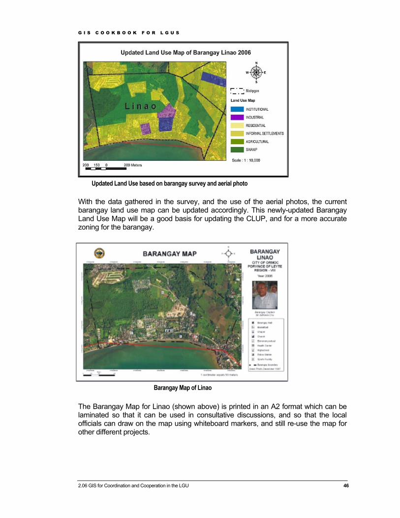
With the data gathered in the survey, and the use of the aerial photos, the current barangay land use map can be updated accordingly. This newly-updated Barangay Land Use Map will be a good basis for updating the CLUP, and for a more accurate zoning for the barangay.
The Barangay Map for Linao (shown above) is printed in an A2 format which can be laminated so that it can be used in consultative discussions, and so that the local officials can draw on the map using whiteboard markers, and still re-use the map for other different projects.
Updated Land Use based on barangay survey and aerial photo
Barangay Map of Linao