a research study on mechanisms for recognition of habitat
TRANSCRIPT

A Research Study on Mechanisms for Recognition of Habitat Rights of
PVTGs under the Forest Rights Act
UNDP under the aegis of
Ministry of Tribal Affairs, Government of India
(2014)
2
A Research Study on Mechanisms for Recognition of Habitat Rights of
PVTGs under the Forest Rights Act
July 30, 2014
With Support From:
United Nations Development Programme
55, Lodi Estate, New Delhi – 110 003
Fax: 91-11-24627612
Under the aegis of Ministry of Tribal Affairs, Govt. of India
VASUNDHARA
Plot No. 1731, Phase – II, Near
Maruti Villa, At/Po - KIIT
Campus, Bhubaneswar -
751024,

i
Research Team
Study Coordinators
Subrat Kumar Nayak & Tushar Dash, Vasundhara
Principal Researcher
Prof (Dr) Premananda Panda, Former Director SCSCRTI, Govt. of Odisha
Study Team Members
Odisha
Subrat Kumar Nayak, Vasundhara
Reena Rani Bagh, Vasundhara
Madhulika Sahoo, Independent Researcher
Madhya Pradesh
Rana Roy, Independent Researcher
Subrat Kumar Nayak, Vasundhara
Balwant Ranghale, Independent Researcher
Chhattisgarh
(In collaboration with Navrachana, (NGO) based at Bilaspur, Chhattisgarh)Rana Roy,
Independent Researcher
Tushar Dash, Vasundhara
Subrat Kumar Nayak, Vasundhara
Devjit Nandi, Navrachana
Sanjay Nirala, Navrachana
Durgesh Dixena, Navrachana

ii
Guidance & Review
Madhu Sarin, Independent Researcher
Kundan Kumar, Independent Researcher
Y.Giri Rao, Executive Director, Vasundhara
Tushar Dash, Vasundhara
Rana Roy, Independent Researcher
Review of International laws Relevant to Habitat/Territorial Rights
Stella James, Fellow, Natural Justice
Report Compilation
Rana Roy & Subrat Kumar Nayak

iii
Acronyms & Abbreviations
BBCM – Banabasi Chetana Mandal (Local NGO)
BDO - Block Development Officer
CFM - Community Forest Management
CFR - Community Forest Resources
CPR - Common Property Resource
CWH - Critical Wildlife Habitat
DFO - Divisional Forest Officer
DKDA – Dongaria Kondh Development Agency
DLC - District Level Committee
DPF - Demarcated Protected Forests
DTWO- District Tribal Welfare Officer
DWO - District Welfare Officer
FCA - Forest Conservation Act
FD - Forest Department
FDA - Forest Development Agency
FGD - Focus Group Discussion
FRA - Forest Rights Act
FRC - Forest Rights Committee
FRO - Forest Range Officer
GP - Gram Panchayat
GPS - Global Positioning System
GS - Gram Sabha
IAY- Indira Awas Yojana
IFA - Indian Forest Act
iv
IFR - Individual Forest Rights
IFS- Indian Forest Service
ITDA - Integrated Tribal Development Agency
JFM - Joint Forest Management
JDA – Juang Development Agency
LTR- Land Transfer Regulations
MADA- Modified Area Development Approach
MFP - Minor Forest Produce
MGNREGA - Mahatma Gandhi National Rural Employment Guarantee Act
MoEF - Ministry of Environment and Forests
MoTA - Ministry of Tribal Affairs
NTFP - Non-Timber Forest Produce
OBC - Other Backward Classes
OFDC - Odisha Forest Development Corporation
OFSDP - Odisha Forestry Sector Development Project
OTFDs - Other Traditional Forest Dwellers
PA-ITDA – Project Administrator Integrated Tribal Development Department
PCCF - Principal Chief Conservator of Forest
PESA - Provisions of the Panchayats (Extension to the Scheduled Areas) Act
PO - Programme Officer
PRF - Proposed Reserve Forest
PRI - Panchayat Raj Institution
PS - Palli Sabha
PVTG - Particularly vulnerable Tribal Group
RF - Reserved Forest

v
RI - Revenue Inspector
RoR - Record of Rights
RTI - Right to Information
SC - Scheduled Caste
ST – Schedule Tribe
SDLC - Sub-Divisional Level Committee
SLMC - State Level Monitoring Committee
TSP - Tribal Sub-Plan
UDPF - Un-demarcated Protected Forest
WEO - Welfare Extension Officer

vi
Glossary Bak Clan
Barika Messenger (from other caste- SC)
Bewar Shifting cultivation/ swidden agriculture
Bisi-majhi Social and cultural head
Charigada Pidha A Juang sub pidha
Chhatan Rock
Dakua Messenger
Dhakalrahit nistar Encumbrance free nistar lands
Dongaria Kondh A PVTG community of Odisha
Gochar Grazing land
Gramya Jungle Village forests
Gramkantha Parambhok Reserve for house site / Basti
Jharkhanda Pidha A Juang sub pidha.
Juang A PVTG community living in Odisha
Juang Pidha The traditional and customary geographical territory (habitat)
of Juang tribe, it consists of six sub pidha.
Kathua Pidha A Juang sub pidha
Majang Youth dormitory for boys
Manda Ghar Dormitory for boys
Mukhiya Sardar Head of all pidha
Mondal Administrative head
Navtorh Encroached land/ newly encroached land
Nistar Traditional land and forest rights of villagers/ villages
Padrika Dongaria Kondh clan head
Palli Sabha In Odisha it is considered as Gram Sabha under the FRA, 2006
Panike niche Submerged in water
Pahad Hill/ hillock
Patita Fallow land-A kisam of govt land meant for future use or
allotment to the landless.
Pradhan Village head
Pidha Sardar Head of sub-pidha
Rebona Pidha A Juang sub-pidha
Sathkhanda Pidha A Juang sub-pidha
vii
Executive Summary
The Forest Rights Act (FRA) has been acclaimed as a milestone in India’s legislative history.
It seeks to undo historical injustice done to millions of tribals and other traditional forest
dwellers whose rights on ancestral lands and their habitat were not recorded during the
consolidation of state forests during colonial and post-independence periods. Amongst the
diversity of rights, the FRA recognises rightsincluding community tenures of habitat and
habitation of Particularly Vulnerable Tribal Groups (PVTG) and pre-agricultural
communities.
However even after more than six years of implementation of the law, no habitat rights have
been recognised and only a couple of claims have been filed for the same. Lack of clarity
within and outside government about the concept and meaning of habitat, as well as the
procedure to be used for recognising such rights over larger landscapes covering multiple
villages, has been a major obstacle in the recognition of habitat rights.
Against this backdrop, the UNDP, at the request of the Ministry of Tribal Affairs,
Government of India, commissioned Vasundhara, an NGO based at Bhubaneswar (Odisha) to
undertake a study with the broad objectives of defining the concept of PVTG Habitat rights
and develop a suggestive guideline for its determination and recognition under the Forest
Rights Act. The PVTGs studied included the Baiga community in the States of Madhya
Pradesh and Chhattisgarh and the Dongaria Kandha community in Odisha. In addition a case
study of Juangs of Odisha, who were the first to file a claim for their habitat rights has been
undertaken.
A. Findings with regards to basis of determination of habitat rights.
The study has provided important insights about the meaning of habitat as perceived by the
PVTGs and the possible basis for determination as well as a desirable process for the
recognition of habitat rights so as to their ensure active involvement in the habitat rights
determination and recognition process. These are briefly discussed below:
Clan Identity: The PVTGs are divided into a number of exogamous clans with each clan
drawing its identity from a particular place or an element of nature or both. Clan deities are
usually located in the place of origin of each clan which the Baigas refer to as garh;
Dongarias as padar and Juangs as pidha. This gives an idea of their territory as well as their

viii
deities. The places of origin of different clans often lie deep in dense forests, with hillocks
and sources of water nearby suggesting a strong ecological link with their habitat.
Socio-cultural Beliefs and Practices: Social, cultural and religious events are organised at
different sites and are based on beliefs deeply connected to forests and other natural
resources. The periodicity of such social and cultural rituals and location of the place is often
dynamic and changes at varied frequency. These thus form an important constituent of their
habitat rights.
Resource access and Livelihood Relation: Livelihood sites of PVTGs might extend to a
wider territory depending on the nature and periodicity of their access and availability of
particular types of resources needed for their livelihoods. This may include their agroforestry
based traditional farming practices (referred to as podu, bewar, dongarchas etc. in local
parlance), items gathered and extracted from forests, sites for gathering medicinal plants etc.
Understanding sources of their livelihoods provides important indicators of the extent and
nature of their habitat.
Natural Markers/Important Landmarks: These may include hills, rivers, streams,
vegetation, grasses, particular tree species etc. considered other land marks for delineating the
boundaries and extent of their territory. Knowledge about these physical features is deeply
ingrained in their knowledge system and relate to their social and cultural beliefs and
practices.
Folklore, Songs and Narratives: The PVTGs are found to have a rich repository of songs,
dances and narratives about their origin, area, natural elements and cultural beliefs which
provide important clues about their use and conservation beliefs and behaviour. These may
constitute important sources of evidence for their habitat rights claims.
Traditional Knowledge: PVTGs have a rich repository of medicinal and ecological
knowledge including locations of medicinal plants, knowledge about wildlife behaviour,
pathways of wildlife etc. Their regime of knowledge and its connection with different
territories can serve as an important basis for determination of habitat rights.
Historical Information: Documents like encyclopaedia on geography, forest and ecology
gazetteers, land settlement reports, earlier anthropological accounts can provide important
information about PVTGs for reconstructing their habitat rights.

ix
B. Operational Definition of Habitat
The study suggests an operational definition of habitat rights based on insights gained from
the field work:
Habitat constitutes the customary cultural, ecological and social territory of a tribe which
does not necessarily comprise a compact or bounded geographical area. Habitat rights may
be defined as a bundle of rights that relate to livelihood, social, cultural and religious
practices of tribal communities embedded in the territory comprising their habitat.This rights
regime is mediated by their various forms of traditional institutions and leadership base who
play a crucial role in multiple affairs of the tribe. Many such rights are not necessarily
exclusive to one community and may be shared with other communities living in the habitat
area based on age old traditions of mutuality and reciprocity.
It is important to mention that the Forest Rights Act differentiates habitat rights with CFR
rights. While CFR rights may pertain to one or group villages, habitat rights relate to an entire
community or tribe. The areas of differences is briefly summarised in the following table:
CFR Rights Habitat Rights
Village as unit of claim making Community through its representative
institution/s as unit of claim making
Limited to Customary or traditional boundary of
a village/Hamlets or Group of
Villages/Hamlets
Limited to Customary or traditional boundary
of a particular PVTG or a community
FRC will initiate the process Concerned FRCs/gramsabha in coordination
with Traditional Institution(s) of the
community would initiate the process on be-
half of the community
More often the customary or traditional rights
are within their customary boundary except
rights over Minor Forest Produce
In case of PVTGs it is also beyond their
village/ settlements (temporary in case of
nomadic communities) or hamlet boundary
More often most of STs or OTFDs are not
confined to a particular geographical location
Identity is linked with the geographical area
or territory (PVTGs are found within a more
clearly identifiable geographical area)
Customary rights are limited within the
customary or traditional boundary of a village
Customary rights are not limited within the
customary or traditional boundary of concern
PVTG’s village or habitation

x
C. Diversity of rights enshrined within habitat rights
Further, diverse rights are embedded within the habitat of each PVTG. Some of these include:
Right to perform religious or cultural rites over the geographical locations related to
their clans
Right to protect and conserve such natural entities/sacred areas
Right to protect and conserve places of their religious and spiritual importance
(irrespective of their distance from the actual settlement of PVTGs) from any
modification or destruction.
Rights over existing cultural sites and the right to decide and identify newer sites for
holding their rituals/ cultural events in future.
Right to practice their traditional systems of agriculture and other livelihood sites in
and around forests where they have regular, periodic or seasonal access.
These rights indicate the complexity and expansive nature of habitat rights. The above list is
is indictive in nature based on insights gained from the field work. .
D. Suggestive process for recognition of habitat rights
Habitat rights essentially constitute a bundle of multi-layered rights having territorial linkages
incorporating cultural expression. Thus it can be construed that habitat as a territory is
culturally constructed. However, exposure to multiple outsider interventions both before and
after independence and widespread alienation from their resources through forest and land
settlements has increased their vulnerability and influenced their ways of living, leaving them
socially, economically and politically weak. Thus determination of PVTGs habitat rights
would essentially involve a reconstruction of their habitat and of the variety of rights
enshrined within it. Although considerably weakened due to the super-imposition of external
administrative systems such as the Panchayati Raj system, PVTGs still retain various forms
of traditional leadership and institutions which are dynamic and flexible in nature.
The study suggests a proactive and explicit role of representatives of traditional institutions in
anchoring the process of determination and recognition of habitat rights in consonance with
the amended FRA rules. However this will require creating an environment that is sensitive
and accommodative to the perceptions of PVTGs and help them articulate their opinions
freely. In this backdrop, the study suggest a process guideline for determination and
recognition of habitat rights which includes built-in mechanisms within the existing
xi
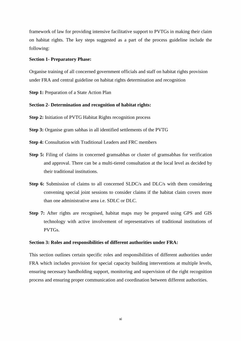
framework of law for providing intensive facilitative support to PVTGs in making their claim
on habitat rights. The key steps suggested as a part of the process guideline include the
following:
Section 1- Preparatory Phase:
Organise training of all concerned government officials and staff on habitat rights provision
under FRA and central guideline on habitat rights determination and recognition
Step 1: Preparation of a State Action Plan
Section 2- Determination and recognition of habitat rights:
Step 2: Initiation of PVTG Habitat Rights recognition process
Step 3: Organise gram sabhas in all identified settlements of the PVTG
Step 4: Consultation with Traditional Leaders and FRC members
Step 5: Filing of claims in concerned gramsabhas or cluster of gramsabhas for verification
and approval. There can be a multi-tiered consultation at the local level as decided by
their traditional institutions.
Step 6: Submission of claims to all concerned SLDC/s and DLC/s with them considering
convening special joint sessions to consider claims if the habitat claim covers more
than one administrative area i.e. SDLC or DLC.
Step 7: After rights are recognised, habitat maps may be prepared using GPS and GIS
technology with active involvement of representatives of traditional institutions of
PVTGs.
Section 3: Roles and responsibilities of different authorities under FRA:
This section outlines certain specific roles and responsibilities of different authorities under
FRA which includes provision for special capacity building interventions at multiple levels,
ensuring necessary handholding support, monitoring and supervision of the right recognition
process and ensuring proper communication and coordination between different authorities.

xii
It is important to mention here that habitat rights are not just territorial but are an interwoven
fabric of social, religious, cultural, economic and political rights underlying the life and
livelihoods of PVTGs.
E. Significance of Habitat Rights Recognition
The PVTGs share a common history of dispossession and forest alienation. Across time due to
historic and external conditions inflicted upon them the relative harmony got disturbed causing
marginalization, migration and resettlements in some alien bio-cultural setup. This has had serious
adverse impact on their identiy threatening their very existence and survival. In this regard,
recognition and restoration of their habitat rights becomes important to secure not only their
livelihoods but to secure the very existence of such vulnerable PVTGs. Given the understanding that
Habitat Rights constitute a bundle of rights related to PVTG livelihoods, culture, society, religious
practices and beliefs, medicinal knowledge etc., recognition of such rights would imply holistic
development of such communities and revival of their lost identities.

xiii
Contents
Research Team ................................................................................................................................. i
Acronyms & Abbreviations ............................................................................................................. iii
Glossary ........................................................................................................................................... vi
Executive Summary ........................................................................................................................ vii
CHAPTER-1- Introduction ..............................................................................................................1
1.1. Introduction ............................................................................................................................. 1
1.2. Habitat Rights and FRA provisions ........................................................................................ 2
1.3. Status of habitat rights recognition under FRA....................................................................... 4
CHAPTER-2-Objective and Method Adopted ..................................................................................7
2.1. Objective ................................................................................................................................. 8
2.2. Methodology ........................................................................................................................... 8
2.2.3. Parameters for identifying the nature and extent of habitat rights of a concerned PVTG. ........ 8
2.3. Study Sample .......................................................................................................................... 9
2.4. Criteria for Selection ............................................................................................................. 10
2.5. Data Collection Tools ........................................................................................................... 11
CHAPTER- 3- Habitat Rights Determination & Recognition: Field Study Findings ...................... 12
3.1. Baiga: ........................................................................................................................................ 13
3.1.1. Baigas of Chhattisgarh and Madhya Pradesh: An Introduction ............................................... 13
3.1.2. Socio-economic Status and Development ............................................................................... 17
3.1.3. Status of FRA in Baiga dominated area (Sample districts) ..................................................... 20
3.1.4. Basis of determination of habitat Rights .................................................................................. 21
3.2. Dongaria Kondha: ...................................................................................................................... 29
3.2.1. The Dongria Kondh in Niyamgiri: An Introduction ................................................................ 29
3.2.2. Socio-economic Status and development ................................................................................ 30
3.2.3. Status of FRA in Dongaria dominated area (Sample districts) ................................................ 33
3.2.4. Basis of determination of habitat Rights: ................................................................................ 34

xiv
3.3. Habitat Rights of Juang - A Case Study on Claim Making Process .......................................... 39
3.3.1. Juang - An Introduction ........................................................................................................... 39
3.3.2. Basis of determination of habitat Rights. ................................................................................. 44
3.3.3. Steps followed for determination and filing of claim for habitat rights................................... 48
3.3.4. Learnings ................................................................................................................................. 53
CHAPTER-4- Summary of Key Findings & Conclusion ................................................................. 55
CHAPTER-5- Guideline for Determination and Recognition of Habitat Rights of Particularly
Vulnerable Tribal (PVTG) Groups ................................................................................................. 71
5.1. Process Guideline for Determination and Recognition of Habitat Rights of Particularly
Vulnerable Tribal Groups (PVTG) ................................................................................................... 72
i. Background ................................................................................................................................. 72
ii. Process Guideline ........................................................................................................................ 73
Section 1: Preparatory Phase............................................................................................................ 73
Step 1: Preparation of a State Action Plan ......................................................................................... 73
Section 2: Determination and recognition of habitat rights .............................................................. 74
Step 2: Initiation of PVTG Habitat Rights recognition process ........................................................ 74
Step 3: Organise gram sabhas in all identified settlements of the PVTG .......................................... 74
Step 4: Consultation with Traditional Leaders and FRC members ................................................... 75
Step 5: Filing of Claims ..................................................................................................................... 76
Step 6: Submission of Claims ............................................................................................................ 76
Step 7: Preparation of Habitat Maps .................................................................................................. 77
Bibliography ................................................................................................................................... 81
ANNEXURES ................................................................................................................................. 87
Annexure 1: Guideline for discussion in consultation with representatives of traditional
institutions and FRC members ....................................................................................................... 88
Annexure 2: Additional sources of evidence .................................................................................... 89
Annexure 3: Examples of Indicative Habitat Maps ......................................................................... 90
Annexure 4: International legal initiatives to recognise Habitat/ Territorial rights of local
communities. ................................................................................................................................... 95

xv
Annexure 5: FRA Implementation Issues in Chhattisgharh & Conservation Zones ....................... 99
Annexure 6: Community Reports ................................................................................................. 109

CHAPTER-1- Introduction

1
1.1. Introduction
The Forest Rights Act (FRA) is a milestone in the legislative history of independent India.
This is due to its mandate to ‘undo the historical injustice’ done to millions of forest dwelling
tribal and other communities whose pre-existing rights were not recognised during the
consolidation of state forests. The FRA recognises diverse individual and community forest
rights. This includes the right to community tenures over the habitat’ of Particularly
Vulnerable Tribal Groups (PVTGs) and pre-agricultural communities. These communities
have faced the maximum alienation from their customary forested habitats at least for 150
years with initiation of permanent settlement by the British followed by unabated alienation
after independence.
There are 75 centrally recognised PVTGs in the country. In some States like Chhattisgarh,
two communities viz. Pando and Bhunjia are considered as PVTGs by the State government
but they are yet to be centrally recognised. The centrally recognized special category from
among the Scheduled Tribe was constituted on the basis of the report of the Dhebar
commission (1960-61) which suggested that there exists inequality amongst tribal
communities in terms of their development. This sub-category was originally categorised as
‘Primitive Tribal Group’ (PTG). Such groups were identified by one or more of the following
features:
a. Existence of pre-agricultural practices
b. Practice of hunting and gathering
c. Zero or negative population growth
d. Relatively low level of literacy as compared to other tribal groups
The communities were identified based on the recommendations Tribal Research Institutes
(TRIs) of the respective state governments. By 1993-94, 75 groups had been identified and
placed on the list of PTGs. Since then, neither new groups have been added nor there any
deletion. In 2006, Government of India replaced the term PTG with Particularly Vulnerable
Tribal Groups (PVTGs) considering the derogatory connotations of the term ‘primitive’.
PVTGs are among the most marginalised and vulnerable groups in India today. They are
often not settled agriculturists, are often regarded with hostility or indifference by other
communities (including other tribal communities), tend to live in remote areas and are outside
most systems of education and social provisions in the country. There is also a great deal of
diversity within these communities, ranging from those such as the Katkaris of Maharashtra,
2
who have been reduced to destitute landless labour in most areas; to the Baigas of MP or the
Dongaria Kandhas of Odisha, who have a defined sense of territory and habitat and practice
collective and other forms of cultivation within it; to the Mankadia/Birhor of Odisha, who are
nomadic; to the Chenchus of Andhra Pradesh or other communities that continue practice of
hunting and gathering as their means of survival. The communities of the Andaman and
Nicobar Islands form an even more distinct subgroup within this wide canvas.
Special development projects and agencies have been launched for their development
although none of these has attempted to recognise and secure their rights over their habitats
and resources or prevent their further alienation and marginalization.
1.2. Habitat Rights and FRA provisions
The historic Forest Rights Act of 2006 for the first time provided scope for the recognition of
the PVTGs’ forest and habitat rights. Section 2 (h) of the FRA defines habitat as,
‘Habitat’ includes the area comprising the customary habitat and such other habitats in
reserved forests and protected forests of primitive tribal groups and pre-agricultural
communities and other forest dwelling Scheduled Tribes
The definition thus extends the recognition of habitat rights to other STs in addition to
PVTGs and pre-agricultural communities.
Section 3 (e) recognises:
‘Rights including community tenures of habitat and habitation for primitive tribal groups and
pre-agricultural communities’
Section 5 (c) of FRA which empowers forest right holders and their institutions to:
‘Ensure that the habitat of forest dwelling Scheduled Tribes and other traditional forest
dwellers is preserved from any form of destructive practices affecting their cultural and
natural heritage’
Rules 5(c) and 7(c) for the FRA provide for representation of PVTGs in the Sub-Divisional
Level (SDLC) and District Level Committees (DLC), (authorities constituted for
implementation of the law). For example, Rule 7(c) requires the following composition of the
DLC:
‘Three members of the district panchayat to be nominated by the district panchayat, of whom
at least two shall be the Scheduled Tribes preferably those who are forest dwellers, or who

3
belong to members of the primitive tribal groups, and where there are no Scheduled Tribes,
two members who are preferably other traditional forest dwellers, and one shall be a woman
member, or in areas covered under the Sixth Schedule of the Constitution, three members
nominated by the Autonomous District Council or Regional Council of whom at least one
shall be a woman member’
Requiring special attention being paid to the recognition of the habitat rights of PVTGs, Rule
8 (b) provides that the DLC shall:
‘Examine whether all claims, especially those of primitive tribal groups, pastoralists and
nomadic tribes, have been addressed keeping in mind the objectives of the Act’
Rule 12B (1) requires involving the traditional institutions of PVTGs in the recognition of
their habitat rights by stating:
‘The District Level Committee shall, in view of the differential vulnerability of Particularly
Vulnerable Tribal Groups as described in clause (e) of sub-section (i) of section 3 amongst
the forest dwellers, ensure that all Particularly Vulnerable tribal Groups receive habitat
rights, in consultation with the concerned traditional institutions of Particularly
Vulnerable Tribal Groups and their claims for habitat rights are filed before the concerned
Gram Sabhas, wherever necessary by recognizing floating nature of their Gram Sabhas’
Thus, the FRA and its Rules give special emphasis on ensuring recognition of the habitat
rights of PVTGs and pre-agricultural communities.
Internationally there have been legal initiatives to recognise similar rights of local
communities. In Phillipines, the Indigenous Peoples’ Rights Act (IPRA) 1997 recognises
‘ancestral domain’ of local communities. Within this law, ancestral domain claim of the
Ilonggot over Luzon Island, comprising an area of 136,000 hectares have been recognised. In
Canada, under the Indian Act, land belonging to the First Nation Peoples is declared as
‘Reserve Lands’; authority is divided between the Indigenous Peoples and the government on
tax, justice, fiscal relations, environment etc. Malasiya recognises the concept of ‘native
title’. An interesting example of ‘native title’ is that of the Kadazandusun village of Bundu
Tuhan, spread over the hills, valleys and southern foothills of Mount Kinabalu, a Native
Reserve of 1263 hectares with a model of self-governance. The Native Title Act of Australia

4
or the i Taukei Land Act of Fiji has similar scope to recognise the native and ancestral
territory and rights of local communities1.
1.3. Status of habitat rights recognition under FRA
It has been more than six years since the FRA came into force. However there are only two
known cases of claims for habitat rights having been filed till now – that of the Juang
community from Odisha and of the Madias from Gadchiroli district (Maharastra). In both
cases, the claim filing process was supported and facilitated by local NGOs. Neither of the
two claims has been recognised to date. Some of the key bottlenecks with regard to
implementation of FRA provisions related to habitat rights recognition are:
Lack of knowledge, clarity and awareness about the rights of PVTGs under the Act,
including in particular the right to community tenures of habitat. This lack of
awareness and clarity applies both to government officials and to the communities
themselves.
Lack of clarity about the meaning of ‘habitat’ and related rights under the Forest
Rights Act.
Lack of clarity about the procedure for the recognition of the habitat rights of these
communities given that their claims may extend across multiple settlements over a
large geographical area.
Low literacy levels and lack of legal awareness among PVTGs, making the claim
filing process particularly difficult.
Tendency to rely on forest records during the rights recognition process, when these
are irrelevant to most forest rights and especially so in the case of PVTGs, most of
whose rights and activities were either never recorded or were recorded elsewhere
(such as in gazetteers, anthropological studies, princely state records, etc.).
Resistance to the recognition of PVTG rights by other interests and a lack of clarity
among officials about the implications of overlap between PVTG rights and those of
other communities, individuals and agencies.
Concerns regarding lack of clarity with regard to habitat rights at different levels have also
been expressed in several regional consultations on FRA organised by Ministry of Tribal
1 For a more detailed summary of such legislations in the countries mentioned above, please refer to Annexure
4 of this report.

5
Affairs in the last couple of years. The MoEF-MoTA Committee to study the implementation
of FRA in the year 2010 also pointed out the lack of adequate details and explanation about
the habitat rights in the Act and the rules and had suggested that MoTA should come up with
a detailed guideline on the issue of determination and recognition of habitat rights under
FRA.
Against this backdrop, at the request of Ministry of Tribal Affairs the UNDP commissioned
Vasundhara to carry out a study to evolve a suggestive framework and guideline for
determination and recognition of the habitat rights of PVTGs. The specific study objectives
are:
1. To identify the nature and extent of the habitat rights of a concerned PVTG.
2. To explore the determination and recognition process of Habitat rights under FRA
Key Research Questions
What is the procedure that the state administration should follow in order to ensure
the recognition of habitat rights for PVTGs?
How can the traditional institutions of the PVTG, if any, be incorporated in the
decision making process?
What records would state agencies need to provide and in what manner?
In what manner can state agencies facilitate the preparation and filing of claims to this
right? How can they coordinate the process of filing and securing the decisions of
multiple gram sabhas in this regard?
The Dongaria Kandha and Juang communities from Odisha and Baiga community from
Chhattisgarh and Madhya Pradesh were selected for the study.
This study report has four chapters: Chapter 1 gives a brief idea about PVTG and FRA
provisions related to recognition of their habitat rights. It further outlines the study objectives
and briefly deals with the meaning of habitat and possible approach to determine the nature
and extent of habitat. Chapter 2 provides an account of the methodology of the study.
Chapter 3 includes the community wise reports having separate sections for each of the
studied communities i.e. Baiga, Dongaria Kandha and Juangs. Each of the section synthesises
the findings related to basis of determination of habitat rights and process of its recognition as
per FRA provisions. Chapter 4 summarises the key findings from the study with regards to

6
the basis for determination of habitat rights and defining the meaning, nature and scope of
habitat rights within FRA provisions, its difference with CFR rights and provides a brief
conclusion highlighting the complex nature of habitat rights and the need for attentive and
intensive facilitation of the rights determination and recognition process with meaningful
involvement of PVTGs. Chapter 5 draws from the previous chapter and provides a
suggestive framework and guideline for determination and recognition of habitat rights of
PVTGs.

7
CHAPTER-2-Objective and Method Adopted

8
2.1. Objective
The objective of the study is broadly divided into two broad categories mentioned below:
1. Identifying the nature and extent of the habitat of a concerned PVTG.
2. The Determination and recognition process of Habitat rights under FRA.
What is the procedure that the state administration should follow in order to
ensure the recognition of habitat rights for PVTGs?
How can the traditional institutions of the PVTG, if any, be incorporated in the
decision making process?
What records would state agencies need to provide and in what manner?
In what manner can state agencies facilitate the preparation and filing of claims to
this right? How can they coordinate the process of filing and securing the
decisions of multiple gram sabhas in this regard?
2.2. Methodology
2.2.3. Parameters for identifying the nature and extent of habitat rights of a concerned
PVTG2.
1. Ecological Parameters: It is an established fact that an area with higher bio-
diversity provides greater livelihood security to the people .Keeping this in view the
following parameters has been chosen.
Natural Markers
Land
Water (River Bank, Stream)
Mountains
Movement of wild animals
Movement of inhabitants
Land Contour
Seasonal Variation
Vegetation
2 The list of indicators under each parameters were drawn up hypothetically based on literature review to
guide the field investigation. During the course of field work, it was realized that covering all the parameters would require a much longer period of time and a detailed anthropological work which was again beyond the scope of the present study limited by time.

9
2. Demographic Parameters:
Sex ratio
Concentration of clan members (Ethnic Group) in the geographical space
History of demographic composition of PVTG micro project area
Uni-Clan– multi-clan – multiethnic composition
Mobilityof human resource through traditional institution
In migration – out migration (Immigration- emigration)
3. Economic Parameters:
Grazing land
Cultivation – Shifting/settled
Forest resource dependency
Bovines
Hunting
Fishing
Labour
4. Material & Cultural Traits [Material Culture, Non-material culture]
Hunting & Fishing
Native Technology
Art , Dress
Rights and Rituals, Myth, Legends, Belief system, Magic, Folksongs
Purpose of the use of Natural Resources
Tangible Cultural Traits
2.3. Study Sample
Sample PVTG State District
Covered
Sample villages
Core Fluid/Outer
Dongaria Kandha Odisha 2 2 10
Baiga Madhya Pradesh &
Chhattisgarh
9 4 20
Juang (Special Case Study) Odisha
Sample Size Odisha: Two Dongaria Kondha Core Villages in Nyamgiri Hills under
concerned micro-project area.
Sample Size in Chhattisgarh & Madhya Pradesh: Four Baiga core villages, two in MP and
Chhattisgarh each.
30 satellite villages (in relation with the in-depth study villages) ten from each state.

10
2.4. Criteria for Selection
For operational definition the PVTG setellement area may be categorized into three cultural
zones:
- Culture Core Zone: The geographical space with very high concentration of
concerned PVTG population having traditional and customary practices in vogue and
may or may not be within the confines of micro-project area determined by the
government.
- Fluid Zone: The geographical space having mixed concentration with population of
the concerned PVTG less than half but still within the administrative unit of the
micro-project and with highly disintegration of customary and traditional feature.
- Outer Zone: The geographical space represented by very low concentration of
concerned PVTGs and has undergone a massive acculturation process. These areas
also fall out the administrative unit of the micro-project.
A multi-stage stratified random sampling method was adopted for selecting the study
village. It is decided to take up the main study villages from the culture core area
(hereinafter referred to as core villages) having numerical dominance of the powerful clan.
Such clan hierarchy has been considered as to what is in perception and practice of PVTG
communities in the concerned area. Care was taken to select the remotely located villages. In
order to understand the historical and contemporary situation around the parameter, separate
discussions with representatives of three generations was carried out in the core villages.
These villages were considered for deeper and extensive enquiry on the aforesaid parameters
while short visits were made to a few other villages in the locality.
In addition to the exploring the aforesaid parameters, focus was made on the dynamics
of understanding clan, sub-clan, lineage, and tribe and their territories to develop a
holistic picture of the habitat of the studied PVTG. These further involved interactions
with representatives of the traditional institutions and formal and informal leaders at the
habitat/larger landscape level in order to develop a proper understanding of bio-cultural
dimension of territoriality of the group who collectively shared and customarily expressed
solidarity of the community as a whole.

11
Further in addition to detailed village study, interviews with multiple set of stakeholders on
the aforesaid parameters and other aspects were carried out. An indicative list of research
participants is given in the following section.
Type of Research Participants
Core village: important villagers that include elders, women leaders, opinion makers,
PRI representative from the village (covering these sections across three generations),
youth club members/ leaders, village animators under any government program, any
village level worker associated with the micro-project program.
Knowledgeable traditional leaders from the region (including those beyond study
village/s), members/leaders of the traditional institutions representing socio-political
organizations of the community (e.g. clan leaders, collective of the leaders at the
habitat level)
Officers/ staff of micro-project
NGO members working in the locality or on PVTG issues at multiple level
Officers of tribal and forest department
Local academicians/ scholars/ historians having done work on concerned PVTG
PRI leaders from the region
Local political leaders
Activists/ activist forum working on PVTG issues
Leaders/ members of any other PVTG people’s forum
2.5. Data Collection Tools
Primery Sources: The key data collection tools include FGDs with different generations,
unstructured interviews with multiple stakeholders, In-dept interviews, participant
observation, Focus Group Discusson and Observation Method. GPS and GIS analysis have
been used to understand the geographical landscapes, density and quality of forests, key
natural landmarks etc. Data were cross-checked the process was based on information from at
least three sources.
Secondary sources: Census Report, State Library & Archives, Anganwadi Center, DSO,
Survey of India and other Govt. Office.

PTG-UNDP Habitat study
12 Vasundhara
CHAPTER- 3- Habitat Rights Determination & Recognition: Field Study
Findings

PTG-UNDP Habitat study
13 Vasundhara
3.1. Baiga:
3.1.1. Baigas of Chhattisgarh and Madhya Pradesh: An Introduction
Baiga are a small numbered tribe living in the Maikal range of hills covering several districts
of Madhya Pradesh and Chhattisgarh up-stream of Narmada. The following map shows the
Baiga concentrated districts under Madhya Pradesh and Chhattisgarh:
Figure.3.1. Baiga Concentrated Districts in Madhya Pradesh and Chhattisgarh
While this area is also inhabited by other tribes and castes like Gonds, Agaria and Pardhan
and schedule castes like Ahir (milkmen) and Panka, Baigas are considered as autochthons
(original natives) of the area (Sarangapani, 2003). Several authors including Verrier Elwin
(1939, 1943), Russel and Hiralal (1919), Philip McEldowney (1980), Gadgil and Guha (1993,
1995) have made important contributions to building up repository of knowledge on Baigas.
The earliest anthropological account was made in Tribes and Castes of India (Russel and
Hiralal, 1916/1975) while a detailed anthropological account of social, political, economic,
cultural, spiritual and religious dimensions of Baigas was made by Dr. Verrier Elwin
(1938/1986). Since these earlier accounts, more than 70 years have passed and the situation
of Baigas has changed through complex acculturation.

PTG-UNDP Habitat study
14 Vasundhara
Origin of Baigas:
The story of Nanga Baiga and Nanga Baigin as the first ancestors of Baigas with Mahadeo/
Thakurdeo as their God is well documented in early anthropological work on Baigas (Russel
and Hiralal, 1919; Elwin, 1939/43) and later studies have also confirmed this. The recent
field visit also found this story behind their creation quite alive in the minds of adult Baigas
especially the middle-aged and elder ones.
Russel and Hiralal have recorded a myth to show the status and identity of Baigas in the
middle ages. This is mentioned below (cited in Prasad, 1998)
In the beginning they say, God created Nanga Baiga and Nanga Baigin, first of the human
race, and asked them by what calling they would choose to live. They at once said they could
make their living in the jungle, and permission being accorded, have done so ever since. They
had two sons, one of who remained a Baiga and the other became a Gond and a tiller of the
soil. The sons married their own two sisters….and while the elder couple are the ancestors of
the Baigas, from the younger are descended the Gonds and all the remainder of the human
race. In another version of the story, the first Baiga cut down two thousand old sal trees in
one day, and God told him to sprinkle a few grains of kutki on the ashes, and then retire and
sleep for some months, when on his return he would be able to harvest a rich harvest for their
children.
And Prasad further shows as to how such a narrative made Baigas socially superior than other
and they in fact looked down upon Gonds and others but with their alienation from forest
where the British followed an aggressive timber oriented management, marginalisation and
decline of Baigas was ensured.
In 1881, the total number of Baiga households was around 30000 with a population of 1.86
lakh. They were spread over a dense forest area of 30,000 square kilometres covering the
present districts of Mandla, Dhindori, Sahdol, Anuppur and Umaria of Madhya Pradesh and
Kwardha and Bilaspur districts of Chhattisgarh (Gangwar and Bose, 2013). It is estimated
that Baigas have been living in these lands for more than 20000 years and are considered to
be the first settlers of the region. They used to move around in groups in the forests with short
transit stay for around three to four years and roughly around 1500 such groups used to move
in the entire region. This left roughly an area of one square kilometre for each Baiga
household (Gangwar and Bose, 2013).

PTG-UNDP Habitat study
15 Vasundhara
Forest Alienation of Baigas3: A brief historical transect
Baigas (along with Agarias who were proficient in iron-works) are considered to be the
earliest settlers of the Son valley and other tribal groups like Gonds, who came later, subdued
them (Baker1991). These tribal entities formed ‘elementary states’ to protect themselves from
Aryan invasion (Baker, 1991). The decline of tribal dominance began with the invasion of
Mughals in 15th
century which opened the central provinces to infiltration of outsiders getting
settled there. These areas were subsequently taken over by Marathas in 1780s who gave away
these areas to agencies of the British Government in India during 1818-20. With the British
coming in, the process of formalisation of land ownership through settlement was intensified
and the area was declared as Central Provinces in the year 1861 as a new administrative unit.
By 1911, the Baigas numbered around 22% of the total population of 16 million in the
Central Provinces and Berar (Census of 1921, vol. X, CP and Berar, part I, Report, p. 148
cited in Baker, 1991).
The Baigas were essentially hunter gatherers who subsequently took up shifting cultivation
locally referred to as bewar. Their belief about earth as mother whose breast would be
lacerated if plough is used and use of manure would poison the earth provided the foundation
for the ancestral bewar cultivation practice (Arjjumend and Barrera, 2006). The British
forced the Baigas to abandon Bewar to a large extent and take up sedentary agriculture
(Rangarajan, 1996). A study in Baiga Chak area4 has captured the frustration and anger of
older Baigas towards the British who forced them to give up Bewar which used to supply
them with 12-14 food crops, 18 types of vegetables, 21 types of leafy crops and more than 20
types of grasses for themselves and their livestock (Gangwar and Bose, 2013). The final
assault on tribal systems and their ways of life began with a decision by the government of
north-west province to provide ‘proprietary rights’ over lands of malguzars and revenue
payers in 1854 which was finally implemented in 1861. This settlement continued until 1890s
and many officers did not consider recognising the tribals considering them as wanderers and
they had difficult time finding malguzars in the difficult and forested terrain. Authors have
observed that ‘imposition of an alien economic and social system on the tribal community
was an important element in its decline’ (Baker, 1991).
3 More detail analysis of several deprivation issues with regard to FRA implemantion, land alienation and other
were captured during field work and have been provided in Annexure-5 4 Description about Baiga Chak area has been given in the following section.

PTG-UNDP Habitat study
16 Vasundhara
The loss of tribal lands to non-tribals started during distress period of famine during 1890 –
1901. However the famine was only officially recognised in 1897, and by 1940s, most of the
tribal malguzars had lost land to non-tribals. The condition of Baigas who were being
continuously hounded by the British for their bewar practice and had little or no permanent
land during those days is not difficult to imagine. In nutshell, the process of permanent
settlement initiated by the British in the Central Provinces and elsewhere affected
communities like Baigas the most5.
The practice of bewar came to a complete halt by early 1970s owing to intense pressure of
the government and criminalisation of the activity by the forest department leading to arrests
and imposition of cases against the Baigas. Lamtu Singh of Bhorsipakhri (Bodla block)
describes their community as insects that carry their home over their body who were involved
in Bewar cultivation. There was no plough involved and their only equipment included
hansua, tangia and khanta6. In bewar, they used to cultivate 17 types of crops and everybody
used to get three plots over a period of 9 years rotation. He recollects that people got pital
pattas7 over such lands by the then Zamindar which were taken back by the government
when bewar was completely stopped by the FD during the 60s-70s (Field survey, 2014).With
near closure of bewar operations, a lot of Baigas became labourers as they were less
amenable to sedentary agriculture (Gangwar and Bose, 2013). This forced their migration to
other places where they opted for labour work and going to states like Maharastra for bamboo
cutting or taking up construction work, rickshaw pulling and cable trench-cutting
(Deshingkar et al., 2008).
The Story of Baiga Chak: A ‘Created’ Habitat:
Mandla district (undivided) was the core area of Baigas where the British adopted a different
approach towards them as they also respected them in comparison to others considering their
mild behaviour. In 1868, the British closed all forest reserves from doing bewar considering
it as destructive. The settlement of 1860s forcing the Baigas and other tribes to malguzari
areas had a telling effect on their life and livelihoods and this virtually excluded them from
the forest which used to be the mainstay of their economy (Baker, 1991). From 1890 onward
5A more detailed illustration of tribal decline with special focus on Baigas can be found in David Baker’s article
titled ‘State policy, the market economy, and tribal decline: The Central Provinces, 1861-1920’ which
bases its analysis on a review of substantial historical material available on the subject. 6 Hansua means sickle; tangia means axe and khanta means a short iron rod with one end being sharp and
pointed and is used to dig holes in the ground for sowing seeds. 7 Land record made in brass

PTG-UNDP Habitat study
17 Vasundhara
the British specifically geared their energies in settling down the Baigas and stop their Bewar
completely. Realising that this cannot be stopped fully faced with reluctance and resistance
by Baigas, they decided to allocate a forested region within the then Dhindori tehsil under the
undivided Mandla district in 1890 as a reservation (called Baiga Chak) where they were
allowed to practice their ancestral bewar cultivation and hunting covering an area of 36
square miles in the heart of Maikal range and where they had to pay tax per axe. The idea was
to continue pursuing them to follow permanent agriculture (Mandla Gazetteer, 1912). The
chak had five villages and nine clusters under th e jurisdiction of District Collectors and the
Tehsildar (Mandla District Record, 1937 cited in Prasad, 1998). The condition of Baigas
within the chak was precarious as the bewar lands were insufficient and later in 1895 the
British allowed the Gonds to settle in the Chak area realising that Baigas were not inclined to
enter the chak. This accentuated the process of acculturation. Rather a large section of
Baigas migrated to Pandaria Zaminadari where there was negligible restriction on bewar
cultivation. This area now forms part of the Kwardha district of Chhattisgarh. Interestingly all
Baiga settlements within Baiga chak region continue to have the status of Forest Villages
(VAN GRAM), though they have started receiving developmental benefits from 1991-92.
Current FRA progress in these regions is not noteworthy. The idea of reservation also
emanated from the mobile lifestyle of Baigas that was founded on their practice of bewar
which was visualised by British as an obstacle in fulfilling their colonial motives in the
forested regions (Prasad, 1998).
3.1.2. Socio-economic Status and Development
In present times, Baigas have mostly opted for settled cultivation with very little bewar
operations remaining. With Bewar practice coming to a complete halt, Baigas were forced to
look for and develop lands for settled cultivation. However communities like Gonds and
Pankas being more forward looking were able to occupy most of the good land and Baigas
could only have the poor quality lands or even no land.
It was observed during field visit and in discussion with NGO persons working in the region,
that Baigas are a shy community and not really driven by the desire to own and control any
type of property including land. This has led them not to hold on to lots of lands developed
by them which were subsequently taken over by other communities, including through
claiming them under FRA with little or no opposition from the Baigas who are extremely
peace loving, live in their own cosmos and normally avoid any conflicts or quickly retire

PTG-UNDP Habitat study
18 Vasundhara
from a scene of confrontation. They are particularly afraid of and under the influence of
revenue and forest staff and keep hoping that someday they would get a title over their land
or will not be evicted from their lands (Arjjumend and Barrera, 2006).
Studies have indicated the Baigas do not normally envisage a future of having lots of
properties or land to secure their coming generations and it is only now that there is some
consciousness about owning land as a necessary way of survival (Arjjumend and Barrera,
2006).
Based on the realisation that particularly vulnerable tribal groups (earlier referred to as
Primitive Tribal Groups) or PVTGs would require differential and need based developmental
intervention, special development agencies were set up in different states. For Baigas, the
Baiga Vikash Abhikaran (Baiga Development Agency) was first set up in 1978 in Dhindori
(undivided Mandla District) in Madhya Pradesh which initially covered on 8 forest villages
under the Baiga Chak area. However considering that a huge number of Baiga population
was left out, it was decided to extend the coverage area to 44 villages in 1980 and another
extension took place in 1986 to cover 1215 villages in the ITD areas of Mandla, Bilaspur,
Rajnandgaon, Shahdol and Balaghat of undivided MP.
In 1992-93, the Tribal Research Institute of Madhya Pradesh (undivided) carried out a special
survey on Baigas which showed their population count as 134357 spread over 1215 villages
of Mandla, Shahdol, Balaghat, Bilaspur and Rajnandgaon (Patel, 1999 cited in Gautam,
2011).
The State of Chhattisgarh was carved out of MP in the year 2000. The Tribal Research
Institute of Chhattisgarh conducted a baseline survey of PVTGs in the year 2005-06 and
based on the survey results, it was decided to reorganise and extend the jurisdiction of the
special development agency. Both the states combined, following is the information about
jurisdiction of Baiga development agencies.

PTG-UNDP Habitat study
19 Vasundhara
Table.3.1.1. Jurisdiction of Baiga Development Agency
State BDA HQ District Name of
Blocks
No. of
Villages
Baiga
Population
Madhya Pradesh Dhindori Dhindori Dhindori 34 3269
Shahpura 19 1963
Mehandwani 37 2734
Amarpur 38 2220
Samnapur 28 4259
Karanjia 23 3428
Bajag 23 5570
Mandla Mandla Nainpur 5 NA
Bichhia 58 NA
Mowai 33 NA
Chugri 38 NA
Mohgaon 35 NA
Mandla 15 NA
Chhattisgarh Kabirdham Kabirdham Pandaria 66 NA
Bodla 163 36123
Bilaspur Bilaspur Goirella 15 NA
Kota 11 9691

PTG-UNDP Habitat study
20 Vasundhara
Korea
(Prakost8)
Korea Manendragarh 21 NA
Khadgawan 22 NA
Bharatpur 84 16811
Rajnandgaon
(Prakost)
Rajnandgaon Chhuikhadan 35 3495
Mungeli Mungeli Lormi 40 5742
Grand Total 843 95305
Source: Tribal Research Institute, Chhattisgarh
3.1.3. Status of FRA in Baiga dominated area (Sample districts)
Even after 2012 amendment in FRA rules, the FRCs continue to be formed at the level of GP
where each panchayat comprises of several villages. This has been found in earlier studies on
FRA conducted in the state (SC/ST RTI, 2012).9 The situation is same in the Baiga
dominated areas. It was commonly observed that in the Baiga dominated areas in Kawardha
district, most of the Sarpanches and all GP secretaries belong to other communities. Big
panchayats spread over a large geographical area with domination of non-Baiga communities
in office bearer position has further constrained accommodation of the interest of Baigas. E.g.
Bokharkhar panchayat (Bodla block in Kawardha) has 14 villages and has a FRC constituted
at the level of Gram Panchayat by drawing representatives from the villages spread over huge
area. Inspite of being Baiga dominated (more than 80%), the Sarpanch is from a different
community. Baiga communities from the locality allege that the FRC and Panchayat affairs
are being dominated by other communities and their views were never taken into account
during field verification or any other panchayat related processes. In some pockets, it is
alleged that Baigas have been instigated to cut down forest by people from other
community’s post 2005 in the hope of getting recognition over these lands. There is complete
lack of awareness about CFR rights as provisioned under FRA in the Baiga dominated
regions, not to speak about habitat rights.
8 Prakost in Hindi can be referred to a section as these areas have been newly created based on the TRI survey
in 2005-06 and given target area is very small, a full-fledged agency has not been set up. 9 Draft report on Status of FRA implementation in the States of Andhra Pradesh, Chhattisgarh and Odisha’
conducted by Tribal Research Institute of Odisha in the year 2012.
PTG-UNDP Habitat study
21 Vasundhara
Table.3.1.2. Status of IFR recognition of Baiga HH in Kwardha district, CG (as in
January, 2014)
S.
N.
Name
of the
Block
s
Cas
te
Recognised Area (in Hectare)
No
. of
titl
es
RF PF P Masah
ati
Reven
ou
Unkno
wn
Total Avg.
land/ti
tle
holder
1 Panda
ria
Bai
ga
60
9
441.9
97
151.3
08
48.0
52
194.4
74
NA 31.966 867.7
97
1.42
2 Bodla Bai
ga
91
1
314.2
764
168.4
61
NA NA 369.6
78
NA 852.4
154
0.93
Grand total 15
20
756.2
734
319.7
69
48.0
52
194.4 369.6
78
31.966 1720.
212
1.13
Source: Baiga Vikash Abhikharan, Office of the Assistant Commissioner, Collectorate, Kwardha
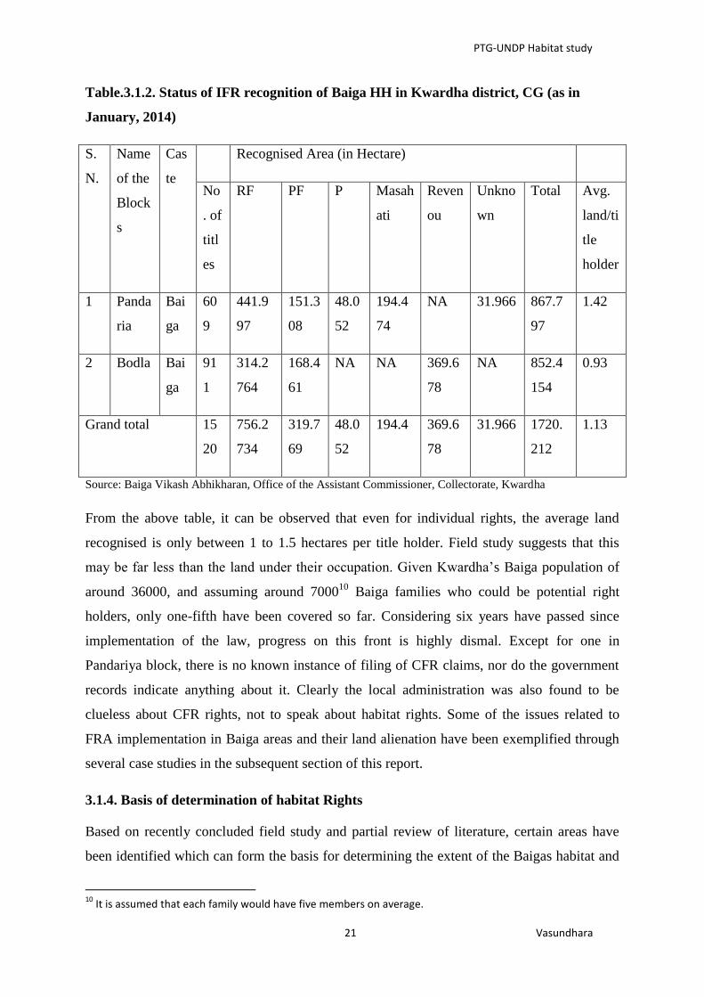
From the above table, it can be observed that even for individual rights, the average land
recognised is only between 1 to 1.5 hectares per title holder. Field study suggests that this
may be far less than the land under their occupation. Given Kwardha’s Baiga population of
around 36000, and assuming around 700010
Baiga families who could be potential right
holders, only one-fifth have been covered so far. Considering six years have passed since
implementation of the law, progress on this front is highly dismal. Except for one in
Pandariya block, there is no known instance of filing of CFR claims, nor do the government
records indicate anything about it. Clearly the local administration was also found to be
clueless about CFR rights, not to speak about habitat rights. Some of the issues related to
FRA implementation in Baiga areas and their land alienation have been exemplified through
several case studies in the subsequent section of this report.
3.1.4. Basis of determination of habitat Rights
Based on recently concluded field study and partial review of literature, certain areas have
been identified which can form the basis for determining the extent of the Baigas habitat and
10
It is assumed that each family would have five members on average.

PTG-UNDP Habitat study
22 Vasundhara
the bundle of rights that should accompany recognition. The mechanisms for protection and
the resources over which Baigas would have the ‘first charge’ to use, conserve and decide
about its governance and management can also specified. These are briefly discussed below:
i. Clan identity:
Baigas are divided into different clans which they would locally refer to as jaat (Reddy and
Modell, 1997) or goti (Elwin, 1938) in sanskritised language called gotra. The educated
Baigas would understand the term gotra but they now mostly use the term ‘jaat’ to refer to
their clans. These clan identities are place based and non-totemic. Every Baiga jaat claim
their origin from a particular place which they would refer in their local language as garh-
bhidi or garh where their original Gods and Godesses are believed to live and when a lot of
them dispersed far off form their original villages, they have established those Gods and
Godesses in their new villages. These garhs are located deep inside the forest. These garhs
are believed to serve the tradition of protecting the identity of Baigas and conserving and
protecting biodiversity. The key Gods worshipped in these garhs include Bhawani Mata,
Dharti Mata, Panghat Paniharin, Junhadewar, Junhadewarin, Patta Devi, Lapta Muda,
Budhi Mai etc. and places of medicinal plants and religious importance like Sheetalpani,
Kasaikund etc. The worship normally takes place in Baishak (month of May) on Mondays,
Wednesdays and Fridays. The Baigas who have now settled far off form their garh, do the
worship on an interval of three year in the same manner in which worship is being held in the
original garh. In addition to this Baigas have community worship and certain religious sites.
Some of the key ones include Thakur Deo, Khila Muthwa, Maharani, Badadeo, Mabar
Sigadia (near Fatari), Deogna (in Samnapur), etc. As with garh worship, all villagers come
together to worship these Gods lead by their chief priest.
After a family member dies, some of his/her remains after their funeral are being taken to the
garh with a belief to consummate its meeting with the Atma (soul). They also put a flag for
recognition and establish the soul of dead with the ancestors. It is normally believed that if
this ritual is not followed the soul would wander around and harass everybody.
Based on field work and review of secondary literature, an illustration of such clan related
garhs is given in the following section.
Rathuria: This is one of their clans who refer to their garh as a place called Dudhi
which lies on the shores of Narmada River in Anuppur district where people of this

PTG-UNDP Habitat study
23 Vasundhara
particular clan go for worship at an interval of 8-10 years. It is suggested that Baigas
are divided into 52 clans and Rathurias are considered as the highest in terms of their
hierarchy and numbers. The Rathuria people consider lion (sher) and jaddu snake as
their Gods and worship them at an interval of 3 to 5 years.
Nigunia: Their garh is a place called Nigungarh which is in the Chatia-Khajri jungle
in Dhindori district. It is suggested that the place has ancient statues of Gods and
Godesses and there is a big tila (hillock). The worship procedure is the same as that of
the Rathurias.
Kewatia: They claim to have originated from Kewti Garh which is inside the jungle
near Kewti village of Dhindori district and have similar ancient statues. Baigas of this
clan consider crow and medhili snake as their God and worship them.
Pachgaiya: Their garh is called Pachgaon which is in the Bijauri forests under
Amarpur block of Dindhori district. The Bijauri forest is in the fringes of Bijauri
village which has an ancient math and a hillock.
Nandia: their garh is in the Nanda jungle under Amarpur and have similar features as
above.
Samardaihya: Their place of origin is called Samardha Garh which is near a small
stream called Beej-Bhajri inside the jungle on the fringes of Samardha village under
Samnapur block of Mandla district and have similar features as mentioned above.
Lathudiya: Their garh is a place called Lathogarh which is situated in the Churia
Salwaha forest under Ghugri block of Mandla district. This place has a math and a
very old plant of chilli which bears fruit every year. The place has other similar garh
features and the worship procedure is also the same as followed by other Baiga clans.
Ghatia: They believe to have originated from Maru Garh which lies inside the
Singhanpuri jungle under Mandla district which has similar features such as presence
of ancient statues of deities and hillocks.
It can be observed from the above illustration that every Baiga clan has a garh and as it
appeared from the field work that almost all of them can be found in the undivided Mandla
district which happens to be their original abode. Substantiation of this can be found in
historical documents. This area lying in the state of Madhya Pradesh is now divided into the
districts of Dhindori, Shahdol, Anooppur, Umariya and Mandla. From here the Baigas have
spread to the present Chhatisgarh districts of Kawardha, Bilaspur, Korea and Rajnandgaon
with their most prominent presence in Kawardha district. The Baigas who have traversed

PTG-UNDP Habitat study
24 Vasundhara
several hill ranges and now are settled far from their place of origin (garh) have created
places for their Gods and deities in their present settlements. However, the Baiga clans settled
closer to their garh do make it a point to visit their garh for worshipping their Gods.
Interestingly, the garhs have a few things in common including the presence of ancient
statutes of Gods and Goddesses and hillocks locally known as Tila.
Based on primary research and literature review, the study has so far been able to identify
around 38 clans with their respective garhs. However, field observations suggest that this list
may not be complete or conclusive. Another secondary list put the clan number at 180.
Verrier Elwin based on his extensive work had identified tehsil-wise garhs but was
inconclusive as to whether the list was complete as also suggested by the short field study. It
will require thorough enumeration of all villages where Baigas are present to list their clan
related garhs. On the basis of this, a detailed map can be drawn showing the expanse of baiga
settlements in relation to their place of origin. This would indeed be a long-drawn and
sensitive exercise which may not be possible to be carried out within the structure of
government unless some specialized agency is engaged and proper resources are allocated.
Western countries have adopted arial photography and surveys for identifying such habitats
for wild-life, if not of humans.
ii. Geographical characteristics:
The Mandla Gazetter of 1912 notes that the ‘principal habitat’of Baigas ‘lies in the recesses
of Maikal hills’11
. The range of hills known as Maikal lies at the junction of Satpura and
Vindhya hills and represent a distinct and expansive territory of Baigas. As an elder Baiga
person said during one consultation with traditional Baiga leaders, ‘Saheb hum to maikal
pahad se bandhe hue hain’ (Sir, we are tied to the Maikal hills). An author refers to this
geographical spread as ‘baigadesh or baiga-country’ (Gautam, 2011). The District Gazeteer
of Shahdol (1994) provides a detailed account of Maikal:
The Maikal Range is the cross versed range of the Satpur Mountain on its eastern extremity.
Whereas the multitude of Satpura range from the west coast to Mandla district extend in west
to east direction, the Maikal range extends from south-west to north-east in Rajnandgaon and
Bilaspur districts, The range of hills thus form the boarder of Satpura plateau. It sharply
scarps east on a lower plateau……… The secondary range of the Maikal bifurcates to the
west (rather West-North-West) from Parkighat. It runs nearly parallel to the main range and
11
Mandla Gazeteer, 1912, pg. 41

PTG-UNDP Habitat study
25 Vasundhara
forms the Great Central Parting line of India. It separates the waters of narmada in the south
from that of the Johila in the north. It is a narrow and disconnected chain in the east Ajania
(917 meters) in Mandla and Aganhuri (842 metres) are the prominent peaks.
It should be noted in this context that migration of Baigas from Mandla has happened along
this hill range and not beyond and all of their garhs are located on Maikal hill range, many of
which are deep inside the forest with some of the sites possibly uninhabited at present, but
Baigas connect to their garh culturally, religiously and emotionally. Though today’s
generation having never seen their place of origin continue to nurture it in their memory, this
is fading from the memory of current youths due to intense exposure and government focus
to ‘develop’ them. The Baigas have developed two broad identities based on their spatial
location along the Maikal range. They divide the range into two territories: bandhan and
khaloti where bandhan refers to uphills and mountain tops (also locally called dadar and
many hill-top villages have the word as a suffix to the village name) and khaloti refers to the
lower hills and the plains. Thus the Baigas living in the upper hills would be referred to as
‘bandhan ke baiga’ and those in the lower hills and plains would be referred to as ‘khaloti ke
baiga’. However no discrimination in terms of status or hierarchy is assigned to this
distinction. Thus Baigas appear to connect to and identify themselves with bandhan and
khaloti combined as their territory. The term khaloti and dadar that defines particular type of
geography can also be found in historical account12
iii. Basis of settlement:
An elderly Baiga of Bahapani village when asked about the basis of their settlement
suggested that ‘jungle ke jagah chahi; pani ke jagah chahi’ (the land must have jungle and
water for them to settle). In addition to Bewar practice, the Baigas have been highly skilled
hunter-gathers with deep knowledge about forest, different species, tubers, medicinal plants
etc. and have mastered certain skills like bamboo weaving and and are known for their
mastery of preparing traditional medicines from herbs and plants. In the Baiga villages, one
can observe that they would still prefer to drink water from jharia or natural stream and have
also selected their settlement based on the presence of such streams, availability of bamboo
forest etc.
12
Please refer to Mandla District Gazetteer, 1912 (reprint, 1995), pg.1 and 30 for more details.

PTG-UNDP Habitat study
26 Vasundhara
iv. Social Relations:
Baigas are exogamous communities and would enter into marriage relations with other clans
from other areas. When asked about the extent of area, they would suggest that beti-behni
(marriage relations) from particular settlement extend to a vast area where they have married
their daughters or have wives from. This is also linked to their seasonal and regular livelihood
access areas which are sometimes extremely far off. Understanding the social relations in a
particular settlement also provide leads to understanding the micro-cosmos of a particular
community within their larger habitat determined by their clan relations.
The Baigas also have their traditional leaders. Every Baiga settlement/ village would have a
social head who is called by different names like Mukaddam, Samrat or Dewan who provide
leadership to all social events, resolving social issues and other social negotiations. They are
also assisted by Sian (elderly) of their village. They also have jati Samaj covering several
villages who sit to discuss and resolve social issues which include disputes, matters related to
elopement, organizing any social ceremony etc. However several Baiga leaders lament that
these traditional institutions and social leaders have lost importance and prestige due to
imposition of government panchayat system in their areas which is often controlled and
dominated by people of other communities. It was observed that Gonds have had a particular
dislike for Baigas and it is alleged that they marginalize them in panchayat proceedings.
However these institutions continue to play an important role in their traditional and social
affairs.
v. Cultural Aspects:
There is a Baiga specific mela called Madai which is held in different places across the Baiga
territory where they go and many perform the madai nach (Madai dance). The venue of this
fair also happens to be their local market places where most of the commodities were earlier
bartered including trading of different types of ornaments which Baiga men and women wear.
These fairs also used to be a place where youth would choose their life-partners and a boy
would elope with a girl and bring her to his house after which the marriage would be socially
solemnized. Discussions in the field indicate a fast disappearance of this tradition. With
increasing influence of administrative machinery amidst a disintegrating traditional
institution, this concept of elopement is now considered as a criminal breach of law and
people from other communities many a times instigate the girl’s family to file a police
complaint so that they can extract money from the boy’s family. With growing exposure to
PTG-UNDP Habitat study
27 Vasundhara
mainstream media, television etc. such kinds of practices appear to be ‘unsocial’ and have
become a matter of ridicule. One such Madai melawas visited and it was interesting to note
that unlike other tribal haat cum fairs, there wasn’t a drinking zone, though Baigas as
drunkards apathetic to their development issues has assumed a mainstream narrative. On
enquiry, it was suggested that one would not find Baiga people openly resorting to drinking
and that they do so within their own community and would follow certain rules for serving
the drink. However as an elder Baiga leader suggested, this aspect has been wrongly used and
made this cultural association with Mahua liquor, a major weakness for them. The Madai
mela locations are spread across the Maikal range.
Their culture is also distinct and separate from other tribes in the area e.g. Baiga dance and
pride in expressing this superiority of theirs (Sarangpani, 2003). The liquor made from
Mahua is considered sacred by them and used on all social occasions of celebrations or
observing grief (Sarangpani, 2003). Recent field visits to Baiga areas reflected the practice of
responsible drinking and no liquor is freely available even in their traditional Madai fair
unlike other tribal haats and fairs where liquor is sold openly. It was suggested that Baiga
people would privately consume Mahua liquor at home and then come to the fair and one
cannot find Baiga people resorting to drinking in open places. Drinking is done by both men
and women who would remember their original ancestors by sprinkling few drops of liquor
on the earth before starting their drink (Sarangpani, 2003). People from other communities
and local workers from the government and non-government sectors readily accepts that
these people are extremely simple and are easily exploited and fooled by others.
vi. Traditional Medicinal and Ecological Knowledge
Baigas also appear to be a rich repository of expansive traditional medicinal and ecological
knowledge. Though fast disappearing amongst youth, Baiga elders have good knowledge
about their area, ecology and sources of medicinal plants e.g. they cited one Rengakhar (near
Mowai) and Maharshi as places which have a wide variety of wildlife and medicinal plants. It
wasn’t possible, considering the short span of time, to capture this remarkable trait of Baigas
which had made them the most superior tribe of the region in the past. However it is amply
evident that such knowledge is missing amongst youth with growing dependence on external
medicine, with little effort for preservation and recognition of such knowledge, something
which could have made the Baigas proud enough to preserve it. It is however important that
such ecological sites contained in their knowledge are duly protected and their rights over
such forms of knowledge are duly recognised. Literature also reveals the wide expanse of
PTG-UNDP Habitat study
28 Vasundhara
Baiga’s traditional ecological knowledge (Gangwar and Bose, 2013) which also reflects their
strong association with their geography which deeply embedded in their culture. Baiga
dominated settlements are also referred to as epistemic communities (Holzner, 1968 cited in
Sarangpani, 2003) as a hub for ‘application and transmission of medicinal’ knowledge which
is fairly well distributed and shared amongst adults and elders (Sarangpani, 2003). A study
exploring traditional medicinal knowledge identified at least 48 species that can cure 30
ailments although such knowledge is gradually receding amongst the younger generation
(Tiwari et al., 2012; Bhat and Tiwari, 2011).The number of Baiga vaidyas (traditional
healers) and priests to Gonds have gone down considerably over time. Several authors have
noted that such indigenous knowledge can provide a solid foundation for socially and
ecologically sound development models (Posey, 1985; Quiroz, 1996) while such knowledge
has been ignored by the forest department in states like Chhattisgarh in conservation
planning. There is an acute need to recognise and protect such forms of knowledge which is
disappearing due to negligence. It can provide a knowledge base for future planning of forest
and other natural resources. This can be done with effective coordination between state and
non-state agencies ideally involving the Forest department and academicians like,
Anthropologists, Botanists, Geographers and N.G.O's (Bhat and Tiwari, 2011). The task of
facilitating a claim for the Baigas habitat rights should essentially lie in the hands of a
sensitive multi-disciplinary team having the acumen and the attitude to engage with the Baiga
community in a respectful manner so that they conveniently voice their opinion and
perception without any fear as they often do in front of outsiders.
vii. Baiga Song and Dance
Elwin’s and other’s work have partly captured the rich traditions of baiga dance and location
which speaks volumes about their area, nature, and social traditions and culture that are
deeply embedded in their environment. With gradual marginalisation of Baigas, their ways of
livelihoods and traditions have either been hounded or have been subjected to social ridicule.
There is a need for a mechanism for recognition which could help Baigas to revive their
declining traditions and practices while not cutting them off from the mainstream but
facilitating their integration on their own terms.
viii. Concentration of Population:
The census data indicates areas of their geographical concentration which also provides a
definitive idea about the geographical extent of their habitat.

PTG-UNDP Habitat study
29 Vasundhara
3.2. Dongaria Kondha:
3.2.1. The Dongria Kondh in Niyamgiri: An Introduction
In terms of developmental interventions Dongria Kondh was rendered a special status during
1978-80 (6th
five year plan) as Primitive Tribal Group (PTG) who recently renamed as
Particularly Venerable Tribal Group (PVTG). Earlier they figured as a sub group of the
‘Khond’, a Schedule Tribe which is the largest among the 62 tribes in Odisha13
. According to
Macpherson (1852) the name Khond is derived from the Telegu word ‘Konda’ (a hill). In a
note on the Kui, Kandhi or Khond language, G.A. Grieson mentions that ‘the Kandhs or the
Khonds are a Dravidian tribe in the hills of Odisha and neighbouring districts14
. The Kondhs
believe themselves as the original inhabitants of Odisha. According to them,"this is our soil,
the earth is our mother and we always appease her by regularly worshipping her because she
provides us food”. There is such wide diversity in the community in terms of rites, social
customs, economics and even language (Schulze 191 1 Winfield 1929: VII-X)1516
that any
single name to encompass this complexity would seem inappropriate. They are distributed in
the state of Bihar, West Bengal & Jharkhand as Scheduled tribe. In Odisha there are as many
as 17 sub-group of ‘Kondh’ identified as Kond, Kandha, Nanguli Kandha, Sitha Kandha,
Kondh, Kui, Buda Kondh, Bura Kandha, Desia Kandha, Dongria Kondh, Kutia Kandha,
Kandha Gauda, Muli Kondh, Malua Kondh, Pengo Kandha, Raja Kondh, Raj Khond.
The Dongria are found in the Niyamgiri hill ranges of the Eastern Ghats and particularly in
the Rayagada and Koraput districts. Their major concentration is found in Kalyansinghpur,
Bissamcuttack, Muniguda and lanjigarh Block. They are called Dongria or dweller
of donger17
. The Dongria are considered as the protectors of streams, hills and forest by the
people of the nearby plains.
The Odisha district Gazetteer, Koraput (1966:83) says that Dongria Kondh and Bonda are the
only tribes who live on hill slopes, abandon their settlements in search of new area, but locate
their new settlements not beyond their areas of habitat. The Dongria Khond strongly believes
that they are the descendants of Niyamraja, the legendary king of Niyamgiri hills. They
worship Niyamraja in the form of their deity. The major tract of Dongria habitat comes under
13
Dongria Kandh (2008) Photo handbook, SCSTRI Bhubaneswar. 14
Mac-pherson, S., (1952). ‘An account of the religion of the Khonds of Orissa’. Journal of Royal Asiatic society, xiii:216-274. 15
Schulze, F V P (191 1): Kuvi Gramuner, Madras 16
Winfield, W W ( 1929): A Vocabulary o f the Kuie Language ,Asiatic Society of Bengal,C alcutta 17
Hills of niyamgiri is locally known as donger

PTG-UNDP Habitat study
30 Vasundhara
Rayagada forest division. The Dongrias populate the forest tracts of Muniguda, Rayagada,
Bissamcuttack and Lanjigarh range and their demographic concentration is spread over four
blocks under two districts Kalahandi & Raigada, displayed in figure.3.2.1
Figure.3.2. Concentration of Dongaria Kondhas in Odisha.
Note: There are other inhabited villages including forest villages and hamlets which are not mentioned in the
list due to unavailability of data. It is important to mention here that the DKDA does not cover all the Dongria
Kandha Villages.
3.2.2. Socio-economic Status and development
The Dongria Kondh attach social-cultural significance to the Niyamgiri hill ranges and
perceive the entire geographical area as a living entity. This hill range provides shelter to
their physical and metaphysical entities like their kin, bovines, plants, wild animals, and
deities, ancestral spirits, and other kinds of spirits respectively. The hill top is referred to as
‘penu eja’ literally means, God’s abode. The hill top is referred to as ‘penu eja’ literally

PTG-UNDP Habitat study
31 Vasundhara
means, God’s abode. The hill slopes are used for slash-and-burn cultivation locally known as
donger or ‘neta’ by the Dongria18
. Their dependence on forest is expressed in several
religious ceremonies and socio-cultural activities. Thus, forest-swidden-plain environment is
inseparable from their traditional patterns of livelihood in which religion and economic
survival are woven around. The perception about forests being sacred has led Dongrias the
indigenous modus-operandi to promote conservation of natural resources in their habitationl
area. They call their indigenous resource management system as pracheli or parcheli . They
consider the maintenance of kaman type of forest, comprising tall mature trees to be of prime
importance for effective management (Kaman pracheli). (Jena et.al, 2002)
They collect various types of forest products and transact them in exchange mode and
monetary mode in nearby weekly haats/ market to meet their exigencies. Around 40 to 50
percent of their annual income is derived from selling of forest products like Siali leaves,
Myrobalans, Amla etc (Pathy 1976 and Jena, et.al, 2002). They grow fruit crops like
pineapple. Apart from the forest coolection, the Dongria economy revolves around shifting
cultivation and horticulture. The Dongrias consider that their right to cultivate hill slopes has
been conferred upon them by Niyam Raja and unless the hills are tilled, one can hardly call
them a Dongria. The right over swidden can never be confiscated or changed since each
dongar (hill) plot is haunted by an ancestoral spirit who helps in bumper growth of crops19
.
They grow about twenty eight varieties of crops like ragi, small millets, oil seeds and others.
Vegetables are also grown in the podu patches. Shifting cultivation is given highest priority
with horticulture coming second and plain land agriculture third in their resource ranking.
Apart from this, the Dongrias engage themselves in fishing (minka beta). Fishing is carried
out in hill streams which abound the Niyamgiri hill ranges.
Demographic composition under the micro project area: The census for 2010(DKDA)
reveals that the total Dongaria population is 11508 with 4844 males and 6664 females. The
Dongria have a favorable sex ratio with 1376 female per 1000 male against the state and
national average of 979 and 933 respectively. This demographic composition indicates that
Dogaria women enjoy considerable freedom and autonomy and thus assume relatively higher
position in society.
18
Jena, M. et.al., (2002.) Forest Tribes of Orissa Vol.1 The Donria Kondh, D.K printworld ltd. 19
For more details refer (Daspatnaik, op.cit.).

PTG-UNDP Habitat study
32 Vasundhara
Table.3.2.1.Demographic profile of Dongria Kondh.
Particular DKDA, Parsali
DKDA,
Chatikona Total
No. of GPs / Block covered
2 G.Ps of K.
Singpur Block 3 Block, 7 G.Ps 3 Block, 9 G.Ps
Geographical Area 50.35 Sq.Km. 167.35 Sq. Km. 217.7 Sq.Km.
Elevation 1000ft to 5000ft 1000 ft to 5000ft 1000 ft to 5000 ft
Total Forest Area 6195 Ac. 27467 Ac. 33662 Ac.
Total Cultivable Land
(private & Govt.) 3927 Ac. 111775 Ac. 115702 Ac.
Total PTG House Holds (as
per 2011 Survey) 631 2106 2737
PTG Population
Male 1105 Male 3739 4844
Female 1479 Female 5185 6664
Total 2584 Total 8924 11508
Source: DKDA, 2010
It is noteworthy here that the DKDA covers only three blocks, nine GPs and one hundred
and four villages while the Dongrias are found beyond this administrative boundary and
their habitat covers a greater area . It was also revealed during a consultation with the
traditional leaders that the Dongria Kondh habitat includes more than 400 villages (including
revenue village, hamlets and forest villages).
The main instrument for achieving the constitutional objectives of welfare and development
of PVTGs are the creation of micro projects first to bring them at par with other tribals and
then to the main stream of the nation within a stipulated period for this there has been a
special fund flow from centre under Article 270 of the constitution. At presently, in Odisha
for the holistic development of all the 13 Particularly Vulnerable Tribal Groups, 17 Micro
Projects are functioning. Of these Micro Projects, 13 are located within the Scheduled Area
and the remaining 4 are located outside the scheduled area. These are loked after by ST
Development Department, Govt of Odisha.

PTG-UNDP Habitat study
33 Vasundhara
Table.3.2.2. Micro project wise Distribution of the sample PTG
Sl.
No
PTG Micro Project No.
of
GPs
No. of
Villages/
hamlet
Geo.
area
Population Density/
Sq. km
Avg.
HH
size
1 Dogaria
Kondha
DKDA, Kurli 5 62 115 6036 52 4.2
DKDA, Parsali 2 40 50 2567 51 4.2
2 Juang JDA, Gonasika 6 35 641 8281 13 4.8
3.2.3. Status of FRA in Dongaria dominated area (Sample districts)
As per the government records obtained from DKDA, till 31st march 2014, A total of 2121
claims had been received at FRC level out of which 1895(89.34%) titles had been distributed
after approval by the DLC with an average of 2.2 acre of land being recognized per claim as
mentioned in the (Table No.3.2.3.) mentioned below. As per the status available at DKDA
some CFR claims (exact number is not known) were filed but those claims had been later
rejected by the Dongria Khondh community as the Palli Sabhas have resolved that the
Dongria have got rights over entire Niyamgiri hill ranges and not on a few patches.
The Dongaria settlement is contiguous so as their habitat and settling individual and
community rights over smaller patches is against their culture and tradition. Imposition of the
concept of individual rights is a threat to their unity. They apprehend that it will adversely
affect their rights over the resources which they enjoying since centuries. On Individual and
Community Rights a few elderly Dongarias stated that: “they can visit anywhere in the entire
Niyamgiri, they cannot be confined to a particular patch of land forever as they are shifting
cultivators and in shifting cultivation the cycle for reuse the same patch takes atleast five
years.

PTG-UNDP Habitat study
34 Vasundhara
Table.3.2.3. Status of Individual Claims
Particulars D.K.D.A.,Parsali D.K.D.A.,Chatikona Total
Claim received by FRC 661 1460 2121
Claim approved by FRC 661 1380 2041
Claim rejected by FRC 0 29 29
Claim pending with FRC 0 NA 0
Sent to SDLC 661 1380 2041
Rejected by SDLC 92 0 92
Approved by DLC 569 1380 1949
Certificate of Titles issued 532 1363 1895
Pending for issue 0 17 17
Pending for approval at SDLC
level 37
- 37
Source: DKDA, March 2014.
When asked about FRA during the consultation and FGD it was clearly evident that they are
aware of FRA and its provisions regarding Individual Rights and Community Rights and
ignorant about any provision of Habitat Rights, when asked about the rights settled under
FRA they said “what we will do with this tiny patch of land recognized under FRA as
Individual Rights, we have rights over entire Niyamgiri since several generations. We have
been living in Niyamgiri since centuries; we born and live in here and serve Niyamgiri,
Niyamgiri belongs to us and we belong to Niyamgiri; and if government want to give us
rights then they should give us rights over the entire Niyamgiri.”
3.2.4. Basis of determination of habitat Rights:
During consultation with the Dongria Community and their traditional leaders some of the
parameters had been identified that can help determine the habitat rights. These are discussed
below:
i. Clan Identity
Among the Donarias the clan is called Kuda in local language and each clan has functionaries
called Bisimajhi, Mandal and Jani, One Dongaria clan is different from another with respect
PTG-UNDP Habitat study
35 Vasundhara
to their clan deity, rites and rituals. These functionaries have specific roles towards their
clan deities. Each clan has its own deity such as Boyer penu of Kadraka clan, Malkamba of
Jakesika, and Nidimuda-tambamuda of Sikaka, etc.
The exact number of clan is not known and it is also not possible to identify their clan
hierarchy. The clans are exogamous units. Their clan social solidatity and cultural collectivity
is symbolized though totemic objects and by a common clan name. The study on Dongira
Kandh clan revealed that each clan has its own territory and members of clan mostly live
together in a definite geographic space. The density of clan members in their villages /
satellite villages and their interacting areana provide indication about their possible habitat
area.
The distribution of land among the Dongria Kandh has been made on the basis of family
members the extent of clan’s territory. Each clan has a definite territory known as Padar (the
total area of land under a clan is known as Padar which is a cluster of Dongria
settlement that includes more than one revenue village, hamlets or forest villages). The
Padar is named after the clan, therefore, when the villagers refer to the land of the village and
most often the village itself, they generally use the clan name with suffix Padar (e.g- Sikaka
(clan) and Sikaka Padar as their clan territory).
There are instances where members other clan are settling in neighboring clan territory and
practicing podu cultivation to what they call it as donger chas. In such cases, the right to
own has never been given to the members not belonging to their territory .And the right to
use hill slopes for danger chas given non clan member is at the mercy of the clan leader - the
padrika. Such use right given to the outsider is temporary. It can be withdrawn at any time as
padrikas opine. However, the expansion of a village in a new site within the clan territory is a
necessary condition for coping mechanism and rescue maintenance to combat demographic
pressure.
Each Padar has a distinct name based on it clan title; such as Jakesika, Sikaka, Wadeka. The
identity and solidarity of the clan members are manifested by paying homage to their distinct
clan deities, however, irrespective of any clan they first worship Niyamraja with much
reverence. The Niyamgiri is represented by a long pointed stone erected in the middle of each
Dongria village. As every Dongria Kandh has a village deity and so also is in each Padar. It
has its own territorial demarcation on every direction locally known as Handi or Sandhi.
Numerical preponderance makes clan powerful. Nayak (1989) it was established that the

PTG-UNDP Habitat study
36 Vasundhara
Sikaka, Wadaka, Jakesika, Nundruka and Pusika considered themselves as important clans.
However, size of the padars vary on the basis of demographic composition and number of
settlements and the area at its disposal for podu cultivation. The settlement pattern of each
Padar vary, Each Padar covers many villages which may exceed 60. It was found that the
Sikaka padar has the highest number of villages (60) compared to other clan groups.
Although each clan territory is numerically preponderate by the specific clan members, it was
observed that none of the clan territories comprises with the homogeneity in its population
composition. However, as narrated by the Dongria, villages under each padar representing a
particular clan were homogeneous, over the period of time, due to in-migration and out-
migration, due to socio-cultural support extended to the needy affine in one’s own padar /
village, today the villages in particular and the padar in general are clan heterogeneous in
demographic composition. It can be observed that all the padar taken together would
constitute the habitat of the Dongaria Kondha.
ii. Cultural sites & Rituals
The religion of the Dongaria Kondh is characterized by polytheism. There are several gods,
goddesses and spirits who are denominated according to their special imageries and the
phenomena attributed with them. The Dongaria Kondh believes in the existence of supreme
deities with other associated gods and goddess’s shairing the same environment of which the
Dongaria Kondh are a part. The Dongria refered to the supernatural entities as penu
(goddess) like Dharani Penu (earth goddess, Gangi penu (Goddess of water resources) and
considered their abode as sacred.
Belief in ancestral spirit is prevalent among the Dongaria Kondh and believes that they have
been descendants of Niyamraja. It was believed that While He was ruling the entire
Niyamgiri He was having direct communication with sun god Gama penu who was His
mentor. The Dongaria call their ancestral spirit Dumba / Duma, but Niyamraja is never
considered to be a Dumba. Rather he is propitiated as a god20
. The installation sites of these
Gods and deities provide important clues towards determining their cultural rights and
cultural boundaries which is deeply enmeshed with forests. Thus, these spots are inseparable
constituents of rights over resources and habitat.
The Dongarias dispose of their dead in their respective clan territories within the cultural
recognized location. This might offer one of the clues to identify the territorial demarcation.
20
Forest Tribes of Odisha, vol-1, 2002
PTG-UNDP Habitat study
37 Vasundhara
iii. Traditional Institution
The smallest social unit among the Dongria Kondh is the nuclear family, next comes lineage and
clan whose functionaries are Bissimajhi, Mandal and Jani. These functionaries play major roles
in all matters of their socio-cultural, economic and religious activities. Wadaka, Karaka,
Pushika, Huika, Toika, Wangesika, Sikoka are some of their clan names used as surnames. The
exact number of their clan is not known21
. Besides, there is a traditional village council that
handles matters like inter-personal quarrels, breach of taboos and customs, offences
committed in drunken state, partition of families, property inheritance, inter-clan marriages
and love affairs. The traditional council composed of Padar head and a few lineage
concerned heads sits to resolves the disputes amicably. To resolve the disputes the offenders
are imposed certain punitive fine either in terms of cash or in kind.
Padar itself is an institution at clan level being headed by a Padrika. He is also the clan head
supported by village heads -Bisi-majhi – social and cultural head, Mondal – administrative
head, Jani (Religious leader) and Barika (messanger). Each sub-clan is termed as Punja and
each Punja in turn at the local level can be divided into kaja-punja (the senior sub-clan) and
icha-puja (the junior sub-clan). The well structured traditional institutions that exist indicate
the PVTG is culturally integrated and if approached from within, it might help the
implementing agency in identification of the nature and extent of habitat.
iv. Concentration of population
The clan demographic density is one of the most crucial aspects of determination of the extent
of clan habitat. Therefore, information regarding these parameters needs to be collected from
primary or secondary source. From the interaction with the villagers and traditional leaders
they revealed that there are total of 112 padar, It including the padars in Rayagada and
Kalahandi districts. When asked about the extent of the Dongaria Kondh settlement, it was
informed by Dongarias that they extend across Muniguda, Kalyansingpur, Lanjigarh and
Bissamcuttack Blocks. These blocks cover the entire Niyamgiri.
v. Geographical characteristics
The habitat to Dongaria Kondh stretches over the entire Niyamgiri hill range and spread over
four blocks of two districts (Kalahandi and Raigada). The Niyamgiri hill range is
characterized by heavy rainfall, cold climate and the birthplace of several perennial hill
21
Nayak, P. (1989) Blood, women and territory, ed. Gurumuthry, K.G., Reliance Publishing House, New Delhi

PTG-UNDP Habitat study
38 Vasundhara
streams and two rivers (Nagabali and Nansibali). Thus, the entire Niyamgiri hill ranges
constitute the physical habitat of Dongaria Kondhas.
vi. Basis of village Settlement:
Certain prerequisites are taken into account while selecting a site for settlement like
existence of a perennial water source, the availability of adequate hill land nearby for
cultivation and the easy access to the forest for the collection of edible resources, fuel wood,
fodder and leaves. The dongaria make their settlement usually at the foot of hill slope. The
Dongaria settlement especially exhibits linear patterns of housing arrangement
vii. Dongaria Song and Dance:
‘Forest tribes of Orissa’ and other works have captured the rich tradition and oral lore of
Dongaria. There are three basic forms of oral lore: Songs (pranambu), tales (katha), and
riddles (idi anari). They may either be long or short piece, and some type of songs are
predominantly sung by girls; for example; hedi pranambu (marriage songs), prabu pranambu
(festival songs), desia pranambu (desia kondh-oriya songs), kui pranambu (mythical songs),
dakina pranambu (ritual chants). The transmission of oral lore is not regulated by specific
procedure in Dongaria society. Knowledge is passed on to boys and girls during the course of
daily life in dormitories22
. These oral lores are the only unwritten documents of the
community narrated the detail about their tradition, culture their habitat which need to be
preserved and protected .Such rich oral tradition might provide clues while recognizing
their habitat rights.
22
Forest Tribes of Odisha, vol-1, 2002

PTG-UNDP Habitat study
39 Vasundhara
3.3. Habitat Rights of Juang - A Case Study on Claim Making Process
The Juang PVTG of Odisha happens to be the first community in the whole to country to
have filed habitat rights claim under the Forest Rights Act. A total of three habitat rights
claim have been filed with the SDLC of which the first one was filed in the year 2010 and the
remaining were filed in 2011. The claims were never processed by the SDLC due to
prevailing confusion regarding meaning and scope of habitat rights at the level of
government. The Government of Odisha subsequently wrote to the Ministry of Tribal Affairs
seeking clarification on the issue. The process of claim making was facilitated by Vasundhara
(an NGO based at Bhubaneswar, Odisha) and Banabasi Chetna Mandal (a local NGO based
at Gonasika, Keonjhar district), Odisha based NGOs. Similar processes were adopted for
determination and filing of claims. Example of one such claim making process has been
described in the following section:
3.3.1. Juang - An Introduction
The Juangs are found only in Odisha State. The community can broadly be divided into two
sections, namely the hill Juang and the Plain Juang. The hill Juang are confined to the hill
ranges of Keonjhar and Pallahara, whereas the plain Juangs are distributed among the plains
of Dhenkanal and Keonjhar Districts. The following map show the Juang concentration areas
in Odisha:
Figure.3.3. Juang Concentrated District in Odisha

PTG-UNDP Habitat study
40 Vasundhara
The hill Juang are subsisting mainly on shifting cultivation and collection of Minor Forest
Produce (MFP). In Pallahara, they pursue basket – making in addition to their traditional
shifting cultivation. Ethnically, the Juang are considered a branch of the Munda group23
The Juang claim the ‘Juang Pidha’ of Keonjhar District as their homeland. Those who live in
this area are known as Thaniya (Original settlers), while those who have migrated to the plains
of Keonjhar and Dhenkanal Districts are called Bhagudia (those who have fled away). There
is a popular myth about their origin. The Juang believe that they are the first human being to
be born on earth. Their ancestors were born from a Rusi couple (a saint and his partner) who
were living in Rusi Tangar, a hillock near Gonasika in Keonjhar district24
. According to the
2001 census, the Juang Population was 41,339 or 0.5 per cent of the total tribal population of
the state. In 1991 their population was 35,665. Thus the growth rate of the Juang during
1991-2001 was 15.90 per cent as against 15.82 per cent and 16.25 per cent of the state’s tribal
and general population respectively.
The most characteristic feature of the Juang social organization is their village exogamy. The
villages used to be uniclan and marriage within it is forbidden. As such village and clan
exogamy go hand in hand, however over the time villages have become multi-clan and multi-
ethnic due to dispersal and migration and in-migration of other communities as well. The clan
is a unilinial descent group whose members trace their origin back to a common ancestor.
The Juangs Pidha is their traditional territorial unit. The Juang Pidha organization consists
of 6 Sub Pidhas and under each sub pirdha there are a few villages. The list of Pidha and the
list of villages comprising each Sub Pidha are listed below (Table No.3.3.1).
23
SCSTRTI, Bhubaneswar-2004 24
SCSTRTI, Bhubaneswar-2004

PTG-UNDP Habitat study
41 Vasundhara
Table.3.3.1. Village list under the Juang Pidha
Village G.P
Block
JDA/Non
JDA Pidha
Satkhandia Pidha
Gonasika Gonasika Banspal JDA Satakhandia
Guptaganga Gonasika Banspal JDA Satakhandia
Jantari Gonasika Banspal JDA Satakhandia
U. Raidiha Gonasika Banspal JDA Satakhandia
U. Baitarani Gonasika Banspal JDA Satakhandia
Kadalibadi Gonasika Banspal JDA Satakhandia
Goliabandha raidiha Gonasika Banspal Non JDA Satakhandia
Talabaitarni Gonasika Banspal Non JDA Satakhandia
Jharkhand Pidha
Sinkulapada Gonasika Banspal Non JDA Jharkhanda
Talapada Kuanar Banspal JDA Jharkhanda
Kanjipani Kuanar Banspal JDA Jharkhanda
Budhighar Gonasika Banspal JDA Jharkhanda
Dumuria Barhagarh Banspal JDA Jharkhanda
Phulabadi Barhagarh Banspal JDA Jharkhanda
Upperpanasnasa Kuanar Banspal JDA Jharkhanda
Talapanasnasa Kuanar Banspal JDA Jharkhanda
Hatisila Barhagarh Banspal JDA Jharkhanda
Saria Barhagarh Banspal JDA Jharkhanda
Talabali Barhagarh Banspal JDA Jharkhanda
Upperbali Barhagarh Banspal JDA Jharkhanda
Bankuda
budhakhaman Barhagarh
Banspal
Non JDA Jharkhanda

PTG-UNDP Habitat study
42 Vasundhara
Nadambansdiha Barhagarh Banspal Non JDA Jharkhanda
Nadam Barhagarh Banspal JDA Jharkhanda
Jamudiha Barhagarh Banspal Non JDA Jharkhanda
Baragarh Barhagarh Banspal JDA Jharkhanda
Kuanar Kuanar Banspal Non JDA Jharkhanda
Kathua Pidha
Medinipur Talakainsari Banspal Non JDA Kathua
Talachampei Talachampei Banspal JDA Kathua
Rugudi Talachampei Banspal Non JDA Kathua
Badaraduan Talachampei Banspal Non JDA Kathua
Kodipasa Kodipasa Banspal Non JDA Kathua
Sarukudara Talachampei Banspal Non JDA Kathua
Bayapandadar Bayakumutia Banspal JDA Kathua
Mamalaposi Bayakumutia Banpal JDA Kathua
Uparasamatha Talachampei Banspal Non JDA Kathua
Uparakaipur Talachampei Banspal Non JDA Kathua
Tangarpada(Kha) Kodipasa Banspal JDA Kathua
Sanaraduan Talachampei Banspal Non JDA Kathua
Uparachampei Talachampei Banspal JDA Kathua
Bayakumutia Bayakumutia Banspal JDA Kathua
Chempei Talachampei Banspal Non JDA Kathua
Kundei Kodipasa Banspal JDA Kathua
Talasamatha Barhagarh Banspal JDA Kathua
Mundala Bayakumutia Banspal Non JDA Kathua
Ghungi Kodipasa Banspal JDA Kathua
Kanthadas Bayakumutia Banspal Non JDA Kathua
Toranipani Kodipasa Banspal JDA Kathua

PTG-UNDP Habitat study
43 Vasundhara
Duarasuni Kodipasa Banspal JDA Kathua
Kansa Kodipasa Banspal Non JDA Kathua
Hunda Pidha
Samagiri Budhakhamana Harischandanpur Non JDA Hunda
Budhkhamana Budhakhamana Harischandanpur Non JDA Hunda
KuaJharana Patila Harischandanpur Non JDA Hunda
Nalapanga Janghira Harischandanpur Non JDA Hunda
Gayalamunda Patila Ghatagaon Non JDA Hunda
Charigarah Pidha
Pitanali Koria Telkoi Non JDA Charigarah
Godi Narda Koria Telkoi Non JDA Charigarah
Madhusudanpur Telkoi Telkoi Non JDA Charigarah
Rebona Pidha
Kharba Pithabola Harichandanpur Non JDA Rebona
Rangamatia Pithabola Harichandanpur Non JDA Rebona
Kahneigola Pithabola Harichandanpur Non JDA Rebona
Baura Bhagamunda Harichandanpur Non JDA Rebona
Nola Bhagamunda Harichandanpur Non JDA Rebona
Maragola Bhagamunda Harichandanpur Non JDA Rebona
Kusumyodi Bhagamunda Harichandanpur Non JDA Rebona
Budhipada Bhagamunda Harichandanpur Non JDA Rebona
Kanjipal Bhagamunda Harichandanpur Non JDA Rebona
Turkipada Bhagamunda Harichandanpur Non JDA Rebona
Rebona Rebona Harichandanpur Non JDA Rebona
Talapada Rebona Harichandanpur Non JDA Rebona
Note: The list of villages has been prepared on the basis of Juang and Bhuiyan Pidha settlement records (obtained from keonjhar district
record room) which were verified during the focus group discussions with the traditional leader of each Juang sub-pidha. These sub-pidhas were taken as the unit for initiating the habitat right claim making process. As stated earlier, three sub-pidhas initiated the process of claim
making and subsequently submitted their claims for habitat rights.

PTG-UNDP Habitat study
44 Vasundhara
3.3.2. Basis of determination of habitat Rights.
The following parameters were decided by the traditional institutions of Juangs to determine
their habitat rights. The several rounds of discussions at village and pidha level to arrive at
these parameters were facilitated by personnel from Vasundhara (an NGO based at
Bhubaneswar, Odisha) and Banabasi Chetna Mandal (a local NGO based at Gonasika,
Keonjhar district):
i. Clan Identity:
The clan refers to uni-lineal descent group whose members trace their origin to mythical
common ancestor. The clan is called a bak in local language. It is patrilineal, patrilocal
totemic group. It is governed by the usual rules of exogamy and any deviation from it is
considered a very serious offence. All the clans in the Juang society may be grouped in two
divisions known as Bandhu clans and Kutum clans. Bandhu refers to affainal groups and
Kutum refers to consanguineal groups.
Most of the baks, as mentioned above, are totemic groups bearing names of animal such as
elephant (hatisilabak), bear (baneibak), rabbit(nachingbak), etc. and plant species such as
Schleichera pleosa (barumbak), Diospyros melanoxylon (temrembak), Fisus semicordata
(samanbak), ficus glomerata (dumriabak)25
. These totemic groups are seen confined in higher
frequency to a considerable geographic locality. Thus, these are territorial groups. The extent
of their spread and concentration of each clan in the form of settlements provides one of the
clear parameter to determine the physical extent of Juang Habitat.
ii. Traditional Institution:
In every Juang village there is a village council consisting of some office holders and the
village elders. This body is responsible for maintenance of peace and harmony through
enforcement of traditional norms in the village. The Pradhan is the headman of the council.
All important matters are brought to his notice. He decides the disputes among the villagers,
imposes punitive fine for breach of minor taboos, redresses divorce cases and settles
separation of property with the help of village elders. The Nagam or Dehuri, the sacerdotal
chief of the village, takes an active part in some important decisions regarding the
25
SCSTRTI, Bhubaneswar, 2004

PTG-UNDP Habitat study
45 Vasundhara
distribution of talia land to the villagers and fixing the date for observing different rituals.
The Dakua acts as the messenger of the Nagam and the Pradhan.
Juang Traditional Administrative setup
All the six sub-Pidhas together form the Pidha Mahasabha and is headed by the
Mukhya Sardar. The Sardars of each Pidha with Pradhans, Dehuri and Naik of each village
together select the Mukhya Sardar of the Pidha Mahasabha. The decision of the Mukhya
Sardar is final and binding for all Juang community. The offices of the traditional leaders are
non-hereditary. The existence of a well organized traditional institution indicated
management of a territory and the hierarchy of the traditional leaders. It provides evidence
about existence of Sub-Pidha. The sub-pidhas when combined together form the habitat of
Juang.
iii. Geographical characteristic:
The Juang claim that their pidha located in Keonjhar District as their homeland. They are
confined to the hill ranges of Keonjhar and Pallahara. The Pidha as an administrative unit of
Juangs are divided into 6 sub- pidhas as mentioned earlier which are their traditional
territorial unit. The villages of a particular clan in close vicinity (group of neighbouring
villages) were clubbed under one Pidha. This, by and large, corresponds to the villages
belonging to kutum clans. There were as many as 68 villages under six different sub-pidha
with well-defined land marks, some of which are briefly mentioned below:
Pradhan – Village head
Dehuri - Village priest
Dakua – Village messenger
Pidha Sardar – Head of sub-pidha
Mukhiya Sardar – Administrative Chief (all pidha)
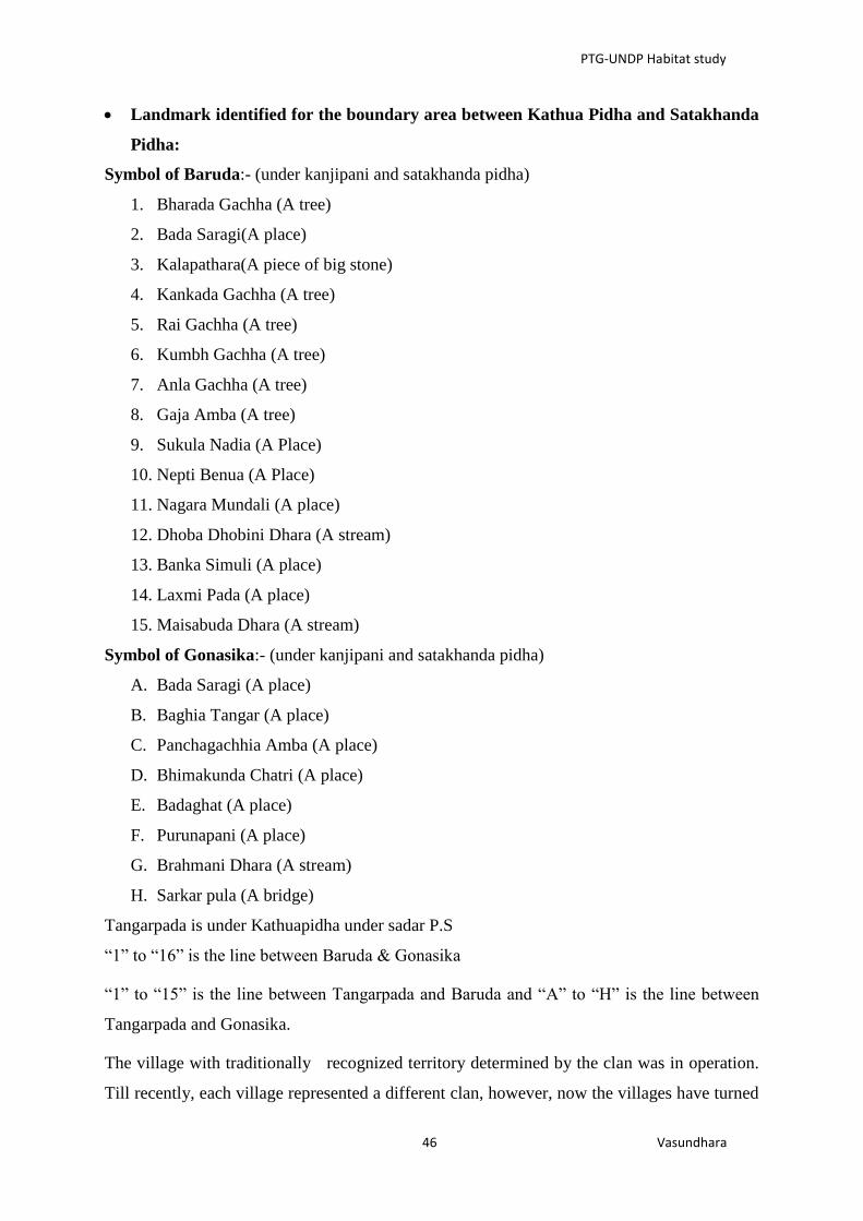
PTG-UNDP Habitat study
46 Vasundhara
Landmark identified for the boundary area between Kathua Pidha and Satakhanda
Pidha:
Symbol of Baruda:- (under kanjipani and satakhanda pidha)
1. Bharada Gachha (A tree)
2. Bada Saragi(A place)
3. Kalapathara(A piece of big stone)
4. Kankada Gachha (A tree)
5. Rai Gachha (A tree)
6. Kumbh Gachha (A tree)
7. Anla Gachha (A tree)
8. Gaja Amba (A tree)
9. Sukula Nadia (A Place)
10. Nepti Benua (A Place)
11. Nagara Mundali (A place)
12. Dhoba Dhobini Dhara (A stream)
13. Banka Simuli (A place)
14. Laxmi Pada (A place)
15. Maisabuda Dhara (A stream)
Symbol of Gonasika:- (under kanjipani and satakhanda pidha)
A. Bada Saragi (A place)
B. Baghia Tangar (A place)
C. Panchagachhia Amba (A place)
D. Bhimakunda Chatri (A place)
E. Badaghat (A place)
F. Purunapani (A place)
G. Brahmani Dhara (A stream)
H. Sarkar pula (A bridge)
Tangarpada is under Kathuapidha under sadar P.S
“1” to “16” is the line between Baruda & Gonasika
“1” to “15” is the line between Tangarpada and Baruda and “A” to “H” is the line between
Tangarpada and Gonasika.
The village with traditionally recognized territory determined by the clan was in operation.
Till recently, each village represented a different clan, however, now the villages have turned

PTG-UNDP Habitat study
47 Vasundhara
to have housed more than one clan members. Within the delineated customary boundary each
village possess land and patches to practice settled and shifting cultivation. They also regulate
themselves to use the forest based resources for their livelihoods as well as to meet the
cultural necessities. The customary boundary of the village is identified by physical
landmarks like hillocks, rivers/streams, long standing trees etc .The resources used by the
adjacent village(s) is normally based on mutual consent and principles of share and care set
by the village elders and leaders of the concerned villages.
iv. Village Settlement:
The Juang live in homogeneous as well as heterogeneous villages located at the foothills or in
the valley surrounded by forests and close to water source like stream. Some settlements are
situated in the plains where the villages have scattered houses. A unique feature of the Juang
settlement pattern in earlier times is their frequent change of village site. Each village had a
number of village sites and the villagers use to live in one site for some years after which they
moved to another site. The shifting of sites is conditioned by ecology and economy. Besides,
many other reasons were also attributed to the change of village sites, however the main
reason being attributed was regarding shortage of talia land (land under shifting cultivation)..
The other reasons stated by the Juangs include spread of epidemic, frequency of deaths in the
villages, etc. Nowadays they live in permanent villages.
Another unique feature of Juang village is their dormitory locally called mandaghara. This
is their community house. Juang huts are small in size and are used for multifarious purposes
such as bedroom, kitchen, store, and sometime goat-shed. They can accommodate only one
couple and young unmarried children. Grown-up sons sleep in the mandaghara but nowadays
the mandaghara has been used as community hall where they cook food for their guest, store
grains and assemble together at the call of their leader for meetings. The minimal unit of a
Juang habitat is a village. Few of them combined together on the basis of socio-political
parameters forms sub-pidha. The sub-pidha combine together forms the Juang pidha.
Therefore, for determining Juang habitat, it is important to understand the dynamism of
village sites and settlements.
v. Culture & rituals:
The Juang observe various rituals throughout the year to propitiate their deities and ancestors.
Their important festivals include Puspunei, Amba-Nua, Tirtia, Asadi, Pidha Puja, Dhan Nua,
etc. On the occasion of Amba –Nua and Dhan-Nua the Juang clean their houses, and through

PTG-UNDP Habitat study
48 Vasundhara
away their old earthenware cooking pots and use new ones. They prepare a special type of
food and offer it to ancestor with mahuli liquor. The Juang observe Pus Punei with much
pomp and ceremony, this being the beginning of the agriculture cycle. On the full moon day
of Pausa (December-January), the Nagam kills a pig and sprinkles blood over the grains
collected from each household, these being kept in the mandaghara for seed purpose. Amba-
Nua is associated with offerings of mango blossoms to the village deities and ancestral
spirits. The Juang also commonly celebrate “Baruni Mela” once in a year at Gonasika. The
sites of their culture and religious practices constitute a significant part of their habitat rights.
vi. Juang Song & Dance:
The Juang songs are melodious and rhythmic and do cover a wide range of topics taken from
their natural surrounding and their social life. Songs are mostly sung during specific
occasions such as marriage, rituals and functions in the forest and swiddens. In most of their
songs their cultural values and code of conduct are addressed. The Juang are known for their
Changu dances. Boys and girls dance together, while the boys play on the changu, the girls
dance in a stooping posture to the rhythm of the changu in front of the boys. The group dance
is performed in a half moon circle.
3.3.3. Steps followed for determination and filing of claim for habitat rights
1st Step - Call for Mahasabha meeting of all the Pidhas
A series of awareness camp were organised by the facilitating NGOs to make the Juang
aware about the provision under FRA regarding
habitat rights. This was followed Pidha Mahasabha
meeting under the leadership of Mukhya Sardar of
all the Sub-Pidha Sardar with Pradhans, Dehuris and
also dakua of all the villages coming under Juang
Pidha. In the first Mahasabha meeting, the Mukhya
Sardar and the village chiefs with technical support
from Vasundhara discussed about the provision of habitat rights under FRA. In this meeting
they listed out various types of rights inside their habitat and their extent. An action plan was
developed to repeat the process at the level of sub-Pidha depending on the nature of rights.
The respective, traditional institutions (at sub-pidha level) then were entrusted with the
Box No-4: The process give a clue on
how to increase the participation of the
traditional institution in the habitat rights
claim making process which is very
crucial, a interface and a joint
participation of implementing agency
with the tradition institution is very
important and should be taken into
consideration
PTG-UNDP Habitat study
49 Vasundhara
responsibility. The process of determination of rights was recorded in the form of resolutions
and SDLC was intimated of such a process being undertaken.
2nd
Step - Gram Sabha Meeting (Preparation and Finalization of Customary Boundary
of the Village by the Gram Sabha)
Each village coming under the Pidha (whether revenue, hamlets, unsurveyed, forest villages)
convened their separate Gram Sabha with the support of Panchayats. This was followed by
the traditional leader of the village (Pradhan) calling the Gram Sabha meeting. The Gram
Sabha discussed about the provisions of Forest Rights Act with special focus on habitat
rights. The Gram Sabha informed the community about the discussion on habitat rights at the
Mahasabha level and also discussed about the nature and extent of rights to be determined at
the community level. Then the Gram Sabha fixed dates for subsequent meetings/gatherings
where they get together to determine the rights and map and demarcate them.Intimation of
this exercise was then provided to the concerned villages and also to SDLC.
In all subsequent meetings, the community sat together and discussed about the nature and
extent of each of the rights and also discussed about the customary boundary of their own
village. The following points were taken into consideration for discussion to help them in
claiming their rights:
Customary practices
Traditional resource use pattern
Cultural linkage (Listing out in details the sacred areas, places of worship, festivals,
functions etc)
Livelihood dependence/occupation in forest land (Identification of places of
collection/use/occupation along with seasonality)
Social structure/institutions

PTG-UNDP Habitat study
50 Vasundhara
After clear cut mapping of the nature and extent of resource use, the entire community
developed a detailed map of their village indicating the places of NTFP collection, places of
worship, Rivers, nalas or any water bodies used by them, grazing places, roads used by them
etc. and then delineate the boundary with the help of physical attributes or any recognizable
landmarks (Streams, hillocks, trees, any
other).
The map prepared was presented in each
of the Gram Sabhas under the Pidha
area. After endorsement in each of the
GS, joint gramsabhas (covering all gram
sabha coming under one sub-pidha area)
were organised and the claim was
finalised.
All the villages under a sub-Pidha drew
and finalized the map of their own village in the above mentioned process.
3rd
Step - Pidha Level Meeting (Preparation and Finalization of extent of one Pidha)
When all the villages of one sub-Pidha had finalized and consolidated their map, a Pidha
level meeting was then called up by the Sardar which include the Pradhans, Dehuris, Dakua,
elders persons, women representatives, Panchayat Secretary, Forest Rights Committee
Secretary and President of all the villages falling within that particular sub-pidha.
Individual village maps with clear cut demarcated boundaries and extent and nature of
resource use was presented at the Pidha level meeting. This exercise gave a clear picture of
the overlapping resource use zones amongst two or many villages and also the extent of the
Pidha.
At the sub-Pidha level similar exercise of identification of Sub-pidha customary boundary
was done based on the above mentioned aspects. To avoid any conflict in future the
overlapping areas of resource use by more than one village was clearly spelt out and they
also decided to initiate a process of management plan of the resources also decided and
finalized with consent of the villagers, village chiefs and Sardar of the Pidha.
The Pidha map was then finalized by the Sardar (traditional Pidha leader) with the consent of
the Pradhans, Dehuris and all elders/important members of the villages of the Pidha where
Panchayat Secretary and FRC Secretary and President were also a part. The Sardar and the
Box No-5: The entire process gives us a clue of
identification of the traditional institution and its
leaders are very crucial to habitat right recognition
process and the learning suggests that the claim
facilitation should be initiated by the traditional
institution.
To help the traditional institution understand the
whole process a group of expert outside the purview
of FRA implementing agency should be attached to
them during the process of the claim making.

PTG-UNDP Habitat study
51 Vasundhara
village leaders decided to prepare a detailed management plan for sustainable use,
regeneration and conservation of the resources falling within their claimed habitat area.
However this process is yet to take off for want of recognition of their habitat rights.
4th
Step - Mahasabha level meeting (Finalization of the entire Pidha Map)
Similar Pidha level mapping exercises was then
carried out in all the Pidhas constituting the entire
Juang Pidha (the names of the Pidha and the list of
villages falling within the Pidha have been mentioned
above). At the Pidha Mahasabha level meeting, the
Maps of all the Pidhas as drawn by the Pidha level
villages was then presented and finalized by the
Mukhya Sardar with consent of the Sardars, Pradhans, Dehuris and the map of entire Juang
pidha was finalised. This was again discussed at the level of each of the gramsabhas and
subsequently recommendations on habitat claim were send to SDLC.
Box No-6: One of the major learning
from the process is the mapping
exercise of the habitat area is complex
in nature and can ideally be done after
the rights have been recognized jointly
with the help of traditional institution
and the implementing agency.

PTG-UNDP Habitat study
52 Vasundhara
Habitat Right Determination Process flow
Series of awareness camp and meetings on FRA provisions and habitat rights in the region
organised by facilitating NGO
Pidha level Mahasabha meeting organized under the leadership of Mukhya Sardar participated
by all Sub-Pidha Sardar with Pradhans, Dehuris and also dakua of all the villages coming under
Juang Pidha. An action plan developed to initiate the habitat rights determination process.
Gram sabha of each village under the leadership of Pradhan (whether revenue, hamlets, un-
surveyed, forest villages) under all Sub-Pidha organised to discuss the action plan. Dates for
subsequent meetings fixed.
Subsequent round of gramsabha meetings organised as per previously fixed plan. In these
meetings they demarcated their customary boundaries and intimated to SDLC about this
development.
In next round of meetings, details related to places of NTFP collection, places of worship,
Rivers, nalas or any water bodies, grazing places and roads used by them etc were marked and
recognizable landmarks (Streams, hillocks, trees etc.) were identified and shown across the
previously delineated customary boundary.
Prepared maps presented in each of the concerned GS under all Sub-pidha area. Subsequently
joint gramsabhas (covering all gram sabha coming under one sub-pidha area) was organised to
look after any issue related to overlapping area or any conflict between two of the gram sabha
and then the claim was finalised.
Pidha level meeting was organised under the leadership of Sardar and included the Pradhans,
Dehuris, Dakua, elders persons, women representatives, Panchayat Secretary, Forest Rights
Committee Secretary and President of all the villages falling within that particular sub-pidha for
final verification before making recommendation to SDLC..A final Sub-Pidha map was then
consolidated and prepared.
The Sub-Pidha map was then finalized by the Sardar (traditional Sub-Pidha leader) with the
consent of the Pradhans, Dehuris and all elders/important members of the villages of the Pidha
where Panchayat Secretary and FRC Secretary and President were also a part.
Recommendation on Sub-Pidha wise Habitat Rights claim was made to SDLC. This process was
adopted for all three Sub-pidha wise habitat rights claim making.

PTG-UNDP Habitat study
53 Vasundhara
Box No.2- The important thing that also should be
taken into consideration while facilitating the habitat
claim is the awareness level of the community as
well as the Government officials which need to
ascertain before initiating any such process, if
required a proper training and awareness camp
should also be organized regarding the provisions of
habitat rights in particular and FRA in general.
Box No.1- The process followed by Juang gives an
learning and idea to identify the parameters before
initiating the claim making process which is related to
the exercise of rights of a particular PVTG over a
particular landscape which may include lots of socio-
cultural , economical and ecological factors and rights
over it and the rights of the PVTGs over these
landscape known as habitat rights interwoven with
these factors, these factors then sets a guideline for
discussion with the community where the nature and
extent of habitat can be ascertained.
3.3.4. Learnings
The habitat claim was filed by Juang Mahasabha separately for each sub-pidha. So far habitat
claims of only three sub-pidha i.e Satkhanda pidha, Kathua pidha and Jharkhanda pidha has
been filed with SDLC in March 2010, March 2011 and May 2011 respectively.
The claims are still pending with the
SDLC.
The key reason for the delay in processing
the claim was due to confusion about the
concept of habitat, and what it would
entail. Since, at SDLC/DLC level the
clarification on habitat remained
unsolved, the state government sought
clarification from MoTA regarding asking
for clarification about the scope and
extent of habitat right:
While looking at some of the claims it is becoming difficult to ascertain the scope and ·extent
of habitat right. For example- while Juang PVTG is confined to the geographical area of
Gonasika. The habitat right being claimed by the PVTGs extends much beyond Gonasika
area. Similarly, there are instances of claims of habitat right on areas which arc neither
frequented by the PVTGs nor used for accessing MFPs or grazing of animals. By definition,
any forest area can become a 'habitat' for the STs/ OTFDs irrespective of where they stay. It
can also encompass Revenue land depending on the interpretation of traditional institutions
of PTGs pertaining to their habitat. In most
cases revenue lands also forms part of the
habitat right claim which does not come
under the purview of Forest Rights Act. The
word 'habitat' needs to be clarified in terms
of its extent and coverage to avoid
ambiguity in making and considering such
claims.
PTG-UNDP Habitat study
54 Vasundhara
Box No: 3
What happens to the part of the habitat which is not forest land as the FRA only covers forest land?
This issue should be considered from the point of view of the intention of the law which seeks to undo the
historical injustice. The preamble of FRA highlights the historical injustice done to forest dwelling communities
due to non-recognition of their rights on their ancestral lands and habitats while notifying them as State forests.
The same process was repeated while declaring parts of their habitat areas as State owned revenue lands. It is
also to be noted that the definition of PVTGs’ habitat is inclusive and includes the area comprising the
customary habitat and such other habitats in reserved forests and protected forests of primitive tribal groups and
pre-agricultural communities and other forest dwelling Scheduled Tribes. Therefore, the intent of the legislation
is to recognize the right to community tenures over the entire habitat of PVTGs including forest and non-
forest land. State governments need to ensure that habitat rights on all types of land coming within them are
recognized using constitutional provisions, PESA and state laws. (Ref. Supreme Court judgement in OMC vs.
Union of India case, 2013, FAQ released by MoTA).
Although in case of individual rights, but for treatment of non-forest land, the Government of Odisha has taken
an exemplary in-principle decision to not reject claims over non-forest lands made under FRA and have
instructed the SDLCs and DLCs to consolidate such information about such claims over revenue lands and
explore possibility of their settlement under State revenue land laws and schemes of the government (Ref.
Circular no: 368/ CSR & D.M. Dated 4th
January, 2010 issued by the Revenue and Disaster Management
Department, Government of Odisha). This can be followed in case of treatment of revenue land within the
habitat area.

PTG-UNDP Habitat study
55 Vasundhara
CHAPTER-4- Summary of Key Findings & Conclusion
PTG-UNDP Habitat study
56 Vasundhara
4.1 Summary of Key Findings
4.1.1. Nature, Scope and Extent of Habitat Rights
The study has suggested several possibilities with regard to the nature, scope and extent of
habitat/s and habitat rights of PVTGs. Given the wide diversity of PVTGs, it will be
inappropriate to suggest the ‘one size fits all’ formula and the proposed guideline has been
developed keeping this complexity in view.
The Baiga communities are found to be spread over several districts of the two States of
Madhya Pradesh and Chhattisgarh including areas in higher hills to relatively plain areas. The
higher patches have higher and near exclusive Baiga concentration, where older traditions are
more in vogue whereas more changes could be observed in lower reaches. Moreover, Baigas
strongly link their identities to garh, places which are presently physically far off from many
of their settlements. Such places are visited by Baigas living far away only occasionally but
they continue to have deep association with them. All Baiga settlements, therefore, do not
constitute an exclusive and contiguous patch. Rather large numbers of their settlements have
several of their social, cultural and religious rights overlapping with each others’ territories or
over other territories like many of their garh that lie deep inside forests without Baiga
habitations at present but which are seasonally accessed by concerned clan groups for
carrying out their religious rituals. Thus habitat and habitat rights would possibly cover
several habitats in terms of territorial limits; all such garh (inhabited or uninhabited); other
sites of seasonal access (for medicinal plants/ livelihoods/ cultural purposes like organising
fairs) with an explicit right to seek territory or habitat to meet their future requirements.
While the territories of the other two studied communities viz. Dongaria Kandhas and Juang,
as compared to those of Baigas, appear to be in more geographically compact zones in terms
of their physical settlements, their cultural and religious rights expand over a wider territory
and specific sites. E.g. the Dongaria Kandhas appear to have a clear sense of their defined
territory and claim the whole of Niyamgiri hills as their habitat with multiple rights
embedded in it. The Juang while deciding their habitat rights filed claims over three habitat
areas (sub-pidha) that constitute a part of their larger habitat.
It was observed during the study that there has been greater inflow of other communities in
Baiga areas compared to the Juang areas and the least in Dongaria Kandha area except for
villages that lie on the foothills of Niyamgiri ranges. Thus overlapping, shared or exclusive
rights of other communities/ tribal groups would also be of varying degree and nature

PTG-UNDP Habitat study
57 Vasundhara
depending on their presence of non-PVTGs in PVTG zones. The proposed guideline does
take care of this issue by providing scope for discussion on determination of the forest rights
of non-PVTG communities and resolution of the same through organising joint meetings.
There has been greater concern to understand how the extent of habitat and habitat rights of
PVTG can be determined in terms of geographical territory. The study represents the
following scenarios in this regard:
a. A PVTG can have a contiguous habitat in terms of geographical territory that
encompasses their settlements and sites of cultural, social, religious and livelihood
importance (e.g. Dongaria Kandhas of Niyamgiri, Odisha). This can be observed from
the following indicative map:
Figure.4.1. Dongaria Kandha Village Habitation in Niyamgiri
* There are other inhabited villages including forest villages and hamlets which are not
mentioned in the list due to unavailability of data. It is important to mention here that the
micro-project does not cover all the Dongria Kandha Villages.

PTG-UNDP Habitat study
58 Vasundhara
b. A PVTG which is highly dispersed can have multiple habitats that may not be
contiguous patches and not an exclusive territory inhabited by that particular PVTG. In
addition, their rights extend over many other territories near or far off from their actual
settlements which relate to their social, economic, cultural and religious
practices/beliefs (e.g. Baigas of CG and MP). The following provides an indicative
picture with regards to possible nature and extent of habitat rights of Baigas when
mapped:
Figure.4.2. Nature & Extent of Baiga Habitat Rights – An Indicative Map
The above map has been prepared on the basis of few GPS coordinates obtained about their
garh (origin place of clans), cultural and religious sites of Baigas and is purely indicative in
nature. However it does provide some clues as to how habitat rights of Baigas might appear
when mapped. Two sample villages viz. Upka and Amania under Kwardha districts under
CG were taken. Baigas of Ningunia clan happen to reside in Upka village (along with few
other clan members) who trace their origin to Ninguniagarh which lay far off from their
existing settlement in Dhindori district under MP. Similar has been the case of Totariya clan
of Amaniya village who trace their origin to Tantargarh in Dindori district. Though the garh
are physically far off, the clan members strongly relate origin and identity with such places
where their original dieties also rests. Similarly several of their cultural and religious sites

PTG-UNDP Habitat study
59 Vasundhara
(shown in red) are spread across the territory and revered by all Baigas and there is periodical
gathering at those sites. The intermesh of all such rights constitutes the larger habitat of
Baigas which is indicated in the above-mentioned map.
c. A PVTG community, though living in a relatively compact geographical zone
comprising their habitat in terms of territory, often does have the notion of sub-habitats
linked to their traditional institutional set up which comprise functional sub-units. These
functional sub-units involving a cluster of villages can also become the claimants for
filing habitat rights claims. (e.g. Juangs of Keonjhar, Odisha). The following map was
drawn as a part of facilitating the habitat rights claim making process which shows the
sub-habitat areas within the larger habitat of Juangs:
Figure 4.3 Juang Habitat (Three sub Pidha out of Total six sub pidha)
The above map demarcates the Pirha and the villages in it and the area it covers. The list of
villages obtained was segregated into sub-Pirha (sub-habitat) based on discussion with Juang
communities and digitised village maps were plotted with use of GIS to make a habitat map
of Juangs. The sub-habitat areas used as an unit to make habitat rights claim are shown in
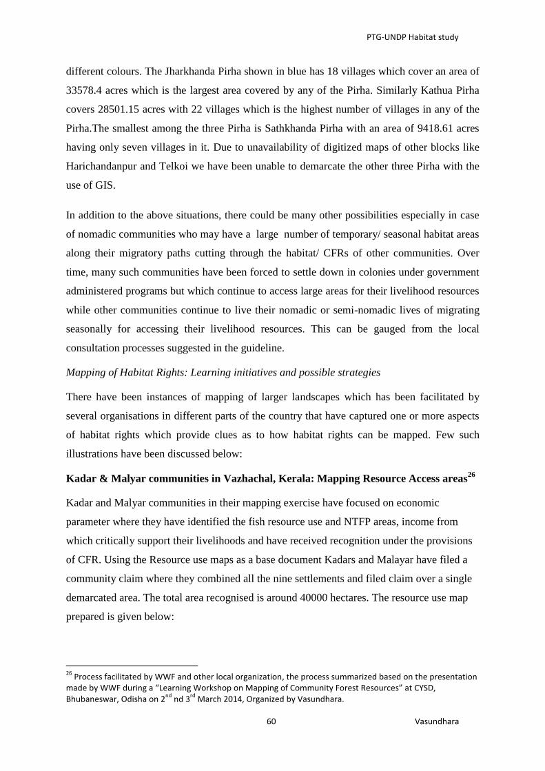
PTG-UNDP Habitat study
60 Vasundhara
different colours. The Jharkhanda Pirha shown in blue has 18 villages which cover an area of
33578.4 acres which is the largest area covered by any of the Pirha. Similarly Kathua Pirha
covers 28501.15 acres with 22 villages which is the highest number of villages in any of the
Pirha.The smallest among the three Pirha is Sathkhanda Pirha with an area of 9418.61 acres
having only seven villages in it. Due to unavailability of digitized maps of other blocks like
Harichandanpur and Telkoi we have been unable to demarcate the other three Pirha with the
use of GIS.
In addition to the above situations, there could be many other possibilities especially in case
of nomadic communities who may have a large number of temporary/ seasonal habitat areas
along their migratory paths cutting through the habitat/ CFRs of other communities. Over
time, many such communities have been forced to settle down in colonies under government
administered programs but which continue to access large areas for their livelihood resources
while other communities continue to live their nomadic or semi-nomadic lives of migrating
seasonally for accessing their livelihood resources. This can be gauged from the local
consultation processes suggested in the guideline.
Mapping of Habitat Rights: Learning initiatives and possible strategies
There have been instances of mapping of larger landscapes which has been facilitated by
several organisations in different parts of the country that have captured one or more aspects
of habitat rights which provide clues as to how habitat rights can be mapped. Few such
illustrations have been discussed below:
Kadar & Malyar communities in Vazhachal, Kerala: Mapping Resource Access areas26
Kadar and Malyar communities in their mapping exercise have focused on economic
parameter where they have identified the fish resource use and NTFP areas, income from
which critically support their livelihoods and have received recognition under the provisions
of CFR. Using the Resource use maps as a base document Kadars and Malayar have filed a
community claim where they combined all the nine settlements and filed claim over a single
demarcated area. The total area recognised is around 40000 hectares. The resource use map
prepared is given below:
26
Process facilitated by WWF and other local organization, the process summarized based on the presentation made by WWF during a “Learning Workshop on Mapping of Community Forest Resources” at CYSD, Bhubaneswar, Odisha on 2
nd nd 3
rd March 2014, Organized by Vasundhara.

PTG-UNDP Habitat study
61 Vasundhara
Figure.4.4.Resource use map of Vazhachal
The Solegas of BRT Sanctuary: Mapping Cultural Territories
The Solega tribe of BRT have identified their clan territories (yelle) and mapped them. Their
map, thus focus on two parameters i.e. demographic (settlements) and clan (cultural sites).
This extensive process was facilitated by ATREE, a Bangalore based organisation.
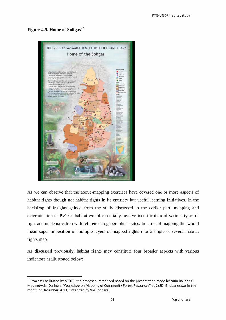
PTG-UNDP Habitat study
62 Vasundhara
Figure.4.5. Home of Soligas27
As we can observe that the above-mapping exercises have covered one or more aspects of
habitat rights though not habitat rights in its entiriety but useful learning initiatives. In the
backdrop of insights gained from the study discussed in the earlier part, mapping and
determination of PVTGs habitat would essentially involve identification of various types of
right and its demarcation with reference to geographical sites. In terms of mapping this would
mean super imposition of multiple layers of mapped rights into a single or several habitat
rights map.
As discussed previously, habitat rights may constitute four broader aspects with various
indicators as illustrated below:
27
Process Facilitated by ATREE, the process summarized based on the presentation made by Nitin Rai and C. Madegowda. During a “Workshop on Mapping of Community Forest Resources” at CYSD, Bhubaneswar in the month of December 2013, Organized by Vasundhara

PTG-UNDP Habitat study
63 Vasundhara
Figure.4.6. Aspects of Habitat rights.
However it cannot be construed that any habitat area would necessarily have all rights regime
but different rights regime in various degrees and when combined together would constitute a
habitat of the community. This is further illustrated in the following Venn
diagram(figure.4.6) where four circles sets has been represented as a parameter also
indicated as layers which defines various kinds of rights and when all the circles combined
may constitute the larger habitat with more intense to less intense areas based on existence of
pre-existing rights.

PTG-UNDP Habitat study
64 Vasundhara
Figure.4.7. Super Imposition of layer to constitute a Habitat Map- an Illustration
The Venn diagram showing a set of four circles (layer-1, 2, 3, 4) constitute and represent the
universe of a habitat. Each circle represents a particular parameter (Economic, Ecology,
Demographic, and Matirial & Cultural Traits) which include various kind of indicators as
mentioned in the above figure.4.6, According to the Venn diagram there are places where
there is no overlap between two parameters like for example the part highlighted as 1, 2, 3, 4
and there are also places where there is overlap between two parameters, three parameters
and also four parameters like the part highlighted in ‘8’ , ‘11’ and ‘13’ respectively, it
indicates for example the part highlighted as ‘13’ represents a place where all the four
Layer-4 –
Material &
Cultural Traits
Layer-3-
Demographic
parameters
Layer-2-
Ecological
Parameters
Layer-1-
Economic
Parameters
6
7 8
5
9
13 10
11
12

PTG-UNDP Habitat study
65 Vasundhara
Box No-7: In a State level consultation
organised as a part of the study in Raipur, a
similar basis for determination of habitat
rights emerged as is discussed in the
following section. iIn addition to Baigas,
Birhor, Kamar and Pahadi Korwa PVTGs
from Chhattisgarh and Madias from
Maharashtra participated in the consultation.
parameters can be found like the community habitation area(Demographic parameters) might
also include the cultural places like their dieties inside there village(material & cultural
traits), they might also practice shifting cultivation (economic parameters) and their
habitation area might also comprises of Ecological parameters like mountains, streams etc.,
there might also be places like ‘3’ which is not an over lapping area and only one parameter
can be found like for example the place use for ‘Maria’ festival by Dongaria kondha where
they use to celebrate it once in three year over a particular place and that place does not
comprises of any other parameters and similar example can also be found with Baiga.
The habitat area when mapped thus may be a combination of multiple maps or a single map.
However this would solely depend as to how the concerned communities define and explain
their habitats rights through a process outlined in the proposed guideline for determination
and recognition of habitat rights.
4.1.2. Scope of habitat rights under the FRA
Under the FRA provisions and its Rules, such diverse PVTG situations imply that the process
of determination and recognition of habitat rights would involve any one of the following
administrative and political jurisdictions:
1. Within one SDLC area
2. More than one SDLC area, but under one DLC
3. More than one DLC area
4. More than one state (SLMC) area
The habitats of different PVTGs may be varied especially when such groups are nomadic or
semi-nomadic having seasonal access to wider geographical areas.
4.1.3. Basis for determination of habitat rights
The following provides the key indicative
categories of information to be. Details obtained
along these suggestive categories are expected to
form a definitive basis forto determininge the
nature, scope and extent of habitat rights of a
particular PVTG. A checklist forof discussing
these aspects duringin the consultations with traditional leaders is provided as Annexure 1.

PTG-UNDP Habitat study
66 Vasundhara
i. Information related to clan:
Most PVTGs (and other tribal groups/ castes) are divided into clans which are exogamous i.e.
no marriages can happen between persons from the same clan as they are considered to be
brothers and sisters. These clans draw their identity from certain geographical locations
which often house their deities or from certain natural entities which may include plants and
wildlife. Their religious rights over such geographical locations need recognition, their
right to protect and conserve such natural entities (as enshrined in their clan beliefs and
practicesbehaviour) needs recognition and such places of their religious and spiritual
importance (irrespective of their geographical distance from their actual settlement)
should be granted protectedion from any action that might lead to theirany
modification or destruction of such place in part or full. It is observed from the study that
such clan related places often lie deep inside the jungle, on hill-tops or in deep valleys and
often have a source of water nearby.
ii. Information about their social and cultural sites:
The PVTGs observe social and cultural rituals by organising faires (melas) at different
intervals and at different places. The periodicity of such social and cultural rituals and their
location of the place is often dynamic and changes at varied frequency. In many cases, some
local haat (village markets) specific to a PVTG community also constitutes the place. Given
their traditions, such places will get shifted over time with new places being added to the list.
As a part of their habitat rights, it is imperative that while rights over existing cultural sites
and the right to organise them as per their beliefs and customs need recognition, the right
to decide and identify newer sites within their habitat for holding their rituals/ cultural
events in future would also require recognition. The PVTGs’ traditional institutions need
to be empowered to decide whether any major land use change in the area should be
permitted or not. This would imply extending the requirement for gram sabha consent
for forest diversion needed in other areas to the entire habitat. It is important to mention
here that all rituals, social and cultural activities and events of PVTGs are deeply connected
with forests and other elements of nature.

PTG-UNDP Habitat study
67 Vasundhara
iii. Information about their livelihoods and sites of livelihood:
This may include sites of their agroforestry based ancestral farming practices (referred to as
podu, bewar, dongarchas etc. in local parlance), areas from where items are gathered and
extracted from forests, sites for gathering medicinal plants etc. There is need for recognition
of their forms of livelihood practices based on forest and geographical sites which support
such livelihoods. The practice of cultivation on hill slopes or hill tops in rotation is found in
varying degrees amongst different PVTGs. While communities living in lower hills or plains
were successfully forced by the government to abandon such practices due to these being
considered ecologically destructive, in many locations where plain land is absolutely missing,
this practice is still prevalent and provides a crucial source of their livelihood as also evident
from the field studies. It isbecomes important that any such existing practices of traditional
farming areshould be recognised and the existing nature of de facto rights currently enjoyed
(individual or communal) over suchthe areas under such cultivation should be are recognised
in its present form.
iv. Information about other important landmarks:
These can include like hills, rivers, streams, vegetation, grasses, particular tree species etc.
which provide other land marks for delineating the boundaries and extent of their territory,
the sub-territories and their social, cultural, religious, economic and political linkages.
v. Information about their songs and narratives:
Places, objects, beliefs, rituals described in the songs and narratives of PVTG communities
provide important information about the traits of their habitat.
vi. Traditional knowledge:
The PVTGs, especially their eldersly population have a huge repository of knowledge about
medicinal plants, sites where they are most available, wildlife, behaviour of wildlife, their
corridors etc. While they are reluctant to divulge details of their medicinal knowledge, they
are inclined to suggest different geographical sites or forests where there is rich concentration
of medicinal plants or forest areas/ zones having good wildlife population and types of
wildlife. Their rights over indigenous knowledge about their ecology of their habitat need due
recognition and should form the basis of its governance and management of such areas where
they have a significant stake.

PTG-UNDP Habitat study
68 Vasundhara
vii. Archival/Secondary Material:
This also provides historical information about the settlement of particular PVTG
communities which can also be usedsourced as evidence for filing their claim. In addition to
this, Copies of any old records available with the villagers (e.g. pattas or rights allowed by an
ex-King) and traditional leaders should also be collected in support of claims. The concerned
DLCs should source such material and make them available to all concerned gramsabhas.
Copies of all such materials should be made available to the concerned Gram Sabhas/FRCs
prior to the initiation of the consultation and claim filing process.
Based on the above, an attempt has been made to arrive at an operational definition of habitat
rights, which is given below:
Habitat constitutes the customary cultural, ecological and social territory of a tribe which
does not necessarily comprise a compact or bounded geographical area. Habitat rights may
be defined as a bundle of rights that relate to livelihood, social, cultural and religious
practices of tribal communities embedded in the territory comprising their habitat.This rights
regime is mediated by their various forms of traditional institutions and leadership base who
play a crucial role in multiple affairs of the tribe. Many such rights are not necessarily
exclusive to one community and may be shared with other communities living in the habitat
area based on age old traditions of mutuality and reciprocity.
This definition is in line with the explanation provided inMoTA’s Frequently Asked
Questions (FAQ) with regard to habitat rights and further explains the nature, scope and
extent of habitat rights. Here it is important to note that non-contiguity and non-exclusiveness
are two important features of habitat rights.
In this context, it is important to explain the difference between CFR and habitat, a matter of
confusion prevailing at different level. The FRA has defined these terms in the following
manner:
CFR: “Community forest resources” means customary common forest land within the
traditional or customary boundaries of the village or seasonal use of landscape in the
case of pastoral communities, including reserve forests, protected forests and
protected areas such as Sanctuaries and National Parks to which the communities has
traditional access;

PTG-UNDP Habitat study
69 Vasundhara
Habitat: includes the area comprising the customary habitat and such other habitats in
reserved forests and protected forests of primitive tribal groups and pre-agriculture
communities and other forest dwelling scheduled Tribes;
It can be observed from the above that while CFR rights are village/ group of village centric,
habitat focuses on customary habitat of particular communities especially PVTGs or pre-
agriculture communities. This implies that CFR rights lay in a relatively defined and compact
territory as it is limited to a particular vlllage or group of village covering relatively small
landcaspe while habitat would involve a wider landscape which may be dispersed, contiguous
and non-exclusive. While village level gramsabhas form the unit for determination of habitat
right, different forms of gramsabhas need to be organised involving traditional institution of
PVTGs for determination and recognition of habitat rights.
4.2 Conclusion
The PVTGs share a common history of dispossession and forest alienation which started
during colonial times and continued post-independence. Concerted policy attention towards
their plight only started gaining ground during late 1960s and 1970s. Over time, most of these
communities have gone through complex acculturation processes leading to substantial
changes in their lives and livelihoods. While in earlier times, most of the communities were
foragers, a large section of them today practice settled agriculture. Their alienation from
forests has gradually rendered them an inferior status even amongst other tribal groups.
Against this backdrop, the process of determination of their habitat and habitat rights would
not only involve understanding their present practices and systems but also a reconstruction
of their habitat and habitat rights by invoking their memories supported by information from
earlier research. The effort should be to restore to them many of their social, cultural,
livelihood and religious rights, something which forms the essence of the Forest Rights Act
of ‘undoing historical injustice’.
While ‘fixing’ boundaries of habitats may be a practical necessity, a note of caution would be
to not narrowly visualise them only as bounded geographical territories. Such a thrust on
permanent settlement in the past has brought considerable misery for these communities. It
would be important to understand habitat and habitat rights as a complex and layered bundle
of rights which are dynamic and flexible. Many such rights which were alienated/
extinguished in the past may need restoration and protection.
PTG-UNDP Habitat study
70 Vasundhara
Undoubtedly the process may be time-consuming and long drawn. As the determination of
habitat and habitat rights would be a combination of reconstruction of the past and
understanding the present practices, the SDLCs and DLCs will need to be supported to play
the required proactive and attentive role for facilitating their proper recognition.

PTG-UNDP Habitat study
71 Vasundhara
CHAPTER-5- Guideline for Determination and Recognition of Habitat
Rights of Particularly Vulnerable Tribal (PVTG) Groups

PTG-UNDP Habitat study
72 Vasundhara
5.1. Process Guideline for Determination and Recognition of Habitat Rights of
Particularly Vulnerable Tribal Groups (PVTG)
i. Background
The PVTG communities, as observed during the field studies and from secondary literature
are relatively more reticent in sharing their opinions and talking about their society and
culture. Habitat rights are complex, dynamic and flexible making the determination process
equally complex. The process is liable to be specific for each community. Therefore it
becomes important that the PVTG communities and their representatives be involved right
from the inception and take fully informed decisions with regard to determination of their
habitat rights. This is also a legal requirement under the FRA. For this purpose they need to
be made adequately aware of the FRA and its provisions related to habitat rights, and
provided with quality facilitation and handholding support during their discussions and
deliberations on habitat rights determination. In two cases (Juang PVTG in Odisha and Madia
PVTG in Maharashtra), filing of habitat rights claim has been possible due to sustained,
intensive and quality facilitation by NGOs well versed with the Act. There have also been
instances of mapping of cultural (clan) territories of Soligas (Karnataka); resource access
territories of Kadars (Kerela); seasonal landscapes of Maldhari pastoralist communities
(Gujarat) through sustained and long-term facilitation by NGOs. Thus the process of
facilitation of claim making on habitat rights would require sensitive and respectful
engagement with PVTGs and sustained care and attention. In this backdrop, the detailed
process steps to be followed for the recognition of habitat rights under the FRA are listed
along with the required facilitative support before, during, and after each of the suggested
process steps. The guideline is divided into three sections. Section 1 deals with the
preparatory phase describing the processes to be followed before initiation of the claim for
habitat rights. Section 2 deals with the actual process to be followed for determination and
recognition of habitat rights and Section 3 outlines the specific roles and responsibilities of
different authorities under FRA with respect to recognition of habitat rights.
This process guideline may be issued by MoTA as a direction under section 12 of the Forest
Rights Act.

PTG-UNDP Habitat study
73 Vasundhara
ii. Process Guideline
Section 1: Preparatory Phase
Organising training of all concerned government officials and staff on habitat rights provision
under FRA and the centrally issued directions on the process of determination and
recognition of habitat rights. NGOs having proven record of working on FRA would be
included in capacity building programmes.
Step 1: Preparation of a State Action Plan
a) The Tribal Department, the State Nodal Agency for the implementation of Forest Rights
Act, along with the concerned Tribal Research Insitute and other experts, is to prepare a
draft State Action Plan for PVTG Habitat Rights recognition under FRA, based on the
process guidelines including
i. Identification and listing out the districts, sub-divisions, Panchayats, revenue villages
and habitations in the State where PVTGs are located; Prepare a final list of all
settlements where PVTGs are present including those not covered by micro projects.
This is irrespective of whether the concerned land is forest or revenue land. The
floating nature of gram sabhas of nomadic/ semi-nomadic PVTGs should be taken
into consideration while preparing such lists and a separate list of such gram sabhas
should be prepared for special attention of the local administration.
ii. Collection, compilation and documentation of relevant information (all kinds of
evidence as per Rule 13 of the 2012 FRA amendment rules) pertaining to each of the
PVTGs and their habitat rights Financial and human resources that may be required
for implementation of the State Action Plan for PVTG Habitat Rights.
iii. Mechanism for monitoring progress in implementation of the State Action Plan for
PVTG Habitat Rights
b) The draft State Action Plan for PVTG Habitat Rights shall be placed before the State
Level Monitoring Committee for approval, finalization of a time schedule for the
initiation of recognition of PVTG Habitat Rights, identifying the bottlenecks if any, issue
of necessary directions to the concerned districts and any other institutions for
implementation of the guideline, allocation of financial and human resources if any, and
any other matter found necessary.

PTG-UNDP Habitat study
74 Vasundhara
c) The Tribal Department shall organize state level orientation programme of all the
concerned district, sub-divisional officials and the designated officers from the micro-
project agencies and others like CSO, NGOs assigned to facilitate the gramsabhas by the
DLC (see below in Step 3) as are required to explain and carry out the State Action Plan
for PVTG Habitat Rights recognition.
Section 2: Determination and recognition of habitat rights
Step 2: Initiation of PVTG Habitat Rights recognition process
The DLC shall ensure the following in this regard:
a) Publicise and communicate the initiation of PVTG Habitat Rights recognition in the
district by providing information about the communities whose rights are thus to be
determined through locally used traditional means of communication to inform people
such as through the village messenger.
b) Issue advertisements, especially in locally read newspapers in PVTG areas, and through
other channels such as posters in public places, PVTG habitations, Panchayat offices etc.,
and inviting claims for PVTGs’ habitat rights.
c) In case a particular PVTG’s habitat area is spread over more than one district, the
concerned DLCs should coordinate with each other with support and advice of the Tribal
Department and the Tribal Research Insitute.
Step 3: Organise gram sabhas in all identified settlements of the PVTG
a) The DLC shall ensure organizing gramsabha meetings focused on the following key
areas:
i. Building awareness and knowledge on habitat rights provision under FRA.
ii. Identify traditional leaders from each gramsabha or respective unit/ structure of
traditional institution. Pass a resolution to initiate the determination and claim filing
process on habitat rights
b) The concerned DLC/s will designate an officer from the PVTG micro-project agencies to
facilitate the gramsabhas. In case the area is not covered under a micro-project or a micro-
project agency is not there, the DLC/s will designate an appropriate officer for the
aforesaid purpose. In cases where some PVTG villages have been left out of a micro
project, it shall be ensured that all such villages are included in the process.

PTG-UNDP Habitat study
75 Vasundhara
Box No-8: Expected Outcome:
Draft habitat claim and tentative map prepared
(there could possibly be several maps as habitat
does not necessarily constitute a contiguous
patch). This draft claim document should also
clearly indicate overlapping, shared and other
forest rights of non-PVTGs and other
communities
c) The DLC/s will organise training for all traditional leaders on habitat rights provisions
and the centrally issued directions for determination and recognition of habitat rights.
DLC/s may invite resource persons from concerned TRI/ CSO/ other experts to facilitate
the training program.
Step 4: Consultation with Traditional Leaders and FRC members
The concerned Collector/s as Chairperson of DLC/s will call for a consultation with
traditional leaders and FRC members. While most of the traditional leaders could be men (as
per insights gained from the study), DLC/s should take special care in involving all women
members of FRCs and other local women representatives from the concerned PVTG in the
consultation process.The first round of consultation should happen after the gramsabha
meeting that passed the resolution to initiate the determination and claim filing process on
habitat rights.
Suggestive Process for the consultation
Place/s of consultation: DLC/s should
decide a suitable place which should
preferably be the traditional common
meeting place of concerned PVTG or a
place easily accessible to the communities
to enable greater participation of
representatives of traditional institutions as well as other interested villagers.
Possible agendas for discussion:
a. Provisions under FRA related to Habitat rights
b. Concept of habitat as understood by the community
c. Identification of their habitat as perceived by them supported by a suggestive
guideline for discussion (attached as Annexure 1) and developing a draft of their
possible habitat rights (this might include a tentative map of their geographical area
showing important landmarks/ cultural markers)
d. Identifying the rights under FRA of non-PVTG communities residing in the habitat
area identified by the PVTG.
If all the above-mentioned agendas cannot be completed in one consultation, then one or
more additional rounds of consultations should be organised to complete the discussion.
These consultations could also be organised at the level of clan-territories/ jati samaj

PTG-UNDP Habitat study
76 Vasundhara
involving a cluster of villages/ settlements if the representatives of the traditional institutions
so decide.
The DLC will invite resource persons from concerned TRI/ CSO/ other experts to facilitate
the consultation process.
Remark/ Explanation
In the case of some PVTGs (like Baigas of Chhattisgarh and MP), their complete habitat may
extend over an expansive geography. In such cases, it is advisable that smaller units claim
their habitat rights separately if the traditional institutions so decide and suggest the same
during the consultations. In the Juang case of Odisha (attached as a case study in this report),
sub-territory of their habitat (sub-pidha) was taken as a unit for filing claims which was
decided by their traditional leaders considering practicability of the approach.
Step 5: Filing of Claims
The draft habitat claim prepared in the consultation shall be presented before each of the
concerned FRCs/gramsabhas of villages28
by representatives of PVTGs having participated in
the consultations. A second round of joint meetings of concerned FRCs should be organised
for verification and approval of the habitat rights claim and to decide on conflicting,
overlapping claims or rights of non-PVTG communities in the habitat area as per Rule 12 (3).
Following this, the revised claims should be presented in the final round of gramsabha
meetings. It must be ensured that the draft claim is presented and discussed in each of the
concerned gramsabhas. While traditional institutions would have a significant role in
anchoring the claim determination and filing process, the role of gramsabha shall be central
as provided in Rule 12 of the FRA Rules. This will also ensure involvement of women who
tend to be less or not represented in traditional institutions. Gramsabha resolutions of
endorsement and approval should be attached to the finalised claim document/s.
Note: The officer designated by the DLC/s would facilitate the process of discussion of draft
claims in gramsabha meetings.
Step 6: Submission of Claims
The concerned gramsabha/s should send their claims to all concerned SDLC/s, DLC/s and
SLMC/s (in case the geographical area goes beyond a sub-division or district or state). These
bodies might decide on convening special joint sessions of SDLCs and/or DLCs to consider
28
‘village’ for this purpose should be a hamlet or a group of hamlets as defined in PESA

PTG-UNDP Habitat study
77 Vasundhara
the claim for habitat rights in such cases. Otherwise it would follow the normal procedure as
outlined in FRA rules.
Step 7: Preparation of Habitat Maps
After habitat rights claims are recognised, the government shall get digitized maps geo-
referenced with topo-sheets of the recognised habitat/territory showing the different rights
areas. This shall be done with the involvement of traditional institution representatives using
GPS instruments. Examples of similar habitat maps (thematic maps) prepared through civil
society facilitation have been provided under Annexure 3.
1. The DLC/s should seek support from TRI and State Remote Sensing Agencies in the
process.
2. The DLC/s should also seek the support of other government agencies specialized in
use of GPS and GIS technologies and which have substantial experience in their use
in community based mapping.
3. The DLC/s should organise training for PVTG youth and traditional leaders on GPS
use.

PTG-UNDP Habitat study
78 Vasundhara
5.2. Specific roles and responsibilities of different authorities under the Forest Rights
Act in the habitat rights recognition process
In addition to what is laid down under the Act, the authorities under the Act would be
required to perform certain specific roles and responsibilities. These are briefly mentioned
below:
Ministry of Tribal Affairs
To issue necessary directions to the State governments for determining and
recognising PVTG Habitat Rights.
To develop a separate reporting format to monitor the progress of recognition of
PVTG habitat rights.
To instruct the different research institutions and archives to provide full support and
cooperation to concerned DLCs for providing all necessary information required by
them.
To provide necessary financial support to the States for providing required facilitative
support as outlined in the process guideline.
State Level Monitoring Committees
To consider and approve the draft State Action Plan for recognition of PVTG Habitat
Rights with necessary modifications
To issue necessary directions/instructions to the concerned DLCs, SDLCs and any
other institutions as required to initiate the implementation of the State Action Plan
for recognition of PVTG Habitat Rights
To issue necessary instructions to all DLCs and SDLCs to undertake extensive
awareness campaigns and training of different stakeholders on the concept of Habitat
Rights and the process of their determination and recognition as suggested in the
guideline.
To ensure proper and adequate representation of PVTG communities in concerned
SDLCs and DLCs as provided under Rule 5 (c) and 7 (c) and to ensure and monitor
their complete and regular participation in SDLC and DLC affairs.
To liase with SLMCs of the adjoining States in cases where the habitat of PVTGs
extends into the adjoining State/s
To ensure regular reporting on progress of Habitat Rights recognition process in the
state from the concerned DLCs.

PTG-UNDP Habitat study
79 Vasundhara
To provide separate reports on the progress of habitat rights recognition in the
concerned State to the FRA division of Ministry of Tribal Affairs, Government of
India.
District Level Committees and Sub-divisional Level Committees
To prepare and consolidate the list of PVTG settlements based on the advice of the
concerned Tribal Research Insitute.
To issue necessary instructions to their officers for following up on the centrally
issued directions for recognition of PVTG habitat rights and the instructions from the
SLMC and the Tribal Department, the nodal agency for implementation.
To organise local level awareness campaign, training and capacity building program
as outlined above and in accordance with the Central directions.
To organise the first round of consultation after the gramsabha meeting that passed
the resolution to initiate the determination and claim process on habitat rights and
organise additional rounds of consultations.
To ensure that discussions on draft Habitat rights claim in the consultation are
presented properly in all the concerned gramsabhas and adequate attention is given to
ensure that PVTG opinions and voices are expressed freely. It should be ensured that
government officials are present in gramsabha meetings and provide necessary
assistance as mentioned under Rule 4 (3) of Forest Rights Rules.
To laise with adjoining DLCs and SDLCs as the case may be in instances where the
habitat rights extend over the adjoining districts and sub-divisions.
Gramsabhas
To ensure proper identification of traditional leaders
To ensure maximum participation of their women and men members including
traditional leaders and FRC members in different capacity building programs
organised on habitat rights recognition under the Forest Rights Act.
To ensure that the FRCs liasen with the FRCs of the adjoining Gram Sabhas as the
case may be in instances where the habitat rights overlap with the adjoining districts
and sub-divisions in order to reach a consensus among the concerned Gram Sabhas;
where consensus is not reached, then to approach the concerned SDLCs/DLCs for
adjudicating differences of opinion or conflicts including those with the non-PVTG
Gram Sabhas whose rights overlap with the habitat of PVTGs.

PTG-UNDP Habitat study
80 Vasundhara
Forest Rights Committee
To carry out the role and functions as outlined in the Rules and as instructed by the
gramsabhas.
PTG-UNDP Habitat study
81 Vasundhara
Bibliography
Adam, R.M.1996. Early Civilizations, Subsistence and Environment, Readings in
Anthropology Ed; Jennings, Fesse D. and Hoebel. E Adamson McGraw-Hill Book Company
New York: 44-56.
Anderson, J.N. 1973. Ecological anthropology and anthropological ecology Handbook of
Social and Cultural Anthropology, Ed John, J. Honigmann, Rand McNally and Company,
Chicago.
Bapat, J. 1988. Towards a Critical Human Ecology, Journal of Indian Anthropological
Society, Vol.23 (1): 1-16.
Banerjee, S.1969. Ethnographic study of the Kondha Anthropological survey of India
Calcutta.
Bailey, F.G. 1957. ‘Caste and Economic Frontier’, Manchester, Manchester University press
Bailey, F.G. 1960. ‘Tribe, caste and Nation: A study of political activity and political change
in highland Orissa’ Indian Branch, Oxford University press.
Baker, D. 1991.State policy, the market economy and Tribal Decline: The Central Provinces,
1861-1920Indian Economic & Social History: 341-370.
Behuria, N.C.1992.Orissa State Gazetteer, Printing, Stationary and Publication, Orissa, vol-
III.
Bennett, J.W. 1976. The Ecological Transition: Cultural Anthropology and Human
Adaptation, Pergamum Press, Inc; New York.
Bhat,S.A. & Tiwari,S.C. Indigenous Knowledge of Communities of Achanakmar-Amarkantak
Biosphere Reserve in Utilization, Conservation and Sustainability of NTFP in Chhattisgarh
(INDIA) , Department of Forestry, Wildlife and Environmental Sciences,Guru
GhasidasVishwavidya/a, Bi/aspur-495009 (Chhattisgarh),[email protected] and
Boal, B.M.1963.The Church in the Kondh hills: An encounter with animism, NCCI Nagpur.
Cashdon, E.1983. Territoriality among Human Foragers: Ecological Models and an
Application to Four Bushman Groups, Current Anthropology, Vol.24 (1)

PTG-UNDP Habitat study
82 Vasundhara
Das, M. N. 1956. Supression of human sacrifice among the hill tribes of Orissa, Jou. Man In
India Vol 36 (1).
Dash, J.1998. Human Ecology of Foragers, Commonwealth Publishers, New Delhi: 62-200.
Dash, T. & Kothari.A. Forest Rights and Conservation in India, Chapter-8.
Deshingkar, P.; Sharma, P.; Kumar, S.; Akter, S.; Farrington, J. 2008.Circular migration in
Madhya Pradesh: changing patterns and socialprotection needs, The European Journal of
Development ResearchVol. 20 (4): 612–628.
Dongria Kandh. 2008. Photo handbook of Dongria Kondh, SCSTRI Bhubaneswar.
Forde, D. C.1963. Food gathering economies, Habitat Economy and Society, Methuen & Co
London: 371-377.
Foster, G. M. 1973. Raditional societies and technological change University of California
Berkeley.
Gangwar, M. and Bose, P.2012.A Sociological study of the Livelihoods of the Baigas in
Baiga-chak Belt of Dindori, India.The Peoples of the World Foundation. Retrieved
Noveni>er22, 2013, from The Peoples of the World Foundation.http://www.peoplesofthew
orld.org/hosted/baigas/.
Hasrat,A.& Alicia Cristina G. B. 2006.Baiga and Gond Tribes in Chhattisgarh, India
Comparative Study of Community Behaviors in Development Context, Grassroots Occasional
Papers No. 6.
Isaacs, H. A.1976. Ecology and Development: Some aspects of Jamacian experiences.
Human Ecology and the Development of Settlement (Ed) Plenum press, New York.
Jena, M. et.al. 2002. ‘Forest tribes of Orissa Vol.1: The Dongria Kondh, D.K Printworld ltd.
Jena, M.K; Pathi,P.; Dash,J.; Patnaik,K.K. and Seeland,K.2002.Man and Forest Series-2,
Forest Tribes of Orissa,The Dongaria Kondh,D.K.Printworld(p)Ltd,vol-1.
Jonas, Harry; Makagaon, J. Eli; and Shrumm, Holly. (May 2013). The Living Convention – A
Compendium of Internationally Recognized Rights that support the integrity and resilience of
indigenous peoples’ and local communities’ territories and other social-ecological systems.
Jones, Brian. (September 2012). An Analysis of International Law, National Legislation,
Judgments and Institutions as they interrelate with territories and areas conserved by
indigenous peoples and local communities – Report No. 4: Namibia. Natural Justice;
PTG-UNDP Habitat study
83 Vasundhara
Kalpavriksh. Bangalore; Pune. Available at http://naturaljustice.org/wp-
content/uploads/pdf/ICCALegalReviewNAMIBIA.pdf
Keesing, R.M. and Keesing F.M. 1995. Colonial ethnography of the kondha “white man’s
burde’ o political expediency? EPW vol-30(4):220-228.
Kohli, K. and Dutta, R.2013. Forest Case Update, Briefing note on Vedanta Judgment, April-
June, issue-78: 2-4. http://www.forestcaseindia.org .
Kroeber, A. L. 1941.Cultural and Natural Areas of Native North America and review by:
McKern, W. C. American Anthropologist, New Series, Vol. 43(2), Part 1: 272-278
Mac-pherson, S. 1952. ‘An account of the religion of the Khonds of Orissa’. Journal of Royal
Asiatic society, xiii: 216-274.
Mac-pherson, S. 1946. ‘Report upon the Khonds of the district of Ganjam and Cuttack’
Calcutta review, vol. VI, 11:45-108.
Mac-pherson, S.1952. An account of the religion of the Khonds of Orissa’, Journal of Royal
Asiatic society, xiii: 216-274
Maliasili Initiatives. (2012). Securing Community Land Rights: Local experiences and
insights from working to secure hunter-gatherer and pastoralist land rights in Northern
Tanzania. Pastoral Women’s Council (PWC) and Ujamaa Community Resource Team
(UCRT) with Maliasili Initiatives. Tanzania: Arusha. Available online at
http://www.maliasili.org/wp-
content/uploads/2012/12/Securing%20Community%20Land%20Rights%20in%20Northern%
20Tanzania.pdf?9d7bd4
Manthan. 2010. ‘Report National Committee on Forest Rights Act: a joint committee of
Ministry of Environment and Forests and Ministry of Tribal Affairs’ Government of India.
Natural Justice. South Africa. Available online at http://naturaljustice.org/wp-
content/uploads/pdf/The-Living-Convention-second-edition.pdf
Nayak, P.K. 1989. Blood, Women and Territory, ed. Gurumuthry, K.G., Reliance Publishing
House, New Delhi
Nayak, P.K. 1989. ‘Blood, Women and Territory an analysis of clan feuds and Dongria
Kondh’ Sociological publications

PTG-UNDP Habitat study
84 Vasundhara
Nayak, P.K. 1981. The Dongria Kondh of Orissa: Their problems and approaches to their
development’. In the profiles of marginal and performing tribes of east-central India ef.
Vidyarthi, Culcutta: Cultural Research Institute
Ota, A.B. and Mohanty, S.C.2008. Dongira Khond, SCSTRI, Bhubaneswar
Pedragosa, Samson. An Analysis of International Law, National Legislation, Judgments and
Institutions as they interrelate with territories and areas conserved by indigenous peoples
and local communities – Report No. 16: Philippines. Natural Justice; Kalpavriksh.
Bangalore; Pune. Available at http://naturaljustice.org/wp-content/uploads/pdf/
ICCALegalReviewTHEPHILIPPINES.pdf
PNN. 2008. A Survival International Report, October, Orissa.
Posey, D.A.1985a.Management of Tropical Forest Ecosystems: The Case of the Kayapo
Indians of the Brazilian Amazon. AgroforestrySystemsL3 (2):139-158.
Prasad, A.1998.The Baiga: Survival strategies and local economy in the Central Provinces
Studies in History: 325-348.
Quiroz, C.1996.Farmer Experimentation in a Venezuelan Andean Region' In Warren, D.M. ;
Fujisaka ,S and Prain,G. (eds). Indigenous experimentation and cultural diversity, London: IT
Publications.RASSROOTS
Radhakrishnan, K.S.2011. In the Supreme Court of India Civil Original Jurisdiction, Writ
Petition (Civil) No.180.
Ramdhyani,R.K.Report on Land Tenures & The Revenue System of the Orissa and
Chhattisgarh states, Indian Law Publication press, Berhampur, General Report vol-I.
Ramdhyani, R.K.Report on Land Tenures & the Revenue System of the Orissa and
Chhattisgarh states, Indian Law Publication press, Berhampur, General Report vol-II
Rangarajan, M. 1996. Fencing the Forest Conservation and Ecological Change in India’s
Central Provinces 1860–1914, Oxford University Press, Delhi.
Rao, Y. G.and Mishra, S. Niyamgiri: An Ecological, Cultural & Social Treasure of Eastern
Ghat Ranges- FRA and Dongaria Kondh, unpublished research document,
Vasundhara.Paper
Russell, R. V. & Hiralal, L. (1916/1975 reprint) The Baiga, in: R. V. Russell & L. Hiralal
Tribes and Castes of the Central Provinces of India Vol-II.
PTG-UNDP Habitat study
85 Vasundhara
Saxena, N.C.; Parsuraman, Dr.; Kant, P.; Baviska, A.2010. Report of the Four Member
Committee for Investigation into the Proposal submitted by the Orissa Mining Company for
Bauxite Mining in Niyamgiri, Ministry of Environment and Forests Government of India,
New Delhi.
Schulze, F. V. P.191 1: Kuvi Gramuner, Madras.
Schulze, F V P. 191 1. Kuvi Gramuner, Madras
Senapati, N.and Kuanr, D.C.1984. Orissa District Gazetteers, Supplement Koraput District
Gazetteer, Printing, Stationary and Publication, Orissa, Orissa Government press, Cuttack.
Smyth, Dermot; Jaireth, Hannah. An Analysis of International Law, National Legislation,
Judgments and Institutions as they interrelate with territories and areas conserved by
indigenous peoples and local communities – Report No. 18: Australia. Natural Justice;
Kalpavriksh. Bangalore; Pune. Available at http://naturaljustice.org/wp-
content/uploads/pdf/ICCALegalReviewAUSTRALIA.pdf
Special drive on Forest Right: Its provisions and implementation process, SCSTRI,
Bhubaneswar.
Steward, J.1988. Theory of culture change Urbana, University of Illinois press.
Tiwari, A.P.; Dubey, P.C.; Sikarwa. R.L.S.and Khanna, K.K. 2012. Ëthnomedicinal plants
Used by Baiga tribe of Achanakmar – Amarkantak, Biosphere Reserve, Central India, India, J
Trop. Med Plants, and Vol. 13. No (2).
Thiady, S.1965. Phulbani the Khondland , A run Press, Berhampur.
Turnbull, C.M.1972. Contemporary societies (hunting and Gathering), International
encyclopedia of social sciences, The Macmillon Company , The free press, New York ,Vol-
7 & 8.
Vaz, Justine. An Analysis of International Law, National Legislation, Judgments and
Institutions as they interrelate with territories and areas conserved by indigenous peoples
and local communities – Report No. 15: Malaysia. Natural Justice; Kalpavriksh. Bangalore;
Pune. Available at http://naturaljustice.org/wp-content/uploads/pdf/
ICCALegalReviewMALAYSIA.pdf
Vukikomoala, Kiji; Jupiter, Stacy; Erasito, Elizabeth; and Chand, Kevin. An Analysis of
International Law, National Legislation, Judgments and Institutions as they interrelate with

PTG-UNDP Habitat study
86 Vasundhara
territories and areas conserved by indigenous peoples and local communities – Report No.
19: Fiji. Natural Justice; Kalpavriksh. Bangalore; Pune. Available at
http://naturaljustice.org/wp-content/uploads/pdf/ICCALegalReviewFIJI.pdf
Wilson, Peigi; McDermont, Larry; Johnston, Natalie; Hamilton, Meagan. An Analysis of
International Law, National Legislation, Judgments and Institutions as they interrelate with
territories and areas conserved by indigenous peoples and local communities – Report No.
8: Canada. Natural Justice; Kalpavriksh. Bangalore; Pune. Available at
http://naturaljustice.org/wp-content/uploads/pdf/ICCALegalReviewCANADA.pdf
Winfield,W. W.1929: A Vocabulary o f the Kuie Language ,Asiatic Society of
Bengal,Calcutta.
Womack, M.1997. Being Human: An introduction to cultural anthropology, Prentice Hall,
New Jersey
2013. Dongarias Get set for Niyamgiri Sight, Orissa Post, www.orissapost.com/dongrias-get-
set-for-niyamgiri-fight/
2011. Niyamgiri: A Case Study of Community Initiatives for Protection of Forests & Habitat
using the Forest Rights Act, Vasundhara.

PTG-UNDP Habitat study
87 Vasundhara
ANNEXURES

PTG-UNDP Habitat study
88 Vasundhara
Annexure 1: Guideline for discussion in consultation with representatives
of traditional institutions and FRC members
Name of the Community:
Number of villages represented for this discussion (please attach list of villages):
District/s:
State/s:
Checklist for discussion
1. Please list the names of all clans in your community and the villages inhabited by
different clans.
2. Please explain the basis for the name of each particular clan.
a. Please mention the name of the place if it is linked to any particular place and
give more information about its location.
b. Please mention the name if it is related to any natural or other entity and provide
more details about it
c. Please mention the names of deities/Gods that are linked exclusively to each clan
and name the places if they are different for each clan
d. Please mention if there are relations between these deities/Gods/ Goddesses
(meaning if one deity/god is related to the other in some ways)
e. When and how are these deities/gods worshipped? What is the time period or
frequency? Which places are visited for worshipping the
deities/Gods/Goddesses?
f. Please narrate stories related to your clan
3. Please list out your cultural and social events and names of places where these are
organised. Please mention if there is one central place where all of your community
people come on a periodic basis or, if there are more than one place where such
events are held. Please mention any particular cultural and social events (rituals)
linked to the clan territory.
4. Please list important trees, animals, hills, stream, bushes etc. which you worship and
consider very important and sacred and provide details about their locations.
5. Please make a list of the songs and narratives (stories) about your community and
your area.

PTG-UNDP Habitat study
89 Vasundhara
6. Please make a list of sites which are rich with medicinal plants and wild animals. Also
please share your knowledge about paths of animals and suggest ways for better
protection of forest resources, wildlife and environment.
7. Please mention the list of cremation/ burial grounds, resting places of ancestors or any
other place considered important for the ancestors.
8. For nomadic/ semi-nomadic PVTGs: Please list and map your seasonal access
areas, route of migration, sites of temporary settlements in addition to all other
categories of information mentioned in this checklist.
9. Any other information that the community might consider appropriate to include.
Forest Rights of Non-PVTGs in the Habitat Rights area
1. Please provide list of other communities residing in your habitat
2. Please list rights over forests and other natural resources which you share with them
3. Please list their forest rights, access and use that is exclusive to them and not practiced
by your community
4. Please provide the names of Gods and deities that are commonly worshipped by you
along with other non-PVTG communities. Also please provide details about their
location
5. Do you have any type of conflicts with other communities regarding use of any forest
or related resources? If yes, please provide suggestions for resolution.
Annexure 2: Additional sources of evidence
Apart from collecting empirical evidences as per the checklist mentioned under Annexure 1,
there could be additional evidence that can be collected through secondary sources. An
indicative list of such sources is mentioned below:
District gazetteers
Settlement reports
Prominent anthropological literature on the concerned PVTG
Forest settlement reports
Reports of different committees on tribal issues
Report of Joint Parliamentary Committee on FRA
Study reports on FRA like Manthan

PTG-UNDP Habitat study
90 Vasundhara
Annexure 3: Examples of Indicative Habitat Maps
Process of claim filing by Kadar & Malyar in Vazhachal and sample habitat maps
Process Steps:
Data collation on resource dependency and socio economic status of settlements
Settlement meetings to explain about Sustainable Resource Use and FRA
Community mobilization to initiate mapping exercise
Preparation of resource use map – marking the areas of NTFP collection and seasonal
calendar
Preparation of Community map – marking the village area – includes house,
agricultural fields, other important things
Demarcation of Critical WL and Water areas plus NTFP depletion areas
Value addition of NTFPs and integration of resource use maps in the VSS micro-
plans
Validation of resource maps through community meetings
Agreement of all villagers on agreed boundaries of resource use areas
Claim filing paper work plus supporting documents as evidences
Claim Filing steps:
Using the Resource use maps as a base document
Kadars and Malayans have filed a community claim.
All the settlements have come together and filed claim over a single demarcated area
Panchayat Secretary received the claims from the FRC’s on March 16, 2012
Panchayat Secretary forwarded the claims to SDLC on April 30th
, 2012
SDLC has had a meeting on June 19th
, 2012- Separate Maps
Letter of no objection from Community – No disputes
DLC meets on May 1013 Final signature Jan 2014

PTG-UNDP Habitat study
91 Vasundhara
Status:
Titles given in 26th
February, 2014 (3 villages)
Kadar Conservation Committee formation discussions on going- Byelaws, CFR Plan,
SRU and Mon Plan
VSS and CFR management committee convergence? And also Tiger Foundation
CFR Management plan and Working plan preparation synergies being built. Tiger
Conservation Plan?
Another assessment of current resource dependency data at HH level completed
Compare with earlier baseline and develop settlement plans
DST has approved a RRC proposal to get funds for decreasing direct pressures and
value addition of NTFP
Capacity building of front line staff of Forest Department
Fish Resource use map of Vazhachal

PTG-UNDP Habitat study
92 Vasundhara
Mapping the BRT landscape, Solega
Methods used:
• Participatory Rural Appraisals
• Socioeconomic surveys
• Ecological Monitoring
• Ethnography and oral history
First Phase: Kula institutional workshop
Two day workshop organized in the Yarakana Gadde Community hall.
77 Soliga elders and clan leaders were participants from different Podus.
Second Phase: Collection of information on kula
Visited the 60 tribal Podus inside and outside BRT wildlife sanctuary and collected
the Kula based sacred site information.
Third phase: Mapping of the sacred sites
After identifying the sacredsites, we informed the concern Kula leaders/elders on one
day and next day took the elder/ leader to the site and mapped the sacred site.
In this fashion 489 sacred sited were mapped in all the BRT wildlife sanctuary and
sacred sites stories etc information.
Fourth phase: Sacred sites stories collection
Visited 61 podus to collect sacred site stories
Fifth phase: Second workshop
During the second workshop, presented the sacred site map.
During the workshop discussed in depth the mapping process and kula structure and Yelles.
Among them some people felt they wanted the Yelle mapped and some of them felt they did
not want. At the end of the workshop all of them agreed to map yelles.

PTG-UNDP Habitat study
93 Vasundhara
Sixth phase: Discussing the Yelle Map:
Discussed with selected Soliga elders on yelle issues. Visited the different Podus to discuss
the yelle map like Keredemba Podu, Kalayani Podu, Kuntugudi colony, Yarakana gadde
Muthagadda Gadde, Bedaguli, and other Podus.
Seventh Phase: Yelle Map preparation workshop
Selected elders/leaders were involved in the yelle map preparation One day workshop
conducted at ATREE field station.
Eight phase: Yelle map at the forest
After the several clarifications we visited tribal Podus and took the people to forest areas
from which to map. Sat with elders on the top of the hills and marked the yelles. Covered 46
yelles in different places
Tenth phase: Yelle Map meetings at Podus
After the final yelle map conducted meetings in 20 Podus. This was done to discuss whether
fixing these boundaries might cause conflict
11th phase: sacred sites maps distribution
Sacred site maps were distributed to all podus
• Tribal Schools
• Forest department, Tribal Welfare departments and individuals
• Distributed to visitors/researcher

PTG-UNDP Habitat study
94 Vasundhara

PTG-UNDP Habitat study
95 Vasundhara
Annexure 4: International legal initiatives to recognise Habitat/ Territorial
rights of local communities.
PHILIPPINES
In the Philippines, rights of indigenous communities are recognized under the Indigenous
Peoples’ Rights Act (IPRA) 1997. This Act recognizes the right of indigenous communities
to their ‘Ancestral Domain’.
Under S. 3(a) of IPRA, Ancestral Domain is defined as – “all areas generally belonging to
indigenous communities or indigenous peoples comprising land, inland water, coastal areas
and natural resources therein, including mineral resources”.29
Essentially then, an ancestral
domain consists of the entire area that was traditionally roamed by nomadic communities and
includes claims to both land and water.
The IPRA includes the principle of “self-delineation” – indigenous peoples are granted full
authority to determine the extent and boundaries of ancestral domains, and to use and dispose
of resources. The Act also recognizes the applicability of customary property rights and
relations for economic, social, cultural well-being of the community, as well as the right to
manifest, practice spiritual/religious traditions and protect spiritual sites within the ancestral
domain. Moreover, the IPRA provides that indigenous peoples living in contiguous areas of
communities can constitute their own local government according to the Philippines Local
Government Code, and maintain and develop their own political structures.
An example of an ancestral domain claim is of the Ilonggot over Luzon Island, comprising an
area of 136,000 hectares, which is the largest ancestral domain in Philippines.
29 An Ancestral Domain is distinguished from a Native Title, however, the latter is a categorization based on
the Spanish conquest and is hence only marginally relevant in the Indian context.
A Native Title is defined in the IPRA as – “pre-conquest rights to land and domains, which as far back as
memory reaches, have been held under a claim of private ownership by indigenous communities/indigenous
peoples, have never been public lands and are indisputably presumed to have been held that way since before
the Spanish Conquest”. Right to Ancestral Domains can be recognized via native title as well.
The Doctrine of Native Title (Cariño doctrine) was laid down by the US Supreme Court in the case of Mateo
Cariño v. Insular Government 1909, as an exception to the Regalian Doctrine/Doctrine of Eminent Domain. The
Cariño doctrine states that lands held by indigenous communities since time immemorial as owner is private in
character and has never been part of the public domain. It is argued that this doctrine is a part of the IPRA as
well. However, the State retains authority and sovereignty over disposition of resources in ancestral domains,
for instance, where the State grants permits for logging and mining even in recognized ancestral domains.

PTG-UNDP Habitat study
96 Vasundhara
Another example is of the Calamian-Tagabanwa of the Corona Islands, who have received
ancestral domain title over Corona Island and its surrounding waters, an area of 15,000
hectares. Some of the particular sites owned by the Tagabanwa under this title include –
particular farm sites owned by particular clans
caves with swift birds : the Tagabanwa trade in Birds’ nests, which are edible
islets, caves and white sands around Corona Islands which are used as burial
sites
13 sacred lakes in the mountains of the island
Waters of the coasts, where only traditional fishing practices are allowed
Squid reef, where fishing is prohibited
The community is governed by a Council of Elders, with 30 members, called the Mamepet.
Permissions are needed from the Mamepet to enter any sacred natural site, including the
abovementioned 13 lakes. Other rules include things like the prohibition of cutting trees,
hunting and swidden farming in scared forests and the use of only spear and hook fishing in
lagoons where the fish shelter their eggs.
CANADA
Canadian law recognizes the inherent right of the indigenous peoples to the land. This was
first accepted under the Royal Proclamation of 1763 which mandated the Crown to enter into
an agreement with the Indigenous Peoples to settle on any part of their territory. This
principle is now constitutionally protected under the Inherent Rights Policy.
Under the Indian Act, land belonging to the First Nation Peoples is declared as ‘Reserve
Lands’; authority is divided between the Indigenous Peoples and the government on tax,
justice, fiscal relations, environment etc. The exact division of authority is based on
comprehensive agreements between the Indigenous Peoples and the government of Canada,
and determine the diversity and extent of ownership and control over resources.
The most comprehensive of these agreements is the one between the Inuit and the Crown
under the Labrador Inuit Land Claims Agreement and the Nunavik Inuit Land Claims
Agreement. These treaties are constitutionally protected. The Labrador Agreement composes
of a settlement area of 15,800 sq. km., and covers rights over land, right to water “on, in
under, flowing through” the territory, sub-surface resources of up to 25%, and consultation
procedures for any activities by the government in the adjacent ocean.

PTG-UNDP Habitat study
97 Vasundhara
The Agreement calls for a Labrador Inuit Constitution, and also establishes a Nunatsiavut
Government. The Nunatsiavut government makes laws relating to education, health, culture,
marriage, land administration, environment etc. In case of conflict with federal or provincial
law, in most cases Inuit law prevails. There is also established a Nunatsiavut Assembly with
elected members; the Assembly has representation from each of the AngajuKkak (chief
executive officer and mayor) of the local community governments of the five Inuit
communities that are part of the Labrador Agreement. The Nunatsiavut Government is
recognized as a regional government within the province of Newfoundland and Labrador.
MALAYSIA
The principle of pre-existence of native rights, i.e. the derivation of rights from customary
law rather than statute, is now established. Malaysia recognizes the concept of ‘Native Title’,
the interpretation of which term has been expanded through some landmark judgments:
Adong Kuwau case – Native Title interpreted as the right of the native to continue to
live as his forefathers had done.
Sagong Tasi case – Rights of aborigines over land is common law. The Orang Asli
(original/indigenous peoples) were deemed to have community title even over
ungazetted land.
Nor anak Nawayi case (Sarawak) – The headman of the Iban in Rumah Nor claimed
that the Borneo Pulp company, which had been given a provisional lease by the
government, had trespassed into ancestral lands. The High Court of Sabah and
Sarawak recognized native customary rights over the entire pemakai menoa
(territorial domain), including both the temuda (cultivated landscape) as well as the
pulau galau (the uncultivated cultural landscape).
An interesting model of self-governance is that of the Kadazandusun village of Bundu Tuhan,
spread over the hills, valleys and southern foothills of Mount Kinabalu, a Native Reserve of
1263 hectares. It brings together elements of traditional governance systems and modern
democratic models. The governance structure comprises of a Community General Assembly,
which is reported to by the Chairpersons and Executive members of the 3 administrative units
of Bundu Tuhan, as well as 8 Ketua Kampungs (village chiefs) and 1 Ketua Anak Negeri
(Native Chief).

PTG-UNDP Habitat study
98 Vasundhara
AUSTRALIA
The indigenous peoples of Australia have adopted the word ‘Country’ as an English
approximation to describe the complex layers of meaning attached to their place of origin and
belonging. This concept of a ‘Country’ is central to indigenous peoples across Australia.
It was only in 1992 that Native Title was formally recognized. The Native Title Act
established that indigenous customary title to land survived British colonization and persisted
where land had not been explicitly alienated. Other than the federal act, there are also various
state acts which determine the range and diversity of the rights of indigenous peoples
Under the Wik claim in 1994, 6000 sq. km of Native Title in Cape York co-exists
with a pastoral lease.
The Dhimurru Indigenous Protected Area, formerly an ‘Aboriginal Reserve’ which
was transferred to the ‘Traditional Owners’, consists of an area of 92,000 hectares in
North-East Arnhemland, includes Bremar Islands as well as 9000 hectares of coastal
waters. There are 13 clans that live in the area that operate through a Corporation.
Separate Land Rights Act were passed in South Australia – The Anangu Pitjantjatjara
Yankunjytjatjara Land Rights Act 1981, which transferred ownership of 102,650 sq.
km of native territory; and the Maralinga Tjarutja Land Rights Act, 1984 which
transferred 81,373 sq. km of territory to the traditional owners.
FIJI
There is a high degree of native land tenure in Fiji for the i Taukei (Indigenous Peoples of
Fiji). Fiji law recognizes the concept of i Taukei Land or Native Land, with 88% of the total
land of Fiji being owned by the i Taukei. Formalized land ownership in the form of i Taukei
Reserves occurs at the mataqali (clan) level; the individual membership of each mataqali is
recorded. The mataqali was recognized as a central proprietary unit under Fijian law, with a
right to sue and be sued by the case of Waisake Ratu. According to Section 3 of the i Taukei
Land Act, “native land shall be held by native Fijians according to native custom as
evidenced by usage and tradition” and includes rights to fishing, hunting, collection etc. for
members of the mataqali.

PTG-UNDP Habitat study
99 Vasundhara
Annexure 5: FRA Implementation Issues in Chhattisgharh &
Conservation Zones
5.1. Conservation Zones
The earliest tiger conservation efforts in the Baiga territory started way back in 1955 through
establishment of Kanha National Park and Tiger Reserve was created in 1974. As per a data,
44 forest villages are located inside the Tiger Reserve, out of which, 25 villages have been
relocated outside the reserve (Gautam, 2011. It should be noted here that all are
predominantly Baiga villages came within those reservation. In recent times, a Kanha –
Achanakmar Tiger Corridor is being proposed that stretches through the whole Baiga
territory across the Maikal range. The same area was declared on 30th
March, 2005 by the
Government of India as Achanakmar – Amarkantak Biosphere Reserve covering an area of
3835.51 square kilometres spread across the States of Chhattisgarh and Madhya Pradesh
which happens to be the 14th
Biosphere and 2nd
such in Madhya Pradesh. This was also
included by UNESCO on 11th
July, 2012 as part of its World Network on Biosphere Reserve.
The recent working plan of Dhindori forest division list out 21 forest and 2 revenue villages
that falls within the path of the corridor and suggest that they put indirect or direct impact on
the corridor. However it is important to note that this data only represents a part of
information of the corridor. Though detailed information on the corridor is scarce and it is not
clear if any proposal in this regard has been send to the Central government by the concerned
state governments. This message of tiger corridor which might lead to further eviction of
Baigas has however spread to different parts of the Baiga territory which has made them
apprehensive and in several places we went baiga leaders voiced their opinion against any
such proposal that would seek their eviction. Some Baiga leaders from upper hills are though
willing to shift if they get good cultivable lands.
In addition to setting up such conservation zones, the impact of eco-tourism on Baiga
territory might require a serious review. During field survey, we come across one such eco-
tourism site being built in a village called Sarodha Dadar (GP – Rajadhar, Block – Bodla,
Dist – Kawardha), the construction of which started in 2011 and has been named after the
Baigas – ‘The Baiga Resort, Sarodha Dadar’. While the construction is on-going and there is
signboard put warning trespassers. Our discussion with the concerned villagers suggested that
the land over which the resort is being built belonged to several Baiga families who were
doing agriculture there and paltry amount was paid and the land was taken away. Secondly,
PTG-UNDP Habitat study
100 Vasundhara
the Baigas are complete unaware of the proposal of such a resort coming up in their area and
clueless about whether they would have any management stake over it or would have share of
the revenue the resort might yield. Few leaders noted that building up of the resort has seen
lot of outsiders coming in their area, doing unsocial things which includes prostitution,
drinking etc. having negative impact on their adolescent population. As of now a chowkidar
has been temporarily appointed for the resort who belong to their village. The villagers
appear unhappy with the whole thing but are too afraid of the forest department to raise their
voice. Eco-tourism projects like this can be a pseudo land grab that might lead to further
marginalisation of Baiga communities who are highly vulnerable and susceptible to
exploitation.
5.2. FRA implementation issues and Baiga land alienation: Case Studies
(a) The Case of Gouthu Ram Baiga and 11 other Families
Gouthu Ram and 11 other baiga families belong to Upka - Bijapara hamlet of Damgarh
revenue village which also happens to be panchayat headquarters. As Gouthu Ram, a
community leader suggests that these families have been living here for at least three
generations before independence. They had applied for title under FRA for the portion of
land under their occupation for agriculture in compartment number 447 of Kukdur forest
range in the year 2009. The concerned gramsabha of Damgarh passed a resolution dated
26.08.09 in its gramsabha considering the proposal of individual claims endorsing the claims
of these Baiga families suggesting that they have the land under occupation since 2000.
However since then they have been waiting to get their titles. Gouthu Ram claims that they
have been forced to file claim forms at least 5 times as they were told every time by the SDM
office and foresters that their forms have been misplaced. Even before FRA was implemented
these families have been petitioning authorities for regularisation of their lands and even
wrote letter to the Prime Minister during that time. The PMO in its letter to the Chief
Secretary of the state (letter no: 04/3/2006-PMP-4/451851) to take appropriate action. Since
then he had written to the SDM, Tehsildar, Office of the Vice-President of India and to Ajit
Jogi, MLA from Marwahi constituency. The office of the Vice-President in the letter (letter
no: and VPS 24/06/2013 (P)) to the Chhattisgarh Chief Secretary have drawn their attention
to the issue of recognition of their claims over the forest lands. Mr. Ajit Jogi in his letter
(letter no: 1342/APKJ/2012) dated 04.10.12 has asked the collector to take appropriate action
for issuing them title over the forest land. Subsequently, owing to these pressures, the
Collector Kawardha wrote a letter dated 29.08.13 to the Assistant Commissioner, Tribal

PTG-UNDP Habitat study
101 Vasundhara
Development (letter no: 1346/Van Adhi./ajak/2012-13) with a direction to take the matter
seriously as there has been instructions from the VP office and urged him to take appropriate
action and further inform his office about the action taken. Till date the families have not yet
got the titles. Under RTI, Gouthu Ram had demanded information regarding the proceedings
of the gramsabha and about other developmental programs which the secretary initially
refused to give. After repeated pressure, the secretary wrote a letter to them demanding a total
of Rs. 111200 from six persons and one of the letters further suggested that since they all
belong to BPL category, a discount of Rs.100 per person!! One person suggested, panchayat
mein to jyada gadbadi hai, na koi sune hai, na sachiv sune hai’ (there are more problems at
the panchayat level where nobody listens to us and not the Secretary as well).
Gouthu Ram alleges that the forest department has been opposing their claims from the
beginning. In 2003-04, the department dug up their lands for undertaking plantation but
relented after intense resistance of local Baigas. Even the land was under the occupation of
the concerned Baiga families, the forest department tried to carry out plantation again on their
land which was opposed by the Baigas. Consequently, the Executive Magistrate of Pandaria
issued a notice to some of the Baiga leaders like Gouthuram, Kartikram and Mangru in case
no: 121/80 for possible breach of law and order and directed them to be present in the court
on an appointed date and furnish a surety of Rs.3000 per person which they did. They
complain that the forest department have been demanding Rs.7000 from each of the families
but they could only arrange for half of the money and subsequently lodged a complaint
following which the Ranger was suspended. The forest department continued to harass them
even after they had filed their claims under FRA. In 2012, they imposed and collected
monetary fine of Rs.1000 citing violation of Section 33 (1) (c) of the Indian Forest Act which
is in gross violation of section 4(5) of the Forest Rights act. He alleges that the SDM also
does not listen even after seven months have passed after the collector wrote letter. They have
some revenue land but they could not find concerned records in the tehsil office and suggest
that they have been given false titles in the form of loan register. The Baiga families further
allege that while they have been denied titles, many Gond families who cleared forest land
even after 2005 have managed to get titles after bribing the forest department and took me
around few sites where recent felling can be traced with major stumps of tree being found
intact. There were also allegations that in some villages, school teachers have occupied forest
lands and have managed to manipulate the gramsabhas and in connivance with the local
forest department staff have received titles over such lands.

PTG-UNDP Habitat study
102 Vasundhara
Naresh Bunkar, a local activist suggested that the main Damgarh village has 80 Baiga
families but none of them have got titles.
(b) Defying High Court Orders
Around 24 tribal families (including 8 Baiga families) of Bhangi Tola village under Polmi
gram panchayat, 4 gond families of Lututola village under Damgarh grampanchayat and 8
Baiga and one Gond families of Bhelwanakan under Polmi grampanchayat and 24 Baiga
families (out of a total of 33 claimant) of Chitadabri village under Mathiupur panchayat had
filed their individual claims in the year 2011 which was subsequently passed by the
concerned gramsabhas and sent to SDLC. In Bhangitola and Lututola, during field
verification, the Deputy Forest Ranger, Mr. Lahre told them that only if they pay up Rs.3000
per family, he would ensure patta within two months of field verification or all claims will be
rejected. The families obliged and even after one year of wait, they didn’t get any title.
Subsequently they complained to the Collector, Kawardha as a consequence of which the
concerned Ranger and Forest Guard were suspended. However the forest department
continued with eviction threats.
With the help of one local NGO, these communities subsequently filed petitions with the
Bilaspur High Court for disposal of their claims and protection from eviction. The High
Court directed the concerned DLC to urgently consider their claims and dispose them within
a maximum period of 2 – 3 months and allowed them to approach the concerned SDLC for
protection from eviction (vide order dated 16.7.2013 for Bhangitola; order dated 24.01.14 for
Lututola; order dated 14.02.14 for Bhelwanakan and order dated 20.01.14 for Chitadabri).
Subsequently they wrote to the concerned SDLC and DLC to process their claims citing the
High Court order. Even after the outer limit set by the High Court has passed, the SDLC and
DLC is yet to act upon their claims that have already been approved and recommended for
title by the gram sabha. Local activist working in the area informed us this has been a
common situation in the region and especially the Baiga communities have been marginalised
in the whole process and in many places forest land under their occupation has been claimed
by other tribal groups/ other communities through deceiving them and also considering that
people of Baiga community happen to be the least aware about Forest Rights Act.
(c) Baiga land lost to non-forest dependent and other communities
It is alleged that three persons who are government teachers and another person connected to
the family have wrongfully filed their claims by hiding their profession in connivance with

PTG-UNDP Habitat study
103 Vasundhara
the local Forest Rights Committee and have got titles over land which was under the
occupation of Baigas. The details of the persons as per a complaint made to the Sub-
Divisional Magistrate by baiga representative is given in the following table:
S.N. Name of the claimant
accused of filing false
information to make
claim under FRA
Actual
Profession
Community Title
Area
(ha)
Forest
Compartment
number
1 Balaram S/o Ramdhari Siksha Karmi
– 3, Primary
School, Neur
Dhoba30 0.55 236
2 Bhupendra S/0 Ganesh
Ram
Teacher,
Baiga Balak
Ashram
Dhoba 1.50 403/1 A
3 Bhuvaneshwari D/o
Rambharose
Siksha Karmi
- 3, Kanya
Ashram, Neur
Dhoba 1.60 403/1 A
4 Bishnuprasad S/o
Ganeshram
Rozgar
Sahayak
Dhoba 0.60 403/1 A
5 Jaleshwar S/0 Ganesh
Ram
Dhoba 0.60 403/1 A
The complaint suggests that the above persons belong to the same undivided family who in
connivance with FRC, Sarpanch, GP secretary and the Patwari have managed to file claims
with false information citing them as agricultural labour (Krishi Mazdoor) and have managed
to get title over the aforesaid lands which were actually developed and in possession of
Baigas. The complaint has demanded revocation of such titles and return of the land to
Baigas.
During field visit, we were told about similar instances of taking over of land of Baigas by
other communities with regard to forest land under their occupation, this trend of Baiga land
30
The Dhoba community is considered in the backward category in Chhattisgarh while it is learnt that this community has filed petitions for their recognition as Scheduled Tribes.

PTG-UNDP Habitat study
104 Vasundhara
grabbing appears to have escalated. In Damgarh, it was alleged that around 10 acres land of
one Dasri Bai, a widow was taken over by Dhoba communities around 15 years ago by
threatening her. The land belongs to revenue category but the local Baigas assert that their
occupation would be more than 70-80 years. Their land patta was allegedly taken away by
Dhoba communities by deceiving them using a lawyer and though there was intervention by
government officials, the woman is too afraid to complain. Similar cases were reported in one
nearby Parsatola where around 2.5 acre of one Gopi has being captured and he appears to be
equally afraid to complain. Gouthu Ram of Upka suggested that his father had developed
more than 50 acres of revenue lands which was subsequently taken by others. It is alleged
that people from other communities in connivance with Patwari and local officials have
managed to get patta over those lands. A baiga laments, aajkal to patta ka jamana hai aur
kuchh ka nai. (In today’s time only patta is recognised and nothing else). In Upka hamlet, as
Gouthu suggests that there used to be 20 families who had settled but only 3 families
remained and others fled when their lands were taken away (those three families have now
grown to 12). He suggested that even he was pressurised and threatened to leave but he stood
his ground somehow though around 50% of his land was taken away. Baigas being peaceful
communities avoided confrontation with communities like Dhobas who came much later and
whenever anybody would try to complain, they had to return empty handed for want of
legitimate title in their hand – patta nahin to pen-e nahin uthae (if we cannot show the patta,
they would not lift the pen to register their complaint). They even doubt if the Dhobas had a
known origin; one Baiga leader suggested, jab pooche to batata hai ki beej to Gond ka hai,
maa ko janta nain (they do not know the female counterpart of their original ancestor).
As per data collected based on discussion with allegedly original victims of land alienation,
we could identify three other families from few villages of Amania gram panchayat under
Pandariya Block, the details of which are given as under:
S.N. Name of
the alleged
victim
Village Panchayat Area
(in
acre)
Type of
Land
Land
details
Name of
the alleged
land
grabber
1 Kasnshiram
S/o
Amania 6
acre
Revenue NA Ratiram
Dhoba S/o
Habruram
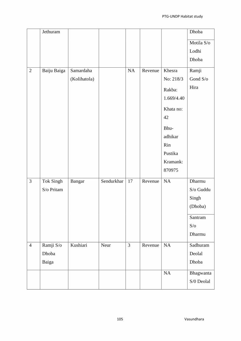
PTG-UNDP Habitat study
105 Vasundhara
Jethuram Dhoba
Motila S/o
Lodhi
Dhoba
2 Baiju Baiga Samardaha
(Kolihatola)
NA Revenue Khesra
No: 218/3
Rakba:
1.669/4.40
Khata no:
42
Bhu-
adhikar
Rin
Pustika
Kramank:
870975
Ramji
Gond S/o
Hira
3 Tok Singh
S/o Pritam
Bangar Sendurkhar 17 Revenue NA Dharmu
S/o Guddu
Singh
(Dhoba)
Santram
S/o
Dharmu
4 Ramji S/o
Dhoba
Baiga
Kushiari Neur 3 Revenue NA Sadhuram
Deolal
Dhoba
NA Bhagwanta
S/0 Deolal

PTG-UNDP Habitat study
106 Vasundhara
5 Lallu
Dugalu
Baiga S/o
Dukalu
Baiga
Amatola Putputa 5 Forest
land
NA Birjha S/o
Mansingh
Dhoba
6 Bhaiyalal
S/o
Mahajan
Baiga
Amatola Putputa 3 Revenue NA As above
7 Baisakhu
S/o Pitaru
Amania Amania 5 Forest
land
NA Motilal S/o
Lodhi
Dhoba
8 Lalu S/o
Matwar
Baiga
Amania Amania 3 Revenue NA Amrit Lal
Pahatia
(Dhoba)
9 Bisnath Dewanpatpar Helki 5 Revenue Maturam
S/o
Mahasingh
Dhoba
Bhagwant
S/o Deolal
Sidhram
S/o
Baliram
While Baiga people would privately admit to numerous such cases of land alienation, they
are afraid to record the details for fear of repercussion from influential and dominant
communities like Gond and Dhoba in the region. A local baiga community leader from
Amania panchayat suggested that there are numerous cases of land alienation of Baigas as
they were able to skilfully clear the forest lands and develop agricultural field but have little
wherewithal and social and political power to effectively control those lands. It is imperative

PTG-UNDP Habitat study
107 Vasundhara
that the government undertake an independent evaluation of such inter-tribal land alienation
process to have an in-depth understanding of the problem so that necessary strategies can be
formulated to tackle it.
5.3. Threat to Baiga Identity and Habitat
(d) Problem in getting caste certificate
Baiga villagers also complained of facing serious hardship in getting caste certificates. As
many Baiga households do not have patta over revenue land occupied by them or a lot of
them also do not have revenue land under their occupation, they are not able to get missal
abhilekh (mentioning year of settlement and name of ancestors) which is considered by
government officials as one of the key basis of issuing caste certificates. In addition to this,
in many cases where Baigas do have revenue records, their castes have been mentioned as
bhumia (because sometimes they also refer to themselves as Bhumia baiga and government
people have preferred to record only part of it) which also makes establishing their identity
difficult.
(e) Adopting surnames/ gotra names of other communities
Over time, Baigas have been found to have adopted surnames/ or clan names of Gonds like
markam, dhurwe, marawi, porte etc. which can be linked with growing political and social
importance of Gonds in the region and growing ridicule of Baigas due to their distinct
features like ornaments, wear, make-up, long hair etc. As revealed during field visit, they
would actually start to tell the gotras of Gonds when asked and many of them would actually
feel shy to tell their gotra and it appeared that many of them feel ashamed to reveal their
identities probably due to their lost social and political status in the region which started with
the permanent settlement process initiated by the British and their subsequent alienation from
forest. These phenomenon have also been noted in earlier works on Baigas but appear to have
assumed deeper roots in contemporary times.
(f) Marginalised by ‘development’:
Micro-project approach for their development appear to have failed to produce the desired
output in absence of any need based and Baiga driven development initiatives in the region.
The Baiga Vikash Abhikharan (BVA) prima-facie appears to act as a fund channelizing
agency as all the special and additional funds are fully diverted to line departments including
forest department for implementation pre-planned developmental interventions. Also as some
current and previous members of Governing Body of BVA alleged that they hardly have any

PTG-UNDP Habitat study
108 Vasundhara
stake in the decision making process which is virtually controlled by the collectors and other
local political persons like MLA. It is imperative that the government should consider a
serious re-thinking on the development approach adopted for Baigas and should also carry
out an evaluation of intervention and functioning of special development agencies.
(g) Degrading Health
While population of Baigas has increased, it has been difficult to find very old people in the
settlements visited as most of them are no more and it can also be observed that the average
longevity has also probably gone down. In addition to a reduced basket of nutritious food
from bewar, reduced number of game/ wild animals has also lead to loss of a good source of
protein for the Baigas (Gangwar and Bose, 2013). Their degrading health is one important
aspect of their marginalisation. I was told that instances of TB amongst Baigas has increased
manifold, however the government medical centre would not certify most of the cases even
after detection as their responsibilities and work load would increase.

PTG-UNDP Habitat study
109 Vasundhara
Annexure 6: Community Reports
5.1 List of Clan identified in field study
Clan of Baigas
S.N. Name of the Clans Name of the Garh
1. Kachnaria Kachnari, Deonari
2. Rathudia Rathkhatigarh/ Rathodgarh (Village
Latkhati)
3. Dhutia -
4. Machhiya -
5. Girhudia Girhudgarh
6. Ratrangia Ratanpur
7. Mandhaia -
8. Sadia Sarangarh
9. Mangadia Manglirajgarh, Chhilpigarh
10. Dhahia -
11. Amthuria -
12. Kudhopania -
13. Dewaria -
14. Baddahiya -
15. Amdaria -
16. Sadia -
17. Basia -
18. Jhumaddhia -
19. Mindakia -
20. Chikhalia -
21. Bagdaia -
22. Turia -
23. Chadchadia -
24. Saradia -
25. Ghangharia -
26. Telasia -
27. Nigunia -
28. Pangaria Palangar
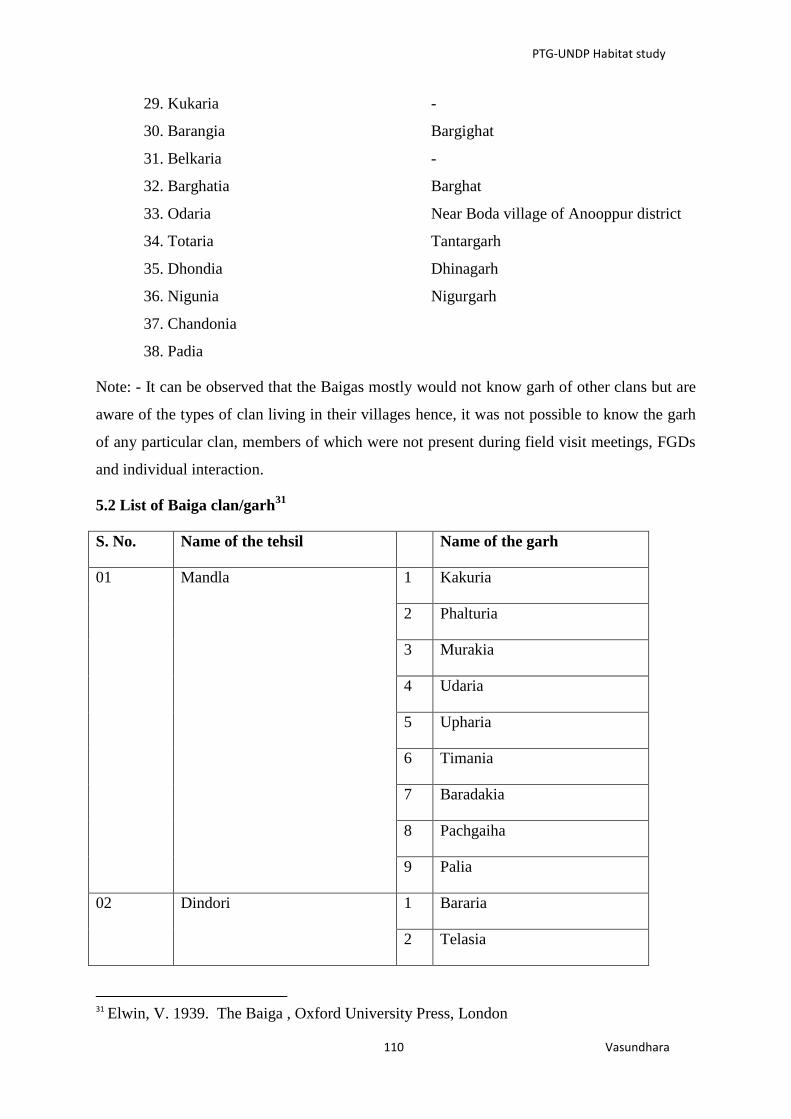
PTG-UNDP Habitat study
110 Vasundhara
29. Kukaria -
30. Barangia Bargighat
31. Belkaria -
32. Barghatia Barghat
33. Odaria Near Boda village of Anooppur district
34. Totaria Tantargarh
35. Dhondia Dhinagarh
36. Nigunia Nigurgarh
37. Chandonia
38. Padia
Note: - It can be observed that the Baigas mostly would not know garh of other clans but are
aware of the types of clan living in their villages hence, it was not possible to know the garh
of any particular clan, members of which were not present during field visit meetings, FGDs
and individual interaction.
5.2 List of Baiga clan/garh31
S. No. Name of the tehsil Name of the garh
01 Mandla 1 Kakuria
2 Phalturia
3 Murakia
4 Udaria
5 Upharia
6 Timania
7 Baradakia
8 Pachgaiha
9 Palia
02 Dindori 1 Bararia
2 Telasia
31
Elwin, V. 1939. The Baiga , Oxford University Press, London

PTG-UNDP Habitat study
111 Vasundhara
3 Kukaria
4 Bidhia
5 Rathoria
6 Chithuria
7 Bindhia
8 Saria
9 Ghatia
10 Daria
11 Chanaria
12 Nandia
13 Kaharia
14 Kotdaria
15 Ataria
16 Kordia
17 Kawatia
18 Pachgaiha
19 Chamaradaiha
20 Chapuria
21 Ninguria
22 Machia
23 Kamania
24 Niguria

PTG-UNDP Habitat study
112 Vasundhara
03 Niwas 1 Bagdaiha
2 Kisunia
3 Dhobia
4 Pachgaiha
5 Sarjania
6 Bassania
04 Pandaria 1 Jajulia
2 Upharia
3 Mudakia
4 Babulia
5 Odaria
6 Ghatia
7 Chachhuria
8 Amdaria
9 Rathoria
10 Saradia
11 Kusaria
05 Baihar 1 Kewaria
2 Pachgaiba
3 Chamaradaiha
4 Chapuria
5 Ninguria
6 Chithuria
7 Bindhia
8 Saria

PTG-UNDP Habitat study
113 Vasundhara
9 Ghatia
06 Rewa 1 Chithuria
2 Ghangharia
3 Pachgaiha
4 Kumania
5 Chandanihaa
6 Bhainoti
7 Aduria
8 Upharia
9 Saradia
10 Lamoriha
11 Masaniha
12 Poria
13
14 Mahataria
15 Nangbansia
16 Ghusariabadgaria
17 Dhobia
18 Basaria
19 Damgadia
20 Dewariha
21 Salgaiha
22 Sawat
23 Chandgaria
24 Damadia

PTG-UNDP Habitat study
114 Vasundhara
25 Chapuria
26 Paria
27 Saria
28 Dhijoria
29 Bagdaria
30 Jhimor
31 Sarjaniha
32 Amgaria
33 Dhodhia
34 Kisaniha
35 Mangaria
07 Kawardha 1 Kusaria
2 Kachnariha
3 Surakia
4 Bagdaria
5 Kawathia
6 Gondia
7 Ghangharia
8 Niguria
9 Duria
10 Jhimuria
11 Chithuria
12 Mahagia
13 Satkuria
14 Koharia

PTG-UNDP Habitat study
115 Vasundhara
15 Gutalia
16 Chaharia
17 Nadia
18 Amthuria
19 Dewariha
20 Rathoria
21 Jajulia
22 Dimuria
23 Odaria
24 Pathaniha
25 Pachgaiha
26 Mundaria
27 Bindhia
28 Languria
29 Lakhia
30 Ghatia
31 Jhimuria
32 Chandarania

PTG-UNDP Habitat study
116 Vasundhara
5.3 Figure showing the Jakesika Padar along with their natural resources which they
have access to32
.
5.4. Padar Details
Name of the
Padar
Village coming under
the Padar Block District
Sikaka Padar Lakhapadar Kalyansinghpur Rayagada
Sikaka Padar Patampadar Kalyansinghpur Rayagada
Sikaka Padar Dangamati Kalyansinghpur Rayagada
Sikaka Padar Puiebala Kalyansinghpur Rayagada
Sikaka Padar Guma Kalyansinghpur Rayagada
Sikaka Padar Waliumba Kalyansinghpur Rayagada
Sikaka Padar Kangaieu Kalyansinghpur Rayagada
Sikaka Padar Dengileli Kalyansinghpur Rayagada
Sikaka Padar Sarijola Kalyansinghpur Rayagada
32
Sources-Special drive on Forest Right: Its provisions and implementation process, SCSTRI, Bhubaneswar

PTG-UNDP Habitat study
117 Vasundhara
Sikaka Padar Niskalu Kalyansinghpur Rayagada
Sikaka Padar Nirghuangi Kalyansinghpur Rayagada
Sikaka Padar Kenepadar Kalyansinghpur Rayagada
Sikaka Padar Takeri Kalyansinghpur Rayagada
Sikaka Padar Sandendileli Kalyansinghpur Rayagada
Sikaka Padar Wakpadi Kalyansinghpur Rayagada
Sikaka Padar Sarivenja Kalyansinghpur Rayagada
Sikaka Padar Swerpadar Kalyansinghpur Rayagada
Sikaka Padar Karlaguda Kalyansinghpur Rayagada
Sikaka Padar Parsali Kalyansinghpur Rayagada
Sikaka Padar Bhaleri Kalyansinghpur Rayagada
Sikaka Padar Tuta Kalyansinghpur Rayagada
Sikaka Padar Kanhuru Kalyansinghpur Rayagada
Sikaka Padar Patamba Kalyansinghpur Rayagada
Sikaka Padar Serkapadi Kalyansinghpur Rayagada
Sikaka Padar Panimunda Kalyansinghpur Rayagada
Sikaka Padar Tadijola Kalyansinghpur Rayagada
Sikaka Padar Harda Kalyansinghpur Rayagada
Sikaka Padar Kunakatu Kalyansinghpur Rayagada
Sikaka Padar Palberi Kalyansinghpur Rayagada
Sikaka Padar Phuldumberi Kalyansinghpur Rayagada
Sikaka Padar Chakrabusa Kalyansinghpur Rayagada
Sikaka Padar Khemudipadar Kalyansinghpur Rayagada
Sikaka Padar Geranda Kalyansinghpur Rayagada
Sikaka Padar Melenda Kalyansinghpur Rayagada

PTG-UNDP Habitat study
118 Vasundhara
Sikaka Padar Lelingpadari Kalyansinghpur Rayagada
Sikaka Padar Ichapudeni Kalyansinghpur Rayagada
Sikaka Padar Arichakani Muniguda Rayagada
Sikaka Padar Gulugula Muniguda Rayagada
Sikaka Padar Kataguda Muniguda Rayagada
Sikaka Padar Narengabadi Muniguda Rayagada
Sikaka Padar Baraguda Muniguda Rayagada
Sikaka Padar Bhaliupadar Muniguda Rayagada
Sikaka Padar Sakata Muniguda Rayagada
Sikaka Padar Kaliaripeta Muniguda Rayagada
Sikaka Padar Trahali Muniguda Rayagada
Sikaka Padar Manda Muniguda Rayagada
Sikaka Padar Sanadengini Muniguda Rayagada
Sikaka Padar Badadengini Muniguda Rayagada
Sikaka Padar Jenigu Muniguda Rayagada
Sikaka Padar Kurcheli Muniguda Rayagada
Sikaka Padar Ambadani Muniguda Rayagada
Sikaka Padar Katu Muniguda Rayagada
Sikaka Padar Gayelingu Muniguda Rayagada
Sikaka Padar Sargipanga Muniguda Rayagada
Sikaka Padar Taladuargudi Muniguda Rayagada
Sikaka Padar Suduni Muniguda Rayagada
Sikaka Padar Ambaguda Muniguda Rayagada
Sikaka Padar Kargadi Muniguda Rayagada
Kadraka Padar Tepadu Kalyansinghpur Rayagada

PTG-UNDP Habitat study
119 Vasundhara
Kadraka Padar Parmeni Kalyansinghpur Rayagada
Kadraka Padar Tamkasili Kalyansinghpur Rayagada
Kadraka Padar Kasbandeli Kalyansinghpur Rayagada
Kadraka Padar Pudeni Kalyansinghpur Rayagada
Kadraka Padar Dhamanapanga Muniguda Rayagada
Kadraka Padar Kadraguma Muniguda Rayagada
Kadraka Padar Randa Muniguda Rayagada
Kadraka Padar Bhetkapadari Muniguda Rayagada
Pushika Padar Lamba Kalyansinghpur Rayagada
Pushika Padar Odesi Kalyansinghpur Rayagada
Pushika Padar Gorta Muniguda Rayagada
Pushika Padar Sutanguni Muniguda Rayagada
Pushika Padar Gunjapayu Muniguda Rayagada
Pushika Padar Salpajhala Muniguda Rayagada
Mandika Padar Batudi Kalyansinghpur Rayagada
Kutruka Padar Kesarpadi Kalyansinghpur Rayagada
Kutruka Padar Dahali Kalyansinghpur Rayagada
Kutruka Padar Ankuravali Kalyansinghpur Rayagada
Jakesika Padar Kusikidali Kalyansinghpur Rayagada
Jakesika Padar Mayuvali Kalyansinghpur Rayagada
Jakesika Padar Upar Batudi Kalyansinghpur Rayagada
Jakesika Padar Nachinguda Kalyansinghpur Rayagada
Jakesika Padar Engua Kalyansinghpur Rayagada
Jakesika Padar Narag Kalyansinghpur Rayagada
Jakesika Padar Bereapinda Kalyansinghpur Rayagada

PTG-UNDP Habitat study
120 Vasundhara
Jakesika Padar Rangsipta Kalyansinghpur
Jakesika Padar Adapanga Muniguda Rayagada
Jakesika Padar Hundujali Muniguda Rayagada
Jakesika Padar Hutesi Muniguda Rayagada
Jakesika Padar Tanguda Muniguda Rayagada
Jakesika Padar Mundubali Muniguda Rayagada
Jakesika Padar Kurli Muniguda Rayagada
Jakesika Padar Ranibandha Muniguda Rayagada
Jakesika Padar Gandili Muniguda Rayagada
Nundruka Padar Shrambi Muniguda Rayagada
Nundruka Padar Panchakodi Muniguda Rayagada
Nundruka Padar Merkabandili Muniguda Rayagada
Nundruka Padar Upardurugudi Muniguda Rayagada
Wadaka Padar Khambesi Muniguda Rayagada
Wadaka Padar Erpibata Muniguda Rayagada
Wadaka Padar Gartali Muniguda Rayagada
Wadaka Padar Khajuri Muniguda Rayagada
Nishika Padar Ningabadi Muniguda Rayagada
Nishika Padar Rangamba Muniguda Rayagada
Nishika Padar Bandili Muniguda Rayagada
Nishika Padar Kirina Muniguda Rayagada
Nishika Padar Kudiguma Muniguda Rayagada
Nishika Padar Tonda Muniguda Rayagada
Nishika Padar Kocharla Muniguda Rayagada
Nishika Padar Borgoda Muniguda Rayagada

PTG-UNDP Habitat study
121 Vasundhara
Kruska Padar Chalibata Kalyansinghpur Rayagada
Kruska Padar Kruskamuya Kalyansinghpur Rayagada
Kruska Padar Kumbali Kalyansinghpur Rayagada
Kruska Padar Tinimaska Kalyansinghpur Rayagada
Kruska Padar Tadmuyu Kalyansinghpur Rayagada
Wanjelika Padar Khambesi Muniguda Rayagada
Wanjelika Padar Jarapa Muniguda Rayagada
Wanjelika Padar Himandi Muniguda Rayagada
Wangesika Padar Chatikona Muniguda Rayagada
Wanjelika Padar Bemberi Muniguda Rayagada
Wanjelika Padar Donopadari Muniguda Rayagada
5.5 Details of forest land coming under the four blocks (Muniguda, Bissamcuttack,
kalayansinghpur, Lanjigarh) coming within the the Habitat area of Dongria Kondh.
Id Forest_name
For
est_
type Plantation
Type_of
_tree
Remark
s Perimeter Acres
1 Dahikhala RF RF Dense Jungle Sal 0.24140247 3416.378
2 Patragurha RF RF
Open Mixed
Jungle Sal 0.04990564 438.6578
3
Patragurha
RF(Proposed) RF
Open Mixed
Jungle 0.06806666 439.631
4
Karhaghati
RF(Proposed) RF
Dense Mixed
Jungle Sal 0.08007899 590.8696
5
Bamunidangar
RF(Proposed) RF
Dense Mixed
Jungle Sal 0.09563049 1474.809
6 Birli RF RF Fairly Dence
Sal 0.06320975 482.8204

PTG-UNDP Habitat study
122 Vasundhara
Mixed Jungle
7
Deokupuli
RF(Proposed) RF
Dence Mixed
Jungle 0.12767052 1565.179
8 (Proposed) RF 0.03179361 163.7018
9 Kudilima RF RF
Dence Mixed
Jungle Sal
Gumuni
Dangar 0.10381938 1315.728
10 Jambragurha RF RF 0.03828213 142.2345
11 Sakata RF RF
Open Mixed
Jungle 0.08678116 571.9876
12 Goilakana RF RF
Open Mixed
Jungle
Pathar
Dongar 0.0828813 1165.446
13
Sarambi
RF(Proposed) RF
Dence Mixed
Jungle 0.10550302 1562.009
14
Raula Jhimiri
Extension Reserv RF Dense Jungle Sal 2.52417339 63291.37
15
Ambadala
RF(Proposed) RF Dense Jungle Sal 0.28062283 4114.553
16 (Proposed) RF 0.02789129 124.2807
17
Siringul
RF(Proposed) RF 0.02744547 134.2437
18 (Proposed) RF 0.01745233 66.09504
19 (Proposed) RF 0.03696895 166.8286
20
Sorisapadar
RF(Proposed) RF Dense Jungle Sal 0.17287868 1615.03
21
Tima
Dangar(Proposed) RF 0.0280797 139.6775
22 Dhepagurha RF RF
Dence Mixed
Jungle 0.10499166 1189.413

PTG-UNDP Habitat study
123 Vasundhara
23 Chhatapadar RF RF
Open Mixed
Jungle 0.065285 583.2117
24 Singari RF RF Open jungle Bamboo 0.09597677 555.7031
25 KanaSaralu RF RF Open jungle Sal 0.29289401 2910.52
27 RF
Dence Mixed
Jungle 0.03357903 158.4591
28
Nipania
RF(Proposed) RF
Open Mixed
Jungle 0.06333653 523.1734
29
Polama
RF(Proposed) RF 0.05030038 208.4009
31
Suha
dangar(Proposed) RF 0.04357767 221.1252
32 (Proposed) RF 0.01851707 39.62963
34 Samajhola RF RF Dense Jungle
Bamboo
& Sal 0.97673015 16802.87
33 RF 0.05611995 208.9943
35 Sargigurha RF RF Open Jungle Sal 0.32866319 6836.619
36 Dhepagurha RF RF Dense Jungle Sal 1.01376796 19864.1
37
Barhuni
RF(Proposed) RF
Fairly Densed
mixed Jungle 0.49099997 8871.135
38 Padaba Rf RF 0.0591489 318.8365
39
Latagurha
RF(Proposed) RF
Fairly Densed
mixed Jungle Sal 0.07849281 810.2123
40 (Proposed) RF
Fairly Densed
mixed Jungle Sal 0.04933799 235.8952
41 Chengili RF RF
Open Mixed
Jungle Sal 0.08139467 904.1059
42 Chatikana RF RF Dense Mixed
Sal 0.40856746 6554.116

PTG-UNDP Habitat study
124 Vasundhara
Jungle
43
Gangaparha
RF(Proposed) RF 0.09310222 415.9092
44
Ghagurupadar
RF(prpoposed) RF
Dence Mixed
Jungle 0.07647638 628.849
26 Bijaynagar RF RF
Dence Mixed
Jungle 0.73829802 11332.99
45 Bengbhata RF RF Dense Jungle Sal 0.2856175 4106.554
46 (Proposed) RF 0.06567308 320.9863
47
Bijepur
RF(Proposed) RF Open Jungle Sal 0.23063749 2949.617
48 Paharhapadar RF RF 0.2231191 4060.39
49 Kankubarhi RF RF
Dence Mixed
Jungle Sal 0.15130719 1989.218
50 (Proposed) RF 0.03653048 143.84
51 (Proposed) RF 0.0469888 210.1359
52
Alanda
RF(Proposed) RF 0.06502773 227.0972
53 (Proposed) RF 0.03391231 122.4947
54 Sajja PF PF
Fairly dense
mixed jungle 0.23038816 3433.893
55 Proposed RF
Open mixed
jungle 0.03462752 143.3243
56
Ribalkana
RF(proposed) RF
Dence Mixed
Jungle 0.62052965 18319.91
0 0.30588951 2456.326
58
Satbishi
RF(Proposed) RF 0.04531295 423.939

PTG-UNDP Habitat study
125 Vasundhara
Source: Topo-sheet
5.6 Land Mark Identification
The boundary of the Pidha is demarcated by certain landmarks like:
North South
Kainjhar river NH-6
Chakadhar (Water body) Ek Phalia hill
Dharam dwar in north west
Badam chaturi (a huge rock boulder)
Dumbak
West East
Kheljharan Telichuan hill
Bharidgachha (Harida tree)
Name of the
Pidha
Dependency on Mountain,
Spring & Forest
Resource Dependence
Satkhand Pidha Hills
1. Ek Phalia
2. Dharma dwar
3. Telichua
Lac, Wax, Honey, Harida,
Bahada, Fulajhadu, Siali
leaf, Siali Pat, Daranga Pat, Kumbha
chhali or Jenga chhali, Gangasiuli,
Bhuinimba, Basturachhali,
Fesaphenaphala, Agnijhal,
Pitalu kanda, Bainga, Tunga,
Saigakanda,
Kantaalu, Mandaialu, house
accessories, Kendu, Char, Mango,
Panasa, Putei, Pachariphala,
Bhaenresaga, Salaraphala, Bhelia,

PTG-UNDP Habitat study
126 Vasundhara
Pijuli, Kusuma etc.
Water bodies
4. Baitarini
5. Kainjharan
6. Chakadhar
Place of worship
Gonasika Temple
Villages of all the Pidhas
have access to this temple