a u r a satellite mission t e s
TRANSCRIPT
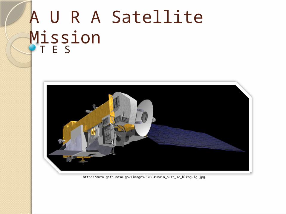
A U R A Satellite MissionT E S
http://aura.gsfc.nasa.gov/images/106949main_aura_sc_blkbg-lg.jpg
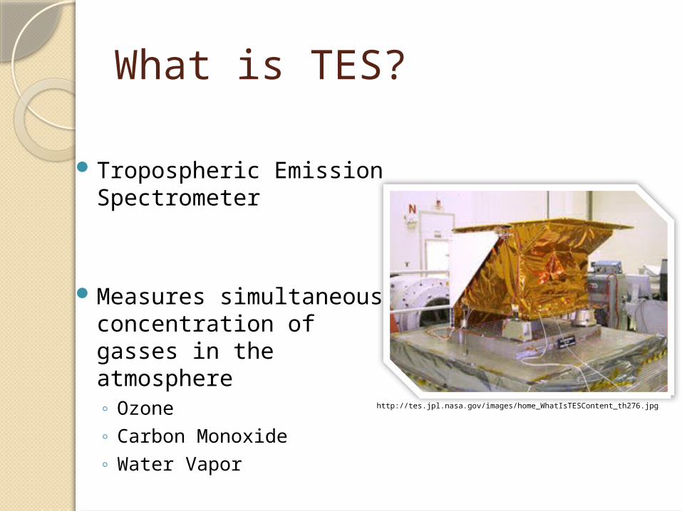
What is TES?
Tropospheric Emission Spectrometer
Measures simultaneous concentration of gasses in the atmosphere◦ Ozone◦ Carbon Monoxide◦ Water Vapor
http://tes.jpl.nasa.gov/images/home_WhatIsTESContent_th276.jpg

Orbit and CoverageSun Synchronous Orbit
438 miles above earth’s surface
Inclination of 98.21 degrees
Nadir Pointing and Limb Pointing
http://www.heavens-above.com/orbitdisplay.asp?lat=0&lng=0&alt=0&loc=Unspecified&TZ=CET&satid=28376
TES MeasurementsMeasure infrared radiances
◦ Surface Temperature
Vertically resolved measure of atmospheric gasses◦ Ozone◦ Carbon Monoxide ◦ Water Vapor◦ Nitric Acid
Special Observations◦ Air Pollution

TES FunctionalityFourier Transform Infrared Spectrometer (FTIR)
◦ Infrared emissions from gasses◦ Everything above absolute zero emits infrared energy
at a certain wavelength
Makes a scan every 4 or 16 seconds
Spectral Resolution of 0.1cm-1 to .025cm-1◦ Used to pinpoint wavelengths◦ Infrared absorption lines
Determines altitude of substance in atmosphere
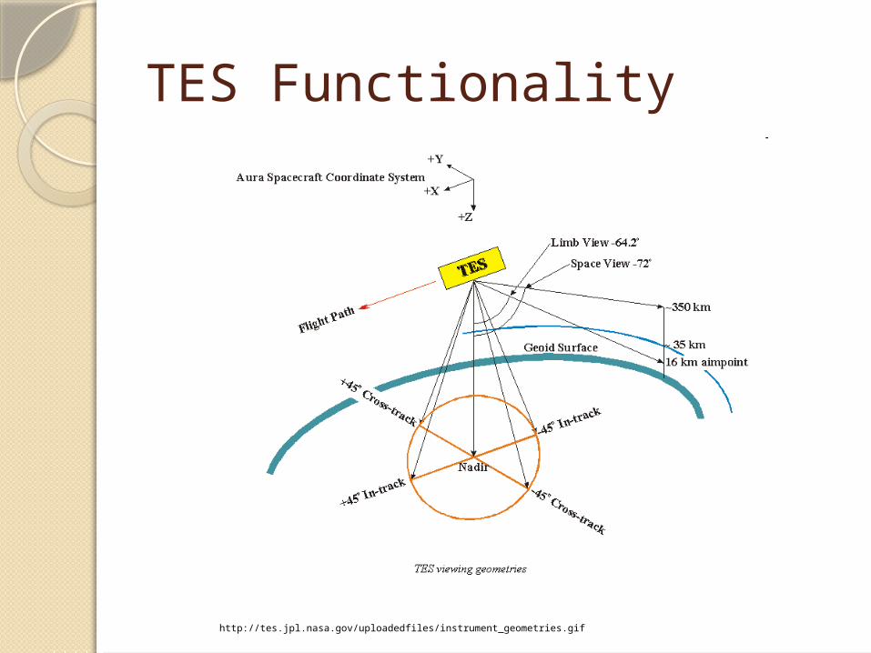
TES Functionality
http://tes.jpl.nasa.gov/uploadedfiles/instrument_geometries.gif

TES Data
http://www.nasa.gov/centers/jpl/images/content/159454main_tes-20060925-browse.jpg

Special ObservationsScheduled only during 9 or 10 orbit gaps
Conducted in 3 modes◦ Stare◦ Transect◦ Step-&-Stare
Depends on requirements

3 Special Observation ModesStare
◦ Volcano monitoring◦ Biomass Burning◦ Industrial Accidents
Nadir Mode
Points to a target region of interest◦ Up to 4 minutes
Has to be in ±45 degrees in nadir direction

3 Special Observation Modes
http://tes.jpl.nasa.gov/visualization/SCIENCE_PLOTS/R11/PNG_Files/run10269/run_10269_curtain_ret_O3.png

3 Special Observation Modes
Transect◦ Regional Pollution studies
Nadir Mode
Point at a set of contiguous areas◦ Covers up to 850 km
http://tes.jpl.nasa.gov/images/transect_mode.gif

3 Special Observation Modes
Step-&-Stare
Nadir mode◦ Points in nadir for 4 seconds◦ Moves 39 km in orbit◦ Point again, move 35 km
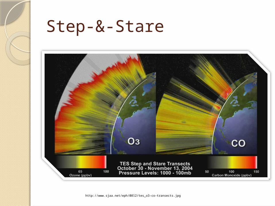
Step-&-Stare
http://www.sjaa.net/eph/0812/tes_o3-co-transects.jpg

Applications of TES
Determine atmospheric temperature and humidity profile
Local Surface Temperature
Local Surface reflectance and admittance

Calibration
Sensitivity
Changes from time to time◦ Use average kernel for calibration◦ Degrees of Freedom
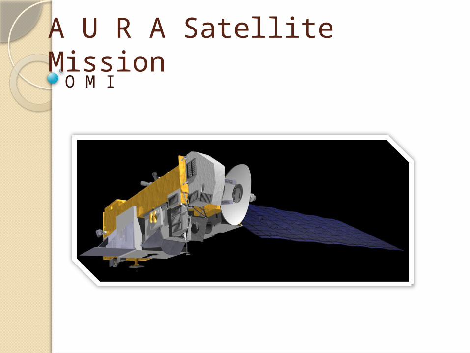
A U R A Satellite MissionO M I

What is OMI?
Ozone Monitoring Instrument
http://www.dutchspace.nl/uploadedImages/Products_and_Services/Instruments/OMI/OMI_OPTICAL_BENCH_DM.JPG
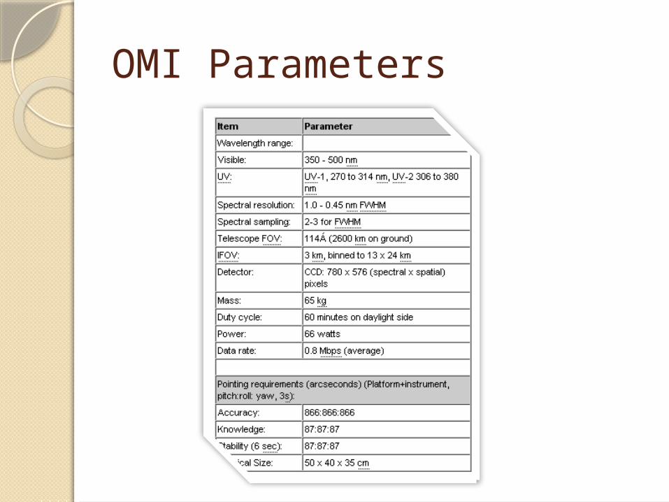
OMI Parameters
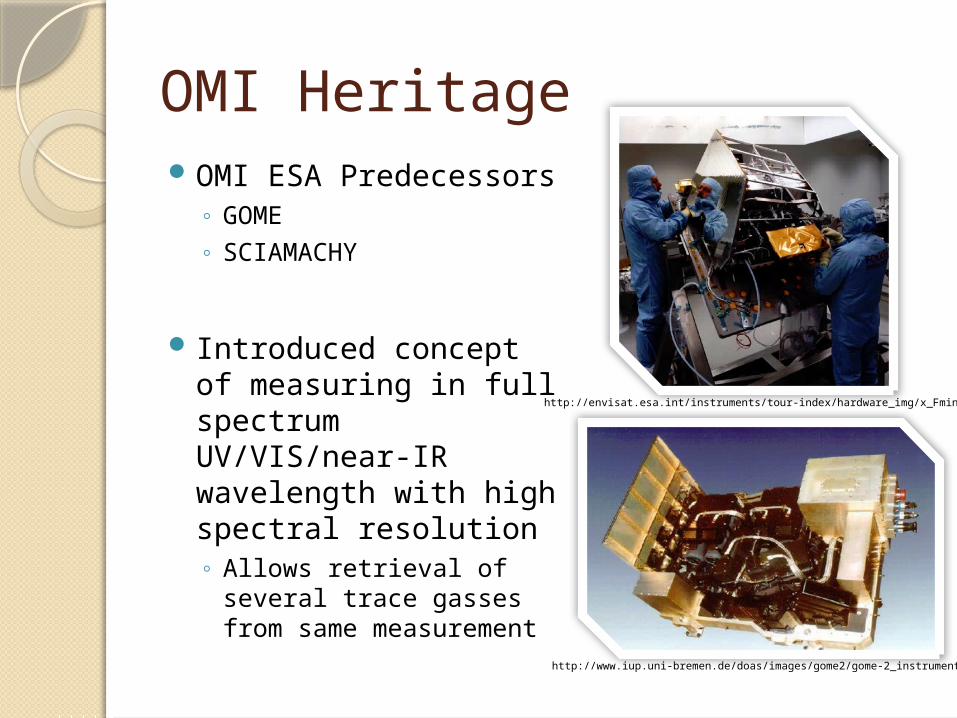
OMI HeritageOMI ESA Predecessors
◦ GOME◦ SCIAMACHY
Introduced concept of measuring in full spectrum UV/VIS/near-IR wavelength with high spectral resolution◦ Allows retrieval of several
trace gasses from same measurement
http://envisat.esa.int/instruments/tour-index/hardware_img/x_Fmint01.jpg
http://www.iup.uni-bremen.de/doas/images/gome2/gome-2_instrument.png

OMI HeritageAmerican predecessor of
OMI◦ NASA’s TOMS◦ Total Ozone Mapping
Spectrometer
Used only 8 wavelength bands◦ Obtained ozone column
Had very small ground pixel size◦ 50 km x 50 km◦ Combo with daily global
coverage
http://suzaku.eorc.jaxa.jp/GLI2/adeos/Project/Toms.html
OMI Advantage
Combines advantages of GOME SCIAMACHY and TOMS
Measures complete spectrum of UV/VIS/IR wavelengths
Range of high resolution◦ 13 km x 24 km and daily global coverage

OMI Functionality Nadir viewing imagery spectrometer
Uses hyperspectral viewing ◦ Push broom like mode
◦ Observes solar backscatter from atmosphere and surface
Uses wavelengths 270-500nm
114 degree viewing angle◦ Allows 2600 km swath (Global Coverage)
Daily Global Average

OMI FunctionalityGlobal mode
◦ Pixel size of 13 km x 24 km
Zoom Mode◦ Spatial resolution reduced◦ 13 km x 12 km
Enables OMI to look between clouds
Good for receiving tropospheric information
Does not allow for global coverage

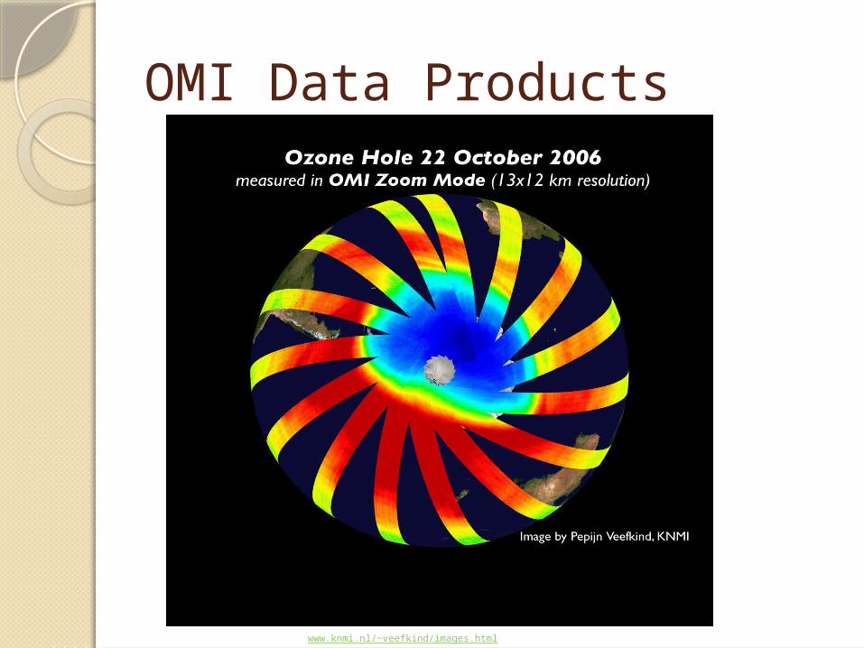
OMI Data Products
http://www.volcano.si.edu/volcanoes/region08/ivm_arc/anatahan/3004ana1.jpg

OMI Data Products
http://toms.gsfc.nasa.gov/

References NASA, . (2009). Ozone monitoring instrument. Retrieved from
NASA,. (2009). Omi: ozone monitoring instrument. Retrieved from http://www.nasa.gov/mission_pages/aura/spacecraft/omi.html
KNMI, . (2008, December 16). Omi instrument summary. Retrieved from http://www.knmi.nl/omi/research/instrument/index.php
Jet Propulsion Laboratory, . (2009). Tropospheric emission spectrometer: orbit and coverage. Retrieved from http://tes.jpl.nasa.gov/instrument/orbitcoverage/
Jet Propulsion Laboratory, . (2009). Tropospheric emission spectrometer: orbit and coverage. Retrieved from http://tes.jpl.nasa.gov/instrument/specialobservations/
NASA, . (2009). What is Tes?. Retrieved from http://tes.jpl.nasa.gov/mission/whatistes/
NASA, . (2009). Nasa instruments. Retrieved from http://aura.gsfc.nasa.gov/instruments/tes.html
NASA, (2009) Total Ozone Mapping Spectrometer. Ozone Processing Team. Retreived from http://toms.gsfc.nasa.gov/