augmented reality for aec - technology research...
TRANSCRIPT
Augmented Reality for AECApplications by VTT
ARea15June 11-12, 2015
Mika Hakkarainen, Charles WoodwardVTT Technical Research Centre of Finland

AR-PDA system (2003)Client/serverMarker based
UMPC stand-alone system (2006)Interactive placement of modelOptical flow / feature based tracking
“Google Earth on Earth” (2007)Model placed in Google EarthUser’s location provided by GPSInteractive positioning
Markerless tracking (2010)Model-based initializationReal time feature based tracking
Pioneering works by VTT
Mobile AR for AEC – Background

Building and Construction
Project AR4BC (2009-2011)Large models, various formats, etc.Accurate maps & feature based trackingPhotorealistic visualization, lighting, occlusionsContinuation in project VisiLean 2014-2015
VTT first in the world with mobile AR & 4D BIM
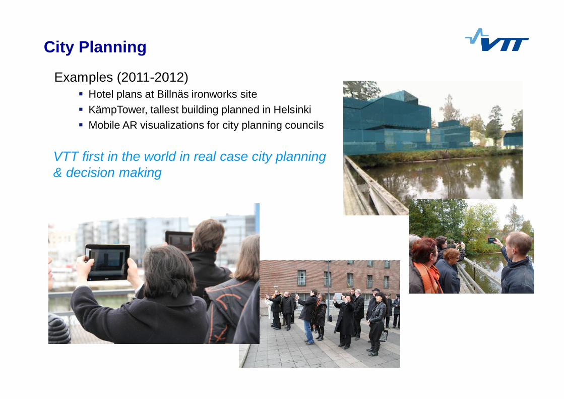
City Planning
Examples (2011-2012)Hotel plans at Billnäs ironworks siteKämpTower, tallest building planned in HelsinkiMobile AR visualizations for city planning councils
VTT first in the world in real case city planning & decision making
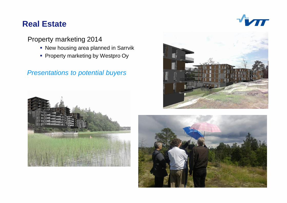
Real Estate
Property marketing 2014New housing area planned in SarrvikProperty marketing by Westpro Oy
Presentations to potential buyers
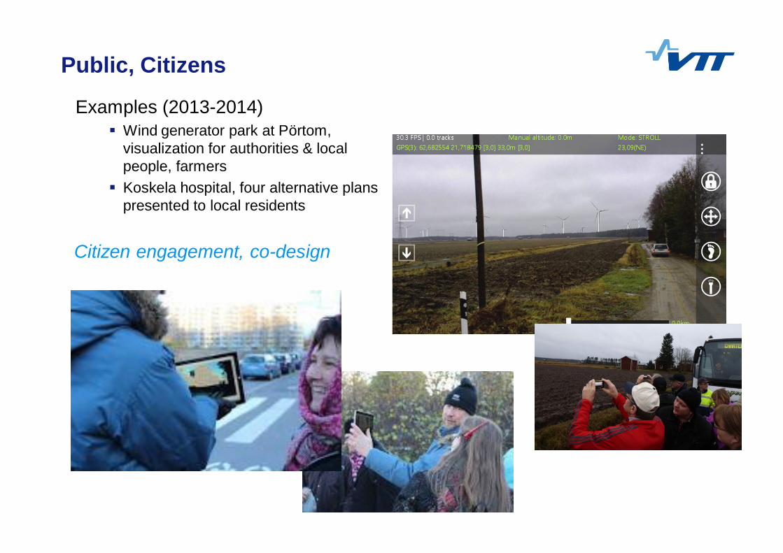
Public, Citizens
Examples (2013-2014)Wind generator park at Pörtom, visualization for authorities & local people, farmersKoskela hospital, four alternative plans presented to local residents
Citizen engagement, co-design
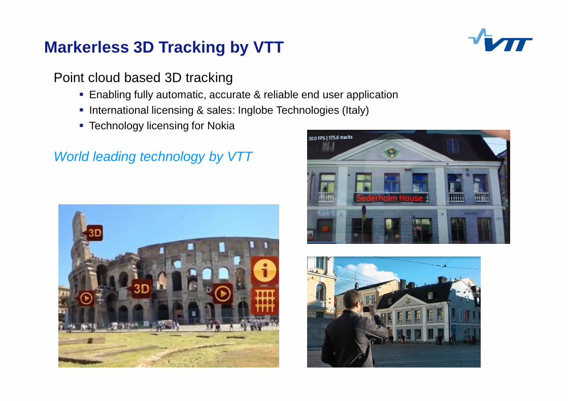
Markerless 3D Tracking by VTT
Point cloud based 3D trackingEnabling fully automatic, accurate & reliable end user applicationInternational licensing & sales: Inglobe Technologies (Italy)Technology licensing for Nokia
World leading technology by VTT
Koskela case
Slides

Thank you!
Mika Hakkarainen, VTT
[email protected]://www.vtt.fi/multimedia
www.youtube.com/user/VTTAugmentedReality

TECHNOLOGY FOR BUSINESS
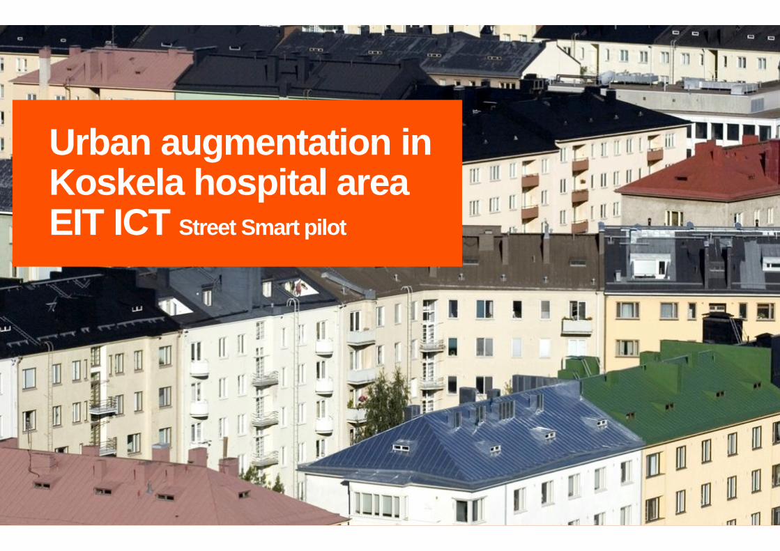
Urban augmentation in Koskela hospital area EIT ICT Street Smart pilot

A new way of seeing your environmentHelsinki City Planning center, VTT and Forum Virium Helsinki collaboration projectUrban augmentation was piloted as a part of citizen participation in the Koskela hospital area planning
Koskela Hospital area pilot
There were 4 different construction plans for Koskela Hospital area People had the possibility to get familiar with the new plans in the Helsinki City Planning department internet pages and newsletter. The test group were introduced the new plan during a walking tour in the area and through an augmented reality application (which could be used in a tablet or other smart devices). There were 21 participants and they were divided in to two different groups to observe the plansAfter the walking tour people could comment and discuss the different construction designs with the architectsThe urban augmentation pilot received positive feedback from the participants. People appreciated the different plans of which they could pick their favorites.
The pilot setting
Most of the people appreciated the green
areas and parks around the Koskela hospital area
A tram connection to the city and biking routes were important to the
participants
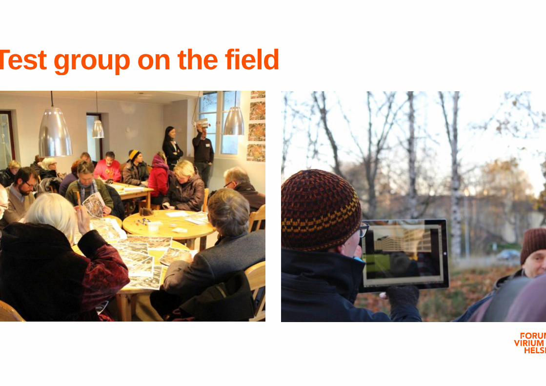
Test group on the field

Results of the user study The users were given a set of questions Questions/ Arguments that they answered in multiple choice.
About half of the respondents felt that the application helped to conceptualize the construction plansMost of the users felt that the application was easy to use and it functioned well technicallyMore than half of the users felt that the application was not natural to useThe application added to the traditional ways of visualizing thingsThe designs were too rough for people to evaluate them
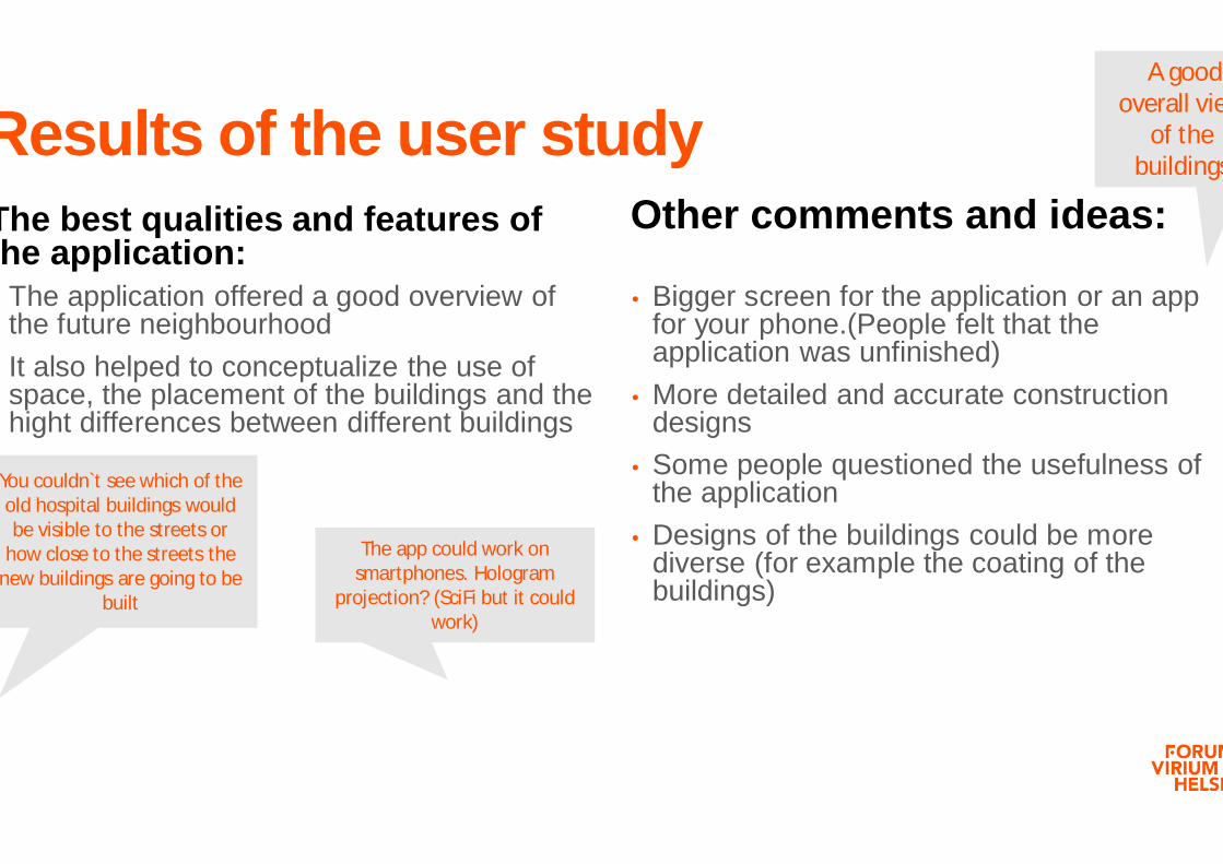
Results of the user studyThe best qualities and features of the application:
Other comments and ideas:
The application offered a good overview of the future neighbourhoodIt also helped to conceptualize the use of space, the placement of the buildings and the hight differences between different buildings
• Bigger screen for the application or an app for your phone.(People felt that the application was unfinished)
• More detailed and accurate construction designs
• Some people questioned the usefulness of the application
• Designs of the buildings could be more diverse (for example the coating of the buildings)
You couldn`t see which of the old hospital buildings would be visible to the streets or
how close to the streets the new buildings are going to be
built
The app could work on smartphones. Hologram
projection? (SciFi but it could work)
A good overall view
of the buildings
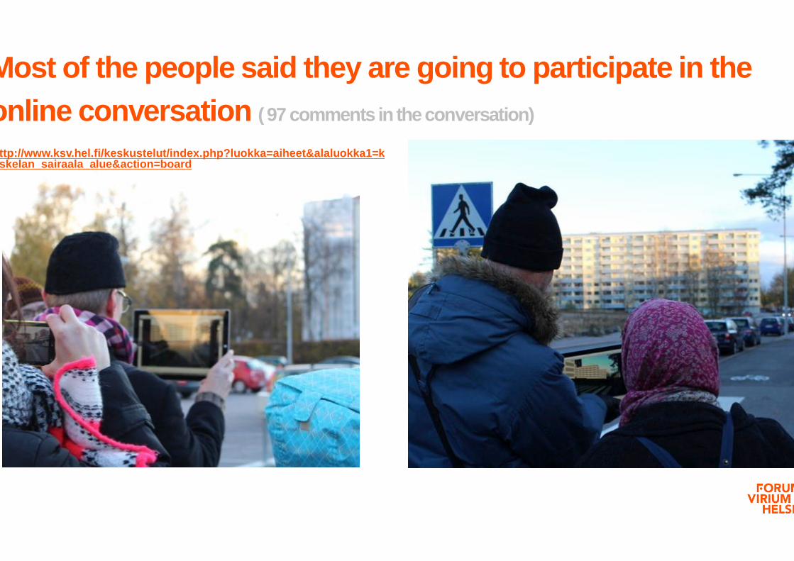
Most of the people said they are going to participate in the online conversation ( 97 comments in the conversation)
http://www.ksv.hel.fi/keskustelut/index.php?luokka=aiheet&alaluokka1=koskelan_sairaala_alue&action=board

Comments from the City of HelsinkiThe pilot was produced in tight collaboration with Helsinki City Planning Center as part of their activities of involving the citizens.
The augmented reality helped to visualize the used space and proportions of the city space. The application has its limitations and it is not meant for every situation. For example the trees around Koskela area limited the use of application in this pilot”, says Antti Varkemaa,Architect, project manager from the Helsinki City Planning Department.

Thank you!