carto builder: from visualization to geospatial analysis
TRANSCRIPT

JORGE SANZSUPPORT TEAM MANAGER & SOLUTIONS ENGINEER
[email protected] · @XURXOSANZ
BUILDER: FROM VISUALIZATION TO GEOSPATIAL ANALYSISLOCATIONTECH TOUR 2016
bit.ly/161129-carto-builder

HISTORY
DESIGNConsiderations that we have taken designing the application.
Brief review of the different versions of the application.
DISTRIBUTIONNew Builder structure.
NEW FEATURESFunctionality added in the Builder.
SUMMARY
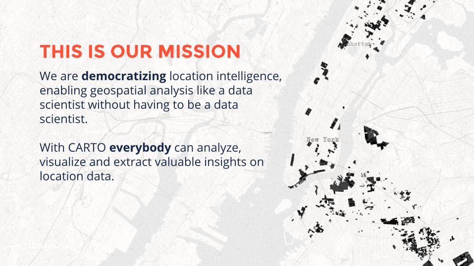
We are democratizing location intelligence, enabling geospatial analysis like a data scientist without having to be a data scientist.
With CARTO everybody can analyze, visualize and extract valuable insights on location data.
THIS IS OUR MISSION

HISTORY

BETAHISTORY
CARTODB 2011

VERSION 1HISTORY
CARTODB 2012-2013


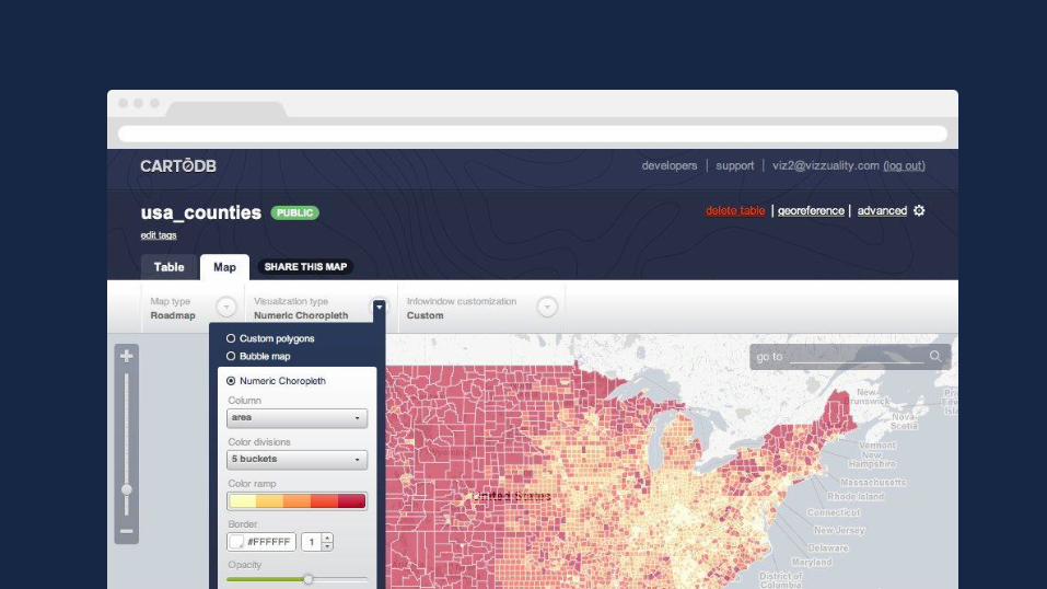
EDITORHISTORY
CARTODB 2014-2015


BUILDERHISTORY
CARTO 2016

BUILDER
A web-based drag and drop analysis tool for business users and analysts to discover and predict key insights from location data.
CARTO Builder unleashes the power of location intelligence with self-service, actionable dashboards you can share across your whole organization.
LOCATION INTELLIGENCE FINALLY INTUITIVE

DESIGN

SCALABILITY
SIMPLICITYConsiderations that we have taken during the design process of the the application.
Capability of a system to handle a growing amount of work, or its potential to be enlarged.
COLORFULColors are as important as any other part. Cartography to the next level.
WE HAVE PRINCIPLESWith CARTO we have established 3 main points when we designed this new version.
DESIGN
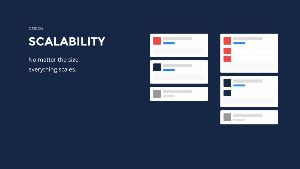
SCALABILITYDESIGN
No matter the size,
everything scales.
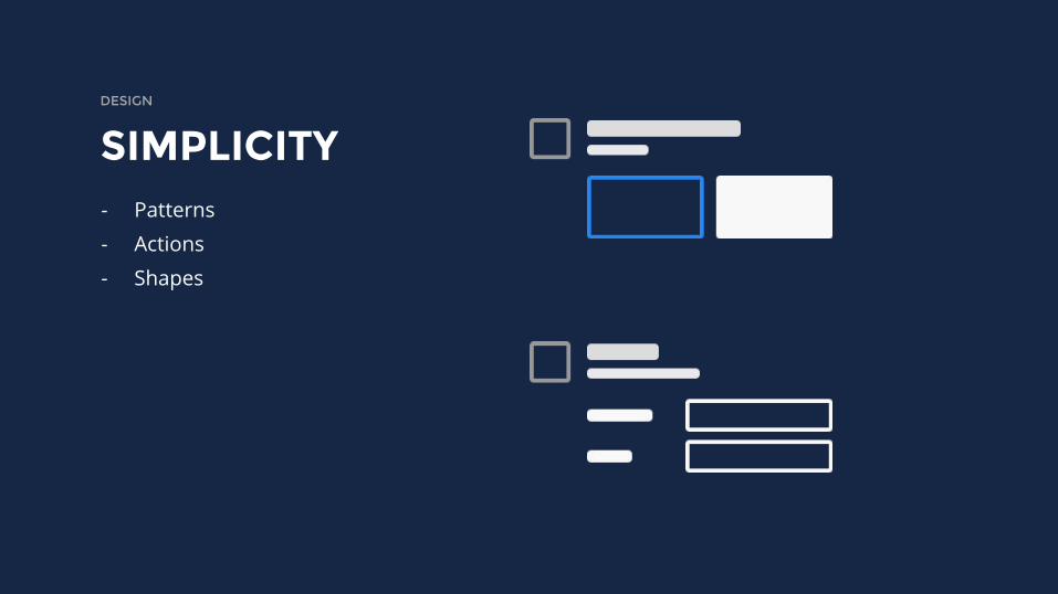
SIMPLICITYDESIGN
- Patterns
- Actions
- Shapes

COLORFULDESIGN
- Palettes for ramps
- Autocolor
- Each geometry type owns
its proper color
- Cartography

DISTRIBUTION

SIDEBARDISTRIBUTION
- Moved to the left
- Editing
- Settings
- Feedback!
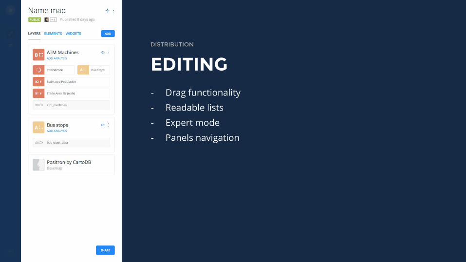
EDITINGDISTRIBUTION
- Drag functionality
- Readable lists
- Expert mode
- Panels navigation

MAPDISTRIBUTION
- The same easy map.
- New map overlays.
- New legends.
MAPDISTRIBUTION
- Same easy map
- Editing controls
- Redesigned popups
- New legends

WIDGETSDISTRIBUTION
- Filter your data live
- Three different types
- Auto-style enhancement

NEW FEATURES
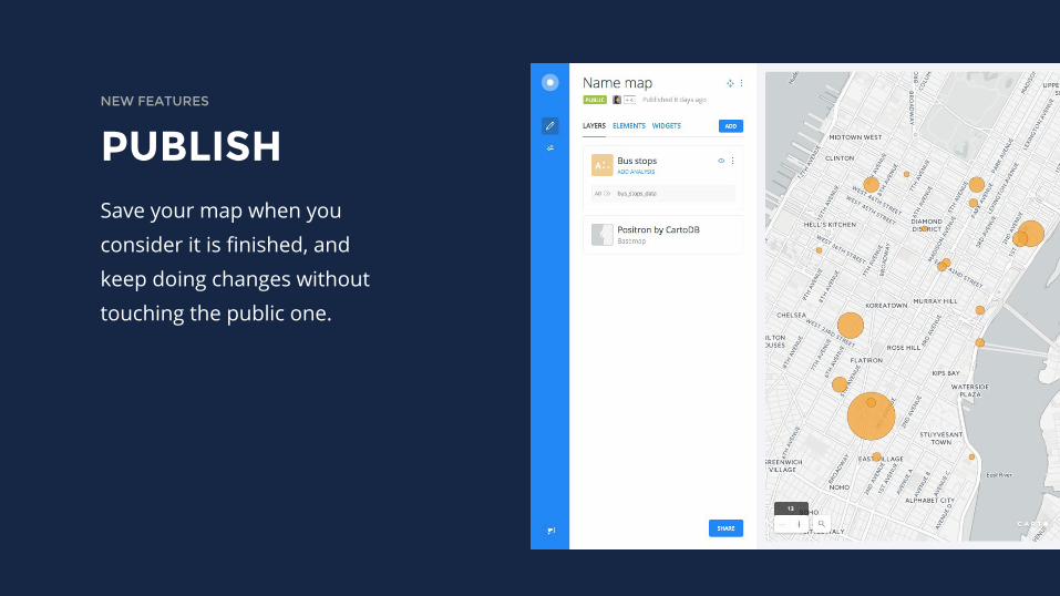
PUBLISHNEW FEATURES
Save your map when you
consider it is finished, and
keep doing changes without
touching the public one.

LEGENDSNEW FEATURES
Created from scratch. They
react to data changes.
Possibility to have 2 different
kinds of legends per layer.

NEW FEATURES
WIDGETSFind insights over your
filtered data.
Style them in seconds in
order to find patterns.
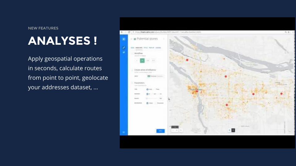
ANALYSES !NEW FEATURES
Apply geospatial operations
in seconds, calculate routes
from point to point, geolocate
your addresses dataset, ...

DEMO

THANKS! - GET IN TOUCH
JORGE SANZSUPPORT TEAM MANAGER & SOLUTIONS ENGINEER
[email protected] · @XURXOSANZ