city of beaverton council agenda · 2019. 10. 8. · city of beaverton council agenda final agenda...
TRANSCRIPT

CITY OF BEAVERTON COUNCIL AGENDA
FINAL AGENDA
FORREST C. SOTH CITY COUNCIL CHAMBER REGULAR MEETING 4755 SW GRlFFlTH DRIVE APRIL 2,2007 BEAVERTON, OR 97005 6:30 P.M.
CALL TO ORDER:
ROLL CALL:
PROCLAMATIONS:
Arbor Week: April 8-14, 2007
PRESENTATIONS:
07060 Washington County Consolidated Communications Agency Briefing
VISITOR COMMENT PERIOD:
COUNCIL ITEMS:
STAFF ITEMS:
CONSENT AGENDA:
Minutes of the Regular Meetings of February 26 and March 19, 2007
07061 Special Purpose Grant Budget Adjustment Resolution for 2007 Oregon Office for Community Dispute Resolution Carry Forward Funds Grant (CFFG) Resolution No. 3894)
PUBLIC HEARINGS:
07062 Appeal Hearing on Traffic Commission Issue No. TC 609 Regarding a Traffic Signal at SW Brockman Street and Sorrento Road
07063 Williams Ballot Measure 37 Claim for Compensation M37 2006-0002
07064 Harmony Investments Ballot Measure 37 Claim for Compensation M37 2006- 0003
07065 Wiesmann Ballot Measure 37 Claim for Compensation M37 2006-0012
ORDINANCES:
Second Reading:
07059 An Ordinance Granting a Non-Exclusive Cable Franchise to Verizon Northwest Inc. (Ordinance No. 4433)
EXECUTIVE SESSION:
In accordance with ORS 192.660 (2) (h) to discuss the legal rights and duties of the governing body with regard to litigation or litigation likely to be filed and in accordance with ORS 192.660 (2) (e) to deliberate with persons designated by the governing body to negotiate real property transactions and in accordance with ORS 192.660 (2) (d) to conduct deliberations with the persons designated by the governing body to carry on labor negotiations. Pursuant to ORS 192.660 (3), it is Council's wish that the items discussed not be disclosed by media representatives or others.
ADJOURNMENT:
This information is available in large print or audio tape upon request. In addition. assistive listening devices, sign language interpreters, or qualified bilingual interpreters will be made available at any public meeting or program with 72 hours advance notice. To request these services, please call 503-526-2222Ivoice TDD.

PROCLAMATION OFFICE OF THE MAYOR
CITY OF BEA VER TON
WHEREAS, 60 million trees are planted each year in Oregon - over 50 for each Oregonian; and
WHEREAS, Oregon Arbor week was established by the Oregon State Legislature to encourage tree planting and tree care, as well as to gain an appreciation of the environment; and
WHEREAS, the City of Beaverton recognizes that trees and parks are important to enhance the beauty of the City, and actively encourages the planting and care of trees throughout the City; and
WHEREAS, the City of Beaverton has planted and maintains approximately 4,923 street trees and adds new street trees each year to enhance the quality of the neighborhood environment; and
WHEREAS, the City of Beaverton has been recognized for twelve years as a Tree City USA by the National Arbor Day Foundation and desires to continue its tree-planting ways; and
NOW, THEREFORE, I, ROB DRAKE, MAYOR, of the City of Beaverton do hereby proclaim the week of April 8 - 14, 2007 as:
ARBOR WEEK
In the City of Beaverton, and urge all citizens to support

AGENDA BILL
Beaverton City Council Beaverton, Oregon
SUBJECT: Washington County Consolidated FOR AGENDA OF: 04/01/07 BILL NO: 07060 Communications Agency Briefing
Mayor's Approval: w DEPARTMENT OF ORIGIN: Mayor
DATE SUBMITTED: 03/28/07
CLEARANCES:
PROCEEDING: PRESENTATION EXHIBITS:
BUDGET IMPACT
EXPENDITURE AMOUNT APPROPRIATION REQUIRED $0 BUDGETED $0 REQUIRED $0
INFORMATION FOR CONSIDERATION:
Paul Pederson, Washington County Consolidated Communications Agency (WCCCA) will update Council on WCCCA's activities.
RECOMMENDED ACTION:
Listen to presentation.
Agenda Bill No: 07060

D R A F T
BEAVERTON CITY COUNCIL REGULAR MEETING FEBRUARY 26.2007
CALL TO ORDER:
The Regular Meeting of the Beaverton City Council was called to order by Mayor Rob Drake in the Forrest C. Soth City Council Chamber, 4755 SW Griffith Drive, Beaverton, Oregon, on Monday, February 26,2007, at 6:35 p.m.
ROLL CALL:
Present were Mayor Drake, Couns. Catherine Amold, Betty Bode, Bruce S. Dalrymple, and Dennis Doyle. Coun. Cathy Stanton was excused. Also present were City Attorney Alan Rappleyea, Chief of Staff Linda Adlard, Finance Director Patrick O'Claire, Community Development Director Joe Grillo, Public Works Director Gary Brentano, Human Resources Director Nancy Bates, Police Chief David Bishop, Traffic Engineer Randy Wooley, Senior Planners Barbara Fryer and Margaret Middleton, and City Recorder Sue Nelson.
VISITOR COMMENT PERIOD:
Gary Rowell, Portland, District Administrator, Oregon Little League District 4, recognized Miles Vance, Sports Editor, Beaverton Valley Times, as the Oregon Little League District 4 2006 Volunteer of the Year. He said Vance attended and wrote articles on every District 4 tournament, including those out-of-state. He said Vance and the Beaverton Valley Times Sports Division went over and beyond what he considered outstanding support.
Rowell said also this year the Oregon Little League District 4 was awarded the Junior Western Regional Tournament for 13-and-14-year old boys, to be held July 31 -August 9, 2007, at the Tualatin Hills Park and Recreation District. He said the winner of that tournament would go to the Junior League World Series in Michigan. He said that was the next level up from where the Murray Hill boys were last year. He asked for the City's assistance in promoting this event.
Coun. Doyle seconded Rowell's comments about Vance. He asked if he had contacted the Chamber of Commerce and the Visitors Bureau for assistance.
Rowell said he contacted the Visitors Bureau and would contact the Chamber. He said he was hoping to garner more support for the event so that it could continue to be hosted in Beaverton.

Beaverton City Council Minutes - Febmaly 26, 2007 Page 2
Coun. Dalrymple said he had known Vance for many years and he was a positive influence for community sports. He said Vance had done a great job covering all of the sporting events for many years.
Coun. Bode thanked Rowell for the information. She said two years ago she was a speaker at one of the tournaments in Beaverton. She commended him for his participation in organized sports and said she would be willing to add her voice in support of these activities.
Rowell thanked her and said there was no other place he would rather have the tournament than in Beaverton.
PRESENTATIONS:
07035 Report on 2005 Tree Program Update
Senior Planner Barbara Fryer presented a PowerPoint presentation on the 2005 Tree Program Update (in the record). She reviewed the objectives of the Update and the categories of protected trees. She said landscape and street trees were removed from the Tree Program for they were covered in other Code sections; and mitigation trees were added as protected trees. She reviewed the changes to the Tree Program in detail.
Fryer reviewed Tree Plans 1 and 2 (TPl/TP2), and the applications that were received for both in 2005 and 2006. She said some of the TP2 Community Tree Applications drew public concern because the Code did not require mitigation for Community Trees and in each case many trees were removed. She said because of this, the Planning Commission made the following recommendations for TP2 Community Tree Applications: 1) Criteria should be revisited with an incentive based program; 2) A Tree Plan 1 for Community Trees be developed so that clear cuts would be tied to development; 3) Mitigation be required for specific tree species of a certain size; and 4) Community Trees be protected through construction, if the trees were kept to protect the property.
Fryer reviewed Tree Plan 3 (TP3) requirements and the applications received in 2005 and 2006. She said some developers chose to pay into the Mitigation Fund rather than keep the trees on their development. She said the Mitigation Fund currently has a balance $1 19,035 and the Commission recommended that these funds be used for the Tualatin Hills Park & Recreation District's (THPRD) Oak Habitat Restoration Project and the Specimen Tree Planting Program.
Fryer reviewed the difficulties encountered in monitoring and enforcing the Tree Proaram, durina construction and after a ~roiect was com~leted. She said the ~ l a ~ n i n ~ c o m m i s s i o n recommended the folkwing solutions: 1) Requiring a cash deposit for mitigation and removal of dead, dvina and hazardous trees that result from construction practices and developmeni; 2jlmplementing a TPI Application for field changes required on site to remove a tree and pay a mitigation fee. if it appears the Gee may develop problems from constr~ctio~; and 3) Requiring that construction sites maintain a log of the arborist's visits that inspectors can review to track when trees were inspected and other tree-related activities.
Beaverton City Council Minutes - February 26,2007 Page 3
Fryer said the Commission reviewed the mitigation requirements for Significant Groves and Significant Natural Resource Areas (SNRA). She said the Commission f i t it was better to replace as many trees on site as possible. The Commission recommended a 2:l mitigation on site (for every two trees removed, one would be replaced) and a 1:l mitigation for any remaining trees.
Fryer said winter storms brought down many trees in the nature parks and developments. She said the THPRD was reviewing the options for handling these fallen trees as they were hazards; one option would be removal. She said the Commission recommended that the trees be left in place unless they were on single-family lots. She said the current Code required that fallen logs be left in place in Significant Groves and SNRA. She said if the Council wished to change the Code, an amendment would need to be initiated.
Fryer said staff was developing internal procedures to track tree removals on projects, to ensure preserved areas were protected, and to include an arborist report about all tree plan applications. She said the Planning Commission also recommended clarifying the definition of nuisance tree, adopting plant lists by resolution and defining the root zone as five feet beyond the canopy or ANSI, whichever would be greater.
Coun. Doyle asked if the Planning Commission held a work session on this issue and questioned what staff was seeking from Council.
Fryer said the Commission had a work session and made recommendations for the Update. She said staff was soliciting Council input; that input would be combined with the Commission's recommendations and a public hearing would be held on the proposed Code revisions to solicit public input.
Coun. Bode said there were two competing policies concerning blow downs in natural parks: community safety and usability vs. Mother Nature's natural cleaning process. She said it would take too long for the park paths to be cleaned naturally and the parks must be safe for the community to use. She asked staff to weigh in more heavily towards allowing cleanup of the parks when natural events bring down trees and vegetation. She said the recommended standard suggests that all root zones and growth patterns were the same. She said the root ball of a poplar was very different from that of a northern pine. She said she thought five feet beyond the canopy was a more realistic standard. She said she thought it would be better to have one single standard and asked if that could be revisited.
Fryer replied that it could
Coun. Dalrymple said he wanted to ensure there was a public process and that developers, homeowners, businesses and the THPRD would be contacted and involved. He suggested that under Enforcement Solutions, the City allow a bond as well as cash for mitigation and removal. He said from his 18 years with THPRD and as a developer, he thought this process was complicated, burdensome and over-the-top in relationship to forest management. He said he did not want to see key trails closed due to fallen trees, whatever the cause. He

Beaverton City Council Minutes - February 26,2007 Page 4
said the THPRD had a plan in place for managing the natural resources in the District. He said he would be very careful about putting over-burdensome restrictions on the THPRD. He referred to the comment that protection was not occurring for the 50% preserved area and cautioned against being too restrictive, for that would compromise a developer's opportunity to produce a nice plan. He said he did not want the restrictions to negatively impact good things that new development could do for the infill properties.
Coun. Doyle said the impact of these regulations could be enormous, burdensome and protective. He asked what professional foresters said concerning blow downs in urban forests that were used by many people. He said in Highland Park many trees were blown down; the THPRD opened the pathways but left the trees on either side of the path.
Fryer said the City of Portland cuts the trees to clear the trails, but leaves the rest of the tree in place; the tree sections that are cut from the trail are placed in the forested area so they can degrade over time as part of the natural process.
Coun. Doyle asked if Portland had lost 300 trees in the blow down this year.
Fryer replied it had not.
Coun. Doyle asked if the rest of the Council would agree that this should go back to the Planning Commission for full hearing so that all the entities can comment on the revisions. He said this was serious and he was uncomfortable with strict language that would prohibit the THPRD from taking certain actions.
Fryer explained that one of the issues was that the current Code has such strict language and restrictions. She said what was being recommended was alternate language that was more lenient.
Coun. Doyle said that was necessary. He said the urban forests and trees have to be protected in a safe and beneficial manner that ensures the long term integrity of those tracts.
Mayor Drake said the Council adopted this Code and asked that staff return with a report on how it was working. He said this could be sent back to the Planning Commission to review certain issues. He said that timber would be worth a great deal of money and it would give the THPRD a great opportunity to replant native species and trees to improve the park.
Coun. Arnold asked why the Planning Commission ruled the way it did on the THPRD areas.
Fryer said the Commission felt the nature park was a natural system, that a blow down was a natural occurrence and that this was the example of what a nature park should look like. If blow down occurred, there should be a kiosk that explained what happened and what was happening over time in that area. She said the Commission felt the trees could be cut to open the path and then just left in place.

Beaverton City Council Minutes - February 26,2007 Page 5
Coun. Arnold asked if the THPRD was involved in these discussions.
Fryer said she had discussed this with the THPRD staff and her concern was that the City's Code states the tree has to be lefl in place, which does not give the THPRD an option to do something else with the tree. She said it would allow clearance of the path but it would not allow other options such as helicopter removal when many trees come down. She said she wanted to find a solution that would work for the THPRD.
Coun. Arnold asked if it made sense to address this in the City Code, or should it be omitted from the Code and the City would then rely on the THPRD's expertise to deal with the natural area.
Fryer said one reason to include this in the Code was that if there was an SNRA set aside as a tract, and trees around it had to come down for development, those trees would stay in the tract to provide the wooded setting. She said that may need revision so that it would not be so limiting in its capacity.
Coun. Arnold said she favored a middle-of-the-road approach between turning this over to the THPRD totally or deciding that the City should make a ruling. She said joint discussion between the City and the District might be best. She said she had heard that in a tree grove the trees on the outer edge were the strongest; when the stronger trees were cut down, the weaker inner trees were more likely to blow down. She asked if that was discussed and what was the resolution.
Fryer said blow down was a complex issue. She said it could occur because of the way trees were preserved. She said typically a row of trees could blow down; usually a large solid clump of trees would not blow down. She said in the nature park it was a tree grove that blew down; this was an odd phenomenon and unexpected. She said under current preservation practices, if that same gust of wind came through it could blow down a tree cluster. She said she was not sure what could be done in the tracts to prevent that from happening.
Coun. Arnold related a story about a woman who had a tree with 12 foot branches that were a hazard. She said there were trees, like poplars, that were not good for housing areas and she asked if that was considered.
Fryer said poplar trees were considered a nuisancelhazard tree and could be removed at anytime and anywhere in the city. She said there were around ten nuisance trees that fall into this category. She said if a nuisance tree was in a SNRA, removal of the tree would be allowed without a permit.
Mayor Drake said in referring this back to the Commission, other issues to consider were Ballot Measure 37 and its affect, and what would happen if no entity wanted to claim the tree groves that were set aside. He noted the THPRD did not want small tracts; people love trees but do not want to maintain them. He agreed care was needed concerning the root zone issue and poplar trees were trouble. He said he agreed they needed to find a reasonable way to preserve the large tree tracts.

Beaverton City Council Minutes - Februaly 26, 2007 Page 6
Coun. Bode asked if the Urban Management Plan was a take off from the Federal Management Plan for tree groves. She said the Federal Plan said that fallen trees would stay and the forest would not be cleaned. She said that created a fuel source for the fires that have occurred in the Oregon mountains. She noted this summer Highland Park was posted with Fire Hazard signs. She asked what the management plan was when considering this increasing fuel source. She said this created a greater threat. She said another consideration was that wooded areas were closer to developments and required careful management so as not to be a threat to homes and citizens. She asked that these issues be considered.
Coun. Dalrymple said he thought the key was balance, for Beaverton is a Tree City. He asked how some of the ideas came to the Planning Commission.
Fryer said the internal issues were identified by Development staff and reviewed by Planning Services staff. She said regarding community trees, the Planning Commission accepted two of the staffs six recommendations and then added a third, that the Tree Plan 1 clear cut be tied to development.
Coun. Dalrymple said he did not want them to have such a text book approach rather than a practical approach. He suggested looking at this again. He said he wanted this city to work with developers for the benefit of future growth.
Coun. Doyle referred to tree problems that occurred at Palomar Estates and asked what caused those issues.
Fryer said the trees that were preserved at Palomar Estates were within a Significant Grove. She said the trees had a four foot protection zone but frequently during construction the fence was moved and monitoring was not as frequent as needed to catch when the fence was moved.
Coun. Doyle said it would be good if they could put some sensibility into the Code to deal with unique circumstances and develop unique solutions. He said he was glad she brought this forward as the Code requires more flexibility than it currently provides.
Coun. Arnold thanked Fryer for her excellent work. She added that Fryer knew the trees in this city better than anyone for she had worked with them since the beginning of the inventory process many years ago.
Mayor Drake asked if there was Council consensus to send this back to the Planning Commission to review the Council's comments from this session.
Coun. Bode MOVED, SECONDED by Coun. Doyle, that Council send this matter, along with Council's comments, back to the Planning Commission for additional review and public hearing prior to returning this to Council. Couns. Arnold, Bode, Dalrymple and Doyle voting AYE, the MOTION CARRIED unanimously. (4:O)

Beaverton City Council Minutes - February 26, 2007 Page 7
07036 Small Transportation Improvement Projects
Mayor Drake said Coun. Dalrymple had asked to see a list of the City's Small Transportation Improvement Projects. He explained that annually the Council approves the Capital Improvements Plan, which lists improvement projects in the City in preparation for the budget process. He said over the last 18 months, there were county-wide discussions concerning the need to find funding sources for many transportation improvement projects that were not currently funded. He said this presentation would cover what the cities and county were doing regarding funding, and potential funding sources. He said the goal was to develop an action plan.
Public Works Director Gary Brentano said the presentation would cover potential small transportation projects, funding options that have the most potential to generate revenue for capital projects and maintenance activities, and the need to increase funding for maintenance. He said the Street Fund does not have a broad funding base; revenue comes mainly from State Gas Tax, Transportation Impact Fees and development activities. He said this year the Street Fund started with a balance of $6.4 million and the estimated ending balance is $2.7 million. He said the City contributed a great deal to the street maintenance program at the expense of larger capital improvement projects. He said while the City faced challenges, it did not have enormous unfunded liabilities. He said there were large projects that would be done in stages over the next few years in order to fund the work. He said the City would need to focus on arterial and collector streets at the expense of some residential streets. He said he did not think they would get far behind but there were issues that have to be addressed. He added that the small transportation projects fit the criteria previously adopted by the Council: Capacity, Connectivity, Safety and Livability.
Transportation Engineer Randy Wooley explained staff was asked to identify small transportation projects that could be done for $2 million or less. He said they selected small projects from the Transportation System Plan and larger projects that could be broken down into smaller components and done on their own. He said staff also included areas where they knew problems existed. He said from that staff prepared the Current Small Transportation Projects list (in the record). He said the first half of the list consisted of projects that met the safety and livability criteria; these were mainly pedestrian and bicycle improvements. He said staff looked at high volume streets that needed sidewalks and to keep costs down, the estimates were based on constructing sidewalks only on one side of the street. He said the second half of the project list addressed the capacity criteria, which also improves safety and livability. He said these projects consisted of intersection improvements and were more expensive. He reviewed the projects in detail.
Senior Planner Margaret Middleton reviewed transportation funding options as follows: 1) City Traffic Impact Fee (TIF). She said this would be a system development charge on new development; it would be over and above the County TIF. She said TlFs were based on trip generation rates that were developed and accepted by the Institute of Transportation Engineers (ITE). She said this has the potential to generate $1-3 million per year depending upon

Beaverton City Council Minutes - Februaly 26, 2007 Page 8
development activity. 2) Street Utility Fee. She said this would be used for street maintenance and would be collected monthly with the water utility bill. She said the fee was based on ITE trip generation rates and has the potential to generate $2-3 million per year. 3) Local Improvement District (LID). She explained LIDS would fund improvements that were specific to a group of property owners; they require owner and voter approval and are assessed against property. She said LIDS were best used for smaller projects such as sidewalks.
Brentano asked that the Council establish priorities for the small transportation improvement projects and that they identify preferred fundina options. He said staff would do' further financial analysis onthe preferred funding options. He said from that they would take the priority list and develop a construction program. He said the projects would be scheduled over several years, for none of the revenue options presented would provide sufficient revenue to construct all of the projects in one or two years.
-
Mayor Drake said that if the County adopted a county-wide TIF, and the cities then adopted the County's TIF, the City might consider reducing its TIF equal to what the County had approved. He said that would maintain balance with the other cities. He said the TIF would be paid by new development. He said the other potential was that the street utility fee would be an on-going fee paid by everyone (residential, commercial and industrial customers).
Brentano said the City of Shewood recently adopted its own TIF and conditioned that fee to the County's TIF (if the County's TIF is approved, it would offset Shewood's TIF). He said if the Council approved this option, the City would do the same thing so it would not be out of balance with other cities relative to what developers are expected to pay within the City. He said the monthly utility fee would be in perpetuity for the purposes of funding road maintenance on a continuing basis. He said the Council would still decide annually how much to spend on maintenance and capital projects.
Coun. Arnold asked if all the projects on the list were on an approved list for future improvements but had no funding.
Wooley said the projects were in the Transportation System Plan and were identified as needed by 2020; most of them were already needed. He said they were not in the current CIP for they were not funded.
Coun. Arnold said in adding up all the project costs, it looked like it would take about five years.
Brentano confirmed that was correct.
Coun. Doyle asked if the revenue options had a sunset clause and if there would be public involvement on this issue. He asked how many projects were not on the list.
Wooley said in the Transportation System Plan the City's share of project needs through 2020 was $300 million. He said this list was a small portion of that.

Beaverton City Council Minutes - February 26,2007 Page 9
Coun. Doyle asked if they had considered a gas tax similar to Tigard's.
Brentano said it was on the list. He said that Tigard has a utility fee and a gas tax, and Tualatin has had a utility fee since 1994. He said this indicated that other cities have recognized that gas tax revenue from the State and County has not met their needs on a continuing basis. He said staff tried to identify projects that had primary benefit to people within the city and were of a magnitude that they could be funded and constructed in the short term. He said the remainder of the $300 million in projects needed to be part of another discussion for there was no way to do these projects without an outside funding source that was not based within the City.
Coun. Doyle asked if the gasoline tax would not have an impact.
Mayor Drake said the gas tax was discussed and they preferred not to impact the retailers. He said people could decide to not buy gas in Beaverton and instead go to other cities that do not have the tax.
Brentano added that the gas tax would create a large level of concern and yet the revenue generated would be minimal. He said the City currently received only $300,000 from the County gas tax.
Coun. Doyle said he agreed that Council needs to consider funding options for something has to be done to solve the traffic problems in the community.
Coun. Dalrymple said this was a big issue and it would take bold action on the part of the City and others State wide to do what is necessary. He said the City could not do this on its own. He said he was not against the TIF, but he would want to be sure it was commensurate with the ITE count or something similar. He said Washington County provides credit for certain work done within the right- of-way and he hoped the City would do that. He said he thought using the LID process to construct the sidewalk projects was reasonable.
Coun. Dalrymple asked Wooley for clarification of his comment that the commuter rail project would benefit from the intersection improvements at Lombard Avenue and Farmington Road.
Wooley said the commuter rail project would be relocating rail and traffic signals at that intersection. He said as part of that, they were allowing for that right turn lane to be added in the future. He said it would be less expensive to wait until the commuter rail project is completed rather than doing it now.
Coun. Dalrymple asked if the $2 million allotted for the intersection of Farmington Road and Murray Boulevard only covered purchase of the right-of-way, and the City would need to seek additional funding for the improvements.
Wooley said that was correct. He said the application for the intersection improvement was almost $5 million this year and the cost for the entire street from Murray Road to Hocken Avenue was $8-10 million. He said that was why they were trying to divide this project into smaller components. He said the

Beaverton City Council Minutes - February 26.2007 Page 10
reason the right-of-way cost was a bit high was because the City currently has a willing seller and staff did not wish to delay and lose the seller.
Coun. Dalrymple referred to the Street Fund Schedule (in the record) and asked if the balance available was $2.75 million.
Finance Director Patrick O'Claire explained the $2.75 million was this fiscal year's projected ending working capital in the Street Fund. He said the Street Fund receives the gas tax from the State and County, and provides for all the maintenance activities. He said the schedule was intended to show that the gas tax revenue covers the Street Fund maintenance activities and some transfers for capital projects. He said that number (ending balance) would vary from year to year. He said the $2.75 million could be used one time for capital projects and then over time it would build back up. He confirmed the $2.75 million was a carry-folward amount and once those funds were spent the balance would be zero and the account would have to build back up.
Coun. Dalrymple thanked staff for assembling the list. He said he was surprised at the cost of these projects but with the standards that have to be met, he could understand how the costs increase. He said it would be interesting to have a public process to help determine what projects should be selected.
Mayor Drake said the construction index had risen each year and the cost of steel and gravel had gone way up. He said the other cost element was that the City did not own the right-of-way on all of the intersection projects, so the City may have to purchase the land to install these improvements. He said this all leads to the increased costs.
Coun. Dalrymple said this was very important because costs were increasing significantly and it would never cost less than what it costs today. He said today's dollars would buy more than tomorrow's. He said that was why it was important to start now; there was a lot to do and some bold decisions have to be made for the primary benefit has to be for the citizens.
Coun. Doyle said he thought staff should prioritize the projects, for they knew the priorities and what was currently happening region-wide and then make a recommendation to Council. He said he was comfortable in looking at the funding options. He asked if redevelopment was subject to TIF fees.
Wooley said that any development that increased the traffic impact would pay the TIF.
Coun. Doyle said this could have an impact on redevelopment.
Coun. Arnold asked if the TIF fees for redevelopment were a density differential.
Wooley replied it was based on the number of new trips generated.

Beaverton City Council Minutes - February 26.2007 Page 11
Coun. Arnold said she would be curious to see what the assessments would be for sidewalk construction projects handled through LIDS. She said she knew in past LIDS the owners could not bear the whole cost. She said it might make sense for the City to pay part of the assessment in order to encourage the property owners to approve the LID.
Brentano said that was possible and it might be a good idea for the 155th Avenue project where there were a number of elements including sidewalks, curbs, gutters, storm drains and utility relocations. He said the project would be covered from a variety of funds. He said if the pedestrian improvements were segregated out as an LID, then it was possible to make that reasonable for a property owner.
Coun. Arnold said if the City moved toward taxing, she liked the idea of balancing. She said it would be interesting to hear what the neighborhoods have to say about these projects, especially if they were assessing costs.
Drake said they would need a solid project to present to the public. He said the TIF was for increased capacity projects only; it could not be used for sidewalks. He said the fairness in the TIF was that if development or redevelopment was generating increased traffic, they would pay accordingly.
Coun. Arnold said regarding fairness, her concern was that they were considering increasing the burden to the development community and yet the capacity improvements would benefit existing citizens. She said the other question was how much revenue the City would receive from the TIF only versus an additional fee for everyone.
Coun. Doyle said his least favorite experience was enacting an LID. He said if it was done properly, correctly, slowly and deliberately it had worked.
Mayor Drake said Coun. Stanton was not able to attend the meeting but he read her comments, as follows: She never wanted to do away with the privilege tax on the electric utility bills for undergrounding. She was a great believer in the niche or user taxes, therefore she really liked the street utility fee as it provides another toll (pot of money) for meeting transportation needs of the City; it would be an equitable way to raise additional funds. As to projects, any monies found should go to the 125th Avenue Extension project. As to projects on the list, i f there were funds available she would like to see sidewalks near schools and in interested neighborhoods, for example Davies Road, all of Menlo Street, Vermont Street and West Slope Drive and intersection capacity improvements.
Coun. Bode said the rational for prioritizing the projects was pro-community, safety and livability. She said some of the improvements would help those who drive through Beaverton and sidewalks would become more critical. She asked staff to move forward so that projects could be presented to the neighborhoods. She said it was critical to purchase the land for the intersection improvements as soon as possible. She said she liked the criteria they were using.

Beaverton City Council Minutes - February 26.2007 Page 12
RECESS:
Mayor Drake called for a brief recess at 8:35 p.m.
RECONVENED:
Mayor Drake reconvened the meeting at 850 p.m
COUNCIL ITEMS:
There were none.
STAFF ITEMS:
There were none.
CONSENT AGENDA:
Coun. Doyle MOVED, SECONDED by Coun. Arnold, that the Consent Agenda be approved as follows:
Minutes of the Special Joint Meeting of January 29,2007
07037 Liquor Licenses: Change of Ownership: Scholls &Allen Market Deli; Thai Derm Original Thai Cooking
Contract Review Board:
07038 Authorize the City Attorney to Enter into a Professional Services Contract with Outside Counsel to Provide Legal Review and Consultation
07039 Authorize the City Attorney to Enter into a Professional Services Contract with Outside Counsel to Provide Legal Consultation
Question called on the motion. Couns. Arnold, Bode, Dalrymple, and Doyle voting AYE, the MOTION CARRIED unanimously. (4:O)
ACTION ITEM:
07040 Resolution of Nike v. City of Beaverton Litigation
Coun. Doyle MOVED, SECONDED by Coun. Bode, that Council approve Agenda Bill 07040, Resolution of the Nike v. City of Beaverton litigation with the funding outlined in the agenda bill.
Coun. Doyle asked the City Attorney if the appeal period expired at 5:00 p.m. on March 8. 2007.
City Attorney Alan Rappleyea said that was correct.

Beaverton City Council Minutes - February 26, 2007 Page 13
Question called on the motion. Couns. Arnold, Bode, Dalrymple, and Doyle voting AYE, the MOTION CARRIED unanimously. (4:O)
ORDINANCES:
Coun. Doyle MOVED, SECONDED by Coun. Bode, that the rules be suspended, and that the ordinance embodied in Agenda Bill 07041 be read for the first time by title only at this meeting, and for the second time by title only at the next regular meeting of the Council.
Coun. Arnold said she would abstain from voting on this issue as she may have a potential conflict of interest. She said she was currently working for a company that leases one of the buildings on this site.
Question called on the motion. Couns. Bode, Dalrymple, and Doyle voting AYE, the MOTION CARRIED unanimously. (3:O:l) Coun. Arnold abstained.
First Reading:
Rappleyea read the following ordinance for the first time by title only:
07041 An Ordinance Amending Ordinance No. 4187, Figure 111-1, the Comprehensive Plan Land Use Map and Ordinance No. 2050, the Zoning Map for Six Properties Located in Central Beaverton; CPA 2006-0017lZMA 2006-0023 (Ordinance No. 4424)
Coun. Doyle MOVED, SECONDED by Coun. Bode, that the rules be suspended, and that the ordinances embodied in Agenda Bills 07042, 07043,07044, 07045 and 07046, be read for the first time by title only at this meeting, and for the second time by title only at the next regular meeting of the Council. Couns. Arnold, Bode, Dalrymple, and Doyle voting AYE, the MOTION CARRIED unanimously. (4:O)
Rappleyea read the following ordinances for the first time by title only.
07042 An Ordinance Amending Ordinance No. 4187, Figure 111-1, the Comprehensive Plan Land Use Map and Ordinance No. 2050, the Zoning Map for Property Located East of SW Hocken Avenue and West of SW Cedar Hills Boulevard on the South Side of SW Jenkins Road; CPA 2007-0002lZMA 2007-0001 (Ordinance No. 4425)
07043 An Ordinance Amending Ordinance No. 4187, Figure 111-1, the Comprehensive Plan Land Use Map and Ordinance No. 2050, the Zoning Map for Property Located South of NW Walker Road and North of Baseline Road, on the East Side of SW 173'~ Avenue; CPA 2007-0003lZMA 2007-0002 (Ordinance No. 4426)

Beavelton City Council Minutes - Febnrary 26.2007 Page 14
07044 An Ordinance Amending Ordinance No. 4187, Figure 111-1, the Comprehensive Plan Land Use Map and Ordinance No. 2050, the Zoning Map for Property Located South of NW Waterhouse Avenue, North of NW Blueridge Drive and East of NW Turnberry Terrace, on the West Side of NW 1 58th Avenue; CPA 2007-0004lZMA 2007-0003 (Ordinance No. 4427)
07045 An Ordinance Amending Ordinance No. 4187, Figure 111-1, the Comprehensive Plan Land Use Map and Ordinance No. 2050, the Zoning Map for Property Located West of NW 167'~ Place, East of NW 173' Place and South of the Sunset Highway, on the North Side of NW Cornell Road; CPA 2007-0005lZMA 2007-0004 (Ordinance No. 4428)
07046 An Ordinance Amending Ordinance No. 4187, Figure 111-1, the Comprehensive Plan Land Use Map and Ordinance No. 2050, the Zoning Map for Property Located Both North and West of NW Cornell Road, East of NW Bethany Boulevard and South of the Bethany-Cornell Onramp to the Sunset Highway; CPA 2007-0006lZMA 2007-0005 (Ordinance No. 4429)
Second Reading:
Rappleyea read the following ordinances for the second time by title only:
07025 An Ordinance Relating to the Use and Possession of Replica Firearms in a Public Place (Ordinance 4423)
Coun. Doyle MOVED, SECONDED by Coun. Bode, that the ordinance embodied in Agenda Bill 07025 now pass. Roll call vote. Couns. Arnold, Bode, Dalrymple, and Doyle voting AYE, the MOTION CARRIED unanimously. (4:O)
ADJOURNMENT:
There being no further business to come before the Council at this time, the meeting was adjourned at 9:00 p.m.
Sue Nelson, City Recorder
APPROVAL:
Approved this day ,2007.
Rob Drake, Mayor

D R A F T
BEAVERTON CITY COUNCIL REGULAR MEETING MARCH 19,2007
CALL TO ORDER:
The Regular Meeting of the Beaverton City Council was called to order by Mayor Rob Drake in the Forrest C. Soth City Council Chamber, 4755 SW Griffith Drive, Beaverton, Oregon, on Monday, March 19,2007, at 6:30 p.m.
ROLL CALL:
Present were Mayor Drake, Couns. Catherine Arnold, Betty Bode, Bruce S. Dalrymple, Dennis Doyle and Cathy Stanton. Also present were City Attorney Alan Rappleyea, Chief of Staff Linda Adlard, Finance Director Patrick O'Claire, Community Development Director Joe Grillo, Public Works Director Gary Brentano, Library Director Ed House, Human Resources Director Nancy Bates, Police Captain Stan Newland and Deputy City Recorder Catherine Jansen.
VISITOR COMMENT PERIOD:
There were none.
COUNCIL ITEMS:
Coun. Stanton said on Thursday, May 22, 2007, at 7:30 a.m., at the Kingstad Center, the Westside Economic Alliance would hear a presentation on the Economic Cost of Traffic Congestion in the Region. She also noted that on Friday, May 23, at 11:OO a.m., the ribbon cutting ceremony would be held for Safe Place for Youth, a new homeless shelter for teens, at 454 SE Washington Street, Hillsboro. She said this project was a result of the HUD Program.
Coun. Bode added that this new youth shelter would have 18 beds for homeless youth, and the need was such that they could use five times that many beds. She said these were kids whose parents asked them to leave and they go from friend's home to friend's home sleeping on sofas. She said they were struggling to stay in school and carried all their possessions in their backpacks. She stressed there was poverty in Beaverton.
Coun. Doyle reminded Council that the Economic Impact Statements were due April 17, 2007.
STAFF ITEMS:
There were none.

Beaverton City Council Minutes - March 19, 2007 Page 2
CONSENT AGENDA:
Coun. Doyle MOVED, SECONDED by Coun. Bode, that the Consent Agenda be approved as follows:
Minutes for the Regular Meetings of February 12 and March 5, 2007
07055 A Resolution Forming the Murray Boulevard Extension Local Improvement District (Resolution No. 3893)
Contract Review Board:
07056 Authorize the City Attorney to Enter into a Professional Services Contract with Outside Counsel to Provide Municipal Court Prosecution
07057 Bid Award - South Central "A" Utility lmprovements Project
Coun. Stanton thanked staff for meeting with her to answer her questions. She referred to the South Central "A" Utility lmprovements Project and said the City spends a great deal of money on water and sewer projects such as this project. She said she was pleased that the City started saving money years ago to "pgrade these systems and scheduled the projects for replacement. She said she appreciated staffs foresight and maintenance of the systems.
Question called on the motion. Couns. Arnold, Bode, Dalrymple. Doyle and Stanton voting AYE, the MOTION CARRIED unanimously. (50)
WORK SESSION:
07058 Verizon Cable N Franchise
Bruce Crest, Administrator, Metropolitan Area Communications Commission (MACC), presented MACC's recommendation that the City grant Verizon Northwest a cable television franchise to provide service to city residents who are within Verizon's current telephone service area. He said the MACC staff report, franchise agreement and letter responding to issues raised by Comcast, were in the Council packet and Verizon representatives were present to answer questions. He said in 2005 Verizon started upgrading its telephone plant that served the MACC area, to fiber optics (known as fiber- to-the-premise: FTTP). He said the upgraded plant provided improved telephone service, high speed Internet and cable television services. He said MACC staff spent a year negotiating with Verizon for the cable television franchise to serve the MACC jurisdictions. He said negotiations were completed in January 2007 and during the negotiations the Commission was kept informed on the status. He said on February 8, 2007, MACC held a public hearing on the proposed franchise agreement and recommended that the affected jurisdictions adopt the Verizon franchise. He said that in order for the franchise to become effective, all 11 member jurisdictions must adopt the agreement; if a single jurisdiction denies the franchise, it would be vetoed for the other ten. He said if the franchise was adopted, this would be the first area in the Pacific Northwest that Verizon would offer cable television services.

Beaverton City Council Minutes - March 19.2007 Page 3
Crest said this agreement was reasonably comparable to the Comcast Franchise Agreement; if approved it would provide residents with a choice between two cable television companies. He said MACC believed the competition would help both companies provide the best customer service possible. He said if the agreement was approved by all 11 jurisdictions, Verizon would start offering cable television service in approximately one year and the service should be available to all areas within five years. He said Verizon had almost completed its build out of the Beaverton area and was interested in quickly upgrading its cable services to this area. He said this would only affect those residents who have Verizon telephone service; not Quest customers. He repeated that this agreement has to be approved by all MACC members.
Coun. Dalrymple asked if all the points and issues within the franchise agreement were the same for all of the cities.
Crest replied that all the jurisdictions were adopting the same agreement that was recommended by MACC.
Coun. Bode asked where the City was in the process.
Crest said Beaverton was the eighth city to consider the franchise; seven cities have adopted the agreement and Washington County, Tigard and Lake Oswego would consider the matter in the next month.
Coun. Stanton referred to Public, Education and Government (PEG) access and asked if the same level of service would be offered for PEG channels.
Crest said it would. He said Verizon would provide the same six channels that Comcast provides and it would also provide the $l.OO/month fee for subscribers.
Coun. Bode asked for those who already have cable service would the fiber optic deliver cable television.
Crest said the optic fiber would deliver telephone, cable and high-speed Internet access. He said Verizon has a twisted-pair copper plant that has existed for many years. He said that was now being upgraded; they were building side by side a fiber optic plant that would cover the entire area now covered by the telephone plant. He said for those who wished to signup for more than telephone service, Verizon would run the fiber from the main line to a box on the side of the house to hookup all connections for telephone and internet service. He said when Verizon starts offering cable service they would attach the customer's existing cable lines to that same box to start the service. He said fiber optic cable lasted longer, was state-of-the-art and was more reliable than twisted-pair copper. He said the advantage Verizon has over the long run, would be that as new services come on-line, they can go through the fiber; they would attach a new piece of equipment at the head end, run the electronic signal down the fiber and adjust the settings at the box, so that the customer would have the new service. He said they would not have to dig in the right-of-way to add more cable or fiber.
Coun. Arnold said she appreciated the service comparison between Comcast and Verizon. She asked for clarification of a comment in the staff report that when there was an agreement in place, then MACC would discuss the franchise with Comcast.

Beaverton City Council Minutes - March 19.2007 Page 4
Crest clarified that if the franchise was approved by all 11 members, then Comcast could go to MACC to discuss the differences between the two franchise agreements. He said MACC was willing to discuss this with Comcast.
Coun. Arnold said it did not seem that the automated telephone response and caps on fines were a big issue.
Crest said their hope was that both companies would provide such excellent customer service, of which telephone response was a major part, that this would become a moot point; if there were any fines they would not be imposed because they were doing an excellent job. He said regarding telephone response, the two companies handle calls differently. He said Verizon has five regional call centers in the United States and they load share between them. He said one advantage to that was that calls were answered quickly. He said Comcast has a regional center for each service area and that works for them.
Coun. Arnold asked about automated response.
Crest said both companies use automated response system to answer telephone calls. He said MACC has measured Comcast calls from the beginning of their franchise. He said they think it will be easier for Verizon to meet the telephone answering standard because the regional centers can instantly route the calls around the country due to the fiber optic cable. He said they would be willing to discuss this with Comcast.
Coun. Arnold asked when MACC would talk to Comcast.
Crest said if the franchise was granted and Comcast asked for the same changes, they could hold discussions soon after the request.
Coun. Doyle said he was glad MACC responded to Comcast's concerns for that answered his questions regarding franchise comparability. He noted the agreements were found to be reasonably comparable and asked if there was a definition for that term.
Crest said reasonably comparable was the negotiated standard that was in the Comcast agreement that was negotiated in 1999. He said Comcast and MACC both agreed to that standard.
Coun. Doyle asked if Comcast has the ability through its contract to renegotiate its franchise.
Crest explained Comcast could discuss any concerns it may have with MACC and could renegotiate its contract. He said MACC was always open for discussion.
Coun. Dalrymple complimented Crest and MACC for putting this package together for it was clear and easy to review. He said he had no further questions.
Coun. Stanton said MACC would be meeting on April 5 and the agenda included Comcast's annual review. She encouraged interested citizens to attend the meeting.

Beaverton City Council Minutes - March 19, 2007 Page 5
Curt Henninger, Senior Vice President and Manager, Comcast OregonISW Washington, said Comcast was a big part of Beaverton; it occupied four different locations and of 1,750 employees more than 600 were located in Beaverton. He said Comcast did not oppose granting a franchise to Verizon; however, they do not agree that the franchise agreements were reasonably comparable. He said while MACC has indicated they could discuss this, they have no assurance that their concerns would be addressed. He said he was giving notice to the City and others that if they were not able to negotiate a comparable franchise with MACC, they would go to the other 11 member jurisdictions for a solution. He noted they submitted a letter outlining their concerns (in the record). He said Comcast would have to bear hundreds of thousands of dollars of extra cost if their franchise was not amended. He said there were questions of fairness relating to how calls were answered and fine schedules and caps. He asked for Council assistance in assuring that the Comcast franchise remained competitively neutral in relation to Verizon's franchise. He said if MACC finds the contracts were reasonably comparable, then Comcast should have the option of operating from its own agreement or selecting Verizon's agreement. He said Comcast also has a fiber hybrid network at their plant. He said fiber optic is run from the plant to the node; they then run coax cable from the node to the customer's home. He said the advantage to this system was that it was easier and faster to repair than fiber optic. He said they also share call volume from their Beaverton plant to ensure calls were answered locally. He distributed information about Comcast to Council (in the record).
Coun. Doyle assured Henninger that Coun. Stanton, the City's representative to MACC, would be pro-active in looking out for Comcast's interests. He said he was aware of all that Comcast had done for the community and Comcast had friends in the community. He encouraged Comcast to discuss this with MACC and said he was glad that Comcast was not opposing the franchise.
Coun. Arnold asked Henninger if he saw the response to Comcast's February 12,2007 letter (in the record).
Henninger said they had seen it. He said until a franchise was ado~ted for a com~etitor, there was no obligation for MACC to change the requirements in the Comcast franchise: He said if the franchise was granted, they would hold discussions with MACC.
Coun. Arnold said if this came back to Council, she would need to see actual financial data on how much was being spent on fines and such. She said this information was needed to assess if the market was competitive.
Henninger said hopefully they would never pay fines. He said in terms of what would qualify them to be fined; the standards would need to be the same for both companies.
Mayor Drake said Comcast had done an outstanding job in servicing the community. He said the financial information should go to Crest and all the member agencies. He said that would ensure that everyone had the same information.
Glen Johnson, Beaverton, said his opinion of Comcast was not flattering and he favored competition. He said in his experience as a Comcast customer, the company acted bullish, aggressive and without accountability. He said competition would help and he reported he received poor customer service from Comcast.

Beaverton City Council Minutes - March 19,2007 Page 6
ORDINANCES:
Coun. Doyle MOVED, SECONDED by Coun. Stanton, that the rules be suspended, and that the ordinance embodied in Agenda Bill 07059 be read for the first time by title only at this meeting, and for the second time by title only at the next regular meeting of the Council. Couns. Arnold, Bode, Dalrymple, Doyle and Stanton voting AYE, the MOTION CARRIED unanimously. (5:O)
First Reading:
Rappleyea read the following ordinance for the first time by title only:
07059 An Ordinance Granting a Non-Exclusive Cable Franchise to Verizon Northwest Inc. (Ordinance No. 4433)
Second Reading:
Rappleyea read the following ordinances for the second time by title only:
07052 TA 2006-0003 (PUD Text Amendment) (Ordinance No. 4430)
07053 TA 2006-0010 (Sunset Transit Center and Teufel Town Center MPR Text Amendment) (Ordinance No. 4431)
07054 TA 2006-0012 (Merlo & Tektronix MPR Text Amendment) (Ordinance No. 4432)
Coun. Doyle MOVED, SECONDED by Coun. Stanton, that the ordinances embodied in Agenda Bills 07052, 07053 and 07054, now pass. Roll call vote. Couns. Arnold, Bode, Dalrymple, Doyle and Stanton voting AYE, the MOTION CARRIED unanimously. (50) Coun. Arnold abstained from voting on Agenda Bill 07054, Ordinance No. 4432.
ADJOURNMENT:
There being no further business to come before the Council at this time, the meeting was adjourned at 7:14 p.m.
Catherine Jansen, Deputy City Recorder
APPROVAL:
Approved this day ,2007,
Rob Drake, Mayor

.AGENDA BILL
Beaverton City Council Beaverton, Oregon
SUBJECT: Special Purpose Grant Budget Adjustment FOR AGENDA OF: 4/2/2007 -BILL NO: 07061 Resolution for 2007 Oregon Office for Community Dispute Resolution Carry Mayor's Approval: Forward Funds Grant (CFFG)
DEPARTMENT OF
DATE SUBMITTED: 03-1 5-07
PROCEEDING: Consent Agenda
CLEARANCES: Finance City Attorney
EXHIBITS: 1. Special Purpose Grant Budget Adjustment Resolution
BUDGET IMPACT
I EXPENDITURE AMOUNT APPROPRIATION I I REQUIRED $14,892 BUDGETED $0- REQUIRED $14,892* I * The $14,892 required appropriation will be established through the attached Special Purpose Grant Budget Adjustment Resolution.
HISTORICAL PERSPECTIVE: The source of these funds is a carry forward account of court filing fees previously collected by the dissolved Oregon Dispute ~esolut ion Commission from the ~ r e ~ o n c o u n t i e s that never had a dispute resolution program. As a result of changes in the manner that court filings fees are now allocated the University of Oregon Law School, which manages the Oregon Office of Community Dispute Resolution, has determined that these unused funds can no longer be carried forward and must be distributed and spent by June 30, 2007 or returned to the State's general fund. As required by the OOCDR as criteria to receive these funds, the Beaverton Dispute Resolution Center submitted a proposed budget and scope of work grant proposal for their approval on February 16, 2007.
INFORMATION FOR CONSIDERATION: On February 23, 2007, the Beaverton Dispute Resolution Center was notified by the Oregon Office for Community Dispute Resolution that our grant proposal was approved and that a request for payment in the amount of $14,892 be processed.
Oregon Budget Law [ORS 294.326(3)] permits the acceptance of special purpose grants and their associated appropriations through a resolution. Attached is a Special Purpose Grant Budget Adjustment Resolution that establishes the receipt of the special purpose grant revenue and provides for the expenditure of these funds to augment the Center's outreach to the Latino and other communities within our service area. The additional funds will also be used in the development of additional outreach materials to target underserved regions of our service area in eastern Washington County including the cities of Sherwood, Tualatin, and King City. Additional citizen and volunteer mediator trainings will also be created and implemented with an emphasis on training our volunteer mediators to effectively manage the cultural differences with the unique family dynamics within the Latino and Asian communities they serve in Beaverton.
Agenda Bill No: 07061
RECOMMENDED ACTION: Authorize the attached Special Purpose Grant Budget Adjustment Resolution for the 2007 OOCDR Carry Forward Funds Grant.
Agenda Bill No: 07061

RESOLUTION NO. 3394
A RESOLUTION APPROVING THE ACCEPTANCE OF A SPECIFIC PURPOSE GRANT AND THE ASSOCIATED APPROPRIATIONS IN THE GENERAL FUND OF THE ClTY DURING THE FY 2006-07 BUDGET YEAR AND APPROVING THE APPROPRIATIONS FOR THE FUND
WHEREAS, the City Council reviews and approves the annual budget; and,
WHEREAS, during the year the Council may authorize the acceptance of special purpose grant funds and the associated appropriations through a special purpose grant budget adjustment resolution; and,
WHEREAS, a special purpose grant entitled "Carry Forward Funds Grant" was received in the amount of $14,892, and the Council desires to appropriate the grant award in the General Fund; now therefore,
BE IT RESOLVED BY THE COUNCIL OF THE ClTY OF BEAVERTON, OREGON:
Section 1. The Finance Director is hereby authorized and instructed to adjust the General Fund's budgets to reflect receipt of the special purpose grant revenue, and the associated appropriation:
General Fund Revenues:
Grants - State
Expenditures: DRC Grant Expenses 001 -1 0-0655-48 1 $1 4,892
Adopted by the Council this day of ,2007
Approved by the Mayor this day of ,2007
Ayes:
ATTEST:
Nays:
APPROVED:
SUE NELSON, City Recorder ROB DRAKE, Mayor
Resolut ion No. 3894 Agenda B i l l : 07061

AGENDA BlLL
Beaverton City Council Beaverton, Oregon
SUBJECT: Appeal Hearing on Traffic Commission FOR AGENDA OF: 4-02-07 BILL NO: 07062 lssue No. TC 609 Regarding a Traffic Signal at SW Brockman Street and Mayor's Approval: Sorrento Road
DEPARTMENT OF ORIGIN:
DATE SUBMITTED: 3-19-07 w
CLEARANCES: Transportation City Attorney
PROCEEDING: Public Hearing EXHIBITS: 1. Vicinity Map 2. City Traffic Eng~neer's report on
lssue TC 609 3. Final Written Order of the Traffic
Commission on lssue TC 609 4. Written testimony 5. Notice of Intent to Appeal 6. Minutes of the Traffic Commission
meeting of January 4,2007 (excerpt related to discussion on lssue TC 609)
BUDGET IMPACT EXPENDITURE AMOUNT APPROPRIATION REQUIRED $0 BUDGETED $0 REQUIRED $0
HISTORICAL PERSPECTIVE:
On January 4, 2007, the Traffic Commission held a hearing on lssue TC 609 regarding installation of a traffic signal at the intersection of SW Brockman Street and Sorrento Road. Exhibits 1 through 6 provide the Traffic Commission record on this issue.
INFORMATION FOR CONSIDERATION:
After hearing testimony on TC 609, the Commission voted 4-3 to recommend installation of a traffic signal to be funded from the Traffic Enhancement Fund. The Commission adopted a final written order (Exhibit 3). An appeal of the decision was received on January 16, 2007, from Doug Heatherington (Exhibit 5).
Under the Traffic Commission procedures adopted in Section 6.02.065 of the Beaverton code, appeals are heard by Council. Council review of appeals shall be on the record. Any person may testify before the Council but testimony will be limited to issues previously raised before the Traffic Commission. Council, on its own motion, may hold a de novo hearing that would allow new evidence to be presented. The procedures for the Council hearing are set forth in Beaverton Code Section 2.1 1.020- G.2.
RECOMMENDED ACTION:
Conduct a public hearing on the appeal, make a preliminary decision, and instruct staff to prepare a final written order.
Agenda Bill No: 07062

EXHIBIT 1
\ Vicinity Map for January 2007
Drawn By: -JM Date: TC Issues: 604, 608-610
Reviewed By' Date: _ - PUBLIC WORKS DEPARTMENT
ENGINEERING DIVISION Approved By: -_ City Of Beaverton TRANSPORTATION SECTION
1

EXHIBIT 2
CITY TRAFFIC ENGINEER'S REPORT ISSUE NO. TC 609
(Traffic Signal at SW Brockman Street and SW Sorrento Road)
Background Information
In the vicinity of the SW Sorrento intersection, SW Brockman Street is a two lane roadway with a center turn lane. SW Sorrento intersects SW Brockman Street to form a "T" intersection, with the Sorrento approach consisting of a left-turn and a right-turn lane. SW Brockman is classified as an arterial, and SW Sorrento is classified as a collector. The posted speed on SW Brockman is 35 mph.
Initial analysis in 2002 indicated that the intersection met Manual on Uniform Traffic Control Devices (MUTCD) Traffic Signal Warrants #I (8-Hour Vehicular Volume), #2 (4-Hour Vehicular Volume), and #3 (Peak Hour). Recent counts for the intersection were not available; therefore a growth rate factor of 2% was used to estimate the volumes for the 2007 signal warrant analysis. Current signal warrant analysis with the adjusted volumes for 2007 shows the intersection still meets MUTCD Traffic Signal Warrants #1, #2, and #3. The MUTCD only requires that one warrant be met before considering installation of a traffic signal.
Crash data indicates that there were a total of 4 reported crashes between January 2000 and December 2005. One out of the 4 crashes was of type that may be correctable by a traffic signal (i.e., left-turning or right-angle crashes). The crash involved a southbound left-turning vehicle turning in front of a westbound vehicle. The other three crashes were rear-end type. Typically, a traffic signal will help to eliminate turning or right-angle crashes, but it can actually increase the number of rear-end crashes.
Operational Issues
The intersection of SW Brockman and SW Sorrento is about 600 feet from the signalized intersection of SW Brockman and 125'. Proper signal coordination between the two intersections will be required to ensure uninterrupted flow of traffic during peak periods, and prevent excessive queuing of traffic on Brockman.
Final design of the signal will need to include measures to assure that the signal can be seen by westbound drivers for an adequate distance in advance of the intersection. Some relocation of existing utilities may be required in order to provide space for the signal poles and mast arms.
Funding
The Traffic Enhancement Fund includes $225,000 for an additional traffic signal at a location to be determined by the Traffic Commission. This funding is adequate for
Issue Number TC 609 City Traffic Engineer's Report Page 1

installation of a signal at Brockman and Sorrento, including costs of interconnection to the existing signal at 125'~.
Applicable Criteria
Applicable criteria from Beaverton Code 6.02.060A are: l a (provide for safe vehicle, bicycle and, where allowed, pedestrian movements); lb (help ensure orderly and predictable movement of vehicles, bicycles and pedestrians); l g (carry anticipated volumes safely); 2 (all proposed new traffic control devices shall be based on the standards of the MUTCD)
Conclusions:
The installation of a signal at the intersection of SW Brockman and SW Sorrento will provide safe vehicle, bicycle and, where allowed, pedestrian movements in a predictable manner; reducing excessive delay experienced by traffic on Sorrento, and will provide a protected pedestrian crossing. This satisfies criteria l a and lb.
The intersection meets MUTCD Traffic Signal Warrants #1, #2, and #3 under current conditions. Therefore, criteria l g and 2 are satisfied.
Recommendations
Install a traffic signal at the intersection of SW Brockman and SW Sorrento, to be funded from the Traffic Enhancement Fund
Issue Number TC 609 City Trafic Engineer j. Report Page 2

i Proposed Traffic Signal
Traffic Signal at 3
Drawn By: Date: 12/12/06 SW Brockman Street and SW Sorrento Road
Reviewed By: Date:
ENGINEERING DIVISION TRANSPORTATION SECTION
Approved By: - City Of Beaverlon
4

EXHIBIT 3
CITY OF BEAVERTON
FINAL WRITTEN ORDER OF THE TRAFFIC COMMISSION
REGARDING ISSUE NUMBER TC 609 (Traffic Signal at SW Brockman Street and SW Sorrento Road)
1. A hear~ng on the issue was held by the Traffic Comm~ssion on January 4,2007.
2. The following cr~teria were found by the City Traffic Engineer to be relevant to the issue: l a (provide for safe vehicle, h~cycle and pedestrian movements); Ib (help ensure orderly and predictable movement of vehicles, bicycles and pedestrians); Ig (carry anticipated volumes safely); 2 (all proposed new traffic control devices shall be based on the standards of the MUTCD).
3. In making its decision, the Traffic Commission relied upon the following facts from the staff report and puhlic test~mony:
The intersection meets MUTCD warrants for installation of a traffic signal based on traffic volumes. Fundmg is available kom the Traffic Enhancement Fund to construct a signal at the intersection. A traffic signal at this intersect~on is antic~pated to provide improved safety and more predictable movement of veh~cles and pedestrians.
4. Following the public heanng, the Traffic Commission voted &aye, 3 nay) to recommend the following action:
Install a traffic signal at the intersect~on of SW Brockman and SW Sorrento, to he funded from the Traffic Enhancement Fund.
5. The Traffic Commssion decision was based on the following findmgs: The ~nstallation of a signal at the ~ntersection of SW Brockman and SW Sorrento will provide safe vehicle, bicycle and pedestrian movements in a pred~ctable manner; ~t will reduce excessive delay experienced by traffic on Sorrento, and it will provide a protected pedestrian crossing. This satisfies criteria l a and lh. The intersection meets MUTCD Traffic Signal Warrants #1, #2, and #3 under current condit~ons. Therefore, criteria l g and 2 are satisfied.
The intersection meets MUTCD Traffic Signal Warrants #1, #2, and #3 under current conditions. Therefore, criteria l g and 2 are sat~sfied.
6. The decision of the Traffic Commission shall become effectwe upon formal approval of the C ~ t y Council.
d SIGNED THIS & DAY OF JANUARY 2007
-// 6- Traffic Commission ~ M i r
TC 609 Final Order Page 1

RECORD COPY EXHIBIT 4
I am a resident living on the Tapadera St, Beaverton. I wholeheartedly support the proposal to install traffic light between Sorrento and Brockman St. for the following two major reasons:
1. At peak time, it is really difficult to make left turns to get on the Brockman Street. When I send my kids to school in the morning, I have to wait for very long time to get on the Brockman Street.
2. Since I have a toddler goes to the Sorrento Day Care oil the Brockman Street, I usually pick my child up in the afternoon and walk him home. It is dangerous to cross the street if there is no traffic light. Though there is a traffic light between the Brockman and the 125" Ave, it is too far away.
Thanks for your consideration.
Baoqin Wang 13 160 SW Tapadera St. Beaverton, OR 97008
EIFCFI\IFla
' " " fi 4 ?rIfl7
ENGINEERING DEPT.

MEMORANDUM Beaverton Police Department
DATE: December 20,2006
TO: Randy Wooley
FROM: Jim Monger
SUBJECT: TC 609
Ch~ef David G. Bishop
TC 609. I concur with the recommendation as outlined in the City Traffic Engineer's Report detailing the installation of a traffic signal at the intersection of SW Brockman Street and SW Sorrento Road.

EXHIBIT 5
January 14,2007
City Recorder City of Beaverton 4755 SW Griffith Dr. Beaverton, OR 97076
Subject: Appeal of Traffic Commission regarding Issue TC 609
This is to appeal the January 4 decision by the Beaverton Traffic Control Commission to install traffic signals at the intersection of SW Brockman and SW Sorrento. This notice is submitted with the appropriate fee, and within 10 days of the decision (note: the 10" day falls on a weekend, followed by the MLK holiday, and this is submitted on the very next business day).
I attended and gave testimony to the Traffic Commission on January 4,200'7.
My appeal is based on the following:
1. The primary basis for the Traffic Commissions 4-3 vote was safety concerns. However, there was no oral testimony about accidents or "close calls" at the intersection. More importantly, the traffic engineer's written report cited only 1 accident at the intersection, during the 6 years of data that was considered, that "was of a type that be correctable by a traffic signal.. .".
There was discussion whether signaled crosswalks were needed for pedestrians, but again no testimony about close calls nor any evidence or history of pedestrian accidents. There is already a signaled crosswalk at SW 125", just 1-2 blocks to the east.
2. Another basis for the decision was to "reduce excessive delay experienced by traffic on Sorrento." The only oral testimony about delays for Sorrento traffic was about some difficulty merging into eastbound traffic on Brockman. This traffic gets jammed up from about 7: 15 AM to 8: 15 AM (school days only) because of congestion backed up from Southridge H.S. Still, there was no testimony to say any delay exceeded a minute or two -which will still be the case if traffic on Sorrento has to wait for a red light at Brockman.
As for westbound traffic on Brockman during the afternoon rush hours, traffic breaks are regularly created for Sorrento traffic by the stop light at SW 125'.
3. The final basis given for the decision was that traffic counts at the intersection meet MUTCD criteria. This may be a reason to consider the issue, but is no justification in itself. If that were the case, traffic signals could be installed at

nearly every intersection along Brockman (or along just about any primary arterial in Beaverton).
4. The decision by the Traffic Commission was made despite the fact that public testimony was split in terms of pro and con. Even those who testified in support of the traffic lights expressed some reservations and concerns about potential side effects, and these were not clearly addressed by the commission or the traffic engineer.
In addition to the decision not being supported by objective evidence or testimony, there are several arguments against installing a light at this intersection:
There is a homeowner's driveway just west of the intersection, on the south side of Brockman (see map). If the eastbound traffic was to regularly stop at a traffic signal, this could further complicate the situation for cars using that driveway. The owner of that residence testified against the traffic signal.
Coordinating the new light with the existing signal at 125" would be problematic, at least in one direction or the other. The intersections are not close enough so that lights could change at the same time, nor far enough apart that would allow them to be consistently timed. Because of that, drivers will regularly be unable to proceed on Brockman without being stopped, unnecessarily, for one or both of these lights.
There will be more frequent and increased wait times for traffic on both Sorrento and Brockman. According to all of the testimony, both pro and con, the "congestion" at Brockman and Sorrento is limited to relatively brief time spans. In the case of Southridge's morning traffic (about 1 hour per day), this occurs only during the 180 school days of each year. Note: neither the traffic engineer nor the commission had an answer to how the traffic light at Sorrento would lessen the congestion when traffic is backed up from Southridge.
That means that well over 90% of the time the traffic, on either street, will be stopping unnecessarily at the intersection. Cars coming from Sorrento will be waiting longer for the red light to change than they have to pause, and occasionally wait, at the current stop sign. Interestingly, at least two people suggested the possibility of operating the light only during peak hours, but the traffic engineer dismissed the idea with nothing other than assumptions about driver's being confused.
There may be increased traffic on side streets. There was testimony from at least one area resident that the new signal light would increase traffic on side streets through nearby neighborhoods, because of some drivers trying to avoid the new light.

I regularly pass through this intersection and rarely have to stop or pause more than 5-10 seconds - to make a left turn north onto Sorrento, or to turn from Sorrento onto Brockman. I have occasionally had to wait, at most, not more than 30-45 seconds to get from Sorrento onto Brockman. If a light is installed, I will frequently be waiting that long. Certainly, my convenience is a minor concern to the city, but it has to be considered when multiplied by the number of drivers using this intersection.
Finally, there are two more broad-scope issues deserving consideration:
#l. Pollution. Thousands of cars pass through this intersection every &. If we add just 30 seconds of stopping and starting to half, or even a third, of those cars, we have significantly added to area pollution.
#2. Beaverton has an image problem that is part real, and part imagined. If you mention that you live in Beaverton to someone who lives elsewhere in our tri-county area, the reaction is often a comment about our traffic problems. Some of that may be unavoidable due to our significant growth, but.. .some of it is due to our using traff~c signals as the "default solution". There are alternate solutions being considered in other cities and countries, and Beaverton should consider the adverse impact of more traffic lights as thoroughly as it considers the addition of more lights.
Thank you for considering this appeal.
Doug ~eAher in~ ton (Beaverton resident since 1988) 13733 SW Hiteon Dr. Beaverton, OR 97008

- m m C - 3
Proposed Traffic Signal e! 0 /
$ 2 + / . . >
Traffic Signal at SW Brockman Street and SW Sorrento Road
ENGINEERING DIVISION TRANSPORTATION SECT1 N
5 DtawnBy: MC Date:
Reviewed By: - Date: -
Approved By: - 11

EXHIBIT 6
City of Beaverton
TRAFFIC COMMISSION
Minutes of the January 4,2007, Meeting
CALL TO ORDER
Chairman Scott Knees called the meeting to order at 7:05 p.m. in the Forrest C. Soth City Council Chamber at Beaverton City Hall, Beaverton, Oregon.
ROLL CALL
Traffic Commissioners Scott Knees, Carl Teitelbaum, Thomas Wesolowski, Bob Sadler, Ramona Crocker, Kim Overhage and Maurice Troute constituted a quorum. Alternate Member Patrick Reynolds was in the audience to observe.
City staff included City Traffic Engineer Randy Wooley, Project Engineer Jabra Khasho, Project Engineer Baotu Ho and Debbie Martisak standing in for the recording secretary.
-- START EXCERPT --
PUBLIC HEARINGS
ISSUE TC 609: TRAFFIC SIGNAL AT SW BROCKMAN STREET AND SWSORRENTOROAD
Chairman Knees opened the public hearing on Issue TC 609.
Staff R e ~ o r t Mr. Wooley said the intersection of Brockman Street and Sorrento Road met the Manual onuniform Traffic Control Devices (MUTCD) traffic signal warrants ten years ago. At that time, the Traffic Commission considered Brockman/Sorrento for a traffic signal that would have been funded through the City's capital improvement funding. The Commission decided against recommending a signal at BrockmanISorrento because they believed the nearby 125th extension would be funded and built in the near future.
Ten years later, Mr. Wooley said, traffic volumes at Brockman/Sorrento still meet the MUTCD traffic signal warrants. The cost to complete the 125th extension is now about $10 million. The City has no funding to pay for that project and the

Traflic Cornrnrssion Minutes January 4, 2007 Page 2
project no longer qualifies for most grant funds. When the Commission previously discussed traffic signals for BrockmdSorrento, there was concern that a signal would divert traffic and speeding cars onto Sorrento. Since then, the City has installed a traffic calming project on Sorrento. This has lowered traffic speeds. Another change since the first hearing is that voters approved the Traffic Enhancement Fund in 1996. This fund pays for smaller traffic improvements such as new traffic signals.
Mr. Wooley said the above changes make it appropriate to reconsider the need for a traffic signal at BrockmadSorrento. BrockmadSorrento is the only prospective signal remaining on the City's Traffic Signal Priority List (as approved in TC 607 on the above consent agenda).
Mr. Wooley asked the Commission to recommend installation of a traffic signal at the intersection of BrockmdSorrento to be funded from the Traffic Enhancement Fund.
Commissioner Teitelbaum said people have told him that traffic on Brockman backs up to the west of the intersection with 125th during peak morning hours. He said a new signal at Sorrento might increase the length of the backup.
Mr. Wooley said they intend to interconnect the traffic signals at Brockmadl25th and at BrockmadSorrento. These two signal would operate together.
Commissioner Teitelbaum is concerned that the BrockmadSorrento signal would shift the queue problem to the intersection of 130th to the west. He said he has no personal knowledge of that area; this is only what he has heard from others.
Mr. Ho said he has observed these intersections during peak morning hours. He has not seen any significant traffic backup caused by the 125th intersection. The only exception was this evening (Thursday, January 4,2007) when he observed a queue eastbound on Brockman almost reaching Sorrento. Mr. Ho said staff intend to interconnect the two signals, so both will show green at the same time. This would prevent cars queuing to the west on Brockman.
Commissioner Teitelbaum wanted to know specifically during what hours Mr. Ho observed the traffic at this intersection. Nearby Southridge High School affects the area's traffic during very specific times.
Mr. Ho said he has observed traffic from 7-8:30 a.m. on several weekdays.
Commissioner Wesolowski said some people driving on Sorrento need to turn left onto Brockman and then right onto 125th. If the signal is green on Sorrento and 125th at the same time, he said the signal on westbound Brockman would have to be red. City staff would have to time the sequence exactly to avoid backups.
Mr. Wooley said staff have not invested time in detailed signal design because they do not know if the Commission intends to approve the recommendation.

Tmmc Commrssion Minutes January 4, 2007 Page 3
Signals are typically programmed differently for a.m. and p.m. peak traffic hours. This is done because traffic flows in different patterns at different times during the day. There are several signals in South Beaverton with short, 15-minute peaks each day-then the traffic quickly returns to normal for the remainder of the day.
Commissioner Crocker referred to the Operational Issues section of the staff report where it states that the location of some utilities might need to change. To what utilities does this refer?
Mr. Wooley said these are overhead utilities that would need to be relocated to provide space for the signals. The City has franchise agreements with the utility companies. This means the utility companies would move the structures at no cost to the City.
Public Testimony The Commission reviewed written testimony submitted for this hearing from Traffic Sergeant Jim Monger of the Beaverton Police and Baoqin Wang.
Kim Brown, Beaverton, Oregon, said she supports installing this traffic signal. Ms. Brown said it is very difficult for her to turn left from Sorrento onto Brockman, especially from 4-6:30 p.m. Ms. Brown has narrowly missed a collision twice.
Ms. Brown said traffic backs up during peak hours and makes it difficult to turn eastbound onto Brockman. She believes traffic turning east from 130th onto Brockman will have a longer wait if a signal is installed. She said much of the Southridge High School traffic that comes from Murray Hill cuts through Davies, to Weir, to Pamlico and then up through New Forest. Anything that further slows traffic on Brockman will affect the traffic flow through nearby neighborhoods.
Commissioner Teitelbaum asked what Ms. Brown meant about the proposed signal changing the exit from 130th.
Ms. Brown responded that she supports the proposed plan because of the high volume of traffic traveling on Sorrento. She does not think the signal will help people living on 130th.
Commissioner Troute said he is hearing that she supports the signal, but she still has reservations. Which carries the most weight in her mind?
Ms. Brown said she wants the signal installed.
Vicki Mead, Beaverton, Oregon, stepped forward to say the earlier discussions clarified the questions that brought her to this hearing. If the traffic signal can be timed to coordinate with the signal at 125th, then she fully supports installing the new signal. The timing is critical for her neighborhood on 130th. Ms. Mead would like the signal to function only during peak traffic hours so it does not become a nuisance to the neighborhood.

Tmffic Commission Minutes January 4, 2007 Page 4
Commissioner Overhage asked if Ms. Mead meant that, if signal activity is coordinated and timed accurately, then she is in favor of installing the signal.
Ms. Mead said that is correct.
Commissioner Crocker asked about Ms. Mead's comment that the signal should only function during peak traffic hours.
Ms. Mead said it only seems necessary to have the signal on between 7-8:30 a.m. and between 3:30-6 p.m.
Steve Lindenberg, Beaverton, Oregon, owns the property directly across from the Brockman ISorrento intersection. He opposes TC 609.
Mr. Lindenberg said his property is a residential rental with a driveway on the south side of Brockman about 60 feet west of the intersection with Sorrento. The renter already has a hard time making a left turn out of the driveway. This is a safety issue.
Mr. Lindenberg said someone suggested that the City install a sign saying "Do Not Block Driveway." He wonders if police could enforce such a sign. He stated that it is currently very difficult to make a left turn from this driveway, especially during peak morning traffic. He believes it would become even more dangerous if a traffic signal were installed 60 feet away.
Commissioner Troute thought that drivers waiting at a red light at the proposed signal would be courteous enough to let a driver exit from a driveway. The signal would control traffic flow and provide safer gaps in traffic.
Mr. Lindenberg said the person waiting in the driveway might have to wait longer. He said the traffic is extremely heavy between 7-8:30 a.m. on weekdays at this intersection. He said the person exiting this driveway will not be able to see the light on the traffic signal. In answer to a question, Mr. Lindenberg said the renter turns his car around in the driveway and does not need to back out into the street. Still, this is a safety issues.
Commissioner Troute said it would be reasonable for the person waiting at the driveway to assume that if eastbound traffic was stopped at the signal, then westbound traffic would also be stopped at the signal. This would provide a safe gap to exit the driveway.
Mr. Lindenberg said it is hard to visualize all the possibilities the Commission has suggested without actually seeing the traffic signal in action.
Commissioner Crocker said even if the traffic on Brockman is stopped for the Sorrento signal, then the westbound trafic from 125th would be passing by the

Traffic Commission Minutes January 4, 2007 Page 5
driveway. The renter at the driveway would have a hard time finding a safe gap with good visibility of oncoming traffic.
Commissioner Overhage suggested placing the stop line for eastbound Brockman traffic to the west of Mr. Lindenberg's driveway. She described a similar situation in front of a middle school. She would like to brainstorm with staff on this solution.
Mr. Lindenberg said if that happened, the renter at the driveway would almost need his own traffic signal to exit the driveway.
Chairman Knees said the cars obscure the view.
Mr. Lindenberg said, again, that it is hard for him to visualize all the Commissioners' suggestions and ideas. He is still against the proposal.
Doug Heatherington, Beaverton, Oregon, said he is against the proposal. Mr. Heatherington said traffic signals should be installed for safety, convenience, or to accommodate traffic from a new project. The staff report does not mention safety as a big concern. He uses this intersection about 20 times each week and he rarely needs to wait more than 10-15 seconds to turn right. His wait to turn left is about 30-60 seconds.
Mr. Heatherington said a signal would make everybody stop. He thinks a signal will create regular traffic backups across Mr. Lindenberg's driveway. He thinks traffic from Southridge High School will also negatively affect the proposed signal. In his mind, the small need for a signal does not justify the cost and inconvenience of having a signal at Brockman/Sorrento.
Commissioner Teitelbaum asked if Mr. Heatherington makes a left turn from Sorrento onto Brockman?
Mr. Heatherington said he usually turns left.
Commissioner Teitelbaum asked if he has ever had trouble making a left turn from eastbound Brockman onto Sorrento.
Mr. Heatherington said he does not normally make that turn. When he does, it might take a 30-60 second wait. This is still less than having to stop for an extra traffic signal every time he travels on Brockman.
Bill Blackwell, Beaverton, Oregon, said he has lived on Sorrento Road for 19 years and he makes the "infamous" left-hand turn every day. He opposes the traffic signal. Mr. Blackwell would like to see a three-way stop instead of a traffic signal. It is a less expensive solution. He suggested adding a bus stop in a right-hand lane near the rental property driveway.
TmRc Commission M~nutes January 4, 2007 Page 6
Mr. Blackwell said there will be volume spikes that neither stop signs nor a traffic signal can correct. He mostly objects to the cost. Mr. Blackwell would like the $225,000 from the proposed traffic signal saved, to be eventually used as part of the $10 million needed to complete the 125th Avenue extension. That road needs to go through.
Commissioner Crocker said the City needs to hear from more residents like Mr. Blackwell as to the need to move forward on the 125th Avenue extension. She said citizens see other streets being built, yet there has been no progress on the 125th extension. She thanked him for his comments.
Mr. Blackwell asked the Commission to please consider a three-way stop.
Chairman Knees said Mr. Wooley would likely comment on that suggestion after the public testimony is closed.
Jim Mead, Beaverton, Oregon, has lived within a few blocks of this intersection for 16 years. Mr. Mead said a traffic signal would make the "whole process more orderly." The signal would need to be perfectly coordinated to work correctly.
Mr. Mead said he lives on 130th and it is always difficult to turn left onto Brockrnan during peak hours. He believes that problem could be corrected with a "Do Not Block Intersection" sign. He worries that the signal is expensive; however, since no local money is available for the 125th extension anyway, this signal would improve traffic flow+specially during peak hours. He mostly supports installing the traffic signal.
Commissioner Troute asked Mr. Mead to estimate the percentage of backed up traffic.
Mr. Mead said traffic backs up only five to ten percent of the time; however, these backups happen during peak traffic times when people are in a hurry and most frustrated by delays. He said Brockman-Greenway backs up all the way to the Albertsons store on Hall Boulevard. He said 7:15-8:30 a.m. are the most congested hours.
Staff Comments Mr. Wooley said staff uses the MUTCD criteria to determine if a traffic signal is warranted. The MUTCD is the national guideline for traffic engineering. Most MUTCD traffic signal warrant criteria is based on traffic volume. When volumes reach specific levels, then a signal is "warranted." School crossings, pedestrian crossings, crash records and nearby signal progression are other criteria. In this case, the traffic volumes on both Sorrento and Brockman are heavy enough to meet the warrants. When traffic volumes and delays reach a certain level, intersection safety is jeopardized.
As for suggestion of installing an all-way stop instead of a traffic signal, Mr. Wooley said an all-way stop would address the safety issue. A stop would also

Traflc Commission Minutes Januaty 4, 2007 Page 7
cause longer traffic backups. With high traffic volumes on Brockman, Mr. Wooley does not recommend an all-way stop. With an all-way stop, Brockman drivers would have to stop even if no other cars were on the road.
One person gave testimony that a traffic signal is not needed 24-hours per day. Mr. Wooley agrees. Modem signals with traffic detection are seldom operated part time. It is safer to keep signals running 24-hours per day so drivers know what to expect.
Mr. Wooley said, when traffic is queued at a signal, waiting drivers often make room so turning drivers can enter the roadway. This does not always happen, but it does happen often. This would likely benefit Mr. Lindenberg's renter who must exit the driveway on Brockman near the Sorrento intersection.
Mr. Wooley addressed testimony that said a traffic signal would lower capacity. That is not correct. There is already a signal at Brockmanll25th, and 125th carries more traffic than Sorrento. Brockman traffic has a greater interruption at 125th than it would at Sorrento. This signal would not change Brockman's capacity.
Mr. Wooley responded to a question about the flow of westbound traffic from the left turn at125th, while eastbound traffic had a red light. That would not occur.
Chairman Knees asked about the cost estimate.
Mr. Wooley said staff has not invested time in signal design. Currently, traffic signal costs are in the $200,000 range. This might be less because it is a three- way intersection. Coordination with the 125th signal will also have some costs. The $225,000 referred to in the staff report is the total amount of Traffic Enhancement Funds available for a traffic signal. It is not a cost estimate. Any money left over will go into the reserve account for traffic calming.
Commissioner Overhage asked about adding "Do Not Block Intersection" signs at the driveway on Mr. Lindenberg's property and at Brockman/l30th.
Mr. Wooley said a sign would be best. He or Mr. Ho will observe traffic at these locations during peak traffic hours to confirm that signs would help.
Commissioner Teitelbaum asked if staff counted how many people make the more difficult left turn from Sorrento onto eastbound Brockman, versus drivers entering westbound Brockman from Sorrento.
Commissioner Teitelbaum said it is very difficult to make the leA turn from Sorrento to Brockman during peak traffic hours. Making the left (eastbound) turn easier has to be balanced against the number of westbound drivers who will be inconvenienced by a traffic signal.

Trafic Commiss~on Minutes January 4, 2007 Page 8
Mr. Wooley said the southbound Sorrento traffic has about a 50150 morning peak hour split; meaning that 50 percent of the cars turn eastbound and 50 percent turn westbound.
Commissioner Teitelbaum asked if the traffic signal would be "turned off' during non-peak hours. He believes that most drivers can easily turn left from Sorrento onto eastbound Brockman during non-peak hours. The Commissioner said he often makes a similar turn from Davies onto Brockman and, in the most extreme cases, he only has to wait a minute or two.
Mr. Wooley said the proposed traffic signal would operate all day. During times with low traffic volumes on Sorrento, the signal would show green for Brockman traffic. It would only become active when a car or pedestrian was waiting at Sorrento waiting to cross Brockman.
Commissioner Teitelbaum asked if the traffic signal could distinguish whether the waiting car wanted to make a right or left turn.
Mr. Wooley answered that staff can program traffic signals to detect that a car is present and then, during a short delay, cancel the call to stop traffic if the car turns and no longer needs the signal.
Chairman Knees closed the public hearing on Issues TC 609.
Commission Deliberation Commissioner Overhage said she lives in north Beaverton and does not regularly drive through this intersection. She appreciates the public testimony. She counted four people who testified in favor of the traffic signal (including one letter) and three people who testified against the signal. She might vote either way, depending on the opinions and reasoning she hears from the Commissioners who live closer to the BrockmdSorrento intersection.
Commissioner Teitelbaum said he no longer has to drive through the BrockmdSorrento intersection during rush hour. He feels ambivalent about this issue. The left turn from Sorrento to Brockman can be difficult during peak hours. The left turn from Brockman onto Sorrento is easy because the 125th traffic signal provides enough breaks in traffic. The Commissioner said this signal will likely create more delays for surrounding neighborhoods. He agrees with the testimony he heard tonight that traffic from the Murray Hill area headed for Southridge High School cuts through from Teal to Davies to Weir to Brockman to arrive at 125th and the school and recreation center. Commissioner Teitelbaum said the lack of collisions at BrockmadSorrento makes him think people are safely managing the intersection without a traffic signal. He still has not made up his mind about how he will vote on TC 609.
Commissioner Wesolowski said he, too, is struggling to make a clear decision. He uses this road everyday, and during non-peak hours there are no problems. He knows the morning rush hour at BrockmanISorrento is congested. The morning

TralYic Commission Minutes January 4, 2007 Page 9
traffic on 125th backs up from Southridge High School all the way to Brockman. He has waited in traffic there and knows the queue can be long. Commissioner Wesolowski said maybe we should try installing a three-way stop before we commit to installing a traffic signal. His main objection to installing a traffic signal is that it is an all-day solution to a short-term problem.
Commissioner Teitelbaurn said he would like staff to come up with a plan showing how the signals would be coordinated and how traffic would flow. Then he could visualize the impact. He would especially like to see something specific on how eastbound Brockman traffic would flow.
Mr. Wooley said this is possible; however, staff would need to collect preliminary design data. If that is the Commission's wish, he suggested that the Commission continue this hearing for about two months in order to give staff time to collect and process the data.
Commissioner Troute said he does not live in this neighborhood and he rarely drives in this area of Beaverton. Based on the testimony, residents' main concern is additional traffic backup, beyond what now exits. He said drivers often blame the City for traffic signal coordination problems that are actually Washington County's responsibility. Commissioner Troute said he has "full faith and confidence" in City staffs ability to accurately coordinate the timing of the new traffic signal. While there might be some benefits to designing the signal timing and coordination before the signal is approved, Commissioner Troute said the resulting data would not influence his opinion. He pointed out that Traffic Commissioners are not traffic engineers. He can visualize challenges that staff might need to overcome during design; however, he is fully confident that "staff can rise to the occasion."
Commissioner Troute said two people testified about pedestrian safety concerns. That takes precedence over driver convenience. Traffic signals are sometimes inconvenient and drivers naturally find them annoying. Ultimately, traffic signals improve safety. Commissioner Troute pointed out that the neighborhood is not in agreement on this issue. He wants to install the signal now and make timing adjustments in the future, if needed. It will improve safety. Increased traffic volumes bring decreased safety by default.
Commissioner Crocker said some people whose testimony supports installing the traffic signal support it with conditions attached. One of these worried about increased neighborhood traffic and one worried about unnecessary stops at the signal during non-peak hours. Three people opposed the signal for various reasons including additional delays and additional congestion.
Commissioner Cracker added that vehicles waiting at traffic signals increase air and noise pollution. She lives in this general neighborhood and she has noticed the heavy traffic on Greenway and 125th during peak hours. She believes traffic signals increase cut-through traffic. She believes more drivers will begin using Sorrento once the traffic signal is installed.

Traffic Commission Minutes January 4, 2007 Page 10
Commissioner Crocker said she has not given up on the 125th extension. Residents need to keep leaders focused on the agreed-upon, long-term plan. The City should have built the 125th extension 30 years ago. Every delay increases the project's final cost. Money is diverted to one project after another, while residents of south Beaverton are being slighted. She described the Brockman/Sorrento traffic signal as "another expensive stop-gap measure" that will use more money and still not solve the problem. She is opposed to installing a traffic signal at BochadSorrento, especially because the signal is only needed during peak traffic hours.
Commissioner Teitelbaum asked if a pedestrian crosswalk is part of the signal plan.
Mr. Wooley said there would be both pedestrian signals and marked crosswalks,
Commissioner Teitelbaum said that would encourage Southridge students to cross at Brochan/Sorrento, instead of crossing at the existing pedestrian signal at Brockmanll25th. Installing a pedestrian crossing at Sorrento would cause the signal to stop traffic more frequently.
Mr. Wooley said unless there is a clear traffic movement conflict, pedestrian facilities are typically provided at all traffic signals. The letter of testimony from Baoqin Wang specifically requested help for pedestrians. Mr. Wooley said field observations convince him that Southridge students already cross Brockman at Sorrento and at many other locations in the same block.
Commissioner Teitelbaum felt strongly that Southridge students should cross Brockman at 125th. He said the only reason they cross farther down Brockman is because they do not want to wait for the traffic signal at 125th.
Mr. Wooley said the City's policy has been to provide for pedestrians at traffic signals. It is possible to install "Crosswalk Closed" signs and not allow pedestrians to cross at Sorrento. He said this would be "unusual" and it would not support the City's Comprehensive Plan policy which encourages accommodating all modes of transportation.
Commissioner Sadler said he was also "up in the air" on this issues and he tried tallying the conditional ayes and nays from testimony. He frequently drives this route and he thinks southbound Sorrento traffic will benefit most from a traffic signal. He believes a traffic signal will also increase traffic on Sorrento. He said it is hard for him to commit to spending $200,000 when he does not feel strongly one way or the other.
Chairman Knees said the BrockmadSorrento intersection has needed a traffic signal for the past 10 years. Ten years ago the Commission believed that denying a traffic signal at Brockn~adSorrento would send a strong message to the City to

Traffic Commission Minutes January 4, 2007 Page 11
finish the 125th extension. Ten years later, the extension is still not funded and BrockmdSorrento still needs a traffic signal.
Chairman Knees said he understands Commissioner Cracker's stance and that she is willing to wait. He believes the traffic signal should go in now. He responded to Commissioner Teitelbaum's statement that it is easy to make a right turn from Sorrento to westbound Brockman. He disagrees. Chairman Knees said the problem for westbound traffic is to see oncoming traffic when a vehicle is in the left turn lane blocking the line of sight. Left turning vehicles typically pull out as far as possible into Brockman and then check for oncoming traffic from both directions.
Turning to the previous discussion about cost, Chairman Knees said he would oppose installing the traffic signal if the $200,000 was connected to the 125th extension. He is completely convinced that the 125th extension is the right solution for south Beaverton. That solution is not going to happen in the near future. If the City does not install the Brochan/Sorrento traffic signal, this $200,000 cannot be redirected into the 125th extension. The funds will be held for neighborhood traffic calming and similar small transportation projects.
Chairman Knees pointed out criteria No. l b (help ensure orderly and predictable movement of vehicles, bicycles and pedestrians) on Page 2 of the staff report. The traffic signal would finally provide "orderly and predictable movement" at that intersection. He is amazed there have been so few crashes considering the traffic volume and line of sight problems. Bicycle riders no doubt have the same turning issues as cars at BrochdSor ren to . For all these reasons he will support the recommendation.
Commissioner Troute said "safety trumps everything." He said traffic signals always improve safety because stopped vehicles are safer than moving vehicles. People should not have to take risks to make turns. In a high-volume intersection such as BrockmadSorrento, a traffic signal will increase safety. Some might find that inconvenient. He believes that public safety is more important than personal convenience.
Commissioner Teitelbaum said he is still ambivalent about recommending a traffic signal. He wants to see detailed plans and a detailed study of how the signal would work. If the detailed plans and study look good, then they should consider funding the signal. He wants that phase completed first and he is willing to make a motion with this request.
Commissioner Overhage said staff has a history of considering the Commission's deliberation comments and making sure the Commission's wishes are evident in the project outcome. In the final written order at No. 5, Bullet 1, it states, "The installation of a signal at the intersection of SW B r o c h a n and SW Sorrento will provide safe vehicle, bicycle and pedestrian movements in a predictable manner.. .." Based on the Commission's experience working with Mr. Wooley and the transportation staff, Commissioner Overhage said she is convinced staff

Tmfic Commission Minutes January 4, 2007 Page 12
will inform the Commission if they find that they cannot provide safe traffic movement. She has confidence that staff will not build a signal if their studies show it cannot be properly coordinated.
Chairman Knees said he agrees with Commissioner Overhage. He asked if the City has any similarly configured traffic signals.
Mr. Wooley said there is a similar intersection on Farmington Road at Erickson Avenue. This is also a T-intersection, near a high school and very close to an existing traffic signal. To the west on Farmington at Cedar Hills Boulevard, there is another T-intersection with a higher volume.
Mr. Wooley addressed testimony that said the Brochan/Sorrento traffic signal is only needed during a few peak traffic hours. He said that is true of many Beaverton traffic signals, especially at low-volume intersections where a neighborhood street enters a major street.
Chairman Knees said he has full confidence in the engineering ability of Mr. Wooley's staff.
Commissioner Overhage said she is now clear that she supports the recommendation.
Commissioner Overhage MOVED and Commissioner Troute SECON DED a MOTION to approve the recommendation in the city traffic engineer's report on Issue TC 609 "Traffic Signal at SW B r o c h a n Street and SW Sorrento R o a d and the draft final written order as written on TC 609.
The MOTION CARRIED 4:3. Chairman Knees called for a voice vote. Commissioners Overhage, Troute Knees and Sadler voted "AYE." Commissioners Wesolowski, Crocker and Teitelbaum voted "NAY."
Mr. Wooley reminded the audience that the Commission's recommendation on TC 609 would now go to City Council. His experience is that when the Commission vote is this close, the City Council will often pull the item from their consent agenda for Council consideration.
-- END EXCERPT --

AGENDA BlLL
- ~ Beaverton City Council Beaverton, Oregon
SUBJECT: Williams Ballot Measure 37 Claim for FOR AGENDA OF: 4-2- 7 BILL NO: 07063
Compensation M37 2006-0002 Mayor's Approval:
DEPARTMENT OF ORIGIN: CDD
DATE SUBMITTED: 3-20-07
CLEARANCES: City Attorney Dev. Serv.
PROCEEDING: Public Hearing -Map
EXHIBITS: -Staff Report dated 3120107 with exhibits 1 through 4
BUDGET IMPACT
EXPENDITURE AMOUNT APPROPRIATION REQUIRED $0 BUDGETED $0 REQUIRED $0 I The amount of compensation claimed by Williams is $962,920 as a result of City zoning regulations affecting the subject property
HISTORICAL PERSPECTIVE: On November 28, 2006, representatives for Davis and Karen Williams (Williams) tiled a claim for compensation aqainst the City as authorized by Ballot Measure 37. The claim is for $962.920. In the claim, Williams alleges the sibject properties have been devalued due to zoning regulations. The claim does not state which specific zoning regulations have devalued the property. However, the claim references the recently denied 10-lot subdivision proposal, of which the subject parcel was a part, as a basis of the claim. The subject property is located at 6675 SW 155'~ Avenue (also known as TLID# 1 S120BD00300).
INFORMATION FOR CONSIDERATION: Attached staff report.
RECOMMENDED ACTION: Deny the claim for compensation and grant the limited waiver of the Development Code as Identified in the attached staff report,
Agenda Bi l l No: 07063

.. . .
Notes lS120BD00300 Rmbd 07-MOI-DIO? 16 PU
s 1

Measure 37 Claim 2006-0002
Table of Contents
Page No.
Staff report dated March 20, 2007 responding to Measure -
37 Claim
Exhibit 1 Filed Claim dated November 28, 2006 with exhibits A - 34 through D.
Exhibit 2 Incomplete letter from Steven A. Sparks, AICP, 35 - 36 Development Services Manager
Exhibit 3 Correspondence dated January 5, 2007 from Ty Wyman 37 - 118 with attachments.
Exhibit 4 Staff identified relevant sections of Washington County 119 - 122 Code from 1986.
Table of Contents

CITY of BEAVERTON 4 7 5 5 S.W. G r i f f i t h Drive, P.O. Box 4755 , Beavercon, OR 97076 Gencrnl Information (503) 526.2222 V/TDD
CITY OF BEAVERTON STAFF REPORT AND RECOMMENDATION
TO: Mayor Drake and City Council
STAFF REPORT DATE: Tuesday, March 20, 2007
STAFF: Steven A. Sparks, AICP, Development Services Manager . 3@ SUBJECT: M37 2006-0002 (Williams Claim)
REQUEST: Payment of $962,920 to Williams in compensation for the imposition of land use restrictions on the property located a t 6675 SW 155th Avenue or waiver of the zoning current regulations affecting this property.
APPLICANT: David and Karen Williams (Williams) 6675 SW 155th Avenue Beaverton OR 97007
APPLICABLE Municipal Code Section 2.07.030.D.l-3 (City CRITERIA: Council Hearing)
HEARING DATE: Monday, April 2, 2007
RECOMMENDATION: DENIAL of the claim for payment, WAIVER of Development Code regulations for the affected property.
A. HISTORY
I n November 2004, the voters of the State of Oregon passed Ballot Measure 37 which allows property owners to file for claims of compensation against local jurisdictions if tha t jurisdiction has adopted zoning regulations which has devalued property. Measure 37 provides local jurisdictions a n alternative to payment of a claim by allowing a jurisdiction to waive the zoning regulations which have
M37 2006-0002 Wlll ia~~is Cla111i Page 1 of 8 0 0 1

devalued the property. Measure 37 fails to provide any direction on how to evaluate claims for compensation. The Measure does state tha t local jurisdictions may establish procedures by which to process any claims, but claimants are under no obligation to follow such procedures.
On November 22, 2004, the Beaverton City Council adopted Ordinance 4333, amending the Municipal Code, which established procedures for the filing, evaluation, and resolution of claims filed pursuant to Measure 37. Attorneys for Williams filed a claim with the City on November 28, 2006 (Exhibit 1 of this report). In the claim, Williams states that imposition of City zoning regulations reduces the value of the property by $962,920. Pursuant to Section 2.07.015, staff informed Williams representatives tha t the materials submitted for the claim were incomplete. On January 5, 2007, Williams representatives amended their materials by submitting some of the additional information requested by staff.
In 2006, the Williams submitted four (4) land use applications (Preliminary Subdivision, Minor Adjustment, Tree Plan 3, and Flexible Setback) to develop a 10- lot subdivision on the subject site and a neighboring property. The Williams have submitted a copy of their application submittal to develop the subject property in their January 5, 2007 materials (Exhibit 2 of this report). The development proposal was denied by the Planning Commission. However, before the Planning Commission could sign the land use order, the Williams withdrew the applications. Therefore, no formal action was taken on the land use applications for the proposed development of the subject site.
B. Sub jec t P r o p e r t y
The subject property is located a t 6675 SW 155th Avenue (also known as TLID# lS120BD00300). A vicinity map is attached to this report. The subject property is improved with a residence.
C. Analysis of Cla im for Compensat ion
In the November 28, 2006 claim for compensation filed by the Williams representatives, it asserts that the Williams took possession of the property on March 14, 1986. In 1986, the subject property was in the jurisdiction of Washington County. The property was annexed to the City on July 1, 1988 by action of the Boundary Commission ordinance number 2523. The City assigned land use and zoning to the parcel effective on August 27, 1988. The assigned zoning was R7 which is the current zoning designation. The zoning prior to annexation was Washington County R6.
M37 2006-0002 W~ll iams Claim Page 2 of 8

Washington County residential zoning designations identify the number of allowed dwelling units per acre. Therefore, the County R6 zone allows 6 dwelling units per acre. The City's residential zoning designations are different in that the zone identifies the minimum parcel area for a parcel in the zone. The City's R7 zone requires a minimum 7,000 square foot parcel which equates to 6 dwellings per acres. The City's R7 zoning is the zoning which most closely resembles the County R6 zone. Exhibit 4 to this report contains the applicable County R6 zoning requirements in effect on March 14, 1986 for the subject property.
In the November 28, 2006 materials (Exhibit I), Williams' representatives lists twelve (12) general code requirements for which Williams is claiming compensation The twelve requirements are addressed in the following subheadings:
Section 20.05.15 (R7 Zone)
As noted above the zoning in effect at the time the property was acquired was the County R6 zone. The uses allowed in the County R6 zone are largely identical to those uses allowed in the City's R7 zone. The list below are the uses allowed by the County R6 zone which are not listed in the City's R7 zone.
Agricultural Uses and Structures Ambulance Service Attached dwelling units (more than a duplex) Boarding House, includes Bed and Breakfast Campground Golf Course Heliport Kennel Mobile Home parks / subdivisions Recycle drop box Special recreation use Storage area for recreation vehicles
Section 20.05.50 (Site Development Requirements)
Eight (8) of the twelve (12) zoning requirements identified by the Williams are found in this section of the current code.
The Williams correctly summarize the differences between the City's R7 zone and the County's R6 zone for total unit count per acre, minimum lot size, and lot dimensional requirements. On the face of it, the County allows lot size and lot dimensions at a lower standard than the City's. However, the only difference between the County and the City for these standards is the procedure by which a property owner follows to develop according to those standards. The County R6 zone allows a maximum of 6 units per gross acre, a minimum lot size of 5,000
~ - - M37 2006-0002 Williams C l a ~ m Page 3 of 8

square feet, a minimum lot width of 40 feet, and a minimum lot depth of 80 feet. These standards can be met through the County's land division process, which is a Type 2 procedure. The Williams can develop to these same County standards in the City's R7 zone through a Planned Unit Development process, which is a Type 3 procedure.
With respect to building setbacks, the County and City standards are the same except for the rear yard setback. The minimum rear yard setback for the County R6 is 15 feet while the City's setback requirement is 25 feet. The Williams can reduce the rear yard setback to as low as five (5) feet through the City's Flexible Setback application process.
With respect to maximum building height, the City's 30 foot height limit is 10 feet lower than the County R6 standard.
None of the above identified County code requirements are prohibited by the City's R7 zone. Land use processes exist to propose exactly what the 1986 County code states. Procedural requirements are not a limitation on use; therefore, not a devaluation of property. Prohibition of a use could be a devaluation, but as the Williams materials indicate, developing the property as single family detached units is not a prohibited use in the R7 zone. However, if the Williams demand the site development regulations be waived, staff can support waiving the site development regulations to the March 1986 Code.
Section 60.15.15.5 (Grading)
No evidence has been submitted demonstrating how the City's grading provisions prohibit the use of the property or otherwise devalue the property. Grading can occur on the subject site within certain limits up to 25 feet from the property line. However, if the Williams demand the grading provisions be waived, staff can support waiving any grading regulations to the March 1986 Code.
Section 60.45 (Solar Access)
Section 60.45 contains provisions to provide solar access protection to new and existing single family homes and other structures in single family zoning districts. Processes within Section 60.45 exist to remove any solar access requirement for new development. However, if the Williams demand the solar access provisions be waived, staff can support waiving any solar regulations to the March 1986 Code.
M37 2006-0002 Williams Claim Page 4 of 8 9 0 4

Section 60.60 (Trees and Veeetation)
The subject site is located within a City designated Significant Grove (SG). The SG was enacted on the subject site in September 1999. Washington County did not designate the area as a SG or area of special environmental concern. As a SG, the protection and mitigation provisions of Section 60.60 apply. There are no tree protection provisions in the 1986 County Code.
In 2006, the Williams submitted a development proposal which would have removed some of the trees within the SG. Removal of these trees would require mitigation by either planting new trees or paying an in-lieu mitigation fee. The Williams do clearly state that the mitigation requirements have devalued their property by a specific amount. The value assigned in the claim is based on the number of lots that could be created on the site. The claim implies that the tree protection and mitigation provisions limit the number of lots that could be created. If the Williams demand the tree protection and mitigation provisions be waived, staff can support waiving any tree regulations to the March 1986 Code.
D. Timeliness of Claim
ORS 197.352(5) requires that a written demand for compensation be made:
1. For claims arising from land use regulations enacted prior to the effective date of Measure 37 (December 2, 2004), within two years of that effective date, or the date the public entity applies the land use regulation as an approval criteria to an application submitted by the owner, whichever is later; or
2. For claims arising from land use regulations enacted after the effective date of Measure 37 (December 2, 2004), within two years of the enactment of the land use regulation, or the date the owner of the property submits a land use application in which the land use regulation is an approval criteria, whichever is later.
Staff find in^: The claim was submitted to the City on November 28, 2006. This date is within two years of the effective date of Measure 37. The claim is based on land use regulations enacted or adopted prior to December 2, 2004. Therefore, the claim is timely filed.
E. Claim Evaluation Criteria
Section 2.07.025.D of the Municipal Code specifies how a claim for compensation will be evaluated by the City Council. The criteria are as follows:
M37 2006-0002 Willlams Cla~m Page 5 of 8 0 0 5

The Council shall determine whether the following criteria have been met:
1. The application is complete;
S t a f f Finding: As identified in the attached letter dated December 14, 2006, s taf f found the materials submitted by Williams' representatives to be incomplete. Williams' representatives submitted a letter dated January 5, 2007 supplementing the November 28, 2006 claim for compensation. The submitted materials do not contain all o f the materials requested by s ta f f and as stated in the November 28, 2006 submittal, the Williams have declined to submit information requested by the City. The City has not deemed the application complete.
2 The claimant is a qualifying Property Owner under Measure 37 as follows: a. The subject property is located within the City and is subject to the
ordinance or regulation, which is the basis of the application for claim;
S ta f f Finding: The subject property is identified as 6675 SW 155th Avenue (also known as TLID# 1S120BD00300) and is located within the city limits o f the City o f Beaverton. The subject property is subject to Ordinance 2050, the Beaverton Development Code. As such, the subject property is subject to current code requirements. S ta f f has addressed the applicability o f the claims for each o f these requirements in Section C o f this report, above.
b. The use which the claimant alleges is restricted under a City regulation and does not constitute a nuisance;
S t a f f Finding: The Williams state in the November 28, 2006 materials that the City Code will prevent t h e m from developing their property as an eight (8) lot subdivision. In the January 5, 2007 materials, their representative states that the Williams are not requesting relief from regulations that restrict nuisances.
c. The City regulation is not required as part of any federal requirement and is not a n exempt regulation;
S ta f f find in^: None o f the regulations concerning the development o f the subject site are a part of a federal regulation or are regulations which are exempt from the provisions o f Measure 37.
d. The owner of the property as shown on the application was the owner of the property prior to the date the regulation was adopted, first enforced or applied;
S t a f f Finding: Williams has submitted a copy o f a statutory warranty deed from March 14, 1986 which indicates that the Williams acquired the subject property at
M37 2006-0002 W~lliams Claim Page 6 of 8 806

t h a t t ime . A title report dated October 23, 2003 w a s submit ted in t h e January 5, 2007 materials. Because t h e tit le report w a s issued more t h a n three (3) years ago, s t a f f cannot determine i f there i s a n y other ownership interest o n t h e subject property.
e. There i s substantial evidence to support the claim of reduction i n the fair market value of the subject property;
S t a f f Finding: Neither Wi l l iams or their representatives have submit ted any evidence demonstrat ing how t h e City's Development Code h a s reduced t h e value o f his properties other t h a n t h e claim t h a t reduction h a s occurred. A s identified o n page 2 o f t h i s report, t h e Wi l l iams did propose a t e n lot subdivision o n t h e subject property and a neighboring property. T h e Planning Commission moved t o deny t h e land use applications w i t h prejudice. T h e Wil l iams wi thdrew their development applications before t h e Commission could sign t h e land use orders denying t h e applications.
f. T h e amount of compensation claimed or determined to be potentially due:
S t a f f Finding: Wi l l iams h a s specified a claim o f $962,920 in t h e materials dated November 28. 2006.
g. T h e availability o fpubl ic financial resources to pay the c la im i n consideration of competingpriorities in the public interest;
S t a f f Finding: T h e Finance Director, in consultation with t h e Ci ty Attorney, have advised s t a f f t h a t there are no funds appropriated t o pay t h i s claim. Additionally, t h e y have advised t h a t a grant o f a waiver for any regulation t h a t reduces value i s advised over paying a n y claims.
h. T h e impact of waiving enforcement o f the regulation(s) or otherwise permitting the use o n other properties a n d the public interest; a n d
S t a f f Finding: I f t h e Council were t o elect t o waive t h e current code and apply t h e Washington County Development Code provisions in e f f ec t o n March 14, 1986, s t a f f recommend t h a t all t h e provisions o f t h e current Code can be waived with t h e exception o f floodway and floodplain regulations and C W S regulations. These regulations cannot b e waived as t h e y are federal requirements and designed t o protect t h e public heal th and safety. T h e regulations would not apply t o a n y development o f t h e subject site since there i s n o watercourse o n t h e subject property.
0 0 7 M37 2006-0002 Williams Claim Page 7 of 8

z. Such other factors as are determined to be in the interest of theproperty owner and the public to consider to adjudicate the claim.
Staff Finding: Staff do not identify any other factors which may be of interest to the property owner or the public.
3. The cited regulation(s) reduce the fair market value of theproperty and entitle the Owner to compensation or waiver of enforcement of the regulation pursuant to Measure 37.
Staff Finding: Staff recommend that Williams have provided some evidence that the cited regulations may reduce the value of their property. In making this recommendation, staff is relying entirely on the evidence that the City's Planning Commission denied their 2005 development proposal.
F. Recommendation
Although there is little evidence of any diminution in value, it is possible that Williams may be able to prove some diminution in value to a circuit court and therefore receive those costs plus a large award of attorney fees. Thus, to avoid these risks, staff recommends that the Council waive the use restrictions of the current Development Code and apply the use restrictions contained in the Washington County Development Code in effect on March 14, 1986. This use waiver is in the form of a license as described in BCC 2.07.045 and is non- transferable and is issued to David and Karen Williams. Furthermore, the waiver license shall be construed to mean that upon a land use application for a permit by David and Karen Williams, the City shall waive any land use regulations (as defined by Measure 37 in section (11)(B) as limited by section (3)) that were enacted after March 14, 1986 that the City believes restricts the use of private real property and reduces the value of the property.
G. Exhibits
1. Filed Claim dated November 28, 2006 2. Incomplete letter from Steven A. Sparks, AICP 3. Supplemental materials dated January 5, 2007. 4. Staff identified relevant sections of Washington County Code in effect in
1986.
M37 2006-0002 Williams Claim Page 8 of 8

TY K. WYMAN
DIRECT OWL Via Hand Delivery Only
5034175478
Citv of Beaverton
November 28,2006
E-MAIL tkw@dunn-carney corn
Community Development Department Development Services Division
ADDRESS 4755 ~ h . Griffith Drive
suite 1500 Post Office BOX 4755 851 s w s~xth Avenue Beaverton, Oregon 97076
Portland. Oregon
97204-1357
Phone5032246440 Re: Measure 37 Claim of David and Karen Williams Fax 503.224.7324 Our File No. WIL147-1
INTERNET w dunncarney.com Dear Sir or Madame:
Enclosed please find the Measure 37 Claim of David and Karen Williams.
I look forward to working with you towards a resolution of this matter.
Member w m MERITAS
IAWRIY IUORWMOI
TKW:mpc Enclosure: Measure 37 Claim form cc: David & Karen Williams \ D C A S P D X - ~ S ~ I D M N F S L I I D C A P D X Z ~ ~ ~ ~ ~ ~ \ ~ W C A P D X . X ~ ~ ~ ~ P ~ ~ ~ ~ ~ T T T T ~ T ~ I I ~ ~ I ~ ~ ~ ~ ~ ~ C C ~ ~ ~ Y ~ ~ B B B B I ~ I ~ I ~ ~ ~ ~ ~
INDEPENDENT MEMBER OF MERITAS WlTH AFFILIATED OFFICES IN MORE THAN 250 CITIES AND 60 FOREIGN COUNTRIES

City of Beaverton Measure 37 Claim Form Measure 37 Claim of David and Karen Williams

CITY OF BEAVERTON Commmty Development De,%irlmeol
&\-;L\ oeveiopmen "mms avis~on \ , 4755 SW Grlffith Dr~ve
PO Box 4755 Beavenon, OR 97076 Tel: (503) 526-2420 Fax (5031 526-3720 w ci beaverton orus
MEASURE 37 CLAIM FORM
PROPERTY OWNER(S1: 0 Attach additional sheet if necessary 0 Check box if Primary Contact COMPANY: &ujd and Karen Williams A n n n m . 6675 S.W. 155 th Avenue . ~ - - . .---, (CITY, STATE. ZIP) Beaverton, Oregon 97007 PHONE: $05 q73.j/l</ FAX: 5- E-MAIL: Unk . . 4 970b7p* .(by
- . . SIGNATURE:
I - ' ~
CONTACT:
SIGNATURE: $2- c.&!!2++- (Original ~ i ~ n a t u r e RequiredJ (Orlglnal Signature Required)
REPRESENTATIVE: %check box if Primary Contact COMPANY: Dunn Carney Allen Hipins &Tongue LLP Ty K. Wyrnan, Attorney at Law ADDRESS: 851 S .W. Sixth Avenue, Suite 1500 (CITY, STATE, ZIP) Portland, Oregon 97204 PHONE: 5 0 3 . 2 ; p a FAX: 503.974 7374 E-MAIL:
SIGNATURE: 'I l----- CONTACT: (Original ~ l & a t u r e Required)
PROPERTY INFORMATION (REQUIRED)
SITE ADDRESS: 6675 S .W. 155 th Avenue Beaverton, Oregon 97007 CONTIGUOUS SITES UNDER SAME OWNERSHIP:
ASSESSOR'S MAP &TAX L O T I LOT SlZE ZONING DISTRICT ASSESSOR'S MAP &TAX LOT # LOT SlZE ZONING DISTRICT
1s 1 W 20BD Tax Lot 300 1.47 acres

City of Beaverton Measure 37 Claim Submittal Checklist Measure 37 Claim of David and Karen Williams

CITY OF BEAVERTON Comrnunily Developrnenl Departmenl Deveiopmenl Services Dlvlsion 4755 SW Griffiih Drive PO Box 4755 Beaverton, OR. 97076 Tel. (503) 526-2420 Fax: (503) 526-3720 w.ci .beavedon.or us
MEASURE 37 CLAIM FORM
MEASURE 37 CLAIM SUBMITTAL CHECKLIST
Submit two (2) copies of the following information:
A. The names and street addresses of the record owners of property on the most recent property tax assessment roll and within 500 feet of the subject property (Beaverton Code Section 2.07~015~~.3) - See enclosed memorandum of Ty Wyman.
U B. A copy of the land use order in which the City enforced i ts regulations on an appiicatlon for a use on the property or a copy of the cltation for a violation of a land use regulation for activities on the property. (Beaverton Code Sectlon 2.07.015.C.10). See enclosed memorandum of Ty Wylman.
c Title Report and Proof of Ownership issued within 30 days of submittal of the Measure 37 ciaim. The report must include names of ail persons or entities with legal, equitable and secure interest in the property and the dates the ownership were establlshed (Beaverton Code Section 2.07.015.C.4).
See enclosed memorandum of T Wyrian. D. identification of the Regulation for wxich enforcement has occurred and the claim is being made.
Identification must be by number of section the law, rule, ordinance, resolution, goal or other enforceable enactment, or a copy of the reguiatlon for which ciaim Is submitted as contained in Measure 37 Ordlnance No. 4333 (Beaverton Code Section 2.07.015.C.5). See enclosed memorandum of Ty Wyman
E. Wrltten description addressing the approval criteria, including land use that was applied for and the results of that application (Beaverton Code Section 2.07.015.C.6). See enclosed memorandum of Ty Wyman.
F. Amount of Claim $ ? 6 2 , 9 ~ (Beaverton Code Section 2.07.015.C.7).
G. Appraisal Report for subject property showing reduction in the fair market value as defined by Measure 37 Ordinance No. 4333 (Beaverton Code Section 2.07.015.C.7). See enclosed memorandum of Ty Wyman.
H. A statement, including analysis, as to why the regulations are nat exempt from application for compensation under Measure 37 (Beaverton Code Section 2.07.015.C.9). See enclosed memorandum of Ty Wyman.
I. All otherdocuments, lnformatlon or argument to be relied upon by the claimant In support of the applicatlon (Beaverton Code Section 2~7.015.~.11).
J. Application Fee, as estabilshed by the Clty Council (Beaverton Code Section 2.07.015.C.12).
See enclosed memorandum of Ty Wyman. ke%l- /have provided all the items required by thls one (1) page submittal checklist. I understand that any mlsslng lnformatlon, omissions o r both may result in the application being deemed incomplete, which may lengthen the time requlred to process the appllcatlon. The lnformatlon submitted i s true and complete to the best o f my knowledge and belief. I hereby waive any claims for regulations not Identified herein with this claim.
Tv Wyman /7 503.224.6440 Print Name I Telephone Number
1 -, W p er 7006
Signature I B Date -
Measure 37 Clalm Form 121212004

Supplemental Memorandum to the City of Beaverton Measure 37 Claim of David and Karen Williams
To: City of Beaverton Date: November 22,2006
From: Ty Wyrnan File No: WIL147-2
Re: ORS197.352 Claim of Dave & Karen Williams
This office represents David and Karen Williams, owners of that real property generally known as 6675 SW 155th Ave. (1s 1W 20BD Tax Lot 300 ("the Property")). This memorandum is submitted in support of the claim filed by the Williams pursuant to ORS 197.352. It addresses the claim form and submittal checklist provided by the City.
The claim form suggests a pre-application conference between a claimant and the City. Nothing in ORS 197.352 requires such a conference as a precondition to filing a claim and the Williams are not inclined to undertake it.
In response to the submittal checklist, we note the following:
A. The names and street addresses of the record owners of property on the most recent property tax assessment roll and within 500 feet of the subject property.
Nothing in ORS 197.352 requires a claimant to provide this information and the Williams decline to provide it.
B. A copy of the land use order in which the City enforced its regulations on an application for a use on the property or a copy of the citation for a violation of a land use regulation for activities on the property.
Nothing in ORS 197.352 requires a claimant to provide this information and the Williams decline to provide it.
C. Title Report and Proof of Ownership issued with 30 days of submittal of the Measure 37 claim. The report must include names of all persons or entities with legal, equitable and secure interest in the property and the dates the ownership were established.
Nothing in ORS 197.352 specifies the evidence of title requested here. Attachment A hereto evidences the fact that the Williams acquired fee title to the Property on March 13, 1986 and hold such title presently.
I - MEMORANDUM

D. Identification of the Regulation for which enforcement has occurred and the claim is being made. Identification must be by number of section the law, rule, ordinance, resolution, goal or other enforceable enactment, or a copy of the regulation for which claim is submitted as contained in Measure 37 Ordinance No. 4333.
By its terms, ORS 197.352 creates a claim where the City "enforces a land use regulation enacted prior to December 2, 2004, that restricts the use of private real property or any interest therein and has the effect of reducing the fair market value of the property . . .." Accordingly, ORS 197.352 does not require the Williams to identify the land use regulations that diminish the value of the Property.
Rather, in making this claim, it suffices for us to note that (1) any regulation, to the extent it restricts use andlor development of the Property, diminishes its fair market value and (2) provisions of the Statewide Land Use Planning Goals and Beaverton Comprehensive Plan, as those are implemented through the Community Development Code (CDC), restrict use of the Property. Accordingly, the following is advisory only and not intended as an exhaustive list of such regulations:
CDC § 20.05.15, "Urban Standard Density (R7) District;" CDC 5 20.05.50, "Site Development Requirements;" CDC § 20.05.60, "Required Minimum Residential Density;" CDC 5 40.03, "Facilities Review Committee;" Analysis and Findings for Land Division Preliminary Subdivision CDC § 40.45.15.3C, "Approval Criteria;" CDC 5 40.90, "Tree Plan," et seq.;" CDC 5 40.90.15.3C, Tree Plan Three, "Approval Criteria;" CDC 60.15.10, "Land Division Standards;" CDC 60.15.15, "Compliance With Land Division Approvals;" CDC 5 60.30.10, "Number of Required Parking Spaces;" CDC 5 60.45, "Solar Access Protection;" CDC 4 60.55, "Transportation Facilities;" CDC 60.60, "Trees and Vegetation;" Statewide Planning Goal 5, as implemented by OAR 660-023-000, et. seq., and CDC 5 60.60.05 ef. seq., "Trees and Vegetation;" CDC 60.65, "Utility Undergrounding;" CDC 60.67, "Significant Natural Resources."
The extent to which enforcement of these regulations diminishes the value of the property is informed by City Case file No. LD2005-0026/ADJ2005-0012/FS2006-0007/TP2005-00l6), There, the Planning Commission considered application of the CDC to a proposed 10-lot subdivision that consisted of the Property and its easterly neighbor (Lot 400).
The applicants to that proceeding (which included the Williams) offered to preserve trees within the proposed subdivision lots. The Commission demanded that the Williams accomplish this by donating land to a preservation tract.
2 - MEMORANDUM

E. Written description addressing the approval criteria, including land use that was applied for and the results of that application.
Again, nothing in ORS 197.352 requires a claimant to provide this information. Please refer to our response to item B above.
F. Amount of Claim: $962,920.
Were the City to enforce the CDC in the manner suggested by the Planning Commission (i .e. , that trees may be preserved only in an unbuildable tract), the Property could be divided into only 4 lots. (See Attachment B.)
The value of the Property under the regulations that applied when the Williams acquired it takes some research. In 1986, Washington County zoned the Property R-6. Here is a comparison of development entitled under that zoning to development entitled under present City zoning:
Washington County -Section 303, R-6 District _ 6 units max. per acre (not including roads) -Minimum lot size is 5,000 sf ' 20' front yard setback - 5' side yard, (10' street side yard) 1 15' rear yard setback -.Average lot width is 40' minimum -Average lot depth is 80' minimum - 40' Maximum Height
No solar restrictions No Tree restrictions on this site Minimal Slope & Grading restrictions
Beaverton Zoning Section 20.05.15 R-7 Zone 6 units max based on 7,000 sf min *
Minimum lot size is 7,000 sf / 20' front yard setback , 5' side yard .-,' 25' rear yard setback ' Minimum lot width is 70 feet ' Minimum lot depth is 100 feet 30' Maximum Height - Solar Restrictions Multiple tree restrictions and fees Slope limit of 2' fall @ 5' to Prop.
We assume that development of the Property under these terms would be accessed by continuation of 156" Avenue. With reference to Attachment C, this leaves 54,037 sq. ft. ofthe Property west of that street. The remainder (eastern portion of the Property) would be 12,925 sq. ft. After deducting for a "flag" driveway and hammerhead (5,518 sq. ft.), the Williams would have 61,444 sq. ft. of buildable area.
Accordingly, as shown on Attachment C, but for the land use regulations that the City now enforces on the Property, the Williams could divide it into 8 buildable lots. Such lots would be valued at $200,000 each (per Attachment D), making the fair market value of the Property as divided $1,600,000.
Again with reference to the assessor's records, the fair market value of the Property under existing land use regulations is $637,080. Subtracting this "as-restricted" fair market value from the unrestricted value calculated above, nets the figure $962,920.
G. Appraisal Report for subject property showing reduction in the fair market value as defined by Measure 37 Ordinance No. 4333.
3 - MEMORANDUM
Nothing in ORS 197.352 requires a claimant to provide an appraisal as requested here and the Williams decline to provide one.
H. A statement, including analysis, as to why the regulations are not exempt from application for compensation under Measure 37.
Nothing in ORS 197.352 requires a claimant to provide this information and the Williams decline to provide one.
J Application Fee, as established by the City Council.
An interlineation on the form describes this fee as a "deposit" of $1,000. We find nothing in the ordinance provided us by City staff describing the basis of this deposit or how it works. In order to facilitate the City's processing of this claim, we enclose a check payable to the City for $1,000. However, we request that the City apprize us of charges billed against that deposit and obtain our consent to any charges that exceed it.
Lastly, the submittal checklist requested the claimant to affirm the following:
I have provided all the items required by this one (1) page submittal checklist. I understand that any missing information, omissions or both may result in the application being submitted is true and complete to the best of my knowledge and belief. I hereby waive any claims for regulations not identified herein with this claim.
Once again, nothing in ORS 197.352 renders consideration of a claim contingent on such affirmations. We are happy to affirm that the information submitted in support of this claim is true and accurate to the best of our knowledge. However, the City's obligation in processing this claim is set forth in law and the Williams do not consent to any delays in such processing. Furthermore, contrary to the City's request, this claim is made expressly without limitation or waiver of any other rights or actions that accrue to the Williams under ORS 197.352 or any other law.
4 - MEMORANDUM

Attachment A to the Supplemental Memorandum to the City of Beaverton
Measure 37 Claim of David and Karen WilliamsO

From: "Day, Kevin C <[email protected]> To: "Ty K Wyman" <[email protected]> Date: 11/22/2006 3:06:38 PM Subject: RE: Vesting Deed Please
I have attached the deed for the property listed below. Please let me know if I can be of any further assistance.
Thank you and have a great afternoon
Kevin Day Commercial Projects Coordinator [email protected] ph (866)747-3372 fx (866)879-4491
---Original Message---- From: Ty K. Wyman [mailto:[email protected]] Sent: Wednesday, November 22,2006 2:41 PM To: [email protected] Cc: Mikael P. Coppola Subject: Vesting Deed Please
for 6675 SW 155th Ave. in Beaverton; title should be in "David & Karen Williams"
Thanks!

First American Title Insurance Company of Oregon
Washington (OR)
Prepared For: Prepared By: Kevin Day Customer Service Department 1700 SW Fourth Avenue - Portland, Oregon 97201-5512 Phone: (503) 222-3651 Fax: (503) 790-7872
OWNERSHIP INFORMATION Owner : Williams David L Ref Parcel Number : lS120BD 00300 CoOwner : Karen C I : 01s R: 01W S: 20 Q: 250 Site Address : 6675 SW 155th Ave Beaverton 97007 Parcel Number : R0166974 Mail Address : 6675 SW 155th Ave Beaverton Or 97007 Map Number Telephone : Olvner: Tenant: County : Washington (OR)
Transferred : Document # : 86010792 Sale Price : $30,000 Deed Type : %Owned
SALES AND LOAN INFORMATION Loan Amount : Lender Loan Type Interest Rate : Vesting Type :
Map Page & Grid Census SubdivisiodPlat Neighborhood Cd Land Use Legal
PROPERTY DESCRIPTION : 624 H5
Tracr: 318.06 Block: 3
ASSESSMENT AND TAX INFORMATION MkrLand : $348,200 MkIStrucrure : $238,7 10 M o t h e r MkrTotal : $586,910 M5O Assd Total : $338,690 %Improved : 41 05-06 Taxes : $6,510.70 Exempt Amount : Exempt Type : Levy Code : 05 15 1 Millage Rate : 19.2232
Bedrooms Bathrooms Heat Method Pool Appliances Dishwasher Hood Fan Deck Garage Type Garage SF
: 3 : 3.00 : Forced
: Yes : Attached : 600
Lot Acres Lor SqFf Bsm Fin SqFt Bsm Unfin SqFt Bsm Low SqFt Bldg SqFt 1st FIr SqFt Upper FIr SqFt Porch SqFt Attic SqFt Deck SqFt
Year Built EflearBIt Floor Cover Foundation Roof Shape Roof Mat1 InteriorMat Paving Mot1 Const Type Ex1 Finish
: 1990 : 1990 : Carpet : Concrete Ftg
: Conc Tile : Drywall : Concrete : Wd Studkhtg : 251
--
Th s 1n.e lnformatlon has been Idrn snea w,Inoul cnarge in u m f m a n c e w VI tne g~ldeltnes approved by the State oi Oregm lns~rance Cmm.ss1oner The Insurance D us lm cad1 ons ntermed ar es lnat VIls semce 1s deslgnea to Deneft the J lamate lnsbreds In0 scr~mlnate use
mhl wnefn ng lntemwlanes wil n d be pwmtned Sald s m c e s may be d~scmt .n~ed ho .lao 1101 s assdmw fcf any errm n tnls repal
021

.-" .-- -- - .. . 860 10792
mMClNT1TLB STATUIORY WARIZANTY !XED (1.4I.Mwll01 colpolifl..) MBURMiCB COMPANY
. -- -- - , ammi,
- conveys and wanulb to DAVID I. !4I-- - - - - - hantrr.
lhclollowln'desdkd red pmpiny in lhrCounly 01 W- md Sua 01 Ocrpon - fm 01 liens and eocumbranco. L I C L ~ IS ~PCdfic~IIy (CI lorln hcrdn: ~- --=
sm W W "A" .4TI2YWB) xmQX0.
This prom), b 1r.r 01 1i.w and cmun~brmcn. EXCEPT: WDlf Creek Hiubav WaCer District: Unified -
Swerzqe ngency; -t, 9/29/65, Bk 571, Pg 17; h t , 2/2/70, Ek 770, Pg 405; !kc 1 AgreEnent, 3/9/72, Bk 857, Pg 400; C o v e ~ n t , 10/27/75, Bk 1061, Pg 835;
-- . . - - -. . .. . . ,--.
I! he ~ ~ c m n d d . ~ t i ~ n lor ihh.rrnwynnyc ir s 30.000.00 (Hem romp(^ v i ~ h ihc rmui-mt. oroas 9$.030-).
-~ - ?n% &- h%R,fl - ~ . M a r y - -
. .. . .- " = - - - -
.- - .- - -- STA* OF ORBOON. county or wsshinamn hr. STATE OF -
An- -k mva tm
olqcm Title Insurance CcnpaFY Beawton office
NAME, ADDllM, ZIP U * U . I * U ~ . . . * U I " U I M . I W * W ~ . U I W * ~ ~ *
David L. c Knror; C. Yjilliana 3834 SS Alder PoNd, OR 97214
OllC !U NIUE. ADDIM% ZIP I -L

ErnlBIT "A"
The West 310 f e e t of even width and t h e North 50 f e e t of even width.
A t r a c f of l and i n Section 20. Township 1 South. Range 1 West. o f t h e Willamette Meridian, i n the,County of Washington and s t a t e of Oregon, more p a r t i c u l a r l y described as follows:
BEGINNING a t a Point on d iv ia ion l i n e between t h e East and ~ ~
Wezt halves o f t h e William H. William8 Donation Land Claim i n s e c t i o n 20, Township 1 South, Range 1 West, of t h e Willamette Meridian. Washinaton Countv. Oreaon. north 0'141 ves t . 619.1 f e e t f r & t n e i & t h i i n e ' i f s a i d ~ o n a t i o n ~ L & & Claim s a i d beginning p i n t be ing t h e Northwest corner of a t r a c t conveyed t o Richard M . Gustafson, e t ux, by Deed recorded November 16, 1953 i n Book 350. page 428, Records o f Waehington'county: thence South 88-41' East. 684.5 f e e t t o a p o i n t on t h e Westerly r i s 5 t - o i + a y of North Conner Rsad; thsnce NorUlariy a long t h e sa id -wes te r ly right-of-way l i n e of North Conner Road t o t h e Southeas ter ly corner of t h a t t r a c t o f land conveyed t o Marshall D. Herron, e t ux, . in Deed recorded i n Book 1003, page 127, Recoi-ds of Washington County; thence Westerly along s a i d SOuCh l i n e t o a p o i n t North 00'14' West, 203.93 f e e t from t h e p o i n t of bes innins : thence South 00'14' Eas t , 203.93 f e e t t o t h e p o i n t of-beginning.
TOGETHER WITH an easement f o r roadway and u t i l i t y purposes over Parcel I, recorded December 31, 1975 i n Book 1061, page 835, Washington County Deed Records.

Attachment B to the Supplemental Memorandum to the City of Beaverton
Measure 37 Claim of David and Karen Williams 0 2 4
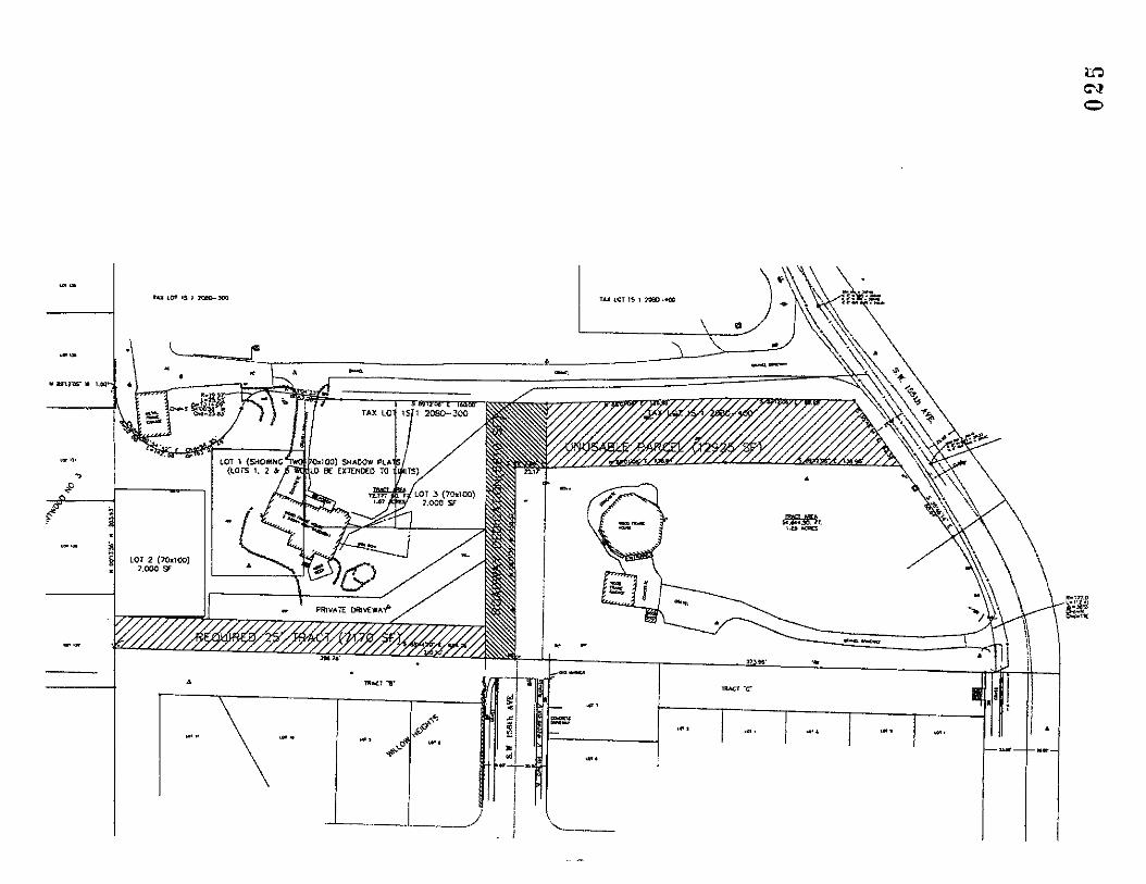

Attachment C to the Supplemental Memorandum to the City of Beaverton
Measure 3 7 Claim of David and Karen Williams 0 2 6


Attachment D to the Supplemental Memorandum to the City of Beaverton
Measure 37 Claim of David and Karen Williams 0 2 8

Client Full http://www.rmlsweb.co~eports.asp?CMAID=lOO4943~Time-O942&Repo~~~~
Presented by: Amy Burghardt Client Full Keller Williams Realty Port Pr
LOTS AND LAND , Status: ACT 1111612006 MW: 6094797 Area: 150 List Price:
Address: 156th AVE a d T -5
City: Beaverton Zip: 97008 Additional Parcels: 1 Map Coord: 624lHl5 Zoning:
County: Washington . Tax ID: Not Found
1 f 1 Subdivision: Bums View EP bu ?=I- Manufhs Okay: N CC8Rs: N #Image: 2 a 0 -y =,;----z--- J. Elem: CHEHALEM Middle: HIGHLAND PARK
High: ALOHA Prop Type: t
RESlD
FACT A Legal: Bums View lot 1
..LLt I
GENERAL. INFORMATION Lot Size: 7K-9,999SF Acres: Lot Dimensions: 8783 Square Feet
Waterfront: I RiverILake: Availability: SALE #Lots: 1 Perc Test: N I RdFrntg: Rd Surfc: Seller Disc: Other Disc: View: Lot Desc: Soil TypelClass: Topography: LEVEL Soil Cond: Present Use:
IMPROVEMENTS Utilities: GAS-AVL. POW-AM, SWR-AVL, WAT-AVL Existing.Structure: N I
REMARKS XStIDir: Next to 7041 SW 156th Ave. Down Private Or.
Remarks: One of 2 remaining lots, subject to final patidion recording. All utilities& paving are in. Located down private drive off 156th. next to 7041.PLEASE CALL LISTING AGENT PRIOR TO WALKING PROPER PI...
. . , .. .. . - . . , - PTaxlYr: 0 HOA Dues: HOA Dues-2nd: HOA Incl:
0 RMLS7" 2006. ALL RlGrlTS RESERVED - INFORMATION NOT GUARANTEED AhD SHOJLD BE VERIFIED. SQUARE FOOTAGE IS APPROXIMATE 8 MAY INCLUDE BOTd FIN8SHED 8 UNFINISHED AREAS - CONSU-T BROrCER FOR
INFO. SCHOOL AVAILABILITY SUBJECT TO CHANGE.

Client Full
Presented by: Amy Burghardt Client Fulf Keller Williams Realty Port Pr
LOTS AND LAND Status: ACT 11HB/2006 8:42:27 AM ML* 6060848 Area: 150 ~ i s t price: EiGET
Ns Photo Address: 9481 5W 165TH LOT 25 City: Beaverton Zip: 97008 Addilonal Parcels: 1 Map Coord: 654lG11 Zoning:
Available County: Washington Tax ID: Not Found Subdivision: CARSON CREST 2 Manufhs Okav. N CC8Rs. Y #Imaae:
Elem: S&ON MOUNTAIN Middle: -
HIGHLAND PARK High: SOUTHRIDGE Prop Type: RESlD Legal: LOT 25 CARSON CREST PHASE 2
GENERAL INFORMATION Lot Size: 5K-6,999SF Acres: Lot Dimensions:
Waterfront: 1 Riverllake: Availability: SALE #lots: Perc Test: I RdFmtg: Rd Surfc: PAVEDRD
Seller Disc: DSCLOSUR Other Disc: View: Lot Desc: Soil TypelClass: NATIVE Topography: Soil Cond: Present Use:
IMPROVEMENTS Utilities: GAS, PHONE, POWER. SEWER. WATER Existing Structure: N I
REMARKS XSffDir. MURRAY RD, W ON BEARD-TURNS INTO NORATO DIAMOND VIEW.
Remarks: GREAT OPPORTUNITY! FOR A LIMITED TIME-DESIRABLE CARSON CREST LOTS. BRING YOUR BUILDER OR USE OURS!
, ..., ~, .L
PTaxWr: 0 HOA Dues: . HOA Dues-2nd: HOA Incl:
0 RMLSN 2006. ALL RlGhTS RESERVED. - INFORMATION NOT GUARANTEED AND SHOULD BE VERIFIED. SQUARE FOOTAGE IS APPROXIMATE 8 MAY INCLUDE BOTH FINISHED 8 UNFINISHED AREAS - COhSULT BROKER FOR
INFO. SCHOOL AVAIIABILIiT SUBJECT TO CHANGE.

Client Full hrtp:llwww.ml~ieb.com/Reports.asp7CMAID=l0049432&Tim4942&ReportID=CL
Presented by: Amy Burghardt Client Full Keller Williams Realty Port Pr
LOTS AND LAND Status: ACT 1111612006 8:42:27 ML#: 6060850 Area: 150 Ust Plice:
Address: 9471 SW 165TH LOT26 p&y
.City: Beaverton Zip: 97008 Addiiional Parcels: I Map Coord: 6541GIl Zoning:
County: Washington Tax ID: Not Found Subdivision: CARSON CREST2 Manufis Okay: N CC&Rs: Y #Image:
Elem: SEXTON MOUNTAIN Middle: HIGHLAND PARK H i h SOUTHRIDGE Prop Type: RESID ~egal: LOT 26 CARSON CREST PHASE 2
GENERAL INFORMATION Lot Size: 5K-6.999SF Acres: Lot Dimensions:
Waterfront: I RiverlLake: Availability: SALE #Lots: Perc Test: I RdFmtg: Rd Surfc: PAVEDRD Seller Disc: DSCLOSUR Other Disc: View: Lot Desc: Soil TypeIClass: NATIVE Topography: Soil Cond: Present Use:
IMPROVEMENTS Utilities: GAS, PHONE. POWER. SEWER, WATER Existing Structure: N /
REMARKS XSVD~~: MURRAY RD. W ON BEARD-TURNS INTO NORA TO DIAMOND VIEW.
Remarks: GREAT OPPORTUNIW! FOR A LIMITED TIME-DESIRABLE CARSON CREST LOTS. BRING YOUR BUILDER OR USE OURS!
FINANCIAL PTaxNr: 0 HOA Dues: HOA Dues-2nd: HOA Inch
Q RM-Sw 2006 ALL RlGhTS RESERVED. - INFORMATlOh NOT GUARANTEED AND WOULD BE VERIFIED. SQUARE FOOTAGE IS APPROXIMATE 8 MAY INCLUDE BOTH FINISHED & UNF NlStiED AREAS - COhSULT BROKER FOR
INFO. SCHOOL AVAILABILITY SUBJECT TO CHANGE.

Client Full h t t p : / l ~ . m l s w e b . c o m l R e p o ~ . ~ ~ p ? ~ L
Presented by: Amy Burghardt Client Full Kelier Williams Realty Port Pr
LOTS AND LAND Status: ACT 1 l/l6/2006 T&42:28AbJ ML#: 6040029 Area: 150 List Price: $240,000
Address: 4865 SW l6OTH AVE City: Beaverton Zip: 97007 Additional Parcels: I Map Coord: 624/G/3 Zoning: R9
County: Washington Tax ID: R0140537 Subdlvlslon: JOHNSON ESTATE ADD Manufbs Okay: CCBRs: #Image: 3
Elem: ALOHA-HUBER PRK Middle: FIVE OAKS High: ALOHA Pro, Tvoe: RESlD
Legal: JOHNSON ESTATE ADDITION TO BEAVERTON-REEDVILLE ACREAGE. LOT PT 354. ACRES .37
GENERAL INFORMATION Lot Size: 15K-19.999SF Acres: 0.37 Lot Dimensions:
Waterfront: / RivedLake: Availability: SALE #Lots: Perc Test: N / RdFmtg: N Rd Surfc:
Seller Disc DSCLOSUR Other Disc: View: Lot Desc: PRIVATE, TREES Soil Typ/Class: Topography: LEVEL Soil Cond: Present Use: RESIDNC
IMPROVEMENTS Utilities: SWR-AVL, WAT-AVL Existing Smcture: Y / COOP. RESlDNC
REMARKS X W i r : From Murray-Weston Farmington. North on 160th Avenue
Investors opport~n'ty. Large flag Id wlsmall780 sq f l home on ne mrner currently rented for $625 mo. County states property Remarks: can be divided by 3. Bea~ t i f ~ l level lot. Call Itsting agent for more info. Home shown by appt only. ho lockbox. Buyer lo verfy
wMlashingbn County. FINANCIAL
PTaxNr: 1297.46 HOA Dues: HOA Dues-2nd: HOA Incl:
0 RMLSTM 2006. ALL RIGHTS RESERVED. - INFORMATION NOT GUARANTEED AND SHOULD BE VERIFIED. SQUARE FOOTAGE IS APPROXIMATE 8 MAY INCLUDE BOTH FINISHED 8 UNFINISHED AREAS -CONSULT BROKER FOR
INFO. SCHOOL AVAlLABlLrPl SUBJECTTO CHANGE.

Client Full h t t p : / / w w w . r m l s w e b . c o m / R e p o r t s . a s p ? C M A I ~ C L
Presented by: Amy Burghardt Client Full Keller Williams Realty Port Pr
LOTS AND LAND Status: ACT 11/16/2006 8:42:28 AM ML#: 6060785 Area: 150 List Price: $245,000 \
Address: 9470 SW 165TH LOT 16 - City: Beaverton Zip: 97008 Additional Parcels: I ~ ~ .. .~
Map Coord: 654/G/l Zoning:
Awllabla; County: Washington Tax ID: Not Found Subdivision: CARSON CREST 2 Manufhs Okay: N CCBRs: Y #image:
Eiem: SEXTON MOUNTAIN Middle: . HIGHLAND PARK
High: SOUTHRIDGE Prop Type: RESlD Legal: LOT 16 CARSON CREST PHASE 2
GENERAL INFORMATION Lot Size: 5K-6,999SF 'Acres: . Lot Dimensions:
Waterfront / RivedLake: Availability: SALE #Lots: Perc Test I RdFrntg: Rd Sulfc: PAVEDRD
Seller Disc: DSCLOSUR Other Disc: View: LO^ Desc: Soil TypeIClass: NATIVE Topography: Soil Cond: Present Use:
IMPROVEMENTS Utilities: GAS, PHONE. POWER, SEWER. WATER Existing Structure: N I
REMARKS XSWDir: MURRAY RD, W ON BEARD-TURNS NTO NORA TO DlAMOhD VIEW.
Remarks: GREAT OPPORNNilY! FOR A LIMITED TIME-DESIRABLE CARSON CREST LOTS. BRING YOUR BJILDER OR JSE . OURS!
FINANCIAL PTaxNr: 0 HOA Dues: HOA Dues-2nd: HOA Ind:
0 RMLS'" 2006. ALL RiGHTS RESERVED. - INFORMATION NOT GUARANTEED AND SHOULD BE VERIFIED. SQUARE FOOTAGE IS APPROXIMATE 8 MAY INCLUDE BOTH FINISHED 8 UNFINISHED AREAS -CONSULT BROKER FOR
INFO. SCHOOL AVAILABILITY SUBJECT TO CHANGE.

Client Full http:Nwww.rmlsweb.com/Reports.~~p?CMAID=lOO49432&Tim~942&Repo~1~L
Presented by: Amy Burghardt Client Full Kener Williams Realty Port Pr
LOTS AND LAND Status: ACT 11/16/2006 8:42:29 AM ML#: 6060783 Area: 150 Llst Price: ~--$zGzq
Address: 9460 SW 165TH LOT 15 City: Beaverton Zip: 97008 Additional Parcels: I Map Coord: 654/G/1 Zoning:
County: Washington Tax ID: Not Found Subdlvlslon: CARSON CREST 2 Manufhs Okay: N CC&Rs: Y #Image:
Elem: SDCTON MOUNTAIN Middle: HIGHLAND PARK High: SOUTHRIDGE Pmp Type: RESlD Legal: LOT 15 CARSON CREST PHASE 2
GENERAL INFORMATION Lot Sue: 5K-6,999SF Acres: Lot Dimensions:
Waterfront: I RiverlLake: Availability: SALE #Lots: PercTest; I RdFmtg: Rd Surfc: PAVEDRD
Seller Disc: DSCLOSUR Other Disc: View: Lot Desc: Soil TypeIClass: NATIVE Topography: soil Cond: Present Use:
IMPROVEMENTS Utilities: GAS,, PHONE, POWER. SEWER. WATER ExisUng Structure: N I
REMARKS XSVOir: MURRAY RD. W ON BEARD-TURNS INTO NORATO DIAMOND VIEW.
Remarks: GREAT OPPORTUNITY! FOR A LIMITED TIME DESIRABLE CARSON CREST LOTS. BRING YOUR BUILDER OR USE OURS!
FINANCIAL PTaxP(r: 0 HOA Dues: HOA Dues-2nd: HOA Incl:
O RM-S" 2006. ALL RIGHTS RESERVED. - INFORMATION NOT GJARANTEED AND ShOULD BE VER FIED. SQUARE FOOTAGE IS APPROXIMATE & MAY .hCLUDE BOTH FiNlShED & UNFINISHED AREAS - CONSULT BROKER FOR
INFO .. .. -. SCHOOL AVAILABILITY SUBJECT TO CHANGE.

CITY of BEAVERTON 4755 S.W. Griffith Drive, P.O. Box 4755, Bcavcrton, OR 97076 Gcncral Information (503) 526.2222 V/mD
December 14,2006
Ty Wyman Dunn Carney LLP 851 SW 6th Avenue #I500 Portland OR 97204-1357
RE: Williams Measure 37 Claim
Mr. Wyman:
As you have noted in your application materials dated received November 28, 2006, you state that you are claiming compensation on the behalf of your clients, David and Karen Williams, pursuant to Ballot Measure 37. You also state in your letter that your client will not process their claim in accordance with Beaverton Municipal Code Section 2.07.001 through 080. This is unfortunate because this information is essential for the City to determine how it should handle this claim. As it stands now, your application is incomplete. We hope that you will reconsider and submit the following necessary information.
Pursuant to Section 2.07.015, the following information must be submitted to find that the application for a compensation claim is complete:
1. A written description addressing the approval criteria, including the impact of the specific City regulation on the subject property and the reason(s) why under Measure 37 such regulation restricts the use of the property and impacts the value of the property.
2. An appraisal of the subject property prepared by a certified general appraiser, licensed by the Oregon Appraiser Certification and Licensing Board showing the reduction in the fair market value of the property as that reduction is defined under Measure 37 as described in the City Code.
3. An analysis of why the regulations are not exempt from application for compensation.
4. A complete list of all interests of encumbrances, including without limitation leases and encroachments, of which the claimant is aware or has reason to think may exist.
Page 1 of 2 0 3 5

5. An itemization of any prior payments made to the Property Owner relating to a claim on the property, including any contiguous parcels under substantially the same ownership, if any.
6. Copies of all appraisals, market studies, economic feasibility studies, development schemes, or environmental assessments related to the property prepared within the 2-year period prior to submittal of the claim.
7. A copy of all enforcement actions taken by any governmental body as regards the Property.
8. A deposit of $1,000.
Please submit this information by January 16, 2007. If you chose not to respond by that time, it may result in the scheduling a public hearing before the Beaverton City Council for the purposes of reviewing your claim based only on the very limited information you have provided. The Council may deny the claim because you did not submit a complete application. The lack of this crucial information will make it very difficult for the Council to determine the appropriate response to this claim. Your assistance in helping the City Council make this decision by providing the above information would be appreciated.
Sincerely, /
c Joe Grillo, AICP Alan Rappleyea, AICP
Page 2 of 2 0 3 6

DIRECT DIAL 503 417.5478
E-MAIL Ikwadunn-camey cam
ADDRESS
suite 1500 851 S W Smth Avenue
Portland, Oregon 97204-1357
Phone 503 224.6440 Fax 503 224 7324
INTERNET www.dunncarney.wm
January 5,2007
Steven A. Sparks, AICP Development Services Manager City of Beaverton 4755 S.W. Griffith Drive Post Office Box 4755 Beaverton,Oregon97076
Re: Williams Measure 37 Claim Our File No. WIL147-1
Dear Steve:
This responds to your December 14,2006 letter to me regarding the above. It responds in a point-by-point manner to the information that you request.
1. We attach excerpts from staff reports and application materials. These excerpts analyze at length the manner and degree in which City regulations restrict parcelization, use, and development of the site.
2. Again, the City's code may require an appraisal to support a Measure 37 claim, but the measure itself (ORS 197.352) does not. We are happy to discuss with you the basis of the comps that we submitted previously.
3. The Williams do not request relief from any regulations that purport to restrict "selling pornography or performing nude dancing," activities historically recognized as nuisances, activities covered by the building code, nor are any of the regulatims required by federal law.
4. We attach a title report for the subject property.
5. The Williams are aware of no prior payments made to them relating to this claim.
6. The Williams are not aware of any market studies, economic feasibility studies, or environmental assessments completed regarding the property over the past years. We are unsure what the City considers to constitute a "development scheme." As noted in
MERITAS U I R I Y I * O I L D W I D I
INDEPENDENT MEMBER OF MERITAS WlTH AFFILIATED OFFICES IN MORE THAN 250 CITIES AND 60 FOREIGN COUNTRIES

Steven A. Sparks, AICP January 5,2007 Page 2
our claim, the Williams, in conjunction with their easterly neighbor, submitted to the City a preliminary plat for review last year.
7. The Williams are not aware of any enforcement action pending on the property.
8. I believe that the City has this check.
The Williams understand that Measure 37 places an administrative burden on the City. Accordingly, rather than back and forth letters, we invite staff to sit down with us to expedite resolution of these issues.
TKW:lbs Enclosures cc: David & Karen Williams DCAPDX_n403972.vl_Lcner~toDStevennSp~s doc

Title Report In Support of Williams Measure 3 7 Claim
January 5, 2007 Letter of Ty K. Wyman to Steve Sparks of the City of Beaverton
0 3 9

Subdlvislon Guarantee Guarantee No,: 7019-290849 Page 1 of 4
First American Tit/e Insurance Company of Oregon 1700 SW Fourth Avenue, Suite 102, Portland, OR 97201
(503) 222-3651 - FAX (503) 790-7872
For the Proposed Plat of:
Unnamed Plat
GUARANTEE NO. : 7019-290849
FEE $ 225.00 YOUR REF.:
First American 75tIe Insurance Company of Oregon
reports to
The Oregon Real Estate Commission, and any'county or ety within which said subdlvislon or proposed subdivision is located.
That, according to the public records which impart constructive notice or matters affecting title to the premises hereinafter referred to, we find:
That the last deed of record runs to:
David L. Williams and Karen c. Willianis, as tenants bythe entirety
We also find the following apparent encumbrances, which includes "~lanltet Encumbrances" as defined by OR5 92.305 (I), and also easementr, restrictive covenants and rights of way prior to the effective date hereof:
1. Taxes for the year 2003-2004 Tax Amount 8 6,208.59 Unpaid Balance: 8 6,208.59, plus interest and penalties, if any Code No.: 051.51 Map &Tax Lot No.: 1S120BD-00300 Property I D No.: R166974
2. City liens, if any, of the City of Beaverton.
3. Statutory powers and assessments of Clean Water Services.
4. These premises are within the boundaries of the Tualatin Valley Water District and are subject to the levies and assessments thereof.

Guarantee No.: 7039-290849 Page 2 of 4
5. Agreements concerning well and water rights, including the terms and provisions thereof, Recorded: September 29, 1965 in Book Vl, page 17, and Recorded: Februaty 2,1970 in Book 770, page 405, and Recorded: March 9, 1972 in Book 857; page 400
6. Agreement for Easement including the t e r n and provisions thereof: . ..
Dated: October 27, 1975 Recorded: December 31,1975 in Book 1061, page 835 Executed by: Marshall D. Hermn, Verna L. Herron, Dale Johnson and Carol A.
Johnson
7. Dekd of Trust and the terms and conditions thereof. Loan No.: 2295152 GmntorfFrustor: David L. Williams and Karen C. Williams, husband and wife Grantee/Beneficiaty: Bank of America, N.A. Trustee: Chicago Title Insurance Company Amount: $129,373.72 Dated: August 26,2002 Recorded: September 17,2002 Recording Information: 2002-108064
8. Line of Credit Trust Deed, .including the terms and provisions thereof, given to secure an indebtedness of up to $80,000.00 Gmntor: David L. Williams and Karen C. Williams, husband and wife Beneficiary: Bank of America, N.A. Trustee: Chicago Title'lnsumnce Company Dated : August 26, 2002 Recorded: September 17, ZOO2 Recording Information: 2002-108065
9. Examination of the records discloses numerous matters pending against persons with names similar to David L. Williams. A statement of Identity should be completed and returned to this company for consideration prior to closinq.
The land referred to in this report is described in Exhibit A attached hereto.
THIS IS NOT A m E GUARANTEE since no examination has been made of. the Mle tn the above described property. Our search for apparent encumbmnces was limited to our Tract Indices and therefore above listings do not include additional matters which might have been disclosed by an examination of the record title. We assume no liability in connection with this Subdivision Report and will not be responsible for errors or omissions therein.
Dated: October 23, 2003

Subdivitien Guarantee
First American Title Insurance Company of Oregon,
F 8 .
By: ,> tm? Jim R ejj, Authorized Signatory
cc: First W rican Ttie Company Builders Services A m : Greg KoR il
Guarantee No.: 7019-290849 Page 3 of 4

Subd~lslon Guarantee
Exhibit "A"
Guarantee No.: 70L9-290849 Page 4 of 4
Real property in the County of Washington, State of Oregon, described as follows:
The West 310 feet of even width and the North 50 feet of even width of the following:
A t r x t of land in Section 20, Township 1 South, Range J. West, of the Wiliarnette Meridian, in the City of Beaverton, County of Washington and State of Oregon, more particularly described as follows:
Beginning at a point on division line between the East and West halves of the William H. Williams Donation Land Claim In Sectlon 20, Township 1 South, Range 1 West, of the WiliameYce Meridian, in the City of Beaverton, County of washington and State of Oregon, North 0°14' West 619.1 feed frorn.the South line of said Donatlon Land Claim, said beginning point being the Northwest coiner of a tract conveyed to Richard M. Gustafson, et ux, by Deed.recorded November 16, 1953 in Book 350, page 425, Records of Washington County; thence South 88a41' East 684.5 feet to a point on the Westerly right-of- way of North Conner Road; thence Northerly along the said Westerly right of way line of North Conner Road to the Southeasterly corner of that tract of land mnveyed to Marshall D. Herron, et ux, in Deed recorded in Book 1003, page 127, Records of Washington County; thence Westerly along said South line to a point North 00°14' West, 203.93 feet from the point of beginning; thence South 00°14' East, 203.93 feet to the point of beginning.
Tax Parcel Number: R166974

THIS MAP IS FURNISHED AS A CONVENIENCE BY PACIFIC NORTHWEST TITLE N
This map is not a survey and does not show Lhe location of any improvements The company assumes no liability for errors therein.
MAP # IS120BD 00300 0 4 4

Excerpts from 2005 Preliminary Subdivision Application & Staff Reports In Support of Williams Measure 3 7 Claim
January 5, 2007 Letter of Ty K Wyman to Steve Sparks of the City of Beaverton

Narrative
The applicant is requesting permission to develop a 10-lot subdivision on the properties located at 6675 and 6755 5 W 155'~ Avenue in Beaverton, Oregon. The two addresses are abutting properties, which are jointly submitting this application to have their properties subdivided. Both of these properties are zoned R-7 and contain a significant tree grove.
The request is t o subdivide these two properties creating eight additional lots. Each propetty currently contains one residence with associated outbuildings. The two existing residences and their outbuildings will remain; the remainder of the properties would be subdivided, creating eight additional lots. Each of these newly created lots is planned to have one single-family detached home constructed on it.
The site is located on an east-facing slope. The site is heavily wooded, containing second growth fir and spruce. The City of Beaverton has designated the vegetation on-site as a significant tree grove. The development has been planned to minimize the number of trees and understory that will be disturbed. The site currently has 2.5 acres of canopy, with 0.4 acres of existing yard, driveway and buildings.
As part of the development street modifications will be made. SW 156'~ Avenue will be extended from the southern edge of the site to the northern property boundary. The road grades have been set to blend with the existing SW 1 5 6 ~ ~ Avenue and the grades of the gravel driveway. A planting strip and sidewalk are planned as parts of this improvement. SW 155'~ venue will also be addressed with a half street improvement, which will include widening the existing pavement, adding a sidewalk, adding a planter strip and a dedication of property to the right-of-way.
Along with the road improvements, infrastructure will be provided with the development. Sanitary sewer will be constructed within the SW 1 5 6 ~ ~ Avenue right of way to serve the residences on the western portion of the site. A second sanitary sewer line is planned in a public easement on the eastern portion of the site to serve the remaining residences. Stormwater will be collected and treated in a storm filter catch basins. The water will then be detained and released from a detention pipe.
All lots, but Lot 3, comply with the required 70-ft. x 100-ft. dimensional standards and 7,000 sq. ft. lot area standard of the R-7 zone. An adjustment is requested for the lot depth on Lot 3, which is proposed at 95 feet, instead of the required 100 feet. A flexible rear setback for Lot 3 is requested due to the shape and orientation of the site and all other abutting lots meeting the 70-ft. x 100-R. dimensional requirements of the R-7 zone. I f this lot were required to have the 25-foot rear yard setback the house would only be able to be 32 feet in depth. The current building market is for 2-story homes that are 45 to 70 feet in depth for lots this size. The applicant is proposing a typical plan with 42 feet in depth that will f i t with a rear yard setback of 15 feet.
The applicant is proposing a 10-foot wide non-development easement along the south property lines of lots 1 and 9 and 4 and 6. This no-build easement will allow for tree protection for the trees in the tract to the south.
The development that is proposed on-site is for custom-built single family residences. Therefore, i t is difficult to determine the area needed for construction and which trees will

need to be removed and which trees can be retained. Due to this, the applicant is proposing to mitigate for all of the non-exempt trees on-site using the in-lieu fee option. Five years after the completion of construction, the City will reimburse the builder for the healthy, non-exempt trees that were preserved.
Page 2 Williamwood Subdivision
Preliminary Subdivision Application 047

October 28, 2005
David \.Villiams 6675 SW 155th Avenue Beaverton, OR 97007
RE: Williamwood Subdivision I LD2005-0026 I ADJ2005-0004 I TP2005-0016
Dear Williams,
The Facilities Review Committee finished its completeness review on October 27, 2005 and deemed the applications incomplete. The purpose of this letter is to inform you of the items necessary to make your application complete. This letter does not identify shortcomings of the content of the materials that has been submitted nor provide any indication whether staff will support your proposal to the decision making body. Review of the content of the submitted material and staffs recommendation on the proposal will occur during the project review phase of the application process after your proposal is deemed complete. Please address the following items for completeness.
A. COMPLETENESS ISSUES Pur suan t t o Section 50.25.1 of t h e Development Code, a complete application is one which contains t he information required by t h e Director t o address the relevant criteria, development requirements a n d procedures of th is Code. The following items & be addressed a n d submitted in o rder for t he application t o be deemed complete:
1. WRITTEN STATEMENT REQUIREMENTS: Your proposal did not address the following requirements.
A. In order for staff to determine if the correct applications have been submitted, you will need to label the Improvement Plan with the buildable area of the lot, lot width and lot depths, as defined in Chapter 90 of the Development Code.
2. P lan & Graphic Requirements
A. Exist ing Conditions Plan: 1. Location of existing public and private utilities, easements, and 100-year
floodplain. Staff comment: If t he existing driveway connection t o t he
Williamswood Subdivision I LD2005-0026 i .lDJ2005-0004 I TP2005-0016 Page 1 0 4 8

western most lot is located within a n easement, i l lustrate t he easement o n t h e plan.
2. Existing drip line canopy of individual trees or grove of trees. Staff comment: The dripline needs t o be shown in the actual form. It appears t h a t t he plan illustrates t he dripline a s i t would appear based on the t ree protection ra t io calculation of .5 foot for every 1 caliper inch of t runk.
3. Existing root zone of each tree. Root zone is defined as an area 5 feet beyond the drip line of the tree. Staff Comment: Because the dripline appears t o be shown based on the calculation cited above, t he root zone is not being shown accurate t o Code. I n addition, t he root zone needs t o be illustrated for each individual t ree and not just t he grove.
B. Dimensioned Site Plan. (For Tree Plan) 1. Location, quantities, size (diameter breast height), genus and species of
Significant Trees and Groves, Historic Trees, Trees within a Significant Natural Resource Area, and Community Trees, and identification of whether they are proposed to be removed or proposed to remain, as applicable. Staff Comment: The symbols chosen for trees t o remain a n d t rees t o be removed appear t o be similar. Please provide a clear distinction between these trees, such as a n 'X" through the t rees t o be removed.
2. Dimensioned footprints of all structures and dimensioned area of all on-site parking and landscaped areas, and their lineal distance from trees proposed to be removed, to remain, or trees to be planted for mitigation.
3. Dimensioned tree mitigation areas specifying the location, quantities, size (diameter breast height), genus and species of trees within the mitigation area(s) identified, if applicable. Mitigation areas are to be set aside in a separate tract, if the project includes a subdivision. If the project does not include a subdivision, the mitigation trees must be set aside in a conservation easement. Staff comment: Sheet 21 shows proposed conifer a n d deciduous t rees a n d does not list t he specific type o r size of t r ee proposed. Also, t he t rees a r e proposed t o be planted a t t he base of existing trees. It appears that the re is not adequate room i n these a reas t o accommodate t he mitigation trees.
4. Drip line canopy of individual trees or grove of trees. Staff comment: The dripline needs t o be shown in the actual form. I t appears t h a t t h e plan illustrates t he dripline as i t would appear based o n t h e t ree protection ra t io calculation of .5 foot for every 1 caliper inch of t runk.
5. Root zone area of each tree to be protected. Root zone is defined as an area 5 feet beyond the drip line of the tree. Staff Comment: Because the dripline appears t o be shown based on the calculation cited above, t h e root zone is no t being shown accurate t o Code. In addition, t h e root zone needs t o be i l lustrated for each individual t ree a n d not just t he grove.
6. Construction disturbance areas and methods to minimize construction impact including but not limited to the identification and location of construction fencing, the identification and location of erosion control measures, and the location of construction access roads including access to the public right-of-way. Staff Comment: Tree protection fencing, a s required by the Code is not
LVilliamswood Subdivision i LD2005-0026 ! 4DJ2005-0004 ! TP2005-0016 Page 2

represented on t h e Tree Plan (Sheet 8 of t he plan set). Please provide th i s fencing and illustrate t he disturbance areas.
7. Location of storm water qualityldetention facilities. 8. Site grading information, showing 2 ft. contours.
C. Grad ing Plan: If you choose provide a separate plan for the grading include the following information. 1. Indicate which trees are proposed to be saved and which are proposed to be
removed. Staff Comment: The plan illustrates trees t o be removed; however, there is no grading o r building envelope within those a reas t h a t would justify removal. Please illustrate proposed grading a n d the limits of grading within t he areas where trees a r e proposed for removal.
D. Proposed Preliminary Pla t 1. Please remove all physical improvements, such as walls and paving from the Plat
drawing. 2. Label the dimension of the western lot line of Lot 4.
E. Proposed Improvement Plan (Sheet 6 of t he submittal) 1. Existing and proposed right-of-way and improvements, including sidewalk
dimensions.
F. Minimum Density Plan 1. Illustrate lot widths and depths for the proposed lots to demonstrate they all
meet the Code requirements without a Variance or Adjustment request. 2. Illustrate how access would be provided to the proposed lots.
B SITE DEVELOPMENT COMMENTS - J i m Duggan While no t strictly completeness items, t h e following a re mat ters t ha t will need t o be addressed prior t o t h e Facilities Review Committee meeting t h a t would occur approximately 30 days after t h e application, when resubmitted, would be complete. Submittal of th is information is necessary no la ter t han 14 days after t h e application is made complete, i n o rder for staff t o make findings t h a t t he proposal is consistent with t h e Facilities Review Technical criteria.
1. In addition to the submitted drainage report, a flowchart-type graphic will need to be provided. The intent of this graphic is to communicate pertinent design details for the storm water qualitylquantity control facilities such as, but not limited to, stagelstorageldischarge, references to plots of hydrographs, flow control structure elevations and drainage areas. An Excel spreadsheet showing as example of a flowchart type graphic is available and can be found at:
Single Pond or Vault: www.ci.beaverton.or.us/departmentslCDDlsitedevelopment/formslsingleponddatagraph.pdf
***Multiple Ponds o r Vault i n Series****
Will~amswood Subd~vision / LD2005-0026 1 ADJ2005-0004 I TP2005-0016 Page 3 3 50

2. Each proposed or anticipated future lot must be shown to have its own, separate connection to public water, storm, and sanitary sewer. In this case, it appears that public storm and public sanitall: sewer lines will need to be extended to serve Lot 2 along. the common lot line of Lots 5 and 6 in order to provide for the possibilitv of Lot 2 subdividing into Lots A and B.
C. PRELIMINARY STAFF COMMENTS The following is a preliminary list of issues identified during the completeness review of your application. Staff recommend that these issues be addressed early as they will impact staffs recommendation on your applications. NOTE: The items listed below is not an exhaustive list of issues pertaining to your proposal as a detailed analysis of your proposal has not begun Expect that additional questions and comments will be brought to your attention as staff begins the detailed project review phase of your application once your application is deemed complete.
1. Minimum Densitv 1 Oversized Lot (Lots 1 and 2): your minimum density plan needs to address feasibility of utility extension to shadow plat lots and should provide easement descriptions to assure future development.
2. Tree Preservation. Your proposal indicates that 50% of the trees are to be saved on the subject site on the lots potentially using conservation easements. Section 60.60.15.2.C.2 of the Development Code requires that trees to be preserved are retained in Preservation Areas which for Land Divisions are to be set aside in Tracts. Your current proposal does not show Preservation Areas within Tracts. The following are potential options to consider:
a. Revise your proposal to include tracts for the Tree Preservation Area. This may mean that there are more than 50% of the trees to be removed. This will require you to recalculate your mitigation requirements to include trees in excess of the 50% to be removed. This may also result in modifications to your lots which could require additional adjustments or potentially using the option of the CU-PUD as described herein.
b. If your proposal does not include tracts, then revise your proposal and request that all trees on the subject site are not identified as retained trees. You will be required to mitigate for 50% of the trees on the subject site through replanting or fee-in-lieu. The trees on the subject site would be removed from the Significant Tree Inventory, but this does not require you to remove them.
As identified in your narrative, you are requesting the City to approve another method of tree preservation through the use of conservation easements. Please note, if you choose to proceed with conservation easements for Tree Protection Areas, staff could not provide you with a favorable recommendation before the Planning Commission. Under the new ordinance, conservation easements have not been established for tree protection purposes for Land Divisions. If you choose to show conservation easements a s a method of tree preservation, staff recommend providing the hearing body with
\V~lliamswood S u b d i v ~ s i o n I LD2005-0026 I ADJ2005-0004 I TP2003-0016 Page 4 0 5 1

detailed information on how the preservation of the trees will be accomplished and who would be responsible for tree preservation after the lots are sold.
c. CUP-PUD Option. Sections 40.15.15.5 and 40.15.15.6 of the Development Code are the application sections for Conditional Use - Planned Unit Developments. Implementation of a PUD design approach may provide more options for the proposed Land Division and eliminate the need for the -1djustment application.
3. The proposed tree protection measures are not the same a s those outlined in the Development Code (Section 60.60.20.1.A.1. If you chose to pursue different protection measures, please provide written documentation from the project Arborist tha t provides evidence the proposed protection measures will be equal or better than those outlined in the Code.
4. An ultimate % right of way of 31 feet is required along the frontage of 15j th Avenue. The plans illustrate a dedication of 25 feet and should be modified to illustrate 31 feet.
5 . The City received public comments regarding the application which listed a number of discrepancies between the tree inventory matrix and the plan. Please see the attached list of discrepancies and make the appropriate revisions to your application so tha t the materials are consistent.
RESUBMITTAL Please provide three (3) collated submittal packages that each include: copies of the written narrative, reports, and folded complete plan sets bound. Additional copies will be required a t a later time when your project has been scheduled for final review and processing.
One set of the original application materials is kept on file a t the Development Services Division. At the time of a future application, we can provide the information on file to assist you in preparing your materials. For information about application requirements, forms, fees and schedules, please contact the Development Services Counter a t 503-526-2420.
If you have any questions regarding this letter or any other aspect of our process, please don't hesitate to call. I a m including a list of the primary members of the Facilities Review Committee who were involved in the completeness review.
W N D USE & DESIGN: Liz Jones - 503-350-4082 TRANSPORTATION PLANNING: Don Gustafson - 503-350-4057 SITE ENGINEERING: J im Duggan - 503-526-2442
Thank you and we look forward to working with you to complete your application
Sincerely
Liz Jones Associate Planner
cc: Constantin Consuic. 6755 SW 155th Avenue, Beaverton, OR 97007 Peter Keefe, LDC Design Group, 2008.5 NW Tanasbourne Drive. Hillsboro, OR 9712-1 (2): Counter; Project files
Will~amswood S u b d ~ v ~ s i o n I LD2005-0026 I iDJ2005-0004 I TP2005-0016 Page 5 0 5 2

Facilities Review
40.03. FACILITIES RE W E W COMMITTEE I . AN critical facilities and services related to the developtnent have, or catr be irnproved
to have, adequate capacity to serve the proposal at the time of its conzpletion.
Response: The facilities and services that will serve the site will be extended from existing facilities in the Rebecca Woods subdivision or from facilities in the 155th Ave right-of-way.
Road access to the site will be created by extending 156th Ave from its terminus in the Rebecca Woods subdivision. The road will pass through the center of the site from the south to the north. At the north end of the site a barricade will be installed to prevent access to the private driveway north of the site. This access will be lockable to allow fire access in case of an emergency. The roadway has been designed to allow for future road extension to the north.
Water service will be extended from its current terminus in 156th Ave. Water service will be extended up the 156th Ave right of way to the proposed terminus. Lots I, 2, 5, 6, 7, 8, and 9 will obtain water from this service. Lots 3 and 4 will connect to the existing service on 155th Ave
Sanitary sewer service will be continued from its current terminus in 156th Ave. The service will be continued in the 156th Ave right-of-way and connect to existing service by continuing down the shared driveway and connecting to the service in 155th Ave.
Stormwater facilities will be continued from the services south of the site. Two filtering catch basins will be installed at the north end of 156th Ave. This will collect and treat stormwater runoff from the western half of the site as well as from 156th Ave. A stormwater detention pond is planned in the southeastern comer of the site. This will collect and release runoff from the entire site . *
Fire protection will be serviced by Tualatin Valley Fire and Rescue. The site has provided street access that conforms to the City of Beaverton design criteria, which incorporate adequate access for fire safety equipment. In this development this includes providing access from 155th Ave and providing adequate road widths. This application proposes to end 156th Ave at the northern property line. The road has been designed to allow for future extension to the north. A lockable banier will be constructed to block access to the private driveway that is north of the site, but could be unlocked to permit access to fire vehicles.
2. Essential facilities and services are available or catr be made available prior to occupancy of the development. In lieu ofproviding essential facilities and services, a specific plan strategy may be submitted that den~onstrates how these facilities, services, or both will be provided within five years of occupancy.
Response: School services will be provided by the Beaverton School District. The site will be served by Chehelam Elementary, Mountain view Middle School and Aloha High School. These existing school systems will not be significantly impacted by the construction of these additional homes.
0 5 3

The Beaverton Police Department will provide the proposed subdivision with * services. The site has been designed to provide adequate site access, allowing police vehicles access to the site. The development of the subdivision will construct a small number of residences and the addition of these residences will not inflict a measurable addition * on police services.
Pedestrian facilities will be provided in both the 155th and 156th Avenues rights-of-way. On both of these streets sidewalks will be constructed to meet the city design criteria provlding safe walking routes for pedestrians.
3. The proposal is consistent )vitli all applicable provisiorls of Chapter 20 (Land Uses) unless the applicable provisions are subject to an Adjust~nent, Planned Unit Development, or Variance which shall be already approved or considered concurrently with the subject proposal.
Response: The plan is largely consistent with the provisions of the provisions in the R-7 zoning and other portions of Chapter 20.
4. The proposal is consistent with all applicable provisions of Chapter 60 (Special Regulations) and that all improvements, dedications, or both required by the applicable provisions of Chapter 60 (Special Regulations) are provided or can be provided in rough proportion to the identified intpact(s) of the proposal
Response: The applicable provisions of Chapter 60 are addressed later in this application. The narrative demonstrates that the proposed subdivision complies with the provisions of the chapter.
5. Adequate means are provided or can be provided to ensure continued periodic maintenance and necessary normal replacement of the following private conrnron facilities and areas: drainage ditches, roads and other improved rights-of-way, structures, recreation facilities, landscaping, fill and excavation areas, screening and fencing, ground cover, garbage and recycling storage areas and other facilities, not subject to periodic maintenance by the City or other public agency.
Response: Facilities have been located so that access for maintenance is provided. No private drainage ditches, roads rights-of-way, structures, recreation facilities, fill or excavation areas, fencing, groundcover or garbage and recycling areas are proposed. Access to the stormwater detention area and the associated landscaping is available from 155th Ave.
6. There are safe and efficient vehicular and pedestrian circulation patterns within the boundaries of the site.
0 5 4

Response: The only proposed access to the development will be through the extension of 156th Ave. This extension has been proposed to the City's standards for a * street and provides safe and efficient circulation to the site.
7. The on-site velzicrrlar and pedestrian circrrlation systerrr connects to the surrourzding circulation systerrz in a safe, efBcient, and direct manner.
Response: All vehicle and pedestrian access to the site will be through the extension of 156th Ave. This connects the site to the surrounding neighborhood and to 155th Ave, a collector street.
8. Structures andpublic facilities artd services serving the site are designed irz accordance with adopted City codes and standards at a level which will provide adequate f i e protection, including, but not lintited to, fire flow, and protection frorn crime and accident, as well as protection frorn hazardous conditions due to inadequate, substandard or ill-designed development.
Response: All development will be designed to City code requirements and will meet these requirements.
9. Grading and contourirtg of the site is designed to accommodate the proposed use and to rnitigate adverse effectfs) on neighboring properties, public right-of-way, surface drairrage, water storage facilities, and the public storm drainage systern.
Response: The site has an existing grade that slopes to the east. The site has been designed to minimize the amount of grading that will be needed. Grading has been minimized by using retaining walls to reduce the area of disturbance. The site contains a significant tree grove and the maximum number of trees have been retained.
No adverse impacts to public rights-of-way are anticipated. 156th Ave will be extended.
Surface drainage patterns will not be blocked or significantly altered offsite. Existing runoff pattems are to the eastern site boundary and into the roadside ditch. Proposed drainage patterns will collect water in a detention pond in the southeast comer of the site and release it at the predevelopment rate into the same roadside ditch.
A public stormwater system is proposed that will collect and treat stormwater in filtering catchbasisn, direct it into buried detention pipes and finally release it at pre-development rates into the existing system.

10. That access and facilities for physically handicappedpeople are incorporated into the site and building design, with parlicular attention to providing continuous, uninterrupted access routes.
Response: All of the building development on the site will be single family residences. Handicap access to these buildings will be the responsibility of the builder and they will be responsible for meeting access standards in the building code.
The extension of 156th Ave will include sidewalks. The proposed sidewalk will join smoothly with the existing sidewalk allowing access to the road extension.
11. The proposal contains all applicable application sr~bminal requiren~eitts as specified in Section 50.25.1 of the Developrnent Code. [ORD 4265; September 20031
Response: These materials have been submitted.

Findings
20.05.15. Urban Standard Density (R7) District 1. Purpose. The purpose of this zone is to allow one dwelling per lot of record.
(ORD 3293; November, 1982) The R-7 is intended to establish standard urban density residential home sites where a minimum land area of 7,000 square feet is available for each dwelling unit, and where full urban services are provided.
2. District Standards and Uses. R-7 districts and uses shall co~ttpfy with tlze following: A. Permitted Uses:
Unless otherwise prohibited or subject to a conditional use, the followirrg uses and their accessory uses arepermitted: 1. Detached dwelling. [ORD 4224; August 20021
Response: The site currently contains two tax lots, each containing one single family home. The two properties will be subdivided to create seven additional lots, for a total of nine lots. Each lot will contain one single family, detached home with the lots will vary from 7,000 to 26,000 square feet.
20.05.50. Site Development Requirements. I. Minimum Land Area Per Dwelling Unit: [ORD 4224; August 20021
A. Detached Residentiat Zoning Districts RA 5 acres RZO 10,000 square feet R7 7,000 square feet RS 5,000 square feet R4 4,000 square feet [ORD 4047; May 19991
Response: A total of 9 lots are proposed, with all lots being zoned R7. These lots range in size from 7,000 sf to 26,000 sf, with all of the lots exceeding the 7,000 sf criterion.

2. Minimum Lot Dimensions
90 Mininrunt Depth - Corner Lots
Response: Most of the proposed lots comply with the minimum average lot dimensions required under the R-7 zoning. Lot 8 is not able to meet the depth criteria due to the proximity of the lot to the existing Williams house. The Minimum Density Plan (Sheet 5) of the plan set demonstrates that even with the current shortened lot depth the property line and proposed driveway are within * feet of the existing house. Moving the proposed pole to the north an additional 20 feet would result in a severe encroachment on the existing house.
Future Developnrent Lots
No corner Iots are proposed
AII lots rneet this criteria
R 7 Building element
Zoning
75 Minirnunz Width - Corner Lots - 70 Minirlrurrt Width - Interior Lots
Minirtrunr Depth - Interior Lots 100
Some of the future development lots are not able to meet the depth criteria primarily due to the placement of the existing homes and the configuration of the existing parcels. The curvature of 1 551h Ave results in an orientation of lots 3 and 5 that impinge the northeast comer of Lot A. Trylng to "square off' Lot A would result in Lots 3 and 5 not meeting their width requirement. Because the Williams house is located in the center of the western portion of the site the lots have been conformed to fit around the existing house. Ln addition the irregularly shaped site boundary in the northwest comer further impacts the lot layout. Lots D, and E are not able to meet the depth criteria but they all far exceed the minimum lot size and have sufficient buildable areas. Each home will be designed and constructed after the land use process has been completed and adherence to the setback regulations will be through the building permit process.
Proposed Lots
No corner lots are proposed
All Iots nreet this criteria
No corner lots are proposed
All of the proposed lots will have road access to 156 '~ Avenue. No new access is proposed onto 155Ih Ave. Lot 1 will maintain their current driveway configuration but will also be provided with a pole to provide future dnveway access to 1561h Ave. Lot 2 will abandon their current driveway to 1 55Ih Ave and will share a driveway with Lot 6 to provide road access to 1 561h Ave. Lots 3 , 4 and 5 will share a dnveway access 1561h Ave. Lot 7 will have a private driveway onto 1 5 6 ' ~ Ave. Lots 8 and 9 will share a driveway in the pole for Lot 9 to provide access to 156 '~ Ave. The future lots A and B would have direct access onto 1 561h Ave. Lots C, D, and E would share a driveway located in the Lot C pole to access 156Ih Ave.
No corner Iots are proposed
Lot 8 does not meet the depth standard
Page 2 Williamwood Subdivision
Preliminary Subdivision Application 0 5 8
Lots A, D and E do not meet the depth
criteria

20.05.55. Suppletnental Developme~tt Requirements 3. Exterrsioit of Facilities. [ORD 4061; Septetrrber 19991 To provide for orderly
development of the adjoining property or to provide an adequate grid of the City system, the City Engineer or designee shaN require extension of water lines, sarritary and storm sewer lines through applicant's property to the property line of the adjoining or abuttingproperty. Exfension of streets shall conforrrr to the requirements of Section 60.55 Transportation Facilities. Facilities required in accordance with this section shall be consistent with the acknowledged Contpreherrsive Plan. Where physical or topographic conditions make the extension of a facilify or facilities impracticable, the City Engineer or designee may require a cash payment to the City in lieu of the extension of the facility or facilities, the amount of which shall be equal to the estimated cost of the exfensiort(s) under more sititable conditions.
Response: Utility lines and the proposed road have been designed to allow their future extension. 156 '~ Ave has been extended across the site from its current terminus south of the site to the site's north property line. The 156 '~ Ave Plan and Profile Plan (Sheet 10) is included to demonstrate how the street network could be extended to the north in the future. Sanitary sewer, storm sewer and water supply lines are aligned in the 1561h Ave. right-of-way. This alignment will allow for their future extension to as the road network is extended into other properties.
20.05.60 Required Mininruin Residential Density [ORD 4046; May 19991 New residential development in the RA, RIO, R7, R5, R4, R3.5, R2, and RI zoning districts must achieve at least the rninimum density for the zoning district in which they are located Projectsproposed at Iess than the minitnuat density ntust demonstrate on a site plan or other means, how, in aN aspects, future intensijication of the site to the minimunt density or greater can be achieved without an adjustment or variance. [ORD 4071; October 19991 If meeting the nrinirnum density will require the submission and approval of an adjustntent or variance application(s) above and beyond application(s) for adding new printary dwellings or Iand division ofproperty, meeting minimum density shall not be required [ORD 4111; June 20001 [ORD 4224; August 20021
For the purposes of this section, new residential development shaN mean intensification of the site by adding new primary dwelli~tg(s) or Iand division of the property. New residential development is not intended to refer to additions to existing structures, rehabilitation, renovation, remodeling, or other building nlodifications or reconstruction of existing structures. [ORD 4224; August 20021
Minimunt residential density is calculated as follows: [ORD 4224; August 20021
I. Refer to the dejinition of Acreage, Net. Multiply the net acreage by 0.80.
Page 3 - Williamwood Subdivision
Preliminary Subdivision Application 0 5 9
2. Divide tlie resulting nutnber in step I by the ntini~ttutn land area requiredper dwelling for the applicable zoning district to deter~r~ine the rninirttrrn~ number of dwellings that must be built on tlie site.
3. If the resulting nurnber in step 2 is not a whole number, the nulttber is rounded to the nearest whole nurtrber as follows: If the decimal is equal to or greater than 0.5, then the nurnber is rounded up to the nearest whole number. If the decirtlal is less than 0.5, then the nusiber is rounded down to the nearest whole nurnber.
Response; The calculations used to determine the minimum density are included on sheet 5 of the plan set. Calculating the net acreage and applying the reduction factor determines that the minimum density for the site is 12 lots. While only nine lots are cunently proposed the alternative layout, the minimum density plan demonstrates that the site could be further divided in the future to locate twelve lots on the site
40.1 0.1 5. Application.
There are four (4) Adjustment applicatiorrs which are as follows: Minor Adjustnlent, Minor Adjustment - AN Regional Center zones and South Tektronix Station Community, Major Adjustment, and Major Adjustment - All Regional Center zones and in the South Tektronix Station Community.
3. Major Adjustrtient.
A. Threshold. An application for Major Adjustment shall be required when one or rttore of the following thresholds apply:
I. Involves an adjustment of ntore than 10% and up to and including 50% adjustment front the numerical Site Development Requirement specified in Chapter 20 (Land Uses).
Response, R7 zoning requires a minimum lot width of 70 feet and minimum lot depth of 100 feet. Due to the placement of the two existing homes and their relationship to the extension of 1561h Ave., the required dimensions cannot be met in some of the lots. Lot 8 does to meet the depth criteria having a average lot depth of 80 feet, not 100 feet. The dimensions of the lots needed to be adjusted so that the created lots would not encroach into the yard of the existing home. Therefore, this application includes a Major Adjustment application to allow the smaller dimensioned lot.
Page 4 Williamwood Subdivision
Preliminary Subdivision Application 060

In addition the depth of future development lots A, D and E do not meet the depth criteria. The average depth of Lot A is 87 feet, Lot D is 80 feet and Lot E 88 feet.
C. Approval Criteria. In order to approve a Major Adjustment application, the decision making authority shall make findings of fact based on evidence provided by the applicaizt deinonstrating that all the following criteria are satisfied:
I. The proposal satisfies the threshold requiretnmts for a Major Adjustment application.
Response, All of the reduced lot depths mentioned above vary from the standard by more that 10% and and therefore a major adjustment is necessary
3. Special conditions exist which are unique to the land, structure, or building involved.
Response, The location of the existing buildings the relationship of the existing buildings to the extension of 156'h Ave make it impractical to meet dimensional criteria. Building these lots to the required depths would place significant portions of the lots within the yard of the existing home and close to the house itself. Where one of the dimensions of the lot could not be met, the other dimension has been increased to better use the existing area and create lots that meet of exceed 7,000 sf.
4. Granting the Major Adjust~fzent will result in a project that equally or betfer meets the regulation to be modified
Response, The primary intent of the zoning designation is met, that single family residential units are located on parcels that exceed 7,000 sf. Where a dimensional standard has not been met the other dimension has been increased so that the desired housing density has been maintained. Forcing the lots to meet the dimensional requirements would create lots that intrude into the yards of the existing homes and place property lines that are extremely close to the existing homes themselves.
5. Granting the adjustrnent will not obstructpedestriait or vehicular movement.
Page 5 Williamwood Subdivision
Preliminary Subdivision Application 0 6 1
Response, This adjustment does not affect pedestrian or vehicular traffic.
6. The Major Adjtlstrnent will allow City designated scertic resources and historic resources, ifpresent, to bepreserved.
Response, No scenic or historic resources will be impacted.
7. If ruore tharl one ( I ) Major Adjustnzent is being requested, the curriulative effect of the adjustrnents will result in aproject which is still consistent with the overall purpose of the applicable zone.
Response, Only one major adjustment is being requested.
8. Any Major Adjustrrtent granted shall be the minintunz adjustment that will rnake possible a reasonable use of land, building, and structures.
Response, The lots have been made the as large as possible within the space. The boundaries of the lots have been extended as close to the existing houses as practical without encroaching into the existing yard.
9. The proposal incorporates building, structure, or site design features which cornpensate for adjusting the Site Developirtent Requirement.
Response, The adjustments are requested to accommodate the size and orientation of the site. The placement of the existing homes and the extension of 156Ih Ave create spaces that do not easily accommodate the dimensional standards of the zoning. Where one dimensional standard could not be met (such as depth) the other dimension (width) was increased to create lots that exceed the 7,000 sf minimum area required.
Page 6 Williamwood Subdivision
Preliminary Subdivision Application 0 6 %

40.45. LAlYD DZVZSI0.N 40.45.05. Purpose.
3. Prelirttinay Subdivision. A. Threshold. An application for Prelintinary Subdivisiot~ shall be required
when the following threshold applies: I. The creatiorl of four (4) or rttore new lotsfiotrt a lot of record in one ( I )
calendar year.
Response: The application is requesting pennission to subdivide the existing two lots to create a total of nine lots.
3. Prelintina y Subdivision.
C. Approval Criteria. I. The proposal satisfies the threshold requirements for a Prelitititlaty - -
Subdivision application.
Response: These requirements have been addressed throughout this application packet and are satisfied.
2. All City application fees related to the applicatiott under consideration by the decision making authority have been subntitted.
Response: The application fee has been paid.
3. Oversized lots shall have a size and shape which will facilitate the future partitioning or subdividing of such lots in accordance with the requiretnents of this Code. In addition, streets, driveways, and utilities shall be sufficient to serve the proposed lots as well as the future development on oversized lots.
Response: This proposal includes oversized lots. Sheet 5 (Minimum Density Plan), of the attached plan set demonstrates that the site can be further developed in the future to accommodate additional
Page 7 Williamwood Subdivision
Preliminary Subdivision Application 0 6 3

partitioning. This road and utilities that have been proposed will accommodate this additional development.
4. lfphasing is requested by the applicant, the requestedphasingplan can be carried out in a rnanner which satisfies the approval criteria and provides necessary public irttprovernents for each phase as tlze project develops.
Response: No phasing is requested
5. Applicatiorts and docurttents related to the request, which will require further City approval, shall be subrnitted to the City in the proper sequence.
Response: All necessary applications will be submitted.
40.90. TREE PLAN 40.90.15. Application. 2. Tree Plan Two
A. Threshold An application for Tree Plan Two shall be required when none of the actions listed in Section 40.90.10 apply, none of the thresholds listed in Section 40.90.15.1 apply, and one or lnore of the following thresholds apply: 3. Commercial, Residential, or Industrial Zoning District: Removal of
up to and including 75% of the total DBH of non-exempt surveyed tree(s) within a SNRA or Significant Grove area that is found on tlte project site.
Response: The entire site is identified as a significant Tree Grove.
Teragan & Associates, Inc. has prepared a tree survey of the site (May 26, 2005) that is included as Appendix *. The tree survey inventoried all of the trees on site in accordance with the City of Beaverton standards. The Teragan report used their professional judgment to determine which trees could be affected by the proposed development on site. Taking into account the type and size of tree and the proposed development they made determinations of whch trees would need to be removed and which trees could be protected. The report determined that 50% of the total dbh of trees over 10 inch dbh could be retatined.
Page 8 Williamwood Subdivision
Preliminary Subdivision Application 0 6 4

C. Auuroval Criteria. In order to approve a Tree Plan Two application, the decision ittaking authority shall make findings of fact based on evidertce provided by the applicant demonstrating that all the following criteria are satisfied:
I. The proposal satisfies the threshold requireittents for a Tree Plan Two application.
Response: The site is a residentially zoned property that has been designated as a Significant Grove. The proposed development is requesting to remove less than 75% of the total dbh of non-exempt trees on the site. These criteria require that a Type I1 Tree Plan be prepared.
2. All City application fees related to the application under consideration by the decisiort making authority have been submitted.
Response: All fees will be paid.
3. If applicable, removal of a Community Tree(s) is necessary to enhance the health of the tree, grove, group of trees, or an adjacent tree or to elirnirzate conflicts with structures or vehicles.
Response: No community trees exist on-site
4. If applicable, rernoval of any tree is necessary to observe good forestry practices according to recognized American National Standards Institute (ANSI) A300-1995 standards and International Society of Arborists (ISA) standards on the subject.
Response: The Tree Survey has identified some trees for removal due to the health of the tree. However, this number of trees is relatively small and has not been included in the total dbh inches to be removed.
Page 9 Williamwood Subdivision
Preliminary Subdivision Application 0 6 5

5. If applicable, removal of any tree is necessary to accomrrzodatephysical development where 110 reasonable alternative exists.
Response: Trees have been identified for removal where the proposed development will require the removal of the tree or where construction activities would cause severe damage to the tree. Where tree protection measures could preserve the health of the tree, these measures have been proposed.
6. Ifapplicable, renzoval of any tree is necessary because it has become a t~uisance by vir-tue of danrage to proper@ or improvenzents, either public or private, on the subject site or adjacent sites.
Response: No nuisance trees were identified.
7. If applicable, removal is necessary to accotnplish public purposes, such as installation ofpublic utilities, street widening, and similar needs, where no reasonable alternative exists without significantly increasing public costs or reducing safety.
Response: Much of the development will be to build public facilities such as improvements to 1 551h, the extension of 1 56'h and installing public sanitary and storm sewer facilities.
8. If applicable, removal of any tree is necessary to enhance the health of the tree, grove, SNRA, or adjacent trees to eliminate conflicts with structures or vehicles.
Response: Although some trees may be in poor health, no trees are being removed specifically to improve the health of the grove.
9. If applicable, removal of a tree(s) within a SNRA or Significant Grove will not result in a reversal of the original determination that the SNRA or Significant Grove is significant based on criteria used in making the original significance determination.
Response:
Page 10 Williamwood Subdivision
Preliminary Subdivision Application 0 6 6

A significant portion of the grove will remain after development and the grove will continue to function as a significant grove.
10. If applicable, rernoval of a tree(s) within a SNRA or Significant Grove will not result irz the rentainir~g trees posing a safety hazard due to the effects of wirtdtlrrow.
Response: The arborist has examined the effects of windthrow and has found that the removal of the planned trees will not increase the likelihood of windthrow significantly because the existing grove's trees are adequately spaced that hey have been exposed to wind, unlike a tightly spaced grove where interior trees would have been protected from wind.
11. Applicatiorzs and documents related to the request, which will require further City approval, shall be submitted to the City in the proper sequence.
Response: They will be submitted as needed.
60.I5. LAND DIVISIONSTANDARDS. [ORD 4224; August 20021 60.15.10. General Provisions.
1. Easeinents.
A. The rninimum public utility and drainage easements for residential subdivisions shall be as follows:
1. A six-foot (6) public utility easernerzt aloizg all front lot lines.
Response, Because this site contains lots that have varying orientations easements have been provided where they would be the most useful. A 6 foot easement is included where lots 2, 7 and 8 front on 1 561h Ave. A * easement has been provided where lots 3 and 4 front onto 155'~ Ave. A
~ -
fifteen foot easement has been provided along the common property line of lots 3,4,5 and 6. Lots 3,4, 5 and 6 have an easement along the rearlside of the propertv to accommodate the - . & . utilities placed there.
Page 1 1 Williamwood Subdivision 0 6 7
Preliminary Subdivision Application

2. A three-foot (3) rttility and drairtage easeiftent along all side and rear lot lines.
Response, .4 three foot easement has been provided along all other property lines not mentioned above.
B Public water, sanitary sewer, and storrtt drainage lirzes on private properly shall be centered witltin a permanetit easement graitted to the City, with a ntinint~tm width offifteen feet (15) along its erztire lerzgth.
Response, Wherever possible public utilities have been placed in a road right-of-way. Utilities are located within both the 1 55Ih and 156th rights-of-way. In addition sanitary sewer and storm sewer have been aligned to pass through the center of the eastern portion of the site. They are aligned under the lots 3,5, and 6 shared driveway and also along the northeastern end of the property, along 1 55'h Ave.
2. Building Lines. The Director rnay approve special setbacks based upon the consideration for safety, topography, geology, solar access or other such reasons. If special building setback lines are to be established in the land division that are greater than required by this Code, they shall be shown on the final land division and included iiz the deed restriction.
Response, No special setbacks are requested.
3. Dedications. Public streets, sidewalks, pedestrian ways, bikeways, multi-use paths, parks, open space, and other public rights-of-way required as mitigation for on site or off site irnpacts in proportion to the identifed impacts of the proposed development and reasonably related to the development, shall be dedicated or otherwise conveyed to the City or the appropriate jurisdiction for maintenance. Dedication of any land forpark or open space purposes must be approved by the jurisdiction to whom the park or open space is being dedicated prior to Final Land Division approval.
Response, Dedications will be made for the two roads. 1551h Ave will require a varying setback along the site's frontage that varies between * and * feet. 156 '~ Ave will require a dedication of 52 feet. No other dedications are planned.
Page 12 Williamwood Subdivision
Preliminary Subdivision Application 0 6 8

60.15.15. Conlpliance With Land Division Approvals. 3. Intprovernent Requiretnents. The inrprovernents that are reasonably related and
roughly proportional to the iritpacts of the proposed development that shall be installed at the expense of the developer are as follows:
A. Streets:
I . All streets, includirzg alleys, within the land division.
Response; 156Ih Ave will be extended from its current terminus, through the site to the north side of the property. The road will require a 52 foot dedication and will be constructed to Beaverton's local street standards. The north end of the road will be dead ended with a lockable barricade, which can be opened by emergency vehicles.
An additional dedication will be made to accommodate a half street improvement to 1 55Ih Ave.
2. Streets adjacent to the land division.
Response, The development will also include a half street development for 155 '~ Ave. As the road is improved the road will be improved to the City of Beaverton's collector street standards and will include a planter strip and sidewalk. These improvements will be designed to join the improvements made to the south. Roadway elevations and sidewalk alignments will be matched.
3. The extension of the land division streets to the interceptingpaving line of existing streets with which the land division streets intersect.
Response, 156th Ave will be constructed as a continuation of the existing street to the south. At the northern end the 1 561h extension will intersect with an existing private driveway. The road grades will blend with the driveway grades but no intersection will be developed. A lockable barricade will be installed at the end of 156 '~ Ave. However, 156" Ave has been planned so that it will smoothly intersect with the adjacent gravel driveway and allow for the future extension of the street.
The improvements to 155'~ Ave will blend with the existing road sections north and south of the site.
Page 13 Williamwood Subdivision 0 6 9
Preliminary Subdivision Application

4. Streets which intersect with streets within the development thatprovide ingress or egress to the development or on which there are traffic impacts reasonably related to the developnzeiit.
Response, There are no street intersections within the development and due to the low traffic volumes that the development will generate, no off site road improvements are planned.
5. All streets shall be built or improved to City standards.
Response, 1 ~ 6 ' ~ Ave will be built to Beaverton's local street standard and 155 '~ Ave will be improved to Beaverton's collector street standard.
B. Catch basins. Catch basins shaN be installed and colinected to drainage tile leading to storm sewers or drainage ways.
Response; Filtering catch basins will be installed at the north end of 156'~ Ave. The water collected in the catch basins will then be piped to the stormwater detention pipes located under the 1 55Ih Ave sidewalks along the north end of the site. Water will be released from the pipes and eventually directed to the existing off-site structures.
C. Monuments and bench mark.
Response, Monuments and benchmarks will be installed.
D. Surface drainage and storm sewer system. Drainage facilities including, but not limited to, conveyance, detention, and water quality facilities, shall be provided within the land division to connect the land division drainage to drainage ways or storm sewers outside the land division. Design of drainage shaN be in accordance with the standards established by the City Engineer and shall allow for the extension of the system to serve other areas.
Response,
Page 14 Williamwood Subdivision
Preliminary Subdivision Application 0 7 0

Runoff from impervious areas on the western portion of the site will be collected and treated in two filtering catch basins located at the north end of the 156'~ street extension. This will include runoff from 156'~ Ave, driveways and the new houses and the existing home. The outfall from the catch basins will be piped to the stormurater detention pipes and then released to existing roadside facilities. There are five houses on this eastern half of the property. The existing house will be exempted from needing to meet the stormwater quality requirements. The exemption for a second house will be transferred from the existing Williams house on the western portion of the site. The remaining three houses will pay a fee-in-lieu for stormwater quality facilities.
E. Sanitary sewers. Sanitary sewers shall be installed to serve the land division and to connect the land division to existing mains.
Response, A public line will be installed under 156 '~ Ave and this will serve the western portion of the site. This line will extend down the length of 156'h Ave and then down an easement on the north side of the property, under the shared driveway, to connect to existing facilities in 155'~ Ave. The houses on the eastern portion of the site will connect into the pipe in this easement.
F. Water system. Water lines with valves andfire hydrants serving the land division, connecting the land division to City mains, shall be installed in conformance with the City specifications. The design and construction by the developer shall provide for extension beyond the land division, for extensions to adequately grid the City system, and for proper connection of adjoining pressure zones, where required
Response, Public water lines will be installed to city standards. Lots 3 and 4 will be served by stubs from the water line in 155 '~ Ave. A new line will be installed in the 156 '~ Ave right of way and will serve the remaining lots.
G. Street Trees. Street trees shall be planted along street frontages in accordance with the following:
I. For detached dwelling land divisions, the Developer shall pay a fee to the City. The City shall be responsible for tree purchase andplanting, and maintenance for one year, consisting ofpruning, disease control and watering. The fee shall be based upon a standard of one tree per thirty (30) lineal feet of street frontage, with standard rounding methods applied for fractions tltereof: The fee to be charged and collected shall
Page 15 Williamwood Subdivision 0 7 1
Preliminary Subdivision Application

be established and front time to tinre amended by Resolution of the City Council.
Response, The developer agrees to pay this fee
H. Bike and pedestrian ways. Bike and pedestrian ways shall be constructed according to City Engineering Design Manual and Standard Drawings.
Response; Sidewalks are planned as part of the roadway improvements to 155Ih and 1561h Avenues. No other pedestrian or bike ways are planned.
I. Other improve~tients reasonably related to the itttpacts of the development which rnay be required in rough proportion to the impacts of the proposed development at the partial or total expense of the developer.
I. Improvement of streetsprovidingprimary access to land division streets.
2. Signals, traffic control devices, and traffic calming devices. 3. Intersection ifttprove~nents. 4. Fences, privacy screens, retaining walls, and sound walls. 5. Slope stabilization and erosion control. 6. Parks and open space shall be iniproved as required by the City and
appropriate jurisdiction.
Response, No other improvements are necessary.
J. Street Liphts. Street lights shall be installed in accordance with City standards.
Response, The street design will include lighting.
K. Curb cuts and driveway installations are not required of the developer but, if installed, shall comply with City standards.
Response, If the developer installs curb cuts, they will be constructed to city standards
Page 16 Williamwood Subdivision 0 7 2
Preliminary Subdivision Application

60.30. OFF-STREET PARKING
Residential Uses I Detached dwellings @er unit) 1.0 1.0 I nfa I n/a
Land Use Category
7. Residential Parkine. For all residential uses, any requiredparkirtg space shall not be less than 8 1/2 feet wide and 18 1/2 feet lorig. (See also Section 60.30.15., Off Street Parking Lot Design for other staridards.)
Response; Parking is provided in each driveway. In addition to parking provided in the garages it is anticipated that each residence will have parking provided in each driveway.
Parking Apaces
9. Location o f Required Vehicle Parkinr: C. In R-10, R-7, and R-3.5 zones parking and loading spaces rnay be located in
side and rear yards and rnay be located in the front yard of each dwelling unit only if located in the driveway area leading to its garage.
Response: All development on the site is composed of single family, detached housing. Each unit house will be developed with a driveway and garage. Parking for each residence will be provided in the garage with additional parking provided in the driveway.
Multiple Use Zones
60.45.1 0. Solar Access for New Developnient. 3. Des i~n Standard. At least 80 percent of the lots in a development subject to this
ordiriance shall contply with one or more of the options in this section. A. Basic Requirement (see Figure 9). A lot complies with this Section if it:
1. Has a north-south dimension of 90 feet or more; and
Parking Spaces All Other
7 n n a
Response,
Zone A
Page 17 Williamwood Subdivision 0 '-/ 3
Zone
Preliminary Subdivision Application

The lots' predominately axis is east west and the development includes three flag lots which are not able to conform to the 90 foot dimension.
2. Has a front lot line that is oriented within 30 degrees of a true east-west axis.
Response, The front lot lines are predominantly oriented on a north south axis, in alignment with 1 5 j t h and 1 56'h Avenues.
4. Exenrptions fiont Design Standard. A developnrent is exenrptfionr this Section' i f the Directorjinds the applicant has shown that one or more of the following conditions apply to the site. A development is partially exenrpt from this Section to the extent the Directorjinds the applicant has shown that one or more of the following conditions apply to a corresponding portion of the site. If a partial exetnption is granted for a given development, the remainder of the development shall comply with this Section. C. On-site shade. The site, or a portion of the site for which the exemption is
requested, is:
1. Within the shadowpaftern of on-site features such as, but not limited to structures and topography which will remain after the developnrent occurs; or
Response, No existing structures or topography casts significant shade on the site.
2. Contains non-exenrpt trees at [east 30 feet tall and more than 6 inches in diameter measured 4 feet above theground which have a crown cover over at least 80% of the site or relevant portion. The applicant can show such crown cover exists using a scaled survey or an aerial photograph.
Response, The included tree survey and aerial photograph show that the site is currently has a heavy tree canopy, with a dense stand of second generation spruce and fir that are more than 30 feet tall. This grove of trees is fairly uniform across the site, with the canopy covering 85% of the site. The survey shows that the site contains many trees that are greater than 6 inches in diameter.
Afler development it is estimated that the tree canopy will still cover 65% of the site.
Page 18 Williamwood Subdivision 0 7 4
Preliminary Subdivision Application

Ifgranted, the exernptiort shall be approved subject to the condition that the applicant preserve at least 50% of the trees that cause the shade that warrants the exemptiort. The applicant shallfile a note on the plat or other docuntertts in the office ofthe County Recorder binding tlte applicant to contply with this requireifrent. The City of Beaverton shall be made aparty of arty coverlanl or restriction created to enforce arty provision of this ordinance. The covenant or restriction shall not be amended without written City approval.
Response, This covenant will be submitted.
60.55. TRANSPORTATION FACILITIES [ORD 4061; September 19991 60.55.15. Traffic Management Plan. [ O m 4302; May 20041 Where developntent
will add 20 or more trips in arty hour on a residential street, a Trafjc Management Plan acceptable to the C i v Engineer shall be submitted in order to complete the application. A residential street is arty portion of a street classified as a Local street or Neighborhood Route and having abutting property zoned R2, R3.5, R4, R5, R7, or RIO.
Response, This development will have nine single family residences. Eight of these will access the extension of 156'~ Ave and the existing Williams house will retain its access to the existing gravel driveway. These nine homes will generate seven peak hour trips, which is below the criterion and therefore no traffic management plan is required.
60.55.20 Traffic Impact Analysis. [ O m 4103; April 2000/[ORD 4302; May 20041 For each development proposal that exceeds the Analysis Threshold of 60.55.20.2, tlte application for land use or design review approval shall include a Traffic Impact Analysis as required by this code. The Traffic I~ttpact Analysis shaN be based on the type and intensity of the proposed land use change or development and its estimated level of impact to the existing and future local and regional transportation systems.
2. Analysis Threshold A. A Traffic Intpact Analysis is required when the proposed land use
change or developmettt willgenerate 200 vehicles or more per day (vpd) in average weekday trips as determined by the City Engineer.
Response,
Page 19 Williamwood Subdivision 0 7 5
Preliminary Subdivision Application

This development will have eight single family residences accessing the extension of 156 '~ Ave. These nine homes will generate 86 total daily trips, again this is below the criterion and no traffic impact analysis is required.
60.55.25 Street and Bicycle and Pedestrian Connection Requirements. [ORD 4302; May 20041
Response, All new circulation into the development will be through the extension of 156'h Ave. This extension will be constructed to the city standards of a local street, including pavement width and sidewalk. No other circulation pathways are planned.
156 '~ Ave will be extended from its current terminus at the south side of the site. The existing banicade will be removed and the roadway will be extended and graded to intersect the existing gravel driveway that is north of the site. All grading is planned that so that the proposed section of road will meet the existing road and driveway with smooth grade transitions.
Improvements will also be made to 155Ih Ave. A half street improvement will include sidewalk, planter strip and an increased lane width. These features will be connected to the existing sidewalk at the south edge of the property.
60.55.30 Minintum Street widths. [ORD 4302; May 20041 Minitnurn street widths are depicted in the Engineering Design Manual and Standard Drawings. Street width includes right-of-way width, paved width, and widths of sidewalks and planter strips.
Response, These standards will be adhered to and are depicted on sheet 4 of the plan set. 155 '~ Ave will have a half street improvement of a two lane collector street, which will include a 3 1 foot right of way, 17 foot paved width, 7.5 foot planter strip, and 6 foot sidewalk. 1561h Ave will be fully developed as a L2 local street with a 52 foot right of way, 26 foot paved width, 6.5 foot planter strip and 5 foot sidewalk.
60.55.35 Access Standards. [ O m 4302; May 20041
Response, All new access to the development will be from 1561h Ave. No new roadway intersections or dnveway entrances onto 1551h Ave. will be created. The relatively small scope of the development and low number of trips will not significantly impact the existing intersections.
Page 20 Williamwood Subdivision
Preliminary Subdivision Application 0 7 6

60.60. TREES AND VEGETATION. [ O m 4224; August 20021 60.60.15 Pruning, Removal, and Preservation Standards
2. Removal and Preservation Standards C. For Significant Natural Resource Areas (SKRA) and significant groves, the
following additional standards shall apply:
I. A miniinurn of 5% of the trees within a SNRA or significantgrove area shall be preserved The area shaN be measured by the area of the tree canopy at maturity. SNRA and sigrrificant grove preservation shall irtcludepreservation of understory vegetation, as tvell as trees.
Response: This standard will be exceeded. Eighty five percent of the site is currently covered in the tree canopy. The development has been planned to preserve as many trees as possible. This has resulted in the majority of the grove being preserved, with 64% of the original grove remaining after the development has been completed.
2. Significant groves shaN be preserved in rounded clusters rather than in linear strips.
Response, Sixty four percent of the grove will be retained and the remaining grove will remain as an irregularly shaped series of connected clusters. The housing lots will create a matrix of open and canopied spaces. The remaining canopy will be irregularly shaped stands not linear strips or isolated islands.
3. Significant groves shall provide connectivity with adjoining forested areas.
Response: The closest remaining forested area is north of the site, across the private driveway and it this forested area extends north to Davis Road. This development will not break the existing connectivity. Trees along the north edge of the property will be kept. This is especially true in the northwest portion of the site where no development is proposed and the remaining conditions will remain.
4. Native species shaN be retained to the exterzt possible, Native species include, but are not linrited to: Grand Fir, Douglas-fir, Western
Page 2 1 Williamwood Subdivision
Preliminary Subdivision Application 077

Hemlock, Pacxjic Yew, Western Red Cedar, Bigleaf Maple, Oregon White Oak, Oregon Ash, Red Alder, Western Flowering Dogwood, Ponderosa Pine. and Black Cottonwood.
Non-native tree species nray also be retained for aesthetic, unique condition, size, and wildlife habitat purposes.
Response: No significant non-native species exist on-site, except in the yard areas. The trees and understory are presumed to be second generation. Where development is not proposed, no pruning or thinning will be performed on the grove. The existing vegetation will remain as it is.
60.60.25. Mitigation Requirements
I . The following standards shall apply to mitigation for the removal of Significant Z~zdividual Trees or trees within Significant Groves or SNRAs.
A. AN mitigation treeplanting shall takeplace in conformance with accepted arboriculturalpractices and shall be spaced a minimum of ten (I 0) feet apart.
B. As ofMay 19,2005, all trees planted for the purpose of tree removal rnitigation shall be maintained in accordance with the approved rnitigation plan. Monitoring of mitigation planting shall be the ongoing responsibility of the property owner where mitigation trees are located, unless otherwise approved through Development Review. Monitoring shall take place for a period of two (2) years. Trees that die shall be replaced irz accordance with the tree replacement standards of this section.
C. As of May 19,2005, all trees planted for thepurpose of tree rentoval rnitigation shall be set aside in a conservation easernent or a separate tract and shall be designated as "Mitigation Trees" and recorded with a deed restriction ideiztifiing the trees as "Mitigation Trees".
D. Each Mitigation Tree planted shall be insured through a performance security, equal to 110percent of the cost of the landscaping, filed with the City for a period of two (2) years to ensure establishment of the mitigation planting.
E. Street trees shall not be counted as providing mitigation of a SNRA or. Significant Grove.
Page 22 Williamwood Subdivision 0 7 8
Preliminary Subdivision Application

F. TraIZ~p~antillg trees within the project site is not subject to nzitigation. However, a perfornzance security is required for tran~planted tree(s) to insure that the tree(s) will be replaced if the tree(s) is dead or dying at the end of two (2) years.
Response: The applicants understand the above requirements. The proposal does not include any transplanting as that is not considered a viable alternative for the trees found on-site. Mitigation is proposed as slightly more than 50% of the dbh of the non-exempt trees will be removed. The applicants are proposing to perform the mitigation as fee-in-lieu.
2. Mitigation for the renloval of trees from Significant Groves or SNRAs shall be required as follows:
A. Calculate the total DBH of the trees to be removed. Denote both deciduous and coniferous trees in separate tables; however, both tables will result in the surrr total of the DBH to be refnoved
Response: The Teragan & Associates report contains these calculations. A total of 79 inches of deciduous trees will be removed and a total of 2,243 inches of evergreen trees will be removed.
B. If the total DBH of trees to be retnoved is less than or equal to 50% of the total DBH of surveyed trees on the site, then no mitigatiorz is required for the trees to be removed.
Response: The total dbh of non-exempt trees to be removed is slightly more than 50% of the total dbh of non-exempt trees found on the property. Therefore, mitigation is necessary.
C. If the total DBH of trees to be rernoved is greater than 50% of the total DBH of surveyed trees on site, then mitigation is required for the antount of DBH to be removed that exceeds 50% of the total DBH of surveyed trees otz site.
Response: The total dbh of non-exempt trees to be removed is * dbh inches out of a total of *inches. Therefore, mitigation of * dbh inches is necessary.
Page 23 Williamwood Subdivision 0 7 9
Preliminary Subdivision Application

3. In addition to the requirentents listed in Section 60.60.25.1 Mitigation Requireritents, the following rnitigation requirenteitts shall appfy for the retitoval of trees from Sigitijicartt Groves or SNRAs.
A. Dead or dyirzg trees within a Significant Grove or SNRA shall be fallert when required for safety. Such tree fallirtg shall not require rnitigation. However, the fallen log should reinairt in the Significant Grove or SNRA, to serve as habitat for wildlife, unless the tree has been diagrtosed with a disease and tlte log must be reriroved front the area to protect tlte remaining trees.
B. All treesplanted for rrtitigation rrtust rireet the following minirrtunt requirentents:
I. Deciduous trees shall be replaced with native deciduous trees that are no less thart two caliper inches (2'3 in diariteter.
2. Coniferous trees shall be replaced with native coniferous trees that are no less than three feet (3') in height and no more than four feet (4') in height. A three foot (3 7 nritigation tree shall equate to 2" DBH and four foot (4') mitigation tree will equate to 3" DBH.
3. The total linear DBH nteasurement of the trees to be removed shall be rrtitigated with the necessary number of trees at least two caliper inches (2'7 in dianteter.
Response: The applicants understand these requirements.
7. In-Lieu Fee. If the total caliper inch on-site- or off-site treeplanting initigation does not equal the DBH inch rernoval or if no tree planting mitigation is proposed, the remaining or total caliper inch tree planting mitigation shall be provided as a fee in-lieu payment. The in-lieu fee shall be specified in the Cornntunity Development In-Lieu Fee schedule. Fee revenues shall be deposited in the City's Tree Mitigation Fund
Response: The applicants are proposing to perform their mitigation as a fee-in-lieu payment. Due to the configuration of the site and the location of the existing houses on the site, dedicating land for tree mitigation would be difficult without needing to request additional adjustments. Therefore, the applicant is requesting to make a fee-in-lieu payment to avoid additional site impacts.
Page 24 Williamwood Subdivision
Preliminary Subdivision Application 0 8 0

60.65. UTILITY U?VDERGROUNDIR.% [ORD 41 18; August 2000j 60.65.20. Information on plans. The applicant for a development subject to design
review, sribdivision, partifion, or site developmentper~nit approval shall show, on theproposedplan or in the explanatory information, the folIowin,n.
I. Easeltrents for all public and private utility facilities;
2. The location of aN existing above ground and undergrorrndpublic andprivate utilities within 100 feet of the site;
3. The proposed relocation of existing above ground utilities to underground; and
4. That above groundpublic orprivate utility facilities do not obstr~~ct vision clearance areas pursuant to Section 60.55.50. of this Code.
Response, The existing and proposed locations of the utilities serving the proposed development are shown in the plan set. All of the proposed utilities will be placed underground.
Page 25 Williamwood Subdivision 0 8 1
Preliminary Subdivision Application

Facilities Review
40.03. FACILITIES REVIEW COMMITTEE 1. All critical facilities and services related to the development have, or can
be improved to have, adequate capacity to serve the proposal at the time of its completion.
Response:
The facilities and services that will serve the site will be extended from existing facilities in the Rebecca Woods subdivision or from facilities in the SW 155th Avenue right-of-way.
Road access to the site will be created by extending SW 156th Avenue from its terminus in the Rebecca Woods subdivision. The road will pass through the center of the site from the south to the north. At the north end of the site a barricade will be installed to prevent access to the private driveway north of the site. This access will be lockable to allow fire access in case o f an emergency. The roadway has been designed to allow for future road extension to the north.
Water service will be extended from its current terminus in SW 156th Avenue. Water service will be extended up the SW156th Avenue right of way t o the proposed terminus. Lots 1, 2, 5, 6, 7, 8, 9 and 10 will obtain water from this service. Lots 3 and 4 will connect to the existing service on SW 155th Ave
Sanitary sewer service will be continued from its current terminus in SW 156th Ave. The service will be continued in the SW 156th Avenue right-of-way and connect to existing service by continuing down the shared driveway and easement and connecting to the service in SW 155th Avenue.
Stormwater facilities will be extended from the services south of the site. Filtering catch basins will be installed a t the north end of SW 156th Ave. One filtering catch basin will also be installed at the low end of each common driveway. These will collect and treat stormwater runoff from all of the paved areas. Stormwater detention pipes are planned in the SW 155'~ and SW 156'~ rights of way. These will collect and release runoff at the predevelopment rate.
Fire protection will be serviced by Tualatin Valley Fire and Rescue. The site has provided street access that conforms to the City of Beaverton design criteria, which incorporate adequate access for fire safety equipment. I n this development, this includes providing access from SW 155th Avenue and providing adequate road widths. This application proposes to end SW 156th Avenue at the northern property line. The road has been designed to allow for future extension to the north. A lockable barrier will be constructed to block access to the private driveway that is north of the site, but could be unlocked to permit access t o fire vehicles. The private driveway has not had been tested to determine its loading capacity, i t has supported heavy construction equipment during the construction of the homes and has not required repair. Because i t has served other heavy equipment, the applicants believe that it will also serve the fire equipment.
2. Essential facilities and services are available or can be made available prior to occupancy of the development. I n lieu of providing essential facilities and services, a specific plan strategy may be submitted that demonstrates how these facilities, services, or both will be provided within five years of occupancy.

Response:
School services will be provided by the Beaverton School District. The site will be served by Chehelam Elementary, Mountain View Middle School and Aloha High School. These existing school systems will not be significantly impacted by the construction of these additional homes.
The Beaverton Police Department will provide service to the proposed subdivision. The site has been designed to provide adequate site access, allowing police vehicles access t o the site. The development of the subdivision will construct a small number of residences and the addition of these residences will not inflict a measurable addition burden on police services.
Pedestrian facilities will be provided in both the SW 155th and SW 156th Avenues rights-of-way. On both of these streets sidewalks will be constructed to meet the city design criteria providing safe walking routes for pedestrians.
3. The proposal is consistent with all applicable provisions of Chapter 20 (Land Uses) unless the applicable provisions are subject to an Adjustment, Planned Unit Development, or Variance which shall be already approved or considered concurrently with the subject proposal.
Response:
The plan is consistent with the provisions of the provisions in the R-7 zone and other portions of Chapter 20.
4. The proposal is consistent with all applicable provisions of Chapter 60 (Special Regulations) and that all improvements, dedications, or both required by the applicable provisions of Chapter 60 (Special Regulations) are provided or can be provided in rough proportion to the identified impact(s) of the proposal
Response:
The applicable provisions of Chapter 60 are addressed later i n this application. The narrative demonstrates that the proposed subdivision complies with the provisions of the chapter.
5. ,Adequate means are provided or can be provided to ensure continued periodic maintenance and necessary normal replacement of the following private common facilities and areas: drainage ditches, roads and other improved rights-of-way, structures, recreation facilities, landscaping, fil l and excavation areas, screening and fencing, ground cover, garbage and recycling storage areas and other facilities, not subject to periodic maintenance by the City or other public agency,
Response:
Facilities have been located so that access for maintenance is provided. No private drainage ditches, roads rights-of-way, structures, recreation facilities, fill or excavation areas, fencing, groundcover or garbage and recycling areas are proposed. Access to the stormwater detention area and the associated landscaping is available from SW 155th Ave.
6. There are safe and efficient vehicular and pedestrian circulation patterns 0 8 3 within the boundaries of the site.

Response:
The only proposed access to the development will be through the extension of SW 156th Ave. This extension has been proposed to the City's standards to provide safe and efficient circulation to the site.
7. The on-site vehicular and pedestrian circulation system connects to the surrounding circulation system in a safe, efficient, and direct manner.
Response:
All vehicle and pedestrian access to the site will be through the extension of SW 156th Ave. This connects the site to the surrounding neighborhood and to SW 155th Ave, a collector street.
8. Structures and public facilities and services serving the site are designed in accordance with adopted City codes and standards at a level which wil l provide adequate fire protection, including, but not limited to, fire flow, and protection from crime and accident, as well as protection from hazardous conditions due to inadequate, substandard or ill-designed development.
Response:
All development will be designed to City code requirements and will meet these requirements.
9. Grading and contouring of the site is designed to accommodate the proposed use and to mitigate adverse effect(s) on neighboring properties, public right-of-way, surface drainage, water storage facilities, and the public storm drainage system.
Response:
The site has an existing grade that slopes t o the east. The site has been designed to minimize the amount of grading that will be needed. Grading has been minimized by using retaining walls to reduce the area of disturbance. The site contains a significant tree grove and trees will be retained where practical, at the owner's discretion. The applicant has elected to provide mitigation for all non-exempt trees in accordance with Chapter 60.60.25.
No adverse impacts to public rights-of-way are anticipated. SW 156th Avenue will be extended.
Surface drainage patterns will not be blocked or significantly altered offsite. Existing runoff patterns are to the eastern site boundary and into the roadside ditch. Proposed drainage patterns will collect water in a storm water treatment and detention system. Storm water will release it at the predevelopment rate.
A public stormwater system is proposed that will collect and treat stormwater in filtering catch basin, direct i t into detention pipes and finally release i t at pre-development rates into the existing system.
1O.That access and facilities for physically handicapped people are incorporated into the site and building design, with particular attention to providing continuous, uninterrupted access routes.
084

Response:
All of the building development on the site will be single-family residences. Accessibility to these buildings will be the responsibility of the builder and they will be responsible for meeting access standards in the building code.
The extension of SW 156th Ave will include sidewalks. The proposed sidewalk will join smoothly with the existing sidewalk allowing access to the road extension.
11.The proposal contains all applicable application submittal requirements as specified in Section 50.25.1 of the Development Code. [ORD 4265; September 20031
Response:
These materials have been submitted,

Findings
20.05.15. Urban Standard Density (R7) District 1. Purpose. The purpose of this zone is to allow one dwelling per lot of
record. (ORD 3293; November, 1982) The R-7 is intended to establish standard urban density residential home sites where a minimum land
where full urban services are ~rovided.
2. District Standards and Uses. R-7 districts and uses shall comply with the following: A.P>miffedVsei.~~
Unless otherwise prohibited or subject to a conditional use, the following uses and their accessory uses are permitted: 1. Detached dwelling. [ORD 4224; August 2OO2-j
Response: The site currently contains two tax lots, each containing one single-family home. The two properties will be subdivided to create eight additional lots, for a total of 10 lots. Each lot will contain one single family, detached home with the lots will vary from approximately 7,600 to 20,500 square feet.
20.05.50. Site Development Requirements. 1. Minimum Land Area Per Dwelling Unit: [ORD 4224; August 20021
A. Detached Residential Zoning Districts RA 5 acres R10 10,000 square feet R7 7,000 square feet R5 5,000 square feet R4 4,000 square feet [ORD 4047; May 19991
Response: A total of 1 0 lots are proposed. These lots range in size from approximately 7,600 to 20,500 sq. ft., with all of the lots exceeding the minimum 7,000 sq. ft. criterion.
2. Minimum Lot Dimensions
Minimum Width - Interior 70 Lots
Minimum Depth - Corner 90 Lots
All lots meet this criterion
Minimum Depth - Interior 100 Lots
All lots meet this criterion
No corner lots are proposed
All Lots meet this All Lots meet this criterion criterion
No corner lots are proposed

6. Depth: as specified, provided however that no lot depth shall be more than 2 112 times the lot width.
Chapter 90 definition: Oversized Lot. [ORD 4224; August 20021 A lot which is greater than twice the required minimum lot size allowed by the subject zoning district is illegal.
Response: All but one of the 10 proposed lots comply with the minimum average lot dimensions
- - - - r e q u i ~ n d e r - t h e e R - - 7 t ~ i ~ g 9 ~ ~ a ~ ~ u e s ~ 8 5 - f ~ ~ e d u ~ j ~ J o M e ~ u e t o ~ ~
i ts required re-orientation. See adjustment discussion below. The Minimum Density Plan (Exhibit 6) of the plan set demonstrates that the proposed ten lots and potential twelve lots h i l l comply with the above standards, except for Lot 3's depth (Lots 1 & 2-can be - ~ - redeveloped into Lots A-D).
All of the proposed lots will have road access to SW 1.56'~ Avenue. No new access is proposed onto SW 15Sth venue. Lot 1 will maintain its current driveway configuration via an existing easement from SW 15Sth Avenue (See Exhibits 2 & 4). Lot 2 will abandon its current driveway from SW 155 Avenue and will share a driveway with Lot 6 to provide road access from SW 156'~ Avenue. Lots 3, 4 and 5 will share a driveway access from SW 156'~ Avenue. Lot 7 will have a private driveway onto SW 1 ~ 6 ' ~ Avenue. Lots 8, 9 and 10 will share a driveway t o provide access from SW 156'~ Avenue. The future Lots A and B would have access to the shared driveways. Lot C, would retain the access to the existing driveway easement to the north of the site, and Lot D would share the common driveway with lots 8, 9 and 10.
Two oversized lots are proposed, Lots 1 and 2. Neither lot has a lot depth that exceeds two and one-half times the lot width. Both Lot 1 and 2 have been designed to be divided in the future, into Lots A-D. The four future lots within Lots 1 and 2 meet all applicable minimum lot dimensions of the R-7 zone.
20.05.55. Supplemental Development Requirements 3. Extension of Facilities. [ORD 4061; September 19991 To provide for
orderly development of the adjoining property or to provide an adequate grid of the City system, the City Engineer or designee shall require extension of water lines, sanitary and storm sewer lines through applicant's property to the property line of the adjoining or abutting property. Extension of streets shall conform to the requirements of Section 60.55 Transportation Facilities. Facilities required in accordance wi th this section shall be consistent with the acknowledged Comprehensive Plan. Where physical or topographic conditions make the extension of a facility or facilities impracticable, the City Engineer or designee may require a cash payment to the City in lieu of the extension of the facility or facilities, the amount of which shall be equal t o the estimated cost o f the extension(s) under more suitable conditions.
Response: Utility lines and the proposed road have been designed to allow their future extension. SW 156'~ Avenue has been extended across the site from its current terminus south of the site to the site's north property line. The SW 1 ~ 6 ' ~ venue Plan and Profile Plan (Sheet 13) is included to demonstrate how the street network could be extended to the north in the
Page 2 W~lliamwood Subdivision
0 8 7 Prellmlnary Subdivision Application

future. Sanitary sewer, storm sewer and water supply lines are aligned in the SW 15bth Avenue right-of-way. This alignment will allow for their future extension to as the road network is extended into other properties.
20.05.60 Required Minimum Residential Density [ORD 4046; May 19991 New residential development in the RA, R10, R7, R5, R4, R3.5, R2, and
density for the zoning district in which they are located. Projects proposed at less than
fheminimu~ensitymusMemonstrat~6~65iteplan~~the~means, -
how, in all aspects, future intensification of the site to the minimum density or greater can be achieved without an adjustment or variance. rORD 4071; October 19991--If meeting the minimum density wi l l require - - -- - -
the submission and approval of an adjustment or variance application(s) above and beyond application(s) for adding new primary dwellings or land division of property, meeting minimum density shall not be required. [ORD 411 1; June 20001 [ORD 4224; August 20021
For the purposes of this section, new residential development shall mean intensification of the site by adding new primary dwelling(s) or land division of the property. New residential development is not intended to refer to additions to existing structures, rehabilitation, renovation, remodeling, or other building modifications or reconstruction of existing structures. [ORD 4224; August 20021
Minimum residential density is calculated as follows: [ORD 4224; August 20021
1. Refer to the definition of Acreage, Net. Multiply the net acreage by 0.80.
2. Divide the resulting number in step 1 by the minimum land area required per dwelling for the applicable zoning district to determine the minimum number of dwellings that must be built on the site.
3. I f the resulting number in step 2 is not a whole number, the number is rounded to the nearest whole number as follows: I f the decimal is equal to or greater than 0.5, then the number is rounded up to the nearest whole number. I f the decimal is less than 0.5, then the number is rounded down to the nearest whole number.
Response: The calculations used to determine the minimum density are included on Sheet 6 of the plan set. Calculating the net acreage and applying the reduction factor determines that the minimum density for the site is 10 lots. The maximum density for the site is 13 lots. While only 10 lots are currently proposed, the minimum density plan demonstrates that the site could be further divided in the future to locate twelve lots on the site, without any variances.
Page 3 W~lliamwood Subdlvislon
Preliminary Subdlvlsion Appl~cation

40.10.15. Application.
There are four (4) Adjustment applications which are as follows: Minor Adjustment, Minor Adjustment - All Regional Center zones and South Tektronix Station Community, Major Adjustment, and Major Adjustment - All Regional Center zones and in the South Tektronix Station Community.
- - - ~ A f h r e s h o I d ~ A ~ a p p l ~ e a ~ o n ~ r - + & o r = A d J d - -- - - -- -
when one or more of the following thresholds apply:
- - .. -. .. - - - l ~ I n v o l v e s - u p toand-including a-1 0Vo-adjustment-fromthe- - - - - -
numerical Site Development Requirements specified in Chapter 20 (Land Uses).
Response: R7 zoning requires a minimum lot width of 70 feet and minimum lot depth of 100 feet. Due to the alignment of 155'~ Avenue and its relationship to the extension of 156" Ave., the required dimensions cannot be met in one of the lots (Lot 3). Lot 3 does not meet the depth criteria having a lot depth of 9 1 feet, not 100 feet. Lot 3 cannot meet the depth requirement due to the distance between 155'h venue and 156'h Avenue, and the required depths o f Lots 4 and 5. Therefore, this application includes a Minor Adjustment application to allow the smaller dimensioned lot.
C, Approval Criteria. I n order to approve a Major Adjustment application, the decision making authority shall make findings of fact based on evidence provided by the applicant demonstrating that all the following criteria are satisfied:
1. The proposal satisfies the threshold requirements for a Major Adjustment application.
Response: The reduced lot depth mentioned above varies from the standard by 9% and therefore, a minor adjustment is necessary.
2. All City application fees related to the application under consideration by the decision making authority have been submitted.
Response: All applicable fees have been submitted with this application.
3. Special conditions exist which are unique to the land, structure, or building involved.
Response: The location of the existing buildings the relationship of the existing buildings to the extension of 156'~ Avenue make it impractical to meet dimensional criteria. Building Lot 3 to the required depth would require Lot 5 or the future two lots on Lot 2 to have less than the required width or depth in the R-7 zone. Also, the alignment of 155'~ Avenue is set and
page4 0 8 9 W~iliamwood Subdivislon
Prel~m~nary Subdivislon Application

156'~ Avenue is an extension of the existing alignment. Lot 3 cannot meet the depth requirement due t o the distance between 155'~ � venue and 156'~ Avenue, and the required depths of Lots 2 and 5. Therefore, one lot will not meet code, as the site just does not have the extra 5 feet needed for compliance and future lot are not allowed to request adjustments. However, it is important to note that the lot exceeds the 7,000 square feet minimum area criterion.
s e n t will result in a proiect that equally or better meets the regulation to be modified.
-~ - - - - - - - - - --.-- ~ - - - - - -- - - - . - -- - ppp p~
Response:
- .. The primary intent of the zoning designation is met, that single-family residential units are
_ I Q ~ ~ ~ T D - u . ~ rceIsSthat -excee& 7,000-sf;-W here-rd imensional-sia ndard-hx-not-been-met- - -- - the other dimension has been increased so that the desired housing density has been maintained. Forcing the lot to meet the dimensional requirement would create a lot that does not comply with lot width (Lot 5), thus in affect requiring the loss of a lot.
5. Granting the adjustment will not obstruct pedestrian or vehicular movement.
Response: This adjustment does not affect pedestrian or vehicular traffic.
6. The adjustment will allow City designated scenic resources and historic resources, if present, to be preserved.
Response: No scenic or historic resources will be impacted.
7. I f more than one (1) Minor Adjustment is being requested, the cumulative effect of the adjustments will result in a project which is still consistent with the overall purpose of the applicable zone.
Response: Only one minor adjustment is being requested.
8. Any Minor Adjustment granted shall be the minimum adjustment that will make possible a reasonable use of land, building, and structures.
Response: Due to the existing and required road alignments of 155'h and 156'h venues the minor adjustment to lot depth for Lot 3 is requested. The adjustment is the minimum needed to allow for reasonable use of the land.
9. The proposal incorporates building, structure, or site design features which compensate for adjusting the Site Development Requirement.
Response: The adjustment is requested to accommodate the size and orientation of the site. The extension of 15bth venue create a space that does not easily accommodate the dimensional
- W 11 arnivooo 5 ~ b d . b s c n
Pre.,rn rlary Sc2o6~ son Ap2, catson

standards of the zoning. Although Lot 3 could not meet the dimensional requirements the lot area exceeds the 7,000 sf minimum area.
40.30. FLEXIBLE AND ZERO YARD SETBACKS 40.30.15. Application Types.
There are s- 7ero Yard S e f b a c k c h -re as . .
follows: Flexible Setback for Individual Lot With Endorsement; Flexible - - - - - - - - ~ t & a c k 3 d n d i v i d f f a & W t h o u t
Proposed Land Division; Flexible Setback for an Annexation; Zero Side or Zero Rear Yard Setback for a Proposed Land Division in Residential Districts;
-.nrtZercrS-idHmd SetbackforaProposed-Land~ivisio~n~heCommercid,- Industrial, or Multiple Use Districts.
3. Flexible Setback for a Proposed Residential Land Division.
A. Threshold. An application for Flexible Setback for a Proposed Residential Land Division shall be required when the following threshold applies:
1. The property is located within a residential zoning district and is accompanied by a land division application for the subject property.
Response: The subject property is zoned R-7 and this application is accompanied by a subdivision application ("Williamwood"). The applicant is requesting a flexible rear yard setback for Lot 3 only.
B. Procedure Tvoe. The Type 3 procedure, as described in Section 50.45 of this Code, shall apply to an application for Flexible Setback for a Proposed Residential Land Division and shall be considered concurrently with the proposed land division. The decision making authority is the Planning Commission.
Response: This application will be reviewed through a Type 3 procedure.
C, A D P ~ O V ~ ~ Criteria. I n order to approve a Flexible Setback for a Proposed Residential Land Division application, the decision making authority shall make findings of fact based on evidence provided by the applicant demonstrating that all the following criteria are satisfied:
1. The proposal satisfies the threshold requirements for a Flexible Setback for a Proposed Residential Land Division application.
Response: This proposal for a reduced rear yard setback on Lot 3 meets the threshold for a Type 3 Residential Land Division application. Lot 3 is a lot in the proposed Williamwood Subdivision and is located in the R-7 zone. This criterion is satisfied.
Page 6 091 W~ll~arnwood Subd~v ls~on
Prellrninary Subdivision Applicat~on

2. All City application fees related to the application under consideration by the decision making authority have been submitted.
Response: The a ~ ~ l i c a t i o n fees for the flexible setback application have been submitted to the City. This ;r/terion is satisfied.
3. The proposal is compatible with the surrounding area, which is -- c f e f i n & ~ b u t t i n ~ r ~ p e ~ i e s a ~ d p r ~ p e ~ i e d i r n & I ~ ~ s ~ ~
street from the proposal site. Properties directly across the street from the development shall be those properties perpendicular
- f r c m r a n y ~ ~ ~ ~ s H i n ~ o m p a t i b i l i ~ ~ - must be made with regard to topography, vegetation, building character, and site design. I n determining compatibility, consideration shaN be given to harmony in: scale, bulk, coverage, density, rooflines, and materials.
Response: The proposed 10-lot subdivision is compatible with the surrounding subdivisions. Lot 3 will be similar to all of the other lots in the proposed subdivision, but due to its required orientation, the rear yard setback in combination with the front yard setback would only allow for a 32-foot deep house. Two-story houses for lots on 7,500 to 14,000 square feet are generally a t least 42-feet in depth. Many plans are up to 70+ feet in depth. Since Lot 3 is short in depth, but long in width, the applicant has requested a 15-foot rear yard setback to allow for a 42-foot deep house. A building elevation for the potential building on Lot 3 has been provided (Exhibit 10). This is a typical elevation, as the applicant is not a builder. Lot 3 will be required to have a house with a depth of no more than 42 feet. The typical elevation shows a side garage. A side garage setback of 20 feet has been added to the site plan. Access is not ailowed onto SW 155'~ Avenue. However, the future builder may propose a rear yard garage. I f so, the garage would be required to have a 20-foot rear yard setback.
Lot 3 is relatively flat. Trees exist on future Lot 3. As noted before, as many trees as possible will be saved on the site, including Lot 3. Street trees will be provided along Lot 3's frontage of SW 155'~ Avenue as part of the required improvements. The proposed typical building is similar to houses in the area and will blend. The site has been designed as required. All lots must have front yard frontage onto a street; therefore, the front yard for Lot 3 is off SW 155'~ venue, even though access is restricted. Setbacks and orientation of the building have been decided by this requirement. The proposed typical building is 2- stories and is approximately 2,535 square feet (both similar and compatible to the surrounding houses). Lot coverage on Lot 3 will be able to be required. Again the lot is wider than deep. The proposed typical unit is only 55 feet in width, whereas the lot is 124 feet in width. Both side yards will be large and will allow the lot to meet the maximum coverage requirement. The proposed reduced rear yard setback for Lot 3 does not affect density. The materials on the shown typical plan are horizontal siding with decorative trim, asphalt shingles, and paned windows.
4. Applications and documents related to the request, which will require further City approval, shall be submitted to the City in the proper sequence.
Page 7 Williamwood Subdivision
092 Prellmlnary Subdivlslon Application
Response: The required information has been submitted with this application. This criterion is satisfied.
D. Submission Reauirements. An application for a Flexible Setback for a Pro~osed Residential Land Division shall be made by the owner of the subject property, or the ownerrs authorized agent, on a form provided & fhe- and 5-rn filed with the Qireenr* The Flexible Setback for a Proposed Residential Land Division application shaN be
- ~ c c 6 m p a r n f i l e d = b y ~ h ~ n f ~ ~ f i ~ t l i r ~ w ~ i e ~ n = f o ~ & ~ by Section 50.25 (Application Completeness), and any other information identified through a Pre-Application Conference.
~ .
Response: The required information has been submitted with this application. This criterion is satisfied.
40.45.LAND DIVISION 40.45.05. Purpose.
3. Preliminary Subdivision. A. Threshold. An application for Preliminary Subdivision shall be
required when the following threshold applies: 1. The creation of four (4) or more new lots from a lot of record in
one (1) calendar year.
Response: The application is requesting permission to subdivide the existing two lots to create a total of 10 lots.
40.45.1 5. 3. Preliminary Subdivision.
C. A D D ~ O V ~ ~ Criteria. 1. The proposal satisfies the threshold requirements for a
Preliminary Subdivision application.
Response: These requirements have been addressed throughout this application packet and are satisfied.
2. All City application fees related to the application under consideration by the decision making authority have been submitted.
Response: The application fee has been paid.
3. Oversized lots shall have a size and shape which will facilitate the future partitioning or subdividing of such lots in accordance with the requirements of this Code. I n addition, streets,

driveways, and utilities shall be sufficient t o serve the proposed lots as well as the future development on oversized lots.
Response: This proposal includes two oversized lots (Lots 1 and 2). Sheet 5 (Minimum Density Plan), of the attached plan set demonstrates that the site can be further developed in the . future . to a r r ; I w nf have hppn ~P~IVII tn he dt!~&d in the future, into Lots A-D. The four future lots within Lots 1 and 2 meet all applicable . . ~ m m y i % L l € e & a e - & - & a t have been proposed will accommodate this additional development. Sheet 5 describes the utility service for all lots. Sheet 6 shows conceptual driveway access for all of the lots. Lots . .
__Rmrd-Mi L, >L, ----ti- easement on the gravel driveway north of the site and lot D will have driveway access from the shared on-site driveway.
4. I f phasing is requested by the applicant, the requested phasing plan can be carried out in a manner which satisfies the approval criteria and provides necessary public improvements for each phase as the project develops.
Response: No phasing is requested.
5, Applications and documents related to the request, which wil l require further City approval, shall be submitted t o the City in the proper sequence.
Response: All necessary applications will be submitted.
40.90. TREE PLAN 40.90.05. Purpose
Healthy trees and urban forests provide a variety of natural resource and community benefits for the City of Beaverton. Primary among those benefits is the aesthetic contribution to the increasingly urban landscape. Tree resource protection focuses on the aesthetic benefits o f the resource. The purpose of a Tree Plan application is t o provide a mechanism to regulate pruning, removal, replacement, and mitigation for removal of Protected Trees (Significant Individual Trees, Historic Trees, trees within Significant Groves and Significant Natural Resource Areas (SNRAs)), and Community Trees thus helping to preserve and enhance the sustainability of the City's urban forest. This Section is carried out by the approval criteria listed herein and implements the SNRA, Significant Grove, Significant Individual Tree, and Historic Tree designations as noted or mapped in Comprehensive Plan Volume III.
40.90.TREE PLAN 40.90.15. Application.
Page 9 Wtlliamwood Subdtvision
0 9 4 Prelimtnary Subdlvtslon Appltcation

3. Tree PIan Three
A. Threshold. An application for Tree Plan Three shall be required when none of the actions listed in Section 40.90.10 or none of the thresholds listed in Section 40.90.15.1 or Section 40.90.15.2 apply and one or more of the following thresholds
t ~ l t i p ~ ~ g = l 3 i s t ~ ~ u a b E g r e a ~ a ~ 85% of the total DBH of non-exempt surveyed trees within a SNRA or Significant Grove area that is found on
te. -.
2. Residential, Commercial, and Industrial Zoning Districts: Removal of greater than 75% of the total DBH of non- exempt surveyed trees within a SNRA or Significant Grove area that is found on the project site.
3. Removal of individual Historic Trees.
4. Commercial timber harvest of trees which fail to meet the approval criterion specified in Section 40.90.15.4.C.4.
Response: The application is for the development of a subdivision. The actions requiring the removal of non-exempt trees are not exempted in 40.90.10 and the threshold in 40.90.15.1 and 40.90.15.2 are exceeded.
The applicant is proposing a mitigation plan for the trees on-site. The applicant will pay a mitigation fee to the City for all trees on-site. Five years after construction completion the City will reimburse the builder for the non-exempt trees remaining.
B. Procedure Tvoe. The Type 3 procedure, as described in Section 50.45 of this Code, shall apply to an application for Tree Plan Three. Upon determination by the Director, the decision making authority shall be either the Planning commission or the Board of Design Review. The determination will be based upon the proposal.
C. Aooroval Criteria. I n order to approve a Tree PIan Three application, the decision making authority shall make findings of fact based on evidence provided by the applicant demonstrating that all the following criteria are satisfied:
1. The proposal satisfies the threshold requirements for a Tree Plan Three application.
Response: Custom built homes are planned for the lots on this site. Therefore, i t is drfficult to anticipate the area that will be disturbed or the trees that will need to be removed. Due to this, the applicant is proposing to mitigate for all of the non-exempt trees existing on-site

using the in-lieu fee option. Five years after construction completion the City will reimburse the builder for the non-exempt trees remaining, Because the Applicants are proposing to use the in-lieu fee to effectively mitigate for 100% of the non-exempt trees, the criteria for a Type 1 and Type 2 tree plan have been exceeded.
2. All City application fees related to the application under ~ ~ ~ ~ consideration bv the decision makinq authorityhave
been submitted.
Response: Fees have been paid.
3. I f applicable, removal of a diseased tree or a tree is necessary because the tree has been weakened by age, storm, fire, or other condition.
Response: The arborist's report has identified some damaged and diseased trees. However, this is not the primary reason for the application. The Applicants are seeking land use permission to develop a 10-lot subdivision on the property, necessitating the removal of some of the trees. All of the trees will not be removed, but trees will be retained a t the owner's discretion.
4. I f applicable, removal is necessary to enhance the health of the grove or adjacent tree(s) to reduce maintenance, or to eliminate conflicts with structures or vehicles.
Response: Not applicable.
5. I f applicable, removal is necessary to observe good forestry practices according to recognized American National Standards Institute (ANSI) A300-1995 standards and International Society of Arborists (ISA) standards on the subject.
Response: Not applicable
6. I f applicable, removal is the minimum necessary to accommodate physical development because no reasonable alternative exists for the development at another location on the site and variances to setback provisions of the Development Code wil l not allow the tree(s) to be saved or will cause other undesirable circumstances on the site or adjacent properties.
Page11 0 9 6 Williarnwood Subdivision

Response: The Application is not proposing to preserve trees because the development incorporates the entire site. It has always been the Applicant's wish to preserve as many trees as possible. Due to the location of the existing residences and the required alignment of SW 156'~ Avenue, developing the site as a CUP-PUD is not practical, so setting aside tracts has not been an option. I n previous submittals, the application has proposed conservation easements but staff did not feel that easements were a viable protection method for
-ha ~ . to - mtt&m&kx ~ all o f ~ ~~ the non-eypmpt . . .
trees on the site by paying the in-lieu fee and provide a 10-foot wide non-development --- -
trees south of the site. The Applicants are not proposing to remove all of the trees however; it is still their intent to preserve as many trees as possible.
~- ~~~ - - --- - -- -- -.
7. I f applicable, removal is necessary because a tree has become a nuisance by virtue of damage to personal property or improvements, either public or private, on the subject site or on an adjacent site.
Response: Not applicable.
8. I f applicable, removal is necessary to accomplish a public purpose, such as installation of public utilities, street widening, and similar needs where no reasonable alternative exists without significantly increasing public costs or reducing safety.
Response: The removal of some of the trees will be for improvements to SW 155'~ and SW 156'~ Avenues (See Exhibit 8, Sheet 21). SW 155'~ will be improved to its full dimensional width and SW 156'~ will be extended across the property. Other trees will be removed to provide access and utilities to the individual lots (See Exhibit 8, Sheet 21).
9. I f applicable, removal of a tree(s) within a SNRA or Significant Grove will not result in the remaining trees posing a safety hazard due to the effects of windthrow.
Response: The Teragon &Associates arborist report does state that the removal of trees does pose some risk of windthrow. However, due to the spacing of the trees, the potential for windthrow should not be excessive.
10. I f applicable, removal of tree or trees within a Significant Grove will not reduce the size of the grove to a polnt where the remaining trees may pose a safety hazard due to the effects of windthrow.
Page 12 0 9 7 Wtillamwood Subdiv~sion
Preliminary Subdlvtsion Appl~cat~on

Response: As stated in the Terragon &Associates report, the removal of trees does pose some risk for windthrow but the spacing of the existing trees has developed trees that are wind firm.
11. I f applicable, removal of a tree within a Historic Grove wi l l not substantially reduce the significance of the grove
- - - -~~~ .~ ~ ~ in-terms of its-oriainal designationon- the list raWkkxk - ~ - -~ .-
Groves. . -~
Response: Not applicable.
-. -p--.ppp-.-. ~~p ~ ~-pp -
12. Applications and documents related to the request, which wi l l require further City approval, shall be submitted to the City in the proper sequence.
Response: The documents will be submitted.
D. Submission Reauirements. An application for a Tree PIan Three shall be made by the owner of the subject property, or the owner's authorized agent, on a form provided by the Director and shall be filed with the Director. The Tree PIan Three application shall be accompanied by the information required by the application form, and by Section 50.25 (Application Completeness), any other information identified through a Pre- Application conference, and by a report from a qualified professional.
Response: These documents are provided in the application or will be submitted as requested.
60.15. LAND DIVISION STANDARDS. [ORD 4224; August 20021 60.15.10. General Provisions.
1. Easements.
A. The minimum public util ity and drainage easements for residential subdivisions shall be as follows:
1. A six-foot (6) public util ity easement along all front lot lines.
Response: All easements will be provided on the final plat.
2. A three-foot (3) util ity and drainage easement along all side and rear lot lines.
Page 13 O 9 8 Will~arnwood Subdivision
Preliminary Subdtv~s~on Applicat~on

Response: All easements will be provided on the final plat.
B. Public water, sanitary sewer, and storm drainage lines on private property shall be centered within a permanent easement granted to the City, with a minimum width of fifteen feet (15) along its
------aespmse Wherever possible public utilities have been placed in a road right-of-way or under shared drivewavs. Utilities are located within both the SW 155'~ and SW 156th riqhts-of-way. . . ~ q - a r & m + m i ~ * + ~ ~ ~ ~ ~ ~ ~ ~ ~ l l e a m e ~ ~ I I
lots 8, 9, and 10. These rights-of-way and easements all have a minimum width of 15 feet.
2. Building Lines. The Director may approve special setbacks based upon the consideration for safety, topography, geology, solar access or other such reasons. I f special building setback lines are to be established in the Iand division that are greater than required by this Code, they shall be shown on the final land division and included in the deed restriction.
Response: No special setbacks are requested.
3. Dedications. Public streets, sidewalks, pedestrian ways, bikeways, . multi-use paths, parks, open space, and other public rights-of-way required as mitigation for on site or off site impacts in proportion to the identified impacts of the proposed development and reasonably related to the development, shall be dedicated or otherwise conveyed to the City or the appropriate jurisdiction for maintenance. Dedication of any Iand for park or open space purposes must be approved by the jurisdiction to whom the park or open space is being dedicated prior to Final Land Division approval.
Response: Dedications will be made for the two roads. SW 15Sth Avenue will require a 31-foot half street dedication foot along the site's frontage. SW 1561h Avenue will require a dedication of 52 feet. No other dedications are planned.
60.15.15. Compliance With Land Division Approvals. 3. Improvement Requirements. The improvements that are reasonably
related and roughly proportional to the impacts of the proposed development that shall be installed at the expense of the developer are as follows:
A. Streets:
1. All streets, including alleys, within the land division.
Page 14 Williamwood Subd~vision
0 9 9 Preliminary Subdtvlsion Application

Response: SW 156'~ Ave will be extended from its current terminus, through the site to the north side of the property. The road will require a 52-foot dedication and will be constructed to Beaverton's local street standards. The north end of the road will be dead ended with a lockable barricade, which can be opened by emergency vehicles.
.~~ -~ ~
2. Streets adjacent to the land division.
Response: The development will also include a half street development for SW 155'~ Avenue. As the
. . -------fe- ---- -
oa$wi lw- -v -e t -. -. - - - -- -
standif-ds and win include a planter strip and sidewalk. These improvements will be designed to join the improvements made to the south. Roadway elevations and sidewalk alignments will be matched.
3. The extension of the land division streets to the intercepting paving line of existing streets with which the land division streets intersect.
Response: SW 156'~ Avenue will be constructed as a continuation of the existing street to the south. At the northern end the SW 156'~ extension will intersect with an existing private driveway, The road grades will blend with the driveway grades but no intersection will be developed. A lockable barricade will be installed at the end of SW 15bth Avenue. However, SW 156'~ Avenue has been planned so that i t will smoothly intersect with the adjacent gravel driveway and allow for the future extension of the street.
The improvements to SW 155'~ Ave will blend with the existing road sections north and south of the site.
4. Streets which intersect with streets within the development that provide ingress or egress to the development or on which there are traffic impacts reasonably related to the development.
Response: There are no street intersections within the development and due to the low traffic volumes that the development will generate; no off site road improvements are planned.
5. All streets shall be built or improved to City standards.
Response: SW 156'~ ~ v e will be built to Beaverton's local street standard and SW 155'~ ~ v e will be improved to Beaverton's collector street standard.
Page 1 5 W~ll~arnwood Subdivision 1 0 0

5. Catch basins. Catch basins shall be installed and connected to drainage tile leading to storm sewers or drainage ways.
Response: A series of filtering catch basins will be installed at the north end of SW 156'~ Ave and in the shared driveways. The water collected in the catch basins will then be piped to the stormwater detention pipes located under the SW 155'~ and 156'~ Avenues. Water will be
- - -releasedfrom-the-~i~es-and directed-to the-existinqoff:site structuces -
C. Monuments and bench mark.
------bespome: . . ~ ~ .- ~
Monuments and benchmarks will be installed.
D. Surface drainage and storm sewer system. Drainage facilities including, but not limited to, conveyance, detention, and water quality facilities, shall be provided within the land division to connect the land division drainage to drainage ways or storm sewers outside the land division. Design of drainage shall be in accordance with the standards established by the City Engineer and shall allow for the extension of the system to serve other areas.
Response: Runoff from impervious areas on the site will be collected and treated in filtering catch basins located a t the north end of the SW 156th street extension and in each of the shared driveways. The outfall from the catch basins will be piped to the stormwater detention pipes located in SW 155'~ and 15bth venues and then released to existing roadside facilities.
E. Sanitary sewers. Sanitary sewers shall be installed to serve the land division and to connect the land division to existing mains.
Response: A public line will be installed under SW 156'~ ~ v e and this will serve the western portion of the site. This line will extend down the length of SW 156th Ave and then down an easement on the north side of the property, under the shared driveway, to connect to existing facilities in SW 15sth ~ v e . The houses on the eastern portion of the site will connect into the pipe in this easement. Houses on the western half of the property will be served by a public line that is also located in the shared driveway easement.
Sheet 5 in the Plan Set shows the locations of the sanitary stubs for the future development lots as well. The stub for Lot A is located on the north side of Lot 2, in the shared driveway. The stub for Lot B is focated in the center of the western side o f Lot 2. The stubs for both Lots C and D are located in the shared driveway easement on that portion of the property.
F, Water system. Water lines with valves and fire hydrants serving the land division, connecting the land division to City mains, shall be installed in conformance with the City specifications. The
Page 16 103 Will~amwood Subdlvislon
Prellmlnary Subdivision Application

design and construction by the developer shall provide for extensi0.n beyond the land division, for extensions to adequately grid the City system, and for proper connection of adjoining pressure zones, where required.
Response: Public water lines will be installed to city standards. The water meters for all of the lots are
~Pla~Set-l~ts3-and-4wiII-beserved-fmm~thewater~einSML--- .- 15sth Avenue. A new line will be installed in the SW 156'~ Avenue right-of-way. Meter
- ~ ~ = 2 5 d ~ r ~ ~ ~ - - $ U t k e A r e e t extension. The meters serving Lot 1, 7, 8, 9, and 10 are located in the western shared driveway.
- - The meters for the future development lots are also shown on Sheet F o f the Plan Set.-T5e meters serving Lots A and B are shown in the center of the western edge of Lot 2. The meters serving Lots C and D are located in the shared driveway easement on the eastern edge of Lot 1.
G. Street Trees. Street trees shall be planted along street frontages in accordance with the following:
1. For detached dwelling land divisions, the Developer shall pay a fee to the City. The City shall be responsible for tree purchase and planting, and maintenance for one year, consisting of pruning, disease control and watering. The fee shall be based upon a standard of one tree per thirty (30) lineal feet of street frontage, with standard rounding methods applied for fractions thereof. The fee to be charged and collected shall be established and from time to time amended by Resolution of the City Council.
Response: The developer agrees to pay this fee.
H. Bike and ~edestr ian wavs. Bike and pedestrian ways shall be constructed according to City Engineering Design Manual and Standard Drawings.
Response: Sidewalks are planned as part of the roadway improvements to SW 155'~ and 156'~ Avenues. No other pedestrian or bikeways are planned.
I. Other improvements reasonably related to the impacts of the development which may be required in rough proportion to the impacts of the proposed development at the partial or total expense of the developer.
1. Improvement of streets providing primary access to land division streets.
2. Signals, traffic control devices, and traffic calming devices. 3. Intersection improvements.
Paoe 17 102
4. Fences, privacy screens, retaining walls, and sound walls. 5. Slope stabilization and erosion control. 6. Parks and open space shall be improved as required by the
City and appropriate jurisdiction.
Response: No other improvements are necessary.
.I- se- ' s t a i w ~ ~ . ~
City standards.
~ -- - - The street design will include lighting.
K. Curb cuts and driveway installations are not required o f the developer but, if installed, shall comply with City standards.
Response: If the developer installs curb cuts, they will be constructed to city standards.
5. Grading
A. When grading a site within twenty-five (25) feet of a property line within or abutting any residentially zoned property, the on-site surface contours shall observe the following:
1. 0 t o 5 feet from property line. Maximum of two (2) foot slope differential from the existing or finished slope of the abutting property, whichever is applicable.
2. More than 5 feet and up to and including 10 feet from property line. Maximum of four (4) foot slope differential from the existing or finished slope of the abutting property, whichever is applicable.
3. More than 10 feet and up to and including 15 feet from property line. Maximum of six (6) foot slope differential from the existing or finished slope of the abutting property, whichever is applicable.
4. More than 15 feet and up to and including 20 feet from property line. Maximum of eight (8) foot slope differential from the existing or finished slope of the abutting property, whichever is applicable.
5. More than 20 feet and up to and including 25 feet from property line. Maximum of ten (10) foot slope differential from the existing or finished slope of the abutting property, whichever is applicable.
Paqe 18 103
WI anvrood ~uba~;ts~on Preltrr nary S-oalv son App! cation

B. Not withstanding the requirements of subsection A.1. above, grading wi th in 25 feet of a property line shall not change the existing slopes by more than ten percent within a tree root zone of an identified significant grove or tree, or an identified historic t ree located on an abutting property unless evidence provided by a certified arborist supports additional grading that wi l l not harm the subject grove or tree. For the purpose of this standard, the
s-t,he-sam&kbnce - - f rom . a - tree ~- ~
tree canopy.
Resoonse: The conditions of this ordinance are met. There is little grading occurring near or at the
- -- ' . a i n ~ d s - a , r e p l a r m e d - - a t - t h ~ - e ~ ~ ~ W - ~ - ~=tended. other small walls are ~ lanned. Other small walls are ~ l a n n e d at the northern and southern edges of the site w h e k the SW 155'~ Avenue improvements are planned. These walls are retaining existing conditions that were created on abutting properties. The wall along SW 156'~ Avenue will retain an existing grade that was created when the road was graded. The walls associated with SW 155'~ Avenue are also retaining existing steep grade changes with abutting properties.
60.30. OFF-STREET PARKING
7. Residential Parkinq. For ai l residential uses, any required parking space shall not be less than 8 1 / 2 feet wide and 18 1 / 2 feet long. (See also Section 60.30.15., Off-Street Parking Lot Design for other standards.)
Residential Uses
Response: Parking is provided in each driveway. I n addition to parking provided in the garages i t is anticipated that each residence will have parking provided in each driveway.
I Detached dwellings (per uni t) I 1.0
9. Location of Required Vehicle Parkinq C. I n R-10, R-7, and R-3.5 zones parking and loading spaces may be
located in side and rear yards and may be located in the front yard o f each dwelling uni t only if located in the driveway area leading t o i t s garage.
1.0 I n / a I n / a
Page 19 W~ll~arnwood Subdlvlsion
Preltmlnary Subdivision Applicat~on

Response: All development on the site is composed of single-family, detached housing. Each unit house will be developed with a driveway and garage. Parking for each residence will be provided in the garage with additional parking provided in the driveway.
60.45.10. Solar Access for New Development. - --of the-Jotsina development--
subject to this ordinance shall comply with one or more of the options
A. Basic Requirement (see Figure 9). A lot complies with this Section if it:
-~ ~ t f r d i m e n s k m ~ f 9 0 - f e e ~ r e ; - a n d -
Response: Lots 1, 2, 3, 4, 5, 6, 7, 8 and 10 have a north-south dimension exceeding 90 feet. This represents more than 80% of the lots, at 90% of the lots.
2. Has a front lot line that is oriented within 30 degrees of a true east-west axis.
Response: The front lot lines are predominantly oriented on a north-south axis, in alignment with SW 155'~ and 156'~ Avenues. Of the lots above that meet the north-south dimension of 90 feet or more, only lots 1 and 5 have a front lot line oriented with 30 degrees o f a true east-west axis. Therefore, only two lots fully meet the solar access design standards, o r 20% of the lots.
4. Exemptions from Design Standard. A development is exempt from this Section if the Director finds the applicant has shown that one or more of the following conditions apply to the site. A development is partially exempt from this Section to the extent the Director finds the applicant has shown that one or more of the following conditions apply to a corresponding portion of the site. I f a partial exemption is granted for a given development, the remainder of the development shall comply with this Section.
C. On-site shade. The site, or a portion of the site for which the exemption is requested, is:
1. Within the shadow pattern of on-site features such as, but not limited to structures and topography which wil l remain after the development occurs; or
2. Contains non-exempt trees at least 30 feet tall and more than 6 inches in diameter measured 4 feet above the ground which have a crown cover over at least 80% of the site or relevant portion. The applicant can show such crown cover exists using a scaled survey or an aerial photograph.
Page 20 1 0 5
Wili~amwood Subdivision Preliminary Subdivision Appllcat~on

I f granted, the exemption shal l be approved subject to the condition that the applicant preserve a t least 50% o f the trees tha t cause the shade that warrants the exemption. The applicant shal l f i le a note o n the p la t or other documents in the office o f the County Recorder binding the applicant t o comply w i th this requirement. The City o f Beaverton shal l be made a pa r t y o f any covenant o r restriction created to enforce any
..
n o t b e amended without wr i t ten City approval.
Response: No exemptions are requested.
5. Adjustments t o Desian Standard. The Director shall reduce the percentage of lots that must comply w i th this Section to the minimum extent necessary i f it finds the applicant has shown one or more of the fol lowing si te characteristics apply.
A. Density and cost. I f the design standard i n th is Section is applied, either the resulting density is less than that proposed, or on-site site development costs (e.g. grading, water, storm drainage and sanitary systems, and roads) and solar related off-site site development costs are a t least 5% more per lo t than if the standard is no t applied. The following conditions, among others, could constrain the design of a development in such a way that compliance w i th this Section would reduce density or increase per lo t costs in this manner. The applicant shall show which i f any of these or other similar site characteristics apply in an application for a development.
1. The port ion of the site for which the adjustment is sought has a natural grade that is sloped 10 percent o r more and is oriented greater than 45 degrees east or west of t r ue south based on a topographic survey of the site by a professional land surveyor.
2. There i s a significant natural feature on t h e site, identified as such in the comprehensive plan or development ordinance, that prevents given streets or lots f rom being oriented for solar access, and it wi l l exist after the site is developed.
3. Existing road patterns must be continued through the site o r must terminate on-site t o comply w i th applicable road standards o r public road plans i n a way tha t prevents given streets o r lots in the development f rom being oriented for solar access.
4. An exist ing public easement or right-of-way prevents given streets o r lots in the development f rom being oriented for solar access. [ORD 4071; October 19991
6. Development amenities. I f the design standard in this Section applies t o a given lo t or lots, significant development amenities that would otherwise benefit the lot(s) w i l l be lost or impaired.
106 Page 21
Williamwood Subdivision Preliminary Subdivis~on Applicat~on

Evidence that a significant diminution i n the market value of the lot(s) would result from having the lot@) comply with this Section is relevant to whether a significant development amenity is lost or impaired.
C. Existing shade. Non-exempt trees at least 30 feet tal l and more
-. -- than 6 inches in diameter measured 4 feet above the ground have
crown cover wi l l remain after development of the lot. The
of non-exempt trees on the site or using an aerial photograph.
.~ . - -- l~.--Shadeftom-non-exempt treesis-assumed-to rernand:_fhe . -
trees are situated in a required setback; or they are part of an existing or proposed park, open space, or recreational amenity; or they are separated from the developable remainder of their parcel by an undevelopable area or feature; or they are part of landscaping required pursuant to local law; and they do not need to be removed for a driveway or other development.
2. Also, to the extent the shade is caused by on-site trees on land owned by the applicant, it is assumed to remain i f the applicant files in the office of the County Recorder a covenant binding the applicant to retain the trees causing the shade on the affected lots.
Response: The remainder eight lots that do not meet the design standards of this Section are requested for adjustment. Ninety percent of the lots meet the north-south dimension of 90 feet, but cannot meet the front property line standard. Front lot lines have been oriented to the public streets where possible, as per discussions with staff.
The included tree survey and aerial photograph show that the site is currently has a heavy tree canopy, with a dense stand of second generation spruce and fir that are more than 30 feet tall. This grove of trees is fairly uniform across the site, with the canopy covering 85% of the site. The survey shows that the site contains many trees that are greater than 6 inches i n diameter.
60.55. TRANSPORTATION FACILITIES [ORD 4061; September 19991 60.55.15. Traffic Management Plan. [ORD 4302; May 20041 Where
development wi l l add 20 or more trips in any hour on a residential street, a Traffic Management Plan acceptable to the City Engineer shall be submitted in order to complete the application. A residential street is any portion o f a street classified as a Local street o r Neighborhood Route and having abutting property zoned R2, R3.5, R4, R5, R7, or R10.
Response: This development will have 10 single-family residences. Nine of these will access the extension of SW 15bth Avenue and the existing Williams house will retain its access t o SW 155th Avenue through its existing easement on the gravel driveway north of the site. Lots 3 and 4 have front yards along S W 155'~ venue. However, access is restricted on this
107 Page 22
Will~arnwood Subdlvlsion

collector street; therefore, access to these two lots is proposed off the private drive at the rear of these lots, which connects to SW 156th venue. These 10 homes will generate eight new peak hour trips, which is beiow the criterion and therefore no traffic management plan is required.
- 60.55.20 Traffic Impact Analysis. [ORD 4103; April 2OOO] [ORD 4302; ~ ~-
Threshold of 60.55.20.2, the application for land use or design review approval Shall rncriSae a I r a f f p code. The Traffic Impact Analysis shall be based on the type and intensity of the proposed land use change or development and its
~~ estimated-level-of-impa~-t0~the-existing-and7u~ocal~nd~~g1ona1
transportation systems.
2. Analysis Threshold A. A Traffic Impact Analysis is required when the proposed
land use change or development wil l generate 200 vehicles or more per day (vpd) in average weekday trips as determined by the City Engineer.
Response: This development will have 10 single-family residences, nine of these will access the extension of 156th Avenue. These 10 homes will generate 95 total daily trips, again this is below the criterion and no traffic impact analysis is required.
60.55.25 Street and Bicycle and Pedestrian Connection Requirements. CORD 4302; May 20041
Response: All new circulation into the development will be through the extension of SW 156'~ Avenue. This extension will be constructed to the city standards of a local street, including pavement width and sidewalk. No other circulation pathways are planned.
SW 1 5 6 ~ ~ venue will be extended from its current terminus at the south side of the site. The existing barricade will be removed and the roadway will be extended and graded to intersect the existing gravel driveway that is north of the site. All grading is planned that so that the proposed section of road will meet the existing road and driveway with smooth grade transitions.
Improvements will also be made to SW 155" Avenue. A half street improvement will include sidewalk, planter strip and an increased lane width. These features will be connected to the existing sidewalk at the south edge of the property.
60.55.30 Minimum Street Widths. [ORD 4302; May 20041 Minimum street widths are depicted in the Engineering Design Manual and Standard Drawings. Street width includes right-of-way width, paved width, and widths of sidewalks and planter strips.
Page 23 Williamwood Subdivision
Preliminary Subdlvls~on Application
Response: These standards will be adhered to and are depicted on Sheet 4 of the plan set. SW 155'~ Avenue will have a half-street improvement of a two-lane collector street, which will include a 31-foot right-of-way, 17-foot paved width, 7.5-foot planter strip, and 6-foot sidewalk. SW 15bth Avenue will be fully developed as a L2 local street with a 52-foot right-of-way, 26-foot paved width, 6.5-foot planter strip and 5-foot sidewalk.
--
60.55.35 Access Standards. [ORD 4302; May 20041
-- Response:- -- -- All new access to the development will be from SW I S ~ ~ ~ Avenue. No new roadway intersections or driveway entrances onto SW 155'~ Avenue will be created. Lots 3 and 4 have front yards along SW 1 5 5 ~ ~ Avenue. However, access is restricted on this collector street; therefore, access to these two lots is proposed off the private drive at the rear of these lots, which connects to SW 156'~ Avenue. The relatively small scope of the development and low number of trips will not significantly impact the existing intersections.
60.60, TREES AND VEGETATION. [ORD 4224; August 2OO2] 60.60.15 Pruning, Removal, and Preservation Standards
2. Removal and Preservation Standards C. For SNRAs and Significant Groves, the following additional
standards shall apply: 1. The minimum DBH o f non-exempt surveyed trees that must
be preserved on a site is as follows: a) Multiple Use Zoning Districts: Fifteen percent (15%) of
the DBH o f non-exempt surveyed trees found on a project site.
b) Residential, Commercial, or Industrial Zoning District: Twenty five percent (25%) of the DBH o f non-exempt surveyed trees found on a project site
Response: The Applicants are proposing to mitigate for all of the non-exempt trees on site. The applicants will pay an in-lieu fee for all non-exempt trees on-site. They are not proposing to removal all trees but will retain trees at their discretion. The City will reimburse the applicants/builder for remaining healthy trees five years after construction completion. (See further discussion above).
2. DBH to be retained shall be preserved in cohesive areas, termed Preservation Areas, when development is proposed in SNRAs or Significant Groves.
3. Native understory vegetation and trees shall be preserved in Preservation Areas.
Response: All o f the non-exempt trees will be mitigated for using in-lieu fee option. Trees will be preserved a t the owner's discret~on, as preliminarily shown on the plans. 1 0 9
Paae 24 \Vi amwood ~ubn.;~j,on
Pre .r n a q S-oa~vls.cn Appl.cat on

4. Preservation Areas, conditioned for protection through the Land Division process, shall be set aside in tracts and recorded with a deed restriction with Washington County, unless otherwise approved by the City. The deed restriction shall prohibit future development and specify the conditions for maintenance if the property is not
Response: I t is the Applicant's intent to preserve as many trees and understory vegetation on the site
-- a 5 p r a e t i e a l 4 h e y - h a v e - e x p e n d e d s i g n i f m v p utilities with the least impact to existing trees as possible. They also believe that this was in keeping with the intent of the Significant Grove designation and is the wishes of the neighbors as well.
Since almost the entire site is wooded with non-exempt trees, the Applicant has chosen to mitigate for all of the non-exempt trees using the in-lieu fee option. The Applicant does not feel that a CUP-PUD is not viable in this instance and therefore, no preservation area is practical. However, the applicant is proposing a 10-foot wide non-development easement along the southern property line of Lots 1 and 9 and 4 and 6. This easement will provide a no-build area that will help protect the trees within this easement and the trees in a tract south of the site.
8. Hazardous and dead trees within Significant Groves and SNRAs should be fallen only for safety and left at the resource site to serve as habitat for wildlife, unless the tree has been diagnosed with a disease and must be removed from the area to protect the remaining trees.
Response: Hazardous trees will be felled and left where practical and will not obstruct development.
60.60.20. Tree Protection Standards During Development
1. Trees classified as Protected Trees under this Code shall be protected during development in compliance with the following:
A. A construction fence must be placed around a tree or grove beyond the edge of the root zone. The fence shall be placed before physical development starts and remain in place until physical development is complete. The fence shall meet the following:
1. The fence shall be a four foot (43 tall orange plastic or snow fence, secured to six foot (63 tall metal posts, driven two feet (2') into the ground. Heavy 12 gauge wire shall be strung between each post and attached to the top and midpoint of each post. Colored tree flagging indicating that this area is a tree protection zone is to be placed every five (5) linear feet
I I 0 Page 25
Will~amwood Subdivis~on Preliminary Subdtvls~on Application

on the fence to alert construction crews of the sensitive nature of the area.
Fence Location ? land r~ 6) feel beyond the edge oftha roo1 zlme
OC ar dlom on h e Tn. Plot!
2. Other City approved protection measures that provide equal or greater protection may be permitted, and may be required as a condition of approval.
Response: The tree plan shows protective fencing placed five feet beyond the root zone, in accordance with City standards.
6. Within the protected root zone of each tree, the following development shall not be permitted:
1. Construction or placement of new buildings.
2. Grade change or cut and fill, except where hand excavation is approved with the submittal of an arborist's report, as part of application approval.
3. New impervious surfaces.
4. Trenching for utilities, irrigation, or drainage.
5. Staging or storage of any kind.
6. Vehicle maneuvering or parking
111 Page 26
W~lliamwood Subdivision Preliminary Subdlvislon Application

Response: The Applicants understand these requirements and tree protective measures are outlined in the Arborists Report.
Along the eastern property line the extension of the utilities will intrude into the protective area of some trees. While this construction is underway, the arborist will need to be
-. - present on-site. Using the arborist's professional judgment, alternative construction m u .
-- ~-
60.60.25. Mitigation Requirements
. . . - -- - - I d h e - f o l l o w i n g - s t a n d a r d s ~ h a l l - a p p l y f o - nf Significant Individual Trees or trees within Significant Groves or SNRAs.
A. All mitigation tree planting shall take place in conformance with accepted arboricultural practices and shall be spaced a minimum of ten (1 0) feet apart.
B. As of May 19, 2005, all trees planted for the purpose of tree removal mitigation shall be maintained in accordance with the approved mitigation plan. Monitoring of mitigation planting shall be the ongoing responsibility of the property owner where mitigation trees are located, unless otherwise approved through Development Review. Monitoring shall take place for a period of two (2) years. Trees that die shall be replaced in accordance with the tree replacement standards of this section.
C. As of May 19, 2005, aN trees planted for the purpose of tree removal mitigation shall be set aside in a conservation easement or a separate tract and shall be designated as "Mitigation Treesfrand recorded with a deed restriction identifying the trees as "Mitigation Trees".
D. Each Mitigation Tree planted shall be insured through a performance security, equal to 110 percent of the cost of the landscaping, filed with the City for a period of two (2) years to ensure establishment of the mitigation planting.
E. Street trees shall not be counted as providing mitigation of a SNRA or Significant Grove.
F. Transplanting trees within the project site is not subject to mitigation. However, a performance security is required for transplanted tree(s) to insure that the tree(s) wil l be replaced i f the tree(s) is dead or dying at the end of two (2) years.
Response: The Applicants understand the above requirements. The proposal does not include any transplanting, as that is not considered a viable alternative for the trees found on-site. Mitigation is proposed for all of the non-exempt trees existing on the site. Using the in-lieu
112 Page 27
Wtlliamwood Subdivision Preliminary Subd~vlslon Application

fee option the Applicants or builder will make a payment to the City based on the caliper inches of trees found on-site. The City will reimburse the applicants/builder for remaining healthy trees five years after construction completion.
2, Mitigation for the removal of trees from Significant Groves or SNRAs
-- shall be required as follows:
.-
-~ A. Calculate the total DBH of the trees to be removed. Denote both
~
Cte--p-- tables wi l l result in the sum total of the DBH to be removed.
Response: The Teragan &Associates arborist report contains these calculations for all trees on-site, which will be mitigated for through a fee in-lieu payment to the City. The site contains 219 dbh inches of deciduous and 4,182 inches of evergreen trees, with a total of 4,401 dhb inches of non-exempt trees.
B. I f the total DBH of trees to be removed is less than or equal to 50% of the total DBH of surveyed trees on the site, then no mitigation is required for the trees t o be removed.
C. I f the total DBH of trees to be removed is greater than 50% of the total DBH of surveyed trees on site, then mitigation is required for the amount o f DBH to be removed that exceeds 50% of the total DBH of surveyed trees on site.
Response: The Applicants are proposing to mitigate for all of the non-exempt trees on site by paying a in-lieu fee. The City will reimburse the applicants/builder for remaining healthy trees five years after construction completion. (See further discussion above).
3. I n addition t o the requirements listed in Section 60.60.25.1 Mitigation Requirements, the following mitigation requirements shall apply for the removal of trees from Significant Groves or SNRAs.
A. Dead or dying trees within a Significant Grove or SNRA shall be fallen when required for safety. Such tree falling shall not require mitigation. However, the fallen log should remain in the Significant Grove or SNRA, to serve as habitat for wildlife, unless the tree has been diagnosed with a disease and the log must be removed from the area to protect the remaining trees.
Response: Dead or dying trees will be fallen or left in place, or moved when needed to accommodate development.
6. All trees planted for mitigation must meet the following minimum requirements:
1 1 3 Page 28
Williamwood Subdivision Prel~minary Subdiv~sion Application

1. Deciduous trees shall be replaced with native deciduous trees that are no Iess than two caliper inches (2") in diameter.
2. Coniferous trees shall be replaced with native coniferous
- trees that are no Iess than three feet (3') in height and no I
--- mitigation tree shall equate to 2" DBH and four foot (4') mitigation 2 3gff.
Response: - ---The+n-tieu-fee+chedule-basesaIi-of-th&pri~ing~n-ther~pla~emenbf2al1~ d n c h e s . - 1 1 1 e
calculations below use this criterion.
3. The total linear DBH measurement of the trees to be removed shall be mitigated with the necessary number of trees at least two caliper inches (2") in diameter.
Response: No mitigation trees will be planted. Mitigation will be provided through the in-lieu fee option.
7. In-Lieu Fee. I f the total caliper inch on-site- or off-site tree planting mitigation does not equal the DBH inch removal or if no tree planting mitigation is proposed, the remaining or total caliper inch tree planting mitigation shall be provided as a fee in-lieu payment. The in-lieu fee shall be specified in the Community Development In-Lieu Fee schedule. Fee revenues shall be deposited in the City's Tree Mitigation Fund.
Response: The Applicants are choosing to use the in-lieu fee option to mitigate for all of the non- exempt trees on the site. The Teragan &Associates report determines that a total of 219 dbh inches of deciduous and 4,182 dbh inches of evergreen trees are present in these areas (See Exhibit 4 and Exhibit 8, Sheet 21). Using the methodology described in the Code the following mitigation fee for was determined;
/ dbh inches of non-exempt trees on-site 4,401 1 dbh mitigation threshold (50%) I 2,200.5 dbh to be mitiqated (100% dbh surveyed - 1 2,200.5
1 50% dbh threshold = 50% mitigation dbh) / J The arborist survey found that of the non-exempt trees existing on-site, 219 dbh inches were deciduous and 4,182 dbh inches were evergreen. Therefore, the dbh inches to be mitigated are 50% of the total inches, or 109.5 inches of deciduous and 2,091 inches of evergreen trees.
Using the City of Beaverton In-Lieu Fee Schedule a 2" coniferous tree fee is $90 and a 2" deciduous tree is $175. This determines that the in-lieu fee is
Page 29 Will~arnwood Subdivision
Prellrninary Subdivision Appl~cation

109.5 dbh inches mitigated as deciduous trees / 2" (mitigation dbh) x $175 = $9,581.25 2,091 dbh inches mitigated as evergreen trees / 2" (mitigation dbh) x $90 = $94,095.00
Total mitigation cost $103,676.25
60.65.UTILITY UNDERGROUNDING [ORD 4118; A ~ g ~ s t 20001 - . - - - - - . - . . . . .... . . ppficanfforad
. - - . . . . ~ 2 O . i w z m m t 7 ~ 1 ~ eiiefo-mtsu bje- .
design review, subdiviGon, partition,-or site development permit - approval shall show, on the proposea phn or in information, the following:
2. The location of all existing above ground and underground public and private utilities within 1 0 0 feet of the site;
3. The proposed relocation of existing above ground utilities to underground; and
4. That above ground public or private utility facilities do not obstruct vision clearance areas pursuant to Section 60.55.50. of this Code.
Response: The existing and proposed locations of the utilities serving the proposed development are shown in the plan set. All of the proposed utilities will be placed underground.
Page 30 Will~arnwood Subdivlsion
Prellrnlnary Subdivlsion Application

Responses to Completeness Issues
A. Completeness Issues from Incomplete Letter Dated December 22, 2005.
1. I t does not appear that utilities have been proposed to lot 6. Please revise the proposal accordingly.
Response: Utilities have been provided for Lot 6 (See Sheet 5 - Proposed Improvement Plan). The water meter is within the 1561h Avenue right-of-way, just south of the proposed driveway access. Sanitary and storm laterals are proposed at the northeast corner of Lot 6.
2. The tree mitigation calculations need to include all surveyed trees, as defined in Chapter 90. The previous submittal included some trees that do not appear on the most recent submittal.
Response: The trees shown on the plans are accurate and current. The trees have been updated as site conditions have changed and trees have been lost due to recent wind storms. The arborist report has also been updated to reflect these changes.
The applicant is proposing a new mitigation plan for the non-exempt trees on-site. It has been difficult to anticipate what trees will be impacted, as each lot will be a custom-built residence and the footprint of the house has not been determined. Further complicating the tree mitigation is that the development will not be built-out in the near future. Some lots may not be sold or built on for a number of years. Therefore, the applicants are proposing a new tree mitigation strategy. Trees will be mitigated for in a stepwise manner, as the impacts occur.
The first step in the development will be constructing the project infrastructure; the extension of 1561h venue, improvements to 1551h Avenue, constructing the shared driveways, retaining walls and utilities. Sheet 21 of the plan set (Exhibit 8) identifies the non-exempt trees that could be impacted by the infrastructure development. The applicant's will pay the mitigation fee for the identified trees. I f any of the mitigated trees remain healthy five years after the completion of construction, the City will reimburse the applicants for the healthy trees.
This application is also proposing that impacts to trees on the lots are handled on a lot-by-lot basis. As a building permit is applied for on each lot, the owner will pay the mitigation fee for all of the non-exempt trees on the lot. Then, five years after construction has been completed, the City would reimburse the owner for the trees that have been retained and are healthy.
Using this methodology, impacts for undetermined building footprints do not have to be anticipated, and the actual impacts to non-exempt trees can be accurately mitigated for.
3. Please review the definition in Chapter 90 for "front lot line under lot line". As defined, the lot line abutting a street is the front lot line.
Williamwood Subdivis~on Prellmlnary Subdivis~on Application

The proposed l o t orientation does no t meet th is definit ion and the applications w i l l need t o be revised to comply w i t h t he site development requirements for lo t orientation and setbacks. I n addition, the lo t orientation does not appear t o fo l low a consistent land use pattern on Lot's 3, 4, 9, and 10.
Response: Many of the lots have been re-oriented to have the front lot line abut a street. See attached plans for setbacks and orientation of lots.
4. The application materials do no t provide the l o t depth, width and dimensions for Lot 2 and Lot 1 as proposed wi thout future lots. Please not that per Code Section 20.05.50.2.8, n o l o t depth shall be more than 2 '/z t imes the lo t width.
Response: The lot depth, width and dimensions for Lots 1 and 2, without the future lots are now shown on Sheet 6 - Minimum Density Plan and Minimum Width and Length Exhibit. The lot depth for Lot 1 is 204 feet and lot width is 101 feet; therefore the lot depth is 2.02 times the lot width. The lot depth for Lot 2 is 204 feet and Lot width is 109 feet; therefore the lot depth is 1.87 times the lot width.
5. The required rear setbacks in the R-7 zone is 25 feet. Please revise the materials accordingly and provide dimensions f rom the existing homes t o the property line, particularly on Lot 2.
Response: The rear setbacks have been corrected and are shown at 25 feet. However, Lot 3 is requested to have a rear setback of 15 feet through the flexible setback standards.
6. Comment received f rom Jim Duggan, Site Development Engineer:
I n addition t o t he submitted drainage report, a f lowchart-type graphic wi l l need t o be provided. The intent o f th is graphic i s t o communicate pert inent design details for the storm water quali ty/quantity control facilities such as, bu t not l imited to, stage/storage/discharge, references t o plots of hydrographs, f low control structure elevations and drainage areas. An Excel spreadsheet showing as example of a f lowchart type graphic is available and can be found at: Single Pond o r Vault:
***Multiple Ponds or Vault in Series***
Response: The requested flowchart was submitted with the application on December 1, 2005. I t was located right after the completeness responses and responses to the Willow
W~lliamwood Subdivision Preliminary Subdivision Appl~cation
Heights Homeowners' Association under tab number 6. This flowchart has been resubmitted with this application and is located under tab number 9 as Exhibit 9.
7. Comment received from Jim Duggan, Site Development Engineer:
Each proposed or anticipated future lo t must be shown t o have i t s own, separate connection to public water, storm, and sanitary sewer. I n th is case, it amears that public storm and public sanitarv sewer lines w i l l need to be extended t o serve Lot 2 alona the common lo t l ine of Lots 5 and 6 in order t o provide for the ~oss ib i l i t v o f Lot 2 subdividina into Lots A and B.
Response: Public sanitary sewer is proposed in 156'~ Avenue, which will allow for both future Lots A and B for Lot 2 to be served by sanitary sewer. The proposed public sanitary sewer lateral for the existing house on Lot 2 is proposed from the sanitary line along the north portion of the lot, which can remain for Lot A. The proposed public sanitary sewer lateral for the future Lot B (southern portion of Lot 2) is proposed from the middle sanitary sewer manhole in 15bth venue (See Sheet 5 - Proposed Improvement Plan).
Public storm sewer is proposed in part of 1 5 6 ~ ~ venue and along the northern portion of Lot 2. The proposed public storm connection for the existing house on Lot 2 is proposed from the storm line along the northern portion of the lot. The proposed public storm sewer lateral for the future Lot B (southern portion of Lot 2) is proposed from the header to the detention pipe in 156'~ Avenue (See Sheet 5 - Proposed Improvement Plan).
W~lliamwood Subd~vislon Preliminary Subdivision Application
118

303 R-6 DISTRICT (RESIDENTIAL 6 UNITS PER ACRE)
303-1 I n t e n t and Purpose
The purpose o f t h e R-6 D i s t r i c t i s t o implement t h e p o l i c i e s o f t h e Comprehensive Plan f o r areas designated f o r r e s i d e n t i a l devcl- opment a t no more than s i x (6) u n i t s pe r acre. The i n t e n t o f the R-6 D i s t r i c t i s t o prov ide t h e o p p o r t u n i t y f o r more f l e x i b i l i t y i n development than i s a l lowed i n t h e R-5 D i s t r i c t .
303-2 Uses Permi t ted Through a Type I Procedure
The fo l l ow ing uses a re permi t ted sub jec t t o the a p p l i c a b l e stan- dards as se t f o r t h i n A r t i c l e I V .
303-2.1 Accessory Use - Sect ion 430-1
303-2.2 A g r i c u l t u r a l Uses and S t ruc tu res - Sect ion 430-5
303-2.3 Ambulance Service - Sect ion 430-9.1
303-2.4 Bus She l te r - Sect ion 430-23
303-2.5 Attached Dwel l ing U n i t s (Duplex on an approved duplex l o t on ly )
303-2.6 Detached Dwel l ing U n i t - Sect ion 430-37.1A
303-2.7 Expansion o f any Type I 1 o r 111 use which meets t h e f o l l owing:
A . I s exempt from a p p l i c a t i o n o f p u b l i c f a c i l i t y stan- dards of Sect ion 501-2.1; and
6. I s not i n an area o f Special Concern as designated on t h e app l i cab le Community Plan map.
303-2.8 Guest House - Sect ion 430-55
303-2.9 Home Occupation - Sect ion 430-63.1
303-2.10 Parks and Playgrounds - Sect ion 430-95
303-2.11 Recycle Drop Box - Sect ion 430-113
303-2.12 Temporary Use - Sect ion 430-135.1
303-3 Uses Permi t ted Through a Type I 1 Procedure
The f o l l o w i n g uses are permi t ted sub jec t t o app l i cab le standards as s e t f o r t h i n A r t i c l e I V .

111-10
303-3.1 Attached Dwe l l i ng U n i t - Sec t ion 430-13
303-3.2 F lag l o t - Sect ion 430-45
303-3.3 Home Occupation - Sect ion 430-63.2
303-3.4 I n f i l l - Sect ion 430-72
303-3.5 Mobi le Home Park - Sect ion 430-77
303-3.6 Mobi le Home Subdiv is ion - Sec t ion 430-79
303-3.7 Parks and Playgrounds - Sec t ion 430-97
303-3.8 Receiv ing Dish - Sect ion 430-111
303-3.9 Rental U n i t i n an E x i s t i n g Dwe l l i ng - Sect ion 430-117
303-3.10 Temporary Use - Sect ion 430-135.2A
303-3.11 Zero L o t L ine Development - Sect ion 430-147
303-4 Uses Which May Be Permi t ted Through a Type I 1 1 Procedure
The f o l l o w i n g uses may be pe rm i t ted sub jec t t o the app l i cab le standards as se t f o r t h i n A r t i c l e I V and as may be f u r t h e r con- d i t i o n e d by t h e Review Au tho r i t y .
303-4.1 Boarding House, inc ludes Bed & Breakfas t - Sect ion 430-19
303-4.2 Campground - Sect ion 430-25
303-4.3 Cemetery - Sect ion 430-27
303-4.4 Church - Sect ion 430-29
303-4.5 Col lege - Sect ion 430-31
303-4.6 Go1 f Course (may i n c l u d e Country Club) - Sect ion 430-51
303-4.7 Group Care - Sect ion 430-53
303-4.8 H e l i p o r t (Personal use o n l y ) - Sect ion 430-59
303-4.9 Hosp i ta l - Sect ion 430-65
303-4.10 Kennel - Sect ion 430-73
303-4.11 Park ing not i n Conjunct ion With an Allowed Use - Sect ion 430-91
303-4.12 P u b l i c B u i l d i n g - Sect ion 430-103

111-11
303-4.13 P u b l i c U t i l i t y - Sect ion 430-105
303-4.14 Radio, T e l e v i s i o n and o the r T ransmi t te rs o r Related Towers - Sect ion 430-109
303-4.15 School - Sect ion 430-121
303-4.16 Special Recreat ion Use - Sect ion 430-131
303-4.17 Storage Area f o r Recreat ion Vehic les - Sect ion 430-133
303-5 P r o h i b i t e d Uses
303-5.1 S t ruc tu res o r uses no t s p e c i f i c a l l y author ized by Sect ion 303.
303-5.2 The use of a mobi le home o r r e c r e a t i o n v e h i c l e as a residence except where s p e c i f i c a l l y author ized under Sect ion 303-2.12, 303-3.5, 303-3.6 o r 303-3.10.
303-5.3 The o f f - s t r e e t park ing o r s torage o f t r a c t o r t r a i l e r s , semi- t rucks, o r heavy equipment used i n a business, no t i n c l u d i n g f a n equipment used i n con junc t ion w i t h a farm use.
303-5.4 The outdoor park ing o r storage o f any f i v e ( 5 ) o r more veh ic les on a s i n g l e l o t o r parce l f o r more than f o r t y - e i g h t (48) hours, except as approved i n con junc t ion w i t h a development.
303-5.5 Keeping o f fowl f o r sale, keeping o f swine o r operat ing a feed l o t .
303-5.6 The l o c a t i o n of se rv i ce f a c i l i t i e s such as h igh schools, h o s p i t a l s , nu rs ing homes, p u b l i c assembly and h igh den- s i t y r e s i d e n t i a l development i n a i r p o r t approach zones. Locat ion o f these f a c i l i t i e s s h a l l be avoided w i t h i n any e x i s t i n g (June, 1983) a i r p o r t year 2000 LON f i f t y - f i v e ( 5 5 ) contour.
303-6 Dimensional Requirements
303-6.1 L o t Area:
The minimum l o t area s h a l l be f i v e thousand (5.000) square feet per u n i t , except as pe rm i t ted through a Planned Development.

303-6.2 Yard Requirements:
The minimum yard requirements s h a l l be:
A. F i f t e e n (15) f o o t f r o n t yard;
0 . Twenty (20) f o o t yard t o garage v e h i c l e entrance;
C. Ten (10) f o o t s t r e e t s i d e yard;
0. F i v e ( 5 ) f o o t s ide yard;
E. F i f t e e n (15) f o o t r e a r yard;
F. Three ( 3 ) f o o t s ide and r e a r ya rd f o r accessory s t r u c t u r e s ;
G, Required yards s h a l l be h o r i z o n t a l l y unobstructed except as provided i n Sect ion 418.
H. Add i t i ona l setbacksmay be requ i red as s p e c i f i e d i n Sect ions 411 and 418;
303-6.3 Height :
A . The maximum b u i l d i n g he igh t f o r s t r u c t u r e s s h a l l be f o r t y (40) f e e t , except as may be mod i f i ed by Sect ion 419.
8. The maximum he igh t f o r accessory s t r u c t u r e s s h a l l be f i f t e e n (15) fee t ;
C. Chimneys, r a d i o and t e l e v i s i o n a e r i a l s may extend above the f o r t y (40) f o o t he igh t l i m i t t o a maximum o f s i x t y (60) f e e t .
303-6.4 L o t Dimensions:
The minimum dimensions f o r any new l o t o r parce l s h a l l be:
A. Average l o t w id th - f o r t y (40) f e e t ;
8. Average l o t depth - e i g h t y (80) fee t ;
C. L o t w id th a t the s t r e e t - f o r t y (40 ) f e e t except a s may be al lowed through Sect ion 430-45 ( f l a g l o t s ) ; and
D. L o t w id th a t the s t r e e t on a cul-de-sac - twenty (20) fee t .

AGENDA BILL
Beaverton City Council Beaverton, Oregon
SUBJECT: Harmony lnvestments Ballot Measure 37 0 7 0 6 4 FOR AGENDA OF: zIL70- Claim for Compensation M37 2006-0003
Mayor's Approval:
DEPARTMENT OF ORIGIN: CDD
DATE SUBMITTED: 3-20-07
CLEARANCES: City Attorney h!- Dev. Serv.
PROCEEDING: Public Hearing -Map
EXHIBITS: -Staff Report dated 3120107 with exhibits 1 through 5.3
BUDGET IMPACT
I EXPENDITURE AMOUNT APPROPRIATION I I REQUIRED $0 BUDGETED $0 REQUIRED $0 I
The amount of compensation claimed by Harmony lnvestments is $3,441,000 as a result of City zoning regulations affecting the subject property
HISTORICAL PERSPECTIVE: On November 29, 2006, representatives for Harmony Investments, LP (Harmony) filed a claim for compensation against the City as authorized by Ballot Measure 37. The claim is for $3,441,000. In the claim, Harmony alleges the subject properties have been devalued due to zoning regulations. The claim does not state which specific zoning regulations have devalued the property. However, the claim implies that the provisions requlatinq office and retail use in the IP (Industrial Park) zone are the basis of the claim. he subject property is located at 10605 SW Allen Boulevard (also &own as TLID# 1 S114CC00400).
INFORMATION FOR CONSIDERATION: Attached staff report.
RECOMMENDED ACTION: Deny the claim for compensation and grant the limited waiver of the Development Code as identified in the attached staff report.
Agenda Bi l l No: 0 7 0 6 4


Measure 37 Claim 2006-0003
Table of Contents
Page No,
Staff report dated March 20, 2007 responding to Measure - 37 Claim
Exhibit 1 Filed Claim dated November 29, 2006 with exhibits A - 31
through D
Exhibit2 Incomplete letter from Steven A. Sparks, AICP, 32 - 33 Development Services Manager
Exhibit 3 Correspondence dated December 7, 2006 from David 34 - 35 Petersen with attachment.
Exhibit 4 Correspondence dated January 8, 2007 from David 36 - 39 Petersen.
Exhibit 5 Staff identified relevant sections of Ordinance 2050. 40 - 52
Exhibit 5.1 IP Zoning July 1986
Exhibit 5.2 IP Zoning 2007
Exhibit 5.3 Uses added to the IP zone since 1986 52
Table of Contents

CITY of BEAVERTON -
4755 S.W. G r i f f i t h Drive, P.O. Box 4 7 5 5 , Beavercon, OR 9 7 0 7 6 General Information (503) 526.2222 V/TDD
CITY OF BEAVERTON STAFF REPORT AND RECOMMENDATION
TO: Mayor Drake and City Council
STAFF REPORT DATE: Tuesday, March 20, 2007
STAFF: Steven A. Sparks, AICP, Development Services
SUBJECT: M37 2006-0003 (Harmony Investments Claim)
REQUEST: Payment of $3,441,000 to Harmony in compcnsation for the imposition of land use restrictions on the property located a t 10605 SW Allen Boulevard or waiver of the zoning current regulations affecting this property.
PROPERTY Harmony Investments, LP (Harmony) OWNER: 10605 SW Allen Boulevard
Beaverton OR 97005
APPLICABLE Municipal Code Section 2.07.030.D.l-3 (City CRITERIA: Council Hearing)
HEARING DATE: Monday, April 2, 2007
RECOMMENDATION: DENIAL of the claim for payment, WAIVER of Development Code regulations for the affected property.
A. HISTORY
In November 2004, the voters of the State of Oregon passed Ballot Measure 37 which allows property owners to file for claims of compensation against local jurisdictions if that jurisdiction has adopted zoning regulations which has devalued property. Measure 37 provides local jurisdictions a n alternative to payment of a claim by allowing a jurisdiction to waive the zoning regulations which have
M37 2006-0003 Harmony Claim Page 1 of 8 001

devalued the property. Measure 37 fails to provide any direction on how to evaluate claims for compensation. The Measure does state that local jurisdictions may establish procedures by which to process any claims, but claimants are under no obligation to follow such procedures. Under the terms of Measure 37, before December 4, 2006, a property owner is able to file a claim for compensation without having the jurisdiction enforce any land use regulation on the property owner.
On November 22, 2004, the Beaverton City Council adopted Ordinance 4333, amending the Municipal Code, which established procedures for the filing, evaluation, and resolution of claims filed pursuant to Measure 37. Attorneys for Harmony filed a claim with the City on November 29, 2006. In the claim, Harmony states that imposition of City zoning regulations reduces the value of the property by $3,441,000. Pursuant to Section 2.07.015, staff informed Harmony representatives that the materials submitted for the claim were incomplete. On January 9, 2007, Harmony representatives amended their materials by submitting some of the additional information requested by staff.
B. Subject Property
The subject property is located at 10605 SW Allen Boulevard (also known as TLID# lS114CC00400). A vicinity map is attached to this report. The subject property is improved with a structure which is occupied by Platt Electric.
C. Analysis of Claim for Compensation
The representatives for Harmony filed their claim on November 29, 2006 and supplemented the claim with submissions dated December 7, 2006 and January 8, 2007. In the November 29, 2006 claim for compensation filed by Harmony representatives, it asserts that Harmony Investments, LP took possession of the property on July 10, 1986. The name of the ownership in July 1986 was M&J Investment Company which was an Oregon general partnership. M&J Investment Co was converted to a limited partnership and changed its name to Harmony Investments on June 26, 1998.
On July 10, 1986, the subject property was zoned IP (Industrial Park). The applicable Development Code was Ordinance 2050 as amended through Ordinance 3509. Exhibit 5.1 to this report contains the applicable IP code requirements in effect on July 10, 1986 for the subject properties.
In the January 8, 2007 correspondence, Harmony's representative states that Measure 37 does not require a claimant to identify specific regulations which have devalued the subject property and accordingly, the claimant is not identifying any
M37 2006-0003 Harmony Claim Page 2 of 8 O Q 2

specific regulation. The January 8, 2007 correspondence states that the claimant "seeks compensation for, or a waiver of, all land use regulations negatively affecting the value of the property that were enacted after [July 10, 19861".
There was some reformatting of the text since 1986, but the list of uses for the IP zone in 1986 is almost exactly the same in 2007 with two modifications. In 1986, a nursery, day or child care facility use was a conditional use. In 2007, the use is a permitted use. In 1986, public services or utility uses were permitted. In 2000, the use listing was modified to read "Public services or utility uses including vehicle storage and, incidental service a n d repair" Since 1986, the IP zone has added several uses. Exhibit 5.3 lists those uses of which have been added to the IP zone since 1986.
With such a broad statement of adverse impact by imposition of undefined land use regulations and no submitted evidence that any land use regulation enacted since July 1986 has adversely affected the value of the subject property, it is impossible for the staff to address the claim with any certainty as to the appropriateness of compensating the property owner or waiving a regulation. The Harmony representative states that a prohibition of retail or office uses reduces the value of the property. However, the Code in July 1986 is the same in 2007 with respect to prohibiting retail and office uses in the IP zone. Therefore, the prohibition of those uses is not new since the owner of the property acquired the subject property. Nevertheless, staff can support application of the use provisions contained in the 1986 code to the subject properties with the understanding that the property owner will be subject to a more limited number of uses under the 1986 Code.
Site Development Requirements
The site development requirements for lot area, setbacks, building height, and lot coverage for the IP zone are exactly the same in 1986 and 2007.
Supplementary Regulations
The supplementary regulations concerning parking and loading, development adjacent to residential districts, and required conditions are the same in 2007 as they were in 1986. The sole difference is the 2007 Code requires extension of water lines, sanitary and storm sewer utilities through a property to an adjoining property.
Chapter 40 (Applications)
In 1986, just as in 2007, any development proposal would be subject to a land use application. Since no proposal for development has been suggested by Harmony, it is impossible to determine what type of land use application would be required.
M37 2006-0003 Harmony Clalm Page 3 of 8 0 0 3

Furthermore, if a land use application could be identified, Chapter 40 contains procedural requirements. Procedural requirements are not a limitation on use; therefore, not a devaluation of property.
Chapter 60 (Special Requirements)
Harmony has not identified any provision in Chapter 60 (Special Requirements) as devaluing the subject property. No specific provision(s) have been identified; therefore, it is impossible for staff to evaluate the validity of the claim for compensation against the provisions contained in Chapter 60. The only zoning regulation inferred in the materials submitted by Harmony is the prohibition of retail and office use in the IP zone. Land uses aEe identified by Chapter 20 (Land Uses, not by Chapter 60. If the claimant were to identify any regulations in Chapter 60 which devalue the subject property, the staff would then be able to provide an analysis of and response to that claim.
D. Timeliness of Claim
ORS 197.352(5) requires that a written demand for compensation be made:
1. For claims arising from land use regulations enacted prior to the effective date of Measure 37 (December 2, 2004), within two years of that effective date, or the date the public entity applies the land use regulation as an approval criteria to an application submitted by the owner, whichever is later; or
2. For claims arising from land use regulations enacted after the effective date of Measure 37 (December 2, 2004), within two years of the enactment of the land use regulation, or the date the owner of the property submits a land use application in which the land use regulation is an approval criteria, whichever is later.
The claim was submitted to the City on November 29, 2006. This date is within two years of the effective date of Measure 37. The claim is based on land use regulations enacted or adopted prior to December 2, 2004. Therefore, the claim is timely filed.
E. Claim Evaluation Criteria
Section 2.07.025.D of the Municipal Code specifies how a claim for compensation will be evaluated by the City Council. The criteria are as follows:
M37 2006-0003 Harmony Claim Page 4 of 8 0 0 4

The Council shall determine whether the following criteria have been met:
1. The application is complete;
S ta f f find in^: As identified in the attached letter dated December 14, 2006, staf f found the materials submitted by Harmony's representatives to be incomplete. Harmony's representatives submitted letters dated December 7, 2006 and January 8, 2007 supplementing the November 29, 2006 claim for compensation. The submitted materials did not adequately respond to the s ta f f request for information. The City has not deemed the application complete. The City is proceeding with processing the claim since the City must render a decision on the claim by May 28, 2007.
2. The claimant is a qualifying Property Owner under Measure 37 as follows: a. The subject property is located within the City and is subject to the
ordinance or regulation, which is the basis of the application for claim;
S ta f f Finding: The subject property identified as 10605 SW Allen Boulevard (also known as TLID# lS114CC00400) are located within the city limits of the City of Beaverton. The subject properties are subject to Ordinance 2050, the Beaverton Development Code. As such, the subject properties are subject to current code requirements. S ta f f has addressed the applicability o f the claims for each o f these requirements above in Section C of this report.
b. The use which the claimant alleges is restricted under a City regulation and does not constitute a nuisance:
S ta f f Finding: Harmony has submitted a letter dated November 17, 2006 from George Slevin in which retail and office uses are listed as a potential use o f the subject property. Both retail and office uses are prohibited uses when Harmony acquired the subject property and in 2007. Therefore, s taf f cannot respond to how the City is restricting a use o f the subject property that would have been otherwise allowed when the property was acquired.
C. The City regulation is not required aspart of any federal requirement and is not a n exempt regulation;
S ta f f Finding: Harmony has made broad assertions that the Code has devalued the subject property without identifying any specific section o f the Code. The City's floodway and floodplain regulations are contained in Chapter 60 of the Development Code. The City's floodway and floodplain regulations are required by the Federal Emergency Management Agency (FEMA) in order for the City to participate in the federal Flood Insurance program and therefore are not compensable under Measure
M37 2006-0003 Harmony Claim Page 5 of 8 0 0 5

d. T h e owner of the property a s shown o n the application was the owner o f the property prior to the date the regulation was adopted, first enforced or applied;
S t a f f Finding: Harmony h a s submit ted a tit le summary report which shows t h a t M & J Inves tment Company acquired t h e subject property o n Ju ly 10, 1986. Harmony h a s also submit ted a document indicating t h a t M & J Inves tment Company converted t o Harmony Inves tments Limited Partnership o n J u n e 26, 1998.
e. There i s substantial evidence to support the claim o f reduction i n the fair market value of the subject property;
S t a f f Finding: A s identified in t h i s report, neither Harmony or their representatives have submit ted a n y evidence demonstrat ing how t h e City's Development Code h a s reduced t h e value o f his properties other t h a n h i s claim t h a t reduction h a s occurred. No plans for development o f a n y kind have b e e n submitted as a part o f th i s claim or a n y other prior development process wh ich demonstrates t h e Ci ty applying a n y regulation t o t h e subject properties.
f. T h e amount of compensation claimed or determined to be potentially due;
S t a f f Finding: Harmony h a s specified a claim o f $3,441,000 in t h e materials dated November 29, 2006.
g. T h e availability of public financial resources to pay the claim in consideration of competingpriorities i n the public interest;
S t a f f Finding: T h e Finance Director, in consultation with t h e Ci ty Attorney, have advised s t a f f t h a t there are n o funds appropriated t o pay th i s claim. Additionally, t h e y have advised t h a t a grant o f a waiver for a n y regulation t h a t reduces value is advised over paying a n y claims.
h. T h e impact of waiving enforcement of the regulation(s) or otherwise permitting the use o n other properties a n d the public interest; a n d
S t a f f Finding: I f t h e Council were t o elect t o waive t h e current code and apply t h e Development Code provisions in e f fec t o n Ju ly 10, 1986, s t a f f recommend t h a t t h e provisions concerning public sa fe ty such as floodway and floodplain regulations and transportation not be waived as t h e y are requirements designed t o protect t h e public hea l th and safety.
0 0 6 M37 2006-0003 Harmony Claim Page 6 of 8

z . Such other factors as are determined to be in the interest of theproperty owner and the public to consider to adjudicate the claim.
Staff Finding: Staff do not identify any other factors which may be of interest to the property owner or the public.
3. The cited regulation(s) reduce the fair market value of the property and entitle the Owner to compensation or waiver of enforcement of the regulation pursuant to Measure 37.
Staff Finding: Staff recommend that Harmony has not provided adequate evidence that the cited regulations do in fact reduce the value of their properties. No development plans have been submitted as a part of the claim for compensation nor have any plans been presented to the City in any development review process to which the City could respond to the claim that the subject properties have been devalued by City regulations.
F. Recommendation
Harmony and representatives have not provided the City with evidence of how the City has applied or enforced any regulations on the development of the subject property. Further, Harmony has not provided the City with a development proposal which illustrates how the City's regulations would prevent Harmony from achieving any development goal for the subject property. By failing to provide any evidence with sufficient specificity to the City Council, Harmony has prevented the Council an opportunity to respond to each issue in a manner anticipated by Measure 37. The claim for $3,441,000 is entirely based on the letter dated November 17, 2006 from George Slevin of GVA Zdder Mathews. The only regulations identified in the Slevin letter is the prohibition of retail and office uses. As documented in staffs analysis of the claim in Section C of this report, the basis for the $3,441,000 claim is flawed since the zoning in 1986 clearly did not allow retail or office uses in the IP zone. Due to the lack of any other evidence submitted by Harmony, the City cannot ascertain the factual occurrence of property devaluation or the amount of devaluation as a result of any other zoning regulation. Therefore, based on the facts and findings outlined in this report, staff recommend that the Council deny the request for compensation.
Although there is little evidence of any diminution in value, it is possible that Harmony may be able to prove some diminution in value to a circuit court and therefore receive those costs plus a large award of attorney fees. Thus, to avoid these risks, staff recommend that the Council waive the use restrictions of the current Development Code and apply the use restrictions contained in the 1986 Development Code (Ordinance 2050 as amended through Ordinance 3509). This use waiver is in the form of a license as described in BCC 2.07.045 and is non-
M37 2006-0003 Harmony Claim Page 7 of 8

transferable and is issued to Harmony Investments, LP. Furthermore, the waiver license shall be construed to mean that upon a land use application for a permit by Harmony Investments, LP, the City shall waive any land use regulations (as defined by Measure 37 in section (11)(B) as limited by section (3)) that were enacted after July 10, 1986 that the City believes restricts the use of private real property and reduces the value of the property. Except as specifically noted in this paragraph, the claim is denied.
G. Exhibits
1. Filed Claim dated November 29, 2006 with exhibits A through D 2. Incomplete letter from Steven A. Sparks, AICP 3. Letter dated December 7, 2006 from Harmony representative David Petersen
with attachment. 4. Letter dated January 8, 2007 from Harmony representative David Petersen
with attachment. 5. Staff identified relevant sections of Ordinance 2050.
5.1 IP Zoning in 1986 5.2 IP Zoning in 2007 5.3 Uses which have been added to the IP zone since 1986.
0 0 8 M37 2006-0003 Harmony Claim Page 8 of 8

DAVU) I PETERSEN ADMITTED TO PRACTICE M OREGON AND CALIFORNIA
November 29,2006
VIA MESSENGER
City of Beaverton Development Services Division 4755 SW Griffith Drive Beaverton, OR 97076
1600 Pioneer Tower 888 SW Fifth Avenue Portland, Oregon 97204 503.221.1440
503.802.2054 FAX 503.972.3754
Re: Harmony Investments Limited Partnership Measure 37 Claim 10605 SW Allen Blvd., Beaverton
To Whom It May Concern:
Enclosed please find an original Measure 37 claim to the City of Beaverton on behalf of Harmony Investments Limited Partnership, and the required filing fee. I have also enclosed a copy of the claim. Please stamp the copy as "Received" with the appropriate date and return it to me via the messenger.
Thank you and please call if you have any questions
Best regards,
David J. Petersen DJPIDJP Enclosures cc: Mr. Andy Wilk (wlcopy of encl.)

CITY OF BEAVERTON Commnlty Development Deparlmenl Development Services Divlslon 4755 SW Grlffilh Drive PO Box 4755 Beaverton. OR. 97076 Tel: (503) 5262420 Fax: (503) 5263720
R E C E I V E F .cl.beaverlon.or.us
NOV 2 9 2006
ciy of Beaverton
oprnent Services MEASURE 37 CLAIM FORM
OFFICE USE O N L Y
FILE #: ~ 3 ? 2 a - m ~ FILE NAME: t-t-bkW@ LL~/N\
TYPE: IU3Tf- RECEIVED BY: Tqk 2 FEE PAID: / CHECWCASH:
SUBMITTED: I ( - z ~ - @ LWI DES~G: LAND USE DESIG: NAC: pid
PROPERN 0 WNER(S1: O Attach additional sheet if necessary 0 Check box if Primary Contact COMPANY: Harmony Investments Limited Partnership
ADDRESS: 10605 SW Allen Blvd.
(CITY, STATE, ZIP) Beaverton, OR 97005 PHONE: 503-526-2323 FAX: 503-350-5579 E-MAIL: [email protected]
SIGNATURE: CONTACT:
SIGNATURE: SIGNATURE:
fOriginai Signature Required)
REPRESENTATIVE: 6il Check box if Primary Contact COMPANY: Tonkon Torp LLP
ADDRESS: 888 SW 5th Avenue, Suite 1600
(CITY. STATE, ZIP) Portland. OR 97204 FAX: 503-972-3754 E-MAIL: [email protected]
CONTACT: David J. Petersen - (Orlglnai Signature Required)
PROPERTY INFORMATION (REQUIRED)
SITE ADDRESS: 10605 SW Allen Blvd. CONTIGUOUS SITES UNDER SAME OWNERSHIP:
ASSESSOR'S MAP 6 TAX LOT U LOT SUE ZONING DISTRICT ASSESSOR'S MAP h TAX LOT# LOT SIZE ZONING DISTRICT
1 S114CC 00400 11.47 ac IP
PRE-APPLICATION DATE: nla Measure 37 Claim Form

CITY OF BEAVERTON Community Dsvelopmenl Departmenl Development Services Dlvlslon 4755 SW Gdffilh Drive PO Box 4755 Beavelton. OR. 97076 Tel: (503) 5262420 Far (503) 526-3720 www.ci.baeverton.or.us
MEASURE 37 CLAIM FORM
- -
MEASURE 37 CLAIM SUBMITTAL CHECKLIST-
Submit t w o (2) copies of the following information:
A. The names and street addresses of the record owners of propelty on the most recent property tax assessment roll and within 500 feet of the subject property (Beaverton Code Section 2.07.015.C.3).
B. A copy of the land use order in which the City enforced Its regulations on an application for a use on the property or a copy of the citation for a violation of a land use regulation for activities on the property. (Beaverton Code Section 2.07.015.C.10).
C. Title Report and Proof of Ownership issued within 30 days of submittal of the Measure 37 claim. The report must include names of all persons or entities with legal, equitable and secure interest in the property and the dates the ownershlp were established (Beaverton Code Section 2.07.015.C.4).
D. Identification of the Regulation for which enforcement has occurred and the claim is being made. identification must be by number of section the law, rule, ordinance, resolution, goal or other enforceable enactment, or a copy of the regulation for whlch claim is submitted as contained in Measure 37 Ordinance No. 4333 (Beaverton Code Section 2.07.015.C.5).
E. Written description addressing the approval criteria, including land use that was applied for and the results of that application (Beaverton Code Section 2.07.015.C.6).
F. Amount of Claim $3,441,000 (Beaverton Code Section 2.07.015.C.7).
G. Appraisal Report for subject property showing reduction In the fair market value as defined by Measure 37 Ordinance No. 4333 (Beaverton Code Sectlon 2.07.015.C.7).
H. A statement, including analysls, as to why the regulations are not exempt from application for compensation under Measure 37 (Beaverton Code Section 2.07.015.C.Q).
I. All other documents, information or argument to be relied upon by the claimant in support of the application (Beaverton Code Section 2.07.015.C.11).
J. ~ p ~ l i c a t i o n Fee, as established by the City Council (Beaverton Code Section 2.07.015.C.12).
1 heve provided all the items required by Ulis one (1) page submittal checklist. 1 understand that any mlssing information, omissions or both may result in the application being deemed incomplete, which may lengthen the time required to process the applicatlon. The information submitted is true and complete to the best o f my knowledge and belief. J ~ ~ 4 r w i u e ~ ~ ~ - ~ d d ~ n o t i c l ~ I ~ ~ r r i ~ ~ ~ ~
Telephone Number
Date '
Measure 37 Claim Form 12/2/2004

Harmony Investments Limited Partnership Measure 37 Claim 10605 SW Allen Boulevard, Beaverton
RECEIVED
D ''Y Of Beaverion eve OPment Services
Following is the applicant's response to the Measure 37 Claim Submittal Checklist:
A. Names and Addresses of Owners Within 500 Feet: The application will be supplemented with the required information as soon as it is available.
B. COPY of Land Use and Enforcement Orders: The requirement to identify prior City enforcement of the identified regulations is not permitted under Section 7 of Measure 37 (ORS 197.352(7)), which states that a city "may adopt or apply procedures for the processing of claims under this act, but in no event . . . shall the failure of an owner of property to file an application for a land use permit with the local government serve as grounds for dismissal, abatement or delay" of a Measure 37 claim. Further, Section 5 of the Measure (ORS 197.352(5)) states that:
For claims arising from land use regulations enacted prior to the effective date of this act [December 2, 20041, written demand for compensation shall be made within two years of the effective date of this act, or the date the public entity applies the land use regulation as an approval criteria to an application submitted by the owner of the property, whichever is later.
The second sentence of Section 5 similarly provides that claims based on newly-enacted land use regulations may be filed within two years of enactment, without first having the regulation applied to a land use application.
Evidence that the City has enforced a regulation against the property necessarily first requires an application for a land use permit subject to the regulation. This claim, however, was filed within two years of the date of the act, and therefore under Section 5 no land use application is necessary. If the City cannot require that a land use application first be filed, it necessarily follows that it cannot require evidence of enforcement of a regulation against the property as a prerequisite to a claim. Any such requirement in the Beaverton Code, including without limitation the relevant provisions of Beaverton Code Sections 2.07.01 5(A) and 2.07.015(C)(6), is contrary to law.
With respect to Beaverton Code 2.07.015(C)(lO), which requires copies of any prior enforcement actions taken by any governmental body against the property, there are none.
C'. XUepaon and I'roofofO\vn&: A currcnt status of record title rcport sho\viny title \.ested in l l m o n y Investments Limited Partnership ( " I larmony") is attachcd as ~ x h i b i t ~ . The title report includes a vesting deed showing that Harmony acquired title to the property as M&J Investment Company, an Oregon general partnership, on July 10, 1986. M&J Investment Company converted to a limited partnership pursuant to ORS 67.345 on June 26, 1998, and changed its name to Harmony Investments Limited Partnership, as evidenced by the

Certificate of Limited Partnership attached as Exhibit B. Conversion from a general partnership to a limited partnership is merely a change in the business form of the owner, not a change in the identity of the owner. Instead, "the business entity continues its existence despite the conversion [and] title to all real estate and other property owned by the converting business entity is vested in the converted business entity without reversion or impairment." ORS 67.348(1)(a) and (b). Consequently, Harmony is and has been the current owner of the Property continuously since July 10, 1986.
D. Identification of Regulations For Which Claim Is Made. Measure 37 does not require the claimant to identify specific regulations to which the claim is addressed, and any such requirement in the Beaverton Code is contrary to law. The relevant fact is the date of acquisition, and compensation should be paid for, or a waiver granted of, all land use regulations negatively affecting the value of the property enacted after that date. Consequently, this claim is for compensation for, or a waiver of, all land use regulations that negatively impact the value of the property and have been made applicable to the property after July 10, 1986.
E. Analysis of Approval Criteria. The approval criteria set forth in Beaverton Code Section 2.07.015(6) and Section 2.07.030(D)(2) and (3) are met, as follows.
2.07.015(6) A written description addressing the approval criteria, including without limitation the impact of each and every city regulation on the subject property and the reason(s) why under Measure 37 such regulation restricts the use of the property and impacts the value of the property. The claimant shall describe the land use that was applied for and the results ofthat application.
As explained in part B above, any Measure 37 claim filed prior to December 2, 2006 does not require that an application for a specific land use first be made and rejected. Similarly, the Measure does not require a regulation-by-regulation analysis of the impact of the regulation on the value of the subject properties. Instead, it can safely be assumed that the regulations for which this claim is made, collectively, have reduced the fair market value of the subject properties by an indeterminate but significant amount, and in an amount no less than the amount stated in Part F.
2.07.030(0)(2) The claimant is a qualrfiingproperty owner under Measure 37 as follows:
a. The subject property is located within the city and is subject to the ordinance or regulation, which is the basis ofthe application for claim.
The property is within the city limits. The claim is for all land use regulations made applicable to the property after July 10, 1986 which negatively affect the property's value.
b. The use which the claimant alleges is restricted under a City regulation and does not constitute a nuisance.

The applicant does not and is not required under Measure 37 to identify a specific restricted use upon which the claim is based (see part B above). All regulations subject to this claim and made applicable to the property after July 10, 1986 restrict the use of the property in comparison to what was permitted on that date. As explained in part H below, none of the subject regulations are exempt from Measure 37 under the nuisance exception.
c. The City regulation is not required aspart ofany federal regulation and is not an exempt regulation.
See part H below
d The owner of the property as shown on the application was the owner of the property prior to the date the regulation was adopted, first enforced or applied
See part C above.
e. There is substantial evidence to support the claim ofreduction in the fair market value of the property.
See part F below.
f: The amount of compensation claimed or determined to be potentially due.
See part F below.
g. The availability ofpublic financial resources to pay the claim in consideration of competingpriorities in the public interest.
The applicant is not in a position to address this criterion.
h. The impact of waiving enforcement ofthe regulation(s) or otherwise permitting the use on other properties and the public interest.
The applicant is not in a position to address this criterion.
i. Such other factors as are determined to be in the interest of the property owner and the public to consider to adjudicate the claim.
The applicant is not in a position to address this criterion.
2.07.030(0)(3) The cited regulation(s) reduce the fair market value ofthe property and entitle the Owner to compensation or waiver of enforcement of the regulation pursuant to Measure 3 7.

See Part F below.
F. Amount of Claim. As noted above, the relevant date for purposes of this claim is July 10, 1986. It cannot seriously be disputed that the land use regulations made applicable to the property after that date collectively have caused a substantial reduction in the property's value, compared to its value should those regulations not apply.
To provide just one example, if land use regulations enacted after July 10, 1986 that prohibit the use of the property for retail or office uses were waived, the value of the property would increase by at least $300,000 per acre and probably more (see letter from Mr. George Slevin attached as Exhibit C). Mr. Slevin's letter indicates that the property in its current industrial use is worth between $260,000 and $350,000 per acre. If retail or office uses were permitted, the property would be worth between $650,000 and $2,000,000 per acre. Even if one assumes the high end of the range for the current use and the low end of the range for the prohibited uses, the regulations have a negative value impact of $300,000 per acre. At 11.47 acres, the total lost value is at least $3,441,000.
G. Appraisal Report. Measure 37 does not require an appraisal to demonstrate the reduction in fair market value caused by the challenged regulations, and in fact the vast majority of claims across the state are being filed, processed and decided without appraisals. As Oregonians In Action (the chief sponsor of the measure) notes on its website,' an appraisal may be necessary only if the local government intends to pay compensation, or if "there is uncertainty about whether there has been a loss in use and value of the property because of the offending regulations."
As discussed above in Part F, the prohibition of use of the property for retail or office uses alone has a negative impact on the value of the property of at least $3,441,000. The cumulative negative impact on the value of the property from all land use regulations within the scope of this claim certainly is much higher. To our knowledge there has not been a single Measure 37 claim anywhere in the state where compensation of more than $50,000 has been awarded rather than a waiver granted, and it seems highly unlikely the City is going to consider payment of compensation in the neighborhood of $3,441,000 or higher on this claim. Thus, neither of the situations are presented that might justify the need for an appraisal here. The letter attached as Exhibit C is sufficient evidence to demonstrate that the regulations in question have reduced the fair market value of the property, entitling the applicant to have its claim granted.
H. Statement of Lack of Exemption. Beaverton Code Section 2.07.015(C)(9) requires a statement as to why the regulations subject to this claim are not exempt from Measure 37, as follows:
a. Adoption or enforcement of a nuisance.
The Measure does not apply to regulations "restricting or prohibiting activities commonly and historically recognized as public nuisances under common law.

This subsection shall be construed narrowly in favor of a finding of compensation under this act." ORS 197.352(3)(A). To the applicant's knowledge, no regulations made applicable to the property after July 10, 1986 were enacted to restrict or prohibit activities commonly and historically recognized as public nuisances under common law. To the extent such regulations exist, and subject to the Measure's requirement to construe this exemption narrowly, the applicant excludes them from its claim.
b. Imposition to the extent required, of a regulation to implement a federal requirement.
To the applicant's knowledge, no regulations made applicable to the subject property after July 10, 1986 were enacted to implement a federal requirement. To the extent such regulations exist, the applicant excludes them from its claim.
c. Regulation prohibiting the use ofthe properlyfor the purpose ofselling pornography or performing nude dancing.
To the applicant's knowledge, no regulations made applicable to the property since July 10, 1986 prohibit the use of the property for these uses. To the extent such regulations exist, the applicant excludes them from its claim.
I. All Other Relevant Information. A copy of the most recent property tax statement for the property is attached as Exhibit D. The current tenant of the property is Platt Electric Supply, Inc.
J. Application Fee. The required application fee of $1,000 is enclosed, without waiver of any right to recover the fee, plus interest, on the grounds that an application fee is not required or permitted under Measure 37, or that the fee is excessive.

EXHIBIT A

@ Chicago Title lnsuraoce Company of Oregon 10135 SE Sunnyside Road. Suite 200 Clackamas. OR 97015 Phone No. (503)653-7300
STATUS OF RECORD TITLE
November 28,2006
NOV 2 9 2006
CJt of Beaverton / oprnent Services
Order No.: 4345 1 I
TO: Tonkon Torp LLP 1600 Pioneer Tower. 888 SW Fifth Ave. Portland. OR 97204
ATTN.: David I. Feterscn
Customer Rrf.: Harmony Investments (Beaverton properly)
Charge: $200.00
We have searched our Tract lnd~ces as to the follow~ng described real property:
See Legal Dcscriptlon Attached Hereto
Vestee; Harmony Investments Limited Partnership, an Oregon limitedpartnership, successor in interest to M & J Investment Company, an Oregon general partnership
Dated as of: November 17. 2006 at 08:00 AM
CHICAGO TITLE INSURANCE COMPANY OF OREGON
- By:
Authorized Officer
THIS REPORT IS TO UI: UTILIZED FOR INFORMATION ONLY. ANY USE OF THIS REPORT AS A BASIS FOR TRANSFERRING, ENCUMBERING OR FORECLOSING THE REAL PROPERTY DESCRIBED WILL REQUIRE PAYMENT IN THE AMOUNT EQUIVALENT TO APPLICABLE TITLE INSURANCE PREMIUM AS REQUIRED BY THE RATR'IG SCHEDULE ON FILE WITH THE OREGON EVSIIRANCE DIVISION.
The liability of Chicago Title Insurance Company of Oregon is limited to the addressee and shall not exceed the fee paid therefor.
9014710055 rdw
0 18

LEGAL DESCRIPTION:
All that cettain parcel of land situated in Section 15. Township 1 South, Range I West. Willamette Base and Meridian, in the Cicy of Beavertnn, County of Washington and State of Oregon, described as follows:
Commencing at the Southeast comer of satd Sectton IS; thence North 88"35'02" West along the South line thereof, 118.25 feet to the true point of beginning of the parcel of land to be described; thence North 88'35'02" West continuing along said Soutll line, 501.63 feet to the Southerly prolongahon of the Easterly line of that certain 7.77 acre parcel of land described in Deed, dated January 7. 1966, frornSouthem Pac~fic Company to D.H. Overrnyer Warehouse Co., recorded February 4. 1966 in Book 587, Page 193, Film Records of said County; thence North l051'05" East along said prolongation and Easterly line, also being along the East l i e of 107th Avenue, 1019.61 feet to the Southerly line of that certain 5.450 acre parcel of land described in Deed, dated September 26, 1969 from Southern Pacific Company to Arner~can International Forest Products, Inc . recorded November 24, I969 in Book 763, Page 512, Film Records of said County; thence South 88'03'04" East along said Southerly line 51 1.64 feet (shown as 510.54 fcet in last said Deed) to the Southeasterly comer thereof: thence South 1°51'05" West along the Southerly prolongation of the Easterly line of said land. 120.09 feet to the ~ b n h e r l ~ line oithe land now iri(irorgra Pactfic Corporaton. then& ~ o i h 88"03'04" Wrrt aiong sand Northerly ltne 10 02 feet to tl~r honhwcst corncr uilast s ad land, thct~ce Soullr 1'51 05" West along h e H'eslerly ltne of last satd land, 894 66 feet to the true polnt of beginning.
EXCEPTING THEREFROM that portlon of said property lyng below a depth of 500 feet measured vertically from the contour of the surface thereof, as excepted in Deed from Southem Pactfic Transponation Company, recorded November 6. 1974 in Book 999, Page 613, Records of Wash~ngton County, Oregon.
ALSO EXCEPTING THEREFROM that parcel deeded to the State of Oregon. by and through its State H~ghway Deparhnent. recurded November 14, 1978, fee number 78050252.
9014710299 rdw
0 1 9

Order No.: 43451 1
Said propcrty is subject to the following on record matters:
RECEIVED NOV 2 9 2006 Clt of Beaverion
Deve / opment Services
I. City liens. if any, of the City of Beavenon. No search has been made or will be made as to the existence of such liens
2. The premises herein described are wtthin and subject to the statutory powers including the power of assessment of Clean Water Servrces.
3. The r~ghts of the publlc in and to that portton of the premises herein descrtbed lying wrthrn the ltmits of streets, roads and hrghways
4. An easement crcated by instrument, lnclud~ng terms and provisions thereof; Dated: December 7, 1970 Kecorded. Januaty 27. 197 1 Book: 805 Page: 39 In Favor Of. City of Bcavctton For. Koadway purposes Affccts. A strip of land 10 feet in width across the southerly portion o f the subject property
5 . An easement created by inshument, ir~clud~ng term5 and provisions thereof; Dated: June 14, 1974 Recorded. November 6, 19 74 B w k - 999 Page: In Favor Of. For. Affects.
613 Southern Pacific Transportation Company Railroad, transportation and communication purposes and sideyard cleatance The easterly portion of the subject property
6. An easement created by inslrument, including terms and provisions thereof; Dated. April 13, 1978 Recorded: April 18, 1978 Recorder's Fee No : 78 17469 In Favor Of: General Telephone Company of the Northwest, Inc., a corporation and Portland General Electric, a corporation For. Communrcatron and power services Affects: A ten foot wide utxlity easement bordering the southerly property line.
7 Trust Deed, ancludlng the terms and provisions thereaf, grven to secure an ~ndebtedness with interest thereon and such future advanccs as may bc provided therein; Datcd: October 28, 1996 Recorded: November 2 I, 1996 Recorder's Fee No: 961042 16 Amount: $4,800.000.00 Grantor: M & I lrivesrment Company, an Oregon general partoershcp T ~ s t e e : Wells Fargo Bank (Arizona), National Association Beneficrary: Wells Fargo Bank, National Assoctation Loan No.: 5435638208
Reaffinnatron of Assumption, including the terms and provlslons thereof; Dated: March 1, 1999 Recorded. September 30, 1999 Recorder's Fec No.: 99 11 1829 By and Between: Hannony Investments Limited Partnership, an Oregon limited pamership ("Successor") and Plan Electric Supply Inc., an Oregon corporation ("Guarantor") in favor of Wells Pargo Bank, National Association ("Bank")
NOTE: Taxes for the fiscal year 2006-2007. paid in full; Amount $ 109,750.70

Order No.. 4345 11
Levy Code- Account No. Map No. Tax Lot No :
NOTE: Propeny address is identified as: 10605 S W Allen Roulevard and 5620 SW 107th Avenue. Beaverton, Oregon 97005
END 01; REPOR'I
mVml November 28,2006

CHICAGO TITLE "Th~s plat 1s for your aid in locating your land with reference lo streets and other parcels.
While this plat is believed to be correct, the company assumes no liability for any loss occurring by reason of reliance Iilereon Map No. 1S114CC 00400
CHICAGO TITLE INSURANCE COMPANY 10135 S.E. SUNNYSIDEROAD SuiM ZW
CLACKAMAS. OREGON 97015

;ent by: CHICAGO TITLE . 5036537853; 07120105 4:35PM; J-#671 ;Page 416
d. - .- . --
~. .-
G a l -- 3 r- ......... ,- t$ - - ..-. .. :.r '-%= ,-.-
dm.-- ........
V O W & RUBICAN I=., J Now Y6r.k cor orltiw* ~ r m t o z , anvcyr .ad vmrrrata ta H & J I B W S ~ M X ~ WHPAW, .a Or. on ganer.1 p ~ t t n e r s h i p Grancu the rea l poparty dm- -- +
serfbod ma eh. atcaahod z~hibir A, oE encumbranctr sw- cepe .o sp.clElesily i ec forth tharoiu.
me rrua consSdstatian iar Lhis eonvmpan:.: l a -
&4,000,600. --- TULS tWlfRUUmT YZ1.L W T ULOW USE DP 'IHK PROWRTY DHSOILIBBD TI TBi3 i iU~t9MEfE I* VIOWLTIOLI PP A??LIChBW UYa UnB W.wS
L._I - -.., . -
ERBCY WRH 5111 A P P U O ~ U T S GIN an cw P W ~ I N U umPAxww TO VEXIp APPBOVCD USES.
DATED, rhla . /o"" o"" d8y of \GAY p 1986. ..- - - 1 ,
. .*- - 1 - STATUTORY UAaBhWy ~~~u -. .- ... ..-- ~ E I n a c o m w r ~ PLZ~EL!.!!T~~)! GaIcnm H . d ... ...... mth
nrwrw. bc W -. --= * c n i w. 0- a. ~twrlry be t.v - i= icoa a. U, acn - a w t ~ L ~ O O
. . . .- mtSued 011 912M-il62 1-3 . - .- 1 -
..a- .-_ . , . . -+- , . " ,& RECEIVED .
I ..a- . L ',= ,,
s , . . . . 1 ,. ~ .
- ? NOW 2 9 2006
.-?- . ... - . - i ' .' . . . . . . . . Cli or ~eaverto? , . . . . .I' . : : . . . - . . . . . . 1 - . ~ e v e k ~ m e n t Seru~CeS .. " , .... .. ,
-

n t by: CEICAGO TITLE . .
5036537853; 07/20/05 4:35PM;JetE%~#671;Page 516 -. . ..--
L=- - g.s L ~ O E L njucr P ~ C * -- - .
. , .-. s*, *,..a: 1:*27

Sent by: Ck!ICAGO TITLE 5036537853; 07120105 4:36PM;J-#671;Page 13/63
I-. .--...,I
,I ., ,
-- 3. nightr u i rhr public in atrm.or, road* ahd hL h w ~ . -
arwr*e.a mpn sargmln ~ld.nlo m.4, fno~ud- the etm. @$'td ' F W L ~ W thCf*~f l
-. s- f nXOltli sou-=n paci@io TranopwC.mCi- COmWb?, --*-
a mlmwe eexporauon $a, ~ a y i ~ m ~ t w w t L n f i CDLP=ationr +--. -- I
ao o*sgon aotpoca*hn -A:::-- -oy&dr SmvambRr $, 1974 1s W o k 9991 Bb PW* 6L3a .p-c
m-d. 01 WaoUngtOn Connty, OWOn- .~ - .."A. &.LIIF.~ - , -
4. h ermnonr, incltldlw t h o t+m an@ Prnv ---, ---- ~ m L m i r
Cli o Beavertoll Deve / op:i~nt Services

EXHIBIT B

Enclosure 19 Phone: (503) 986-2200
Fax: (503) 3784381 Certificate of Limited Partnership Seuetary of State For ofice use only Corporation Division 255 Capitol S t NE. Suite 151 Salem, OR 9731G1327 RECEIVED FILED
Registry Number: NOW 2 9 2006 Anach Additional Sheet i( Necessary
JUN 2 6 1998 Please Type or Print Legibly in Black Ink
Cit of Beaverton / OREGON Deve oprnent Services SECRET^^^ OFSTATE
1) NAME (Must mnlain me words'Umited Partnership.wiVlout abbreviabn.)
Harmony Investments Limited Par tnership
2) LATEST DATE UPON WHICH THE PARTNERSHIP IS TO DISSOLVE December 31, 2027
3) ADDRESS OFTHE OFFICE WHERE RECORDS OF THE PARTNERSHIP 6) NAME AND ADDRESS OF EACH GENERAL PARTNER WILL BE KEPT ( ~ u s t be an Oregon street Address.) Harmony Cap i ta l LLC, an Oregon l imi ted 888 S.W. 5 t h Avenue
S u i t e 1600 . l i a b i l i t y company 11 r - .
10604 S.W. Allen Bouleyard Por t land, Oregon 97204
b9, w=$ Beaverton, Oregon 97005
4) NAME AND STREET ADDRESS OF INITIAL REGISTERED AGENT (Must be an Oregon Stnet Addrus Mich is identical lo the nhiskred agent's business 0fice.r Owen D. Blank 9) The pa r tne r sh ip was converted from a
888 S.W. 5 t h Avenue genera l t o a l i m i t e d p a r t n e r s h i p
S I ? ~ + - l ~ n n pursuant t o ORS 67.345. Por t land, Oregon 97204
5) AOORESS MERE THE DIVISION MAY MAIL NOTICES 10) The former name of t h e p a r t n e r s h i p was 888 S.W. 5 t h Avenue
M L J Investment Company. ait~ l 6 n n Port land, Oregon 97204
7) EXECUTiON (AII general pamen must sign.)
Printed Name Harmony C a p i t a l LLC
By: Harvey P l a t t , Member
-
8) CONTACT NAME D A ~ M E PHONE NUMBER Ingolf Noto (503) 802-2113 &Z&J
11
0 2 7 NOTE: Fik t a r may O. p.a VISA w Mastahad. m.
urd n m ~ ~d .xpnlion drl. -d M uhmd a "pl.,. st.,! IwyDYt

EXHIBIT C

=A Kidder Mathews worldwide Real Estate Solutions
November 17.2006
Mr. David J. Petersen Tonkon Torp LLP 1600 Pioneer Tower 888 SW Fifth Avenue Portland, OR 97204
Re: 10605 SW Allen Boulevard. Beaverton, Oregon
One SW Columbia Street. Suite 950 Portland, Oregon 97258
Tel. 503.221 9900 Fax. 503 221 2277
www.gvakm.com
RECEiVED NOV 2 9 2006
Cit of Beaverton Y Deve opment Services
Dear Mr. Petersen:
I am a commercial real estate broker with 13 years experience in the Portland metropolitan area market. As part of my business, I am familiar with the marketplace for land that is available for a variety of commercial uses. Furthermore, I am specifically familiar with the above-referenced property, which consists of about 11.47 acres of improved industrially- zoned property currently used as a distribution center.
I understand that the owner of this property seeks to obtain a waiver under Ballot Measure 37 of all land use regulations negatively impacting the property's value that were enacted after the date the owner acquired the property. In my opinion, it is reasonable to assume that the value of the property would increase significantly if the City waived certain land use regulations applied to the property after the owner acquired it. For example, based on my knowledge of land values in the area of this property, it is my opinion that as industrially-zoned land, this property is currently worth about $260.000 to $350,000 per acre. If the owner were able to obtain waivers of land use regulations so that retail use of the property was permitted, the value of the property would be about $870,000 to $2,000,000 per acre. Similarly, if the owner were able to obtain waivers of land use regulations so that office use of the property was permitted, the value of the property would be about $650,000 to $1,100,000 per acre. This is not an exhaustive analysis of the impact of the land use regulations within the scope of the owner's requested Measure 37 claim, but rather an illustration of a particular negative impact to the property's value arising out of a particular restriction on the use of the property.
Please feel free to contact me if you have further questions.
Sincerely,
Jr-rM George Slevin CVA Kidder Matthews
009287\00029\726108 VOOl
0 2 9

EXHIBIT D

-. -- -- - - -* --- - - --- - ---- ---- - ---- ------- ----- WASHINGTON COUNTY OREGON 165 N FIRST AVE. RM 1 3 a HILLSBORO. OREQON 97124
[ PROPERTY DESCRIPTION I IMAP: ~SI~UC-OOUMI( I ACCOUNT NO: ~ 1 0 3 1 6 8 l
SITUS: 10605 5W MEN BLVD. CODE AREA! 05 1.58 ACRES 11.47 1 2006-2007 CURRENT TAX BY DISTRICT: I
C O L T ' - P O X ~ BOD-MI BBDIOHAL O C H O O L - w n EDUCATION T-8:
W A S K I ~ COUm7 14,262.16 HARMONY INVESTMENTS LP PO BOX 3167
REG-WiTRO SZRVICZ 612.79
PORTLAND, OR 97208 PORT-- 444.68 P W - T W S A T I I ! HILLS 8,292.90
VALUES: LAST YEAR THIS YEAR r~m-n r ~ m r m m 9,675.15
lUILlCET VALWSr CITY-BEAVIWTOIU 25,041.72 LAW) 2,473,170 2,698,000 TV r~m r ~ .sco l r LOL 1,585.88 S m m 5,955,160 5,813,610 CSUERAL TAXXSI $59,915.28 TOTAL RHV VALUE 8,428,330 8,511,610
TAXABLE VNAlSS: BOUD-WMEIXTOIO COUUTY
ASSESSEI) VALVE 6,158,770 6,343,530 m v I C B bIsT BOND-PCC
?ROPERTY TAXES: $118,391.19 $109,750.70 E?WD-T(UL HILLS PAEX L RXC 857.65 BW- n PI^ o nrsm 280.38
APPEAL DEADLINE W Y 2nd, 2007 BOIIID-CITY OF BMIRBTON 1,675.33
,.& 11/15/06 1,463.34 11/15/06
P W S E fWKE PAYMENT fO: w9.hiWton County T u w~ ,D-TAXESDDZ (see b s d c f w ~ ~ oftorar msrked with m W k 0.
Make Online P a p c a b at: Datlquent Tax Total is lndudad in pymem Dptlons to ht tpo: i l -msaw.shi~n.or ,ndpr0~x I'Ol'AL (After BiSCOlmt):
Pay by Phone at: (888) 510-9274 All Payments P m e s w d Upon Receipt
Value Q~eetiorts Call JO34$6B826 Tuhrrstions Call 5034464W1 Pemaml Property Qcl6suonr WII 60344M741 Other QII~~~~~IIS C0Il!5036484741
PROPERN TAX PAYMENT OPTION8 (See back d statement for payment irnbrrdlons.)
I Ttar Htrc ? W E RETURNTHIS PORTION W l l PAYMENT - SEE BACK OPSTATEMENT FOR INSIRUCTIONS C T a r Htrc
BOEID-TRI-mZ 617.23 BQHD AlEl W S C TAX: $17,295.65
2006-07 TAX (-fern D i s o ~ W l t l $109.750.70
CEI vED
2006-2001 Pmprty Tax payment81ub WASHIMGTOM COUNTY. OREGON [ACCOUNT NO: Ri03168 1
M a i l l n g ~ s ~ o r M m e ~ o n bockd iTCUS: 10605 SW MLEN BLVD, att‘b
w i d DELINQUENT TAX WE IS lYYCLUDED IN PAWPIIT O m s .
FUU PAYMENT (Indudes 3% lhcoud) DUE: 11-15-06 ........................................ $ 106,458.1 8 ........... PAYMENT (Imluder 2!4 DI.count) DUE: 11-15-06 ..-... - .......... .... -... ...". $71,303.80
... ........ .... llj PAYMENT (NO Dlrcount ORered) DUE: 1 1-1546 - -...- - .............-.-. $36,583.57 DISCOUNTIS LOST b INTniESTAPPUES AFTER DUE DATE.
HARMONY INVESTMENTS LP PO BOX 3167 PORTLAND, OR 97208
Please Make Payment to: WASHINGTON COUNTY Propelty Tax Payment Center P. 0. Box 3587 Portland, OR 972084587
EHTER AMOUNT PAID

CITY of BEAVERTON 4755 S.W. Griff ith Drivc, P.O. Box 4755 , Beaverton, OR 97076 General Information (503) 526-2222 V/TDD
December 14, 2006
David Petersen Tonkon Torp LLP 888 SW 5 t h Avenue Portland OR 97204-2099
RE: Harmony Investments LP Measure 37 Claim (M37 2006-0003)
Mr. Petersen:
As you have noted in your application materials dated received November 29, 2006, you state that you are claiming compensation on the behalf of your client, Harmony Investments, pursuant to Ballot Measure 37. You also state in your letter that your client will not process their claim in accordance with Beaverton Municipal Code Section 2.07.001 through 080. This is unfortunate because this information is essential for the City to determine how it should handle this claim. As it stands now, your application is incomplete. We hope that you will reconsider and submit the following necessary information.
Pursuant to Section 2.07.015, the following information must be submitted to find that the application for a compensation claim is complete:
1. A specific and detailed reference to each and every regulation that the claimant asserts will restrict the use of property and has the effect of reducing the value of the Property. The reference shall identify by number or section the law, rule, ordinance, resolution, goal or other enforceable enactment, or a copy of the regulation for which claim is submitted.
2. Evidence that any regulation being challenged enhances the value of the property.
3. Evidence that the City has enforced on the subject property a regulation for which the claim has been filed.
4. An appraisal of the subject property prepared by a certified general appraiser, licensed by the Oregon Appraiser Certification and Licensing Board showing the reduction in the fair market value of the property as that reduction is defined under Measure 37 as described in the City Code.
Page 1 of 2 632
5. Copies of all appraisals, market studies, economic feasibility studies, development schemes, or environmental assessments related to the property prepared within the 2-year period prior to submittal of the claim.
6. A copy of all enforcement actions taken by any governmental body as regards the Property.
Please submit this information by January 16,2007. If you chose not to respond by that time, it may result in the scheduling a public hearing before the Beaverton City Council for the purposes of reviewing your claim based only on the very limited information you have provided. The Council may deny the claim because you did not submit a complete application. The lack of this crucial information will make it very difficult for the Council to determine the appropriate response to this claim. Your assistance in helping the City Council make this decision by providing the above information would be appreciated.
Sincerely
Steven A. Sparks AICP Development Se R ices Manager
c Joe Grillo, AICP Alan Rappleyea, AICP
TONKONTORP~~~ ATTORNEYS
DAVID J . PETERSEN ADMITTED TO PRACTICE M OREGON AND CALIFORNIA
1600 Pioneer Tower 888 SW Fifth Avenue Portland, Oregon 97204 503.221.1440
503.802.2054 FAX 503.972.3754 [email protected]
December 7,2006
VIA FIRST CLASS MAIL
Mr. Steven A. Sparks Development Services Manager City of Beaverton 4755 SW Griffith Drive P. 0. Box 4755 Beaverton, OR 97076
Re: Measure 37 Claims for Harmony Investments (10605 SW Allen Blvd.) and GrabhodSnyder (10720 SW Allen Blvd.)
Dear Mr. Sparks:
As a supplement to each of the above-referenced Measure 37 claims, enclosed please find the required list of names and addresses of owners within 500 feet of the subject properties. Please contact me if you have any questions.
Best regards,
David J. Petersen
DJPIDJP Enclosures
DEC 0 8 2006
:QMtt!UFI':T'~ DDEVELCP MPT:

lS123BB00500 BEAVERTON SCHOOL DlST M 8 J 16550 SW MERLO RD
~ ~
30TH GROUP, LLC BY CARLETON MGMT INC 11440 W BERNARD0 CT #240
ABP OR (BEAVERTON) LLC BY ABP DISTRIBUTION HOLDINGS INC 4300 WILDWOOD PKWY BEAVERTON OR 97006
SAN DIEGO CA 92127 ATLANTA GA 30339
GRABHORN, ALTON F BY HOLIDAY INN 25425 SW 95TH AVE
F C FOREST PRODUCTS LLC PO BOX 4209 PORTLAND OR 97208
FRY, GEORGE F JRIHELEN PO BOX 685 WILSON WY 83014
1s114CC00700 LEISURE BEAVERTON PARTNERSHIP ATTN: LAURIE MCGIBBON
lS114CCOO400 HARMONY INVESTMENTS LP PO BOX 3167 PORTLAND OR 97208
KELLER BEAVERTON LIMITED PARTNERSHIP A n N : LAURIE MCGIBBON 3209 17TH AVE WEST
PO BOX 79014 SEATTLE WA 981 19
SEATTLE WA 98119
1S122AA00100 PARK PLAZA OFFICES. LLC
1S123BB00400 REA REAL ESTATE LLC MCDONALD. CHARLES H
BY SAVAGE WHOLESALE 9701 SE MCLOUGHLINBLVD PORTLAND OR 97222
3701 7TH AVE S SEATTLE WA 98134 PO BOX 8100
TACOMA WA 98418
I S 1 23BB00300' WESTON INVESTMENT CO LLC BY POORMAN-DOUGLAS CORP
1S115DA00700 SCHNITZER INVESTMENT CORP PO BOX 10047 PORTLAND OR 97296
ROSE PROPERTY MANAGEMENT CORP 6149 SW SHATTUCK RD PORTLAND OR 97221
10300 SW ALLEN BLVD BEAVERTON OR 97005
1S114CBOO600 WEYERHAEUSER COMPANY
1S114CC00100 WEYERHAEUSER COMPANY DAVID J PETERSEN
TONKON TORP LL[ 888 SW 5TH AVE #I600 PORTLAND OR 97204
WBM ACCOUNTING EC4-2A4 PO BOX 9777 FEDERAL WAY WA 98063
TAX DEPT CH2E29 PO BOX 9777 FEDERAL WAY WA 98063
ANDREW BYNUM CHAIR PENNY DOUGLAS CHAIR VOSE NAC 6170 SW MAD HATTER LANE BEAVERTON OR 97008
MORGAN SELPH VICE-CHAIR DENNEY WHITFORD NAC 10440 SW HEATHER LN BEAVERTON OR 97008
DENNEY WHITFORD NAC 7305 SW 101" AVE BEAVERTON OR 97008
CHRISTOPHER REDMOND VICE-CHAIR VOSE NAC
RALEIGH WEST NAC NEIGHBORHOOD PROGRAM PO BOX 4755 BEAVERTON OR 97076
~
7470 SW ALPINE DR BEAVERTON OR 97008

JAN 0 9 2007
COMrdLlb!:T:' CTXL@p D E n
DAVID I. PETERSEN ADMll'TED TO PRACTICE IN OREGON AND CALIFORNIA
January 8,2007
1600 Pioneer Tower 888 SW Fifth Avenue Portland, Oregon 97204 503.221 1440
503.802.2054 FAX 503.972.3754 [email protected]
Mr. Steven A. Sparks Development Services Manager City of Beaverton 4755 SW Griffith Drive P. 0 . Box 4755 Beaverton, OR 97076
Re: Harmony Investments Limited Partnership Measure 37 Claim Your File No. M37 2006-0003
Dear Mr. Sparks:
We are in receipt of your incompleteness notice of December 14,2006 with respect to the above-referenced Measure 37 claim. This letter sets forth the claimant's response.
Initially, you misstate the claimant's position in your first paragraph by saying that the claimant "will not process [its] claim in accordance with Beaverton Municipal Code Section 2.07.001 through 080." The claimant does not dispute the wisdom of an ordinance to govern processing of claims under Measure 37, and has complied with the ordinance to the extent it does not exceed the City's authority under the Measure. However, several individual provisions of the City's ordinance do exceed that authority, as explained in the claim and in this letter,
Following is the claimant 's response to each numbered paragraph in your incompleteness notice:
1. A specific and detailcd rcfcrence to each and c\.cry regulation that the claimant asserts \ \ i l l restrict thc use o f property and has the effect of reducing the value o a Property.
As explained in the claim, Measure 37 does not require the claimant to specify specific regulations to which the claim is addressed. Rather, the claimant is entitled to compensation for, or a waiver of, all land use regulations that reduce the value of the property and which were enacted after the owner or its family member acquired the property. Consequently, the relevant fact is the date of acquisition, and compensation should be paid for,

Mr. Steven A. Sparks January 8,2007 Page 2
or a waiver granted of, all land use regulations affecting the value of property enacted after that date.
The claim identifies the relevant date of acquisition as July 10, 1986. The applicant seeks compensation for, or a waiver of, all land use regulations negatively affecting the value of the property that were enacted after that date.
2. Evidence that any regulation being challenged enhances the value of the m.
I think you mean to request evidence that any regulation being challenged reduces rather than enhances the value of the property. This evidence was provided as Exhibit C to the claim, which demonstrates that one regulation alone -prohibition of retail or office uses - has a negative impact on the value of the property of at least $3,441,000. It almost goes without saying that the cumulative negative impact on the value of the property from all land use regulations within the scope of this claim is much higher.
3. Evidence that the City has enforced on the subiect property a regulation for which the claim has been filed.
As explained in part B of the claim, this requirement is directly contrary to the language of Section 7 of the Measure, which states that a city "may adopt or apply procedures for the processing of claims under this act, but in no event . . . shall the failure of an owner of property to file an application for a land use permit with the local government serve as grounds for dismissal, abatement or delay" of a Measure 37 claim. Further, Section 5 of the Measure states that:
For claims arising from land use regulations enacted prior to the effective date of this act [December 2, 20041, written demand for compensation shall be made within two vears of the effective date of t k s act, or the date the public entity applies the land use regulation as an approval criteria to an application submitted by the owner of the whichever is latei.~
The second sentence of Section 5 similarly provides that claims based on newly-enacted land use regulations may be filed within two years of enactment, without first having the regulation applied to a land use application.
Evidence that the City has enforced a regulation against the property necessarily first requires an application for a land use permit subject to the regulation. This claim, however, was filed within two years of the date of the act, and therefore under Section 5 no land use application is necessary. If the City cannot require that a land use application first be filed, it

Mr. Steven A. Sparks January 8,2007 Page 3
necessarily follows that it cannot require evidence of enforcement of a regulation against the property as a prerequisite to a claim.
4. An appraisal of the subiect property . . . showing the reduction in the fair market value of the property as that reduction is defined under Measure 37 as described in the City Code.
As explained in part G of the claim, Measure 37 does not require an appraisal to demonstrate the reduction in fair market value caused by the challenged regulations, and in fact the vast majority of claims across the state are being filed, processed and decided without appraisals. As explained in the claim, an appraisal may be necessary only if the local government intends to pay compensation, or if "there is uncertainty about whether there has been a loss in use and value of the property because of the offending regulations."
As noted above. the relevant date for Dumoses of this claim is July 10. 1986. It . . , ,
cannot seriously be disputed that land use regulations made applicable to the property after that date collectively have caused a substantial reduction in the property's value, compared to its * - - value should thbse regulations not apply. As noted in the letter attached to the claim as Exhibit C, the effect of one regulation alone -prohibition of retail or office uses - has a negative impact on the value of the property of at least $3,441,000. It almost goes without saying that the cumulative negative impact on the value of the property from all land use regulations within the scope of this claim is much higher.
To our knowledge there has not been a single Measure 37 claim anywhere in the state where compensation of more than $50,000 has been awarded rather than a waiver granted, and it seems highly unlikely the City is going to consider payment of compensation in the neighborhood of $3.4 million or higher on this claim. Thus, neither of the situations are presented that might justify the need for an appraisal here. Exhibit C to the claim is sufficient evidence to demonstrate that land use regulations enacted after July 10,1986 have reduced the fair market value of the property, entitling the claimant to have those regulations waived.
5. Copies of all appraisals, market studies. economic feasibility studies, development schemes, or environmental assessments related to the property prepared within the 2-year period prior to submittal of the claim.
There are none.
6. A copy of all enforcement actions taken by any governmental body as regards the Property.
There are none.

Mr. Steven A. Sparks January 8,2007 Page 4
Please process the claim based on the November 29,2006 claim and this letter. The Measure requires a decision within 180 days of filing the claim. Consequently, we expect a decision will be made no later than May 29,2007. Thank you for your cooperation.
Best regards,
David J. Petersen
DJPJDJP cc: Mr. Andrew Wilk, Harmony Investments Limited Partnership (via facsimile)

INnsTRIAL - I P , LI C CI
Section 52. Purpose
52.1 I n d u s t r ~ a l Park o r "IP" Dis t r i c t . The Indus t r i a l Park D i s t r l c t 1s intended t o provi& s i t e s for namfactur ing, d i s t r ibu t ion and i n d u s t r ~ a l uses .
52.2 Gmpus I n d u s t r i a l TI' Dis t r i c t . The Campus Indus t r i a l or ":I"
D i s t r i c t is intended to provide areas for t h e combining of li$t narufacturing, o f f i c e and l imited r e t a i l uses in an "employment a c t i v i t y center" concept.
52.3 Light Indus t r i a l o r .LI" District. The Light Indust r ia l D i s t r i c t o r
"LI" D l s t r i c t is intended t o provide for F n e r a l i n d s t r i ; : a c t i v i t i e s rhich r equ i re processirq, f ab r i ca t ion and s t o r q e , inc ludirq outooor s torrge a reas , heavy equipnent and other uses not c m p a t i b l e i n Indus t r i a l Fark o r C m u s Indus- t r i a l areas.
Sect ion 53. Uses Within the Indus t r i a l Park District
"P" - Permitted uses.
m n C , ~ - Conditional uses which may be permitted subject t o the approval of a
Conditional Use Permit.
"X" - Uses s p c i f i c a l l y prohibited.
53.1 Mamfacturing, fabricating, processing, packing o r s to rage except the f o l l a r i q uses, a i c h are p r d i b i t e d i n t k d i s t r i c t s :
A. A n y use having t h e primary f m c t i o n of s t o r i n g d - i l i z i~
o r marufacturirq explosive materials .
0. Any p r inc ipa l use involving t h ~ render i rq of f a t s , t h e slaughtering of f l s h o r meat, o r the f e rmen t iq of foods s u d as s a m r l c a u t , v i n e q r o r p a s t .
53.2 Wholesale ard d i s t r i b u t i v e a c t i v i t i e s .
53.3 P a l i c se rv ices o r u t i l i t y uses.
53.4 Research laboratory.
53.5 Ptb l i c parks, parkways, recreation f a c i l i t i e s , t r a i l s and re l a t ed f a c i l i t i e s .
53.6 H e l i p r t (See a l s o Special Regu1a:mns chapter, Aircraf t
Lardim F a c i l i t i e s )

53.7 F a c i l i t i e s r e l a t e d t o u t i l i t y d i s t r ibu t ion su r f , a s
substations,waber towers, pump s t a t ions , o ther than transmission h n e s .
53.8 Motor f r e i g h t t e n i n a l
53.9 Administrative, emplope physical f i t n e s s , e d u e t ional
a d o ther related a c t i v i t i e s a d f a c i l i t i e s s h a r d i n a t e to a permitted use. (OR0 3136; October 1979)
53.10 Cold s torage plants.
53.11 Equipnent s a l e s , inc luding i n c i b n t a l service and r e p a i r (excludes r e t a i l s a l e s of spec i f i c items on display).
53.12 Fuel o i l d i s t r ibu to r s .
53.13 Pr in t ing, publishing a d bock birding.
55.14 Processing uses such a s b o t t l i n g p lan t s , creameries, labora tor ies , blueprinting and p b t o c c p y i q , laundr ies , carpet ard r q c leaning plants , cleaning a d dyeing plants , t i r e r e t r e d i n g , recapping a d rebuilding.
53.15 Retail o r combination r e t a i l - w b l e s a l e lumber and/or
building materials yard, not includirg concrete mixing.
53.16 S t o r a p o r s a l e yard for contrac tom equipment, hmse mouzr, de l ivery vehicles, t r a n s i t s tor rge , trucking terminal a d used qu ipnen t i n o p r a b l e condition.
53.17 Storage yard f o r b u i l d i q materials; except bulk mater ia ls surf , as sand, gravel and t h e l i k e are not allowed i n the I P zone.
53.18 Tra i l e r , r ec rea t iona l vehicle or boat s t o r a p only.
53.19 Accessory s t ruc tu res ard uses to a pa r t i cu la r permitted use.
53.20 Trai ler s a l e s o r r e p a i r .
53.21 R e s t a ~ r a n t s , ca fes except drive-in r e s t a r a n t s (wirdows) ard take-out r e s t au ran t s serving markt areas outside t h e Indust1 Park D i s t r i c t .
53.22 Railroad t racks and f a c i l i t i e s such as s v d t b i n g yards, spur or h o l d i q t r acks , f r e i g h t depots but not within 200' c' a r e s i k n t i a l zone.
53.23 Salvage yards.

53.24 Offlce uses ex i s t ing a t the e f fec t ive date of t h i s ordlnance o r vested by t h i s ordlnance, s l h j e c t t o the provis lom of Sect ion 56. P
53.25 Planned bit Developments. C
53.26 vehicle r epa i r shops (located e n t l r e l y within an enclosed building). (OR0 3108; April, 1979) X
53.27 Equipment r en ta l agencies (ORD 3136; October :979) C
53.28 Auto, t ruck and t r a i l e r r e n t a l agencies (OR0 3162; March 1980) C
53.29 Hini-storage f a c i l i t i e s (OR0 3177; June 1980) C
53.30 Nursery, day or ch i ld care f a c i l i t y (OR0 3184; Ju l ) 1980) C
(See a lso Special Regulations chapter)
53.31 Surface p a r k i q l o t s a s pr incipal use (ORD 3204; January 1981) P (See a lso Special Regulations chapter, Park ' n Ride Facilities)
53.32. Parking s t r u c t u r e s (OR0 3204; January 1981) C
(See a lso Speclal Regulations chapter, Perk 'n Ride F a c i l i t i e s )
53.33 Solid Waste Transfer Sta t ions (ORD 3499) C
Section 54. Uses P e m i t t e d Within tk C I D i s t r i c t .
54.1 Up t o 100 percent of the land area i n a Developrent Control Area may provide fo r manufac tu r lq , assembly, f a b r ~ c a t i n g , p r o c e s s i q , packing, s torage and wholesale and d i s t r ibu t ion activities. These uses s n a l l m e t a l l o: t h e following coni i t ions :
A. Act iv i t i e s a re en t i r e ly enclosed within a building or s t r u c t u r e
whose appearance is c m p a t i b l e wlth normal indus t r i a l or o f f i ce b u i l d l p deslgn.
B. Wors, noise, v ibra t ions o r o ther emieslons a r e control led within the conf lnes of the b u i l d l q o r s t ruc tu re .
C. Are not fo r servicing or use by the general pub!.:.
0. Do not e n t a i l outdoor s torage of raw mate.-lals or f lnrshed producls.
E. Do not e n t a i l movement of heavy equipment on and off the s i t e , except t ruck del iver ies .
, . F. Do not involve brlnging l i v e anlmals o r tb- o f f a l of dead
animals to t h e s i t e .
G. Do not invoive outdoor t e s t ing of products o r processes on the s i t e .
H. Do not invo!ve highly combustible, explosive or hazardous nmter la ls o r waste.
SectLon 56. S i t e Dae lap . sn t Requiraents .
56.1 Land Area Standards - C I - LI - I P
A. Minimum l o t area None None None
El. Minimum area for new z o n i q d l s t r i c t (acres) 25 None None
In ins tances ~ n v o l v i q annexation, t h e Plsnning Dlrectnr may a u t t u r l z e a minlmm d l s t r l c t a rea of l e a s than 25 acres h e n i t is determined t h a t abutt ing land outside t h e City has a s i m i l a r land use designation and t h a t the a ree w i l l develop a s an employwnt center. For reques ts lnvolvlng mne a m n d m n t s , Counc.1 may approve a mlnlmum d l s t r ~ c t area of l e s s than 25 acres uhen a s imi lar determination is made. However, for purposes of determlnirg the appl icable Development Control Area, only t h a t land area ac tua l ly w ~ t h l n t h e City s h a l l be considered. (3475)
56.2 Minlmun l o t d i ~ n s i o n s
A. Width None None None
8. Depth None None None
56.3 Kinimum yard setbacks
A. Front 35 f t . 35 f t . 35 f t .
El. Side 10 f t . 10 f t . 10 f t .
C. Rear None None None
D. Any yare abutt ing a residential zone 75 f t . 75 f t . 75 f t .
E. No s i d e or r e a r yard setbacks a r e required h e r e slde o r rear property l i n e s abut a ra i l road right-of-way o r spur. t rack.
F. Reouction t o setback standards. Under condi t ions out lmed i n Section 78, appl ica t ion may be made for ze ro s ide yard setbacks. (ORD 3494)
56.4 Maximun building height, without a conditional use permit, except as provided by Section 72 of t h i s o rdnance . 45 f t . 45 f t . 45 ft.

56.5 Maximum building coverqe . 6 E 6 Wc 6 5
56.6 Fences, walls and hedges: Fenclng s h a l l be allowed i m i d e a boundary planting screen.
56.7 Off-street parking: No parking s h a l l be allowed within the f i r s t
20 fee t of t h e f ront yard setback. Parking s h a l l be permitted within s ide or r e a r
yard setbacks; provided, however, when the s ide and/or r ea r yards abut a r e s i - den t i a l d i s t r i c t t he re s h a l l be no parklng within the f i r s t 20 fee t of t h e s e t - back.
56.8 Off-street loading: In addi t ion t o the requirements of Section 89,
off -s t ree t loading s h a l l not be permitted within s i d e o r r e a r yard setbacks abutt ing a r e s iden t i a l d i s t r i c t or within f ront yard setbacks abutt ing any non- i n d u s t r i a l zoning d l s t r i c t unless t h e setback 1s increased to 75 fee t and t h e f i r s t 20 f e e t f r m the property l i n e is lardscaped or screened.
56.9 Access: Access points s h a l l minimize t r a f f i c congestion an : avoid
d i rec t ing t r a f f l c in to r e s i d e n t i a l o r local access s t r e e t s . Wenever poss ib le within an i n d u s t r i a l zone, access t o t h e p t b l i c road s h a l l be made t o fmre than one indus t r i a l s i t e .
56.10 No service roads, spur trackage, hardstands, outside s t o r ~ e a reas , e t c . s h a l l be permitted within required yards adjacent to residential d i s t r i c t .
56.11 Other required condit ions within the Campus Indus t r i a l , Indus t r i a l Park and Light Indus t r i a l D i s t r i c t :
A. A l l business, s e rv ice , r epa i r , processing, s torage or merchan- d i s e display s h a l l be conducted wholly within an enclosed buildlng unless screened by a sight-obscuring fence or wall.
8. Motor vehicle, boat , o r t r a i l e r storage l o t s s h a l l be drained and surfaced with crushed rock or pavement except in those portions of t h e l o t maintamed as landscaped areas.
C. A l l ms te r i a l s , i n c l u d i g wastes, s h a l l be s tored and a l l grounds s h a l l be malntalnec i n a rnanner rhich w i l l not a t t rac : o r a i d t h e propa- gat ion of in sec t s or rodents o r c.eate heal th or f i r e hazards. A 1 1 a reas fo r s torage of waste s h a l l be f u l l y screened.
56.12 Supplernentary Regulations: A l l uses s h a l l be subject to Sect ions
71-84, Special Regulations.
56.13 Lardscaping: Not l e s s than 15% of the t o t a l l o t a rea s n a l l be
landscaped.
1 Public parks, parkways, recreat ion f a c i l i t i e s , t r a i l s and r t l a t e d
f a c i l i t i e s a re exempt from these s i t e developuent requirements.

LAND USES
Industrial: IP
20.15.10. Industr ia l P a r k Districts: IP
1. Purpose. The Industrial Park District or " IP District is intended to provide sites for manufacturing, distribution and industrial uses.
2. District S tandards a n d Uses. IP Districts and uses shall comply with the following:
A. Permitted Uses:
Unless otherwise prohibited or subject to a conditional use, the following uses and their accessory uses are permitted:
1. Manufacturing, fabricating, processing, packing or storage except the uses detailed in C.1. and C.2., which are prohibited in the districts.
2. Wholesale and distributive activities.
3. Public services or utility uses, including vehicle storage and, incidental service and repair. [ORD 4093; March 2000]
4. Research laboratory.
5. Public parks, parkways, recreation facilities, trails and related facilities.
6. Administrative, employee physical fitness, educational and other related activities and facilities subordinate to a permitted use. (ORD 3136; October 1979)
7. Cold storage plants.
8. Equipment sales, including incidental service and repair (excludes retail sales of specific items on display).
9. Fuel oil distributors.
10. Printing, publishing and book binding.
Chapter 20 LU- 69

LAND USES
Industrial: IP
Processing uses such as bottling plants, creameries, laboratories, blueprinting and photocopying, laundries, carpet and rug cleaning plants, cleaning and dyeing plants, tire retreading, recapping and rebuilding.
Storage yard for building materials; except bulk materials such as sand, gravel and the like are not permitted in the IP zone.
Trailer, recreational vehicle or boat storage only.
Accessory structures and uses to a particular permitted use.
Railroad tracks and facilities such as switching yards, spur or holding tracks, &eight depots but not within 200' of a residential zone.
Office uses existing a t the effective date of this ordinance or vested by this ordinance, subject to the provisions of Section 30.15.
Nursery, day or child care facility (ORD 3184; July 1980) (See also Special Use Regulations Section, Uses Requiring Special Regulations - Nursery Schools, Day or Child Care Facilities.)
Surface parking lots as principal use (ORD 3204; January 1981) (See also Special Use Regulations Section, Uses Requiring Special Regulations - Park and Ride Facilities.)
Privately owned recreational facilities such as fitness clubs, racquetball or handball clubs, tennis courts or swimming pools exclusive of spectator sports facilities. (ORD 3739)
Collocation of wireless communication facilities on an existing wireless communication facility tower [ORD 4248; April 20031
Chapter 20 LU- 70

LAND USES
Industrial: IP
21. Installation of wireless communication facilities on streetlights, excluding streetlights on power poles, traffic signal lights, and high voltage power utility poles within public road rights-of-way [ORD 4248; April 20031
22. Attachment or incorporation of wireless communication facilities to existing or new buildings or structures that are not exclusively used for single-family residential or multi-family residential purposes [ORD 4248; April 20031
23. Temporary wireless communication facilities structures (See also Temporary Structures - Section 40.80) [ORD 4248; April 20031
24. Up to and including two (2) satellite antennas less than five (5) meters in diameter on one (1) lot [ORD 4248; April 20031
25. Installation of one (1) replacement wireless communication facility tower on a parent parcel containing an existing tower supporting one (1) carrier for the purpose of providing collocation opportunity consistent with previous land use approvals [ORD 4248; April 20031
B. Conditional Uses: (Subject to Section 40.15 or Section 40.96 as applicable)
The following uses and their accessory uses may be permitted subject to the approval of a Conditional Use (CU):
1. Heliport (See also Special Use Regulations Section, Uses Requiring Special Regulations - Aircraft Landing Facilities.)
2. Facilities related to utility distribution such as substations, water towers, pump stations, other than transmission lines.
3. Motor freight terminal,
4. Eating or drinking establishments. [ORD 3975, February 19971
Chapter 20 LU- 71

LAND USES
Industrial: IP
5. Salvage yards.
6. Planned Unit Developments.
7. Equipment rental agencies (ORD 3136; October 1979)
8. Auto, truck and trailer rental agencies (ORD 3162; March 1980)
9. Self Storage Facilities [ ORD 4354; June 20051
10. Parking structures (ORD 3204; January 1981). (See also Special Use Regulations Section, Uses Requiring Special Regulations - Park and Ride Facilities.)
11. Solid Waste Transfer Stations (ORD 3499)
12. Construction of a wireless communication facility tower [ORD 4248; April 20031
13. Attachment of a new wireless communication facility to an existing or new privately-or Publicly owned building or structure that does not utilize stealth design [ORD 4248; April 20031
14. More than two (2) satellite antennas five (5) meters or greater in diameter on one (1) lot [ORD 4248; April 20031
15. Direct-to-home satellite service having antennas greater than one (1) meter in diameter [ORD 4248; April 20031
C. Prohibited Uses:
1. Any use having the primary function of storing, utilizing or manufacturing explosive materials.
2. Any principal use involving the rendering of fats, the - slaughtering of fish or meat, or the fermenting of foods such as sauerkraut, vinegar or yeast.
3. Retail or combination retail-wholesale lumber andlor building materials yard, not including concrete mixing.
Chapter 20 LU- 72 07/13/05 0 4 8
LAND USES
Industrial: IP
Chapter 20
4. Storage or sale yard for contractors equipment, house mover, delivery vehicles, trucking terminal, used equipment in operable condition, and transit storage, except for public transit vehicles. [ORD 4093; March 2000]
5. Trailer sales or repair.
6. Eating or drinking establishments providing drive-in (windows) or take-out serving market areas outside the Industrial Park District. [ORD 3975, February 19971
7. Automotive Services, Major or Minor [ORD 3975, February 19971
8. Mobile home parks and subdivisions. (OED 3739)
D. Use Restrictions:
reserved. (not currently specified in Development Code.)
E. District Requirements:
1. There is no Minimum Area for a new Zoning District.
2. There is no Maximum Area for a new Zoning District.
LU- 73

LAND USES
Industrial: Site Development
20.15.50. Si te Development Requirements.
1. Minimum Lot Area: (in Square Feet)
2. Minimum Lot Dimensions: (in feet)
A. Width
B. Depth
None None None
None None None
None None None
3. Minimum Yard Setbacks: (in feet)
A. Front 35 35 35
B. Side
C. Rear
10 10 10
None None None
D. Reduction to setback standards. Under the thresholds outlined in Section 40.30.5, application may be made for zero side yard setbacks. (ORD 3494) [ORD 4224; August 20021
E. Any yard abutting residentially developed property or developable property in a residential zone shall have a minimum setback of 75 feet (ORD 3549)
F. No side or rear yard setbacks required where side or rear property lines abut a railroad right-of-way or spur track.
4. Maximum Building Height: (in feet)
a - LI Ip
A. Maximum building height 45' 45' 45' except as provided by Section 60.50.10 of this ordinance
Chapter 20 LU- 78

LAND USES
Industrial: Site Development
B. The maximum height for wireless communication facilities inclusive of antennas in all industrial zoning districts shall be one hundred twenty (120) feet. The maximum height of at- grade equipment shelters for wireless communication facilities in all industrial zoning districts shall be twelve (12) feet. [ORD 4248; April 20031
5. Maximum Lot Coverage: 60% 60% 60%
6. Public parks: Public parks, parkways, recreation facilities, trails and related facilities are exempt from these site development requirements.
Chapter 20

Exhibit 5.3 - Uses which have been added since 1986
20.15.10.2.A. Permitted Uses
19. Privately owned recreational facilities such as fitness clubs, racquetball or handball clubs, tennis courts or swimming pools exclusive of spectator sports facilities. (ORD 3739)
20. Collocation of wireless communication facilities on an existing wireless communication facility tower.
21. Installation of wireless communication facilities on streetlights, excluding streetlights on power poles, traffic signal lights, and high voltage power utility poles within public road rights-of-way.
22. Attachment or incorporation of wireless communication facilities to existing or new buildings or structures that are not exclusively used for single-family residential or multi-family residential purposes.
23. Temporary wireless communication facilities structures (See also Temporary Structures - Section 40.80).
24. Up to and including two (2) satellite antennas less than five (5) meters in diameter on one (1) lot.
25. Installation of one (1) replacement wireless communication facility tower on a parent parcel containing an existing tower supporting one (1) carrier for the purpose of providing collocation opportunity consistent with previous land use approvals.
20.15.10.2.B. Conditional Uses
12. Construction of a wireless communication facility tower.
13. Attachment of a new wireless communication facility to an existing or new privately-or publicly owned building or structure that does not utilize stealth design.
14. More than two (2) satellite antennas five (5) meters or greater in diameter on one (1) lot.
15. Direct-to-home satellite service having antennas greater than one (1) meter in diameter.
Page 1 of 1 0 5 2

AGENDA BlLL
Beaverton City Council Beaverton, Oregon
SUBJECT: Wiesmann Ballot Measure 37 Claim for FOR AGENDA OF: Compensation M37 2006-0012
Mayor's Approval:
DEPARTMENT OF ORIGIN: 9
DATE SUBMITTED: 3-20-07
CLEARANCES: City Attorney Ad4 Dev. Serv,
-Map PROCEEDING: Public Hearing EXHIBITS: -Staff Report dated 3120107 with
exhibit 1
BUDGET IMPACT
EXPENDITURE AMOUNT APPROPRIATION REQUIRED $0 BUDGETED $0 REQUIRED $0 The amount of compensation claimed by Wiesmann is $560,000 as a result of City zoning regulations affecting the subject property
HISTORICAL PERSPECTIVE: On December 5, 2006, Larry Wiesmann (Wiesmann) filed a claim for compensation against the City as authorized by Ballot Measure 37. The clairn is for $560,000. In the clairn, Wiesmann alleges the subject properties have been devalued due to zoning regulations. The claim does not state which specific zoning regulations have devalued the property. However, the claim states that CWS buffer requirements are the basis of the claim. The subject property is located at 13450 SW Second Street (also known as TLID# 1 S116AC04100).
INFORMATION FOR CONSIDERATION: Attached staff report.
RECOMMENDED ACTION: Deny the claim for compensation and not waive any provision of the Development Code as identified in the attached staff report.
Agenda Bil l No: 07065

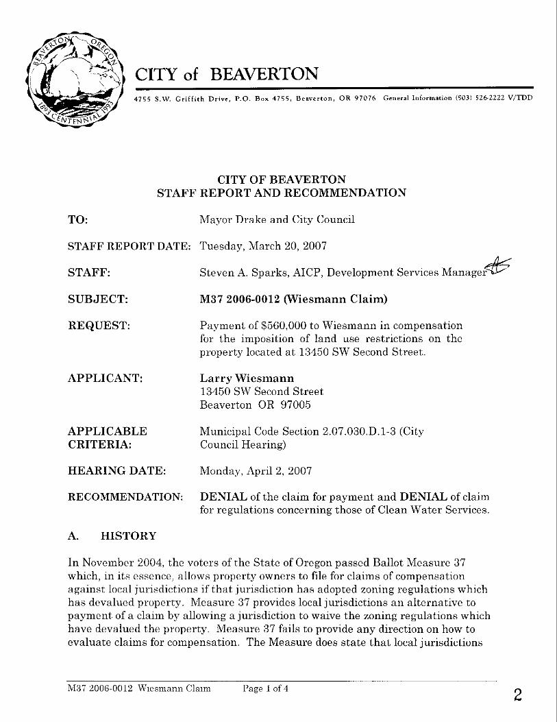
CITY of BEAVERTON 4 7 5 5 S.W. Griffith Drive, P.O. Box 4 7 5 5 . Beaverton , OR 9 7 0 7 6 G e n e r a l Informarion (5031 526-2222 V/TDD
CITY OF BEAVERTON STAFF REPORT AND RECOMMENDATION
TO: Mayor Drake and City Council
STAFF REPORT DATE: Tuesday, March 20, 2007
STAFF: Steven A. Sparks, AICP, Development Services Manager & SUBJECT: M37 2006-0012 (Wiesmann Claim)
REQUEST: Payment of $560,000 to Wiesmann in compensation for the imposition of land use restrictions on the property located a t 13450 SW Second Street.
APPLICANT: Larry Wiesmann 13450 SW Second Street Beaverton OR 97005
APPLICABLE Municipal Code Section 2.07.030.D.l-3 (City CRITERIA: Council Hearing)
HEARING DATE: Monday, April 2, 2007
RECOMMENDATION: DENIAL of the claim for payment and DENIAL of claim for regulations concerning those of Clean Water Services.
A. HISTORY
I n November 2004, the voters of the State of Oregon passed Ballot Measure 37 which, in its essence, allows property owners to file for claims of compensation against local jurisdictions if tha t jurisdiction has adopted zoning regulations which has devalued property. Measure 37 provides local jurisdictions a n alternative to payment of a claim by allowing a jurisdiction to waive the zoning regulations which have devalued the property. Measure 37 fails to provide any direction on how to evaluate claims for compensation. The Measure does state t ha t local jurisdictions
M37 2006-0012 W~esniann Claim Page 1 of 4 2

may establish procedures by which to process any claims, but claimants are under no obligation to follow such procedures. Under the terms of Measure 37, before December 4, 2006, a property owner is able to file a claim for compensation without having the jurisdiction enforce any land use regulation on the property owner.
On November 22, 2004, the Beaverton City Council adopted Ordinance 4333, amending the Municipal Code, which established procedures for the filing, evaluation, and resolution of claims filed pursuant to Measure 37. Mr. Wiesmann filed a claim with the City on December 5, 2006. In the claim, Mr. Wiesmann states tha t imposition of Clean Water Services (CWS) regulations on the property reduces the value of the property by $560,000. Mr. Wiesmann does not cite any City zoning regulations concerning the potential development of his property.
B. Subjec t P r o p e r t y
The subject property is located a t 13450 SW Second Street (also known as TLID# lS116AC04100). A vicinity map is attached to this report. The subject property is improved with a residence. The rear of the property is the south fork of Beaverton Creek.
C. Analysis of Cla im f o r Compensat ion
In the December 5, 2006 claim for compensation filed by Mr. Wiesmann, it asserts that the CWS requirement of a 50 foot buffer from the top of the bank of South Fork Beaverton Creek is the regulation devaluing the subject property. CWS is the special district in Washington County tha t implements the Clean Water Act and attempts to protect the health and safety of the public, including the prevention of the waters of the Tualatin River Basin, through adoption of sanitary sewer and storm sewer regulations. The City does not have any authority under state law to override CWS's regulations, or to permit activities that CWS' regulations prohibit. Mr. Wiesmann's claim implies tha t the City is liable for the regulations adopted by CWS because the City requires a service provider letter from CWS for any new development. Regardless of the City requiring a service provider letter from CWS, Mr. Wiesmann's claim for compensation is misdirected a t the City since the development regulations are from CWS and since CWS has the independent authority to enforce its regulations.
D. Timeliness of Claim
ORS 197.352(5) requires tha t a written demand for compensation be made:
1. For claims arising from land use regulations enacted prior to the effective date of Measure 37 (December 2, 2004), within two years of tha t effective date, or the date the public entity applies the land use regulation as an
M37 2006-0012 Wiesmann Claim Page 2 of 4 3

approval criteria to an application submitted by the owner, whichever is later; or
2. For claims arising from land use regulations enacted after the effective date of Measure 37 (December 2, 2004), within two years o f the enactment o f the land use regulation, or the date the owner of the property submits a land use application in which the land use regulation is an approval criteria, whichever is later.
S ta f f Finding: Since the two year deadline for filing claims fell on Saturday December 2, 2006, the City accepted claims filed by Monday December 4, 2006. The claim was submitted to the City on December 5, 2006 as shown by the received date stamp on the application. This date is after the two years o f the effective date o f Measure 37. The City has not enforced any land use regulation on Mr. Wiesmann or the subject property. Mr. Wiesmann has not submitted any land use applications. Therefore, the claim is not timely filed. O n this fact alone, the City has no obligation to compensate Mr. Wiesmann or waive any City land use regulation.
E. C l a i m Eva lua t ion Cr i ter ia
Because the claim was not filed on or before December 4, 2006, the evaluation criteria are not applicable since the claim is not valid. Therefore, s ta f f have not prepared any findings to address the evaluation criteria.
Section 2.07.025.D o f the Municipal Code specifies how a claim for compensation will be evaluated by the City Council. The criteria are as follows:
The Council shall determine whether the following criteria have been met:
1. The application is complete;
2. The claimant is a qualifying Property Owner under Measure 37 as follows: a. The subject property is located within the City and is subject to the
ordinance or regulation, which is the basis of the application for claim; b. The use which the claimant alleges is restricted under a City regulation
and does not constitute a nuisance; c. The City regulation is not required aspart of any federal requirement
and is not an exempt regulation; d. The owner of the property as shown on the application was the owner of
theproperty prior to the date the regulation was adopted, first enforced or applied;
e. There is substantial evidence to support the claim of reduction i n the fair market value of the subject property;
M37 2006-0012 Wiesmann Claim Page 3 of 4 4

f. The amount of compensation claimed or determined to be potentially due;
g. The availability of public financial resources to pay the claim in consideration of competingpriorities in the public interest;
h. The impact of waiving enforcement of the regulation(s) or otherwise permitting the use on other properties and the public interest; and
z . Such other factors as are determined to be in the interest of theproperty owner and the public to consider to adjudicate the claim.
3. The cited regulation(s) reduce the fair market value of theproperty and entitle the Owner to compensation or waiver of enforcement of the regulation pursuant to Measure 37.
F. Recommendation
Mr. Wiesmann has not provided the City with evidence of how the City has applied or enforced any regulations on the development of his property. Further, Mr. Wiesmann has not provided the City with a development proposal which illustrates how the City's regulations would prevent him from achieving his development goals for the subject property. Moreover, Mr. Wiesmann has failed to file his claim in a timely manner a s specified by Measure 37. Therefore, based on the facts and findings outlined in this report, staff recommend tha t the Council deny the request for compensation and not grant a waiver of land use regulations applicable to the subject property.
G. Exhibits
1. Filed Claim application form dated December 5, 2006.
M37 2006-0012 W~esmann Claim Page 4 of 4 5

CITY OF BEAVERTON ..C'omrnunlty Development Department Develapment Selvices Division 4755 SW Griffith Drive PO Box 4755 Beaverton, OR. 97076 Tel: (503) 526-2420
CHECWCASH.
PROPERTY OWNER(S): Atta dditional sheet if necessary d i c k box if ~i-imaly Contact
COMPANY: ADDRESS: (CITY, STATE, ZIP) B~~&,-ad oh
-... E-MAIL: CONTACT:
SIGNATURE: SIGNATURE:
(Original Signature Required) (Original Signature Required)
~. . . .
REPRESENTATIVE: ',,. 0 Check box if Primary Contact COMPANY: \.
x.. -- ADDRESS: "1, ,_I,
*./'
(CIPI, STATE, ZIP) x ....
PHONE: FAX: E-MAIL: SIGNATURE: CONTACT:
(OriginaiSignature Required)
PROPERTY INFORMATION (REQUIRED)
SITE ADDRESS:>/~.+,I n 2 r J -A/ .zyr CONTIGUOUS SITES UNDER S A M E OWNERSHIP:
ASSESSOR'S MAP 8 TAX LOT # LOT SlZE ZONING DISTRICT ASSESSOR'S MAP 8 TAX LOT # LOT SlZE ZONING DISTRICT
,Lid14 cn ~ D A
PRE-APPLICATION DATE:/$= &)n P Measure 37 Claim Form

CITY OF BEAVERTON MEASURE 37 CLAIM FORM . . .. Community ~evelo6me'nt Depaiiment Development Services Division 4755 SW GrifRUI Drive PO Box 4755 RECEIVED Beaverton, OR. 97076 Tel: (503) 526-2420 DEC 0 5 2006 Fax. (503) 526-3720 www.ci.beavelton.or.us Cit of Beaverton
Deve / opment Services
MEASURE 37 CLAIM SUBMITTAL CHECKLIST
Submi t two (2) copies of t he fol lowing information: /
P A . The names and street addresses of the record owners of property on the most recent property tax assessment roll and within 500 feet of the subject property (Beaverton Code Section 2.07.015.C.3).
d B . A copy of the land use order in which the City enforced its regulations on an application for a use on the property or a copy of the citation for a violation of a land use regulation for activities on the property. (Beaverton Code Section 2.07.015.C.10).
Title Report and Proof of Ownership issued within 30 days of submittal of the Measure 37 claim. The report must include names of all persons or entities with legal, equitable and secure interest in the
, property and the dates the ownership were established (Beaverton Code Section 2.07.015.C.4).
ide.tifi;ation of the Regulation for w i i c h enforcement h i s occurred and the claim is being mide. identlficatlon must be by number of section the law, rule, ordinance, resolution, goal or other enforceable enactment, or a copy of the regulation forwhich claim is submitted as contained In Measure 37 Ordinance No. 4333 (Beaverton Code Section 2.07.015.C.5).
Written description addressing the approval criteria, including land use that was applied for and the results of that application (Beaverton Code Section 2.07.015.C.6).
& Amount of Claim b &@ 0 (Beaverton Code Section 2.07.015.C.7).
v
Appraisal Report for subject property showing reduction in the fair market value as defined by Measure 37 Ordinance No. 4333 (Beaverton Code Section 2.07.015.C.7).
5. A statement, including analysis, as to why the regulations are not exempt from application for compensation under Measure 37 (Beaverton Code Section 2.07.015.C.9).
All other documents, information or argument to be relied upon by the claimant in support of the application (Beaverton Code Section 2.07.015.C.11).
Application Fee, as established by the City Council (Beaverton Code Section 2.07.015.C.12).
I have provided all the items required by this one (1) page submittal checklist. I understand that any missing information, omissions or both may result in the application being deemed incomplete, which may lengthen the time required to process the application. The information submitted is true and complete to the best o f my knowledg? and belief. I hereby waiye any claims for regulations not identified herein with this claim.
o$-Ov Y 3 V Telephone Number
/d - 4'-6' L Date
Measure 37 Clalm Form 12/2/2004 7

- -
AGENDA BlLL Beaverton City Council
Beaverton, Oregon 04-02-07
SUBJECT: An Ordinance Granting A Non-Exclusive FOR AGENDA BILL NO: 07059 Cable Franchise to Verizon Northwest Inc.
Mayor's Approval: . .
DEPARTMENT OF ORlGl /tw/ h Ltorney
DATE SUBMITTED: 3-13-07
CLEARANCES:
PROCEEDING: ~isrmaamg- EXHIBITS: Ordinance Cable Franchise Agreement
Second Reading and Passage
BUDGET IMPACT EXPENDITURE AMOUNT APPROPRIATION REQUIRED $0 BUDGETED $0 REQUIRED $0
HISTORICAL PERSPECTIVE:
Verizon Northwest Inc, a Washington corporation, is proceeding to upgrade its copper wire telephone service in Beaverton and elsewhere in the United States to a service using fiber optic cable. The new service makes for greater capacity and higher speed transmission, allowing Verizon to transmit "cable television" and other video content using the same cable that will transmit telephone services. Federal law allows local governments to require separate agreements for use of public right of way for telephone service and cable television service notwithstanding that both services are transmitted over the same cable. Verizon has worked with MACC staff in the past year to negotiate this proposed cable television franchise and MACC staff has regularly briefed this office on their progress and the contents of the franchise. The MACC Board, including City Councilor Cathy Stanton, now has enacted a resolution that endorses the attached franchise and recommends that each member city enact it. The MACC Board acted by majority vote as Verizon will not presently offer the cable television service to a few of the smaller member cities, for reasons that will be explained in the work session.
INFORMATION FOR CONSIDERATION:
MACC's bylaws require that all member cities as to whom Verizon seeks a franchise must enact the very same franchise or if not, the franchise must be renegotiated. MACC staff will inform the Council of actions taken by other member cities to date; none of them have rejected the franchise nor have sought different terms. We have reviewed the terms of the franchise and find it acceptable as to legal form.
RECOMMENDED ACTION:
f ir+fhding Second Reading and Passage
Agenda Bill No: 07059

ORDINANCENO. 4433
AN ORDINANCE GRANTING A NON-EXCLUSIVE CABLE FRANCHISE TO
VERIZON NORTHWEST INC.
WHEREAS, in 1980 the Metropolitan Area Communications Commission (hereinafter "MACC") was formed by Intergovernmental Cooperation Agreement, amended in 2002 and now an Intergovernmental Agreement (hereinafter IGA) to enable its member jurisdictions to work cooperatively and jointly on communications issues, in particular the joint franchising of cable services and the common administration and regulation of such franchises, and the City of Beaverton is a member of MACC; and
WHEREAS, the IGA authorizes MACC and its member jurisdictions to grant one or more nonexclusive franchises for the construction, operation and maintenance of a cable service system within the combined boundaries of the member jurisdictions; and
WHEREAS, the IGA requires that each member jurisdiction to be served by the proposed franchisee must formally approve any cable service franchise; and
WHEREAS, Verizon Northwest Inc. has formally requested a franchise with MACC and several of its member jurisdictions, and MACC has reviewed the franchisee's qualifications in accordance with federal law; and
WHEREAS, the Board of Commissioners of MACC, by Resolution 2007-01 adopted on the 8th day of February, 2007, recommended that affected member jurisdictions grant a franchise to Verizon Northwest Inc. in the form attached hereto as Exhibit "A": and
WHEREAS, the Council finds that approval of the recommended franchise is in the best interest of the City and its citizens, in order to provide opportunities for effective competition in the provision of these services consistent with the federal Telecommunications Act of 1996;
NOW THEREFORE,
THE CITY OF BEAVERTON ORDAINS AS FOLLOWS:
Section 1. The City grants to Verizon Northwest Inc. a non-exclusive franchise on the terms and conditions contained in Exhibit "A". This nonexclusive mant authorizes the ~rovision of cable services within the jurisdictional boundaries of the City asihose boundaries presently exist or may be amended, commencing upon Verizon's fulfillment of the franchise acceptance provisions contained in the franchise andupon the formal determination by the MACC - Administrator that all affected jurisdictions have approved the franchise, and ending fifteen years thereafter.
4433 Ordinance No. - Page 1 of 2
Agenda Bill No. 07059

Section 2. The grant of franchise at Section 1 is conditioned upon each of the following events:
(a) The affirmative vote of the governing body of each MACC member jurisdiction to be served under the franchise:
(h) Verizon's fulfillment of the franchise acceptance provisions contained in the franchise; and
(c) Formal written determination by the MACC Administrator that each of the above two events has occurred.
First reading this lgth dayof March ,2007.
Passed by the Council this day of ,2007.
Approved by the Mayor this day of ,2007
ATTEST: APPROVED:
SUE NELSON, City Recorder ROB DRAKE, Mayor
Ordinance No. 4 4 3 3 - Page 2 of 2 Agenda Bill No. 07059