civil pnt policy and utility - global positioning system · affect the performance of a significant...
TRANSCRIPT

1
Civil PNT Policy and Utility
Civil GPS Service Interface CommitteeU.S. States and Local Government Subcommittee
Sacramento, CAAugust 23, 2011
Timothy A. KleinSenior Policy Advisor/RITA NDGPS Coordinator

2
GPS is a Critical Component of the Global Information Infrastructure
2
SatelliteOperations
Power Grids
Personal Navigation
Communications
Aviation
Fishing &BoatingOil Exploration
Trucking & Shipping
Surveying & MappingPrecision Agriculture
Disease Control

3
Surveying, Mapping, GISSurveying is essential to any new development□ Electrification□ Telecom tower placement□ Pipeline installation□ Dam construction□ Port dredgingGPS enables 2-5 cm real-time positioning accuracy (RTK)□ Mm-level accuracy possible with
post-mission data processing100%-300% savings in time, cost, labor□ Stakeless, paperless surveys

4
Construction, MiningFaster site preparationEnhanced management of assets, equipment□ More efficient asset utilization□ Less idling of workers, machineryPrecise automated machine control□ Up to 70% increased job site productivity□ Saves time, fuel, and emissions□ Reduces maintenance□ Prevents accidentsAutomated, wireless job tasking□ Smaller, more empowered workforce –
no foreman□ Real-time progress tracked remotely

5
AgricultureImproved management of land, machinery, personnel, time□ Optimized placement of crop rows, seeds□ Enhanced monitoring of crop yields, soil quality,
problems□ Automated, 24-hour operations using lighter
equipment, less fuel, less laborPlant-specific applications of water, fertilizer, pesticides, herbicides□ Up to 80% increase in efficiencyGreater crop yields, profit marginsEnvironmental benefits□ Reduced chemical use□ Precise leveling of fields reduces runoff□ Strip tillage/no tillage releases less CO2□ Reduced CO2 emissions from lighter, more
efficient machinery

6
TimingGPS offers an inexpensive alternative to high-maintenance timing equipment, networksSynchronization, management of communication networks□ Phones, pagers, wireless systems□ LANs, WANs, Internet, satellites□ Cell phone tower handoffs□ Digital TVFinancial transactions□ Stock exchanges□ ATMs□ E-commercePower grid management□ Load balancing□ Fault detection, location
7
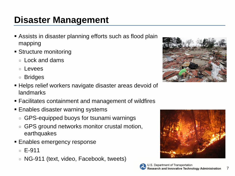
Disaster ManagementAssists in disaster planning efforts such as flood plain mappingStructure monitoring□ Lock and dams□ Levees□ BridgesHelps relief workers navigate disaster areas devoid of landmarksFacilitates containment and management of wildfiresEnables disaster warning systems□ GPS-equipped buoys for tsunami warnings□ GPS ground networks monitor crustal motion,
earthquakesEnables emergency response□ E-911□ NG-911 (text, video, Facebook, tweets)

8
Environmental Stewardship
Climate monitoring□ Sea level rise measurements□ Ice sheet change observations□ Atmospheric moisture profilesReduced greenhouse gas emissions□ Efficient routing of aircraft, trucks, and other vehicles□ Reduction of vehicle fleet idle timesOil and chemical spill cleanup□ Positioning, modeling of spills to guide remediation effortsCommercial fishing□ Enforcement of fishery boundariesForestry□ Safe and efficient lumbering□ Monitoring of illegal deforestationHarbor and inland waterway dredging□ Maintain/improve transportation channels□ Dredge and dispose

9
New Applications Appear Every Day
Mobile applications□ Location based servicesLocalized GIS datasetsPersonal, pet safetyGPS radio occultationRoad use taxation

10
FAA GPS Augmentation Programs

11
WAAS Architecture
38 Reference Stations
3 Master Stations
4 Ground Earth Stations
(2+1) Geostationary Satellite Links
2 Operational Control Centers
Telesat107°W
Intelsat133°W
4F3 98° W

12
Nationwide Differential GPS
Expansion of maritime differential GPS (DGPS) network to cover terrestrial United StatesBuilt to international standard adopted in 50+ countries

13
National Continuously Operating Reference Stations (CORS)
Enables highly accurate, 3-D positioning□ Centimeter-level precision□ Tied to National Spatial
Reference System1,500+ sites operated by 200+ public, private, academic organizations
NOAA’s Online Positioning User Service (OPUS) automatically processes coordinates submitted via the web from around the worldOPUS-RS (Rapid Static) declared operational in 2007NOAA considering support for real-time networks

14
GPS-Based Applications are Critical to Major DOT Initiatives
Reliable and accurate positioning worldwide
Reduced delaysMore fuel-efficient routesIncreased system capacity with
enhanced safety
Aviation – NextGen
ITS/Connected Vehicle
Rail – Positive Train ControlReduced probability of collisions Increased efficiency and
capacityRapid rail structure and
conditioning mapping
Enable crash prevention among vehicles and between vehicles and infrastructure
Increased mobility and reduced environmental impact

15
What Are We Trying to Get to?• Intelligent Transportation Systems (ITS) Safety Applications for all Surface
Modes of Transportation– Leverage technology to make vehicles discoverable to other vehicles,
infrastructure, and pedestrians– Enable 360° situational awareness to the vehicle and driver
• Intelligent Railroad Systems– Assessing HA-NDGPS for meeting requirements
• Positive Train Control• Track Defect Location• Automated Asset Mapping/Surveying

16
Where are States Trying to Get to?• GPS Enforcement of Designated Truck Routes
– Illinois State Legislature required study– Illinois DOT study makes eight recommendations for truck GPS systems
• Vertical clearance• Weight restrictions• Communications and enforcement of truck GPS systems
• Automated Vehicle Location (AVL) Systems for Data Collection– 2011 VDOT Survey
• Road weather management systems• Near-real-time road conditions• Mapping noxious weed control• Tracking incarcerated workers
17
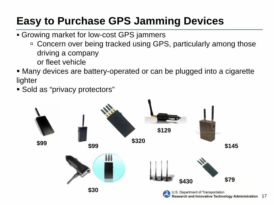
Easy to Purchase GPS Jamming DevicesGrowing market for low-cost GPS jammers
Concern over being tracked using GPS, particularly among those driving a company or fleet vehicle
Many devices are battery-operated or can be plugged into a cigarette lighter
Sold as “privacy protectors”
$99 $99$320
$129
$145
$30$79$430

18
Affect of GPS Jamming Devices
RFI source “Locked-on” and pursued.
On Site ON-OFF tests confirms GPS RFI source.

19
The Way AheadLightSquared agrees that transmissions in the upper 10 MHz channel —the channel nearest to the 1559-1610 MHz GPS band —will adversely affect the performance of a significant number of legacy GPS receivers.
LightSquared’s Proposed Solution
–First, it will operate at lower power than permitted by its existing FCC authorization.
•LightSquared ATC stations during Las Vegas Live Sky Tests were transmitting at 10% of FCC authorized power (32 dBW). They intend to operate in the lower 10 MHz block of their network at this power level for an undefined period of time.
–Second, LightSquared will agree to a temporary standstill in the terrestrial use of its upper 10 MHz of its frequencies immediately adjacent to the GPS band.
LightSquared

20
LightSquared (2)
--Six months into the standstill period, LightSquared will commence a process of working with the Commission (FCC) and NTIA to explore options to enable mutual GPS and LightSquared operations at/near the band borders.“
•Third, LightSquared will commence terrestrial commercial operations only on the lower 10 MHz portion of its spectrum.
–They will coordinate and share the cost of underwriting a workable solution with GPS manufacturers of legacy precision measurement devices that may be at risk.
-- LightSquared still plans to use the lower 10 to deliver service within two years, much shorter than the projected time to research/replace high-precision receivers and dependent systems.

21
LightSquared (3)
The Coalition to Save Our GPS States:•Until it can be conclusively shown that there will be no interference to critical GPS uses, LightSquared should not be allowed to deploy in the upper or lower MSS band.•The Coalition further notes that ― LightSquared already owns valuable high quality spectrum assets, including 59 MHz of nationwide ubiquitous spectrum in an advantageous frequency position.”•On June 30 the FCC issued a Notice seeking public comment on the three LightSquared recommendations. Comments were filed by July 30 and reply comments by August 15, 2011.

22
LightSquared (4)
Projected transportation impacts:
• FAA/RTCA assessment projects over ten years –• $70 Billion impact to industry in re-equipage• Loss of 800 lives due to safety impacts• Significant NextGen delay, $17 billion cost
• FRA assessment projects over ten years –• Loss of $15 billion in productivity costs• Significant Positive Train Control delay; $5.3 billion cost
• MARAD assessment projects over ten years --• $30 billion in hull, cargo and oil pollution costs from ship
groundings and collisions• Indeterminate loss of life, economic losses

23
LightSquared (5)
Projected transportation impacts:• Highway/transit assessment projects over ten years –
• $1.4 Billion impact to industry and state/local agencies• Loss of lives due to safety impacts• Significant ITS deployment delays, $2 billion cost
Department of Transportation:• Supports NTIA’s request to FCC for delay in approval until testing
complete on lower 10 scenario• Committed to working with all parties to find a technical solution that
supports the National Broadband Plan and GPS safety requirements
Dish Network Filing:• Relies on LightSquared waiver; again not ancillary• Uses S-band [2GHz], not L-band, so no GPS issues