climate change in nuiqsut, alaska - alaska native tribal ... · climate change in nuiqsut, alaska...
TRANSCRIPT

Climate Change in Nuiqsut, AlaskaStrategies for Community Health
ANTHC Center for Climate and Health
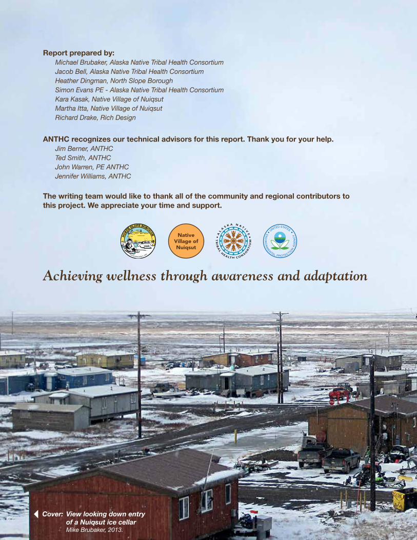
Report prepared by:Michael Brubaker, Alaska Native Tribal Health ConsortiumJacob Bell, Alaska Native Tribal Health ConsortiumHeather Dingman, North Slope BoroughSimon Evans PE - Alaska Native Tribal Health ConsortiumKara Kasak, Native Village of NuiqsutMartha Itta, Native Village of NuiqsutRichard Drake, Rich Design
ANTHC recognizes our technical advisors for this report. Thank you for your help.Jim Berner, ANTHCTed Smith, ANTHCJohn Warren, PE ANTHCJennifer Williams, ANTHC
The writing team would like to thank all of the community and regional contributors to this project. We appreciate your time and support.
Achieving wellness through awareness and adaptation
Cover: View looking down entry of a Nuiqsut ice cellar
Mike Brubaker, 2013.
NativeVillage ofNuiqsut
United States Environmental Protection Agency
United States Environmental Protection Agency

Nuiqsut in May. Jake Bell, 2014
TABLE OF CONTENTSIntroduction 1 Community – People of the Colville River 3 Ecosystem – a system in change 7 Climate – the new Arctic 9Findings Weather – going to extremes 13 Land – a fragile landscape 15 River – a growing Colville 19 Subsistence – the best of both worlds 23 Ice Cellars – preserving an Inupiat tradition 27 Infrastructure – a slow moving disaster 31Summary 33Conclusion 35
Figures 1. North Slope Borough 22. Nuiqsut area and region 63. Nuiqsut Mean Monthly Temperature 104. Nuiqsut Mean Monthly Precipitation 115. Climate Change Health Assessment Summary of Findings 36 Appendices A. Ice Cellar Conceptual Design 37B. Community and Regional Contributors 39C. Climate and Health Web Resources 40D. Acronyms 41
References 42

1
This Climate Change Health Assessment was performed based on requests from tribal health representatives and from local and regional leadership. Information about local climate, environment, and health conditions was gathered with the help of local and regional government, universities, industry, and state and federal agencies.
Climate change refers to change over time due to natural variability or as a result of human activity (IPCC, 2008). Today the term is mostly used to describe global changes caused by the burning of fossil fuels and the warming effect caused by the transfer of enormous quantities of carbon dioxide from the earth to the air. But climate change also has local implications and communities seek adaptive strategies that encourage wellness and sustainability. The North Slope of Alaska is characterized by permafrost and ice. The wildlife, vegetation and people have specially adapted to live in an environment that is mostly cold and frozen. But because of warming, the environment is rapidly changing and a new Arctic is emerging, characterized by thawing land, open water and a longer warm season. For residents of the North Slope this means new challenges in building and maintaining infrastructure, for providing local services, collecting food and water, and safely navigating the land and seascape. It also means new opportunities for subsistence, land use, transportation, commerce and development. Understanding local effects is the first step in finding a healthy course through the changes and challenges ahead.
This climate change health assessment project was initiated in 2013 by the North Slope Borough, Health Impact Assessment (HIA) program with a grant from the National Petroleum Reserve-Alaska. Supplemental funding was provided by the U.S. Environmental Protection Agency. The project is in collaboration with the Alaska Native Tribal Health Consortium (ANTHC), Center for Climate and Health, and participating local governments. ANTHC
performed a prior assessment in Point Hope in 2009 with funding from the U.S. Indian Health Service.
Under the current project, baseline information on climate change vulnerabilities was compiled for all of the communities in the North Slope Borough, but with a special focus on Wainwright, Barrow, Atqasuk and Nuiqsut. Mike Brubaker, 2013.
INTR
ODU
CTIO
N

2
Figure 1. North Slope Borough.
A project team was established to perform on-site visits and to coordinate with local and regional experts. The team included Heather Dingman from North Slope Borough and Jake Bell and Mike Brubaker from ANTHC. Site visits were performed in Nuiqsut in June 2013 and in April 2014. The survey and report preparation was based on guidance from the village council, city council and the project team. Information sources include observations of local residents, reports from government agencies, and scientific findings gathered from published sources.
Nuiqsut residents recalled the lessons of their elders, who told them about a time to come that would bring warming and hardship (Annie Lampe; Archie Ahkiviana). Similar premonitions have been reported in other villages across the North Slope. Climate change is occurring now and is certainly bringing new challenges to traditional ways of life. But in some ways and in some places, it is also bringing new opportunity. Understanding local impact of climate change is important for assessing both the negative and positive effects, and for developing appropriate adaptation strategies. Residents report unprecedented changes to the weather, seasons, land and seascape, plants, wildlife and infrastructure with important implications for public health. These change raise new concerns about food and water security, safety and mental health related to the stress of adapting to a new climate and changing environment.
This report includes observations, experience and knowledge shared by a wide range of local experts. Predictions and projections on future conditions such as climate, flooding, and erosion are based on available information and limited by the quality of current scientific data and the uncertainties inherent in models. Research and model development is ongoing in Alaska and new information will be available in the near future.
Nuiqsut
3
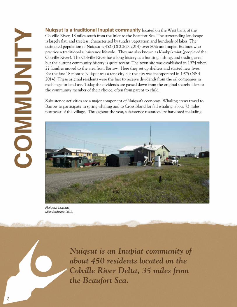
Nuiqsut is a traditional Inupiat community located on the West bank of the Colville River, 18 miles south from the inlet to the Beaufort Sea. The surrounding landscape is largely flat, and treeless, characterized by tundra vegetation and hundreds of lakes. The estimated population of Nuiqsut is 452 (DCCED, 2014) over 80% are Inupiat Eskimos who practice a traditional subsistence lifestyle. They are also known as Kuukpikmiut (people of the Colville River). The Colville River has a long history as a hunting, fishing, and trading area, but the current community history is quite recent. The town site was established in 1974 when 27 families moved to the area from Barrow. Here they set up shelters and started new lives. For the first 18 months Nuiqsut was a tent city but the city was incorporated in 1975 (NSB 2014). These original residents were the first to receive dividends from the oil companies in exchange for land use. Today the dividends are passed down from the original shareholders to the community member of their choice, often from parent to child.
Subsistence activities are a major component of Nuiqsut’s economy. Whaling crews travel to Barrow to participate in spring whaling and to Cross Island for fall whaling, about 73 miles northeast of the village. Throughout the year, subsistence resources are harvested including
Nuiqsut is an Inupiat community of about 450 residents located on the Colville River Delta, 35 miles from the Beaufort Sea.
Nuiqsut homes. Mike Brubaker, 2013.
COM
MUN
ITY
4
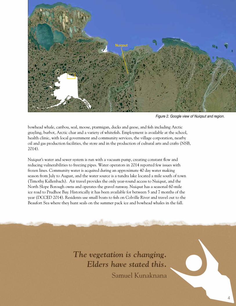
bowhead whale, caribou, seal, moose, ptarmigan, ducks and geese, and fish including Arctic grayling, burbot, Arctic char and a variety of whitefish. Employment is available at the school, health clinic, with local government and community services, the village corporation, nearby oil and gas production facilities, the store and in the production of cultural arts and crafts (NSB, 2014).
Nuiqsut’s water and sewer system is run with a vacuum pump, creating constant flow and reducing vulnerabilities to freezing pipes. Water operators in 2014 reported few issues with frozen lines. Community water is acquired during an approximate 40 day water making season from July to August, and the water source is a tundra lake located a mile south of town (Timothy Kallenbach). Air travel provides the only year-round access to Nuiqsut, and the North Slope Borough owns and operates the gravel runway. Nuiqsut has a seasonal 60-mile ice road to Prudhoe Bay. Historically it has been available for between 5 and 7 months of the year (DCCED 2014). Residents use small boats to fish on Colville River and travel out to the Beaufort Sea where they hunt seals on the summer pack ice and bowhead whales in the fall.
Figure 2. Google view of Nuiqsut and region.
Nuiqsut
The vegetation is changing. Elders have stated this.
Samuel Kunaknana
5
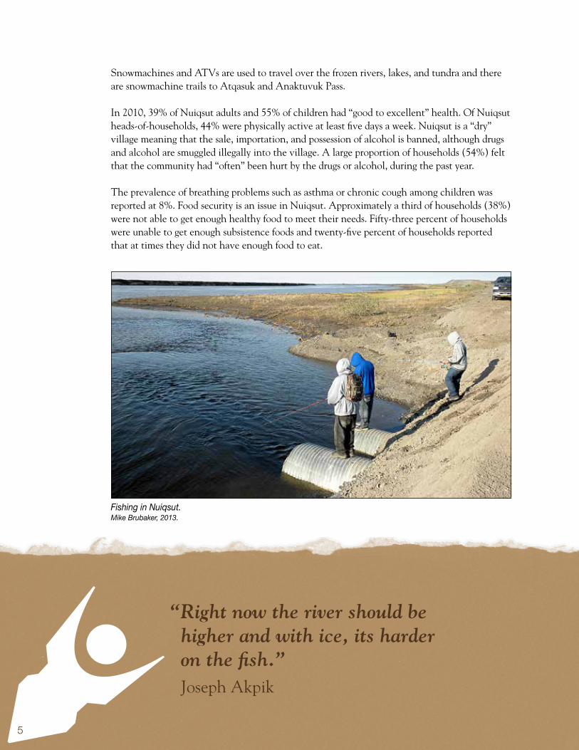
Snowmachines and ATVs are used to travel over the frozen rivers, lakes, and tundra and there are snowmachine trails to Atqasuk and Anaktuvuk Pass.
In 2010, 39% of Nuiqsut adults and 55% of children had “good to excellent” health. Of Nuiqsut heads-of-households, 44% were physically active at least five days a week. Nuiqsut is a “dry” village meaning that the sale, importation, and possession of alcohol is banned, although drugs and alcohol are smuggled illegally into the village. A large proportion of households (54%) felt that the community had “often” been hurt by the drugs or alcohol, during the past year.
The prevalence of breathing problems such as asthma or chronic cough among children was reported at 8%. Food security is an issue in Nuiqsut. Approximately a third of households (38%) were not able to get enough healthy food to meet their needs. Fifty-three percent of households were unable to get enough subsistence foods and twenty-five percent of households reported that at times they did not have enough food to eat.
“Right now the river should be higher and with ice, its harder on the fish.”
Joseph Akpik
Fishing in Nuiqsut.Mike Brubaker, 2013.

6
Aerial view of Nuiqsut.Mike Brubaker, 2013.
“The school is going to erode. The elders said this long ago.”
Jonah Nukapigak
7
“Its hard to adapt to when its all happening so fast, you adapt and it changes again.”
Bruce Nukapigak
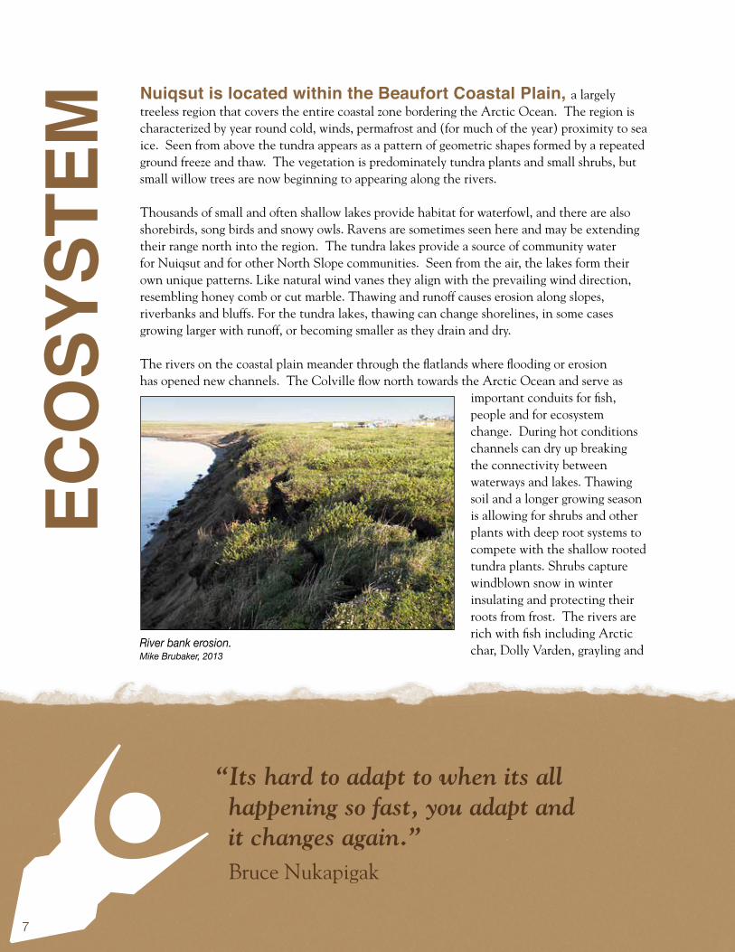
Nuiqsut is located within the Beaufort Coastal Plain, a largely treeless region that covers the entire coastal zone bordering the Arctic Ocean. The region is characterized by year round cold, winds, permafrost and (for much of the year) proximity to sea ice. Seen from above the tundra appears as a pattern of geometric shapes formed by a repeated ground freeze and thaw. The vegetation is predominately tundra plants and small shrubs, but small willow trees are now beginning to appearing along the rivers.
Thousands of small and often shallow lakes provide habitat for waterfowl, and there are also shorebirds, song birds and snowy owls. Ravens are sometimes seen here and may be extending their range north into the region. The tundra lakes provide a source of community water for Nuiqsut and for other North Slope communities. Seen from the air, the lakes form their own unique patterns. Like natural wind vanes they align with the prevailing wind direction, resembling honey comb or cut marble. Thawing and runoff causes erosion along slopes, riverbanks and bluffs. For the tundra lakes, thawing can change shorelines, in some cases growing larger with runoff, or becoming smaller as they drain and dry.
The rivers on the coastal plain meander through the flatlands where flooding or erosion has opened new channels. The Colville flow north towards the Arctic Ocean and serve as
important conduits for fish, people and for ecosystem change. During hot conditions channels can dry up breaking the connectivity between waterways and lakes. Thawing soil and a longer growing season is allowing for shrubs and other plants with deep root systems to compete with the shallow rooted tundra plants. Shrubs capture windblown snow in winter insulating and protecting their roots from frost. The rivers are rich with fish including Arctic char, Dolly Varden, grayling and
ECO
SYST
EM
River bank erosion.Mike Brubaker, 2013

8
“There are willow stands that are now so deep and tall that it prevents the
caribou from migrating.” Rosemary Ahtuantaruak
a variety of white fish. Climate related challenges for fish include, early snowmelt, lower late season water levels and higher temperatures. Turbidity and habitat change are also concerns as thaw-related bank erosion increases sediment deposits, and beveling occurs as cut banks collapse and fill the river bed. Sediments deposited from the banks are transferred downstream, swallowing the river and limiting travel by boat.
The sea ice becomes a virtual extension of the coastal plain in winter providing access for polar bears and people to travel and hunt from the ice. Ice seals inhabit the coastal zone along with walrus. Bowhead, beluga and grey whale migrate along the coast in the spring and return south in the fall. Under the water, salmon, sheefish, crab and cod are present and fished at different times of the year. King salmon and silver salmon are emerging as new species in the region, and gradually becoming appreciated as subsistence resources (Craig George).
The coastal plain hosts huge herds of caribou in summer when they migrate towards the coast for calving, grazing and to seek relief from insects. In their wake comes a variety of predators and scavengers including wolves, Arctic fox and grizzly bear. Porcupine, beaver, lynx and coyotes are reported in the region, with increasing frequency. Red foxes are coming north and raising concerns about competition with smaller less aggressive Arctic foxes, and the spread of rabies. Climate related threats to caribou include wildfire and freezing rain that can reduce forage areas, and higher air temperatures that can cause heat stress. Musk oxen face their own climate related threats, coastal storm surge that have trapped and drowned entire herds. Small mammals in the region include lemmings, ground squirrels and voles. Low snow years such as the winter of 2014 can be hard on these ground dwellers, and animals that hunt them for prey. High snow years like 2013 are hard on the larger mammals like moose and caribou.
Aerial view of tundra outside Nuiqsut.Mike Brubaker, 2013

9
“In about 97’, 98’ it rained in November and my snow machine went through the ice. Nine other people broke through including two elders. I had never heard of elders breaking through before.”
Rosemary Ahtuangaruak
A new Arctic. Community members report that historically the timing for the warm up and thaw in Nuiqsut was in the first part of June. In 2014 the thaw began in April (Eli Nukapigak). Historically, a typical winter “cold spell” could run to -50oF below and last for 2 months. More recently the cold spells have been averaging -15oF to -20oF (Eli Nukapigak). Abnormal wind patterns have been occurring in most North Slope communities, including Nuiqsut. The spring of 2014 brought a lot of abnormal south wind to the area (Joseph Akpik) In general, a west wind is becoming more common in the springtime instead of the historical East winds (Eli Nukapigak). Warming temperature is one of the factors causing residents to ask whether they are witnessing the emergence of a new climate era. The climate in Nuiqsut is “arctic” characterized by cold dry winters and cool summers.
CLIM
ATE
Thin ice and open water.Jake Bell, 2014.

10
“The wind has been changing, west wind in the spring instead of east.”
Eli Nukapigak
Temperatures have historically ranged from -56 to 78° Fahrenheit. On average, the daily minimum temperature is below freezing 297 days each year. Precipitation is generally light, averaging only about 5 inches annually as rain and about 20 inches as snowfall. Despite low precipitation the land is covered with water - ice and snow in winter, lakes and wetlands in summer. This is because permafrost acts as a barrier and prevents water from dissipating into the ground. This however, is changing as shallow permafrost is diminished and the thaw zone grows with each passing year. The Chukchi Sea has traditionally been ice-free from mid-July through September (NSB 2009). However, the ice-free period is increasing and local hunters travel by boat as early as May and as late as November.
At the National Weather Service station in Barrow, the average annual temperature has increased by 4.9 degrees Fahrenheit (1949-2012). The biggest increase has occurred during the winter, 7.3 degrees compared with the (still large) increase of 3.2 degrees during the summer (Alaska Climate Research Center). Between 1958 and 1997 the average number of days in August that exceeded 39 degrees was about 1.2, while between 1998 and 2013 the number increased to 5.9 days. In 2003 there were twenty five days above the 39 degree mark (SNAP 2014).
Figure 3. Historic & Projected Average Monthly Temperature, Nuiqsut, Alaska.UAF, Scenarios Network for Alaska & Arctic Planning, 2013.

11
“March used to be part of winter.” Annie Lampe
Figure 4. Historic & Projected Average Monthly Precipitation, Nuiqsut, Alaska.UAF, Scenarios Network for Alaska & Arctic Planning, 2013.
Average monthly temperature and precipitation trend data is available for Nuiqsut and the models compare temperatures from 1961 to 1990 with projected temperatures from 2010 to 2019. The projection is that average monthly temperatures will increases in every month (see Figure 3) with the largest increases occurring during the winter. Precipitation change is projected in eight out of twelve months; the biggest change occurs during July and August. Precipitation levels are expected to remain mostly unchanged in the spring and the fall. See Figure 4 (SNAP 2014).
The long-term projections are for continued warming and variations in the timing of freeze-up, break-up, and green-up. Continued increase in the length of the ice free season and the frequency and intensity of extreme weather are also expected. Precipitation is expected to increase significantly in summer with smaller changes in other seasons. More rain is expected in the shoulder seasons with winter rain also occurring periodically. In the winter of 2013-2014 the limited winter snow resulted in interruptions and delays for snow travel. Benefits of a warmer milder arctic climate include a longer season for water travel, for gardening, for making community water, and for performing maintenance and construction.

12
“It has been very rainy and foggy. We now educate the children about
smoking fish for storage.” Rosemary Ahtuantaruak
Foggy spring day.Jake Bell,, 2014.

13
Climate change means new kinds of extreme weather and at different times of the year.
WEA
THER
Going to extremes.
Some types of extreme weather are increasing. Nuiqsut experiences a wide range of extreme weather. Wind-driven ocean waves produce coastal flooding and can drive large chunks of sea ice in land and send tidal surges that can extend for many miles upriver. High winds can produce blizzards and wind chills to -75°F. Extreme cold (-40°F to -78°F) and ice fog have historically lasted for a week at a time. Heavy snow can collapse roofs and rain storms or rapid thaw can result in flooding (NSB 2009). According to the community hazard assessment, Nuiqsut is at high risk for weather related disasters, medium risk for floods, and low risk for wildfire, erosion, landslides, storm surge and drought (NSB 2009). With climate change however, the risk for some types of extreme weather are expected to change. One example is flooding. Nuiqsut has no significant flood history, however, flooding of the Colville does occur often caused by heavy rainfall in the Delong Mountains. The dump road floods frequently and in 1973 both the gravel source and the boat dock were under water. In June of 2004, floodwaters on the Nechelik Channel rose to the highest level in recorded history, 10 feet below the river, flooding over two bridges on dump road (NSB 2009).
With projections for more precipitation and more extreme weather, risk of flooding may also be expected to increase. Another potential factor is changing sea level and sea ice conditions. With diminishing sea ice the fetch from winds blowing across the Beaufort Sea can send waves surging upriver for many miles. Nuiqsut is 10 miles south of the Nechelik Channel entrance, which is the head of the Colville River. The slightly inland location has historically provided protection from storm surge. But there is another emerging risk factor; sea level rise resulting from the melting of glaciers and polar ice caps. Sea level rise may increase vulnerability to erosion and flooding in Nuiqsut. It may also result in benefits such as increased inland access as tidal influence expands up the river. A South wind in the Nuiqsut area rises river levels while a North wind does the opposite. Abnormal wind patterns have been occurring in most North Slope communities, including Nuiqsut. Changes in average sea level are difficult to predict
Changes: more lightning, less extreme cold, more extreme heat, more intense storms; Impacts: wildfire, thawing, erosion, loss of infrastructure; Health Effects: respiratory (smoke) reduced cold injury, increased potential for heat injury, mental stress, injury; Adaptations: enhance disaster preparedness and planning.

14
Snow in May in Nuiqsut.
Jakr Bell, 2014.
“I’m not scared of these changes because our ancestors told us this was coming.”
Annie Lampe
because of the lack of measuring stations and the complex thaw, erosion and land sinking forces at play. Another 4 or 5 years of data is needed in order to get estimates from the tide station in Prudhoe Bay (Laura Rear McLaughlin, NOAA).
Nuiqsut resident’s also report more frequent thunderstorms. Thunderstorms in Alaska generally last 20-30 minutes and do not usually produce severe weather. Sometimes however, pulse thunderstorms produce brief high winds, weak tornadoes and hail. Over the last decade funnel clouds and hail have been observed in the region and wildfires have been occurring with greater frequency, This can affect infrastructure and food security as wildfires change vegetation and forage conditions for wildlife.
Discussion: Some types of extreme weather may be increasing. These can cause loss of life, injury, mental stress and damage to infrastructure. Consideration of emerging threats is critical for adapting to climate change. Developing comprehensive hazard risk scenarios are helpful to understand potential threat levels. Developing living hazard plans that can be updated regularly is recommended, and coordination between community and emergency planners to ensure that infrastructure design takes into account new understanding about environmental conditions today and for the future.
15
“There are willow stands that are now so deep and tall that it prevents the caribou from migrating.”
Rosemary Ahtuangaruak
A fragile landscape.
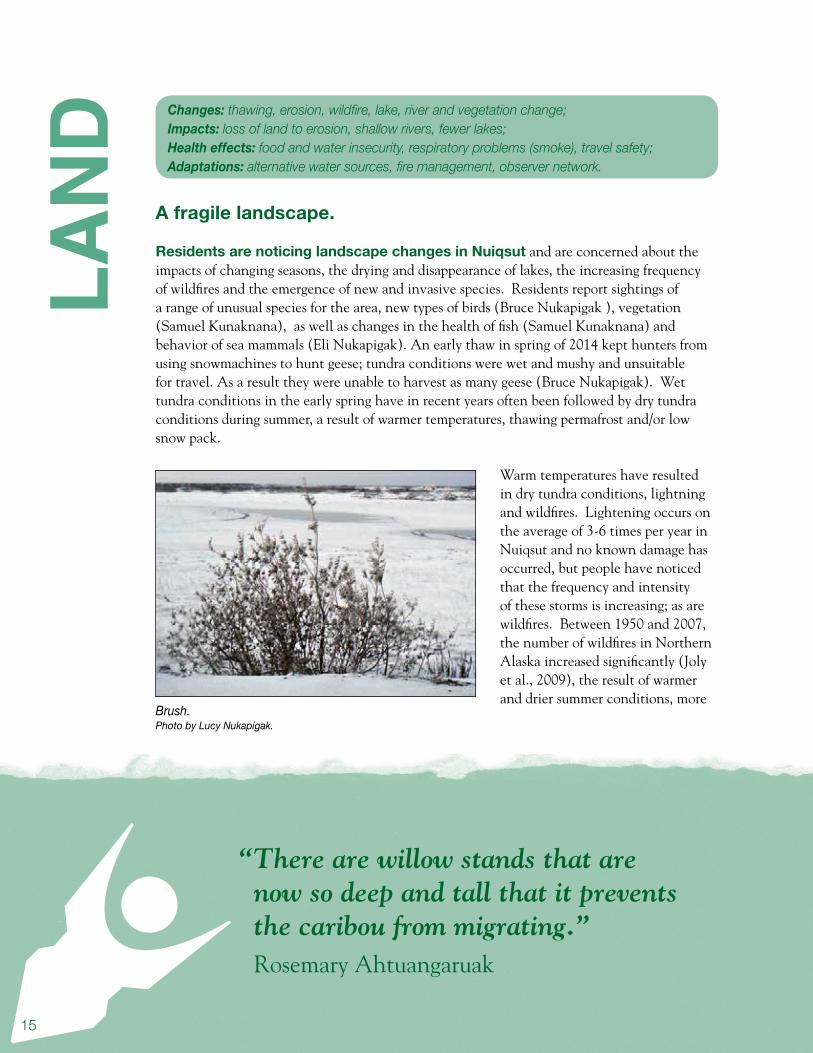
Residents are noticing landscape changes in Nuiqsut and are concerned about the impacts of changing seasons, the drying and disappearance of lakes, the increasing frequency of wildfires and the emergence of new and invasive species. Residents report sightings of a range of unusual species for the area, new types of birds (Bruce Nukapigak ), vegetation (Samuel Kunaknana), as well as changes in the health of fish (Samuel Kunaknana) and behavior of sea mammals (Eli Nukapigak). An early thaw in spring of 2014 kept hunters from using snowmachines to hunt geese; tundra conditions were wet and mushy and unsuitable for travel. As a result they were unable to harvest as many geese (Bruce Nukapigak). Wet tundra conditions in the early spring have in recent years often been followed by dry tundra conditions during summer, a result of warmer temperatures, thawing permafrost and/or low snow pack.
Warm temperatures have resulted in dry tundra conditions, lightning and wildfires. Lightening occurs on the average of 3-6 times per year in Nuiqsut and no known damage has occurred, but people have noticed that the frequency and intensity of these storms is increasing; as are wildfires. Between 1950 and 2007, the number of wildfires in Northern Alaska increased significantly (Joly et al., 2009), the result of warmer and drier summer conditions, more
LAND
Brush.Photo by Lucy Nukapigak.
Changes: thawing, erosion, wildfire, lake, river and vegetation change; Impacts: loss of land to erosion, shallow rivers, fewer lakes; Health effects: food and water insecurity, respiratory problems (smoke), travel safety; Adaptations: alternative water sources, fire management, observer network.

16
“For berry picking, we usually go upriver. We used to be
able to go in town.”Martha Itta
The Alpine oil facility as seen from Nuiqsut.Mike Brubaker, 2013.
Caribou.
frequent lightning strikes, an increase in woody plants, and dryer conditions on the tundra (Duffy et al. 2005). A lightning storm caused a wildfire near Wainwright in the summer of 1993 and took two weeks to extinguish (NSB 2009). In 2007, the largest tundra fire on record occurred on the North Slope, burning over 240,000 acres.
Permafrost thaw beneath lakes has resulted in methane seeps, lake drying and draining. The dry lake conditions has caused difficult and dangerous overland travel for fall hunters who are sinking into the land “like quicksand”(Bruce

17
Nukapigak, Eli Nukapigak). Inland camps have seen freeze-up delayed from mid-September to early October. With less snow pack or a warm dry summer, the life of a shallow lakes can be shortened considerably, drying and in some cases disappearing entirely. This means less lake habitat and more wetlands or grass habitat. Arctic bird species will be impacted by changes in lake conditions. A recent assessment identified ten climate change vulnerable bird species including the Common Eider and five species that would benefit such as the Common Redpoll (Liebzeit J, and Zack, S. 2011.). UAF Geophysical Institute is generating computer models and maps of lake change in the North Slope region. The models predict drying or draining of over 2000 lakes by the end of the century; over 200 could be dry within the next ten years (Jones, B., Grosse, G., Jenkins, J.L., Martin, P.D. 2012).
Discussion: With warming the length of the fire season can be expected to grow, and local capacity for response, training and equipment should be adjusted appropriately. Respiratory problems will occur downwind of wildfires. Monitoring of lake conditions including timing of break-up and freeze-up, water level, temperature, turbidity, and other measures of change is recommended. Advisories for hazardous travel conditions including “quick sand in dry lake areas” should be shared through local networks. A local environmental observer program can help connect residents and local government with technical resources related to landscape changes and new wildlife and environmental impacts.
“Usually right now we are still out hunting geese on our snow machines.”
Bruce Nukapigak
Blueberries on the tundra.Mike Brubaker, 2013.

18Flock of snow geese.USGS.
19
“A couple of years ago we had our first time boating in October on the river.” Bruce Nukapigak
RIVE
RA growing Colville
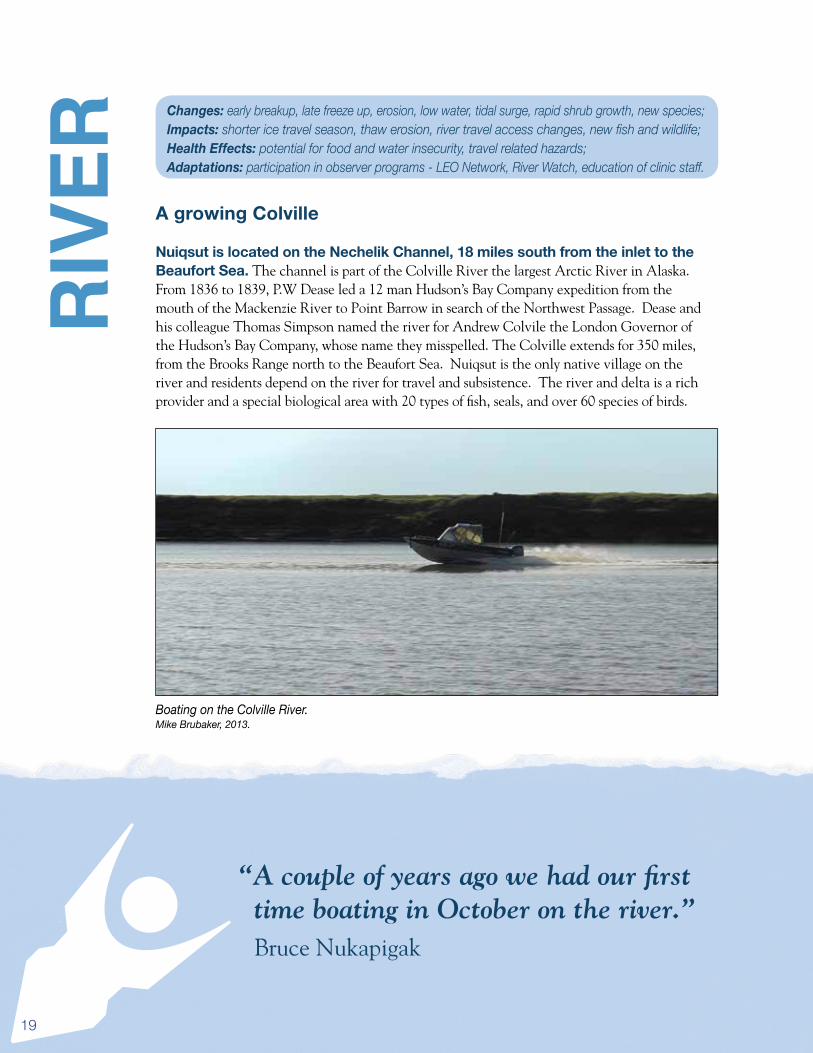
Nuiqsut is located on the Nechelik Channel, 18 miles south from the inlet to the Beaufort Sea. The channel is part of the Colville River the largest Arctic River in Alaska. From 1836 to 1839, P.W Dease led a 12 man Hudson’s Bay Company expedition from the mouth of the Mackenzie River to Point Barrow in search of the Northwest Passage. Dease and his colleague Thomas Simpson named the river for Andrew Colvile the London Governor of the Hudson’s Bay Company, whose name they misspelled. The Colville extends for 350 miles, from the Brooks Range north to the Beaufort Sea. Nuiqsut is the only native village on the river and residents depend on the river for travel and subsistence. The river and delta is a rich provider and a special biological area with 20 types of fish, seals, and over 60 species of birds.
Boating on the Colville River.Mike Brubaker, 2013.
Changes: early breakup, late freeze up, erosion, low water, tidal surge, rapid shrub growth, new species; Impacts: shorter ice travel season, thaw erosion, river travel access changes, new fish and wildlife; Health Effects: potential for food and water insecurity, travel related hazards; Adaptations: participation in observer programs - LEO Network, River Watch, education of clinic staff.
20
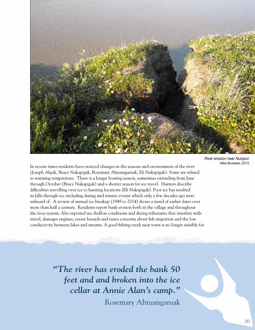
In recent times residents have noticed changes in the seasons and environment of the river (Joseph Akpik, Bruce Nukapigak, Rosemary Ahtuangaruak, Eli Nukapigak). Some are related to warming temperature. There is a longer boating season, sometimes extending from June through October (Bruce Nukapigak) and a shorter season for ice travel. Hunters describe difficulties travelling over ice to hunting locations (Eli Nukapigak). Poor ice has resulted in falls-through-ice including during mid winter; events which only a few decades ago were unheard of. A review of annual ice breakup (1949 to 2014) shows a trend of earlier dates over more than half a century. Residents report bank erosion both in the village and throughout the river system. Also reported are shallow conditions and drying tributaries that interfere with travel, damages engines, create hazards and raises concerns about fish migration and the loss conductivity between lakes and streams. A good fishing creek near town is no longer suitable for
River erosion near Nuiqsut.Mike Brubaker, 2013.
“The river has eroded the bank 50 feet and and broken into the ice
cellar at Annie Alan’s camp.”Rosemary Ahtuangaruak

21
travel due to low water, where erosion has led to rapid drainage and sedimentation (Archie Ahkiviana).
The erosion season for Arctic rivers occurs mostly in the spring, with ice scouring, snow melt and bank slumping during the thaw. Although ice scouring during breakup is decreasing in some years, permafrost thaw makes for a longer erosion season. Increased erosion effects sediment load, turbidity, and fish habitat and makes the Colville wider and shallower. In Nuiqsut, there is annual erosion impacting the gravel source road and north edge of town. This threatens the sewage outflow line and snow machine trails (NSB 2009) and without bank protection measures erosion may someday threaten the
school. There are also vegetation changes including rapid growth of willows along the river (Rosemary Ahtuangaruak, Samuel Kunaknana, Bruce Nukapigak; Eli Nukapigak). Softer (ice), earlier break up, and warmer soil and air temperatures encourage growth of shrubs and other deep-rooted plants. The emergence of porcupine in the area is an indication that the river is providing habitat for new species. Beaver raises concerns about the safety of drinking water from traditional sources.
Discussion: Changes occurring on the Colville River have implications for safe travel, subsistence, food security, and drinking water safety related to species that can carry waterborne pathogens. Continued river monitoring is encouraged including break-up, freeze-up, water level, temperature, turbidity, among others. Installation of stream gauges and participation in River Watch programs, and broadcasting river conditions, low water, slide areas and poor ice condition are encouraged. The Local Environmental Observer (LEO) Network can help share observation about new events and connect managers with technical resources to address questions about environmental change. Clinical staff should be aware of potential for new types of environmental change related illness such as giardia.
“It melts so fast we can’t get out to our hunting camps.”
Eli Nukapigak
An Arctic grayling.Mike Brubaker, 2013.

22Ice on the Colville River.Jake Bell, 2014.
23
SUBS
ISTE
NCE
The best of both worlds.
The Kuukpikmiut harvest a wide range of coastal and inland resources. The location on the lower Colville allows easy access up river and down for hunting, fishing and picking berries. The whaling crews travel long distances, to Barrow for spring whaling, and 20 miles downriver to the coast and then East to Cross Island (73 miles northeast of Nuiqsut) for whaling in the fall. As a result the Kuukpikmiut enjoy a wide range of healthy wild foods; over thirty different resources have been recorded (Bacon et al, 2009). In 1993, an almost equal part of the harvest was made up of marine mammals (mostly bowhead), land mammals (mostly caribou) and non-salmon fish (ADF&G 1993). For marine mammals there is the bowhead, two kinds of ice seal and polar bear. For land mammals there is caribou but also some moose and muskox. Bird resources include geese and eider. Fish are a very important resource, especially whitefish, arctic cisco, arctic grayling and burbot, but also salmon (Bacon et al. 2009). One survey found that over 89,000 pounds of fish were harvested annually and similar amounts of sea mammal and caribou (ADFG 1993). Five species of wild berries are also picked including
moss berry (black berry), bog cranberry (red berry), mountain cranberry (cranberry), bog bilberry (blueberry) and cloud berry (akpik) (Helen Kasak, LEO Berry Survey 2014).
Climate change is resulting in a wide range of subsistence impacts, including the time of season, modes of travel, wildlife health, availability and behavior, harvest success, and the ways used to prepare and store food. It is also forcing development of new knowledge to adapt to unusual and sometimes unprecedented environmental
Changes: harvest seasons, environmental conditions, wildlife health and behavior, species; Impacts: concerns over food safety, adaptation to climate change; Health effects: nutrition, mental health, food security; Adaptations: development of alternative subsistence practices.
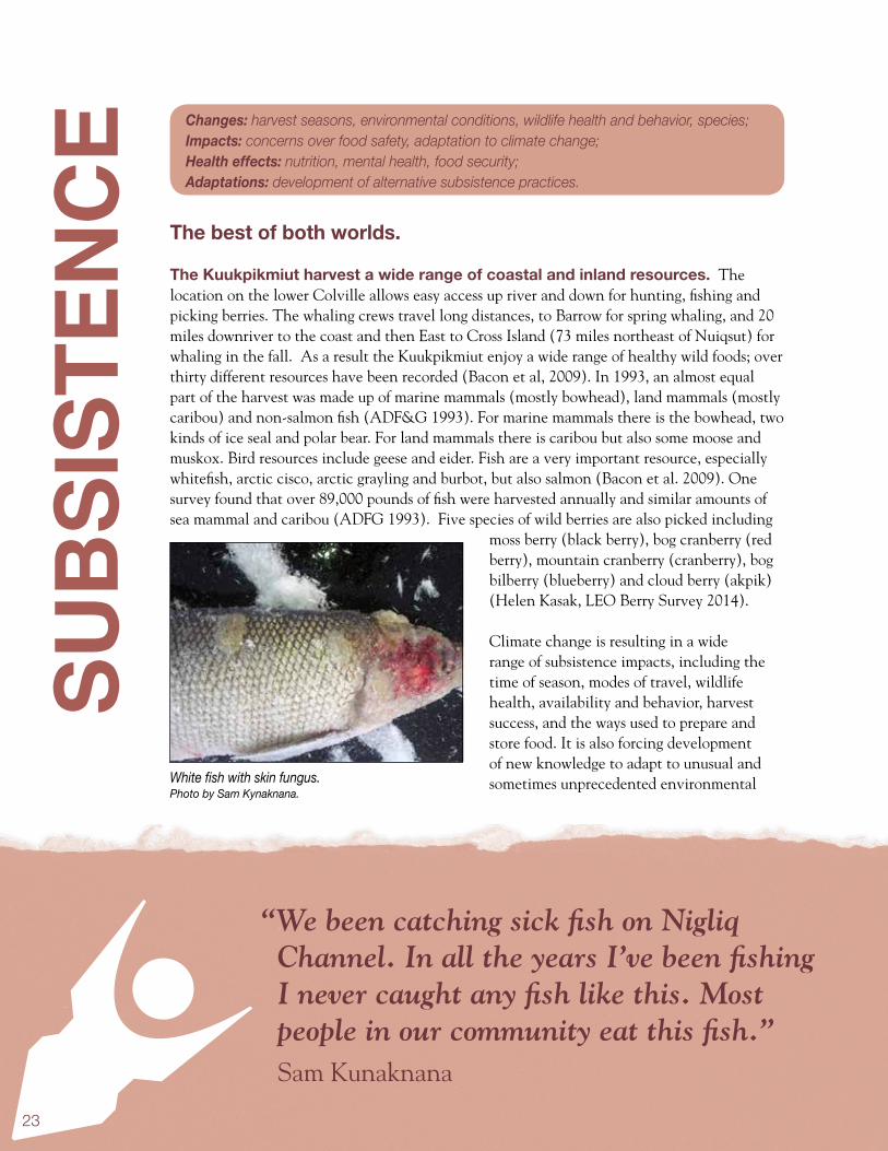
“We been catching sick fish on Nigliq Channel. In all the years I’ve been fishing I never caught any fish like this. Most people in our community eat this fish.”
Sam Kunaknana
White fish with skin fungus.Photo by Sam Kynaknana.
24
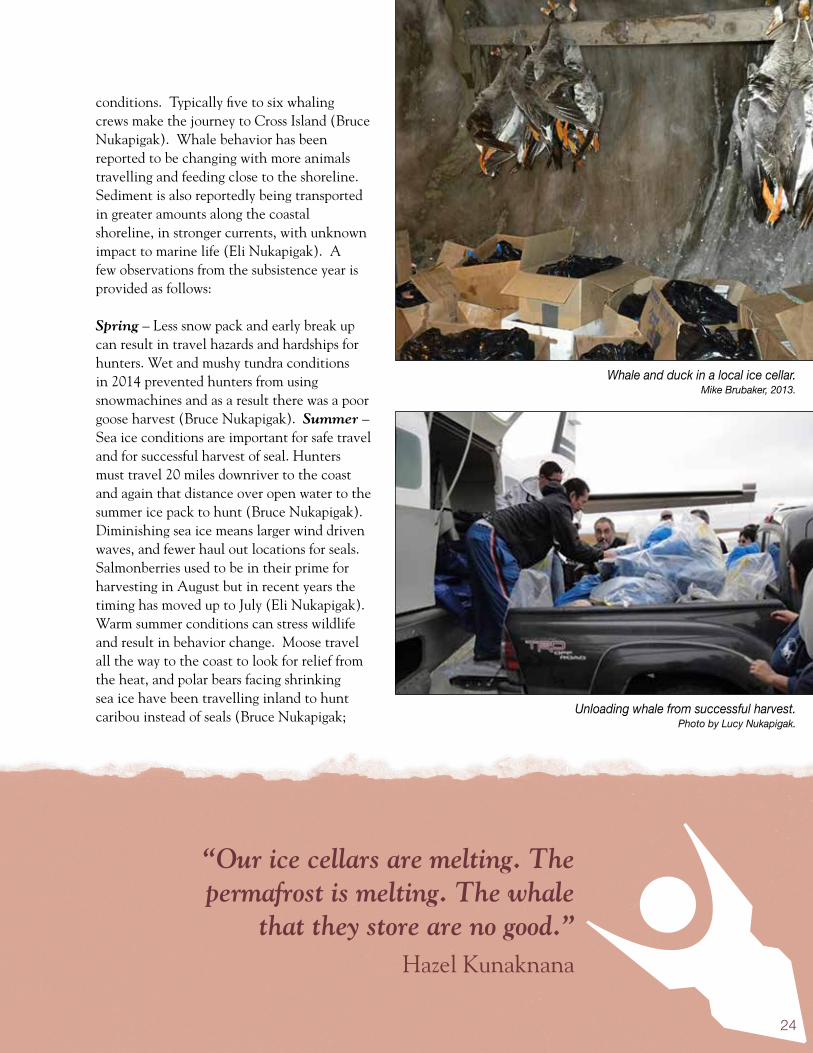
Whale and duck in a local ice cellar.Mike Brubaker, 2013.
“Our ice cellars are melting. The permafrost is melting. The whale
that they store are no good.” Hazel Kunaknana
conditions. Typically five to six whaling crews make the journey to Cross Island (Bruce Nukapigak). Whale behavior has been reported to be changing with more animals travelling and feeding close to the shoreline. Sediment is also reportedly being transported in greater amounts along the coastal shoreline, in stronger currents, with unknown impact to marine life (Eli Nukapigak). A few observations from the subsistence year is provided as follows:
Spring – Less snow pack and early break up can result in travel hazards and hardships for hunters. Wet and mushy tundra conditions in 2014 prevented hunters from using snowmachines and as a result there was a poor goose harvest (Bruce Nukapigak). Summer – Sea ice conditions are important for safe travel and for successful harvest of seal. Hunters must travel 20 miles downriver to the coast and again that distance over open water to the summer ice pack to hunt (Bruce Nukapigak). Diminishing sea ice means larger wind driven waves, and fewer haul out locations for seals. Salmonberries used to be in their prime for harvesting in August but in recent years the timing has moved up to July (Eli Nukapigak). Warm summer conditions can stress wildlife and result in behavior change. Moose travel all the way to the coast to look for relief from the heat, and polar bears facing shrinking sea ice have been travelling inland to hunt caribou instead of seals (Bruce Nukapigak; Unloading whale from successful harvest.
Photo by Lucy Nukapigak.

25
Eli Nukapigak). Fall – Changes in animal behavior is an important climate topic, including the timing of animal migration and the changes in environmental conditions that are needed for successful harvest. Hunters were amazed in recent years to still be boating on the river in October (Bruce Nukapigak). Arctic cisco has been running very late which is resulting in challenging harvest conditions for ice fishing. Freeze and thaw cycles on the river are creating overflow and making it hard to set nets (Bruce Nukapigak; Eli Nukapigak). Changing behavior for sea mammals was also described. “Whales are tending to move and feed closer to the shoreline.” (Eli Nukapigak). Winter – The delay of winter, mild mid-winter conditions, winter rain and thaw events and early spring have created new hardships and challenges for
the Kuukpikmiut. Annie Lampe expressed the sentiments of many when she said “March used to be part of winter”. One frequently voiced concern was about travel hazards, and the failure of time tested traditional knowledge in the light of the new climate. Winter rain has caused people traveling on snow machine to break through the ice. During one November ten people broke through the ice including two elders. “I had never heard of elders breaking through before” mentioned Rosemary Ahtuangaruak
Climate change is raising concerns about wildlife health as well. The Alaska Department of Fish and Game’s list of ten “at risk” tundra species from climate change” includes important subsistence species for Nuiqsut - caribou, musk ox and eider (Clark R. et al. 2010). Many community members have reported different tastes in the fish, caribou
and whale in recent years (Annie Lampe; Michelle Ipalook). Is this an indication of climate change? In October 2013 a Local Environmental Observer (LEO) Network member in Nuiqsut reported unusual skin illness in fall broad whitefish (Sam Kunaknana). The Alaska Fish Pathology Laboratory tested these fish and identified a mold “Saprolegnia” a condition that can be triggered by warm water conditions. Although unsightly, it did not affect the safety of the fish for food. Still, it was a first for Nuiqsut and residents wondered if this was an
Musk Oxen.
“Around 2002 a spring flood event caused a small herd of Musk Ox to drown on the Colville River near ocean point. It was very hot so the muskoxen had gone down by the ice to cool down.”
Rosemary Ahtuangaruak

26
Caribou harvest.Mike Brubaker, 2013.
“We have to go 20-30 miles out to get caribou. They used to be
about seven miles out.” Samuel Kunaknana
indication of climate change or some other environmental stress.
Researchers and public health are worried about new diseases in fish, birds and wildlife, including those which can spread to humans (zoonotic). In Nuiqsut, visiting researchers explained their concerns for lungworm and brainworm in caribou, diseases that would require specific environmental conditions to occur in the North Slope environment. Tapeworms and parasites that occur in southern latitudes may also begin to occur (ERM community meeting). Some community members said that they are already seeing an increase in sick caribou and fish (Bruce Nukapigak; Eli Nukapigak).
Discussion: In the new Arctic, subsistence resources will be joined or in some cases replaced by new and different species. Time of hunting will be altered and hunters will need to be flexible in order to accommodate current conditions, rather than historical seasons. Changes to sea and land conditions will require new methods of travel, and hunters will need to watch for new hazards and extreme weather. Local experience and traditional knowledge is the best measure of when an animals is normal or healthy to harvest, but science can help and work with communities to improve monitoring and to understand emerging issues, and how to deal with them safety. The Kuukpikmiut can take stock in the fact that they enjoy some of the most abundant and healthy food resources available anywhere, and that science and traditional knowledge agree that wellness is found in following a subsistence lifestyle. Public health and wildlife officials and local residents are all dedicated to continuing to protect these resources and the subsistence lifestyle for generations to come.

27
“It takes a lot longer for our bowhead to freeze in the ice cellars.”
Bruce Nukapigak
ICE
CELL
ARS
Preserving an Inupiat tradition.
Ice cellars, a traditional method of storing foods, are used in Nuiqsut, as well as Kivalina, Point Hope, Point Lay, Barrow, and Kaktovik. The cellars offer convenience, ample space, and an economical method for refrigeration. But across the North Slope, problems with preservation and storage of subsistence foods have been documented. Overly wet or warm conditions can prevent proper air drying of fish, caribou and seal. Problems associated with permafrost thaw and erosion can ruin food and damage or prevent use of ice cellars. In
Nuiqsut, there are ice cellars that continue to function effectively. But there are also cellars that are in trouble. Some have been lost to erosion. Others are operating on the margins of safety, vulnerable to further warming and even collapse. Understanding the construction, operation, status and challenges faced by ice cellars is important for food security and safety.
Ice cellars built in the 1970s started seeing increasing problems with thawing and caving in the late 1980s and 1990s (Archie Ahkiviana). Geese stored inside a cellar.
Mike Brubaker, 2013.
Changes: warming, erosion, permafrost thaw; Impacts: changes is food quality, spoilage, structural failure; Health effects: nutrition, food insecurity, food safety, injury; Adaptations: development of alternative locations or practices to store food, adaptive cellar systems.

28
In April 2014 an inventory was made of ice cellars in Nuiqsut. Seven ice cellar are in use and those near the river are warming and in some cases filling with water (Bruce Nukapigak; Eli Nukapigak; Michelle Ipalook). Residents observe that warmer air and soil temperatures have lengthened the time it takes to freeze the whale meat and blubber (Bruce Nukapigak; Eli Nukapigak). Some adaptations have been applied to prevent spoilage. One elder is using a convection fan to keep maktak fresh through the summer (Michelle Ipalook). Historically it was cold enough to keep many foods in the entryway of homes well into spring; because of warming this is often no longer possible (Annie Lampe). The timing and availability of snow used to clean out ice cellars in the spring Is another problem. In recent years there has often not been snow available (Eli Nukapigak).
Hut covering a functioning ice cellar.Mike Brubaker, 2013.
“One of our elders had the best maktak through the summer because he had a convection fan down in his ice cellar.”
Michelle Ipalook
29
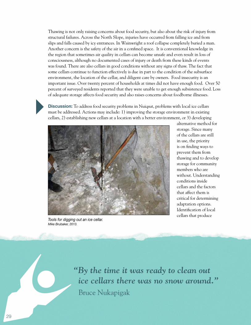
Thawing is not only raising concerns about food security, but also about the risk of injury from structural failures. Across the North Slope, injuries have occurred from falling ice and from slips and falls caused by icy entrances. In Wainwright a roof collapse completely buried a man. Another concern is the safety of the air in a confined space. It is conventional knowledge in the region that sometimes air quality in cellars can become unsafe and even result in loss of consciousness, although no documented cases of injury or death from these kinds of events was found. There are also cellars in good conditions without any signs of thaw. The fact that some cellars continue to function effectively is due in part to the condition of the subsurface environment, the location of the cellar, and diligent care by owners. Food insecurity is an important issue. Over twenty percent of households at times did not have enough food. Over 50 percent of surveyed residents reported that they were unable to get enough subsistence food. Loss of adequate storage affects food security and also raises concerns about foodborne illnesses.
Discussion: To address food security problems in Nuiqsut, problems with local ice cellars must be addressed. Actions may include: 1) improving the storage environment in existing cellars, 2) establishing new cellars at a location with a better environment, or 3) developing
alternative method for storage. Since many of the cellars are still in use, the priority is on finding ways to prevent them from thawing and to develop storage for community members who are without. Understanding conditions inside cellars and the factors that affect them is critical for determining adaptation options. Identification of local cellars that produce
“By the time it was ready to clean out ice cellars there was no snow around.”
Bruce Nukapigak
Tools for digging out an ice cellar. Mike Brubaker, 2013.

30
Entrance to an ice cellar.Mike Brubaker, 2013.
“In some cellars, the whale meat last year had not frozen in time for the November
feast. It has been like this for five years.” Rosemary Ahtuangaruak
food that is safe and tastes good is very important. Monitoring these cellars is recommended, to record environmental conditions (humidity, temperature etc.), and how they change throughout the food storage season. This is necessary to replicate good conditions in new cellars, or in engineered storage facilities. Immediate actions are needed to address cellar safety issues and prevent serious injury or death. Development of guidance for ice cellars (structural, confirmed space, air quality, slips and falls) is recommended. Appendix A of this report is a conceptual design for an ice cellar developed by engineers at ANTHC. Features of the design include an energy efficient thermostat controlled cooling system, solar and/or wind energy system, structural supports and ventilation for allowing exchange of cellar and outside air. The design is based on technology that is being piloted in other communities to protect permafrost vulnerable water and sanitation infrastructure. Designs like this may someday be used to improve food storage for North Slope communities.
31
“The connection boxes are being jacked up around town, water and sewer.”
Samuel Kunaknana
INFR
ASTR
UCTU
REA slow moving disaster.
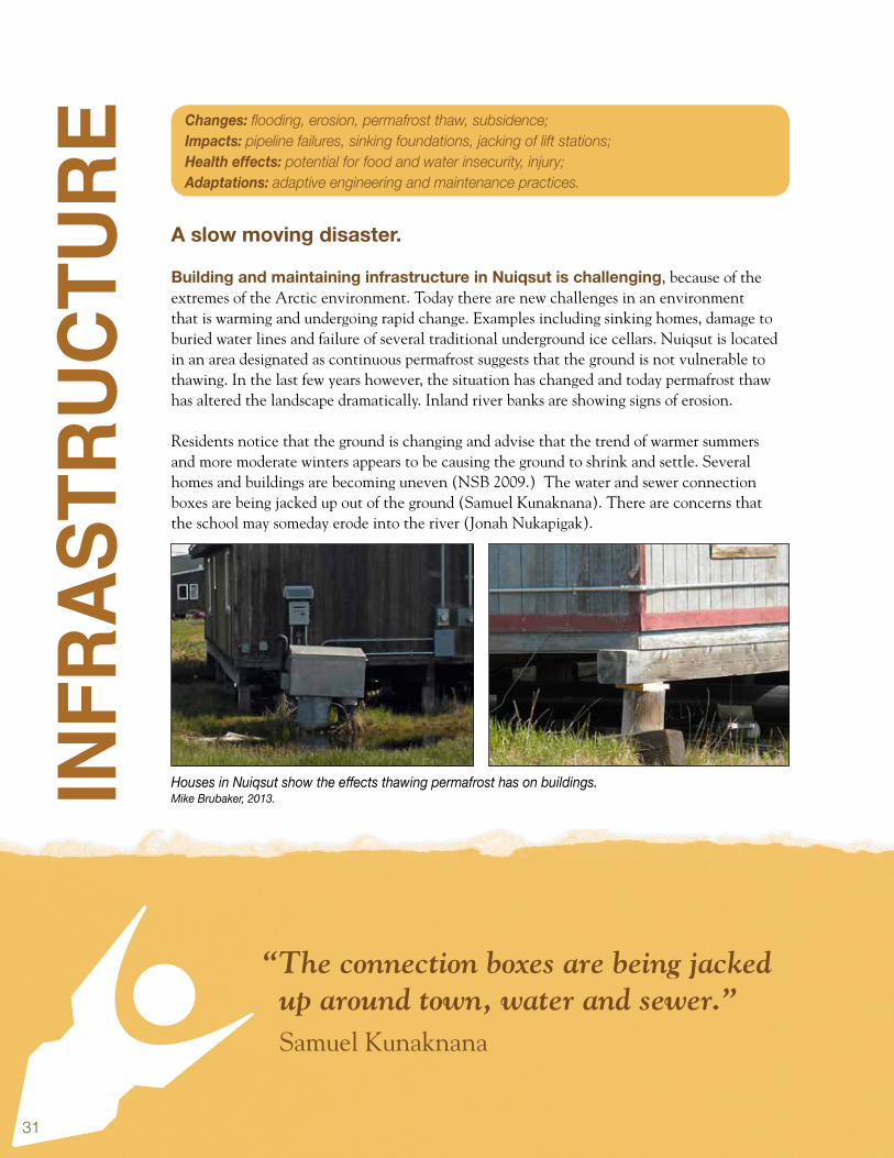
Building and maintaining infrastructure in Nuiqsut is challenging, because of the extremes of the Arctic environment. Today there are new challenges in an environment that is warming and undergoing rapid change. Examples including sinking homes, damage to buried water lines and failure of several traditional underground ice cellars. Nuiqsut is located in an area designated as continuous permafrost suggests that the ground is not vulnerable to thawing. In the last few years however, the situation has changed and today permafrost thaw has altered the landscape dramatically. Inland river banks are showing signs of erosion.
Residents notice that the ground is changing and advise that the trend of warmer summers and more moderate winters appears to be causing the ground to shrink and settle. Several homes and buildings are becoming uneven (NSB 2009.) The water and sewer connection boxes are being jacked up out of the ground (Samuel Kunaknana). There are concerns that the school may someday erode into the river (Jonah Nukapigak).
Houses in Nuiqsut show the effects thawing permafrost has on buildings.Mike Brubaker, 2013.
Changes: flooding, erosion, permafrost thaw, subsidence; Impacts: pipeline failures, sinking foundations, jacking of lift stations; Health effects: potential for food and water insecurity, injury; Adaptations: adaptive engineering and maintenance practices.

32
Nuiqsut’s water and sewer system is run with a vacuum pump, creating constant flow and reducing vulnerabilities to freezing pipes. Water operators in 2014 reported few issues with frozen lines in recent times. Water is treated during an approximate 40 day season from July to August, and the water source is located a mile south of town. Water utility staff have noticed some small-scale permafrost erosion near their outflow pipe from their water tanks to the Colville (Timothy Kallenbach).
In Nuiqsut, there is annual erosion impacting the gravel source road and north edge of town. This threatens the sewage outflow line and snow machine trails (NSB 2009). Although Nuiqsut is on the river there is no significant flood history. Flooding of the Colville does occur often caused by heavy rainfall in the Delong Mountains. The dump road floods frequently and in 1973 both the gravel source and the boat dock were under water. In June of 2004, floodwaters on the Nechelik Channel rose to the highest level in recorded history, 10 feet below the river, flooding over two bridges on dump road (NSB 2009).
Discussion: Impacts to local water and sanitation system and home foundations indicate that some community infrastructure is vulnerable to changing permafrost conditions. The North Slope Borough is actively addressing these problems, fixing damaged infrastructure, applying new construction methods, and new practices such as aggressively removing snow during winter to encourage ground freeze. Regular monitoring of infrastructure for change including foundations is recommended. Subsurface monitoring of permafrost conditions can help to evaluate how permafrost is performing and identify vulnerable areas. Phased development is recommended towards areas of town that are more stable and less prone to erosion.
School near eroding river bank.
Mike Brubaker, 2013.
“Last year, we had to level our house about eight to nine inches.”
Hazel Kunaknana
33
“Whaling captains have requested freezers – whale getting rotten in cellars.”
Hazel Kunaknana
SUM
MAR
Y It is becoming warmer with an increase in average annual air temperature. Temperatures have increased in every month of the year except July. More extreme warm days are expected.
It is becoming wetter with a longer period when rain occurs. The amount of precipitation has increased in seven months. Winter rain events are expected to occur more frequently.
Extreme weather is increasing, including thunderstorms. Lightening and wildfires are also increasing with related risks: poor air quality, infrastructure damage and loss of caribou forage areas.
Warming has resulted in decreases in snow and ice. This is affecting conditions for travel on rivers, lakes and on the sea. Poor ice conditions is preventing some types of subsistence activities.
The season for hunting on the sea ice is becoming shorter. The season for open water travel is however, becoming longer and hunters are adapting with new equipment and methods.
Sea conditions are becoming more challenging and dangerous for navigation. This is resulting from sea ice loss, increased effect of wind fetch, and resulting increase in wave size.
Higher water is increasing river access. Residents report the ability to travel further upriver for hunting than ever before, expanding and improving access to subsistence use areas.
Erosion is causing loss of the riverbank and historical sites. Ice cellars and traditional harvesting sites have been lost. Armoring the shoreline would protect infrastructure that would otherwise need to be relocated.
Permafrost thaw is affecting food security. Some ice cellars have failed because of warming air and soils condition. Adaptations such as phased relocation to better cellar sites, retrofits with cooling systems or alternative cold storage facilities are under consideration.

34
Climate change will certainly bring new challenges and hardships, but
also in some ways, new opportunity.
Sea level rise will increase flood risk. Better sea level trend data is needed through tide stations and projection scenarios to look at combined effects of thawing, erosion, ice change and sea level rise.
Community members are concerned about food security. Changes are affecting subsistence, including the abundance, availability, timing, and quality of food resources.
Climate change has resulted in poor conditions for food preservation. Residents report that unseasonable weather has resulted in poor conditions for drying fish and seal and other foods.
Climate models project continued rapid change. Residents should expect that some plants and wildlife will be stressed during a period of rapid environmental change, but that new resources and opportunities will emerge that can benefit Nuiqsut.
Change will bring new challenges including natural disasters. As climate and environmental conditions are changing so also are the risks for disasters. Updating the next version of Nuiqsut’s all hazards mitigation plan is recommended to address climate change related threats.
Sunset on the Colville.Photo by Lucy Nukapiga.

35
CONC
LUSI
ON Public health considers climate change based on effects to mental health, injury, disease,
and food and water safety and security. In Nuiqsut, residents report rapid erosion along the coastline and in the town caused by warming temperatures, decreased sea ice, increased wave and storm impact and runoff. Erosion is resulting in the loss of critical infrastructure including ice cellars and raising concerns about food security. Permafrost thaw is another contributing factor to erosion, and also causing damage to community infrastructure.
Potential health effects include increased risk of illness related to disruptions in basic services and loss of traditional food storage facilities from erosion, thawing and flooding. Subsistence practices are adapting to changes in environment, seasons, and harvest conditions. The season for ice-based hunting activities is decreasing, while water based hunting is growing. Another effect is potential for injury related to new land and sea based hazards, includinginjury related to slips and falls in icy conditions and collapsing walls and ceilings in ice cellars. Poor ice is dangerous to travel and work on. Less sea ice means bigger waves and increasing hazards for sea travel. These conditions increase stress for hunters and their families which can negatively affect mental health.
Positive examples of adaptation include more time hunting whale from the water and efforts by the borough public works to develop new design and maintenance strategies for water and sanitation infrastructure. Benefits of climate change include subsistence resources, warmer water for swimming in the lagoon, and a longer season for making community water and for maintaining infrastructure.
This report raises awareness about current, emerging, and potential future climate change. It is hoped that this will help Nuiqsut make informed planning decisions, find community appropriate development strategies, and pursue a safe, healthy, and sustainable future.
For more information, contact the Center for Climate and Health by e-mail at [email protected] or by phone (907) 729-2464.
It is hoped this report will help Nuiqsut make informed decisions and find community appropriate adaptation strategies.

36
Figure 5. Climate Change Health Assessment Findings, Nuiqsut, Alaska
Topic Changes Impacts Health Effects Adaptations
Climate Increases in temperature, precipitation variabilityand extremes.
Travel disruptions,infrastructure damage,timing of seasons.
Supply shortages,accident and injury,mental stress.
Enhance systems forself-sufficiency andemergency preparedness.
Weather More storms, extremeweather, and lightning.
Damage to infrastructure,travel challenges and disruptions.
Supply shortages, injury, poor air quality, mental stress.
Engineering for extremes, phased relocation.
River Erosion, low river level, higher tides, increased turbidity flooding.
Land and infrastructure loss, travel disruptions.
Travel accident injury, loss of services.
Riverwatch, Bank protection, phased relocation.
Land Rapid tree growth,new coastal wetlands,invasive plants.
Loss of tundra towoodlands, loss of berryplant habitat.
Food security, potentialfor new or increasedallergens, mental health.
Monitor changes (LEO); inform clinics on new environmental healthconcerns; manageinvasive plants.
Subsistence Changes in harvest season. Changes in timing of migration, conditions for travel and the health and abundance of subsistence resources.
Fish illness. Loss of food storage facilities. Poor harvest due to travel problems or changes in wildlife health or behavior.
Food security. Injury. Mental stress.
Monitor subsistenceevents (LEO), performcomprehensive harvestsurvey, and encouragehealthy food.
Ice Cellars Warming temperatures, erosion.
Thawing and eroding cellars.
Loss of stored food and water (ice) resources. Foodborne illness.
Provide supplemental cooling systems, relocate cellars to better location. Community freezers.
Infrastructure Warmer temperatures, erosion, flooding, lightening, wildfires.
Foundation failures, infrastructure loss, damage, service loss.
Loss or interruption of health critical services. Increase for injury or disease.
Monitor change, use adaptive engineering to address risks, align maintenance and repair schedules as appropriate.
Nuiqsut cemetary.Mike Brubaker, 2013.
37
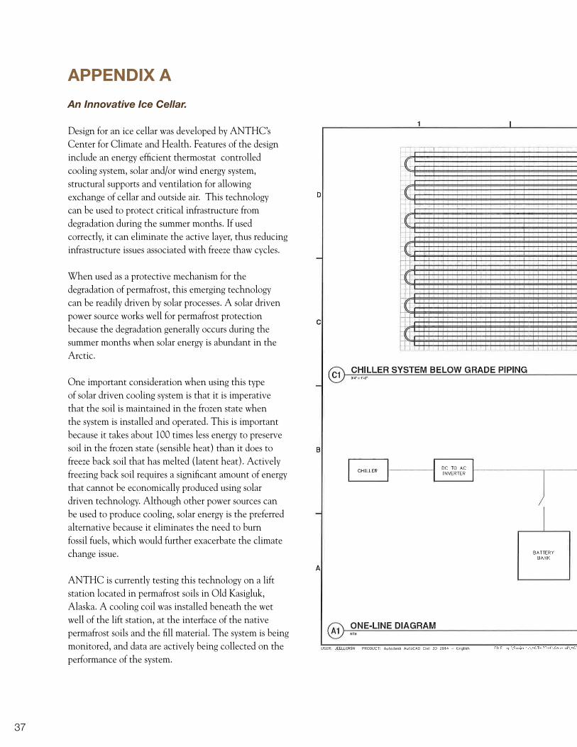
APPENDIX A
An Innovative Ice Cellar.
Design for an ice cellar was developed by ANTHC’s Center for Climate and Health. Features of the design include an energy efficient thermostat controlled cooling system, solar and/or wind energy system, structural supports and ventilation for allowing exchange of cellar and outside air. This technology can be used to protect critical infrastructure from degradation during the summer months. If used correctly, it can eliminate the active layer, thus reducing infrastructure issues associated with freeze thaw cycles.
When used as a protective mechanism for the degradation of permafrost, this emerging technology can be readily driven by solar processes. A solar driven power source works well for permafrost protection because the degradation generally occurs during the summer months when solar energy is abundant in the Arctic.
One important consideration when using this type of solar driven cooling system is that it is imperative that the soil is maintained in the frozen state when the system is installed and operated. This is important because it takes about 100 times less energy to preserve soil in the frozen state (sensible heat) than it does to freeze back soil that has melted (latent heat). Actively freezing back soil requires a significant amount of energy that cannot be economically produced using solar driven technology. Although other power sources can be used to produce cooling, solar energy is the preferred alternative because it eliminates the need to burn fossil fuels, which would further exacerbate the climate change issue.
ANTHC is currently testing this technology on a lift station located in permafrost soils in Old Kasigluk, Alaska. A cooling coil was installed beneath the wet well of the lift station, at the interface of the native permafrost soils and the fill material. The system is being monitored, and data are actively being collected on the performance of the system.

38

39
APPENDIX B
Community and Regional ContributorsAnecdotal data was collected on observations and experiences from local experts in health, wildlife, weather, subsistence, education, sanitation, local governance, law enforcement, and emergency services.
Key Contacts, Nuiqsut
Name Position / Knowledge Association1 Name Position / Knowledge Association
2 Archie Ahkiviana Elder NA
3 Joseph Akpik Elder NA
4 Rosemary Ahtuantaruak Tribal Liaison Alaska Wilderness League
5 Martha Itta Tribal Administrator Native Village of Nuiqsut
6 Michelle Ipalook Community Health Aide NSB Health Department
7 Timothy Kallenbach Water System Operator NSB Public Works
8 Helen Kasak Assistant Native Village of Nuiqsut
9 Kara Kasak Acting Assistant Native Village of Nuiqsut
10 Doreen Kosbruk Acting Administrator Assist. Native Village of Nuiqsut
11 Hazel Kunaknana Treasurer Native Village of Nuiqsut
12 Samuel Kunaknana Tribal Council member Native Village of Nuiqsut
13 John Nicholls Secretary Native Village of Nuiqsut
14 Jonah Nukapigak Tribal Council member Native Village of Nuiqsut
15 Eli Nukapigak Vice President Native Village of Nuiqsut
16 Bruce Nukapigak Tribal Council member Native Village of Nuiqsut
17 Margaret Pardue President Native Village of Nuiqsut
18 Annie Lampe Elder NA

40
APPENDIX C
Nuiqsut Climate and Health Web Resources
Topic Resource LocationClimate / Health Study Center for Climate and Health www.anthc.org/chs/ces/climate/links.cfm
Community Profile State of Alaska Community Database www.commerce.state.ak.us/dca/commdb/CF_BLOCK.htm
Community Profile NSB Nuiqsut Community Profile www.north-slope.org/assets/images/uploads/NuiqsutVillageProfile06.pdf
Regional Climate Data Alaska Climate Research Center, UAF climate.gi.alaska.edu/Climate/Location/TimeSeries/KingSalmon.html
Temperature Charts Scenario Network for Alaska Planning www.snap.uaf.edu/charts.php
Precipitation Charts Scenario Network for Alaska Planning www.snap.uaf.edu/charts.php
Extreme precipitation NOAA Atlas 12 hdsc.nws.noaa.gov/hdsc/pfds/pfds_map_ak.html
Weather Spotters NWS Extreme Weather Spotter www.weather.gov/skywarn/
Precipitation Monitor Collaborative Snow, Rain, Hail Program www.cocorahs.org/
Erosion Data USACE Community Report, 2009 www.poa.usace.army.mil/AKE/Home.html
Flood Data USACE Flood Hazard Database 66.223.166.160/usace_disclaimer.html
Coastal Observations National Weather Service www.nws.noaa.gov/om/coop/index.htm
Season Observations USGS Phenology Network www.usanpn.org/
Local Observers LEO Network - ANTHC www.anthc.org/chs/ces/climate/leo/
Regional Health Profile North Slope Borough http://www.north-slope.org/our-communities/nuiqsut
Regional Climate Studies
Landscape Conservation Cooperative www.arcus.org/arctic-alaska-lcc
Harvest Summary Data Alaska Department of Fish and Game www.adfg.alaska.gov/sb/CSIS/index.cfm?ADFG=commInfo.Summary&CommID=364&Year=1989

41
APPENDIX D
Acronyms
AACD Alaska Association of Conservation Districts
ACCAP Alaska Center for Climate Assessment and Policy
ACRC Alaska Climate Research Center
ANTHC Alaska Native Tribal Health Consortium
ADF&G Alaska Department of Fish and Game
ADEC Alaska Department of Environmental Conservation
CAHM Climate and Health Measure
CCH Center for Climate and Health
CCHA Community Climate and Health Assessment
CCHRC Cold Climate Housing Research Center
CDC Centers for Disease Control
CIP Capital Improvement Project
CSIS Community Subsistence Information System
CVI Climate Vulnerability Index
DHSS Department of Health and Social Services
EIS Environmental Impact Statement
EPA Environmental Protection Agency
GIS Geographic Information System
HIA Health Impact Assessment
HVA Hazard Vulnerability Assessment
IPCC Intergovernmental Panel on Climate Change
LEO Local Environmental Observer
NOAA National Oceanographic and Atmospheric Administration
NPRA National Petroleum Reserve - Alaska
NPS National Park Service
NWS National Weather Service
NSB North Slope Borough
SNAP Scenarios Network for Alaska & Arctic Planning
UAA University of Alaska, Anchorage
UAF University of Alaska, Fairbanks
UIC Ukpeagvik Inupiat Corporation
USFWS U.S. Fish & Wildlife Service
USG U.S. Geological Service

42
REFERENCES
Alaska Climate Research Center, University of Alaska, Fairbanks. Available at: http://climate.gi.alaska.edu/.
ADF&G 1989. Nuiqsut Harvest Summary Report. Community Subsistence Information System. Alaska Department of Fish and Game, Subsistence Division. Available at: www.adfg.alaska.gov/sb/CSIS/index.cfm?ADFG=commInfo.Summary&CommID=364&Year=1993
DCCED (Department of Commerce, Community, and Economic Development - Community and Regional Affairs), State of Alaska., 2014. Community Database. Available: http://commerce.alaska.gov/cra/DCRAExternal/community
Bacon, J.J., et al. 2009. Estimates of Subsistence Harvest for Villages on the North Slope of Alaska, 1994-2003. North Slope Borough Department of Wildlife Management, Barrow, Alaska.
Duffy P., Walsh J., Graham J., Mann D., and Rupp T. 2005. Impacts of large-scale atmospheric-ocean variability on Alaskan fire season severity. Ecological Applications 15:1317-1330.
IPCC (Intergovernmental Panel on Climate Change), 2007. Climate Change 2007. Synthesis Report, Contribution of Working Groups I, II and III to the Fourth Assessment Report of the Intergovernmental Panel on Climate Change. IPCC, Geneva, Switzerland. pp. 104.
Joly K., Rupp S., Chapin F., 2009. Fire in the range of the Western Arctic Caribou Herd. Alaska Park Science, Vol. 8, No. 2, pp. 68-73.
Markon, C.J., Trainor, S.F., and Chapin, F.S., III, eds., 2012, The United States National Climate Assessment— Alaska Technical Regional Report: U.S. Geological Survey Circular 1379, 148 p.
Nowacki, G., P. Spencer, M. Fleming, T. Brock, and T. Jorgenson (2002) Unified Ecoregions of Alaska: 2001. Available at http://agdc.usgs.gov/data/projects/fhm.
NSB (North Slope Borough) 2014. “Our Communities” Profiles. Available; http://www.north-slope.org/our-communities
NSB 2012. Baseline Community Health Analysis Report. North Slope Borough Department of Health and Social Services. July 2012.
NSB 2009. Nuiqsut All Hazards Mitigation Plan. The North Slope Borough Risk Management Division Joe Stankiewicz, Risk Manager. August 2009.
North Slope Borough, 2005. Nuiqsut Village Profile. URS Corporation. October 2005. Available at: http://www.north-slope.org/assets/images/uploads/NuiqsutVillageProfile06.pdf
Poppel B., Kruse J, Duhaime G., and L. Abryutina: 2007. SLiCA Results. Anchorage Institute of Social and Economic Research, University of Alaska Anchorage. Available online at www.arcticlivingconditions.org
SNAP 2014, Scenarios Network for Alaska & Arctic Planning. UAF Geophysical Institute. Available at: http://www.snap.uaf.edu/
Nuiqsut Flood Map. North Slope Borough, Care of Department of Risk Management.

43
Bird hunting in springtime..Jake Bell, 2014.

44
ANTHC would
like to express our
special thanks to
the residents of
Nuiqsut and other
parts of the North
Slope Region, who
provided their time,
knowledge and
assistance during
this project.

© Alaska Native Tribal Health Consortium (ANTHC), July 2014.
We gratefully acknowledge the materials and assistance of these organizations:
City of NuiqsutNative Village of Nuiqsut
North Slope BoroughThe Alaska Center for Climate Assessment and Policy
The Alaska Climate Research CenterThe Scenarios Network for Alaska & Arctic Planning
The University of Alaska Fairbanks Geophysical InstituteThe State of Alaska Department of Community, Commerce, and Economic Development
The State of Alaska Department of Health and Social ServicesThe State of Alaska Department of Fish and Game
The State of Alaska Division of Homeland Security & Emergency ManagementThe State of Alaska Department of Environmental ConservationThe National Oceanographic and Atmospheric Administration
The National Weather ServiceThe U.S. Geological Survey
The U.S. Army Corps of EngineersThe U.S. Environmental Protection Agency
The U.S. Fish & Wildlife Service
For more information please contact:Center for Climate and Health, Alaska Native Tribal Health Consortium: (907) 729-2464
Find this report and other information about climate and health at our website:www.anthc.org/chs/ces/climate/index.cfm
Cite as: Brubaker M., Bell J., Dingman H., Itta M., Kasak K.,Climate Change in Nuiqsut, Alaska, Strategies for Community Health. ANTHC, 2014.
http://www.anthc.org/chs/ces/climate/climateandhealthreports.cfm
Primary funding for this report provided by a National Petroleum Reserve-Alaska grant fund made available through the Department of Commerce, Community and Economic Development.
Supplemental funding provided through an Indian General Assistance Program grant from the U.S. Environmental Protection Agency. Thank you for your support.
NativeVillage ofNuiqsut
United States Environmental Protection Agency
United States Environmental Protection Agency