collector for arcgis for maintaining botanical garden plant ......collector for arcgis for...
TRANSCRIPT

Collector for ArcGIS for
Maintaining Botanical Garden
Plant RecordsVeronica Nixon - Desert Botanical Garden
Steve Gensler - San Francisco Botanical Garden

Why we map our plants
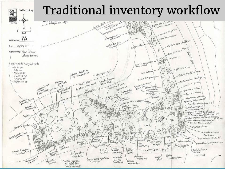
Traditional inventory workflow

GIS inventory workflow 2014

How DBG uses the
Collector app

Planting bed
inventory
Plant registrar and GIS
specialist work together

Plant symbols
A set of visually
distinct types of
plants that can be
recognized easily by
new volunteers

Inventory symbols
Needs additional
research/work
Just needs a new
tag printed
Done!

Full garden inventory

Start of inventory...

End of inventory

How SFBG uses the
Collector app

Plant Detective Program
• What is the program?
• Who are the detectives?
• How does the program work?
• Why?

2016

Red indicates plants which have
not been inventoried. Allows for
Plant Collections staff to quickly
pick up where they left off.
Question mark indicates the
plant needs further research.

Inventory symbols
New Planting - Exactly what it means.
Certified - Reviewed by Plant Collections. Location and
information is correct and has photo documentation.
No - We have not set eyes on this plant since the
inception of the Plant Detective program.
Yes - Yes! A Plant Detective has seen this plant!
Research - Plant needs attention by Plant Collections
staff.
Gardener Update - Update by Garden Staff.
New Mapping - Recently mapped, but accession is in
the Plant Collections database.
Not Found - Plant is either not found or dead.
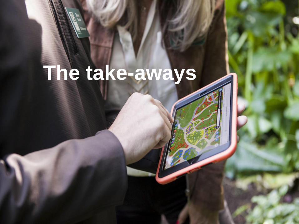
The take-aways

Collector app shakes things up!
• No more paper!
• A tool for staff
• Teamwork
• Streamlines workflow
• Takes the office outside where it should be!
• No programming required!

Challenges that remain
• Integration of GIS and plant database
• Staffing and volunteers
• Spatial awareness
• Dynamic labels
• Dynamic Scale Bar
• Rotate the view within the app
• Edit location vs. edit attributes
• Tap sensitivity
Things Esri could help us with?
