comitÉ espagnol de gÉodÉsie et … · comitÉ espagnol de gÉodÉsie et gÉophysique spanish...
TRANSCRIPT
1
COMITÉ ESPAGNOL DE GÉODÉSIE ET GÉOPHYSIQUE SPANISH COMMITTEE OF GEODESY AND GEOPHYSICS
NATIONAL REPORT ON GEODESY
FOR
2007 - 2010
IUGG XXV GENERAL ASSEMBLY
PREFACE
This report outlines some Spanish activities in Geodesy for the period 2007 to 2010. It
has been prepared for submission to the International Association of Geodesy (IAG) on the occasion of the XXV General Assembly of the International Union of Geodesy and Geophysics in Melbourne, Australia, June 27 to July 8, 2011. It is issued on behalf of the Spanish Committee of Geodesy and Geophysics
In the report the main activities in Geodesy developed in Spain in the period 2007-2010 by different Institutions are presented. These Institutions in alphabetic order are.
1. Astronomy, Geodesy and Cartography Laboratory. Facultad de Ciencias. Universidad de Cádiz, Puerto Real, CÁDIZ.
2. Cartographic Institute of Valencia. Department of Geodetic Projects, Valencia. 3. Department of Astronomy and Geodesy, Facultad de Ciencias Matemáticas
Universidad Complutense, MADRID. 4. Department of Cartographic, Geodesic and Photogrammetric Engineering (DICGF) -
Cartography Geodesy and GPS. VALENCIA 5. Institute Cartographic of Catalonia. BARCELONA. 6. Institute of Astronomy and Geodesy, (UCM-CSIC), MADRID. 7. Institute of Geomatic. Castelldefels, BARCELONA. 8. Microgeodesia Jaén Research Group. Universidad de Jaén, JAEN 9. National Geographic Institute (Instituto Geográfico Nacional). MADRID. 10. Royal Institute and Observatory of the Navy. (Real Instituto y Observatorio de la
Armada). San Fernando, CÁDIZ.
The information provided by the Institutions has been incorporate in the Report, and due to the quantity and diversity of works done these has been resumed, giving for each Institution a list of the activities followed by the list of papers published in the period. Madrid, April, 2011 Miguel J. Sevilla (IAG Spanish National Correspondent)

2
3
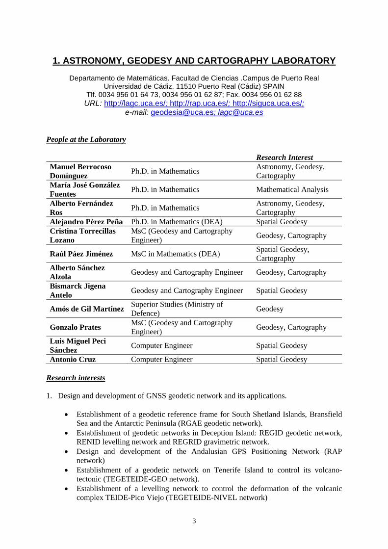
1. ASTRONOMY, GEODESY AND CARTOGRAPHY LABORATORY
Departamento de Matemáticas. Facultad de Ciencias .Campus de Puerto Real Universidad de Cádiz. 11510 Puerto Real (Cádiz) SPAIN
Tlf. 0034 956 01 64 73, 0034 956 01 62 87; Fax. 0034 956 01 62 88 URL: http://lagc.uca.es/; http://rap.uca.es/; http://siguca.uca.es/;
e-mail: [email protected]; [email protected] People at the Laboratory
Research Interest Manuel Berrocoso Domínguez
Ph.D. in Mathematics Astronomy, Geodesy, Cartography
María José González Fuentes
Ph.D. in Mathematics Mathematical Analysis
Alberto Fernández Ros
Ph.D. in Mathematics Astronomy, Geodesy, Cartography
Alejandro Pérez Peña Ph.D. in Mathematics (DEA) Spatial Geodesy Cristina Torrecillas Lozano
MsC (Geodesy and Cartography Engineer)
Geodesy, Cartography
Raúl Páez Jiménez MsC in Mathematics (DEA) Spatial Geodesy, Cartography
Alberto Sánchez Alzola
Geodesy and Cartography Engineer Geodesy, Cartography
Bismarck Jigena Antelo
Geodesy and Cartography Engineer Spatial Geodesy
Amós de Gil Martínez Superior Studies (Ministry of Defence)
Geodesy
Gonzalo Prates MsC (Geodesy and Cartography Engineer)
Geodesy, Cartography
Luis Miguel Peci Sánchez
Computer Engineer Spatial Geodesy
Antonio Cruz Computer Engineer Spatial Geodesy Research interests 1. Design and development of GNSS geodetic network and its applications.
Establishment of a geodetic reference frame for South Shetland Islands, Bransfield Sea and the Antarctic Peninsula (RGAE geodetic network).
Establishment of geodetic networks in Deception Island: REGID geodetic network, RENID levelling network and REGRID gravimetric network.
Design and development of the Andalusian GPS Positioning Network (RAP network)
Establishment of a geodetic network on Tenerife Island to control its volcano-tectonic (TEGETEIDE-GEO network).
Establishment of a levelling network to control the deformation of the volcanic complex TEIDE-Pico Viejo (TEGETEIDE-NIVEL network)

4
2. Determination of volcanic and tectonic deformation models.
Application of the RGAE geodetic network to determine the tectonic deformation occurring in the South Shetland Islands, Bransfield Sea and the Antarctic Peninsula.
Monitoring of the volcano-tectonic activity in Deception Island and its environment and volcanic deformation models determination.
Determination of tectonic deformation models for Andalusia and the North of Africa.
Volcano-tectonic deformation models for Tenerife Island and Teide-Pico Viejo volcanic complex.
Real time monitoring of the volcanic activity on Deception Island and in the Teide-Pico Viejo volcanic complex.
3. Determination of experimental geoids
Determination of geophysical and geodetic experimental models in volcanic areas (Deception Island and Teide-Pico Viejo volcanic complex).
Geoid determination in Cádiz Bay for seaside areas delimitation. 4. Cartography: Technical and scientific information systems and remote sensing.
Design and development of a multidisciplinary system of scientific support (SIMAC). An application of Deception Island.
Maps Server development and Web Client. Design and elaboration of an information system for universities management
(SIGUCA), by means of free software and web client. Quality control for the toponimy of cartographic series. Satellite images for multispectral sensors. Using of panchromatic images for cartography update.
Publications (Papers and Book Chapters) Autores: A. Fernández‐Ros, M. Berrocoso, M. E. Ramírez Título: Volcanic deformation models for Deception Island (South Shetland Islands, Antarctica) Fecha de publicación: 2007 Referencia: A. Cooper, C. Raymond, and the 10th ISAES Editorial Team (eds): Antarctica: A Keystone in a Changing World. Contribución número: 094 ISSN: 0196‐1497 DOI: 10.3133/of2007‐1047 ISBN (CD‐ROM): 1‐411‐31788‐2 Editorial: U. S. Geological Survey and The National Academics Lugar de Publicación: Santa Barbara (California)
Autores: M. E. Ramírez, M. Berrocoso, A. Fernández‐Ros, M. J. González Título: GPS time series analysis from Deception Island Volcano (South Shetland Islands, Antarctica) Fecha de publicación: 2007 Referencia: A. Cooper, C. Raymond, and the 10th ISAES Editorial Team (eds): Antarctica: A Keystone in a Changing World. Contribución número: 102 ISSN: 0196‐1497 DOI: 10.3133/of2007‐1047 ISBN (CD‐ROM): 1‐411‐31788‐2 Editorial: U. S. Geological Survey and The National Academics Lugar de Publicación: Santa Barbara (California)

5
Autores: M. Berrocoso, J. M. Enríquez de Salamanca, M. E. Ramírez, A. Fernández‐Ros, B. Jigena Título: Determination of a local geoid for Deception Island Fecha de publicación: 2007 Referencia: A. Cooper, C. Raymond, and the 10th ISAES Editorial Team (eds): Antarctica: A Keystone in a Changing World. Contribución número: 123 ISSN: 0196‐1497 DOI: 10.3133/of2007‐1047 ISBN (CD‐ROM): 1‐411‐31788‐2 Editorial: U. S. Geological Survey and The National Academics Lugar de Publicación: Santa Barbara (California)
Autores: M. Berrocoso, A. Fernández‐Ros, M. E. Ramírez, J. M. Salamanca, C. Torrecillas, A. Pérez‐Peña, R. Páez, A. García‐García, Y. Jiménez‐Teja, F. García‐García, R. Soto, J. Gárate, J. Martín‐Davila, A. Sánchez‐Alzola, A. de Gil, J. A. Fernández‐Prada, B. Jigena Título: Geodetic Research on Deception Island and its Environment (South Shetland Islands, Bransfield Sea and Antarctic Peninsula) During Spanish Antarctic Campaigns (1987–2007) Fecha de publicación: 2008 Referencia: A. Capra, R. Dietrich (Eds.): Geodetic and Geophysical Observations in Antarctica. Páginas: 97‐124 ISBN: 978‐3‐540‐74881‐6 Editorial: Springer‐Verlag Lugar de Publicación: Berlin
Autores: M. E. Ramírez, M. Berrocoso, M. J. González, A. Fernández‐Ros Título: Crustal Deformation Models and Time‐Frequency Analysis of GPS Data from Deception Island Volcano (South Shetland Islands, Antarctica) Fecha de publicación: 2008 Referencia: Donner, R. V., Barbosa, S. M. (Eds.): Nonlinear Time Series Analysis in the Geosciences. Applications in Climatology, Geodynamics and Solar‐Terrestrial Physics. Series: Lecture Notes in Earth Sciences Volumen: 112/2008 Páginas: 245‐272 ISSN: 0930‐0317 DOI: 10.1007/978‐3‐540‐78938‐3 ISBN: 978‐3‐540‐78938‐6 Editorial: Springer‐Verlag Lugar de Publicación: Berlin
Autores: C. Torrecillas, M. Berrocoso Título: Diseño, metodología y desarrollo de un Sistema de Información Multidisciplinar de Apoyo Científico (SIMAC) para la isla Decepción (Antártida) Fecha de publicación: 2008 Referencia: Proceedings del Congreso Internacional de Ingeniería Geomática y Topográfica y IX Congreso Nacional TOP‐CART Páginas: 1‐5 ISBN (CD‐ROM): Editorial: Universidad Politécnica de Valencia Lugar de Publicación: Valencia
Autores: M. Berrocoso, A. Fernández‐Ros, A. Pérez‐Peña Título: Tectonic deformation for South Shetland Islands and the Antarctic Peninsula by means of GPS observations in Geodynamic Network RGAE Fecha de publicación: 2008 Referencia: M. Leppe, C. Gimpel, L. F. Leiva (eds): Antártica y Sudamérica. Ciencia en el Año Polar Internacional. Páginas: 391‐394 ISBN‐13: 978‐956‐7046‐03‐4 Editorial: Instituto Antártico Chilena Lugar de Publicación: Valparaíso (Chile)
6
Autores: M. R. Arias, A. Serrano, R. Benítez, M. Berrocoso Título: Thermometric network for volcanic monitoring at Deception Island, Antarctica Fecha de publicación: 2008 Referencia: M. Leppe, C. Gimpel, L. F. Leiva (eds): Antártica y Sudamérica. Ciencia en el Año Polar Internacional. Páginas: 447‐450 ISBN‐13: 978‐956‐7046‐03‐4 Editorial: Instituto Antártico Chilena Lugar de Publicación: Valparaíso (Chile)
Autores: M. Berrocoso, M. R. Arias, A. Serrano, A. Fernández‐Ros, A. de Gil, C. Torrecillas, J. A. García Título: Geodetic and thermometric monitoring of the volcanic activity at Deception Island (Antarctica): VOLTEDEC Project (2005‐2008) Fecha de publicación: 2008 Referencia: M. Leppe, C. Gimpel, L. F. Leiva (eds): Antártica y Sudamérica. Ciencia en el Año Polar Internacional. Páginas: 382‐384 ISBN‐13: 978‐956‐7046‐03‐4 Editorial: Instituto Antártico Chilena Lugar de Publicación: Valparaíso (Chile)
Autores: A. Carmona, M. Berrocoso Título: Una primera experiencia sobre la impartición de “Astronomía” en el contexto docente del Campus Andaluz Virtual Fecha de publicación: 2009 Referencia: J. I. Aguaded‐Gómez, A. Infante‐Moro (Directores): Buenas prácticas de teleformación en las diez universidades andaluzas. Páginas: 319‐327 ISBN: 978‐84‐9745‐219‐9 Editorial: Netbiblo, S.L. Lugar de Publicación: Oleiros (La Coruña)
Autores: A. Pérez‐Peña, J. Martín‐Davila, J. Gárate, M. Berrocoso, E. Buforn Título: Velocity field and tectonic strain in Southern Spain and surrounding areas derived from GPS episodic measurements Fecha de publicación: 2010 Referencia: Journal of Geodynamics 49 Issues 3‐4 Páginas: 232‐240 DOI: doi:10.1016/j.jog.2010.01.015 Editorial: Elsevier.
Autores: M. Berrocoso, J. Carmona, A. Fernández‐Ros, A. Pérez‐Peña, R. Ortiz, A. García Título: Velocity Kinematic model for Tenerife Island (Canary Islands, Spain): Geodynamic interpretation in the Nubian plate context Fecha de publicación: 2010 Referencia: Journal of African Earth Science Páginas: En prensa DOI: 10.1016/j.jafrearsci.2010.04.007 Editorial: Elsevier.
Conferences and meetings attended Autores: M. Berrocoso, R. Páez, R, A. Fernández‐Ros, A. Sánchez‐Alzola, A. Pérez‐Peña, J. Gárate Comunicación: Calculation and adjustment method of the RAP network to refer it to ITRF frame and quality checking of the coordenates obtained Congreso: EUROPEAN GEOSCIENCES UNION GENERAL ASSEMBLY Tipo de Congreso: Internacional

7
Lugar de celebración: Viena Fecha: Abril, 2007 Tipo de la presentación: Poster
Autores: M. E. Ramírez, M. Berrocoso, M. J. González‐Fuentes, A. Fernández‐Ros Comunicación: Crustal deformation models and time ‐ frequency analysis of GPS data from Deception Island Volcano (South Shetland Islands, Antarctica) Congreso: EUROPEAN GEOSCIENCES UNION GENERAL ASSEMBLY Tipo de Congreso: Internacional Lugar de celebración: Viena Fecha: Abril, 2007 Tipo de la presentación: Oral (CONFERENCIA INVITADA)
Autores: A. Fernández‐Ros, M. Berrocoso, M. E. Ramírez Comunicación: Deformation models and volcanic source location for Deception Island Volcano (South Shetland Islands, Antarctica) Congreso: EUROPEAN GEOSCIENCES UNION GENERAL ASSEMBLY Tipo de Congreso: Internacional Lugar de celebración: Viena Fecha: Abril, 2007 Tipo de la presentación: Poster
Autores: M. Berrocoso, M. E. Ramírez, A. Fernández‐Ros, A. Pérez‐Peña, A. Sánchez‐Alzola Comunicación: Tectonic deformation in South Shetland Islands, Bransfield Sea and Antarctic Peninsula environment from GPS surveys Congreso: EUROPEAN GEOSCIENCES UNION GENERAL ASSEMBLY Tipo de Congreso: Internacional Lugar de celebración: Viena Fecha: Abril, 2007 Tipo de la presentación: Poster
Autores: M. Berrocoso, J. M. Enríquez‐Salamanca, Y. Jiménez, B. Jigena Comunicación: Geodesic and geophysical models for Deception Island (Antarctica) Congreso: EUROPEAN GEOSCIENCES UNION GENERAL ASSEMBLY Tipo de Congreso: Internacional Lugar de celebración: Viena Fecha: Abril, 2007 Tipo de la presentación: Poster
Autores: M. Berrocoso, A. García‐García, J. A. Fernández‐Prada, M. E. Ramírez, A. Sánchez‐Alzola, A. Fernández‐Ros Comunicación: Crustal deformation models for Tenerife Island (Canary Island, Spain) Congreso: EUROPEAN GEOSCIENCES UNION GENERAL ASSEMBLY Tipo de Congreso: Internacional Lugar de celebración: Viena Fecha: Abril, 2007 Tipo de la presentación: Poster
Autores: M. Berrocoso, A. Fernández‐Ros, M. E. Ramírez Comunicación: Volcano deformation models an source location for Deception Island (South Shetland Islands, Antarctica) Congreso: IUGG XXIV General Assembly (IAVCEI) Tipo de Congreso: Internacional Lugar de celebración: Perugia (Italia) Fecha: Julio, 2007
8
Tipo de la presentación: Poster
Autores: M. Berrocoso, García‐García Alicia, Fernández‐Ros Alberto, Sánchez‐Alzola Alberto, Fernández‐Prada Juan Antonio, Ramírez María Eva Comunicación: Volcano‐tectonic deformation models for Tenerife Island (Canary Spain) Congreso: IUGG XXIV General Assembly (IAVCEI) Tipo de Congreso: Internacional Lugar de celebración: Perugia (Italia) Fecha: Julio, 2007 Tipo de la presentación: Poster
Autores: M. Berrocoso, Ramirez Eva, González‐Fuentes María José, Fernández‐Ros Alberto Comunicación: Deformation models and GPS time series analysis from Deception Volcano(South Shetland Islands, Antarctica) Congreso: IUGG XXIV General Assembly (IAVCEI) Tipo de Congreso: Internacional Lugar de celebración: Perugia (Italia) Fecha: Julio, 2007 Tipo de la presentación: Poster
Autores: M. Berrocoso, M. E. Ramirez, A. Fernández‐Ros, A. Pérez‐Peña, A. Sánchez‐Alzola Comunicación: TECTONIC DEFORMATION IN DECEPTION VOLCANO AND YOUR ENVIRONMENT FROM GPS SURVEYS (1990‐2007) Congreso: IUGG XXIV General Assembly (IAG) Tipo de Congreso: Internacional Lugar de celebración: Perugia (Italia) Fecha: Julio, 2007 Tipo de la presentación: Poster
Autores: M. Berrocoso, R. Páez, A. Fernández‐Ros, A. Sánchez‐Alzola, A. Pérez‐Peña, A. de Gil, A. Hermosilla, M. Redondo, J. Gárate Comunicación: THE ANDALUSIAN POSITIONING NETWORK: DESING, DEVELOPMENT, CALCULATION AND ADJUSTMENT METHOD AND SERVICES Congreso: IUGG XXIV General Assembly (IAG) Tipo de Congreso: Internacional Lugar de celebración: Perugia (Italia) Fecha: Julio, 2007 Tipo de la presentación: Poster
Autores: M. Berrocoso Comunicación: La Red Andaluza de Posicionamiento Jornadas: NUEVAS TECNOLOGIAS: NUEVOS SENSORES TERRESTRES Y AEROTRANSPORTADOS: APLICACIÓN A LA ORDENACION DEL TERRITORIO organizado por STEREOCARTO Tipo de Congreso: Nacional Fecha: Diciembre, 2007 Tipo de la presentación: Oral (CONFERENCIA INVITADA)
Autores: M. Berrocoso Comunicación: Aplicaciones Científicas del Sistema GNSS Curso de Verano: INGENIERÍA DE SATÉLITES. APLICACIONES. ESCENARIO ACTUAL Y FUTURO organizado por la Universidad Politécnica de Madrid y dirigido por A. Pérez Yuste Lugar de celebración: La Granja de San Ildefonso (Segovia) Fecha: Julio, 2007 Tipo de la presentación: Oral (CONFERENCIA INVITADA)

9
Autores: M. Berrocoso, M. E. Ramírez, A. Fernández‐Ros, A. Pérez‐Peña, and J. M. Salamanca Comunicación: Tectonic deformation models for South Shetland Islands, Bransfield Strait and the Antarctic Peninsula from GPS surveys Congreso: 10th International Symposium on Antarctic Earth Sciences (IX ISAES) Tipo de Congreso: Internacional Lugar de celebración: Santa Barbara (California) Fecha: Agosto‐Septiembre, 2007 Tipo de la presentación: Poster
Autores: A. Fernández‐Ros, M. Berrocoso and M. E. Ramírez Comunicación: Volcanic deformation models for Deception Island (South Shetland Islands, Antarctica) Congreso: 10th International Symposium on Antarctic Earth Sciences (IX ISAES) Tipo de Congreso: Internacional Lugar de celebración: Santa Barbara (California) Fecha: Agosto‐Septiembre, 2007 Tipo de la presentación: Poster
Autores: M. E. Ramírez, M. Berrocoso, A. Fernández‐Ros, and M. J. González Comunicación: GPS time series analysis from Deception Island Volcano (South Shetland Islands, Antarctica) Congreso: 10th International Symposium on Antarctic Earth Sciences (IX ISAES) Tipo de Congreso: Internacional Lugar de celebración: Santa Barbara (California) Fecha: Agosto‐Septiembre, 2007 Tipo de la presentación: Poster
Autores: C. Torrecillas, M. Berrocoso Comunicación: Diseño, metodología y desarrollo de un Sistema de Información Multidisciplinar de Apoyo Científico (SIMAC) para la isla Decepción (Antártida) Congreso: Congreso Internacional de Ingeniería Geomática y Topográfica y IX Congreso Nacional TOPCART Tipo de Congreso: Nacional Lugar de celebración: Valencia Fecha: Febrero, 2008 Tipo de la presentación: Oral
Autores: A. Perez‐Peña, J. Garate, J. Martin Davila, M. Berrocoso Comunicación: Deformation model in South of Spain and North of Africa region from GPS episodic surveys Congreso: EGU General Assembly 2008 Tipo de Congreso: Internacional Lugar de celebración: Viena Fecha: Abril, 2008 Tipo de la presentación: Poster
Autores: M. Berrocoso, A. Fernández‐Ros, A. Sánchez‐Alzola, A. de Gil Comunicación: Deformation models for Deception volcano (Antarctica) obtained with classical and spatial geodetic techniques Congreso: IAVCEI General Assembly Tipo de Congreso: Internacional Lugar de celebración: Reykjavík Fecha: Agosto, 2008 Tipo de la presentación: Poster
Autores: M. Berrocoso, J. M. Enrique de Salamanca, B. Jigena, A. Fernández‐Ros Comunicación: Geodetic and Geophysics Frame for the Deception Volcano Congreso: IAVCEI General Assembly Tipo de Congreso: Internacional
10
Lugar de celebración: Reykjavík Fecha: Agosto, 2008 Tipo de la presentación: Poster
Autores: M. Berrocoso, A. Fernández‐Ros, A. Pérez‐Peña Comunicación: Volcanotectonic deformation models in Deception volcano and its environment (1990‐2008) Congreso: IAVCEI General Assembly Tipo de Congreso: Internacional Lugar de celebración: Reykjavík Fecha: Agosto, 2008 Tipo de la presentación: Poster
Autores: M. Berrocoso, A. García‐García, A. Fernández‐Ros, A. Pérez‐Peña, J. Carmona, A. Sánchez‐Alzola Comunicación: Volcanotectonic deformation models for Tenerife Island from observations GPS at geodynamical TEGETEIDE network Congreso: IAVCEI General Assembly Tipo de Congreso: Internacional Lugar de celebración: Reykjavík Fecha: Agosto, 2008 Tipo de la presentación: Poster
Autores: M. Berrocoso, A. Fernández‐Ros, A. Pérez‐Peña Comunicación: Tectonic deformation for South Shetland Islands and the Antarctic Peninsula by means of GPS observations in Geodynamic Network RGAE Congreso: IV SIMPOSIO LATINOAMERICANO SOBRE INVESTIGACIONES ANTÁRTICAS Y VII REUNIÓN CHILENA DE INVESTIGACIÓN ANTÁRTICA Tipo de Congreso: Internacional Lugar de celebración: Valparaíso (Chile) Fecha: Septiembre, 2008 Tipo de la presentación: Oral
Autores: M. R. Arias, A. Serrano, R. Benítez, M. Berrocoso Comunicación: Thermometric network for volcanic monitoring at Deception Island, Antarctica Congreso: IV SIMPOSIO LATINOAMERICANO SOBRE INVESTIGACIONES ANTÁRTICAS Y VII REUNIÓN CHILENA DE INVESTIGACIÓN ANTÁRTICA Tipo de Congreso: Internacional Lugar de celebración: Valparaíso (Chile) Fecha: Septiembre, 2008 Tipo de la presentación: Poster
Autores: M. Berrocoso, M. R. Arias, A. Serrano, A. Fernández‐Ros, A. de Gil, C. Torrecillas, J. A. García Comunicación: Geodetic and thermometric monitoring of the volcanic activity at Deception Island (Antarctica): VOLTEDEC Project (2005‐2008) Congreso: IV SIMPOSIO LATINOAMERICANO SOBRE INVESTIGACIONES ANTÁRTICAS Y VII REUNIÓN CHILENA DE INVESTIGACIÓN ANTÁRTICA Tipo de Congreso: Internacional Lugar de celebración: Valparaíso (Chile) Fecha: Septiembre, 2008 Tipo de la presentación: Oral
Autores: A. García, R. Ortiz, M. Berrocoso, J. Vila Comunicación: Configuring an automatic volcanological observatory able to operate in unattended areas: the example of Deception Congreso: ESC Working Group "Earthquakes and Volcanoes" Annual Workshop 2008 co‐sponsored by the IASPEI/IAVCEI Inter‐Association Commission on Volcano Seismology

11
Tipo de Congreso: Internacional Lugar de celebración: Managua y León (Nicaragua) Fecha: Septiembre, 2008 Tipo de la presentación: Oral
PH. D. Thesis Título: Modelización de movimientos y deformaciones de la corteza terrestre mediante observaciones de los satélites del Sistema de Posicionamiento Global Doctorando: Alberto Fernández Ros Universidad: Cádiz Facultad:Ciencias Fecha: 7 de marzo de 2007 Calificación: Sobresaliente cum Laude por Unanimidad
Título: Modelización de la deformación superficial en áreas volcánicas mediante la teoría de wavelets. Aplicación al volcán Decepción. Doctoranda: María Eva Ramírez Rodríguez Universidad: Cádiz Facultad:Ciencias Fecha: 4 de mayo de 2007 Codirectores: Manuel Berrocoso Domínguez y María José González Fuentes Calificación: Sobresaliente cum Laude por Unanimidad (Suplemento Europeo)
Título: MODELIZACIÓN DE LAS DEFORMACIONES CORTICALES EN EL SUR DE ESPAÑA Y NORTE DE ÁFRICA A PARTIR DE OBSERVACIONES DE SATÉLITES GPS.
Doctorando: Alejandro Pérez Peña Universidad: Cádiz Facultad:Ciencias Fecha: 15 de junio de 2007 Codirectores: Jorge Gárate Pasquín y José Martín Davila Calificación: Sobresaliente cum Laude por Unanimidad
Msc. And Grade Dissertations Alberto Sánchez Alzola (2007). El control de la actividad volcánica de la isla Decepción y del complejo volcánico Teide‐Pico Viejo a partir de redes de nivelación. Tutor de Investigación: M. Berrocoso. Programa de Doctorado “Astronomía, Geodesia y Geofísica”. Universidad de Cádiz. Juan Antonio Fernández Prada (2007). La red geodésica TEGETEIDE y su aplicación para la obtención del modelo de deformación tectónica para la isla de Tenerife. Tutor de Investigación: M. Berrocoso. Programa de Doctorado “Astronomía, Geodesia y Geofísica”. Universidad de Cádiz. Bismarck Jigena Antelo (2007). Primera aproximación a la determinación del geoide experimental de la Bahía de Cádiz. Tutor de Investigación: M. Berrocoso. Programa de Doctorado “Astronomía, Geodesia y Geofísica”. Universidad de Cádiz. Alfonso Lorenzo Moya (2007). Integración de sensores meteorológicos en el Círculo Meridiano del Real Instituto y Observatorio de la Armada. Tutor de Investigación: M. Berrocoso. Programa de Doctorado “Astronomía, Geodesia y Geofísica”. Universidad de Cádiz. Columba Fernández Muñoz (2007). Aplicación de los Sistemas de Información Geográfica a la gestión de entornos educativos. El proyecto SIGUCA. Tutor de Investigación: M. Berrocoso. Programa de Doctorado “Astronomía, Geodesia y Geofísica”. Universidad de Cádiz.

12
Luis Miguel Peci Sánchez (2009). Utilización de la tecnología WIFI para la transmisión‐recepción de datos GPS y procesado en tiempo real para control de la actividad volcánica de la isla Decepción (Antártica). Tutor de Investigación: M. Berrocoso. Programa de Doctorado “Modelado, simulación y pruebas de procesos y tratamiento de señales y de datos”. Universidad de Cádiz. (The information of this Institution has been remitted by M. Berrocoso)
13
2. CARTOGRAPHIC INSTITUTE OF VALENCIA
Department of Geodetic Projects
Valencian Government Comunidad Valenciana
Calle Santos Justo y Pastor, 116 46022 Valencia www.icv.gva.es
e-mail: [email protected], [email protected] a) Working areas and research
Levelling rings GNSS Networks and services Geodetic Densifications Promoting ETRS89 adoption GNSS-DInSAR combination. PPP analysis Cooperation in educational projects
b) Projects and scientific tasks
1. Levelling rings
As a first approach, the GNSS Reference Stations of the Cartographic Institute of Valencia (ICV) have been connected to the Spanish High Precision levelling network (REDNAP) during 2009-2010. The “Marker points” of some of the GNSS stations have now orthometric heights. The tasks performed include the observation with high precision geometric levelling method combined with trigonometric data, and computations with interpolation of gravity data or new gravity measurements.
The works are being developed because it is highly recommended in spatial geodesy the establishment of “tie” measurements between materializations of high precision geodetic techniques, furthermore consistent regional solutions provide qualitatively better performance and results to final users. According to this idea, the ICV is carrying out levelling works in order to connect its geodetic networks with REDNAP-2008 network, of the National Geographic Institute of Spain (IGN-Spain).
The new levelling points of the levelling rings are also being determined with static GNSS techniques for integration in the 4th-order geodetic network of Valencia. This set of points is very useful as control points to check the geoid models.
2. GNSS Reference Station Network of Valencia
The establishment of the GNSS Reference Station Network of the Region of Valencia (ERVA Network), has meant the achievement of different objectives. For example: research about technological tools and resources for the improvement of productivity in Geodesy and Topography; densification of the European Terrestrial Reference System, ETRS89, in the land of Valencia and enlargement of the current geodetic infrastructure. All the establishment of the network was completely done by the ICV.

14
The GNSS Network begun to provide real-time corrections and post-processing data in 2005. Since then, the network has been completed with more stations, providing redundancy of services, and cooperating with other existing GNSS networks of neighbouring regions. Nowadays, the GNSS CONTROL CENTER in Valencia in the Cartographic Institute of Valencia is connected to 16 stations.
Available services include:
-Rinex data files GPS+GLONASS, of own stations at 30 second daily, hourly data files at 1 second and 5 second. All of them are available with FTP and http.
-Real Time Kinematic (RTK) Network solution and RTK corrections from individual stations in RTCM format, with Networked Transport of RTCM via Internet Protocol (NTRIP).
Both services, (real time and RINEX data), are duplicated in two public servers.
2.1. Advanced analysis and applications.
In the last years different analysis and research works have been carried out so far in the ICV:
-GNSS Network Monitoring in the control center of the ICV.
-Analysis series in different frames with GAMIT software: ETRF2000-ETRF2005.
-Own development of software for daily quality check. The plots of the daily quality check are available in the webpage of the ICV.
Current services are being widely used by professionals and with scientific purposes. Since 2007, BORR station is accepted in EUREF network, and it is providing RINEX files and streaming RTCM data to EUREF-IP project. These data are also provided to the National Geographic Institute of Spain, which acts as Data Center.
Furthermore, hourly RINEX files of all stations are available for applications like Eumetnet GPS water vapour programme for meteorology, EGVAP. Several institutions and universities are downloading files for advanced applications and research.
Other services:
-Implementation of Real time Streaming of geodetic transformations, such as frame transformations, Datum GRID FILES, and geoid undulations: The standard format for real time corrections Radio Technical Commission for Maritime Services, RTCM 3.1, contains the data fields for geodetic transformation transport and real time computation of orthometric heights by received geoid undulations via internet protocol. These parameters can be generated dynamically by a GNSS data center, encapsulated in RTCM messages and finally, they can be broadcast to the rover location so they are centrally administered by the GNSS Control center and the same frame transformations and geoid model are available to all users in the field.
The implementation of transformation, preparation of grids, parameters and encapsulation following the standard RTCM format using NTRIP protocol, has been done by the ICV. Test field campaigns were done to describe the real performance and usefulness of these RTCM 3.1 geodetic transformation messages.
-GLONASS Real time streaming in Network RTK solutions: In 2006, the ICV begun to provide GPS Network RTK solution. But some GPS receivers are being replaced with GPS+GLONASS equipment since 2009. The capability has also been improved with the GPS+GLONASS Network RTK solution as a new service for ERVA network. It provides an optimal constellation and improves initialization time at user’s side.

15
3. Fourth Order Geodetic Network of Valencian Community
Following the strategy of initial maintenance of the fourth order passive network, autonomic GNSS campaigns were carried out for the adoption of ETRS89 Datum. The set of points, form a three-dimensional block with more than 1000 points, are connected to the REGENTE CLASS C-IGN network and include the last campaigns. A set of control measurements have been done, to check the results and consistency in ETRS89, by means of the real time kinematic services of the GNSS reference station network. Between 2007-2010, annual works of restoration and re-observation of destroyed points have been done.
In addition to these campaigns, some of the points of the fourth order network are part of the new leveling rings of the Cartographic Institute of Valencia, and have orthometric height. In the rest of the network, it has been adopted the EGM2008-REDNAP (IGN-Spain) geoid model, as a solution for the vertical reference system referred to mean sea level.
Finally, double set of coordinates in ETRS89 and ED50 of this network, have been very helpful for quality control of the National Transformation grid file, (sped2et.gsb -NTv2). It has helped to detect anomalous residuals and errors in grid generation due to the use of ROI points with errors in the calculation of the grid. The task of the quality control of the national grid file in the area was requested to the ICV.
4. Promoting the adoption of ETRS89 and maintenance of the passive networks
The ICV is promoting the adoption of ETRS89 between users, enterprises and agencies in the area, since the establishment of ETRS89 as official Geodetic Reference System. As a public organism, the ICV has made periodic training courses in order to help to update knowledge of professionals.
Several tasks have been conducted to provide information by letters to the councils of the Valencian Community about the tools and ETRS89 available results. The purpose of the campaigns was also having a feedback from the municipalities on the status of all passive networks. The ICV sent circulars with information about the fourth order network, the letters also included links to download the national network ROI and REGENTE after an agreement with IGN. Information received from the municipalities helps to keep the geodetic databases updated and lead a suitable maintenance policy.
5. Research tasks in the ICV
-GNSS –DINsar combination: Processing of Geodetic Measurements for Persistent scatterers method.
The objective of this work, developed in 2010, is the detection and mapping of ground subsidence related to human activities using differential interferometry techniques (DInSAR) over a period of seven years (2003-present) using a small perpendicular baseline (< 500 m) interferogram approach. The attention is put on the harbor area of Valencia City, the part of the city that has suffered several changes in the last 25 years.
In the analysis it have been used seven year ENVISAT archive of 21 Advanced Synthetic Aperture Radar ascending and descending images from 2003 to present, and available TERRASAR-X strip-map images in that period. GNSS measurements on the harbor area for validation process have been used. The GNSS processing has been done in the Cartographic Institute of Valencia, in order to have series and results for Persistent Scatterers method.
-Precise Point Positioning analysis
Precise Point Positioning (PPP) analysis and simulations have been done in order to advance in the knowledge of the technique for GNSS positioning. Less investment in reference station installations

16
are necessary with the PPP technique, although GNSS network infrastructure still will be necessary for a lot of applications and generation of products for PPP. The analysis includes:
-Determination of accuracy based on the available precise GNSS orbit and clock products.
-Determination of initialization time as phase ambiguities converges and the solution reaches its optimal precision.
On the one hand, the tests have been done for real time case study. It has been used stream solutions that contain products (clock and orbits), provided from EUREF's Real-time Analysis project, and the IGS Real-time Pilot Project. Real-time applications needs to broadcast orbit and clock information under standard format messages (RTCM through NTRIP), so an analysis of these products and their actual standardization for real-time applications is needed.
The ICV has set up a simulation control unit, which is working 24 hours, using the infrastructure and architecture of the control center of the GNSS network. The streams that contain analysis centers orbits and clocks are applied in real time to the stream of reference stations. It allows analysing several parameters in the continuous stream: availability of analysis centers real time orbits and clocks, percentage of gaps and outages during continuously tracking period, convergence and initialization time. Finally, the use of GPS+GLONASS products in Real time PPP is being analysed in order to determine the significant impact on convergence time.
On the other hand, the institute has participated in the drafting of the proposal funded by the Ministry of Science and Innovation (MICINN) of the Department of Cartographic Engineering of the Polytechnic University of Valencia about the study of the PPP technique. This research project was recently granted.
In the frame of this project, the ICV is cooperating with the Polytechnic University of Valencia in the performance of post-processing tasks in the PPP technique.
6. Cooperation and educational projects
There is a collaborative agreement for educational cooperation program between the Generalitat Valenciana, through the Valencian Cartographic Institute, and the Polytechnic University of Valencia.
Students in the last years of the degree can apply for a training grant and make degree’s final investigation work in this institution. In this cooperation program, the ICV trains students of the university. There are two opportunities every year in order to apply for grants in the department of geodesy of the ICV, the students have the opportunity to develop a research and development job related to GNSS and geodesy in the institute, or simply they can have work experience in this area. Universities that have signed the Cooperation agreement with the ICV, can offer this kind of grants to geodesy students.
In 2010, the ICV received a “BANCAJA foundation” award for one Geodesy project developed in the frame of its cooperation projects.
c) Publications and events organizations.
Capilla, R., Die J, Esteso, E., Saa, JM: Diseño, Aplicaciones integradas y Rendimiento de la red Activa GPS/GNSS de Valencia. Proceedings 7th International Geomatic Week. Dep. Legal : B 9432-2007. Barcelona, 2007.
Capilla, RM, Esteso, E, Saa, J.M., Palau, A. : The Active Geodetic Network of Valencian Community: E.R.V.A. Proceedings International congress on geomatic and surveying engineering.Valencia, 2008

17
Capilla, R., Martín, A., Anquela, A.B..,Zaragoza, M: Analysis of dynamic generation and real time transmission of RTCM 3.1 geodetic transformation messages. PROCEEDINGS 8 th International Geomatic Week, Barcelona 2009.
Capilla, R: GALILEO: Aplicaciones en el campo de la geomática: Rendimiento y demanda de servicios GNSS autonómicos. Investigación y requisitos del Sistema Galileo. Proceedings Jornada GALILEO-ITACA –IV jornada sobre servicios de movilidad. Valencia, 2009.
Capilla, R., Martín, A., Anquela, A.B., Berné, J.L.,Zaragoza, M: Transporte NTRIP de transformaciones geodésicas y ondulaciones del geoide a través de mensajes RTCM 3.1 en redes GNSS locales y regionales. Mapping interactivo, Revista Internacional de Ciencias de la Tierra. ISSN: 1.131-9.100 . Vol: 136. Pp: 52-58. Madrid, 2009.
Capilla, R., Martín, A., Anquela, A.B., Berné, J.L: Frame transformation and geoid undulation transfer to GNSS real time positions through the new RTCM 3.1 transformation messages. SURVEY REVIEW. Maney publishing. Online ISSN: 1752-2706 . 2010 (In press).
Delgado, J. M., F. Cian, A. B. Ruescas, M. Datcu, F. Sarti, Capilla RM: Subsidence determination in the city of Valencia and its sourrondings using RADAR interferometry and GNSS. Proceedings 3rd International Symposium on the Recent Advances in Quantitative Remote Sensing. Torrent, 2010.
Garcia-Asenjo L., Capilla, RM, Baselga, S. Garrigues, P: Determination of ETRS89 coordinates for the GNSS Reference Station Network of Valencian Community (Spain). Proceedings EUREF 2007. London, 2007.
Souto, S., R.M. Capilla, J.L. Berné: Establecimiento de Redes Activas GNSS con fines Científicos y Profesionales: el caso de Córdoba (Argentina) y contraste con la Técnica Precise Point Positioning, PPP. Revista de Ciencia y Tecnología de la Facultad de Ciencias exactas, químicas y naturales. National University of Misiones (UnaM). ISSN: 1851-7587 . Córdoba, Argentina, 2010.
Souto S., Capilla R., Berné J.L.: Trabajos para el diseño de redes GNSS: Posicionamiento diferencial para Córdoba (Argentina) y contraste con la técnica Precise Point Positioning. Proceedings. XXV Reunión Científica de la Asociación Argentina de Geofísicos y Geodestas & Taller de Aplicaciones Profesionales de Estaciones Permanentes y Redes Provinciales. Córdoba, Argentina, 2010.
Martín, A., R. Capilla, Anquela, A.B., Padín, J., Berné, J.L.: Computation and analysis of the gravimetric geoid model of the Valencian Community. TOPCART- Topografía y Cartografía" Revista del Ilustre Colegio Oficial de Ingenieros Técnicos en Topografía. ISSN: 0212-9280. Vol: 26, Nº 151. Pp: 2-14. Madrid, 2009.
Martín, A. B. Anquela, R. Capilla, J. L. Berné: PPP analysis technique based on time convergence solution, repeatability, IGS products, different software processing and GPS+GLONASS constellation. Journal of Surveying Engineering. American Society of Civil Engineers. ISSN: 0733-9453. 2010 (Accepted, In press).
Events organizations
Organization of the Workshop of the GNSS Reference Station Network of Valencia (ERVA Network). Ilustre Colegio Oficial de Ingenieros Técnicos en Topografía de Valencia. Valencia, 2007.
Seminar on fundamentals and practical aspects of change of ETRS89 datum in projects and engineering. Ilustre Colegio Oficial de Ingenieros Técnicos en Topografía de Valencia. 1st and 2nd edition, Valencia, 2009.
GNSS technologies course. CENTRO FORMACION POSTGRADO. Polytechnic University of Valencia, Valencia, 2010.
(The information of this Institution has been remitted by R. M. Capilla)

18
3. DEPARTMENT OF ASTRONOMY AND GEODESY. UCM
FACULTAD DE CIENCIAS MATEMÁTICAS UNIVERSIDAD COMPLUTENSE
28040 MADRID (SPAIN) Tlf. ++ 34 91 394 45 84, ++ 34 91 394 45 82; Fax. ++ 34 91 394 46 15
E-mail: [email protected] URL: http://www.mat.ucm.es
Research lines Cartographic projections. Earth Tides. Gravimetry and inverse problem. GPS investigations. Monitoring Crustal Movements. Satellite orbit Control. Relativity and Geodesy. Publications (Papers and Book Chapters)
- Alberti M., Amat S., Busquets S., Romero P., Tejada J.: “Mathematics for Engineering and
Engineering for Mathematics”.EIMI 2010 Conference educational interfaces between mathematics
and industry Proceedings, pp 11-41. ISBN-13: 978-1-933223-64-2 (2010).
- Ariza, F. J., Rodríguez, A.F., Sevilla, M. J., et al.: “Introducción a la normalización en
información geográfica: La familia ISO 19100”. Universidad de Jaén, 59-74. ISBN 978-84-612-
2075-5 (2008).
- Arnoso, J., Montesinos, F. G., Benavent, M.: “Analysis of ground tilt measurements made in El Hierro (Canary Islands)”. Geophysical Research Abstracts, 10, EGU2008-A-01245. ISSN 1029-7006 (2008).
- Arnoso, J, Benavent, M., Bos, M.S., Montesinos, F. G.: “Analysis of ocean tide loading computations in the Iberian Peninsula on the basis of recent ocean tide models”. Geophysical Research Abstracts, 11, EGU2009-6378. ISSN: 1029-7006 (2009).
- Arnoso, J., Benavent, M., Bos, MS, Montesinos, F. G.: “New insights into ocean tide loading corrections on tidal gravity data in Canary Islands. Geophysical Research Abstracts, 11, EGU2009-6378. ISSN: 1029-7006 (2009).
- Arnoso, J., Benvent, M., Boss, M.S., F.G. Montesinos, Vieira, R.:”Verifying the body tide at the
canary islands using tidal gravimetry observations”. Journal of Geodynamics (in press, Available
online 12 November 2010) doi:10.1016/j.jog.2010.10.004. ISSN 0264-3707 (2010).
- Benavent, M., Arnoso, J., Montesinos, F. G.: “First results of a new ocean tide loading model by data assimilation in the nearby of Iberian Peninsula”. Geophysical Research Abstracts, SRef-ID: 1607- 7962/gra/EGU2008-A-09917. ISSN 1029-7006 (2008)
- Benavent, M.T., Arnoso, J., Montesinos, F. G.: “Regional ocean tide loading modelling around the Iberian Peninsula”, Journal of Geodynamics, 48, 132-137. ISSN: 0264-3707. (2009).
19
- Benavent, M., Arnoso, J., F.G. Montesinos: “Regional ocean tide loading modeling around the
Iberian Peninsula”. Journal of Geodynamic, 48, 132-137, ISSN 0264-3707
doi:10.1016/j.jog.2009.09.023. (2010).
- Bermejo-Solera, M., Otero, J.: “Simple and highly accurate formulas for the computation of Transverse Mercator coordinates from longitude and isometric latitude”, Journal of Geodesy, 83, 1, 1-12. ISSN: 0949-7714 (2009)
- Bermejo Solera, M.; Otero, J.: “Global optimization of the Gauss conformal mappings of an ellipsoid to a sphere”. Journal of Geodesy, 84, 481-489. ISSN: 0949-7714 (2010).
- Catalão, J., Sevilla, M. J.: “Um modelo gravimétrico do geóide das regioes Ibérica e Macaronésica-ICAGM07”. Comunicaciones presentadas en la 6ª Asamblea Hispano-Portuguesa de Geodesia y Geofísica. Publicaciones del Instituto de Astronomía y Geodesia, 203, 1-2, Editor: Miguel J. Sevilla. ISSN: 0213-6198 (2008).
- Catalao, J., Sevilla, M.J.: “Mapping the geoid for Iberia and Macronesian islands using multi-sensor gravity data and GRACE geopotential model”, Journal of Geodynamics, 48, 6-15. Doi: 10.1016/j.jog.2009.03.001. ISSN: 0264-3707 (2009).
- Catalao, J. and M. J. Sevilla: “Towards a unified vertical datum on Iberia and Macaronesian
islands”. The apple of Knowledge. Volume in Honour of Prof D. N. ARABELOS, pp. 31-42. ZHTN,
Thessaloniki. (2010).
- Charco, M., Folgueira, M., García, L., Montesinos, F. G., Rodríguez, G., Rodríguez –Velasco,
G.: “Banco de recursos virtuales para el aprendizaje experimental en Geodesia y Astronomía”
Resúmenes III Jornada Campus Virtual UCM “Innovación en el Campus Virtual: Metodologías y
Herramientas, Ed. UCM: 33-37. ISBN: 978-84-7491-811-3.
- Folgueira, M., Dehant, V., Lambert, S.B. and Rambaux, N.: “Impact of tidal Poisson terms on nonrigid Earth rotation”. Astronomy and Astrophysics, 469: 1197-1202. ISSN 0004-6361 (2007).
- Folgueira, M., Capitaine, N. and Souchay J.: “International Reference Systems for
Astrodynamics and Space Geodesy”. Progress in Industrial Mathematics at ECMI 2006. Serie:
Mathematics in Industry. Springer-Verlag, 12: 265-269. ISBN: 978-3-540-71991-5., (2008)
- Dehant, V., Folgueira, M., Rambaux, N., Lambert, S. B.: “Contributions of tidal Poisson terms in the theory of the nutation of a non rigid Earth”. Proceedings of International Union of Geodesy and Geophysics. XXIV Assembly. (2008).
- Dehant, V., Lambert, S. B., Rambaux, N., Folgueira, M., Koot, L. “Recent advances in modelling precesion-nutation”. Proceedings of Journées 2007 Systèmes de Référence Spatio-temporels, 82-87. ISBN: 978-2-901057. (2008).
- Dehant, V., Folgueira, M., Rambaux, N., Lambert, S.B., Sideris M.G.: “Contributions of Tidal Poisson Terms in the Theory of the Nutation of a Nonrigid Earth”. Observing our Changing Earth, International Association of Geodesy Symposia, 133, pp. 455-462. ISBN: 978-3-540-85425-8. (2009).
- De Toro, C. y Gil, E.: “Nivel medio del mar y Cambio Climático. Efectos sobre la Península Ibérica”. La Jabar, 20, HVTN. DLM: 4530-2002. (2008).

20
- De Toro, C.: “História del descobriment dels astres del Sistema Solar”. Foguera La Condomina: 10 Solsticis. Any Internacional de l'Astronomia. Ed. Zinc Science, 25-33.
- Díaz, G., Díaz, J. I., Otero, J.: “Construction of the maximal solution of Backus’ problem”, European Geosciences Union General Assembly 2008 (solicited talk). Geophysical Research Abstracts, 10, EGU2008-A-10113. ISSN: 1029-7076 (2008).
- Fernández, J., González, P.J., Camacho, A.G., Rodríguez-Velasco, G., Arjona, A., Pallero, J. L., Prieto, J. F., Perlock, P. A., Tiampo, K. F., Seco, A., Aparicio, A., Rundle, J. B.: “DInSAR, GPS and Gravity observation results in La Palma, Canary Islands”. 2008 Second Workshop on Use of Remote Sensing Techniques for Monitoring Volcanoes and Seismogeneic Areas. IEEE Catalog Number: CFP0858E-DVD, 5. ISBN: 978-1-4244-2547-1 (2008).
- Fernández, J., González, P.J., Camacho, A.G., Rodríguez-Velasco, G., Arjona, A., Pallero, J.L., Prieto, J.F., Perlock, P.A., Tiampo, K.F., Seco, A., Aparicio, A., Rundle, J.B.: “DInSAR, GPS and Gravity observation results in La Palma, Canary Islands”. Second Workshop on Use of Remote Sensing Techniques for Monitoring Volcanoes and Seismogeneic Areas. IEEE Catalog Number: CFP0858E-DVD, 5 páginas, ISBN: 978-1-4244-2547-1. (2008).
- Gambi, J. M., del Pino, M. L. G., Rodríguez, M. C., Salas, M., Romero, P.: “Post-Newtonian covariant measurement formulations in Space Geodesy”. Progress in Industrial Mathematics at ECMI 2006, Mathematics and Industry, 12, 270-275. Springer-Verlag Berlin. ISBN: 978-3-540-71991-5. (2008).
- Gómez, A. I., Hollerou, C., Dorán, R. Mankievicz, L., Melchior, A-L., Metaxa, M., Zanazzi, M., Hill, R. and the EU-HOU team: “Bringing frontline astronomy in the classroom: EU-HOU”, IATED Articles. www.houspain.com/H/publicaciones/IATEDArtible.pdf. (2008).
- Gómez, A.I.: “La participación española en el telescopio espacial WSO-UV”. Boletín de la SEA, 19, 10-13 (2009).
- - Gómez de Catro, A.I.: “AK Sco, First detection of a highly disturbed atmosphere in a pre-main
sequence close binary”. The Astrophysical Journal, 698, L108-L111. ISSN: 0004-637X (2009). - Gómez de Castro, A. I.: “La participación española en el telescopio espacial WSO-UV”, Boletín
de la Sociedad Española de Astronomía, 19, 10-13 (2009). - Gómez de Castro, A. I.:“The birth of planetary systems”, Cosmic Diary (portal) Unión
Astronómica Internacional (para el año internacional de la astronomía) cosmicdiary.org/blogs/ana_ines_castro (2009).
- Gómez de Castro, A. I., Brosch, N. (Eds): “Space Astronomy: the UV window to the Universe”. Springer. ISBN: 978-90-481-3005-4 (2009).
- Gómez de Castro, A.I.:“The formation of planetary disks and winds: an ultraviolet view”, Astrophysics and Space Science, 320, 97-106. ISSN: 0004-640X (Print) 1572-946X (Online) (2009).
- Gómez de Castro, A.I.: “Hot Gas in Accretion Disks and Jets: an UV View of Star Formation”, Protostellar Jets in Context. Astrophysics and Space Science Proceeding Serie 43-49. ISSN: 0004-640X (2009).
- Gómez de Castro, A.I.: “Understanding the Accretion Engine in Pre-main Sequences Stars”, Future Directions in Ultraviolet Spectroscopy. AIP Conference Proceedings, 1135, 262-267. (2009)
- Gómez de Castro, A. I., Boris, S., Mikhail, S., Isabella, P., Torres, F., YURI, Z.: “World Space Observatory-Ultraviolet: international space mission for the nearest future”, New Quests in Stellar Astrophysics. II. Utraviolet Properties of Evolved Stellar Populations, Proceedings of the

21
International Conference held in Puerto Vallarta, Mexico 2007, Astrophysics and Space Science, 301-308. ISSN: 0004-640X (2009).
- Gómez, A.I.; López, F.: “El Universo en tus manos. Hands-on Universe: un esfuerzo global para renovar la educación Científica”, Astronomía, 128, 76-82. (2010). ISSN: 9788413042640 (2010).
- Gómez Molina, A, Francisco José Arjonilla Sampedro, F.J., Antolín Sánchez, R., Pérez García, J.L., Delgado García, J.: Aplicaciones medioambientales del sensor fotogramétrico de matriz lineal ADS40.. Secretariado de Publicaciones de la Universidad de Sevilla. Sevilla. Pp. 135-147. ISBN: 978-84-472-1294-1 (2010)
- Martinez-Benjamin, J. J., Garcia, M. M., Davila, J.M., Garate, J., Castellon, M.A.O., Talaya, J., Baron, A., Velasco, G. R., Bonnefond, P., Perez, B,: ”Altimetric calibration experiences in the Western Mediterranean”. IEEE International Geoscience and Remote Sensing Symposium, IGARSS, 5121-5124. (2007).
- Montesinos, F.G., Arnoso, J., Vieira, R., Luque,T., Benavent, M.: ”Subsurface geometry and structural evolution of La Gomera island based on gravity data”. Journal of Volcanology and Geothermal Research 199 (2011) 105–117. 2010oi:10.1016/j.jvolgeores.2010.10.007. (2010).
- Otero, J., Pozuelo, M.: “Proyecciones conformes óptimas”. Libro-Homenaje a José María Fraile Peláez (Eds. S. J. Álvarez Contreras y J. M. Rey Cabezas),. Departamento de Matemática Aplicada. Universidad Complutense, 115-123. (2008)
- Perlock, P.A., González, P.J., Tiampo, K.F., Rodríguez-Velasco, G., Samsonov, S., Fernández, J.: “Time evolution of deformation using time series of differential interferograms: Application to La Palma Island (Canary Islands)”. Pageoph Topical Volumes, (Reprint Pure and Applied Geophysics, 165, nº8) Birkaüser, Basel-Boston-Berlin, 1531-1554, ISBN 978-3-7643-8906-2 (2008).
- Prieto, J. F., González, P. J., Seco, A., Rodríguez-Velasco, G., Tunini, L., Perlock, P.A., Arjona, A., Aparicio, A., Camacho, A. G., Rundle, J. B., Tiampo, K. F., Pallero, J. L. G., Pospiech, S., Fernández, J.: “Geodetic and Structural Research in La Palma island, Canaries, Spain: 1992-2007 results”. Pageoph Topical Volumes, (Reprint Pure and Applied Geophysics, 166, nº 8/9) Birkaüser, Basel-Boston-Berlin. 1461-1484. ISBN 978-3-0346-0147-4.
- Romero,.P., Gambi, J. M., Patiño, E.: “Station keeping manoeuvres for geostationary satellites using feed-back control techniques”. Aerospace Science and Technology, 11, (2-3), 229-237. ISSN: 1270-9638. (2007).
- Romero,.P., Gambi, J. M., Patiño, E., Antolin, R: “Optimal station-keeping for geostationary
satellites with electric propulsion systems under eclipse constrains”. Progress in Industrial
Mathematics at ECMI. Serie: Mathematics in Industry. Springer-Verlag, 12: 260-265. ISBN: 978-3-
540-71991-5. (2008)
- Romero, P.: “Post-Newtonian Covariant Formulation for gravity determination by differential
Chronometry”. Gravity, Geoid and Earth Observation. Series: International Association of
Geodesy, Springer-Verlag, Vol. 135, Cap. 8,,doi 10.1007/978-3-642-10634-7, (2010). - Romero P. ,. Antolin, R.: “Low cost Airbone Laser Fly”. Forward Look Mathematics and Industry
100 Success-Stories, European Mathematical Society/ European Science Foundation. pp.27, (2010).
- Rodríguez-Caderot, G., Folgueira, M., Cerdeño, M.L., Pascual, E., Mejuto, J., Gordillo, C. R.: “Trabajos geodésicos para la documentación y georreferenciación precisa de yacimientos

22
arqueológicos”. Publicaciones del Instituto de Astronomía y Geodesia, 203, 23-26. ISSN: 0213-6198 (2008).
- Rodríguez-Caderot, G. Folgueira, M.: “Estudio arqueoastronómico en la necropolis de Herrería III”, La Necrópolis celtibérica de Herrería III y IV, Guadalajara. Fundación Segeda – Centro de Estudios celtibéricos. Junta de comunidades de Castilla – La Mancha, 180-182
- Rodríguez-Caderot, G., Folgueira, M., Mejuto J., Pascual E., (Editores) Rubino Martin, J. A., Belmonte, J. A., Prada, F., Alberdi, A.: “Review of Topo-astronomical Methods for the Precise Orientation in Archaelogical Sites”. Cosmology Across Cultures, Astronomical Society of the Pacific Conference Series, 409, 396-399. ISBN: 978-1-58381-698-1. (2009).
- Sevilla, M. J.: “Cálculos de Precesión y Nomenclatura I.A.G”. CSIC-UCM. Instituto de Astronomía y Geodesia. 130 páginas. ISBN 978-84-87488-09-2 (2009).
- Sevilla, M. J.; OTERO, J.: “The Minimax Method Applied to the Determination of the Earth Dimensions”, Mission and Passion: Science. A volume dedicated to Milan Bursa on the occasion of his 80th birthday”. Published by the Czech National Committee of Geodesy and Geophysics, 213-219. ISBN: 978-80-254-5018-5 (2009).
- Sevilla, M. J.: “La Geodesia: de Jorge Juan a nuestros días. En Jorge Juan y la Ciencia
Española”. Publicación de la Real Academia de Ciencias Exactas Físicas y Naturales, 59-69.
Depósito Legal: 7.495-2010 (2010).
- Zurutuza, J. Sevilla, M. J.: “Influence of the Cutoff Angle and the Bearing in High-Precision GPS Vector Determination”. Journal of Surveying Engineering, 113 (2): 90-94. ISSN: 1131-9100.
(The information of this Institution has been remitted by P. Romero)
23
4. DEPARTMENT OF CARTOGRAPHIC, GEODESIC AND PHOTOGRAMMETRIC ENGINEERING (DICGF) - CARTOGRAPHY
GEODESY AND GPS
Universidad Politécnica de Valencia Camino de vera s/n VALENCIA (SPAIN) Tlf: +34-963877550 [email protected]
www.upv.es/cgf
SUMMARY OF RESULTS DESCRIPTION (2007-2010)
Staff
Dr.José Luís Berné Valero [email protected] Dr.Ana Belén Anquela Julián [email protected] Dr.Sergio Baselga Moreno [email protected] Dr. Carmen Femenia Ribera [email protected] Dr.Natalia Garrido Villen [email protected] Pascual Garrigues Talens [email protected] Dr.Luis García-Asenjo Villamayor [email protected] Dr.Angel Martín Furones [email protected] Amparo Martinez Domingo [email protected] Dr.Israel Quintanilla Garcia [email protected] 1. Research interests
GNSS: Navigation.
Positioning and navigation services based on permanent GNSS networks with RTK applications. Geodetic surveying with GNSS. Geodetic networks and GNSS. Analysis and optimization of Precise Point Positioning technique (PPP).
Research has been done in the field of GNSS & INS integration: publications and a patent under development are the most representative outcomes.
There have also been some contributions to the adjustment theory and procedures for error testing (as it can be seen in publication list below).
Some new proposals have been made for optimizing GNSS positioning capabilities under different assumptions: application of global robust estimation has been proven to be useful for mitigating multipath effects, as well as for avoiding the ionospheric delay in the single frequency case. Further, the classical approach of ambiguity functions has proven to be strengthened by the use of global optimization algorithms.
PPP technique analysis is actually carrying out based on time convergence solution, repeatability, IGS products, different software processing and GPS+GLONASS constellation, both in static and kinematic mode, postprocessing or real time.

24
A new line research has been integrated, a research project about EGNOS (European Geoestationary Navigation Overlay Service) to improve his accuracy using VRS (Virtual Reference Station) differential corrections phase applied to emergency medical helicopters
Technical advice on Geodesy and Surveying
A Trajectory Surveying System has been specifically developed for monitoring beach areas. A VRS real-time kinematic GPS receiver and an Inertial Measurement Unit had been integrated on a small all terrain vehicle (QUAD). The surveying system is controlled by means of a rugged computer and especially developed software. This method offers high productivity (5 Ha /h) with an acceptable level of accuracy (better than 10 cm). Continuous system improvement is part of the research contract which is described in more detail in the corresponding section.
Deformation monitoring in building and civil engineering such as building control in the Ricardo Tormo Circuit, Pinedo sewage treatment plant, Lonja Silk Trade structural control, etc.
Terrestrial Reference Systems and/or Frames
DICGF has cooperated with some of the responsible regional institutions (Valencian Cartographic Institute, Asturias Principality) for the computation of ETRS89 coordinates of their active networks. As it can be seen in the publication list section, methodology and results were presented in the Symposium IAG Subcommission for Europe (EUREF).
Instrumental calibration and sensor integration
A calibration baseline facility has been established at the UPV campus (November 2007). Each of the 7 pillars of this Heerbrugg-type baseline consist in two stainless steel cylinders, with an air chamber in between them, a double forced-centering mechanism and reinforced concrete foundations.
This geodetic infrastructure was certified as a calibration baseline by the Spanish Metrology Center (Centro Español de Metrología, CEM) and it is currently used for geodetic instrumental verification in accordance with ISO standard No. 17123.
DICGF is also member of the AEN/CTN 82/SC 2 – GT7, Spanish counterpart of ISO TC172/SC6 - Optics and optical instruments/ Geodetic and surveying instruments. Related with this research field, some activities can be mentioned such as the organization of the 15th ISO TC172/SC6 meeting and the organization of the Technical Conference “La normalización en el sector del instrumental geodésico y topográfico”, which were held in the UPV campus in April 2009.
Compact integration of GSM-19 magnetic sensor with high-precision positioning by RVS GNSS technology has been developed.
Physical geodesy
High-precision and high-resolution gravimetric geoid model has been developed for the Community of Valencia under research contract with the Valencian Cartographic Institute. The geoid determination is based on remove-restore technique following Stokes-Helmert procedure. EIGEN-CG03C global geopotential model, more than 13000 gravity observations and more than 100 25x25 Km digital elevation files from DEM of the SGE with 25x25 meters resolution have been used.
High-precision geoid model determination in small areas have been studied based on remove-restore technique applied to GPS/levelling observations. A case study in Doñana national park has been developed.
25
The analysis and ability for local geoid computations of the new global geopotential models based on CHAMP, GRACE and GOCE solutions are one of the main goals of this research area, with special emphasis on high degree geopotential models such as EGM2008.
2.- Research Projects
Next generation in positioning, navigation and sensor positioning. Analysis and optimizacion of Precise Point Positioning technique (PPP)
The main goal of this project, funded by the Spanish Science Ministry, is to advance in the knowledge and implementation of the Precise Point Positioning technique (PPP) as a potential technique for positioning and navigation with GNSS. No reference station data is necessary making the technique applicable e.g. for airborne high accuracy GPS positioning with InSar, LIDAR or geophysical sensors in remote areas such as Greenland, Northern Canada and the Northen parts of Scandinavia.
Research in static and real-time characteristics of PPP will be done in order to develop potential improvements those guarantee accuracy in the results (centrimetric in absolute and decimetric for real-time applications).
Development of an architectural information system for automatic modelling documentation and multimedia diffusion of cultural heritage.
This project, funded by the Spanish Science Ministry, involve the integration of multispectral imagery, laser scanner data and spatial positioning sensors (GPS/INS), looking for optimum return and cost. The project focuses on developing an information system to automate the processes of acquisition, processing, and plotting spatial data and is especially useful for architectural heritage inventories and conservation tasks.
3.- Main Contract Research
Beach-dune monitoring system in the Devesa de L’Albufera coastal area. This research project is funded by the Valencian City Hall since 2005. It is a long time research project which involves geodetic reference frame control, reference frame transformations, GPS-RTK surveying techniques and LIDAR data processing. Previous geodetic works and initial results were presented in the Journal of Coastal Research in 2005. Some geodetic problems and the adopted solution were also presented in the
V Asamblea Hispano-Portuguesa de Geodesia y Geofísica, held in Sevilla (Spain) in January, 2006. Analisis and conclusions for the 2005-2010 period will be shortly presented.
A satellite navigation system to emergency medical helicopters. This is a research project to improve the EGNOS (European Geoestationary Navigation Overlay Service) accuracy to apply in low visibility conditions for emergency medical helicopters. We use EGNOS improved with VRS (Virtual Reference Station) into ABAS (Aircraft-Based Augmentation) to increase the accuracy and integrity
High-precision and high-resolution gravimetric geoid model for the Community of Valencia. This research contract is supported by the Valencian Cartographic Institute.
Software applications improvements for surveying and civil engineering. This research project is funded by APLITOP S.L. It deals with specific problems with geodetic reference frames and their transformations and GPS localization jobs to local reference systems.

26
4.- Publications
Baselga, S. Global optimization applied to GPS positioning by ambiguity functions. Measurement Science and Technology, 21: 125102 (5pp).
Martín, A; Anquela, A.B; Capilla, R; Berné J.L. PPP technique analysis based on time convergence, repeatability, IGS products, different software processing and GPS+Glonass constellation: a case study. AMERICAN SOCIETY OF CIVIL ENGINEERS Doi: 10.1061/(ASCE)SU.1943-5428.0000047.
Martín, A; Anquela, A.B; Padín J; Berné J.l. Ability of the egm2008 high degree geopotential model to calculate a local geoid model in valencia, eastern spain. studia geophysica et geodaetica. v 53(3) pp 347-366
2009 Basega, S., García-Asenjo, L., Garrigues, P. and Lerma, J.L. Inertial Navigation System data filtering prior to GPS/INS integration. Journal of Navigation, 62(4): 711-720.
Martín A; PAdín J; Anquela A.B; Sanchez J; Belda s. compact integration of a gsm-19 magnetic sensor with high-precision positioning using vrs gnss technology. sensors v9 pp 2944-2950
Martín, A., Anquela, A.B., Padín, J. and Baselga, S. Some Notes and Numerical Comparisons on Gravity Anomalies Interpolation. Survey Review, 41(2): 201-215.
Baselga, S. and García-Asenjo, L. Multipath Mitigation by Global Robust Estimation. Journal of Navigation, 61(3): 385-392.
Núñez m.a., Martin a., Gili j., Anquela a.b. high-precision geoid determination in small areas. a case study in the national park of doñana (spain). studia geophysica et geodaetica. v 52(3) pp 361-380.
Baselga, S. and García-Asenjo, L. Global Robust Estimation and its Application to GPS Positioning. Computers & Mathematics with Applications, 56(3): 709-714.
Baselga, S. and García-Asenjo, L. GNSS Differential Positioning by Robust Estimation. Journal of Surveying Engineering, 134(1): 21-25.
2007 Baselga, S. Global Optimization Solution of Robust Estimation. Journal of Surveying Engineering, 133(3): 123-128.
Baselga, S. Critical Limitation in Use of Test for Gross Error Detection. Journal of Surveying Engineering, 133(2): 52-55.
5.-Conferences
2008 Berné, J.L., Revhaug, I., Garrigues, P., García-Asenjo, L., Baselga, S. and Navarro, S. Calibration baseline at the Universidad Politécnica de Valencia: description and observation, Proc. International Congress on Geomatics and Surveying Engineering, and IX Congreso Nacional de Topografía y Cartografía (TOPCART), Valencia, Spain, February 18-21.
García-Asenjo, L., Lerma, J.L., Garrigues, P., Baselga, S., Cabrelles, M., Hernández, D. and Buchón, F. Integration of GNSS and a low cost inertial navigation system for direct georeferenciation of terrestrial photogrammetric imagery, Proc. International Congress on Geomatics and Surveying Engineering, and IX Congreso Nacional de Topografía y Cartografía (TOPCART), Valencia, Spain, February 18-21.
MARTÍN A.., ANQUELA A.B., PADÍN J., BERNÉ J.L. Hacia una nueva era en la determinación de modelos de geoide. análisis del nuevo modelo geopotencial global egm2008 Setmana Geomàtica internacional. Barcelona.
Sevilla C.,García-Asenjo, L.,Bisbal J. Standardization in the surveying instruments field., Proc. International Congress on Geomatics and Surveying Engineering, and IX Congreso Nacional de Topografía y Cartografía (TOPCART), Valencia, Spain, February 18-21.
MARTIN A., ANQUELA A.B., PADÍN J., BENÉ J.L., CAPILLA r. Determinación del geoide gravimétrico de alta resolución y precisión para la Comuidad valenciana. i Congreso internacional de Ingeniería Geomática.Valencia.
MARTIN A., FEMENIA C., MORA J.G., ANQUELA A.B., PADÍN J. Generación de imágenes digitales sobre información gravimétrica de la comunidad valenciana.xx congreso internacional de ingeniería gráfica. VALENCIA.

27
2007 García-Asenjo, L., Capilla, R., Baselga, S. and Garrigues, P. Determination of ETRS89 coordinates for the GNSS Station Network of Valencian Community (Spain), Proc. Symp. IAG Subcommission for Europe (EUREF), London, U.K., June 6-9.
García-Asenjo, L., Cuadrado, O., Hernández D. Determination of ETRS89 coordinates for the Active Geodesic Network of Principado de Asturias (Spain), Proc. Symp. IAG Subcommission for Europe (EUREF), London, U.K., June 6-9.
PADIN, J; MARTIN, A; ANQUELA, A; GOMEZ, l.d. Caso práctico de un estudio geoelectrico para la explotación de ganado vacuno. iv congreso nacional y i iberico. ALBACETE.
QUINTANILLA, I, GARRIGUES, P; QUESADA, N; ANQUELA, A, GARRIDO, N. go to the europeanhiger education area. international congress on geomatics education in europe. VARSOVIA
6. Other Academic Activities
Organization of the International Congress on Geomatics and Surveying Engineering and IX Congreso Nacional de Topografía y Cartografía (TOPCART), Valencia, Spain, February 18-21, 2008.
Organization of the 15th ISO/TC 172/SC 6 Geodetic and surveying instruments meeting, Valencia, Spain, April 22-24, 2009.
Editorial Board Member of ASCE Journal of Surveying Engineering, since 2008.
(The information of this Institution has been remitted by J. L. Berné)

28
5. INSTITUTE CARTOGRAPHIC OF CATALONIA
INSTITUT CARTOGRÀFIC DE CATALUNYA (ICC) Parc de Montjuïc, s/n.
08038 – BARCELONA (SPAIN) Tlf. ++ 34 935 671 500 Fax. ++ 34 935 671 567 URL: http://www.icc.cat
1. SPGIC: Sistema de Posicionament Geodèsic Integrat de Catalunya Since 1991, the Institut Cartogràfic de Catalunya (ICC) has been working on the SPGIC project (Integrated Geodetic Positioning System of Catalonia), based on sparse geodetic networks, the knowledge of the geoid and GPS. SPGIC may be defined as a set of geodetic permanent stations, networks, procedures, regulation data, communications, software, hardware and technical advice for the purpose of high-precision local positioning in Catalonia. 1.1 XU: Xarxa Utilitària de Catalunya The objective of the XU is to have a modern and accessible geodetic network. Modern because XU is a three-dimensional network, where horizontal and vertical components are computed at the same time. Accessible because the distribution of its points adapts to user necessities and technology. In order to know the description, location, coordinates and information associated with each one of the XU vertices, for each point a file with all the information is generated. These files can be consulted and printed free of charge through Internet (http://www.icc.cat/eng/Home-ICC/Inici/Geodesia/Xarxa-Utilitaria). Until the end of 2010, ICC has observed 3935 points with GPS technology. All main cities of Catalonia have already XU deployed, and now the goal is to deploy one benchmark at every municipality. With the widespread use of GNSS RTK Real time services and their acceptance by the surveyor community the need of a proper instrumental calibration and check arises as a key factor on a daily basis procedure. With this density ICC provides the capability to request a calibration to the surveyors without compromising the efficiency of the field task. The procedures to review the XU points in urban areas have been carried out together with the quality control procedures for 1:1000 cartography production. The goal is to keep all points updated every 10 years. The procedures for rural benchmark reviewing are under study 1.2 XdA: Xarxa d’Anivellació Following the works carried out by the REDNAP adjustment provided by the IGN , ICC has done the observation of a leveling line and gravimetry of 10 Km to reach the tidal gauge station of Barcelona Harbor. The processing works of this line are underway. 1.3 Tidal gauge stations Since 1990, the ICC has been storing data from the tidal gauge station l’Estartit and has been collaborating with other institutions in Spain. 1.4 GPS permanent stations The CATNET network has 15 reference stations tracking the GPS constellation continuously. The network was conceived mainly to offer a public service of GPS data. The network was designed from an initial triangle (corresponding to the three ends of the Catalan territory) and has been increasing its density progressively towards the interior. The coverage provided by a set of 15 stations made

29
possible the installation of a VRS system able to provide RTK positioning thorough Catalonia. The system was set in operation on January 2006 as a free of charge public service. We can distinguish two types of stations: geodynamics, in which the point is materialized with a structure of great robustness anchored in the subsoil and that is going to allow to us to use its data for studies of cortical deformations; and non-geodynamic, with one structure that guarantees the stability of the antenna in the long term although not at the mm level. During 2009-2010 the communications systems were upgraded in order to allow the future upgrade to GNSS receivers and allocate the increased data throughput needed. The system chosen is a Wimax system provider witch offers 1Mbps IP links symmetrically, instead of the 10Kbps Satellite link previously used. This has been possible thanks to the deployment of such broadband IP services at remote areas of Catalonia. During the period 2007-2010 the CATNET services provided an average of 35.000 hours of real time services and 40.000 hours of RINEX epochs to 440 registered active users every year. CATNET stations participate in international networks as IGS and EUREF reaching the higher grades of performance as reference stations for ITRF and ETRF determination. Also participates in several international projects as IGS-RT, EUREF-IP and provides real time streaming of raw data to development groups, from several CATNET stations. 1.4.1. GeoFons The GeoFons service, initiated in 1995, has been providing the following products:
Observations of CATNET network. RINEX standard format has been adopted for all GPS files, as a standard product.
Geoid, datum transformation parameters, XU coordinates, etc. Reviews of the XU points.
During the 2010, 2043 users downloaded more that 78 GB of data, mainly consisting of RINEX observations. 1.4.2. RASANT The RASANT service has provided a valuable service improving the GPS positioning in Catalonia for 15 years. It has made possible to reduce the autonomous GPS positioning error from hundred meters to a metric precision in real time throughout the territory. The discontinuation of selective availability (SA) in May 2000 and the entry of the EGNOS service in October 2009 have made the availability of the RASANT service a not significant improvement for the autonomous GPS positioning. Taking into account these assessments, the RASANT service has been disconnected on January 1st 2011. 1.5. GeoCat: Geoide de Catalunya The publication by the National Geospatial-Intelligence Agency of the EGM2008 gravity model, the leveling REDNAP network publication by the National Geographical Institute and the ICC interest in upgrading UB91 geoid model adjusted for leveling, did raise the concern for the ICC to analyze the goodness of this gravimetric model in Catalonia. The ICC carried out in 2008 a campaign to measure the ellipsoidal height in more than 250 points of the REDNAP in Catalonia using the service RTKAT, Network RTK from CATNET network. Whit these measurements obtained a direct measurement of the geoid undulation referred to the Spanish altimetry datum. These undulations were compared with those obtained with the corresponding gravimetric models. The result showed that once the offset is compensated, due to the diverse reference potential used, the RMS obtained was 4cm and the maximum error of 13 cm. This result improves almost 3 times the obtained with the former gravimetric model so the ICC decided to adopt the EGM2008 with a correction of 595mm as its reference geoid model.

30
2. ETRS89 Adoption. According to the INSPIRE Directive 2007/2/EC the “Real Decreto 1071/2007” was published establishing the ETRS89 system (European Terrestrial Reference System 1989) as the official geodetic reference system in Spain, whose framework is materialized by REGENTE network and its densifications. Based on an agreement established between the ICC (Cartographic Institute of Catalonia) and the IGN (National Geographical Institute of Spain), we calculated a single set of coordinates of the ETRS89 ROI network (Network of Lower Order) in Catalonia, which are a densification of REGENTE frame. From a geodetic point of view, strictly speaking, the methodology necessary and sufficient to address a change of reference system is the three-dimensional similarity transformation. Assuming that the change of reference system needs to be applied in a two-dimensional space (as might be the case of cartography, if there is no change on elevation datum), the methodology proposed previously can be simplified to a two-dimensional similarity transformation. The use of two-dimensional similarity transformation avoids an important part of the calculations, it is not necessary to switch between geographic and UTM coordinates, or between systems of geodetic and geocentric coordinates. All this avoids the use of Taylor series expansions and calculations on the surface of the ellipsoid, because of their complexity, may differ when they are processed by different algorithms used in diverse software, affecting the result and final accuracy of the process. In addition, the two-dimensional similarity transformation avoids the use of the geoid models and eliminates the orthometric height calculations. Moreover the four parameters of the two-dimensional similarity transformation are expressed for direct application in the UTM projection. Consequently, it can be applied to the coordinates of the elements to transform. The two-dimensional similarity transformation can be applied in most CAD and GIS systems, and which can be decomposed into two translations, a rotation and a scale factor. To calculate the parameters have been chosen 683 points of the ROI network, as they are available in both systems ED50-ICC adjustment and ETRS89, and have a homogeneous distribution in the territory. To estimate the error that the two-dimensional similarity transformation can produce to the cartography we studied the database of control points used in the aerial triangulation of 1:1.000 scale projects. This database consists of 15,000 points distributed throughout Catalonia, whose coordinates are expressed in ED50-ICC. On one hand, these points have been transformed to ETRS89 by an LSA on the new reference frame ETRS89/SPGIC and these are the coordinates that are now used for aerial triangulations in ETRS89. On the other hand, in order to know the divergence introduced by the two-dimensional similarity transformation mapping, this control points have transformed using the transformation and compared to the LSA result. The result showed that this transformation is valid for all the geo-information produced by the ICC for scales 1:1000 and smaller for the whole territory. With this validation work approved by the CCCC (Comissió de Coordinació Cartogràfica de Catalunya), regulatory commission that coordinates the efforts in mapping and geo-information production at the Administration of the Generalitat de Catalunya and local authorities, this transformation has been formalized as the official for products and services made by the ICC in Catalunya. With the goal of leading the reference system transition in Catalonia, the ICC is developing a communication plan and support. This plan covers aspects of information to the user community, training for different professional profiles for the correct processing of their products in a manner consistent with the conditions of ICC, and support for change through tools and technical advice. One of the main tasks indentified was the communication to different manufacturers and software developers in the geo-information environment. For this purpose and for a proper communication the transformation has been registered at the OGP geodetic database. The transformation and its parameters can be found at the EPSG Geodetic Registry under the EPSG code: 5166, type 'Coordinate Transformation', named "ED50 / UTM zone 31N to ETRS89 / UTM zone 31N (1) ". Further information and results can be found at the geodesy site of the ICC web www.icc.cat.

31
Publications Bosch,E. Grau,J. Talaya,J. Colomer,JL. “Implementación del ETRS89 en el ámbito del Institut
Cartogràfic de Catalunya” JIDEE 2010 .
Grau,J.; Bosch,E.: Canvi de Sistema de Referència ED50 a ETRS89. Revista Catalana de Geografia IV època / volum XIV / núm. 36 / juny 2009.
Canvi de sistema de referència ED50 a ETRS89 v3.1 . Normes i estàndards , Comissió de Coordinació Cartogràfica de Catalunya. , 16/09/2009
J.Grau: “Cambio al sistema de referencia ETRS89” 7 Setmana Geomàtica. Barcelona . 20-23 Febrer 2007,
C. Parareda, Miquel Soro, E. Bosch, A. Termens: “Un año de experiencias con el servicio RTKAT.” 7 Setmana Geomàtica. Barcelona . 20-23 Febrer 2007,
A. Termens, E. Bosch, C. Parareda, M. Soro ; “SPGIC Sistema de Posicionament Geodèsic Integrat de Catalunya.” [poster ] 7 Setmana Geomàtica. Barcelona . 20-23 Febrer 2007.
A. Serra, A. Baron, E.Bosch, J.Casacuberta, M. Pla, S. Sánchez, J. Talaya..: “Integración de Cámaras Color en el Sistema GEOMÒBIL” 7 Setmana Geomàtica. Barcelona . 20-23 Febrer 2007.
Bosch,E. ;”CATNET, Experience and Outlook” Trimble GNSS Network Operator Seminar. Barcelona, 29 - 30 May 2007.
(The information of this Institution has been remitted by J. Talaya)

32
6. INSTITUTE OF ASTRONOMY AND GEODESY (CSIC-UCM)
Facultad de Ciencias Matemáticas Plaza de Ciencias 3 Ciudad Universitaria
28040-Madrid (Spain) Tel.: +34-913944632, Fax: +34-913944615
E-mail: [email protected], URL: http://www.iag.csic.es/ Scientific Personnel (December 2010) - Arnoso Sampedro, José (CSIC) - Benavent Merchan, Mª Teresa (UCM) - Charco Romero, María (CSIC) - Fernandez Torres, José (CSIC, Acting Director) - Folgueira López, Marta (UCM) - Garcia Pallero, José Luis (UCM) - Gonzalez Camacho, Antonio Jesús. (CSIC) - Gonzalez Montesinos, Fuensanta (UCM) - Martin Hernández, Adriana María (UCM) - Otero Juez, Jesús (UCM) - Rodríguez Velasco, Gema (UCM) - Sevilla de Lerma, Miguel Jesús. (UCM, Vice-Director) - Vieira Díaz, Ricardo (CSIC) Research Lines - Development of new geodetic software - Earth tides - Theoretical modelling - Earth rotation - Geodesy applied to geological and anthropogenic hazards - Gravimetry, microgravity and inverse gravimetric problem - Satellite altimetry - Space geodesy (including GPS, InSAR and optical methods) Publications Ariza, F. J., Rodríguez, A.F., Sevilla, M.J., et al., 2008. Introducción a la normalización en
información geográfica: La familia ISO 19100. Universidad de Jaén, pp. 59-74. ISBN 978-84-612-2075-5.
Arjona, A., Díaz, J.I., Fernández, J., 2009. Geometric form of volcanoes with a limited based. Actas del XXI Congreso de Ecuaciones Diferenciales y Aplicaciones. XI Congreso de Matemática Aplicada. Ciudad Real, 21-25 septiembre 2009. pp. 1-7.
Arjona, A., Díaz, J.I., Fernández, J., Rundle, J.B., 2008. On the Mathematical Analysis of an Elastic-gravitational Layered Earth Model for Magmatic Intrusion: The Stationary Case. Pure and Applied Geophysics, 165, nº 8, 1465-1490.

33
Arjona, A., Monells, D., Fernández, J., Duque, S., Mallorquí, J., 2010. Deformation analysis employing the Coherent Pixel Technique and ENVISAT and ERS images in Canary Islands. Proc. Fringe 2009. ESRIN, Frascati, ESA, SP-677, ISSN: 1609-042X, 8 pp (CD).
Arjona, A., Santoyo, M.A., Fernández, J., Monells, D., Prieto, J.F., Pallero, J.L.G., Prieto, E., Seco, A., Luzón, F., Mallorquí, J., 2010. On the applicability of an advanced DInSAR technique near Itoiz and Yesa reservoirs, Navarra, Spain. Proc. Fringe 2009. ESRIN, Frascati, ESA, SP-677, ISSN: 1609-042X, 6 pp (CD).
Arnoso, J, Benavent, M, Bos, M.S. y F.G. Montesinos, 2009. Analysis of ocean tide loading computations in the Iberian Peninsula on the basis of recent ocean tide models. Geophysical Research Abstracts, Vol. 11, EGU2009-6378, 2009.
Arnoso, J., Benavent, M., Bos, M.S., Montesinos, F.G., 2009. New insights into ocean tide loading corrections on tidal gravity data in Canary Islands. Geophysical Research Abstracts, ISSN 1029-7006. Vol. 11.
Arnoso, J., Benavent, M., Montesinos, .F.G., 2010. Ocean tide loading effects on new gravity tide measurements made at south of Spain. Geophysical Research Abstracts, ISSN 1029-7006. Vol. 12, EGU2010-5004, 2010.
Arnoso, J., FG. Montesinos, M. Benavent, 2008. Analysis of ground tilt measurements made in El Hierro (Canary Islands). Geophysical Research Abstracts, ISSN 1029-7006.
Arnoso, J., FG. Montesinos, M. Benavent, EJ. Vélez, 2008. Gravity tide measurements at two absolute gravity sites in Madrid. Resúmenes de la V Asamblea Hispano Portuguesa de Geodesia y Geofísica. pp. 257, IPT.
Battaglia, M., Gottsmann, J., Carbone, D., Fernández, J., 2008. 4D volcano gravimetry. Geophysics, 73/6, WA3-WA18. doi: 10.1190/1.2977792.
Benavent, M., Arnoso, J., Montesinos, F.G., 2009. Regional ocean tide loading modeling around the Iberian Peninsula.Journal of Geodynamics, 48, 132-137, doi: 10.1016/j.jog.2009.09.023.
Benavent, M., J. Arnoso, FG. Montesinos, 2008. First results of a new ocean tide loading model by data assimilation in the nearby of Iberian Peninsula. Geophysical Research Abstracts, ISSN 1029-7006.
Benavent, M., J. Arnoso, FG. Montesinos, 2008. High Resolution Ocean Tide Loading Model for the Iberian Peninsula Region. Resúmenes de la V Asamblea Hispano Portuguesa de Geodesia y Geofísica. pp. 277, IPT.
Bermejo-Solera, M., Otero, J., 2009. Simple and highly accurate formulas for the computation of Transverse Mercator coordinates from longitude and isometric latitude. Journal of Geodesy, 83, 1-12, doi: 10.1007/s00190-008-0224-y.
Bermejo-Solera, M., Otero, J., 2010. Global optimization of the Gauss conformal mapping of an ellipsoid to a sphere. Journal of Geodesy, 84, 481-489. Doi: 10.1007/s00190-010-0385-3.
Berrino, G. and Camacho, A.G., 2008. 3D Gravity Inversion by Growing Bodies and Shaping Layers at Mt. Vesuvius (Southern Italy). Pure and Applied Geophysics, 165, nº6, 1095-1105.
Caderot, G. R. & Folgueira, M., 2007. Estudio arqueoastronómico en la necropolis de Herrería III”, La Necrópolis celtibérica de Herrería III y IV, Guadalajara. Fundación Segeda – Centro de Estudios celtibéricos. Junta de comunidades de Castilla – La Mancha, 180-182.
Camacho, A. G., Fernández, J., Charco, C., Tiampo, K.F. and Jentzsch, G., 2007. Interpretation of 1992-1994 gravity changes around Mayon volcano, Philippines, using point sources. Pure and applied geophysics (Pageoph), 164/4,733-749.

34
Camacho, A.G., Díez, J.I., Fernández, J., 2008 (Editors). Pure and Applied Geophysics (Pageoph), Topical Issue “Earth Sciences and Mathematics. Volume I.” 165, nº6, 997-1225.
Camacho, A.G., Díez, J.I., Fernández, J., 2008 (Editors). Pure and Applied Geophysics (Pageoph), Topical Issue “Earth Sciences and Mathematics. Volume II.” 165, nº8, 1459-1706.
Camacho, A.G., Díez, J.I., Fernández, J., 2008. Introduction to Earth Sciences and Mathematics, Volume II. Pure and Applied Geophysics, 165, nº8, 1459-1463.
Camacho, A.G., Díez, J.I., Fernández, J., 2008. Introduction: Linking Earth Sciences and Mathematics Pure and Applied Geophysics, 165, nº6, 997-1001. DOI: 10.1007/s00024-008-0343-7.
Camacho, A.G., Fernández, J., González, P.J., Rundle, J.B., Prieto, J.G., Arjona, A., 2009. Structural results for La Palma Island using 3D gravity inversion. Journal of Geophysical Research, 114, B05411, doi: 10.1029/2008JB005628.
Catalão, J., Sevilla, M.J., 2008. Um modelo gravimétrico do geóide das regioes Ibérica e Macaronésica-ICAGM07. Comunicaciones presentadas en la 6ª Asamblea Hispano-Portuguesa de Geodesia y Geofísica. Publicaciones del Instituto de Astronomía y Geodesia. Nº 203, 1-2, Editor: Miguel J. Sevilla. ISSN: 0213-6198.
Catalão, J., Sevilla, M.J., 2009. Mapping the geoid for Iberia and the Macaronesian Islands using multi-sensor gravity data and the GRACE geopotential model. Journal of Geodynamics, 48, 6-15.
Charco, M., Camacho, A.G., Tiampo, K.F., Fernández, J., 2009. Spatiotemporal gravity changes on volcanoes: Assessing the importance of topography. Geophys. Res. Letters, 36, L08306, doi: 10.1029/2009GL037160.
Charco, M., Fernández, J., Luzón, F., Tiampo, K.F. and Rundle, J. B., 2007. Some insights about topographic, elastic and self-gravitation interaction in modelling ground deformation and gravity changes in active volcanic areas. Pure and applied geophysics (Pageoph), 164/4, 865-878.
Charco, M., Folgueira, M., García, L., Montesinos, F. G., Rodríguez, G., Rodríguez –Velasco, G., 2007. Banco de recursos virtuales para el aprendizaje experimental en Geodesia y Astronomía. Resúmenes III Jornada Campus Virtual UCM “Innovación en el Campus Virtual: Metodologías y Herramientas, Ed. UCM: 33-37. ISBN: 978-84-7491-811-3.
Charco, M., Luzón, F., Fernández, J., and Tiampo, K.F., 2007. Topography and self-gravitation interaction in elastic-gravitational modelling. Geochemistry, Geophysics, Geosystems (G3), 8, Q01001, doi:10.1029/2006GC001412.
Charco, M., Luzón, F., Fernández, J., Tiampo, K.F., and Sánchez-Sesma, F.J., 2007. 3D Indirect Boundary Element Method for deformation and gravity changes in volcanic areas. Application to Teide volcano (Tenerife, Canary Islands). Journal of Geophysical Research, 112, B08409, doi:10.1029/2006JB004740.
Chávez-García, F.J., Luzón, F., Raptakis, D., Fernández, J., 2007. Shear-wave velocity structure at Teide volcano. Results using microtremors and the SPAC method. Implications for interpretation of geodetic results. Pure and applied geophysics (Pageoph), 164/4, 697-720.
Chini, M., P. González, S. Stramondo, J. Fernández, 2010. Optical Satellite Images for Co-Seismic Horizontal Offsets Estimate and Fault Trace Mapping Using Phase-Corr Technique. Proceedings Title: Proceedings of the 2010 IEEE International Geoscience and Remote Sensing Symposium, pp. 3640-3643, ISBN DVD-ROM: 978-1-4244-9564-1, ISBN IEEE Xplore entry: 978-1-4244-9566-5.

35
d’Oreye, N., Kervyn, F., Calais, E., Cayol, V., Fernández, J., Frischknetcht, C., González, P.J., Heleno, S., Oyen, A., Wauthier, C., 2008. Systematic InSAR monitoring of African active volcanic zones: what we have learned in two years, or an Harvest beyond our expectations. 2008 Second Workshop on Use of Remote Sensing Techniques for Monitoring Volcanoes and Seismogeneic Areas. IEEE Catalog Number: CFP0858E-DVD, ISBN: 978-1-4244-2547-1. 6 pp.
Dehant, V., Folgueira, M., Rambaux, N., Lambert, S.B., Sideris M.G., 2009. Contributions of Tidal Poisson Terms in the Theory of the Nutation of a Nonrigid Earth. Observing our Changing Earth, International Association of Geodesy Symposia, 133, pp. 455-462.
Díaz, G., Díaz, J.I., and Otero, J., 2008. Construction of the maximal solution of Backus’ problem. Ponencia invitada (Solicited Talk) en: European Geosciences Union General Assembly 2008 (Viena, Austria). Geophysical Research Abstracts, Vol. 10, EGU2008-A-10113, 2008 (ISSN: 1029-7076). Electronic Proceedings: http://www.vugtk.cz/odis/sborniky/EGU2008-G2
Eff-Darwich, A., García-Lorenzo, B., Pérez-Darias, J.C., González, A., Fernández, J., González, P.J., 2009. Characterization of the distribution of water vapour for DInSAR studies on the volcanic island of Tenerife, Canary Islands. Procc. Remote Sensing for Environmental Monitoring, GIS Applications and Geology IX. U. Michel, D.L. Civco (Edits.). DOI: 10.1117/12.830340. ISBN: 9780819477835.
Eff-Darwich, A., Grassin, O., Fernández, J., 2008. An upper limit to ground deformation in the island of Tenerife, Canary Islands, for the period 1997-2006. Pure and Applied Geophysics, 165, nº6 1049-1070. DOI: 10.1007/s00024-008-0346-7.
Fernández, J., A. Arjona, J.F. Prieto, M.A. Santoyo, A. Seco, D. Monells, J.L.G. Pallero, E. Prieto, F. Luzon and J.J. Mallorqui, 2010. Application of CPT, an advanced DInSAR technique, to study surface displacement near Itoiz dam, Navarra, Spain. Comptes Rendus, JLG. Conseil de L'Europe, 95, 5pp. (http://www.ecgs.lu/jlg95-abstracts/)
Fernández, J., Fernàndez, M., Miguelsanz, L., Camacho, A.G., 2008. On the interpretation of gravity tide residuals in the Iberian Peninsula. Journal of Geodynamics, 45/1, 18-31. 10.1016/j.jog.2007.03.006
Fernández, J., González, P.J., Camacho, A.G., Rodríguez-Velasco, G., Arjona, A., Pallero, J.L., Prieto, J.F., Perlock, P.A., Tiampo, K.F., Seco, A., Aparicio, A., Rundle, J.B., 2008. DInSAR, GPS and Gravity observation results in La Palma, Canary Islands. 2008 Second Workshop on Use of Remote Sensing Techniques for Monitoring Volcanoes and Seismogeneic Areas. IEEE Catalog Number: CFP0858E-DVD, ISBN: 978-1-4244-2547-1. 5 pp.
Fernández, J., P. Tizzani, M. Manzo, A. Borgia, P. J. González, J. Martí, A. Pepe, A. G. Camacho, F. Casu, P. Berardino, J. F. Prieto, R. Lanari, 2009. Subsidence induced by sinking of Tenerife intrusive complex measured by InSAR time series analysis. Geophys. Res. Letters, 36, L04306, doi: 10.1029/2008GL036920.
Folgueira, M., Capitaine, N. and Souchay J., 2007. International Reference Systems for Astrodynamics and Space Geodesy. Progress in Industrial Mathematics at ECMI 2006. Serie: Mathematics in Industry. Springer-Verlag, 12: 265-269. ISBN: 978-3-540-71991-5.
Folgueira, M., Dehant, V., Lambert, S.B. and Rambaux, N., 2007. Impact of tidal Poisson terms on nonrigid Earth rotation. Astronomy and Astrophysics, 469: 1197-1202. ISSN 0004-6361.

36
Gambi, J.M., del Pino, M.L.G., Rodríguez, M.C., Salas, M., Romero, P., 2008. Post-Newtonian covariant measurement formulations in Space Geodesy. Progress in Industrial Mathematics at ECMI 2006., Mathematics and Industry, 12, 270-275. Springer-Verlag Berlin. ISBN: 978-3-540-71991-5.
González P.J., Fernández J., Luzón F., 2009. Interferometría radar aplicada a terremotos de magnitud moderada en las cordilleras béticas. Mapping, 133, 18-23.
González, P. J., Tiampo, K. F., Camacho, A. G., Fernández, J., 2010. Shallow flank deformation at Cumbre Vieja volcano (Canary Islands): Implications on the stability of steep-side volcano flanks at oceanic islands. Earth and Planetary Science Letters, 297, 545-557. doi: 10.1016/j.epsl.2010.07.006.
González, P.J., Chini, M., Stramondo, S., Fernández, J., 2010. Co-seismic horizontal displacements using phase correlation of IRS satellite images: the 1999 Izmit (Turkey) earthquake. IEEE Transactions on Geoscience and Remote Sensing, 48/5, 2250-2242, doi: 10.1109/TGRS.2009.2039352.
González, P.J., Fernández, J., Camacho, A.G., 2009. Co-seismic three dimensional displacements determined using SAR data: processing, elastic modeling and interpretation. Pure and Applied Geophysics, vol.166, Nº. 8/9, 1403-1424.
González, P.J., Palano, M. and Fernández, J., 2010. Study of the present-day tectonics and seismogenetic sources of the Al-Hoceima region (Morocco) using GPS and MTInSAR. Proc. Fringe 2009. ESRIN, Frascati, ESA, SP-677, ISSN: 1609-042X, 7 pp (CD).
González, P.J., Samsonov, S., Manzo, M., Prieto, J.F., Tiampo, K.F., Tizziani, P., Casu, F., Pepe, A., Berardino, P., Camacho, A.G., Lanari, R., and Fernández, J., 2010. 3D volcanic deformation fields at Tenerife Island: integration of GPS and Time Series of DInSAR (SBAS). Cahiers du Centre Européen de Géodynamique et de Séismologie, 29, 44-50. ISBN: 978-2-91989-708-7.
Gorbatikov, A.V., J. Arnoso, FG. Montesinos, M.Yu Stepanova, 2008. Development of the model of El Hierro Island (Canary Islands) on the basis of complementary interpretation the results of low-frequency microseismic sounding and gravimetric survey. Geophysical Research Abstracts, ISSN 1029-7006.
Gottsmann, J., Camacho, A.G., Martí, J., Wooller, L., Fernández, J., García, A., and Rymer, H., 2008. Shallow structure beneath the central volcanic complex of Tenerife from new gravity data: Implications for its evolution and recent reactivation. Physics of the Earth and Planetary Interiors, 168, 212-230.
Guglielmino, F., Spinetti, C., Bonforte, A., Buongiorno, M.F., Fernández, J., Puglisi, G., 2007. Pre-operative test-case of Eurorisk-PREVIEW Project during the 2006 Mt. Etna eruption. 2007 ESA ENVISAT Symposium. SP-636, ESA. 5 pp.
Hautmann, S., Gottsmann, J., Camacho, A.G., Fournier, N., Sacks, I.S., Sparks, R.S.J., 2009. Mass variations in response to magmatic stress changes at soufrière Hills Volcano, Montserrat (W.I.): Insights from 4-D gravity data. Earth and Planetary Science Letters, 290, 83-89, doi:10.1016/j.epsl.2009.12.004.
Hayes, T.J., Tiampo, K.F., Fernández, J., Rundle, J.B., 2008. A gravity gradient method for characterizing the post-seismic field for a finite fault. Geophysical Journal International, 173(3), 802-805, doi:10.1111/j.1365-246X.2008.03795.x.
Hayes, T.J., Tiampo, K.F., Rundle, J.B., Fernández, J., 2008. A general method for calculating co-seismic gravity changes in complex fault systems. Computers & Geosciences, 34, 1541-1549.
Luzón, F., García-Jeréz, A., Santoyo, M.A., Sánchez-Sesma, F.J., 2009. Numerical model of the pore pressure variations due to time varying loads using a hybrid technique: the case of

37
the Itoiz reservoir (Northern Spain). Geophysical Journal International, 180, 327-338, doi: 10.1111/j.1365-246X.2009.04408.x.
Martínez Benjamín, J.J., Ortiz Castellón, M.A., Martínez García, M., Pérez Gómez, B., Rodríguez Velasco, G., 2008. Implementación de CGPS em la costa mediterrânea para monitorización del nível del mar. Comunicaciones presentadas en la 6ª Asamblea Hispano-Portuguesa de Geodesia y Geofísica. Publicaciones del Instituto de Astronomía y Geodesia. Nº 203, 9-10, Editor: Miguel J. Sevilla. ISSN: 0213-6198.
Martinez-Benjamin, J. J., Garcia, M. M., Davila, J.M., Garate, J., Castellon, M.A.O., Talaya, J., Baron, A., Velasco, G. R., Bonnefond, P., Perez, B., 2007: Altimetric calibration experiences in the Western Mediterranean. IEEE International Geoscience and Remote Sensing Symposium, IGARSS, 5121-5124.
Montesinos, F.G., J. Arnoso, M. Benavent, R. Vieira, 2008. Structure of La Gomera island from gravity data. Resúmenes de la V Asamblea Hispano Portuguesa de Geodesia y Geofísica. pp. 377, IPT.
Montesinos, F.G., Nunes, J.C., Arnoso, J., Luque, T., Medeiros, S., Benavent, M., Vieira, R., 2010. Inferences from gravity data interpretation of the volcanic complexes of the Terceira Island (Azores). Geophysical Research Abstracts, ISSN 1029-7006. Vol. 12, EGU2010-4435-1.
Montesinos, FG., Arnoso, J., Luque, T., Benavent, M., Vieira, R., 2009. Gravity inversión for modelling of subsurface structures associated to the volcanic evolution of La Gomera island (Canarian Archipelago, Spain). Geophysical Research Abstracts, ISSN 1029-7006. Vol. 11.
Otero, J., 2008. Problema de Stokes elipsóidico. Comunicaciones presentadas en la 6ª Asamblea Hispano-Portuguesa de Geodesia y Geofísica. Publicaciones del Instituto de Astronomía y Geodesia. Nº 203, 11-14, Editor: Miguel J. Sevilla. ISSN: 0213-6198.
Otero, J., Pozuelo, M., 2008. Proyecciones conformes óptimas. En: Libro-Homenaje a José María Fraile Peláez (Eds. S. J. Álvarez Contreras y J. M. Rey Cabezas), Departamento de Matemática Aplicada, Universidad Complutense, pp: 115-123.
Perdiguer, R., Zurutuza, J., Ruiz, M.C., Sevilla, M.J., 2008. Estratégias de cálculo del retardo troposférico y su influencia en procesamiento GPS de alta precisión. Comunicaciones presentadas en la 6ª Asamblea Hispano-Portuguesa de Geodesia y Geofísica. Publicaciones del Instituto de Astronomía y Geodesia. Nº 203, 15-20, Editor: Miguel J. Sevilla. ISSN: 0213-6198.
Perlock, P.A., González, P.J., Tiampo, K.F., Rodríguez-Velasco, G., Samsonov, S., Fernández, J., 2008. Time evolution of deformation using time series of differential interferograms: Application to La Palma Island (Canary Islands). Pure and Applied Geophysics, 165, nº 8, 1531-1554.
Prieto, J.F., P. J. González, A. Seco, G. Rodríguez-Velasco, L. Tunini, P. A. Perlock, A. Arjona, A. Aparicio, A. G. Camacho, J. B. Rundle, K. F. Tiampo, J. L. G. Pallero, S. Pospiech, J. Fernández, 2009. Geodetic and Structural Research in La Palma island, Canaries, Spain: 1992-2007 results. Pure and Applied Geophysics, vol.166, Nº. 8/9, 1461-1484.
Rodríguez-Caderot, G., Folgueira, M., Mejuto J., Pascual E., Rubino Martin, J.A., Belmonte, J.A., Prada, F., Alberdi, A., 2009. Review of Topo-astronomical Methods for the Precise Orientation in Archaelogical Sites., Cosmology Across Cultures, Astronomical Society of the Pacific Conference Series, 409, 396-399.
Romero, P., Gambi, J.M., Patiño, E., Antolín, R., 2008. Optimal station keeping for geostationary satellites with electric propulsión systems under eclipse constrains.

38
Progress in Industrial Mathematics at ECMI 2006., Mathematics and Industry, 12, 260-264. Springer-Verlag Berlin. ISBN: 978-3-540-71991-5.
Romero,.P., Gambi, J. M., Patiño, E., 2007. Station keeping manoeuvres for geostationary satellites using feed-back control techniques”. Aerospace Science and Technology, 11, (2-3), 229-237. ISSN: 1270-9638.
Samsonov, S. Tiampo, K., González, P.J., Manville, V., Jolly, G., 2010. Ground deformation ocurring in the city of Auckland, New Zealand, and observed by Envisat interferometric apertura radar during 2003-2007. Journal of Geophysical Research, 115, B08410, doi: 10.1029/2009JB006806.
Samsonov, S., Tiampo, K.F., González, P.J., Prieto, J.F., Camacho, A.G., Fernández, J., 2008. Surface deformation studies of Tenerife Island, Spain, from joint GPS-DInSAR observations. 2008 Second Workshop on Use of Remote Sensing Techniques for Monitoring Volcanoes and Seismogeneic Areas. IEEE Catalog Number: CFP0858E-DVD, ISBN: 978-1-4244-2547-1, 6 pp.
Santoyo, M.A., García-Jerez, A., and F. Luzón, 2009. A subsurface stress analysis and its possible relation with seismicity near the Itoiz reservoir, Navarra, Northern Spain. Tectonophysics, doi: 10.106/j.tecto. 2009.06.022.
Seco, A., P.J. González, F. Ramírez, R. García, E. Prieto, C. Yagüe and J. Fernández, 2009. GPS monitoring of the tropical storm Delta along the Canary Islands track, November 28-29, 2005. Pure and Applied Geophysics, vol.166, Nº. 8/9, 1519-1531.
Sevilla, M. J., M. Burša, D. Dušátko, S. Kenyon, J. Kouba, Z. Šíma, V. Vatrt, M. Vojtíšková, 2008. Determination of Geopotential W0, ALICANTE and its Connection to W0,NAVD88. EUREF Pubblication No. 16, Mitteilungen des Bundesamtes für Kartographie und Geodäsie. Band 40, Frankfurt am Main, pp. 89-90.
Sevilla, M.J. (Editor), 2008. Comunicaciones presentadas en la 6ª Asamblea Hispano-Portuguesa de Geodesia y Geofísica. Instituto de Astronomía y Geodesia Pub. Nº 203, 46 páginas ISSN 0213-6198.
Sevilla, M.J., Catalão, J., Quirós, R., 2008. CANGEO_2007. Nuevo Geóide gravimétrico de Canarias. Comunicaciones presentadas en la 6ª Asamblea Hispano-Portuguesa de Geodesia y Geofísica. Publicaciones del Instituto de Astronomía y Geodesia. Nº 203, 27-30, Editor: Miguel J. Sevilla. ISSN: 0213-6198.
Spinetti, C., Berardino, P., Buongiorno, M.F., Casu, F., Fernández, J., Guglielmino, F., Lanari, R., Manzo, M., Pepe, S., Puglisi, G., Solaro, G., Tizzani, P., Zeni, G., Camacho, A.G., 2007. Monitoring actives volcanoes by using of ENVISAT and ERS data: First results of the Eurorisk-PREVIEW Project. 2007 ESA ENVISAT Symposium. SP-636, ESA. 7 pp.
Tiampo, K.F., Assefa, D., Fernández, J., Mansinha, L., Rasmussen, H., 2008. Postseismic deformation following the 1994 Northridge earthquake identified using the localized Hartley transform filter. Pure and Applied Geophysics, 165, nº 8, 1577-1602.
Tiampo, K.F., Fernández, J., Hayes, T. and Jentzsch, G., 2007. Modeling of stress changes at Mayon volcano, Philippines. Pure and applied geophysics (Pageoph), 164/4, 819-835.
Tiede, C., Fernández, J., Gerstenecker, C., Tiampo, K.F., 2007. A hybrid model for the summit region of Merapi volcano, derived from gravity changes and deformation measured between 2000 and 2002. Pure and applied geophysics (Pageoph), 164/4, 837-850.
Tiede, C., Tiempo, K.F., Fernández, J., 2007. Models at Merapi volcano derived from GPS, gravity and STRM data. A summary. In Festschrift zum 65. Geburtstag von Prof. Dr.-

39
Ing. Carl-Erhard Gerstenecker. Technische Universitat Darmstadt, ISBN 978-3-935631-17-4, pp. 117-126.
Tizzani, P., A. Manconi, G. Zeni, A. Pepe, M. Manzo, A.G. Camacho, J. Fernández, 2010. Long-term vs. short-term deformation processes at Tenerife volcano (Canary Islands). Journal of Geophysical Research, 115, B12412. doi:10.1029/2010JB007735.
Van Aalsburg, J., Rundle, J.B., Grant, L.B., Rundle, P.B., Yakovlev, G, Turcotte, D.L., Donnellan, A., Tiampo, K.F., Fernandez, J., 2010. Space- and time- dependent probabilities for earthquake fault systems from numerical simulations: Feasibility study and first results, Pure and applied geophysics (Pageoph), 167/8-9, 967-977. doi: 10.1007/s00024-010-0091-3.
Vélez, E., Vieira, R., Venedikov, A., 2008. Estudio y evaluación, con fines geodésicos, de la serie temporal de datos mareográficos del Laboratorio de Geodinámica de Lanzarote. Comunicaciones presentadas en la 6ª Asamblea Hispano-Portuguesa de Geodesia y Geofísica. Publicaciones del Instituto de Astronomía y Geodesia. Nº 203, 31-36, Editor: Miguel J. Sevilla. ISSN: 0213-6198.
Vélez, E., Zurutuza, J., Sevilla, M.J., Galparsoro, I., Antziar, A., 2008. Estación mareográfica del Puerto de Pasaia. Comunicaciones presentadas en la 6ª Asamblea Hispano-Portuguesa de Geodesia y Geofísica. Publicaciones del Instituto de Astronomía y Geodesia. Nº 203, 37-40, Editor: Miguel J. Sevilla. ISSN: 0213-6198.
Wauthier, C., Oyen, A., Marinkovic, P., Cayol, V., Fernández, J., González, P.J., Hanssen, R., Kervyn, F., d’Oreye, Shirzaei, M., Walter, T., 2010. L-band and C-band InSAR studies of African volcanic areas. Proceedings of the 2009 IEEE International Geoscience and Remote Sensing Symposium, vol. 2, II-210-II-213, ISBN: 978-1-4244-3394-0, INSPEC Accession Number: 11150237, doi: 10.1109/IGARSS. 2009.5418043.
Wolf, D., Fernández, J., 2007 (Editors). Pure and Applied Geophysics (Pageoph), Topical Issue “Deformation and Gravity Change: Indicators of Isostasy, Tectonics, Volcanism and Climate Change.”, 164/4, 633-878.
Wolf, D., Fernández, J., 2007. Deformation and Gravity Change: Indicators of Isostasy, Tectonics, Volcanism and Climate Change. Introduction. Pure and Applied Geophysics (Pageoph), 164/4, 633-635.
Wolf, D., González, P.J., Fernández, J., 2009 (Editors). Pure and Applied Geophysics (Pageoph), Topical Issue “Deformation and Gravity Change: Indicators of Isostasy, Tectonics, Volcanism and Climate Change. Volume II.”, vol.166, Nº. 8/9, 1165-1531.
Wolf, D., González, P.J., Fernández, J., 2009. Deformation and Gravity Change: Indicators of Isostasy, Tectonics, Volcanism and Climate Change, Volume II. Introduction. Pure and applied geophysics (Pageoph), vol.166, Nº. 8/9, 1165-1166.
Zurutuza, J. Sevilla, M. J., 2007. Influence of the Cutoff Angle and the Bearing in High-Precision GPS Vector Determination”. Journal of Surveying Engineering, 113 (2): 90-94. ISSN: 1131-9100.
Zurutuza, J., Perdiguer, R., Ruiz, M.C., Sevilla, M.J., 2008. Análisis de las transformaciones IGS05<->ITRF05<->ETRS89. Comunicaciones presentadas en la 6ª Asamblea Hispano-Portuguesa de Geodesia y Geofísica. Publicaciones del Instituto de Astronomía y Geodesia. Nº 203, 41-46, Editor: Miguel J. Sevilla. ISSN: 0213-6198.
(The information of this Institution has been remitted by J. Fernández)

40
7. INSTITUTE OF GEOMATIC
Av. Carl Friedrich Gauss, 11 Parc Mediterrani de la Tecnologia 08860 Castelldefels, BARCELONA
Tf: +34 935569280 Fax: +34 935569292
1. AREAS OF RESEARCH
The Institute of Geomatics, among other disciplines, does research in the integration of any available sensor for local geodetic applications both in their geometric and physical aspects. Over the past ten years, the Integrated Geodesy and Navigation unit (GIN) has developed theoretical, software development, hardware integration and educational capabilities, through the realization of applied research projects and continuous education programmes. The GIN unit has a record of cooperation with other academic groups, with private companies and with public administration at the international level, with partners in Europe and the Americas .
More specifically, the GIN unit does research on static and kinematic point and gravity field determination. This includes, for instance, precise positioning and navigation with INS/GPS or INS/Galileo, LiDAR and imaging sensor orientation and calibration, and kinematic INS/GPS gravimetry among other topics. The technologies currently used by GIN are satellite navigation, inertial sensing and digital image/ranging sensing. Its methods are those of geodesy which, in turn, are based on redundant measurements, deterministic and stochastic modelling, statistical testing, signal analysis, numerical analysis and algorithmic design. The combination of these technologies and methods results in a research capacity beyond geodesy. For instance, radiometric sensor calibration, multi-sensor matching and multi-sensor data fusion have recently entered the GIN agenda. 2. SCIENTIFIC PROJECTS GIN’s research and teaching is organized along lines driven by the evolution of technology, the geoinformation community needs, the institutional and industrial markets and the GIN expertise and vision. Current and recent drivers have resulted in the following activity areas: (1) precise and robust integrated navigation, (2) precise and robust kinematic positioning and trajectory determination, (3) precise and robust sensor orientation and calibration, (4) new platforms and paradigms for high-resolution geodata acquisition. A few representative projects related to the above four areas are uVISION [MITyC, CIDEM] for geodata acquisition with unmanned aerial vehicles (UAVs) (1,2,3 and 4); IADIRA [6FP/GJU/GSA] for INS/Galileo deeply integrated architectures (1), SARVant-INS [OrbiSat] for UAV-based Synthetic Aperture Radar (SAR) remote sensing (1,2), IEGLO [7FP/GSA] for EGNOS/Galileo receivers (1), GeoLandModels [TRACE/MICINN] for airborne LiDAR and digital camera integration (3), GeoTRAM [TRACE/MICINN] for railway surveying (2,3) and the courses "Sensor orientation: precise trajectory and attitude determination with INS" (1,2) and "Sensor orientation: calibration and block adjustment" (3). Analogously, a number of SW and HW tools have been developed for in-house research use or under contract for private companies giving the GIN group a remarkable independent data acquisition and data processing capacity. 3. PUBLICATIONS Colomina,I., 2007. From off-line to on-line geocoding: the evolution of sensor orientation. Photogrammetric Week’07, Wichmann, pp. 173–183. (invited paper)

41
Colomina, I.; Aigner, E.; Agea, A.; Pereira, M.; Vitoria, T.; Jarauta, R.; Pascual, J.; Sastre J.; Brechbühler De Pinho, G.; Derani, A.; Hasegawa, J., 2007. The Uvision Project For Helicopter – Uav Photogrammetry And Remote-Sensing. 7a Setmana Geomàtica Internacional, Barcelona (Es).
Martínez, M.; Blázquez, M.; Gómez, A.; Colomina, I., 2007.A New Approach To The Use Of Position And Attitude Control In Camera Orientation. 7a Setmana Geomàtica Internacional, Barcelona (Es).
Silva, P.F.; Silva, J.S.; Lorga, J.F.; Colomina, I.; Wis, M.; Parés, M.E.; Fernández, A.; Díez, J., 2007. Innertial Aiding: Performance Analysis Using Tight Integrated Archictecture, Co-Author, Enc-Gnss , Ginebra, Suïssa.
Wis, M.; Colomina, I.; Parés, M.E.; Silva, P.; Silva, J.; Caramagno, A.; Fernández, A.; Díez, J.; Gabaglio, V., 2007. The Iadira Galileo Receiver Hybridization Project: Results And Perspectives. Actes De La 7a Setmana Geomàtica Internacional, Barcelona (Es).
Silva, P. F.; Silva, J. S.; Caramagno, A.; Wis, M.; Parés, M. E.; Colomina, I.; Fernández, A.; Diez, J.; Gabaglio, V., 2006. Tight Fit: Inertial-Aided GNSS Receiver. Inside GNSS. Mar/abr 2007, Ed: Gibbons Media and Research LLC. March / April 2007. Num. 2, Vol 2. pp: 58 – 63.
Blázquez, M., 2008. “A new approach to spatio-temporal calibration of multi-sensor systems“.International Archives of Photogrammetry, Remote Sensing and Spatial Information Sciences, Beijing, Xina. Premi de la Commissió 1: “ISPRS Prize for Best Papers by Young Authors”. Blázquez,M., Colomina,I., 2008. “On the use of inertial/GPS velocity control in sensor calibration and orientation“. The Calibration and Orientation Workshop EuroCOW 2008, EuroSDR and ISPRS, Castelldefels. Colomina, I., Blázquez, M., Molina, P., Parés, M.E., Wis, M., 2008. “Towards a new paradigm for high-resolution low-cost photogrammetry and remote sensing“. International Archives of Photogrammetry, Remote Sensing and Spatial Information Sciences, Beijing. Molina, P., Wis, M., Parés, M.E., Blázquez, M., Tatjer, J.C., Colomina, I., 2008. “New approaches to IMU modelling and INS/GPS integration for UAV-based Earth-observation“. ION GNSS 2008, Savannah, EUA.
Parés,M.E.,Rosales,J.J.,Colomina,I.,2008. “Yet another IMU simulator: validation and applications“. The Calibration and Orientation Workshop EuroCOW 2008, EuroSDR and ISPRS, Castelldefels.
Waegli, A., Skaloud, J., Guerrier, S., Parés, M.E., Colomina, I., 2010. “Noise reduction and estimation in multiple micro-electro-mechanical inertial systems”. Measurement Science and Technology, Vol. 21, juny 2010.
Angelats, E., Parés, M. E., Colomina.: “Precise INS-based navigation and positioning for terrestrial corridor mapping and kinematic surveying”. Proceedings of ENC GNSS 2010, 19 -21 Octubre 2010, Braunschweig (DE).
Blázquez,M., Colomina, I.: “On the role of self-calibration functions in Integrated Sensor Orientation”. Calibration and Orientation Workshop EuroCOW 2010, EuroSDR and ISPRS, 10-12 de febrer de 2010, Castelldefels (ES).
Fernández, A., Diez, J., de Castro, D., Silva, P., Parés, M.E., Colomina, I., Dovis, F., Friess, P., Lindenberger, J., Fernández, I.:"ATENEA: Advanced techniques for deeply integrated GNSS/INS/LiDAR navigation". Proceedings of the NAVITEC 2010 Congress, 8-10 Desembre 2010. ESTEC, Noordwijk (NL).
Molina, P., Colomina, I., Troger, M., Hofmann-Wellenhof, B., Aguilera, C.: “Non-Conventional INS/GNSS integration for qualitative motion analysis in caregiving applications”. ION GNSS 2010, 22-24 Setembre 2010, Portland, OR (USA).

42
Silva, P., Silva, J., Peres, T., Diez, J., Palomo, J., Colomina, I., Parés, M.E., Hill, C., Moreira, J., Barbin, S., Galera, J., Camargo, P., Granemann, E., Freitas, E.,Streiff, G., Aguilera, C.:"ENCORE: Enhanced Code Galileo Receiver for Land Management Applications in Brazil". Proceedings of the NAVITEC 2010 Congress, 8-10 Desembre 2010. ESTEC, Noordwijk (NL).
Wis, M., Colomina, I., "Dynamic Dependent IMU Stochastic modeling for enhanced INS/GNSS navigation". Proceedings of the NAVITEC 2010 Congress, 8-10 December, 2010. ESTEC, Noordvijk (NL).
(The information of this Institution has been remitted by I. Colomina)

43
8. MICROGEODESIA JAÉN RESEARCH GROUP
Grupo de Investigación MICROGEODESIA JAÉN Universidad de Jaén
Dpto. de Ingeniería Cartográfica, Geodésica y Fotogrametría Escuela Politécnica Superior de Jaén Campus Las Lagunillas s/n, Edif. A3
23071 JAEN (SPAIN) Tlf: +34 953 212 467
Fax: +34 953 212 855 e-mail: [email protected]
URL: http://coello.ujaen.es/investigacion/webmicro/
1.- Introduction The “MICROGEODESIA JAÉN” research group was set up in 1997 in the Department of Cartographic, Geodetic and Photogrammetric Engineering of the University of Jaén. It is mainly focused on Geometrical and Physical Geodesy applications and in the period 2007-2010 carried out research on the following areas:
Geodetic monitoring of surface deformation and its application to natural disaster hazards Determination of the Earth figure. Surface displacement monitoring in olive trees sloping areas affected by erosion. Geodetic networks and GPS. Positioning and navigation services based on permanent GNSS networks with RTK
applications. Application of radar interferometry to monitor ground deformation
2.- Research Projects
APLICACIÓN DE LA INTERFEROMETRÍA RADAR DE SATÉLITE (INSAR Y PSINSAR) Y LOS SISTEMAS GLOBALES DE NAVEGACIÓN POR SATÉLITES (GNSS) EN ESTUDIOS DE DINÁMICA LITORAL PRESENTATIONEN EL SUR Y ESTE DE LA PENÍNSULA IBÉRICA Funding: MICINN AYA2009-10209 (Subprogram ESP) Participanting teams: Univ. Jaén, Univ. Porto, Univ. Tec. Delft, Univ. Complutense Madrid. Period, from: 01/01/2010 to: 31/12/2010. Budget: 36.300 Euros Principal Investigator: Antonio J. Gil (Univ. Jaén)
CUANTIFICACIÓN DE LA DEFORMACIÓN ACTUAL EN LA CORDILLERA BÉTICA
MEDIANTE UNA NUEVA OBSERVACIÓN GPS DE LA RED PENINSULAR DE ORDEN CERO (IBERIA95) EN SU SECTOR MÁS MERIDIONAL Funding: MICINN Complementary action CGL2008-05155-E/BTE Participanting teams: Univ. Jaén, Univ. Granada, Univ. Alicante Period, from: 04/06/2009 to: 03/10/2010. Budget: 15.000 Euros Principal Investigator: Antonio J. Gil (Univ. Jaén)
APLICACIÓN DE LAS TÉCNICAS GPS EN TRABAJOS ARQUEOLÓGICOS. ARQUEOGPS.
Funding: DGI. Complementary action. ESP2006-28465-E Participanting teams: Univ. Complutense Madrid, Univ. Jaén Period, from: May 2007 to: May 2008. Budget: 6.000 Euros Principal Investigator: Gracia Rodríguez Caderot (Univ. Complutense Madrid)
APPLICATION OF SATELLITE RADAR INTERFEROMETRY IN STUDIES OF COASTAL
DYNAMICS (SOUTHERN SPAIN) Funding: EUROPEAN SPACE AGENCY - CAT1 PROPOSAL ID: 7629 Funding: EUROPEAN SPACE AGENCY - CAT1 PROPOSAL ID: 3963 Participanting teams: Univ. Jaén - Univ. Porto – Univ. Tec. Delft – Univ. Silesia

44
Period, from: 2010 to: 2011. Budget: (Reproduction costs) Principal Investigator: Antonio M. Ruiz (Univ. Jaén)
DEFORMATION MONITORING OF THE PADUL FAULT (BETIC CORDILLERA, SOUTHERN
SPAIN) USING RADAR INTERFEROMETRY (INSAR) Funding: EUROPEAN SPACE AGENCY - CAT1 PROPOSAL ID: 3963 Participanting teams: Univ. Jaén - Univ. Porto – Univ. Tec. Delft Period, from: 2006 to: 2008. Budget: (Reproduction costs) Principal Investigator: Antonio M. Ruiz (Univ. Jaén)
EVALUATION OF ACTIVE DEFORMATIONS IN THE BETIC REGION
Funding: EUROPEAN SPACE AGENCY - CAT1 PROPOSAL ID: 3858 Participanting teams: Univ. Jaén - Univ. Porto – Univ. Tec Delft Period, from: 2006 to: 2008. Budget: (Reproduction costs) Principal Investigator: Luisa Bastos (Portugal)
APLICACIÓN DE LA INTERFEROMETRÍA RÁDAR DE SATÉLITE (INSAR) PARA EL
CONTROL DE DEFORMACIONES EN EL SECTOR CENTRAL DE LA CORDILLERA BÉTICA. Funding: DGI. Complementary action. ESP2006-28463-E Participanting teams: Univ. Jaén Period, from: June 2007 to: December 2008. Budget: 9.200 Euros Principal Investigator: Antonio Miguel Ruiz Armenteros (Univ. Jaén)
GEOCIENCIAS EN IBERIA: ESTUDIOS INTEGRADOS DE TOPOGRAFÍA Y EVOLUCIÓN 4D
(TOPOIBERIA). Funding: MEC (CONSOLIDER-CSD2006-00041). Participanting teams: Instituto Jaume Almera (CSIC) and 10 teams (UCM, UGR, UPC, UB, IGME, UJA,…) Period, from: October 2006 to: September 2012. Budget: 4.500.000 Euros Principal Investigator: J. Gallart (IJA-CSIC) (Coordinator); PI UJA team: Antonio J. Gil
SERVICIOS DE POSICIONAMIENTO Y NAVEGACION BASADOS EN REDES DE
ESTACIONES PERMANENTES GNSS CON APLICACIONES TIEMPO REAL (RTK). Funding: MEC. Proyecto de I. ESP2006-10113 Participanting teams: Univ. Jaén Period, from: October 2006 to: December 2009. Budget: 47.610 Euros Principal Investigator: Antonio J. Gil (Univ. Jaén)
CUANTIFICACIÓN DE PROCESOS TECTÓNICOS DE CONVERGENCIA, ESCAPE Y
LEVANTAMIENTO, EN EL SUR DE ESPAÑA Y NORTE DE ÁFRICA. PROPUESTA DE UN MODELO TECTÓNICO. (Research project of excellence) Funding: Junta de Andalucía Ref. 00327 Participanting teams: Univ. Granada, Univ. Jaén Period, from: January 2006 to: December 2008. Budget: 169.400 Euros Principal Investigator: Francisco González Lodeiro (Univ Granada)
INVESTIGACIONES GEODÉSICAS, GEOFÍSICAS Y DE TELEDETECCIÓN EN LA ISLA
DECEPCIÓN Y SU ENTORNO (PENÍNSULA ANTÁRTICA-ISLAS SHETLAND DEL SUR) Funding: MEC. Proyecto de I. CGL2005-07589-C03-01/ANT Participanting teams: Univ. Cádiz, Univ. Jaén, Univ. Valencia, Natural Sciences Museum Period, from: 31-December-2005 to: 31-December-2008. Budget: 249.900 Euros Principal Investigator: Manuel Berrocoso (Univ. Cádiz)
ANÁLISIS DE LA EROSIÓN EN EL OLIVAR TRADICIONAL
Funding: Diputación Provincial de Jaén. Instituto de Estudios Giennenses (IEG) Participanting teams: Univ. Jaén Period, from: November-2009 to: November-2011. Budget: 5.000 Euros Principal Investigator: Mª Isabel Ramos Galán (Univ.Jaén)

45
Application of satellite radar interferometry in studies of coastal dynamics (southern Spain) Funding: EUROPEAN SPACE AGENCY - CAT1 PROPOSAL ID: 7629 Budget: (Reproduction costs) Participanting teams: UNIV. JAÉN - UNIV. PORTO - UNIV. TEC DELFT - UNIV. SILESIA Period, from: 2010 to: 2011 Principal Investigator: ANTONIO M. RUIZ (Univ. Jaén)
Application of satellite radar interferometry in studies of coastal dynamics (southern Spain)
Funding: EUROPEAN SPACE AGENCY - CAT1 PROPOSAL ID: 7629 Budget: (Reproduction costs) Participanting teams: UNIV. JAÉN - UNIV. PORTO - UNIV. TEC DELFT - UNIV. SILESIA Period, from: 2010 to: 2011 Principal Investigator: ANTONIO M. RUIZ (Univ. Jaén)
Coastal dynamics and stability of water defense structures monitoring by satellite radar
interferometry (northern Portugal) Funding: EUROPEAN SPACE AGENCY - CAT1 PROPOSAL ID: 8111 Budget: (Reproduction costs) Participanting teams: UNIV. JAÉN - UNIV. PORTO - UNIV. TEC DELFT - UNIV. SILESIA Period, from: 2010 to: 2012 Principal Investigator: JOAQUIM JOAO SOUSA (Univ. Porto)
Nuevos algoritmos para el futuro sistema GNSS multifrecuencia
Funding: MEC. Ref. AYA2008-02948 Participating teams: Univ. Jaén, Univ. Complutense Madrid, Politecnico di Milano (Campus Como), Univ. Ljubljana Period, from: 2009 to: 2011. Budget: 14000 € Principal Investigator: M. Clara de Lacy (Univ. Jaén)
Gestión de información urbana tridimensional Funding: Junta de Andalucía. Ref. P07-TIC-02773 Participating teams: Univ. Jaén Period, from: 2008 to: 2012. Budget: 327568,14 € Principal Investigator: Francisco F. Feito (Univ. Jaén)
3.- Publications
J. A. Armenteros, A. J. Gil (2010) A methodology for creating RTK positioning coverage maps via a radio modem link to CORS stations. Survey Review. ISSN: 0039-6265 DOI: 10.1179/003962610X12747001420744. Vol. 42, 318: 406-411
Carlos Marín-Lechado, Jesús Galindo-Zaldívar, Antonio J. Gil, María Jesús Borque, María
Clara de Lacy, Antonio Pedrera, Angel Carlos López-Garrido, Pedro Alfaro, Francisco García-Tortosa, Maria Isabel Ramos, Gracia Rodríguez-Caderot, José Rodríguez-Fernández, Ana Ruiz-Costán, Carlos Sanz de Galdeano-Equiza (2010) Levelling Profiles and a GPS Network to Monitor the Active Folding and Faulting Deformation in the Campo de Dalias (Betic Cordillera, Southeastern Spain). Sensors ISSN: 1424-8220 doi:10.3390/s100403504. Vol. 10: 3504-3518
J. J. Sousa, A. M. Ruiz, Ramon F. Hanssen, L. Bastos, A. J. Gil, J. Galindo-Zaldívar, C. Sanz
de Galdeano (2010) PS-InSAR processing methodologies in the detection of field surface deformation - study of the Granada basin (Central Betic Cordilleras, Southern Spain). Journal of Geodynamics ISSN: 0264-3707 doi:10.1016/j.jog.2009.12.002. Vol. 49: 181-189
B. Moreno , S. Radicella, M. C. de Lacy, M. Herráiz, G. Rodríguez Caderot (2010) On the
Effects of the Ionospheric Disturbances on Precise Point Positioning at Equatorial Latitudes.(DOI 10.1007/s10291-010-0197-1). GPS SOLUTIONS. Online article.

46
J. Giménez , M.J. Borque, A. J. Gil, P. Alfaro, A. Estévez, E. Suriñach (2009) Comparison of long-term and short-term uplift rates along an active blind reverse fault zone (Bajo Segura, SE Spain) Studia Geophysica & Geodaetica. ISSN: 0039-3169. doi 10.1007/s11200-009-0005-y Vol. 53: 81-98
GARCÍA BALBOA, J.L, RUIZ ARMENTEROS, A.M., CRESPO ALONSO, M. Y RAMOS
GALÁN, M.I. (2009) Aplicación del aprendizaje cooperativo para el desarrollo de competencias transversales en la materia de topometría de la titulación de Ingeniería técnica en Topografía. En: Métodos y herramientas innovadoras para potenciar el proceso de aprendizaje del alumno en el EEES. ISBN: 978-84-936853-4-8. Pag: 581-592. Servicio de publicaciones de la Universidad europea Miguel de Cervantes. Valladolid. Colección Scholaris
RAMOS GALÁN, M.I., CRESPO ALONSO, M., RUIZ ARMENTEROS, A.M Y GARCÍA BALBOA, J.L (2009) Aplicación del aprendizaje cooperativo para el desarrollo de competencias transversales en la materia Topografía y Construcción de la titulación de Ingeniería técnica Industrial. En: Métodos y herramientas innovadoras para potenciar el proceso de aprendizaje del alumno en el EEES. ISBN: 978-84-936853-4-8. Pag: 203-209. Servicio de publicaciones de la Universidad europea Miguel de Cervantes. Valladolid. Colección Scholaris
M.I. Ramos, F.R. Feito, A.J. Gil, J.J. Cubillas (2008) A study of spatial variability of soil loss with
high resolution DEMs: A case study of a sloping olive grove in southern Spain. Geoderma ISSN: 0016-7061 doi:10.1016/j.geoderma.2008.08.015 Vol. 148 (11-12
J. GALLASTEGUI, J.A. PULGAR, J.M. GONZÁLEZ-CORTINA, J. GARATE, J. MARTIN
DAVILA, G. KHAZARADZE, A.J.GIL, A.M. RUIZ, I. JIMENEZ-MUNT, C. AYALA, J. TELLEZ, G. RODRÍGUEZ-CADEROT, P. AYARZA Y F. ÁLVAREZ-LOBATO (2008) Despliegue de estaciones GPS permanentes en el marco del proyecto Topo-Iberia. GEO-TEMAS (Proceedings del VII congreso geológico de España, Las Palmas de Gran Canarias). Vol. 10. Pag: 1543-1545.
P. Alfaro, J. Delgado, C. Sanz de Galdeano, J. Galindo-Zaldívar, F.J. García-Tortosa, A.C.
López-Garrido, C. López-Casado, C. Marín-Lechado, A.J. Gil, M.J. Borque (2008) The Baza Fault: a major active extensional fault in the central Betic Cordillera (south Spain).DOI: 10.1007/s00531-007-0213-z International Journal of Earth Sciences (Geol Rundsch) ISSN: 1437-3254. Vol. 97: 1353-1365
De Lacy, M.C., A. J. Gil, G. Rodriguez-Caderot, B. Moreno (2008) A method to estimate the
Ionospheric bias by using the new GNSS frequencies: an analysis of its theoretical accuracy in a PPP context. Física de la Tierra ISSN: 0214-4557 Vol. 20: 133-150
M. Chersich, M. Fermi, M.C. De Lacy, A.J. Gil, M. Osmo, R. Sabadini, B. Stopar (2008)
Perspective of Galileo in Geophysical Monitoring: The Geolocalnet Project .DOI 10.1007/978-0-387-47524-0_29. Book: Satellite Communications and Navigation Systems ISBN: 978-0-387-47522-6. 369-385. Springer
M. C. de Lacy, M. Reguzzoni, F. Sansò, G. Venuti (2008) The Bayesian detection of
discontinuities in a polynomial regression and its application to the cycle-slip problem (DOI 10.1007/S00190-007-0203-8) Journal of Geodesy, Vol. 82(9): 527-542
C. Sanz de Galdeano, J. Delgado, J. Galindo-Zaldívar, C. Marín-Lechado, P. Alfaro, F.J. García
Tortosa, A.C. López- Garrido, A.J. Gil. (2007) Anomalías gravimétricas de la cuenca de Guadix-Baza (Cordillera Bética, España). Boletín Geológico y Minero ISSN: 0366 - 0176 Vol. 118, 4763-774
J. Galindo-Zaldívar, A.J. Gil, C. Sanz de Galdeano, S. Shanov, D. Stanica (2007) Monitoring of
active tectonic structures in central Betic Cordillera (Southern Spain). Acta Geodynamica et Geomaterialia ISSN: 1214 – 9705. Vol. 4, 1 14519-29

47
M.I. Ramos, A.J. Gil, F.R. Feito, A. García-Ferrer (2007) Using GPS and GIS tools to monitor olive tree movements. doi:10.1016/j.compag.2007.03.003. Computers and Electronics in Agriculture. ISSN: 0168-1699 Vol. 57, 2135-148
P. Alfaro, F.J. García Tortosa, J. Delgado, C. Sanz de Galdeano, J. Galindo-Zaldívar, A.C.
López Garrido, C. López Casado, L. Gibert, J.A. Peláez, C. Marín, A.J. Gil, M.J. Borque. La falla activa de Baza (2007) La Cuenca de Guadix-Baza. Estructura, tectónica activa, sismicidad, geomorfología y dataciones existentes ISBN: 8-496-85636-4. Pag: 155-175. Ed. C. Sanz de Galdeano y J.A. Peláez. Granada
J. Delgado, J. Galindo-Zaldívar, C. Marín, C. Sanz de Galdeano, P. Alfaro, F.J. García Tortosa,
A.C. López Garrido, A.J. Gil (2007) Los mapas gravimétricos de la cuenca de Guadix-Baza: campaña y elaboración de datos Libro: La Cuenca de Guadix-Baza. Estructura, tectónica activa, sismicidad, geomorfología y dataciones existentes ISBN: 8-496-85636-4. Pag: 97-99. Ed. C. Sanz de Galdeano y J.A. Peláez. Granada
J. Garate, J. Martin Davila, G. Khazaradze, A.J.Gil, I. Jimenez-Munt, J. Gallastegui, C. Ayala, J.
Tellez, P. Ayarza (2007) Topo-Iberia Project: GPS planned contribution. Geophysical Research Abstracts, European Geosciences Union 2007 Vol. 9, 07611. Viena (Austria)
4.- Contributions to conferences
SOUSA, J., RUIZ, A., HANSSEN, R.F., PERSKI, Z., BASTOS, L., GIL, A.J., GALINDO-ZALDIVAS, J., SANZ DE GALDEANO, C. Anthropogenic subsidence revealed by PS-InSAR in an area of active tectonics: Granada basin Poster presentation Conference: ESA Living Planet Symposium 2010 Publication: In press. Held at: Bergen, Norway. Date: 28 JUNE -2 JULY 2010
SOUSA, J., RUIZ, A., HANSSEN, R.F., PERSKI, Z., BASTOS, L., GIL, A.J., GALINDO-ZALDIVAS, J., SANZ DE GALDEANO, C. Evaluation of PS-InSAR applicability for monitoring millimetric deformation in montainous areas Poster presentation Conference: ESA Living Planet Symposium 2010 Publication: In press. Held at: Bergen, Norway. Date: 28 JUNE -2 JULY 2010
Serrano, R., J. Galindo-Zaldívar, A.J. Gil
Local non-permanent GPS network to reference geodetic and geophysics studies in Greenwich Island, South Shetland Island: Results of the first campaign. Poster presentation Conference: SCAR XXXI & Open Science Conference 2010 Publication: Abstracts del congreso. Held at: Buenos Aires, Argentina. Date: 2010
Gil, A.J., M.C. Lacy, J.A. Armenteros, F. Riguzzi, R. Devoti and the Topo-Iberia GPS Team.
Topo-Iberia GPS network: Preliminary results at UJA analysis centre. Poster presentation Conference: EGU General Assembly 2010 Publication: Geophysical Research Abstracts, Vol. 12, EGU2010-9626, 2010. Held at: Viena, Austria. Date: 2-7 May 2010
Ferhat, Gilbert, María Jesús Borque, Pedro Alfaro, Fanny Ponton, Antonio J. Gil
Geodetic measurement of tectonic deformation in the eastern part of the Betic Cordillera, Spain. Poster presentation

48
Conference: EGU General Assembly 2010 Publication: Geophysical Research Abstracts, Vol. 12, EGU2010-5789-1, 2010. Held at: Viena, Austria. Date: 2-7 May 2010
B. Moreno, S. Radicella, M. C. de Lacy, G. Rodríguez-Caderot, M.Herraiz,
On the posible effects of large vTEC rate of change on Precise Point Positioning at low latitudes Oral Presentation Conference: 16th SBAS-Ionos Meeting Held at: Barcelona. Date: June 6, 2010
Gil, Antonio J., Jesús Galindo, Pedro Alfaro, María Clara de Lacy, María Jesús Borque, Juan A.
Armenteros, Oscar Franco, Patricia Ruano, Francisco Juan García Tortosa, Angel Carlos López Garrido, Antonio Pedrera Current deformation of the Betic Cordillera from a new GPS observation of the southern sector of the IBERIA95 Zero-Order Geodetic Network. Poster presentation Conference: EGU General Assembly 2010 Publication: Geophysical Research Abstracts, Vol. 12, EGU2010-6245-2, 2010 Held at: Viena, Austria. Date: 2-7 May 2010
M. C. De Lacy, A. J. Gil, A. M. Ruiz, J. Gallastegui, J.M. Gonzalez-Cortina, J. Pulgar, J. Garate,
J. M. Davila, G. Khazaradze, I. Jimenez-Munt, C. Ayala, J. Tellez, G. Rodriguez-Caderot, P. Ayarza A New Continuous GPS Network To Monitor Deformations In The Iberian Peninsula (Topo-Iberia Project). First Study of The Situation Of The Betic System Area Poster presentation Conference: VII Hotine-Marussi Symposium Publication: Proceedings del Congreso Held at: Roma. Date: 6-10 July 2009
G. Rodríguez-Caderot, B. Moreno, M. C. de Lacy
Influence of Ionospheric Anomalies in Positioning Poster presentation Conference: EGU 2009 Held at: Viena, Austria. Date: 19-24 April 2009
B. Moreno, G. Rodríguez-Caderot, M. Herraiz, M. C. de Lacy
Effect of the Equatorial Plasma Bubbles (EPB) in Positioning. Oral Presentation Conference: Symposium on Geophysical and Geodinamical Geosystem Held at: Zaragoza. Date: 22-25 June 2009
B. Moreno, G. Rodríguez-Caderot, M. C. de Lacy
The state of the art of a new approach in precise pointpositioning Poster presentation Conference: 2nd International Colloquium - Scientific and Fundamental Aspects of the Galileo Programme, COSPAR Colloquium Held at: Padúa, Italia. Date: 14-16 October 2009
Rodríguez Caderot, G., B. Moreno, M. Herraiz, M.C de Lacy
Efecto de las anomalías ionosféricas en las posiciones determinadas por GNSS Conference: XXXII Bienal de la Real Sociedad Española de Física, Held a :Ciudad Real, Spain. Date: 7-11 September 2009
Joaquim J. Sousa, Antonio M. Ruiz, Ramon F. Hanssen, Luisa Bastos, Antonio J. Gil, Jesús
Galindo-Zaldívar, Carlos Sanz De Galdeano Estudo Comparativo: Processamento Ps-Insar Para Detecção De Deformações Da Crusta Terrestre. Caso De Estudo: Bacia De Granada (Cordilheira Bética, Sudeste De Espanha)

49
Poster presentation Conference: VI Conferencia Nacional De Cartografia E Geodesia Publication: Proceedings del Congreso Held at: Caldas Da Rainha (Portugal). Date: 7-8 May 2009
E. Asensio, G. Khazaradze And The Topo-Iberia Gps Team (E. Asensio, E. Suriñach, J. Gárate,
J. Martín Dávila, A.J. Gil, A.M. Ruiz, M.C. Lacy, J. Gallastegui, J.M. González-Cortinas, I. Jiménez-Munt, C. Ayala, J. Martín, J. Téllez, G. Rodríguez-Caderot, F. Ávarez-Lobato, P. Ayarza, J. Galíndo-Zaldívar, C. Sanz De Galdeano) GPS Crustal Deformation Studies In The Pyrenees Poster presentation Conference: EGU General Assembly 2009 Publication: Geophysical Research Abstracts Vol. 11, EGU2009-5628 Held at: Viena, Austria. Date: 19-24 April 2009
Z. Khazaradze And The Topo-Iberia Gps Team (E. Asensio, E. Suriñach, J. Gárate, J. Martín
Dávila, A.J. Gil, A.M. Ruiz, M.C. Lacy, J. Gallastegui, J.M. González-Cortinas, I. Jiménez-Munt, C. Ayala, J. Martín, J. Téllez, G. Rodríguez-Caderot, F. Ávarez-Lobato, P. Ayarza, J. Galíndo-Zaldívar, C. Sanz De Galdeano) Topo-Iberia Gps Network: Installation Complete Poster presentation Conference: EGU General Assembly 2009 Publication: Geophysical Research Abstracts Vol. 11, EGU2009-9077 Held at: Viena, Austria. Date: 19-24 April 2009
A.J. Gil, A.M. Ruiz, M.C. Lacy, J. Galíndo-Zaldívar, F.Anahnah, P. Ruano, P. Ayarza, F.
Álvarez-Lobato, A. Teixel, M.L. Arboleya, O. Azzouz, A. Chalouan, M. Ahmamou, A. Kchikach Geodetic Networks In Al-Hoceima, Fez-Meknes and Ouarzazate Regions (Morocco) to Monitor Local Deformations Poster presentation Conference: EGU General Assembly 2009 Publication: Geophysical Research Abstracts Vol. 11, EGU2009-8028 Held at: Viena, Austria. Date: 19-24 April 2009
Mª Isabel Ramos Galán, Sebastián Álamo Romero, Francisco R. Feito Higueruela, Antonio J.
Gil Cruz Aplicación en MapBasic para el cálculo de desplazamientos de olivos como consecuencia de la erosión Poster presentation Conference: XIV Symposium Científico-Técnico Expoliva 2009 Publication: CD Proceedings Held at: Jaén. Date: May 2009
Sebastián Álamo Romero, Mª Isabel Ramos Galán, Francisco R. Feito Higueruela
Aplicación del GPS y de los sistemas de información geográficos (SIG) al olivar. Poster presentation Conference: XIV Symposium Científico-Técnico Expoliva 2009 Publication: CD Proceedings Held at: Jaén. Date: May 2009
Mª SELMIRA GARRIDO CARRETERO; ELENA GIMÉNEZ DE ORY; ANTONIO JOSÉ GIL
CRUZ ANALYSIS OF THE REAL-TIME POSITIONING SERVICES PROVIDED BY REGAM AND MERISTEMUMNETWORKS IN THE REGION OF MURCIA (SPAIN) POSTER PRESENTATION Conference: HOTINE MARUSSI SYMPOSIUM Held at: ROMA (ITALIA). Date: 2009
50
Mª SELMIRA GARRIDO CARRETERO; ELENA GIMÉNEZ DE ORY; Mª CLARA DE LACY PÉREZ DE LOS COBOS; ANTONIO J. GIL CRUZ ANALYSIS OF THE REAL-TIME POSITIONING SERVICES PROVIDED BY RTK NETWORKS IN THE SE PENINSULAR (SPAIN) POSTER PRESENTATION Conference: SYMPOSIUM ON GEOPHYSICAL & GEOCHEMICAL GEOSYSTEMS Held at: ZARAGOZA (ESPAÑA). Date: 2009
Mª SELMIRA GARRIDO CARRETERO; ELENA GIMÉNEZ DE ORY; ANTONIO J. GIL CRUZ
CONTROL DE CALIDAD DE LOS SERVICIOS RTK OFRECIDOS POR LA RED ANDALUZA DE POSICIONAMIENTO (RAP). RESULTADOS PRELIMINARES EN EL SECTOR OCCIDENTAL DE ANDALUCÍA. Oral presentation Conference: SEMANA GEOMÁTICA DE BARCELONA Publication: In press Held at: BARCELONA (Spain). Date: 2009
Galindo-Zaldívar, J., Chalouan, A., Gil, A.M., Azzouz, O., Sanz de Galdeano, C., Anahnah, F.,
Ameza, L., Ruano, P., Pedrera, A., Ruiz, A.M., Ruiz-Constán, A., Marín-Lechado, C., Benmakhlouf, M., López-Garrido, A.C, Ahmamou, M., Roldán-García, F.J., Akil, M., Clara de Lacy, M., Chabli, A. Recent and active deformations in the Internal and External Rif Cordilleras: new non permanent GPS networks Comunication Conference: 4th TOPO-EUROPE Workshop Publication: Abstract del Congreso Held at: El Escorial (Madrid). Date: October 2008
Jorge Garate, J. Martin Davila, G. Khazaradze, A.J. Gil, I. Jimenez-Munt, P. Ayarza, F. Alvarez-
Lobato, C. Ayala, J. Gallastegui, J. Tellez, G. Rodriguez-Caderot A new Continuous GPS Network for the TOPOIBERIA Project Comunication Conference: 14th General Assembly of Wegener Publication: CD Proceedings Held at: Darmstadt (Germany). Date: September 2008
Joaquim J. Sousa, Antonio M. Ruiz, Ramon F. Hanssen, Zbigniew Perski, Luisa Bastos,
Antonio J. Gil, Jesús Galindo-Zaldivar Comparison of PS-InSAR Processing Methodologies in the Detection of Field Surface Deformations - Study of the Granada Area Comunication Conference: 14th General Assembly of Wegener Publication: CD Proceedings Held at: Darmstadt (Germany). Date: September 2008
Jorge Gallastegui, Juan Manuel Gonzalez-Cortina, Javier Pulgar, Jorge Garate, Jose Martin
Davila, Giorgi Khazaradze, Antonio Jose Gil, Antonio Miguel Ruiz, Ivone Jimenez-Munt, Concepcion Ayala, Julia Tellez, Gracia Rodriguez Caderot, Puy Ayarza, Fernando Alvarez Lobato A new continuous GPS network to monitor deformations in the Iberian Peninsula (Topo-Iberia project) Comunication Conference: 33 International Geological Congress Publication: CD de Abstracts del Congreso Held at: Oslo (Norway). Date: August 2008
Joaquim J. SOUSA, Antonio M. RUIZ, Ramon F. HANSSEN, Zbigniew PERSKI, Luisa
BASTOS, Antonio J. GIL and Jesús GALINDO-ZALDÍVAR
51
Monitorização De Deformações Na Bacia De Granada (Cordilheira Bética) Utilizando Reflectores Permanentes (Persistent Scaterrers Sar Interferometry) Comunication Conference: X encontro de utilizadores de informaçao geográfica. Publication: CD Proceedings Held at: Oeiras (Portugal). Date: May 2008
A.J. Gil, M.C. de Lacy, A.M. Ruiz, J. Galindo-Zaldívar, P. Ayarza, A. Teixell, F. Alvarez-Lobato, M.L.. Arboleya, A. Kchikach, M. Amrhar, M. Charroud, R. Carbonell y E. Tesón GPS Network for local deformation monitoring in the Atlas Mountains of Morocco Comunication Conference: 13th FIG internacional Symposium on Deformation Measurements and Analysis Publication: CD Proceedings Held at: Lisboa (Portugal). Date: May 2008
Joaquim J. Sousa, Antonio M. Ruiz, Ramón F. Hannsen, Zbigniew Perski, Luisa Bastos,
Antonio J. Gil y Jesús Galindo-Zaldívar PS-INSAR measurement of ground subsidence in Granada area (Betic Cordillera, Spain) Comunication Conference: 13th FIG internacional Symposium on Deformation Measurements and Analysis Publication: CD Proceedings Held at: Lisboa (Portugal). Date: May 2008
Antonio M. Ruiz, Joaquim Sousa, Ramon F. Hanssen, Zbigniew Perski, Antonio J. Gil, Luisa
Bastos and Jesús Galindo-Zaldívar Measurement of ground subsidence in the Granada area (Southern Spain) using PS-InSAR Comunication Conference: IX Congreso Nacional TOP-CART Publication: Actas del congreso en CD Held at: Valencia. Date: February 2008
Antonio M. Ruiz, Antonio J. Gil, M. Clara de Lacy Jesús Galindo-Zaldívar, M. Ahmamou and
Ahmed Chalouan GPS network for local deformation monitoring in the Fez-Meknes Region (Morocco) Poster presentation Conference: IX Congreso Nacional TOP-CART Publication: Actas del congreso en CD Held at: Valencia. Date: February 2008
Ramos, M. I., Garrido, M. S., Gil, A. J.y Feito, F. R.
Generación de DEM de alta precisión a partir de datos GPS en tiempo real aplicados al estudio de la erosión de laderas Comunication Conference: IX Congreso Nacional TOP-CART Publication: Actas del congreso en CD Held at: Valencia. Date: February 2008
Armenteros, J. A., Garrido, M. S. y Gil, A. J.
Evaluación del servicio RTK de la estación GPS permanente de la Universidad de Jaén. Resultados con GPRS y radio-modem Poster presentation Conference: IX Congreso Nacional TOP-CART Publication: Actas del congreso en CD Held at: Valencia. Date: February 2008
Joaquim J. Sousa, Antonio M. Ruiz, Ramón F. Hannsen, Zbigniew Perski, Luisa Bastos,
Antonio J. Gil y Jesús Galindo-Zaldívar Monitorizacão de deformacões na Bacia de Granada usando PS-InSAR Comunication

52
Conference: 6ª Asamblea Hispano Portuguesa de Geodesia y Geofísica Publication: CD Proceedings Held at: Tomar (Portugal). Date: February 2008
M. Clara de Lacy, Antonio M. Ruiz, Antonio J. Gil, Jesús Galindo-Zaldívar, Omar Azzouz,
Farida Anahnah, Latifa Ameza, Patricia Ruano y Ahmed Chalouan Control de deformaciones mediante una red GPS no permanente en la región de Al-Hoceima (Cordillera del Rif, Marruecos) Comunication Conference: 6ª Asamblea Hispano Portuguesa de Geodesia y Geofísica Publication: CD Proceedings Held at: Tomar (Portugal). Date: February 2008
E. Rodríguez Pujol y A.J. Gil Cruz
Elevación de la corteza a partir de determinaciones absolutas y relativas de la gravedad en Jaén Comunication Conference: 6ª Asamblea Hispano Portuguesa de Geodesia y Geofísica Publication: CD Proceedings Held at: Tomar (Portugal). Date: February 2008
J. Gárate, J. Martín Davila, G. Khazaradze, A.J. Gil, I. Jimenez.Munt, J. Gallastegui, C. Ayala,
J. Tellez, G. Rodríguez Caderot, P. Ayarza Despliegue de estaciones GPS permanentes en el marco del proyecto Topo-Iberia Comunication Conference: 6ª Asamblea Hispano Portuguesa de Geodesia y Geofísica Publication: CD Proceedings Held at: Tomar (Portugal). Date: February 2008
M. C. de Lacy , A. J. Gil, G. Rodríguez-Caderot, B. Moreno
Un análisis de la presencia de nuevas frecuencias en las observaciones GNSS Comunication Conference: 6ª Asamblea Hispano Portuguesa de Geodesia y Geofísica Publication: Held at: Tomar (Portugal). Date: February 2008
Joaquim Sousa, Ramon F. Hanssen, Luisa Bastos, Antonio M. Ruiz, Zbigniew Perski, Antonio
J. Gil Ground subsidence in the Granada city and surrounding area (Spain) using DInSAR monitoring Comunication Conference: 2007 American Geophysical Union Fall Meeting Publication: Held at: San Francisco, CA, USA. Date: December 2007
SOUSA, J., HANSSEN, R., BASTOS, L., FERNÁNDEZ, R., PERSKI, Z.; RUIZ, A., GIL, A.
Monitorização de deformações na bacia de granada recorrendo à interferometria radar: resultados preliminares Oral presentation Conference: V CONFERENCIA NACIONAL DE CARTOGRAFIA E GEODESIA Publication: CD PROCEEDINGS Held at: LISBOA (PORTUGAL). Date: 2007
P. Ayarza, A. Teixell, F. Alvarez-Lobato, M.L. Arboleya, A. Kchikach, M. Amrhar, M. Charroud,
A.J. Gil, R. Carbonell, J. Galindo, E. Tesón, A. Ruiz and C. de Lacy Geophysical and geodetic studies in the Atlas Mountains of Morocco: past, present and future perspectives. Comunication Conference: The First MAPG Internacional Convention, Conference & Exhibition

53
Publication: Proceedings Held at: Marrakech (Marruecos). Date: October 2007
Jesús Galindo-Zaldívar, Antonio Gil, Omar Azzouz, Antonio Ruiz, Farida Anahnah, Latifa
Ameza, Patricia Ruano, Ahmed Chalouan, Clara de Lacy A new local non-permanent GPS Network to constraint tectonic motions in Al-Hoceima Region (Rif Cordillera) Comunication Conference: The First MAPG Internacional Convention, Conference & Exhibition Publication: Proceedings Held at: Marrakech (Marruecos). Date: October 2007
M. C. de Lacy, A. J. Gil, B. Moreno, G. Roríguez-Caderot
A method for cycle-slip detection of multifrequency GNSS data Conference: 1st Colloquium Scientific and Fundamental Aspects of the Galileo Programme Publication: Poster presentation Held at: Toulouse (Francia). Date: October 2007
P. Alfaro, A. Estévez, M.J. Borque, A.J. Gil, S. Molina y J. Giménez
Actividad de la Falla “Ciega” del Bajo Segura (Cordillera Bética Oriental) Comunication Conference: 3er Congreso Nacional de Ingeniería Sísmica. Asociación Española de Ingeniería Sísmica Publication: CD de Actas del Congreso Held at: Girona. Date: May 2007
M.I. Ramos, A.J. Gil, F.R. Feito
Estudio de la Pérdida de Suelo en un Olivar en Pendiente a partir de MDTs de Alta Precisión Comunication Conference: XIII Edición del Simposium Científico-Técnico de EXPOLIVA 2007, Feria Internacional del Aceite de Oliva e Industrias Afines Held at: Jaén. Date: May 2007
Ruiz, A.M., Sousa, J.J., Hanssen, R.F., Perski, Z., Bastos, L., Gil, A.J.
Deformation in the Granada Basin (Southern Betic Cordillera) studied by PS-INSAR: Preliminary results Poster presentation Conference: 2007 ENVISAT SYMPOSIUM Publication: CD Proceedings Held at: Montreaux (Switzerland). Date: April 2007
J. Gárate, J. Martín Davila, G. Khazaradze, A.J. Gil, I. Jiménez.Munt, J. Gallastegui, C. Ayala,
J. Tellez, P. Ayarza Topo-Iberia Projects: GPS planned contribution Poster presentation Conference: EGU General Assembly 2007 Held at: Viena (Austria). Date: April 2007
M.C. de Lacy, A.J. Gil, B. Moreno, G. Rodríguez-Caderot
The Effect of Modernized GPS and Galileo in the Theoretical Limits of the Precise Point Positioning Poster presentation Conference: EGU General Assembly 2007 Held at: Viena (Austria). Date: April 2007
Galindo-Zaldivar Jesús, Antonio Gil, Carlos Marín-Lechado, Pedro Alfaro, Clara De Lacy,
Francisco Juan García-Tortosa, Angel Carlos López-Garrido, Antonio Pedreras-Parias, Isabel Ramos, Gracia Rodríguez-Caderot, Ana Ruiz-Constán, Carlos Sanz de Galdeano, María Jesús Borque.

54
Interaction of active fault and fold development: the Balanegra-Sierra de Gador GPS network (Central Betic Cordillera, SE Spain) Comunication Conference: IUGG 2007 Perugia Publication: CD de Abstracts Held at: Perugia (Italia). Date: 2007
5.- Committees and international representation
A.J. Gil in “Measuring the Changes” Scientific Committee. 13th FIG Symposium on Deformation Measurement and Analysis. Laboratório Nacional de Engenharia Civil (LNEC).2008
Mª Isabel Ramos in “IX Francisco Coello International Award”. Commissioner. 2008
Mª Isabel Ramos in “X Francisco Coello International Award”. Commissioner. 2009
M.C. Lacy in Inter-Commission Study Group “Statistics and Geometry in Mixed Integer Linear Models, with Application to GPS and InSAR” (IAG Commission Positioning and Applications). International Association of Geodesy (IAG). From 2003 on.
(The information of this Institution has been remitted by A. M. Ruiz (A. J. Gil))

55
9. NATIONAL GEOGRAPHIC INSTITUTE
INSTITUTO GEOGRÁFICO NACIONAL (IGN) Centro de Observaciones Geodésicas
General Ibañez de Ibero, 3 28003 MADRID, (SPAIN) Tlf.: ++ 34 91 597 9768 Fax: 34 91 597 97666 URL: http://www.ign.es
1. GEODETIC NETWORKS New Geodetic Reference System in Spain: ETRS89. On august 2007, a law was published adopting ETRS89 (European Terrestrial Reference System 1989) as the new legal Geodetic Reference System for all type of works of geodesy, mapping, surveying and any other works involving geographic referencing.The Royal Decree 1071/2007 set up the geodetic reference system on which to compile all the geographical information and official maps, allowing full integration of geographic information and Spanish official mapping with other European countries and navigation systems.
ETRS89 system is adopted as official geodetic reference system in Spain for geographical referencing and mapping in the area of the Iberian Peninsula and Balearic Islands. In the case of the Canary Islands, REGCAN95 system was adopted, wich is equivalent to ITRF93 epoch 1994.8. Both systems have associated the GRS80 ellipsoid and realised by the framework of the National Geodetic Network through Spatial Techniques (REGENTE) and their densifications.
Respecting to the Altimetric Reference System, the R.D. 1071/2007 set the Spanish High Precision Levelling Network (REDNAP) as the legal frame for the realization of the system, taking as reference height the records of mean sea level in Alicante for the Peninsula and local tide and references for each of the islands. The origins of the references are defined and published by the Directorate General of the National Geographic Institute (IGN).
In order to reach the transition from ED50 to ETRS89 conveniently, IGN has published a set of tools that facilitates the change between coordinates. The tools are based on a regular grid of parameters depending on the area the user is working on.
This grid have been computed taking into account the double set of coordinates in both systems of REGENTE network (about 1100 points with ETRS89 coordinates well known, 5 cm of precision) and National Geodetic Network (about 9800 points more). A minimum curvature surface algorithm has been used to model the differences between both geodetic reference systems.
The law establishes a maximum available period to publish and compile cartography in the old system (1st January, 2015). Also from 1st January, 2012 no cartography in the old system ED50 wouldn't inscribe in the Central Cartography Registry neither in the National Cartographic Plan.

56
1.1 Computation of new orthometric heights in the National Geodetic Network (ROI).
The adoption of ETRS89 as official Geodetic Reference System in Spain has important consequences and changes in all the geodetic, topographic and cartographic works. The National Geodetic Network by Space Techniques (REGENTE) constitutes the frame on which these works must be carried out. The density of this class C network is one geodetic point per sheet of the National Topographic Map scale 1/50000, totalling more than 1100 stations in the whole country (an average density of one by each 450 km2).
The general characteristics and conditions that this network fulfils (precision better than 5 cm, good accessibility, cleared horizon, etc) make the density of the network enough to support for any geodetic, topographic or cartographic works in Spain. Nevertheless, the National Geodetic Network of Inferior Order (ROI) –included REGENTE stations- is more dense, and it's constituted by about 11000 geodetic points in all Spain (density of one bench mark every 45 km2). This network was mainly observed during years 80’s and 90’s by means of triangulation, measuring three angle's series with the horizon method.
In 2007 a re-computation of all the ROI has been made in ETRS89 system constraining to the REGENTE network and including classic angular observations and GPS, including 127.000 azimutal directions, 67.000 zenital angles and 7.000 GPS vectors, weighting the observables suitably by calculation blocks.
Additionally to this computation, in 2009 a new adjustment was carried out in order to provide to these points orthometric heights consistents with the new High Precision Levelling Network (REDNAP) and the geoid model EGM08-REDNAP, mentioned above. Through the values of deviation of the vertical provided by the model, zenithal angles (referred to the geoid) were transformed into vertical angles respect the ellipsoid, because computation had to be done in Cartesian reference system components. The final equation system was composed of almost 200.000 observations to solve 42.000 parameters. As in the previous global adjustment, the network was constrained to REGENTE coordinates, also in ellipsoidal heights.
Concerning the final precision obtained in altimetry is represented by a mean standard deviation in the adjustment of 4.5 cm and a mean vertical vector error (95% confidence) of 8.8 cm for those geodetic points where only angular observations were available. 81% of the geodetic points have a vertical vector error less than 10 cm. In the case of 1222 vertex with GPS observables, the resulting average standard deviation was 1.2 cm and the average error vector of 2.3 cm (95% confidence). In the next picture the spatial distribution of the vector errors is shown.

57
Vertical vector errors in the adjustment.
1.2 GNSS Reference Station Network (ERGNSS)
ERGNSS is the GNSS Permanent Network of the Geodetic Observations Centre of the National Geographic Institute of Spain. The installation of the first station was carried out in March 1998. Currently, ERGNSS is constituted by 33 stations. All of them accomplish the requirements to be a station of the EUREF Permanent Network (EPN).
The main objectives of this network are:
To obtain precise coordinates and velocities of the points.
Two of them (YEBE and LPAL) are IGS stations contributing to the definition of the
International Terrestrial Reference Systems ITRS.
23 of them are stations of the EPN contributing to all projects that affect at this
Network and to the definition of the European Terrestrial Reference Systems ETRS.
To collaborate in other scientific projects, like Geodynamical, Meteorological or
Geophysical projects.
To participate in the last Real Time Projects (EUREF-IP).
Providing public and free Rinex one second hourly data through a public ftp server
with the next address: ftp://ftp.geodesia.ign.es

58
IGN Permanent GNSS stations Network.
In the last four years most of these stations have been upgraded to be able to track GLONASS satellite signals. New stations that have been placed are:
- Aranda de Duero. EDAR Aranda. (ARDU). - Ceuta Port (CEU1). - Observatorio Meteorológico de Izaña (IZAN). - León Aeroport, Agencia Estatal de Meteorología (LEON). - Tarifa Port (TARI). - Agencia Estatal de Meteorología. Teruel (TERU). - For Teide Volcano TN01 to TN06. - Yebes Astronomical Observatory, Guadalajara (YEB1). - Ayuntamiento de Zafra (ZAFR).
Instalation Public data ERGNSS
date IGS EUREF
EUREF-NRT
EUREF-IP
GLONASS 1 second
ACOR sep-98 X X X X
ALAC abr-98 X X X X X
ALBA jun-02 X X X X X
ALME dic-99 X X X X
ARDU jul-09 X X
CACE dic-00 X X X X
CANT mar-00 X X X X
CEU1 may-07 X X X X
COBA abr-04 X X X X
HUEL dic-01 X X X X
IGNE may-00 X X
IZAN may-08 X X X X X

59
LEON mar-07 X X X X X
LPAL may-01 X X X X X X
MALA mar-00 X X X X X
MALL may-00 X X X X X
RIOJ may-01 X X X X
SALA jun-06 X X X X X
SONS dic-00 X X X X X
TARI may-10 X X
TERU mar-08 X X X X X
TN01 may-07 X
TN02 may-07 X
TN03 nov-07 X
TN04 ago-08
TN05 ene-10
TN06 jun-10
VALE ene-00 X X X X X
VIGO sep-01 X X X X
YEB1 may-09 X X
YEBE may-99 X X X X X
ZFRA nov-11 X X
ZARA abr-06 X X X X
IGN Permanent GNSS stations Network availability. The link of Yebes permanent station (YEBE) to the telescope through high precision geodetic observations and its integration in IGS makes possible the transference from VLBI observations to the network, being the kernel of IGN analysis.
For real-time applications a Professional NTRIP Caster (http://ergnss-ip.ign.es) working on TCP ports 8080 and 2101 has been developed with RTCM2.3 and RTCM3.x data streams for each GNSS station. To get access to RTCM data streams through this server you need to submit by e-mail to [email protected] next pdf document (ftp://193.144.251.14/documentos/registro_cliente.pdf).
1.3 IGE, Analysis Centre.
IGE as a Local Analysis Centre of EUREF
The IGN geodetic department became a EUREF Analysis Centre since the first week of September of 2001 (GPS WEEK 1130). The three letters acronym used is IGE.
Currently, the processing is done by Bernese Processing Engine BPE of Bernese 5.0 under LINUX platforms in an automatic procedure. Weekly and daily solutions are reported in SINEX format (Solution Independent Exchange format), together with a weekly SUMMARY of results and seven troposphere parameter files (one per day of the week) corresponding to a special project of estimation of troposphere parameters (zenith path delays) of EUREF processed with precise IGS products. Additionally, we are collaborating sending daily solutions processed with rapid IGS products. The current number of EPN stations that are

60
processed is 61. The processing strategy have changed in these years with new and better models, using new values at processing, using Absolute Antenna Phase Centre Variations, changing to the current Reference System for orbits at the processing epoch. Also, IGE is participating in the re-processing activities of EUREF with a sub-network of around 100 EPN stations.
IGE Processing Network for EUREF
1.4 IGE as a Analysis Centre of E-GVAP and E-GVAPII projects
IGE Analysis Centre has begun the collaboration with AEMET, the Spanish Meteorological Institution, in E-GVAP since March 2009. During this time the number of stations have grown up and the strategy have been re-adapted. We are currently processing about 300 stations, but some of them do not provide hourly data on time. The processing is done by Bernese Processing Engine BPE of Bernese 5.0 under LINUX platforms in an automatic procedure. The processing consists of two phases, a daily process with the objective of getting precise coordinates and an hourly process to get zenith total delays. The first process is done with double differences strategy using final IGS products and at the end making a weekly combination. We are dealing with the huge number of stations clustering the network. The hourly process is done using the precise coordinates from the first process, with double differences strategy and using ultra rapid IGS products. Finally, the 12 last hours are combined.

61
IGE Processing Network for E-GVAP-II and IBERRED project
1.5 IGE as Iberian Analysis Centre
Following almost the same strategy used for EUREF, the IGE Analysis Centre is processing an Iberian Network with stations of the area which provide public data. Currently we are processing about 300 stations. These stations have not to be EPN stations. The name of this network is IBERRED. As a result of this process IGN is making a Time Series analysis of the coordinates for monitoring and geodynamical studies.
2. National High Precision Levelling Network (REDNAP). The Instituto Geográfico Nacional of Spain is carrying out since 2001 the establishment of a New High Precision Levelling Network (REDNAP Project), already finished in 2008, consisting on about 17.000 kilometres of levelling lines composed by about 22.000 benchmarks.
Once the main project finished in 2008, during the 2008-2010 period, this network have been densified and new additional lines have been observed as well as its extension to the Balearic Islands. This REDNAP densification project consist on 3.300 kilometres, which currently more than 2.000 kilometres have been already observed, including in 2009 a lot of links to the network of GNSS permanent stations and tide gauges.

62
Also in 2010 two lines were observed in the area of Gibraltar Strain, one in the European side and the other one in the African continent (Ceuta), wich support a common altimetric reference for the Geodetic Network of Geodynamic Observations of the Gibraltar Strait (RGOG), linked to tide gauges on both sides of the Strait and the Moroccan Levelling Network in the African border.
The REDNAP densification project will be ended in the next 2012, being in this way an homogeneous and precise levelling network composed of a total of 20.000 kilometres of lines and 30.000 benchmarks.
High Precision Levelling Network of Spain (REDNAP).
Respecting to the relative gravimetric observation during this period (2007-2010) in the REDNAP project, a total of 3.500 benchmarks were observed and 20 new gravimetric fundamental points were set up in order to observe the gravimetric itineraries.
3. EGM2008-REDNAP geoid model.
Obtaining orthometric heights (referred to mean sea level) from GPS techniques require to use series of points with well known altitude or having a geoid model with enough accuracy. IGN has recently published the new geoid model EGM08-REDNAP, adapting the global gravimetric geoid model EGM2008 to the vertical reference frame in Spain given by the Spanish High Precision Levelling Network (REDNAP), whose origin is the mean sea level of the Mediterranean in Alicante.
EGM2008 was published by the National Geospatial-Intelligence Agency (NGA) EGM Development Team, being the most complete and accurate global model obtained so far.

63
In short, it can be said that it has taken the "overall" of the gravity model and it has moved and adjusted to a great number of REDNAP benchmarks covering the country. Thus the resultant surface cannot strictly named geoid, but "vertical reference surface", because it is used to convert ellipsoidal heights into orthometric heights, supportting all types of jobs of surveying, mapping, geodesy and positioning in general.
The technique involved the direct observation of the geoid undulations at most of the points of REDNAP. This network currently consists of about 25000 benchmarks on main roads along 18000 kilometres. GNSS observation on these signals, which have a very precise orthometric height, provide ellipsoidal heights, although not so precises (rms ~ 3 cm). This direct observation of the geoid undulation has been made in nearly 18.000 points, but an exhaustive debugging, computation and analysis of data, the number of available points (in order of precision) were more than 13.000 benchmarks, which have been used to build a "corrective surface" over EGM2008 original gravity model in order to adapt it to the national vertical reference surface materialised by REDNAP.
The mean difference between observed and model undulations has a value of -0.561 m, due to the low mean sea level of the Mediterranean. After subtracting this adopted constant value, a surface of corrections in order to adapt the gravity model to the vertical reference surface was computed and to a 1' x 1' regular grid. Different algorithms were tested, resulting the most effective, given the irregular distribution of the data (linear along the main roads), the minimum curvature surface algorithm.
Correction surface applied to EGM2008 (-0.561 m).
Applying this corrections surface to the gravity model, the final model named EGM08-REDNAP was obtained, given by a regular grid of geoid undulations spaced every minute in latitude and longitude (nearly half a million points).

64
EGM2008-REDNAP geoid model.
In order to check the quality and accuracy of the final model, 188 REDNAP benchmarks located in levelling lines that originally didn't participate in the preparation of the model, were observed with GPS, following more strict observation methodology in terms of accuracy than the 13000 points previously used. In this set of points a standard deviation and an equivalent average difference of 3.8 cm was obtained comparing undulations observed and given by the final model (absolute accuracy). Also relative accuracy of the model between signals of 2 parts per million (ppm) was computed.
REDNAP-EGM08 model is available in public FTP server and also accessible from the website of the IGN. The model can be downloaded in ascii format and also for direct use with GPS receivers (Leica, Topcon and Trimble formats) or GeoLab format for its use with this software.
Also through a tool named Geodetic Applications Programme (PAG), the users can obtain geoid and vertical deflection components in Spain. This software has many other utilities, such as transformation between ED50 to ETRS89, transformation of coordinates (geographic, UTM, geocentric), search on map and access to all national geodetic infrastructure, access to GNSS data of IGN permanent stations network, etc.
In 2012, a densification REDNAP project will be finished, with 3200 kilometres more of levelling lines, so additional data will be available to a new computation of EGM08-REDNAP surface.

65
4. ABSOLUTE and RELATIVE GRAVITY Absolute gravity stations are divided into two sub-networks (figure 1): the Zero Order Network and the First Order Network.
Absolute gravity sites
Zero Order Network
The Zero Order Network consists of 30 sites observed from 2001 until 2010 in the Iberian Peninsula with the FG5 gravity meter. Some sites have already been re-occupied, allowing thus the beginning of the time series. All results must be considered in the frame of the international absolute intercomparisons and carefully observed in the future to detect outliers. All observation and processing protocols are similar to those performed in the above mentioned intercomparisons and the World Gravity Standards (Boedecker, 1988).
Most stations, placed in geophysical or astronomical observatories, have a strong well founded pier without any metallic reinforcement bar. Piers are usually connected to bedrock to reduce instrumental vibrations. Seismically quiet sites far from cultural and industrial noise bring up low scattered observations. In those cases where no such facilities were found, a special selection of old well founded buildings (abbeys, old churches, universities, etc) were chosen. Thus, examples such as Geophysical Observatory of Santiago de Compostela, Geophysical Observatory of Logroño, Geophysical Observatory of Málaga, Geophysical Observatory of Almería, Geophysical Observatory of San Pablo de los Montes (Toledo), El Miracle Cluster (Lleida), Astronomical Observatory of Fabra (Barcelona), Ebro Observatory (Tarragona), El Puig Monastery (Valencia), and Valle de los Caídos (IAGBN station) already
66
observed, point up a quietness and very long permanence qualities.
The station Astronomical Observatory of Madrid is located in the library of the main facility building of "Observatorio Astronómico Nacional", inside the "Parque del Retiro" in Madrid. The measurement was made in the pillar where Mr. Joaquin Barraquer placed the Strasser clock for his 1882 absolute gravity determination, which is about 1 meter to the west of the pier where he made the measurements with the Repsold Pendulum. The station is placed on a granite outcrop around 1.8 m deep in the ground. There is a IGSN71 point next to these piers (MADRID-A).
Since 1933 the Gravity Laboratory of IGN in Madrid is a fundamental point, where an IGSN71 core station Madrid-C and absolute piers coexist in the same room.
The geological stability and low noise (far from big roads) of the San Pablo de los Montes and Sonseca sites in “Montes de Toledo”, in the Sistema Central Mountain Range, allows to join geodetic, magnetic, seismological and gravity instruments in the same site. Two piers are set up to measure gravity.
An easily accessible eccentric at every station will be set up to facilitate direct value of gravity. Some eccentrics were already measured.
Before absolute measurements, true gravity gradient observations were made to introduce the best possible gradient in the absolute gravity formula and to translate the absolute value from effective height to the floor, see for instance Niebauer et al. (1989, 1995) and also Francis and Van Dam (2003). A LaCoste & Romberg, Model G, gravimeter with analogue feedback system was used to develop this task. At least 24 hours of measurements were made in every station to obtain the final absolute value, 24 set of a hundred drops per set, namely about 2400 drops. The starting fringe was 30 in all cases, and the number of fringes were 600, namely a million and a half time-distance pairs. To obtain the final results, the g software processing tool from Microgsolutions Inc. (Niebauer et al., 2002) has been employed.
First Order Network
The First Order Network consists of 44 sites observed from 2003 until 2010 in the Iberian Peninsula and the Balearic Island (Majorca, Minorca and Ibiza) with the A10 gravity meter (figure 1). Most of these sites have also a concrete pier to obtain a good stability, sharing accelerometer sites. Also the main entrance of churches and cathedrals are stable buildings and considered as sites. Measurements of gradient were carried out to translate the 0.7 m nominal height value to the floor datum. All stations were processed identically as the zero order stations.
Gravity Pavilion at Yebes
In 2008 the IGN started a new project at the Yebes Astronomical Observatory endowing it

67
with new facilities for combining top quality techniques (VLBI, Laser ranging, GPS and continuous gravity measurement) at the same site. To this end, in 2008, is designed and built a pavilion of gravimetry in the outbuildings Yebes Observatory. The pavilion, designed to reach a high-quality, has a dual-chamber with seven pillars of measurement, which allows simultaneous measurement and inter comparison of gravimetric instrumentation. It has been also installed instrumentation for environmental conditions measurement (weather station, measuring the water table, measurement of soil moisture ...). In this pavilion, in May 2010, has been installed the newly acquired Gravimeter Superconductor (SG) launched in the world of superconducting gravimetry. The new SG has been made by G.W.R Company and it is now installed in one of the gravity meter pier. The new SG is being calibrated with one of the IGN´s absolute FG5 instrument.
The SG opens a wide range of new possibilities for study, allowing research in seismology, geodesy, geomagnetism, volcanology, VLBI or GPS, and to measure the acceleration of gravity in real time, continuously and with high resolution, which was unattainable until now. At present, data from the Superconducting Gravimeter of Yebes, is integrated in many projects, as GGP (Global Geodynamics Project) and the IRIS (Incorporated Research Institution for Seismology).
Indoors Gravity Pavilion. To the left is the absolute gravimeter FG5 of the IGN, the simultaneous measurement of the SG is required for the control of superconducting
gravimeter drift during the first months of registration.
Continuous relative gravimeters In 2009, the IGN acquire a relative continuous gravimeter for continuous earth tides

68
registration. The instrument, a gPhone, from Micro-g-Lacoste Company, has been installed in Tenerife for volcano monitoring proposes.
5. SPECIAL WORKS
5.1 Gibraltar Strait GPS Network (RGOG 2004) Geodetic Network of Geodynamic Observation of Gibraltar Strait (RGOG). In 2010 a new campaign was done in the RGOG network. The main objetive in this campaign was the link in terms of ortometric heights between both sides of the Gibraltar Strait through many techniques in order to compare results and fix a realistic value.
These techniques include classical observations of reciprocal and simultaneous cenital angles, combination of GNSS data with many local geoid models and high precision levelling networks from tide gauges using mean sea level references on both sides of the Strait. The results by comparing the three different techniques had a good agreement and a common altimetric reference was set up for both sides.
Also in this campaign a new GNSS permanent station was installed in the area, in Tarifa tide gauge and a network of stations in the area are also being continuously monitorized in real time.
5.2 Tenerife Volcanic Monitoring System Project
Geodetic Network to Tenerife, Volcanic Monitoring System Project Tenerife is an island with active volcanoes. For this reason the Spanish Government decided to develop a Volcanic Monitoring System project in 2004 after several seismic movements affected the island that year.
The Spanish National Geographic Institute is developing a network to monitor the island, using different techniques: geodetic, seismic, geochemical and geomagnetic techniques. Due to volcanic process, land movements can occur at different spatial and temporal scales. The measurement of these possible deformations can be useful precursors to active volcanoes. So, it is necessary to have a geodetic network covering the whole island, which uses land and space techniques. Apart from REGCAN network (REGENTE Canary Island) and the National High Precision Levelling Network (REDNAP), permanent GPS stations and tide gauges, GPS periodic campaigns and InSAR techniques has been used in the last years.
Continuous GPS
A permanent GPS network of about 11 sites is being installed in order to control ground deformation on the whole island. Nowadays there are 7 GPS stations working in the island, some of them close to Teide volcano. Some stations are located at the coast next to a tide gauge. Next figure shows the Continuous GPS stations installed in Tenerife (CGPS in red and

69
CGPS with Tide Gauge blue).
Data are sampled every second and downloaded hourly in two analysis centres at Centro Geofísico de Canarias (CGC) in Tenerife and Centro de Observaciones Geodésicas (COG) in Madrid. In these centres quality is checked using TEQC software and data are processed together with IGS and EUREF stations around the area using the Bernese Processing Engine (BPE) of Bernese 5.0 software.
Processing is carried out in the Analysis Centre IGE. The strategy depends on the type of movement expected in the deformation monitoring. In the case of volcano monitoring the deformation is expected to be slow or not present during quiescence periods. Nevertheless ground movements of increasing magnitude can occur in the hours to days prior to a magma intrusion. This is why two strategies are being used to process GPS data:
Rapid processing mode occurs with minimum delay (the day after) in static sessions of a day in length using ultra-rapid orbits.
Post-processing mode with static sessions of a day in length to measure slow deformation, such as a constant rate, using precise orbits and Earth rotation parameters to improve the quality of the solution.
The network solution is connected to the ITRF2005 through some IGS core stations. In this way, daily solutions are reported in SINEX files and coordinate time series from our stations in ITRF2005 are obtained to control ground deformation associated with volcanic activity in Tenerife.
GPS campaigns
A GNNS high density network has been created adding 11 points to the permanent GPS network (green points in next figure). This new network, called RCT (Red de Control del Teide), is observed twice per year since May 2009. In each campaign simultaneous GPS observations of half of the network are carried out for two days with an interval of 5 hours per day. The other half of the network is observed for another two days, 5 hours per day too. There are three points in common in all the observations (PARA, TEID and FUEG) apart from the continuous GPS stations.

70
RCT network and CGPS stations in Tenerife for Volcanic Monitoring System project
Computation of the RTC network has been made in REGCAN95 and ITRF2005 system, using Bernese software v.5.0. The solutions obtained for each campaign are compared with previous ones to detect any possible deformation that could be taken place.
InSAR
SAR Interferometry technique (InSAR) can detect changes in the position of the Earth’s surface using two radar images of the selected area taken from approximately the same position in space but at two different epochs. Basically, an interferogram shows the phase difference between the two radar signals. So, if a deformation has occurred between the two passes there will be a change in the total length of the return signal of the second image, regarding to the first one. This is showed in the interferogram as a pattern of certain fringes.
Because of the area covered by radar images is typically 100 km2, this method allows to measure deformations over large areas, being a complementary technique to GPS. Moreover, there are radar images available since 1992 to date what makes possible the study of the deformation processes in the past. However, the real-time monitoring is not possible with this technique as the radar acquire a new image every 35 days.
Currently, as we are involved in a Category-1 ESA Project, we have 25 radar images of Tenerife between 2003 and 2010 which we are processing. In the near future we have planned

71
to use advanced InSAR methods (PSI) to improve the results.
5.2 The 2009 local ties survey at San Fernando Naval Observatory A local ties survey in the San Fernando Naval Observatory (ROA: Real Observatorio de la Armada) was carried out by the Instituto Geografico Nacional de España (IGNE) team during the summer of 2009. A SLR station (SFEL) contributing to the International Laser Ranging Service (ILRS) and a Continuous GPS receiver (SFER), contributing to the International GNSS Service (IGS) are collocated at ROA since 1996. Another CGPS receiver (ROAP) was installed a couple of years ago to contribute to the IGS Time Transfer Experiment.
The objective of the survey was to verify old values, modifying them as needed and, to complete the information linking not only these three reference points together but also linking them with other points to allow further reviewing: there are a number of survey monuments and pillars within the observatory to be used as reference marks for the local ties determination through terrestrial connections.
But local ties determination at ROA is actually complicated due to the situation of the main points. The SLR station is located inside a closed dome at the top of the Observatory main building while the intermediate reference marks are placed at the main terrace. It means that there are large height gradients, and it is also difficult to get a direct line of sight from the reference points located at the terrace to the SLR telescope reference point. Furthermore, to look for the telescope axis cross point is not an easy task due to the reduced dimensions of the SLR telescope dome. And last, but not least a background of scattered buildings of very different heights and large trees that hinder the visual intermediate between them seem to be not the best scenario to ensure uncertainty improvements.
Finally, despite the difficulty, the local ties were successfully calculated and sent to IERS for the new ITRF2008 in SINEX format.
Bibliography. Sánchez Sobrino, J. A.; Cano Villaverde, M. A.; Revuelta Villeras, L.; Quirós Donate R.: "Ajuste de la Red Geodésica de España (ROI) en ETRS89". Topografía y Cartografía nº 144-145, vol. XXV. Abril - Mayo de 2008, pags. 8 - 15. ISSN 0212-9280. Ilustre Colegio Oficial de Ingenieros Técnicos en Topografía. Sánchez Sobrino J. A., Dalda Mourón A., Barbadillo Fernández A.: "El nuevo modelo de geoide para España EGM08-REDNAP". Topografía y Cartografía nº 155, vol. XXVI. Noviembre – diciembre 2009, pags. 4 - 16. ISSN 0212-9280. Ilustre Colegio Oficial de Ingenieros Técnicos en Topografía. Sánchez Sobrino J. A., Cano Villaverde M. A., Revuelta Villeras L., Quirós Donate R.:"Nuevo ajuste de la Red Geodésica de España (ROI) en altitudes ortométricas". Topografía

72
y Cartografía nº 155, vol. XXVII. Enero - Febrero 2010, pags. 4 - 16. ISSN 0212-9280. Ilustre Colegio Oficial de Ingenieros Técnicos en Topografía. Dalda Mourón, A., González Matesanz, F. J., Sánchez Sobrino, J. A.: "La solución técnica de paso de ED50 a ETRS89: aprovechamiento de la compensación de la ROI en la generación de la rejilla NTV2 definitiva". Topografía y Cartografía. Vol. 25, Nº 146, 2008, pags. 5-11. ISSN 0212-9280. Ilustre Colegio Oficial de Ingenieros Técnicos en Topografía. Cano, M. A., Sánchez Sobrino, J. A., Revuelta, L. ,Quirós, R., Matesanz, F. J. G.: “Ajuste de la red geodésica de España (ROI) en ETRS89 - Adjusment of the geodetic network of Spain (ROI) in ETRS89”. 6ª Asamblea Hispano-Lusa de Geodesia y Geofísica. Tomar (Portugal), 11 feb. – 14 feb. 2008. Barbadillo, A., Sánchez Sobrino, J. A., de la Cruz, F., Quirós, R.:"Compensación preliminar de la nueva Red Española de Nivelación de Alta Precisión - Preliminary adjustment of the New Spanish High Precision Levelling Network". 6ª Asamblea Hispano-Lusa de Geodesia y Geofísica. Tomar (Portugal), 11 feb. – 14 feb. 2008. Cano, M. A. , Sánchez Sobrino, J. A., Revuelta, L. ,Quirós, R., Matesanz, F. J. G., Valdés, M.:"Ajuste de la red geodésica de España (ROI) en ETRS89 - Adjusment of the geodetic network of Spain (ROI) in ETRS89”. IX Congreso Nacional de Topografía y Cartografía TOP-CART 2008. Congreso Internacional de Ingeniería Geomática y Topográfica. Valencia, 18 - 21 de feb. 2008. Valdés, M., Cano, M. A., García Cañada, L., Sánchez Sobrino, J. A.:" Procesamiento en el Centro de análisis Local de EUREF del IGN (IGE) - Proccessing in the Local Analisis Center of EUREF of the IGN (IGE)". IX Congreso Nacional de Topografía y Cartografía TOP-CART 2008. Congreso Internacional de Ingeniería Geomática y Topográfica. Valencia, 18 - 21 de feb. 2008. Dalda Mourón, A., González Matesanz, F. J., Sánchez Sobrino, J. A.: "La solución técnica de paso de ED50 a ETRS89. Aprovechamiento de la compensación de la ROI en la generación de la rejilla NTV2 definitiva - ED50 to ETRS89 technical solution. Using ROI computation to generate a definitive NTV2 grid". IX Congreso Nacional de Topografía y Cartografía TOP-CART 2008. Congreso Internacional de Ingeniería Geomática y Topográfica. Valencia, 18 - 21 de feb. 2008. Sánchez Sobrino, J. A.:"Ajuste de la Red Geodésica de España (ROI) en ETRS89 y de la Red de Nivelación de Alta Precisión (REDNAP)". VII Jornadas Internacionales de Geomática en Ingeniería. Universidad Politécnica de Madrid y Universidad Pública de Navarra. Madrid, 25 - 28 Nov. 2008
Valdés, M.: “Spanish National Report”. EUREF 2007 Symposium. Londres (Reino Unido). 6-9 June 2007. Valdés, M, García-Cañada, Laura, Cano, M.A.,”Estado actual de procesamiento en el Centro de Análisis Local de EUREF (IGE)” 6ª Asamblea Hispano-Portuguesa de Geodesia y Geofísica. Tomar (Portugal) Febrero de 2008.

73
Valdés, M.: “Spanish National Report”. EUREF 2008 Symposium. Bruselas (Bélgica). 18-21 Junio 2008. Valdés, M, Quirós, R., Cano, M. A., Sobrino, J. A. S.: “Procesamiento en el Centro de Análisis Local de EUREF (IGE)”. Congreso Internacional de Ingeniería Geomática y Topografía Valencia (España). Junio 2008. Terradellas, E, Téllez, B, Valdés M. “Near-real-time mapping of GNSS products from an area of complex topography for operational meteorology”. EGU General Assembly. Viena (Austria), 19 – 24 Abril 2009. Romero,P,M, Cuevas, E, Ramos, R, Valdés M, Schneider, M. “Programa de vapor de agua en columna del Centro de Investigación Atmosférica de Izaña: Análisis e Intercomparación de diferentes Técnicas de Medida” de la Serie de Notas Técnicas digitales del Centro de Investigación Atmosférica de Izaña de la AEMET Nota Técnica digital Nº 1, Abril 2009. Valdés, M.: “Spanish National Report”. EUREF 2009 Symposium. Florencia (Italia). 27-30 Mayo 2009. Valdés M, Dalda, A, Gárate J, Quirós, R, Dávila, J, M. “The 2009 Local ties survey at San Fernando Naval Observatory”. EGU General Assembly. Viena (Austria), 2-7 Mayo 2010. Cano, M. A., L. García-Cañada, M.J. García-Arias, J. Pereda y R. Quirós. “Infraestructura Geodésica del IGN para el Sistema de Vigilancia Volcánica”. 6ª Asamblea Hispano-Portuguesa de Geodesia y Geofísica. Tomar (Portugal), 11-14 February 2008. Cano, M. A., L. García-Cañada, M.J. García-Arias, J. Pereda y R. Quirós. “Desarrollo de la Red Geodésica del IGN para el Sistema de Vigilancia Volcánica en Tenerife”. Congreso Internacional de Ingeniería Geomática y Topografía. IX Congreso Nacional TOP_CART. Valencia (Spain), 18-21 February 2008. López, C, M.J. Blanco, R. Quirós, R. López, D. Moure, J. Guzmán, B. Casas, E. Romero, J. Pereda, M. A. Cano, B. Puyol, L. García-Cañada y M. J. García-Arias. “Implantación de la Red de Vigilancia Volcánica del Instituto Geográfico Nacional en las Islas Canarias (España).” 6ª Asamblea Hispano-Portuguesa de Geodesia y Geofísica. Tomar (Portugal), 11-14 February 2008. Valdés, M., L. García-Cañada y M. A. Cano. “Estado actual del procesamiento en el Centro de Analísis Local de EUREF (IGE)”. 6ª Asamblea Hispano-Portuguesa de Geodesia y Geofísica. Tomar (Portugal), 11-14 February 2008. (The information of this Institution has been remitted by M. A. Cano (A. Dalda))

74
10. ROYAL INSTITUTE AND OBSERVATORY OF THE NAVY. (SAN FERNANDO)
REAL INSTITUTO Y OBSERVATORIO DE LA ARMADA (ROA).
Cecilio Pujazón s/n 11100 San Fernando (Cádiz). SPAIN.
Phone: +34-956-599285. Fax: +34-956-599366.
E_mail: [email protected], [email protected]
The “Real Instituto y Observatorio de la Armada en San Fernando” (ROA), is a Naval institution working on geodesy from its foundation on the mid XVIII century. Now, activities on this area are focused in Satellites Laser Ranging (SLR) and Global Positioning System (GPS) measurements and applications.
1. Satellites Laser Ranging (SLR).
Installed on the top of the main building, under a dome, ROA has a SLR station successively improved since 1968. During the period 2007-2011, the station has been upgraded, partially funded by the Spanish Government through the following research projects:
• “Laser Tracking on GNSS satellites (GPS, Galileo…)” (ESP2004-4598), from the National Program for Space Research, ‘Ministerio de Educación y Ciencia’, until the end of 2008.
• “Satellite Laser Ranging automating and accuracy improving” (AYA2009-11896), from the National Program for Space Research, ‘Ministerio de Ciencia e Innovación’, from the beginning of 2010. The most important goal of the first research action was reached in May 2007. Since then, the SLR station is able to track successfully High Earth Orbiter Satellite, with a semi major axis of about twenty thousand kilometers. The most of this kind of satellites equipped with retro reflectors are those included into the Global Satellite Systems. Besides the GPS-35 and GPS-36, all of the Glonass Constellation satellites have got mirrors to be tracked by the SLR Technique, as well as the Giove satellites, prototypes of the upcoming Galileo European Navigation System. Since 2010, January 1st, the second research action is going on. We are developing a new movement control system. The objective we are expecting to reach is a significant improvement in the tracking accuracy. First steps have been made, and promising results are expected. A brief tracking statistics for the 2007-2010 period:
2007:
Satélite ENE FEB MAR ABR MAY JUN JUL AGO SEP OCT NOV DIC Lageos 1 15 14 24 19 40 35 37 17 14 30 33 17 Lageos 2 16 17 37 17 13 2 20 11 21 32 29 14
Ajisai 44 11 39 53 32 54 68 7 32 76 34 65 Starlette 28 9 39 20 20 61 17 16 18 32 61 15
Stella 1 0 2 0 7 17 10 2 6 12 18 22 ERS2 12 4 25 23 29 35 34 13 12 18 13 10
Champ 2 6 6 0 2 7 14 0 3 1 5 7 Jason 12 11 30 3 34 33 35 0 15 29 29 14 GFO 15 11 15 0 5 10 28 13 8 20 32 17

75
BEC 19 21 23 42 15 76 26 15 26 40 68 23 GRACE A 2 1 7 1 6 9 9 1 3 0 1 3 GRACE B 1 1 11 2 5 11 16 4 3 2 5 12
Envisat 11 10 28 20 33 37 31 16 14 19 22 13 Larets 8 7 13 9 12 24 16 7 13 8 12 10
ANDE-P 0 0 0 1 0 2 1 1 0 0 1 0 ANDE-A 0 0 0 0 0 3 0 0 0 0 1 0
TerrasarX 0 0 0 0 0 0 2 0 2 12 17 14 Glonass95 0 0 0 0 0 2 3 3 1 6 5 3 Glonass99 0 0 0 0 6 0 0 1 0 3 1 0
Glonass102 0 0 0 0 2 2 2 0 0 2 7 5 Etalon-1 0 0 0 0 0 0 1 0 0 0 0 0 Etalón-2 0 0 0 0 0 0 1 0 0 0 0 0 TOTAL 186 123 299 210 261 420 371 127 191 342 394 264
Number of successful tracking in 2007
Satélite ENE FEB MAR ABR MAY JUN JUL AGO SEP OCT NOV DIC Lageos 1 8245 8391 14413 12722 44343 33034 41401 19173 8753 28358 31889 14099 Lageos 2 8033 9684 34534 15307 26544 1697 18059 12187 15836 29657 34841 8692
Ajisai 77243 10736 42908 85396 34469 114553 149601 11941 43551 96128 30301 83228 Starlette 13882 3452 17657 11060 10795 46169 6968 9871 5847 18541 43418 6174
Stella 830 0 619 0 2802 8940 5998 2530 2839 4782 7156 9289 ERS2 4106 2293 10374 9979 24441 26573 29176 10364 4854 5250 5493 3625
Champ 320 1206 946 0 438 1532 5546 0 546 114 1481 2563 Jason 4024 6877 23681 1200 42541 33827 37835 0 6794 17273 17119 6521 GFO 5008 3432 3912 0 491 3687 25875 8218 2625 8258 21191 4249 BEC 17480 22378 13778 33051 7104 106553 19345 23586 26257 34776 69804 13797
GRACE A 257 81 4046 310 2098 1985 1986 101 862 0 15 304 GRACE B 230 113 2704 439 2462 4527 7146 1425 874 324 375 1495
Envisat 4199 4985 9966 7688 30718 32248 23949 11315 6162 7263 6989 5115 Larets 1964 1110 3183 1715 5292 7182 5912 2603 2681 1274 2565 2366
ANDE-P 0 0 0 85 0 227 93 16 0 0 469 0 ANDE-A 0 0 0 0 0 821 0 0 0 0 67 0
TerrasarX 0 0 0 0 0 0 76 12187 383 5138 10384 9057 Glonass95 0 0 0 0 0 248 309 674 25 614 2580 276 Glonass99 0 0 0 0 3597 0 0 273 0 175 194 0
Glonass102 0 0 0 0 391 360 113 0 0 111 481 135 Etalón-1 0 0 0 0 0 0 9 0 0 0 0 0 Etalón-2 0 0 0 0 0 0 22 0 0 0 0 0 TOTAL 145821 74738 182721 178952 238526 424163 379419 126464 128889 258036 286812 170985
Number of successful echoes in 2007
2008:
JAN FEB MAR APR MAY JUN JUL AUG SEP OCT NOV DEC Lageos 1 15 7 5 8 18 32 39 26 31 30 32 7 Lageos 2 5 7 10 29 24 40 23 3 4 15 27 7
Ajisai 62 24 64 57 17 98 73 6 61 51 27 14 Starlette 60 17 41 34 12 82 15 38 22 24 52 4
Stella 17 8 13 17 12 24 22 4 9 12 18 22 ERS2 12 4 25 23 29 35 34 13 12 11 19 7
Champ 4 5 5 0 5 2 9 3 0 5 5 0 Jason-1 36 8 22 14 36 50 17 9 32 22 24 4 Jason-2 - - - - - - 3 11 34 21 28 5
GFO 17 10 13 7 3 34 33 16 12 2 2 - BEC 61 13 54 24 41 57 49 40 14 59 25 13
GRACE A 4 4 3 4 10 19 7 0 3 8 7 0

76
GRACE B 7 3 3 5 11 15 13 0 4 9 10 1 Envisat 23 10 18 22 31 40 36 25 19 24 20 4 Larets 10 6 13 15 11 21 22 13 16 14 15 1
ANDE-P 1 - - - - - - - - - - - TerrasarX 14 5 4 2 0 1 4 0 3 9 18 5 Glonass95 2 0 2 - - - - - - - - - Glonass99 1 1 5 5 4 2 2 3 2 5 0 0
Glonass102 3 3 3 0 2 1 0 0 0 6 7 1 Glonass109 - - - - - 1 0 0 0 5 6 0
TOTAL 354 135 303 266 266 554 401 210 191 332 342 95 Number of successful tracking in 2008.
JAN FEB MAR APR MAY JUN JUL AUG SEP OCT NOV DEC
Lageos 1 7844 5864 1457 5884 17579 42427 32125 29671 26133 15391 13728 1171 Lageos 2 425 3384 7347 29547 30837 55595 18629 891 3690 7637 13127 1757
Ajisai 91562 19359 86826 113310 9300 180001 126445 10196 97729 81852 34227 15545 Starlette 35229 9927 18075 24858 5430 48948 6287 39723 18965 15138 28240 2135
Stella 10523 3397 7680 14301 8275 17334 29240 3547 3610 3071 13997 3107 ERS2 8545 5612 6986 15388 13734 28188 24290 18625 9768 6722 9116 2337
Champ 670 600 943 0 1838 730 4569 2580 0 461 1128 0 Jason-1 16502 5011 14893 12120 33874 44107 17747 5581 11305 6997 9926 1149 Jason-2 - - - - - - 726 7354 16666 6981 14399 1335
GFO 5465 2162 4086 958 844 24481 20442 8522 2778 42 1263 - BEC 81151 4851 60574 21825 66462 55923 81993 69523 11324 79492 18889 14696
GRACE A 1403 948 374 759 2196 7760 4345 0 361 1866 1211 0 GRACE B 941 809 570 1026 2369 6062 3995 0 239 1539 1990 18
Envisat 6140 4183 6469 11011 19061 35481 28699 21280 7448 9014 7308 1755 Larets 1686 1287 2038 3955 3744 7797 6223 5495 5865 5118 3187 542
ANDE-P 23 - - - - - - - - - - - TerrasarX 8700 2572 236 288 0 63 384 0 121 5021 12539 2793 Glonass95 186 24 - - - - - - - - - - Glonass99 37 7 366 318 238 69 213 413 150 240 0 0
Glonass102 364 206 198 0 178 17 0 0 0 412 438 17 Glonass109 - - - - - 10 0 0 0 825 209 0
TOTAL 277396 70203 219118 178952 215959 554993 406352 223401 215882 247819 184922 48357
Number of successful echoes in 2008.
2009:
JAN FEB MAR APR MAY JUN JUL AUG SEP OCT NOV DEC Lageos 1 22 20 28 17 8 0 4 17 6 8 Lageos 2 3 5 13 31 26 36 22 18 10 4
Ajisai 77 42 50 93 21 20 81 57 43 57 Starlette 43 31 38 50 9 50 25 44 52 9
Stella 20 16 20 22 17 11 13 29 11 13 ERS2 21 23 40 33 26 30 26 31 23 7
Champ 8 11 3 7 10 10 10 4 5 3 Jason-1 7 30 44 37 7 31 17 36 16 10 Jason-2 14 30 45 37 10 32 33 36 13 13
BEC 26 46 70 36 47 4 74 36 57 35 Grace A 8 9 13 2 3 7 4 10 10 6 Grace B 5 9 15 6 4 10 8 10 16 9 Envisat 17 30 42 38 30 36 30 31 26 14 Larets 11 11 21 19 18 20 19 17 16 8 Ande-P 3 1 0 0 Ande-C 3 1 3 1
Blits
0 3 4 1

77
Goce 1 5 12 9 TerrasarX 1 6 6 10 2 0 8 16 18 12
Etalon1 1 0 0 0 0 0 0 0 0 0 Glonass115 1 6 8 10 6 10 10 3 Glonass102 4 3 4 0 0 0 2 4 2 4 Glonass99 4 3
Glonass109 4 2 2 1 1 1 1 8 5 2 TOTAL 296 327 455 445 247 308 390 424 358 228
Number of successful tracking in 2009. Mirrors were recoated in January and February
JAN FEB MAR APR MAY JUN JUL AUG SEP OCT NOV DEC Lageos 1 12047 11672 16237 8872 2400 0 1860 11867 1906 700 Lageos 2 1061 1321 4592 20805 14532 25429 15021 12891 1638 521
Ajisai 150046 49874 62844 158708 31963 26007 109019 83186 41591 77550 Starlette 23127 18603 19010 20205 2877 28116 6766 21013 22722 3623
Stella 10096 9111 13268 15541 15058 6185 4798 12046 3153 4086 ERS2 8586 10498 17948 25456 16808 17133 6216 11474 6658 2796
Champ 1199 5671 1508 3328 3288 1447 4736 1213 1018 693 Jason-1 3774 14492 27741 26802 1924 18856 4782 23712 5827 2937 Jason-2 8269 16457 37468 30073 3762 20872 11345 19311 6723 3570
BEC 27061 50211 60944 36827 77188 1619 53757 42640 41113 35682 Grace A 1728 1463 3932 125 1678 691 631 1528 4417 1894 Grace B 1218 1034 4931 714 800 85 1249 1909 4345 3402 Envisat 6014 11034 22946 22139 19464 18792 7424 9772 8031 3109 Larets 3816 2477 4591 6532 4911 3822 2313 2909 3011 1714 Ande-P 195 67 0 0 Ande-C 469 73 252 20
Blits 0 100 99 12 Goce 64 1302 3038 2220
TerrasarX 40 1515 608 1627 731 0 1214 9178 8172 7431 Etalon1 12 0 0 0 0 0 0 0 0 0
Glonass115 87 1355 2157 1912 538 2301 1511 107 Glonass102 185 88 252 0 0 0 67 122 34 122 Glonass99 203 349
Glonass109
771 96 42 115 10 20 16 793 223 56 TOTAL 259253 205966 298949 379224 199551 170986 232480 269407 165482 152245
Number of successful echoes in 2009. Mirrors were recoated in January and February
2010:
JAN FEB MAR APR MAY JUN JUL AUG SEP OCT NOV DEC Lageos 1 5 6 8 7 37 28 32 13 15 13 6 8 Lageos 2 1 4 14 13 12 3 5 6 14 22 13 6
Ajisai 17 22 47 19 75 77 16 45 76 26 39 27 Starlette 22 10 27 24 32 52 11 29 18 18 13 9
Stella 11 5 8 7 24 21 18 14 15 15 13 12 ERS2 11 6 12 33 32 32 21 22 18 16 15 8
Champ 4 2 3 3 9 0 4 2 2 Jason-1 13 10 10 27 47 27 5 20 23 25 16 5 Jason-2 7 13 8 24 50 27 14 29 36 23 17 12
BEC 22 22 20 45 29 72 14 33 48 33 37 13 Grace A 4 0 4 4 1 8 6 6 3 10 3 1 Grace B 4 1 3 9 0 10 8 4 11 16 6 1 Envisat 10 4 9 14 36 31 32 22 23 14 16 5 Larets 4 2 5 4 15 13 10 9 10 11 8 7 Blits 1 0 0 2 0 2 1 0 1 0 2 0
Ande-C 0 0 1

78
Proba2 1 Goce 5 1 0 0 0 1 0 0 1 5 4 4
Cryosat 2 1 8 20 16 10 2 15 19 6 TerrasarX 8 4 4 2 8 7 0 0 4 6 8 3 TandemX 0 2 1 10 14 13 4
Glonass102 2 2 0 0 0 0 0 0 0 0 0 0 Glonass109 0 0 1 0 0 0 0 0 2 3 1 1 Glonass115 2 0 0 0 2 9 6 1 1 4 1 0 Glonass120 2 0 0 2 0 2 0 0 0
TOTAL 153 114 185 239 409 420 207 256 333 274 250 132 Number of successful tracking in 2010.
JAN FEB MAR APR MAY JUN JUL AUG SEP OCT NOV DEC
Lageos 1 570 1009 3118 3429 20899 15944 20605 2815 6896 4851 999 610 Lageos 2 128 864 5093 2692 12151 709 1181 2104 6142 9973 2271 2158
Ajisai 13127 18990 43182 15008 108854 103922 6996 55799 83516 24481 38039 22728 Starlette 7277 4738 7829 6959 10946 19270 2678 13068 5130 8779 17862 2183
Stella 2944 1794 2414 2004 9651 7634 10076 7321 7274 5687 6698 1598 ERS2 4890 1372 3091 1802 19938 15637 15499 8274 4916 4680 4321 812
Champ 1486 275 472 591 2318 0 1529 123 104 Jason-1 2913 3576 3798 7093 29063 10503 3751 11627 11390 16829 3690 2638 Jason-2 2829 3374 3143 6455 30403 16722 9485 11494 12255 17916 5649 3218
BEC 13675 14067 7003 23069 16495 65742 6617 36011 26891 26590 38243 4414 Grace A 610 0 580 887 76 2496 988 730 541 4597 897 49 Grace B 233 77 788 1561 0 2097 915 419 1481 4461 470 39 Envisat 2936 406 1778 3317 17156 15866 22365 10278 6907 3869 3197 928 Larets 747 565 489 609 2922 3176 2193 1790 1878 1937 1997 754 Blits 35 0 0 40 0 62 62 0 56 0 104 0
Ande-C 0 0 75 Proba2 180 Goce 896 140 0 0 0 24 0 0 63 1187 1517 415
Cryosat 2 38 4979 8734 6914 1552 2267 3393 7591 2329 TerrasarX 2648 848 808 110 533 600 0 0 332 1006 1843 593 TandemX 0 111 156 1383 2906 2753 1024
Glonass102 42 28 0 0 0 0 0 0 0 0 0 0 Glonass109 0 0 32 0 0 0 0 0 160 70 14 12 Glonass115 43 0 0 0 291 2822 226 22 7 471 18 0 Glonass120 75 0 0 119 0 303 0 0 0
TOTAL 58029 52123 44693 75919 286675 291960 112310 163583 179865 143683 138173 46502
Number of successful echoes in 2010.
2. GPS geodetic activity.
The main contribution to Geodesy by using GPS is the ROA CGPS Geodetic Network. In 2007, November 7th, a new permanent receiver was installed in Chafarinas Islands. It is a group of three small islands located in front of the Moroccan coast, not far from the Algerian border. It was not possible to automate the downloading process yet. Data files are recovered quarterly by the ROA staff. Anyway the station is working properly, and the data process is made without further problems.

79
As a results of the collaboration with the Scientific Institute of Rabat (ISRABAT), in 2008,
June 3rd, a CGPS was installed at the Averroes Observatory, close to Casablanca (Morocco). Its data files are recovered daily through the Internet. It is remarkable that the CGPS is collocated with a Very Broad Band seismic device to gain the synergies of both instruments.
In 2009 January 29th, the CGPS at the Alboran Island was relocated at the island Lighthouse. The new position is safer than the old one, because it can be attended by the island crew. Data files are recovered through the corporative web in a daily basis, although the receiver is easily accessible to download high rate data files if needed.
Furthermore, a CGPS was installed in April 2010 at the Spanish Navy Rota Naval Base main pier, in order to research the ocean tide loading behavior on the Atlantic Ocean Coast. As it is a temporally CGPS station, it is not included in the sketch, nor in the CGPS network.
On the other hand, ROA is contributing to the Research Project:” Geociencias en Iberia: Estudios integrados de topografía y evolución 4D. “TOPO-IBERIA”. CONSOLIDER-Ingenio” Ref. CSD2006-00041. ROA is leading the GPS working group. A new 26 CGPS network has been installed in the Region. Up to 22 was placed in the Iberian Peninsula, but 4 additional equipments were mounted in Morocco in order to study Northern Morocco and Southern Spain region as a tectonic unit. The implementation of the network started in March 2008, after a preparative period including the instrumentation election and purchasing, and the network design, which took into account the relevant topography events, and the already existing CGPS high quality networks.
CGPS stations responsibilities were distribute among the different groups contributing to the project: University of Barcelona, CSIC- Jaume Almera Earth Science Institute, University of Jaen, Complutense University at Madrid, Geological and Mining Institute of Spain, University of Oviedo, and University of Salamanca as well as ROA. We have to acknowledge the above mentioned

80
ISRABAT collaboration in the CGPS stations located in Morocco. Data collection is still going on. Data files are archived at the Mining Institute of Spain, working as Project Data Center.
There are three different analysis groups integrated in the Working Group: University of Barcelona, University of Jaen and ROA. Each group analyzes data files by using different software: GAMIT, BERNESSE and GIPSY, respectively. ROA acknowledge Jet Propulsion Laboratory for the software license. Different approaches are also used: network solution as well as Precise Point Positioning.
A significant event on the routinely data acquisition was the stolen of one of the receivers, marked in red in the sketch. But it was more important the anomalous behavior shown by some of the antennae, which had to be replaced, while they were delivered to the manufacturer to be fixed. Time

81
series for the damaged places had to be delayed, and the whole network processing was affected.
After more than two years of data for the most of the stations, preliminary results from positioning time series are achieved. Exhaustive and detailed results are expected during the coming months.
The GPS activities have been funded by the following research projects:
. • “Geociencias en Iberia: Estudios integrados de topografía y evolución 4D. “TOPO-IBERIA”. CONSOLIDER-Ingenio” Ref. CSD2006-00041. Spanish Government ‘Ministerio de Ciencia e Innovación’ CONSOLIDER Research Program. . • “Riesgo de Terremotos y Tsunamis en España” (CGL2006-10311-C03-02/BTE). Spanish Government ‘Ministerio de Ciencia e Innovación’ Research Program
3. Publications:
Vernant, P., A. Fadil, T. Mourabit, D. Ouazar, A. Koulali, J. Martin Davila, J. Gárate, S. McClusky, R. Reilinger Geodetic constraints active tectonics of the Western Mediterranean: Implications for the kinematics and dynamics of the Nubia-Eurasia plate zone. Journal of Geodynamics. Volume 49, Issues 3-4, April 2010, Pages 123-129. Pérez-Peña, A., J. Martín Davila, J. Gárate, M. Berrocoso, E. Buforn. Velocity field and tectonic strain in Southern Spain and surrounding areas derived from GPS episodic measurements. Journal of Geodynamics. Volume 49, Issues 3-4, April 2010, Pages 232-240. Martinez Benjamin, J.J.; Gonzalez, S.; Nuñez, A.; Bullí, F.; Lopez-Marco, J ;Martín Davila, J.; Garate, J. et al (2004) Ibiza Absolute Calibration Expeiment: Survey and Preliminary Results. ‘Marine Geodesy’ vol. 27, 657--681 Taylor & Francis. Filadelfia (USA) Martinez Benjamin, J.J.; Martinez, M.; Ortiz, M.A.; Rodríguez, G.; Martín Davila, J.; Garate, J. et al (2005). Calibration Altimeter Sites at Cape Bagur and Ibiza Island. ‘Física de la Tierra’ vol. 17, 33--45 Universidad Complutense de Madrid. Madrid Spain. Khazaradze, G., Suriñach, E., Gárate, J., and Davila, J. M. (2005): Crustal Deformation in Eastern Betics, Spain . ‘Terra Nostra’ vol.5 n.1 64—65. Madrid Spain. Martín Davila, J.; Gárate, J.; Pazos, A.; Catalán, M. (2006): La Geofísica en el Real Instituto y Observatorio de la Armada en San Fernando. ‘Física de la Tierra’ vol. 18, 119--135 Universidad Complutense de Madrid. Madrid Spain. Valdes, M., A. Dalda, J. Garate, R. Quiros, J. Martin Davila.(2010). Local ties survey at San Fernando Naval Observatory. European Geophysical Union General Assembly.Viena.
Current Status of a Near-Real Time High Rate (1Hz) GPS Processing applied to a Network located in Spain and surrounding for Quick Earthquake Magnitude Determination. Viena, 06-05-2010, Asamblea General de la Unión Geofísica Europea. Leonor Mendoza, Jorge Garate, Jose Martin Davila, Matthias Becker, y Ralf Drescher
TopoIberia CGPS Network: preliminary GPS analysis at ROA. Viena, 06-05-2010. Asamblea General de la Unión Geofísica Europea. Jorge Gárate, Jose Martin Davila, Miguel Angel Gonzalez y TOPOIBERIA GPS Working Group Team.
TopoIberia New infrastructure at Alboran island (Western Mediterranean): a submarine and on-land Geophysical Observatory. Viena, 04-05-2010. Asamblea General de la Unión Geofísica Europea. Antonio Pazos, José Martín Davila, Elisa Buforn, Maria Jesús García Fernández, Mercedes Bullón, Jorge Gárate and the ROA seismic Team.

82
Multi-parameter observations in the Ibero-Moghrebian region: the Western Mediterranean seismic network (WM) and ROA GPS geodynamic network. Viena, 05-05-2010. Asamblea General de la Unión Geofísica Europea. Antonio Pazos, José Martín Davila, Elisa Buforn, Jorge Gárate Pasquín, Manuel Catalán Morollón, Winfried Hanka, Agustín Udías, Mourad Benzzeghoud, Mimoun Harnafi and the ROA seismic Team.
Gárate, J., Martín Davila, J., Suriñach, E., Berrocoso, M., Pérez-Peña, A.., Talaya, J., (2003) CUATENEO Network: preliminary results after first reobservation. European Geophysical Society. XXVi General Assembly Nice (France) Martínez-Benjamín, J. J., Martínez, M., Núñez. A., Ortiz, M. A., Talaya, J., Perez, B., Martín Davila, J., Gárate, J., Vigo-Aguiar, M. I., Rodríguez, G. (2003) JASON 1 CALVAL 2003 Campaign at the Ibiza Island area.. European Geophysical Society. XXVi General Assembly Nice (France) Gárate, J., Martín Davila, J., García Silva, C. (2004) Contribución del Observatorio de San Fernando al proyecto europeo ESEAS-RI.. 4ª ASAMBLEA HISPANO-PORTUGUESA DE GEODESIA Y GEOFÍSICA Figueira da Foz (Portugal) Gárate, J., Martín Davila, J., Berrocoso, M., Pérez-Peña, A. (2004) Red Geodinámica del Observatorio de San Fernando: Resultados preliminares a partir de campañas episódicas. 4ª ASAMBLEA HISPANO-PORTUGUESA DE GEODESIA Y GEOFÍSICA Figueira da Foz (Portugal) Gárate, J., Martín Davila, J., Berrocoso, M. (2004) Series temporales para las estaciones GPS del Observatorio de la Armada en San Fernando. 4ª ASAMBLEA HISPANO-PORTUGUESA DE GEODESIA Y GEOFÍSICA Figueira da Foz (Portugal) Gárate, J. Martín Davila, J., Berrocoso, M., Pérez-Peña, A., Garcia Silva, C. (2004) Time series for Southern Spain – Northern Africa GPS permanent Network. European Geosciences Union. 1st General Assembly Nice(France) Martínez Benjamin, J.J., Martín Davila, J., Gárate, J., Bonnefond, P., Rodriguez, G,, Pérez, B., Ortiz Castellon, M.A., Talaya, J., Gonzalez, S., Nuñez, A. (2004) IBIZA 2003 Jason-1 IBIZA 2003 Campaign and Preliminary Results. European Geosciences Union. 1st General Assembly Nice(France) Gárate, J. Martín Davila., J. Quijano. M., Belza, C. (2004) San Fernando SLR: status and future objectives. 14th International Workshop on Laser Ranging San Fernando (Spain) Vigo-Aguiar, I., Ferrándiz, J., Gárate, J., Martín Dávila,J., García D. (2004) Determination of the Site Position at the SLR Tracking Station (7824). 14th International Workshop on Laser Ranging San Fernando (Spain) Gárate, J. Martín Davila., J. (2004) San Fernando Observatory GPS network: time series. XII Asamblea General. Proyecto WEGENER Tangier (Morocco) Martín Davila., J.; Guitart, A.; Palomo, C.; Carbó, A.; Catalán, M.; Villarubia, J.; Acosta, J.; Muñoz Martín, A.; Marín, J.A.; Herranz, P.;Gárate, J.; Muñoz, A.; Gómez, M.;J de Andrés.J.R. (2004) Spanish Economic Exclusive Zone (ZEEE) Project: Almost 10 years of marine systematic surveys at Valencia Trough and Balearic Sea (Western Mediterranean), Canary Islands and Bank of Galicia (NW Iberian Peninsula). XII Asamblea General. Proyecto WEGENER Tangier (Morocco) Khazaradze, G.; Suriñach,E.; Gárate, J. Martín Davila., J., Fleta,J.; Goula, X.; Soro, M. Térmens, A. Giménez, J. (2004) Present-day Crustal Deformation in Eastern Betics (SE Spain) inferred from two observations of the CuaTeNeo GPS network. XII Asamblea General. Proyecto WEGENER Tangier (Morocco)
83
Gárate, J. Martín Davila., J. Garcia Silva,C. (2004) ROA Preliminary Results for the ESEAS GPS Network. Workshop on Observing and Understanding Sea Level Variations. Malta (Malta) Khazaradze, G., Suriñach, E., Gárate, J., and Davila, J. M. (2005) Active deformation in eastern Betics (SE Spain) inferred from GPS measurements and numerical modelling. European Geosciences Union General Assembly Wien (Austria) Gárate, J.; Fernandes, R.M.S.; Bos, M.S. (2006) Efectos de la Carga de Marea Oceánica en la Costa Atlántica de la Península Ibérica.. 5ª ASAMBLEA HISPANO-PORTUGUESA DE GEODESIA Y GEOFÍSICA Seville (Spain) Gárate, J.; Martín Davila, J.; Garcia Silva, C.; Perez Peña, A (2006) Análisis de Series Temporales efectuado por el ROA en el marco del proyecto ESEAS-RI. 5ª ASAMBLEA HISPANO-PORTUGUESA DE GEODESIA Y GEOFÍSICA Seville (Spain) Berrocoso,M.; Fernandez-Bruna,D.; Fernandez-Prada, J.A.; Gárate, J.; Garcia Silva, C.; Gil, A. ; et al. (2006) La red Andaluza de posicionamiento. 5ª ASAMBLEA HISPANO-PORTUGUESA DE GEODESIA Y GEOFÍSICA Seville (Spain) Gárate, J.; Martín Davila, J.; Perez Peña, A. (2006) Plate Boundary Deformation at the Strait of Gibraltar Area from GPS episodic surveys and CGPS: preliminary results. European Geosciences Union General Assembly Wien (Austria) Berrocoso, M.; Paez, R.; Sanchez-Alzola, A.; Perez-Pena, A.; Hermosilla, A.; Redondo, M.; Gárate, J. (2006) A Permanent GPS Network for Andalusia (Spain). XIII Assembly of the WEGENER project. Nice (France) (The information of this Institution has been remitted by J. Gárate)