development management panel 19 case no: …
TRANSCRIPT

DEVELOPMENT MANAGEMENT PANEL 19th May 2014 Case No: 1400162S73 (RENEWAL OF CONSENT/VARY
CONDITIONS) Proposal: VARIATION OF CONDITION 1 OF PLANNING PERMISSION
1300164OUT TO SUBSTITUTE PLAN AP0001_P26 FOR THE APPROVED LAYOUT PLAN DRAWING (AP0001_P21) TO OMIT THE LINK TO WILLOW ROAD AND TAKE ALL PEDESTRIAN AND VEHICULAR ACCESS FROM BROADWAY
Location: LAND INCLUDING SNOWCAP MUSHROOM SITE AT MERE
VIEW Applicant: R AND H ESTATES Grid Ref: 519285 292943 Date of Registration: 11.02.2014 Parish: YAXLEY
RECOMMENDATION - APPROVE 1. DESCRIPTION OF SITE AND APPLICATION 1.1 The application site is located south of Broadway, northeast of Mere
View/Willow Road and west of the East Coast Main Line. There is residential development to the north and industry/offices on the other three sides. The site itself is currently occupied by a mushroom farm, industrial premises and a scrap yard. The application site has an area of 2.34ha.
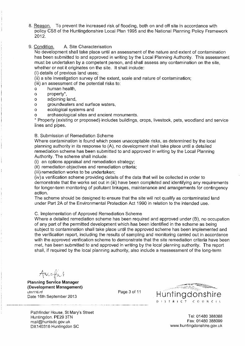
1.2 Outline planning permission for 78 dwellings was granted in
September 2013, ref. 1300164OUT, following a resolution by the Panel in May 2013. Condition 1 of this planning permission approved two accesses to the development site for vehicles and pedestrians; one from Broadway and the second from Mere View (via the private Willow Road).
1.3 Permission is now being sought to vary condition 1 of planning
permission 1300164OUT to alter the means of vehicle and pedestrian access to the residential development, so that it is served exclusively from the access to Broadway; in effect ‘deleting’ the access from Mere View.
1.4 The appearance, scale, layout and landscaping of the development
were the ‘reserved matters’ for future consideration. 1.5 An update to the transport assessment has been submitted in support
of this application.

2. NATIONAL GUIDANCE 2.1 The National Planning Policy Framework (2012) sets out the three
dimensions to sustainable development - an economic role, a social role and an environmental role - and outlines the presumption in favour of sustainable development. Under the heading of Delivering Sustainable Development, the Framework sets out the Government's planning policies for : building a strong, competitive economy; ensuring the vitality of town centres; supporting a prosperous rural economy; promoting sustainable transport; supporting high quality communications infrastructure; delivering a wide choice of high quality homes; requiring good design; promoting healthy communities; protecting Green Belt land; meeting the challenge of climate change, flooding and coastal change; conserving and enhancing the natural environment; conserving and enhancing the historic environment; and facilitating the sustainable use of minerals.
2.2 The CLG Planning Practice Guidance is also relevant in relation to
highway safety and flexible options for existing planning permissions. For full details visit the government website www.gov.uk/government/organisations/department-for-communities-and-local-government 3. PLANNING POLICIES 3.1 Saved policies from the Huntingdonshire Local Plan (1995)
• H37: “Environmental Pollution” – housing development will not be permitted in locations where there is a known source of environmental pollution which would be detrimental to residential amenity. • H38: “Noise Pollution” – development sites adjoining main highways, railways, industrial operations and other potentially damaging noise pollution sources will be required to adopt adequate design solutions to create acceptable ambient noise levels within the dwellings and their curtilage. • T18: “Access requirements for new development” states development should be accessed by a highway of acceptable design and appropriate construction. • En12: “Archaeological Implications” – permission on sites of archaeological interest may be conditional on the implementation of a scheme of archaeological recording prior to development commencing. • En20: “Landscaping Scheme” – Wherever appropriate a development will be subject to the conditions requiring the execution of a landscaping scheme. • En25: "General Design Criteria" - indicates that the District Council will expect new development to respect the scale, form, materials and design of established buildings in the locality and make adequate provision for landscaping and amenity areas.

• CS8: “Water” – satisfactory arrangements for the availability of water supply, sewerage and sewage disposal facilities, surface water run-off facilities and provision for land drainage will be required. • R7 “Land and Facilities” – For new residential development of 30 dwellings or more (or 1.2ha), in addition to the provision of children’s casual and equipped play space, the District Council will normally seek the provision of (or equivalent contribution towards) formal adult and youth play space. • R8 “Land and Facilities” – consideration will be given to the acceptance of contributions from developers towards improving recreational facilities in the vicinity.
3.2 Saved policies from the Huntingdonshire Local Plan Alterations
(2002)
• HL5 – Quality and Density of Development - sets out the criteria to take into account in assessing whether a proposal represents a good design and layout. • HL6 – Housing Density - indicates that housing development shall be at a density of 30-50 dwellings per hectare. • OB2 – Maintenance of Open Space – contributions may be sought for the maintenance of small areas of open space, children’s play space and recreational facilities, woodland or landscaping to benefit the development.
3.3 Adopted Huntingdonshire Local Development Framework Core
Strategy (2009)
• CS1: “Sustainable development in Huntingdonshire” – all developments will contribute to the pursuit of sustainable development, having regard to social, environmental and economic issues. All aspects will be considered including design, implementation and function of development e.g., by making best use of land, buildings and existing infrastructure. • CS2: “Strategic Housing Development” – during the period 2001 – 2026, a total of at least 14,000 homes will be provided. • CS3: “The Settlement Hierarchy” – Identifies Yaxley as a ‘Key Service Centre’ in which development schemes of moderate and minor scale and infilling may be appropriate within the built up area. • CS4: “Affordable Housing in Development” – Proposals of 15 or more homes or 0.5ha or more should seek to achieve a target of 40% affordable housing with a target of 70% social rented accommodation with the balance being provided as intermediate housing. In determining the amount and mix of affordable housing to be delivered, specific site conditions and other material considerations including viability, redevelopment of previously developed land • CS10: “Contributions to Infrastructure Requirements” – proposals will be expected to provide or contribute towards the cost of providing

infrastructure and of meeting social and environmental requirements, where these are necessary to make the development acceptable in planning terms.
3.4 Draft Huntingdonshire Local Plan to 2036: Stage 3 (2013)
• Policy LP 1 – ‘Strategy and principles for development’:
The Council will support proposals which contribute to the delivery of new housing, economic growth and diversification and infrastructure provision through, amongst others: • market towns and key service centres will make provision for approximately 7,850 new homes and support economic and community development that serves needs in the most sustainable locations, promotes the vitality and viability of established communities and maintains their character and identity. Development proposals will be expected to, amongst others: a. prioritise the use of previously developed land in accessible locations; b. contribute to the creation or maintenance of mixed and socially inclusive communities by integrating development of homes, jobs, services and facilities; c. make efficient use of land, buildings and infrastructure within existing settlements whilst preserving local character and distinctiveness; e. maximise opportunities for use of public transport, walking and cycling; f. provide appropriate infrastructure to meet the needs generated by the proposed development; i. reduce water consumption and wastage, minimising the impact on water resources and quality and managing flood risk; and j. protect and enhance the historic environment and the range and vitality of characteristic landscapes, habitats and species.
• Policy LP 2 – ‘Contributing to Infrastructure Delivery’:
A proposal will be supported where it makes appropriate contributions towards the provision of infrastructure, and of meeting economic, social and environmental requirements. Community Infrastructure Levy: Applicable developments will be liable to pay the Community Infrastructure Levy (CIL) as set out in the Huntingdonshire Community Infrastructure Levy Charging Schedule or successor documents. Planning Obligations: Contributions in addition to the CIL may be necessary to make the proposals acceptable in planning terms. Such contributions will be calculated as set out in the Developer Contributions Supplementary Planning Document (SPD) or successor documents and will be sought through a planning obligation.
• Policy LP 6 – ‘Flood Risk and Water Management’

Surface Water - a proposal will be supported where: d. sustainable drainage systems (SuDS) are incorporated where possible in accordance with the Cambridgeshire SuDS Design and Adoption Manual and the Cambridgeshire SuDS Handbook (forthcoming) or successor documents to the satisfaction of Cambridgeshire County Council as SuDS approval body and considered comprehensively with water efficiency measures; e. the standing advice of the appropriate Internal Drainage Board and the Middle Level Commissioners has been taken into account for the proposal if surface water would drain to an Internal Drainage Board area; and f. there is no adverse impact on, or unacceptable risk to, the quantity or quality of water resources by incorporating appropriate measures to help achieve the strategic aim of reducing impact and risks to the quality and quantity of water resources and to help meet the objectives of the Water Framework Directive.
• Policy LP 9 – ‘Development in Key Service Centres’:
Yaxley is defined as a Key Service Centres. A housing scheme, including a residential institution and supported housing, will be supported where it is appropriately located within the built-up area of the Key Service Centre.
• Policy LP 11 – ‘The Relationship Between the Built-up Area
and the Countryside’
Built-up Areas. All settlements defined as Key Service Centres, Small Settlements or as settlements that are part of a Spatial Planning Area, are considered to have a built-up area. The built-up area is defined as a continuous group of 30 or more houses. It excludes: a. gardens, paddocks, agricultural land and other undeveloped land in the curtilage of buildings on the edge of the settlement where the land relates more to the surrounding countryside than to the built-up area of the settlement; b. outdoor sports and recreation facilities, other formal open spaces and agricultural buildings on the edge of the settlement
• Policy LP 13: “Quality of Design” - A proposal will need to be
designed to a high standard based on a thorough understanding of the site and its context.
• Policy LP 15: “Ensuring a High Standard of Amenity” - A
proposal will be supported where a high standard of amenity is provided for existing and future users and residents of both the surroundings and the proposed development.
• Policy LP 17: “Sustainable Travel” - A proposal will be
supported where it is demonstrated that: a. opportunities are maximised for the use of sustainable travel modes; b. traffic volumes can be accommodated and will not cause significant harm to the character of the surrounding area; c. any adverse effects of traffic movement to, from and within the site including

the effect of car parking is minimised; d. a clear network of routes is provided that provides connectivity and enables ease of access, to, around and within the proposal and with the wider settlement for all potential users, including those with impaired mobility; and e. safe and convenient pedestrian and cycle routes, including links to new and existing services, facilities, footpaths, bridleways and the countryside are provided where appropriate and if possible formalised as rights-of-way.
• Policy LP 18: “Parking Provision” - A proposal will be
supported where it incorporates appropriately designed vehicle and cycle parking with a clear justification for the level of provision proposed.
• Policy LP 24: “Housing Mix” - Proposal for housing will be
supported where the sizes, types and tenures of housing responds to advice and guidance listed in the policy and all new-build homes will be expected to comply with Lifetime Homes standards or successor standards.
• Policy LP 25: “Affordable Housing Provision” – a target of
40% of all housing should be affordable where the scheme: a. includes 10 or more homes or 0.3ha or more of land for housing development; or b. where it is located within any of the defined small settlements and includes 3 or more homes or 0.1ha or more of land for housing development. Affordable and market housing should be integrated across the scheme. The affordable housing provision should seek to meet identified affordable housing need in the district. The target is 70% of new units as social or affordable rented properties. An alternative dwelling or tenure mix or a lower level of provision may be supported where it can be demonstrated that the target is not viable.
• Policy LP 30: ‘Open Space’ - Proposals will be expected to
include open space as set out in the Developer Contributions Supplementary Planning Document or successor documents and to provide or improve connections to open spaces and green infrastructure nearby. Proposal should seek to avoid the whole or partial loss of an area of open space, an outdoor recreation facility, area of garden land or allotment that meet specific criteria. Where such loss is unavoidable the proposal will be expected to include appropriate mitigation and/or compensation.
• Policy LP 31: “Heritage Assets and their Settings” - Great weight is given to the conservation of any heritage asset; more weight is accorded to assets of greater significance. A proposal which affects the special interest or significance of any heritage asset or its setting must demonstrate how it will conserve, and where appropriate enhance, the asset. Any harm must be fully justified and this harm will be weighed against the public benefit of the proposal. Substantial harm or loss will require exceptional justification. Harm to assets of the highest significance will require wholly exceptional justification.

Local policies are viewable at https://www.huntingdonshire.gov.uk 4. PLANNING HISTORY 4.1 1300164OUT – residential development of 78 dwellings (outline),
permitted September 2013. Copies of the report, decision notice and drawing showing the approved means of access are included on ‘Green Paper’.
5. CONSULTATIONS 5.1 Yaxley Parish Council – recommend refusal (copy attached) 5.2 HDC Operations – requested drawings showing that a refuse freighter
is able to turn within the site. The applicant submitted a drawing and any comment from Operations will be reported to members at or before the meeting.
5.3 County Council Highways – no objection. 5.4 County Council Archaeology – any response will be reported to the
Panel at or before the meeting. 5.5 County Council Education - no reply. Any response will be reported
to the Panel at or before the meeting. 5.6 County Council Planning - no reply. Any response will be reported to
the Panel at or before the meeting. 5.7 Primary Care Trust - no reply. Any response will be reported to the
Panel at or before the meeting. 5.8 HDC Environmental Health – no reply. Any response will be reported
to the Panel at or before the meeting. 5.9 HDC Housing - no reply. Any response will be reported to the Panel
at or before the meeting. 5.10 National Grid - no reply. Any response will be reported to the Panel
at or before the meeting. 5.11 Police Architectural Liaison Officer - no reply. Any response will be
reported to the Panel at or before the meeting. 5.12 Cambridgeshire Fire & Rescue - no reply. Any response will be
reported to the Panel at or before the meeting. 6. REPRESENTATIONS 6.1 Received 3 representations (2 objections and 1 raising concerns)
regarding two principal issues: - highway safety. - neighbour amenity. It is commented that:

- the revised transport assessment underestimates the impacts by averaging out the traffic flows when in fact the congestion at the roundabouts junctions on Broadway will be worsened. - conflict with bus stop opposite. - conflict between vehicles accelerating away from the Violet Way roundabout towards Farcet and vehicles waiting in Broadway to enter the site. - the steep slope to the access will make exiting the development difficult.
7. SUMMARY OF ISSUES 7.1 In determining an application to remove or vary a condition of a
planning permission, the Local Planning Authority must consider the ‘question’ of the condition. That is to say, would the approved residential development be made unacceptable by the variation of condition 1?
7.2 The main issue is whether the variation of condition 1 to ‘delete’ the
Mere View access to the residential development site, so that it is served exclusively by the Broadway access, makes the approved development unacceptable now, having regard to highway safety, neighbour amenity, servicing and the connectivity of the development with the wider settlement of Yaxley.
7.3 The applicant explains that serving the residential development
exclusively from the Broadway access will create a better environment for the residential development and remove the potential for conflict between the residential and commercial vehicle movement. Such concerns were not expressed during the consideration of the outline planning application and Officers do not consider this explanation to be convincing. However, the proposal must be considered on individual merit having regard to planning policy and other material considerations.
Highway safety: 7.4 The application is accompanied by an update to the Transport
Assessment, which in order to determine the impact of serving the residential development exclusively from the Broadway access, has made an assessment of the capacity of the following junctions, allowing for growth up to 2016 and including an allowance for the Great Haddon development:
(i) Broadway/Site Access priority junction (ii) Broadway/Violet Way mini-roundabout (iii) Broadway/Mere View mini-roundabout
7.5 The update to the transport assessment and modelling of traffic
‘flows’ found no capacity issues at these junctions in 2016 with allowances for the worst case traffic growth, a 15% increase allowance for the Great Haddon development and the proposed development being occupied and served exclusively from the access with Broadway.

7.6 The Local Highway Authority has considered the update to the transport assessment and has no objection to this proposal subject to conditions.
Neighbour amenity: 7.7 Serving the approved residential development exclusively from the
access with Broadway is likely to result in more vehicles using this access and a resulting increase in levels of noise and disturbance within the vicinity of the properties flanking the access. Given the width of the access and the potential for noise attenuating fencing and planting, the effects of this are not considered to be significantly detrimental to residential amenity.
Connectivity: 7.8 It would have been desirable for the development to have been
served by the two approved accesses, so that the development was ‘permeable’ giving occupiers of the properties - particularly at the southern end of the development - a more direct and convenient route through the development and out into the village.
7.9 Given the scale of the development, it is not considered that
connectivity between the residential development and the rest of the village would be made significantly worse by serving the development exclusively from the access to Broadway, such that a reason for refusal could be sustained. The applicant has submitted a tracking diagram showing that a refuse freighter is able to turn within the site.
Other matters: 7.10 In determining an application to remove or vary a planning condition,
the effect of approving this application is to grant a new planning permission and therefore the Local Planning Authority must have regard to the development plan and other material considerations.
7.11 With regard to the development plan, it is considered that the
development remains acceptable for the reasons explained in the previous report to the Development Management Panel and that the applicant will be required to enter into a deed of variation to carry forward the agreed section 106 obligations, including residential wheeled bins, affordable housing and open space, in the event that permission is granted.
7.12 With the exception of the proposed variation to condition 1 of planning
permission 1300164OUT, it is necessary to carry forward all previously imposed conditions; some in a modified form to take account of the ‘deletion’ of the access to Mere View (via Willow Road).
7.13 It was reported in the ‘Friday Letter’ to the May 2013 meeting of the
Development Management Panel that the policies of the Stage 3 Draft Local Plan to 2036 (2012) has been considered prior to the grant of outline planning permission. The Planning Practice Guidance has been published since the previous grant of permission and has been taken into account in coming to the recommendation of approval.

7.14 This application includes an amended indicative layout. Layout is not
to be determined at this time and Officers remain of the view that 78 dwellings can be satisfactorily accommodate on the site. As with the previous permission, the indicative layout would be specifically excluded from the permission.
7.15 The concerns raised by the 3 neighbouring occupiers regarding
highway safety and noise/disturbance are noted and have been addressed above.
Conclusion: 7.16 The approved residential development as proposed to be varied by
‘deleting’ the access to Mere View is considered to be compliant with relevant national and local planning policy, and can therefore be approved as it can be developed without significant harm to:
- residential amenity, - the future operation of adjoining industry, - highway safety, - servicing by refuse freighter, - street scene - archaeology - foul drainage and water pollution. - surface water drainage and flood risk. - health of future occupiers arising from contamination
7.17 For these summary reasons the proposal is compliant with the
National Planning Policy Framework 2012, policies H37, H38, T18, En12, En20, En25, CS8, R7 and R8 of the Huntingdonshire Local Plan 1995, policies HL5, HL6 and OB2 of the Huntingdonshire Local Plan Alteration 2002, policies CS1, CS2, CS3, CS4 and CS10 of the Huntingdonshire Core Strategy 2009 and policies LP1, LP2, LP6, LP9, LP11, LP13, LP15, LP17, LP18, LP24, LP25, LP30 and LP31 of the Draft Huntingdonshire Local Plan to 2036: Stage 3 (2013).
8. RECOMMENDATION - APPROVE subject to the prior
completion of deed of variation to carry forward the Section 106 obligation relating to affordable housing, open space and wheeled bins and to conditions to include those below or REFUSE if the applicant has not completed the necessary obligation to secure affordable housing AND is unwilling to agree to an extended period for the determination of the application.
Development to be carried out in accordance with approved access details Time limits as previously approved (submission of reserved matters by 15th September 2015 and implementation by 15th September 2017) Reserved matters Reserved matters to include 25m buffer area

Foul water drainage
Surface water drainage Contamination Acoustic barriers, sound reducing double glazing, impervious close boarded fencing, no outside amenity areas in some cases Fire hydrants Archaeology Highways conditions Levels Landscaping replacement
If you would like a translation of this document, a large text version or an audio version, please contact us on 01480 388388 and we will try to accommodate your needs. CONTACT OFFICER: Enquiries about this report to Mr Gavin Sylvester Assistant Development Management Officer 01480 387070


Application Ref: 1400162S73o© Crown copyright and database rights 2014
Ordnance Survey HDC 1000223221:5,000Scale = Date Created: 06/05/2014
!
Development Management Panel
Location: Yaxley
LegendThe Site


GREEN PAPERS FOLLOW

DEVELOPMENT MANAGEMENT PANEL 20 MAY 2013 Case No: 1300164OUT (OUTLINE APPLICATION) Proposal: PROPOSED RESIDENTIAL DEVELOPMENT - 78
DWELLINGS (OUTLINE) Location: LAND INCLUDING SNOWCAP MUSHROOM SITE AT
MERE VIEW Applicant: R AND H ESTATES Grid Ref: 519285 292943 Date of Registration: 05.02.2013 Parish: YAXLEY
RECOMMENDATION - APPROVAL 1. DESCRIPTION OF SITE AND APPLICATION 1.1 The application site is located south of Broadway, northeast of Mere
View/Willow Road and west of the East Coast Main Line. There is residential development to the north and industry/offices on the other three sides. The site itself is currently occupied by a mushroom farm, industrial premises and a scrap yard. The application site has an area of 2.34ha. Access to the development would be from Broadway and the north end of Willow Road.
1.2 The application is in outline but access is to be considered at the
outline stage. The application is accompanied by an illustrative layout showing how it could be developed and demonstrating that the site is capable of accommodating the scale of development proposed (78 dwellings). The illustrative layout is not necessarily the way the development will be carried out, that will be established at the reserved matters stage.
2. NATIONAL GUIDANCE 2.1 The National Planning Policy Framework (2012) sets out the three
dimensions to sustainable development - an economic role, a social role and an environmental role - and outlines the presumption in favour of sustainable development. Under the heading of Delivering Sustainable Development, the Framework sets out the Government's planning policies for : building a strong, competitive economy; ensuring the vitality of town centres; supporting a prosperous rural economy; promoting sustainable transport; supporting high quality communications infrastructure; delivering a wide choice of high quality homes; requiring good design; promoting healthy communities; protecting Green Belt land; meeting the challenge of climate change, flooding and coastal change; conserving and enhancing the natural environment; conserving and enhancing the historic environment; and facilitating the sustainable use of minerals.

2.2 Paragraphs 203-205 state that “Local planning authorities should consider whether otherwise unacceptable development could be made acceptable through the use of conditions or planning obligations. Planning obligations should only be used where it is not possible to address unacceptable impacts through a planning condition. Planning obligations should only be sought where they meet all of the following tests: * necessary to make the development acceptable in planning terms; * directly related to the development; and * fairly and reasonably related in scale and kind to the development. Where obligations are being sought or revised, local planning authorities should take account of changes in market conditions over time and, wherever appropriate, be sufficiently flexible to prevent planned development being stalled.”
2.3 Technical Guidance to the National Planning Policy Framework on
flood risk. Safer Places – The Planning System and Crime Prevention 2004
Circular 01/2006 – Guidance on changes to the development control system
Community Infrastructure Regulations Noise Policy Statement for England For full details visit the government website http://www.communities.gov.uk 3. PLANNING POLICIES Further information on the role of planning policies in deciding planning applications can also be found at the following website: http://www.communities.gov.uk 3.1 Huntingdonshire Local Plan 1995 (Saved policies)
• H37: “Environmental Pollution” – housing development will not be permitted in locations where there is a known source of environmental pollution which would be detrimental to residential amenity.
• H38: “Noise Pollution” – development sites adjoining main
highways, railways, industrial operations and other potentially damaging noise pollution sources will be required to adopt adequate design solutions to create acceptable ambient noise levels within the dwellings and their curtilage.
• T18: “Access requirements for new development” states
development should be accessed by a highway of acceptable design and appropriate construction.
• R7 “Land and Facilities” – For new residential development of
30 dwellings or more (or 1.2ha), in addition to the provision of children’s casual and equipped play space, the District Council will normally seek the provision of (or equivalent contribution towards) formal adult and youth play space.
• R8 “Land and Facilities” – consideration will be given to the
acceptance of contributions from developers towards

improving recreational facilities in the vicinity of the site to off set recreational requirements sets out in R7.
• En12: “Archaeological Implications” – permission on sites of
archaeological interest may be conditional on the implementation of a scheme of archaeological recording prior to development commencing.
• En20: “Landscaping Scheme” – Wherever appropriate a
development will be subject to the conditions requiring the execution of a landscaping scheme.
• En25: "General Design Criteria" - indicates that the District
Council will expect new development to respect the scale, form, materials and design of established buildings in the locality and make adequate provision for landscaping and amenity areas.
• CS8: “Water” – satisfactory arrangements for the availability of
water supply, sewerage and sewage disposal facilities, surface water run-off facilities and provision for land drainage will be required.
3.2 Huntingdonshire Local Plan Alterations 2002 (Saved policies)
• HL5 – Quality and Density of Development - sets out the criteria to take into account in assessing whether a proposal represents a good design and layout.
• HL6 – Housing Density - indicates that housing development
shall be at a density of 30-50 dwellings per hectare
• OB2 – Maintenance of Open Space – contributions may be sought for the maintenance of small areas of open space, children’s play space and recreational facilities, woodland or landscaping to benefit the development.
3.3 Huntingdonshire Local Development Framework Core Strategy 2009
• CS1: “Sustainable development in Huntingdonshire” – all developments will contribute to the pursuit of sustainable development, having regard to social, environmental and economic issues. All aspects will be considered including design, implementation and function of development e.g., by making best use of land, buildings and existing infrastructure.
• CS2: “Strategic Housing Development” – during the period
2001 – 2026, a total of at least 14,000 homes will be provided
• CS3: “The Settlement Hierarchy” – Identifies Yaxley as a ‘Key Service Centre’ in which development schemes of moderate and minor scale and infilling may be appropriate within the built up area.
• CS4: “Affordable Housing in Development” – Proposals of 15
or more homes or 0.5ha or more should seek to achieve a

target of 40% affordable housing with a target of 70% social rented accommodation with the balance being provided as intermediate housing. In determining the amount and mix of affordable housing to be delivered, specific site conditions and other material considerations including viability, redevelopment of previously developed land or mitigation of contamination will be taken into account.
• CS10: “Contributions to Infrastructure Requirements” –
proposals will be expected to provide or contribute towards the cost of providing infrastructure and of meeting social and environmental requirements, where these are necessary to make the development acceptable in planning terms.
3.4 Development Management DPD: Proposed Submission 2010
• C1: “Sustainable Design” – development proposals should take account of the predicted impact of climate change over the expected lifetime of the development.
• C2: “Carbon Dioxide Reductions” – major development
proposals will include renewable or low carbon energy generating technologies. These should have energy generating capacity equivalent to 10% of the predicted total CO² emissions of the proposal.
• C5: “Flood Risk and Water Management” – development
proposals should include suitable flood protection / mitigation to not increase risk of flooding elsewhere. Sustainable drainage systems should be used where technically feasible. There should be no adverse impact on or risk to quantity or quality of water resources.
• E1: “Development Context” – development proposals shall
demonstrate consideration of the character and appearance of the surrounding environment and the potential impact of the proposal.
• E8: “Sustainable Travel” – proposals must demonstrate how
the scheme maximises opportunities for the use of sustainable travel modes, particularly walking, cycling and public transport.
• E9: “Travel Planning” – A Travel Plan will be required where
the development involves large scale residential development; employment/commercial development in excess of national guideline figures or non-residential institutions including schools and colleges. The Travel Plan will need to demonstrate that adequate mitigation of the transport impacts of the proposal can be achieved.
• E10: “Parking Provision” – car and cycle parking should
accord with the levels and layout requirements set out in Appendix 1 ‘Parking Provision’. Adequate vehicle and cycle parking facilities shall be provided to serve the needs of the development.

• H1: “Efficient Use of Housing Land” – housing developments will optimise density taking account of the nature of the development site; character of its surroundings and need to accommodate other uses and residential amenities such as open space and parking areas.
• H2: “Housing Mix” – a mix of housing is required that can
reasonably meet the future needs of a wide range of household types in Huntingdonshire and reflect the advice and guidance provided within the Cambridgeshire and Peterborough SHMAs and relevant local housing studies. Regard must also be given to other materials factors specific to the site.
• H7: “Amenity” – development proposals should safeguard the
living conditions for residents and people occupying adjoining or nearby properties.
• P3: “Safeguarding Employment Areas” – proposals for
alternative uses outside Established Employment Areas on land last used or used for employment uses will not be permitted unless it can be demonstrated that the continued use of the land for employment purposes is no longer viable.
• D1: “Green Space, Play and Sports Facilities Contributions” -
informal green space should be provided on site where possible, taking account the nature of the development proposed and the existing local provision. Where provision is not made on site, an appropriate financial contribution will be made.
3.5 Policies from the Huntingdonshire Local Plan to 2036 - Draft Strategic
Options and Policies (2012)
• Draft Policy 5: “Scale of development in Key Service Centres” – sustainable development proposals located within the Key Service Centres will be acceptable where they are in accordance with policies of this Plan.
3.6 Policies from the Huntingdonshire Local Plan to 2036 - Draft
Development Management Policies (2012)
• DM1: “Safeguarding local employment opportunities” – proposals shall safeguard Established Employment areas to balance the provision of employment across the district. The application site is not a designated Established Employment Area.
• DM5: “Sustainable travel” – development proposals should
demonstrate opportunities for use of sustainable travel modes, traffic volumes will not exceed the capacity of the local or strategic transport network, the effect of traffic movements and parking is minimized, connectivity is provided, and it is safe for pedestrians and cyclists.

• DM6: - “Parking provision” – development proposals should ensure that sufficient parking is provided to meet its needs and minimise impacts on existing neighbouring uses.
• DM9 – “Affordable Housing in Development” – Proposals of 15
or more homes or 0.5ha or more should seek to achieve a target of 40% affordable housing with a target of 70% social rented accommodation. In determining the amount and mix of affordable housing to be delivered, specific site conditions and other material considerations will be taken into account.
• DM13: – “Good design and sustainability” – requires high
standards of design for all new sustainable development and the built environment.
• DM14: “Amenity” – requires development proposals to provide
a high standard of amenity for existing and future users of the proposed development and its surroundings.
• DM20: “Integrated renewable energy” – development
proposals shall provide integrated renewable energy equipment in the design of new buildings in order to reduce carbon dioxide emissions.
• DM23: Flood risk and water management” – outlines the
considerations for the acceptability of development in relation to the risk of flooding, including the implementation of Sustainable Drainage Systems (SuDS).
• DM 28: “Developer contributions” –development proposals
shall contribute towards local infrastructure, facilities and services from sustainable development proposals, predominantly through the Community Infrastructure Levy and Section 106 agreements.
3.7 Supplementary Planning Documents:
• Developer Contributions SPD 2011 4. PLANNING HISTORY 4.1 1201352OUT Proposed residential development - not exceeding
81 dwellings. Withdrawn. 5. CONSULTATIONS 5.1 Yaxley Parish Council – Recommend approval. Questions have
been resolved. A worthwhile and good use of unused land. (Copy attached)
5.2 HDC Environmental Health – Noise and Odours – The application is
for residential development in a predominantly industrial area. We had reservations about this proposal and requested changes to the originally proposed layout. The plan submitted reflects those requests, most notably to include the 25m standoff from the west boundary of Clarksteel to aid dispersion of odours and increase distance attenuation of industrial noise but also in relation to

orientation of buildings. Plan AP0001_P19 dated 24 January 2013 should not be departed from without further consultation on noise/odour.
5.3 The application is accompanied by a noise report (SEM/J2300/14531)
which concludes that relevant residential noise standards can be met with the appropriate mitigation measures in place. These mitigation measures are substantial and essential to making the development acceptable in noise terms. For the avoidance of doubt the recommendations should be included as conditions in the event that permission is granted. (Acoustic barriers, sound reducing double glazing, impervious close boarded fencing, no outside amenity areas in some cases).
5.4 Land Contamination - The site has between 0.35 and 1.55 metres of
made ground, locally containing elevated levels of arsenic, cadmium, lead, nickel, BaP and TPH. Remediation is necessary and this should comprise removing redundant foul, surface water and land drains and any contamination and replacing with uncontaminated soil in gardens and open spaces.
5.5 HDC Operations – For the development of 78 units there is a
requirement for 0.57ha of public open space (exclusive of unusable areas such as highway verges). The new buffer provides approximately 1300m2, less than the required 5700sqm. A scheme of this size would require 460m2 of equipped play provision and a LEAP or a LAP should be provided as the minimum for play provision on the site.
5.6 Cambridgeshire County Council (Highways) – No objection subject to
conditions relating to full details of the access, roads etc being constructed to binder course surfacing level before first occupation and completion of the highway improvements. The transport assessment has already been assessed by the County Council and been found to be acceptable for application 1201352OUT which was for more dwellings. Request a contribution to the improvement of the cycleway along Broadway towards Peterborough.
5.7 Cambridgeshire County Council (Archaeology) – The ground
investigation report borehole logs indicate some potential for undisturbed former land surfaces, which may contain archaeological remains extending southwards from a known Iron Age and Roman settlement to the north. Due to the current working industrial yards, warehouses and scrap yard in combination with contaminated soils known from within the proposed development area we are happy to recommend that the archaeological programme of works would best occur post consent once the demolition of the existing buildings has occurred and the yard surface has been removed. This would enable a more structured evaluation trench array to occur giving us a better understanding of the archaeological potential of the site. The evaluation results would demonstrate the need for further archaeological work to take place ahead of development, or conversely, that the site has been too badly damaged in the past for any archaeological remains to have survived. An archaeological condition applied to any planning consent for this development area would be appropriate.

5.8 Environment Agency – Comments awaited 5.9 Cambridgeshire Constabulary Police Architectural Liaison Officer –
No comment. There have been extensive consultations in respect of the layout and comments about crime reduction and reducing the fear of crime have all been addressed or mitigated in this submission.
5.10 Cambs Fire & Rescue Service – Adequate provision for fire hydrants
should be made via condition. 5.11 Network Rail – No objection subject to soundproofing being secured
by condition and an informative added to the decision notice relating to the need to ensure access to the railway is kept open at all times.
6. REPRESENTATIONS 6.1 An objection has been received on behalf of Clarksteel:
- The proposal will have a serious adverse impact on Clarksteel’s ability to operate and develop its factory satisfactorily. - The juxtaposition of the factory with residential development will result in unsatisfactory living conditions for future residents. - The factory operates 24/7 with work carried out inside and outside the buildings. The manufacture of steel products involves: articulated lorry movements up to 10pm; loading of up to 25 lorries per day with forklift truck operating in the yard; noisy operations, including percussive noise; a galvanising plant with an Environmental Permit with associated ventilation units which operate continuously. - The revised noise report indicate the site will be subject to a high level of noise from Clarksteel and other premises and it will be difficult to achieve a satisfactory noise environment for residents. - The proposed layout is cramped, poorly laid out and there are too many dwellings on the site. This is borne out by the Council’s own assessment for the emerging Local Plan restricting development to the southern and western part of the site. The illustrative layout does not reflect that. - The illustrative layout provides inadequate green space to compensate for the deficit. - Clarksteel has already been the subject of noise complaints from residents further away so it is entirely foreseeable that the development will increase complaints with more and closer housing impeding the operation of the factory, preventing planned future growth and ultimately putting the factory at risk. Clarksteel have operated from the site for 50 years and employ 130 people. - The proposal is contrary to Core Strategy Objective 4, paragraphs 17, 19, 56, 59 and 123 of the National Planning Policy Framework, the Framework objective to build a ‘strong, responsive and competitive economy’ as demonstrated by appeal decision APP/Y2736/A/12/1270715 relating to a comparable case. - If notwithstanding the strong objections the Council is minded to grant permission the development should be limited to 40 dwellings away from the northern and eastern parts of the site protected by a noise attenuation barrier limiting noise to less than 50dBLAeq at the boundary and not more than 30 dBLAeq inside dwellings at all times, noting that Clarksteel need to operate 24 hours with allowance made for future expansion to protect their legitimate business, economic and employment benefits.

7. SUMMARY OF ISSUES 7.1 The main planning issues are:
- the principle of the development - the impact of surrounding uses on the living conditions of future residents and the impact of new residential properties on the future operation of adjoining industry - design - provision of open space - archaeology - highways - S.106 considerations, including affordable housing
Principle of the development 7.2 Yaxley is identified as a Key Service Centre in the Core Strategy and
emerging local policy. In the former ‘moderate’ scale residential development of 10-59 dwellings is appropriate but the policy also provides that development proposals of a larger scale may be allowed where site specific circumstances demonstrate that this secures the most sustainable option for the site. In the more recent Local Plan to 2036 Draft Strategic Options and Policies the site is identified as Potential Housing Allocation YX2 for approximately 40 homes requiring a form of development which addresses the adjacent steelworks and proximity to the railway to ensure adequate amenity for future residents. The site is not designated as an Established Employment Site. The proposal is acceptable in principle.
7.3 The impact of surrounding uses on the living conditions of future
residents and the impact of new residential properties on the future operation of adjoining industry
7.4 The development of the site is constrained by adjacent industrial uses
on three sides, especially the steel works to the east, and by its proximity to the East Coast Main Line. In addition to noise and odour issues arising from the surrounding industry, the large buildings at the steel products factory are unattractive and dominate the eastern side of the site. The use of part of the site as a mushroom farm has itself given rise to complaints from existing residents in the area and another part of the site is an unattractive scrap yard. The redevelopment of the site with housing is desirable in principle but this should be undertaken in such a way that future residents have a satisfactory standard of amenity. Paragraph 123 of the National Planning Policy Framework (the Framework) states that planning decisions should avoid noise giving rise to significant adverse impacts on health and quality of life as a result of new development. It refers to the Explanatory Note to the Noise Policy Statement for England. Conversely, decisions should recognise that development will often create some noise and existing businesses wanting to develop in continuance of their business should not have unreasonable restrictions put on them because of changes in nearby land uses since they were established. An objection submitted on behalf of the steel factory makes this point and provides an appeal decision in which an Inspector concluded “Paragraph 123 of the NPPF requires that planning decisions should aim to avoid noise from giving rise to significant adverse impacts on health and quality of life. Reference is

made to the Noise Policy Statement for England which, in turn, sets out the aim to not only avoid significant adverse impacts on health and quality of life but also requires that ‘all reasonable steps should be taken to mitigate and minimise effects on health and quality of life…’ so a very simple and reasonable step is not to place new residential units immediately next door to general industrial uses”. Each case has to be treated on its merits and it is considered that the concerns in this case are adequately addressed by the buffer zone which has been introduced in the illustrative layout accompanying the application. This will provide reasonable protection to future occupiers of the site and not put undue limitations on Clarkesteel’s use of their site.
Design 7.5 Paragraph 52 of Circular 01/2006 says for outline planning
applications detailed consideration will always be required on the use and amount of development and that as a minimum, the application should always include information on the amount of development proposed. The purpose of an illustrative layout is to demonstrate that the site can accommodate the amount of development proposed. In this case the layout is not for consideration at the outline stage giving the eventual developer of the site the flexibility to propose alternatives. If aspects of an illustrative layout are considered to be important to achieving a satisfactory form of development the planning authority can impose a condition or put a note on the decision as appropriate.
7.6 The main factors which have influenced the layout are the position of
the accesses and the presence of industrial uses and buildings on the site boundaries. The illustrative layout is a revised version of one which accompanied application 1201352OUT which gave rise to concerns about the proximity of new housing to the Clarksteel factory. The revised layout includes a 25m wide area which will provide a clear corridor along the eastern edge of the site to provide noise attenuation by distance and allow any odours to disperse. The illustrative layout is considered to show that the site can be developed satisfactorily (in terms of optimising the potential of the site, creating good streetscapes and responding to local surroundings) for the amount of development proposed. It will however be important to ensure that the 25m wide area is included as part of any future reserved matters submission.
Provision of open space 7.7 A development of 78 units would require 0.57ha of public open space
(exclusive of highway verges, shelter belts, structural planting, existing woodland, surface water attenuation areas). The new buffer area provides approximately 1300m2. An off-site contribution would be required to mitigate for the shortfall in open space and children’s play provision.
Land contamination 7.8 Ground investigations have shown that the site has been
contaminated by its former uses but this can be remediated by removing contaminated soil and drainage systems and replacing

them with uncontaminated soil in gardens and open spaces. A condition will require the submission of a detailed remediation strategy before any remedial work is undertaken. On completion of the remedial measures a verification report will be required prior to occupation of the development.
Archaeology 7.9 The site is in an area of archaeological potential. The presence of
buildings and yards and the potential for ground contamination mean that in this case archaeological investigation is best carried out after the grant of planning permission, once the site has been cleared but before construction commences.
Highways 7.10 The Local Highway Authority has considered the transport
assessment and proposed access arrangements and has no objections to the development. The indicative plan shows appropriate car parking provision.
S.106 considerations, including affordable housing 7.11 Following the introduction of the Community Infrastructure Levy
Charging Schedule the following applies for the scale of residential development proposed at this site.
Affordable housing 7.12 The site is over 0.5 hectares in size and therefore the development
should seek to achieve a target of 40% affordable housing in accordance with Core Strategy Policy CS4 and the Developer Contributions SPD (Part A). With the proposed number of dwellings of up to 78 this would equate to up to 31 units. Provision should be made on site and it should seek to achieve a target tenure split of 70% social rented and 30% shared ownership.
7.13 In the context of withdrawn application 1201352OUT a detailed
assessment of viability was undertaken. The Council’s consultants view, which was not accepted by the applicants, was that the development would be viable if affordable housing provision was made at 40% with a 50/50 tenure split or 40% and 70/30 if the absence of Homes and Communities Agency grant meant that the affordable homes would not have to be built to higher Code for Sustainable Homes standards than the standards applicable to market housing under the Building Regulations. The issue was not resolved pending the preparation of a revised application to take account of the impact of the neighbouring industrial premises. The revised application (albeit in outline) proposes about 4% fewer houses but about 8% less floorspace. This reduction will clearly have an impact on viability. Some costs of developing the site as a whole remain largely unchanged but there will be lower build costs and lower sales revenue.
7.14 The applicant has offered 25% affordable housing at a 50/50 tenure
split and requested that this be accepted in view of the delays, additional design and consultants fees incurred because of the

unforeseen need to revise the application, the general state of the economy and the need to provide new housing. Taking into account these factors, the desirability of redeveloping this challenging and unsightly site which has given rise to complaints in its former use and the local support from the Parish Council it is consider that in these particular circumstances the amount of affordable housing proposed by the applicant can be accepted. Officers have suggested and the applicant has agreed that in order to emphasise the desirability of bringing forward the redevelopment, the normal 3 year period for submitting reserved matters should be reduced to 2 years. This would also mean that the viability could be reassessed at an earlier date if the outline permission is not taken up.
Green space 7.15 In accordance with Core Strategy Policy CS10 and the Developer
Contributions SPD (Part B) proposals of between 10 and 199 dwellings are required to provide the development specific land for informal and formal open space. The overall requirement is 2.12ha per 1,000 population for usable, informal green space and play and 1.61ha per 1,000 population for outdoor sport. All other requirements will be met by the CIL charge. For 78 dwellings and using the 2011 average household size of 2.33 persons per household the requirement for a development population of 182 would be broadly:
Type of open space Requirement per person in hectares
Area required in square metres
Formal Green space for outdoor sports (1.61ha/1000 population)
0.00161 2930
Informal Open Space (2.12ha/1000) – made up of:
0.00212 3853
Parks and Gardens (0.48ha/1000)
0.00048 872
Natural and Semi Natural Green Space (0.23ha/1000)
0.00023 418
Allotments and Community Gardens (0.32ha/1000)
0.00032 582
Amenity Green Space (1.09ha/1000) – made up of:
0.00109 1981
Play facilities – casual space (0.55ha/1000)
0.00055 1000
Play facilities – equipped space (0.25ha/1000)
0.00025 454
Other amenity green space (0.29ha/1000)
0.00029 527

7.16 In this case the appropriate on site provision would be land for a LEAP (Local Equipped Area for Play – 400sqm) or a minimum of a LAP (Local Area for Play – 100sqm).
Footpaths and access 7.17 Under Part C of the SPD, this requirement is limited to on-site
provision of appropriate publicly accessible routes to move within the site and in and out of the development. The new development road through the site will provide this route.
Other community provision 7.18 Health (Part D), Community Facilities (Part E), Libraries and Lifelong
Learning (Part F), Education and Schools (Part G) For all these categories, provision is made for proposals smaller than large scale major residential developments (200 or more dwellings) through CIL contributions.
Residential wheeled bins 7.19 Contributions for the provision of wheeled bins should be secured
through a planning obligation at a rate of £57.20 per dwelling for the supply of all three bins (Part G).
7.20 The views of the S106 Working Group which precedes Panel will be
reported at the meeting If you would like a translation of this document, a large text version or an audio version, please contact us on 01480 388388 and we will try to accommodate your needs. 8. RECOMMENDATION - APPROVE subject to the prior
completion of a S.106 obligation relating to affordable housing, open space and wheeled bins and to conditions to include the following:
Nonstand - Time limits (2 years for submission of reserved matters) Nonstand - Reserved matters Nonstand - Reserved matters to include 25m buffer area Nonstand - Contamination Nonstand - Acoustic barriers, sound reducing double glazing, impervious
close boarded fencing, no outside amenity areas in some cases
Nonstand - Fire hydrants Nonstand - Archaeology Nonstand - Highways conditions CONTACT OFFICER: Enquiries about this report to Nigel Swaby, Development Management Team Leader 01480 388461