:fmln~jc'.item · .. · · t.t!ls'~.1~ndar.1tem· no. §2...
TRANSCRIPT

···.··if~'· · •. ·:: ·: :fMlN~JC'.ITEM · .. · · T.t!ls'~.1~ndar.1tem· No. §2...
,' ';r - ' ,,,, - ~ . ' • . <; • ,~ -~ ! '<' • J,.
was approveCI as Minute lt&m ;\lo.~ by the State Landa Commlsnlon by a vote ~f .£ to o at its "1-/'e., l1 meeting.
A 7
s 1
APPLICANT:
CALENDAR ITEM
•• 39
APPROVAL OF A RECREATIONAL PIER PERMIT
Reid W. Dennis 225 Mountainwood Lane Woo.dside, California 94601
02/06/89 RC 7277 W 209S3 p J. Ludlow
AREA, TYPE LAND AND LOCATION: A parcel of submerged land in Lake Tahoe, south of Tahoe City, Placer County.
LAND USE: Reconstruction and maintenance of a pier and two boathouses.
TERMS OF PROPOSED PERMIT: Initial period: Ten year.s beginning January,
198.9.
CONSIDERATION: Rent-free pursuant to Section 6S03.5 of the P.R.C.
APPLICANT STATUS: Applicant is owner of upland.
PREREQUISITE CONDITIONS, FEES AND EXPENSES: Filing fee and processing costs have been received.
· STATUTORY AND OTHER REFERENCES; A. P.R.C.: Div. 6, Parts 1 and· 2; Div. 13.
8. Cal. Code of Regulations: Title 2, Div. 3; Title 14, Div. 6.
-1-
CALENDAR ITEM NO. 3 9 (CONT'D}
AB 884: 03/25/89.
OTHER PERTINENT INFORMATION: 1. Pursuant to the Commission's delegation of
authority and the State CEQA Guidelines (14 Cal. Code Regs. 15025), the staff has prepared a Proposed Negative Declaration identified as EIR ND 449, State Clearinghouse No. 88101911. Such Proposed Negative Declaration was prepared and circulated for public review pursuant to the provisions of CEQA.
Based upon the Initial Study, the Propos~d Negative Declaration, and the comments recaived in response thereto, there is ·no substantial evidence that the project will have a significant effect on the environment. (14 Cal. Code Regs. 15074(b))
2. In order to determine the other potential trust uses in the area of the proposed project, the staff contacted represeritatives of the following agencies: TRPA, Department of Fish and Game, County of Placer, and Tahoe Conservancy. None of these agencies expressed a concern that tha proposed project would have a significant effect on trust uses in t~e area. The agencies did not identify any trust needs which were not being met by existing facilities in the area. Identified trust uses in this area would include swimming, boating, walking along the q~ach, and views of the lake.
There are piers on both sides of the subject pier.
3. This activity involves lands identified as possessing significant environmental values pursuant to P.R.C. 6370, et seq. Based upon the staff 1 s consultation with the persons nominating such lands and through the CEQA review process, it is the staff's opinion that the project, as proposed, is consistent with its use classification.
-2-
CALENDAR ITEM NO. 3 9 (CONT 1 0)
4. All permits covering structures in lake Tahoe will include a condition subsequent that if any structure authorized is found to be in nonconformance with the Tahoe Regional Planning Agency's shorezone ordinance and if any alterations, repairs, or removal required pursuant to said ordinance are not accomplished within the designated time period, then the permit will be automatically terminated, effective upon notice by the State, and the site shall be cleared pursuant to the terms thereqf'.
5. The County of Placer has received notice of the proposed project and has no objection to the pier reconstruction or to the issuance of the State Lands Commission's permit.
APPROVALS OBTAINED:
EXHIBITS:
Tahoe Regional Planning Agency, United-States Army Corps of Engineers.
A. land Description. B. Location Map. C. Placer County Letter of Cons,~t. D. Negative Declaration.
IT IS RECOMMENDED THAT THE COMMISSION:
1. CERTIFY THAT A NEGATIVE DECLARATION, EIR ND 449, STATE CLEARINGHOUSE NO. 88101911, WAS PREPARED FOR THIS PROJECT PURSUANT TO THE PROVISIONS OF THt CEQA AND THAT THE COMMISSION HAS REVIEWED AND CONSIDERED THE INFORMATION CONTAINED THEREIN.
2. DETERMINE THAT THE PROJECT, AS APPROVED, WILL NOT HAVE A SIGNIFICANT EFFECT ON THE ENVIRONMENT.
3. AUTHORIZE ISSUANCE TO REID W. DENNIS' OF A TEN-VEAR RECREATIONAL PIER PERMIT BEGINNING DATE OF JANUARY, 1989, FOR THE RECONSTRUCTION, USE AND MAINTENANCE OF ONE RECREATIONAL SOAT DOCK AND TWO BOATHOUSES ON THE LAND DESCRIBED ON EXHIBIT 11 A11 ATTACHED AND BY REFERENCE MADE A PART HEREOF.
-3-
· , .; '· l 2 o~ ,..., ~NOAR PAGE:-.... -.: "'l
5 ~ . ·; ~) T L. i: MfiUl'E, PAGE .:. :. .... '

. ',r '·~' ~ • ..- ...;-.. 't •"'~ r t,,. {"' ': < •
e()cK ce1B
~1 .. A~: .. LAmi: :~cRl:~?ioti· , . . , .
~ ..
·PREPARED DECEMBE:" 9,
l!'#$.C£D,i.£ DE<:k
"1;10• ./D!5T5fl 2'190.C.
'
0
H•tJlf /~,,,., .. (>STEEL PIU.~
15'0.C..
I JI z'"·~ I "" •
Dr£NPll.£
P1£.e Af ZJ:)(;>'~ I PIE~ A.r :J'IO~ I
Pl:OP. £11./~ Ar KJo '± I P£OP. UtVI! A 7: ~o 't
IWA 'MYMOND VAIL ind ~SOCfATES. >tsMift11mc a. .. d · •.o. bi 1n. tetioi Cltt. CA tmo. CtsN 11,.,;.,
j
l P~OFlli°
I ~
··~AGE
~~E'

v~:I;~~~:~-;-> .. ·.· ... · ................................................. ~ .......................... ~ -~ l, .... ·:. ;,,. ,, tr
·~
..
I w w I ,.... IO I
~
.,
N UJ UJ ID ,.._
0: 0:
Tl6N
UJ UJ . ID ,.._
0: 0:
T 15 N
; ; I Kings Beach
/~-way T•h••v... J J.r
Agate Bay
I II I I I I I I I I I
LAKE: . I
TA H o!E· I I I I I Placer Co~tY..... - -I
- -El Do~u County I
EXHIBIT "B"
UJ ,....
0:
.W 20953 T 14 N
T 13 N 'llJ UJ ,.._ IO
a: a:
• I •• I Ii I •) ••. ·t
"~ ·; '+~ ;,
.... I
..... .... l
~~ j1
.r ·13.N,~ UJ UJ CO. CJ\
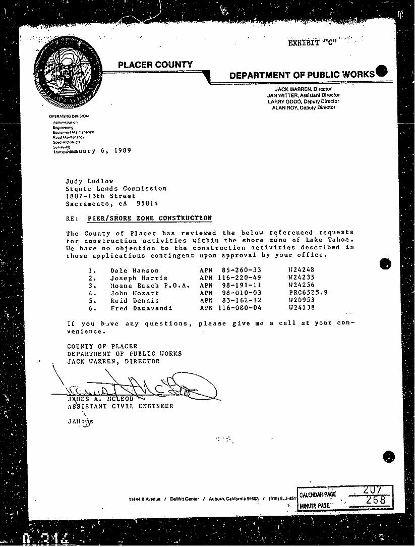
PLACER COUNTY
OPERAllNG DIVISION
En91ntt"11n9 EQ01pmtnl Ma1n1en.ance Roao Ma1n1tnanc~ S~1a: 01SU•CIS
S"'"~•Nl t .. n.;,J'1a.p,ua r y 6 1 198 9
Judy Ludlow Stqate Lands Commission 1807-13th Street Sacramento, cA 95814
DEPARTMENT OF PUBLIC WORKS-'===============~--.!=====
JACK WARREN, Director JAN WITTER, Assistant Director LARRY ODDO, Deputy Director
ALAN ROY, Deputy Director
RE: PIER/SHORE ZONE CONSTRUCTION
The County of Placer has reviewed the below referenced requests for construction activities within the.shore zone of Lake Tahoe. \le have no objection to the construction activities described in these applications contingent upon approval by your office!
l . Dale Hanson APN 85-260-33 \124248 2. Joseph Harris APN 116-220"':'49 ·\124235 3. Hoana Beach P.O.A. APN 98-191-11 W24256 4. John Mozart APN 98-010-03 PRC6525.9 5. Reid Dennis APN 83-162-12 ll20953 6. Fred Damavandi APN 116-080-04 W24138
If you _ll·.;ve any questions, please give me a call at your convenience.
COUNTY OF PLACER DEPARTUENT OP PUBLIC UORKS
\JACK llAR~REN,~E:TOR~~-
,~-;:\~ ~~c ~~ J'AlfES A.l'iC~ c::
' ASSISTANT CIVIL ENGINEER \
JM~ :~~s
·:. :··
11444 B Avertue I O.W1tt Center I Auburn. C11t1ornla 95ro.1 I (916) t.J·451

;:,.. su-' ... ,_ 1807-llth Str_ee_t __ ~ ___ Jll. C111 ---s_a-c_ra;;..m...;.e;..n_t_o _ __, ___ _ e· °""''': _____ s ... a"""c.-.ra_me_..._n.._to ____ lei. zsp· __ .;..95_8._1_4 ___ ~. ~· __ (._9_1_6._) 3_2_2_-'1_1_11_3 __
l'lll1IC't UJCtnO\ •· eaw.rr· ___ P_.1 ... a .. c .. e_r ______ ••· <'1tr1C.....,117·_..n ... e..,a_r_T_a_h_o_e.__C_f_t ... y ____ _ 11. • .........,. •• h.rul "°·------ tc. :i..:u ... _____ _ ''f'es., _______ IWl1• ______ _
:la. C'rou St..-.i..· $b ''" R•'ftl. -r .. t ---------------- . c.-:nur: ______________ _
, S1&t1t Al,.. ~II· lu.r-1, •1u11e 2 •II••: a. ,,.,. •_ ... 8_9 ____ "· pono.._ __ n_o ___ c ... ,. __ n_o ____ ti ... ,.~~
• • llXLWM 1TI'!
~ 01. _to>
o::. _blrlr ~·
03 • ...!_ .... ~
°'· _Draft 1:111
QI, llCl -Cf, _ ICIC
QI, -IQ)
3111>111-•t/ ~- ~tmoq-t ti• (1'1'~~11o.:
°'·_!IOI
IC. POCSI -.-!!'!!!!!
""'" u._ris
1:._u
u. _Joll\ o=-at
''· _nat fJOl:\mrn 15, _OtlMr ____ _
10. 10TJt. MJl!3.
•· Dl'nl.l'I_,. m'll
01. -~"""' Plu Vpdat• o::. _ ..... ,._,.,
Ol, -~-.-1 Plu Mt-ot
04, _ ... t.erPloa
oa._-.. u• OI. _SpocU&c Plu
at. _o-.&1tr Plu
°'---1-•: °'·--IC. L&nc! Dltl SIDD
~UUIOO, .... ,,,.,
~.1Tut .:vt~~ .-,., .. ,, n. -~t ,,.l:l~~-'<{'.)\_ 12. lili;!:.t Plu ":.··\ r::·-- . ., . ., -<: • ••• u. ..... Ac ...... ._ \.:.
1•. i-.o-·-ub>T.+..;;~.;. • ....,('.;.., ..;..;:;:; ..
01, _llnttlHShl l:ftlta ___ Acn1_
o:. __ orou. Sq. ''· AcNo.._ ____ ....... ..,. .... ____ _
OJ. _noi.uc1c-rc1a1: Sq."·----Ac'"----- .... oy-..r..~----Ac,..... _____ blplor"'•-----
C$, __,h.cu hc&lltt•s' IC:>. ______ _
Cl&, _TnN;IO"-'ltlOO: T;w-------07. _IC•••I' ll;Mral ________ _
QI, --~: T\orr ____ l•tll ___ _
Cll, _l'ur. 'fr'<oata11111· 1);-: ______ _
10. CICS hlat..S
u. x OtMr: pier 'reconstruction
-. ll• .'IUUL JIOllS au.~
&I:.· ~ fS'QllS OISJ:l:mll> Ill ax:aolRf <::· !S." :.._Septic Srat-
~1· &nlHUt:/Yl ... I oe. r'f ~•11t:n1oac.. <:is: ~' C.pacnr
:t:I. _,u .. ~111, :1•. _•u~r s~rrlr
- - '~ I /"n,-;-"i.\ \. -cz. _..,..1 ... u..,..1 Lud oe. _~, .. ~~1-c 11. _Soc1a1
Cl. _Alr 1>.iel:11 10. _Jocs/lb..stq lt.l...:u JI, _Soll troo1oa
Q4, _Ardlholcvlc.al/llUCOncal u. _, lllHr&I• 11. _:t•ltd hat•
OS. -~IX.... 12. _!Col.,. • 21), _TO&Sc/llA:>o.-UI
~. _•nll.lld/IUJ1lrUo
:is. _111a1u.
%1. ,,_CrQortl\ loduclDll
:it. -'""°"'"Ubl• La.od,..,.
OS. -"""-• ll· _!'l.t>llc ~.-.lctc .21. _TrafUc/ClrculaUae 2!1. _c-.a.aauv. Ul~ta
er:. _Fll'T llaurd 14. _,.,,,..,.,.. ::!, -\'~t&U« )0, _OU.•r _____ _
ll. ~ laf'P"'•I '""""'I '·--------- Si.t• s _________ Tntel '---------
If, ~ !.L"!l ll:Ji tic 'l!Jl'l!IC:
Reconstruction of an existing pier.

( . .. , .mm" : -= ==- -
STATE LANDS COMMISSION 1807 13TH STREET SACRAMENTO, CALIFORNIA 95814
I STATE OF CALlfOJlNIA ·STATE LANDS C\.. .11SSION -==TOP.D1 •&&S"-:.:u • .:..:- • • = ce•r • •
1
•
HOTICE OF PUBLIC REVIEW OF A
PROPOSED NEGATIVE DECLARATION {Section 15073 CAC)
File Ref.: W 20953
Date: Oct. 20, 19:
A Proposed Negative Declaration has been prepared pursuant to the requirements of the California Environmental Quality Act (Section 21000 et seq., Public Resources Code), the State CEQA Guidelines {Section 15000, et seq., Title 14, California Administrative Code), and the State Lands Commission regulations (Section 2901 et seq., Title 2, California Administrative Code), for a project currently being processed by the staff of the State Lands
The document is attached for your revieW. Colll\lents should be addressed to tit the State Lands Commission office shown above, with attention to the under-
Commission.
signed. All cowments must be received by November 9, 1988.
Should you have any questions or need additional information, please ca11
(916) 322-7813. .
ATTACHMENT
.- . • ~ Cl\1.€NOAR p~ ,
MlNUTlPAGE
;t:'sr.\l'E of: cAli;ORNiA-STAiE·a;.(NoS CO·
STATE LANDS COMMISSION 1807 13TH STREEli
' 3StON.
GEORGE DEUKMEJiAN: G1111~mor ,
e SACRA¥ENTO, CALIFORNIA 95814
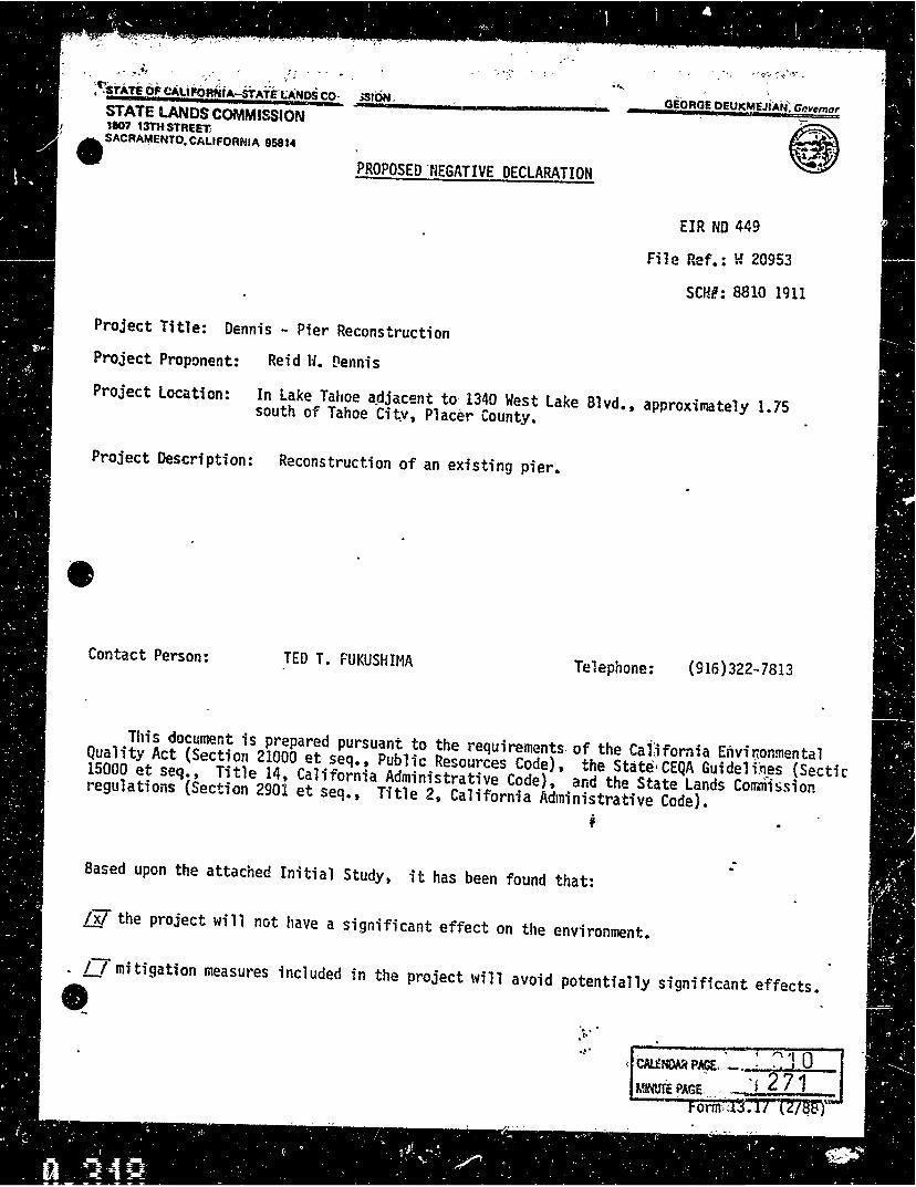
PROPOSED.NEGATIVE DECLARATION @ , .
Project Title: Dennis - Pier Reconstruction
Project Proponent: Reid H. tlennis
EIR ND 449
File Ref.: W 20953
SCHH: 8810 1911
Project Location: In lake Tahoe a_djac~:nt to 1340 West Lake 81 vd., approximately 1. 75 south of Tahoe Ciiv, Placer County.
Project Description: Reconstruction of an existing pier.
Contact Person: TED T. FUKUSHIMA Telephone: (916)322-7813
This document is prepared pursuant to the requirements, of the Cal;ifornia Envii::onmental Quality Act (Section 21000 et seq., Public Resources Code), the State1 CEQA Guideli'.tl__es (Sectic 15000 et seq., Title 14, California Administrative Code), and the State Lands Commission regulations (Section 2901 et seq., Title 2, California Administrative Code).
;
Based upon the attached Initial Study, it has been found that:
Ix! the project will not have a significant effect on the environment •
. f_j mitigation measures included in the project will avoid potentially significant effects • • .. ,. -~. . . . ' '"''I Q
~ CAU!NOAA PAGE, - , ' ' , I
J.~PAGE~ - . "j 2 71

I
-(. ·15TA1E. lANlis· coMM1ss~oN .,
ENVIRONMENTAL IMPACT ASSESSMENT FORM - Part I (To be completed by applicant) FORM 69.31t 11821
A. GENERAL INFORMATION
1. Name, address. and tell?phone number:
a. Applicant
Reid W. Dennis
~25 Mountain Wood Lane
Woodside, CA 94n61 •
( 415 I 851-!l571l
Date Filed: 10 ' 19 · ?.8
File Ref.: W 20953
b. Contact per~on if other than applicant:
Kevin H. Agan
Raymond Vail Associates
395 Nor~h Lake Blvd •• Tahoe City
916 l 583-3417
2. a. Project location: (Pleale re'rt:rence to nearHt town or community and include countV)
In Lake Tailo~ adjacent to 1340 I.Jest Lake Blvd4, approximately 1. 75 miles south of
Tahoe City, Placer County.
b, Assessor'! parcel number: __ 8_3_-_1_6_2-_1_2 ________________________ _
3. Existing zoning of project site: __ .;_---------------------------
4. Existing land use of project site: __ R ... e.._c ... r..;e ... a;..;t ... i.o.;.;n.;.a.;.1...;o;...i...;e ... r ____________________ _
5. Proposed u1e of site:_~Sa..;.m .... e;;;..·:.., ...;r...;e;;..;c;..;;o..;.n..;;.s..;;.t.;..ru~~c;;..t;;..i;..;o;;.,;.n;.....;;o.,.f_.;t..;.h.;;;.e...:p~1.;..;· e;;;.;r...;·~-----~----------
6. Other permitsrequired: Tahoe Regional Planning Agency( obtained), Deot. of Fish & Game( pen
ding); Regional Water Q~ality Control Board(obtained) ---------------~~-----------
B. PROJECT DESCRIPTION
1. For building construction projects, complete "ATTACHMENT A".
2. For non·building construction projects: Describe fully, the proposed activity, its purpose and intended use, e.g. for propose~ mineral prospecting permits, include the number of test holes, size of holes, amount of material to be excavated, m;wmum surface area of dist~r!Jance, hole locations, depth of holes, .:tc. Attach plans or other drawings .is ni:icessarv.
------------~~

I ,"y
·: . •· ' : .C.-· ·ENVtRONMENTAL'SETTING
1. Describe the project site ts it exists befo:-i the project, including hiformation on topagr1phy, aoll stabilitv. plants and anim1ls, and 1nv cultural, historic:JI, or scenic asptcts. Describe any existing 1\ructure1 on tht 1it1, and the use of tht structures.
See attached environmental assessment Ol!scr1be the surrounding properties, including information on planu .tnd animals and 1ny cultural, historical, or ~nie 1w1ct1. indicate the tYP! of land use (residential, commercial, etc.), intensity ,.,, land use (ont·f1mily. apartmant houses. &hops, d1p1rt· ment stores, etc.), and sc1l1 of development (hei~t. frontage, set-back, n,ar yard, etc.).
D. ENVIRONMENTAL IMPACT ASSESSMENT
Answer the fc.~~.ming Qtu>tions by placing • chtck in the appropriaHl ho•. Oitcun tll items chKktd "yts" or "maybe". (Attach additional sheets as nKOss1ry)
Will the project involve: YES MAYBE NO
1. a chin QI! in existing futures of anv bliys. tidtlancl;, beaches, lakes, or hitls, or substantial 1lttration • • • • • • • • 0 0 [i} of ground contours?
2. a ch1n91 in scenic vi41W$ or vistas from existing resid«\tial areH or public llnds or ro.ds7 • • • • • • • • • • • • . • • 0
J. I change in pattern, sale, Or character 01 the general area Of projecti' •••• 1 ••••• • • , • • • • • • • • • • • • • • • n 4. a significant effect on plant or animal life?. • • • . • . • • • • • • • • • • • • • • • • • • • • • • • • • • • • • • • • . • . • • • • 0
5. significant amaunts of solid waste or litter? • • • • • • • • • • • • • • • • • • • • • • • • • • • • • • • • • • • • . • • . • . . • • 0
6. a chan~ in dust, ash, smoke. fumes, or odors in the vicinity?. • • • • • • • • . • • • • • • • • • • . • • • • • • • • • • • • • 0 a change in ocean, bay, lake, stream, or ground water quality or quantity, or alteration of existing drainage pattern$?
D
8. a change in existing noise or vibration levels in thP. 'llicinity?. • • • • • • • • • • . • . • • • • • • • • • • • • • • • • • • • • • [R} Temporary-during removal of old pi~r and construction of the new one
~· construction on filled land or on slope of 10 percent or more?. • • • • • • • • • • • • • • • • • • • • • • • • • • • • • • • • 0
10. we or dispasal of potentially hazardou~ materials, such 11 toxic or r•dioactive • • • • • • • • • • • • • • • • • • • • • • 0 substances, flammables. or explosives?
, 1. a change in demand for municipal setvices (police, fire, water, sewage, etc.)7 0
~ 0
0 0 0 0
0 IR
0 0
0
0 0
0 IXl
0 lil
0 Gl
12. an increase in follis fuel coniumption t•ltctriciw. oil, natural Qis, etc.)7 ••••••• , • • • • • . • • • • • • • • • • . • 0 0 @
13. a larger project or a serie: of projecu7 •••••••••••••••••••••••••••••••• ~:. • • • • • • • • • • • • • • • 0 0 Q
E. CERTIFICATION
I hereby certify that !he statements furnished above and in the attached exhibits present th• data and information r•· quired for this inilial evaluation to the best of my ability, and that thl'! facts, statemenu, and information pr111nted are true and correct to the best of my knowledge and belief.
Daie: ___________________ _ Signed=------------------

l
_'S'("~~-~~c~ss•~· ,,,
ENVIRONMENTAL IMPACT ASSE~iwlENT Cf:t.ECKUST - PART 11 "°'"' u.20 c1112)
w 20953 Fil• Ref.-.: ---------
I. BACKGROUND INFORMATION
A. Applicant: Reid W. Dennis 225 Mountainwood Lane Woodside, CA 94061
B. Checklist Date: __ 10__._/_1_9_..../_8_8 __
c. Ccniact Person: TED T. FUKUSHIMA
Telephone: { 916 I 322-7813 D. Purpose: Reconstruction and continued use and manitenance of an existing pier.
E. Location: In Lake Tahoe adjacen to 1340 West Lake Blvd., approximately 1.75 miles south of Tahoe City, Placer County4
F. Description: Reconstruction of an existinq pier.
G. Persons Contacted=------------------------------------
II. ENVIRONMENTAL IMPACTS. (Explain all "yes" and "maybe" ans~rsl
A. f.iJrtlt. Will the p~oposai result in:
1. Unstable earth conditions or changes in geologic substructures? ••..•.••.•.•..••.•••.•.•.••..•
2. Disruptions, displacements, compaction, or overcovering of the soil? ..•..••..•••.•..•.•...•••..
3. Change in topography or ground surf<ce reiief features? •••••.•..••.•••••••..•.•••.••.••...
4. The destruction: covering, or modifici tion of any unique geologic or physical feature..? •.••••••••..•.
-5. Any'increase in wind or water erosion l)f soils, either on or off the site? •.•••••••.•.•••• : •••.••••
6. Ch;myc~ in deposition or erm1on of bedch sands, 01 c_hanges in siltation, deposition or erosion winch may 'modify the channel of a ri11er or stream or the bed ol the ocean or any bay, inlet, or lake? •.•..••.•...
7: Exposure of all people or property to geologic hazards su,ch as ea1tht1uakes, landslides mudslides. ground
Yes Maybe
[j [J D i"'I [J [J [I Cl Cl C8 I I I
l. I l I
1a11u1e: or s1m11ar ha1.ards? ....•....•....••. • •• · •• • •• · •. · •• • • • · • • · • cJu:ENbAlifiAG£J..,·_· ___ ....,..
MINUTE PAGE .• 1------

Ji~.: ~!~U~:p~oj)i~ !~t.in. ·l 1·. Suh\tinti.11 au 1?1JHTI1\\i~1th 0t de• ·
'J. The cicatton of ob1ect1onablc otlors?.
J. Alter01t1c11 of air movement, moisture ot tem~1r.rature, or any change in climate, either locally or regionally?. e C. hi111•r. Will tht? p1opo~al iesult 1n:
1. C 1an!1••s in the currents. or the course 01 d1rect1on of wate1 movements, in either marine or fresh waters?
2. Chan~s in abso1pt1on rates. dramagP. patterns, or the rate ancfamount of surface water runoff? •.••....•
J. Alterations to the course 01 flow of tlootl Willers> ..•...
4. Change in the amount ol s111face water in any water body?. . . •.••...••...••.•....••.•..••.
&. Disch;uqe mto surface Naters. 01 in any altrr a11nn of surlai:e water quality. including but not limited to IPrn111•1,11mr., l11ssolvrd c xygcn 01 turb1d1tv?. . . . • . . . • . . • , . . ...••....
G. Altc1Jtiu11 •11 the duc·rt un 111 rat<' of flow of !trouml \\,1le1s>.
7. 0lall4l! m thr quantity ol 91 ounl1 WJlers. t?lther through dnect adt11tions or withdrawals, or through inter ception of .m auu1fc1 by cuts or excavations? . • . • • • • . . . • . . . . ............. .
8. S11~ta11t1al reduchon m ;hi: amount of wate1 otherw1s1? a11;11lahlc• for pubhc'water supplies'
9. Ex1111\u1c uf people m pror>c•tv to water·relatP.<I hazards sud1 a~ flooding or tidal waves? ......••...••
10 S1q111lll".111t t:hJnQt•\ 111 the 1o•m1lera1urr. flow or r.hcmical c11nte111 of surface thermal sriring\' .......... .
0. l'/Jlll I ti•" Woll lhc l'ICi!IOSJI 1r-.ult m:
t. Ch;.•111<? m the chw1 \llV uf ,pec11!s. 01 1111mbt1 of .my spi:c•C\ of plants (mc!udmg tree\. shrubs. grass. crops, .111<1 aqu;it..- plants!'. . . . . . • . . . . ••.•..••.•••..•••..•••••........
'2. R~'\f11ct1u11 ol tht' numb•·h col any unique, rare or endangered sprc1cs of plants? •••••••••..•.•.•...•
3. lntrocluction of new species of plants into an area, or m a harrier to the norm;! replemshm~nt of e"istmg species' .••..........•...•.....• " ..•....•..•.••••••.••••••••..••••••.•.....
4. Reduction 11l acreage of any agricultural crop? ....•..•.•.•.•.•..••••••.•••..•.•..•.....
E ·l11i11111/ /.if1· Will tht' pro1i.J;al re~ult in:
1. C:ha1111t! in the <11 ... l'!r\1ty of ~per1es. 01 numbl'I~ ol anv species of animals (birds. land animals including 11?flllll!\, 11\h anti sh1!llf1~h. benthic or!la1f1sms. 01 msectsl? •.••••••••••••••.•..•••..••.......
2. R1•duction of tlrn numb•!rs of any umque, rare or endangered species of animals? •••••.•..••.••...•.
3 1111roclt11:11011 of new s1Ncies of animals into an drea, or rc~ult in a barrier to th!! migration or movement of animals? ....••.•••.....•.......••........•.•••••. , ••••••••••.•• , .•...•....
4. Octr.riuratinn to ex1st1ni1 fi\h or wilclhfe habitat' ......•....••••••••••••••••....•.•....•.
l. lncrrasc 1n existing noist? lc\'~ls? .........•..•.••••.•.•..•••..•••••••.•••.••.•...•..
2. E Xl'OSlllC of people to S•!verc noise level\? f
G. J.(1(./11 mu/ <il1m'. Will the proposal result m:
1. The ll•Ollu1;tion of new light or glaiu' ...•
H. I.um/ C:"" Will the p1oposul result m:
L A suhsta11t1JI altc1t1tl(ln of the pres•mt 01 planncrl lancl use of an mea? .•....•..•...•.•......
I. /\'utural lfr.\1111rn•.\, Will the proposal result in:
1. Increase in the r;ite of use or any natural resources? ..•••.••.••••••..••..•...•.•.•.•...•.•
2. Substantial depletion of any nonrenewalJle re~ourccs? ••••.•...•••.•••.•.••••••.••. ', ...•..
2
..'[I. I I ·Ix! [I l I rx i 1 ·.1 I I 1x i
I I 1x: I
I "l I i Ix l I '] I I 1x I I
I .I I 1x;
I I I I 'x I ,
!X
,x: I I x ! . I I
I I . :x I ' ... I I Ix
x
'x; I • . ' x·
! I :
I ix : . I I
1·1 iX!
1X:
I I I ;x, I
r ~1 ix:
I. i ix~
1 · ! .x: I. I
[ -, ' I :x•

,, .J; HiJ. 11fi'1"e1: '0tl\'\.1he P;.<.iJt·· ·v~i · Maybe N~
1. A 11\k of •11 rxplnsion or the releue of huardous sumtances (inchiiiing. but not llmlttd to oil pesticides ch1m11cJls, or radiation) in the event of an accident or upset conditioni? •••••••.• , ••• , : •• ' ••••••• :
2: ·Possible interference with emergency response plan or an emtrgency evacuation pl11n? ••••••••••• ~ •••
K. /'fl/tttlatimr. Will the proposal result in:
0 0 [i
DClJ 1. The 111teration, distribution, density. or growth rate of the human population of the area? . • • • • • • • . • • • 0 [J I!
l. /lmuintt. Will the pr<iposal result in:
1. Affecting existing housing, or create a demand for ~ditional housing7 . • • • • • • • • • • • • • • • • • • • • • • • • 0 0 ~ M. 1rumf'mlatiun/Cirrulutintt. Will the proposal r~ult in:
1. Generation of substantial additional vehicular movement? ••••••••••••••••••• , • • • • • • • • . • • • • . 0 [] ~ 2. Affcc:ting existing parking facilities. or create a demand for new parking?. • . • • • • • • • • • • • • • • . . . • • • • D [] rx
L·1 l_.l l~ 3. Sulntant1al impact upon existing transportation systems? ••••••..•••.••••.• , • • • . • . • . . . . . . . _ _
4. Alteiations to present pattern\ of circulation or movem1mt of people and/or goods? • • • • . . • . • • . • . . • . [1 [] ~ S. Alte1ations to waterborne, rail, or air traffic? •••..•.•..•.•• , •.••••••••••••.•.•••••••••.. L. 'J [' _..,t LX
G. lncrt>asc in traffic hazards to motor vehicles, bicyclists, or pedestrians? •••.•.•••.•.•••••.•••••.. D L·-·1 l·x_
N /'11/lli1· .'frrri1·1•!.. Will the proposal have an effect upon, or result in a need for new or altered gove:nmental sc1v1ccs in any of 1he following areas:
l. Fne protection> ........•..•.•..•......•....••.•••.•• · • • • · • • • · • •••.•• • • · • · • • • ·
7.. Police 1>rotec11on? ..•..........••••...•.••...•.•.••.•••••.••.••.•••.•••.••••••
3. Schools? • . . . . . . •....•....•.•.••.• " ••.••••••.•..•••••.••.••••...•••••••.•.
4. P.irks and other recreational facilities? .••••.•..•..•.•.•..•••••••••••••••••.••.••••••.
5. Ma1ntrndnce uf public facilities, including roads? .•••••.••..••••••.••••••.•••.••••.•.••..
6. Oth~r governmental services? •..•..••••..•..•.•.•.•••••••••••••••.•..••.••..•.••..
0. 1."11t·rxy. Will the proposal result in:
[~] l_-1 !>_ 1. Use uf substantial amounts of fuel or energy?. • • . . • . • • • • • • • • • • • . • . • • • • • • • • • • • • • • • . • • . . . _
2. Suhstanllal increase in demand upon existing sourcr:sof energy, or require 'he development of new ;ources? • D rJ ~ P. llti/itil•.\. Will the proposal result in a need for new systems, or substantial alterations to the following utilities:
L-.] [J h 1. Power or natural gas? ......•...••.••••••••••.•••••••••••••••••••••••.•••••• • • · • "'
2. Communication s•1stems? ...•.••••••••••.•••••...•••••• • ••••• • ••• • • • • • • · • • · • • • · • 0 D f} 0 --, r
3. Wdl.er? •••••••......•..•.•.•••.•••••.••.•..••••••• • ••••.•••••• • • • · · • • • • • • · · _ I I ,> 0 [ "l
4. Sewer or septic tanks? .•.•..•..••••••.•...••••.••.••••••••. f\ ... · ... · . · · · '• · · · · · · I i;
S. Storm water drainaye? ...•..•••..•••••••••.•• • •• • • • • • • • • • • • • • • • • • • · • • • • • · • • • • • • • [~] l~ [: 6. Solid waste and disposal? •.•.••.••....•••.••••.. · · •• • • • • • • · • • • • • • • • • • • • • • • · • • • • • f_l 0 [.
0. l/umun /lrultlt. Will the proposal result in:
1. Creation of any health ha1;ull or potential health hazard (excluding mental health)? • • • • . • • . • . • • . . . . l] [J ?. Exposu1e of peo11le to potential health hazards7 •••••••••••••••••••••.••••••.•••. • • · • • · • [J [I I
R. ..tl'~tlil'tiC'.\. Will the proposal result in:
1. The obstruction of any scenic vista or view open to the public, or will the proposal result in the creation of ("] an a«!sthetically offensive site open to public view7 ••.••••••••••.••.••••••••••• • • · · · • · • • •
S. R1·rr1•uti1111. Will the propos~l result in:
I ·· 1 f . I ' 1. An impar.t upon the quality or quantity .of existing recreational opportunities? ••••.•••••••••.. • .. · •
- 3,-

: t ~ ~ ~ ', ~ ·-~-- ·-~~:~ ·. : ~~~ -:~ /: ' . .,,Vis M~~.,_ Nn
: '1' Woli ... P,<0~1 "'"" ;" lhe ~i .. .:1.,,, •i'Df-thO """"''"'" of • lk•h;"odc;o, h-..o.;c ,.,h.ot~Qlc.1 ;11•1,
2. Will the- proposal result in adverse P,!iysical et aesthetic effocts to a prehistoric or historic builcJirm, structtire;o! object? ••••••••••• _ ••••.•• ·-· ••. , ••• ·-· .......... ; •••••••• -. :-• • : .-~,~ .. ~ •.•••• ".
3. Doe~ the proposal have the Potential to cause a physical change which would affect unique ri'thnic cultural values? •...••..•.••••.•.•••..• : ••••.....••.•••••••••••••.••.••. , •••...••..
4. Will the prop0sal restrict existin.g religious or sacred uses within the potential impact arna? .•••••••..•• U. !tlantlott1r.a· fi11di1111 nfSiRnifiranr~.
1. Does the projtct have the Potential to degr;,de the quality of the environment, reduce the habitat of a fish or wildlift' species. cause a fish or wildlife population to drop below self-sustaining levels, tlueaten to eliminate a pl•nt or animal community, reduce the number 01 restrict the range of a rare or ,end1ngered plant or oinim;il or eliminate import;in1 e>1amples of the major periods of California history or Pl.~history? .•..•.•.
2. DOt?s the project havt' the 11oten11al to achieve short term. to the uisddvantage of long.term, environmental goals? .••••.•..••.••.••••..•..••.••.• · · • • · • • • · · · • • • · · • • • • • ,, • • • • • • · · · · • · • • •
3. Does the project have impacts which ire individually limited, but cumulatively consider.able? ••.•••••••
tJ I'. l !xi
LI Ll Ix!
l. I I I /X/ 0 LI LXI
I J f I /xi
rJ r · J lxi I '
[] Cl jxj 4. Doc.-i the project have environmental eflects which will cause substanual -idv~1i11: effects on humiln beings,
either dnttllv or indirectly? •••••.•••••.•...•.•••.•.••.••••••••••••• , •••••••.•.••
Ill. DISCUSSION OF ENVIROPilME~TAL EVALUATION l&e Comme11ts Att«httJJ f] r-1 1x i I I
Fl - The project would increase the noise level during the removcil of the existing pier and the construction of the new pier.
IV. PRELIMINARY DETERMINATION
-On the? hasis of this initial evaluation:
I ~I t find the proposed project COULD NOT hav~ a significant effect on th<i environment, and a NEGATIVE DECLARATION will J be p1ep;11ed, •
f.J I find that although the proposed proj:ct could have a significant effect on the environment, there will not be a sign1f1cant elfec1 in this case heci.'use the m1tigJtion measures described on an attached sheet have been adcle~l to the project. A NEGATIVE DECLARATION will be prepared.
I ] I find the propose<i Projer.t MAY have a significant effect on the environment, and an ENVIRONMENTAL·IMPACT REPORT 1s 1equied.
Date: 10 I 19 I 88
4-
]
J. J J J J J J J l 4
I ...
l ...
. '
' ' • , ,/ ! e \ • f I , ,. .. ~ 1 ~ \ ~,,.._ fl •
• ~ ' ' ~ - ' ' ' ' , : ' \' , ' ', • • -·, , ,· ·, ' • I '
Beconstruction or a Rock Crib Pier Reid Dennis. Owner
January 11, 1988
Prepared by:
Stanford L. Loeb, Ph.D. Consultant
515 Dexter Lane West Lafayette, Indiana 47906
l CALENDAR p~ I
, ' · MINUTE PAGE ~"" ;-~
217 2..7 8
]
j
j
-J .. .. . I ...
1t .....
-i j
J
]
TABLE OF COllTENTS
List o! Tables ana Figures
1.
2.
5.
6.
1.
Present Environment
Wat;~r Quality
Fish Habitat and Fishies in·General
Sediment Transport
Shoreline Erosion
Mitigation of Atty Potential Environmental Impacts
8. Alternatives to Reconstruction
9A References
10. Photographs of Pier and Sediments
Page
11
1
3
5
6
8
12
13
14
17
18
C~~PAG£· . ·:!..-: ___ _ ~PAGE. )..:

1 J ]
j
j ..
i .. l .. i ..
,j. :. - ' ~ .. ,.. ' - .,
LIST OF T1BLE.S lHD FIGUIES
P~ge
Table 1. Sediment organic matter content 11
Figure 1. Lccaticn or proposed reccnstruction project 2 (1340 W. Lake Blvd., Tahoe Cityp Placer County, Cclifornia, A.P.N. 83-162-12).
Figure 2. Bathymetric measurements •round rock crib pier. 10
CAttNOAA PAGE.
MJNl.itf ?AGE:_

1. Int~oduction
Hr. Reid Dennis is proposing to repair the rock crib pier and
boathouse which extends into Lake Tahoe adjacent to his property (1340
V. Lake Blvd., T~hoe City, Placer County, California, A.P.N. 83-162-12)
(Figure t). !he purpose of the proposed project is to insure the safety
of those using the structure which has decayed due to natural causes
over the years. !he following presentation is an assessment of the
environmental conditions in the area and the possible impacts the
proposed repair project will have on the environment.
The material included in this report was in part derived front
three site visits (October 5, November 7, 8, 1987) during which th~ pier
and associated structures, the area's benthic composition, fisheries and
present environment were examined. On the t\JO latte~ visits, SCUBA was
used to examine the underwater conditions of the littoral zone and pief.
Bathyraetric measurement,, sediment samples and photos were taken during
those visits. Relevant scientific literature was also reviewed and
individuals with backgrounds in fisheries, sediment transport and water
quality were queried to provide background and additional information
concerning the proposed project.
The following section3 of this report will address the individual
areas of concern as outlined by ~he Tahoe Regional Pla,ning Agency.
These areas include: present environment, water quaiity, fish habitat
and fisheries in general, sediment transport, shoreline erosion,
mitigation of any potential !mpacts including those which are
construction (reconstruction in this case) related, and alternatives to
reconstruction. Other agencie3 expressed their concerns ·about projects
1

]
]
]
]
l .. J ]
]
]
l .I
' ( ',,
Flgu~e 1. Location cf th~ proposed reconstruction project (1340 W. Lake
Blvd •• Tahoe City, Placer County, californla, A.P.N. 83-162-12).
, C,Al.ENDAR PAGE I I

~~ ,.(",,,,.,;- ... ', ,.
{~-> :.>,:~;"'~\ 1:;;:~. '·· "/.' ·._::, ' ~' "; ·~ '>'
i • ~ 1
r . I I .......
~
I J
I
·I

• l' ; ..
1{ Jr·:\".: .. :: J)' I'"
. . l • .
'
J J J j
J . J I 0 I .0
I ·I -, ~.J
-~ • .J I ·]
~ (J I
of this nature and many were contacte~ to inform them of the preparation
of this environmental assessment report. All agencies requested a copy
or this report upon its completion tor their revie~. Thc~c agencies
include: Calilornia Department of Fish and Game, t~hontan hgional
~al;er Quality Control Board, California State Lands Commission, and the
United States Corp of Engineers.
2. Present Endronment
The location of the project is approximately 1.75 ·mi south of
Tahoe City in Placer County (Figure 1}. The inflow of Ward Creek is
1,25 mi. south of the project. The shoreline is heavily vegetated with
aspen (Pooulus tremuloides), pine {Pinus murrayana and?. jeffreyi), and
fir (Abies concolor) trees with t1umerous shrubs (e.g. 0 Amelanchi~a·
aln1folia, Ceanothus spp., Arcto~taphylos sp.). From the high water
line to.approximately the 6,223 ft. elevation contour, the substrata on
the beach and in the lake are cobbles (1-12" diam.). The very nearshore
area cobble substrata exist on both sides of the pier structure •
Scattered cobbles are found out deeper although the substrata from 6,223
out into the lake is almost uniformly all sand-silty sediments. The
overall bathymetry of the littoral area of the project is slight sloping . Cea. SU out away from shore approximately 500-600 r~., .. followed by a
steeper slQpe (ca. 10-1si> out to approximately 0.7~ mi.
The existing water quality is very clean and oligotrophic. At a
~ater quality monitoring station approximately 0.5 mi. south, the
average annual ni~rate-nitrogen concentration in the littoral zone was 4
ug/.liter; phosphorus (soluble ~eactive), 3 ug/l.iter; iron (biologically
available), 4 ug/li~er (1985-1987) (Loeb, 1987). Water tempP.ratures
3

1 J
J
• J
.. , ...
- . I I
•
l ...
generally range from 5-18°c in this area or the lake's littoral region.
. ' ~· ' (
During the :site vbits, the existing habitat around the rock c:-~b pier was found to support minnows (Richardsonius egres!us) and crayfish
(Pacifastacus leniu:sculu:s). A school of approximately 20 minnow were
observed adjacent to the pier which, when disturbed, moved into the rock
c:-ibbing for refuge. Only crayfish track~ in the sediments ware
observed although this environment is particularly well suited for
crayfish (e.g,, cobbles and the rock cribbing). On the shQr! adjacent
to the pier were raccoon tracks which also use crayfish as a food item.
Th~ habitat is also suitable for other aquatic animals of the lake such
a3 rainbow trout (Salmo gairdnerii), sculpin C,£9tt!:!.'.! sp.), countain
whitefish (Prosopium willia~s~.!?!> and the Lahontan mountain sucker
(e.g., f!!!.tosteus lahontan) although none were observed. It is not know
whet:her the brown trout (Salmo trutta) or mackinaw trout (.§_alvelinus
namaycush) utilize these shall~w c- 0-15 rt.) waters. The kokanee
salmon (Oncorhynchus nerl@_) h not believed to be present in t..lis iilrea,
rather, are more restricted to the south and southwest~rn shores or Lake Tahoe •
The water currents along the shoreline were not determined during
this evaluation. Sediment transport characteristics have previously
been studied for this area and have been described tto be northwardf
parallel to the shore (Osborne et al., 1985). The specific area of the
pier is very close to what has been described as a "sublacustraine
canyon head, which may serve as a littoral sediment barrier"
(approximately 2,000 ft. south of the proposed project). Further
details concerning the possible interference of the rock crib pier with

] 1 .J
]
1 4
•
•
long3hore currents and sediment transport will be discussed in more
detail later in this report. It should be noted that in the earlier
study of littoral ~cdiwent drift in Lake Tahoe (Osborne et al., 1985),
the shallow transport was characterized as highly segmented or.
compartmentalized along the shore. Therefore, the information presented
in this report is relatively restricted to the specific location of ~his project •
3. Vater Quality
The water quality or the littoral area where the pier 13 situi1ted
was described in the previous section (Section 1). The impact of t·ne
existing· rock crib pier and the potential impact of the reconstruc~ion activity on water quality will be addressed here.
Moreover, the existance of the pier has no deleterious effect on
water quality. At best, the increased surface area provided by the
rocks within the cribs would allow colonization by attached algae
(periphyton) and ot~er organisms which can utilize nutrients in the lak~ waterso While some of these nutrients may be recycled back into the
lake water through decomposition or grazing, a part would be tied up in
the sedi~ents and biomass of the grazing organisms. Overall, there
should be no water quallty problems in this area of the lake associated
with the pier structure per se.
During the proposed recon~truction project, the majority of the
work will not disturb the sedi111ents. nie minimum elevation to which' the
crib wood replacement is to be made is 6,224.00 ft. The two cribs
nearest the shore (cribs Kand J, Figure 2) were out of the water du~ing
the site visits (October-November, 1~87). Piling the crib rocks on the
5

] . 1 J
J l
.. -a ..
...
..
~- ' '
beach while the wood is replaced should be done carefully to insure that
this activity does not contribute any material (e.g., sediments and
nutrients) into the lake. The next lak~ward crib (crib I) contoct5 the
lake sediments at an elevation of 6,222.7q. All wood removal and
reconstruction on the ~ribs froru here out into the lake will be above
the sediments and, therefore, should not disturb them.
If possible, all rocks when removed should be kept off the lake
sediments to minim~ze any potential disturbance of the nutrients and
fine silts the sediments contain. Potential water quality problems
associated with this project should be greatly reduced or eliminate4 if
disturbance of the sedicents is avoided.
-· Fish Habitat and Fisheries in General
In an earlier section, the conditions of the existing environment
were described (Section 1). The general littoral region a~ong the
ndrthwest shore has been classified by the California Department of fish
and Gat11e and the T~hoe Regional Planning Agency CTRPA) as fish habitat.
Within the TRPA thresholds for the Tahoe basin, two issues specifically
apply to the lake's fish habitat: (1) there will be a non-d~gradation
standard in fish habitat, and (2) efforts will be made to improve
approximately ;,ooo areas of excellent fish habitat to add to the
existing approximat.e 2, 776 acres. A history of how t'he existing fishery
in Lake Tahoe developed will ·not be covered in this report; however, a
sum~ary can be found in the proceedings of the TRPA sponsored symposium
on nF1sheries and fish habitat in Lake Tahoe" (TRPA, 1986).
The habitat aroun~ the proposed project is a band of cobbles along
the shoreline exttnding out about qo-100 rt. (elevation ca. 6~222 ft.).
6
CALENDAR PAGE _

,. ; ,..~ , ~.v.I" ;7t:'<'•
-~1 .•. ,
J ]
-, A
-J
-' .. -1
I • -.
I
•
l ...
J -, I
""
-1 •
.. . .., i ..
•
•
·,, <}~.,I y~
<,. ~
(The cobble zone varies in width along the shoreline as the lake level
'=:t fir, ..... _ ... 'o/~, - .,....
' " . ';" ~ ' .
fluctuates.) The bottom substratum outward into the lake after the rock
cobbles and is unifonnly sand or fine grain inorganic sediments (see
sf:ction 4). The habitat is relatively shallow well beyond tha end of
the pier (waters depth - 20 ft., 500-600 ft. offshore>~
The existing habitat does not appear to have be~n modified
significantly by the long time-existence of the rock crib pier. Benthic
habitat on each side of the pier appears virtually identical in
composition. The rock cribbing probably, to som~ extent, improved the
previous habitat in thi~ area. 'nle rocks provide a place of refuge for
young fish fry and minnows and increased the amount of surfaces for
attached algae (periphyton) to grow. In turn, the perlphyton collllllunity
can support a population of invertebrates, organisms utilized in the
food web of fish.
These benefits a~e not meant to support or justify any increased
use of rock crib piers in Lake Tahoe, rather they simply are the
consequences of the structure. Increasing the available rock substr~t~
in the littoral, e~pecially ~here there are none, is currently bein~:
tested by the Fish and Game Department together \d.th the -Forest Ser\·;_1/e,
Tahoe Conservancy an~ the TRPA. The objective of that study is to
detvnnine the effect of introduced artificial reefs trocks) on the
fisheries of Lake Tahoe (currently being tested in the southweot corner
of the lake: pers. comm. Hr. R. Wickwire, C.F.G.D., Hr. J~ Reiner,
USFS). These new substrata are senerally placed in the littoral at
depths of 20 ft. or greater.
The proposed pier reconstruction project will have no negative
7
CAl.ENOAA.PAGE;c
~~r~E~_:-:,~_.:;::::::::::=:~~
....
. ..., • i ..
--, i ...
. ..
--. i .. • •' ..
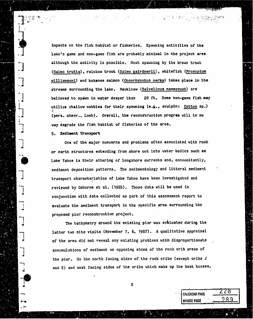
impacts on the fish habitat or fisheries. Spawning activities of the
lake'~ game and non-game fish are probably minimal in the project area
~lthough the actlvity is possible. Most spawning by tho brown trout
(Salmo trutta), rainbow trout C§almo gairdnerii), whitefish (Prosopium
williamsoni) and kokanee salmon (Oncorhynchus nerka) takes place in the
streams surrounding the lake. Mack1n2w (Salvelinus namaycush) ere
believed to spawn in water deeper than 20 ft. Some non-1ame fish may
utilize ~hallow cobbles for their spawning (e.g., sculp!n: Cottus sp.)
(pers. obser., Loeb). overall, the reconstruction program will in· no
way degrade the fish habitat of fisheries of the area •
5. Sedi•nt Tran:aport
One of the major concerns and problems often associated with rock
or earth structures extending from shore out into water bodies such as
Lake Tahoe is their altering of longshore currents and, concomitantly,
sediment deposition patterns. The sedimentology and littoral sediment
transport characteristics of Lake Tahoe have been investigated and
reviewed by Osborne et al. (1985). Those data will be used in
conjunction with data collected as part of this assessment report to
evaluate the sediment transport in the specific area surrounding the
proposed pier reconstruction project.
'nle bathymetry around the existing pier was ev~luated during the
latter two site visits (November 7, 8, 1987). A qualitative appraisal
of the area did not,~eveal any existing problems ~ith disproportionate
accumulations of sediment on opposing sides of the rock crib areas of
the pier. On the north facing sides of the rock cribs (except cribs J
and K) and we~t facing sides of the cribs which make up the boat hou3es,
8
.. CALENDAR ~AGE -. ----
MINUTE PAGE - I -~

_ •• -~~~-?;
LJ :-J :-J u ]
:-J
:1 :1 --1 . ....
~-J
~-]
i ..
.. , -' '·.·;' ',, - ~ "';-';-·,
. ,, ~ ;. . ' ,·
there was a small trough directly against the pier. The trough wu
approximately 1-2 rt. wide ~nd as much as 2 rt. deep. No undercutting
of the actual structure oi the pier was evident. The entire area
outside the trough and those other areas around the pier where there was
no trough was very flat. No sand or• sediment ridges (e.g., :sandbars)
were observed although a slight uniform rippling of the sediments was
observed (alignment approximately 45° to the !hore) (Figure 2).
The sediment bathymetr.y was determined quantitati.ve.ly around the
pier for this report (Figure 2). These data revealed accumulation of
sediments had occurred on the north facing side of the rock crib pier in
some places~ The sediment accumulation:ditferences ranged from 0-20".
T'ne aversge w~s about 7" or .slightly less.
Sediil:ent samples (3) were collected adjacent to the pier to
determine ~h~lr organic matter content. One sample was collected within
the boathou~e on the end of the pier, another about 10 ft. away
(northwar;' from.the oute~ rock cribbing and a third ~bout 50 ft.
farther away toward' the next pier (Figure 2). All samples had very low
and similar amounts or organic content. The range was 0.83-1.~o~
organic content and the amounts between sites were not significantly
different (Table 1). The sand sediments of the littoral area b~tween·
Homewood ar1 the Truckee River outflow have been de~cribed as volcanic
in origi.1". with a relative paucity of quartz and plutonic rock fra&~~:its
(O:sbornl~ et al., 1985) ~ The shorezone sa.'llples fro·m 'the earlier study
(1985) also showed a high degree of 3imilar1ty to cliff-backshore
(on~hore) material (also see Section 5).
The study of Osborne et al. (1985) described the .general sand
9 ,; -· I r
: CALENDAR PAGE, --...... ----~ L~ 0 l 290 MINUT£ PAGE •• :;.,.._..

·9' • i I
' ...
-·-... I
! ....
.J
Figure 2. The bathymetric data collected around the Reid Dennis pier.
The vm?.ur/!:J are in units or elevation above sen level (ft.). The general
:sub3tat1.11n types are also mapped as are the loct:!tlons of the sedilllent
samples ·collected &nd the orient~tion or the sedimei1t rippling. Cribs
are lidentU'ied by th~ letters A~.
10
Cftl,ENOAR PAGE
. MINUTt PAGE L 291

1 1
1
1
1
* .... 3 ~!....~
~.~.~i s...,_..,r., .. • 1
tt-------i E
·"-Z~~~~~ /
N/
' CAl.£NDAR PAGE . '
so.11~-si H1 t\vb~h· .... to...

I ~-
Table 1. The organic content or sediments collected adjacent to the rock crib pier (1340 W Laked Blvd., T~hoe City, Plac~r County, California) •
Sample Orga,r-:~c Content CS> Hean ( t S.D.)
1.a. 1. to
b~ 0.95
2.a. o.86
b. 0.87 o.~1 co.on 3.a. 0.94
b. 0.92 0.93 (0.01)
f
11
, MINUTE PAt:iE ..... L - ? q 3_
-.f . ,..
. i I ...
. !
I ...
. .
....
. .
.~
I'!
I!
,• : ~ ,
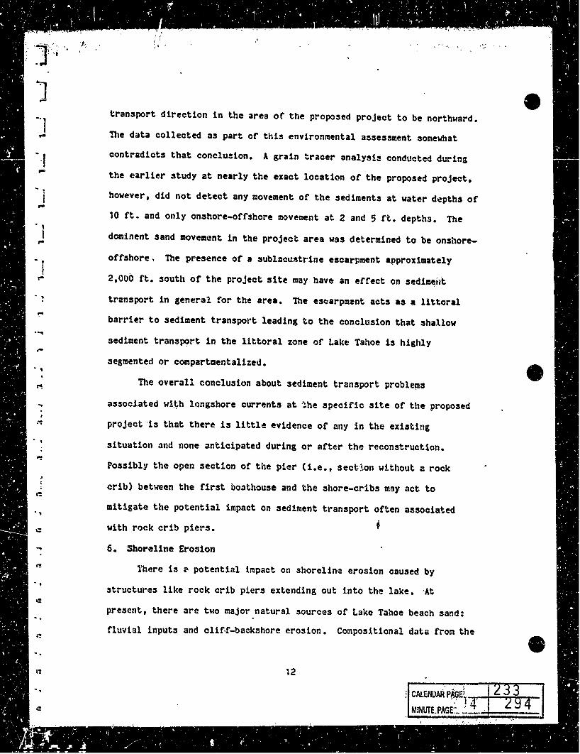
transport direction in the area of the proposed project to be northward.
llle data collected as part of this environmental a~sesmnent somewhat
contradicts that conclusion. A grain tracer analysis conducted during
the ti~rlier study at nearly the exact locati<m of the proposed project,
however, did not detect any movement of the sediments at water depths of
10 ft. and only onshore-offshore movement at 2 and 5 rt. depths. The
dorninent sand movement in the project area was determined to be onshore-
offshore, lhe presence of a 3Ublmcustrine escarpment approximately
2,IJOO ft. south or the project site may have an effect on sedimei;t
transport in general for the area. 1he es~arpment acts as a littoral
barrier to sediment transport leading to the conclusion that shallow
sediment transpt?~t in the littoral zone of Lake Tahoe is highly
segmented or compartmentalized •
The overall conclusion about 3ediment transport proble~s
associated w!~h longshore currents at ~he sp~cific site of the propos~d
project ·is that there is little evidence or any in the existing
situation and none anticipated during or after the reconstruction.
Possibly the open section or the pier (1.e., sect·lon without a rock
crib) between the first boathouse and the shore-cribs may act to
mitigate the potential impact on sediment t~ansport often associated
with rock crib piers.
6. Shoreline Erosion
l'here is ~ potential impact on shoreline erosion caused by
structures like rock crib piers extending out into the lake. ·At
present, there are two major natural sources or Lake Tahoe beach sand:
fluvial inputs and clitf-backshore erosion. Compositional data from the
12 ' • j
; CALENDAR P~E~1-. .-, -+---..~r-T'-MiNUTE.PAGE'.".. ~-· ·

"I' ,. .. ···' , l .,, , i 1: t . ~IAI: t
-] ]
]
]
]
]
J
••
analysis of sediments near the proposed project found a high degree of
similarity with the cliff-backshore material (Osborn et al. 0 1985).
Fluvial inputs or sediment to the littoral area of concern in this •
report would be unl~~ely since the nearest stream inflow is 1.25 mi.
south across the ·.sublacmstrine escarpment.
As discus~ed earlie~ in this report (Section 1), the shoreline
above the high wat~r line 1~ well vegetated. No erosional problem were
apparent during the site visit. Overall, sho~~itne erosion problems
usually result from stonn events during period of high rake water .
levels. Tile amount of e~osion can also depend on the wave direction,
the duration of the wind and/or storm, and the pre~ence of structures
which may affect ·wave interaction with the shore (e.g., rock crib piers,
retaining walls, marina~ in the lake, etc.)
nte existing conditions show no evidence of this pier causing
accelerated shoreline erosion. The present shoreline appeared stable
and unaffected by the presence of the pier. It should be noted that the
pier also does not present a hazard to 3afe navigation extending only
ca. 250 rt. offshore.
7. Mitigation or Any Pot~ntial EnYironmentnl Impact3
nte proposed reconstruction project has been planned in such a way
as to minimize any potential environmental impact3. 'ihe crib rock
removal during the in-lake reconstruction of the decaying wood pilings,
decking c..~-:J crib support structures will be done in a "leap frog" manner
in order to minimize disturbance to the benthic sediments. "Leap frog"
in this case means the rocks which ar~ removed from a crib will be
placed in the adjacent crib until the wood ~epair is completed on th?
13
J
J ]
]
J ]
]
]
]
J
J
J
J
l ]
l
1
. 'I
emptied struct~re. Once repaired, the rocks will be returned to the
reconstructed crib and the next crib will be repaired, its rock being
placed in an adjacent crib. It is recommended that rocks from not be
stored on the lake sediment while repair work is being conducted. Rocks
from the two most shoreward cribs Ccri~s J and K) could be stored on the
beach, although, this activity should be handled with care so QS not to
disturb the soils. No heavy equipment should be used on the beach
itaelf without careful consideration of the p..:>tential for erosion and/er
sediment generation.
Overall, there are no serious problems anticipated during the
reconstruction associated with environmental degradation. Using
accepted methods for this type of work in Lake T2hoe and demonstrating:
concern and awareness of the environment should el1mir1ah any potential
impacts the proposed project may have on the environmental quality of
the ar-ea.
8. Alternatives to: Reconstruction
The propose reconstruction of the existing rock crib pier is
believed to be the best choice in this situation. Possible alternatives
include the following: C 1) allow the pier to contin1.1e to decay;· (2)
reii1ove the rock cribbing and pier from the lake; and (3) replace the
rock crib pier with an open pi.ling pier (with or with6ut removal or the
existing pier).
The first alternative is unacceptable. Allowing the structure to
continue to decay would create an unsafe situation. Eventually, use and
access to the structure would need to be restricted and prohibited as
conditions became more and more dangerous. If the pier collapsed or the
14

,. r I•~ ~
• ·r~
''
~ 1
l J
J
1
I J
wood structures began to fragment, the debris would be aesthetically
unacceptable and JY,>ssibly cause navigational safety problems.
The second alternative would operationally cause more potentt~l
environmental disturbance than reconstruction. Removal or the pilings,
rocks and crib work from the lake would necessitate disturbing the
sediments. There is no reason.to believe removing the pier would
improve the existing environment. To the contrary, to some extent the
pier has increased ro~k substratum availability having a potential
positive effect on the fish habitat (see Section 3). Although not an
enviro~mental i~sue, the structure also affords its users personal
enjoyment and increases recreational acti~it!es. Pier r~val does not
appear to be justified in this situation-since no net gain to the
environ:nent seems to be definable.
lbe third alternative, replacing the existing rock crib pier with
an open piling pi~r, can be considered in two way~: (1) replacement
after the existing pier is removed, or (2) replacement without removing
the existing pier. nte removal of the rock crib structures was
previously discussed in this section. The procedure would possibly ·
cause environmental degradation (e.g., disturbance of the sediment3) and
no definable improvement to the existing environment. No problems have
been identified associated with the rock crib pier at ~his particular
site concerning water quality (Section 2), fish habitat and f~sheries,
(Section 3), sediment transport (Section 4) or shoreline erosion
(Section 5). Removal of the pier and replacing it with an open piling
pi~r .does not appear to be neces:sary. tlei.ther does it appear beneficial
to leave the existing pier in place to continue to decay while building
15
CAl.ENOAR PAGE
. , ,. ' .
)
]
]
] ... J
]
]
]
]
]
l ]
l l ]
l ] . I
]
I' .. . _,. '\
a new open piling pier to r.eplace it. Again, no net improvement in the
environment would be gained in this case by building a new open pili»g
pier.
Based on an evalu~~~~n or the present environment and those ar~as
or concern raised by the many agencies charged with the responsibility
ol •Rintaininz and regulating the environmental quality or Lake Tahoe's
shoreline. the conclusion is the reconstruction of the existing pier is
the best alternative. The methods to be used during the reconstruction
project appear to be appropriate in order to adniilize or eliminate
potential environmental degradation or Lake Tahoe.
16

·l -•
\. J • I
I I D
I
. ,.
9. leferencers
Loeb, S.L. 1987. Groundwater quality within the Tahoe basin.
Institute of Ecology, University of California, Davis. 280 p •
O.sborne, R.H., H.C. Edelman, J.M. Gaynor, J.H. Waldron. 1985.
Sedimentology or the littoral zone in Lake Tahoe, California,
Nevada. Dept. of Geological Sciences. University of Southern
California, for the California State Lands COlllJllission. 88 p.
TRPA. 1986• Pl"iNeeding of: Symposium un fisheries and fish habit1t in
,~ake Tahoe. Tahoe Regional Planning Agency-publication, Z~phyr
Cove, Nevada. 34 p.
'" ').,--('•'i ' -:•· '
' ,, l:-, ' ' ,
) 10. Photographs of Pier and Sed~nts
B
I
D
D
B
D
J ·~
...-----,-~--·--------., CN.ENOAR PAGE;1 __ ,;,....;;;:...-..;;.,,,__
,MINUTE Pilaf\ · r~.l .:

,9
A 8 c
I D
E
F
G
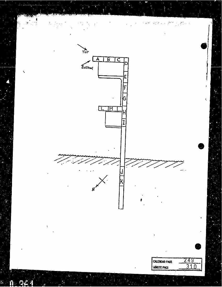
L M H \ I
Colfotl\
ll<>l'
e


• !
·'" ,,. , ., ~ '' ~ ~ ... , .. ·'; .... ' '
A B
CALENQAR PAGE


• )
J
J
J
J
J
I
-]
1
J
J
J ')
ft J \
"';, ' ... . ·~~, .. \\f "' •
CALENDAR PAGE
MINUTE PAGE
244._ "'7 305
-· -

'.-,.-,
I A I 8 JC D
I-
E -F ,_
G ~ i IL IM I H t B-'IT••~ - i MIDU.6
I I ToP
.. · •' .:···· ..... :·.,,,,..~·' ---~·' ,_ .. ,·· .,.,.··~·· / 7/ ~/._,. ......... ~ ~ .. . .. · .. . , v ·"" -· .,,.
, . . • 'l ~· ,. - ··' ·'' , ... .. ·/ .,,.,, / ,,,, , ,,,... i- . ..... ~
J '/ -r· K -1f r •
-


A 8 c D
i E n'P
F
G
L M H
I \_
.Kc1Vo1-H
CALEM>AR PAGE

( ,,. '. ' ' {
'- '
~ Tc>P
A s c D /
Eomv.t ·. E
F
G I
L M H
I

·1 , ·1 CALENDAR PA:lE
MINUTE PAGE

I
CAWiDAA PAGE
MINUTE PAGE
..
_251

AVA - T Ai-f OE
ryJAR 2 ~> 1988
RECEIVED
Supplement to:
EMVIRONMEP.TAL ASSESSMENT
Reconstruction of a Rock Crib Pier Ried Dennis, Owner
(January 11, 1988)
March 24, 1988
Prepared by:
Stanford L. Loeb, Ph.D. Consultant
515 Dexter Lane West Lafayette, Indiana 47906

•' , . •,
Introduction
At the request of the California State Lands Commission (February 4,
1988; Ted T. Fukushima), and a more detailed bathymetric map was prepared and
an analysis of the grain size distribution around the pier was completed.
These additional studies were performed in order to better understand the
potential impact of the rock crib pier on sediment transport in the littoral
zone of Lake Tahoe. Th~ plan and design of these studies ~ere discussed and
approve~ by the State Lands Cc!IU:lission (2/18/88).
Bath7J1etr7-Topography
A series of transects (6) were laid out perpendicular to the shoreline
along which 56 measurement were made in order to construct the bathymetric-
topographic map CFigYre 1). Several features were evident fro= this mapping.
The map illustrates an accumulation of material directly under the pier
neare:st the shore. This material is composed enUrely of cobb~es (1-12"
diameter) which is the substratum type out to the 6,224 rt. elevation contour
line. This accumulation directly under the open pier (no crib present in this
area) may have been partly'nran-made and not due entirely to natural processes.
The slope of the sediments beyond the 6,224 ft. contour on the southward
side of the pier is slightly steeper than on the northward side {9J versus 7J
between the 6,224 ft. and the 6,217 ft. contour lines~. The sediments
southward of the .pier show a slight deepening (i.e., sediment displacement)
within an "affected area" extending a distance of 5 to 15 ft. away from the
pier. The estimated "affected area" was determined assuming the "unaffected"
bathymetric contours would be parallel to the shore.
On the northward side of the pier, the sediments appear virtually
2
CALENDAR PAGE
MINUTE PAGE

-,. '
Figure 1. Bathymetric-Topographic map of area surrounding the pier at 1340 w. Lake Blvd., Tahoe City, Placer County, California, A.P.N. 83-162-12. Locations where sediment cores were collected are also noted (C1-6).

(;;l. f' C.-S" •
• C-3
: M

,,, .i. .. ~', ' _,,,_'
unaffected outside the cobble zone (6,223 ft.) Cioe., the contours are
parallel to shore). There is a small mound present inside the outer boat
house. To what extent this situation has resulted from boat activity (e.g.,
propeller driven currents) rather than natural lake processes is difficult to
determine. The overall disposition of the sediments on the northward side
appears virtually flat and even for the most part. There !s, however, ~n
apparent accre~ion of sediments on this s!de compared to the southward side
beyond the 6,222 rt. contour. Inside the 6,222 rt. contour, the trend is
reversed. Whether this apparent difference is due to the presence of the pier
is not certain. Sediment grain size analyses presented later in thi~ ·report
will discuss this possibility.
The sediments outside the outer rock crib pier po~sibly ·indicate a wave
refraction effect of the rock crib pi.er on sediment transport {contours 6,217
rt. and 6,2i8 ft.). If the predominant winds and concomitant waves :are fri'lr.1
the southwest, the apparent ridge may have resulted in part from such a
diffraction effect. · Again, this possibility will be discussed further in .the following section.
Sediment Grain Size Distribution
A series of sediment cores were collected (March 5, 1988) for grain size
analyses. A plex!glas tube Cc.a., 2" diameter) was us~d to core the surficial
sediment (0-511
) via SCUBA. The objective of th!s work was to determine if
there were significant differences in the grain size distribution of the
sediments around the pier. The hypothesis be;.ng tested was that if the rock
crib pier interfers with littoral sediment transport, a greater a~ount of fine
particles (silts, clays and fine sands) will accumulate on the leeward (wind
3

·,...,.· -C• "'~,.-~~~-,
~-·
protected) side compared to the windward side.
A total of six cores were analyzed: three from the leeward side CC-
1,2,3) (Figure t). A standard. sieve analysis was made on each sample. On one
sample (Cq), a rep1icate.analysis was performed to determine the error
associated with these measurements. Sieve sizes used were 30, 50, 100, and
200 (U.S. Standard Sieve series). (Analysis performed by Mr. Bradley E. Vote,
Civil Engineer and Geologist.)
Review of the data demonstrated the composition of the sediment.s in all
cores was nearly identical (Table 1). In only one sample (C6) was the amount
of fine material significantly less-than its paired sample CC3). Significance
was based on a difference greater than two times three standard deviation
units (S.D. : 0.71). In t~P,-other paired samples, no significant differences
were detectable (Ct-CS, C2-C4). The mean percentage composition of silts on
the leeward side of the pier was 12 ::!:. 3 compared to 9 !. 3. These values are
not significantly different.
-----.....-------- ···- ···--------·--------..... --------Table 1. Sediment grain size distribution for cores collected around the rock
crib pier CR. Dennis, owner). Data presented represents the percentage bf sand"versus silts and clay for each core (Cl through C6 and the replicate C41,2>•
Cl C2 C3 C4 1 C42 cs C6
Sand (~) 91 87 86 89 a: ·90 89 95
Silt/Clay (~) 9 13 14 11 to 11 5
Analysis of the sand fractions for each core revealed that finer sands
were present on the win1,lwar i side compared to the leeward side in six of nine
pair-wise comparisons (Table 2). Of these, only three pair-wise comparison
4
CALEflDAR PAGE
MINUTE PAGE

.,.- .
differences appeared statistically significant (2 at P<0.05; 1 at P<0.01).
These results are also presented in a graphical form (Figure 2 a-g). These
illustrations further support the general similarity of the sediments grain
size distribution in the area surrounding the pier.
~~~~--------------·~~~~--~~--~~~~--~~---------------·-·-~--~ Table 2. Percentage of material passing through the sieve for each screen
size. Significant differences are noted for sediments finer than their paired sample ·c 1 , P<0.05, H P<0.01). Pairs are C1-5, C2-4 and C6-3. C4 is the m~an of the 2 replicates.
Sieve Leeward Cores Windward Cores Cl C2 C3 C4 cs C6
30 100 100 100 100 100 100 50 67 71 6li 83* 81'' 82 ..
100 27 37 33 39 39 28 200 9 13 14* 10 11 5
The hypothesis presented earlier in this report implied that finer
sediments should accumulate leeward of the rock crib pier if the structure had
an impact on littoral zone transport of sediments. The data presented here do
not indicate such an impact exists.
Conclusions
The rock crib pier at this specific location· (1340 W. Lake Dlvd., Tahoe
City, Placer County, California, A.P.N. 83-162-12) does not appear to have a
major impact on the littoral transport of sediments. fhe apparent
discontinuity in the sediment deposition around the pier is ~ery localized and
may be characteristic of the area in gener~~. -Zxamination of the overall
bathymetry near this site reveals a stgnificant sublacustrine escarpment just
south of the site which may control the sediment transport in the region. The
study by Osborn et al. (1985) suggested that this area had mainly
5

Figure 2a-g. Graphical presentation of the sediment grain size distribution (sieve analyses) from cores collected around the pier. Note that 2d and 2e are replicate analyses of C4.

<~.;~;,:/~-~~~~:::~~ -~.;'' .· , ~ .~"~) ....... '
2a
I HTOllOM(T(" ANAlTSIS I Sl(Y( ANALYSIS
!'~ ~=· "'"" •tlADl ... S .Jc v $ $r&.,O&•O "'"[$.., .! Ct.tA• ,011/JI( 0"('11"°1
I
• ! • .. i .. • .. u
" .. •
eG•• ·- &DQ .... •·oo •w •ao-'° 8 .. . ... .. .
• --"° t
10
ll. QCll ~ - ~·' OH or• ••• WI ff, - "' 1ZJI .,. ,,.
( OtAUCTCll O' ,. .. 1!1..c 111 1111.dilcrt•ll
Cl.AT 1•~UfC! TO Sri..':' 1-~Ufl" •k" ... •t ... IU•
_.,. ___ .. G"AVCI. Q re SANO 91 ,.. 51t..T AHO CL.AV
l.ICUIO L.I MIT '11 ,.L.ASTICITV IHOEX
l"noM LOEB 1
I HTOllOll(T(" :l.NAl.T!SIS SIEVE AHAl.YSI!
.... ....
••• >&•
'•" . -~-
r ,.r ~ 0
IO
a ... ao!
c ... ... '° • .. • IQW ... ,. ..
• ... ..
-fU •U• Cf •IC
,COHt.U
2b I
.::-. .... rl•t ll(AOl ... ll \I S. 'TANOAllO •••• "~'u"" .! Ct.lU SOUU( C'CN!lloOI
,.~ ~
• •
I
;; • l ... • .. " " ... •
.., ... ·- . ... ·- .. .. ••oo • )() ·~')O ... i4'J ... llO
~
re
--' oO
I
'° ,
10
J • "',m '90 .. , JJ' ... OCI CCII alt O•t on or• ... ,,. 01.&llltT t" O' ,&II I 1..C Ill 11:11.."' (ftllS
Cl.AT ,,.~Ufl(;t fO 111..T ,_.,.~ur1ci . •() ... . . .... Oft AV Cl. i) .% 5AHO
87 °'' SIL.T Al'lO CL.AV
LIQUID L.IM IT ,.l.A!JTICITV IHD£X
l"NOM LOEB 2
GRADATION TEST RESULTS
.. . . .... r --
.
•ti "" ""
CALENDAR PAGE
MINUTE PAGE
--I ....
-
,., a ...
aoX ;;; .. .. w• .. • .., .. u
" ... ,.,.
•u '"' 100 •14 I C.OUt.U
260 321

"'
to .. ! .. • i, .. • :: ., II: .. L JC
10
z •
.:::-.i I
<D ! .. • 2 .. If .. u II: ... L
CIC
"° to
t
"O
>o
10
! I
0"AV£1.. 0 1..IOUIO 1..IMIT
HTOllOMfT[lt ANALYSIS ... .... , olllUOll_.S •••-' to•• ,,,_ ... ~ ·-
-
oat °""' °"' Oot o!r
2c
:SIEVE AHAlTSI u s ,u .. c••:i st••<s-., ' "'°" •
100 •w ·~ "° •• -. C:U A• JOUA•( C"('11"4t .. ... ... . ... - ,. , ...
S .... NO
!
.,:., ••oo
.
014 ...
••• Joa•
SI I.. T ANO Cl..AY
'"'-"'STICITY INOE><
~"0M LOEa J
Sl[V( AltALT51$
:=--=o
ru
C:OllL[S
2d
.. • '°"" u
II: ... fOL
U S STMIOAltO $(111fs-., .1 C:l.(All SOUA•lt 0"["1 ... S • '° ·~'° ... l .. ... .... ....
\
,,. t:N •ti ••
r
r~
, ... .. ~
0 .. eo>r ;; .. .. eo" ..
• llO~ .. .. 'O ..
tlf I fOCI 01.u1nrie 0'
.l"fTr ¥fa,"'° • •• ~J • '" "• ' 1.r '" "'LLl crr•s
•IC I Cl AT l•~•U-CI TC ill.T '"°""'~"9f1C1
• Nn ,C:OllLU ... D .Jl"'a - ...
G"AV£1.. 0 ."/. SANO Sll..T "NO Cl..AY
1..IOUIO l.IMIT P'l.ASTICITY INOE><
,..~cM Loea 4
GRADATION TEST RES UL TS

2e
HTOllOW[T (ii; All&lTSIS I $1(V£ Alf.tt.T,IS ·' fn1( I .. ::'c , ... •(&Qo~' I .. s sra .. ca110 H••u-., .1 ClC &• ..... eo ... ·- ••• ·- °'°' •·oa .'° •ao-)0 ... ... SQUU( 0•("'"°' rr ~ ...
<II • ;;
i .. • .. u .. .. ...
<II ! • .. I
"" JI!' .. ... • "' ...
.. -- ··-- -- -- -- ·--
_... ---
:
-JO
t ,,. -10
--.,. UT i tto - t
( I QQI °'"' ""' C•t C)P or• ••• "' t ZJ• ot ,,.
01a .. trt• 01 ,.u?t!-.c 11: "11.1.ultrtttS
0 % 5AN0 90 ,. Sll..T ANO Cl.AV
l..IQUIO 1..IMI< .. l..ASTICITY INOCX ---
:SAMl"l..C 0,.. SAND ,.. .. OM LOE3 4
r- SIEVE AICAlTSIS
,,. . ...
: ... ,.,
10 o/o o/o
,.
: I 11.t
2f
.,
: !
0
.. .. • ... ... 4 .. .. ,. .
.. •C! t IC»
•MI
~ HTOllOllCTCll Alc&lTSl!I "' ~... .. .. , •00•'"" ~-"1· '°".. .... ...,.. . ....... I u S 'f.altCAllO n••B"o .1 Cl.(&11 SQUAii( o-t••lllOt
~ ·~ ·~'° ... .... ... --'°
.. -fO . .., __ . -:
<lO
.. . ....__..
-· -tv--
tJ I °"' oot °"' O•t OH or• ·~ H'1 ~HO t •t r~.ll • 19 t:IC
L__ Cil<!olt( T t ll 01 P&ll I 1.( Ill '"'-'-' (TClll Cl.IT u .uroe1 10 111,T •-· ·~uroc1 . '' - .,. •lulu• - ,.,
GftAYCI.. l) SANO 89 '70 Sll..T ANO Cl..AY
l..IQUID 1..IMIT .. l..ASTICI TV INDCX
SAMl"l..C 0' Si\~D
GRADA TJON TEST RES UL TS
..
... . .... -
••• Mt
11 % '7·
·~
r
11.C
s·r • 0
'° 0 ..
oar 4 .. ...
to« .. ;rr
Gel ...
" • .. ro"'
•I'' ICQ •N I
C.OilllO -

! • • I .. • .. ¥ .. ..
I KTOltOMtT[lt Al'l&USIS Sl[V[ ANAl.YSIS
=~ ~:. TIU' lt(AOUMS vs SfAllOA•O ~1••u.,, .1 '1.U'! •.. ·- ••• ·- ..... ••oo .,., . ..,.,., .. .... "'' -..
-.
:
1•-• OT• ... ,_yl~~ - .... t'Jl• ... IM c ~ - OCll - Or9 OJf
Ot&M(TEll. O~ """ 1!1.1: ,,. 1111.1.1 cu•s 'l.AY «''-.UfoCI Tit 111.T •-"'-•ITI" 1-:.....,m-- . ... -· "- . ~ ""
' I ~ ~ ,,
GMAVl!:L 0 ,., SAND 95 fo SiLT ANO Cl.AV
1.IQUID /L.IM l T --- Vf, jitc,.ASTICITY INDEX
SAMPLE 01" SAND l"AOM LOEB 6
GRADATION TEST RESULTS
.2g
SOU.Ul 0-1 .. 11•01 ..... .... ,. , ... •
• .. .., " • ' •
.. .. o• .. " ow
,,, .. .. .. ..
to
••• l&t TU •If I le» ,,. I ..
, .. COUl.U
• ,. -;1•. ,.. . \..: '' I
·e
'• ,.'
onshore-offshore movement of sediments which may explain the distribution of
sediments observed around the pier.
The data collected during this study do not indicat~ any major effect of
thi: particular p!er on sediment transport. Such is not the case in all areas
or the littoral zone of Lake Tahoe (e.g., along the southern end or the lake).
The existing pier has been in place for around 30-50 years, therefore, any
detrimental effects should have been readily apparent. No impacts are
anticipated during or after the proposed reconstruction project. The other I
parameters of concern to the California Department or Fish and Game, Lahontan
Regional Water Quality Control Board, United States Corp of Engineers, Tahoe
Regional Planning Agency, and the California State Lands Cnmmission1·.were
included in the initial Environmental Assessment {January 11, 1988).
6
CALEN0>.i1 PAGE~
'MWT~(>AGE
264 325