fuel hazard reduction emergency...
TRANSCRIPT

Board of Forestry adopted Emergency rule submitted to OAL 6/15/04 Prepared by: Chris Zimny, CDF, Board Staff, Ver. 6/17/04
Page 1 of 49 Ver. 6/17/04
Fuel Hazard Reduction Emergency Regulation
BOF Adopted Emergency RuleSubmitted to OAL June 15, 2004

Board of Forestry adopted Emergency rule submitted to OAL 6/15/04 Prepared by: Chris Zimny, CDF, Board Staff, Ver. 6/17/04
Page 2 of 49 Ver. 6/17/04
Contents
A. Executive Summary .......................................…..……………………….3 B. Findings on Public Problem and Fuel Hazard Emergency………….6
C. Strategic plan for fuel hazard reduction……… ………………………..14
D. Scope of Project …………………………………….………………………15
E. Regulatory authority and amendments …………………………..……..17
F. CEQA Compliance……… ……………………………………..……………18
G. Public Involvement …………………………..……………………….……20
H. Rule Language alternatives …………………………………………...……..…….20
1. Fuel Reduction within 500 feet of Structures, Roads and Ridges……………………………………………………………………..20
2. Community Wildfire Protection Plan ………………………………..23 3. Significant Fire Threat areas in the WUI ……………………………25
4. Expand Defensible Space for Structures to 300 feet . …………..27
5. Exemption for Hazardous Fuel Reduction up to 300 ac. ………..27
6. Standards Healthy Forest Restoration Act of 2003 ………….…..27
7. Lake Tahoe Pilot Project ………………………………………………32
8. Planning Watershed ……………………………………………………32
I. Preferred Regulatory Amendment ………………………………...……..…….36
J. Preferred Alternative …………………………………………...……..………………36

Board of Forestry adopted Emergency rule submitted to OAL 6/15/04 Prepared by: Chris Zimny, CDF, Board Staff, Ver. 6/17/04
Page 3 of 49 Ver. 6/17/04
A. Executive Summary State Board of Forestry and Fire Protection recognizes the urgent, extensive and on-going wildfire hazard existing on private forest lands resulting from the combination of increasing quantity and arrangement of natural vegetation. This wildfire hazard is a significant threat to human and natural resources on over 48 million of the State’s 81 million acres of forests and rangelands. Emergency regulation adopted: To address this situation, the Board has adopted emergency regulatory amendments, within the scope of existing legislation and the Forest Practice Rules (Title 14 CCR, Chapters 4, 4.5 and 10), to provide regulatory relief for expedited fuel hazard reduction of live and dead fuels. The adoption of the ”preferred alternative”, as described in this document, was made on June 9, 2004. This relief is created by allowing filing of an Exemption Form or Emergency Notice instead of a Timber Harvest Plan when operations are conducted in accordance with the proposed rule conditions. The emergency rule would be in effect for 120 days after approval by the Office of Administrative Law (OAL). Approval is anticipated by June 25, 2004. The general scope of the rule is the treatment of private timberlands with significant fire threats primarily within the “Wildland Urban Interface”. The primary target groups are small timberland owners, who often have the least means and capability to complete fuel reduction projects. The general goal is reduction of the vertical and horizontal continuity of fuels by using vegetative manipulation methods that modify surface fuels, remove ladder fuels, and to a lesser extent thin the overstory canopy. The Board has incorporated language which requires coordination with an agency approved fire protection plan. This can help focus attention to priority areas and leverage financial opportunities being offered by complimentary federal actions such as the National Fire Plan and the Healthy Forest Restoration Act which provide funding to projects with fire protection plans. Following adoption of the emergency regulation, the Board directed staff to create a monitoring program to evaluate the extent of use, fuel treatment effectiveness, cost effectiveness, regulatory compliance, and environmental protection provided by the rule. Additionally, after considering the results of monitoring, the Board will begin adopting this rule as permanent regulation. Regulatory amendments: The Board’s Forest Practice Committee proposed two regulatory amendment methods:
• Exempt activities from a THP- amend regulation 1038 to exempt from THP fuel reduction projects, which remove commercial products, in accordance with PRC 4584.
• Emergency Conditions – Board defines another emergency condition related to wildfire threat to human and natural resources according to PRC

Board of Forestry adopted Emergency rule submitted to OAL 6/15/04 Prepared by: Chris Zimny, CDF, Board Staff, Ver. 6/17/04
Page 4 of 49 Ver. 6/17/04
4592, and amends regulation 1052, and 1052.1 to include fuel hazard reduction projects.
The Board’s has determined that use of the Emergency condition defining and notice is its preferred regulatory amendment method.
Rule Language Alternatives: Several different conceptual rule language alternatives are proposed below, as submitted to the Board FPC by stakeholders, Board members, or legislators. The alternatives represent a variety of fuel hazard reduction vegetation manipulation and geographic applicability standards. Each alternative can be inserted into either the “Exemption” or “Emergency Condition” regulatory amendment methods. Also, each of the alternatives will likely include a list of “protective measures”, similar to the list found in subsection 1038 (b), (c), and (e) resulting from the environmental analysis (rulemaking functional equivalency to an EIR).
1. Fuel Reduction within 500 feet of Structures, Roads and Suppression Ridges– permits vegetation treatment within 500 feet from a legally permitted structure, either side of public, federal road, mainline road or private road providing access to legally permitted structures, or either side of ridge suitable for fire suppression. Vegetation treatment includes harvests of up to trees 16 inches DBH tree; post harvest thinning or selection stocking standards; and removal of ladder fuels to a height equivalent to the average height of the base of the post harvest stand, but not less than 8 feet.
2. Community Wildfire Protection Plan (CWPP) - permits vegetation
treatment in the “Communities at Risk”, within ¼ mile buffer in the “Wildland Urban Interface” (WUI) areas, in watersheds at risk, and strategic locations as designated in the CWPP. Vegetation treatment includes focus on the creation of shaded fuel breaks. Specification include only single tree selection for thinning, thinning to a minimum of 40% crown closure, and post harvest minimum stocking standards, and slash treatment of operations generated fuels.
3. Significant Fire Threat areas in the WUI – permits vegetative treatments
in timberlands throughout the WUI area (the Community at Risk and up to 1.5 mile buffer) with significant fire threats (as mapped by FRAP). Vegetation treatments focus on the creation of shaded fuel breaks in the Community at Risk and other strategic significant fire threat areas in the WUI by reconfiguration of surface to promote maximum 4 foot flame length and increasing the height of ladder fuel to live co-dominant tree crown base to at least 8 feet; no specific diameter limit for commercial tree removal; RPF certification of prescription implementation( 80 percent of the landscape is treated); canopy cover minimums of 30% to 40% for

Board of Forestry adopted Emergency rule submitted to OAL 6/15/04 Prepared by: Chris Zimny, CDF, Board Staff, Ver. 6/17/04
Page 5 of 49 Ver. 6/17/04
Sierra Mixed Conifer forest types (SMC) or 50% to 60% for Redwood/Douglas Fir (RWD/DF); and post harvest thinning or selection stocking standards.
4. Expand Defensible Space for Structures to 300 feet- Geographic
location of treatments up to 300 feet from a structure or property line in lands classified as having High, Very High or Extreme Fire Threats. Vegetation treatments include creating defensible space/vegetative treatment standards outline by 1038 (c), (PRC 4291, 4584)
5. THP Exemption for Hazardous Fuel Reduction up to 300 ac. -
Geographic location of treatments includes any timberland area not to exceed 300 acres per exemption. Vegetation treatment include elimination of the vertical continuity and the horizontal continuity of vegetation, increasing the diameter of the post harvest stand, post harvest commercial thinning stocking standards, maximum 18 inches stump diameter trees may be removed, and RPF certifies preparation.
6. Standards in Public Law 108-148, the Healthy Forest Restoration Act
of 2003, HFRA - The objective of this alternative is to mirror the requirements of the HFRA requirements. Geographic location is the WUI as defined in P.L. 108-148 (1/2 to 1 1/2 mile from Communities at Risk or as described in a wildfire community protection plan), condition class 2 and 3 lands, near municipal water supplies, or watersheds that feed into municipal water supplies. Vegetation manipulation in creation of defensible space/vegetative treatment standards outline by 1038 (c), (PRC 4291, 4584).
7. Lake Tahoe Pilot Project - The objective of this alternative is to take
advantage of the current political support for preserving the unique watershed values of Lake Tahoe via fuel hazard reduction. This would provide an opportunity to apply created standards on a limited basis and evaluate it in a high profile, challenging resource protection situation. The geographic location is the WUI as described in the Tahoe Basin Fuels Reduction Action Plan (1250 ft. mile from urban areas). Prescriptions and operational requirements would be in accordance to CWPPs or other fire protection agency plans developed.
8. Preferred Alternative - The Board has determined that its preferred alternative is a combination of portions of above alternatives. The geographic focus is treating “Communities at Risk” (communities listed on the California Fire Alliance list with populations densities greater than 1 house per 20 acres), the “Defense Zone” (1/4 mile portion of the Wildland Urban Interface adjacent to the Communities at Risk), and within 500 feet

Board of Forestry adopted Emergency rule submitted to OAL 6/15/04 Prepared by: Chris Zimny, CDF, Board Staff, Ver. 6/17/04
Page 6 of 49 Ver. 6/17/04
Vegetation fires can result in loss of life, property, and natural resources.
from roads, remote structures, infrastructure facilities, or strategic fire suppression ridges outside of the Community at Risk or the Defense Zone, but identified in an approved public agency fire prevention plan.
Vegetative treatment standards would generally be those consistent with a fuel break with vegetation treated to obtain a maximum average 4 foot flame length following operations. Treatments include substantial reduction of surface and activity fuels, ladder fuel reduction based on increasing the height to live crown base to minimum 8 feet, 50% minimum crown closure (varying by forest type), a maximum diameter limit of trees to be removed, and protection of wildlife habitat components. Such projects would be prepared and post harvest success ensured by an RPF.
B. Findings on Public Problem and Fuel Hazard Emergency In recent years, the public has become deeply concern about the potential for severe forest wildfire. Of particular concern are the wildfires in the Wildland Urban Interface areas where homes and development intermix with the wildland vegetation (Carey and Shumman, 2003). Conversely, forest managers are concerned about the spread of fire from these residential areas in to wildland areas and the impacts they have on natural resources and ecological system such as habitats, water cycling and carbon sequestration. The Board recognizes the urgent and on-going wildfire hazard existing on private forest lands resulting from the combination of increasing quantity and arrangement of natural vegetation. Recent information from the CDF Fire and Resource Assessment Program (FRAP) indicates that over 48 million acres (on all ownerships) of California's 81 million acres of forest and rangelands have significant fire threat (fire threat is the combination of fuel hazard and probability of a fire ignitions, see table and figure below).
While modern fire frequency is much lower in most areas than prior to European settlement, much of California's wildlands support conditions of high or very high potential fire behavior if fires are not aggressively suppressed. Much of the forests and rangelands have fuel and slope conditions that would support high or very high fire behavior when burned under typical severe weather conditions. Fires that burn in these areas under hot,

Board of Forestry adopted Emergency rule submitted to OAL 6/15/04 Prepared by: Chris Zimny, CDF, Board Staff, Ver. 6/17/04
Page 7 of 49 Ver. 6/17/04
dry, and windy conditions are difficult to control even by the world's most comprehensive wildland fire protection system.
Statewide fire threat
Fire threat Acres Percentage of State Percentage of area mapped (non-wildland excluded)
Moderate 36,942,600 37 45 High 30,370,766 30 35 Very High 15,769,155 16 18 Extreme 2,249,365 2 2 Not mapped 15,582,151 15 --

Board of Forestry adopted Emergency rule submitted to OAL 6/15/04 Prepared by: Chris Zimny, CDF, Board Staff, Ver. 6/17/04
Page 8 of 49 Ver. 6/17/04
Fire hazard, the combination of terrain and fuel types and condition, is steadily becoming more hazardous on timberlands. Recent measurements by the USFS Forest Inventory and Analysis Program (FIA) indicate increasing level of stocking on private lands over the last three decades. While quantity of fuels is just one measure of fire hazards, another indicative factor is the density and arrangement of fuels (see figures below). Research by the USFS Forest Health monitoring Group suggests that million of acres of coniferous forest types have stand densities far beyond stocking levels associated with the site capacity. This suggests that stands are very susceptible to significant levels of pest mortality and increased dead fuel loads. When combined with on-going drought and atmospheric zone damage, these conditions can lead to catastrophic wildfire effects.
Examples of the extremely hazardous combination pests, drought and fuel build up are being realized at catastrophic levels in the southern California region of the state. Here, over 600,000 acres (141, 000 acres on private lands) of coniferous forest lands have been impacted by the combination of stocking conditions, drought, and pests. The losses in merchantable wood products alone on private lands are estimated at over 1 billion board feet and, when valued at $200 per thousand board feet, represent a loss over $200 million dollars to private land owners.
Dense understory provides ladder to main canopy.

Board of Forestry adopted Emergency rule submitted to OAL 6/15/04 Prepared by: Chris Zimny, CDF, Board Staff, Ver. 6/17/04
Page 9 of 49 Ver. 6/17/04
hazardous fuel conditions in the wildland urban interface of southern California.
The emergency nature of the fuel hazard problem has also been repeatedly recognized by many high profile efforts. These include:
• Governor’s Blue Ribbon Fire Commission of 2004 (State of California, 2004).
• General Accounting office report on western National Forest fire conditions (US GAO, 1999).
• Sierra Nevada Forest Plan Amendment, 2004 • “Comprehensive Strategy for a Collaborative Approach for Reducing
Wildfire Frisk to Communities and the Environment”, US DOI, 2002. The emergency nature is further found by the following information that summaries conditions and assets at risk. It demonstrates the necessity for emergency regulation for the immediate preservation of the public peace, health and safety, and the general welfare:
1. The values at stake in wildland fire protection are extensive and at imminent threat. This is especially true at the Wildland Urban Interface, a term generally applied to areas of human development exposed to threats from wildfire. The extent of the risk to the Wildland Urban Interface (WUI) is especially significant. • A total of 7.8 million acres of California are developed with housing unit
densities considered to meet the Wildland-Urban Interface (WUI) criteria. Of this total, 920,000 acres (12 percent) are exposed to an Extreme Fire Threat, 3.4 million acres (43 percent) to a Very High threat, and an additional 1.2 million acres (15 percent) to a High threat.
• A total of 11.8 million homes are located in the WUI. Of this, 4.9 million housing units (42 percent) are exposed to High or greater Fire Threat. Furthermore, of these, 4.1 million homes (84 percent) are from urban areas, where density of housing units exceeds one unit. Thus while the land area considered WUI is dominated by areas of relatively low development density, the majority of houses at risk come from urbanized areas.
• An additional 8.6 million acres of wildlands surrounding WUI communities pose Very High or Extreme Fire Threat conditions. These lands represent many of the areas requiring mitigation treatments to reduce risks to people and property of the State.
• A total of roughly 37 million acres are ecologically at risk from fire with 17 million acres of these at high risk. These lands span diverse ecosystems

Board of Forestry adopted Emergency rule submitted to OAL 6/15/04 Prepared by: Chris Zimny, CDF, Board Staff, Ver. 6/17/04
Page 10 of 49 Ver. 6/17/04
ranging from pine forests in the Klamath/North Coast region to coastal sage scrub communities along the South Coast. Numerous areas of the State are dominated by ecosystems at risk from wildfire.
• Timber assets and key woodland habitats are both at risk from fire. Roughly three quarters of California’s timberlands and two-thirds of its woodlands are in conditions that support High to Extreme Fire Threat.
2. CDF believes that there is a reasonable likelihood that the risk of wildfire is above normal for 2004 for both Northern and Southern California • Meteorological events and fuel conditions have combined to create a
substantial and earlier fire threat in Northern California in 2004. For example, temperatures in northern California in March, 2004 were warmest March on record and significantly reduced the snowpack. Temperatures for July through September are forecast to average near to 4 degrees above normal overall. Dead and dry fuels will become available earlier in the season and reach critical levels earlier than normal. Indications from the current climate and weather outlook are that fire season could start earlier, and therefore be of longer duration. For Northern California, areas of concern are: Northeast California on the east side of the Sierra Cascade crest where the cumulative effect of previous drought years (1999-2002); dead and dying vegetation from snowfall in central Shasta County that adds to fuel loads, especially ladder fuel; and mortality of conifers and hardwoods from fire and disease.
• Similarly, meteorological events and fuel conditions have combined to create
a substantial and earlier fire threat in Southern California in 2004. For southern and central California, precipitation during was about 60 to 80 percent of normal. This is the fifth year in a row below normal precipitation for the region.
For Southern California, the 1000-hour fuel moistures at severity weather stations are approaching record low levels. These levels are consistent with long-term drought throughout the area. At lower elevations, fine fuels are expected to be fully dry by the end of April. In these areas, there is also long-term drought stress on vegetation, resulting in widespread brush and timber mortality. Timber mortality continues to spread, especially in high-density urban interface areas. Current fuel conditions in these areas show abnormally high resistance to fire control efforts and the potential for high rates of spread is great. These conditions are likely to persist or increase throughout the summer months. Many of mountain and foothill communities in Southern

Board of Forestry adopted Emergency rule submitted to OAL 6/15/04 Prepared by: Chris Zimny, CDF, Board Staff, Ver. 6/17/04
Page 11 of 49 Ver. 6/17/04
California have significant numbers of residents and limited means of egress. Firefighting efforts in these communities will remain difficult and dangerous as demonstrated in the destructive fires.
3. The combination of fuel, weather and valuable human and natural
resource assets have created in increasing amount of wildfire and increasing losses. • Major wildland fires in California, epitomized by the extraordinary fires of October 2003, threaten a wide range of public and private assets, including
not only watershed values, such as water quality, habitat, water supply and power generation, but also life and property, wildlife habitat, air quality
and important infrastructure. Each year on average over 250,000 acres of forest and rangeland of all ownership is affected by wildfire. Recent five year average shows over 500,000 acres are burned, and as seen recently in 2003, this annual total varies greatly with over 1 million acres was burned. Area burned in wildfires varies greatly year to year, with climate driving much of the variability. When viewed statewide, the temporal variation masks any possible trends in total acreage, although there has been an apparent increase in high fire years (total area burned greater than 500,000 acres) since 1985 (see figure).
Annual area burned*, statewide, 1950-2000
While the acreage and number of wildfires each is extensive and increasing, (approximately 10,000 wildfires burn half a million acres on an annual basis in California), the number of acres burned fluctuates considerably. A more significant trend is the climbing wildfire-related financial losses. From 1947 to 1990, the dollar damages to structures and other resources in State

Board of Forestry adopted Emergency rule submitted to OAL 6/15/04 Prepared by: Chris Zimny, CDF, Board Staff, Ver. 6/17/04
Page 12 of 49 Ver. 6/17/04
0
50
100
150
200
250
300
350
1947
1950
1953
1956
1959
1962
1965
1968
1971
1974
1977
1980
1983
1986
1989
1992
1995
1998
2001
Year
Acr
es b
urne
d (th
ousa
nds)
$0
$50
$100
$150
$200
$250
Dol
lar d
amag
e (m
illio
ns, 2
001
dolla
rs)
Acres Burned
Dollar Damage
Responsibility Areas (SRA) exceeded $100 million (2001 dollars) only once. Between 1990 and 2001, losses exceeded $100 million five times (see figure). Wildfire acres and dollar damage on State Responsibility Area (SRA), 1947-2001 While the estimated losses to property on natural resources are daunting, it is important to note that the suppressions costs and assets protection requirements are of large magnitude (see chart below). The California Fire Plan shows that state, federal and local agencies spent an estimated $921 million annually on California wildfires. Suppression costs for the October 2003 fires in Southern California alone approached $125 million, with recent estimates of the damage to assets at over 3 billion dollars.
Estimated Annual Costs of Wildfire in California

Board of Forestry adopted Emergency rule submitted to OAL 6/15/04 Prepared by: Chris Zimny, CDF, Board Staff, Ver. 6/17/04
Page 13 of 49 Ver. 6/17/04
4. Pre fire vegetation management aims to forestall and reduce the impact of what otherwise might be a truly catastrophic fire in a number of regions in California before it occurs.
Hazardous fuels management projects have demonstrated that they can significantly reduce the impacts of wildfires on both natural and human assets at risk by changing the intensity and often the extent of wildfire. The literature on the effectiveness is vast, and several “success stories” are listed on the Fire Plan website (http://fphqfp/fpweb/) the example of the Cone Fire burning into forested areas on the Blacks Mountain. Experimental Forest in adjacent Lassen County is indicative:
The Cone Fire tested the fuels treatments applied at Blacks Mt Experimental Forest under severe fire behavior conditions of wind, low humidity, and low fuel moisture. Units which received both thinning of ladder fuels (biomass harvest) and a follow up prescribed fire to further reduce surface fuels had the wildfire drop to the ground where they extinguished or could be safely suppressed, while units which were just thinned of ladder fuels had sufficient surface fuels to severely scorch trees. Untreated forest burned the most severely, with total tree kill, forest floor consumption, and canopy consumption. Gary Nakamura, UC Cooperative Extension http://ucce.ucdavis.edu/files/filelibrary/5098/5200.pdf

Board of Forestry adopted Emergency rule submitted to OAL 6/15/04 Prepared by: Chris Zimny, CDF, Board Staff, Ver. 6/17/04
Page 14 of 49 Ver. 6/17/04
Hazardous fuels management projects must be deployed across the landscape if they are to change wildfire intensity and spread and thereby protect watershed values. While clearance around structures as required by PRC 4290-91 is highly effective in saving structures from a wildfire, that same fire burning through untreated vegetation can lead to severe watershed damage. Landscape level treatments, such as fuelbreaks or area treatments, complement structure clearance treatments by slowing the rate of spread and lowering intensity and therefore resource damage.
C. Strategic plan for fuel hazard reduction Treatment of the fuel hazard component of wildfire threat is part of CDF’s and Board’s strategic plan to address wildfire fire threats throughout the state and all come under the comprehensive strategy of the State Fire Plan. Several programs, administered by CDF, along with other regulatory and statutory methods are addressing the issue. The major methods include:
• Vegetation Management Program (VMP) - Public Resources Code 4475, and the California Code of Regulations (CCR) Title 14, Section 1560 authorizes the Vegetation Management Program within CDF. The Vegetation Management Program (VMP) is designed to reduce the threat of wildland fire to life, property, and natural resources of the state and also may be used for purposes of watershed management, range improvement, forest improvement, and wildlife habitat improvement. VMP is a cost-share program whereby the state contracts with private landowners and other government entities.

Board of Forestry adopted Emergency rule submitted to OAL 6/15/04 Prepared by: Chris Zimny, CDF, Board Staff, Ver. 6/17/04
Page 15 of 49 Ver. 6/17/04
• California Forest Improvement Program (CFIP) - CFIP projects use
mechanical treatments to achieve timberland productivity resource objectives. The program uses state funds to engage Registered Professional Foresters (RPFs) and contractors in the design and implementation of the treatments.
• Prefire Management Program (PMP) - PMP projects involve mechanical
treatments and prescribed fire to reduce hazard fuels on multiple, usually developed, parcels, implemented through contracts with local governments and districts and non-profits. Most of the work done on the ground, with the exception of prescribed fire, is accomplished through contracts with private firms.
• Environmental Protection and Regulation Program (EPRP) - The
EPRP develops programmatic environmental documents that facilitate the achievement of environmental goals and compliance with CEQA for commercial timber operations on private lands. EPRP will create Program Timberland EIRs (PTEIRs) for project zones, thereby allowing private timberland owners to treat fuels on their property under Program Timber Harvest Plans by harvesting timber sufficient to cover the costs of the fuels treatment without significant adverse environmental impacts. The CCR Title 14 Sect 1092 establishes the Program Timberland PTEIR and the Program Timber Harvest Plan (PTHP) as CEQA-based alternative to the standard THP regulatory procedure. This program represents the longer term solution to facilitating hazard reduction on timberlands, although the economic effectiveness of it has not been routinely demonstrated.
• Statutory Amendments – This includes the introduction legislation to
amend laws addressing fire/fuel hazards. Several pieces of legislation are actively being considered before legislative committees during the 03/04 session. The outcomes of these may direct the Board to establish rules to implement the legislation.
• Regulatory amendments within existing legislation – This includes the
amendment of existing rules or adoption of new rules under the Board of Forestry’s authority to promulgate regulation. The Board’s Forest Practice Committee has reviewed a variety of existing regulations and identified a narrowed list of regulations that offer practical, expedited methods and legally sound solutions. (See E. Regulatory Amendment )
Recommended Course of Action: The Board has considered applying the above course of actions as means to accomplish fuel reduction objectives on private lands (contact BOF staff Chris Zimny for documentation of full discussion of these methods). A key recommendation by the Board's Forest Practice

Board of Forestry adopted Emergency rule submitted to OAL 6/15/04 Prepared by: Chris Zimny, CDF, Board Staff, Ver. 6/17/04
Page 16 of 49 Ver. 6/17/04
Committee is to develop regulatory amendments within existing legislation as its preferred course of action. This recommendation is based the necessity for expedient implementation of regulation for the 2004 field season, cost effectiveness provided to the small timberland owners, and the expected minor environmental impact the rule is likely to incurr. The Board is also considering the regulatory amendment to be issued as “Emergency Regulation”. This is based on the need for expedience of implementation and imminent threat to public health and a safety as a new fire season begins. Additionally, the use of an emergency regulatory amendment is consistent with other strategic actions by the Board and Department. This strategic action includes immediate implementation of the emergency regulatory action while other concurrent actions, such as development of PTEIRS, Vegetation Management Plan EIR and other potential statutory amendment actions which usually take a longer time to create, are established. D. Scope of Project The broadest scope the the Board’s proposed fuel hazard reduction regulation are the non federal timberlands where there is a significant fire threat to human assets and natural resources. The Board’s vision for the scope includes
• target private timberlands (particularly non industrial timberlands); • focus on lands with documented conditions which pose a significant fire
threat and undesirable impacts to human assets and natural resources; • prioritized areas in the “Wildland Urban Interface”, those areas where
timberlands and houses are mixed together with human occupancy (houses) along with adjacent unpopulated timberlands.
• Treat areas to eliminate the vertical continuity of vegetative fuels and the horizontal continuity of tree crowns, for the purpose of reducing the rate of fire spread, fire duration and intensity, fuel ignitability, or ignition of tree crowns. Treatments should obtain a goal that promotes maximum 4 foot flame lengths when burned under severe fire weather.
Each alternative narrows the geographic scope by crafting objectives aimed to address specific wildfire problems. This results in a specific geographic footprint for each alternative. For example, Alternative 6 focuses on the landscapes defined by the federal Healthy Forest Restoration Act of 2003. This generally means the Communities at Risk, adjacent timberlands within 1.5 miles of the community (together termed Wildland Urban Interface -WUI), or municipal watershed, with specific vegetative conditions (termed condition class 2 and 3 where severe ecological disruption would occur from wildfire). State wide acreage extent of this alternative has not been calculated, but CDF FRAP has estimated that many of the state’s bioregions have over 60 percent of the timberlands in condition class 2 or 3.

Board of Forestry adopted Emergency rule submitted to OAL 6/15/04 Prepared by: Chris Zimny, CDF, Board Staff, Ver. 6/17/04
Page 17 of 49 Ver. 6/17/04
Another example of the geographic scope is Alternative 3, Significant Fire Threat areas in the WUI. This represents the intersection of Community at Risk, a 1.5 mile buffer (together termed WUI), and timberlands mapped as Significant Fire Threat by CDF. This is estimated to be approximately 4 million of private timberland out of the 48 million acres of all lands throughout state with Significant Fire Threat. Although the geographic scope of the project is relatively large, it is likely that the application of the rule will affect substantially less area over the near term application of the emergency rule. This is due to several factors:
• the time limits for an emergency rule (as defined by OAL and by the State Forest Practice Rules) are limited to 120 days. This is very narrow operating period, basically restricting operations to the 2004 field season. The general statewide capacity to carryout all types of timber harvesting activities has generally been about 200,000 acres in any one year. There is a low probability that all routine timber harvesting capacity will be shifted to facilitate fuel reduction projects.
• not all timberlands within the geographic have physical terrain
characteristics that allow practical fuel reduction operability (terrain steepness, lack of adequate roads access, watercourse where operations are prohibited)
• hazard reduction removal standards focus on removal of surface and
ladder fuels, not on commercial sized trees. As such, large industrial landowners are not likely to use this rule, as their management plans, professional capacity, and financial capability allow them to conduct management actions different from the proposed rule.
• Projects are permitted when there is an agency approved fire plan. This
oversight helps identify the priority areas and avoid low need areas. This prioritization is demonstrated for Plumas County. CDF FRAP has estimated that there are nearly 140,000 acres of private timberlands in the WUI with significant fire threat [57 percent of which is non industrial (non TPZ) lands]. However, the CDF Butte Unit Fire Plan, an agency approved fire plan, indicates approximately 10,000 acres identified for treatment over the next few years.
E. Regulatory Authority and Amendments Within the regulatory amendment context, the Board’s Forest Practice Committee has narrowed its focus to two regulatory amendments methods:

Board of Forestry adopted Emergency rule submitted to OAL 6/15/04 Prepared by: Chris Zimny, CDF, Board Staff, Ver. 6/17/04
Page 18 of 49 Ver. 6/17/04
• Exempt activities from a THP- amend regulation CCR 14 1038 to exempt fuel reduction timber activities from a THP according to PRC 4584.
This regulatory amendment method adds fuel hazard reduction to the list of actives exempt from a THP under section 1038. It requires the Board to determine that fuel hazard reduction, and the commercial wood products generated by the operation, meets the statutory intent of PRC 4584 (b), “ [exempt a person from a THP when engaged in forest management activities that are limited to ] removal or harvest of…. minor forest products, including firewood”. Upon determining that products generated by fuel hazard reduction projects meet this intent, Forest Practice Rules section 895.1 Definition, and section 1038, Exemption, can be amended to include specific fuel hazard reduction prescriptive/performance based language. The end result of this method is an RPF now has an option to conduct fuel hazard reduction projects without preparing a Timber Harvest Plan; only an “Exemption Form” per 1038.2 would be filed. Determining that commercial forest products (small sawlogs and biomass) generated by fuel hazard reduction projects meet the legislative intent for minor forest products appears to be problematic. There is little legislative history clarifying the intention for minor forest products to include merchantable sawlogs. According to AG Reeves and CDF Leg. Analyst Engle, there is a low probability for finding a paper trail documenting legislative intent for minor forest products as an exempt activity. That said, there are existing Board of Equalization definitions of miscellaneous products suggesting that small sawlogs, up to 16 inches DBH, are considered miscellaneous products similar to fuelwood, posts, and greenery product types. Additionally, existing legislative language in 4584 (j) clearly indicates the intent to harvest trees of any size to meet 4291 defensible space clearing requirements. These case examples help support reasoning for a minor forest products definition to include commercial material that would be typically generated by a fuel hazard reduction project.
• Emergency Conditions - define an emergency condition according to PRC 4592 and amend regulation 1052, and 1052.1 to include fuel hazard reduction.
This regulatory amendment course of action requires the Board to use its existing statutory authority under PRC 4592 to define an emergency. In this case, the emergency is the threat of wildfire due to hazardous fuel conditions and the pending impact on public health, safety, human assets and forest health. Upon declaring this emergency condition, Forest Practice Rules sections 1052.1 and 1052 can be amended to include specific fuel hazard reduction prescriptive/performance based language. Additionally, a new section, 1052.4, Emergency Notice for Fuel Hazard Reduction, would be created to document the vegetation manipulation performance/prescriptive standards and geographic applicability standards permitted.

Board of Forestry adopted Emergency rule submitted to OAL 6/15/04 Prepared by: Chris Zimny, CDF, Board Staff, Ver. 6/17/04
Page 19 of 49 Ver. 6/17/04
F. CEQA Compliance An appropriate question to ask is whether or not these regulatory methods meet the requirements of CEQA as fuel hazard reduction activities are classified as projects under PRC 21065 and require an EIR under PRC 21080. Generally, each Board regulatory action under CEQA is a project. To provide for CEQA documentation for these projects, the Board would use its regulatory process, which is a functional equivalent to an EIR similar to that of the Timber Harvesting Plan process (14 CCR §§ 1141-45). In other words, the CEQA compliance would be conducted under the rulemaking process. As a part of the preliminary project evaluation, the Board is determining the nature of the proposed project as defined by CEQA under the definition in Article 20, Section 15350. Determination can be as to whether the project is a “Categorical Exemption” from the requirements of CEQA, is subject to a determination of negative declaration or mitigated negative declaration, or is subject to an EIR. One outcome of this CEQA process would be to evaluate and modify regulations to sufficiently limit timber harvesting such that no significant effects will reasonably be expected. If this cannot be done, the Board will need to adopt findings that declare the remaining significant effects are outweighed due to a greater overall public gain. Preliminary scoping has identified several resources that may be potentially affected are being reviewed. The include the following: Cultural sites: With the project being proposed to be exempt from the typically archaeological review required by a timber harvest plan, consideration is being given to the nature of the archaeological reviewed needed to avoid significant impacts. Preliminary scoping of this issue identified potential impacts if no review of sites is conducted and that the review must be done by a trained RPF. The requirements for archaeological review as described in section 1052 (a)-(d) appear to be an appropriate model for use in this regulation. If the listed tasks are required in the rule, particularly with an archaeology trained RPF, significant archaeological and historic sites would be adequately protected. Additional consideration of CDF oversight in review of the RPF’s findings is being considered. This would require up to a 15 day period for CDF review prior to beginning of operation. Currently, the section 1052 (e) requires 5 day period. Another suggestion is the need to complete fuel hazard reduction when significant cultural site are present. Current rules for exempted activities prohibit operation in a significant cultural site. For this proposal, the Director could waive this limitation when the projects and Director agree upon appropriate actions within the significant site.

Board of Forestry adopted Emergency rule submitted to OAL 6/15/04 Prepared by: Chris Zimny, CDF, Board Staff, Ver. 6/17/04
Page 20 of 49 Ver. 6/17/04
Water Quality: The rule making process will involve preconsultation with the various water boards to help determine the potential impacts on water quality of the project. Efforts will be made to consider the geographic scope and type of operations applicable to meet water quality concerns while still meeting the objective s of the project. Evaluation of treatments in WLPZs, requirements of water discharge permit wavier, and equipment limitations in stream crossing are likely to be considered. One goal would be to identify a set of “best management practice” that provide for a non significant impact determination. The conditions in the existing FRPS for THPs, those listed for exempt timber harvest activities, or other requirements will be considered in consultation with the Regional Water Quality Control Boards. Fish, Wildlife, and plant habitat: The nature of the projects is expected to disturb the ground cover and understory components of the several forested habitats, primarily in upland (non riparian) areas. The projects are intended to affect the understory components of forests, with lesser changes to overstory conditions. In consultation with the Department of Fish and Game, primary evaluation will be given understory habitat requirements and sensitive plant impacts. Aesthetic setting: The nature of the projects includes removal of understory vegetation that often acts a visual screen between houses or other human occupied space (roads, commercial building etc.). Los of the screening can result in undesired visual affects on those residents in wildlands areas for the values of the remote setting. Key to the mitigating process will be developing fuel hazard reduction prescription which reduces these impacts while meeting the hazard reduction objective. G. Public involvement
The regular monthly FPC meeting has the routine way in which the public has been involved in the development of the rule making process. For this proposal, efforts to expand public involvement have been conducted. These efforts include
• Additional information meetings in a regional locations more convenient to potential users (Redding and San Diego, CA)
• Press release to announce general intent of the Board for developing the rule.
• Special mailings to key stakeholders who have expressed interest in such projects including fires safe council, League of California Cities, California Association of Counties, CDF and local fire district Chiefs, and the Tahoe Regional Planning Agency, and State legislature and staff from the Governor’s Blue Ribbon Fire Commission.
H. Rule language concepts and alternatives

Board of Forestry adopted Emergency rule submitted to OAL 6/15/04 Prepared by: Chris Zimny, CDF, Board Staff, Ver. 6/17/04
Page 21 of 49 Ver. 6/17/04
Shaded fuel break along road. Courtesy Frank Stewart
The Board has identified several alternative concepts that will result in rule language amendments. These alternatives can be incorporated in to either the 1038 Exemption or 1052 Emergency Condition section. The current list of concerns and specific rule language are shown below:
1) Fuel Reduction within 500 feet of Structures, Roads and Suppression Ridges (Rynearson) Amends regulation section1038 to include as an activity exempt from a THP and requires/permits: • removal of hazardous fuels within 500 feet of an approved and legally
permitted structure; • removal within 500 feet of either side of public, federal road, mainline
road or private road providing access to legally permitted structures; • or removal within 500 feet on either side of ridge suitable for fire
suppression.
• harvesting of trees 16 inches DBH or less using the thinning or
selection methods,
• removal of ladder fuels to a height equivalent to the average height of the base of the post harvest stand, but not less than 8 feet.

Board of Forestry adopted Emergency rule submitted to OAL 6/15/04 Prepared by: Chris Zimny, CDF, Board Staff, Ver. 6/17/04
Page 22 of 49 Ver. 6/17/04
Specific language amendments:
Amend CCR 895.1: Minor Forest Products: Includes fuelwood, and small diameter or immature trees 16 inches or less harvested for fuel reduction purposes under the provisions of CCR 1038(i). (Reference PRC 4584(b)) Mainline road: Roads on non federal lands that are used as the primary route for the transportation of forest products that are fed by arterial (secondary) haul roads. Amend CCR 1038:
(i) Harvesting of trees 16 inches DBH or less using the thinning or selection silviculture methods for fuel reduction purposes within the following areas: within 500 feet of an approved and legally permitted structure that complies with the California Building Code; within 500 feet of either side of public or federal road; within 500 feet on either side of a private road providing access to legally permitted structures; within 500 feet on either side of a mainline haul road; or within 500 feet on either side of ridge suitable for fire suppression. Harvesting operations shall meet the conditions identified in section CCR1038(b) (1) through (10). Tree removal shall target under and midstory trees with dominant and codominant trees removed to achieve spacing. Stocking shall meet the requirements of thinning or selection immediately upon completion of operations. The seed tree requirements for selection harvesting shall not apply to this section. The following requirements shall also apply:
Forest stand with removal of surface fuels and greater than 8 foot height to live crown base

Board of Forestry adopted Emergency rule submitted to OAL 6/15/04 Prepared by: Chris Zimny, CDF, Board Staff, Ver. 6/17/04
Page 23 of 49 Ver. 6/17/04
(1) Within the slash treatment zones adjacent to structures and roads open to the public as identified in CCR 917.2 (937.2, 957.2), all surface fuels created by timber operations under the exemption which could promote the spread of wildfire, including logging slash and debris, deadwood, branches exceeding 1 inch in diameter, and brush, shall be chipped, burned, or removed within 45 days from the start of timber operations. Slash in the remainder of the area area treated shall be treated as necessary to prevent a build up of surface fuels. Such treatments may include crushing, piling or removal. (2) Ladder fuels shall be removed to a height equivalent to the average height of the base of the post harvest stand, but not less than 8 feet.
(3) The timber operator shall provide the Director the tentative commencement date of timber operations on the notice required in 14CCR 1038.2. Within a 15 day period before beginning timber operations, the timber operator shall notify CDF of the actual commencement date for the start of operations. The starting date shall be directed to the designated personnel at the appropriate CDF Ranger Unit Headquarters by telephone or by mail. (4) Timber operations conducted under this subsection shall conform to applicable city or county general plans, city or county implementing ordinances, and city or county zoning ordinances within which the exemption is located. The timber operator or timberland owner shall certify that the city or county has been contacted and the exemption conforms with all city or county regulatory requirements. (5) Timber operations may not be conducted without a copy of the Director's notice of acceptance of the exemption at the operating site, except where the Director has failed to act within the 5 working-day review period.
2) Community Wildfire Protection Plan (CWPPs) (Plumas FSC /F.Stewart)
Amends section 1038 Exemptions and to permit fuel hazard reduction prescriptions in locations as described in an approved fire protection
Shaded Fuel Breaks
Butte County Fire Plan

Board of Forestry adopted Emergency rule submitted to OAL 6/15/04 Prepared by: Chris Zimny, CDF, Board Staff, Ver. 6/17/04
Page 24 of 49 Ver. 6/17/04
Community Wildfire Protection Plan, Butte County. Courtesy Frank Stewart
plan. Such plans include County Fire Plan, Fire Safe Council Plan, or Community Wildfire Protection Plan ( as referenced to in the federal Healthy Forest Restoration Act).
Activities conducted under the premise of the CWPPs would be constrained by the typical requirements identified in the existing FPR subsections of 1038. Other restriction could also be amended to this subsections when identified through the Board’s CEQA equivalent rulemaking process as necessary to mitigate significant impacts.
The amendments to subsection 1038 would include a new subsection 1038 (i) describing the prescription/performance standards and general limits of the locations for such projects. Stakeholders proposing this rule have suggested requirements such as
The Hazardous Fuel Reduction Exemption (HFRE) would only apply to
private lands within Communities at risk, Wildland Urban Interface (WUI) areas around Communities at risk, Watersheds at risk and strategic locations as designated in the County Fire Plan.
Only single tree selection for thinning of tree stands can be utilized. No even-aged silvicultural management practices.
Stands containing hazardous fuels can be thinned to a minimum of 40% crown closure of the pre-harvest dominant trees.
Project must meet minimum stocking standards immediately after completion of the project.
Shaded Fuel Break 40% Crown Closure Industrial Timberlands

Board of Forestry adopted Emergency rule submitted to OAL 6/15/04 Prepared by: Chris Zimny, CDF, Board Staff, Ver. 6/17/04
Page 25 of 49 Ver. 6/17/04
No healthy Old Growth trees can be harvertsed
All surface, ladder fuels and project generated logging slash must be removed or burned in place within 45 days of completion of the project or hauling merchantable logs and biomass material from the project area
The HFRE to be signed, certified and filed by the private property owner. If the landowner needs assistance, they can authorize a Registered Professional Forester to sign the HFRE for them.
The term period for a HFRE is 18 months.
Existing Timber Harvest Plans within the specified county will be extended 12 months for private property owners that shift operations to the area covered under the HFRE.
3) Significant Fire Threat areas in the WUI (CDF/FRAP) Applies performance based fuel hazard reduction prescription to locations with High, Very High or Extreme Fire Threats in the WUI areas as defined by mapping at CDF FRAP. An option to the Fire Threat mapping could be location determined to have Condition 2 or 3, as defined by the Healthy Forest Restoration act and as mapped by CDF FRAP.

Board of Forestry adopted Emergency rule submitted to OAL 6/15/04 Prepared by: Chris Zimny, CDF, Board Staff, Ver. 6/17/04
Page 26 of 49 Ver. 6/17/04
This alternative focuses on fuel reduction treatments in the private land WUI, as defined by FRAP mapping. WUI is a general term applied to all manner of configurations of development interspersed or adjacent to landscapes that support wildland fire. The WUI is physically defined as the presence of a community at risk (population density of greater than 1 house per 20 acres) with some adjacent zone of influence where there is a high, very high or extreme fire threat (significant fire threat). There are a variety of perimeters that define the WUI. Generally WUI zones of influence are ¼ mile to 1.5 miles from a community at risk. The eventual estimate of area (scope of project) would be the timberlands in the community at risk and in the adjacent zone of influence with significant fire threat. For compliance ease, treatment areas could be defined by planning watershed name, after determination by CDF/FRAP that the planning watershed substantially meets the WUI, Fire Threat and timberland requirements.
The fuel modification prescription/performance standards focusing treating the existing surface and ladder fuels and include the following standards:
• Reconfiguration of surface to promote maximum 4 foot flame lengths when burned under severe fire weather.
• Increase height of ladder fuel to live co-dominant tree crown base
to at least 8 feet.
Forest with ladder fuel height to live co-dominant tree crown base to at least 8 feet.

Board of Forestry adopted Emergency rule submitted to OAL 6/15/04 Prepared by: Chris Zimny, CDF, Board Staff, Ver. 6/17/04
Page 27 of 49 Ver. 6/17/04
• RPF shall certify that hazard reduction standards were met on at least 80 percent of the landscape using standard photo series to determine success.
• Canopy cover shall not be reduced below predefined levels based on existing canopy cover and habitat requirements. Examples of post harvest canopy cover minimums would be 30% to 40% for Sierra Mixed Conifer forest types and 50% to 60% for Redwood/Douglas fir types. The general canopy standards would except strategically defined fuel break areas.
• Stocking shall meet the requirements of thinning or selection immediately upon completion of operations.
• Retention of isolated understory vegetative aggregations to support wildfire habitat and mitigate visual privacy concerns near residences.
• Periodic audit of prescription application with rule “sunset” provisions if applications of prescriptions do not meet the intended purpose.
4) Expanded Structure Defensible Space (AB 1255/Hollingworth) Permits construction of a firebreak for up to 300 from a structure or property line (which eve is less.)from a legally approved structure. Standards for firebreak construction are not yet define. The defensible space/vegetative treatment standards outline by 1038 (c), PRC 4291 and 4584 (j) would be the probable nature of the vegetative clearing.
5) Healthy Forest Restoration Exemption (AB 2412/La Malfa) Exempts from the requirements of a THP the harvesting of trees that eliminate the vertical continuity of vegetative fuels and the horizontal

Board of Forestry adopted Emergency rule submitted to OAL 6/15/04 Prepared by: Chris Zimny, CDF, Board Staff, Ver. 6/17/04
Page 28 of 49 Ver. 6/17/04
continuity of tree crowns, for the purpose of reducing the rate of fire spread, fire duration and intensity, fuel ignitability, or ignition of tree crowns. The exemption requires:
• An increase the quadratic mean diameter of the stand • tree harvesting area will not exceed 300 acres. • a registered professional forester prepares the operations notice and
certifies the prescription meets hazardous fuel reduction goals. • Post harvest commercial thinning stocking standards • Archeological protection measures as outline 929.1 and .2 • Only trees less than 18 inches stump diameter may be removed.
6) Standards in Public Law 108-148, the Healthy Forest Restoration Act
of 2003 (Regional Council of Rural Counties/AB 2047 Dutton) The geographic location of this fuel hazard reduction alternative are those designations contained in Public Law 108-148, the Healthy Forest Restoration Act of 2003. Fuels reduction would be exempted under section 1038 for the wildland urban interface as defined in P.L. 108-148 and within condition class 2 and 3 lands near municipal water supplies or watersheds that feed into municipal water supplies. P.L. 108-148 defines a wildland interface as a zone of 1/2 to 1 1/2 mile from at risk communities or as described in a wildfire community protection plan.

Board of Forestry adopted Emergency rule submitted to OAL 6/15/04 Prepared by: Chris Zimny, CDF, Board Staff, Ver. 6/17/04
Page 29 of 49 Ver. 6/17/04
The vegetation manipulation standard for the community protection zone is the same standard that has previously been debated and resolved which now applies to 150 feet around building structures (as described in the subsection 1038 ( c).
Specific language amendments:
1038 Exemption Persons who conduct the following types of timber operations are exempt from the plan preparation and submission requirements (PRC 4581) and from the completion report and stocking report requirements (PRC 4585 and 4587) of the Act except no tree that existed before 1800 A.D and is greater than sixty (60) inches in diameter at stump height for Sierra or Coastal Redwoods, and forty-eight (48) inches in diameter at stump height for all other tree species shall be harvested unless done so under the conditions or criteria set forth in subsection 1038 (h):

Board of Forestry adopted Emergency rule submitted to OAL 6/15/04 Prepared by: Chris Zimny, CDF, Board Staff, Ver. 6/17/04
Page 30 of 49 Ver. 6/17/04
(a) Harvesting Christmas trees. (b) Harvesting dead, dying or diseased trees of any size, fuelwood or split products in amounts less than 10% of the average volume per acre when the following conditions are met:
(1) No tractor or heavy equipment operations on slopes greater than 50%. (2) No construction of new tractor roads on slopes greater than 40%. (3) Timber operations within any Special Treatment Area, as defined in 14
CCR 895.1, shall comply with the rules associated with that Special Treatment Area.
(4) No tractor or heavy equipment operations on known slides or unstable areas.
(5) No new road construction or reconstruction, as defined in 14 CCR 895.1.
(6) No heavy equipment operations within the standard width of a watercourse or lake protection zone, as defined in 14 CCR 916.4 [936.4, 956.4](b), except for maintenance of roads and drainage facilities or structures.
(7) No known sites of rare, threatened or endangered plants or animals will be disturbed, threatened or damaged.
(8) No timber operations within the buffer zone of a sensitive species, as defined in 14 CCR 895.1.
(9) No timber harvesting within the standard width of a watercourse or lake protection zone, as defined in 14 CCR 916.4 [936.4, 956.4](b), except sanitation-salvage harvesting, as defined in 14 CCR 913.3 [933.3,953.3], where immediately after completion of operations, the area shall meet the stocking standards of 14 CCR 912.7 [932.7,952.7](b)(2), or, except the removal of dead or dying trees where consistent with 14 CCR 916.4 [936.4,956.4] (b). Trees to be harvested shall be marked by, or under the supervision of, an RPF prior to timber operations.
(10) No timber operations on any site that satisfies the criteria listed in 895.1 for a significant archaeological or historical site. Information on some of these sites may be available from the Information Centers of the California Historical Resources Information System within the Department of Parks and Recreation. (c) The cutting or removal of trees in compliance with sections 4290 and 4291 which eliminates the vertical continuity of vegetative fuels and the horizontal continuity of tree crowns for the purpose of reducing flammable materials and maintaining a fuelbreak to reduce fire spread, duration, and intensity.
(1) Only trees: (A) within one-hundred-fifty feet from any point of an approved
and legally permitted structure that complies with the California Building Code
(B) within the wildland-urban interface as defined in Public Law 108-148, the Healthy Forest Restoration Act of 2003, or

Board of Forestry adopted Emergency rule submitted to OAL 6/15/04 Prepared by: Chris Zimny, CDF, Board Staff, Ver. 6/17/04
Page 31 of 49 Ver. 6/17/04
(C) within condition class 2 or 3 lands, in such proximity to a municipal water supply system or a stream feeding such a system within a municipal watershed that a significant risk exists that a fire disturbance event would have adverse effects on the water quality of the municipal water supply or the maintenance of the system, including a risk to water quality posed by erosion following such a fire disturbance event, consistent with Public Law 108-148, the Healthy Forest Restoration Act of 2003,
may be harvested. (2) The following silvicultural methods may not be used: clearcutting,
seed tree removal step, shelterwood removal step. (3) All surface fuels created by timber operations under the exemption
which could promote the spread of wildfire, including logging slash and debris, deadwood, branches exceeding 1 inch in diameter, and brush, shall be chipped, burned, or removed within 45 days from the start of timber operations.
(4) In addition to the slash treatment described in CCR 1038(c)(3), the areas of timber operations must meet the vegetation treatment standards in PRC 4584(j)(1) to (2)(A) illustrated in Technical Rule Addendum No.4 within one year from the receipt of issuance of Notice of Acceptance.
(5) In addition to the limitations listed in 1038(b)(1)-(10), the following apply:
(A) The timber operator shall provide the Director the tentative commencement date of timber operations on the notice required in 14CCR 1038.2. Within a 15 day period before beginning timber operations, the timber operator shall notify CDF of the actual commencement date for the start of operations. The starting date shall be directed to the designated personnel at the appropriate CDF Ranger Unit Headquarters by telephone or by mail.
(B) Timber operations conducted under this subsection shall conform to applicable city or county general plans, city or county implementing ordinances, and city or county zoning ordinances within which the exemption is located. The timber operator or timberland owner shall certify that the city or county has been contacted and the exemption conforms with all city or county regulatory requirements.
(C) Timber operations may not be conducted without a copy of the Director's notice of acceptance of the exemption at the operating site, except where the Director has failed to act within the 5 working-day review period.

Board of Forestry adopted Emergency rule submitted to OAL 6/15/04 Prepared by: Chris Zimny, CDF, Board Staff, Ver. 6/17/04
Page 32 of 49 Ver. 6/17/04
7) Lake Tahoe Pilot Project In recognition of the current political support for preserving the unique watershed values of Lake Tahoe, federal congressional leaders have prioritized fuel hazard reduction for the Lake Tahoe area. As a mean for the Board to participate in this request, existing rule language subsection1038 (f), which exempts removal of dead and dying trees in the Lake Tahoe area, could be modified to include any of above mentioned fuel hazard reduction performance standards. This would also provide an opportunity to apply proposed standards on a limited basis and evaluate it in a high profile, challenging resource protection situation.
8) Planning Watershed
Geographic scope: --- all private timberlands in designated planning watersheds with significant fire threat and containing a community at risk. --- intensive vegetation treatment within 500 feet of public roads, legal structures, or strategic fire suppression ridges.
The geographic scope is the watersheds which have been determined by CDF FRAP to have private timberlands, a significant fire threat classified to the timberlands, and intersection with a community at risk or ¼ mile from community at risk. To be able to practically identify this boundary on the ground, CALWATER Planning watershed boundaries will be used to proxy those locations. This identifier is a commonly used mapping record used by RPFs when submitting routine Timber Harvest Plan information to CDF. CDF FRAP has intersected the CAL WATER planning watershed boundaries with the threatened timberlands in the Comminutes at Risk and the ¼ buffer. Those planning watershed that intersect the locations shall be the locations where the proposed rule is applicable. The following graphic is depiction of the concept of planning watershed boundaries with timberlands, high fire threat near communities at risk in Plumas County:

Board of Forestry adopted Emergency rule submitted to OAL 6/15/04 Prepared by: Chris Zimny, CDF, Board Staff, Ver. 6/17/04
Page 33 of 49 Ver. 6/17/04
This spatial scope is likely to include substantial portions of the 1.5 mile Wildland Urban Interface buffer. This outcome was determined by the FPC to be an appropriate treatment area as it coincides with the project scope recommend in the Health Forest Restoration Act, Public Law 108-148. The overall extent of this location is expected to be approximately 3.9 million acres. Pending GIS mapping will derived the best approximate total scope.
Vegetative Treatment:
--- Complete treatment of surface and activity fuels, increase in HTLCB to minimum 12 feet, and 40% Crown Closure 500 feet from roads, structures and ridges in the planning watershed. ---Limited treatment of surface and activity fuels, increase in HTLCB to minimum 8 feet, and 40% Crown Closure in non strategic “Threat Zone”

Board of Forestry adopted Emergency rule submitted to OAL 6/15/04 Prepared by: Chris Zimny, CDF, Board Staff, Ver. 6/17/04
Page 34 of 49 Ver. 6/17/04
500’ 150’ Veg. treatment per
PRC 4291/4584
Veg. Treatment per “Defense Zone” standards
Veg Treatment per “Threat Zone” standards
Preferred Alternative: Planning Watershed
Planning watershed boundary
Planning Watershed Boundary
“Threat Zone Treatment”
500’
“Defense Zone Treatment”
500’
“Threat Zone Treatment”
Planning Watershed Boundary
Preferred Alternative: Planning Watershed (Fire Suppression Ridge)
This option focuses on applying a variety of intensities of vegetation treatment in differing geographic areas throughout the planning watershed based on the location of the treatment areas relative valuable human assets, evacuation routes or fire suppression fuelbreaks. The alternative uses both performance and prescriptive standards should obtain a goal that promotes maximum 4 foot flame lengths when burned under severe fire weather in the defense zone around houses ridges and roads, and a 6 foot flame length standard in the threat zone. Treatment include applying existing PRC 4291/4584 fire safe clearing requirements within 150 feet of structures, Defense Zone Standards to areas 500 feet from structures, ridges and roads; and “Threat Zone” standards in non strategic areas further away from people, structures, roads and suppression- based fuel breaks.
The following graphics shows the gradient of treatments:
Surface

Board of Forestry adopted Emergency rule submitted to OAL 6/15/04 Prepared by: Chris Zimny, CDF, Board Staff, Ver. 6/17/04
Page 35 of 49 Ver. 6/17/04
Crown Base Height 8 to 12 feet
Height to Live Crown Base
Surface fuel: Within 500 feet of roads, structure and ridges, all live wood material (surface fuels) or woody debris created by the operation (activity fuels) greater than 1 inch diameter large end and three feet in length shall be removed, or piled and burned within 500 feet of an approved and legally permitted structure; within 500 feet of either side of public, federal road, mainline road or private road providing access to legally permitted structures; and within 500 feet on either side of ridge suitable for fire suppression. Excluded are isolated shrubs and down logs necessary to meet wildlife habitat and visual screening requirements. In the Threat Zone (beyond the 500 feet from structures, roads and ridges) all fuels/ activity slash created by timber operations which could promote the spread of wildfire and flame length of greater than 4 feet in height, including logging slash and debris, deadwood, branches exceeding 1 inch in diameter, and brush, shall include single or combination treatments including lopping crushing, piling, removal, chipping, burning within 45 days from the start of timber operations. Ladder fuels: Increase height of ladder fuel to live co-dominant tree crown base to at least 12 feet in 500 feet from structures, ridges and roads, and 8 feet in non-strategic Threat Zones. Crown fuels: Crown treatments shall be applied to all areas in the planning watershed.
canopy cover shall not be reduced below predefined levels. Examples of post harvest canopy cover minimums would be not less than 40% for Sierra Mixed Conifer forest types and 60% for Redwood/Douglas fir types;
increase the quadratic mean diameter of the stand; post harvest commercial thinning stocking standards; only trees less than 18 inches stump diameter may be removed.
(Option G: 24 inches in Defense Zone, 18 inches in Threat Zone)
Board of Forestry adopted Emergency rule submitted to OAL 6/15/04 Prepared by: Chris Zimny, CDF, Board Staff, Ver. 6/17/04
Page 36 of 49 Ver. 6/17/04
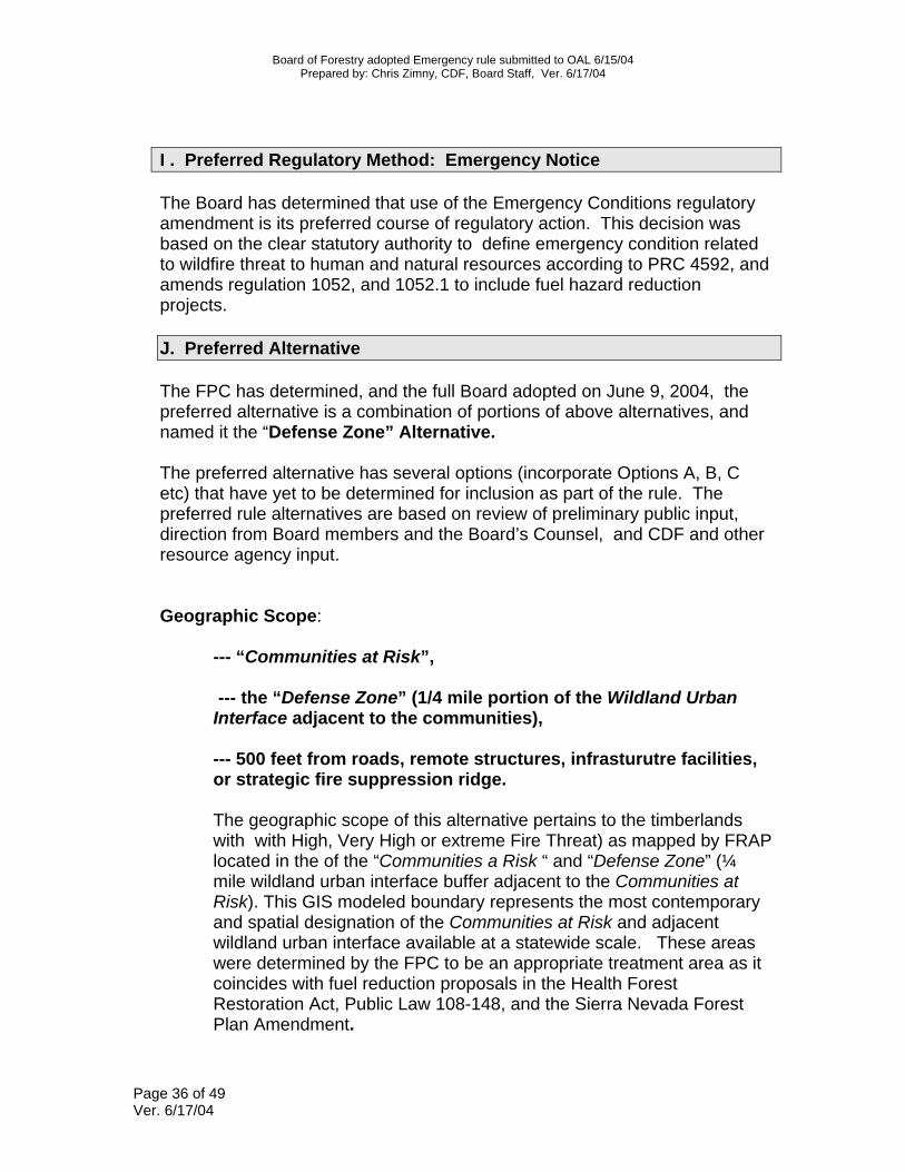
I . Preferred Regulatory Method: Emergency Notice The Board has determined that use of the Emergency Conditions regulatory amendment is its preferred course of regulatory action. This decision was based on the clear statutory authority to define emergency condition related to wildfire threat to human and natural resources according to PRC 4592, and amends regulation 1052, and 1052.1 to include fuel hazard reduction projects. J. Preferred Alternative The FPC has determined, and the full Board adopted on June 9, 2004, the preferred alternative is a combination of portions of above alternatives, and named it the “Defense Zone” Alternative. The preferred alternative has several options (incorporate Options A, B, C etc) that have yet to be determined for inclusion as part of the rule. The preferred rule alternatives are based on review of preliminary public input, direction from Board members and the Board’s Counsel, and CDF and other resource agency input. Geographic Scope:
--- “Communities at Risk”, --- the “Defense Zone” (1/4 mile portion of the Wildland Urban Interface adjacent to the communities), --- 500 feet from roads, remote structures, infrasturutre facilities, or strategic fire suppression ridge.
The geographic scope of this alternative pertains to the timberlands with with High, Very High or extreme Fire Threat) as mapped by FRAP located in the of the “Communities a Risk “ and “Defense Zone” (¼ mile wildland urban interface buffer adjacent to the Communities at Risk). This GIS modeled boundary represents the most contemporary and spatial designation of the Communities at Risk and adjacent wildland urban interface available at a statewide scale. These areas were determined by the FPC to be an appropriate treatment area as it coincides with fuel reduction proposals in the Health Forest Restoration Act, Public Law 108-148, and the Sierra Nevada Forest Plan Amendment.

Board of Forestry adopted Emergency rule submitted to OAL 6/15/04 Prepared by: Chris Zimny, CDF, Board Staff, Ver. 6/17/04
Page 37 of 49 Ver. 6/17/04
Use a GIS map of this footprint was determined to be inadequate from a forest practice compliance perspective, and the GIS map based its structure density on somewhat outdated 2000 US Census housing density block information. Therefore, the FPC determined that the appropriate footprint would be within ¼ mile of any housing structure with greater than 1 house per twenty acres density when the structure is associated with the list of “Communities at Risk”, define in 2001 Federal Register, updated by CDF in cooperation with the State Fire Marshall , and published by the California Fire Alliance. The overall extent of this community at risk and ¼ defense zone buffer is approximately 1.1 million acres of private timberlands. See the following graphic depicting the Communities at Risk and Defense Zone and Threat Zone locations of the Wildland Urban Interface in Plumas County:
In addition to the Communities at Risk and Defense Zone, the FPC and the Board have determined to include locations within 500 feet of an approved and legally permitted structure; within 500 feet of either

Board of Forestry adopted Emergency rule submitted to OAL 6/15/04 Prepared by: Chris Zimny, CDF, Board Staff, Ver. 6/17/04
Page 38 of 49 Ver. 6/17/04
500’
“Defense Zone Treatment”
500’
Preferred Alternative: Defense Zone (Fire Suppression Ridge)
1320’ Veg. Treatment per “Defense Zone”
standards
Preferred Alternative: Defense Zone
side of public, federal road, mainline road (identified in a public agency approved fire prevention plan) or private road providing access to legally permitted structures; infrastructure facilities such as transmission lines, towers, and water conduits; either side of ridge suitable for fire suppression (identified in a public agency approved fire prevention plan). These features are included as they are determined to be essential locations for the protection of evacuation routes and to provide safe locations for fire suppression tactics. When combining these areas with the Communities at Risk and Defense Zone areas above, it is very likely the proposed regulation would match with existing or proposed agency approved fire protection plans or other similar Community Wildfire Protection Plans. The total estimated area with the communities at risk, defense zone and 500 feet of roads, structures, and ridges would be approximately 2.9 million acres. The graphical representation of the geographical scope for this alternative is shown below:

Board of Forestry adopted Emergency rule submitted to OAL 6/15/04 Prepared by: Chris Zimny, CDF, Board Staff, Ver. 6/17/04
Page 39 of 49 Ver. 6/17/04
Road
500’ Defense Zone
500’
Preferred Alternative: Defense Zone (Public Road) The FPC committee has found that these areas meet the Board's goals of prioritizing the protection of human health and safety aspects with an initial emergency rule for locations nearest people. Upon post harvest evaluation of the rule effectiveness, the Board will then consider extending the geographic scope of the rule to significant fire threat areas in the outer portions of the WUI and other threatened timberlands outside the WUI.
Vegetative Treatment:
--- Substantial treatment of surface and activity fuels to meet a four foot flame length objective;
--- increase in HTLCB to minimum 8 feet; --- 50% minimum crown closure, varying by forest type. The FPC has determined that a combination of performance and prescriptive standards for vegetative treatment requirements best meets hazard reduction goals. The performance standard components focus on meeting the goal of treatments to eliminate the vertical continuity of vegetative fuels and the horizontal continuity of tree crowns, for the purpose of reducing the rate of fire spread, fire duration and intensity, fuel ignitability, or ignition of tree crowns. Treatments should obtain a goal that promotes maximum 4 foot flame lengths when burned under severe fire weather. The application of the proposed fuel treatment will depend highly on the expertise of the RPF preparing, implementation and post harvest auditing that the end results are obtained. In additional to the fuel `hazard reduction performance standards, standards are included to address maintaining wildlife habitat, sensitive plant habitat and visual screening in areas determined to be necessary and consistent with fuel hazard reduction objectives.

Board of Forestry adopted Emergency rule submitted to OAL 6/15/04 Prepared by: Chris Zimny, CDF, Board Staff, Ver. 6/17/04
Page 40 of 49 Ver. 6/17/04
“Defense Zone” vegetation treatment standard
“Defense Zone“ standard is the vegetation treatment loosely described as complete treatments needed to construct a fuelbreak. It reflects obtaining the 4 foot flame length objective which produce maximum fire safe conditions structure protection and provides a location suitable for deployment of fire suppression crews. It is generally considered to be very extensive treatment of surface , ladder and crown fuels resulting in very ‘clean” surface and understory forest conditions, and provides for space between crowns by eliminating overlapping crowns.
Surface fuel: All live and dead wood material (surface fuels) or woody debris created by the operation (activity fuels) greater than 1 inch diameter large end and three feet in length shall be removed, or piled and burned over the entire project/planning watershed area. Excluded are isolated shrubs and down logs necessary to meet wildlife habitat and visual screening requirements. Ladder fuels: Increase height of surface/ladder fuel to live co-dominant tree crown base (height to live crown base-HTLCB) to at least 8 feet. Crown fuels: Canopy cover shall not be reduced below predefined levels. Examples of post harvest canopy cover minimums would be 50% for Sierra Mixed Conifer forest types and 50% to 60% for Redwood/Douglas fir types; other requirements include:
increase the quadratic mean diameter of the stand; post harvest stocking standards are described in 912.7; only trees less than 24 inches stump diameter may be
removed. (Option E: 18 inches) (Option F: 30 inches)
Height to live crown base of at least 8 feet
8 ft.

Board of Forestry adopted Emergency rule submitted to OAL 6/15/04 Prepared by: Chris Zimny, CDF, Board Staff, Ver. 6/17/04
Page 41 of 49 Ver. 6/17/04
Performance Standard for Preferred Alternative: Defense Zone Complete treatment of surface and activity fuels, increase in HTLCB to minimum 8 feet, and 50% Crown Closure (Northern and Southern District forest types).
The Board adopted the 30 inch diameter standard as its preferred option during the June 9, 2004, Board meeting. This decision was based on the need to provide reduction in canopy crown bulk density to a level necessary to provide effective fire line heat intensities reduction to allow for tactical suppression operations. Also, this limit was selected as the Board determined that an effective fuel reduction barrier is needed near key communities and evacuation routes associated with human life.
The performance standards will include example photographs of desired post harvest conditions (see below).

Board of Forestry adopted Emergency rule submitted to OAL 6/15/04 Prepared by: Chris Zimny, CDF, Board Staff, Ver. 6/17/04
Page 42 of 49 Ver. 6/17/04
Following adoption of the emergency regulation, the Board directed staff to create a monitoring program to evaluate the extent of use, fuel treatment effectiveness, cost effectiveness, regulatory compliance, and environmental protection provided by the rule. Additionally, after considering the results of monitoring, the Board will begin adopting this rule as permanent regulation.
The rule text is as follows:
Fuel Hazard Reduction Emergency Rule
(Public Notice June 16, 2004)
Amend 14 CCR § 895.1:
Mainline road: Roads on non federal lands that are used as
the primary route for the transportation of forest products that
are fed by arterial (secondary) haul roads.
Average Severe Fire Weather Conditions: Atmospheric and
fuel conditions where fuel moisture content (dry weight basis) of
1-hour timelag fuels is three percent, 10-hour fuels is four
percent and 100- hour fuels is five percent, and live surface
fuels is 70 percent. Mid- flame wind speed is seven miles per
hour or greater, when measured in a closed forest canopy (40
percent canopy cover or greater). Note: Authority cited: Sections 4551, 4551.5, 4553, 4562, Public Resources Code. Reference: Sections 4513, 4551, 4551.5, 21001 (f), Public Resources Code.
Amend 14 CCR § 1052 Emergency Notice

Board of Forestry adopted Emergency rule submitted to OAL 6/15/04 Prepared by: Chris Zimny, CDF, Board Staff, Ver. 6/17/04
Page 43 of 49 Ver. 6/17/04
(a) Before cutting or removing timber on an emergency
basis, an RPF on behalf of a timber owner or operator shall
submit a Notice of Emergency Timber Operations to the Director,
on form RM-67 (9/99), or form RM-65 (1052.4)(6/04) for a Fuel
Hazard Reduction emergency, as prescribed by the Director.
(10)(a) For projects filing an emergency notice for fuel
hazard reduction under 14 CCR § 1052.4, archaeology requirements
shall be conducted by a person possessing current certification
pursuant to 14 CCR § 929.4[949.4,969.4].
(d) Timber operations pursuant to an Emergency Notice may
not commence for five working days, 15 days for a fuel hazard
emergency per 14 CCR §§ 1052.1(e) and 1052.4, from the date of
the Director's receipt of the Emergency Notice unless such
waiting period is waived by the Director. The Director shall
determine whether the emergency notice is complete. If it is
found to be complete the Director shall send a copy of a notice
of acceptance to the timberland owner. If the Emergency Notice is
not complete it shall be returned to the submitter. If the
Director does not act within five working days, 15 days for a
fuel hazard emergency per 14 CCR §§ 1052.1(e) and 1052.4, of
receipt of the Emergency Notice, timber operations may commence.
(e) Timber operations shall not continue beyond 120 days
after the Emergency Notice is accepted by the Director unless a

Board of Forestry adopted Emergency rule submitted to OAL 6/15/04 Prepared by: Chris Zimny, CDF, Board Staff, Ver. 6/17/04
Page 44 of 49 Ver. 6/17/04
plan is submitted to the Director and found to be in conformance
with the rules and regulations of the Board, except for burning
operations to treat fuels in accordance with subsection §
1052.4(d)(6) which shall be completed by April 1 of the year
following fuel creation. Note: Authority cited: Sections 4551, 4551.5, Public Resources Code. Reference: Sections 4513, 21001 (f), 21002.1, 21083.2, 21084.1, Public Resources Code. Amend 14 CCR 1052.1 Emergency Conditions
(e) High, very high or extreme fuel hazard conditions, the
combination combustible fuel quantity, type, condition, configuration
and terrain positioning, poses a significant fire threat on over 3
million acres of
private timberlands in close proximity to communities. Cutting and
removal of
hazardous fuels, including trees, shrubs and other woody material, is
needed to eliminate the vertical and horizontal continuity of ladder
fuels and surface fuels, for the purpose of reducing the rate of fire
spread, fire duration and intensity, fuel ignitability and to achieve a
flame length under average severe fire weather conditions that is less
than 4 feet in the treated areas.
Note: Authority cited: Sections 4551, 4551.5, 4552, 4553, 4592 Public Resources Code. Reference: Sections 4513, 4554, 4555, 4561, 4562, 4592, 21001(f), 21080(b)(4) Public Resources Code. Adopt 14 CCR 1052.4 Emergency Notice for Fuel Hazard Reduction

Board of Forestry adopted Emergency rule submitted to OAL 6/15/04 Prepared by: Chris Zimny, CDF, Board Staff, Ver. 6/17/04
Page 45 of 49 Ver. 6/17/04
The RPF preparing the Notice of Emergency Timber Operations
shall describe the nature of the emergency and the need for
immediate cutting in sufficient detail so that the reason for the
emergency is clear. Emergency timber operations, under the
presumed emergency standard of 14 CCR § 1052.1, may be commenced
and conducted when in conformance with the following:
(a) RPF develops and documents the vegetative treatments
necessary to meet the goals of 14 CCR § 1052.1(e), and ensures
post harvest conditions are in accordance with subsections in §
1052.4. Such documentation includes the following:
(1) A description of the preharvest stand structure
and
statement of the postharvest stand stocking levels.
(2) A description of the criteria used for the trees
to be harvested or the trees to be retained.
(3) All trees that are harvested or all trees that are
retained shall be marked by or under the supervision of a
registered professional forester before felling operations begin.
(4) Post harvest compliance shall be determined by the
combination of physical measurements, observations, and
comparison to
photo series examples in U.S. Forest Service General Technical
Report PNW-51 and 52 description codes 1-PP-4-PC, 1-DF-4-PC, 6-
DF-PC and 2-LP-3-PC , or other examples on file in the official

Board of Forestry adopted Emergency rule submitted to OAL 6/15/04 Prepared by: Chris Zimny, CDF, Board Staff, Ver. 6/17/04
Page 46 of 49 Ver. 6/17/04
rulemaking file and incorporated by reference. Post harvest
compliance shall be met on at least 80 percent of the project
area as calculated excluding WLPZs and other wildlife protection
requirements developed in accordance with subsection § 1052.4
(e).
(b) The conditions of subsection 14 CCR § 1038 (b)(1)
through (10) and (f)(1) through (14) for the Lake Tahoe Basin are
applied.
(c) Geographic area: operations are permitted:
(1)Within ¼ mile from approved and legally permitted
structures that comply with the California Building Code (legal
structure). Such legal structures shall be associated with the
“California Fire Alliance list of Communities at Risk” (copywrite
date
2003 on file in the official rulemaking file and incorporated by
reference) and have densities greater than 1 structure per 20
acres.
(2) Within 500 feet of a legal structures outside the
area defined in subsection § 1052.4(c)(1);
(3) Within 500 feet of either side of a public or
federal road;
(4) Within 500 feet on either side of a private road
providing access to legal structures;
(5) Within 500 feet on either side of a mainline haul
road identified by a public fire agency as necessary for fire

Board of Forestry adopted Emergency rule submitted to OAL 6/15/04 Prepared by: Chris Zimny, CDF, Board Staff, Ver. 6/17/04
Page 47 of 49 Ver. 6/17/04
suppression or evacuation and is approved by a public fire agency
in a fire prevention plan;
(6)Within 500 feet on either side of ridges identified
by a public fire agency as suitable for fire suppression and is
approved by a public fire agency in a fire prevention plan;
(7) Within 500 feet of infrastructure facilities such
as transmission lines or towers or water conduits.
(d) Vegetation Treatments: Tree removal shall target under
and midstory trees. The residual stand shall consist primarily of
healthy and vigorous dominant and codominant trees from the
preharvest stand. Standards listed shall be met by retaining the
largest diameter trees in the preharvest project area.
(1) The quadratic mean diameter of trees greater than
8 inches diameter breast height in the preharvest project area
shall be increased in the post harvest stand.
(2) Only trees less than 30 inches inside bark stump
diameter may be removed.
(3) Minimum post treatment canopy closure of dominant
and codominant trees shall be 40 percent for east side pine
forest types;
50 percent for coastal redwood and Douglas–fir forest types
referenced in subsection § 1052.4(c)(1) and (2) and 60 percent
elsewhere; and 50
percent for mixed conifer and all other forest types.

Board of Forestry adopted Emergency rule submitted to OAL 6/15/04 Prepared by: Chris Zimny, CDF, Board Staff, Ver. 6/17/04
Page 48 of 49 Ver. 6/17/04
(4) Stocking shall meet commercial thinning
requirement of
14 CCR § 913.3 [933.3, 953.3] immediately upon completion of
operations.
(5) Ladder and surface fuels shall be removed to
achieve a minimum clearance distance of 8 feet measured from the
base of the live crown of the post harvest dominant and
codominant trees to the top of the surface fuels.
(6) Not withstanding wildlife habitat requirements of
subsection § 1052.4(e), surface fuels in the project area,
including logging slash and debris, low brush, and deadwood, that
could promote the spread of wildfire shall be treated to achieve
the goal of an average of 4 foot maximum flame length height
under average severe fire weather conditions. These treatments
shall include chipping, removal or other methods necessary to
achieve the goal, and shall be accomplished within 120 days from
the start of operations or by April 1 of the year following
surface fuel creation if piled and burned.
(e) As part of the preharvest project design, the RPF shall
evaluate and incorporate habitat requirements for fish, wildlife
and
plant species in accordance with sections 14 CCR §§ 898.2, 916.9
[936.9,056.9] and 919. Such evaluations shall include use of
the California Natural Diversity Database and local knowledge of

Board of Forestry adopted Emergency rule submitted to OAL 6/15/04 Prepared by: Chris Zimny, CDF, Board Staff, Ver. 6/17/04
Page 49 of 49 Ver. 6/17/04
the planning watershed. Consultation with California Department
of Fish
and Game personnel is recommended. Examples of habitat
requirements to be incorporated into the project include
retention of large woody debris and snags congruent with
emergency condition goals, and vegetative screening for wildlife
cover and visual aesthetics. Note: Authority cited: Sections 4551, 4551.5, 4552, 4553, 4592 Public Resources Code. Reference: Sections 4513, 4554, 4555, 4561, 4562, 4584, 4592, 21001(f), 21080(b)(4) Public Resources Code.
End