gauges – radar – satellite combination prof. eng. ezio todini e-mail : [email protected]
TRANSCRIPT

GAUGES – RADAR – SATELLITECOMBINATION
Prof. Eng. Ezio TODINIe-mail : [email protected]
PROtezione e GEstione Ambientale Sede Operativa: Via Don Bedetti 20 - 40129 Bologna Tel. 051-6389099 Fax 051-6389100 E-mail: [email protected]

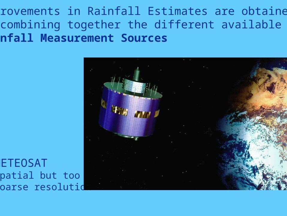
Improvements in Rainfall Estimates are obtained by combining together the different available Rainfall Measurement Sources
RAIN GAUGESReliable but point measures

Improvements in Rainfall Estimates are obtained by combining together the different available Rainfall Measurement Sources
RADAR Spatial but less reliable
Improvements in Rainfall Estimates are obtained by combining together the different available Rainfall Measurement Sources
METEOSATSpatial but toocoarse resolution

The MUSIC Prototype Integrates:Hydrologic & Hydraulic modelsGIS and Advanced Visual User Interface
THE MUSIC INTEGRATED SYSTEM PROTOTYPE
RAINFALL INPUTS CAN BE FROM:Gauges, Radar, Satellite and Meteorological Models Forecasts

Rain-gaugemeasurements
KRIGED measurements from gauges
Radar measurements,A PRIORI estimates
Combination of radar estimates and gaugesmeasurements, A POSTERIORI estimate
BLOCK KRIGING
KALMAN FILTER
SPATIAL
MEASUREMENTS
over the radar
pixels
Eliminating the BIAS and producing MINIMUM
VARIANCE precipitation estimates on pixels
ORIGINAL TECHNIQUE TO COMBINE, IN A BAYESIAN SENSE, AREAL PRECIPITATION FIELDS (RADAR) TO POINT MEASUREMENTS OF PRECIPITATION (RAIN-GAUGES)
GROUND BASED
TELE- METERING
RAIN- GAUGE
MEASUREMENTS
- accurate in a point
- spatial significance
decays with the
distance and with
the area
BLOCK KRIGING estimating the average field over theradar pixels and its Variance from the
point rain-gauge measurements
SPATIAL MEASUREMENTS
POINT MEASUREMENTS
RADAR MEASUREMENTS- good spatial representation
- poor quantitative estimates
- biased measurements
SPATIAL MEASUREMENTS
KALMAN FILTERfinding the a posteriori estimates by combining the
a priori estimates provided by the radar with the blockKriged measurements provided by the gauges,
in a Bayesian framework
1

RAIN-GAUGES
Meteorological RADAR
Meteorological SATELLITE
Measurements of the rainfall field at different scales. combine measurements at multiple resolution.
yUx TMODEL:
UP-SCALING:
yUx T ˆˆ
y disaggregated estimate at the RADAR scale (from the Bayesian combination)
yP~ covariance of the estimation errors at the RADAR scale
aggregated RADAR estimate
UPUP yT
x ~~ variance of the estimation errors of the aggregated RADAR estimate
RAIN-GAUGES, RADAR AND SATELLITE COMBINATION
The true rainfall at the upper scale can be obtained simply by summing the true rainfall at the lower scale
RAD Scale
SAT Scalex
y
DOWNSCALING
RAD Scale
SAT Scalex
y
UPSCALING

BAYESIAN APPROACH at SATELLITE Scale
TRUE BK-RAD SAT BK-RAD-SAT
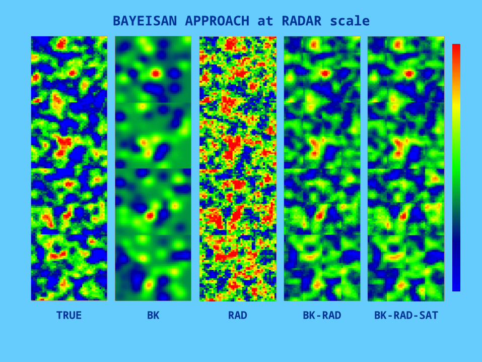
BAYEISAN APPROACH at RADAR scale
TRUE BK RAD BK-RAD BK-RAD-SAT

RESULTS (1000 time-steps)RESULTS (1000 time-steps)
BIASBIAS VARIANCEVARIANCE
RADARRADAR 5.0449 5.0449 19.415419.4154
BLOCK KRIGINGBLOCK KRIGING -0.0051-0.0051 30.572430.5724
BLOCK KRIGING + RADAR (RADAR scale)BLOCK KRIGING + RADAR (RADAR scale) -0.0129-0.0129 14.541914.5419
SATELLITESATELLITE 999.7988999.7988 34475.636834475.6368
BK+RADAR AGGREGATED BK+RADAR AGGREGATED
(SATELLITE scale)(SATELLITE scale)-1.1297-1.1297 27930.314427930.3144
BK+RADAR + SATELLITE (SATELLITE scale)BK+RADAR + SATELLITE (SATELLITE scale) -0.7325-0.7325 16312.851716312.8517
BK+RADAR + SATELLITE (RADAR scale)BK+RADAR + SATELLITE (RADAR scale) -0.0050-0.0050 13.156713.1567

BLOCK KRIGING BLOCK KRIGING RADAR RADAR SATELLITESATELLITE
BK+RADARBK+RADAR BK+RADAR+SATELLITEBK+RADAR+SATELLITEBK+SATELLITEBK+SATELLITE
6.5 mm6.5 mm0.0 mm0.0 mm 2.2 mm2.2 mm 4.4 mm4.4 mm

The present status:
- Block-Kriging software package Completed(*)
- Raingauge – Radar combination Completed
- Raingauge – Satellite combination Completed
- Raingauge-Radar-Satellite comb. Completed
- Coupling with TOPKAPI Completed
(*) Under revision