gc 202 soils mid-term study guidemichal76/classstudyguides/soil formation.pdf · gc 202 soils...
TRANSCRIPT
GC 202 Soils Mid-Term Study Guide
Soil – A collection of natural bodies occupying parts of earth’s surface
that support plants and that have properties due to the integrated effect of
climate and living matter acting upon parent material, as conditioned by relief,
over periods of time.
FUNCTIONS
1.) Medium for Plant Growth
- Regulate temperatures, Foundation for roots, Key Nutrients supplied
- Soil Pores; Supply roots with air and allows gases to vent off, allow root access to water, protect
plants from phytotoxic substances.
- Soil types strongly influence/determine nature of vegetation.
2.) System for Water Supply
- Influence quality & quantity in lakes, rivers, and aquifers
- Determines rates of surface runoff & Infiltration.
- Good Soil = maintains slope, reduce erosion/flooding/sedimentation.
- Bad Soil = lots of runoff, compact soil pores, sedimentation (loss of soil in water).
3.) Act as Recyclers of Raw Material
- Recycle nutrients from plants & animal wastes.
- Plays major role in biogeochemical cycles; turns organic waste into
humus (decomposed organic matter, used by plants & animals).
- Humification = turns out CO2 used by organisms; releases carbon which is helping advance
climate change (carbon sequesters/sinks).
4.) Habitat for Microorganisms
- Contain microorganisms (billions of individual organisms in a single handful!)
- Plays a key role in the flow of nutrients
- Nitrogen- promotes plant growth!
- Mycorrhizal fungi – aid in uptake in nutrients by the plant, improving plant
growth/health.
5.) Engineering Medium
- Base for roads, buildings, bridges, etc. (requires excavation, stabilization, drainage, filling of
natural soils).
- Determines stability & suitability of projects & applications. (ignorance of this can result in
destruction of structures)
TERMS
Regolith – unconsolidated mantle of weathered rock/soil material
(Loose material above bedrock).
- Thickness varies from nothing to 10’s of meters
Bedrock – hard, relatively unweathered rock.
Soil Profile – vertical section exposing layers/horizons of a soil.
Soil Horizon – distinctive, yet highly variable soil layers, typically
parallel to the grounds surface.

Major Soil Horizons/Layers
O: - undecomposed or decomposing organic matter, usually at the
surface of the forest soil.
A: - organic material and mineral matter, darker color;
(Known as TOPSOIL).
E: - (ELLUVIATION) leached zone; usually lighter color.
B: - zone of accumulation of clay, iron and aluminum oxides,
gypsum, or CaCo2.
C: - relatively unweathered, unconsolidated parent material.
R: - rock parent material (Bedrock close to surface).
4 Major Soil Components
By volume, typically ‘Loamy Soil’ (mixture of sand, silt, clay) = BEST! Consists of 50% solids
(45% mineral material, 5% organic), 25% air, and 25% water.
Mineral – inorganic materials from weathering/erosion of rock.
Organic Matter – from living organic remains/dead organisms
Water – held in soil pores, contains dissolved organic/inorganic substances.
-‘PH’ is crucial for plant growth!
Air – held in soil pores, high relative humidity, high CO2
Soil Variation
- Soils ‘vary greatly’ in terms of horizons, physical properties, and chemical attributes
from place to place on earth.
- This is due to ‘major environmental factors’ also vary from place to place (climate &
vegetation, etc.).
5 Soil Forming Factors
1.) (p) Parent Material (Geology)
2.) (cl) Climate
3.) (o) Biota (Organisms)
4.) (r) Topography (Relief)
5.) (t) Time

Parent Material - Soils form ‘in’ parent materials (building blocks of soil).
- Vary greatly and their nature has a profound influence on soil characteristics, esp. texture, chemical, and
mineral composition.
- 3 Types; residual, transported, and organic.
- Residual - formed in place from the weathering or rock.
- Weathering – breakdown of rock material.
- 3 main classes of rock; Igneous, Metamorphic, Sedimentary
- 2 main types of weathering;
- Physical – Temperature Changes, Water, Plants and Animals
- Chemical - Hydration, Dissolution, Carbonation, Oxidation, Complexation
- Transported – deposits that result from ‘erosion’ & ‘mass wasting’ (via gravity) of sediment.
- Major geomorphoric process that created the deposit-glacial, fluvial, eolian, etc.
- Colluvial Deposits – result from certain mass wasting processes
(‘fall’ & ‘creep’; which result from the downslope movement of
weathered rock material.)
- Examples: Talus from rock, Hillside colluviums/Slope wash
- Alluvial/Fluvial – deposits created by action of running, channelized water.
- Major depositional settings: floodplains, alluvial fans, deltas
- Marine & Lacustrine – deposits laid down by marine/ocean water and
freshwater or saline lakes, respectively (standing body of water).
- Highly variable, ranging from sand (near shore), clay/silts (offshore/deep),
even shell/lime (marine settings).
- Sediments become exposed by; ‘drop of water’ or ‘rise of land’.
- Local soils – formed in lacustrine parent materials deposited by glacial
lake/ancestral forms of Great Lakes.
- Glacial & Glaciofluvial – deposits related to the action of ‘Continental’ and ‘Alpine’
glaciers.
- DRIFT – all sediment of glacial origin. (2 categories)
Till – materials deposited directly by a glacier.
Diamicton – unsorted, unstratified mixture of all sizes of
material from boulders to clay. (Dog’s Breakfast!)
Till composes: moraines, drumlins, till plains/ground moraine
Outwash – materials deposited by glacial meltwater.
Stratified, or layered deposits of sands/gravels.
Broad plains form at the margins of retreating glaciers
Outwash composes: eskers, Moulin kames, kame terraces,
kettles.
- Eolian – sediment transported by wind. (Saltation- grains bouncing in the wind)
- Dune Sand – moving hills of wind-blown, fine/medium/relict, formed long ago,
no longer active, covered by vegetation.
- Loess – thick deposits of windblown silt, throughout to have origins in either
glacial times, or desert areas (CHINA).
- Aerosolic dust – very fine particles that are suspended in the atmosphere,
deposited with rainfall (small amounts).
- Volcanic Ash – pyroclastic materials, ranging from cinder chunks to fine ash
(andasol soil).
- Organic Deposits – accumulations of organic material in wet places, where growth of plant
material exceeds the rate of decomposition.
- Over years, plants resides accumulate sink into water, slowly decompose because of
anaerobic conditions (lack of oxygen).
- Peat – (fibers) vs. Muck – (broken down)
- ~340 million hectares (160 million acres) worldwide, mostly Northern Hemp.
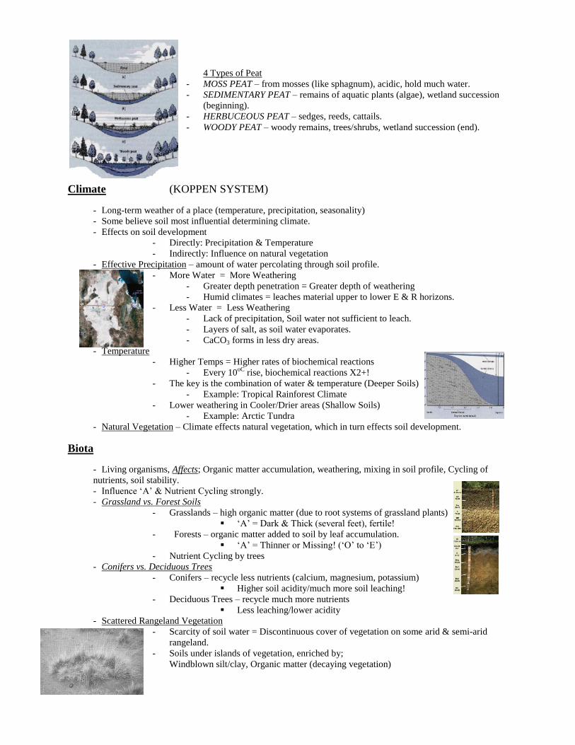
4 Types of Peat
- MOSS PEAT – from mosses (like sphagnum), acidic, hold much water.
- SEDIMENTARY PEAT – remains of aquatic plants (algae), wetland succession
(beginning).
- HERBUCEOUS PEAT – sedges, reeds, cattails.
- WOODY PEAT – woody remains, trees/shrubs, wetland succession (end).
Climate (KOPPEN SYSTEM)
- Long-term weather of a place (temperature, precipitation, seasonality)
- Some believe soil most influential determining climate.
- Effects on soil development
- Directly: Precipitation & Temperature
- Indirectly: Influence on natural vegetation
- Effective Precipitation – amount of water percolating through soil profile.
- More Water = More Weathering
- Greater depth penetration = Greater depth of weathering
- Humid climates = leaches material upper to lower E & R horizons.
- Less Water = Less Weathering
- Lack of precipitation, Soil water not sufficient to leach.
- Layers of salt, as soil water evaporates.
- CaCO3 forms in less dry areas.
- Temperature
- Higher Temps = Higher rates of biochemical reactions
- Every 10oC
rise, biochemical reactions X2+!
- The key is the combination of water & temperature (Deeper Soils)
- Example: Tropical Rainforest Climate
- Lower weathering in Cooler/Drier areas (Shallow Soils)
- Example: Arctic Tundra
- Natural Vegetation – Climate effects natural vegetation, which in turn effects soil development.
Biota
- Living organisms, Affects; Organic matter accumulation, weathering, mixing in soil profile, Cycling of
nutrients, soil stability.
- Influence ‘A’ & Nutrient Cycling strongly.
- Grassland vs. Forest Soils
- Grasslands – high organic matter (due to root systems of grassland plants)
‘A’ = Dark & Thick (several feet), fertile!
- Forests – organic matter added to soil by leaf accumulation.
‘A’ = Thinner or Missing! (‘O’ to ‘E’)
- Nutrient Cycling by trees
- Conifers vs. Deciduous Trees
- Conifers – recycle less nutrients (calcium, magnesium, potassium)
Higher soil acidity/much more soil leaching!
- Deciduous Trees – recycle much more nutrients
Less leaching/lower acidity
- Scattered Rangeland Vegetation
- Scarcity of soil water = Discontinuous cover of vegetation on some arid & semi-arid
rangeland.
- Soils under islands of vegetation, enriched by;
Windblown silt/clay, Organic matter (decaying vegetation)

- Thicker ‘A’ beneath vegetation, thin in between.
- Faunal Influences (Pedoturbation / Soil mixing)
- Burrowing animals (tunnel, higher air circulation, mess up soil horizons)
- Other critters (earthworms, ants, termites) alter nutrient availability, aerate soils, build
mounds.
- Humans (modify soil formations) agriculture, fire, development, habitat alteration.
- Crotovinas – soil mixing due to animals.
Topography
- Configuration of the land surface in terms of elevation differences, slope, and landscape position.
- Tremendous effect on soil; Soil Loss, Water Infiltration, Local Climate (highland zones/aspect), Drainage,
Parent Materials.
- Steep Slopes = More Erosion, Less Infiltration, Less Soil Development (Thinner Horizons)
- Topography = effects vegetation patterns, in turn soil development (US West)
- SLOPE ASPECT – direction a slope faces.
- NH, South facing slopes receive more direct sunlight.
- Tend to be warmer/drier (more evaporation), low veg.
- South facing slopes soils are less-well-developed (weak
horizons, thinner profiles, less organic matter, etc.)
- Upper Latitudes the effect is more subtle (desirable?)
- Drainage
- Some lower lying areas, groundwater/surface water flow maybe impeded, which creates
ponds/wetland conditions.
- Soils different than well-drained/upland settings
- (Example: Prairie Potholes; Great Plains US/Canada; Kettles)
- Parent Material
- Topography can also interact with parent materials
- EBEN JUCTION (Rock River/Silver Creek Canyon)
- Shallow tills over bedrock on Plateaus, Followed by exposed bedrock on valley
sides, Finally rocky talus, colluviums, and aluminum in the valley bottom.
Time
- The soil formation clock begins with fresh parent material (Glaciations, Floods, Human Impact)
- Cool/Dry Areas = Takes a LONG Time
- Warm/Wet Areas = Quicker Development
- ‘O’ / ‘A’ accumulates quicker; ‘B’ requires thousands of years (B & E can be used to date landforms)
- UP upland soils have had as much as 12,000 years development time!; UP Lowlands = Few Thousand
Soil Sequences A number of soils across a segment of a landscape where the infiltration of one soil forming factor explains
the variation in soils.
- Lithosequence – dominated by variation in parent material.
- Climosequence – dominated by variation in climate.
- Biosequence – dominated by variation in biota.
- Toposequence – dominated by variation in topography.
- Chronosequence – dominated by variation in time of development. (Beach Ridges Lab!)

4 Major Processes of Soil Genesis
- Transformations – Soil constituents are modified or destroyed & other synthesized.
- Example: Mineral weathering/Organic breakdown
- Translocation – Movements of inorganic mater from one horizon to another, up or down, usually
by water.
- Example: Leaching / Animal Activity
- Additions – Material added to soil profile from outside sources.
- Example: Leaf Litter, Groundwater/Eolian Influx
- Losses – Removal of material from soil profile.
- Example: Groundwater Leaching & Soil Erosion
Soil Horizon Nomenclature - Designated using numbers (1, 2, 3, etc.) to indicate variables within a horizon.
- If the # follows master horizon letter = means a variable other than parent material.
- Subtle Change in color/structure.
- If the # precedes the master horizon letter = means a change in parent material/textural
discontinuity has occurred.
Transition Horizons – horizons with properties of adjacent horizons, indicated
using matter horizons letter in combination together.
Example: Dominant horizon (Strongest Properties) listed first.
Followed by a subordinate horizon. (AE = A is dominant over E)
Example: A slash of separate 2 Master Horizons.
Bisequal Designations – 2 horizons may develop in the same horizon in a profile
and have the same horizon designation but are separated by an unlike horizon.
Example: A, E, Bh, E’, Bt (The Prime ’ is the Bisequal horizon)
Common Subordinate Distinctions
O horizons: –Oi (fibric or litter),
–Oe (hemic or fermentation),
–Oa (sapric or humidified)
A horizons: –Ap = plowed A horizon
–Ab = buried A horizon
E horizons: –Ew = poorly developed but noticeable leached zone
B Horizons: –Bs = illuvial iron and aluminum oxide-rich B horizon
–Bh = illuvial accumulation of O.M. in B horizon
–Bhs = combination of both
–Bt = illuvial clay-enriched B horizon
–Bk = illuvial carbonate-enriched B horizon (CaCO3)
C Horizons: –Cr = C horizon composed of weathered rock

Physical Properties of Soil - Depth – taken from the ‘uppermost mineral horizon’ (A or E usually) which is set at O.
- Depths of different horizons are then measured downward to the base of the soil exposure
or pit.
- Example: A horizon = 0 – 8 cm.
- O horizons (on upland soils) are measured upward from the same point.
- Example: O horizon = 2 – 0 cm.
- Horizon Boundaries – the lower boundary of each horizon.
- Described in terms of ‘Distinctness’ & ‘General Topography’
- DISTINCTNESS :
- a - abrupt (transition is < 2 cm thick)
- c - clear (transition is 2-5 cm thick)
- g - gradual (transition is 5-15 cm thick)
- d - diffuse (transition is >15 cm thick)
- TOPOGRAPHY:
- s - smooth (boundary is planar or parallel to ground surface)
- w - wavy (undulating surface with pockets wider than deep)
- i - irregular (pockets are deeper than their width)
- b - broken (one or both of the horizons separated by the boundary
are discontinuous, so that the boundary is interrupted)
- Caused: Tree Fall (Tree Tip Mounds) / Humans
Soil Color and Mottling - Often the most obvious of the physical properties, it provides many clues to the nature of soil
properties/conditions.
- Colors/Mottling is noted for each horizon during field descriptions.
- Color:
- MUNSELL SOIL COLOR BOOKS – provide standardized system based on;
- HUE (Main color, usually yellows/reds)
- VALUE (Lightness or darkness, O - ?) Higher = Brighter
- CHROMA (intensity of brightness, O - ?) Higher = Brighter
- Example: 10 YR 5/6
- Compare soil to chips in the book.
Soil moisture is noted (effects soil color)
- Indicates;
- White or light grey - leaching in humid climate or calcium carbonate in arid,
semi-arid climates
- Black or dark brown - organic matter-rich
- Orange or red - iron-rich
- Gray, bluish, grey-green (gleyed) - anaerobic conditions
- Mottling:
- Color variations (spots or blotches) or shades of clors interspersed within a dominant
color.
- May indicate seasonal changes in the water table depth, as well as other processes.
- Described by Size , Abundance (quantity), and Contrast
- SIZE : 1 = fine (<5 mm), 2 = medium (5-15 mm), 3 = large (>15 mm)
- ABUNDANCE : f = few (<2% surface), c = common (2-20% surface),
m = many (>20% surface)
- CONTRAST : f = faint, d = distinct, p = prominent (sharp matrix of colors)

Soil Texture - Proportion of different sized mineral particles (textural classes).
- Also may refer to major size class (Sand, Silt, Clay)
- Usually fraction (particles <2 mm in diameter)
- Particles >2 mm classified as Coarse Fragments
- Gravel/Pebbles (2-75 mm), cobbles/flags (75-250 mm), stones/boulders (>250 mm)
-
- SAND – ranges in size from 0.05mm - <2.0 mm
- Typically silica dioxide (quartz) in composition
- Soils voids between sand grains are large, surface area is relatively low
- Noncohesive – individual particles do not stick together.
- Water moves through easily (droughty)
- Sub-Categories;
- Very Coarse Sand (<2.0 mm -1.0 mm)
- Coarse Sand (<1.0 mm -0.5 mm)
- Medium Sand (<0.5 mm -0.25 mm)
- Fine Sand (<0.25 mm -0.10 mm)
- Very Fine Sand (<0.10 mm -0.05 mm)
- SILT – ranges in size from <0.05 mm to 0.002 mm
- Quartz dominated most silts (microsand)
- Pores between silt particles are smaller than in sand,
silt holds more water, but slower infiltration rates than sand.
- Low stickiness (cohesion), low plasticity (malleability),
easily washed away by water.
- CLAY – size is <0.002 mm, shaped like flat plates or platelets
- Particles have tremendously large surface area
- Largest water holding capacity!
- Very sticky (cohesive) and high plasticity (malleability)
- May behave as Colloids (stays suspended indefinitely in fluids)
- Movement of water/air very low
- BADLANDS = (Shale [Clay])
Textural Classes - Relative percentage of major fine earth fraction sizes.
- 12 textual classes, keyed to textural triangle (Sand Clay)
- LOAM – mix of Sand, Silt, and Clay; exhibits properties of these textures in equal
amounts (doesn’t mean and equal mix!)

Particle Size Determination Lab
- There are a number of methods used to determine particle size;
- Sieves - Hydrometer Jars (Most typical: Bouyoucous)
- Pipettes (Best!: Disperse soil samples in water, deflocculating chemical & blender)
- Stoke’s Law; Velocity = K constant, X particle’s diameter2
- Big stuff hits the bottom first! (Sand, Silt, then Clay)
- Hand Texturing (The Feel Method)
- Textual classes determined in field by hand.
- Need a lot of practice!
- Sand = gritty, will not form a ball.
- Silt = non-gritty (flour), will form a ball, forms a semi-ribbon.
- Clay = feels greasy, will form a long ribbon when moist, Shines!
Soil Structure
- Arrangement (Shape, Size, Distinctness) of primary soil particles into ‘Aggregates’ or ‘Peds’.
- Influences water movement, transfer of heat, soil aeration, etc.
- Described in the field based on; Type (shape), Size (fine, medium, coarse), Grade (degree of development)
- 4 Basic Types;
Spheroidal (Crumb/Granuler)
Spheroidal Peds or Granules
Small! Rich! (Usually pass through worms etc.)
‘A’ horizons typical
2 Types; Granular (<1 mm - >10 mm, Crumb (more porous)
- Plate-Like (Platey)
Relatively thin, horizontal peds, plate-shaped
Found in surface & subsurface horizons
Inherited by parent materials as soils formed or human compaction.
Higher water flow, less infiltration, runoff
Block-Like (Blocky)
Irregular, Blocks, Size range from 5 – 50 mm
In ‘B’ horizons (humid environments)
Good drainage, aeration, good root penetration
2 Types; Angular Blocky – sharp edges, Subangular Blocky – more rounded
Prism-Like Vertically – Oriented pillar- like peds
150 mm or > , various heights
Associated with swelling types of clays
In ‘B’ horizons in arid/semi-arid climates.
2 Types; Columnar – natric ‘B’ horizons, rounded, high sodium
Prismatic – relative angular, flat top
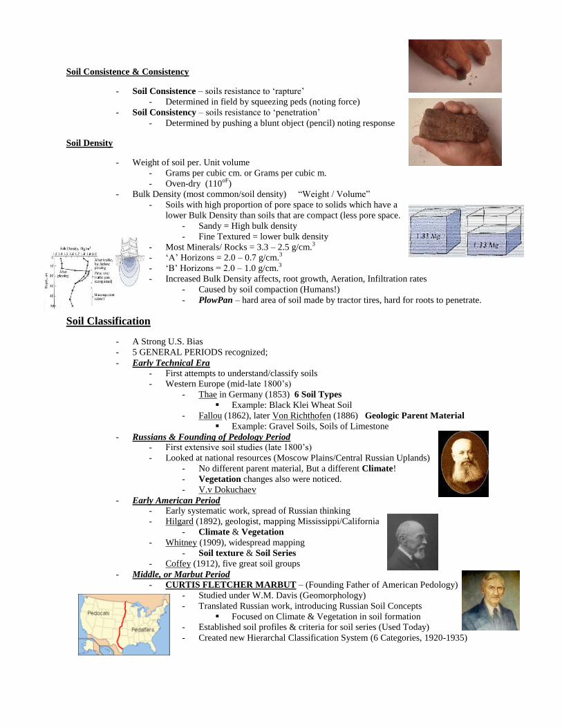
Soil Consistence & Consistency
- Soil Consistence – soils resistance to ‘rapture’
- Determined in field by squeezing peds (noting force)
- Soil Consistency – soils resistance to ‘penetration’
- Determined by pushing a blunt object (pencil) noting response
Soil Density
- Weight of soil per. Unit volume
- Grams per cubic cm. or Grams per cubic m.
- Oven-dry (110oF
)
- Bulk Density (most common/soil density) “Weight / Volume”
- Soils with high proportion of pore space to solids which have a
lower Bulk Density than soils that are compact (less pore space.
- Sandy = High bulk density
- Fine Textured = lower bulk density
- Most Minerals/ Rocks = 3.3 – 2.5 g/cm.3
- ‘A’ Horizons = 2.0 – 0.7 g/cm.3
- ‘B’ Horizons = 2.0 – 1.0 g/cm.3
- Increased Bulk Density affects, root growth, Aeration, Infiltration rates
- Caused by soil compaction (Humans!)
- PlowPan – hard area of soil made by tractor tires, hard for roots to penetrate.
Soil Classification
- A Strong U.S. Bias
- 5 GENERAL PERIODS recognized;
- Early Technical Era - First attempts to understand/classify soils
- Western Europe (mid-late 1800’s)
- Thae in Germany (1853) 6 Soil Types
Example: Black Klei Wheat Soil
- Fallou (1862), later Von Richthofen (1886) Geologic Parent Material
Example: Gravel Soils, Soils of Limestone
- Russians & Founding of Pedology Period - First extensive soil studies (late 1800’s)
- Looked at national resources (Moscow Plains/Central Russian Uplands)
- No different parent material, But a different Climate!
- Vegetation changes also were noticed.
- V.v Dokuchaev
- Early American Period - Early systematic work, spread of Russian thinking
- Hilgard (1892), geologist, mapping Mississippi/California
- Climate & Vegetation
- Whitney (1909), widespread mapping
- Soil texture & Soil Series
- Coffey (1912), five great soil groups
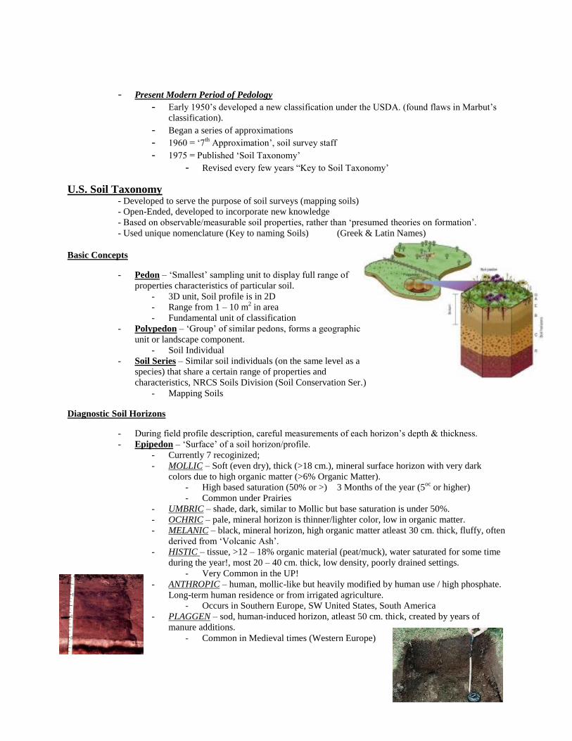
- Middle, or Marbut Period - CURTIS FLETCHER MARBUT – (Founding Father of American Pedology)
- Studied under W.M. Davis (Geomorphology)
- Translated Russian work, introducing Russian Soil Concepts
Focused on Climate & Vegetation in soil formation
- Established soil profiles & criteria for soil series (Used Today)
- Created new Hierarchal Classification System (6 Categories, 1920-1935)
- Present Modern Period of Pedology - Early 1950’s developed a new classification under the USDA. (found flaws in Marbut’s
classification).
- Began a series of approximations - 1960 = ‘7
th Approximation’, soil survey staff
- 1975 = Published ‘Soil Taxonomy’ - Revised every few years “Key to Soil Taxonomy’
U.S. Soil Taxonomy - Developed to serve the purpose of soil surveys (mapping soils)
- Open-Ended, developed to incorporate new knowledge
- Based on observable/measurable soil properties, rather than ‘presumed theories on formation’.
- Used unique nomenclature (Key to naming Soils) (Greek & Latin Names)
Basic Concepts
- Pedon – ‘Smallest’ sampling unit to display full range of
properties characteristics of particular soil.
- 3D unit, Soil profile is in 2D
- Range from 1 – 10 m2 in area
- Fundamental unit of classification
- Polypedon – ‘Group’ of similar pedons, forms a geographic
unit or landscape component.
- Soil Individual
- Soil Series – Similar soil individuals (on the same level as a
species) that share a certain range of properties and
characteristics, NRCS Soils Division (Soil Conservation Ser.)
- Mapping Soils
Diagnostic Soil Horizons
- During field profile description, careful measurements of each horizon’s depth & thickness.
- Epipedon – ‘Surface’ of a soil horizon/profile.
- Currently 7 recoginized;
- MOLLIC – Soft (even dry), thick (>18 cm.), mineral surface horizon with very dark
colors due to high organic matter (>6% Organic Matter).
- High based saturation (50% or >) 3 Months of the year (5oc
or higher)
- Common under Prairies
- UMBRIC – shade, dark, similar to Mollic but base saturation is under 50%.
- OCHRIC – pale, mineral horizon is thinner/lighter color, low in organic matter.
- MELANIC – black, mineral horizon, high organic matter atleast 30 cm. thick, fluffy, often
derived from ‘Volcanic Ash’.
- HISTIC – tissue, >12 – 18% organic material (peat/muck), water saturated for some time
during the year!, most 20 – 40 cm. thick, low density, poorly drained settings.
- Very Common in the UP!
- ANTHROPIC – human, mollic-like but heavily modified by human use / high phosphate.
Long-term human residence or from irrigated agriculture.
- Occurs in Southern Europe, SW United States, South America
- PLAGGEN – sod, human-induced horizon, atleast 50 cm. thick, created by years of
manure additions.
- Common in Medieval times (Western Europe)
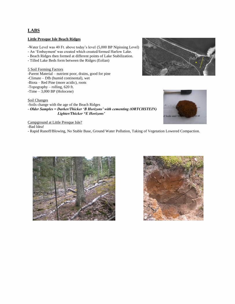
LABS
Little Presque Isle Beach Ridges
-Water Level was 40 Ft. above today’s level (5,000 BP Nipissing Level)
- An ‘Embayment' was created which created/formed Harlow Lake.
- Beach Ridges then formed at different points of Lake Stabilization.
- Tilled Lake Beds form between the Ridges (Eolian)
5 Soil Forming Factors
-Parent Material – nutrient poor, drains, good for pine
-Climate – Dfb (humid continental), wet
-Biota – Red Pine (more acidic), roots
-Topography – rolling, 620 ft.
-Time – 3,000 BP (Holocene)
Soil Changes
-Soils change with the age of the Beach Ridges
- Older Samples = Darker/Thicker ‘B Horizons’ with cementing (ORTCHSTEIN)
Lighter/Thicker “E Horizons’
Campground at Little Presque Isle?
-Bad Idea!
- Rapid Runoff/Blowing, No Stable Base, Ground Water Pollution, Taking of Vegetation Lowered Compaction.

Soil Landscapes at Sugarloaf & Wetmore Pond
-3 Major Outcrop Types;
-Waska (bottom of Mnt.)
-Michigamie Outcrop Complex (middle of Mnt.)
-Peshikee Outcrop Complex (top of Mnt.)
-Origin of Sugarloaf Mnt. (Compeau Creek Gneiss = Metamorphosed Granite)
- Pcnokean Mountains (2.5 Billion Years of Erosion)
- 2.5 Million Years of Glaciation (Marquette Advance)
-‘Roches Mountinee’ ‘Plucking’ forms holes which fill with ‘Glacial Outwash’
‘ORCHSTEIN’ found in Bs1 (Thin Cemented Layer of Soil)
‘Hemlock’ (main vegetation cover) – bark used for tanning hides.
Effect of having a hiking Trail on Sugarloaf
-Pore Compression! Higher Bulk Density (5 tons per. Ton +), 30-40 cm. of soil loss! (B Horizon now exposed),
High Runoff!
Wetmore Pond Topography
-Low area (Glacial Channel) where the topography intersects the water table, saturating area soils.
Is the Area a Wetland (even though its not classified a Histosol?
YES, because it has the 3 indicators;
- High Water Table
- Vegetation
- Soil Indicators (Muck Layer)
- Mostly ‘O Horizon’ with a (‘GLEY’ gravel, boulders, sand) ‘C Horizon’
-The wrongful classifying is a Soil Taxonomy Problem.