geographical resources basic geography lesson general atlases thematic atlases geography-related...
TRANSCRIPT

Geographical Resources
BASIC GEOGRAPHY LESSON
GENERAL ATLASES
THEMATIC ATLASES
GEOGRAPHY-RELATED REFERENCE SOURCES
INTERNET SOURCES
Atlases
Most librarians pay little attention to atlases--grab one off the shelf and hope it’s current
Political upheavals in early 1990s gave atlases renewed news-worthiness: Germany, Soviet Union, Yugoslavia, Czechoslovakia changes, etc.

Atlases
Is the work up to date? Copyright date does not necessarily mean every map has been updated
Is there adequate West/East balance?
Legible maps?

Atlas Indexing
Are all places listed in the index indeed on the maps?
Ideally, places identified both with latitude and longitude |, as well as using grid positions:
106 G8 Chicago, Illinois, USA 41.50N 87.45W
Atlas: Map Scales
Scales given in numbers called representative fractions:
1:100,000
means one unit of distance on map equals 100,000 of the same unit on the Earth’s surface
Atlas: Map Scales
•LARGE scale means a more detailed map
•The smaller the right-hand number, the larger the scale of the map:
1:75,000 is a larger scale map than
1:600,000 which is a small scale map
•Ideally, an atlas should have the same scales or at least multiples of one another:
1:2,000,000 1:4,000,000 etc.


Projection Controversy
•How the continents are depicted.
•Earth is round.
•Globe is only perfect depiction.
•Flat map = distortion.

Projection Controversy
A cartographer has the choice of retaining relationships such as bearings or directions, OR retaining comparable distances and areas
Projection Controversy
A cartographer has the choice of retaining relationships such as bearings or directions, OR retaining comparable distances and areas

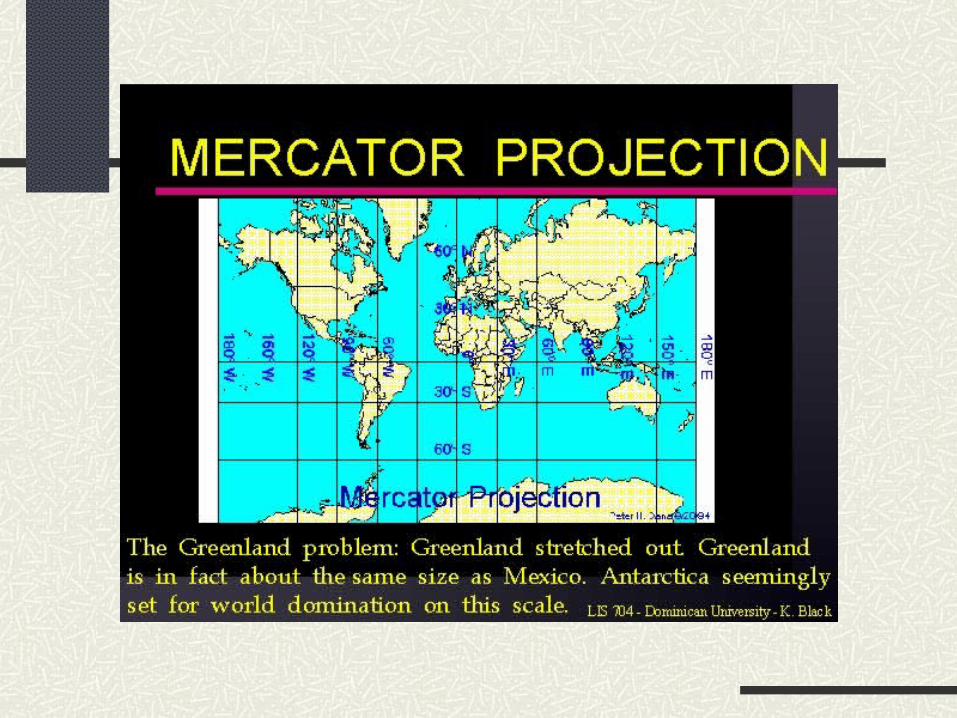
Mercator Projection
•1569 to enable mariners to plot a course of a straight line
•Straight line does represent true direction
•Correct shape of land masses accurate
•Areas distorted, because latitudes near the poles had to be spaced out

Robinson Projection
•National Geographic Society replaced the Van der Grinten projection with the Robinson projection in 1988
•Developed by Arthur Robinson, professor emeritus of cartography at University of Wisconsin, Madison


Cartographic Companies
Rand McNally; (sold in September 1997 to an
investment group)
•Road atlases
•Slow to the draw with electronic sources; Tripmaker and Streetfinder CD-ROMs
•Cartography in Britannica Atlas (and the identical New International Atlas), Reader’s Digest works, and many others

Cartographic Companies
•Hammond; not as big as Rand McNally
•National Geographic Society
•Foreign companies: •George Philip & Son; responsible for Oxford’s Atlas of the World
•John Bartholomew & Son; Edinburgh-based firm responsible for Times Atlas
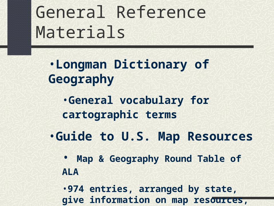
General Reference Materials
•Longman Dictionary of Geography
•General vocabulary for cartographic terms
•Guide to U.S. Map Resources
• Map & Geography Round Table of ALA
•974 entries, arranged by state, give information on map resources, including strength of collection, contact people. Some major sites (UCLC) omitted because survey forms not returned
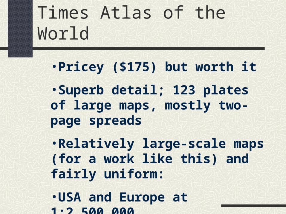
Times Atlas of the World
•Pricey ($175) but worth it
•Superb detail; 123 plates of large maps, mostly two-page spreads
•Relatively large-scale maps (for a work like this) and fairly uniform:
•USA and Europe at 1:2,500,000
•Latin America, Africa and Asia at 1:5,000,000

Times Atlas of the World
•Superb city inset maps; most at 1:250,000; London and Paris at 1:100,000
•Superb index-gazetteer of over 225 pages; the 210,000 entries is by far the most comprehensive and gives both latitude/longitude as well as grid location
Times Atlas of the World
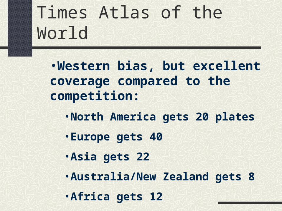
•Western bias, but excellent coverage compared to the competition:
•North America gets 20 plates
•Europe gets 40
•Asia gets 22
•Australia/New Zealand gets 8
•Africa gets 12
•South America gets 5

Times Atlas of the World
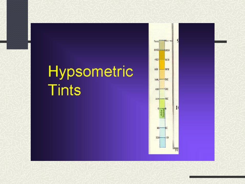
•Fantastic color quality; 8-color printing process used rather than more traditional 4-color process allowing for greater variants of shading
•Colors may take getting used to; Times uses hypsometric tints. Green is used for lowlands, shifting to beige, brown, gray and white as elevation increases. Result: Low areas can be in green

Times Atlas of the World
•Fantastic color quality; 8-color printing process used rather than more traditional 4-color process allowing for greater variants of shading
•Colors may take getting used to; Times uses hypsometric tints. Green is used for lowlands, shifting to beige, brown, gray and white as elevation increases. Result: Low areas can be in green


Goode’s World Atlas: Rand McNally
•Rand McNally’s best-selling atlas; at the reasonable price easy to see why
•Intended as a school atlas
•Many thematic maps--over 50 pages of them (climate, vegetation, economics, industry, etc.)
•Scales vary: Europe and North America mostly 1:4,000,000 but Africa and South America as small as 1:10,000,000 or even 1:16,000,000

Goode’s World Atlas: Rand McNally
•Distinct Western bias: •North America gets 63 pages
•Europe gets 40 pages
•Asia gets 23 pages (compared to 42 in Times)
•Australia/Oceania gets 10 (16 in Times)
•Africa gets 14 (24 in Times)
•South America gets 8 (10 in Times)
•“Pronouncing Index” (good), but only gives latitude/longitude (bad)

Specialized & Thematic
•Rand McNally Commercial Atlas and Marketing Guide
•National Atlas of the United States
•Times Atlas of the World
•Atlas of American History

National Atlas of the US
•Thematic atlas
•Beautifully presented maps, including physical features, economic activities, geological information, etc.
•Plastic overlays for maps without state boundaries
•1970 publication date, however, makes any economic data useless
•Update being issued; see http://www.usgs.gov/atlas for details
National Atlas of the US
•Updated maps:
•http://www.nationalatlas.gov
•Maps can be slow to load over dial-in Internet connections and usually unlabelled--need to click on the LEGEND button to see what’s what
•Valuable resource…free of charge
Times Atlas of World History
•One of the better historical atlases
•Emphasis not so much on politics and war as it is on social and economic changes
•Accompanying text goes into a great amount of detail
•Glossary includes individuals, events, etc.
Atlas of American History
•Intended to be a companion volume to Dictionary of American History
•Drab looking; textual information, however, is reliable
•Advantage? Maps can be easily photocopied, since they are all line drawings
Gazatteer
•Alphabetical listing of places, features, structures, etc.
•Easier to handle (than Atlas), good for quick-reference spell checks or verification
•More comprehensive than an atlas
•Brief historical overview, principle industries, population.

Columbia Gazatteer of the World
•Update of 1952 Columbia Lippincott Gazetteer of the World--for years the largest gazetteer published and still on many shelves
•Includes countries, towns, rivers, mountains, national parks, etc.
•Contains 165,000 entries and relatively lengthy entries
•3-volume set at $750 may make it too pricey for public libraries

Columbia Gazatteer of the World (sample entry)
Buckfastleigh (BUHK-fahst-lee), town (1991 pop. 3,194), S Devon, England, on Dart R., 5 mi/8 km NW of Totnes; 50?29’N 03?47’W. Woolen milling, stone quarrying, paper milling. Has 13th-cent. church. Nearby is Buckfast Abbey, medieval Cistercian monastery restored in early 20th cent. by Benedictine monks from France.

Webster’s New Geographical Dictionary
•Standard American-based work •47,000 entries, but has twice the number of closest one-volume competitor, Chamber’s •Good for ready-reference use including mottoes, chief products, etc.

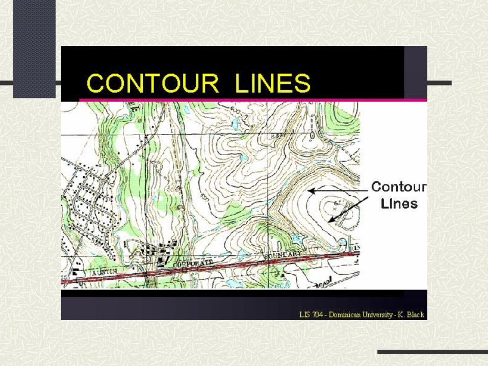
Topographic Maps
•Product of the U. S. Geological Survey •Designed to show natural and man-made features of the land •Elevation of terrain is shown by contour lines •Currently producing 7.5-minute maps of U.S. mainland and Hawaii; 15-minute maps (almost) of Alaska

Mapquest
•Run by GeoSystems Global Corp. •Launched in February 1996 •Includes several components:
•International Maps--unlike ZIP2.COM •MapQuest Travel Guide, with information from Mobil Travel Guide series •City-to-city road directions (unlike ZIP2.COM) with customizable options like fastest, shortest
Mapquest: Driving
•Information from NavTech Corp (based in Rosemont, IL) •Door-to-door directions in 34 metropolitan areas and city-to-city directions between 150,000 towns. •Turn-by-turn maps •Supposedly takes into account construction, closures, etc. by employing people to drive

How Far Is It??
•Based at Bali’s Web page at INDO.COM •Strictly an “as the crow flies” distance projecting system •Will link to Xerox’s PARC map service for general map